AGENDA - LPP
|
Meeting:
|
Georges River Local Planning
Panel (LPP)
|
|
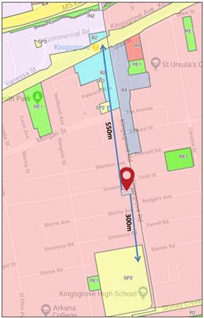
Date:
|
Friday, 05 October 2018
|
|
Time:
|
4.00pm
|
|
Venue:
|
Dragon Room, Georges River
Civic Centre, corner MacMahon and Dora Street, Hurstville
|
|
Panel Members:
|
Paul
Vergotis (Chairperson)
Juliet Grant (Expert Panel
Member)
John Brockhoff (Expert Panel
Member)
Cameron Jones (Community
Representative)
|
|
Council Staff:
|
Meryl
Bishop (Director Environment and Planning)
Ryan Cole (Manager
Development and Building)
Nicole Askew (Coordinator
Development Assessment)
Cathy Mercer (Team Leader DA
Adminstration)
Monica Wernej (DA Admin
Assistant)
|
|
1. On Site Inspections - 1.00pm – 3.30pm
a) 13 Allawah Avenue
Carss Park
b) 48-50 Bellevue
Parade Allawah
c) 54 Woids
Avenue Allawah
d) 470 Railway
Parade Allawah
e) 301 Kingsgrove
Road Kingsgrove
|
|
Break - 3.30pm
|
|
2. Public Meeting
– Consideration of Items 4.00pm – 6.00pm
|
|
Public Meeting Session Closed - 6.00pm
(Break – Light Supper served to Panel
Members)
|
|
Georges
River Council – Local Planning Panel Friday, 5
October 2018
|
Page 2
|
|
3. Reports and LPP Deliberations in Closed
Session - 6.30pm
|
LPP043-18 301
Kingsgrove Road Kingsgrove – DA2017/0487
(Report by
Development Assessment Planner)
LPP044-18 13
Allawah Avenue Carss Park – DA2018/0124
(Report by
Team Leader Development Assessment)
LPP045-18 48-50
Bellevue Parade Allawah – DA2017/0323
(Report by
Development Assessment Officer)
LPP046-18 54
Woids Avenue Allawah – DA2017/0500
(Report by
Development Assessment Officer)
LPP047-18 470
Railway Parade Allawah – DA2018/0132
(Report by
Development Assessment Officer)
LPP048-18 Operation
of the Georges River Local Planning Panel
(Report by
Manager Development and Building)
|
4. Confirmation of Minutes by Chair
|
REPORT TO GEORGES RIVER COUNCIL
LPP MEETING OF Friday, 05 October 2018
|
LPP Report No
|
LPP043-18
|
Development Application No
|
DA2017/0487
|
|
Site Address & Ward Locality
|
301 Kingsgrove Road Kingsgrove
Hurstville Ward
|
|
Proposed Development
|
Demolition of existing structures
and construction of a new 47 place child care centre with basement car
parking
|
|
Owners
|
Mr Youssef Salloum and Ms Nancy
Tamir
|
|
Applicant
|
Futuristic Design Pty Ltd
|
|
Planner/Architect
|
J Salloum
|
|
Date Of Lodgement
|
18/10/2017
|
|
Submissions
|
Forty eight (48) submissions
|
|
Cost of Works
|
$737,000.00
|
|
Local Planning Panel Criteria
|
Number of submissions received
|
|
List of all relevant s.4.15
matters (formerly s79C(1)(a))
|
· Greater
Metropolitan Regional Environmental Plan No 2 – Georges River Catchment
· State
Environmental Planning Policy No 55 - Remediation of Land
· State
Environmental Planning Policy (Educational Establishments and Child
Care Facilities) 2017
· Hurstville Local Environmental Plan 2012
· Hurstville Development Control Plan 2012
|
|
List all documents submitted
with this report for the Panel’s consideration
|
1. Architectural
Plans
2. Acoustic
Report
3. Traffic
Report
4. Landscape
Plan
|
|
Report prepared by
|
Development Assessment Planner
|
|
Recommendation
|
That the application be approved in accordance with the
conditions included in the report.
|
|
|
Summary of matters for
consideration under Section 4.15
Have all recommendations in relation
to relevant s4.15 matters been summarised in the Executive Summary of the
assessment report?
|
Yes
|
|
Legislative clauses requiring
consent authority satisfaction
Have relevant clauses in all
applicable environmental planning instruments where the consent authority
must be satisfied about a particular matter been listed and relevant
recommendations summarised, in the Executive Summary of the assessment report?
|
Yes
|
|
Clause 4.6 Exceptions to
development standards
If a written request for a
contravention to a development standard (clause 4.6 of the LEP) has been
received, has it been attached to the assessment report?
|
Not
Applicable
|
|
Special Infrastructure
Contributions
Does the DA require Special
Infrastructure Contributions conditions (under s7.24)?
|
Not
Applicable
|
|
Conditions
Have draft conditions been provided
to the applicant for comment?
|
No,
standard conditions have been attached with no design changes
|
|
Site Plan
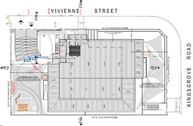
Figure 1: Proposed Site Plan - 301 Kingsgrove Road,
Kingsgrove
|
Executive Summary
Proposal
1. Council
is in receipt of a Development Application (DA2017/0487) seeking consent for
the demolition of all structures, and the construction a two (2) storey child
care centre with basement car parking. The centre is proposed to accommodate
forty seven (47) children aged zero to five (0 to 5) years of age.
Site and
Locality
2. The
subject site is a corner allotment located on the western side of Kingsgrove
Road and the southern side of Vivienne Street between Moreton Avenue to the
north and Morris Avenue to the south. The allotment is generally rectangular in
shape, with a 21.184m eastern frontage to Kingsgrove Road, a 40.386m secondary
northern boundary to Vivienne Street including a splay, a 42.662m southern side
boundary, a 23.470m rear western boundary and a site area of 998.89sqm.
Zoning and
Permissibility
3. The
subject land is zoned R2 - Low Density Residential under the provisions of the
Hurstville Local Environmental Plan 2012 (HLEP 2012). The proposed development
is defined by the (HLEP 2012) as a ‘Centre-based child care
facilities’ which is a permitted land use in the R2 Zone.
Figure
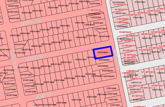
2: Extract of Zoning Map, site outlined in blue, east of Kingsgrove Road
is Bayside Council.
Submissions
4. The
proposed development was notified to the immediate surrounding residents on two
(2) separate occasions due to amendments. During the notification period(s), a
total of forty eight (48) submissions were received by Council, objecting to
the proposed development.
Conclusion
5. The
proposed development generally complies with the planning controls and
objectives of the Hurstville Local Environmental Plan 2012. The proposed
development is seeking variations to the permitted number of children and the
permitted number of storeys under the provisions of the Hurstville Development
Control (HDCP).
In view of the
above, the application is recommended for approval following a merit based
assessment and the conditions contained in this report.
Report in Full
Proposal in Full
6. Council
is in receipt of an application for the demolition of all structures, the
construction of a two (2) storey forty seven (47) place child care centre
including a basement car park, associated landscape works including play areas
and fencing at 301 Kingsgrove Road, Kingsgrove.
The
application is seeking the following:
· 7 children aged
0-2;
· 20 children aged 2-3;
and
· 30 children aged 3-5.
7. Fourteen
(14) car parking spaces are proposed as part of the development including one
(1) accessible car parking space and a dedicated turning bay area.
· 6 staff places;
· 7 parent spaces; and
· 1 accessible space.
The Site and Locality
8. The
subject site is a corner allotment located on the western side of Kingsgrove
Road and the southern side of Vivienne Street between Moreton Avenue to the
north and Morris Avenue to the south. The allotment is generally rectangular in
shape, with a 21.184m eastern frontage to Kingsgrove Road, a 40.386m secondary
northern boundary to Vivienne Street including a splay, a 42.662m southern side
boundary, a 23.470m rear western boundary and a site area of 998.89sqm.
The allotment
has a slight slope with a fall of 0.59m from the rear western boundary to the
front eastern boundary. The immediate surrounding area accommodates single and
two storey residential dwellings, with Kingsgrove Public and Kingsgrove High
School are located approximately 300m to the south and Kingsgrove Uniting
Church to the north of the site. Approximately 550m to the north of the site is
Kingsgrove Railway Station and Kingsgrove Town Centre. There are a number of
bus stops along Kingsgrove Road servicing passengers in a north and south
direction.
Figure
3: Distance from subject allotment to schools and Kingsgrove Local
Centre
Background
9. The
subject DA (DA2017/0487) was lodged on 17 October 2017.
PLANNING
ASSESSMENT
10. The
site has been inspected and the proposed development has been assessed under
the provisions of Section 4.15(1) of the Environmental Planning and Assessment
Act 1979.
Environmental
Planning Instruments
State
Environmental Planning Policies
State
Environmental Planning Policy (Educational Establishments and Child Care
Facilities) 2017
11. State
Environmental Planning Policy (Educational Establishments and Child Care
Facilities) 2017 (Education and Child Care SEPP) commenced on 1 September 2017
and aims to facilitate the effective delivery of educational establishments and
early education and care facilities across the State.
Clause 22 of
the Education and Child Care SEPP indicates that the consent authority cannot
grant consent to a development for the purpose of a centre-based child care
facility except with the concurrence of the Regulatory Authority. However;
concurrence of the Regulatory Authority is only required if the floor area of
the building and the proposed outdoor spaces do not satisfy Parts 107 and 108
of the Education and Care Services National Regulations.
Part 107(2) of
the Regulations states that, for each child being educated and cared for by the
service, the education and care service premises is to have at least 3.25sqm
per child of unencumbered indoor space equating to 152.75sqm for the proposed
forty seven (47) children.
The proposed
unencumbered indoor space is 170.15sqm equating to 3.62sqm per
child, which exceeds the minimum requirement.
Part 108(2) of
the Regulations states that, for each child being educated and cared for by the
service, the education and care service premises has at least 7.0sqm of
unencumbered outdoor space equating to 329sqm for the proposed forty seven (47)
children.
The outdoor
space proposed is to be 501.2sqm equating to 10.67sqm per child, which exceeds
the minimum requirement.
|
Child Care Planning Guideline
Compliance Table
|
|
Controls
|
Requirement
|
Proposed
|
Complies
|
|
3.1 Site selection and location
|
C1- For proposed
developments in or adjacent to a residential zone consider:
|
|
|
|
§ the acoustic and privacy impacts of the
proposed development on the residential properties
|
An
acoustic report prepared by Acoustic Noise and Vibration Solutions has been
submitted with the DA.
Mitigation
measures are proposed as detailed in the report which is an attachment to
this report and will ensure acoustic amenity of neighbours is not
compromised.
These
measures include window and door treatments, materials within the play area
not be of metal, sound barrier fencing, limiting where music can be played,
signage relating to arrival and departure noise, noise levels of staff, and a
noise management plan be developed.
The
acoustic report was also reviewed by Council’s Environmental Health
Team, who deemed the application satisfactory, subject to conditions.
|
Yes
|
|
§ the setbacks and siting of buildings within
the residential context
|
The
proposed setbacks for the proposed development are compliant with
Council’s Development Control Plan (DCP) – Section 5.3 –
Part 2.
A
front setback of approximately 9.534m to Kingsgrove Road is proposed.
A
secondary street setback of approximately 3.423m to Vivienne Street is
proposed.
A
side setback of approximately 0.9m to the south of the allotment is proposed.
A
rear setback of approximately 10.207m to the west of the allotment is
proposed.
The
proposed building footprint is appropriately set back from the
adjoining neighbouring properties.
Architectural
plans have been amended throughout the Development Application process to
accommodate for additional setbacks to address neighbouring concerns.
|
Yes
|
|
§ traffic and parking impacts of the proposal on
residential amenity
|
A
traffic and parking assessment has been prepared by Greys Australia
Consultants which indicates the local road network has capacity to
accommodate the vehicular movements anticipated by the proposal. The proposed
off-street parking provisions satisfy the numerical requirements of
Council’s Development Control Plan (DCP) – Section 5.3 –
Child Cares. Which states:
- Staff Parking: 1 Space per
2 Staff Members;
Five (5) required, applicant provided eight (8);
- Parent Parking: 1 Space
per 10 Children;
Three (3) required, applicant has provided six (6);
Total
spaces required: eight (8); Total spaces provided: Fourteen (14);
The
traffic and parking report was reviewed by Council’s Traffic Engineer,
who supports the findings subject to the imposition of conditions.
|
Yes
|
|
|
C2 - When selecting a site, ensure that:
§ the location and surrounding uses are
compatible with the proposed development or use
|
Centre
based childcare facilities are permissible in the zone.
The
application has respected the setbacks of the DCP and provides a building
form not inconsistent with that of dwelling houses in the locality.
The
application is consider compatible with a low density residential locality.
|
Yes
|
|
|
§ the site is environmentally safe including
risks such as flooding, land slip, bushfires, coastal hazards
|
The
site is not identified in a flood planning area within the Hurstville LEP
2012.
|
Yes
|
|
|
§ there are no potential environmental
contaminants on the land, in the building or the general proximity, and
whether hazardous materials remediation is needed
|
The
site has a long history of residential use and it is not anticipated that
there are any contaminants on the land. There is no reason to suspect that
the site is contaminated, or otherwise unsuitable for the proposed
development.
|
Yes
|
|
|
§ the characteristics of the site are suitable
for the scale and type of development proposed having regard to:
-
size of street frontage, lot configuration, dimensions and overall size -
number of shared boundaries with residential properties.
-
the development will not have adverse environmental impacts on the
surrounding area, particularly in sensitive environmental or cultural areas.
|
The
characteristics of the site are able to accommodate a centre based child care
facility as the site is regular in shape with adequate land area.
The
development will have minimal environmental impacts and storm water will be
appropriately managed.
|
Yes
|
|
|
§ there are suitable drop off and pick up areas,
and off and on street parking
|
The
proposal provides adequate on-site parking and makes provision for on-site
pick up and drop off areas via Vivienne Street within the basement car park.
A
turning bay in the carpark has been accommodated to ensure all vehicles can
manoeuvre within this space to leave the site in a forward direction.
|
Yes
|
|
|
§ the type of adjoining road (for example
classified, arterial, local road, cul-de-sac) is appropriate and safe for the
proposed use
|
The
proposed child care centre adjoins Kingsgrove Road which is a Local Road.
The
access to the car parking is via Vivienne Street where the driveway is the
furthest away from the intersection of Kingsgrove Road.
The
pedestrian entry is via Vivienne Street.
Adequate
site lines are available to ensure pedestrian and vehicle safety are not compromised.
|
Yes
|
|
|
§ it is not located closely to incompatible social
activities and uses such as restricted premises, injecting rooms, drug
clinics and the like, premises licensed for alcohol or gambling such as
hotels, clubs, cellar door premises and sex services premises.
|
The
site is adjoining and surrounded by residential dwellings.
|
Yes
|
|
|
C3 - A child care facility should be located:
|
|
|
|
|
§ near compatible social uses such as schools
and other educational establishments, parks and other public open space,
community facilities, places of public worship
|
The
site is located approximately 300m from Kingsgrove High School and Kingsgrove
Primary School. The Schools are located directly south of the proposed
development site.
|
Yes
|
|
|
§ near
or within employment areas, town centres, business centres, shops
|
The
site is located approximately 450m to the south of employment and business
centres particularly Kingsgrove Town Centre.
|
Yes
|
|
|
§ with access to public transport including
rail, buses, ferries
|
Kingsgrove
Railway Station is located approximately 550m to the north of the site.
Various bus stops are located along Kingsgrove Road.
|
Yes
|
|
|
§ in areas with pedestrian connectivity to the
local community, businesses, shops, services and the like.
|
The
subject site has pedestrian connectivity to public transport, shops, services
and facilities by way of a concrete footway along Kingsgrove Road and
Vivienne Street.
|
Yes
|
|
|
C4- A child care facility should be located to avoid
risks to children, staff or visitors and adverse environmental conditions
arising from proximity to:
|
|
|
|
|
§ heavy or hazardous industry, waste transfer
depots or landfill sites
§ LPG tanks or service stations
§ water cooling and water warming systems
§ odour (and other air pollutant) generating
uses and sources or sites
§ which, due to prevailing land use zoning, may
in future accommodate noise or odour generating uses
§ extractive industries, intensive agriculture,
agricultural spraying activities
|
The
site is not located in close proximity to any of the potentially harmful or
hazardous uses described in this part of the Guideline.
|
Yes
|
|
|
§ any other identified environmental hazard or
risk relevant to the site and/ or existing buildings within the site.
|
No other known environmental hazards have been
identified.
|
Yes
|
|
3.2 Local character, streetscape and the public domain
interface
|
C5 - The proposed development should:
|
|
|
|
|
§ contribute to the local area by being designed
in character with the locality and existing streetscape
|
The
proposed built form will be in keeping with the existing building, character
and locality in terms of height, bulk and scale.
|
Yes
|
|
|
§ reflect the predominant form of surrounding
land uses, particularly in low density residential areas
|
The
site is zoned R2 low density residential.
The
development has proposed height, bulk and scale that is consistent the other
modern and contemporary designed in the locality.
|
Yes
|
|
|
§ recognise predominant streetscape qualities,
such as building form, scale, materials and colours
|
The
proposal seeks to demolish the existing structures on site and construction
of a two storey centre based child care facility. The proposed development
will be in keeping with the predominant streetscape qualities related to
building form, scale, materials and colours.
|
Yes
|
|
|
§ include design and architectural treatments that respond
to and integrate with the existing streetscape
|
The
proposed building has a height bulk and scale that is not inconsistent with
the bulk and scale of the surrounding modern development, albeit additional
forms relating to a publically accessible building which requires access for
all and business identification signage (insufficient signage details have
been provided with this application, no an assessment cannot be undertaken).
|
Yes
|
|
|
§ use
landscaping to positively contribute to the streetscape and neighbouring
amenity
|
The application
has been accompanied by a landscape plan prepared by ‘Futuristic
Design’.
This plan
identifies the species selection and planting arrangement both of which are
appropriate with respect to the presentation to the public domain, adjoining
neighbours and the use of the building.
The plan was
reviewed by Council’s Landscape and Tree Management Officer, the
proposal is adequate subject to the imposition of conditions.
|
Yes
|
|
|
§ integrate car parking into the building and
site landscaping design in residential areas.
|
The
car parking is proposed in a basement.
|
Yes
|
|
|
C6 - Create a threshold with a clear transition between
public and private realms, including:
|
|
|
|
|
§ fencing to ensure safety for children entering
and leaving the facility
|
Appropriate
fencing is proposed for the site to ensure safety and security measures for
children preventing them leaving the facility without assistance.
|
Yes
|
|
|
§ windows facing from the facility towards the
public domain to provide passive surveillance to the street as a safety
measure and connection between the facility and the community
|
The
windows in the proposed building will provide adequate solar access and
visibility. They are also located towards the public domain facilitating
active and passive surveillance to and from the public domain.
|
Yes
|
|
|
§ integrating existing and proposed landscaping
with fencing.
|
The
proposed landscaping appropriately integrates fencing and vegetation
components.
|
Yes
|
|
|
C7- On sites with multiple buildings and/or entries,
pedestrian entries and spaces associated with the child care facility should
be differentiated to improve legibility for visitors and children by changes
in materials, plant species and colours.
|
The
proposed centre based childcare centre is the only building on the site and
has clearly identifiable pedestrian and vehicle access points.
|
Yes
|
|
|
C9- Front fences and walls within the front setback
should be constructed of visually permeable materials and treatments. Where
the site is listed as a heritage item, adjacent to a heritage item or within
a conservation area front fencing should be designed in accordance with local
heritage provisions.
|
The
application proposes a 1.8m high front fence to Kingsgrove Road and Vivienne
Street; the front fence is proposed to mitigate noise as per the
recommendations from the acoustic report which is supported by
Council’s Health Officer.
|
Yes
|
|
|
C10- High solid acoustic fencing may be used when
shielding the facility from noise on classified roads. The walls should be
setback from the property boundary with screen landscaping of a similar
height between the wall and the boundary.
|
Not
located on a classified road, however a 1.8m acoustic fence is proposed
around the allotment, to address neighbouring concerns and the
recommendations of the acoustic report.
Amended
plans have been provided to ensure compliance with the submitted acoustic
report and recommendations.
|
Yes
|
|
3.3 Building orientation, envelope and design
|
C11- Orient a development on a site and design the
building layout to:
|
|
|
|
|
ensure
visual privacy and minimise potential noise and overlooking impacts on
neighbours by:
§ facing doors and windows away from private
open space, living rooms and bedrooms in adjoining residential properties
§ placing play equipment away from common
boundaries with residential properties
§ locating outdoor play areas away from
residential dwellings and other sensitive uses
|
The
development is oriented to Vivienne Street as this is where the pedestrian
and vehicular entry is located.
Openings
overlook Vivienne Street and Kingsgrove Road.
There
are also openings in the southern and western elevations.
The
openings within the southern elevation have a setback exceeding 3m.
Play
areas are located to the eastern and western side of the development, with
covered verandas to the southern side.
The
location of the eastern play area aligns with the rear of the southern
allotment and the eastern side of the western neighbour predominantly within
their rear yards not adversely compromising the amenity of these neighbours.
|
Yes
|
|
|
§ optimise solar access to internal and external
play areas
|
The
development will achieve maximum solar access through its orientation along
the northern boundary. Dual street frontages will ensure the child care
facility is adequately separated from adjacent uses in order to receive
direct sunlight to the children’s play areas. Operable glass walls are
proposed for the indoor play spaces, which will ensure privacy as well as
appropriate solar access to these spaces.
In
addition the first floor built form is 4.241m from the southern neighbour in
order to ameliorate shadow impacts.
|
Yes
|
|
|
§ avoid overshadowing of adjoining residential properties
|
The
proposal will create a minimal impact of overshadowing on nearby residential
properties.
|
Yes
|
|
|
§ minimise cut and fill
|
The
proposed application seeks a basement car parking area, requiring an
excavation of 2.7m, to accommodate for on-site parking. Amended plans have
been sought by Council to provide a turning bay area for users to safety
enter and exit the site.
|
Yes
|
|
|
§ ensure buildings along the street frontage
define the street by facing it
|
The
proposal adequately responds to both Kingsgrove Road and Vivienne
Street.
|
Yes
|
|
|
§ ensure that where a child care facility is located above
ground level, outdoor play areas are protected from wind and other climatic
conditions.
|
The
proposed facility is located above ground level. The siting of the facility
and proposed outdoor play areas will not be affected by climatic
changes.
|
Yes
|
|
|
C12- The following matters may be considered to minimise
the impacts of the proposal on local character:
|
|
|
|
|
§ building height should be consistent with
other buildings in the locality
|
The
proposed two storey building complies with the 9m height standard applicable
to the site.
|
Yes
|
|
|
§ building height should respond to the scale
and character of the street
|
The
proposed building height and form is suitable in scale and responds to the existing
dwelling character of the locality.
|
Yes
|
|
|
§ setbacks should allow for adequate privacy for
neighbours and children at the proposed child care facility
|
The
proposed development will not adversely impact privacy of adjoining
residential allotments.
|
Yes
|
|
|
§ setbacks should provide adequate access for building
maintenance
|
The
proposed building provides adequate setbacks for building maintenance.
|
Yes
|
|
|
§ setbacks to the street should be consistent with the
existing character.
|
The
setbacks to Kingsgrove Road and Vivienne Street are consistent with the
existing character and the Hurstville Development Control Plan.
|
Yes
|
|
|
C13- Where there are no prevailing setback controls
minimum setback to a classified road should be 10m. On other road frontages
where there are existing buildings within 50m, the setback should be the
average of the two closest buildings. Where there are no buildings within
50m, the same setback is required for the predominant adjoining land use.
|
The
proposal provides setbacks consistent with the prevailing setbacks of the
street, and compliant with the Hurstville Development Control Plan.
|
Yes
|
|
|
C14- On land in a residential zone, side and rear
boundary setbacks should observe the prevailing setbacks required for a
dwelling house.
|
The
proposal is compliant with Council’s Controls for setbacks.
|
Yes
|
|
|
C15- The built form of the development should contribute
to the character of the local area, including how it:
|
|
|
|
|
§ respects and responds to its physical context
such as adjacent built form, neighbourhood character, streetscape quality and
heritage
|
The
scale and form of the proposed development is considered to respond to its
physical context in terms of massing arrangement and scale.
The
building is a two storey structure and is well within the height and floor
space development standards. The proposed centre will not be visibly bulky or
intrusive when viewed from surrounding dwellings and Kingsgrove Road and
Vivienne Street.
|
Yes
|
|
|
§ contributes to the identity of the place
|
The
identity of the area is characterised by single detached dwellings of either
a single or two storey forms. The proposed facility is permissible and
compatible with the objectives of the Zone and does not detract from the
identity of the locality.
|
Yes
|
|
|
§ retains and reinforces existing built form and
vegetation where significant
|
The
proposed child care provides for native vegetation as per the submitted
Landscape Plan and provides a built form that is in keeping with the
surrounding area. In addition, the application was referred to
Council’s internal Landscape Officer, who has deemed the landscaping as
satisfactory, subject to conditions.
|
Yes
|
|
|
§ considers heritage within the local
neighbourhood including identified heritage items and conservation areas
|
There
are no heritage items affected by this proposal.
|
Yes
|
|
|
§ responds to its natural environment including
local landscape setting and climate
|
The
development is considered to be responsive to its environment in that it is
appropriately orientated and designed to optimise sunlight penetration and
protection of residential amenity.
|
Yes
|
|
|
C16- Entry to the facility should be limited to one
secure point which is:
|
|
|
|
|
§ located to allow ease of access, particularly
for pedestrians
§ directly accessible from the street where
possible
§ directly visible from the street frontage
§ easily monitored through natural or camera
surveillance
§ not accessed through an outdoor play area.
§ in a mixed-use development, clearly defined
and separate from entrances to other uses in the building.
|
The
main entry to the centre based child care facility is from the Vivienne
Street frontage and via the basement carpark which has lift access to the
ground floor.
The
entrance allows ease of access for pedestrians, is visible from the public
domain with no impact on Kingsgrove Road.
|
Yes
|
|
|
C17- Accessible design can be achieved by:
|
|
|
|
|
§ providing accessibility to and within the
building in accordance with all relevant legislation
§ linking all key areas of the site by level or
ramped pathways that are accessible to prams and wheelchairs, including
between all car parking areas and the main building entry
§ providing a continuous path of travel to and
within the building, including access between the street entry and car
parking and main building entrance. Platform lifts should be avoided where
possible
§ minimising ramping by ensuring building
entries and ground floors are well located relative to the level of the
footpath.
NOTE:
The National Construction Code, the Discrimination Disability Act 1992 and
the Disability (Access to Premises – Buildings) Standards 2010 set out
the requirements for access to buildings for people with disabilities.
|
The proposal will satisfy accessibility
criterion.
It is further noted that the development, has
one (1) accessible parking space, an accessible bathroom and lift access to
all floors of the development is provided.
Within the
internal layout of the proposed basement is a pedestrian walkway, to access
the lifts which lead to the ground and first floor of the proposed
development.
|
Yes
|
|
3.4 Landscaping
|
C18- Appropriate planting should be provided along the
boundary integrated with fencing. Screen planting should not be included in
calculations of unencumbered outdoor space. Use the existing landscape where
feasible to provide a high quality landscaped area by:
|
|
|
|
|
§ reflecting and reinforcing the local context
§ incorporating natural features of the site,
such as trees, rocky outcrops and vegetation communities into landscaping.
|
The
proposal includes appropriate planting to be provided on site which is not
inconsistent with the residential dwellings.
|
Yes
|
|
|
C21- Minimise direct overlooking of indoor rooms and
outdoor play spaces from public areas through:
|
|
|
|
|
§ appropriate site and building layout
§ suitably locating pathways, windows and doors
§ permanent screening and landscape design
|
The
proposed outdoor play area has been located towards the eastern and western
portions of the site, which are away from adjacent dwellings and streets. The
proposed indoor play areas are located away from Kingsgrove Road and Vivienne
Street. Appropriate screening and privacy measures are implemented for play
areas that are adjacent to Kingsgrove Road and Vivienne Street.
|
Yes
|
|
|
C22 Minimise direct overlooking of main internal living
areas and private open spaces in adjoining developments through:
§ appropriate site and building layout
§ suitable location of pathways, windows and
doors
§ landscape design and screening.
|
The
proposed facility will not result in overlooking of main internal living
areas and private open spaces of adjoining allotments.
|
Yes
|
|
|
C23- A new development, or development that includes
alterations to more than 50 per cent of the existing floor area, and is
located adjacent to residential accommodation should:
|
|
|
|
|
§ Provide an acoustic fence along any boundary
where the adjoining property contains a residential use. (An acoustic fence
is one that is a solid, gap free fence).
|
The
development is appropriately separated from adjacent residential uses by a
1.8m acoustic fence that was recommended as part of the acoustic report and
endorsed by Council’s Health Officer and will be reinforced by a
condition of consent.
|
Yes
|
|
|
C24- A suitably qualified acoustic professional should
prepare an acoustic report which will cover the following matters:
|
An
acoustic report prepared by Grey Australia has been submitted with the DA.
Mitigation measures are proposed as detailed in the report and will ensure
acoustic amenity of neighbours is not compromised.
|
Yes
|
|
|
§ identify an appropriate noise level for a
child care facility located in residential and other zones
§ determine an appropriate background noise
level for outdoor play areas during times they are proposed to be in use
§ determine the appropriate height of any
acoustic fence to enable the noise criteria to be met.
|
This
was undertaken as part of the acoustic assessment. In addition, the
application was referred to Council’s Internal Health Officer, who has
deemed the application satisfactory, subject to the imposition of conditions.
|
Yes
|
|
3.6 Noise and air pollution
|
C25 Adopt design solutions to minimise the impacts of
noise, such as:
§ creating physical separation between buildings
and the noise source
§ orienting the facility perpendicular to the
noise source and where possible buffered by other uses
§ using landscaping to reduce the perception of
noise
§ limiting the number and size of openings
facing noise sources
§ using double or acoustic glazing, acoustic
louvres or enclosed balconies (winter gardens)
§ using materials with mass and/or sound
insulation or absorption properties, such as solid balcony balustrades,
external screens and soffits
§ locating cot rooms, sleeping areas and play
areas away from external noise sources.
|
The
submitted acoustic report considers the impact of road noise along with
impacts of the proposal on neighbouring properties. Mitigation measures are
recommended and have been incorporated into the design of the proposal
through the imposition of conditions of consent.
|
Yes
|
|
|
C26- An acoustic report should identify appropriate noise
levels for sleeping areas and other non-play areas and examine impacts and
noise attenuation measures where a child care facility is proposed in any of
the following locations:
|
The
acoustic report considers the impact of road noise along with impacts of the
proposal on neighbouring properties.
Mitigation
measures are recommended and have been incorporated into the design of the
proposal.
Consent
conditions will be imposed that reflect the recommendations outlined in this
report.
|
Yes
|
|
|
C27- Locate child care facilities on sites which avoid or
minimise the potential impact of external sources of air pollution such as
major roads and industrial development.
|
The
proposed child care facility is located within an established residential low
density zone where the proposed use is permissible.
The proposed outdoor play area will be located
away from Kingsgrove Road in order to avoid the potential impact of external
sources of air pollution from the major road. In addition, an internal play
area is provided to Kingsgrove Road part of the development.
It is also noted acoustic fencing is proposed
to the site.
|
Yes
|
|
|
C28- A suitably qualified air quality professional should
prepare an air quality assessment report to demonstrate that proposed child
care facilities close to major roads or industrial developments can meet air
quality standards in accordance with relevant legislation and guidelines.
The air quality assessment report should evaluate design
considerations to minimise air pollution.
|
This
was not considered necessary for this application.
|
Yes
|
|
3.7 Hours of operation
|
C29- Hours of operation within areas where the
predominant land use is residential should be confined to the core hours of
7.00am to 7.00pm weekdays. The hours of operation of the proposed child care
facility may be extended if it adjoins or is adjacent to non-residential land
uses.
|
The
childcare centre will open from 7am-6pm Monday to Friday, as such; it is
confined to the core hours referenced.
|
Yes
|
|
3.8 Traffic, parking and pedestrian circulation
|
C31 Off street car parking should be provided at the
rates for child care facilities specified in a Development Control Plan that
applies to the land.
|
The
parking proposed meets the rates prescribed by the Hurstville DCP.
|
Yes
|
|
|
C33- A Traffic and Parking Study should be prepared to
support the proposal to quantify potential impacts on the surrounding land
uses and demonstrate how impacts on amenity will be minimised.
§ the amenity of the surrounding area will not
be affected
§ there will be no impacts on the safe operation
of the surrounding road network
|
A
Traffic and Parking Impact Assessment has been prepared by Greys Australia
Consultants and is submitted with the DA. This report concludes that:
• An
additional trip generation of 38 vph is projected by the proposed development
in the opening year (approximately one trip every two minutes) during the AM
and PM peak hours. This number is considered non-consequential in terms of
negatively impacting the surrounding road network.
• No
SIDRA intersection assessment was required as considered by Greys traffic
engineer in his initial assessment of the development and due to trivial
number of projected trip generation from the subject development which does
not warrant SIDRA modelling at this stage.
•Parking
layout assessment was undertaken in accordance with Australian Standard
2890.1 the drop- off/pick-up zone and staff parking for the Child Care
Centre.
• The
investigation of the public transport options revealed a reasonable level of
train accessibility to the site. Given these factors, and the results of the
high level intersection and mid-block analysis, it is clear that this
development is sustainable in transport terms, with acceptable impacts on the
local transport network;
• Appropriate
drop-off/pick up spaces have been proposed next to the premises on Vivienne
Street with convenient access to the centre for parents.
The application
is considered acceptable with respect to traffic movements.
|
Yes
|
|
|
C36- The following design solutions may be incorporated
into a development to help provide a safe pedestrian environment:
§ separate pedestrian access from the car park
to the facility
|
The
principle access to the development is via Vivienne Street.
|
Yes
|
|
|
§ pedestrian paths that enable two prams to pass
each other
|
Pedestrian
paths will have suitable space to enable two prams to pass each other.
|
Yes
|
|
|
§ delivery and loading areas located away from
the main pedestrian access to the building and in clearly designated,
separate facilities
|
Delivery
and loading areas will be undertaken outside main drop-off/pick up times,
which are located separate to pedestrian access and onsite vehicle parking.
A
consent condition will be imposed requiring that all deliveries be undertaken
outside of the peak times for the facility which would be between 7am-9am
each weekday morning and between 3pm-5pm each weekday afternoon.
|
Yes
|
|
|
§ vehicles can enter and leave the site in a
forward direction.
|
Vehicles
are able to enter and leave the site in a forward direction, via the turning
bay in the basement car park.
|
Yes
|
|
|
C38 Car parking design should:
|
|
|
|
|
§ include a child safe fence to separate car
parking areas from the building entrance and play areas
§ provide clearly marked accessible parking as
close as possible to the primary entrance to the building in accordance with
appropriate Australian Standards
|
The
proposed building entrance and play areas are adequately separated from the
access to the basement car park.
One accessible parking space is
provided and will be reinforced by a condition of consent that it be clearly
marked.
|
Yes
|
Deemed State Environmental Planning Policy – Georges River
Catchment
12. The subject land is located within the Georges River Catchments
and as such The Greater Metropolitan Regional Environmental Plan No 2 - Georges
River applies to the application.
The
Greater Metropolitan Regional Environmental Plan No 2 - Georges River Catchment
generally aims to maintain and improve the water quality and river flows of the
Georges River and its tributaries.
State Environmental Planning Policy No 55 - Remediation of land
13. Pursuant to Clause 7 of SEPP 55, the following shall be
addressed:
* The site has a long history of being used as a
residential premise.
With
consideration to the above mentioned points there is no sufficient evidence to
suggest that the land is
contaminated, therefore a formal land contamination assessment was not
considered to be necessary.
State Environmental Planning Policy No 64 - Advertising and Signage
14. The site proposes minimal details associated with signage on the
submitted elevation plan and front
fence plan - there is insufficient information and detail to undertake a full
and proper assessment. In this regard separate approval will need to be
obtained prior to any signage being erected.
Draft
Environmental Planning Instruments
15. The Draft Environment SEPP was exhibited from 31 October
2017 to 31 January 2018. This consolidated SEPP proposes to simplify the
planning rules for a number of water catchments, waterways, urban bushland, and
Willandra Lakes World Heritage Property. Changes proposed include consolidating
the following seven existing SEPPs:
· State Environmental Planning Policy No. 19 – Bushland in Urban
Areas;
· State Environmental Planning Policy (Sydney Drinking Water
Catchment) 2011;
· State Environmental Planning Policy No. 50 – Canal Estate
Development;
· Greater Metropolitan Regional Environmental Plan No. 2 –
Georges River Catchment;
· Sydney Regional Environmental Plan No. 20 – Hawkesbury-Nepean
River (No.2-1997);
· Sydney Regional Environmental Plan (Sydney Harbour Catchment) 2005;
· Willandra Lakes Regional Environmental Plan No. 1 – World
Heritage Property;
The proposal is
not inconsistent with the provisions of this Draft Instrument.
Local
Environmental Plan
16. The
extent to which the proposal complies with the relevant standards of Hurstville
Local Environmental Plan 2012 (HLEP, 2012) is outlined in the table below.
|
Applicable LEP Clause
|
Standards
|
Proposal
|
Complies
|
|
4.3 Height of Buildings
|
9m as identified
on Height of Buildings Map
|
7.8m
|
Yes
|
|
4.4 Floor Space Ratio
|
0.60:1 as identified on Floor Space
Ratio Map
|
0.51:1
The requirement for parking is
eight (8) car parking spaces. The applicant has proposed fifteen (15)
allowing for future growth and intensified traffic patterns. Based on merit,
the total of fifteen (15) car parking spaces have not been included in the
Floor Space Ratio calculation – only the proposed floor area.
|
Yes
|
|
6.1 Acid Sulfate Soils
|
The objective of this clause is to
ensure that development does not disturb, expose or drain acid sulfate soils
and cause environmental damage.
|
The site is not located within an
acid sulfate area.
|
Yes
|
Development
Control Plans
Hurstville
Development Control Plan No 1 - LGA Wide
17. The proposed development is subject to the provisions of the Hurstville
Development Control Plan (HDCP, 2016). As outlined in the SEPP assessment table
the proposal is generally consistent with the DCP provisions applicable to this
form of development. However, the proposed application seeks a variation to two
(2) controls within the DCP, these variations are addressed below.
Section
5.3 – PC5 (Size of Centres and Child Age Groups) – DS5.1 states
that;
The
maximum number of children to be accommodated in a child care centre within
Residential zones are as follows:
- R2 Low Density Residential: 40 children.
Design
Solution (DS) 6.1 of the Hurstville DCP No. 1
Council
will consider a variation to the controls under this Clause for Child Care
Centres in the R2 zone where the site is located adjacent to a retail/commercial
area or other non-residential zoning.
The
concerns raised in the submissions essentially relate to the number of child
care places proposed and it exceeding the control which permits 40 children.
Section
4.15(3A)(b) of the Environmental Planning and Assessment Act 1979 specifies
that the consent authority "is to be flexible in applying" the
provisions of a DCP, and "allow reasonable alternate solutions that
achieve the objects of those standards for dealing with that aspect of the
development".
The
objectives of the Design Solution relating to the number of children within a
child care centre are to ensure the size of a centre and child age groups "are
of a manageable size of overall number of children and minimise adverse impacts
on the amenity of the surrounding residential areas", and "ensure
that the number of spaces for under 2 year olds reflects the demographics of
the local government area".
The
potential impacts of the proposed child care centre primarily relate to
traffic, parking and vehicle safety, acoustic impacts, and impacts associated
with the proposed built form. The proposed development is accompanied by
specialist reports in relation to traffic, parking, vehicle safety and acoustic
impacts. The proposed development comfortably complies with the applicable
building height control, and the external impacts of the building form and
reasonable and appropriate.
Finally,
the proposed child care centre includes places for seven (7) children in the 0
- 2 age bracket, representing an appropriate response to the demographics of
the LGA which consists of families with children.
Not
withstand the above, the application is compliant with the provisions of State
Environmental Planning Policy (Educational Establishments and Childcare
Facilities) 2017 with respect to the assessment criterion.
In the circumstances, the proposed child care centre
achieves the objectives of the controls relating to the maximum number of
children within a centre, and the variation to the total number of children is
recommended to be supported as the proposal whilst not numerically compliant
meets the objectives of the control.
Section
5.3 – PC6 (Building Form and Appearance) – DS6.1 states that;
For
residential zones, the maximum height is:
- R2 Low Density Residential: One (1)
storey. A variation to this control will only be considered where the centre is
located adjacent to commercial or other non-residential zonings and where the
proposal complies with the building form objectives.
Clause
4.3 of the Hurstville Local Environmental Plan (LEP) 2012 specifies a maximum
building height of 9 metres. The building height control relates to all forms
of permissible development on the land, including child care centres. The
proposed building extends to a maximum height of approximately 7.8 metres
measured to the top of the architectural roof feature.
The
proposed development has been designed so as to not exceed the height controls
of the HLEP. The proposal has respected the residential dwellings adjoining
through the use of setbacks the location of the outdoor play areas and the
openings within the southern and western elevations being located and treated
in a manner that preserves the amenity of the neighbouring allotments.
The
proposed second storey creates an adequate play area (both indoor and outdoor)
for the site, to accommodate for additional private open space and the
additional storey reduces the bulk and scale of the development, with setbacks
being fully compliant with the SEPP.
In
that regard, Section 3.43 of the Environmental Planning and Assessment Act 1979
specifies that a provision of a DCP "has no force or effect"
to the extent that it is inconsistent or incompatible with a provision of an
environmental planning instrument (in this instance the Hurstville LEP 2012).
The single storey control for child care centres
contained in the DCP is inconsistent with the 9m building height control in the
LEP, as a result the height proposed is considered to be acceptable and the
variation to the HDCP is recommended to be supported.
IMPACTS
Natural
Environment
18. The proposal is supported by Council’s Tree Management
Officer, subject to compliance with the submitted plant schedule and replanting
of an additional three (3) trees along Vivienne Street.
Built
Environment
19. The proposed development will not result in any adverse impacts
upon the built environment for reasons discussed throughout the report.
Social
and Economic Impact
20. The proposed development will not result in any adverse social
and/or economic impacts within the locality subject to compliance the
conditions of consent.
Suitability
of the Site
21. It is considered that the proposed development is of a scale and
design that is suitable for the site having regard to its size and shape, its
topography and relationship to adjoining developments.
SUBMISSIONS
AND THE PUBLIC INTEREST
22. The proposal was notified to adjoining neighbours on two
(2) separate occasions for a period of fourteen (14) days during which time
forty eight (48) submissions were received. The submissions raised the
following issues.
Increase
in Traffic due to drop off and pick up of children
It
is acknowledged that additional vehicle movement will result from this
development. The application exceeds the minimum parking for staff and clients
of the childcare centre.
The
application was accompanied by Traffic and Parking Assessment prepared by Grey
Australia Consultants, which concludes that the potential increase in the
number of vehicle movements in and about Kingsgrove Road and Vivienne Street
will remain well within the Environmental capacity of these streets, with no
adverse impacts on the amenity of the area. This report was reviewed by
Council’s Traffic Engineer, who supports the contents of the report.
The
DA has also been accompanied by a Motor Vehicle and Pedestrian Risk Assessment.
The Assessment is prepared by specialist consultants with specific expertise in
traffic and pedestrian safety related matters.
The
Assessment notes that the access driveway, internal circulation and driveways
are compliant with Table 2-2 of AS 2890.1-2004. Pedestrian access to the
facility from the basement is provided via lift as well as stairs. Further,
clear lines of sight are provided to pedestrians to ensure visibility between
vehicles leaving the car park and pedestrians on Vivienne Street.
The Risk Assessment concludes
that "the proposed parking
facilities satisfy the relevant requirements specified in Australian Standards
and it is therefore concluded the proposed development will not have any
unacceptable risks to pedestrians and motor vehicles accessing the premises".
Adequacy of Parking Provision
23. Off-street car parking
requirements are derived by the provisions of the Hurstville Development
Control Plan (DCP) No.1.
The Assessment notes that the proposed development
generates an off-street car parking requirement of eight (8) spaces, comprising
five (5) spaces to service the drop-off of children, and three (3) spaces to
service staff.
The proposed development makes provision for 14
off-street car parking spaces, comprising eight (8) spaces to the drop-off of
children, and six (6) spaces to service staff. Accordingly, the proposed
development provides six (6) spaces more than the DCP requirements.
The
Traffic and Parking Assessment concludes that "the proposed development will not have any
unacceptable parking implications on the surrounding amenities".
In the circumstances, the concerns raised in
relation to the adequacy of the off-street car parking provision do not form
adequate or appropriate grounds to refuse consent to the DA.
Location of Mechanical Exhaust
24. The concerns raised in
relation to ventilation of the car park relate broadly to the concerns raised
in relation to the inclusion of a basement level more generally. In that
regard, the inclusion of a mechanically ventilated basement structure is not
unusual in any urban context, and the ventilation of the car park (towards
Vivienne Street) is considered entirely appropriate having regard to the
absence of any immediate residential neighbours in that direction given the
interface with a roadway.
Loss of Views
25. A site inspection revealed it
is very difficult to identify how any substantial views will be lost as a
consequence of the proposed development.
It is acknowledged that there will be built form
in a location where there has not been given the existing structure on site is
a single storey dwelling. However it is acknowledged that a two (2) storey
residential development form could be accommodated on this site in an envelope
not inconsistent with the development form sought.
In any event, the proposed development remains
comfortably below the building height control that applies to the site,
circumstances in which any view loss would not constitute adequate or
reasonable grounds for refusal of the DA.
Overshadowing
26. The adjoining property to the
south accommodates a dwelling house on an allotment with an east-west
orientation, with a series of window openings on the northern façade.
Further, a series of solar panels occupy the north facing roof plane, and a
carport and relatively large shed occupy the north-western portion of the
property.
The DA is accompanied by shadow diagrams which
depict the impacts of the proposed development in both plan and elevational
form. The diagrams demonstrate there will be some additional overshadowing of
the adjoining property during the mid-winter period, with the shadows
substantially contained within the boundaries of the site during the equinox.
The elevational shadow diagrams demonstrate that
a majority of the north facing windows will continue to receive solar access
between 9am and midday during the mid-winter period. Further, the shadow will
not affect the existing solar panels at any time during the year.
Part 4 of the Hurstville DCP provides objectives
and controls for solar access for residential development, and the controls
form an appropriate basis upon which to determine the reasonableness of the
overshadowing impacts of the proposed development.
In that regard, Design Solution (DS) 6.1
specifies that development should allow "for at least 3 hours of
sunlight on the widows of main living areas and adjoining principal private
open space of adjacent dwellings between 9.00am and 3.00pm on 22 June".
The adjoining dwelling to the south will continue
to receive solar access to the north facing windows between 9am and midday.
Accordingly, the proposed development satisfies the relevant solar access
criterion, and the overshadowing impacts of the proposed development are
considered reasonable and acceptable.
Acoustic
Impacts
27. The DA is appropriately accompanied by an Acoustic Report. The
Report is prepared by Greys Australia Pty Ltd.
The
Report includes an assessment of the likely impacts resulting from parents
arriving and departing and both indoor and outdoor activities associated with
the proposed child care centre.
The
Greys Report concludes that "Provided the noise controls as recommended in
Section 8.0 of this report are fully implemented the noise emission levels will
be controlled and not exceed the criteria outlined in this report".
The
Applicant accepts the noise mitigation requirements as outlined in the
recommendations of the Acoustic Report. This criterion will result in the noise
generation by the childcare centre being within the acceptable limits. Acoustic
impacts of the proposed development do not form adequate or appropriate grounds
to refuse consent to the DA.
Damage
During Construction
28. A standard Condition of Consent requiring the preparation of a
dilapidation report in respect of the adjoining properties and Council land
will be imposed to ensure there is no damage during the construction period.
Adequacy
of Boundary Setbacks
29. Design Standard (DS) 6.4 of the Hurstville DCP specifies:
A
minimum front boundary setback of 5.5m - 9.0-9.5m to Kingsgrove Road is
proposed.
A
setback of 2m to the secondary frontage on a corner site - 3.0 - 3.5m to
Vivienne Street is proposed.
A
side boundary setback of 900mm – a side setback of 900m is provided to
the south
A
rear setback of 3m – a rear setback of 10m is provided to the west.
Council’s
Development Control Plan does not address a control for rear setbacks to the
first floor for a child care and the assessment is taken on merit – a
rear setback to the first floor of the proposed development is 13m to the west.
Fencing
30. An acoustic report prepared by Acoustic Noise and Vibration
Solutions has been submitted with the DA. Mitigation measures are proposed as
detailed in that report which is an attachment to this report and will ensure
acoustic amenity of neighbours is not compromised. These measures include
acoustic sound barrier fencing. The acoustic report was also reviewed by
Council’s Environmental Health Officers, who deemed the application
satisfactory, subject to conditions.
Non-compliance of the DA
with the Development Control Plan (DCP)
31. See Paragraph 17 – Development Control Plan, Hurstville
Development Control Plan No 1 - LGA Wide.
Location
of the child care centre, there are various facilities within walking distance.
32. The nearest child care to the proposed allotment is 700m away
(Kids Oasis), which is located on Shaw Street, Kingsgrove. Followed by St
George Montessori, Kingsgrove, which is located 1km away from the subject site.
There
are no controls that nominate distances between child care centres.
Impact
on pedestrian movement, particularly school children
33. No concerns have been raised by Council’s Traffic Engineer
in this regard. The peak drop-off and pick-up times associated with the child
care centre will not coincide with those of the school, thus minimising
pedestrian and safety risks. Further, the off-street parking provided exceeds
that required for the site. Any potential impacts on pedestrian safety during
construction of the development can be readily addressed by suitable conditions
of consent in the event of approval.
Fatality
on Vivienne Street (2012)
34. It is acknowledged there has been a fatality in this location. In
this regard the development has been designed to address any conflicts between
pedestrian and vehicle movements by locating the access driveway as far as
particle from the Vivienne and Kingsgrove Road intersection to facilitate
adequate sightlines to ameliorate pedestrian and vehicle conflict.
Width
of Vivienne Street
35. The proposal provides an adequate width to Vivienne Street to
facilitate access and egress from a basement without compromising the road
network, and is supported by Council’s Traffic Engineer.
Council
Referrals
Environmental Health
36. The proposal is supported by Council’s Health Officer
subject to standard conditions and a specific condition requiring compliance
with all recommendations of the acoustic report.
Building and Compliance
37. The proposal is supported by Council’s Building Officer,
subject to standard conditions.
Waste Management
38. The proposal is supported by Council’s Waste Management
Officer, subject to standard conditions.
Tree Management
39. The proposal is supported by Council’s Tree Management
Officer, subject to compliance with the submitted plant schedule and replanting
of an additional three (3) trees along Vivienne Street.
Traffic Engineer
40. The proposal is supported by Council’s Traffic Engineer,
subject to standard conditions.
Development
Contributions
41. The development is subject of a Section 7.12 contribution (former
Section 94A Contribution), under the provisions of the Georges River Council
Section 94A Contributions Plan 2017. The below information, will form a part of
the conditions of consent (if applicable);
|
Fee Type
|
Fee
|
|
Georges River
Council Section 94A Development Contributions Plan 2017
|
$7,370.00
|
CONCLUSION
42. The proposal seeks approval for a demolition of existing
structures and the construction of a child care centre and a basement car park.
The application was notified on two (2) separate occasions for a period of
fourteen (14) days and forty eight (48) submissions were received. The proposed
development generally complies with the planning controls and objectives within
Hurstville Local Environmental Plan 2012 and Hurstville Development Control
Plan.
In
view of the above, the application is recommended for approval subject to
conditions included in the report.
DETERMINATION
AND STATEMENT OF REASONS
43. Statement of Reasons
a) The proposed development is considered to be an
appropriate scale and form for the allotment and is permissible within the
zone.
b) The proposed development will provide minimal impact
upon the natural and built environment and the adjoining allotments.
c) The proposal is compliant with respect to the State
Environmental Planning Policy (Educational Establishments and Child Care
Facilities) 2017 and proposes a compliant and acceptable form of development
for the subject allotment and locality.
DETERMINATION
44. THAT
pursuant to Section 4.16(1) of the Environmental Planning and Assessment Act
1979 (as amended), the Council approves development consent to Development
Application No. DA2017/0487 for the proposed demolition of all structures, the
construction of a two (2) storey 47 place child care centre including a
basement car park, associated landscape works, fencing and play areas at Lot A,
DP 340391 and known as 301 Kingsgrove Road, Kingsgrove, subject to the
conditions below.
Section A -
Development Details
1. Approved
Plans - The development must be implemented in accordance with the approved
plans and supporting documentation listed below which have been endorsed by
Council’s approved stamp, except where marked up on the plans and/or
amended by conditions of this consent:
|
Description
|
Reference No.
|
Date
|
Revision
|
Prepared by
|
|
Proposed site/roof plan
|
DA – 01
|
01.05.2018
|
B
|
Futuristic Design
|
|
Proposed ground floor plan
|
DA – 06
|
01.05.2018
|
B
|
Futuristic Design
|
|
Proposed first floor plan
|
DA – 07
|
01.05.2018
|
B
|
Futuristic Design
|
|
Proposed Front Fence and Elevation Plan
|
DA – 11
|
01.05.2018
|
B
|
Futuristic Design
|
|
Proposed Elevations and Section
|
DA – 08
|
01.05.2018
|
B
|
Futuristic Design
|
|
Proposed Landscape Plan
|
DA – 09
|
01.05.2018
|
B
|
Futuristic Design
|
|
Proposed Basement Plan
|
DA – 05
|
01.05.2018
|
B
|
Futuristic Design
|
Section B -
Separate Approvals Required Under Other Legislation
2. Building
- Hoarding Application - Prior to demolition of the buildings on the site,
or the commencement of work above ground level, a separate application for the
erection of an ‘A class’ (fence type) or a ‘B class’
(overhead type) hoarding or ‘C type’ scaffold, in accordance with
the requirements of SafeWork NSW, must be erected along that portion of the
footways/roadway where the building is within 3 metres of the street boundary.
An application for this work under Section 68 of the Local Government Act
1993 and the Roads Act 1993 must be submitted for approval to Council.
The following information is to be submitted with a Hoarding Application
under Section 68 of the Local Government Act 1993 and Section 138 of the Roads
Act 1993:
(a) A site and location plan of
the hoarding with detailed elevation, dimensions, setbacks, heights, entry and
exit points to/from the site, vehicle access points, location of public
utilities, electrical overhead wire protection, site management plan and
builders sheds location; and
(b) Hoarding plan and details that are certified by an
appropriately qualified engineer; and
(c) The payment to Council of a
footpath occupancy fee based on the area of footpath to be occupied and
Council's Schedule of Fees and Charges (available at
www.georgesriver.nsw.gov.au) before the commencement of work; and
(d) A Public Risk Insurance Policy with
a minimum cover of $20 million in relation to the occupation of and works
within Council's road reserve, for the full duration of the proposed works,
must be obtained a copy provided to Council. The Policy is to note Council as
an interested party.
3. Section
138 Roads Act 1993 and Section 68 Local Government Act 1993 - Unless
otherwise specified by a condition of this consent, this Development Consent
does not give any approval to undertake works on public infrastructure.
Separate approval is required under Section 138 of the Roads Act 1993
and/or Section 68 of the Local Government Act 1993 for any of the following
activities carried out in, on or over a public road (including the footpath)
listed below.
An application is required to be lodged and approved prior to the
commencement of any of the following works or activities;
(a) Placing or storing materials or equipment;
(b) Placing or storing waste containers or skip bins;
(c) Erecting a structure or carrying out work
(d) Swinging or hoisting goods over any part of a public road by means of
a lift, crane or the like;
(e) Pumping concrete from a public road;
(f) Pumping water from the site into the public road;
(g) Constructing a vehicular crossing or footpath;
(h) Establishing a “works zone”;
(i) Digging up or disturbing the surface of a public road (eg Opening the
road for the purpose of connections to utility providers);
(j) Stormwater and ancillary works in the road reserve;
(k) Stormwater and ancillary to public infrastructure on private land;
and
(l) If any excavation is to be supported by the use of below ground
(cable) anchors that are constructed under Council’s roadways/footways.
These separate activity approvals must be obtained and evidence of the
approval provided to the Certifying Authority prior to the issue of the
Construction Certificate.
The relevant Application Forms for these activities can be downloaded
from Council’s website www.georgesriver.nsw.gov.au.
For further information, please contact Council’s Customer Service Centre
on (02) 9330 6400.
Section C -
Requirements of Concurrence, Integrated & Other
Government Authorities
4. Sydney Water - Tap
in TM - The approved plans must be submitted to a Sydney Water Tap in TM to
determine whether the development application will affect Sydney Water’s
sewer and water mains, stormwater drains and/or easements, and if further
requirements need to be met. The approved plans will be appropriately
endorsed. For details please refer to ‘Plumbing, building and developing’
section of Sydney Water’s web site at www.sydneywater.com.au
then see ‘Building’, or telephone 13000 TAP IN (1300 082
746). The Certifying Authority must ensure that a Tap in TM agent has
appropriately stamped the plans prior to the issue of the Construction
Certificate.
5. Notice of Requirements
for a Section 73 Certificate - A Notice of Requirements of what will
eventually be required when issuing a Section 73 Compliance Certificate under
the Sydney Water Act 1994 must be obtained from Sydney Water Corporation.
Application must be made through an authorised Water Servicing
Co-ordinator. Please refer to the ‘Plumbing, building and
developing’ section of the web site www.sydneywater.com.au then refer to
‘Providers’ under ‘Developing’ or telephone 13 20 92
for assistance.
Following
application, a ‘Notice of Requirements’ will advise of water and
sewer infrastructure to be built and charges to be paid. Please make
early contact with the Co-ordinator, as it can take some time to build
water/sewer pipes and this may impact on other services and building, driveway
or landscape design.
The
Notice of requirements must be submitted prior to the commencement of work. A
Section 73 Compliance Certificate will be required at the completion of
development in accordance with further conditions.
Section D -
Prior to the Issue of a Construction Certificate
6. Fire Safety Measures
- Prior to the issue of a construction certificate a list of the essential fire
safety measures that are to be provided in relation to the land and any
building on the land as a consequence of the building work must accompany an
application for a construction certificate, which is required to be submitted
to either Council or a PCA. Such list must also specify the minimum standard of
performance for each essential fire safety measure included in the list. The
Council or PCA will then issue a Fire Safety Schedule for the building.
7. Food Premises -
The following information shall be provided and shown on the Construction
Certificate Plans:
(a) Plans and Specifications
Details
of the construction and fit out of food premises must be submitted to
Council’s Environmental Health Officer. The plans and specifications must
demonstrate compliance with the:
i. Food Act 2003 (as amended)
ii. Food Regulation 2015 (as amended)
Environmental
Health Officers’ must advise in writing that the plans and specification
are considered satisfactory prior to the issue of any Construction Certificate.
8. Fees to be paid -
The fees listed in the table below must be paid in accordance with the
conditions of this consent and Council’s adopted Fees and Charges
applicable at the time of payment (available at www.georgesriver.nsw.gov.au).
Payments
must be made prior to the issue of the Construction Certificate or prior to the
commencement of work (if there is no associated Construction Certificate).
Please
contact Council prior to the payment of Section 7.11 Contributions to determine
whether the amounts have been indexed from that indicated below in this consent
and the form of payment that will be accepted by Council.
Council
will only accept Bank Cheque or Electronic Funds Transfer (EFT) for transaction
values of $500,000 or over. Council must be contacted prior to payment to
determine correct total amount to be paid and bank account details (if
applicable).
A summary of the
fees to be paid are listed below:
|
Fee Type
|
Fee
|
|
Long Service Levy (to Long Service Corporation) Or, provide evidence of
Payment direct to the Long Service Corporation. See https://portal.longservice.nsw.gov.au/bci/levy/
|
|
Builders Damage Deposit
|
$1,900.00
|
|
Inspection Fee for Refund of Damage Deposit
|
$150.00
|
|
Georges River Council Section 94A Development Contributions Plan 2017
|
$7,370.00
|
General Fees
The fees and charges above are subject to change and are as set out in
the version of Council's Schedule of Fees and Charges or as required by other
Government Authorities, applicable at the time of payment.
Development Contributions
The Section 7.11 contribution is imposed to ensure that the development
makes adequate provision for the demand it generates for public amenities and
public services within the area.
A Section 7.12 contribution has been levied on the subject development
pursuant to the Georges River Council Section 94A Contributions Plan.
Indexation
The above contributions will be adjusted at the time of payment to
reflect changes in the cost of delivering public amenities and public services,
in accordance with the indices provided by the relevant Section 94 Development
Contributions Plan.
Timing of Payment
The contribution must be paid and receipted by prior to any works commencing
under the CDC, as required by clause 136L of the EP&A Regulation.
Further Information
A copy of the all current Development Contributions Plans may be
inspected or a copy purchased at Council’s offices (Georges River Civic
Centre, MacMahon Street, Hurstville and Kogarah Library and Service Centre,
Kogarah Town Square, Belgrave Street, Kogarah) or viewed on Council’s
website www.georgesriver.nsw.gov.au.
9. Damage Deposit - Minor
Works - In order to insure against damage to Council property the following
is required:
(a)
Pay Council, before the issue of the Construction Certificate, a damage deposit
for the cost of making good any damage caused to any Council property as a
result of the development: $1,900.00
(b)
Pay Council, before the issue of the Construction Certificate, a non-refundable
inspection fee to enable assessment of any damage and repairs where required: $150.00
(c)
Submit to Council, before the commencement of work, a photographic record of
the condition of the Council nature strip, footpath and driveway crossing, or
any area likely to be affected by the proposal.
At
the completion of work Council will inspect the public works, and the damage
deposit will be refunded in full upon completion of work where no damage
occurs. Otherwise the amount will be either forfeited or partly refunded
according to the amount of damage.
10. Site Management Plan - A Site
Management Plan must be submitted with the application for a Construction
Certificate, and include the following:
(a)
location of protective site fencing;
(b)
location of site storage areas/sheds/equipment;
(c)
location of building materials for construction, e.g. stockpiles
(d)
provisions for public safety;
(e)
dust control measures;
(f)
method used to provide site access location and materials used;
(g)
details of methods of disposal of demolition materials;
(h)
method used to provide protective measures for tree preservation;
(i)
provisions for temporary sanitary facilities;
(j)
location and size of waste containers/skip bins;
(k)
details of proposed sediment and erosion control measures;
(l)
method used to provide construction noise and vibration management;
(m)
construction and demolition traffic management details.
The
site management measures are to be implemented prior to the commencement of any
works including demolition and excavation. The site management measures are to
be maintained throughout the works, to maintain reasonable levels of public
health, safety and amenity. A copy of the Site Management Plan must be kept on
site and is to be made available upon request.
11. Erosion
& Sedimentation Control - Erosion and sediment controls must be
provided to ensure:
(a)
Compliance with the approved Erosion & Sediment Control Plan
(b) Removal or
disturbance of vegetation and top soil is confined to within 3m of the approved
building area (no trees to be removed without approval)
(c)
All clean water run-off is diverted around cleared or exposed areas
(d) Silt fences,
stabilised entry/exit points or other devices are installed to prevent sediment
from entering drainage systems or waterways
(e) All erosion and
sediment controls are fully maintained for the duration of demolition,
excavation and/or development works
(f) Controls are
put into place to prevent tracking of sediment by vehicles onto adjoining
roadway
(g) All disturbed
areas are rendered erosion-resistant by turfing, mulching, paving or similar
(h) Compliance with
Managing Urban Stormwater – Soils and Construction (Blue Book) produced
by Landcom 2004.
These measures are
to be implemented prior to the commencement of work (including demolition and
excavation) and must remain until works are completed and all exposed surfaces
are landscaped/sealed.
12. Pre-Construction
Dilapidation Report – Private Land - A professional engineer
specialising in structural or geotechnical engineering shall prepare a
Pre-Construction Dilapidation Report detailing the current structural condition
of adjoining premises including but not limited to:
(a) All
neighbouring buildings likely to be affected by the excavation as determined by
the consulting engineer.
The report shall be
prepared at the expense of the applicant and submitted to the satisfaction of
the Certifying Authority prior to the issue of the Construction
Certificate.
A copy of the
pre-construction dilapidation report is to be provided to the adjoining
properties (subject of the dilapidation report), a minimum of 5 working days
prior to the commencement of work. Evidence confirming that a copy of the
pre-construction dilapidation report was delivered to the adjoining properties
must be provided to the PCA.
Should
the owners of properties (or their agents) refuse access to carry out
inspections, after being given reasonable written notice, this shall be
reported to Council to obtain Council’s agreement to complete the report
without access. Reasonable notice is a request for access in no sooner than 14
days between 8.00am-6.00pm.
13. Stormwater
System - The submitted stormwater plan has been assessed as a concept plan
only. Final detailed plans of the drainage system, prepared by a professional
engineer specialising in hydraulic engineering, shall be submitted for approval
with the Construction Certificate.
(a) All stormwater
shall drain by gravity to the upper level of Council’s kerb inlet pit located at the corner of Vivienne Street and
Kingsgrove Road in accordance with the
Australian/New Zealand Standard AS/NZS 3500.3: 2015 (as amended).
(b) Stormwater
drainage plans including pipe sizes, type, grade, length, invert levels,
dimensions and types of drainage pits prepared by a professional engineer who
specialises in Hydraulic Engineering in accordance with the Australian
Institute of Engineers Australian Rainfall and Runoff (1987) and Council's
Stormwater Drainage Guidelines, shall accompany the application for the
Construction Certificate.
14. Stormwater
Systems with Basement - The underground basement car park must pump to and
all other stormwater must drain by gravity to the upper level of
Council’s kerb inlet pit located at the
corner of Vivienne Street and Kingsgrove Road
The design of the
proposed drainage system must be prepared by a professional engineer who
specialises in hydraulic engineering and be submitted for approval with the
Construction Certificate application.
15. Protection
of basement from inundation of stormwater waters - The construction of the
building shall be designed to conform to the recommendations and conclusions of
the Drainage Engineer in regards to the protection of the underground basement
from possible inundation by surface waters.
Evidence from a
professional engineer who specialises in hydraulic engineering that this design
requirement has been adhered to shall be submitted with the Construction
Certificate application.
16. On
Site Detention - The submitted stormwater plan has been assessed as a
concept plan only. Final detailed plans of the drainage system, prepared by a
professional engineer specialising in hydraulic engineering, shall be submitted
for approval with the Construction Certificate.
An on-site
detention (OSD) facility designed by a professional engineer who specialises in
Hydraulic Engineering must be designed, approved and installed. The
design must include the computations of the inlet and outlet hydrographs and
stage/storage relationships of the proposed OSD using the following design
parameters:
(a) peak flow rates
from the site are to be restricted to a permissible site discharge (PSD)
equivalent to the discharge when assuming the site contained a single dwelling,
garage, lawn and garden,
(b) at Annual
Recurrence Intervals of 2 years and 100 years.
Refer
to Flow Controls in Council's Draft/Adopted Stormwater Drainage Policy.
The OSD facility
shall be designed to meet all legislated safety requirements and childproof
safety fencing around the facility must be provided where the OSD facility is
open or above ground when the design peak storage depth is greater than 300mm.
A durable metal plate or similar sign is to be placed at the OSD facility and
must bear the words:
"BEWARE: This
is an on-site detention basin/tank for rainwater which could overflow during
heavy storms."
Full
details shall accompany the application for the Construction Certificate.
17. Pump-Out
System Design for Stormwater Disposal - The design of the pump-out system
for storm water disposal will be permitted for drainage of basement areas only,
and must be designed in accordance with the following criteria:
(a) The pump system
shall consist of two pumps, connected in parallel, with each pump being capable
of emptying the holding tank at the rate equal to the rate of inflow for the
one-hour duration storm. The holding tank shall be capable of holding one
hour’s runoff from a one-hour duration storm of the 1 in 20 year storm;
(b) The pump system
shall be regularly maintained and serviced, every six (6) months; and
(c) Any drainage
disposal to the street gutter from a pump system must have a stilling sump
provided at the property line, connected to the street gutter by a suitable
gravity line.
Details and
certification of compliance from a professional engineer specialising in civil
engineering shall be provided for approval with the Construction Certificate
application.
18. Stormwater
Drainage Plan Details - Stormwater drainage plans including pipe sizes,
type, grade, length, invert levels, dimensions and types of drainage pits
prepared by a professional engineering specialising in hydraulic engineering
shall be submitted with the Construction Certificate application.
These plans shall
be prepared in accordance with the Australian Institute of Engineers Australian
Rainfall and Runoff (1987) and Council's Stormwater Drainage Guidelines.
19. Driveway
Construction Plan Details - Detailed engineering plans for the driveway
shall be submitted with the Construction Certificate application for approval
that show:
(a) Longitudinal
and cross sections, gradients, access onto the proposed lots, type of
construction materials designed in accordance with Council's Subdivision
standards and AS/NZS2890.1-2004.
(b) Suitable
underground provision for the supply of all relevant services to the proposed
lots (proposed position of pipes and conduits).
(c) The full length
of the driveway designed with a minimum 150mm thick reinforced concrete and
minimum of 2.7m wide pavement/kerb face to kerb face width, and a non-slip
surface.
20. Council
Property Shoring - Prior to the issue of the Construction Certificate,
plans and specifications prepared by a professional engineer specialising in
practising structural engineering must detail how Council’s property
shall be supported at all times.
Where any shoring
is to be supporting, or located on Council’s property, certified
structural engineering drawings detailing; the extent of the encroachment, the
type of shoring and the method of removal, shall be included on the
plans. Where the shoring cannot be removed, the plans must detail that
the shoring will be cut to 150mm below footpath level and the gap between the
shoring and any building shall be filled with a 5MPa lean concrete mix.
21. Traffic
Management – Compliance with AS2890 - All driveways, access ramps,
vehicular crossings and car parking spaces shall be designed and constructed in
accordance with the current version of Australian Standards, AS 2890.1 (for car
parking facilities) and AS 2890.2 (for commercial vehicle facilities).
22. Construction
Traffic Management Plan - A Construction Traffic Management Plan detailing:
(a)
construction vehicle routes;
(b)
anticipated number of trucks per day;
(c)
hours of construction;
(d)
Access arrangements; and
(e)
Proposed traffic measures to minimise impacts of construction vehicles
must be submitted
for the approval of Council’s Engineers. Council’s Engineers must
specify in writing that they are satisfied with the Traffic Management Plan
prior to the issue of the Construction Certificate.
23. Compliance
with submitted Acoustic Report - The Construction Certificate plans shall
demonstrate compliance with the Acoustic Report submitted and approved by
Council, titled Acoustic Report for proposed childcare Centre – No.301
Kingsgrove Road, Kingsgrove, Reference No.2017-515, prepared by Acoustic
Noise & Vibration Solutions P/L and dated 29 September 2017.
24. Food
Premises - The following information shall be provided and shown on the
Construction Certificate Plans
(a) Plans
and Specifications
Details of the
construction and fit out of food premises must be submitted to Council’s
Environmental Health Officer. The plans and specifications must demonstrate
compliance with the:
i. Food Act 2003
(as amended)
ii. Food
Regulation 2015 (as amended)
iii. Food
Standards Code as published by Food Standards Australia
iv New Zealand and
Australian Standard AS4674:2004 Design, Construction and v fit
out of food premises (as amended)
vi Sydney
Water – trade Waste Section.
Environmental
Health Officers’ must advise in writing that the plans and specification
are considered satisfactory prior to the issue of any Construction Certificate.
(b) Waste
Facility
Details of the
construction and fit out of the waste facility of the food premises must be
submitted to Council’s Waste Services Team for approval. Such
details must demonstrate compliance with the Food Act 2003
(as amended), Food
Regulation 20105 (as amended); the Food Standards Code as published
by Food Standards Australia and New Zealand and Australian Standard AS
4674:2004 Design, construction and fit out of food premises (as amended.)
and must be:
i. provided
with a hose tap connected to the water supply;
ii. paved
with impervious floor materials;
iii. coved
at the intersection of the floor and the walls;
iv. graded
and drained to a waste disposal system in accordance with the requirements of
the relevant regulatory authority (Sydney Water);
v. adequately
ventilated (mechanically or naturally) so that odour emissions do not cause
offensive odour as defined by the Protection of the
Environment Operations Act 1997;
vi. Must
be large enough to accommodate the bins required.
Council’s
Environmental Health Officers’ must advise in writing that the plans and
specification are considered satisfactory prior to the issue of any
Construction Certificate.
25. Health
– Hand wash basins - A hands free operated hand wash basin must be
provided within the kitchen and milk prep room with a supply of hot and cold
water through a single spout. A supply of liquid soap and single use towels is
to be provided adjacent to each hand wash basin.
26. Engineer’s
Certificate - A certificate from a professional structural engineering
Engineer, certifying the structural adequacy of the existing structure, to
support all proposed additional superimposed loads shall be submitted to the
Certifying Authority prior to the issue of the Construction Certificate.
27. Access
and sanitary facilities for persons with disabilities must be provided to the
Premises in accordance with the requirements of the Premises Standards, the
Building Code of Australia, and AS 1428.1. Details must be submitted with the
Construction Certificate Application.
28. Site
Management Plan - A Site Management Plan detailing all weather
access control points, sedimentation controls, fencing, builder’s site
sheds office, amenities, materials storage and unloading arrangements must be
submitted with the application for the Construction Certificate.
A
Site Management Plan must be submitted with the application for a Construction
Certificate, and include the following:
(a) location of protective site fencing;
(b) location of site storage areas/sheds/equipment;
(c) location of building materials for construction, e.g.
stockpiles
(d) provisions for public safety;
(e) dust control measures;
(f) method used to provide site access location and
materials used;
(g) details of methods of disposal of demolition
materials;
(h) method used to provide protective measures for tree
preservation;
(i) provisions for temporary sanitary facilities;
(j) location and size of waste containers/skip bins;
(k) details of proposed sediment and erosion control
measures;
(l) method used to provide construction noise and
vibration management;
(m) construction and demolition traffic management
details.
The
site management measures are to be implemented prior to the commencement of any
works including demolition and excavation. The site management measures are to
be maintained throughout the works, to maintain reasonable levels of public
health, safety and amenity. A copy of the Site Management Plan must be kept on
site and is to be made available upon request.
29. Erosion
& Sedimentation Control - Erosion and sediment controls must be
provided to ensure:
(a) Compliance with the approved Erosion & Sediment
Control Plan
(b) Removal or disturbance of vegetation and top soil is
confined to within 3m of the approved building area (no trees to be removed
without approval)
(c) All clean water runoff is diverted around
cleared or exposed areas
(d) Silt fences, stabilised entry/exit points or other
devices are installed to prevent sediment from entering drainage systems or
waterways
(e) All erosion and sediment controls are fully maintained
for the duration of demolition, excavation and/or development works
(f) Controls are put into place to prevent
tracking of sediment by vehicles onto adjoining r roadway
(g) All disturbed areas are rendered erosion-resistant by
turfing, mulching, paving or similar
(h) Compliance with Managing Urban Stormwater - Soils and
Construction (Blue Book) produced by Landcom 2004.
These
measures are to be implemented prior to the commencement of work (including
demolition and excavation) and must remain until works are completed and all
exposed surfaces are landscaped/sealed.
30. Traffic
Management - Compliance with AS2890 - All driveways, access ramps,
vehicular crossings and car parking spaces shall be designed and constructed in
accordance with the current version of Australian Standards, AS 2890.1 (for car
parking facilities) and AS 2890.2 (for commercial vehicle facilities).
31. Landscape
Plans - All landscape works shall be carried out in accordance with the approved
landscape plans and specifications, drawn by Futuristic Design, reference
numbers – DA- 09/ Rev C. The landscaping shall be maintained in
accordance with the approved plans in perpetuity, subject to the following
–
a) An
additional Australian native tree shall be planted within the property,
fronting Kingsgrove Road. This tree is in addition to the four (4) Elaeocarpus
reticulatus. The additional tree shall be able to reach a height at
maturity of nine (9) metres and be of species within Hurstville DCP –
“5. Recommended species for landscaping”
32. Tree
Removal & Replacement
Tree
removal - Permission is granted for the removal of the following trees:
|
Tree Species
|
Number of trees
|
Location
|
|
Archontophoenix
cunninghamiana
|
2
|
Front yard,
fronting Kingsgrove Road
|
|
Melaleuca
quinquenervia
|
1
|
Councils street
tree within Vivienne Street
|
|
Council shall be appointed to
remove and plant all tree/s on public land
|
General Tree
Removal Requirements
(a) All tree removal shall be carried out by a minimum certificate
Level 3, Licenced and insured Tree Surgeon/Arborist to ensure that removal is
undertaken in a safe manner and complies with the AS 4373-2007 - Pruning of
Amenity Trees and Tree Works Industry Code of Practice (Work Cover NSW
1.8.98).
(b) No trees are to be removed on the site or neighbouring
properties without the prior written approval of Council.
Street Tree
Removal / Replacement by Council –
(a) Three (3) street trees of species to be determined shall be
provided in the road reserve fronting the site, within Vivienne Street.
(b) Council shall be appointed to remove and plant all tree/s on
public land. All costs associated with the removal of the tree/s and the
planting of replacement trees shall be met by the applicant. Fees and charges
outlined in the table below are subject to change and are set out in the
current version of Council's ‘Schedule of Fees and Charges’,
applicable at the time of payment.
|
Fee
Type – Tree removal on public land
|
Amount
|
|
Administration
Fee for Tree Removal x 1
|
$154.50
|
|
Replacement Tree
Fee (per Tree) x 3
|
$185.40
|
|
Cost of tree
removal x 1
|
To be determined
|
|
Cost of Stump
Grinding x 1
|
To be determined
|
A copy of the
Hurstville City Council’s Tree Removal and Pruning Guidelines and Kogarah
City Council, Street Tree Management Strategy and Masterplan, can be downloaded
from Council’s website www.georgesriver.nsw.gov.au.
Section E -
Prior to the Commencement of Work (Including Demolition and Excavation)
33. Dial
Before You Dig - Underground assets may exist in the area that is subject
to your application. In the interest of health and safety and in order to
protect damage to third party assets please contact Dial before you dig at www.1100.com.au
or telephone 1100 before excavating or erecting structures (This is the law in
NSW). If alterations are required to the configuration, size, form or design of
the development upon contact the Dial before You Dig service, an amendment to
the development consent (or a new development application) may be necessary.
Individuals owe asset owners a duty of care that must be observed when working
in the vicinity of plant or assets. It is the individual’s responsibility
to anticipate and request the nominal location of plant or assets on the
relevant property via contacting the Dial before you dig service in advance of
any construction or planning activities.
34. Demolition
& Asbestos - The demolition work shall comply with the provisions of
Australian Standard AS2601:2001 – Demolition of Structures, NSW Work Health &
Safety Act 2011 and the NSW Work Health
& Safety Regulation 2011. The work plans required by AS2601:2001
shall be accompanied by a written statement by a suitably qualified person that
the proposals contained in the work plan comply with the safety requirements of
the Standard. The work plans and the safety statement shall be submitted to the
PCA prior to the commencement of works.
For demolition
work which involves the removal of asbestos, the asbestos removal work must be
carried out by a licensed asbestos removalist who is licensed to carry out the
work in accordance with the NSW Work Health &
Safety Act 2011 and the NSW Work Health
& Safety Regulation 2011 unless specified in the Act and/or
Regulation that a license is not required.
All demolition
work including the removal of asbestos, shall be undertaken in accordance with
the Demolition
Code of Practice (NSW Work Cover July 2015)
Note:
Copies of the Act, Regulation and Code of Practice can be downloaded free of
charge from the SafeWork NSW website: www.SafeWork.nsw.gov.au.
35. Demolition
Notification Requirements - The following notification requirements
apply to this consent:
a) The
developer /builder must notify adjoining residents five (5) working days prior
to demolition. Such notification is to be a clearly written note giving
the date demolition will commence, contact details of the developer/builder,
licensed asbestos demolisher and the appropriate regulatory authority.
Notification is to be placed in the letterbox of every premises (including
every residential flat or unit, if any) either side and immediately at the rear
of the demolition site.
b) Five
(5) working days prior to demolition, the developer/builder is to provide
written notification to Council advising of the demolition date, details of the
SafeWork licensed asbestos demolisher and the list of residents advised of the
demolition.
c) On
demolition sites where buildings to be demolished contain asbestos, a standard
commercially manufactured sign containing the words “DANGER ASBESTOS
REMOVAL IN PROGRESS” measuring not less than 400mm x 300mm is to be
erected in a prominent visible position (from street frontage) on the site. The
sign is to be erected prior to demolition work commencing and is to remain in
place until such time as all asbestos material has been removed from the site
to an approved waste facility.
Section F -
During Construction
36. Cost
of work to be borne by the applicant - The applicant shall bear the cost of
all works associated with the construction of the development that occurs on
Council property. Care must be taken to protect Council's roads,
including the made footway, kerbs, etc., and, where plant and vehicles enter
the site, the footway shall be protected against damage by deep-sectioned
timber members laid crosswise, held together by hoop iron straps and chamfered
at their ends. This construction shall be maintained in a state of good
repair and condition throughout the course of construction.
37. Obstruction
of Road or Footpath - The use of the road or footpath for the storage of
any building materials, waste materials, temporary toilets, waste or skip bins,
or any other matter is not permitted unless separately approved by Council
under Section 138 of the Roads Act 1993 and/or under Section 68 of the Local
Government Act 1993. Penalty infringement Notices may be issued for any
offences and severe penalties apply.
38. Site
sign - Soil & Erosion Control Measures - Prior to the commencement of
works (including demolition and excavation), a durable site sign, issued by
Council in conjunction with this consent, must be erected in a prominent
location on site. The site sign warns of the penalties which apply to pollution,
storing materials on road or footpath and breaches of the conditions relating
to erosion and sediment controls. The sign must remain in a prominent location
on site up until the completion of all site and building works.
39. Hours
of construction for demolition and building work - Any work activity or
activity associated with the development consent that requires the use of any
tools (including hand tools) or any power operated plant and machinery that
creates noise on or adjacent to the site shall not be performed, or permitted
to be performed, except between the hours of 7.00 am to 5.00 pm, Monday to
Saturday inclusive. No work or ancillary activity is permitted on Sundays, or
Public Holidays.
Note: A penalty infringement notice may be issued for any
offence.
Section G -
Prior to the Issue of the Occupation Certificate
40. Acoustic
Compliance - Prior to the issue of any Occupation Certificate, a report
prepared by a suitably qualified acoustic consultant must be submitted to the
PCA certifying that the construction has incorporated the recommendations in
the DA Acoustic Report titled Acoustic Report for proposed childcare Centre
– No.301 Kingsgrove Road, Kingsgrove, Reference No.2017-515, prepared
by Acoustic Noise and Vibration Solutions Pty Ltd and dated 29 September 2017.
41. Acoustic Compliance – General
Operation of Premises - The proposed use of the premises and the operation of all plant and equipment shall not give rise to an
‘offensive noise’ as defined in the Protection
of the Environment Operations Act 1997 (as amended)
and Regulations.
A
suitably qualified person shall certify that the operation of the plant
equipment shall not give rise to sound pressure level at any affected premises
that exceeds the background LA90, 15 min noise level, measured in the absence
of the noise sources under consideration by more than 5dB. The source
noise level shall be assessed as an LAeq, 15 min in accordance with the NSW Environment Protection Authority’s “NSW industrial
Noise Policy.
Certification must be submitted to the PCA prior to the issue of any
Occupation Certificate.
42. Food
Premises - Inspection & Registration - Prior to the issue of any
Occupation Certificate or occupation or use of any food premises:
(a)
An inspection of the fit out of the Food Premises must be arranged with
Council's Environmental Health Officer;
(b)
A satisfactory final inspection must have been undertaken by Council's
Environmental Health Officer; and
(c)
The Food Premises must notify and register its business details with Georges
River Council as required under section 100 of the Food Act 2003.
43. Restriction
to User and Positive Covenant for On-Site Detention Facility - A
Restriction on Use of the Land and Positive Covenant shall be created and
registered on the title of the property, which places the responsibility for
the maintenance of the on-site stormwater management system on the owners of
the land. The terms of the instrument are to be in accordance with
Council’s standard terms and restrictions which are as follows;
Restrictions on
Use of Land
The registered
proprietor shall not make or permit or suffer the making of any alterations to
any on-site stormwater management system which is, or shall be, constructed on
the lot(s) burdened without the prior consent in writing of Georges River
Council. The expression “on-site stormwater management system”
shall include all ancillary gutters, pipes, drains, walls, kerbs, pits, grates,
tanks, chambers, basins and surfaces designed to manage stormwater quantity or
quality including the temporary detention or permanent retention of stormwater
storages. Any on-site stormwater management system constructed on the lot(s)
burdened is hereafter referred to as “the system.
Name of Authority
having the power to release, vary or modify the Restriction referred to is
Georges River Council.”
Positive
Covenants
1. The
registered proprietor of the lot(s) hereby burdened will in respect of the
system:
a) keep the
system clean and free from silt, rubbish and debris
b) maintain
and repair at the sole expense of the registered proprietors the whole of the
system so that if functions in a safe and efficient manner
c) permit the
Council or its authorised agents from time to time and upon giving reasonable
notice (but at any time and without notice in the case of an emergency) to
enter and inspect the land for the compliance with the requirements of this
covenant
d) comply with
the terms of any written notice issued by the Council in respect of the
requirements of this covenant within the time stated in the notice.
2.
Pursuant to Section 88F(3) of the Conveyancing Act 1919 the Council shall have
the following additional powers:
a) in the
event that the registered proprietor fails to comply with the terms of any
written notice issued by the Council as set out above the Council or its
authorised agents may enter the land with all necessary materials and equipment
and carry out any work which the Council in its discretion considers reasonable
to comply with the said notice referred to in part 1(d) above
b) the Council
may recover from the registered proprietor in a Court of competent
jurisdiction:
i. any expense
reasonably incurred by it in exercising its powers under subparagraph (i)
hereof. Such expense shall include reasonable wages for the Council’s
employees engaged in effecting the work referred to in (i) above, supervising
and administering the said work together with costs, reasonably estimated by
the Council, for the use of materials, machinery, tools and equipment in
conjunction with the said work.
ii. legal costs
on an indemnity basis for issue of the said notices and recovery of the said
costs and expenses together with the costs and expenses of registration of a
covenant charge pursuant to section 88F of the Act or providing any certificate
required pursuant to section 88G of the Act or obtaining any injunction
pursuant to section 88H of the Act. Name of Authority having the power to
release vary or modify the Positive Covenant referred to is Georges River
Council.
44. Maintenance
Schedule – On-site Stormwater Management - A Maintenance Schedule for
the proposed on-site stormwater management measures is to be prepared and
submitted to Council. The Maintenance Schedule shall outline the required
maintenance works, how and when these will be done and who will be carrying out
these maintenance works.
45. Works
as Executed and Certification of Stormwater works - Prior to the issue of
an Occupation Certificate, the PCA must ensure that the stormwater drainage
system has been constructed in accordance with the approved design and relevant
Australian Standards. A works-as-executed drainage plan and certification must
be forwarded to the PCA and Council, from a professional engineer specialising
in hydraulic engineering.
This Plan and
Certification shall confirm that the design and construction of the stormwater
drainage system satisfies the conditions of development consent and the
Construction Certificate stormwater design details approved by the PCA.
The
works-as-executed drainage plan must be prepared by a professional engineer
specialising in hydraulic engineering in conjunction with a Registered Surveyor
and must include the following details (as applicable):
(a) The location of
any detention basin/s with finished surface levels;
(b) Finished site
contours at 0.2 metre intervals (if applicable)
(c) Volume of
storage available in any detention areas;
(d) The location,
diameter, gradient and material (i.e. PVC, RC etc.) of all stormwater pipes;
(e) The orifice
size/s (if applicable);
(f) Details of any
infiltration/absorption systems; and (if applicable);
(g) Details of any
pumping systems installed (including wet well volumes) (if applicable).
46. Splay
Dedication - The applicant shall dedicate to Council a 3m x 3m splay to the
corner of Vivienne Street and Kingsgrove Road for the purposes of road widening. This splay
shall be dedicated as road widening on a plan of subdivision prepared by a
Registered Surveyor and submitted to Council with an application for a
Subdivision Certificate.
Any existing or new
fencing shall be adjusted to the new splay alignment and the new splay area
must be restored with turf.
This Plan shall be
registered at the NSW Land and Property Information prior to the issue of a
final occupation certificate.
47. Requirements
prior to the issue of the Occupation Certificate - The following shall be
completed and or submitted to the PCA prior to the issue of the Occupation
Certificate:
(a) All the
stormwater/drainage works shall be completed in accordance with the approved
Construction Certificate plans prior to the issue of the Occupation
Certificate.
(b) The internal
driveway construction works, together with the provision for all services
(conduits and pipes laid) shall be completed in accordance with the approved
Construction Certificate plans prior to the issue of the Occupation
Certificate.
c) Construct any
new vehicle crossings required.
(d) Replace all
redundant vehicle crossing laybacks with kerb and guttering, and replace
redundant concrete with turf.
(f) Work as
Executed Plans prepared by a Chartered Professional Engineer or a Registered
Surveyor when all the site engineering works are complete shall be submitted to
the PCA prior to the issue of the Occupation Certificate.
48. Vehicular
crossing & Frontage work – Major development - The following road
frontage works shall be constructed in accordance with Council's Specification
for Vehicular Crossings and Associated Works together with the Vehicular
Crossing Approval issued by Council’s Engineering Services Division:
(a) Construct a
0.9m wide footpath for the full length of the frontage of the site in Vivienne
Street in accordance with Council’s
Specifications for footpaths.
(b) Construct the
vehicular crossing in accordance with Council’s Specifications for
vehicular crossings.
(c) Any existing
vehicular crossing and/or laybacks which are redundant must be removed.
The kerb and
gutter, any other footpath and turf areas shall be restored at the expense of
the applicant and in accordance with Council’s Specification for
Vehicular Crossings and Associated Works.
A private
contractor shall carry out the above work, at the expense of the applicant and
in accordance with Council’s Specification for Vehicular Crossings and
Associated Works.
The driveway and
road frontage works are to be completed before the issue of the Occupation
Certificate.
49. Completion
of Major Works - Prior to the issue of a Final Occupation Certificate, the
following works must be completed at the applicant’s expense to the
satisfaction of Council’s Engineering Services section:
(a) Stormwater
pipes, pits and connections to public stormwater systems within the road
related area;
(b) Driveways and
vehicular crossings within the road related area;
(c)
Removal of redundant driveways and vehicular crossings;
(d)
New footpaths within the road related area;
(e)
Relocation of existing power/light pole
(f)
Relocation/provision of street signs
(g)
New or replacement street trees;
(h) New footway
verges, where a grass verge exists, the balance of the area between the
footpath and the kerb or site boundary over the full frontage of the proposed
development must be turfed. The grass verge must be constructed to
contain a uniform minimum 75mm of friable growing medium and have a total cover
of turf predominant within the street.
(i)
New or reinstated kerb and guttering within the road related area; and
(j)
New or reinstated road surface pavement within the road.
Council’s
Engineering Services Section must advise in writing that the works have been
completed to their satisfaction prior to the issue of the Occupation
Certificate. [Note: The damage deposit paid to Council will not be released
until the works have been completed to Council’s satisfaction.
50. Traffic
Control Devices - The internal road network, pedestrian facilities and
parking facilities (including visitor parking and employee parking) shall be
designated and line marked in accordance with Australian Standard - AS1742,
Manual of Uniform Traffic Control Devices.
If an exit from car
park utilises a pedestrian footpath, then a warning system such as flashing
light and/or ‘alarm sound’ must be installed on the subject
property to alert pedestrians of vehicles exiting the car park. The Alarm
System must be designed and installed in accordance with AS2890.1 -2004.
51. Dilapidation
Report on Public Land for Major Development Only - Upon completion of
works, a follow up dilapidation report must be prepared for the items of
Council infrastructure adjoining the development site including:
(a) Footpath, kerb
and gutter and road pavement in Vivenne Street
(b) Footpath, kerb
and gutter and road pavement in Kingsgrove Road
The dilapidation
report must be prepared by a professional engineer specialising in structural
engineering, and include:
(a) Photographs
showing the condition of the road pavement fronting the site
(b) Photographs
showing the condition of the kerb and gutter fronting the site
(c) Photographs
showing the condition of the footway including footpath pavement fronting the
site
(d) Photographs
showing the condition of retaining walls within the footway or road
(e) The full name
and signature of the professional engineer.
The report must be
provided to the PCA and a copy provided to the Council. The reports are to be
supplied in electronic format in Word or PDF. Photographs are to be in colour,
digital and date stamped.
Note:
Council will use this report to determine whether or not to refund the damage
deposit.
Council’s
Engineering Services Division must advise in writing that the works have been
completed to their satisfaction prior to the issue of an Occupation
Certificate.
52. Stormwater
drainage works – Works As Executed - Prior to the issue of the
Occupation Certificate, stormwater drainage works are to be certified by a
professional engineer specialising in hydraulic engineering, with
Works-As-Executed drawings supplied to Council detailing:
(a) Compliance with
conditions of development consent relating to stormwater;
(b) The structural
adequacy of the On-Site Detention system (OSD);
(c) That the works
have been constructed in accordance with the approved design and will provide
the detention storage volume and attenuation in accordance with the submitted
calculations;
(d) Pipe invert
levels and surface levels to Australian Height Datum;
Council’s
Engineering Services section must advise in writing that they are satisfied
with the Works-As-Executed prior to the issue of an Occupation Certificate.
Section H -
Operational Conditions (Ongoing)
53. Noise
Control - The use of the premises must not give rise to the
transmission of offensive noise to any place of different occupancy. Offensive
noise is defined in the Protection of the
Environment Operations Act 1997 (as amended).
54. Maintenance
of Sound Attenuation - Sound attenuation must be maintained in accordance
with the DA Acoustic Report titled Acoustic Report for proposed childcare
Centre – No.301 Kingsgrove Road, Kingsgrove, Reference No.2017-515,
prepared by Acoustic Noise & Vibration Solutions Pty Ltd and dated 29
September 2017.
55. Final
Acoustic Report – Verification of Noise report - Within
three months from the issue of an Occupation Certificate, an acoustic
assessment is to be carried out by an appropriately qualified acoustic
consultant, in accordance with the EPA's Industrial
Noise Policy and submitted to Council for consideration. This report should
include but not be limited to, details verifying that the noise control
measures as recommended in the DA Acoustic Report titled Acoustic Report for
proposed childcare Centre – No.301 Kingsgrove Road, Kingsgrove,
Reference No.2017-515, prepared by Acoustic Noise & Vibration Solutions Pty
Ltd and dated 29 September 2017 are effective in attenuating noise to an
acceptable noise level and that the use is not calculated to give rise to
‘offensive noise’ as defined under the provision of the Protection of the
Environment Operation Act 1997 (as amended).
56. Lighting – General Nuisance - Any lighting on the site shall be
designed so as not to cause a nuisance to other residences in the area or to
motorists on nearby roads and to ensure no adverse impact on the amenity of the
surrounding area by light overspill or glare.
Flashing,
moving or intermittent lights or signs are prohibited.
57. Amenity
of the neighbourhood - The implementation of this development shall not
adversely affect the amenity of the neighbourhood or interfere unreasonably
with the comfort or repose of a person who is outside the premises by reason of
the emission or discharge of noise, fumes, vapour, odour, steam, soot, dust,
waste water, waste products, grit, oil or other harmful products.
58. Activities
and storage of goods outside building - There shall be no
activities including storing or depositing of any goods or maintenance to any
machinery external to the building with the exception of waste receptacles.
59. Food
Premises – Adequate waste receptacles - Appropriate waste and
recycling containers must be provided for waste generation rates of 0.3 to 0.6
square metres per 100 meals, plus up to 0.15 cubic metres of beverage
containers per 100 meals. All waste and recycling containers shall be stored in
the approved waste storage area that is large enough to store the required
number of bins and must be adequately serviced by waste collection vehicles.
60. Food
premises – maintenance of food premises - The food premises must be
maintained in accordance with the Food Act 2003
(as amended), Food
Regulation 2015 (as amended); the Food Standards Code as published by Food
Standards Australia & New Zealand and Australian Standard AS 4674-2004: Construction
and fit out of food premises (as amended).
61. Garbage
Odour - A waste contractor shall be engaged to remove all waste from the
garbage storage area on a regular basis so that no overflow of rubbish will
occur. Practical measures are also to be taken to ensure that odour
emission from the garbage storage area does not cause offensive odour as
defined under the provision of the Protection of the
Environment Operations Act, 1997 (as amended).
62. Hours
of operation - The approved hours of operation shall be restricted to the
following:
- Monday to Friday inclusive from 7:30am to 6:00pm. No
trade on Saturdays, Sundays and Public Holidays.
63. Number
of staff - The maximum number of staff permitted on the premise is six (6).
Section I -
Prescribed Conditions
64. Clause
98 – Building Code of Australia & Home Building Act 1989 -
Requires all building work to be carried out in accordance with the Building
Code of Australia. In the case of residential building work to which the
Home Building Act 1989 relates, there is a requirement for a contract of
insurance to be in force before any work commences.
65. Clause
98A – Erection of Signs - Requires the erection of signs on site and
outlines the details which are to be included on the sign. The sign must
be displayed in a prominent position on site and include the name and contact details
of the Principal Certifying Authority and the Principal Contractor.
66. Clause
98D – Erection of sign for maximum number of persons - This
prescribed condition applies to entertainment venues, function centres, pubs,
registered clubs and restaurants. This condition requires the erection of
a sign which states the maximum number of persons (as specified in the consent)
that are permitted in the building.
67. Clause
98E – Protection & support of adjoining premises - If the
development involves excavation that extends below the level of the base of the
footings of a building on adjoining land, this prescribed condition requires
the person who benefits from the development consent to protect and support the
adjoining premises and where necessary underpin the adjoining premises to
prevent any damage.
Section
J - Operational Requirements
68. Requirement
for a Construction Certificate - The erection of a building must not
commence until a Construction Certificate has been issued by the consent
authority, the Council (if the Council is not the consent authority) or an
accredited certifier.
An application form
for a Construction Certificate is attached for your convenience.
69. Appointment
of a Principal Certifying Authority - The erection of a building must not
commence until the beneficiary of the development consent has:
(a) appointed
a Principal Certifying Authority (PCA) for the building work; and
(b) if
relevant, advised the PCA that the work will be undertaken as an Owner-Builder.
If the work is not
going to be undertaken by an Owner-Builder, then the beneficiary of the consent
must:
(a) appoint
a Principal Contractor to undertake the building work. If residential building
work (within the meaning of the Home Building Act 1989) is to be undertaken,
the Principal Contractor must be a holder of a contractor licence; and
(b) notify
the PCA of the details of any such appointment; and
(c) notify
the Principal Contractor of any critical stage inspections or other inspections
that are required to be carried out in respect of the building work.
An Information
Pack is attached for your convenience should you wish to appoint
Georges River Council as the Principal Certifying Authority for your
development.
70. Notification
of Critical Stage Inspections - No later than two (2) days before the
building work commences, the PCA must notify:
(a) the
consent authority and the Council (if not the consent authority) of his or her
appointment; and
(b) the
beneficiary of the development consent of the critical stage inspections and
other inspections that are to be carried out with respect to the building work.
71. Notice
of Commencement - The beneficiary of the development consent must give at
least two (2) days notice to the Council and the PCA of their intention to
commence the erection of a building.
A Notice of
Commencement Form is attached for your convenience.
72. Critical
Stage Inspections - The last critical stage inspection must be undertaken
by the Principal Certifying Authority. The critical stage inspections
required to be carried out vary according to Building Class under the Building
Code of Australia and are listed in Clause 162A of the Environmental Planning
and Assessment Regulation 2000.
73. Notice
to be given prior to critical stage inspections - The principal contractor
for a building site, or the owner-builder, must notify the principal certifying
authority at least 48 hours before each required inspection needs to be carried
out.
Where Georges River
Council has been appointed PCA, forty eight (48) hours notice in writing, or
alternatively twenty four (24) hours notice by facsimile or telephone, must be
given to when specified work requiring inspection has been completed.
74. Occupation
Certificate - A person must not commence occupation or use of the whole or
any part of a new building unless an Occupation Certificate has been issued in
relation to the building or part.
Only the Principal
Certifying Authority appointed for the building work can issue the Occupation
Certificate.
An Occupation
Certificate Application Form is attached for your convenience.
END CONDITIONS
75. Review of
Determination - Section 8.2 of the Environmental
Planning and Assessment Act confers on an applicant who is dissatisfied with
the determination of the application the right to lodge an application with
Council for a review of such determination. Any such review must however
be completed within 6 months from its determination. Should a review be
contemplated sufficient time should be allowed for Council to undertake public
notification and other processes involved in the review of the determination.
Note: Review provisions do not apply to
Complying Development, Designated Development, State Significant Development,
Integrated Development or any application determined by the Sydney South
Planning Panel or the Land & Environment Court.
76. Appeal Rights - Part 8 (Reviews and appeals) of the Environmental Planning and
Assessment Act 1979 confers on an applicant who is dissatisfied with the
determination of the application a right of appeal to the Land and Environment
Court of New South Wales.
77. Lapsing of Consent - This consent will lapse
unless the development is physically commenced within 5 years from the Date of
Operation of this consent, in accordance with Section 4.53 of the Environmental
Planning and Assessment Act 1979 as amended
78. Food
Premises - Information on Australian Standards can be obtained from www.standards.com.au. Guidelines and
Food Safety Standards may be obtained by contacting the Food Standards
Australia New Zealand Authority at foodstandards.gov.au
or the NSW Food Authority on 1300 552 406, email: contact@foodauthority.nsw.gov.au or by
visiting the website www.foodauthority.nsw.gov.au
Notification of
Food Business under Section 100 of the Food Act 2003
requires the proprietor of a food business to give written notice, in the
approved form, before conducting a food business. Penalties apply for failure
to comply.
79. Noise
- Council will generally enforce noise related conditions in accordance
with the Noise Guide for Local Government (http://www.environment.nsw.gov.au/noise/nglg.htm)
and the Industrial Noise Guidelines (http://www.environment.nsw.gov.au/noise/industrial.htm)
publish by the Department of Environment and Conservation. Other state
government authorities also regulate the Protection of the Environment Operations Act 1997.
Useful links
relating to Noise:
(a) Community Justice Centres—free mediation
service provided by the NSW Government (www.cjc.nsw.gov.au).
(b) Department of Environment and Conservation NSW,
Noise Policy Section web page (www.environment.nsw.gov.au/noise).
(c) New South Wales Government Legislation home page
for access to all NSW legislation, including the Protection of the Environment
Operations Act 1997 and the Protection of the Environment Noise Control
Regulation 2000 (www.legislation.nsw.gov.au).
(d) Australian Acoustical Society—professional
society of noise-related professionals (www.acoustics.asn.au /index.php).
(e) Association of Australian Acoustical
Consultants—professional society of noise related professionals (www.aaac.org.au).
(f) Department
of Gaming and Racing - (www.dgr.nsw.gov.au).
80. Acoustic Engineer
Contacts & Reference Material - Further information including lists of
Acoustic Engineers can be obtained from:
(a) Australian Acoustical Society—professional
society of noise-related professionals (www.acoustics.asn.au)
(b) Association of Australian Acoustical
Consultants—professional society of noise related professionals (www.aaac.org.au)
(c) NSW Industrial Noise Policy – Office of
Environment & Heritage (www.environment.nsw.gov.au)
ATTACHMENTS
|
Attachment ⇩1
|
Elevations and Sections - 301 Kingsgrove Road Kingsgrove
|
|
Attachment ⇩2
|
Front Fence Elevation and Setback Details - 301 Kingsgrove
Road Kingsgrove
|
|
Attachment ⇩3
|
Ground Floor Plan - 301 Kingsgrove Road Kingsgrove
|
|
Attachment ⇩4
|
First Floor Plan - 301 Kingsgrove Road Kingsgrove
|
|
Attachment ⇩5
|
Basement - 301 Kingsgrove Road Kingsgrove
|
|
Georges
River Council - Georges River Local Planning Panel (LPP) - Friday, 5 October
2018
LPP043-18 301 Kingsgrove Road Kingsgrove
[Appendix
2] Front Fence
Elevation and Setback Details - 301 Kingsgrove Road Kingsgrove
|
Page 55
|
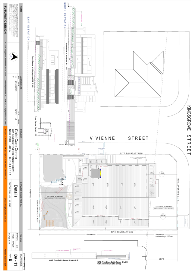
|
Georges River Council - Georges River Local Planning
Panel (LPP) - Friday, 5 October 2018
LPP043-18 301 Kingsgrove Road Kingsgrove
[Appendix
3] Ground Floor
Plan - 301 Kingsgrove Road Kingsgrove
|
Page 56
|
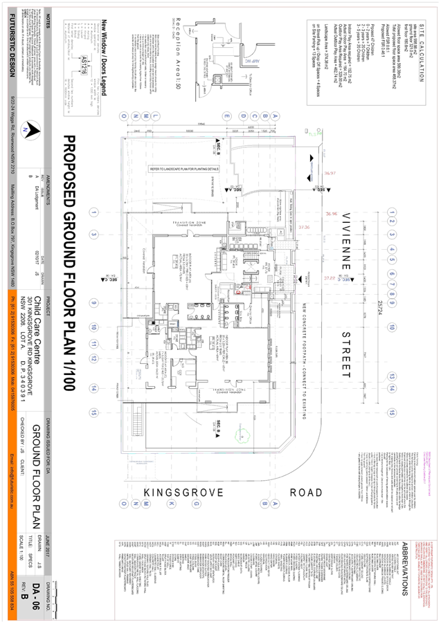
|
Georges River Council - Georges River Local Planning
Panel (LPP) - Friday, 5 October 2018
LPP043-18 301 Kingsgrove Road Kingsgrove
[Appendix
4] First Floor
Plan - 301 Kingsgrove Road Kingsgrove
|
Page 57
|
|
Georges River Council - Georges River Local Planning
Panel (LPP) - Friday, 5 October 2018
LPP043-18 301 Kingsgrove Road Kingsgrove
[Appendix
5] Basement - 301
Kingsgrove Road Kingsgrove
|
Page 58
|
|
Georges River Council – Local Planning
Panel Friday, 5 October 2018
|
Page 59
|
REPORT TO GEORGES RIVER COUNCIL
LPP MEETING OF Friday, 05 October 2018
|
LPP Report No
|
LPP044-18
|
Development Application No
|
DA2018/0124
|
|
Site Address & Ward Locality
|
13 Allawah Avenue Carss Park
Blakehurst Ward
|
|
Proposed Development
|
Demolition works, construction of a
dual occupancy, swimming pools, retaining walls and front fencing
|
|
Owners
|
J Carnabuci and R Vella
|
|
Applicant
|
R Ursino / R Vella
|
|
Planner/Architect
|
Robert Ursino Design
|
|
Date Of Lodgement
|
4/04/2018
|
|
Submissions
|
Six (6) in total. Three (3) to
original DA lodgement; a further three (3) to amended plans.
|
|
Cost of Works
|
$1,190,644.00
|
|
Local Planning Panel Criteria
|
Applicant/Owner is a former
employee of Council
|
|
List of all relevant s.4.15
matters (formerly s79C(1)(a))
|
Kogarah Local Environmental Plan
2012, Kogarah Development Control Plan 2013,
Greater Metropolitan Regional
Environmental Plan No 2 – Georges River Catchment, State Environmental
Planning Policy No 55 - Remediation of Land,
State
Environmental Planning Policy (Vegetation in Non-Rural Areas) 2017
|
|
List all documents submitted
with this report for the Panel’s consideration
|
Architectural Plans
|
|
Report prepared by
|
Team Leader Development Assessment
and Independent Assessment
|
|
Recommendation
|
That the application be approved in accordance with the
conditions included in the report.
|
|
|
Summary of matters for
consideration under Section 4.15
Have all recommendations in relation
to relevant s4.15 matters been summarised in the Executive Summary of the
assessment report?
|
Yes
|
|
Legislative clauses requiring
consent authority satisfaction
Have relevant clauses in all
applicable environmental planning instruments where the consent authority
must be satisfied about a particular matter been listed, and relevant
recommendations summarised, in the Executive Summary of the assessment
report?
|
Yes
|
|
Clause 4.6 Exceptions to
development standards
If a written request for a
contravention to a development standard (clause 4.6 of the LEP) has been
received, has it been attached to the assessment report?
|
Not
Applicable
|
|
Special Infrastructure Contributions
Does the DA require Special
Infrastructure Contributions conditions (under s7.24)?
|
No
|
|
Conditions
Have draft conditions been provided
to the applicant for comment?
|
No
|
|
Site Photo
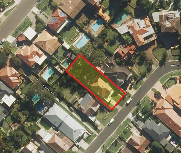
|
Executive Summary
Proposal
1. The
application proposes demolition of existing structures and construction of a
new three (3) storey attached dual occupancy building with a swimming pool
being proposed for each lot. Also proposed are various ancillary works
including retaining walls and front fencing.
Site and Locality
2. The
subject site is legally described as Lot 187 in Deposited Plan 12759 and has a
street address of 13 Allawah Avenue, Carss Park. The property is
located on the north western side of Allawah Avenue.
3. The dimensions of the site are approximately 15.24m (width) x
42.735m at the north eastern boundary and 42.725m at the south western boundary
(depth), with a total area of 651.2sqm. There is an existing two (2) storey
rendered dwelling house situated on the subject land.
4. Surrounding
development in the immediate locality consists of a mix of detached dwelling
houses in a predominantly low density residential setting.
Zoning and Permissibility
5. The
site is zoned R2 Low Density Residential and the proposed development is
permissible with development consent.
Submissions
6. A
total of six (6) submissions were received regarding this DA.
7. The
original DA plans were notified in accordance with Council’s requirements
under Kogarah Development Control Plan 2013 on 20 April 2018 and three (3)
submissions objecting to the proposal were received.
8. The
amended plans submitted by the applicant were renotified by Council on 30 July
2018. A further three (3) submissions were received, of which two (2) were from
objectors that lodged a submission during the original notification period.
9. The
objections raised in relation to the proposal can be summarised as follows:
· Character –
the bulk and scale of the development will be out of character with the local
area.
· Parking –
insufficient parking spaces are provided on site for the proposed development.
· Landscaping –
The proposal will provide for insufficient landscaping opportunities.
· Privacy –
the development will result in overlooking opportunities from the rear windows
of the first floor bedrooms.
· View Loss –
the proposal will impact on views currently afforded to the dwelling house to
the rear of the site at 34 Benwerrin Avenue.
Level of
Determination
10. The
DA is referred to the Local Planning Panel for consideration and the Panel’s
opinion on the application, as the applicant/ owner is a former (Senior) member
of staff at former Kogarah/ Georges River Council.
11. The
assessment of this DA, and the preparation of this report, has been undertaken
by an Independent Planning Consultant on behalf of Council for probity reasons.
Conclusion
12. That
the Panel review the application with respect to the relevant applicable
Planning controls and provide Council with an opinion on the merits of the
application. Having regard to the matters for consideration listed under
Section 4.15 of the Environmental Planning and Assessment Act 1979, and
following a detailed assessment of the proposal, Development Application No.
2018/0124.
REPORT IN FULL
Proposal
13. The
application proposes demolition of all existing structures and construction of
a new three (3) storey dual occupancy with a swimming pool for each lot.
14. Pedestrian
access to Lot 1 is via part of the driveway and a pedestrian path. Pedestrian
entry to Lot 2 is via a dedicated pedestrian pathway.
15. Vehicular
access will be provided to the garages by way of a new central driveway.
16. The
dwellings will comprise the following:
Northern
Dwelling - 1
Lower Ground
Floor:
· Double car garage
(tandem car parking);
· Storage;
· Entry foyer;
· Lift;
· Stairwell to
ground floor; and,
· Mechanical
services room.
Ground Floor:
· Guest bedroom with
ensuite and balcony facing Allawah Avenue;
· Powder room;
· Linen closet;
· Open plan living /
dining / kitchen;
· Outdoor dining
area;
· Lift; and,
· Stairwell to the
lower ground floor and first floor.
First Floor:
· Three bedrooms,
one containing an ensuite and balcony facing Allawah Avenue;
· Bathroom;
· Study nook;
· Linen cupboard;
· Lift; and,
· Stairwell to the
lower ground floor and first floor.
Southern
Dwelling - 2
Lower Ground
Floor:
· Double car garage
(tandem car parking);
· Storage;
· Bin store;
· Lift;
· Stairwell to
ground floor; and,
· Mechanical
services room.
Ground Floor:
· Family room with
direct access to a balcony facing Allawah Ave;
· Powder room;
· Linen closet;
· Pantry;
· Entry foyer;
· Open plan living /
dining / kitchen;
· Outdoor dining
area;
· Lift; and,
· Stairwell to the
lower ground floor and first floor.
First Floor:
· Three bedrooms,
one containing an ensuite and balcony facing Allawah Ave;
· Bathroom;
· Study nook;
· Linen cupboard;
· Lift; and,
· Stairwell to the
lower ground floor and first floor.
17. The
rear yards will each contain an outdoor dining area, inground pool, and
landscaping which includes pathways around the development.
18. The
proposal does not involve the removal of any existing trees given the land is
largely clear of any significant vegetation.
19. The
following is the site plan of the proposed development.
Site Plan of proposed development. Source: Applicant DA plans
The Site and Locality
20. The
subject site is legally described as Lot 187 in Deposited Plan 12759 and has a
street address of 13 Allawah Avenue, Carss Park. The property is
located on the north western side of Allawah Avenue.
21. The dimensions of the site are approximately 15.24m (width) x
42.735m at the north-eastern boundary and 42.725m at the south western boundary
(depth), with a total area of 651.2sqm. There is an existing two (2) storey rendered
dwelling house situated on the subject land.
22. The land slopes and drains to the south eastern side of the site
fronting Allawah Avenue. There are no existing trees on site that will be
affected by the proposal.
23. Surrounding
development in the local area consists of a mix of detached dwelling houses,
one (1) to two (2) storeys in height in a predominantly low density residential
setting.
24. The
immediate vicinity of the subject site is shown in the following photo:
View of the site from Allawah Avenue, Carss Park Source:
https://www.google.com.au/maps
Applicable
Planning Controls
25. The
applicable planning controls relevant to the proposal are contained within:
· Greater
Metropolitan Regional Environmental Plan No 2 - Georges River Catchment (Deemed
SEPP);
· State
Environmental Planning Policy No 55 - Remediation of Land;
· State
Environmental Planning Policy (Building Sustainability Index: BASIX) 2004;
· State
Environmental Planning Policy (Vegetation in Non-Rural Areas) 2017;
· Draft State
Environmental Planning Policy (Environment);
· Kogarah Local
Environmental Plan 2012; and,
· Kogarah
Development Control Plan 2013.
Planning
Assessment
26. The
site has been inspected and the proposed development has been assessed under
the relevant Section 4.15(1) "Matters for Consideration" of the
Environmental Planning and Assessment Act 1979.
Kogarah LEP
2012
Zoning
27. The
site is zoned R2 Low Density Residential under the Kogarah Local Environmental
Plan 2012 (KLEP 2012). The proposed development is permissible with
development consent and satisfies the zone objectives as the proposal will
provide for the housing needs of the community within a low density residential
environment. Further, the proposal will not impact on the ability of other land
within the local area to provide facilities or services to meet the day to day
needs of residents.
28. The
following is the Kogarah LEP 2012 zoning map which illustrates the subject
property.
Kogarah LEP 2012 Zoning Map. Source: legislation.nsw.gov.au
Relevant
Planning Controls in Kogarah LEP 2012
29. The
extent to which the proposal complies with the relevant standards of Kogarah
Local Environmental Plan 2012 is outlined in the table below.
|
Clause
|
Standard
|
Proposed
|
Complies
|
|
Part 2 – Permitted or
Prohibited Development
|
R2 Low Density
Residential
|
Dual
occupancy (attached) developments are permissible in the R2 zone.
|
Yes
|
|
Objectives of the Zone
|
The proposal is consistent with the
objectives of the zone.
|
Yes
|
|
4.1B Minimum Lot Size for Dual
Occupancies
|
650sqm
|
651.2sqm
|
Yes
|
|
4.3 – Height of Buildings
|
9m as identified on Height of
Buildings Map
|
9m
|
Yes
|
|
4.4 – Floor Space Ratio
|
0.55:1 as identified on Floor Space
Ratio Map
|
0.548:1
|
Yes
|
|
4.4A Exceptions to Floor Space
Ratio for Residential Accommodation in Zone R2
|
Maximum Floor Space Ratio of 0.5495
|
0.548:1
|
Yes
|
|
4.5 – Calculation of floor
space ratio and site area
|
FSR and site area calculated in
accordance with Cl.4.5
|
The site area of 651.2m2
has been calculated in accordance with Cl.4.5
|
Yes
|
|
5.10 – Heritage Conservation
|
Heritage impact statement required
if site involves heritage item
|
Site does not contain or adjoin a
heritage item
|
N/A
|
|
6.1 – Acid Sulfate Soils
|
Acid Sulfate Soils Management Plan
must be prepared
|
Site is not affected by acid
sulfate soils
|
N/A
|
|
6.2 – Earthworks
|
To ensure that earthworks do not
have a detrimental impact on environmental functions and processes,
neighbouring uses, cultural or heritage items or features of the surrounding
land.
|
The application does not
necessitate the need for any significant excavation works to take place.
|
Yes
|
State
Environmental Planning Policies
30. The
development is subject to a number of State Environmental Planning Policies,
and compliance is outlined in the table below:
|
State
Environmental Planning Policy
|
Complies
|
|
Greater Metropolitan Regional
Environmental Plan No 2 - Georges River Catchment
|
Yes
|
|
State Environmental Planning Policy
No 55 - Remediation of Land
|
Yes
|
|
State Environmental Planning Policy
(Building Sustainability Index BASIX) 2004
|
Yes
|
|
State Environmental Planning Policy
(Vegetation in Non-Rural Areas) 2017
|
Not directly relevant to the
proposal
|
|
Draft State Environmental Planning
Policy (Environment)
|
Relevant consideration but not
pertinent to the assessment due to status of the draft
|
Greater Metropolitan
Regional Environmental Plan No 2 - Georges River Catchment (Deemed SEPP)
31. The
Greater Metropolitan Regional Environmental Plan No 2 – Georges River
Catchment (deemed SEPP) applies to subject land.
32. The
policy aims to maintain and improve the water quality and river flows of the
Georges River and its tributaries and ensure that development is managed in a
manner that is in keeping with the national, state, regional and local
significance of the catchment.
33. All
stormwater from the proposed development can be treated in accordance with
Council’s Water Management Policy and would satisfy the relevant
provisions of the aforementioned deemed SEPP.
34. It
is noted that the Department of Planning and
Environment (DPE) is seeking to consolidate this SEPP along with several others
and include relevant provisions within a new draft policy that was recently
exhibited referred to as the new Draft State Environmental Planning Policy
(Environment). Further details in relation to the new draft SEPP are provided
under the relevant heading below.
State
Environmental Planning Policy No 55 - Remediation of Land (SEPP 55)
35. SEPP
55 aims to promote the remediation of contaminated land in order to reduce the
risk of harm to human health or any other aspect of the environment.
36. Clause
7 requires contamination and remediation to be considered in determining a
development application. The consent authority must not consent to the carrying
out of development on land unless it has considered whether or not the land is
contaminated.
37. The
site has a history of residential uses and as such, site contamination is not
suspected. In this regard, no further assessment is warranted with regards to
site contamination.
State
Environmental Planning Policy (Building Sustainability Index BASIX) 2004 (BASIX
SEPP)
38. Compliant BASIX Certificates, numbered 883407S and 883524S
dated 26 March 2018 have been issued for the proposed development. Conditions
of consent have been included to ensure the commitments required under the
certificates will been satisfied with the proposed development.
39. It is noted that amended plans were submitted as part of
the DA process, however these have not resulted in a material change to the
development, and as such new BASIX certificates are not required.
State
Environmental Planning Policy (Vegetation in Non-Rural Areas) 2017 (Vegetation
SEPP)
40. The
Vegetation SEPP applies to land in the Sydney and Newcastle metropolitan areas,
and all land that is zoned for urban purposes or environmental
conservation/management under the Standard Instrument - Principal Local
Environmental Plan.
41. The
SEPP applies to clearing of:
(a) native
vegetation above the Biodiversity Offset Scheme (BOS) threshold where a
proponent will require an approval from the Native Vegetation Panel established
under the Local Land Services Amendment Act 2016; and
(b) vegetation
below the BOS threshold where a proponent will require a permit from Council if
that vegetation is identified in the council’s development control plan
(DCP).
42. The
proposal does not involve any clearing and as such, and the provisions within
the Vegetation SEPP are not directly relevant to the proposal.
Draft Environmental Planning Instruments
Draft State
Environmental Planning Policy (Environment) (Environment SEPP)
43. The Department of Planning and Environment have been
working to develop a new SEPP for the protection and management of our natural
environment. The policy will replace seven (7) existing SEPPs including the
Greater Metropolitan Regional Environmental Plan No. 2 - Georges River
Catchment by updating and consolidating relevant provisions.
44. The new Draft Environment SEPP was exhibited from 31 October
2017 until the 31 January 2018. Engagement is now closed and feedback is
currently being considered.
45. As such, the draft plan is a consideration in the
assessment of this application however given the timeframe for adoption is not
yet imminent or certain, no further assessment is required. Irrespective of
this, the proposed development has been assessed as not inconsistent with
provisions of the Environmental SEPP.
Development
Control Plans
Kogarah
Development Control Plan 2013
46. The
development has been assessed against the requirements of Part C1 – Low
Density Housing in Kogarah DCP 2013, as indicated in the following table.
|
Requirement
|
Controls
|
Proposed
|
Complies
|
|
Design Requirements -
Streetscape Character
|
Streetscape Character
Analysis (SCA) must be submitted as part of any Development Advisory Service
(DAS) application for the following:
- New dwellings
- Alterations to the
front and / or two level adds to an existing dwelling
- Attached dual occupancy
- Detached dual occupancy
|
An adequate Streetscape Character
Analysis (SCA) has been submitted.
|
Yes
|
|
|
Comprises an analysis of
the existing streetscape and future desirable streetscape.
|
A review of the SCA has confirmed
that the proposal is generally consistent with the existing and future
desirable streetscape.
|
Yes
|
|
Building Scale and Height
- Floor space requirements
|
Maximum FSR
- Site between 650sqm to
800sqm (SA – 650) x 0.3 + 357.5 (357.86sqm or 0.5495:1)
|
Lower Ground Floor
29.72sqm
Ground Floor
180.55sqm
First Floor:
146.78sqm
Total: 357.05sqm /
0.548:1
|
Yes
|
|
|
FSR calculations include
any secondary dwellings.
|
N/A
|
-
|
|
|
Bulk and relative mass is
acceptable in terms of:
- Streetscape
considerations
- Setbacks
- Landscape requirements
- Vegetation
- Size and shape of allotment
- Topography of site
|
Perceivable bulk and mass is
considered acceptable with consideration given to the existing streetscape,
and the topography of the site.
Although the dwelling will be of a
bulk and scale more significant than the adjoining dwellings, the precedent
for this form of development in the area has been set noting the following
more modern properties:
· 21 Allawah Ave
· 47 Allawah Ave
· 99 Carwar Ave
· 101 Carwar Ave
|
Yes
|
|
|
Blank walls and flat
facades to be avoided – walls longer than 10m to be articulated by a
minimum 300mm projection or indentation.
|
One area of continuous wall greater
than 10.00m in length is proposed. This occurs along the side boundary walls
of the first floor where they are approximately 10.35m in length, otherwise a
variation of 3.5%
This variation is exceptionally
minimal whilst sufficient articulation is provided by way of the roof form
that provides relief and interest.
|
No -
Justifiable
|
|
|
Building mass is in
proportion with allotment size, provides modulation and articulation.
|
Yes. Note above.
|
Yes
|
|
|
Where there is a two
level residential element – second level should not extend beyond 60%
of the depth of the lot form the street boundary.
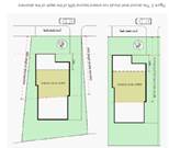
|
60% of site depth is approx.
25.635m.
A depth of 25.66m is recorded on
the first floor whilst a depth of 25.06m is recorded on the ground floor.
Accordingly, the depth of the first
floor results in a non-compliance of 25mm. This very minor variation is
non-consequential, particularly as it only relates to the windows surround.
|
No
– Justifiable
|
|
Building Heights
|
Maximum building heights
for dual occupancy:
- 7.2 to underside of
upper ceiling
- 7.8m to top of parapet
- 9.0m to the top of the
ridge
|
· RL20.10 – RL11.30 =
8.80m being a 1.60m variation or 22.22%.
· No parapet proposed.
· Complies with 9.0m to top of
ridge – refer to clause 4.3 of KLEP2012 above.
|
No -
Justifiable
|
|
|
Maximum two (2) storeys
unless site exceeds 1:8 or 12.5% where the max is three (3) storeys.
|
Slope is 13.8% therefore 3 storeys
is permitted.
|
Yes
|
|
|
Maximum height to be
adhered with irrespective of number of levels.
|
Maximum building height has been
adhered to.
|
Yes
|
|
|
Foundation areas,
garages, basements, etc., most not have an external wall height greater than
1.0m above ground level (existing) at any point on the building.
|
Complies. Garages do not have any
external walls as in a basement form.
|
Yes
|
|
|
Where dominant built form
is single storey – new buildings and alts should present as single
storey. Any second level element to be setback a minimum of 10.0m from the
boundary.
|
Dominant built form is not single
storey. Dwelling houses within Allawah Avenue range from one to three
storeys.
|
Yes
|
|
Rhythm of the Built
Elements in the streetscape
|
Primary building
façade should not exceed 40% of frontage width
|
Primary building façade
comprises approximately 66.27% of the frontage width at 10.10m.
This is considered acceptable due
to the design of the building that is predominantly open i.e. balconies and
voids, which appropriately reduces the bulk and scale.
|
No
– Justifiable
|
|
|
Secondary building
façade – setback a min of 1.5m from primary building
façade
|
Complies. The secondary building
façade on the first floor is setback 1.60m from the primary building
façade on the ground floor.
|
Yes
|
|
|
Where hip and gable are
prominent – additions and new buildings should reflect that form
|
Hip and gable are prominent,
however, multiple examples of alternative roof forms such as at:
- 43 Allawah Avenue
- 47 Allawah Avenue
- 97 Carwar Avenue
- 101 Carwar Avenue
Two appear to be recently approved.
|
Yes
|
|
Building Setbacks
Front Setbacks
|
Where an adjacent
building is setback greater than 5.0m
i. Proposal
is setback same distance as one of the other adjoining buildings provided
that difference between the adjoining setbacks is less than or equal to 2.0m.
ii. If
difference is larger than 2.0m – the average.
|
Setback of adjacent buildings:
11 Allawah Avenue – 5.30m
9 Allawah Avenue – 8.50m to
the dwelling (exclusive of garage)
Average setback of approx. 6.90m
Dwelling is setback 5.52m to the
balcony balustrades of the ground floor which is in line with 11 Allawah
Avenue.
|
Yes
|
|
Side and Rear Setbacks
|
Dual occupancy
i. Rear:
15% of average site length or 6.0m, whichever is greatest.
ii. Rear:
Development to respond to west rear setback if any
iii. Side:
Building with wall height 3.5m or less – 900mm
iv. Side:
building with wall height 3.5m or above – 1200mm
|
i. 15% average
site length is 6.41m. Complies. Rear setback of 13.95m proposed to the
rearmost section of the party wall on the ground floor.
ii. It
is in-line with the established rear setback of adjoining properties which is
approximately 15.0m.
iii. N/A
iv. Minimum
side setback of 1200mm is proposed across all floors with the exception of
where two ground floor windows protrude 300mm into the required setback.
|
No
– Justifiable
|
|
Fenestration and External
Materials
|
Materials and colour
range to compliment street.
|
Range of materials and colours
within the streetscape i.e. red/ brown brick, rendered dwellings in a light
colour, and weatherboard. Range of grey, white, and brown dwellings in
conjunction with the red/brown brick.
The proposal to be a mix of face
brick, rendered brick, horizontal and vertical cladding, and stone.
Colour selection is commensurate
with the streetscape.
|
Yes
|
|
|
Garage doors to not
dominate
|
Garage doors do not dominate,
noting they’re recessed approximately 1.35m from the outermost building
element and are constructed of materials that are not only of a high quality,
but also assist in the doors blending in with the dwelling. Note both garages
are single car in width.
|
Yes
|
|
|
Roof to be similar pitch,
colour, and material as streetscape
|
Roofs within the streetscape are
either metal or tile and are predominantly red, grey, or black.
The roof material is to be a dark
grey metal, ensuring consistency with the streetscape.
|
Yes
|
|
|
Colour of garages, window
frames, balustrade to be integrated with external design of building
|
Complies. High quality material
frames been selected that are cohesive with the overall design.
|
Yes
|
|
|
Glazing to be limited to
35% of façade (front and secondary)
|
Complies. Glazing does not exceed
35% of the front façade.
|
Yes
|
|
|
Garage in front
façade – max of two bays that are separated – max door
width 3.0m
|
Complies. Two single width bays are
proposed that are a maximum width of 2.90m
|
Yes
|
|
Street
Edge
|
New developments should
provide front fencing that complements fencing within the streetscape.
|
Front fence is a low height stone
wall with open sections for pedestrian access and joint driveways, creating a
visually permeable and high quality front fence that is consistent with those
of surrounding dwellings.
|
Yes
|
|
|
Fencing is to be
consistent with the requirements of Section 4.2
|
An assessment against Section 4.2
of DCP2013 has confirmed that front fence is compliant.
|
Yes
|
|
|
Existing vegetation in
the front building line setback or on the street verge that contributes to
the character of the streetscape should be
preserved.
|
N/A – no existing vegetation.
|
-
|
|
|
The driveway location
should not result in the removal of any street trees or removal of
substantial trees on the site.
|
N/A – no existing vegetation
on site or within the Council verge fronting the site
|
-
|
|
Open
Space
|
15% of the site area must
be deep soil landscaped area.
|
Complies. Approximately 153m2
or 23.5% proposed.
|
Yes
|
|
|
Private open space should
be adjacent to and visible from the main living and/or dining rooms and be
accessible from those areas.
|
Private open space areas adjacent
to dining / lounge rooms.
|
Yes
|
|
|
Development should take
advantage of opportunities to provide north facing private open space to
achieve comfortable year round use.
|
Complies. Rear POS will benefit
from northerly aspect.
|
Yes
|
|
|
Where soil and drainage
conditions are suitable, unpaved or unsealed landscaped areas should be
maximised and designed to facilitate on site infiltration of stormwater.
|
More than compliant landscape and
deep soils area proposed.
|
Yes
|
|
Vehicular
access, parking and circulation
|
Car
parking is to be provided in accordance with
the requirements in
Section B4.
- Dual Occupancies
– 1.5 spaces / dwelling
|
Two car spaces have been provided
to each of the proposed dwellings.
|
Yes
|
|
|
Crossings
are to be positioned so that on-street parking and landscaping on the site
are maximised, and removal or damage to existing street trees is avoided.
|
Complies. Minimal impact on
available on-street parking, no landscaping is required to be removed due to
its location.
|
Yes
|
|
|
Garaging
should be setback behind the primary façade
|
Complies. Garage doors are setback
approximately 1.35m from the front setback.
|
Yes
|
|
|
The
maximum driveway width between the street boundary and the primary building
façade is 4m.
|
Driveway is 5.08m in width between
the boundary and garage.
It is noted that the proposal
complies with the maximum driveway width control for dual occupancies at
one-third of width of the site.
|
No -
Justifiable
|
|
|
Storage
areas within basements or garages must not exceed 10m²per
dwelling (with a minimum width of 500mm)
|
Maximum storage area of 5.4m2.
|
Yes
|
|
|
Car
parking layout and vehicular access requirements and design are to be in
accordance with the Australian Standards, in particular AS 2890.1-2004.
|
Refer to Condition No. 10.
|
Yes
|
|
|
Dual
occupancy development must have only one single fronted garage per dwelling.
Where garaging is required for 2 cars, this must be tandem parking.
|
Complies – only one single
fronted garage proposed per dwelling.
|
|
|
Privacy
Visual
Privacy
|
Windows
from active rooms are to be offset between adjacent dwellings so as to avoid
direct overlooking onto neighbouring windows.
|
Complies. Windows from active rooms
have been offset from direct overlooking onto neighbouring windows.
|
Yes
|
|
|
Where
terraces and balconies are proposed and are elevated more than 1.5m above
ground level (finished) and are located behind the street front façade,
they are restricted to a maximum width of 2.5m and must be setback a minimum
3m from any adjoining property boundary.
|
The rear terraces are not elevated
more than 1.5m above ground level.
|
N/A
|
|
|
For
active rooms or balconies on an upper level, the design should incorporate
placement of room windows or screening devices to only allow oblique views to
adjoining properties (Figures 18 and 19).
|
Bedrooms located on the first floor
contain high level windows where located along the side boundaries. Where there
are potential privacy issues from the side facing windows, appropriate
screening has been provided.
Floor to ceiling glass windows are
located along the first floor rear elevation which comprise four bedrooms in
total; views are obscured with fixed privacy screens covering the entirety of
these windows and three 800mm projection blades.
Views to the rear pool area of 34
Benwerrin Avenue will be hindered with existing and proposed landscaping
planting and fencing.
|
Yes
|
|
Solar
Access
|
At
least 50% of the primary private open space of the proposed development
should have access to a minimum of four hours of sunlight between
9am–3pm on 21 June.
|
The primary private open spaces
areas in the form of the outdoor dining areas received a minimum of four
hours of sunlight between 9am and 3pm on June 21 as evidenced by the Shadow
Diagrams.
|
Yes
|
|
|
Where
the neighbouring properties are affected by overshadowing, at
least 50% of the neighbouring existing primary private open space or windows
to main living areas must receive a minimum of 3 hours sunlight between
9am–3pm on 21 June (Figure 21)
|
Neighbouring properties will
continue to receive sunlight to at least 50% of their PPOS areas between 0900
and 1500 on 21 June.
|
Yes
|
|
|
Shadow
diagrams are to be submitted for the winter solstice (21 June)
and the spring equinox (22 September).
|
Complies. Shadow diagrams have been
provided for the winter solstice (21 June) and the spring equinox (22
September).
|
Yes
|
|
|
Shadow
diagrams are required to show the impact of the proposal on solar access to
the open space of neighbouring properties. Existing overshadowing by fences,
roof overhangs and changes in level should also be reflected in the diagrams.
|
Complies.
|
Yes
|
|
Views
and view sharing
|
Development
shall provide for the reasonable sharing of views
|
A four (4) step assessment has been
undertaken as cited in View Sharing- Planning Principle (Tenacity Consulting
v Warringah [2004] NSWLEC 140) and confirms that the proposed is acceptable.
Refer to the full assessment that
is provided in this report.
|
Yes
|
|
Dual
Occupancies and Secondary Dwellings
Dual
Occupancies (attached)
|
Minimum
site requirements for dual occupancies:
- 18.0m frontage
- 850sqm
- As per 4.1A of Kogarah LEP2012
|
Not applicable - Refers to
historical version of LEP
|
N/A
|
|
|
Each
dwelling within an attached dual occupancy development should either be side
by side or one dwelling above the other. It is not acceptable to have one
dwelling behind the other
|
Complies. The proposed
configuration is one dwelling side by side.
|
Yes
|
|
|
One
dual occupancy dwelling must not intrude into the rear yard further than 5
metres beyond the other, see Option 2 – Acceptable design solutions.
|
Both of the dwellings have the same
rear setback.
|
Yes
|
|
|
Attached
dual occupancies should take account of the building form and roof lines of
adjoining dwellings, where a pattern is established by
a group of adjoining houses.
|
Proposed setbacks generally align
with those of adjoining dwellings – roof pattern is not consistent,
however, flat roof forms are more common with modern dwellings in the
locality.
|
Yes
|
|
|
No
more than one third of the width of the frontage of a property should be used
for driveways and accessways.
|
5.08m of the 15.24m (33.33%) of the
frontage is occupied by the driveway.
|
Yes
|
|
|
Access
to garaging and additional parking spaces for dual occupancy dwellings should
not result in large expanses of paved surfaces to the front of the building
|
Complies. The proposed driveway
does not result in a large expanse of paved surface, noting it complies with
the one-third of frontage control and has been softened with landscape
planting.
|
Yes
|
|
|
Garages
for each dwelling within an attached dual occupancy development must be
single fronted only, however garages that provide for tandem parking may be
acceptable.
|
A single fronted garage is proposed
for each dwelling.
|
Yes
|
|
|
Where
existing dwellings in a streetscape are on one side of a block and have a
side driveway, this pattern should also be observed by the
design of the attached dual occupancy.
|
This pattern is not prominent
within the Allawah Avenue streetscape.
|
-
|
|
|
Attached
dual occupancies should not have central garages or driveways (examples of
these are shown under unacceptable designs).
|
A central driveway and garage has
been proposed. However, the garages have been designed so that they are
recessed from the front building line, and are of high quality materials that
complement the building façade.
Furthermore, the driveway has been
significantly reduced in width from the original plans and now only comprise
one-third of the allotment frontage.
|
No -
Justifiable
|
47. The
proposed development has some areas of non-compliance with DCP 2013, which are
discussed as follows.
Building Scale
and Height
48. Compliance
with the floor space ratio development standard of the KLEP2012 has been
achieved with a ratio of 0.548:1 proposed where 0.5495:1 is permitted.
49. Minor
non-compliances have been recorded for Controls 1.2.1 (5) and 1.2.1 (7) of the
KDCP2013 where a flat façade is proposed along the side elevations of
the dwelling for 10.35m where a maximum of 10.00m is permitted, and where the
first floor element of the building is setback further than 60% of the site
depth of 25.635m at 25.66m. Both these minor variations to the control are
inconsequential in nature and do not contribute to an excessive bulk or scale.
50. The
proposal results in a development that will measure 9m in height to the ridge
of the dwelling. The proposed building height complies with the 9m maximum
height as outlined in the KLEP2012.
51. The
development proposes a maximum ceiling height of 8.80m which does not comply
with the maximum height of 7.20m covered by the KDCP2013. This is a variation
to the control of 1.60m or 18.18%. The area of non-compliance occurs for a
minor portion of the building where it is predominantly setback from the level
below, and is therefore less visible. This has been demonstrated along the
south-west elevation where it is most extreme in the following drawing. Given
the steeply sloping nature of the subject site, and no discernible impacts from
the minor breach, this variation is considered acceptable.
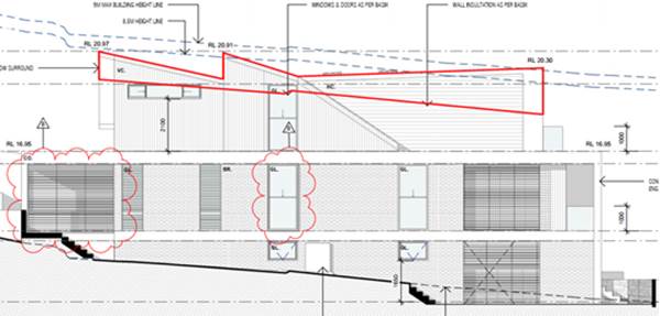
Area of non-compliant height (outlined in red) along the south-west
elevation. Source: Architectural Plans (marked up), Robert Ursino Design
Front Setbacks
52. Control
1.2.4.2 (1) of the KDCP2013 requires a minimum front setback that is the same
distance as one of the other adjoining buildings, provided the difference
between the adjoining setback is less than or equal to 2.0m. The adjoining
properties at 9 Allawah Avenue and 11 Allawah Avenue have a front setback of
8.50m and 5.30m respectively, which is greater than 2.0m in difference.
Accordingly, a setback of 5.52m has been provided to the proposed development
that is in line with the 5.30m setback of 11 Allawah Avenue.
53. As
the building proposes walls greater than 3.50m in height along the side
boundaries, a setback of 1.20m is required in accordance with Control 1.2.4.3
(1). This control has generally been met with the exception of two 300mm window
projections on the ground floor as identified in the following drawing. Due to
the inconsequential nature of the projections, and that the remainder of the
side setbacks being either compliant or greater than the minimum 1.20m setback
stipulated by the KDCP2013, this non-compliance is identified as acceptable.
Floor Plan (blocked for privacy reasons) showing 300mm window
projections located on the ground floor. Source: Architectural Plans, Robert
Ursino Design
Open Space
54. In
accordance with Control 1.3 (1), 15% of the site area must be deep soil
landscaped area. A deep soil/landscaped area of approximately 153sqm or 23.5%
is proposed. An expansive private open space area has been provided to the rear
that benefits from a favourable northerly aspect whilst an array of new
plantings are proposed across the site, inclusive of a tree within the front
setback. This a notable improvement over the current landscaping on site which
is largely clear of any significant vegetation.
Vehicle Access,
Parking and Circulation
55. Council’s
controls require the provision of 1.5 parking spaces per dwelling within a dual
occupancy. Two (2) on-site parking spaces have been provided to each dwelling,
thus exceeding the requirement for parking provision within the KDCP2013
56. The
garage doors have been setback 1.35m from the front building line located
above, whilst the selection of materials appear to be of high quality and
complement the remainder of the building façade.
57. The
width of the driveway at 5.08m exceeds Control 1.4 (6) which stipulates a
maximum width of 4.00m. This is however considered acceptable due to the driveway
servicing two single width garages. Furthermore, it is noted that the width of
the driveway has been significantly reduced from the original width of 6.82m
and is now softened by further landscape plantings.
Privacy
58. Privacy
has been maintained to surrounding properties through the provision of
highlight windows, offsetting windows to adjoining properties, and
incorporating privacy screens where there may be the potential for adverse
privacy impacts. Screening has also been included within the private open space
areas to avoid overlooking into the adjacent private open space areas.
59. No
rear balconies are proposed as part of the development.
60. Improved
landscaping within the rear setback will assist in visual privacy also.
Views and View Sharing
61. The
KDCP2013 states that development shall provide for the reasonable sharing of
views. It is noted that the properties to the rear of the subject site along
Benwerrin Avenue enjoy views to Carss Park and Kogarah Bay where they look over
the subject site. Accordingly, to determine whether the view sharing is
reasonable, a four (4) step assessment has been undertaken as cited from the View Sharing – Planning Principle by the NSW
Land and Environment Court - Tenacity Consulting v Warringah [2004] NSWLEC
140.
62. First Step – Water view is valued more than land
view. Whole view valued more than partial view (e.g. water view in which the
interface between land and water is visible is more valuable than one which is
obscured.
63. Comment: The
views of concern are views to Carss Park and water views to Kogarah Bay. It
should be noted that the existing views to Carss Park are partially obstructed
by existing trees to the rear of properties along Carwar Avenue and existing
trees in Carss Park.
64. As indicated in the plans submitted to Council, the
approximate floor level to the property at the rear, being 34 Benwerrin Avenue,
Carss Park is RL.21.60. The uppermost RL of the proposed development is
RL20.97, which is approximately 630mm below the approximate floor level of 34
Benwerrin Avenue, Carss Park.
65. It should be noted that the proposed development is also
fully compliant with the 9m building height in KLEP2012 and compliant with the
8.5m height limit (as specified in KDCP2013).
66. The development has also been designed to retain the view
corridors to Kogarah Bay through the design of the roof and also stepping of
the side boundaries at the upper level. As indicated on the plans, the side
setbacks to the front of the dwelling are 2570mm.
67. The water view of the uphill property at 34 Benwerrin
Avenue is unlikely to be affected. The following photo indicates the extent of
the views potentially impacted upon by the proposal.
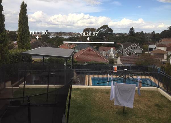
View from the rear yard of 34 Benwerrin Avenue toward Kogarah Bay
noting the approximate roof ridge of the proposal (RL20.97) and adjoining
property (RL21.00). Source: Georges River Council, 2018
68. Second Step - The part of the property, that the views are
obtained (eg protection of views across side boundaries is more difficult than
the protection of views from front or rear boundaries). Standing view or view
from sitting position. Expectation to retain side views and sitting views is
often unrealistic.
69. Comment: 34 Benwerrin
Avenue obtains views from the rear and across the side boundary. The water view
is from the ground floor with the water views available from both sitting and
standing positions. The proposal will retain most of the direct whole water
views to Kogarah Bay, but may result in the loss of views to the park. It is
considered that the views of the park are already restricted by trees both on
private and public property and potentially may be further obstructed with the
planting of additional trees.
70. The proposed development is stepped into the natural
contours of the site and is located well below the objecting neighbour’s
property.
71. Third Step - Extent of the impact / whole of
the property, not just for the view that is affected. Impact on views from
living areas is more significant than from bedrooms or service areas (though
views from kitchens are highly valued as more time is likely to be spent in
kitchens).
72. Impact may be assessed quantitatively, or qualitatively (it
is usually more useful to assess the view loss this way as negligible, minor,
moderate, severe or devastating).
73. Comment: The proposal
will mainly impact on the view from the pool area of the uphill property and
not from the lower level of the dwelling), as shown in the following photos. It
is considered unacceptable to retain a view from an outdoor area.
View from the rear pool area of 34 Benwerrin Avenue
towards Kogarah Bay Source: Site Inspection Photo
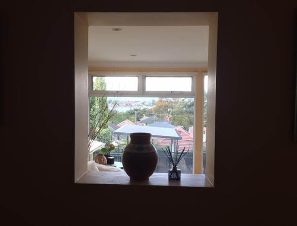
View from the lower level living area of 34 Benwerrin Avenue towards
Kogarah Bay Source: Site Inspection Photo
74. Overall the proposal is considered have
‘minimal’ loss of views, because most of the existing water views
from this neighbouring property is retained.
75. Fourth Step - Reasonableness of the proposal that is
causing the impact. Compliance with all planning controls would be more
reasonable than one that breaches them;
a) Impact on views arises as a result of non-compliance
with one or more planning controls, even a moderate impact may be considered
unreasonable,
b) Complying proposal, to determine whether a more skilful
design could provide the applicant with the same development potential and
amenity and reduce the impact on the views of neighbours/ if not, then the view
impact of a complying development would probably be considered acceptable and
the view sharing reasonable.
76. Comment: The proposal
has been designed to maintain the existing water views of the uphill property
and is considered to be acceptable. The proposal in its current form complies
with the majority of planning controls, including the overall building height
and FSR as specified in KLEP2012 and complies with the 8.5m building height in
the KDCP2013. Overall the proposal is not considered to result in any unreasonable
impacts on views to Kogarah Bay.
Dual
Occupancies (Attached)
77. The
development complies with Council controls requiring that dual occupancies are
provided with similar rear setbacks and take account of the building form of
adjoining dwellings.
78. It
is noted that the proposal does not comply with Control 2.1 (9) of the KDCP2013
which stipulates that attached dual occupancies should not have central garages
or driveways. This non-compliance is considered acceptable as the garage doors
have been setback 1.35m from the front building line located above, whilst the
selection of materials appear to be of high quality and complement the
remainder of the building façade. Accordingly, the garage is not a
dominant feature nor does it detract from the building façade.
79. Furthermore,
the width of the central driveway has been significantly reduced from 6.82m as
per the original plans to 5.08m, ensuring compliance with Control 2.1 (5) which
requires no more than one-third of the width of the frontage of the property to
be used for driveways. Proposed landscape planting on either side of the
driveway softens its appearance, whilst its combined nature ensures the
development presents as a single dwelling building, rather than a dual
occupancy. By combining the driveway, it is also argued the overall amount of
pervious area within the front setback is reduced.
Section 7.11
Contributions
80. The
proposed development requires the payment of developer contributions under
Section 7.11 of the Environmental Planning and Assessment Act 1979. An
appropriate condition of consent is contained in the recommendation below.
Likely Impacts
of the Development
Natural Environment
81. The proposed development will not result in any significant
adverse impacts to the natural environment. It is noted that no vegetation is
proposed to be removed.
82. A landscape plan prepared by a landscape architect has been
submitted with the application. The plan shows that suitable planting will be
introduced.
Built Environment
83. The proposal is not considered to have any adverse impacts
on the built environment. It complies with all key controls and will achieve a
built form that is consistent with the applicable planning framework and the
surrounding built form.
Social Impact
84. The proposal will not give rise to adverse social impacts.
It provides for the addition of one (1) dwelling within the Georges River LGA
on the lot. As such, the development will provide more housing choice to meet
the needs of the community, which is considered to be beneficial in terms of
social impacts.
Economic Impact
85. The proposed development is not considered to generate any
adverse economic impacts.
Suitability of the Site
86. The
proposed development is of a scale and design that is suitable for the site
having regard to its size, shape, topography, vegetation and relationship to
adjoining developments. This is evidenced by the development’s ability to
achieve a high level of compliance with the relevant planning controls.
Submissions
Received
87. A
total of six (6) submissions have been received in relation to this DA.
88. The
DA as originally submitted was notified in accordance with Council’s
requirements under KDCP2013 on 20 April 2018 for 14 days and received
three (3) submissions objecting to the proposal.
89. The
amended plans submitted by the applicant were renotified by Council on 30 July
2018 for 14 days. A further three (3) submissions were received, of which two
(2) were from objectors that lodged a submission during the original notification
period.
90. The
submissions have been summarised and discussed below.
91. Character - The
majority of submissions cited the general bulk and scale of the development as
concerning, suggesting that it will dominate and degrade the streetscape. It
was stated that dual occupancies are out of character with the area, will set a
precedent, and the development should not be permitted on this basis.
92. Officer Comment: The
subject site is zoned R2 Low Density Residential. Within this zone, the KLEP2012
permits dual occupancies are permitted with consent. As such, the form of
development being proposed is consistent with the desired future character for
the local area.
93. The bulk and scale of development is largely controlled by
Council’s FSR and building height development standards under the
KLEP2012. As demonstrated within this assessment report, the proposal achieves
compliance with both of these development standards.
94. The proposal has also been assessed to be generally
compliant with the KDCP2013 controls relating to bulk and scale. Where there
have been variations, these have been minor, such as in the form of 300mm
window projections and an exceedance in the ceiling height which is largely due
to the sloping nature of the subject site. These variations have been
identified as inconsequential in terms of their impact to adjoining property,
and largely indiscernible when viewing the property from either the public
domain for adjoining private property.
95. The development is suitable in this regard.
96. Parking - Multiple
submissions have stated that the development does not provide a sufficient
number of car parking spaces whilst citing the already strained on-street
parking as a cause for concern.
97. Officer Comment: In
accordance with the KDCP2013, a dual occupancy development is to be provided
with 1.5 car parking spaces per dwelling. The dual occupancy is provided with
four (4) car parking spaces, exceeding the minimum requirement by one (1)
space.
98. Pursuant to section 4.15(3A) of the Act, so long as
compliance with the development control plan is achieved, Council cannot
require more onerous standards. It is considered that exceeding the minimum
requirement for on-site parking will minimise the potential for on-street
parking and the development is reasonable in terms of car parking provision.
99. Landscaping - One
submission has asserted that the development will reduce the ability of the
site to be substantially planted with trees, citing the need to retain native
vegetation within the local area.
100. Officer Comment: The
proposal does not involve the removal or any vegetation whilst the minimum deep
soil area specified by KDCP2013 Control 1.3 (1) at 15% of site area has been
well exceeded with 23.5% proposed. The application proposes one tree within the
front setback with a mature height of 10.0m whilst the turfed area to the rear
provides opportunity for further planting of significant trees if
desired.
101. Once again, pursuant to section 4.15(3A) of the Act, so
long as compliance with the development control plan is achieved, Council
cannot require more onerous standards.
102. Privacy Issues - It
has been suggested that the rear windows from the first floor bedrooms will be
provided within views to adjoining properties, resulting in unreasonable
privacy impacts.
103. Officer Comment:
Although it is recognised that the first floor bedrooms located to the rear of
the dwellings comprise floor to ceiling glass windows, no adverse privacy
impacts are anticipated to occur. Privacy screening has been installed across all
of the ‘of concern’ windows that reduce visibility to the rear,
whilst window surrounds reduce the ability for oblique views into the rear
private open space areas of the properties adjoining the side boundaries.
104. It is also noted that the floor level of these bedrooms at
RL16.95 is approximately 4.5m lower than the floor level of the property to the
rear at RL21.60. Any concern is further reduced noting the approximately 30.0m
distance between the bedroom windows and dwelling to the rear. Furthermore,
privacy measures throughout the proposal have been assessed as sufficient
noting the use of highlight windows, screening devices, and landscape screening
where appropriate.
105. Loss of Views - It
has been asserted by a submitter that the proposal will significantly reduce
views to Kogarah Bay from Benwerrin Avenue.
106. Officer Comment:
Contained earlier in this assessment report is a four (4) step assessment which
has been undertaken having regard to the View Sharing – Planning
Principle established under Tenacity Consulting v Warringah [2004] NSWLEC 140.
107. The outcome of this assessment has determined the proposal
will not result in any unreasonable view loss.
108. Rock wall on rear boundary – The adjoining property owner at 34 Benwerrin Avenue
has raised concern with potential damage to property, including an existing
rock wall along the boundary, and also the adjacent swimming pool structure
which are sensitive to development at the rear boundary of the subject site.
109. Officer Comment: The
proposal includes a new landscaped rear setback that will involve some
excavation to improve the grade of the rear yard. This excavation will be up to
1.2m, but will be setback 1.2m from the rear boundary with the adjoining
property at 34 Benwerrin Avenue, Carss Park.
110. The excavation for the footings of the associated retaining
wall will exceed a depth of 1.2m, and be within 1m of the rear boundary.
111. Given the location of the retaining wall, and swimming pool
structure within close proximity of the rear boundary, it is considered
reasonable that a professional engineer specialising in structural or
geotechnical engineering prepare pre-construction and post-construction
dilapidation reports for 34 Benwerrin Avenue. Conditions of consent requiring
these reports have been recommended in this regard.
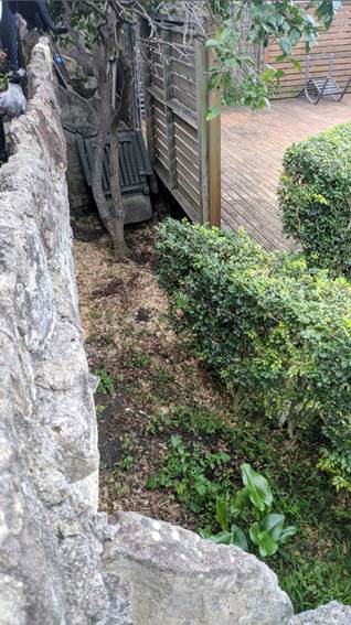
View of the
rock wall between the subject site and the objector’s property to the
rear at 34 Benwerrin Avenue, Carss
Park. Source: Site Inspection Photo
Referral
Comments
112. The
DA has been referred to officers within Council for comment, as discussed
below.
113. Drainage
Engineer: Has considered the proposal in terms of stormwater disposal and
raised no objection subject to imposition of appropriate conditions of consent.
114. Building
Surveyor: Has considered the proposal in terms of compliance with the
National Construction Code, and advised that the proposal is satisfactory
subject to conditions of consent.
Conclusion
115. The
application has been assessed against having regard to the matters of
consideration listed in Section 4.15 of the Environmental Planning and
Assessment Act 1979, including the provisions of any environmental planning
instrument, any proposed instrument and any development control plan.
116. The
application seeks approval for demolition of existing structures and
construction of an attached three storey dual occupancy (attached) building
with a swimming pool in each lot.
117. The
likely impacts of the development, along with the suitability of the site, any
submissions made in relation to the proposal and the public interest have been
evaluated.
118. The
proposed development is generally consistent with all relevant requirements and
the application is recommended for approval, subject to suitable conditions of
development consent.
119. DETERMINATION
AND STATEMENT OF REASONS
Statement
of Reasons
· The proposed
development is considered to be an appropriate scale and form for the site and
the character of the locality;
· The proposed
development, subject to the recommended conditions, will have no unacceptable
adverse impacts upon the natural or built environments;
· In consideration
of the aforementioned reasons, the proposed development is a suitable and
planned use of the site and its approval is in the public interest.
Determination
120. THAT
pursuant to Section 4.16(1) of the Environmental Planning and Assessment Act
1979, as amended, the Council grants development consent to Development
Application DA2018/0124 for demolition of existing structures and construction
of an attached three storey dual occupancy (attached) building with a swimming
pool in each lot at Lot 187 DP 12759 and known as 13 Allawah Avenue, Carss Park,
subject to the conditions below:
SECTION A
– GENERAL CONDITIONS
1. The
development must be implemented in accordance with the approved plans and
supporting documentation listed below which have been endorsed by
Council’s approved stamp, except where marked up on the plans and/or
amended by conditions of this consent:
|
Description
|
Reference No.
|
Date
|
Revision
|
Prepared by
|
|
Site Plan
|
DA202
|
12.07.2018
|
B
|
Robert Ursino Design
|
|
Lower Ground Floor Plan
|
DA301
|
12.07.2018
|
B
|
Robert Ursino Design
|
|
Ground Floor Plan
|
DA302
|
12.07.2018
|
B
|
Robert Ursino Design
|
|
First Floor Plan
|
DA303
|
12.03.2018
|
A
|
Robert Ursino Design
|
|
Roof Plan
|
DA304
|
12.03.2018
|
A
|
Robert Ursino Design
|
|
Front Fence Elevation
|
DA501
|
12.07.2018
|
B
|
Robert Ursino Design
|
|
North-East Elevation
|
DA502
|
12.07.2018
|
B
|
Robert Ursino Design
|
|
South-West Elevation
|
DA503
|
12.07.2018
|
B
|
Robert Ursino Design
|
|
North-West Elevation
|
DA504
|
12.07.2018
|
B
|
Robert Ursino Design
|
|
Construction Management Plan
|
DA702
|
12.07.2018
|
B
|
Robert Ursino Design
|
|
Materials / Window Schedules
|
DA902
|
12.03.2018
|
A
|
Robert Ursino Design
|
|
Stormwater Plans
|
171011-H1
|
22.03.2018
|
1
|
Tall Ideas Pty Ltd
|
|
Landscape Plan
|
DA L-01
|
21.03.2018
|
C
|
Ecodesign
|
|
Statement of Environmental Effects
|
-
|
March 2018
|
-
|
CivitasUrban
|
|
Waste Management Plan
|
-
|
March 2018
|
-
|
Robert Ursino Design
|
SEPARATE
APPROVALS REQUIRED UNDER OTHER LEGISLATION
2. Section
138 Roads Act 1993 and Section 68 Local Government Act 1993 - Unless
otherwise specified by a condition of this consent, this Development Consent
does not give any approval to undertake works on public infrastructure.
Separate approval
is required under Section 138 of the Roads Act 1993 and/or Section 68 of the Local Government Act 1993 for any
of the following activities carried out in, on or over a public road (including
the footpath) listed below.
An application is
required to be lodged and approved prior to the commencement of any of the
following works or activities;
(a) For storing waste containers or skip bins;
(b) Erecting a structure or carrying out work
(c) Swinging or hoisting goods over any
part of a public road by means of a lift, crane or the like;
(d) Pumping concrete from a public road;
(e) Pumping water from the site into the public
road;
(f) Constructing a vehicular crossing
or footpath;
(g) Establishing a “works zone”;
(h) Digging up or disturbing the surface of
a public road (e.g. Opening the road for the purpose of connections to utility
providers);
(i) Stormwater & ancillary works
in the road reserve; and
(j) Stormwater & ancillary to
public infrastructure on private land
(k) If any excavation is to be supported by
the use of below ground (cable) anchors that are constructed under
Council’s roadways/footways.
These separate
activity approvals must be obtained and evidence of the approval provided to
the Certifying Authority prior to the issue of the Construction Certificate.
The relevant
Application Forms for these activities can be downloaded from Council’s
website www.georgesriver.nsw.gov.au.
For further information, please contact Council’s Customer Service Centre
on (02) 9330 6222.
3. Vehicular
Crossing - Minor Development - Constructing a vehicular crossing and/or
footpath requires a separate approval under Section 138 of the Roads Act 1993 prior to the
commencement of those works.
To apply for approval,
complete the Driveway Crossing on Council Road Reserve Application Form
which can be downloaded from Georges River Council’s Website at www.georgesriver.nsw.gov.au.
Lodge the application form, together with the associated fees at
Council’s Customer Service Centre, during business hours. Refer to
Section P1 and P2, in Council’s adopted Fees and Charges for the
administrative and inspection charges associated with Vehicular Crossing
applications.
An approval for a
new or modified vehicular crossing will contain the approved access and/or
alignment levels which will be required to construct the crossing and/or
footpath. Once approved, all work shall be carried out in
accordance with Council’s specifications applicable at the time, prior to
the issue of an Occupation Certificate.
4. Road
Opening Permit - A Road Opening Permit must be obtained from Council, in the
case of local or regional roads, or from the RMS, in the case of State roads,
for every opening of a public road reserve to access services including sewer,
stormwater drains, water mains, gas mains, and telecommunications before the
commencement of work in the road.
PRIOR TO THE ISSUE OF A
CONSTRUCTION CERTIFICATE
5. Sydney
Water – Tap in - The approved plans must be submitted to a Sydney
Water Tap inTM to determine whether the development application will
affect Sydney Water’s sewer and water mains, stormwater drains and/or
easements, and if further requirements need to be met. The approved plans
will be appropriately endorsed. For details please refer to
‘Plumbing, building and developing’ section of Sydney Water’s
web site at www.sydneywater.com.au
then see ‘Building’, or telephone 13000 TAP IN (1300 082
746). The Certifying Authority must ensure that a Tap inTM
agent has appropriately stamped the plans prior to the issue of the
Construction Certificate.
6. Notice
of Requirements for a Section 73 Certificate - A Notice of Requirements of
what will eventually be required when issuing a Section 73 Compliance
Certificate under the Sydney Water Act 1994 must be obtained
from Sydney Water Corporation. Application must be made through an
authorised Water Servicing Co-ordinator. Please refer to the
‘Plumbing, building and developing’ section of the web site www.sydneywater.com.au
then refer to ‘Providers’ under ‘Developing’ or
telephone 13 20 92 for assistance.
Following
application, a ‘Notice of Requirements’ will advise of water and
sewer infrastructure to be built and charges to be paid. Please make
early contact with the Co-ordinator, as it can take some time to build
water/sewer pipes and this may impact on other services and building, driveway
or landscape design.
The Notice of
requirements must be submitted prior to the commencement of work. A Section 73
Compliance Certificate will be required at the completion of development in
accordance with further conditions.
7. Section
73 Compliance Certificate - A Section 73 Compliance Certificate under the Sydney Water Act 1994 must be submitted
to the PCA prior to the issue of the Occupation/Subdivision Certificate.
8. Fees
to be paid - The fees listed in the table below must be paid in accordance
with the conditions of this consent and Council’s adopted Fees and
Charges applicable at the time of payment (available at www.georgesriver.nsw.gov.au).
Payments must be made prior to the
issue of the Construction Certificate or prior to the commencement of work (if
there is no associated Construction Certificate).
Please contact
council prior to the payment of S94 Contributions to determine whether the
amounts have been indexed from that indicated below in this consent and the
form of payment that will be accepted by Council.
Council will only
accept Bank Cheque or Electronic Funds Transfer (EFT) for transaction values of
$500,000 or over. Council must be contacted prior to payment to determine
correct total amount to be paid and bank account details (if applicable).
A
summary of the fees to be paid are listed below:
|
Fee Type
|
Fee
|
|
GENERAL FEES
|
|
Long Service Levy (to Long Service
Corporation)
Or, provide evidence of Payment
direct to the Long Service Corporation.
See https://portal.longservice.nsw.gov.au/bci/levy/
|
|
Builders Damage Deposit
|
$1,900.00
|
|
Inspection Fee for Refund of Damage
Deposit
|
$155.00
|
|
Contributions
|
|
Kogarah Section 94 Development
Contributions Plan No.1 – Roads and Traffic Management –
Residential
|
$28.70
|
|
Kogarah Section 94 Development
Contributions Plan No.5 – Open Space 2007
|
$11,285.69
|
|
Kogarah Section 94 Development
Contributions Plan No.9 – Kogarah Libraries – Buildings
|
$378.27
|
|
Kogarah Section 94 Development
Contributions Plan No.9 – Kogarah Libraries – Books
|
$269.70
|
|
TOTAL CONTRIBUTIONS PAYABLE
|
$11,962.36
|
General Fees
The fees and
charges above are subject to change and are as set out in the version of
Council's Schedule of Fees and Charges or as required by other Government
Authorities, applicable at the time of payment.
Development
Contributions
The Section 94
contribution is imposed to ensure that the development makes adequate provision
for the demand it generates for public amenities and public services within the
area.
A Section 94A
contribution has been levied on the subject development pursuant to the GRC
Section 94A Contributions Plan.
Indexation
The above
contributions will be adjusted at the time of payment to reflect changes in the
cost of delivering public amenities and public services, in accordance with the
indices provided by the relevant Section 94 Development Contributions Plan.
Timing of
Payment
The contribution
must be paid and receipted by Council prior to the release of the Construction
Certificate.
Further
Information
A copy of the all
current Development Contributions Plans may be inspected or a copy
purchased at Council’s offices (Civic Centre, MacMahon Street, Hurstville
and 2 Belgrave Street, Kogarah) or viewed on Council’s website www.georgesriver.nsw.gov.au.
9. Damage
Deposit – Minor Works - In order to insure against damage to
Council property the following is required:
(a) Pay Council, before the
issue of the Construction Certificate, a damage deposit for the cost of making
good any damage caused to any Council property as a result of the development: $1,900.00.
(b) Pay Council, before the
issue of the Construction Certificate, a non-refundable inspection fee to
enable assessment of any damage and repairs where required: $155.00
(c) Submit to Council,
before the commencement of work, a photographic record of the condition of the
Council nature strip, footpath and driveway crossing, or any area likely to be
affected by the proposal.
At the completion
of work Council will inspect the public works, and the damage deposit will be
refunded in full upon completion of work where no damage occurs. Otherwise the
amount will be either forfeited or partly refunded according to the amount of
damage.
10. Site
Management Plan - A Site Management Plan detailing all weather access
control points, sedimentation controls, fencing, builder’s site sheds
office, amenities, materials storage and unloading arrangements must be
submitted with the application for the Construction Certificate.
11. BASIX
Commitments - All energy efficiency measures as detailed in the BASIX
Certificate No. 883407S and 883524S must be implemented on the plans lodged
with the application for the Construction Certificate.
12. Low
reflectivity roof - Roofing materials must be low glare and reflectivity.
Details of finished external materials including colours and texture must be
provided to the Certifying Authority.
13. Service
Utilities – Land Subdivision Only - Arrangements shall be made to
the satisfaction of all Service Utility Authorities in respect to the services
supplied by those authorities to the development. All services to any future
dwellings erected on the site shall be underground.
14. Erosion
and Sedimentation Control - Erosion and sediment controls must be
provided to ensure:
(a) Compliance with the approved
Erosion & Sediment Control Plan
(b) Removal or disturbance of
vegetation and top soil is confined to within 3m of the approved building area
(no trees to be removed without approval)
(c) All clean water run-off is
diverted around cleared or exposed areas
(d) Silt fences, stabilised
entry/exit points or other devices are installed to prevent sediment from
entering drainage systems or waterways
(e) All erosion and sediment
controls are fully maintained for the duration of demolition, excavation and/or
development works
(f) Controls are put into
place to prevent tracking of sediment by vehicles onto adjoining roadway
(g) All disturbed areas are
rendered erosion-resistant by turfing, mulching, paving or similar
(h) Compliance with Managing Urban Stormwater – Soils and
Construction (Blue Book) produced by Landcom 2004.
These measures are
to be implemented prior to the commencement of work (including demolition and
excavation) and must remain until works are completed and all exposed surfaces
are landscaped/sealed.
15. Stormwater
System - The submitted stormwater plan has been assessed as a concept
plan only. Final detailed plans of the drainage system, prepared by a
professional engineer specialising in hydraulic engineering, shall be submitted
for approval with the Construction Certificate.
(a) All
stormwater shall drain by gravity to Council's kerb and gutter directly in
front of the development site in accordance with the Australian/New Zealand
Standard AS/NZS 3500.3: 2015 (as amended).
(b) Stormwater
drainage plans including pipe sizes, type, grade, length, invert levels,
dimensions and types of drainage pits prepared by a professional engineer who
specialises in Hydraulic Engineering in accordance with the Australian
Institute of Engineers Australian Rainfall and Runoff (1987) and Council's
Stormwater Drainage Guidelines, shall accompany the application for the
Construction Certificate.
16. On-site
Detention - The submitted stormwater plan has been assessed as a concept
plan only. Final detailed plans of the drainage system, prepared by a
professional engineer specialising in hydraulic engineering, shall be submitted
for approval with the Construction Certificate.
An on-site
detention (OSD) facility designed by a professional engineer who specialises in
Hydraulic Engineering must be designed, approved and installed. The
design must include the computations of the inlet and outlet hydrographs and
stage/storage relationships of the proposed OSD using the following design
parameters:
(a) peak flow rates from the site are to be
restricted to a permissible site discharge (PSD) equivalent to the discharge
when assuming the site contained a single dwelling, garage, lawn and garden,
(b) at Annual Recurrence Intervals of 2 years and
100 years.
Refer
to Flow Controls in Council's Draft/Adopted Stormwater Drainage Policy.
The OSD
facility shall be designed to meet all legislated safety requirements and
childproof safety fencing around the facility must be provided where the OSD
facility is open or above ground when the design peak storage depth is greater
than 300mm. A durable metal plate or similar sign is to be placed at the OSD
facility and must bear the words:
"BEWARE: This
is an on-site detention basin/tank for rainwater which could overflow during
heavy storms."
Full
details shall accompany the application for the Construction Certificate.
17. Driveway
Construction Plan Details - Detailed engineering plans for the driveway
shall be submitted with the Construction Certificate application for approval
that show:
(a) Longitudinal and cross
sections, gradients, access onto the proposed lots, type of construction
materials designed in accordance with Council's Subdivision standards and
AS/NZS2890.1-2004.
(b) Suitable underground
provision for the supply of all relevant services to the proposed lots
(proposed position of pipes and conduits).
(c) The full length of the
driveway designed with a minimum 150mm thick reinforced concrete and minimum of
2.7m wide pavement/kerb face to kerb face width, and a non-slip surface.
18. Council
Property Shoring - Prior to the issue of the Construction Certificate,
plans and specifications prepared by a professional engineer specialising in
practising structural engineering must detail how Council’s property
shall be supported at all times.
Where any shoring
is to be supporting, or located on Council’s property, certified
structural engineering drawings detailing; the extent of the encroachment, the
type of shoring and the method of removal, shall be included on the
plans. Where the shoring cannot be removed, the plans must detail that
the shoring will be cut to 150mm below footpath level and the gap between the
shoring and any building shall be filled with a 5MPa lean concrete mix.
19. Compliance
with Swimming Pool Act 1992 - The alterations and additions to the
dwelling house and/or the construction of the new dwelling house subject of
this consent must not generate any non-compliances with the Swimming Pools Act
1992, Swimming Pool Regulation 2008, Building Code of Australia and/or AS
1926.1-2007 – Swimming Pool Safety. Details of compliance to be
illustrated on the plans lodged with the application for the Construction
Certificate.
20. Structural
details - Engineer's details prepared by a practising Structural Engineer
being used to construct all reinforced concrete work, structural beams, columns
& other structural members. The details are to be submitted to the
Principal Certifying Authority for approval prior to construction of the
specified works.
A copy shall be
forwarded to Council where Council is not the PCA.
21. Swimming
Pools – Use and Maintenance - The following apply to the
construction, use and maintenance of swimming pools and spas:
(a) no ground level may be raised or filled
except where shown specifically on the approved plans;
(b) all pool/spa waste water is to be
discharged to the sewer according to the requirements of Sydney Water;
(c) the swimming pool must not be used
for commercial or professional purposes;
(d) drain paved areas to the landscaped
areas or a suitable lawful drainage system; and
(e) arrange any external pool/spa lighting
to minimise glare nuisance to adjoining owners.
22. Traffic
Management – Compliance with AS2890 - All driveways, access ramps,
vehicular crossings and car parking spaces shall be designed and constructed
in accordance with the current version of Australian Standards, AS 2890.1 (for
car parking facilities) and AS 2890.2 (for commercial vehicle facilities).
23. Waste
Management Plan - A Waste Management Plan incorporating all requirements
in respect of the provision of waste storage facilities, removal of all
materials from the site that are the result of site clearing, extraction, and,
or demolition works and the designated Waste Management Facility shall be
submitted to the Certifying Authority prior to the issue of any Construction
Certificate.
24. Pre-Construction
Dilapidation Report – Private Land - A professional engineer
specialising in structural or geotechnical engineering shall prepare a
Pre-Construction Dilapidation Report detailing the current structural condition
of adjoining premises including but not limited to:
(a) All neighbouring buildings likely to be
affected by the excavation as determined by the consulting engineer; and
(b) 34 Benwerrin Avenue, Carss Park
The report shall
be prepared at the expense of the applicant and submitted to the satisfaction
of the Certifying Authority prior to the issue of the Construction
Certificate.
A copy of the
pre-construction dilapidation report is to be provided to the adjoining
properties (subject of the dilapidation report), a minimum of 5 working days
prior to the commencement of work. Evidence confirming that a copy of the
pre-construction dilapidation report was delivered to the adjoining properties
must be provided to the PCA.
Should the owners
of properties (or their agents) refuse access to carry out inspections, after
being given reasonable written notice, this shall be reported to Council to
obtain Council’s agreement to complete the report without access. Reasonable
notice is a request for access in no sooner than 14 days between 8.00am-6.00pm.
PRIOR TO COMMENCEMENT OF WORKS
25. Demolition
& Asbestos - The demolition work shall comply with the provisions of
Australian Standard AS2601:2001 – Demolition of Structures, NSW Work Health & Safety Act 2011 and the
NSW Work Health & Safety Regulation 2011.
The work plans required by AS2601:2001 shall be accompanied by a written
statement by a suitably qualified person that the proposals contained in the
work plan comply with the safety requirements of the Standard. The work plans
and the safety statement shall be submitted to the PCA prior to the
commencement of works.
For demolition work
which involves the removal of asbestos, the asbestos removal work must be
carried out by a licensed asbestos removalist who is licensed to carry out the
work in accordance with the NSW Work Health & Safety Act 2011 and the
NSW Work Health & Safety Regulation 2011
unless specified in the Act and/or Regulation that a license is not
required.
All demolition work
including the removal of asbestos, shall be undertaken in accordance with the Demolition Code of Practice (NSW Work Cover
July 2015)
Note: Copies
of the Act, Regulation and Code of Practice can be downloaded free of charge
from the SafeWork NSW website: www.SafeWork.nsw.gov.au.
26. Demolition
Notification Requirements - The following notification requirements
apply to this consent:
(a) The developer /builder
must notify adjoining residents five (5) working days prior to
demolition. Such notification is to be a clearly written note giving the
date demolition will commence, contact details of the developer/builder,
licensed asbestos demolisher and the appropriate regulatory authority.
Notification is to be placed in the letterbox of every premises (including
every residential flat or unit, if any) either side and immediately at the rear
of the demolition site.
(b) Five (5) working days prior to
demolition, the developer/builder is to provide written notification to Council
advising of the demolition date, details of the SafeWork licensed asbestos
demolisher and the list of residents advised of the demolition.
(c) On demolition sites where
buildings to be demolished contain asbestos, a standard commercially
manufactured sign containing the words “DANGER ASBESTOS REMOVAL IN
PROGRESS” measuring not less than 400mm x 300mm is to be erected in a
prominent visible position (from street frontage) on the site. The sign is to
be erected prior to demolition work commencing and is to remain in place until
such time as all asbestos material has been removed from the site to an
approved waste facility.
27. Demolition
work involving asbestos removal - Work involving bonded asbestos removal
work (of an area of more than 10 square metres) or friable asbestos removal
work must be undertaken by a person who carries on a business of such removal
work in accordance with a licence under clause 458 of the Work Health and Safety Regulation 2011
28. Dial
before your dig - The applicant shall contact “Dial Before You Dig on
1100” to obtain a Service Diagram prior to the issuing of the
Construction Certificate. The sequence number obtained from “Dial
Before You Dig” shall be forwarded to Council’s Engineers for their
records.
29. Registered
Surveyors Report - During Development Work - A report must be submitted
to the PCA at each of the following applicable stages of construction:
(a) Set out before commencing
excavation.
(b) Floor slabs or foundation
wall, before formwork or commencing brickwork.
(c) Completion of
Foundation Walls - Before any construction of flooring, detailing the location
of the structure relative to adjacent boundaries and floor levels relative to
the datum shown on the approved plans.
(d) Completion of Floor Slab
Formwork - Before pouring of concrete/walls construction, detailing the
location of the structure relative to adjacent boundaries and floor levels
relative to the datum shown on the approved plans. In multi-storey buildings a
further survey must be provided at each subsequent storey.
(e) Completion of any Roof
Framing - Before roof covered detailing eaves/gutter setback from boundaries.
(f) Completion of all
Work - Detailing the location of the structure (including eaves/gutters)
relative to adjacent boundaries and its height relative to the datum shown on
the approved plans. A final Check Survey must indicate the reduced level
of the main ridge.
Work must not proceed beyond each
stage until the PCA is satisfied that the height and location of the building
is proceeding in accordance with the approved plans.
30. Utility
Arrangements - Arrangements are to be made with utility authorities in
respect to the services supplied by those authorities to the development. The
cost associated with the provision or adjustment of services within the road
and footway areas is to be at the applicants expense.
DURING CONSTRUCTION
31. Site
sign – Soil & Erosion Control Measures - Prior to the
commencement of works (including demolition and excavation), a durable site
sign, issued by Council in conjunction with this consent, must be erected in a
prominent location on site. The site sign warns of the penalties which apply to
pollution, storing materials on road or footpath and breaches of the conditions
relating to erosion and sediment controls. The sign must remain in a prominent
location on site up until the completion of all site and building works.
32. Hours
of construction for demolition and building work - Any work activity or
activity associated with the development consent that requires the use of any
tools (including hand tools) or any power operated plant and machinery that
creates noise on or adjacent to the site shall not be performed, or permitted to
be performed, except between the hours of 7.00 am to 5.00 pm, Monday to
Saturday inclusive. No work or ancillary activity is permitted on Sundays, or
Public Holidays.
Note: A
penalty infringement notice may be issued for any offence.
33. Ground
levels and retaining walls - The ground levels of the site shall not be
excavated, raised or filled, or retaining walls constructed on the allotment
boundary, except where indicated on approved plans or approved by Council.
34. Physical
connection of stormwater to site - No work is permitted to proceed above
the ground floor slab level of the building until there is physical connection
of the approved stormwater drainage system from the land the subject of this
consent to Council's drainage system.
35. Cost
of work to be borne by the applicant - The applicant shall bear the cost of
all works associated with the construction of the development that occurs on
Council property. Care must be taken to protect Council's roads,
including the made footway, kerbs, etc., and, where plant and vehicles enter
the site, the footway shall be protected against damage by deep-sectioned
timber members laid crosswise, held together by hoop iron straps and chamfered
at their ends. This construction shall be maintained in a state of good
repair and condition throughout the course of construction.
36. Obstruction
of Road or Footpath - The use of the road or footpath for the storage of
any building materials, waste materials, temporary toilets, waste or skip bins,
or any other matter is not permitted unless separately approved by Council
under Section 138 of the Roads Act 1993 and/or under Section 68 of
the Local Government Act 1993. Penalty
infringement Notices may be issued for any offences and severe penalties apply.
37. Swimming
Pools – Filling with water - The pool/spa shall not filled until
the safety fences have been completed in accordance with the approved plans and
specifications and inspected by the PCA.
38. Tree
Removal on Private Land - The trees identified as ‘to be
removed/pruned’ on the approved plans or by conditions of this consent
shall be removed in accordance with AS4373 -2007 and the Amenity Tree
Industry Code of Practice (SafeWork NSW, August 1998).
39. Excavation
works near tree to be retained - Excavation around the tree/s to be
retained on site or the adjoining properties shall be supervised by the Project
Arborist to ensure that the root system will not be adversely affected.
Where the Tree
Protection Zone of trees on site or adjoining sites become compromised by any
excavation works, the Project Arborist shall be consulted to establish the
position of any major roots and determine the necessary measures to protect
these roots. The recommendations of the Arborist shall be submitted to Council
prior to any further demolition or construction works taking place.
PRIOR TO AN OCCUPATION CERTIFICATE
40. BASIX
Certificate - All energy efficiency measures as detailed in the approved
BASIX Certificate in the plans approved with the Development Consent, must be
implemented before issue of any Occupation Certificate.
41. BASIX
Compliance Certificate - A Compliance Certificate must be provided to
the PCA regarding the implementation of all energy efficiency measures as
detailed in the approved BASIX Certificate before any Occupation Certificate is
issued.
42. Completion
of Landscape Works - All landscape works must be completed before the
issue of the Final Occupation Certificate.
43. Requirements
prior to the issue of the Occupation Certificate - The following shall
be completed and or submitted to the PCA prior to the issue of the Occupation
Certificate:
(a) All
the stormwater/drainage works shall be completed in accordance with the
approved Construction Certificate plans prior to the issue of the Occupation
Certificate.
(b) The
internal driveway construction works, together with the provision for all
services (conduits and pipes laid) shall be completed in accordance with the
approved Construction Certificate plans prior to the issue of the Occupation
Certificate.
(c) Construct
any new vehicle crossings required.
(d) Replace
all redundant vehicle crossing laybacks with kerb and guttering, and replace
redundant concrete with turf.
(e) A
Section 73 (Sydney Water) Compliance Certificate for the Subdivision shall be
issued and submitted to the PCA prior to the issue of the Occupation
Certificate.
(f) Work
as Executed Plans prepared by a Chartered Professional Engineer or a Registered
Surveyor when all the site engineering works are complete shall be submitted to
the PCA prior to the issue of the Occupation Certificate.
44. Vehicular
crossing - Minor development - The vehicular crossing and/or footpath works
shall be constructed by a private contractor at the expense of the applicant,
in accordance with the Vehicular Crossing Approval issued by Council’s
Engineering Services Division and in accordance with Council’s Specification
for Vehicular Crossings and Associated Works and the issued.
Any existing
vehicular crossing and/or laybacks which are redundant must be removed.
The kerb and
gutter, any other footpath and turf areas shall be restored at the expense of
the applicant and in accordance with Council’s Specification for
Vehicular Crossings and Associated Works.
NOTE: No
stencilled or coloured concrete may be used outside the boundary of the
property.
The work must be
completed before the issue of an Occupation Certificate.
45. Notice
to Council – Allocation of street addresses - Prior to the issue of
any Occupation Certificate, ‘as-built’ drawings detailing the
installed and allocated street address and numbering must be submitted to the
satisfaction of Council.
46. Stormwater
drainage works – Works As Executed - Prior to the issue of the
Occupation Certificate, storm water drainage works are to be certified by a
professional engineer specialising in hydraulic engineering, with
Works-As-Executed drawings supplied to Council detailing:
(a) Compliance
with conditions of development consent relating to stormwater;
(b) The
structural adequacy of the On-Site Detention system (OSD);
(c) That
the works have been constructed in accordance with the approved design and will
provide the detention storage volume and attenuation in accordance with the
submitted calculations;
(d) Pipe
invert levels and surface levels to Australian Height Datum;
(e) Contours
indicating the direction in which water will flow over land should the capacity
of the pit be exceeded in a storm event exceeding design limits.
47. Post
Construction Dilapidation report – Private Land - At
the completion of the construction works, a suitably qualified person is to be
engaged to prepare a post-construction dilapidation report. This report
is to ascertain whether the construction works associated with the subject
development created any structural damage to the following adjoining premises:
(a) All neighbouring buildings
likely to have been affected by the excavation as determined by the consulting
engineer.
(b) 34 Benwerrin Avenue,
Carss Park.
The report is to
be prepared at the expense of the applicant and submitted to the PCA prior to
the issue of the Occupation Certificate. In ascertaining whether adverse
structural damaged has occurred to the adjoining premises, the PCA, must
compare the post-construction dilapidation report with the pre-construction
dilapidation report required by conditions in this consent.
Evidence
confirming that a copy of the post-construction dilapidation report was
delivered to the adjoining properties subject of the dilapidation report must
be provided to the PCA prior to the issue of any Occupation Certificate.
ONGOING CONDITIONS
48. Maintenance
of Landscaping - All trees and plants forming part of the landscaping
must be maintained. Maintenance includes watering, weeding, removal of
rubbish from tree bases, fertilizing, pest and disease control, replacement of
dead or dying plants and any other operations required to maintain healthy
trees, plants and turfed areas.
49. Swimming
Pools – Resuscitation Notice - An expired air resuscitation
warning notice complying with the Swimming Pools Act 1992 must be affixed in
a prominent position adjacent to the pool.
50. Design
of gates - Any approved gates shall not swing outwards into adjoining
public areas.
51. Private
Swimming Pools & Spas – Pump Noise - The swimming pool/spa
pump and associated equipment must be located so that the noise emitted does
not exceed 5dB(A) above the background level. If this cannot be achieved, a
ventilated and sound-proofed enclosure must enclose the pump to achieve the
required noise levels.
Swimming pool is
to be installed with a timer that limits the recirculation and filtration
systems operation such that it does not emit noise that can be heard within a
habitable room in any other residential premises (regardless of whether any
door or window to that room is open):
(a) before 8 am or after 8 pm on any Sunday
or public holiday, or
(b) before 7 am or after 8 pm on any other
day.
52. Outdoor Lighting
- To avoid annoyance to the occupants of
adjoining premises or glare to motorist on nearby roads, outdoor lighting must
comply with AS 4282-1997: Control of the obtrusive effects of outdoor
lighting.
53. Lighting
– General Nuisance - Any lighting on the site shall be designed so as
not to cause a nuisance to other residences in the area or to motorists on
nearby roads and to ensure no adverse impact on the amenity of the surrounding
area by light overspill or glare.
Flashing, moving or
intermittent lights or signs are prohibited.
54. Amenity
of the neighbourhood - The implementation of this development shall not
adversely affect the amenity of the neighbourhood or interfere unreasonably
with the comfort or repose of a person who is outside the premises by reason of
the emission or discharge of noise, fumes, vapour, odour, steam, soot, dust,
waste water, waste products, grit, oil or other harmful products.
OPERATIONAL
REQUIREMENTS UNDER THE ENVIRONMENTAL PLANNING AND ASSESSMENT ACT 1979
55. Requirement
for a Construction Certificate - The erection of a building must not
commence until a Construction Certificate has been issued.
56. Appointment
of a PCA - The erection of a building must not commence until the
applicant has:
(a) appointed a PCA for the building work;
and
(b) if relevant, advised the PCA that the
work will be undertaken as an Owner -Builder.
If
the work is not going to be undertaken by an Owner - Builder, the applicant
must:
(a) appoint a Principal Contractor to undertake
the building work. If residential building work (within the meaning of the Home Building Act 1989) is to be
undertaken, the Principal Contractor must be a holder of a contractor licence;
and
(b) notify the PCA of the details of any
such appointment; and
(c) notify the Principal Contractor of
any critical stage inspections or other inspections that are required to be
carried out in respect of the building work.
An Information
Pack is attached for your convenience should you wish to appoint Georges River
Council as the PCA for your development.
57. Notification
of Critical Stage Inspections - No later than two days before the
building work commences, the PCA must notify:
(a) the consent authority
and the Council (if not the consent authority) of his or her appointment; and
(b) the applicant of the
critical stage inspections and other inspections that are to be carried out
with respect to the building work.
58. Notice
of Commencement - The applicant must give at least two days notice to
the Council and the PCA of their intention to commence the erection of a
building.
A
Notice of Commencement Form is attached for your convenience.
59. Notice
to be given prior to critical stage inspections - The principal
contractor for a building site, or the owner-builder, must notify the PCA at
least 48 hours before each required inspection needs to be carried out.
Where Georges
River Council has been appointed as the PCA, 48 hours notice in writing, or
alternatively 24 hours notice by facsimile or telephone, must be given when
specified work requiring inspection has been completed.
60. Occupation
Certificate - A person must not commence occupation or use of the whole
or any part of a new building unless an Occupation Certificate has been issued
in relation to the building or part.
Only
the PCA appointed for the building work can issue the Occupation Certificate.
An
Occupation Certificate Application Form is attached for your convenience.
PRESCRIBED CONDITIONS
61. Clause
97A – BASIX Commitments - This Clause requires the fulfilment of
all BASIX Commitments as detailed in the BASIX Certificate to which the
development relates.
62. Clause
98 – Building Code of Australia & Home Building Act 1989 -
Requires all building work to be carried out in accordance with the Building
Code of Australia. In the case of residential building work to which the Home Building Act 1989 relates, there is a
requirement for a contract of insurance to be in force before any work
commences.
NOTE: The following matters
are to be addressed as part of the preparation of plans for the Construction
Certificate
· Light and
Ventilation is to be provided to the internal powder rooms, and ensuite at
ground floor level in accordance with the requirements of Part 3.8.4 &
3.8.5 of the Building Code of Australia (BCA). In this regard specific details
are to be submitted to indicate the intended method of compliance prior to the
issue of a Construction Certificate.
· Laundry facilities
are to be provided within each dwelling in accordance with the requirements of
Part P2.4.3 and Part 3.8.3.2 of the BCA. In this regard specific details are to
be submitted to indicate the intended method of compliance prior to the issue
of a Construction Certificate.
· The proposed
swimming pools are to be fenced and constructed in accordance with the Swimming
Pools Act, 1992, the Swimming Pools Regulation 2008 and the BCA Housing
Provisions (Volume 2). In this regard specific details are to be submitted to
indicate the intended method of compliance prior to the issue of a Construction
Certificate.
· The separating
wall between the two dwellings is to comply with the requirements of Part
3.7.1.8 of the BCA. In this regard specific details are to be submitted
to indicate the intended method of compliance prior to the issue of a
Construction Certificate.
ADVICES
63. Review of Determination - Section 8.2 of the
Environmental Planning and Assessment Act confers on an applicant who is
dissatisfied with the determination of the application the right to lodge an
application with Council for a review of such determination. Any such
review must however be completed within 6 months from its determination.
Should a review be contemplated sufficient time should be allowed for Council
to undertake public notification and other processes involved in the review of
the determination.
Note: Review provisions do not apply to
Complying Development, Designated Development, State Significant Development,
Integrated Development or any application determined by the Sydney South
Planning Panel or the Land & Environment Court.
64. Appeal
Rights - Part 8 (Reviews and appeals) of the
Environmental Planning and Assessment Act 1979 confers on an applicant who is
dissatisfied with the determination of the application a right of appeal to the
Land and Environment Court of New South Wales.
65. Lapsing
of Consent - This consent will lapse unless the development is physically
commenced within 5 years from the Date of Operation of this consent, in
accordance with Section 4.53 of the Environmental
Planning and Assessment Act 1979 as amended
66. Access
to NSW Legislations (Acts, Regulations and Planning Instruments) - NSW
legislation can be accessed free of charge at www.legislation.nsw.gov.au
67. Long
Service Levy - The Long Service Corporation administers a scheme which
provides a portable long service benefit for eligible workers in the building
and construction industry in NSW. All benefits and requirements are determined
by the Building and Construction Industry Long Service Payments Act 1986. More
information about the scheme and the levy amount you are required to pay to
satisfy a condition of your consent can be found at http://www.longservice.nsw.gov.au.
The required Long
Service Levy payment can be direct to the Long Service Corporation via their
web site https://online.longservice.nsw.gov.au/bci/levy.
Payments can only be processed on-line for the full levy owing and where the
value of work is between $25,000 and $6,000,000. Payments will be accepted for
amounts up to $21,000, using either MasterCard or Visa.
68. Disability
Discrimination Act - This application has been assessed in accordance with
the Environmental Planning and Assessment Act 1979.
No guarantee is given that the proposal complies with the Disability Discrimination Act 1992. The
applicant is responsible to ensure compliance with this and other
anti-discrimination legislation. The Disability Discrimination Act 1992 covers
disabilities not catered for in the minimum standards called up in the Building
Code of Australia which refers to AS1428.1-Design for Access and Mobility.
69. Security
deposit administration & compliance fee - Under Section 97 (5) of
the Local Government Act 1993, a security
deposit (or part) if repaid to the person who provided it is to be repaid with
any interest accrued on the deposit (or part) as a consequence of its
investment.
Council must cover
administration and other costs incurred in the investment of these monies. The
current charge is $50.00 plus 2% of the bond amount per annum.
The interest rate
applied to bonds is set at Council's business banking facility rate as at 1
July each year. Council will accept a bank guarantee in lieu of a
deposit.
All interest
earned on security deposits will be used to offset the Security Deposit
Administration and Compliance fee. Where interest earned on a deposit is not
sufficient to meet the fee, it will be accepted in full satisfaction of the
fee.
70. Stormwater
& Ancillary Works – Applications under Section 138 Roads Act and/or
Section 68 Local Government Act 1993 - To apply for approval under Section 138
of the Roads Act 1993:
(a) Complete the Driveway Crossing on Council
Road Reserve Application Form which can be downloaded from Georges River
Council’s Website at www.georgesriver.nsw.gov.au.
(b) In the Application Form, quote the Development
Consent No. (i.e. 2012/DA DA2017/0661) and reference this condition number
(e.g. Condition 23)
(c) Lodge the application form,
together with the associated fees at Council’s Customer Service Centre,
during business hours. Refer to Council’s adopted Fees and Charges
for the administrative and inspection charges associated with Vehicular
Crossing applications.
An approval for a
new or modified vehicular crossing will contain the approved access and/or
alignment levels which will be required to construct the crossing and/or
footpath. Once approved, all work shall be carried out by a private
contractor in accordance with Council’s specifications prior to the issue
of an Occupation Certificate.
The developer must
meet all costs of the extension, relocation or reconstruction of any part of
Council’s drainage system (including design drawings and easements)
required to carry out the approved development.
The preparation of
all engineering drawings (site layout plans, cross sections, longitudinal sections,
elevation views together with a hydraulic grade analysis) and specifications
for the new storm water drainage system to be arranged by the applicant.
The design plans must be lodged and approved by Council prior to the issue of a
Construction Certificate.
NOTE: A minimum of four weeks
should be allowed for assessment.
71. Council
as PCA – Deemed to Satisfy Provisions of BCA - Should the Council
be appointed as the PCA in determining the Construction Certificate, the
building must comply with all the applicable deemed to satisfy provision of the
BCA. However, if an alternative fire solution is proposed it must comply
with the performance requirements of the BCA, in which case, the alternative
solution, prepared by an appropriately qualified fire consultant, accredited
and having specialist qualifications in fire engineering, must justifying the
non-compliances with a detailed report, suitable evidence and expert judgement.
Council will also require if deemed necessary, for the alternative solution to
undergo an independent peer review by either the CSIRO or other accredited
organisation. In these circumstances, the applicant must pay all costs
for the independent review.
72. Site
Safety Fencing - Site fencing must be erected in accordance with SafeWork
Guidelines, to exclude public access to the site throughout the demolition
and/or construction work, except in the case of alterations to an occupied
dwelling. The fencing must be erected before the commencement of any work and
maintained throughout any demolition and construction work.
A demolition
licence and/or a high-risk work license may be required from SafeWork NSW (see www.SafeWork.nsw.gov.au).
73. Register
your Swimming Pool - All swimming pools in NSW are required to be
registered. Fines apply for pools that are not registered. To register please
visit: swimmingpoolregister.nsw.gov.au
74. Torrens
Title Subdivisions
(a) The
Section 73 Certificate required must be a separate certificate for this
development consent. Any other Section 73 Certificates (e.g. for the
construction of the building) cannot be accepted to approve the Subdivision
Certificate.
(b) A
Subdivision Certificate cannot be issued unless all relevant conditions of the
development consent that are to be satisfied prior to the issue of the
Subdivision Certificate have been complied with.
(c) Council
will check the consent conditions on the relevant subdivision consent. Failure
to submit the required information will delay endorsement of the plan of
subdivision.
(d) Plans
of subdivision, Administration Sheets, 88B Instruments and copies must not be
folded.
(e) All
Subdivision Plans, Deposited Plan Administration Sheets and Section 88B
Instruments shall be submitted to Council enclosed in a protective cardboard
tube (to prevent damage during transfer).
(f) A
Subdivision Certificate cannot be issued unless all relevant conditions of the
development consent that are to be satisfied prior to the issue of the
Subdivision Certificate have been complied with.
75. Electricity
Supply - This development may need a connection to the Ausgrid network
which may require the network to be extended or its capacity augmented. You are
advised to contact Ausgrid on 13 13 65 or www.ausgrid.com.au (Business and
Commercial Services) for further details and information on lodging your
application to connect to the network.
76. Council
Property Shoring - Prior to the issue of the Construction Certificate,
plans and specifications prepared by a professional engineer specialising in
practising structural engineering must detail how Council’s property
shall be supported at all times.
Where any shoring
is to be supporting, or located on Council’s property, certified
structural engineering drawings detailing; the extent of the encroachment, the
type of shoring and the method of removal, shall be included on the
plans. Where the shoring cannot be removed, the plans must detail that
the shoring will be cut to 150mm below footpath level and the gap between the
shoring and any building shall be filled with a 5MPa lean concrete mix.
ATTACHMENTS
|
Attachment ⇩1
|
Site plan - 13 Allawah Ave Carrs Park
|
|
Attachment ⇩2
|
South West Elevation Plan - 13 Allawah Ave Carss Park
|
|
Attachment ⇩3
|
North West Elevation Plan - 13 Allawah Ave Carss Park
|
|
Attachment ⇩4
|
North East Elevation Plan - 13 Allawah Ave Carss Park
|
|
Attachment ⇩5
|
South East and Front Fence Elevation - 13 Allawah Ave Carss
Park
|
|
Attachment ⇩6
|
Perspective Plan - 13 Allawah Ave Carss Park
|
|
Georges
River Council - Georges River Local Planning Panel (LPP) - Friday, 5 October
2018
LPP044-18 13 Allawah Avenue Carss Park
[Appendix
1] Site plan - 13
Allawah Ave Carrs Park
|
Page 104
|
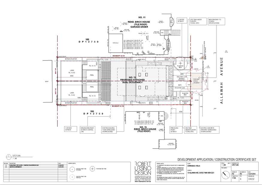
|
Georges River Council - Georges River Local Planning
Panel (LPP) - Friday, 5 October 2018
LPP044-18 13 Allawah Avenue Carss Park
[Appendix
2] South West
Elevation Plan - 13 Allawah Ave Carss Park
|
Page 105
|
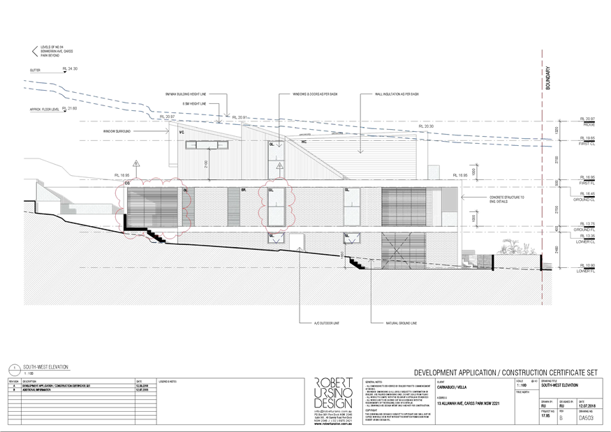
|
Georges River Council - Georges River Local Planning
Panel (LPP) - Friday, 5 October 2018
LPP044-18 13 Allawah Avenue Carss Park
[Appendix
3] North West
Elevation Plan - 13 Allawah Ave Carss Park
|
Page 106
|
|
Georges River Council - Georges River Local Planning Panel
(LPP) - Friday, 5 October 2018
LPP044-18 13 Allawah Avenue Carss Park
[Appendix
4] North East
Elevation Plan - 13 Allawah Ave Carss Park
|
Page 107
|
|
Georges River Council - Georges River Local Planning
Panel (LPP) - Friday, 5 October 2018
LPP044-18 13 Allawah Avenue Carss Park
[Appendix
5] South East and
Front Fence Elevation - 13 Allawah Ave Carss Park
|
Page 108
|
|
Georges River Council - Georges River Local Planning
Panel (LPP) - Friday, 5 October 2018
LPP044-18 13 Allawah Avenue Carss Park
[Appendix
6] Perspective
Plan - 13 Allawah Ave Carss Park
|
Page 109
|
|
Georges River Council – Local Planning
Panel Friday, 5 October 2018
|
Page 110
|
REPORT TO GEORGES RIVER COUNCIL
LPP MEETING OF Friday, 05 October 2018
|
LPP Report No
|
LPP045-18
|
Development Application No
|
DA2017/0323
|
|
Site Address & Ward Locality
|
48-50 Bellevue Parade Allawah
Kogarah Bay Ward
|
|
Proposed Development
|
Demolition of existing dwelling and
relocation of the two (2) storey modular classroom building from 51-69 Woids
Avenue, to the subject site for educational purposes
|
|
Owners
|
St George Christian School
|
|
Applicant
|
DFP Planning
|
|
Planner/Architect
|
DFP Planning
|
|
Date Of Lodgement
|
16/08/2017
|
|
Submissions
|
Thirteen (13) individual
submissions of objection have been received including 2 petitions with 37 and
45 signatures in each.
|
|
Cost of Works
|
$715,000.00
|
|
Local Planning Panel Criteria
|
Development has received greater
than 10 submissions
|
|
List of all relevant s.4.15
matters (formerly s79C(1)(a))
|
Kogarah Local Environmental Plan
2012,
Kogarah Development Control Plan
2013
State Environmental Planning
Policy (Infrastructure) 2007 State Environmental Planning Policy- (Education
Establishments and Child Care Facilities), State Environmental Planning
Policy (Vegetation in Non Rural Areas) 2017, Deemed State Environmental
Planning Policy – Georges River Catchment
|
|
List all documents submitted
with this report for the Panel’s consideration
|
Architectural Plans
|
|
Report prepared by
|
Development Assessment Officer
|
|
Recommendation
|
THAT the application be approved subject to the
conditions included in the report.
|
|
|
Summary of matters for
consideration under Section 4.15
Have all recommendations in relation
to relevant s4.15 matters been summarised in the Executive Summary of the
assessment report?
|
Yes
|
|
Legislative clauses requiring
consent authority satisfaction
Have relevant
clauses in all applicable environmental planning instruments where the
consent authority must be satisfied about a particular matter been listed,
and relevant recommendations summarised, in the Executive Summary of the
assessment report?
|
Yes
|
|
Clause 4.6 Exceptions to
development standards
If a written request for a
contravention to a development standard (clause 4.6 of the LEP) has been received,
has it been attached to the assessment report?
|
Yes
– FSR non-compliance, however it is no longer applicable. See detail in
report.
|
|
Special Infrastructure
Contributions
Does the DA require Special
Infrastructure Contributions conditions (under s7.24)?
|
Not
Applicable
|
|
Conditions
Have draft conditions been provided
to the applicant for comment?
|
No,
standard conditions have been attached with no design changes
|
|
Site Plan
|
Executive Summary
PROPOSAL
1. The
proposal involves the demolition of the residential dwelling on site and the
relocation of the two (2) storey modular classroom building from 51-69 Woids
Avenue, to 48 Bellevue Parade for educational purposes. More specifically, the
proposal includes:
· Demolition of the
residence and garage at the site including removal of three (3) trees.
· Use of 48 Bellevue
Parade for the purposes of an educational establishment.
· Relocation of the two
(2) storey modular classroom building from 51-67 Woids Avenue, to the site.
· Vehicle access and
existing parking retained.
· Landscaping to the site.
· Lighting, fencing, gates
and identification signage.
The application
does not seek to increase student numbers for the school.
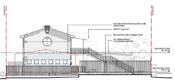
Figure.1
– Proposed South West Elevation – Facing Bellevue
Avenue.
THE SITE AND CONTEXT
2. The
St George Christian School (SGCS) Campus (years 3 to 12) is located at 51-69
Woids Avenue (also known as 70 Bellevue Parade, Hurstville) and 50, 56
and 58 Bellevue Parade, Allawah The SGCS infants school (K-2) is located on a
separate campus at Sans Souci.
The proposed
development is to be undertaken on land at 48-50 Bellevue Parade and 51-69
Woids Avenue. The site is irregular in shape and has an easterly aspect. The
site slopes approximately 8% from Bellevue Parade to the lowest point at the
corner of Church Lane and Woids Avenue.
Currently existing
at 48 Bellevue Parade is a single storey brick dwelling house with associated
outbuildings and concrete parking space. Currently located at 50 Bellevue
Parade are two single storey demountable building with associated pathways,
outdoor learning area, parking spaces and landscaping works.
Vehicular access
is provided from Bogie Lane and Church Lane. Ground level staff car parking is
located within the central portion of the site, and basement parking is
provided from Church Lane. Existing vegetation is concentrated primarily along
the Woids Avenue and Bellevue Parade frontages.
BACKGROUND
3. The
following relevant background is provided with respect to the proposal:
· On 16 August 2017, the
Development Application lodged with Council.
· From 4 September
2017 to 18 September 2017, the application was placed on neighbour notification
for a period of 14 days. Eight (8) submissions were received, including a
petition, raising a number of concerns which will be discussed in more detail
in the later stages of this report.
· On 14 November 2017, the
applicant was sent a letter advising that the following issues were to be
addressed:
o Floor
Space Ratio - The proposal does not comply with the floor space ratio
development standard as prescribed by clause 4.4 of Kogarah Local Environmental
Plan 2012. The two (2) storey classroom building has a floor space ratio
(FSR) of approximately 0.86:1 based on the site area of the residentially zoned
portion of the site. This far exceeds the 0.55:1 FSR standard that
applies. A variation of this magnitude would be difficult to justify
based on the threshold tests in clause 4.6 of the local environmental plan.
o Visual
Privacy - The significant number of windows on the northwest elevation of
the classroom building together with their relatively low sill heights will
give rise to unreasonable adverse visual privacy impacts upon the immediately
adjoining residential property. To mitigate these impacts, consideration should
be given to the inclusion of privacy screens adjacent to these windows so as to
prevent direct viewing into the windows and rear yard of the existing dwelling
house on the adjoining property at 46 Bellevue Parade. Consideration
should also be given to an increased side boundary setback from the common
boundary shared with 46 Bellevue Parade.
o Aural
privacy - The siting of the air conditioning condenser units within the
setback to the north western side boundary of the site will potentially give
rise to unreasonable aural privacy impacts upon the immediately adjoining
residential property at property 46 Bellevue Parade.
To mitigate these impacts,
consideration should be given to the relocation of these units to the south eastern side of the building or some other alternative
location well away from surrounding residents.
o Reflectivity - Details
of the solar absorbance level of the external cladding of the walls of the
classroom building are required, with a view to demonstrating that these walls
will not reflect excessive glare and heat to the detriment of the adjoining
properties, particularly 46 Bellevue Parade.
· On 12 January
2018, amended plans and supplementary information were submitted by the
applicant. A brief summary of the design amendments are as follows:
o Clause 4.6 variation submitted to
vary the FSR development standard.
o Relocation of the air conditioning
condensers away from the side boundary and located to the front of the
building, behind the landscaping.
o Fixed horizontal privacy louvres
added to the NW façade to prevent overlooking of the adjoining property.
o Additional landscaping to be planted
along the north western boundary to screen the building and will assist in
mitigating any potential reflectivity.
Whilst a Clause
4.6 request for variation was submitted with respect to the exceedance of the
floor space ratio, exceeding the maximum FSR of 0.55:1 which applies to the
land within R2 Low Density Residential zone. At the time of lodgement, the FSR
was identified to be 0.86:1 for the property at No 48 Bellevue.
However,
subsequently, there has been an allotment amalgamation between No 48 Bellevue
(zoned R2) and No 50 Bellevue (zoned SP2 – Special Uses Educational
Establishments). Although there is a FSR applicable to the land zoned R2 Low
Density Residential, there is no FSR applicable to the land zoned SP2 –
Special Uses.
A calculation has
been undertaken for the FSR applicable on the new allotment size after the site
amalgamation between No 48 and No 5 Bellevue Avenue has occurred. The resulting
FSR is now 0.53:1 which complies with the maximum 0.55:1 that would apply to
the R2 Low Density zone. Accordingly, this eliminates the need for a clause 4.6
request to vary a development standard.
The amended plans
were re notified for a period of fourteen (14) days. During this time
additional submissions were received and have been addressed in this report.
COMPLIANCE AND ASSESSMENT
4. The
following is an assessment of the application with regard to Section 4.15 of
the Environmental Planning and Assessment Act 1979.
(1) Matters
for consideration – general
In
determining an application, a consent authority is to take into consideration
such of the following matters as are of relevance to the development the
subject of the development application:
(a) the
provision of:
(i) any
environmental planning instrument,
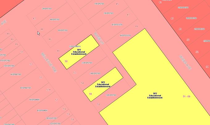
Figure
2. – Zoning map of the site and surrounds under KLEP 2012
Development
Control Table – KLEP 2012
|
Clause
|
Standard
|
Proposal
|
Complies
|
|
1.2 – Aims of the Plan
|
In accordance with Clause 1.2 (2)
|
Consistent with the aims of the
plan.
|
Yes
|
|
2.3 - Zone objectives and Land Use
Table
|
Development must be permissible
with consent
|
No.48 Bellevue Parade is zoned R2
under the LEP. No.50 Bellevue Parade is zoned SP2 Educational Establishment
under the LEP.
An Educational establishment is
permitted with consent on the site pursuant to the education and child care
SEPP Clause 35(1).
|
Yes
|
|
4.3 – Height of Buildings
|
9m - No.48
N/A – No.50
|
8.8m consolidated.
|
Yes
|
|
4.4 – Floor Space Ratio
|
0.55:1 – No.48
N/A – No.50
|
0.53:1 consolidated.
|
Yes
|
|
5.10 – Heritage Conservation
|
Must consider the effect of the
proposed development on the heritage significance of the item concerned.
|
The subject site is located in
close proximity to a heritage item listed in Schedule 5- Environmental
Heritage.
See discussion below.
|
Yes
|
|
6.1 – Acid Sulfate Soils
|
Requires consideration of
an acid sulphate soils (ASS) report if mapped as ASS
|
The site is affected by Class 5
Acid Sulfate Soils.
See discussion below.
|
Yes
|
|
6.2 – Earthworks
|
Subject to the matters
under clause 6.2(3)
|
The
proposed earthworks are considered acceptable having regard to the provisions
of this Clause.
|
Yes
|
|
6.3 – Flood Planning
|
Applies to land
identified as flood planning area on the flood planning map
|
The site has been identified as
being flood affected.
See discussion below.
|
Yes
|
Clause 5.10 – Heritage
5. 51
– 63 Woids Avenue Allawah is identified as a local heritage in Schedule 5
of the Kogarah LEP 2012 being the ‘Former Congregational Church’.
The heritage item is a small component of the site located towards the Woids
Avenue frontage.
The proposed works provide for the relocation of an
existing classroom building which is located approximately 20m to the north of
the subject heritage building. The existing footprint of the relocated
classroom is proposed to be turfed and landscaped, and it is considered that
the nature of these works will have negligible impact on the heritage value of
the site. The works proposed to be undertaken on adjoining land are adequately
separated from the heritage item in terms of distance and existing built form
so that no additional heritage impacts will be generated. The proposed
development is unlikely to result in any detrimental impacts to the heritage
value or significance of the heritage item.
State
Environmental Planning Policy (Infrastructure) 2007
6. The
aim of this Policy is to facilitate the effective delivery of infrastructure
across the State.
Division 3 of Part 3 of the Infrastructure SEPP relates to Educational
Establishments. Clause 28 of the Infrastructure SEPP states (in part) the
following:
28 Development permitted with consent
(1) Development for the purpose of
educational establishments may be carried out by any person with consent on
land in a prescribed zone.
(1A), (1B) (Repealed)
(1C) Development for a purpose specified in
clause 31A (1) may be carried out by any person with consent on land on which
there is an existing school or TAFE establishment.
(2) Development for any of the following
purposes may be carried out by any person with consent on any of the following
land:
(a) development for the purpose of
educational establishments—on land on which there is an existing
educational establishment,
(b) development for the purpose of the
expansion of existing educational establishments—on land adjacent to the
existing educational establishment.
Pursuant to Clause 27 of the SEPP, the R2 Low
Density Residential zone is identified as a prescribed zone. The site is zoned
part SP2 Educational Establishment and Part R2 Low Density Residential under
Kogarah Local Environmental Plan 2012.
Educational establishments are permissible with
consent in the SP2 Zone but are not identified as a permissible use in the R2
zone under Kogarah LEP 2012. However, pursuant to Clause 28 of the
Infrastructure SEPP, educational establishments are permissible with consent on
land zoned R2.
Clause 32(2) requires a consent authority to take into consideration all
relevant standards in the following State government publications (as in force
on the commencement of this Policy) prior to determining a development
application:
(a) School Facilities
Standards—Landscape Standard—Version 22 (March 2002),
(b) Schools Facilities
Standards—Design Standard (Version 1/09/2006),
(c) Schools Facilities
Standards—Specification Standard (Version 01/11/2008).
The Schools Facilities Standards have been superseded by
the Education Facilities Standards Guidelines (EFSG), however SEPP
Infrastructure has not been revised to reflect this change. Notwithstanding,
this application has been prepared having regard to the EFSG and is acceptable.
State
Environmental Planning Policy (Education Establishments and Child Care
Facilities)
7. The
SEPP commenced on the 1 September 2017 but contains savings and transitional
provisions under Schedule 5. The relevant clauses and provisions are:
Cl.1(1) This Policy does not apply to or
in respect of the determination of a development application made under Part 4
of the Act, but not finally determined before the commencement of this
Policy”.
In this instance,
the Policy does not apply to this development as the application was made but
not determined prior to the commencement of this SEPP. In any regards, the
proposal is not inconsistent with the objectives and provisions of this SEPP.
State
Environmental Planning Policy (Vegetation in Non Rural Areas) 2017
8. The
Vegetation SEPP regulates clearing of native vegetation on urban land and land
zoned for environmental conservation/management that does not require
development consent.
The Vegetation
SEPP applies to clearing of:
1. Native
vegetation above the Biodiversity Offset Scheme (BOS) threshold where a
proponent will require an approval from the Native Vegetation Panel established
under the Local Land Services Amendment Act 2016; and
2. Vegetation
below the BOS threshold where a proponent will require a permit from Council if
that vegetation is identified in the council’s development control plan
(DCP).
The Vegetation
SEPP repeals clause 5.9 and 5.9AA of the Standard Instrument - Principal
Local Environmental Plan with regulation of the clearing of vegetation
(including native vegetation) below the BOS threshold through any applicable
DCP.
There are
references in the applicable DCP to maximising tree retention in any
development proposal and the issue is addressed through consideration of the
proposed built form and the proposed landscaping works that are to be
undertaken on site.
Deemed State Environmental
Planning Policy – Georges River Catchment
9. All
stormwater from the proposed development can be treated in accordance with
Council’s Water Management Policy and would satisfy the relevant
provisions of the Deemed State Environmental Planning Policy – Georges
River Catchment.
Draft Environment SEPP
10. The Draft Environment
SEPP was exhibited from 31 October 2017 to 31 January 2018.
This
consolidated SEPP proposes to simplify the planning rules for a number of water
catchments, waterways, urban bushland, and Willandra Lakes World Heritage
Property.
Changes
proposed include consolidating the following seven existing SEPPs:
· State Environmental Planning Policy No. 19 – Bushland in Urban
Areas
· State Environmental Planning Policy (Sydney Drinking Water
Catchment) 2011
· State Environmental Planning Policy No. 50 – Canal Estate
Development
· Greater Metropolitan Regional Environmental Plan No. 2 –
Georges River Catchment
· Sydney Regional Environmental Plan No. 20 – Hawkesbury-Nepean
River (No.2-1997)
· Sydney Regional Environmental Plan (Sydney Harbour Catchment) 2005
· Willandra Lakes Regional Environmental Plan No. 1 – World
Heritage Property.
The
proposal is not inconsistent with the provisions of this Draft Instrument.
Kogarah Development Control Plan
2013 (KDCP 2013)
11.
B1 - Heritage Items and Heritage Conservations Areas
As has been
discussed above in relation to heritage conservation, the nature of the works
will have negligible impact on the heritage value of the site.
B4 - Parking and Traffic
This application does not seek to increase student numbers
for the school and nor will it generate any additional traffic movements. The
current parking is for three spaces accessed via Bogie Lane. Additional parking
is provided at the main school site at 51-69 Woids Avenue. The current parking is considered adequate for the scale
and intensity of the use at the site.
B5 - Waste Management and Minimisation
The proposal will generate some additional
waste associated with the construction phases of the development. The proposal
will not however generate any additional ongoing waste from the site. A waste
management plan has been prepared in accordance with section B5 of the KDCP
2013 which addresses the demolition and construction related waste and outlines
sufficient measures to manage and minimise any waste materials.
B6 - Water Management
The proposal provides for the installation of
10,000L OSD tank, and a 5,000L rainwater tank for onsite reuse. Guttering and
downpipes are proposed to connect to a new stormwater pit draining to
Council’s existing network in Bellevue Parade. The proposed stormwater management
measures are largely consistent with the provisions of Part B6 of the DCP and
the provisions of Council’s Water Management Policy.
C1 – Low Density Residential
The proposed development has a direct interface with adjoining
low-density development. Appropriate setbacks and design controls have been
provided which ensure appropriate interface is maintained between adjoining
developments.
C1.1.1 - Streetscape Character
The proposed development is consistent with the one to
two-storey character and scale of this section of Bellevue Parade. The proposed
pitched roof and site landscaping works will ensure that the proposal is not
dominant as viewed from the street, and does not interrupt the rhythm of the
streetscape. Landscape screen planting is to be provided along the permitter of
the site.
C1.5 – Privacy
Part C1.5 outlines controls relating to visual
and acoustic privacy for residential development. The proposal provides for a
building setback of 3m to the boundary with 46 Bellevue Parade and 3.1m to the
boundary line with 52 Bellevue Parade. Privacy landscaping works are proposed
along the boundary with 46 Bellevue Parade with the existing colorbond fence to
be retained. The existing vegetation along with the boundary with 52 Bellevue
Parade is proposed to be retained
The upper level windows of the relocated
classroom building have been sited to avoid overlooking into neighbouring
windows. Two windows of the proposed GLA 5 will overlook the private open space
of number 46 Bellevue Parade. The provision of privacy screens to the north
elevation windows has been provided. In this regard, the proposal will not
result in any unacceptable impacts on the visual privacy of adjoining
properties.
In terms of acoustic privacy, the site of the
proposed classroom relocation will not be used for outdoor play space. Amended
plans were received which relocated the air conditioning condensers away from
the side boundary and located to the front of the building, behind the
landscaping. Further, the numbers of condensers were also reduced.
The proposal is unlikely to result in any
unacceptable impacts on the acoustic privacy of adjoining properties.
C1.6 – Solar Access
The DCP requires that at least 50% of the neighbouring
existing primary private open space or windows to main living areas must
receive a minimum of 3 hours sunlight between 9am–3pm on 21 June. Shadow
diagrams at 3 hourly intervals were provided showing that the
proposed development is compliant with the relevant overshadowing controls and
will not unacceptably impact adjoining properties at 46 and 52 Bellevue Parade.
SECTION 7.12
CONTRIBUTIONS
12. The
proposed development requires the payment of Section 7.12 (previously Section
94A) contributions under the provisions of Council’s document titled
“Section 94A Contributions Plan 2017”. Contributions under Section
7.12 of the Environmental Planning and Assessment Act 1979 are applicable based
on the estimated cost of development which in this instance is 1% for $200,001
or more. Section 7.12 contributions for this development equate to $7,150 based
on the estimated cost of development of $715,000 as indicated on the
applicant’s DA form.
IMPACTS
13. Following
is an assessment of the proposal against Section 4.15(b) ‘likely impacts
of the development’ of the Environmental Planning and Assessment Act
1979.
Overshadowing
14. There
are no specific solar access controls for the type of development proposed.
In relation to
overshadowing and solar access, Kogarah Development Control Plan 2013 provided
general controls in relation to overshadowing and solar access for other forms
of development predominately of a residential scale which seeks to maintain an
appropriate level of amenity:
The solar access
requirements in the DCP are:
‘Where
the neighbouring properties are affected by overshadowing, at least 50% of the
neighbouring existing primary private open space or windows to main living
areas must receive a minimum of 3 hours sunlight between 9am–3pm on 21
June’.
NBRS Architects
have prepared a shadow analysis illustrating the shadow impact of the proposal
at hourly intervals in midwinter, the September equinox and the Summer
solstice.
The submitted shadow
diagrams demonstrate compliance with Part
C1 – Low Density Residential Clause 1.6 Solar Access in terms of
overshadowing in particular on the privacy open space and main living areas of
the dwelling at 46 and 52 Bellevue Parade.
The shadow
diagrams show that at the winter solstice, the shadows from the proposed
development will fall mainly on the front yard area and street (at 9am); on the
front yard area (at 12noon), and only begin to affect the rear yard area of 48
and 52 Bellevue Parade between 12noon and 3pm. It is considered that the
rear yard area of the adjoining properties will receive at least 3 hours of
sunlight, thus complying with the provisions of DCP 2013.
Visual and Acoustic Privacy
15. The
outlook from adjoining dwellings to the site will change as the site is to be
redeveloped from its former residential use to an educational
establishment. A number of design measures have been introduced in order
to try and soften the visual scale of the development when viewed from the neighbouring
properties. These include:
· Increase in
setbacks to adjoining properties.
· Increase in buffer
landscape planting around the perimeter of the site.
· Re-location of air
conditioning units.
· Provision of
privacy screens to first floor windows overlooking neighbouring private open
space.
It is considered
that these changes have adequately resulted in a reduction in potential visual
and privacy impact to a level which is not considered unreasonable given the
scale of the development and location. An acoustic assessment was not required
to support the application given the building will only be occupied during
school hours and is not to be used for outdoor recreational activities. Further
the building is only to be used for low noise activities such as maths and
english lessons. This will be conditioned to ensure compliance.
The following
conditions will be imposed to ensure visual and acoustic privacy is maintained.
· Noise from
Premises outside Operation Hours: No scheduled activities are to operate
outside operation hours aside from parents and teacher’s meetings, which
will occur once each term between the hours of 5pm and 8pm.
· No outdoor school
activities are to be permitted on site.
· Point of Contact
and Management of Noise Complaints: A Noise Management Policy is to be developed
by the school. The Noise Management Policy shall formalise the school’s
objective as good neighbours and willingness to communicate with its
neighbours, and informing the neighbours of future activities and events likely
to increase noise levels at the residence. Neighbouring residents shall also be
provided with a name and contact number of a school staff member who could be
contacted in the event of a noise issue.
· The building is
not be used for drama, music classes etc. that will generate significant noise.
View Corridors / View Sharing
16. There
are considered to be no significant views to and/or from the site and the
surrounds that would be adversely affected by the application.
Traffic Generation and Parking
17. This application does not seek to
increase student numbers for the school and nor will it generate any additional traffic movements. The current parking is
for three spaces accessed via Bogie Lane. Additional parking is provided at the
main school site at 51-69 Woids Avenue. The
current parking is considered adequate for the scale and intensity of the use
at the site.
Intensity of Use
18. The
proposal will intensify the use of the land, though in so far as the use is
permissible, and presents an appropriate density, height, bulk and scale, it is
considered satisfactory.
Development
surrounding the subject site reflects the low to medium density residential
zoning it is located within and consists of detached residential dwelling
houses and multi-dwelling residential housing ranging in scale from one to two
storeys. A number of design and operational measures were introduced as part of
this development to try and mitigate any potential impacts to neighbouring
developments as a result of the intensification of the site. These include:
· Inset planted
privacy screens.
· Privacy screens on
first floor windows.
· Buildings are to
be air conditioned minimising any loss of acoustic privacy (and reducing noise
impacts from the proposal).
· Recreation and
outdoor learning areas are not to be allowed on the site
Social / Economic
19. The
proposed development is considered of benefit from a social and economic
perspective, providing additional infrastructure to provide for educational
needs of a growing population.
Landscaping / Tree Removal
20. This
application seeks to remove three (3) existing trees on land at 48 and 50
Bellevue Parade. The proposed landscaping works will more than adequately
compensate for the proposed tree removal. The removal of the three trees is
unlikely to result in any immediate impacts to streetscape, or to the
residential amenity of nearby properties
Suitability of site
21. It
is considered that the proposed development is of a scale and design that is
suitable for the site having regard to its size and shape, its topography,
vegetation and relationship to adjoining developments anticipated under the
provisions of KLEP 2012.
SUBMISSIONS
22. In
accordance with the provisions of Section A2 – Public Notification of
KDCP 2013 application was placed on neighbour notification for a period of
fourteen (14) days. A total of eight (8) submissions were received which included
a submission containing 37 signatures. Following the receipt of amended plans,
the application was re notified to adjoining landowners for a period of
fourteen (14) days during which time five (5) submissions were received which
included a submission containing 45 signatures.
A summary of the
submissions received during both notification periods and Council comments are
addressed below.
Relocation of demountable by Crane
The objectors are
concerned that moving the demountable by crane will result in damage to
property and traffic implications.
Comment: The
neighbours’ concerns appear to be that the entire demountable building
will be moved into the new location by crane, and that the path of the crane
will be over neighbouring residential properties.
This is not what
is proposed. The process for re-location of the demountable building has been
discussed with the applicant who has confirmed that the building will be firstly
dismantled at it’s current location (the demountable building in question
is currently located in the main grounds of the school, off Woids Avenue) and
re-assembled on the new site which is 48 Bellevue Avenue. The components of the
building are then to be lifted by crane for installation into the new position
on the site.
The applicant
would be required to prepare a detailed a Site Management Plan and Construction
Traffic Management Plan prior to construction/demolition to mitigate any
potential impacts to neighbouring sites. The dismantling and re-assembly of the
building can occur without risk of impact on neighbouring properties. Further,
a condition will be placed on the consent requesting a Road Closure Application
form and associated documents to be submitted to Council for approval at least
5 business days prior to any proposed lane usage for cranes or other activities
involved in the construction on the site.
Unsuitable use for the location
The objectors were
concerned that the use of a school in this location was unsuitable as the site
is surrounded by low to medium density housing.
Comment: As
discussed in this report, the sites zoning permits this form of development.
While it is noted that an intensification of site will result, numerous design
and construction measures have been introduced in order to reduce the level of
impact to neighbouring properties. This was discussed in detail in the body of
this report.
Further, the
adjoining and nearby properties (47-69 Woids Avenue and 50, 56 and 58 Bellevue
Avenue) have been used for the purposes of the St George Christian School for
over 30 years and in terms of zoning, the proposed development is permissible
within the R2 Low Density Residential zone under the provisions of State
Environmental Planning Policy (Educational Establishments and Child Care
Facilities).
Traffic Generation, Circulation
and Parking
The objectors
raised concern to traffic impacts which will result to both the immediate and
broader street network. Concern was also raised regarding the inconsistency
between this application and another development proposal (DA2017/0657)
for the proposed alterations and additions to St George
Christian School.
Comment: This application does not seek to increase student numbers for the
school and nor will it generate any additional traffic movements. As such, no
changes to parking at the site are proposed. It should be noted that a number of amendments have been made to the other application
DA2017/0657 regarding car parking and traffic moments. This will be considered
to ensure the site is adequate for the scale and intensity of the use.
Overshadowing
The drawings for this DA do not incorporate the structures
proposed as part of DA2017/0657. In particular, the shadow diagrams for this DA (DA2017/0323) do not
illustrate the extent to which the proposed four-storey building on the
Woids Avenue property will impact on properties in Bellevue Parade.
Comment: The proposal does not result in any unreasonable overshadowing of
the adjoining residential properties and is considered satisfactory. This was
discussed in detail in the body of this report.
A
number of recent amendments to the submitted plans have been made to DA2017/0657
including reduction in height and increased setbacks to reduce the impact on
neighboring properties. A detailed amenity impact assessment will be conducted
as part of that DA.
Noise pollution
Noise
from the air conditioning and students/teachers on site will generate
significant noise issues. An acoustic report should be submitted to support the
application. Additional noise control design measures such as double glazing
and soundproof fencing should be applied.
Comment: The amended plans have
relocated the air conditioning condensers away from the side boundary and
located to the front of the building, behind the landscaping. The number
of condensers has also been reduced from 15 to 6 larger units. The
proposed new location minimises the potential acoustic impacts to the neighbour
at 46 Bellevue Parade. It should also be noted that the air conditioning
will predominately be used during the daytime.
An acoustic
assessment was not required to support the application given the building will
only be occupied during school hours and is not to be used for outdoor
recreational activities. This will be conditioned to ensure compliance.
Landscaping will
be planted along the boundary to screen the building and will assist in
mitigating any potential acoustic impacts. A condition will be inserted to
ensure the ongoing maintenance of the landscape buffer planting.
As noted earlier
in the report, the following conditions will be imposed to ensure visual and
acoustic privacy is maintained.
· Noise from
Premises outside Operation Hours: There are no scheduled activities outside
operation hours at the time of the report aside from parents and
teacher’s meetings, which will occur once each term between the hours of
5pm and 8pm. It is expected that no major acoustic disturbances will occur due
to parent/teacher meetings.
· Point of Contact
and Management of Noise Complaints: A Noise Management Policy is to be
developed by the school. The Noise Management Policy shall formalise the
school’s objective as good neighbours and willingness to communicate with
its neighbours, and informing the neighbours of future activities and events
likely to increase noise levels at the residence. Neighbouring residents shall
also be provided with a name and contact number of a school staff member who
could be contacted in the event of a noise issue.
· The building is
not be used for drama, music classes etc. that will generate significant
noise.
Zoning anomaly
The contention on
page 11 of the SEE that there was an "anomaly" in the zoning of the
property at 48 Bellevue Parade is wrong.
Comment: At
the time of lodgement the development application was prohibited in the R2 Low
Density Residential zone that applies to part of the site. The provisions
relating to ‘educational establishments’ in State Environmental
Planning Policy (Infrastructure) 2007 had been repealed following lodgement of
the development application and no savings or transitional provisions in this
policy was in place.
An amendment to
the Education SEPP was gazetted on 15 December 2017 making ‘educational
establishments’ in the R2 zone permissible. Amongst other matters, new
Savings provisions have been made which provide that an application made prior
to the commencement of the Education SEPP is to be determined as if Education
SEPP had not been made (i.e. the provisions of the Infrastructure SEPP would
not have been repealed.) Therefore the permissibility issue is overcome.
Setbacks
The setbacks do
not meet the controls under Kogarah DCP or Education SEPP.
Comment: The proposed development will have the following setbacks:
- 3m to the northern boundary
(46 Bellevue Parade);
- 3m to the southern boundary
(52 Bellevue Parade) as existing;
- 5.2m to Bogie Lane; and
- 4m to Bellevue Parade.
As noted above the provisions of the Education
SEPP do not apply as the application was made but not determined prior
to the commencement of this SEPP. Although the
building is not proposed for residential purposes, the proposal has taken into
account the setback controls under Kogarah DCP. The proposal meets the side
setbacks, however a minor variation is sought to the rear setback as 6m is
required with only 5.2m proposed to Bogie Lane. This is considered acceptable
taking into account a majority of sites in the streetscape contain a detached
garage built to the rear boundary line. Further, Boogie Lane separates the site
from residential properties to the rear which mitigates any amenity impact from
the reduced setback.
Height of the
building
The height of the
demountable is much higher than can be seen from Bogie Lane in its current location.
The height of the demountable not being identified by the applicant in its BCA
Analysis, and a Streetscape Character Analysis not having been prepared as
required by Annexure 1 to the Kogarah DCP 2013.
Comment: As
is shown in the elevations provided, the proposed maximum building height for
the relocated building to land at 48 Bellevue Parade is 8.8m above existing
ground level. The proposal is therefore compliant with the maximum building
height controls under the Kogarah LEP 2012.
Discrepancies
in Heritage Impact Statement
There are
discrepancies between the heritage impact statements submitted for other
applications relating to the school.
Comment:
The heritage impact assessments submitted as part of the other applications
applying to the school sites will be assessed to determine any detrimental
impacts to the heritage value or significance of the heritage item.
Given the
separation from the heritage item identified as NO.51-63 Woids Avenue, Allawah
and the subject site, a heritage impact statement was not required as part of
this application. The works proposed to be undertaken on adjoining land are
adequately separated from the heritage item in terms of distance and existing
built form so that no additional heritage impacts will be generated. It is
therefore noted that the proposed development is unlikely to result in any
detrimental impacts to the heritage value or significance of the heritage item.
Use of
Temporary Structures on permanent basis
The proposed use
of a temporary structure (the demountable) on a permanent basis is not a
realistic solution to requirements of either the school or local residents.
Further, the building is out of character with the streetscape.
Comment:
The application for the demountable has been assessed as a permanent structure
and is considered to be in keeping with the streetscape taking into account its
scale and built form (see above). Any proposal to change the built form will
need to be subject to a new application.
Continued
breaches of non-compliance
Concern is raised
in the submissions regarding past breaches of previous DA conditions attached
to DA93/2010.
Comment:
This matter will be followed up with Councils compliance team to ensure the
conditions of DA93/2010 have been complied with.
Privacy
Upper floor
windows should be no less than 1.5m metres above floor level, or privacy screen
should be installed on all upper floor windows so teachers, students cannot
look into the houses in accordance with the State Environmental Planning
Policy (Educational Establishments and Child Care Facilities) 2017.
Comment:
Privacy screens have been provided along the boundary with No.46 Bellevue
Parade to prevent overlooking. The provisions of the Educational SEPP do not
apply as the application was made but not determined prior to the commencement
of this SEPP. Regardless, it is noted that the upper floor windows on the upper
floors will be a minimum of 5m to the boundary of the residential properties to
the front and rear and as such do not require privacy screens in accordance
with the State Environmental Planning Policy (Educational Establishments and
Child Care Facilities) 2017.
Rainwater Tanks
The location of
large water tanks on the boundary with 46 Bellevue Parade detract from the
amenity of the adjoining property and detracting from the streetscape.
Comment:
The rainwater tanks will be largely screened by landscaping and boundary
fencing and as such will not impact the adjoining properties or streetscape.
Street Frontage
The street
frontage location of the air conditioning condenser units does not comply with
the requirements of provision 4.3 of Kogarah DCP 2013.
Comment:
Although the air conditioning units are proposed to be located within the front
boundary contrary to Part C Residential Section 4.3 of the Kogarah DCP, they
will not be visible from the street as landscaping is proposed along the entire
front and side boundary. This non-compliance is considered acceptable given it
meets the objectives of the clause.
Processing of
the Development Application
The extended time
that Council has allowed the applicant to provide information and to submit a
development application that complies with all relevant planning instruments is
excessive. Further, Council has failed to notify all persons that submitted
objections to the DA.
Comment:
The amended plans were received shortly after concerns were raised by Council
in regard to noise etc. The re notification was undertaken in accordance with
Part A2 – Public notification of Kogarah DCP where only adjoining
neighbours are required to be notified and a notification sign is to be placed
on the subject site.
Consideration
of Access
The Education SEPP
requires consideration of access that the School has and will provide to the
community. The application has ignored the community access obligations under
both the Building the Education Revolution requirements as an integral term of
the $2 million Commonwealth Government grant for the construction of the
multi-purpose hall, and as a requirement of the Education SEPP.
Comment:
The application is for the relocation of the existing demountable building and
does incorporate any multi-purpose hall or library facilities. As such, this is
not a matter for consideration in this assessment.
Architect’s
Design Statement
The Architect's
Design Statement does not provide an objective analysis of the proposed design
against the seven design principles, nor any explanation of how the proposed
design satisfies the Schedule 4 design principles.
Comment: As
relayed above in the report, the provisions of the Educational SEPP do
not apply as the application was made but not determined prior to the
commencement of this SEPP.
Notification to
RMS
Concern is raised
that the Roads & Maritime Service (RMS) has not been notified of the
School’s Development Applications.
Comment:
RMS were not required to be notified as there is no increase in pupils or
traffic generation/car parking, therefore the requirement for a referral to the
RMS is not triggered.
DA2017/0657
A separate DA
(DA2017/0657) has been lodged for alterations and additions to St George
Christian school including demolition works, construction of a new four storey
classroom building, new basement parking accessed from Woids Avenue and other
internal and external alterations. The neighbours’ concern is that
DA2017/0657 should be assessed concurrently with the current application.
Comment:
The proposed works under DA2017/0657 have been taken into consideration as part
of this application review. However, due to the proposals occurring on separate
lots and at different stages, they were required to be lodged separately. The
application for the alterations and additions to the school will need to be
determined by the Sydney South planning Panel due to the cost of the
development.
Local Planning
Panel
Concern is raised
that the Local Planning Panel is not independent and that bias may occur in
determining the application in favour of the applicant.
Officer comment: Local Planning Panels have been introduced to ensure
transparency and an independent assessment and determination process of
development applications.
The Panel comprises State Government appointed members and chair
together with a community representative.
Air
conditioning units
No justification
has been provided with regard to how the number of air conditioning units have
been able to be reduced.
Officer comment:
The new air conditioning units provided on the front setback are larger in
capacity and are sufficient to accommodate the building.
Night lighting
The night lighting from the two storey
classroom will seriously impact the night activities of the adjoining
properties.
Officer
comment: A condition will be imposed stating that any lighting on the site
shall be designed so as not to cause a nuisance to other residences in the area
or to motorists on nearby roads and to ensure no adverse impact on the amenity
of the surrounding area by light overspill or glare. Flashing, moving or
intermittent lights or signs will be prohibited.
School
Masterplan
The applicant has
denied the existence of a Master Plan for the School and has failed to provide
the Master Plan as part of the DA.
Officer comment:
Council has been informed by the school that a masterplan has not been created.
Any significant changes to the school will be subject to a development
application and the associated notification process.
Public interest
23. The
proposed development is of a scale and character that does not conflict with
the public interest.
Council Referrals
24.
Drainage
Engineer
The development application
has been referred to Council’s Drainage Engineer, who has advised that
the proposal is satisfactory subject to conditions.
Building
Surveyor
The development
application has also been referred to Council’s Building Surveyor, where
some issues of concern have been raised in relation to the original DA plans.
These have been satisfied with the amended plans and Building issues can be
addressed via standard conditions of consent.
CONCLUSION
25. The
application has been assessed having regard to the Heads of Consideration under
Section 4.15 of the Environmental Planning and Assessment Act 1979, the
provisions of relevant State Environmental Planning Policies, KLEP 2012 and
KDCP 2013.
On this basis, it
is considered that the development is an acceptable built form, scale and
density and development approval should be granted to Development Application
No 2017/0323 subject to conditions of consent.
DETERMINATION AND STATEMENT OF REASONS
26.
Statement
of Reasons
· The proposed
development is considered to be an appropriate scale and form for the site and
the character of the locality – in particular the proposal seeks a small
expansion of the existing school. The scale of building proposed is consistent
with both the other buildings as part of the St George Christian School and
also the scale of buildings normally expected in a residential zoning.
· The proposed
development, subject to the recommended conditions, will have no unacceptable
adverse impacts upon the natural or built environments
· In consideration
of the aforementioned reasons, the proposed development is a suitable and
planned use of the site and its approval is in the public interest
THAT pursuant to
Section 4.16(1) of the Environmental Planning and Assessment Act 1979, as amended,
the Council grants development consent to Development Application DA2017/0323
for the alterations and additions to the St George Christian School at Lot 1 DP
1245974 and known as 48-50 Bellevue Avenue, Allawah, subject to the following
conditions:
Section A Development Details
1. Approved
Plans - The development must be implemented in accordance with the approved
plans and supporting documentation listed below which have been endorsed by
Council’s approved stamp, except where marked up on the plans and/or
amended by conditions of this consent:
|
Description
|
Reference No.
|
Date
|
Prepared by
|
|
Stormwater services
|
C00(DA1)
|
June 2017
|
NBRS Architecture
|
|
Erosion and Sediment Control Plan
|
C01(DA1)
|
June 2017
|
NBRS Architecture
|
|
Erosion and Sediment Control Details
|
C02(DA1)
|
June 2017
|
NBRS Architecture
|
|
Stormwater Site Plan
|
C03(DA1)
|
June 2017
|
NBRS Architecture
|
|
Details Sheet 1
|
C04(DA1)
|
June 2017
|
NBRS Architecture
|
|
Details Sheet 2
|
C05(DA1)
|
June 2017
|
NBRS Architecture
|
|
Survey Plan
|
3896Ddetail
|
25/05/2017
|
C.M.S Surveyors
|
|
Existing Site Analysis
|
17072-DA-02
|
08/01/2018
|
NBRS Architecture
|
|
Site and Roof Plan
|
17072-DA-04
|
08/01/2018
|
NBRS Architecture
|
|
Ground Floor Plan
|
17072-DA-05
|
08/01/2018
|
NBRS Architecture
|
|
First Floor Plan
|
17072-DA-06
|
08/01/2018
|
NBRS Architecture
|
|
Elevations
|
17072-DA-07
|
8/01/2018
|
NBRS Architecture
|
|
Sections
|
17072-DA-08
|
8/01/2018
|
NBRS Architecture
|
Section B Separate Approvals Required Under
Other Legislation
2. Building
- Hoarding Application - Prior to demolition of the buildings on the site,
or the commencement of work above ground level, a separate application for the
erection of an ‘A class’ (fence type) or a ‘B class’
(overhead type) hoarding or ‘C type’ scaffold, in accordance with
the requirements of SafeWork NSW, must be erected along that portion of the
footways/roadway where the building is within 3 metres of the street boundary.
An application for this work under Section 68 of the Local Government Act
1993 and the Roads Act 1993 must be submitted for approval to Council.
The following information is to be submitted with a Hoarding Application
under Section 68 of the Local Government Act 1993 and Section 138 of the Roads
Act 1993:
(a) A site and location plan of the hoarding with detailed
elevation, dimensions, setbacks, heights, entry and exit points to/from the
site, vehicle access points, location of public utilities, electrical overhead
wire protection, site management plan and builders sheds location; and
(b) Hoarding plan and details that are certified by an
appropriately qualified engineer; and
(c) The payment to Council of a footpath occupancy
fee based on the area of footpath to be occupied and Council's Schedule of Fees
and Charges (available at www.georgesriver.nsw.gov.au) before the commencement
of work; and
(d) A Public Risk Insurance Policy with a minimum cover of
$20 million in relation to the occupation of and works within Council's road
reserve, for the full duration of the proposed works, must be obtained a copy
provided to Council. The Policy is to note Council as an interested party.
Section C Prior to the Issue of a
Construction Certificate
3. Stormwater
- The submitted stormwater plans have been
assessed and approved as concept plans only. No detailed assessment of the
design has been undertaken. A Detailed Stormwater Plan and supporting
information of the proposed on-site stormwater management system is to be
submitted. The required details in this Plan and the relevant checklist are
presented in the document ‘Water Management Policy. Kogarah Council.
August 2006’
The design parameters and the general concept of the
proposed on-site stormwater management system are to be the same as documented
in the approved Concept Stormwater Plan for the proposed development. Any
conceptual variations to the stormwater design will require written approval
from Council and will require to be justified and supported by appropriate
details, calculations and information to allow for proper assessment.
The Detailed Stormwater Plan is to address the following
issue(s):
a) The On-site Detention
storage size is to be increased to the minimum requirement of 11.7m3
b) The On-site Detention
control pit has been shown as a grated pit that would surcharge preventing the
On-site Detention tank to fill. The plans are to be revised to prevent this
surcharge below the top water level.
c) As the height of head over
the orifice to the Top Water Level of the On-site Detention storage will not be
accurately known until installation, it is to be clearly notated on the
Detailed Stormwater Plan that the required size of the orifice is to be
provided by the consulting hydraulic engineer during the installation works.
The orifice size is to be calculated in accordance with Section 4.4.5 of
Council's Water Management Policy Site Drainage and Flood Management Practice
Note #1 to allow for a Maximum Discharge of 7.8 litres per second.
The Detailed Stormwater Plan is to be certified by a
professional engineer specialising in hydraulic engineering. A Statement that
the stormwater system has been designed in accordance with the document
‘Water Management Policy. Kogarah Council. August 2006’ and
satisfies the provisions and objectives of that policy along with the requirements stated above must be included
with the Detailed Stormwater Plan.
A 11.7m3 On-Site Detention system with a Maximum
Site Discharge of 7.8 Litres per Second is to be provided in accordance with
the Stormwater Concept Plan and associated Design Assessment Report. The
overflow is to be directed to the site drainage system
A minimum 5000L of rainwater tank storage for
reuse is to be provided in accordance with the Concept Stormwater Plan. The
overflow from the tank is to be directed to the site’s drainage system.
The rainwater tank system is to be installed in accordance with the Australian
Government, National Water Commission’s “HB 230—2008 Rainwater Tank Design and Installation Handbook
4. Fire
Safety Measures - Prior to the issue of a construction certificate a list
of the essential fire safety measures that are to be provided in relation to
the land and any building on the land as a consequence of the building work
must accompany an application for a construction certificate, which is required
to be submitted to either Council or a PCA. Such list must also specify the
minimum standard of performance for each essential fire safety measure included
in the list. The Council or PCA will then issue a Fire Safety Schedule for the
building.
5. Damage
Deposit - Major Works - In order to insure against damage to Council
property the following is required:
(a) Pay Council, before the issue of the Construction
Certificate, a damage deposit for the cost of making good any damage caused to
any Council property as a result of the development: $25,461.60.
(b) Pay Council, before the issue of the Construction
Certificate, a non-refundable inspection fee to enable assessment of any damage
and repairs where required: $360.00
(c) Submit to Council, before the commencement of
work, a dilapidation report of the condition of the Council nature strip,
footpath and driveway crossing, or any area likely to be affected by the
proposal.
At the completion of work Council will review the dilapidation report and
the Works-As-Executed Drawings (if applicable) and inspect the public works.
The damage deposit will be refunded in full upon completion of work where
no damage occurs and where Council is satisfied with the completion of works.
Alternatively, the damage deposit will be forfeited or partly refunded based on
the damage incurred.
6. Construction Traffic Management Plan - A Construction
Traffic Management Plan detailing:
(a) Construction vehicle routes;
(b) Anticipated number of trucks per day;
(c) Hours of construction;
(d) Access arrangements; and
(e) Proposed traffic measures to minimise impacts of
construction vehicles
must be submitted for the approval of Council’s
Engineers. Council’s Engineers must specify in writing that they are
satisfied with the Traffic Management Plan prior to the issue of the
Construction Certificate.
7. Louvres - The louvres need to be fixed at
an angle that only allows 20 per cent permeability and restricts overlooking,
whilst still allowing airflow, natural daylight
8. Road
Closure - A Road Closure Application form and associated documents shall be
submitted to Council for approval at least 5 business days prior to any
proposed lane usage for concrete pours, cranes or other
activities involved in the demolition, excavation and construction on the site.
9. Management
Plan - Demolition - Prior to the issue of any Construction Certificate, any
demolition or earthworks on the site, the applicant shall submit to Council for
approval a Management Plan detailing the following to safely manage vehicular
and pedestrian traffic during the works at the site.
· Traffic
Control Plans and details of how the company proposes to place, erect,
dismantle and/or undertake the works at the site.
· All
works on the road or road related areas are to be clearly delineated and
designed in accordance with the relevant standards, refer to “AS
1742.3 - 2009” and the Roads and Maritime Services “Traffic Control
at Worksites (TCAWS) Manual, Version 4.0, 2010”
· The
Traffic Control Plans and the works must be prepared/undertaken by RMS
accredited (ticketed) personnel.
· Where
heavy vehicles associated with the site will be parked whilst waiting to enter
the site.
· Location
of loading and unloading areas for trucks.
· The
route of all trucks conveying materials to and from the site.
· Demonstration
that pedestrian access past the site is maintained during demolition and
construction works.
Council’s
Engineers must specify in writing that they are satisfied with the Management
Plan prior to the issue of the Construction Certificate.
10. Fees to be paid -
The fees listed in the table below must be paid in accordance with the
conditions of this consent and Council’s adopted Fees and Charges
applicable at the time of payment (available at www.georgesriver.nsw.gov.au).
Payments must be made prior to the issue of the Construction Certificate
or prior to the commencement of work (if there is no associated Construction
Certificate).
Please contact Council prior to the payment of Section 94 Contributions
to determine whether the amounts have been indexed from that indicated below in
this consent and the form of payment that will be accepted by Council.
Council will only accept Bank Cheque or Electronic Funds Transfer (EFT)
for transaction values of $500,000 or over. Council must be contacted prior to
payment to determine correct total amount to be paid and bank account details
(if applicable).
A summary of the fees to be paid are listed below:
|
Fee Type
|
Fee
|
|
GENERAL FEES
|
|
Long Service
Levy (to Long Service Corporation) Or, provide evidence of Payment direct to
the Long Service Corporation. See https://portal.longservice.nsw.gov.au/bci/levy/
|
|
Builders Damage
Deposit
|
$25,461.60
|
|
Inspection Fee
for Refund of Damage Deposit
|
$360.00
|
|
Security
Bond for Council's Stormwater Asset $25,000.00
|
|
DEVELOPMENT
CONTRIBUTIONS
|
|
Georges River
Council Section 94A Development Contributions Plan 2017
|
$7,150.00
|
General Fees
The fees and charges above are subject to change and are as set out in
the version of Council's Schedule of Fees and Charges or as required by other
Government Authorities, applicable at the time of payment.
Development Contributions
A Section 94A contribution has been levied on the subject development
pursuant to the Georges River Council Section 94A Contributions Plan.
Indexation
The above contributions will be adjusted at the time of payment to
reflect changes in the cost of delivering public amenities and public services,
in accordance with the indices provided by the relevant Section 94 Development
Contributions Plan.
Timing of Payment
The contribution must be paid and receipted by Council prior to the
release of the Construction Certificate.
Further Information
A copy of the all current Development Contributions Plans may be
inspected or a copy purchased at Council’s offices (Georges River Civic
Centre, MacMahon Street, Hurstville and Kogarah Library and Service Centre,
Kogarah Town Square, Belgrave Street, Kogarah) or viewed on Council’s
website www.georgesriver.nsw.gov.au.
11. Engineer’s
Certificate - A certificate from a professional Engineer specialising in
structural engineering certifying the structural adequacy of the existing
structure, to support all proposed additional superimposed loads shall be
submitted to the Certifying Authority prior to the issue of the Construction
Certificate.
12. Structural Details
- Engineer's details prepared by a practising Structural Engineer being used to
construct all reinforced concrete work, structural beams, columns and other
structural members. The details are to be submitted to the Principal Certifying
Authority for approval prior to construction of the specified works.
A copy shall be forwarded to Council where Council is not
the PCA.
13. Site Management Plan
- A Site Management Plan must be submitted with the application for a
Construction Certificate, and include the following:
(a) Location of protective site fencing;
(b) Location of site storage areas/sheds/equipment;
(c) Location of building materials for construction, e.g.
stockpiles
(d) Provisions for public safety;
(e) Dust control measures;
(f) Method used to provide site access location and
materials used;
(g) Details of methods of disposal of demolition materials;
(h) Method used to provide protective measures for tree
preservation;
(i) Provisions for temporary sanitary facilities;
(j) Location and size of waste containers/skip bins;
(k) Details of proposed sediment and erosion control
measures;
(l) Method used to provide construction noise and
vibration management;
(m) Construction and demolition traffic management details.
The site management measures are to be implemented prior to the
commencement of any works including demolition and excavation. The site
management measures are to be maintained throughout the works, to maintain
reasonable levels of public health, safety and amenity. A copy of the Site
Management Plan must be kept on site and is to be made available upon request.
14. Landscape Plans -
All landscape works shall be carried out in accordance with the approved
landscape plans. The landscaping shall be maintained in accordance with the
approved plans in perpetuity.
15. General Tree
Removal Requirements
(a) All tree removal shall be carried out by a certified
Tree Surgeon/Arborist to ensure that removal is undertaken in a safe manner and
complies with the AS 4373-2007 - Pruning of Amenity Trees and Tree Works
Industry Code of Practice (Work Cover NSW 1.8.98).
(b) No trees are to be removed on the site or neighbouring
properties without the prior written approval of Council.
(c) Council shall be appointed to remove all tree/s
on public land. All costs associated with the removal of the tree/s and the
planting of replacement trees shall be met by the applicant. Fees and charges
outlined in the table below are subject to change and are set out in the
current version of Council's ‘Schedule of Fees and Charges’,
applicable at the time of payment.
Section D Prior to the
Commencement of Work (Including Demolition & Excavation)
16. Site Audit
Report and Site Audit Statement - Prior to the commencement of any work,
other than demolition or excavation in association with the remediation of the
site, a Site Audit Report and Site Audit Statement are to be submitted to
Council. These documents must clearly state that the site is suitable for the
proposed use.
Note: The Applicant must comply with clauses 17 ‘Guidelines
and notices: all remediation work’ and clause 18 ‘Notice of
completion of remediation work’ under State Environmental Planning Policy
No.55-Remediation of Land.
Note: Words and expressions used in these conditions have the same
meaning as in the Contaminated Land Management Act 1997.
17. Structural
Engineers Details - Supporting Council road/footway - Prior to the
commencement of work in connection with the excavation of the site associated
with the basement carpark, structural engineer’s details relating to the
method of supporting Council’s roadways/footways must be submitted to the
satisfaction of Council.
18. Dial before
your dig - The applicant shall contact “Dial Before You Dig on
1100” to obtain a Service Diagram prior to the issuing of the
Construction Certificate. The sequence number obtained from “Dial
Before You Dig” shall be forwarded to Council’s Engineers for their
records.
19. Demolition
work involving asbestos removal - Work involving bonded asbestos removal
work (of an area of more than 10 square metres) or friable asbestos removal
work must be undertaken by a person who carries on a business of such removal
work in accordance with a licence under clause 458 of the Work Health and
Safety Regulation 2011.
Section E During
Construction
20. All roof water
and surface water from paved or concreted areas are to be disposed of in
accordance with the Stormwater Plan by means of a sealed pipeline constructed
in accordance with AS/NZS 3500.3:2015. The line must pass through a silt
arrestor pit.
21. Car Park
- Any planting, walls or fences located adjacent to the driveways near the
boundary shall comply with the requirements of AS/NZS2890.1:2004 - Off Street
Car Parking, Section 3.2.4(b).
22. Hours of
construction for demolition and building work - Any work activity or
activity associated with the development consent that requires the use of any
tools (including hand tools) or any power operated plant and machinery that
creates noise on or adjacent to the site shall not be performed, or permitted to
be performed, except between the hours of 7.00 am to 5.00 pm, Monday to
Saturday inclusive. No work or ancillary activity is permitted on Sundays, or
Public Holidays.
Note: A penalty infringement notice may be issued for any offence.
23. Ground levels
and retaining walls - The ground levels of the site shall not be excavated,
raised or filled, or retaining walls constructed on the allotment boundary,
except where indicated on approved plans or approved by Council.
Section F Prior to the
issue of the Occupation Certificate
24. Electricity
Supply - Evidence shall be provided demonstrating that the development has
been connected to the Ausgrid, if required.
25. Flood Emergency
Response - A Flood Emergency Response Plan is to be prepared by a suitably qualified
stormwater engineer that addresses the site specific flood risks up to the
Probable Maximum Flood event (PMF) including evacuation procedures. The plan is
to be in accordance with the requirements of Managing the floodplain: a guide
to best practice in flood risk management in Australia Handbook 7 by the
Australian Emergency Management Institute.
26. Post
Construction Dilapidation report - Private Land - At the completion of the
construction works, a suitably qualified person is to be engaged to prepare a
post-construction dilapidation report. This report is to ascertain
whether the construction works associated with the subject development created
any structural damage to the following adjoining premises:
The report is to be prepared at the expense of the applicant and
submitted to the PCA prior to the issue of the Occupation Certificate. In
ascertaining whether adverse structural damaged has occurred to the adjoining
premises, the PCA, must compare the post-construction dilapidation report with
the pre-construction dilapidation report required by conditions in this
consent.
Evidence confirming that a copy of the post-construction dilapidation
report was delivered to the adjoining properties subject of the dilapidation
report must be provided to the PCA prior to the issue of any Occupation
Certificate.
27. Completion
of Landscape Works - All landscape works must be completed before the issue
of the Final Occupation Certificate.
28. Works as
Executed and Certification of Stormwater works - Prior to the issue of an
Occupation Certificate, the PCA must ensure that the stormwater drainage system
has been constructed in accordance with the approved design and relevant
Australian Standards. A works-as-executed drainage plan and certification must
be forwarded to the PCA and Council, from a professional engineer specialising
in hydraulic engineering.
This Plan and Certification shall confirm that the design and
construction of the stormwater drainage system satisfies the conditions of
development consent and the Construction Certificate stormwater design details
approved by the PCA.
The works-as-executed drainage plan must be prepared by a professional
engineer specialising in hydraulic engineering in conjunction with a Registered
Surveyor and must include the following details (as applicable):
(a) The location of any detention basin/s with finished surface levels;
(b) Finished site contours at 0.2 metre intervals (if applicable)
(c) Volume of storage available in any detention areas;
(d) The location, diameter, gradient and material (i.e. PVC, RC etc.) of
all stormwater pipes;
(e) The orifice size/s (if applicable);
(f) Details of any infiltration/absorption systems; and (if applicable);
(f) Details of any pumping systems
installed (including wet well volumes) (if applicable).
29. Restriction
to User and Positive Covenant for On-Site Detention Facility - A Restriction
on Use of the Land and Positive Covenant shall be created and registered on the
title of the property, which places the responsibility for the maintenance of
the on-site stormwater management system on the owners of the land. The
terms of the instrument are to be in accordance with Council’s standard
terms and restrictions which are as follows;
Restrictions on Use of Land
The registered proprietor shall not make or permit or suffer the
making of any alterations to any on-site stormwater management system which is,
or shall be, constructed on the lot(s) burdened without the prior consent in
writing of Georges River Council. The expression “on-site stormwater
management system” shall include all ancillary gutters, pipes, drains,
walls, kerbs, pits, grates, tanks, chambers, basins and surfaces designed to
manage stormwater quantity or quality including the temporary detention or
permanent retention of stormwater storages. Any on-site stormwater management
system constructed on the lot(s) burdened is hereafter referred to as
“the system”.
Name of Authority having the power to release, vary or modify the
Restriction referred to is Georges River Council.
Positive Covenants
1. The registered proprietor of the lot(s)
hereby burdened will in respect of the system:
a) keep the system clean and free from silt, rubbish and debris
b) maintain and repair at the sole expense of the registered
proprietors the whole of the system so that if functions in a safe and
efficient manner
c) permit the Council or its authorised agents from time to time and
upon giving reasonable notice (but at any time and without notice in the case
of an emergency) to enter and inspect the land for the compliance with the
requirements of this covenant
d) comply with the terms of any written notice issued by the Council
in respect of the requirements of this covenant within the time stated in the
notice.
2. Pursuant to Section 88F(3) of the Conveyancing Act 1919 the Council
shall have the following additional powers:
a) in the event that the registered proprietor fails to comply with
the terms of any written notice issued by the Council as set out above the
Council or its authorised agents may enter the land with all necessary
materials and equipment and carry out any work which the Council in its
discretion considers reasonable to comply with the said notice referred to in
part 1(d) above
b) the Council may recover from the registered proprietor in a Court
of competent jurisdiction:
i. any expense reasonably incurred by it in exercising its powers
under subparagraph (i) hereof. Such expense shall include reasonable wages for
the Council’s employees engaged in effecting the work referred to in (i)
above, supervising and administering the said work together with costs,
reasonably estimated by the Council, for the use of materials, machinery, tools
and equipment in conjunction with the said work.
ii. legal costs on an indemnity basis for issue of the said notices
and recovery of the said costs and expenses together with the costs and
expenses of registration of a covenant charge pursuant to section 88F of the
Act or providing any certificate required pursuant to section 88G of the Act or
obtaining any injunction pursuant to section 88H of the Act. Name of Authority
having the power to release vary or modify the Positive Covenant referred to is
Georges River Council.
30. Maintenance
Schedule - On-site Stormwater Management - A Maintenance Schedule for the
proposed on-site stormwater management measures is to be prepared and submitted
to Council. The Maintenance Schedule shall outline the required maintenance works,
how and when these will be done and who will be carrying out these maintenance
works.
Section G Ongoing
conditions
31. Outdoor Lighting
- To avoid annoyance to the occupants of
adjoining premises or glare to motorist on nearby roads, outdoor lighting must
comply with AS 4282-1997: Control of the obtrusive effects of outdoor
lighting.
32. Lighting -
General Nuisance - Any lighting on the site shall be designed so as not to
cause a nuisance to other residences in the area or to motorists on nearby
roads and to ensure no adverse impact on the amenity of the surrounding area by
light overspill or glare.
Flashing, moving or intermittent lights or signs are prohibited.
33. Noise
from Premises outside Operation Hours: No scheduled activities are to
operate outside operation hours aside from parents and teacher’s
meetings, which will occur once each term between the hours of 5pm and 8pm.
34. Point
of Contact and Management of Noise Complaints: A Noise Management Policy is
to be developed by the school. The Noise Management Policy shall formalise the
school’s objective as good neighbours and willingness to communicate with
its neighbours, and informing the neighbours of future activities and events
likely to increase noise levels at the residence. Neighbouring residents shall
also be provided with a name and contact number of a school staff member who
could be contacted in the event of a noise issue.
35. Noise Control
- The use of the premises must not give rise to the transmission of offensive
noise to any place of different occupancy. Offensive noise is defined in the Protection of
the Environment Operations Act 1997 (as amended).
36. Activities
and storage of goods outside buildings - There shall be no activities
including storing or depositing of any goods or maintenance to any machinery
external to the building with the exception of waste receptacles.
37. Recreation and
outdoor learning areas are not to be allowed in the site.
38. The building is
not be used for drama, music classes etc. that will generate significant noise.
39. Annual Fire
Safety Statement - The owner of the building premises must ensure the
Council is given an annual fire safety statement in relation to each essential
fire safety measure implemented in the building. The annual fire safety
statement must be given:
(a) Within 12 months after the date on which the fire
safety certificate was received.
(b) Subsequent annual fire safety statements are to be
given within 12 months after the last such statement was given.
(c) An annual fire safety statement is to be given
in or to the effect of Clause 181 of the Environmental Planning and Assessment
Regulation 2000.
(d) A copy of the statement is to be given to the
Commissioner of Fire & Rescue NSW, and a further copy is to be prominently
displayed in the building.
40. Amenity of
the neighbourhood - The implementation of this development shall not
adversely affect the amenity of the neighbourhood or interfere unreasonably
with the comfort or repose of a person who is outside the premises by reason of
the emission or discharge of noise, fumes, vapour, odour, steam, soot, dust,
waste water, waste products, grit, oil or other harmful products.
41. Maintenance
of Landscaping - All trees and plants forming part of the landscaping must
be maintained. Maintenance includes watering, weeding, removal of rubbish
from tree bases, fertilizing, pest and disease control, replacement of dead or
dying plants and any other operations required to maintain healthy trees,
plants and turfed areas.
Section H Operational
Conditions
42. Requirement
for a Construction Certificate - The erection of a building must not
commence until a Construction Certificate has been issued.
43. Appointment
of a PCA - The erection of a building must not commence until the applicant
has:
(a) appointed a PCA for
the building work; and
(b) if relevant, advised
the PCA that the work will be undertaken as an Owner -Builder.
If
the work is not going to be undertaken by an Owner - Builder, the applicant
must:
(a) appoint a Principal
Contractor to undertake the building work. If residential building work (within
the meaning of the Home Building Act 1989) is to be
undertaken, the Principal Contractor must be a holder of a contractor licence;
and
(b) notify the PCA of the
details of any such appointment; and
(c) notify the Principal
Contractor of any critical stage inspections or other inspections that are
required to be carried out in respect of the building work.
An Information Pack
is attached for your convenience should you wish to appoint Georges River
Council as the PCA for your development.
44. Notification
of Critical Stage Inspections - No later than two days before the
building work commences, the PCA must notify:
(a) the consent authority
and the Council (if not the consent authority) of his or her appointment; and
(b) the applicant of the
critical stage inspections and other inspections that are to be carried out
with respect to the building work.
45. Notice of
Commencement - The applicant must give at least two days notice to the
Council and the PCA of their intention to commence the erection of a building.
A Notice of
Commencement Form is attached for your convenience.
46. Notice to
be given prior to critical stage inspections - The principal contractor for
a building site, or the owner-builder, must notify the PCA at least 48 hours
before each required inspection needs to be carried out.
Where Georges
River Council has been appointed as the PCA, 48 hours notice in writing, or
alternatively 24 hours notice by facsimile or telephone, must be given when
specified work requiring inspection has been completed.
47. Occupation
Certificate - A person must not commence occupation or use of the whole
or any part of a new building unless an Occupation Certificate has been issued
in relation to the building or part.
Only the PCA
appointed for the building work can issue the Occupation Certificate.
An Occupation Certificate Application Form is
attached for your convenience
Section
I - Prescribed Conditions
48. Clause 98 – Building
Code of Australia - Requires all building work to be carried out in accordance
with the Building Code of Australia.
49. Clause 98A – Erection
of Signs - Requires the erection of signs on site and outlines the details
which are to be included on the sign. The sign must be displayed in a
prominent position on site and include the name and contact details of the
Principal Certifier and the Principal Contractor.
50. Clause 98E –
Protection & support of adjoining premises - If the development
involves excavation that extends below the level of the base of the footings of
a building on adjoining land, this prescribed condition requires the person who
benefits from the development consent to protect and support the adjoining
premises and where necessary underpin the adjoining premises to prevent any
damage.
51. Clause 98E
– Protection & support of adjoining premises - If the development
involves excavation that extends below the level of the base of the footings of
a building on adjoining land, this prescribed condition requires the person who
benefits from the development consent to protect and support the adjoining
premises and where necessary underpin the adjoining premises to prevent any
damage.
END CONDITIONS
52. Review of Determination - Section 8.2 of the
Environmental Planning and Assessment Act confers on an applicant who is
dissatisfied with the determination of the application the right to lodge an
application with Council for a review of such determination. Any such
review must however be completed within 6 months from its determination.
Should a review be contemplated sufficient time should be allowed for Council
to undertake public notification and other processes involved in the review of
the determination.
Note: Review provisions do not apply to
Complying Development, Designated Development, State Significant Development,
Integrated Development or any application determined by the Sydney South
Planning Panel or the Land & Environment Court.
53. Appeal
Rights - Part 8 (Reviews and appeals) of the
Environmental Planning and Assessment Act 1979 confers on an applicant who is
dissatisfied with the determination of the application a right of appeal to the
Land and Environment Court of New South Wales.
54. Lapsing of
Consent - This consent will lapse unless the
development is physically commenced within 5 years from the Date of Operation
of this consent, in accordance with Section 4.53 of the Environmental Planning
and Assessment Act 1979 as amended
55. Electricity Supply -
This development may need a connection to the Ausgrid network which may require
the network to be extended or its capacity augmented. The applicant is advised
to contact Ausgrid for further details and information on lodging your
application to connect to the network.
56. Disability Discrimination
Act – The applicant is responsible to ensure compliance with this and
other anti-discrimination legislation.
57. Security deposit
administration & compliance fee - Under the Local Government Act
1993, a security deposit (or part) if repaid to the person who provided it
is to be repaid with any interest accrued on the deposit (or part) as a
consequence of its investment.
Council
will cover administration and other costs incurred in the investment of these
monies. The current charge is $50.00 plus 2% of the bond amount per annum.
The
interest rate applied to bonds is set at Council's business banking facility
rate as at 1 July each year. Council will accept a bank guarantee in lieu
of a deposit.
All
interest earned on security deposits will be used to offset the Security
Deposit Administration and Compliance fee. Where interest earned on a deposit
is not sufficient to meet the fee, it will be accepted in full satisfaction of
the fee.
58. These conditions comprise the
operational and statutory conditions which must be satisfied under the Environmental
Planning and Assessment Act 1979 and the Environmental Planning &
Assessment Regulation 2000. Please refer to the full details of the Act and
Regulations as in force, at www.legislation.nsw.gov.au. It is the
responsibility of the beneficiary of this consent to determine which
operational and statutory conditions apply.
ATTACHMENTS
|
Attachment ⇩1
|
Existing Site Analysis - 48 - 50 Bellevue Parade Allawah
|
|
Attachment ⇩2
|
Site and Roof Plan - 48 - 50 Bellevue Parade Allawah
|
|
Attachment ⇩3
|
Elevations - 48 - 50 Bellevue Parade Allawah
|
|
Attachment ⇩4
|
Sections - 48 - 50 Bellevue Parade Allawah
|
|
Attachment ⇩5
|
Ground Floor Plan - 48 - 50 Bellevue Parade Allawah
|
|
Attachment ⇩6
|
First Floor Plan - 48 - 50 Bellevue Parade Allawah
|
|
Georges
River Council - Georges River Local Planning Panel (LPP) - Friday, 5 October
2018
LPP045-18 48-50 Bellevue Parade Allawah
[Appendix
1] Existing Site
Analysis - 48 - 50 Bellevue Parade Allawah
|
Page 140
|
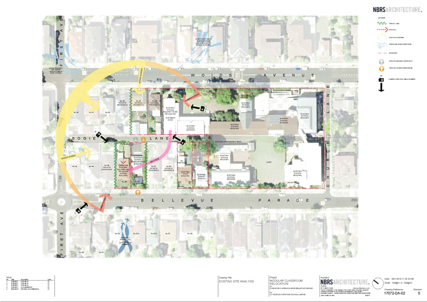
|
Georges River Council - Georges River Local Planning
Panel (LPP) - Friday, 5 October 2018
LPP045-18 48-50 Bellevue Parade Allawah
[Appendix
2] Site and Roof
Plan - 48 - 50 Bellevue Parade Allawah
|
Page 141
|
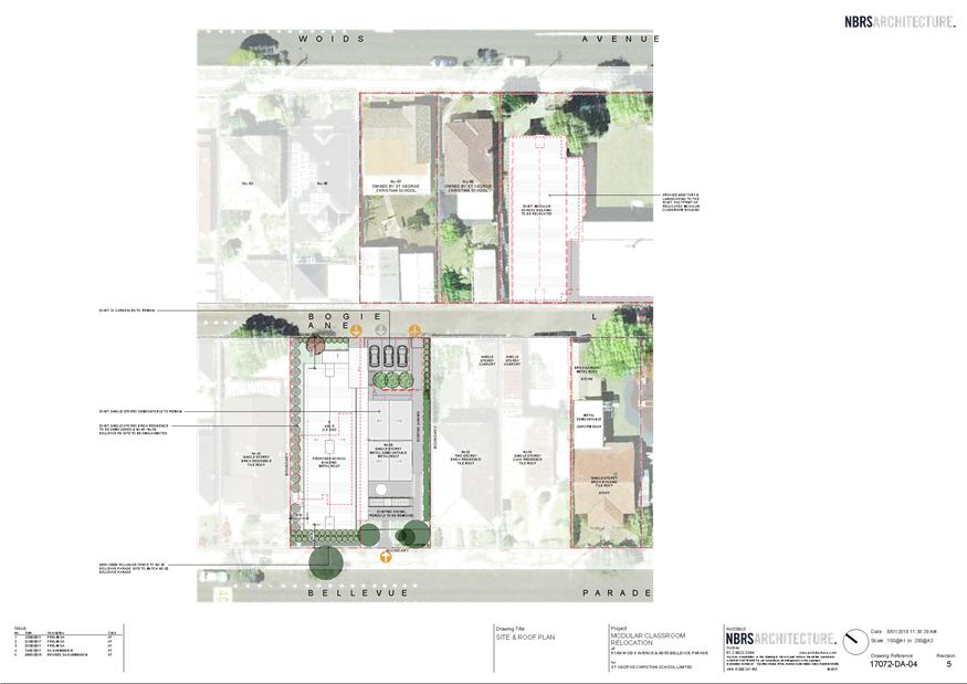
|
Georges River Council - Georges River Local Planning
Panel (LPP) - Friday, 5 October 2018
LPP045-18 48-50 Bellevue Parade Allawah
[Appendix
3] Elevations -
48 - 50 Bellevue Parade Allawah
|
Page 142
|
|
Georges River Council - Georges River Local Planning
Panel (LPP) - Friday, 5 October 2018
LPP045-18 48-50 Bellevue Parade Allawah
[Appendix
4] Sections - 48
- 50 Bellevue Parade Allawah
|
Page 143
|
|
Georges River Council - Georges River Local Planning
Panel (LPP) - Friday, 5 October 2018
LPP045-18 48-50 Bellevue Parade Allawah
[Appendix
5] Ground Floor
Plan - 48 - 50 Bellevue Parade Allawah
|
Page 144
|
|
Georges River Council - Georges River Local Planning
Panel (LPP) - Friday, 5 October 2018
LPP045-18 48-50 Bellevue Parade Allawah
[Appendix
6] First Floor
Plan - 48 - 50 Bellevue Parade Allawah
|
Page 145
|
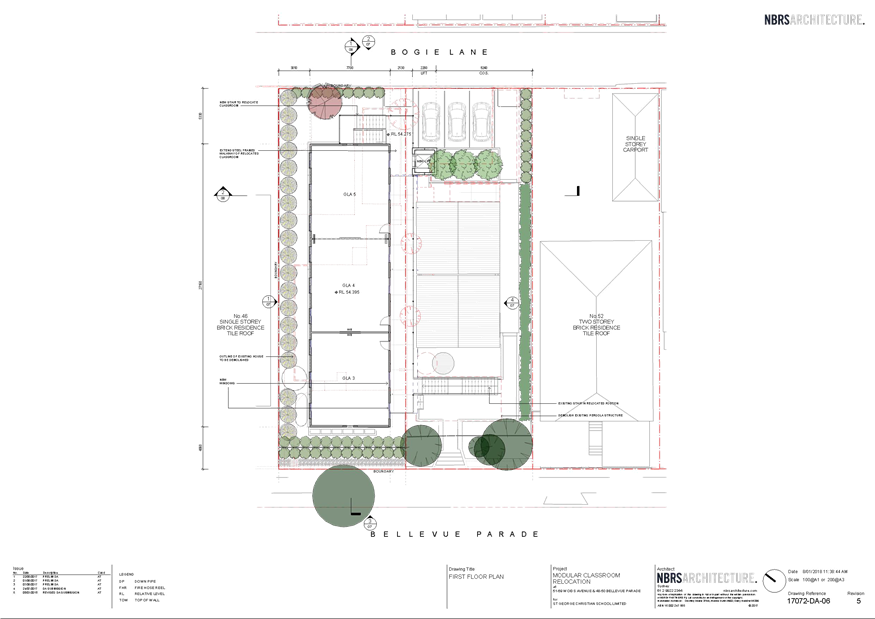
|
Georges River Council – Local Planning
Panel Friday, 5 October 2018
|
Page 146
|
REPORT TO GEORGES RIVER COUNCIL
LPP MEETING OF Friday, 05 October 2018
|
LPP Report No
|
LPP046-18
|
Development Application No
|
DA2017/0500
|
|
Site Address & Ward Locality
|
54 Woids Avenue Allawah
Kogarah Bay Ward
|
|
Proposed Development
|
Alterations and additions to
existing residential flat building
|
|
Owners
|
Milton Argirellis
|
|
Applicant
|
Milton Argirellis
|
|
Planner/Architect
|
Katris Architects Pty Ltd
|
|
Date Of Lodgement
|
24/10/2017
|
|
Submissions
|
One (1) submission in relation to
notification of the originally lodged proposal. No submissions in relation to
the notification of the amended plans.
|
|
Cost of Works
|
$1,167,361.00
|
|
Local Planning Panel Criteria
|
Local Planning Panels
Direction - State Environmental Planning Policy No 65—Design Quality of
Residential Apartment Development applies to the proposed development.
|
|
List of all relevant s.4.15
matters (formerly s79C(1)(a))
|
Greater
Metropolitan Regional Environmental Plan No 2 - Georges River Catchment,
State Environmental Planning Policy (Infrastructure) 2007, State
Environmental Planning Policy No 65 - Design Quality of Residential Apartment
Development, State Environmental Planning Policy (Building Sustainability
Index: BASIX) 2004, State Environmental Planning Policy (Vegetation in
Non-Rural Areas) 2017
Kogarah Local Environmental plan
2012, Kogarah Development Control Plan 2013,
Apartment Design Guide
|
|
List all documents submitted
with this report for the Panel’s consideration
|
Amended plans
Apartment Design Guide Compliance
Table
Kogarah Development Control Plan
2013 Compliance Table
|
|
Report prepared by
|
Development Assessment Officer
|
|
Recommendation
|
THAT the application be approved in accordance with the
conditions included in the report.
|
|
|
Summary of matters for
consideration under Section 4.15
Have all recommendations in relation
to relevant s4.15 matters been summarised in the Executive Summary of the
assessment report?
|
Yes
|
|
Legislative clauses requiring
consent authority satisfaction
Have relevant
clauses in all applicable environmental planning instruments where the
consent authority must be satisfied about a particular matter been listed, and
relevant recommendations summarised, in the Executive Summary of the
assessment report?
|
Yes
|
|
Clause 4.6 Exceptions to
development standards
If a written request for a
contravention to a development standard (clause 4.6 of the LEP) has been
received, has it been attached to the assessment report?
|
Not
Applicable
|
|
Special Infrastructure
Contributions
Does the DA require Special
Infrastructure Contributions conditions (under s7.24)?
|
Not
Applicable
|
|
Conditions
Have draft conditions been provided
to the applicant for comment?
|
No
|
|
Site Plan
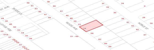
|
Executive Summary
1. The development
application (DA) seeks approval for alterations and additions to the existing
residential flat building including two (2) new levels to facilitate 3 new
units and roof terrace. There are also minor modifications proposed to the
internal configuration of the units and access, remodelling and detailing of
the external finishes to the building and minor alterations within the basement
to introduce a car sliding platform to more efficiently make use of the
existing car space configuration.
The site is located at 54 Woids Avenue, Allawah on the eastern side of
the road and has a total site area of 815.70sqm. The site is regular in shape
and has a frontage of 21m to Woids Avenue and an average depth of 40m. There is
a fall of approximately 2.7m to the rear from south to north with a slight
crossfall along Woids Avenue to the south.
Existing on the site is a two (2) storey residential flat building
comprising of 8 units and 14 car parking spaces located in the basement with
vehicular access from Woids Avenue.
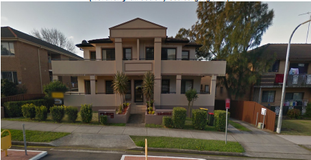
Figure 1 – Existing development at No.54 Woids Avenue, Allawah.
Adjoining land
to the east is zoned R3 Medium Density Residential under the provisions of the
Kogarah Local Environmental Plan 2012 (KLEP2012). Opposite to the west of the
site is the St George Cristian School and land zoned R2 Low Density Residential
under the provisions of the KLEP2012.
Existing
development on the subject site and surrounds is predominantly low and medium
density residential, with some neighbourhood shops located opposite on the
southern side of Railway Parade.
The subject
site is generally free of any significant environmental constraints that would
prove a material limitation to redevelopment of the land for the proposed
purposes. The subject site is not listed as a heritage item under KLEP2012. It
is however, located in the vicinity of a heritage item of local significance at
51-69 Woids Avenue, Allawah. The heritage item is identified as Item I2 on
Schedule 5 Environmental Heritage under KLEP2012.
Having regard
to the zoning of the site and surrounds, it is clear the future character of
land within the immediate vicinity of the subject site is transitioning to a
higher density mixed-use environment.
As part of the
assessment of the subject DA, notification of the proposal was undertaken in
accordance with the provisions of the Kogarah Development Control Plan 2013
(KDCP2013) on 6 November 2017. In response to the notification of the DA, one
(1) submission was received objecting to the proposal.
The objection
raised was on the basis of noise pollution, traffic impact and the
appropriateness of the additional bulk and scale on the streetscape. On 31
August 2018 re-notification of amended plans submitted by the applicant took
place in accordance with the provisions of the KDCP2013. No submissions were
received.
The
application has been assessed having regard to the Heads of Consideration under
Section 4.15 of the Environmental Planning and Assessment Act 1979, the
provisions of the relevant State Environmental Planning Policies, Local
Environmental Plans and Development Control Plans.
The main issue
of concern in relation to this application is the non-compliance with the car
parking requirements in Kogarah DCP 2013. Although the existing development (8
x 2 bedroom units) complies with the car parking requirements under KDCP 2013
as required for the existing development (ie 14 spaces required – 12
resident and 2 visitor spaces provided), the development proposes 3 additional
units (total of 10 x 2 bedroom and 1 x 1 bedroom) with two (2) less parking
space for the overall development. The development now proposes 11 resident
spaces and 1 visitor parking spaces.
The reason why
less car parking is provided as a result of the proposed development compared
to the existing, is that the existing development has stacked car spaces
provided (ie 2 stacked spaces for some of the units). In order to make those
staked spaces available for each individual units, the applicant now proposes
provision of a sliding platform system so that each of the car parking spaces
is available for individual units.
Under KDCP
2013, the development would require 16 resident and 2.2 (say 3 rounded up)
visitor spaces for a total of 19 parking spaces, which is a shortfall of 7
parking spaces.
Despite the
non-compliance with the car parking requirement in KDCP 2013, applicant has
submitted a Car Parking Assessment Report by Terrafic Pty Ltd Traffic &
Parking Consultants which indicates that the amount of parking provided is
sufficient to meet the needs of the development. This parking assessment is
based on average number of resident vehicles per dwelling based on Census data,
and also the proximity of the site to the public transport (Allawah Railway
station). This is discussed in more detail in the body of the report.
Approval of
the application is recommended as discussed in the body of this report.
DESCRIPTION
OF THE PROPOSAL
2. The DA
seeks approval for alterations and additions to the existing dwelling including
two (2) new levels to form a four (4) storey dwelling comprised of 1 x 1
bedroom and 2 x 2 bedrooms, with a new roof terrace. This will bring the total
number of units to eleven (11). Alterations to the external façade are
proposed which includes timber panels, glass balustrades and new boundary
fencing. Due to the increase in units, the basement car parking will be
modified to include car sliding platforms. On that basis, the proposal makes
provision for twelve (12) off-street parking spaces in the basement comprising
eleven (11) resident spaces (1 space per unit) and retention of one (1) visitor
parking space.
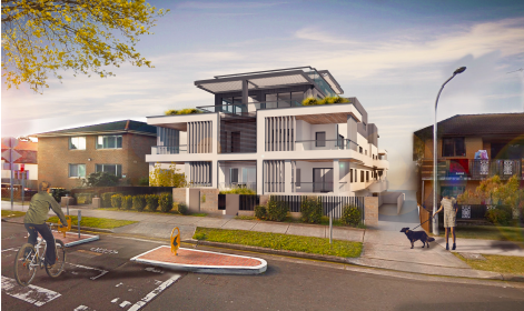
Figure 2 – Perspective of the proposed development as viewed
from the Woids Avenue frontage, looking east.
The principal communal open space area for the development will be
located on the roof top. The communal roof top terrace incorporates a bbq area,
synthetic turf area and raised planter beds at its edges to limit the
trafficable area of the roof top.
HISTORY
3. The following
provides a brief outline as to the history of the subject DA:
23 Oct 17 Subject
DA, being DA2017/0500, lodged with Georges River Council.
6 Nov 17 Application
notified for a 14 day period from 06/11/2017 to 20/11/2017. One (1) submission
was received objecting to the proposal.
8 Feb 18 Design
Review Panel (DRP) meeting held. The recommendation from the meeting was that
the application be supported, subject to a number of issues being resolved
– refer to detailed discussion later in this report.
16 Feb 18 Applicant
emailed DRP minutes
31 Jul 18 Amended
and additional information provided in response to the minutes from the 8
February 2018 DRP meeting.
2 Aug 18 Amended
information re-notified for a 14-day period from 2 August 2018 until 16 August
2018. No submissions were received.
DESCRIPTION OF THE SITE AND LOCALITY
4. The
site is located at 54 Woids Avenue, Allawah on the eastern side of the road and
has a total site area of 815.70sqm. The site is regular in shape and has a
frontage of 21m to Woids Avenue and an average depth of 40m. There is a fall of
approximately 2.7m to the rear from south to north with a slight crossfall
along Woids Avenue to the south.
Existing on the
site is a two (2) storey residential flat building comprising of 8 units and 14
car parking spaces located in the basement with vehicular access from Woids
Avenue. The development was approved in 2003 with construction completed in
2006.
The site is situated in close proximity to the following
services and facilities:
· Access to the Eastern Suburbs/Illawarra train line at
Allawah Station lies within a 300m radius approximately 500m walking distance
and is sited north-east of the subject site.
· The site is within 600m walking distance of Hurstville and
the Westfield Shopping Centre, which comprises of a large number of retail
stores, supermarkets, restaurants and movie theatre etc. The Neighbourhood
shopping centre of Allawah is within 500m walking distance with access to
convenience shopping and local services.
· The site is in close proximity to a number of educational
facilities including St George Christian School which is located opposite the
site.
Adjoining land to the east is zoned R3 Medium Density Residential under
the provisions of the Kogarah Local Environmental Plan 2012 (KLEP2012).
Opposite to the west of the site is the St George Cristian School and land
zoned R2 Low Density Residential under the provisions of the KLEP2012. The
surrounding locality is is predominantly characterised by older style, low
rise, multi-unit buildings of 2-3 storey scale, interspersed with residual
single dwellings that have yet to be redeveloped.
The subject site is not listed
as a heritage item under KELP2012. It is located in the vicinity of a
heritage item of local significance at 51-69 Woids Avenue, Allawah. The
heritage item is identified as Item I2: Former Woids Avenue Congressional
Church – St Gerorge Christian School on Schedule 5 Environmental
Heritage under KLEP2012.
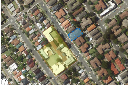
Figure 2 – Aerial view of the subject site at 54
Woids Avenue, Allawah highlighted in blue and the heritage item highlighted in
yellow.
APPLICABLE PLANNING CONTROLS
· Greater Metropolitan
Regional Environmental Plan No 2 – Georges River Catchment
· State Environmental
Planning Policy (Infrastructure) 2007
· State Environmental
Planning Policy No 65 – Design Quality of Residential Apartment
Development
· State Environmental
Planning Policy (Building Sustainability Index: BASIX) 2004
· State Environmental
Planning Policy (Vegetation in Non-Rural Areas) 2017
· Kogarah Local
Environmental Plan 2012
· Kogarah Development
Control Plan 2013
· Apartment Design Guide
PLANNING ASSESSMENT
5. The
site has been inspected and the proposed development has been assessed under
the relevant Section 4.15(1) "Matters for Consideration" of the Environmental
Planning and Assessment Act 1979 (the Act).
Environmental Planning
Instruments
Kogarah Local Environmental Plan 2012
Zoning
6. The subject site is zoned R3 Medium
Density Residential under the provisions of the Kogarah Local Environmental Plan 2012 (KLEP2012). Refer to zoning
map extract below.
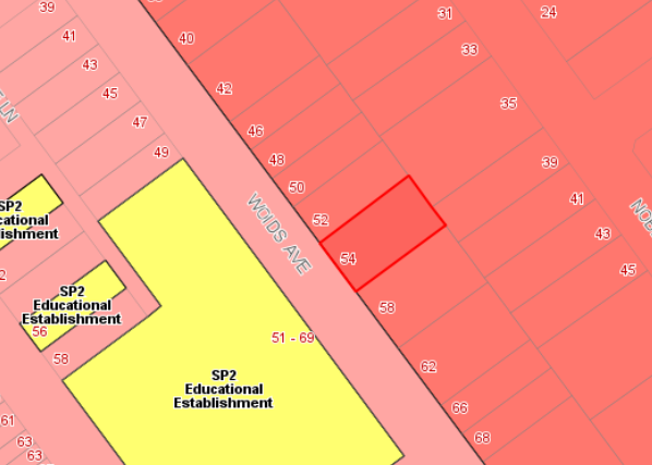
Figure
1 – Zoning map extract from the KLEP2012 demonstrating the subject
site is located within the R3 Medium Density Residential. Within the R3 zone,
residential flat buildings are permitted with consent.
The objectives
of the R3 zone are as follows:
Objectives of zone
• To provide for the housing needs
of the community within a medium density residential environment.
• To provide a variety of housing
types within a medium density residential environment.
• To enable other land uses that
provide facilities or services to meet the day to day needs of residents.
The proposed development is capable of achieving
consistency with the objectives of the R3 zone as it will provide a mix of
additional housing to meet the needs of the community.
7. The
extent to which the proposal complies with the relevant standards of Kogarah
Local Environmental Plan 2012 (KLEP2012) is outlined in the table below.
|
Clause
|
Standard
|
Proposed
|
Complies
|
|
Part 2
– Permitted or Prohibited Development
|
R3 Medium Density Residential
|
The
proposal being a residential flat building is a permissible form of
development with Council's consent.
|
Yes
|
|
|
Objectives
of the Zone
|
Consistent
with zone objectives
|
Yes – see comments above
|
|
4.1
– Minimum Lot Size
|
1000sqm
|
The site area
at 819sqm
does not comply
with Cl
4.1A of KLEP
2012 regarding
minimum lot
sizes for multi
dwelling
housing, residential
flat buildings
and seniors
housing, which
requires a
minimum of 1000sqm.
|
No – See Clause 4.6 variation below
|
|
4.3 – Height of Buildings
|
15m as identified on Height of
Buildings Map
|
Proposal measures a maximum of
14.3m
|
Yes
|
|
4.4 – Floor Space Ratio
|
1.5:1 as identified on Floor Space
Ratio Map
|
1.12:1
|
Yes
|
|
4.5
– Calculation of floor space ratio and site area
|
FSR and
site area calculated in accordance with Cl.4.5
|
Noted
|
Noted.
|
|
5.10
– Heritage Conservation
|
The objectives of
this clause are;
(i) to conserve the environmental
heritage of Kogarah,
(ii) to conserve the heritage
significance of heritage items and heritage conservation areas, including
associated fabric, settings and views.
|
The site
is within the vicinity of the Former Woids Avenue Congregational Church
– St George Christian School at 51-69 Woids Avenue Allawah.
The applicant submitted a heritage impact assessment
to support the application.
The report noted that the visual setting of the heritage
item will be retained due to building setbacks of the two proposed additional
levels. These are setback from the primary elevation, ensuring that existing
views to and from the heritage item will be retained and not altered.
The proposed additions are of a contemporary
architectural character with selected materials clearly identified as new
work.
|
Yes
|
Clause 4.6
Exceptions to development standards
8. Clause
4.1 of the KLEP2012 prescribes that the minimum floor space is 1000sqm for
residential flat buildings. The subject site has a total site area of
815.70sqm, which means that it does not meet the minimum lot size requirement
for this type of development. The applicant has provided a formal written
clause 4.6 request, of which is attached to this report, a synopsis of the
justification is outlined below.
· The
compliance with development standard is unreasonable or inappropriate due to
existing use of land and current environmental character of the particular
parcel of land. That is, the particular parcel of land should not have been
included in the zone.
· The site is well located to services and the proposed
development is of a form and scale that is consistent with the future planning
strategy for the locality. The additional development on site is sustainable
given its proximity to public transport (both train and buses) and the
facilities and services available in the Hurstville Town Centre and Allawah
Local Centres respectively.
· The
proposed development adopts setbacks along the side boundaries that provide
reasonable separation distances from adjoining development and appropriate
treatment of these side elevations has ensured that the development does not
result in any significant privacy impacts to adjoining properties.
The request for a
variation to the floor space ratio development standard in the circumstances of
the case is supported for the following reasons:
· The
current use and character of the land is for multi-unit, residential flat
development and the ongoing use and intensification of the use of the site for
that purpose is appropriate and can be readily facilitated within the existing
site.
· Despite
the relatively restrictive nature of the site the design of the proposal
ensures that the new apartments within the development have an appropriate
amenity in terms of privacy and solar access consistent with the objectives of
the Apartment Design Guide and there is a general improvement for all dwellings
in the provision of a rooftop terrace open space area.
· It
is contended that irrespective of the numerical non-compliance with the minimum
lot size, the objectives of the development standard and also the R3 zone are
still achieved.
· In
the circumstances of the above, it would likely be in the public interest for
the consent authority to permit the variation of the control.
Given the above,
it is recommended that the clause 4.6 variation to the minimum lot size be
supported in the circumstances of this case.
Environmental
Planning and Assessment Regulations 2000
9. The proposed development satisfies the relevant matters for
consideration under the Regulations.
State
Environmental Planning Policies
Greater Metropolitan
Regional Environmental Plan No 2 – Georges River Catchment
10. The site is within
the area affected by the Greater Metropolitan Regional Environmental
Plan No 2 — Georges River Catchment. The proposal, including the disposal
of stormwater, is considered to be consistent with Council's requirements for
the disposal of stormwater in the catchment.
All stormwater
from the proposed development will be managed by the proposed stormwater system
and will be treated in accordance with Council’s Water Management Policy
and would therefore satisfy the relevant provisions of the Deemed State
Environmental Planning Policy – Georges River Catchment.
State Environmental Planning
Policy (Infrastructure) 2007
11. Divisions 5
(Electricity Transmission or Distribution) and 17 (Roads and Traffic) of the
State Environmental Planning Policy (Infrastructure) 2007 (ISEPP) are not
applicable to the proposal. There is no information to indicate that an
external referral to the relevant energy supply authority was required in accordance
with clause 45 of the ISEPP. The proposal does not constitute “Traffic
generating development”, thus a referral was not made to Roads and
Maritime Services (RMS).
State Environmental Planning
Policy No 55 - Remediation of Land
12. The site has long
standing residential use and a recently approved and constructed residential
flat building exists on the site. In view of the above and having regard to the
provisions of SEPP No 55 the site is considered suitable for the proposed
development.
State Environmental Planning
Policy (Building Sustainability Index: BASIX) 2004
13. BASIX Certificate
No 862913M has been issued for the proposed development.
State Environmental Planning
Policy (Vegetation in Non-Rural Areas) 2017
14. The objectives of the SEPP are to protect the biodiversity values
of trees and other vegetation in non-rural areas and preserve the amenity of
non-rural areas through the preservation of trees and other vegetation. No tree
clearance is proposed as part of this development and consideration of this
issue is satisfied.
State Environmental
Planning Policy No 65—Design Quality of Residential Apartment Development
15. State
Environmental Planning Policy No.65 – Design Quality of Residential Flat
Buildings (SEPP 65) was gazetted on 26 July 2002 and applies to the assessment
of DAs for residential flat developments of three or more storeys in height and
containing at least four dwellings. Amendment 3 to SEPP 65 commenced on 17 July
2015 and implemented various changes including the introduction of the
Apartment Design Guide (ADG) to replace the Residential Flat Design Code. Given
the nature of the development proposed, SEPP 65 applies.
Clause 28(2) of
SEPP65 requires that the consent authority take into consideration the following
as part of the determination of DAs to which SEPP 65 applies:
a) the advice (if any) obtained from the design review
panel, and
b) the design quality of the development when evaluated in
accordance with the design quality principles, and
c) the Apartment Design Guide.
The following
provides a comment in relation to items a) and b) above. An assessment against
c) is contained within Attachment A.
The DA was
assessed by the Design Review Panel (DRP) at a meeting held on 8 February 2018
having regard to each of the nine (9) Design Quality Principles.
In their Report,
the DRP recommends support of the application, subject to the issues raised
within their Report being resolved.
It is noted that
the DRP indicates that the application satisfied the design quality principles
contained within SEPP65.
The issues raised
by the DRP are covered below, followed by a comment on how they have been
resolved:
|
SEPP
65 – Design Quality of Residential Flat Buildings
|
DRP
Comment
|
Planner
Comment
|
|
Context and Neighbouring Character
Good
design responds and contributes to its context. Context is the key natural
and built features of an area, their relationship and the character they
create when combined. It also includes social, economic, health and
environmental conditions.
Responding
to context involves identifying the desirable elements of an area’s
existing or future character. Well designed buildings respond to
and enhance the qualities and identity of the area including the adjacent
sites, streetscape and neighbourhood.
Consideration
of local context is important for all sites, including sites in established
areas, those undergoing change or identified for change.
|
The existing
building sits comfortably within a three (3) storey walk-up environment.
Recent changes
to Council planning controls mean that the existing buildings are generally
below development potential for each individual site.
The proposal adds an additional 1.5 floors which can fit within
the existing framework.
|
Noted. The
subject site has been utilised use for multi-unit residential purposes for
some time and the additional units to the site are in keeping with the
residential flat buildings located along Woids Avenue.
|
|
Built
Form and Scale
Good
design achieves a scale, bulk and height appropriate to the existing or
desired future character of the street and surrounding buildings.
Good
design also achieves an appropriate built form for a site and the
building’s purpose in terms of building alignments, proportions,
building type, articulation and the manipulation of building
elements.
Appropriate
built form defines the public domain, contributes to the character
of streetscapes and parks, including their views and vistas, and
provides internal amenity and outlook.
|
The proposal is
not inappropriate for the context however the additional levels and rooftop
garden may require a lift.
The additional
parking requirements are provided by an automated parking system the efficacy
of which the Panel remains unconvinced.
|
The
applicant was forwarded the DRP comments which suggested the provision of a
lift. The amended plans received do not provide for a lift. Although this is
not ideal, the applicant is not required to provide a lift in accordance with
the National Construction Code.
This
will be a matter of amenity and choice for the individual unit occupiers on
whether or not to occupy the upper level units in a building without a lift.
|
|
Density
Good
design achieves a high level of amenity for residents and each apartment,
resulting in a density appropriate to the site and its context.
Appropriate
densities are consistent with the area’s existing or projected
population. Appropriate densities can be sustained by existing or proposed
infrastructure, public transport, access to jobs, community facilities and
the environment.
|
Appropriate
|
Noted.
|
|
Sustainability
Good
design combines positive environmental, social and economic outcomes.
Good
sustainable design includes use of natural cross ventilation and sunlight for
the amenity and liveability of residents and passive thermal design
for ventilation, heating and cooling reducing reliance on technology and
operation costs. Other elements include recycling and reuse of materials and
waste, use of sustainable materials and deep soil zones for groundwater
recharge and vegetation.
|
Extending the life and capability of an existing building is to be
commended. BASIX is able to be achieved as are the sustainability aspects of
the ADG.
|
Noted.
|
|
Landscape
Good design recognises that
together landscape and buildings operate as an integrated and sustainable
system, resulting in attractive developments with good amenity. A positive
image and contextual fit of well designed developments is achieved
by contributing to the landscape character of the streetscape
and neighbourhood.
Good
landscape design enhances the development’s environmental performance
by retaining positive natural features which contribute to the local
context, co-ordinating water and soil management, solar access,
micro-climate, tree canopy, habitat values and preserving green
networks.
Good
landscape design optimises useability, privacy and opportunities
for social interaction, equitable
access, respect for neighbours’ amenity and
provides for practical establishment and long term management.
|
The landscape
plans provided are inaccurate in their representation of the ground floor
(driveway missing, floor plan inaccurate) and the extent of landscape works
proposed is unclear. The plans should be corrected and show the relationship
between built form and landscape at ground level and access to and
circulation within the space (both pedestrian and vehicular). While
planting is shown in boundary setbacks, given the inaccuracies on the drawings,
there is an element of doubt as to whether this can be achieved. Areas of
deep soil, when correctly located on plan, should be used to support larger
tree species.
It appears as
if the area identified as ‘communal open space 1’ is accessible
only via the basement. The use and design of the space has not been addressed
and must be resolved. It has a northerly aspect which is potentially
pleasant, and may be more easily accessible for mobility-impaired residents
and visitors.
The area of
‘communal open area 3’ at the front of the building may be better
utilised if incorporated into the private open space of Unit 1.
The ramp at the
front of the building is unfortunate and is of little consequence, in the
context where a lift is not provided within the building, given that it only
provides access to ground floor units and detracts from the landscape
character and streetscape. The extent of this should be minimised if at all
possible.
Street trees of
an appropriate scale (overhead lines) must be included within the landscape
plan.
A buffer / setback between rooftop open space and the building
edge must be provided for safety and to minimise overlooking of neighbours.
Amenity including shade and water must be provided
|
The
proposal now includes accurate representation of the floor plans and extent
of landscaping proposed.
The
amended proposal maintains a deep soil area along the southern
boundary. The revised landscape plan is to include the proposed street
tree planting in accordance with Council’s specifications.
The
applicant has detailed that outdoor furniture will be provided to existing
Communal open space 1.
The area
previously noted as communal open 3 on the rooftop has now been incorporated
into the private open space of Unit 1.
The ramp
at the front of the building has been located behind new planter boxes so
will be screened from the front boundary.
Box
planters have been provided along the permitter of the rooftop terrace.
|
|
Amenity
Good
design positively influences internal and external amenity for residents
and neighbours. Achieving good amenity contributes to positive living
environments and resident well being.
Good
amenity combines appropriate room dimensions and shapes, access to sunlight,
natural ventilation, outlook, visual and acoustic privacy, storage, indoor
and outdoor space, efficient layouts and service areas and ease of access for
all age groups and degrees of mobility.
|
The design must demonstrate drainage to wet areas
can be achieved without compromising ADG ceiling height requirements.
The absence of a lift, while understandable, is
problematic.
|
This has
been demonstrated on the DA plans.
This has
been addressed above.
|
|
Safety
Good
design optimises safety and security within the development and the
public domain. It provides for quality public and private spaces that are
clearly defined and fit for the intended purpose. Opportunities
to maximise passive surveillance of public and communal areas
promote safety.
A
positive relationship between public and private spaces is achieved through
clearly defined secure access points and well lit and visible areas that are
easily maintained and appropriate to the location and purpose.
|
See comment
above under ‘Landscape’ regarding the setback of rooftop open
space from building edge.
There is no security proposed to the parking area which presents a
safety and security risk.
|
Landscaping
buffer to the roof terrace has been provided for.
No
additional security provisions to the basement car parking have been
provided.
|
|
Housing
Diversity and Social Interaction
Good
design achieves a mix of apartment sizes, providing housing choice for
different demographics, living needs and household budgets.
Well
designed apartment developments respond to social context by providing
housing and facilities to suit the existing and future social mix.
Good
design involves practical and flexible features, including different types of
communal spaces for a broad range of people and providing opportunities for
social interaction among residents.
|
Satisfactory given that it is an alteration to an existing
building.
|
Noted.
|
|
Aesthetics
Good
design achieves a built form that has good proportions and a balanced
composition of elements, reflecting the internal layout and structure. Good
design uses a variety of materials, colours and textures.
The
visual appearance of a well-designed apartment development responds
to the existing or future local context, particularly desirable elements and
repetitions of the streetscape.
|
The Panel questions whether the dark-grey coloured addition is a
substantial improvement over the existing colour scheme.
|
The
applicant has chosen to not make any amendments to the colour scheme
proposed. This is considered acceptable given the contemporary nature of the
proposal.
|
Having regard to
the above, it is considered the advice provided by the DRP has generally been
adopted by the applicant in the amendments to the drawings.
The Apartment
Design Guide (ADG) provides planning and design standards for apartments across
NSW. It provides design criteria and general about how development proposals
can achieve the nine design quality principles identified in SEPP 65.
As outlined
earlier, Clause 28 of SEPP65 requires the consent authority to take into
consideration the provisions of the ADG. Contained in Attachment A is a
detailed compliance table assessment how the proposed development, as currently
amended, performs against the relevant provisions of the ADG.
As demonstrated
within the ADG compliance table, the proposal is satisfactory when considered
against the relevant objectives, design criteria and design guidance for
residential flat buildings.
Draft Environmental Planning Instruments
Draft Environment State Environmental Planning Policy
(SEPP)
16. The
Draft Environment SEPP was exhibited from 31 October 2017 to 31 January 2018.
This consolidated SEPP proposes to simplify the planning rules for a number of
water catchments, waterways, urban bushland, and Willandra Lakes World Heritage
Property.
Changes proposed include consolidating the following seven
existing SEPPs:
· State Environmental Planning Policy No. 19 – Bushland
in Urban Areas
· State Environmental Planning Policy (Sydney Drinking Water
Catchment) 2011
· State Environmental Planning Policy No. 50 – Canal Estate
Development
· Greater Metropolitan Regional Environmental Plan No. 2
– Georges River Catchment
· Sydney Regional Environmental Plan No. 20 –
Hawkesbury-Nepean River (No.2-1997)
· Sydney Regional Environmental Plan (Sydney Harbour
Catchment) 2005
· Willandra Lakes Regional Environmental Plan No. 1 –
World Heritage Property.
The proposal is not inconsistent with the provisions of
this Draft Instrument.
Development Control Plans
KOGARAH DEVELOPMENT CONTROL PLAN NO 2013 (KDCP)
PART C1 KDCP 2013 – DEVELOPMENT COMPLIANCE TABLE
17. A detailed assessment of the development against the
relevant sections of KDCP 2013 is contained in Attachment B of this assessment
report. Below is a discussion on the key non-compliances/issues with the
KDCP2013.
Building
Setbacks
Part C2 –
Medium Density Housing, Part 6 Building Setbacks stipulates that for
residential flat buildings the side and rear boundary setbacks must be 3m plus
¼ the amount that the wall height exceeds 3m.
The wall height of
the building is a maximum 14.3m when measured from natural ground level. As
such, the proposed building has not achieved a minimum of 5.3m from all side
and rear boundary setbacks. The new building work has been generally setback 6m
from the northern and southern side boundaries for primary living spaces with
point intrusions to service area and stairways to the north for Unit 10. The
study to Unit 11 presents a highlight window to that same boundary on a setback
of 4.3m, aligning with the existing floorplate and wall for the unit below. The
master bedroom for that unit presents a similar setback with the fenestration
offset to the alignment of the building.
The proposed
additional floors have been designed to be recessed from the existing
floorplate to reduce visual bulk impacts and allow for landscaping to soften
and compliment the scale of the building. Screen planting and privacy screens
have been provided to ensure no visual or aural privacy impacts to adjoining
properties.
Impervious Area
Part C2 – Medium Density Housing, Part 8 Open Space states that
residential flat buildings must provide for a maximum of 55% impervious area of
site. The proposal does not comply with this requirement, having 58% (475.7sqm)
of impervious area on the site. The new ramp and additional footpaths increases
the impervious area by only 16sqm.
The existing deep soil landscaping along the external perimeters of the
site has been maintained and can appropriately manage the amount of water from
the site.
Private Open
Space
Part C2 – Medium Density Housing, Part 8 Open Space states that where
provided courtyards for ground floor units must be a minimum of 35sqm/
dwelling, with a minimum dimension of 3m. Otherwise all dwellings must be
provided with a balcony 12sqm in area with a minimum dimension of 3m. The
proposed balcony to Unit 11 (one bedroom) is 8sqm in area and provides minimum
dimension of 2.1m. The balcony to Unit 10 (two bedroom) is also 8sqm in area
and provides a minimum dimension of 2.1m.
It is noted that a communal rooftop terrace of 110sqm has been provided
to compensate for the shortfall in private open space to the new units. This is
considered acceptable, given the constraints to provide for larger balconies on
site.
Adaptable and
Accessible Housing
Part C3 –
Medium Density Housing, Part 13 Adaptable and Accessible Housing states that
for developments containing between 11 and 20 units, 2 adaptable unis must be
provided. The proposal does not include the provision of adaptable units
to meet this control.
Although the proposal results in a total of 11 units, only 3 new units
are proposed. Site access has been improved with the inclusion of a new access
ramp to the entry of the building, however there is no opportunity to retrofit
the vehicular and pedestrian access to enable compliant Adaptable Units to be
provided.
Parking
Part B4 General
Controls outline car parking requirements for the subject development. The
proposed development requires provision for 19 car parking spaces as outlined
below:
· 10 x 2
bedroom units requires 15 spaces @ 1.5 spaces per unit;
· 1 x 1
bedroom unit requires 1 space @ 1 space per unit;
· 2.2 spaces
(say 3 spaces rounded up) required for visitor parking @ 1 visitor space per 5
units.
The existing development provides 14 space basement carpark comprising 12
resident spaces and 2 visitor spaces. Of the resident parking provision, 4 are
provided in a tandem arrangement which have been allocated to Units 5, 6, 7 and
8. The remaining 4 units are allocated a single car space in the basement. This
car parking provision (of 12 resident and 2 visitor spaces) complied with the
car parking requirements of Council for the existing development.
The development proposes a total of 12 off-street parking spaces
comprising 11 resident spaces (1 space per unit) and 1 visitor parking space.
The development proposes to install a mechanical system of sliding platforms in
the basement to enable each unit to have access to a car parking space, noting
that some of these parking spaces are in a tandem/stacked formation.
Given that Kogarah DCP 2013 requires 19 car spaces, and the development
proposes 12 car spaces, there is a shortfall of 7 spaces according to the DCP
requirements.
The provisions of the Apartment Design Guide (ADG) contains recommended car
parking provision for residential flat buildings, which state:
On sites that are within 800 metres of a railway station or light rail
stop in the Sydney Metropolitan area the minimum car parking requirements for
residents and visitors is set out in the Guide to Traffic Generating
Developments, or the car parking requirement prescribed by the relevant
council, whichever is less.
The car parking needs for a development must be provided off street.
The “Guide to Traffic Generating Developments” (published
by the Roads and Maritime Services) generally contains a car parking
recommendation of 1 space per unit in a medium-density residential flat
building, such as the subject site.
In support of the request for a variation to the DCP controls, the applicant
has submitted a report from Terraffic Pty Ltd Traffic and Parking Consultants.
In summary, the Terraffic Parking Assessment Report includes an analysis of
Census Data from the Australian Bureau of Statistics, which indicates that for
properties within 800m of Allawah railway station, the actual car parking
demand is 11 parking spaces for 11 units.
The subject site is within 800m walking distance of a railway station. On
this basis and having regard to the provisions of Clause 30(1)(a) of SEPP No.
65 and the relevant design criteria in the Apartment Design Guide (ADG), the
application can rely upon a lesser rate of car parking provision. Given that 11
spaces are proposed for 11 units with the re-arrangement of the basement car
park (through the use of the mechanical sliding platforms), the development is
considered to provide sufficient resident parking.
In terms of visitor parking, the provisions of the DCP require 1 visitor
space per 5 units. For this development of 11 units, the development would require
2.2 spaces (say 3 rounded up). The development proposes 1 visitor space and
therefore does not comply with the DCP requirement. As the development proposes
12 spaces with 11 of those spaces allocated for resident parking, it is not
possible to provide more than 1 visitor space at the site.
The application was accompanied by a parking assessment prepared by a
traffic engineer seeking to justify the deficiency in visitor parking on the
basis of site location and current availability of on street parking. Having
regard to the close walking distance proximity of the site to a range of public
transport options and the trends towards sustainable transport options and
reducing private car use, the minor deficiency in visitor parking is
acceptable.
The application has been referred to Council’s Traffic Engineer for
assessment. No objections were raised on traffic and parking grounds.
Overall, having regard to the above assessment, the proposal is
considered acceptable in terms of car parking.
The use of a mechanical system of sliding platforms for car parking
provision warrants a condition of consent for the creation of a restriction as
to user and positive covenant for the design, construction and maintenance of
such a system. A suitable condition of consent is included in the
recommendation in this regard.
IMPACTS
18.
Natural
Environment
The proposed
development is unlikely to result in adverse impacts to the natural
environment. A landscape plan prepared by a qualified landscape architect has
been prepared for the development which shows appropriate deep soil planting
and buffer planting. Further no excavation is proposed to the site.
Built
Environment
The proposed
development is unlikely to result in adverse impacts to the built environment.
The proposed development complies with the relevant requirements except for FSR
and height.
The subject site has been used for multi-unit residential purposes for
over 10 years and the additional built form to be added to the site is
consistent with a number of multi-unit developments in the streetscape. The
proposal will provide additional housing within an architecturally designed
development that is comparable to the scale of anticipated future development
of multi dwelling housing in the immediate locality and desired streetscape.
Social
Impact
It is noted that
the proposal will provide for new units with a mix of typology in the Georges
River Local Government Area and therefore assist in meeting the housing needs
of the community.
Economic
Impact
The proposed
development has no apparent adverse economic impact.
Suitability
of the Site
The proposed
development is considered capable of satisfying the objectives and requirements
of the relevant planning provisions. In this circumstance, the subject site
would be suitable for the proposed development.
SECTION 7.11
DEVELOPER CONTRIBUTIONS
19. The proposed
development requires payment of developer contributions under Section 7.11
based on the number of an additional dwellings on the subject site.
In this regard, it
is noted that contributions under Section 7.11 (previously s94) were levied and
paid for the existing development (8 x 2 bedroom units approved under the
original DA2002/572). The additional units (2 x 2 bedroom and 1 x 1 bedroom)
proposed in this development requires payment of additional Section 7.11
contributions.
The additional
Section 7.11 contributions payable for this development are:
|
Contribution Type
|
Contribution
Amount
|
|
Roads and traffic management
|
$288.09
|
|
Open Space
|
$29,624.81
|
|
Kogarah libraries - buildings
component
|
$646.71
|
|
Kogarah libraries - books component
|
$548.10
|
|
Total Contributions
|
$31,107.71
|
SUBMISSIONS AND
THE PUBLIC INTEREST
20. As part of the
assessment of the subject DA, notification of the proposal was undertaken in accordance
with the provisions of the Kogarah Development Control Plan 2013 (KDCP2013) on
6 November 2017. In response to the notification of the DA, one (1) submission
was received objecting to the proposal. The objector did not disclose their
address.
The objection
raised was on the basis of noise pollution, traffic impact and the
appropriateness of the additional bulk and scale on the streetscape. On 31
August 2018 re-notification of amended plans submitted by the applicant took
place in accordance with the provisions of the KDCP2013. No submissions were
received.
The issues raised
in the submission received as part of the initial notification are covered
below.
Streetscape
Proposal
building works do not fit in with the streetscape
Comment: The proposal complies with the ADG and has been
designed to be recessed from the existing building footprint to reduce the
visual dominance. To further minimise the appearance of bulk the materials have
been changed including the provision of balconies and additional landscaping to
soften the appearance. The existing streetscape contains a number of
residential flat buildings and proposed development is of a form and scale that
is anticipated within the R3 – Medium Density Zone, having regard to the
height and floor space ratio provisions that apply.
Overlooking
from terrace
Roof terrace
will overlook neighbouring properties
Comment:
The proposal has been amended to provide for additional box planters along the
permitter of the roof terrace to prevent overlooking and increase the
non-trafficable area within the space.
Noise from
terrace
Roof terrace
would generate more noise and disturb residents
Comment: The communal open space is located in the
rear and on the rooftop and any noise generated by these spaces is likely to be
similar to other forms of residential development and associated open space. A
condition of consent will be included to ensure the rooftop common area shall
be vacated and not used between the hours of 10.00pm and 8.00am the following
day.
On street parking
Additional
units will place extra strain on street parking
Comment - While a parking shortfall is presented when
assessed against the Council DCP requirement, the provision of one car space
per unit is considered acceptable under the circumstances presented in this
case. Given the proximity of the site to public transport services, which are
within walking distance and the current availability of on-street parking the
provision of 1 visitor space is not considered to result in an unreasonable
impact on the operation of the road traffic network.
REFERRALS
21.
Waste
No objections
raised subject to conditions
Building
The proposal has
been examined for general compliance with the Fire Safety and construction
provisions of Clause 98 of the EP&A Regulation and with the Building Code
of Australia. Standard conditions to be imposed.
Stormwater
The application
has been referred to Council’s Traffic Engineer for assessment. No
objections were raised on traffic and parking grounds.
Traffic
The application
has been referred to Council’s Traffic Engineer for assessment. No
objections were raised on traffic and parking grounds.
CONCLUSION
22. The application
has been assessed having regard to the relevant heads of consideration under
Section 79C(1) of the Environmental Planning and Assessment Act 1979 and the
provisions of KLEP 2012 and KDCP 2013. Following detailed assessment, it is
considered that Development Application No. DA2017/0500 should be approved
subject to the conditions included in this report.
DETERMINATION AND STATEMENT OF REASONS
23.
Statement of Reasons
· The proposed
development is considered to be an appropriate scale and form for the site and
the character of the locality
· The proposed
development, subject to the recommended conditions, will have no unacceptable
adverse impacts upon the natural or built environments
· In consideration
of the aforementioned reasons, the proposed development is a suitable and
planned use of the site and its approval is in the public interest
That pursuant to Section 80(1)(a) of the Environmental Planning and
Assessment Act 1979 grant consent to Development Application No. DA2017/0500
for an additional 2 levels (3 units) on the residential flat building at 54
Woids Avenue, Allawah, subject to the conditions below.
SECTION
A - GENERAL CONDITIONS
1. Approved
Plans - The development will be implemented in accordance with the approved
plans and supporting documentation listed below which have been endorsed by
Council’s approved stamp, except where marked up on the plans and/or
amended by conditions of this consent:
|
Description
|
Reference No.
|
Date
|
Revision
|
Prepared by
|
|
Survey Plan
|
170593_A
|
07/04/2017
|
|
TSS
|
|
Site Plan
|
L01 D
|
17/04/2018
|
|
Site Design and Studio
|
|
Landscape Plan
|
L02D
|
17/04/2018
|
|
Site Design and Studio
|
|
Basement and GF
|
1
|
18/04/2018
|
B
|
Katris Architects
|
|
First Floor Plan
|
2
|
18/04/2018
|
B
|
Katris Architects
|
|
Second and Third Floor Plans
|
3
|
18/04/2018
|
B
|
Katris Architects
|
|
Front and Rear Elevations
|
4
|
18/04/2018
|
B
|
Katris Architects
|
|
Side Elevations
|
5
|
18/04/2018
|
B
|
Katris Architects
|
2. No
advertising and/or signage is approved as part of this consent. Any new/future
signage must either:
· Obtain
separate consent(s); and/or
· Be
erected/installed in accordance with relevant exempt provisions within State
Environmental Planning Policy (Exempt and Complying Development Codes) 2008.
3. Any
outdoor/security lighting must be located, designed and shielded in a manner
that does not cause disturbance to surrounding premises and/or passing
vehicular traffic.
4. Any
new boundary fencing erected along the side and rear boundaries shall not
exceed a height of 1.8m.
5. Any
new electrical connections to the site are to be carried out using underground
cabling.
6. Any
materials or surfaces addressing the public domain on the ground and first
floor (where accessible by members of the public) shall utilise graffiti-resistant
materials.
7. The
rooftop common area shall be vacated and not used between the hours of 10.00pm
and 8.00am the following day.
SECTION
B - SEPARATE APPROVALS UNDER OTHER LEGISLATION
8. Section
138 Roads Act 1993 and Section 68 Local Government Act 1993 - Unless
otherwise specified by a condition of this consent, this Development Consent
does not give any approval to undertake works on public infrastructure.
If separate activity approvals are required under other legislation, these
approvals will be obtained and evidence of the approval(s) provided to the
Certifier prior to the issue of the Construction Certificate.
Separate approval is required under the Roads Act 1993
and/or the Local Government Act 1993 for any of the following activities
carried out in, on or over a public road (including the footpath) listed below.
(a) Placing or
storing materials or equipment;
(b) Placing or
storing waste containers or skip bins;
(c) Erecting
a structure or carrying out work
(d) Swinging or
hoisting goods over any part of a public road by means of a lift, crane or the
like;
(e) Pumping
concrete from a public road;
(f) Pumping
water from the site into the public road;
(g) Constructing
a vehicular crossing or footpath;
(h) Establishing
a “works zone”;
(i) Digging
up or disturbing the surface of a public road (e.g. Opening the road for the
purpose of connections to utility providers);
(j) Stormwater
and ancillary works in the road reserve;
(k) Stormwater
and ancillary to public infrastructure on private land; and
(l) If
any excavation is to be supported by the use of below ground (cable) anchors
that are constructed under Council’s roadways/footways.
These
separate activity approvals will be obtained and evidence of the approval
provided to the Certifying Authority prior to the issue of the Construction
Certificate.
The
relevant Application Forms for these activities can be downloaded from
Council’s website www.georgesriver.nsw.gov.au.
For
further information, please contact Council’s Customer Service Centre on
(02) 9330 6400.
9. Building - Hoarding Application - Prior to the commencement of work above
ground level a separate application for the erection of an A class (fence type)
hoarding, in accordance with the requirements of Work Cover Authority of NSW,
must be erected along that portion of property boundaries adjoining the
footway. An application for this work under Section 68 of the Local Government
Act 1993 and the Roads Act 1993 must be submitted for approval to Council.
The
following information is to be submitted with a Hoarding Application under s68
of the Local Government Act and s138 of the Roads Act 1993:
(a) A site and location plan of the hoarding with detailed
elevation, dimensions, setbacks, heights, entry and exit points to/from the
site, vehicle access points, location of public utilities, electrical overhead
wire protection, site management plan and builders sheds location.
SECTION C - REQUIREMENTS OF OTHER GOVERNMENT
AGENCIES
10. Notice
of Requirements for a Section 73 Certificate - A Notice of Requirements for
a Section 73 Compliance Certificate under the Sydney Water Act 1994 that
relates specifically to this development consent must be obtained from Sydney
Water Corporation. An application will be made through an authorised Water
Servicing Co-ordinator. The Notice of Requirements will be submitted prior to
the commencement of work. The Section 73 Compliance Certificate must be
submitted to the Principal Certifier prior to the issue of the Occupation
Certificate.
11. Electricity
Supply - An application will be made to Ausgrid for a network connection.
This may require the network to be extended or its capacity augmented. Evidence
of this application to Ausgrid will be provided to the Certifier prior to the
issue of a Construction Certificate.
SECTION
D - PRIOR TO THE ISSUE OF THE CONSTRUCTION CERTIFICATE
12. Requirement
for a Construction Certificate - The erection of a building must not
commence until a Construction Certificate has been issued by the consent
authority, the Council (if the Council is not the consent authority) or an
accredited Certifier.
13. Appointment
of a Principal Certifier - The erection of a building must not commence
until the beneficiary of the development consent has appointed a Certifier for
the building work.
14. Fees
to be paid - The fees listed in the table below will be paid in accordance
with the conditions of this consent and Council’s adopted Fees and
Charges applicable at the time of payment (available at www.georgesriver.nsw.gov.au).
Payments
will be made prior to the issue of the Construction Certificate or prior to the
commencement of work (if there is no associated Construction Certificate).
Council will only accept Bank Cheque or Electronic Funds Transfer (EFT)
for transaction values of $500,000 or over. Council will be contacted prior to
payment to determine correct total amount to be paid and bank account details
(if applicable).
A summary of the fees to be paid are listed below:
|
Fee Type
|
Fee
|
|
GENERAL FEES
|
|
|
Long Service Levy
(to Long Service Corporation) Or, provide evidence of Payment direct to the
Long Service Corporation. See https://portal.longservice.nsw.gov.au/bci/levy/
|
|
|
Builders Damage
Deposit
|
$1,900.00
|
|
Inspection Fee for
Refund of Damage Deposit
|
$155.00
|
|
DEVELOPMENT
CONTRIBUTIONS
|
|
|
Kogarah Section 94
Development Contributions Plan No.1 - Roads and Traffic Management -
Residential
|
$288.09
|
|
Kogarah Section 94
Development Contributions Plan No.5 - Open Space 2007
|
$29,624.81
|
|
Kogarah Section 94
Development Contributions Plan No.9 - Kogarah Libraries - Buildings
|
$646.71
|
|
Kogarah Section 94
Development Contributions Plan No.9 - Kogarah Libraries - Books
|
$548.10
|
|
TOTAL for
Section 7.11 contributions
|
$31,107.71
|
|
|
|
General Fees
The fees and charges above are subject to change and are as set out in
the version of Council's Schedule of Fees and Charges or as required by other
Government Authorities, applicable at the time of payment.
Development Contributions
Indexation
The above contributions will be adjusted at the time of payment to
reflect changes in the cost of delivering public amenities and public services,
in accordance with the indices provided by the relevant Section 94 Development
Contributions Plan.
Timing of Payment
The contribution will be paid and receipted by Council prior to the
release of the Construction Certificate.
Further Information
A copy of all current Development Contributions Plans may be inspected
at Council’s offices or viewed on Council’s website www.georgesriver.nsw.gov.au.
15. Fire
Safety Measures - Prior to the issue of a construction certificate a list
of the essential fire safety measures that are to be provided in relation to
the land and any building on the land as a consequence of the building work
must accompany an application for a construction certificate, which is required
to be submitted to the Certifier. Such a list must also specify the
minimum standard of performance for each essential fire safety measure included
in the list. The Certifier will then issue a Fire Safety Schedule for the
building.
16. Structural
details - Engineer's details prepared by a practising Structural Engineer
being used to construct all reinforced concrete work, structural beams, columns
and other structural members. The details are to be submitted to the Principal
Certifier for approval prior to construction of the specified works.
A copy will be forwarded to Council where Council is not the Principal
Certifier.
17. Stormwater
System - The submitted stormwater plan has been assessed as a concept plan
only. Final detailed plans of the drainage system, prepared by a professional
engineer specialising in hydraulic engineering, shall be submitted for approval
with the Construction Certificate.
a) All
stormwater shall drain by gravity to the existing drainage system in accordance
with the Australian/New Zealand Standard AS/NZS 3500.3: 2015 (as amended).
18. Damage
Deposit - Major Works - In order to insure against damage to Council
property the following is required:
(a) Pay Council,
before the issue of the Construction Certificate, a damage deposit for the cost
of making good any damage caused to any Council property as a result of the
development and to ensure the construction of the civil works to be complete at
the applicant’s expense: $1,900.00
(b) Pay Council,
before the issue of the Construction Certificate, a non-refundable inspection
fee to enable assessment of any damage and repairs where required: $150.00
(c) Submit
to Council, before the commencement of work, a dilapidation report of the
condition of the Council nature strip, footpath and driveway crossing, or any
area likely to be affected by the proposal.
At
the completion of work Council will review the dilapidation report and the
Works-As-Executed Drawings (if applicable) and inspect the public works.
The
damage deposit will be refunded in full upon completion of work where no damage
occurs and where Council is satisfied with the completion of works.
Alternatively, the damage deposit will be forfeited or partly refunded based on
the damage incurred.
19. Access for Persons with Disabilities
- Access for persons with
disabilities must be provided to the site, including to
the entry foyer, basement carpark, required sanitary and kitchen facilities and
allocated balconies in accordance with the requirements of the Premises
Standards, the Building Code of Australia and AS 1428.1. Details must be submitted
with the Construction Certificate Application.
In regards to the
above, access throughout basement shall be highlighted/line marked and sign
posted to safeguard egress.
In the event
that full compliance cannot be achieved the services of an accredited access
consultant is to be obtained to determine alternative methods of compliance,
such a report must be submitted to and endorsed by the Principal Certifying
Authority prior to issue of the Construction Certificate
20. Commonwealth
Disability (Access to Premises) Standard - The Commonwealth Disability
(Access to Premises - Buildings) Standards 2010 (the Premises Standards)
applies to all applications (including a Construction Certificate). This
requires any new building, part of a building and the affected part of the
existing building to comply with the Premises Standards, the Building Code of
Australia and AS 1428.
21. Slip
Resistance - All pedestrian surfaces in areas such as foyers, public
corridors/hallways, stairs and ramps as well as floor surfaces in the wet rooms
in any residential units will have slip resistance classifications, as
determined using test methods in either wet or dry conditions, appropriate to
their gradient and exposure to wetting. The classifications of the new
pedestrian surface materials, in wet or dry conditions, will comply with
AS/NZS4586:2004 - Slip Resistance Classifications of New Pedestrian Materials
and will be detailed on the plans lodged with the application for the
Construction Certificate.
22. Minor
Development- A Site Management Plan detailing all weather access
control points, sedimentation controls, fencing, builder’s site sheds
office, amenities, materials storage and unloading arrangements must be
submitted with the application for the Construction Certificate.
23. Traffic
Management - Compliance with AS2890 - All driveways, access ramps,
vehicular crossings and car parking spaces will be designed and constructed in
accordance with the current version of Australian Standards, AS 2890.1-2004
(for car / motorbike parking facilities), AS 2890.2-2002 (for commercial
vehicle facilities), AS 2890.6-2009 (Off-street parking for people with
disabilities) and AS 2890.3-2015 (bicycles). A “Detailed Design”
certificate, prepared by a tertiary qualified and experienced traffic engineer
that fully addresses this condition, will be submitted to the Principal
Certifier with the Construction Certificate Application. An “As
Constructed” certificate, prepared by a tertiary qualified and
experienced traffic engineer that fully addresses this condition, must be
submitted to the Principal Certifier with the Occupation Certificate
Application.
24. Construction
Traffic Management Plan - A Construction Traffic Management Plan detailing:
(a) construction
vehicle routes;
(b) anticipated
number of trucks per day;
(c) hours
of construction;
(d) Access
arrangements; and
(e) Proposed
traffic measures to minimise impacts of construction vehicles
must
be submitted for the approval of Council’s Engineers. Council’s
Engineers will specify in writing that they are satisfied with the Traffic
Management Plan prior to the issue of the Construction Certificate.
25. SEPP
65 Design Verification Statement - A design verification statement,
prepared by a qualified designer, must be submitted to the Certifier verifying
that the plans and specifications achieve or improve the design quality of the
development for which development consent was granted, having regard to the
design quality principles set out under Schedule 1 of State Environmental
Planning Policy No 65 -Design Quality of Residential Flat Development.
26. Waste
Management Plan - A Waste Management Plan incorporating all requirements in
respect of the provision of waste storage facilities, removal of all materials
from the site that are the result of the works must be submitted to the
Certifier prior to the issue of any Construction Certificate.
27. BASIX
Commitments - All energy efficiency measures as detailed in the BASIX
Certificate must be implemented on the plans lodged with the application for
the Construction Certificate.
28. Acoustic
requirements for timber flooring - If timber flooring is installed within
the development, then appropriate insulation between floors shall achieve a
minimum sound attenuation of (50Rw).
29. Plan
of Management for car stacker parking system. The submission of a Plan of
Management in relation to the car parking system for the approval of the
Principal Certifying Authority as part of the Construction Certificate. The
Plan of Management shall include as a minimum, full details on the
construction, installation and maintenance of the car stacking system, and also
contact details of the person/company to undertake any required urgent
repairs/maintenance to be available 24 hours / 7 days per week.
SECTION
D - PRIOR TO THE COMMENCEMENT OF WORK
30. Dial
before your dig - The applicant will contact “Dial Before You Dig on
1100” to obtain a Service Diagram prior to the issuing of the
Construction Certificate. The sequence number obtained from “Dial
Before You Dig” will be forwarded to Council’s Engineers for their
records.
31. Registered
Surveyor's Report - During Development Work - A report will be submitted to
the Certifier at each of the following applicable stages of construction:
(a) Set
out before commencing excavation.
(b) Floor
slabs or foundation wall, before formwork or commencing brickwork.
(c) Completion
of Foundation Walls - Before any construction of flooring, detailing the
location of the structure relative to adjacent boundaries and floor levels
relative to the datum shown on the approved plans.
(d) Completion
of Floor Slab Formwork - Before pouring of concrete/walls construction,
detailing the location of the structure relative to adjacent boundaries and
floor levels relative to the datum shown on the approved plans. In
multi-storey buildings a further survey will be provided at each subsequent
storey.
(e) Completion
of any Roof Framing - Before roof covered detailing eaves/gutter setback from
boundaries.
(f) Completion
of all Work - Detailing the location of the structure (including eaves/gutters)
relative to adjacent boundaries and its height relative to the datum shown on
the approved plans. A final Check Survey will indicate the reduced level
of the main ridge.
Work
will not proceed beyond each stage until the Principal Certifier is satisfied that
the height and location of the building is proceeding in accordance with the
approved plans.
32. Utility
Arrangements - Arrangements are to be made with utility authorities
in respect to the services supplied by those authorities to the development. The
cost associated with the provision or adjustment of services within the road
and footway areas is to be at the applicant’s expense.
33. Erosion
& Sedimentation Control - Erosion and sediment controls must be in
place prior to commencement of any work on the site. These measures
include:
(a) Compliance
with the approved Erosion & Sediment Control Plan
(b) Removal or
disturbance of vegetation and top soil is confined to within 3m of the approved
building area (no trees to be removed without approval)
(c) All
clean water runoff is diverted around cleared or exposed areas
(d) Silt fences,
stabilised entry/exit points or other devices are installed to prevent sediment
from entering drainage systems or waterways
(e) All erosion
and sediment controls are fully maintained for the duration of development
works
(f) Controls
are put into place to prevent tracking of sediment by vehicles onto adjoining
roadway
(g) All disturbed
areas are rendered erosion-resistant by turfing, mulching, paving or similar
(h) Compliance
with Managing Urban Stormwater - Soils and Construction (Blue Book) produced by
Landcom 2004.
These
measures are to be implemented prior to the commencement of work and will
remain until works are completed and all exposed surfaces are landscaped/sealed.
34. Road
Opening Permit - A Road Opening Permit will be obtained from Council, in
the case of local or regional roads, or from the RMS, in the case of State
roads, for every opening of a public road reserve to access services including
sewer, stormwater drains, water mains, gas mains, and telecommunications before
the commencement of work in the road.
35. Notice
of Commencement - The beneficiary of the development consent must give at
least two (2) days notice to the Council and the Principal Certifier of their
intention to commence the erection of a building.
36. Notification
of Critical Stage Inspections - No later than two (2) days before the
building work commences, the Principal Certifier must notify:
(a) the consent
authority and the Council (if not the consent authority) of his or her
appointment; and
(b) the
beneficiary of the development consent of the critical stage inspections and
other inspections that are to be carried out with respect to the building work.
SECTION E - DURING WORK
37. Critical
Stage Inspections - The last critical stage inspection must be undertaken
by the Principal Certifier. The critical stage inspections required to be
carried out vary according to Building Class under the Building Code of
Australia and are listed in Clause 162A of the Environmental Planning and
Assessment Regulation 2000.
38. Site
sign - A sign must be erected in a prominent position onsite
only showing:
(a) the name, address and
telephone number of the Principal Certifying Authority for the work, and
(b) the name of the
principal contractor or the person responsible for the works and a telephone
number on which that person may be contacted outside working hours, and
(c) that
unauthorised entry to the work site is prohibited.
The
sign must to be maintained while the building work is being carried out, but
must be removed when the work has been completed.
39. Site
sign - A clearly legible Site Management Sign is to be erected
and maintained throughout the course of the works. The sign is to be
centrally located on the main street frontage of the site and is to clearly
state in legible lettering the following:
A. The builder's
name, builder's telephone contact number both during work hours and after
hours.
B. That no works
are to be carried out in Council's Road Reserve without prior application and
approval of a Road Opening Permit from Council.
C. That a Road
Opening Permit issued by Council must be obtained for any road openings or
excavation within Council's Road Reserve associated with development of the
site, including stormwater drainage, water, sewer, electricity, gas and
communication connections. During the course of the road opening works
the Road Opening Permit must be visibly displayed at the site.
D. That no skip
bins or materials are to be stored on Council's Road Reserve.
E. That the contact
number for Northern Beaches Council for permits is 9970 1111.
40. Soil
& Erosion Control Measures - Prior to the commencement of works, a
durable site sign, issued by Council in conjunction with this consent, will be
erected in a prominent location on site. The site sign warns of the penalties
which apply to pollution, storing materials on road or footpath and breaches of
the conditions relating to erosion and sediment controls. The sign will remain
in a prominent location on site up until the completion of all site and
building works.
41. Cost
of work to be borne by the applicant - The applicant will
bear the cost of all works associated with the construction of the development
that occurs on Council property. Care will be taken to protect Council's
roads, including the made footway, kerbs, etc., and, where plant and vehicles
enter the site, the footway will be protected against damage by deep-sectioned
timber members laid crosswise, held together by hoop iron straps and chamfered
at their ends. This construction must be maintained in a state of good
repair and condition throughout the course of construction.
42. Obstruction
of Road or Footpath - The use of the road or footpath for the storage of
any building materials, waste materials, temporary toilets, waste or skip bins,
or any other matter is not permitted unless separately approved by Council
under the Roads Act 1993 and/or the Local Government Act 1993.
43. Hours
of Construction for Building Work - Any work activity or activity
associated with the development consent that requires the use of any tools
(including hand tools) or any power operated plant and machinery must not be
performed, or permitted to be performed, except between the hours of 7.00 am to
5.00 pm, Monday to Saturday inclusive. No work or ancillary activity is
permitted on Sundays, or Public Holidays.
44. Hazardous
or Intractable Waste – Removal and Disposal. Hazardous or intractable
waste arising from the construction process must be removed and disposed of in
accordance with the requirements of SafeWork NSW and the NSW Environment
Protection Authority and all applicable legislation.
45. Structural
Certificate During Construction - The proposed building must be constructed
in accordance with details designed and certified by the practising qualified
structural engineer. All structural works associated with the foundations,
piers, footings and slabs for the proposed building must be inspected and
structurally certified for compliance by an independent practising geotechnical
and structural engineer. In addition a Compliance or Structural
Certificate, to the effect that building works have been carried out in
accordance with the structural design, must be submitted to the Principal Certifying
Authority at each stage of Construction or prior issue of the Occupation
Certificate.
46. Stormwater
to Kerb - Any stormwater connections to the kerb and gutter are to be in
accordance with Council's 'Specification for Construction by Private Contractors'.
All
roof water and surface water from paved or concreted areas are to be disposed
of in accordance with the Stormwater Plan by means of a sealed pipeline
constructed in accordance with AS/NZS 3500.3:2015. The line will pass through a
silt arrestor pit.
47. Redundant
Driveway - All existing vehicular crossings adjacent to the subject
premises that have become redundant will be removed and the footway and kerb
and gutter reinstated at the developer/applicant’s expense.
48. Damage
within Road Reserve & Council Assets - The owner will bear the cost of
restoring any footpath, roadway and any other Council assets damaged due to
works at, near or associated with the site. This may include works by Public
Utility Authorities in the course of providing services to the site.
49. Public
Utility & Telecommunication Assets - The owner will bear the cost of
any relocation or modification required to any Public Utility Authority assets
including telecommunication lines & cables and restoring any footpath,
roadway and any other Council assets damaged due to works at, near or
associated with the site.
50. Works
Zone - The installation of a "Works Zone" for the site will
require the approval from the Traffic Advisory Committee. As a result, the
applicant will provide a formal request to Council's Traffic Section with the
duration and exact location of the required "Works Zone" at least 6
weeks prior to its required installation date. All costs
associated with the installation of a “Works Zone” will be at the
applicants expense.
51. Waste
Management Facility - All materials removed from the site as a result of
site clearing, site preparation and, or excavation will be disposed of at a
suitable Waste Management Facility. No vegetation, article, building material,
waste or the like will be ignited or burnt.
Copies
of all receipts for the disposal, or processing of all such materials will be
submitted to the Principal Certifier and Council, where Council is not the
Principal Certifier.
52. Site
Safety Fencing - Site fencing will be erected in accordance with SafeWork
Guidelines, to exclude public access to the site throughout the construction
work, except in the case of alterations to an occupied dwelling. The fencing
will be erected before the commencement of any work and maintained throughout
construction work.
53. No
trees are to be removed on the site or neighbouring properties without the
prior written approval of Council.
SECTION
F - PRIOR TO THE ISSUE OF THE OCCUPATION CERTIFICATE
54. Occupation
Certificate - A person must not commence occupation or use of the whole or
any part of a new building unless an Occupation Certificate has been issued in
relation to the building. Only the Principal Certifier appointed for the
building work can issue the Occupation Certificate.
55. SEPP
65 Design Verification Statement - The Principal Certifier will not issue
an Occupation Certificate to authorise a person to commence occupation of the
residential flat development unless the he/she has received a design
verification from a qualified designer, being a statement in which the
qualified designer verifies that the residential flat development achieves the
design quality of the development as shown in the plans and specifications in
respect of which the construction certificate was issued, having regard to the
design quality principles set out in Part 2 of State Environmental Planning
Policy No 65 Design Quality of Residential Flat Development.
56. Structural
Certificate - The proposed building will be constructed in accordance with
details designed and certified by a practising qualified structural engineer.
All structural works associated with the foundations, piers, footings and slabs
for the proposed building will be inspected and structurally certified for
compliance by an independent practising geotechnical and structural
engineer. In addition, a Compliance or Structural Certificate, to the
effect that the building works have been carried out in accordance with the
structural design, will be submitted to the Principal Certifier at each stage
of construction and prior to the issue of the Occupation Certificate.
57. Fire
Safety Certificate before Occupation or Use - In accordance with Clause 153
of the Environmental Planning and Assessment Regulation 2000, on
completion of building works and prior to the issue of an Occupation
Certificate, the owner will cause the issue of a Final Fire Safety Certificate
in accordance with Clause 170 of the aforesaid Regulation. The Fire Safety
Certificate will be in the form or to the effect of Clause 174 of the
Environmental Planning and Assessment Regulation, 2000. In addition, in
relation to each essential fire or other safety measure implemented in the
building or on the land on which the building is situated, such a Certificate
is to state:
(a) That the
measure has been assessed by a person (chosen by the owner of the building) who
is properly qualified to do so.
(b) That as at
the date of the assessment the measure was found to be capable of functioning
at a standard not less than that required by the attached Schedule.
A
copy of the certificate is to be given by the applicant to the Commissioner of
Fire & Rescue NSW and a further copy is to be displayed in a frame and
fixed to a wall inside the building's main entrance.
58. Acoustic
Certification - Prior to the issue of any Occupation Certificate, a
suitably qualified acoustic consultant will certify that the operation of the
premises and plant equipment will not give rise to a sound pressure level at
any affected premises that exceeds the relevant acoustic criteria. The
development will at all times comply with these noise levels post occupation.
59. BASIX
Certificate - All energy efficiency measures as detailed in the approved
BASIX Certificate in the plans approved with the Development Consent, will be
implemented before issue of any Occupation Certificate. A Compliance
Certificate will be provided to the Principal Certifier regarding the
implementation of all energy efficiency measures as detailed in the approved
BASIX Certificate before any Occupation Certificate is issued.
60. Long
Service Levy - The Long Service Corporation administers a scheme which
provides a portable long service benefit for eligible workers in the building
and construction industry in NSW. All benefits and requirements are determined
by the Building and Construction Industry Long Service Payments Act 1986.
Payment
of the required Long Service Levy payment must be made and proof of payment
provided to the Principal Certifier prior to the issue of an Occupation
Certificate.
61. Allocation
of Car Parking Spaces – A total of 12 car parking spaces, is to be
allocated as follows:
A. Residential
Component:
· Eleven
(11) residential spaces
· One
(1) visitor spaces.
62. Signage
for allocation of parking - Prior to an occupation certificate, the
allocation of all onsite parking shall be clearly indicated via signage and/or
line-marking.
63. Restriction
to User and Positive Covenant for maintenance of the car parking system
A Restriction on
Use of the Land and Positive Covenant shall be created and registered on the
title of the property, requiring the mechanical car parking system to be
designed, constructed and maintained in perpetuity, in accordance with the
Manufacturer’s specifications.
The Restriction as
to User and Positive Covenant shall be authorised by Georges River Council and
created on the title of the property prior to the issue of any Occupation
Certificate for the development.
Name of Authority
having the power to release, vary or modify the Restriction as to User and the
Positive Covenant is to be Georges River Council.
64. Electricity
Supply - Evidence will be provided demonstrating that the development has
been connected to the Ausgrid, if required.
65. Structural
Certificates - The proposed structure will be constructed in accordance
with details designed and certified by the practising qualified structural
engineer. In addition, Compliance or Structural Certificates, to the effect
that the building works have been carried in accordance with the structural
design, will be submitted to the Principal Certifier prior issue of the
Occupation Certificate.
66. Stormwater
& Ancillary Works - Applications under Section 138 Roads Act and/or
Section 68 Local Government Act 1993 – The applicant must obtain all
necessary approvals. An approval for a new or modified vehicular crossing
will contain the approved access and/or alignment levels which will be required
to construct the crossing and/or footpath. Once approved, all work will be carried
out by a private contractor in accordance with Council’s specifications
prior to the issue of an Occupation Certificate.
The developer
must meet all costs of the extension, relocation or reconstruction of any part
of Council’s drainage system (including design drawings and easements)
required to carry out the approved development.
The
preparation of all engineering drawings (site layout plans, cross sections,
longitudinal sections, elevation views together with a hydraulic grade
analysis) and specifications for the new storm water drainage system to be
arranged by the applicant. The design plans must be lodged and approved
by Council prior to the issue of a Construction Certificate.
NOTE: A minimum of four weeks should be allowed for
assessment.
67. Waste
Room - The waste room will contain the following to minimise odours, deter vermin,
protect surrounding areas, and make it a user-friendly and safe area:
· waste
room floor to be sealed;
· waste
room walls and floor surface is flat and even;
· all
walls painted with light colour and washable paint;
· equipment
electric outlets to be installed 1700mm above floor levels;
· The
bin storage rooms will be mechanically exhausted as required by AS 1668.2;
· light
switch installed at height of 1.6m;
· waste
rooms must be well lit (sensor lighting recommended);
· optional
automatic odour and pest control system installed to eliminate all pest
· types
and assist with odour reduction - this process generally takes place at
· building
handover - building management make the decision to install;
· all personnel
doors are hinged and self-closing;
· waste
collection area must hold all bins - bin movements should be with ease of
access;
· conform
to the Building Code of Australia, Australian Standards and local laws; and
childproofing and public/operator safety shall be assessed and ensured.
· Occupational
Health and Safety issues such as slippery floors in waste rooms and the weight
of the waste and recycling receptacles will need to be monitored.
· Cleaners
will monitor the bin storage area and all spills will be attended to
immediately by cleaners.
68. Stormwater
System - Prior to the issue of an Occupation Certificate, the following
matters are to be addressed:
a) The
PCA shall ensure that a licenced plumber shall certify that the stormwater
system and the OSD system is constructed and working in good conditions as per
the stormwater plan Dwg No. (H101) Issue B, dated 20 Sep 2017 prepared by
Lomford Engineers consultants.
b) The
PCA shall ensure that a proof of easement’s registration and a
Restriction on Use of the Land and Positive Covenant for the On-Site Detention
facility is created and registered on the title of the property, which places
the responsibility for the maintenance of the on-site stormwater management
system on the owners of the land. The terms of the instrument are to be
in accordance with Council’s standard terms and restrictions.
69. Drainage
works - The following shall be completed and or submitted to the PCA prior
to the issue of the Occupation Certificate:
(a)
All the stormwater/drainage works shall be completed in accordance with the
approved Construction Certificate plans prior to the issue of the Occupation
Certificate.
70. Traffic
Control Devices - The internal road network, pedestrian facilities and
parking facilities (including visitor parking and employee parking) shall be
designated and line marked in accordance with Australian Standard - AS1742,
Manual of Uniform Traffic Control Devices.
If an exit
from car park utilises a pedestrian footpath, then a warning system such as
flashing light and/or ‘alarm sound’ must be installed on the
subject property to alert pedestrians of vehicles exiting the car park.
The Alarm System must be designed and installed in accordance with AS2890.1
-2004.
SECTION
G - ONGOING CONDITIONS
71. Noise
Control - The use of the premises will not give rise to the transmission of
offensive noise to any place of different occupancy. Offensive noise is defined
in the Protection of the Environment Operations Act 1997.
72. Amenity
of the Neighbourhood - The implementation of this development will not
adversely affect the amenity of the neighbourhood or interfere unreasonably
with the comfort or repose of a person who is outside the premises by reason of
the emission or discharge of noise, fumes, vapour, odour, steam, soot, dust,
waste water, waste products, grit, oil or other harmful products.
73. Activities
and Storage of Goods Outside Buildings - There will be no activities
including storing or depositing of any goods or maintenance to any machinery
external to the building with the exception of waste receptacles.
74. Maintenance
of Landscaping - All trees and plants forming part of the landscaping will
be maintained. Maintenance includes watering, weeding, removal of rubbish
from tree bases, fertilising, pest and disease control, replacement of dead or
dying plants and any other operations required to maintain healthy trees,
plants and turfed areas.
The maintenance of the
landscaping shall be undertaken in perpetuity. Should any plants or trees
die, then they shall be replaced with the same species (i.e. like for like).
75. Annual
Fire Safety Statement - The owner of the building premises will ensure the
Council is given an annual fire safety statement in relation to each essential
fire safety measure implemented in the building. The annual fire safety
statement will be given:
(a) Within 12
months after the date on which the fire safety certificate was received.
(b) Subsequent
annual fire safety statements are to be given within 12 months after the last
such statement was given.
(c) An
annual fire safety statement is to be given in or to the effect of Clause 181
of the Environmental Planning and Assessment Regulation 2000.
(d) A copy of the
statement is to be given to the Commissioner of Fire & Rescue NSW, and a
further copy is to be prominently displayed in the building.
76. Responsibility
of Owners Corporation - The Owners Corporation will be responsible for
presenting all approved waste and recycling receptacles for collection, and
returning all receptacles to the Main Waste Collection Room, as soon as
practicable after they have been serviced.
The
Owners Corporation will also be responsible for maintaining all equipment,
systems, facilities and storage areas used in conjunction with the provision of
waste management services in accordance with all applicable regulatory
requirements, relevant health and environmental standards, and to the
satisfaction of Council.
77. Management
of Waste Facilities – The ongoing management of onsite waste
facilities shall be undertaken in accordance with the following requirements:
(a) Occupational Health and Safety
issues such as slippery floors in waste rooms and the weight of the waste and
recycling receptacles will need to be monitored.
(b) Cleaners will monitor the bin
storage area and all spills will be attended to immediately by cleaners.”
78. The
ongoing operation of Recycling and Waste Management Services is to be
undertaken in accordance with the Waste Management Plan.
79. Any
external plant/air-conditioning system must not exceed a noise level of 5dBA
above the background noise level when measured at the boundaries of the
property.
80. Any
graffiti on the site is to be removed within forty eight (48) hours.
SECTION H - OPERATIONAL
REQUIREMENTS UNDER THE ENVIRONMENTAL PLANNING & ASSESSMENT ACT 1979
81. Requirement
for a Construction Certificate - The erection of a building must not
commence until a Construction Certificate has been issued.
82. Appointment
of a PCA - The erection of a building must not commence until the applicant
has:
(a) appointed a PCA for the building work; and
(b) if relevant, advised the PCA that the work
will be undertaken as an Owner -Builder.
If the work is not going to be undertaken by an Owner - Builder, the
applicant must:
(c) appoint a Principal Contractor to
undertake the building work. If residential building work (within the meaning
of the Home Building Act 1989) is to be undertaken, the Principal Contractor
must be a holder of a contractor licence; and
(d) notify the PCA of the details of any such
appointment; and
(e) notify the Principal Contractor of any critical
stage inspections or other inspections that are required to be carried out in
respect of the building work.
An Information Pack is attached for your convenience should you wish to
appoint Georges River Council as the PCA for your development.
Should the Council be appointed as the Principal Certifying Authority in
determining the Construction Certificate, the building must comply with all the
applicable deemed to satisfy provision of the BCA. However, if an
alternative solution is proposed it must comply with the performance
requirements of the BCA, in which case, the alternative solution, prepared by
an appropriately qualified fire consultant, accredited and having specialist
qualifications in fire engineering, must justifying the non-compliances with a
detailed report, suitable evidence and expert judgement. Council will also
require if deemed necessary, for the alternative solution to undergo an
independent peer review by either the CSIRO or other accredited
organisation. In these circumstances, the applicant must pay all costs
for the independent review.
83. Energy
Efficiency Provisions - Should Council be appointed as the Principal
Certifying Authority, a report prepared and endorsed by an Energy Efficiency
Engineer or other suitably qualified person must be submitted, detailing the
measures that must be implemented in the building to comply with Section J of
the BCA. The proposed measures and feature of the building that facilitate the
efficient use of energy must be identified and detailed on the architectural
plans. At completion of the building and before the issue of an Occupation
Certificate, a certificate certifying that the building has been erected to
comply with the energy efficiency provisions must be submitted to the Principal
Certifying Authority.
84. Notification
Requirements of PCA - No later than two days before the building work
commences, the PCA must notify:
(a) the consent authority and the Council (if not
the consent authority) of his or her appointment; and
(b) the applicant of the critical stage
inspections and other inspections that are to be carried out with respect to
the building work.
85. Notice
of Commencement - The applicant must give at least two days notice to the
Council and the PCA of their intention to commence the erection of a building.
A Notice of Commencement Form is attached for your convenience.
86. Critical
Stage Inspections - The last critical stage inspection must be undertaken
by the PCA. The critical stage inspections required to be carried out
vary according to Building Class under the Building Code of Australia and are
listed in Clause 162A of the Environmental Planning and Assessment Regulation
2000.
87. Notice
to be given prior to critical stage inspections - The principal contractor
for a building site, or the owner-builder, must notify the PCA at least 48
hours before each required inspection needs to be carried out.
Where Georges River Council has been appointed as the PCA, 48 hours
notice in writing, or alternatively 24 hours notice by facsimile or telephone,
must be given when specified work requiring inspection has been completed.
88. Occupation
Certificate - A person must not commence occupation or use of the whole or
any part of a new building unless an Occupation Certificate has been issued in
relation to the building or part.
Only the PCA appointed for the building work can issue the Occupation
Certificate.
An Occupation Certificate Application Form is attached for your
convenience.
SECTION I -
PRESCRIBED CONDITIONS
89. Clause
97A – BASIX Commitments - This Clause requires the fulfilment of all
BASIX Commitments as detailed in the BASIX Certificate to which the development
relates.
90. Clause
98 – Building Code of Australia - Requires all building work to be
carried out in accordance with the Building Code of Australia.
91. Clause
98A – Erection of Signs - Requires the erection of signs on site and
outlines the details which are to be included on the sign. The sign must
be displayed in a prominent position on site and include the name and contact
details of the Principal Certifier and the Principal Contractor.
92. Clause
98E – Protection & support of adjoining premises - If the
development involves excavation that extends below the level of the base of the
footings of a building on adjoining land, this prescribed condition requires
the person who benefits from the development consent to protect and support the
adjoining premises and where necessary underpin the adjoining premises to
prevent any damage.
END CONDITIONS
93. Review of Determination - Section 8.2 of the
Environmental Planning and Assessment Act confers on an applicant who is
dissatisfied with the determination of the application the right to lodge an
application with Council for a review of such determination. Any such
review must however be completed within 6 months from its determination.
Should a review be contemplated sufficient time should be allowed for Council
to undertake public notification and other processes involved in the review of
the determination.
Note: Review provisions do not apply to
Complying Development, Designated Development, State Significant Development,
Integrated Development or any application determined by the Sydney South
Planning Panel or the Land & Environment Court.
94. Appeal
Rights - Part 8 (Reviews and appeals) of the
Environmental Planning and Assessment Act 1979 confers on an applicant who is
dissatisfied with the determination of the application a right of appeal to the
Land and Environment Court of New South Wales.
95. Lapsing of Consent - This consent will
lapse unless the development is physically commenced within 5 years from the
Date of Operation of this consent, in accordance with Section 4.53 of the
Environmental Planning and Assessment Act 1979 as amended
96. Electricity
Supply - This development may need a connection to the Ausgrid network
which may require the network to be extended or its capacity augmented. The
applicant is advised to contact Ausgrid for further details and information on
lodging your application to connect to the network.
97. Disability
Discrimination Act – The applicant is responsible to ensure
compliance with this and other anti-discrimination legislation.
98. Security
deposit administration & compliance fee - Under the Local Government
Act 1993, a security deposit (or part) if repaid to the person who provided
it is to be repaid with any interest accrued on the deposit (or part) as a
consequence of its investment.
Council
will cover administration and other costs incurred in the investment of these
monies. The current charge is $50.00 plus 2% of the bond amount per annum.
The
interest rate applied to bonds is set at Council's business banking facility
rate as at 1 July each year. Council will accept a bank guarantee in lieu
of a deposit.
All
interest earned on security deposits will be used to offset the Security
Deposit Administration and Compliance fee. Where interest earned on a deposit
is not sufficient to meet the fee, it will be accepted in full satisfaction of
the fee.
99. These
conditions comprise the operational and statutory conditions which must be
satisfied under the Environmental Planning and Assessment Act 1979 and
the Environmental Planning & Assessment Regulation 2000. Please
refer to the full details of the Act and Regulations as in force, at
www.legislation.nsw.gov.au. It is the responsibility of the beneficiary
of this consent to determine which operational and statutory conditions apply.
ATTACHMENTS
|
Attachment ⇩1
|
Site Plan- 54 Woids Ave Allawah
|
|
Attachment ⇩2
|
South and North Plan - 54 Woids Ave Allawah
|
|
Attachment ⇩3
|
East and West Elevation Plan - 54 Woids Ave Allawah
|
|
Attachment ⇩4
|
Survey Plan - 54 Woids Ave Allawah
|
|
Georges
River Council - Georges River Local Planning Panel (LPP) - Friday, 5 October
2018
LPP046-18 54 Woids Avenue Allawah
[Appendix
1] Site Plan- 54
Woids Ave Allawah
|
Page 183
|
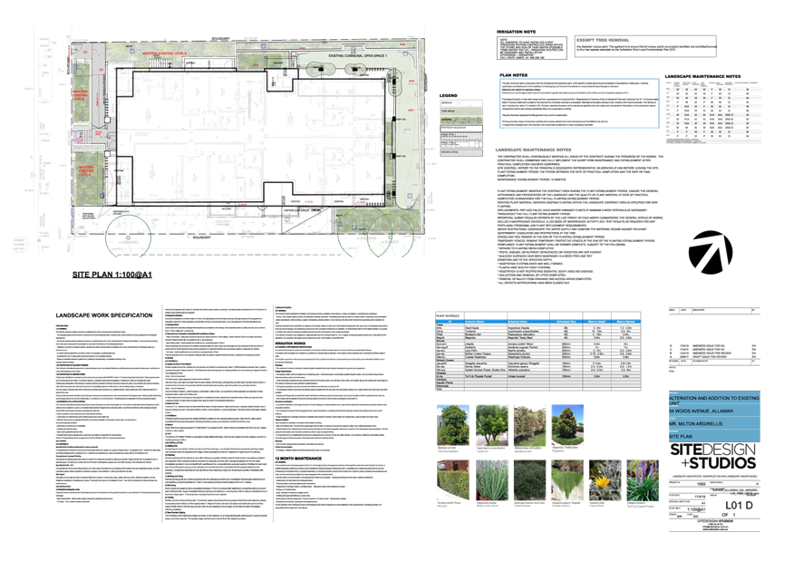
|
Georges River Council - Georges River Local Planning
Panel (LPP) - Friday, 5 October 2018
LPP046-18 54 Woids Avenue Allawah
[Appendix
2] South and
North Plan - 54 Woids Ave Allawah
|
Page 184
|
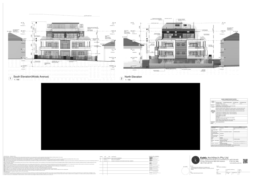
|
Georges River Council - Georges River Local Planning
Panel (LPP) - Friday, 5 October 2018
LPP046-18 54 Woids Avenue Allawah
[Appendix
3] East and West
Elevation Plan - 54 Woids Ave Allawah
|
Page 185
|
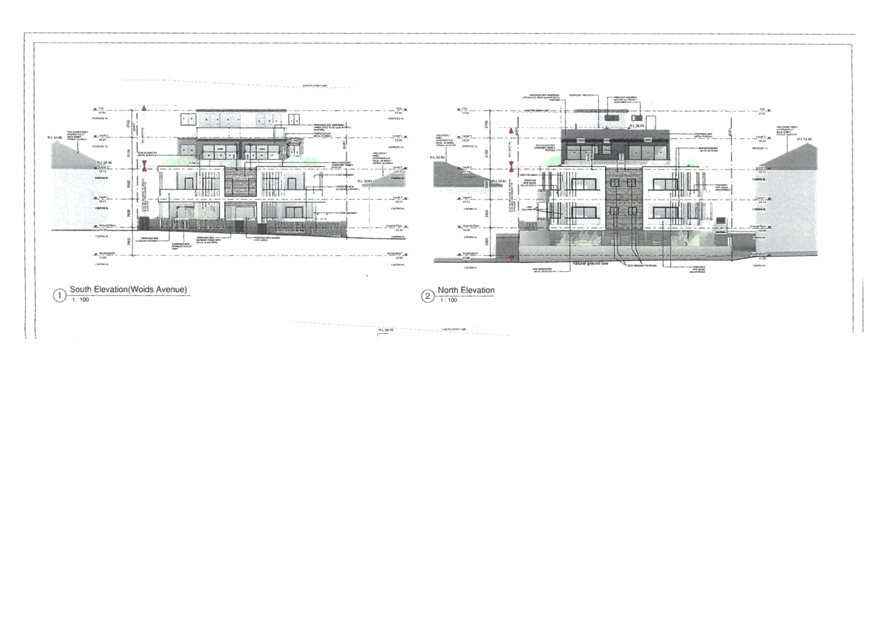
|
Georges River Council - Georges River Local Planning Panel
(LPP) - Friday, 5 October 2018
LPP046-18 54 Woids Avenue Allawah
[Appendix
4] Survey Plan -
54 Woids Ave Allawah
|
Page 186
|
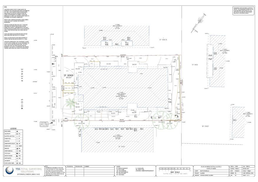
|
Georges River Council – Local Planning
Panel Friday, 5 October 2018
|
Page 187
|
REPORT TO GEORGES RIVER COUNCIL
LPP MEETING OF Friday, 05 October 2018
|
LPP Report No
|
LPP047-18
|
Development Application No
|
DA2018/0132
|
|
Site Address & Ward Locality
|
470 Railway Parade Allawah
Kogarah Bay Ward
|
|
Proposed Development
|
Alterations to Allawah Hotel -
Demolition and reconstruction of the single storey building of the Hotel to
contain an outdoor gaming area, bar and back of house facilities
|
|
Owners
|
Allawah Hotel Fund Pty Ltd
|
|
Applicant
|
White and Partners Investments Pty
Ltd
|
|
Planner/Architect
|
Design Collaborative Pty Ltd
|
|
Date Of Lodgement
|
12/04/2018
|
|
Submissions
|
No submissions received
|
|
Cost of Works
|
$748,000
|
|
Local Planning Panel Criteria
|
Sensitive Development; licenced
premises
|
|
List of all relevant s.4.15
matters (formerly s79C(1)(a))
|
Greater Metropolitan Regional
Environmental Plan No 2 - Georges River Catchemnt,
State Environmental Planning Policy
No 55 - Remediation of Land, State Environmental Planning Policy (Vegetation
in Non-Rural Areas) 2017,
Kogarah Local Environmental Plan
2012, Kogarah Development Control Plan 2013
|
|
List all documents submitted
with this report for the Panel’s consideration
|
Architectual Plans
|
|
Report prepared by
|
Development Assessment Officer
|
|
Recommendation
|
THAT the application be approved subject to conditions
included in the report
|
|
|
Summary of matters for
consideration under Section 4.15
Have all recommendations in relation
to relevant s4.15 matters been summarised in the Executive Summary of the
assessment report?
|
Yes
|
|
Legislative clauses requiring
consent authority satisfaction
Have relevant clauses in all
applicable environmental planning instruments where the consent authority
must be satisfied about a particular matter been listed, and relevant
recommendations summarised, in the Executive Summary of the assessment
report?
|
Yes
|
|
Clause 4.6 Exceptions to
development standards
If a written request for a
contravention to a development standard (clause 4.6 of the LEP) has been
received, has it been attached to the assessment report?
|
Not
Applicable
|
|
Special Infrastructure
Contributions
Does the DA require Special
Infrastructure Contributions conditions (under s7.24)?
|
Not
Applicable
|
|
Conditions
Have draft conditions been provided
to the applicant for comment?
|
No,
standard conditions have been attached with no design changes
|
|
Site Plan
< 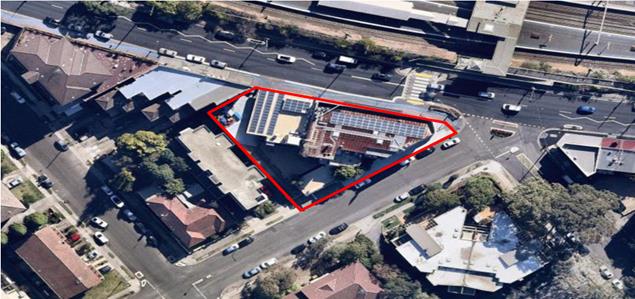
|
Executive Summary
Proposal
1. Development
consent is sought for the alterations and additions to the existing Allawah
Hotel.
More specifically,
the existing single story building on the western side of the hotel that
contains the gaming area, bottle shop and back of house facilities is to be
demolished and replaced with a new outdoor gaming area, two entry points,
sanitary facilities, bar, cold room and food preparation area. In addition to
this, works are proposed to the existing main building including installation
of a new freezer, upgrading the sanitary provisions and demolishing existing
bar and partition wall within the TAB area.
Site and
Locality
2. The
site is identified as 470 Railway Parade, Allawah and consists of two (2)
individual lots with a legal description of Lots 263 and 264 of Deposited Plan
7182. The site is a triangular shaped parcel of land located on the southern
side of Railway Parade and directly opposite Allawah train station.
The Hotel (Item
No. I1) is listed as a heritage item of local significance under Schedule 5
Environmental heritage of the LEP.
The site has an
area of 664sqm with primary frontage to Railway Parade and secondary frontage
to Mona Street. Vehicular and pedestrian access is via Railway Parade.
The surrounding
area is predominantly residential with the exception of the local shopping
strip along Railway Parade comprising of shop top housing and single storey
commercial buildings. Residential buildings in Allawah range from single
dwellings to three storey residential flat buildings.
Zoning and Compliance with LEP
Standards
3. The
site is zoned B2 – Local Centre under Kogarah Local Environmental Plan
2012 and the proposal is a permissible form of development with Council’s
consent. The proposed development satisfies all relevant objectives contained
within the LEP.
Development Control Plan
4. The proposed development generally satisfies the provisions of Kogarah
Development Control Plan 2013. This is discussed in more detail in the body of
this report.
Submissions
5. The
application was neighbour notified for a period of fourteen (14) days from 10
September to 24 September 2018, and no submissions were received as a result of
this process.
Referrals
6. The
internal and external referrals for this DA are supportive, subject to the
imposition of appropriate conditions of consent.
In particular, the
proposal was referred Council’s Heritage Advisor, who raises no objection
to the proposal, advising that “the character, scale, form, and detailing
of the proposed single-storey addition is considered to be acceptable”,
and also that the “proposed internal alterations will have little impact
on heritage values and are acceptable”.
Level of
Determination
7. The
application is referred to the Local Planning Panel for determination as the
development is identified as ‘Sensitive Development’ associated
with the expansion of a licenced premises which will require an amended / new
liquor licence for the additional floor area.
Conclusion
8. Having
regard to the Heads of Consideration under Part 4.15 of the Environmental
Planning and Assessment Act 1979, Development Application No.2018/0132 is
recommended for approval subject to suitable conditions.
Report in Full
Description of proposal
9. Development
consent is sought for alterations and additions to an established venue,
Allawah Hotel, that serves food and drinks and features a gaming room. No
operational changes such as capacity or hours of operation are proposed as part
of the Application.
In this regard,
according to past approvals issued by Council and the Liquor Licence issued by
the NSW Office of Liquor Gaming and Racing, the hours of operation of
the hotel are currently as follows:
· DA 88/96 approved by Kogarah Council on 13 June 1996
permits the Hotel to trade between 7am and 3am Monday to Saturday, and between
10am and midnight Sunday.
· DA 76/2011 approved by Kogarah Council on 8 April 2013
permits the Hotel to use part of first floor as function rooms. The first floor
has a capacity of 160 persons with operating hours between 7am and 12 midnight
Monday to Saturday, and between 10am and 12 midnight Sunday.
· The Liquor Licence
LIQH400100108 permits the Hotel to trade between 7am and 3am Monday to
Saturday, and between 10am and 12 midnight Sunday.
The proposed alterations and additions to the building are to demolish
and remove the single storey structure located on the western side of the
original building that currently accommodates the gaming area and bottle shop
and to construct in its place a reconfigured gaming area, toilets, food
preparation area and new entry. Some proposed alterations are within the original
building, including the reconfiguration of the female toilets and freezer room
adjacent to the kitchen.
The number of gaming machines will increase by five (5) bringing the
total to thirty (30). In this regard, the applicant has been contacted in relation
to the concerns regarding potential increase in the number of poker (gaming)
machines. It is confirmed under legislation, that Hotels of this type are
restricted to a maximum thirty (30) gaming machines. The maximum of thirty (30)
will not exceed the maximum number permitted for this type of hotel.
History
10.
12
Apr 18 The
subject DA was submitted with Council.
12
Apr 18 Following
an initial assessment of the application, the applicant was asked to provide
additional plans indicating the kitchen and bar area and existing/proposed site
plan. The applicant has submitted the amended plans.
10
- 24 Sep 18 The
application was placed on neighbour notification in accordance with KDCP 2013.
No submissions were received.
Description of the Site and
Locality
11. The
site is identified as 470 Railway Parade, Allawah and consists of two (2)
individual lots with a legal description of Lots 263 and 264 of Deposited Plan
7182. The site is a triangular shaped parcel of land and is location on the
southern side of Railway Parade and directly opposite Allawah train station.
The site has an
area of 664sqm with primary frontage to Railway Parade and secondary frontage
to Mona Street. Vehicular and pedestrian access is via Railway Parade.
The site comprises
a part 2-3 storey hotel with an outdoor courtyard and a three (3) car garage.
The ground floor contains a bar, bistro, bottle shop, gaming area and
amenities. The first floor contains lounge areas.
The surrounding
area is predominantly residential with the exception of the local shopping
strip along Railway Parade comprising of shop top housing and single storey
commercial buildings. Residential buildings in Allawah range from single
dwellings to three storey residential buildings.
The nearest residential properties are the three storey residential
building at 3 Mona Street, adjacent to the rear of the Hotel, and shop top
housing located at 472 Railway Parade.
The following are a selection of photos of the hotel and its surrounds.
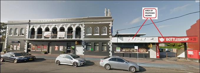
Subject site – Allawah Hotel, viewed from Railway Parade (from the
north/front). Source: nearmap.com.au
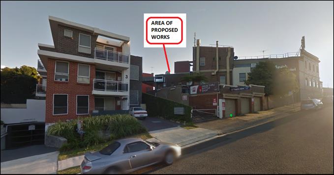
Subject site – Allawah Hotel, viewed from Mona Street (from the
south/rear), with adjoining residential flat development shown to the
south-west. Source: nearmap.com.au
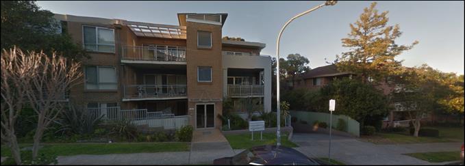
Residential flat developments in Mona Street (opposite/to the south of
the Hotel). Source: nearmap.com.au
Zoning
12.
The site is zoned B2 – Local Centre zone
under Kogarah Local Environmental Plan 2012 and is defined as a
‘pub’ which is a permissible form of development with
Council’s consent as shown on the zoning map below.
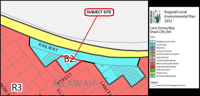
Excerpt from
Zoning Map. Source” Kogarah LEP 2012 Zoning Map.
Applicable Planning Controls
§ Greater Metropolitan Regional
Environmental Plan No 2 – Georges River Catchment
§ State Environmental Planning Policy
No 55 - Remediation of Land
§ Kogarah Local Environmental Plan
2012
§ Kogarah
Development Control Plan 2013
PLANNING
ASSESSMENT
13. The
site has been inspected and the proposed development has been assessed under
the relevant Section 4.15(1) "Matters for Consideration" of the
Environmental Planning and Assessment Act 1979.
Environmental Planning
Instruments
Kogarah Local
Environmental Plan 2012
14. The
extent to which the proposed development complies with the Kogarah Local
Environmental Plan 2012 (KLEP 2012) is detailed and discussed in the table
below.
|
Clause
|
Standard
|
Proposed
|
Complies
|
|
1.2 – Aims of the Plan
|
In accordance with Clause 1.2(2)
|
The development is consistent with
the aims of the plan.
|
Yes
|
|
1.4 – Definitions
|
Pub
|
The proposed development is
consistent with the definition of a “Pub”
|
Yes
|
|
2.7 – Demolition
|
Permissible subject to development
consent
|
Consent for demolition works is
consistent with the works.
|
Yes
|
|
2.3 – Zone objectives and
Land Use Table
|
B2 – Local Centre
Development must be permissible
with consent
|
The pub satisfies the objectives of
the B2 zone
|
Yes
|
|
4.3 – Height of Buildings
|
21m as identified on Height of
Buildings Map
|
The proposed works do not alter the
existing building height.
|
Yes
|
|
4.4 – Floor Space Ratio
|
2.5:1
|
No change to the gross floor area
|
Yes
|
|
5.10 – Heritage Conservation
|
The objectives of this clause are;
(i) to conserve the environmental
heritage of Kogarah,
(ii) to conserve the heritage
significance of heritage items and heritage conservation areas, including
associated fabric, settings and views.
|
The site is a local heritage item
(I1) – Allawah Hotel. The proposed alterations and additions are
sympathetic to the style and character of the existing hotel. The proposed
works do not have any impact on the heritage item or its significance. NOTE:
Refer to the Heritage Advisor’s comments as indicated in the Referrals
section of this report.
|
Yes
|
|
6.2 – Earthworks
|
To ensure that earthworks do not
have a detrimental impact on environmental functions and processes,
neighbouring uses, cultural or heritage items or features of the surrounding
land.
|
The application does not
necessitate the need for any significant excavation works to take place.
|
Yes
|
5.10 Heritage
Conservation
15. Clause
5.10 of KLEP 2012 required that:
‘The
consent authority must, before granting consent under this clause in respect of
a heritage item or heritage conservation area, consider the effect of the
proposed development on the heritage significance of the item or area
concerned.’
In support of the
application, a Statement of Heritage Impact (SOHI) by Russell C,
Lee (Architect and Heritage consultant) has been provided. The SOHI reaches the
following conclusions:
· The
Allawah Hotel was constructed in 1927 and received approval on 30/7/1928 from
the Metropolitan District Licensing Court to trade a hotel. The building is
listed as a heritage item in Schedule 5 of the Kogarah LEP 2012.
· The
building reflects the European development of the southern suburbs of Sydney
that occurred in the early 1900’s. Its significance comes primarily from
its position within the surrounding commercial and residential streetscapes of
Allawah.
· Following
the visual and physical assessment of the proposed building works at the hotel,
it is submitted that the building’s importance within the context of the
local community and surrounding area will be maintained.
· The
impact of the internal works on the existing internal spatial qualities of the
building, that are associated with its heritage significance, are minimal. The
recording of existing building elements that are to be changed allows the
possible future reversal of the proposed new building works.
· In
essence, both the original building’s scale and form will be maintained,
as has the significance of the heritage listed item. The proposed works do not
diminish the visual or spatial qualities of the building within its own context
or within the surrounding streetscape and they do improve the facilities
available to the Hotel patrons and the general public.
The conclusions
made by the SOHI are concurred with. The demolition, alterations and additions
to the pub are located at ground floor level, with the existing single story
component not being original. The existing building to be demolished was
constructed in the 1970s and its form, construction and fabric does not
contribute to the significance of the heritage item.
The proposal is
sympathetic to the original main building and will maintain the buildings
importance and value within the local community and improve the amenities
provided to visitors.
Council’s Heritage Advisor has
considered the proposal and raised no objection, as indicated in the Referrals
section of this report below.
State Environmental Planning Policies
16. Compliance
with the relevant state environmental planning policies is detailed below.
|
State
Environmental Planning Policy
|
Complies
|
|
Greater
Metropolitan Regional Environmental Plan No 2 – Georges River Catchment
|
Yes
|
|
State
Environmental Planning Policy No 55 – Remediation of Land
|
Yes
|
Deemed State Environmental Planning Policy – Georges River
Catchment
17. All stormwater from the
proposed development will be managed by the existing system and will be treated in accordance with Council’s Water Management Policy
and would satisfy the relevant provisions of the Deemed State Environmental
Planning Policy – Georges River Catchment.
State
Environmental Planning Policy No 55 – Remediation of Land
18. The
purpose of State Environmental Planning Policy No 55 – Remediation of
Land (SEPP 55) is to ensure that land which is contaminated is identified and
appropriately remediated so as to be suitable for the proposed development.
The site has long standing use as a hotel (pub) and there are no known
records of contaminating activity being conducted on the site. In view of the
above and having regard to the provisions of SEPP No 55, the site is considered
suitable for the proposed development.
Draft
Environmental Planning Instruments
Draft
Environment SEPP
19. The
Draft Environment SEPP was exhibited from 31 October 2017 to 31 January 2018.
This consolidated SEPP proposes to simplify the
planning rules for a number of water catchments, waterways, urban bushland, and
Willandra Lakes World Heritage Property.
Changes
proposed include consolidating the following seven existing SEPPs:
· State
Environmental Planning Policy No. 19 – Bushland in Urban Areas
· State
Environmental Planning Policy (Sydney Drinking Water Catchment) 2011
· State
Environmental Planning Policy No. 50 – Canal Estate Development
· Greater
Metropolitan Regional Environmental Plan No. 2 – Georges River Catchment
· Sydney
Regional Environmental Plan No. 20 – Hawkesbury-Nepean River (No.2-1997)
· Sydney
Regional Environmental Plan (Sydney Harbour Catchment) 2005
· Willandra
Lakes Regional Environmental Plan No. 1 – World Heritage Property.
The proposal is
not inconsistent with the provisions of this Draft Instrument.
Development
Control Plans
20. The
proposal has been assessed under the relevant sections of the Kogarah
Development Control Plan 2013 (KDCP 2013).
|
Part B General Controls
|
|
Controls
|
Required
|
Proposed
|
Comply
|
|
Part B1 – Heritage and
Heritage Conservation Areas
|
The relevant
requirements of Clause 5.10 of KLEP 2012 are to be addressed for any
development relating to a heritage item.
Where a heritage
management document and/or heritage conservation management plan is required
to be submitted to Council, this is to be prepared by an appropriately
qualified professional.
|
See comments of
KLEP 2012 compliance table above
|
Yes
Yes
|
|
Part B4 – Parking and Traffic
|
Development Type not listed in
Table 1 – base parking requirements on RMS Guide to Traffic Generating
Development.
|
The RMS Guide to Traffic Generating
Developments recommends that “proposed developments be compared to
similar developments, noting the existing supply and demand for parking in
the area.
As the gross floor area of the pub
is to remain the same, no additional parking is required to be provided.
|
Yes
|
|
Part B5 – Waste Management
and Minimisation
|
Submit a Waste
Management Plan with DAs involving:
· demolition;
· construction of a new building(s); or
· change of use or alterations/additions to existing premises (only
when this would result in a change of waste generation).
|
This will be conditioned as part of
the consent.
|
Yes
|
|
Part B6 – Water management
|
All developments
requiring Council approval within the City of Kogarah require consideration
of the Water Management Policy.
|
The proposed
development involves no increase in impervious areas. Stormwater will
be connected to the existing drainage system.
|
Yes
|
|
Part D – Commercial and
Industrial
|
|
D1 – 3.1 Streetscape
|
Ensure
development is compatible with the scale, character and
landscape setting of development in
its immediate vicinity
|
The Application complies with the
controls in that the reconstruction of the single storey building will have
consistent colour and finishing that compliments the original building and is
compatible with the immediate vicinity. Furthermore, the new recessed
entrance between the buildings will provide a visual break between the
original and new sections of the Hotel.
|
Yes
|
|
D1 – 3.3 Heritage and
Significant Facades – commercial precincts
|
Protect and
enhance significant facades and shopfronts to continue to provide richness
and interest to the character of commercial localities.
|
The existing building to be
demolished is not original and was a 1970s extension. The proposed single
storey building is contemporary in nature and does not detract from the main
heritage building. In summary, the heritage impacts of the development are
found to be minimal and the development is supported.
Has been reviewed by
Council’s Heritage Officer and considered satisfactory.
|
Yes
|
|
D1 – 3.4 Height
|
Retain the
visual prominence of heritage items and significant building facades and the
prevailing street wall height Increase adaptability of buildings to new uses.
Floor to ceiling heights should be a minimum of 3.2m at ground floor level in
accordance with D2 – locality controls.
|
The building will provide an
appropriate street wall height and floor to ceiling height of 3.2m and
achieve a consistent built edge.
|
Yes
Yes
|
|
D1 – 3.5 Setbacks
|
Buildings
adjacent to public roads are generally to align with and be
built to the
street frontage to provide continuity in the streetscape and
encourage
active frontages to ground level. Rear setbacks are determined by the context
including the amenity of
neighbouring
residential uses and the amenity of any rear lanes.
|
The new building does not propose
to increase the footprint. It will retain a minimum side setback of 6m and
rear setback of 8m to the residential properties which will ensure amenity is
protected. The front setback will align with the main building.
|
Yes
|
|
D1 – 3.6.5 Material and
finishes
|
Incorporate
quality materials and finishes into new and existing
buildings to
achieve pleasant and coherent streetscapes.
|
The proposed
finishes and materials will match the existing main building and will be contemporary
in design.
|
Yes
|
|
D1- 3.66 Mobility and access
|
New development
and refurbishments are to comply with the requirements of the BCA and
Australian Standards.
|
A BCA Report submitted as part of
the application indicates compliance.
|
Yes
|
|
3.7 – Vehicular Access and
Parking
|
Provide on-site
parking for commercial users, residents and visitors. Where parking
requirements are not stated, reference should be
made to the RTA’s Guide to
Traffic Generating Developments.
|
As the gross floor area of the pub
is to remain the same, no additional parking is required to be provided.
|
Yes
|
|
D1 – 3.12.1 Visual and
Acoustic Privacy
|
Utilise the site and building
layout to maximise the potential for acoustic privacy by providing adequate
building separation within the development and neighbouring properties.
|
An Acoustic Report has been
prepared and acoustic recommendations are incorporated into the Plan of
Management to mitigate any potential adverse impact to the surrounding
sensitive land uses as a consequence of the Application. The measures include
signage to remind patrons to reduce noise, external doors along western
façade to be closed after midnight and maintain a complaining
register.
Has been reviewed by
Council’s Health Unit and considered satisfactory.
|
Yes
|
|
D1 – 3.12.2 Safety and
Security
|
Buildings are
to be designed to maximise passive surveillance and
contribute to active streets.
|
The building is orientated towards
the street with sufficient lighting provided along the footpath.
|
Yes
|
Section 7.12
Contributions
21. The
proposed development requires the payment of Section 7.12 (previously Section
94A) contributions under the provisions of Council’s document titled
“Section 94A Contributions Plan 2017”. Contributions under Section
7.12 of the Environmental Planning and Assessment Act 1979 are applicable based
on the estimated cost of development which in this instance is 1% for $200,001
or more. Section 7.12 contributions for this development equate to $7,480 based
on the estimated cost of development of $748,000 as indicated on the
applicant’s DA form.
Impacts
Natural
and Built Environment, Social and Economic Impacts
22. The
proposed development is of a scale and character that is in keeping with the
locality, streetscape and the developments likely to be constructed within the
immediate context and zoning. The proposed development would revitalise the
existing pub which is considered to have a positive economic impact on the
locality.
The built form of
the development is acceptable. Although the proposal results in modifications
to the existing heritage building, as discussed earlier in this report the
changes would not unreasonably impact the heritage significance of the
property. The heritage item would also remain unaffected by the proposal.
An acoustic report
has been submitted with the application to demonstrate that the proposed works
will not result in any significant acoustic impacts on the neighbouring
properties.
Given the above,
the development would not have any significant impact.
Suitability of
the site
23. It
is considered that the proposed development is of a scale and design that is
suitable for the site having regard to its size and shape, its topography and
relationship to adjoining developments.
SUBMISSIONS AND
THE PUBLIC INTEREST
24. In
accordance with the provisions of Council’s notification requirements,
the application was placed on neighbour notification for a period of fourteen
(14) days in accordance with the DCP where adjoining property owners were
notified in writing of the proposal and invited to comment. No submissions were
received as a result of the notification process.
Referrals
25.
Council
Referrals
Environmental
Health
No objections were
raised subject to conditions.
Heritage
The following
comments were provided from Council’s Heritage Advisor:
I have
reviewed the document forwarded and provide the following comment from a heritage
point of view:
HERITAGE
SIGNIFICANCE:-
The subject
site is a heritage item in schedule 5 of Kogarah Local Environmental Plan 2012.
The place is of Local significance. The Office of Environment & Heritage
State Heritage Inventory statement of significance is as follows:
Riks Bar and
Bistro is historically significant as it represents the grand development that
occurred c1920 with the consolidation of the commercial centres (Allawah) as
the residential sector expanded.
The place is
also of aesthetic value as a good example of an Inter-War Period hotel which
displays fine Georgian Revival stylistic influence. It is also a local
landmark.
The painting
of the original face brick has diminished its aesthetic values.
PROPOSED
DEVELOPMENT:-
The proposed
development includes demolition of a non-original addition and the construction
of a single-storey addition; and relatively minor internal alterations to the
basement and ground floor.
COMMENT:
1) There
is no objection to the proposed demolition of the non-original addition which
is considered to be an intrusive element.
2) The
character, scale, form, and detailing of the proposed single-storey addition is
considered to be acceptable.
3) The
proposed external colour scheme compliments the existing colour scheme.
4) The
proposed internal alterations will have little impact on heritage values and
are acceptable.
CONCLUSIONS
& RECOMMENDATIONS:
Overall the
proposed development is considered acceptable.
There are no
heritage-related conditions.
Building
Council’s
Building Officer raised no objection to the proposed development subject to the
imposition of conditions
External
Referrals
NSW Police
The application
was referred to the Crime Prevention Officer at Hurstville Police Station on 5
September 2018. The NSW Police have raised no objection to the proposal.
CONCLUSION
26. Development
consent is sought for alterations and additions to the existing Allawah Hotel,
involving the demolishing and reconstruction of the single storey building that
contains the gaming room, and other miscellaneous modifications within the
Hotel. No operational changes such as capacity or hours of operation are
proposed as part of the Application.
The application
has been assessed having regard to the Heads of Consideration under Section
4.15 of the Environmental Planning and Assessment Act 1979, the provisions of
the relative State Environmental Planning Policies, Local Environmental Plans
and Development Control Plans. The proposed development fully complies with
those requirements and does not cause any unreasonable impacts upon
neighbouring properties and/or the streetscape.
The application
was notified in accordance with the Development Control Plan with no
submissions received.
The application is
recommended for approval.
DETERMINATION
AND STATEMENT OF REASONS
27.
Statement of
Reasons
· The proposed
development is considered to be an appropriate scale and form for the site and
the character of the locality.
· The proposed
development, subject to the recommended conditions, will have no unacceptable
adverse impacts upon the local heritage item.
· In consideration
of the aforementioned reasons, the proposed development is a suitable and planned
use of the site and its approval is in the public interest.
Determination
28. THAT
pursuant to Section 4.16(1) of the Environmental Planning and Assessment Act
1979, as amended, the Council grants development consent to Development
Application DA2018/0132 for the alterations and additions to the existing
development at 470 Railway Parade, Allawah also identified as Allawah Hotel,
subject to the conditions below:
Section A Development Details
1. Approved
Plans - The development must be implemented in accordance with the approved
plans and supporting documentation listed below which have been endorsed by
Council’s approved stamp, except where marked up on the plans and/or
amended by conditions of this consent:
|
Description
|
Reference No.
|
Date
|
Revision
|
Prepared by
|
|
Proposed Elevations
|
DA-500
|
Nov 2017
|
A
|
Bergstrom Architects
|
|
Existing and Demo Ground Floor Plan
|
DA-011
|
Nov 2017
|
A
|
Bergstrom Architects
|
|
Existing conditions basement floor
plan
|
DA-010
|
Nov 2017
|
A
|
Bergstrom Architects
|
|
Existing demo and proposed first
floor plan
|
DA-102
|
Nov 2017
|
A
|
Bergstrom Architects
|
|
Ground Floor Plan
|
DA-101
|
Nov 2017
|
A
|
Bergstrom Architects
|
|
Proposed Sections
|
DA-510
|
Nov 2017
|
A
|
Bergstrom Architects
|
|
Preparation area and bar equipment
layout
|
AH SK01
|
18.04.18
|
00
|
Cini Little foodservice consultants
|
|
Preparation area and bar section
|
AH SK02
|
18.04.18
|
00
|
Cini Little foodservice consultants
|
|
Schedule of Colour and Finishes
|
DA-501
|
Nov 2017
|
A
|
Bergstrom Architects
|
|
Site analysis
|
DA-000
|
Nov 2017
|
B
|
Bergstrom Architects
|
|
Plan of Management
|
|
April 2018
|
|
JDA Hotels
|
Section B Separate Approvals Required Under
Other Legislation
2. Signage
- A separate application shall be submitted to Council prior to the
erection of any [additional] signage unless the proposed signage is
‘exempt development’ under State Environmental Planning Policy
(Exempt and Complying Development Codes) 2008 or any other applicable
environmental planning instrument.
3. Liquor
Hotel Licence –The Liquor Licence (Licence Number: LIQH400100108) is
to be reviewed in light of this approval and any proposed changes are to be
referred to Council and The Independent Liquor & Gaming Authority for
comment and/or amendment to licence (if/as required).
4. Section
138 Roads Act 1993 and Section 68 Local Government Act 1993 - Unless
otherwise specified by a condition of this consent, this Development Consent
does not give any approval to undertake works on public infrastructure.
Separate approval
is required under Section 138 of the Roads Act 1993 and/or Section 68 of the Local Government Act 1993 for any
of the following activities carried out in, on or over a public road (including
the footpath) listed below.
An application is
required to be lodged and approved prior to the commencement of any of the
following works or activities;
(a) Placing or storing materials or equipment;
(b) Placing or storing waste containers or skip
bins;
(c) Erecting a structure or carrying out
work
(d) Swinging or hoisting goods over any part of a
public road by means of a lift, crane or the like;
(e) Pumping concrete from a public road;
(f) Pumping water from the site into
the public road;
(g) Constructing a vehicular crossing or footpath;
(h) Establishing a “works zone”;
(i) Digging up or disturbing the surface
of a public road (e.g. Opening the road for the purpose of connections to
utility providers);
(j) Stormwater & ancillary works
in the road reserve; and
(k) Stormwater & ancillary to public
infrastructure on private land
(l) If any excavation is to be
supported by the use of below ground (cable) anchors that are constructed under
Council’s roadways/footways.
These separate
activity approvals must be obtained and evidence of the approval provided to
the Certifying Authority prior to the issue of the Construction Certificate.
The relevant
Application Forms for these activities can be downloaded from Council’s
website www.georgesriver.nsw.gov.au.
For further information, please contact Council’s Customer Service Centre
on (02) 9330 6222.
Section C Requirements of
Concurrence, Integrated & Other Government Authorities
5. Sydney
Water – Tap in TM - The approved plans must be
submitted to a Sydney Water Tap inTM to determine whether the
development application will affect Sydney Water’s sewer and water mains,
stormwater drains and/or easements, and if further requirements need to be
met. The approved plans will be appropriately endorsed. For details
please refer to ‘Plumbing, building and developing’ section of
Sydney Water’s web site at www.sydneywater.com.au then see
‘Building’, or telephone 13000 TAP IN (1300 082 746). The
Certifying Authority must ensure that a Tap inTM agent has
appropriately stamped the plans prior to the issue of the Construction
Certificate.
Section D Prior to the Issue of a
Construction Certificate
6. Fees
to be paid - The fees listed in the table below must be paid in
accordance with the conditions of this consent and Council’s adopted Fees
and Charges applicable at the time of payment (available at www.georgesriver.nsw.gov.au).
Payments must be made prior to the issue of the Construction Certificate
or prior to the commencement of work (if there is no associated Construction
Certificate).
Please contact council prior to the payment of S94 Contributions to
determine whether the amounts have been indexed from that indicated below in
this consent and the form of payment that will be accepted by Council.
Council will only accept Bank Cheque or Electronic Funds Transfer (EFT)
for transaction values of $500,000 or over. Council must be contacted prior to
payment to determine correct total amount to be paid and bank account details
(if applicable).
A summary of the fees to be paid are listed below:
|
Fee Type
|
Fee
|
|
GENERAL FEES
|
|
Long Service Levy (to Long Service Corporation)
Or, provide evidence of Payment direct to the Long Service Corporation.
See https://portal.longservice.nsw.gov.au/bci/levy/
|
|
Builders Damage Deposit
|
$1900.00
|
|
Inspection Fee for Refund of Damage Deposit
|
$155.00
|
|
DEVELOPMENT CONTRIBUTIONS
|
|
Georges River
Council Section 94A Development Contributions Plan 2017
|
$ 7,480.00
|
General Fees
The fees and charges above are subject to change and are as set out in
the version of Council's Schedule of Fees and Charges or as required by other
Government Authorities, applicable at the time of payment.
Development Contributions
The Section 94 contribution is imposed to ensure that the development
makes adequate provision for the demand it generates for public amenities and
public services within the area.
A Section 94A contribution has been levied on the subject development
pursuant to the GRC Section 94A Contributions Plan.
Indexation
The above contributions will be adjusted at the time of payment to reflect
changes in the cost of delivering public amenities and public services, in
accordance with the indices provided by the relevant Section 94 Development
Contributions Plan.
Timing of Payment
The contribution must be paid and receipted by Council prior to the
release of the Construction Certificate.
Further Information
A copy of the all
current Development Contributions Plans may be inspected or a copy
purchased at Council’s offices (Civic Centre, MacMahon Street, Hurstville
and 2 Belgrave Street, Kogarah) or viewed on Council’s website www.georgesriver.nsw.gov.au
7. Damage
Deposit – Major Works - In order to insure against damage to Council property
the following is required:
Pay Council, before the issue of the Construction Certificate, a damage
deposit for the cost of making good any damage caused to any Council property
as a result of the development: $1,900.00
Pay Council, before the issue of the Construction Certificate, a
non-refundable inspection fee to enable assessment of any damage and repairs
where required: $155.00
Submit to Council, before the commencement of work, a dilapidation report
of the condition of the Council nature strip, footpath and driveway crossing,
or any area likely to be affected by the proposal.
At the completion of work Council will review the dilapidation report and
the Works-As-Executed Drawings (if applicable) and inspect the public works.
The damage deposit will be refunded in full upon completion of work where
no damage occurs and where Council is satisfied with the completion of works.
Alternatively, the damage deposit will be forfeited or partly refunded based on
the damage incurred.
8. Site
Management Plan - Major Development - A Site Management Plan must be
submitted with the application for a Construction Certificate, and include the
following:
(a) location of protective site fencing;
(b) location of site storage areas/sheds/equipment;
(c) location of building materials for
construction, e.g. stockpiles
(d) provisions for public safety;
(e) dust control measures;
(f) method used to provide site access location and
materials used;
(g) details of methods of disposal of demolition materials;
(h) method used to provide protective measures
for tree preservation;
(i) provisions for temporary sanitary facilities;
(j) location and size of waste containers/skip bins;
(k) details of proposed sediment and erosion
control measures;
(l) method used to provide construction noise and
vibration management;
(m) construction and demolition traffic management
details.
The site management measures are to be implemented prior to the
commencement of any works including demolition and excavation. The site management
measures are to be maintained throughout the works, to maintain reasonable
levels of public health, safety and amenity. A copy of the Site Management Plan
must be kept on site and is to be made available upon request.
9. Fire
Safety Measures - Prior to the issue of a construction certificate a list
of the essential fire safety measures that are to be provided in relation to
the land and any building on the land as a consequence of the building work
must accompany an application for a construction certificate, which is required
to be submitted to either Council or a PCA. Such list must also specify the
minimum standard of performance for each essential fire safety measure included
in the list. The Council or PCA will then issue a Fire Safety Schedule for the
building.
10. Traffic
Management - Compliance with AS2890 - All driveways, access ramps,
vehicular crossings and car parking spaces shall be designed and constructed in
accordance with the current version of Australian Standards, AS 2890.1 (for car
parking facilities) and AS 2890.2 (for commercial vehicle facilities).
11. Structural
details - Engineer's details prepared by a practising Structural Engineer
being used to construct all reinforced concrete work, structural beams, columns
& other structural members. The details are to be submitted to the
Principal Certifying Authority for approval prior to construction of the
specified works.
A copy shall be forwarded to Council where Council is not the PCA.
12. Access
for Persons with a Disability - Access and sanitary facilities for persons
with disabilities must be provided to the premises/building in accordance with
the requirements of the Premises Standards, the Building Code of Australia, and
AS 1428.1. Details must be submitted with the Construction Certificate
Application for approval.
13. Commonwealth
Disability (Access to Premises) Standard - The Commonwealth Disability
(Access to Premises - Buildings) Standards 2010 (the Premises Standards)
applies to all applications (i.e. Construction Certificate). This requires any
new building, part of a building and the affected part of the existing building
to comply with the Premises Standards, the Building Code of Australia and AS
1428.
14. Traffic
Management - Compliance with AS2890 - All driveways, access ramps,
vehicular crossings and car parking spaces shall be designed and constructed in
accordance with the current version of Australian Standards, AS 2890.1 (for car
parking facilities) and AS 2890.2 (for commercial vehicle facilities).
15. Construction
Traffic Management Plan - A Construction Traffic Management Plan detailing:
(a) Construction vehicle routes;
(b) Anticipated number of trucks per day;
(c) Hours of construction;
(d) Access arrangements; and
(e) Proposed traffic measures to minimise
impacts of construction vehicles must be submitted for the approval of
Council’s Engineers. Council’s Engineers must specify in writing
that they are satisfied with the Traffic Management Plan prior to the issue of
the Construction Certificate.
16. Waste
Management Plan - A Waste Management Plan incorporating all requirements in
respect of the provision of waste storage facilities, removal of all materials
from the site that are the result of site clearing, extraction, and, or
demolition works and the designated Waste Management Facility shall be
submitted to the Certifying Authority prior to the issue of any Construction
Certificate.
17. Acoustic
Requirements - Compliance with submitted Acoustic Report - The Construction
Certificate plans shall demonstrate compliance with the Acoustic Report submitted
and approved by Council, titled The Environmental Noise Impact Assessment
prepared by Acoustic Logic dated 5/4/2018
18. Food
Premises - The following information shall be provided and shown on the Construction
Certificate plans.
(a) Plans
and Specifications
Details of the
construction and fit out of the alterations and additions to the food premises
must be submitted to Council’s Environmental Health Officer. The plans
and specifications must demonstrate compliance with the:
i. Food Act 2003 (as amended)
ii. Food Regulation 2015 (as amended)
iii. Food Standards Code as published by
Food Standards Australia
iv. New Zealand and Australian Standard
AS4674:2004 Design, Construction and fit out of food premises (as amended)
v. Sydney Water – trade Waste
Section.
Environmental
Health Officers must advise in writing that the plans and specification are
considered satisfactory prior to the issue of any Construction Certificate
Section E Prior to the
Commencement of Work (Including Demolition & Excavation)
19. Demolition
& Asbestos - The demolition work shall comply with the provisions of
Australian Standard AS2601:2001 - Demolition of Structures, NSW Work Health
& Safety Act 2011 and the NSW Work Health & Safety Regulation
2011. The work plans required by AS2601:2001 shall be accompanied by a
written statement by a suitably qualified person that the proposals contained
in the work plan comply with the safety requirements of the Standard. The work
plans and the safety statement shall be submitted to the PCA prior to the
commencement of works.
For demolition work which involves the removal of asbestos, the asbestos
removal work must be carried out by a licensed asbestos removalist who is
licensed to carry out the work in accordance with the NSW Work Health &
Safety Act 2011 and the NSW Work Health & Safety Regulation 2011 unless
specified in the Act and/or Regulation that a license is not required.
All demolition work including the removal of asbestos, shall be
undertaken in accordance with the Demolition Code of Practice (NSW Work Cover
July 2015).
Note: Copies of the Act, Regulation and Code of Practice can be
downloaded free of charge from the SafeWork NSW website:
www.SafeWork.nsw.gov.au.
20. Demolition
Notification Requirements - The following notification requirements apply
to this consent:
(a) The developer /builder must notify adjoining residents
five (5) working days prior to demolition. Such notification is to be a
clearly written note giving the date demolition will commence, contact details
of the developer/builder, licensed asbestos demolisher and the appropriate
regulatory authority. Notification is to be placed in the letterbox of every
premises (including every residential flat or unit, if any) either side and
immediately at the rear of the demolition site.
(b) Five (5) working days prior to demolition, the
developer/builder is to provide written notification to Council advising of the
demolition date, details of the SafeWork licensed asbestos demolisher and the
list of residents advised of the demolition.
(c) On demolition sites where buildings to be
demolished contain asbestos, a standard commercially manufactured sign
containing the words “DANGER ASBESTOS REMOVAL IN PROGRESS”
measuring not less than 400mm x 300mm is to be erected in a prominent visible
position (from street frontage) on the site. The sign is to be erected prior to
demolition work commencing and is to remain in place until such time as all
asbestos material has been removed from the site to an approved waste facility.
21. Demolition
work involving asbestos removal - Work involving bonded asbestos removal
work (of an area of more than 10 square metres) or friable asbestos removal
work must be undertaken by a person who carries on a business of such removal
work in accordance with a licence under clause 458 of the Work Health and
Safety Regulation 2011.
22. Dial
before your dig - The applicant shall contact “Dial Before You Dig on
1100” to obtain a Service Diagram prior to the issuing of the
Construction Certificate. The sequence number obtained from “Dial
Before You Dig” shall be forwarded to Council’s Engineers for their
records.
23. Utility
Arrangements - Arrangements are to be made with utility authorities in
respect to the services supplied by those authorities to the development. The
cost associated with the provision or adjustment of services within the road
and footway areas is to be at the applicant’s expense.
Section F During
Construction
24. Site
sign – Soil & Erosion Control Measures - Prior to the commencement
of works (including demolition and excavation), a durable site sign, issued by
Council in conjunction with this consent, must be erected in a prominent
location on site. The site sign warns of the penalties which apply to
pollution, storing materials on road or footpath and breaches of the conditions
relating to erosion and sediment controls. The sign must remain in a prominent
location on site up until the completion of all site and building works.
25. Hours
of construction for demolition and building work - Any work activity or
activity associated with the development consent that requires the use of any
tools (including hand tools) or any power operated plant and machinery that
creates noise on or adjacent to the site shall not be performed, or permitted
to be performed, except between the hours of 7.00 am to 5.00 pm, Monday to
Saturday inclusive. No work or ancillary activity is permitted on Sundays, or
Public Holidays.
Note: A penalty infringement notice may be issued for any offence.
26. Cost
of work to be borne by the applicant - The applicant shall bear the cost of
all works associated with the construction of the development that occurs on
Council property. Care must be taken to protect Council's roads,
including the made footway, kerbs, etc., and, where plant and vehicles enter
the site, the footway shall be protected against damage by deep-sectioned
timber members laid crosswise, held together by hoop iron straps and chamfered
at their ends. This construction shall be maintained in a state of good
repair and condition throughout the course of construction.
27. Ground
levels and retaining walls - The ground levels of the site shall not be
excavated, raised or filled, or retaining walls constructed on the allotment
boundary, except where indicated on approved plans or approved by Council.
28. Physical
connection of Stormwater to site - No work is permitted to proceed above
the ground floor slab level of the building until there is physical connection
of the approved stormwater drainage system from the land the subject of this
consent to Council's drainage system.
29. Utility
Services - The applicant shall undertake and bear all costs associated with
the liaison, approval and relocation of any utility services. All
correspondence and approvals between the Applicant and utility authorities
shall be provided to the Council in conjunction with engineering documentation
for the stormwater drainage works
30. Obstruction
of Road or Footpath - The use of the road or footpath for the storage of
any building materials, waste materials, temporary toilets, waste or skip bins,
or any other matter is not permitted unless separately approved by Council
under Section 138 of the Roads Act 1993 and/or under Section 68 of
the Local Government Act 1993. Penalty
infringement Notices may be issued for any offences and severe penalties apply.
31. Major
Development - Internal driveways and parking spaces are to be adequately
paved with concrete or bitumen, or interlocking pavers to provide a dust-free
surface. All car parking spaces are to be line marked in accordance with
AS1742, ‘Australian Standard Manual of Uniform Traffic Control
Devices’ and the relevant guidelines published by the RMS.
32. Waste
Management Facility - All materials removed from the site as a result of
demolition, site clearing, site preparation and, or excavation shall be
disposed of at a suitable Waste Management Facility. No vegetation, article,
building material, waste or the like shall be ignited or burnt. Copies of
all receipts for the disposal, or processing of all such materials shall be
submitted to the PCA and Council, where Council is not the Principal Certifying
Authority
Section G Prior to the
issue of the Occupation Certificate
33. Food Premises -
Inspection and Registration - Prior to the issue of any Occupation
Certificate or occupation or use of any food premises:
(a) An inspection of the fit out of the Food Premises must
be arranged with Council's Environmental Health Officer;
(b) a satisfactory final inspection must have been
undertaken by Council's Environmental Health Officer; and
34. Fire Safety
Certificate before Occupation or Use - In accordance with Clause 153 of the
Environmental Planning and Assessment Regulation 2000 (the Regulation), on
completion of building works and prior to the issue of an Occupation
Certificate, the owner must cause the issue of a Final Fire Safety Certificate
in accordance with Clause 170 of the Regulation. The Fire Safety Certificate must
be in the form required by Clause 174 of the Regulation. In addition, each
essential fire or other safety measure implemented in the building or on the
land on which the building is situated, such a Certificate must state:
(a) That the measure has been assessed by a person (chosen
by the owner of the building) who is properly qualified to do so.
(b) That as at the date of the assessment the measure was
found to be capable of functioning at a standard not less than that required by
the attached Schedule.
A
copy of the certificate is to be given (by the owner) to the Commissioner
of Fire and Rescue NSW and a further copy is to be displayed in a frame
and fixed to a wall inside the building's main entrance.
Section H Ongoing
Conditions
35. Lighting – General
Nuisance - Any lighting on the site shall be designed so as not to cause a
nuisance to other residences in the area or to motorists on nearby roads and to
ensure no adverse impact on the amenity of the surrounding area by light
overspill or glare. Flashing, moving or intermittent lights or signs are
prohibited.
36. Amenity of the
neighbourhood - The implementation of this development shall not adversely
affect the amenity of the neighbourhood or interfere unreasonably with the
comfort or repose of a person who is outside the premises by reason of the
emission or discharge of noise, fumes, vapour, odour, steam, soot, dust, waste
water, waste products, grit, oil or other harmful products.
37. Activities and storage of
goods outside buildings - There shall be no activities including storing or
depositing of any goods or maintenance to any machinery external to the
building with the exception of waste receptacles.
38. Operation of Exhaust Fans -
All kitchen supply and exhaust fans must not operate between 2300 hours and
0700 hours, or 0800 hours on Sundays and Gazetted Public Holidays.
39. Loading & Unloading of
vehicles - All loading and unloading of vehicles in relation to the use of
the premises shall take place wholly within a dedicated loading dock/area.
40. Entering & Exiting of
vehicles - All vehicles shall enter and exit the premises in a forward
direction.
41. Annual Fire Safety
Statement - The owner of the building premises must ensure the Council is
given an annual fire safety statement in relation to each essential fire safety
measure implemented in the building. The annual fire safety statement must be
given:
(a) Within 12 months after the date on which the
fire safety certificate was received.
(b) Subsequent annual fire safety statements are
to be given within 12 months after the last such statement was given.
(c) An annual fire safety statement is to
be given in or to the effect of Clause 181 of the Environmental Planning and Assessment Regulation 2000.
(d) A copy of the statement is to be given to the
Commissioner of Fire & Rescue NSW, and a further copy is to be prominently
displayed in the building.
42. Queue Management - Licensed,
uniformed security guards are to monitor and ensure that patrons awaiting entry
to the licensed premises form a queue and the queue is positioned to not
impeded the free flow of pedestrians.
43. Security - At times
when amplified entertainment is conducted, two (2) uniformed security guards
are to continually patrol the vicinity of the licensed premises to encourage patrons
to move on. Such patrols are to continue until the last patron has left the
licensed premises AND vicinity of the licensed premises.
44. Closed Circuit Television
1) The licensee must maintain a
closed-circuit television (CCTV) system on the premises in accordance with the
following requirements;
a. a. the system must record continuously from
opening time until one hour after the premises is required to close or in the
case of premises that is not required to cease trading, continuously at all
times
b. recordings must be in a digital format and
at a minimum of ten frames per second (10 fps)
c. any recorded image must specify the time
and date of the recorded image
d. the systems cameras must cover the
following areas;
i. all entry and exit points on the premises
ii. the footpath immediately adjacent to the premises and
iii. all publicly accessible areas (other than toilets)
within the premises.
2) The licensee must also;
a. keep all recordings made by the
CCTV system for at least 30 days
b. ensure that the CCTV system is
accessible at all times the system is required to operate by at least one
person able to access and fully operate the system including downloading and
producing recordings of CCTV footage and
c. provide any recordings made by the
system to a police officer of authorised officer within 24 hours of any request
by a police officer or authorised officer
45. Neighbourhood Amenity
Signage - Signage is to be erected in a prominent position near the main
exit of the premises reminding patrons to leave quietly.
46. Complaint Response - In
the event of a complaint being received by the licensee from a neighbouring
resident with respect to a disturbance to the quiet and good order of the
neighbourhood, the licensee must notify Council of the complaint for inclusion
on the complaints register within 48 hours. It remains the responsibility of
the licensee to respond appropriately to complaints.
47. Prohibition of Removal of
Open Alcohol - The licensee must ensure no open alcohol containers are
taken off the premises.
48. Food premises – maintenance
of food premises - The food premises must be maintained in accordance
with the Food Act 2003 (as amended), Food Regulation 2015 (as amended); the Food
Standards Code as published by Food Standards Australia & New Zealand and
Australian Standard AS 4674-2004: Construction and fit out of food premises
(as amended).
49. Outdoor Gaming/Smoking Area
– Smoke Free Compliance - The subject development consent
issued by Council does not imply or otherwise verify compliance with the Smoke-Free Environment Act 2000 and/or the Smoke-Free Environment Regulation 2016. The
applicant and/or owner of the premises should seek their own legal advice as to
compliance with Act and/or Regulation if proprietors of the premises intend
allowing smoking in any area of the premises, including that area subject of
this consent.
50. Outdoor Gaming/Smoking Area
– Amplified Music - There is to be no entertainment in the form
of amplified music on any part of the outdoor gaming/smoking area at any time.
51. Outdoor Gaming/Smoking Area
– Amplified Gaming Machines - There is to be no amplification from
any gaming machines on any part of the outdoor gaming/smoking area at any time.
52. Outdoor Gaming/Smoking Area
– Air Lock Entry - There is to be air lock entry from the main club
or hotel area into the outdoor gaming/smoking area and doors must be fitted
with self-closing device.
53. Outdoor Gaming/Smoking Area
– Acoustic Ceiling - The ceiling of the outdoor gaming/smoking area
above the poker machines is to be acoustically treated by the addition of
acoustic tiles.
54. Licensed Premises –
Noise Levels (7.00am to 12midnight) - The LA10 noise level
emitted from the premises, measured between the hours of 7am and 12 midnight,
is not to exceed the background noise level in any octave band frequency
(centred on 31.5Hz to 8 kHz inclusive) by more than 5 dB, when measured at the
boundary of any adjoining residence.
55. Licensed Premises –
Noise Levels (12midnight to 7.00am) - The LA10 noise level
emitted from the premises, measured between the hours of midnight and 7am, is
not to exceed the background noise level in any octave band frequency (centred
on 31.5Hz to 8 kHz inclusive), when measured at the boundary of any adjoining
residence.
56. Outdoor Gaming/Smoking Area
– No of Gaming Machines - The number of gaming machines in the
outdoor area must not exceed 50% of the total number of machines at the
premises.
57. Cashless Machines - Gaming
machines within the outdoor gaming/smoking area are to be cashless and shall
not dispense coins into coin trays.
58. Plan of Management - The
Plan of Management is to be dated and reviewed annually or as required and any
proposed changes are to be referred to Council and The Independent Liquor &
Gaming Authority for comment.
59. Plan
of Management – Compliance - The premises are to be operated at all
times in accordance with the approved Plan of Management as may be varied from
time to time after consultation with the Local Area Commander of NSW Police
Force.
A copy of the Plan of Management is to be kept on the premises and made
available for inspection on the request of a police officer, council officer,
or liquor and gaming NSW inspector.
Section I
Operational Conditions
60. Requirement for a
Construction Certificate - The erection of a building must not commence
until a Construction Certificate has been issued.
61. Appointment of a PCA
- The erection of a building must not commence until the applicant has:
(a) appointed a PCA for
the building work; and
(b) if relevant, advised
the PCA that the work will be undertaken as an Owner -Builder.
If the work is not
going to be undertaken by an Owner - Builder, the applicant must:
(a) appoint a Principal
Contractor to undertake the building work. If residential building work (within
the meaning of the Home Building Act 1989) is to be
undertaken, the Principal Contractor must be a holder of a contractor licence;
and
(b) notify the PCA of the
details of any such appointment; and
(c) notify the Principal
Contractor of any critical stage inspections or other inspections that are required
to be carried out in respect of the building work.
An Information
Pack is attached for your convenience should you wish to appoint Georges River
Council as the PCA for your development.
62. Notification of Critical
Stage Inspections - No later than two days before the building work
commences, the PCA must notify:
(a) the consent authority
and the Council (if not the consent authority) of his or her appointment; and
(b) the applicant of the
critical stage inspections and other inspections that are to be carried out
with respect to the building work.
63. Notice of Commencement
- The applicant must give at least two days notice to the Council and the PCA
of their intention to commence the erection of a building.
A Notice of
Commencement Form is attached for your convenience.
64. Notice to be given prior to
critical stage inspections - The principal contractor for a building site,
or the owner-builder, must notify the PCA at least 48 hours before each
required inspection needs to be carried out.
Where Georges
River Council has been appointed as the PCA, 48 hours notice in writing, or
alternatively 24 hours notice by facsimile or telephone, must be given when
specified work requiring inspection has been completed.
65. Occupation Certificate
- A person must not commence occupation or use of the whole or any part of a
new building unless an Occupation Certificate has been issued in relation to
the building or part.
Only the PCA
appointed for the building work can issue the Occupation Certificate.
An Occupation
Certificate Application Form is attached for your convenience
Section J Prescribed
Conditions
66. Clause 98 – Building
Code of Australia - Requires all building work to be carried out in accordance
with the Building Code of Australia.
67. Clause 98A – Erection
of Signs - Requires the erection of signs on site and outlines the details
which are to be included on the sign. The sign must be displayed in a
prominent position on site and include the name and contact details of the
Principal Certifier and the Principal Contractor.
68. Clause 98E –
Protection & support of adjoining premises - If the development
involves excavation that extends below the level of the base of the footings of
a building on adjoining land, this prescribed condition requires the person who
benefits from the development consent to protect and support the adjoining
premises and where necessary underpin the adjoining premises to prevent any
damage.
END CONDITIONS
69. Review of Determination - Section 8.2 of the
Environmental Planning and Assessment Act confers on an applicant who is
dissatisfied with the determination of the application the right to lodge an
application with Council for a review of such determination. Any such
review must however be completed within 6 months from its determination.
Should a review be contemplated sufficient time should be allowed for Council
to undertake public notification and other processes involved in the review of
the determination.
Note: Review provisions do not apply to
Complying Development, Designated Development, State Significant Development,
Integrated Development or any application determined by the Sydney South
Planning Panel or the Land & Environment Court.
70. Appeal
Rights - Part 8 (Reviews and appeals) of the
Environmental Planning and Assessment Act 1979 confers on an applicant who is
dissatisfied with the determination of the application a right of appeal to the
Land and Environment Court of New South Wales.
71. Lapsing of
Consent - This consent will lapse unless the
development is physically commenced within 5 years from the Date of Operation
of this consent, in accordance with Section 4.53 of the Environmental Planning
and Assessment Act 1979 as amended
72. Electricity Supply -
This development may need a connection to the Ausgrid network which may require
the network to be extended or its capacity augmented. The applicant is advised
to contact Ausgrid for further details and information on lodging your
application to connect to the network.
73. Disability Discrimination
Act – The applicant is responsible to ensure compliance with this and
other anti-discrimination legislation.
74. Security deposit
administration & compliance fee - Under the Local Government Act
1993, a security deposit (or part) if repaid to the person who provided it
is to be repaid with any interest accrued on the deposit (or part) as a
consequence of its investment.
Council
will cover administration and other costs incurred in the investment of these
monies. The current charge is $50.00 plus 2% of the bond amount per annum.
The
interest rate applied to bonds is set at Council's business banking facility
rate as at 1 July each year. Council will accept a bank guarantee in lieu
of a deposit.
All
interest earned on security deposits will be used to offset the Security
Deposit Administration and Compliance fee. Where interest earned on a deposit
is not sufficient to meet the fee, it will be accepted in full satisfaction of
the fee.
75. These conditions comprise the
operational and statutory conditions which must be satisfied under the Environmental
Planning and Assessment Act 1979 and the Environmental Planning &
Assessment Regulation 2000. Please refer to the full details of the Act and
Regulations as in force, at www.legislation.nsw.gov.au. It is the
responsibility of the beneficiary of this consent to determine which
operational and statutory conditions apply.
76. Food Premises - Information
on Australian Standards can be obtained from www.standards.com.au.
Guidelines and Food Safety Standards may be obtained by contacting the Food
Standards Australia New Zealand Authority at foodstandards.gov.au or the
NSW Food Authority on 1300 552 406, email: contact@foodauthority.nsw.gov.au or by
visiting the website www.foodauthority.nsw.gov.au
Notification of
Food Business under Section 100 of the Food Act 2003 requires the proprietor of a
food business to give written notice, in the approved form, before conducting a
food business. Penalties apply for failure to comply.
77. Noise - Council will
generally enforce noise related conditions in accordance with the Noise
Guide for Local Government (http://www.environment.nsw.gov.au/noise/nglg.htm) and
the Industrial Noise Guidelines (http://www.environment.nsw.gov.au/noise/industrial.htm)
publish by the Department of Environment and Conservation. Other state
government authorities also regulate the Protection of the Environment
Operations Act 1997.
Useful
links relating to Noise:
(a) Community
Justice Centres—free mediation service provided by the NSW Government (www.cjc.nsw.gov.au).
(b) Department
of Environment and Conservation NSW, Noise Policy Section web page (www.environment.nsw.gov.au/noise).
(c) New
South Wales Government Legislation home page for access to all NSW legislation,
including the Protection of the Environment Operations Act 1997 and the
Protection of the Environment Noise Control Regulation 2000 (www.legislation.nsw.gov.au).
(d) Australian
Acoustical Society—professional society of noise-related professionals (www.acoustics.asn.au
/index.php).
(e) Association
of Australian Acoustical Consultants—professional society of noise
related professionals (www.aaac.org.au).
(f) Department
of Gaming and Racing - (www.dgr.nsw.gov.au).
78.
Acoustic Engineer Contacts & Reference Material - Further information
including lists of Acoustic Engineers can be obtained from:
(a) Australian
Acoustical Society—professional society of noise-related professionals (www.acoustics.asn.au)
(b) Association
of Australian Acoustical Consultants—professional society of noise
related professionals (www.aaac.org.au)
(c) NSW
Industrial Noise Policy – Office of Environment & Heritage (www.environment.nsw.gov.au)
ATTACHMENTS
|
Attachment ⇩1
|
Site analysis - 470 Railway Pde Kogarah
|
|
Attachment ⇩2
|
Elevations - 470 Railway Parade Allawah
|
|
Attachment ⇩3
|
Existing & Demolition Ground Floor Plan - 470 Railway
Parade Allawah
|
|
Attachment ⇩4
|
Existing Basement Floor Plan - 470 Railway Parade Allawah
|
|
Attachment ⇩5
|
First Floor Plan - 470 Railway Parade Allawah
|
|
Attachment ⇩6
|
Ground Floor Plan - 470 Railway Parade Allawah
|
|
Attachment ⇩7
|
Sections - 470 Railway Parade Allawah
|
|
Attachment ⇩8
|
Elevation and preparation plan- 470 Railway Pde Kogarah
|
|
Attachment ⇩9
|
Section and preparation plan - 470 Railway Pde Kogarah
|
|
Georges
River Council - Georges River Local Planning Panel (LPP) - Friday, 5 October
2018
LPP047-18 470 Railway Parade Allawah
[Appendix
1] Site analysis
- 470 Railway Pde Kogarah
|
Page 215
|
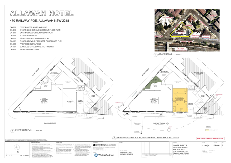
|
Georges River Council - Georges River Local Planning
Panel (LPP) - Friday, 5 October 2018
LPP047-18 470 Railway Parade Allawah
[Appendix
2] Elevations -
470 Railway Parade Allawah
|
Page 216
|
|
Georges River Council - Georges River Local Planning
Panel (LPP) - Friday, 5 October 2018
LPP047-18 470 Railway Parade Allawah
[Appendix
3] Existing &
Demolition Ground Floor Plan - 470 Railway Parade Allawah
|
Page 217
|
|
Georges River Council - Georges River Local Planning
Panel (LPP) - Friday, 5 October 2018
LPP047-18 470 Railway Parade Allawah
[Appendix
4] Existing
Basement Floor Plan - 470 Railway Parade Allawah
|
Page 218
|
|
Georges River Council - Georges River Local Planning
Panel (LPP) - Friday, 5 October 2018
LPP047-18 470 Railway Parade Allawah
[Appendix
5] First Floor
Plan - 470 Railway Parade Allawah
|
Page 219
|
|
Georges River Council - Georges River Local Planning
Panel (LPP) - Friday, 5 October 2018
LPP047-18 470 Railway Parade Allawah
[Appendix
6] Ground Floor
Plan - 470 Railway Parade Allawah
|
Page 220
|
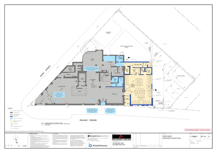
|
Georges River Council - Georges River Local Planning
Panel (LPP) - Friday, 5 October 2018
LPP047-18 470 Railway Parade Allawah
[Appendix
7] Sections - 470
Railway Parade Allawah
|
Page 221
|
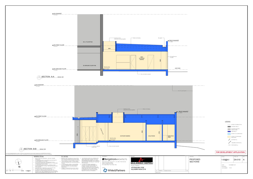
|
Georges River Council - Georges River Local Planning
Panel (LPP) - Friday, 5 October 2018
LPP047-18 470 Railway Parade Allawah
[Appendix
8] Elevation and
preparation plan- 470 Railway Pde Kogarah
|
Page 222
|
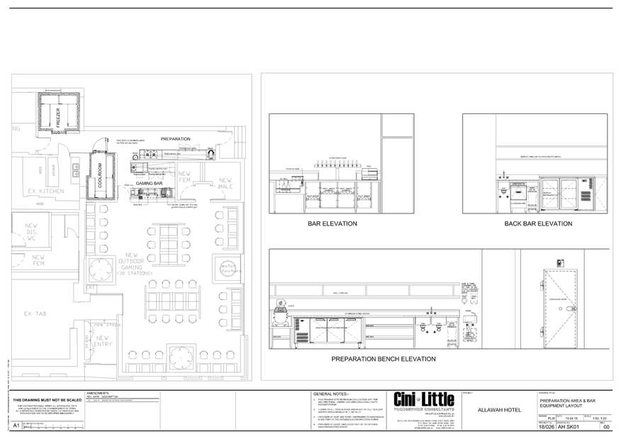
|
Georges River Council - Georges River Local Planning
Panel (LPP) - Friday, 5 October 2018
LPP047-18 470 Railway Parade Allawah
[Appendix
9] Section and
preparation plan - 470 Railway Pde Kogarah
|
Page 223
|
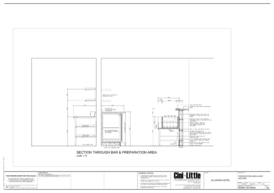
|
Georges River Council – Local Planning
Panel Friday, 5 October 2018
|
Page 224
|
REPORT TO GEORGES RIVER COUNCIL
LPP MEETING OF Friday, 05 October 2018
|
LPP Report No
|
LPP048-18
|
Development Application No
|
18/653
|
|
Proposed Development
|
Operation of the Georges River
Local Planning Panel
|
|
Report prepared by
|
Manager Development and Building
|
|
Recommendation
|
THAT Georges River Council Local Planning Panel formally
consider and respond to Council in relation to the items contained in parts
(b) and (c) of Council Resolution NM037-18 dated
4 April 2018
|
|
REPORT
1. Georges
River Council considered an item at its meeting of 28 May 2018 in relation to
the current Practices and Procedures associated with the operation of the
Georges River Council Local Planning Panel. In doing so, Council resolved
(Resolution No. NM037-18) the following:
(a) That the General Manager provide, as part of the quarterly
report to Council on DA determinations, a listing of all items reported to the
Local Planning Panel (LPP) including a summary of the Assessment
Officer’s recommendation and the final determination made by the Panel.
(b) That the General Manager provide the Georges River Local
Planning Panel with a copy of Council’s resolution of 18 December 2017
regarding the Operational Procedures of the Panel and request the Panel to formally
consider and respond to Council on the matters in that resolution including
(amongst others):
i.
the requested commencement times for meetings of 6pm;
ii.
the request for the Panel to undertake its deliberations in open session;
iii. functions
of the Panel that demonstrate transparency in development decisions and
accountability to the community; and
iv.
access to the Panel’s determinations by the applicant and the public on
the same day the determination is made.
(c) That the General Manager request the Panel to Webcast its
meetings.
In accordance with
Part (b) of the above, the resolution NM030-17 of the meeting held on 18
December 2017 is outline for the Panel’s consideration as follows:
(a) That
the Mayor write to the Minister for Planning, the Hon Anthony Roberts MP and
the Secretary of the NSW Department of Planning and Environment, Ms Carolyn
McNally to request that any Guidelines issued for the operation of IHAPs in NSW
provide for the following:
(i) The
commencement time for IHAP meetings to be no earlier than 6pm to enable
residents and other community members to attend outside of usual business
hours;
(ii) That
Panel deliberations occur in open session;
(iii) That
decisions of the Panel be published on the same day as the meeting;
(iv) That
IHAP meetings are scheduled on a regular basis to avoid any unnecessary delays
to application determination times;
(b) That
the appointment of the Georges River IHAP Chairperson be undertaken as soon as
possible to enable Council to establish the final operational procedures for
the Panel in collaboration with the Chairperson, prior to the commencement of
the new Panel in March 2018.
CONSIDERATION
2. Based
on the Council resolution, the Local Planning Panel is requested to consider
each of the identified matters contained in parts (b) and (c) of Council
Resolution NM037-18 dated 4 April 2018 and
provide a response to Council in the context of the current operating
procedures and the requirements for Local Planning Panels stipulated under the:
· Environmental
Planning and Assessment Act 1979
· Environmental
Planning and Assessment Regulation 2000
· Local Planning
Panel Codes of Conduct; and
· Any relevant
Department of Planning Guidelines
RECOMMENDATION
3. THAT
Georges River Council Local Planning Panel formally consider and respond to
Council in relation to the items contained in parts (b) and (c) of Council
Resolution NM037-18 dated 4 April 2018