AGENDA - LPP
|
Meeting:
|
Georges River Local Planning
Panel (LPP)
|
|
Date:
|
Thursday, 21 November 2019
|
|
Time:
|
4.00pm
|
|
Venue:
|
Council Chambers, Civic
Centre, Hurstville
|
|
Panel Members:
|
Adam Seton (Chairperson)
John Brockhoff (Expert Panel
Member)
Michael Leavey (Expert Panel
Member)
George Vardas (Community
Representative)
|
|
1. On Site Inspections - 1.00pm – 3.30pm
a) 172-174 Railway Parade and
1B Gray Street Kogarah
b) 45 Burgess Street Beverley
Park
c) 37 Plimsoll Street Sans
Souci
d) 83A Kyle Parade Kyle Bay
e) 72Connells Point Road South
Hurstville
f) 57-59 Trafalgar Street
Peakhurst
g) 268 Carrington Avenue
Hurstville
|
|
Break - 3.30pm
|
|
2. Public Meeting
– Consideration of Items 4.00pm – 6.00pm
|
|
Public Meeting Session Closed - 6.00pm
(Break – Light Supper served to Panel
Members)
|
|
Georges
River Council – Local Planning Panel Thursday, 21
November 2019
|
Page 2
|
|
3. Reports and
LPP Deliberations in Closed Session - 6.30pm
|
LPP050-19 45
Burgess Street Beverley Park - DA2018/0098
(Report
by Senior Development Assessment Planner)
LPP051-19 172-174
Railway Parade and 1B Gray Street Kogarah - DA2018/0285
(Report
by Senior Development Assessment Planner)
LPP052-19 57-59
Trafalgar Street Peakhurst - DA2018/0285
(Report
by Senior Development Assessment Officer)
LPP053-19 268
Carrington Avenue Hurstville - DA2018/0576
(Report
by Development Assessment Planner)
LPP054-19 37
Plimsoll Street Sans Souci - DA2019/0347
(Report
by Development Assessment Planner)
LPP055-19 83A
Kyle Parade Kyle Bay - DA2019/0128
(Report
by Consultant Planner)
LPP056-19 72
Connells Point Road South Hurstville - DA2018/0577
(Report
by Development Assessment Planner)
|
4. Confirmation of Minutes
|
REPORT TO
GEORGES RIVER COUNCIL
LPP MEETING OF Thursday, 21 November 2019
|
LPP Report No
|
LPP050-19
|
Development Application No
|
DA2018/0098
|
|
Site Address & Ward Locality
|
45 Burgess Street Beverley Park
Kogarah Bay Ward
|
|
Proposed Development
|
Demolition of existing structures,
tree removal and construction of an attached two storey dual occupancy with
front fencing and associated landscaping works.
|
|
Owners
|
Mr and Mrs Sadig
|
|
Applicant
|
ArtMade Architects
|
|
Planner/Architect
|
Architect: ArtMade Architects
Planner: Urbanesque Planning
|
|
Date Of Lodgement
|
20/03/2018
|
|
Submissions
|
Nine (9)
|
|
Cost of Works
|
$1,387,320.00
|
|
Local Planning Panel Criteria
|
The application is referred to the
Georges River Local Planning Panel as drainage of the development relies upon
an easement located on Council-owned land, being through the Beverley Park
Golf Course.
|
|
List of all relevant s.4.15
matters (formerly s79C(1)(a))
|
Greater Metropolitan Regional
Environmental Plan No 2 - Georges River Catchment; State Environmental
Planning Policy (Infrastructure) 2007;
State Environmental Planning Policy
No 55 - Remediation of Land, State Environmental Planning Policy (Building
Sustainability Index: BASIX) 2004, State Environmental Planning Policy
(Vegetation in Non-Rural Areas) 2017, Draft Environment State Environmental
Planning Policy, Draft Remediation of Land State Environmental Planning Policy
Kogarah Local Environmental Plan
2012, Kogarah Development Control Plan 2013.
|
|
List all documents submitted
with this report for the Panel’s consideration
|
Site and Elevation Plans
|
|
Report prepared by
|
Senior Development Assessment
Planner
|
|
Recommendation
|
That the application be granted a deferred commencement
approval in accordance with the conditions included in the report
|
|
|
Summary of matters for
consideration under Section 4.15
Have all recommendations in relation
to relevant s4.15 matters been summarised in the Executive Summary of the
assessment report?
|
Yes
|
|
Legislative clauses requiring
consent authority satisfaction
Have relevant clauses in all
applicable environmental planning instruments where the consent authority
must be satisfied about a particular matter been listed and relevant
recommendations summarised, in the Executive Summary of the assessment
report?
|
Yes
|
|
Clause 4.6 Exceptions to
development standards
If a written request for a
contravention to a development standard (clause 4.6 of the LEP) has been
received, has it been attached to the assessment report?
|
Not
Applicable
|
|
Special Infrastructure
Contributions
Does the DA require Special
Infrastructure Contributions conditions (under s7.24)?
|
Not
Applicable
|
|
Conditions
Have draft conditions been provided
to the applicant for comment?
|
No,
standard conditions have been attached with no design changes. The conditions
can be reviewed following publishing of the agenda.
|
|
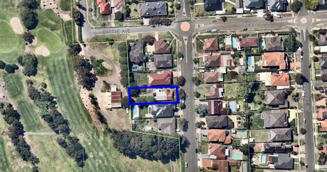
Site Plan – allotment outlined in blue
|
Executive Summary
Proposal
1. Council is in
receipt of a development application (DA2018/0098) proposing demolition of the
existing structures, tree removal and construction of a
new two storey attached dual occupancy including a front fence and landscaping
works at 45 Burgess Street, Beverley Park, known as Lot 19 in DP 8888.
2. The
proposal seeks consent for the removal of three (3) trees located within the
property boundaries. One (1) street tree is proposed to be removed to
accommodate the new driveway access for the dwellings.
Site and
Locality
3. The
site is located on the western side of Burgess Street. A single storey clad
dwelling with attached covered patio, metal and tiled roof, together with a
detached fibro shed with tiled roof, driveway access to rear, and other hard
surfaces occupy the site.
4. The
site falls about 1.33m from the north eastern corner of Burgess Street to the
rear (western) boundary. There are twelve (12) trees located within the
property boundaries, and one (1) tree located on the nature strip.
5. To
the north is a two storey brick dwelling with metal roof, a front and rear
balcony. To the south is a two storey brick dwelling with tiled roof, two
street facing balconies and a rear balcony.
6. Burgess
Street and the immediate locality comprise various low density residential
forms, with the Beverley Park Golf Course located directly behind the subject
site to the west.
Zoning and
Permissibility
7. The
site is zoned R2 Low Density Residential in accordance with the Kogarah Local
Environmental Plan 2012. The proposed development is defined as a dual
occupancy which is a permissible use in the zone and satisfies the objectives
of the zone referenced below:
• To provide for the housing
needs of the community within a low density residential environment.
• To enable other land uses that
provide facilities or services to meet the day to day needs of residents.
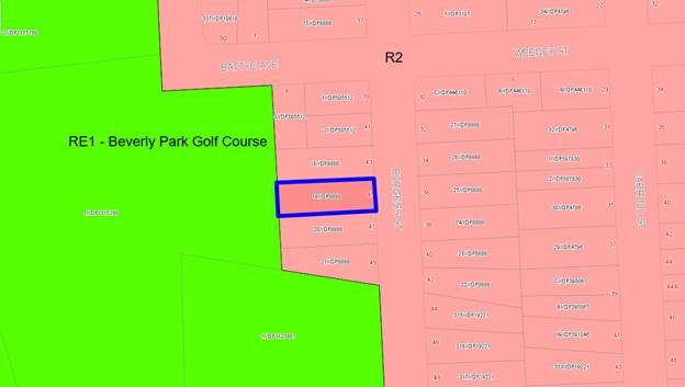
Figure 1 -
Zoning map - Site outlined in blue.
Submissions
8. In
accordance with the public notification provisions of the Kogarah Development
Control Plan (KDCP), the application was placed on neighbour notification on
three (3) separate occasions for a minimum period of 14 days.
9. Nine
(9) unique submissions were received as a result of the notification periods. A
detailed assessment of these submissions are summarised and addressed in full
later in this report.
Referrals
10. The
DA was referred to a number of officers within Council, and as a result,
responses were generally supportive of the application as discussed in the body
of this report.
Reasons for
Referral to the Local Planning Panel
11. The application is referred to the
Georges River Local Planning Panel for determination as drainage of the
development relies upon an easement to be located within Council-owned land,
being Beverley Park Golf Course.
Conclusions
12. The application has been assessed
having regard to the Matters for Consideration under Section 4.15 of
the Environmental Planning and Assessment Act 1979, the provisions of the
relevant State Environmental Planning Policies, and in particular against the
requirements of the relevant Kogarah Local Environmental Plan (LEP) 2012 and
Kogarah Development Control Plan (DCP) 2013. The proposal complies with the
floor space ratio and height standards of the LEP and sufficient justification
has been provided for any variations to the DCP.
13. During
the assessment of the application, the applicant was unable to obtain consent
from the Beverley Park Golf Club to connect to an easement on the land leased
by the Golf Club from Council. A deferred commencement condition has been
recommended, requiring the applicant to acquire an easement to drain water from
the site.
14. The
subject site is identified as flood affected in the Beverley Park Overland
Flow Risk Management Study and Plan 2007, however is not identified as being
affected by the 1% AEP (1 in 100 year ARI) flood event.
15. The
application is recommended as a deferred commencement approval subject to
conditions.
Report in Full
DESCRIPTION OF
THE PROPOSAL
16. Demolition
of the existing structures, tree removal and construction of a new two storey
attached dual occupancy including a front fence and landscaping works at 45
Burgess Street, Beverley Park. The proposed site plan is shown in Figure 2
below.
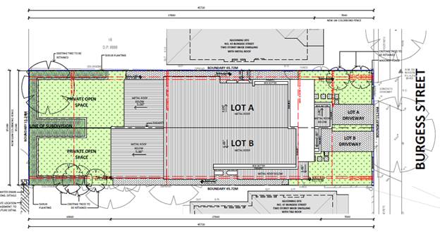
Figure 2 - Proposed Site Plan
17. The proposal is described
in detail as follows:
· Ground Floor – each dwelling contains a single
garage, porch, lounge room, bathroom, laundry, open plan kitchen, dining and
family room, and outdoor patio at the rear of the dwelling. Private open space
is located at the ground level at the rear of each dwelling.
· First Floor – each dwelling contains four bedrooms
with the master containing an ensuite and walk in robe and a bathroom. A
balcony to the front elevation is provided to Lot A.
· The front fence is 1.2m high and a combination of masonry
piers and open-style infill timber horizontal slats.
· The
proposal seeks consent for the removal of three (3) trees located within the
property boundary. One (1) street tree is proposed to be removed to accommodate
the new driveway access for the dwellings.
DESCRIPTION OF THE SITE AND LOCALITY
18. The
subject site is formally known as Lot 19 in DP 8888, is known as 45 Burgess
Street, Beverley Park, and has a site area of 696.8sqm. The site is occupied by
a single storey clad dwelling with metal and tiled roof, attached covered
patio, a detached fibro shed with tiled roof and driveway access to the rear.
19. The
site falls about 1.33m from the north eastern corner of the site from Burgess
Street to the rear (western) boundary. There are twelve (12) trees located
within the property boundaries, and one (1) street tree located on the nature
strip.
20. To
the north is a two storey brick dwelling with metal roof, a front and rear
balcony. To the south is a two storey brick dwelling with tiled roof, two
street facing balconies and a rear balcony.
21. Burgess
Street and the immediate locality comprise various low density residential
forms, with the Beverley Park Golf Course located directly behind the subject
site to the west.
BACKGROUND
22. The
original application was submitted in March 2018, seeking consent for an
attached dual occupancy over basement parking and proposing connection to an
easement to drain water on the adjoining site to the rear, the Beverley Park
Golf Course, which is land owned by council.
23. Amended
plans were submitted in October 2018 in response to issues raised by council
staff, including deletion of the basement parking (which resulted in the height
limit being exceeded) and reducing the height of the building to comply with
the 9m height limit.
24. Amended
plans were submitted on 29 October 2019 (these plans form the basis of this
assessment report) to address issues raised by council staff, including FSR,
garage setbacks, side setbacks, floor level of the outdoor terraces and the
dwelling entries. The amended plans satisfy the concerns raised by staff and
are recommended for approval via a deferred commencement determination.
STATE
ENVIRONMENTAL PLANNING POLICIES (SEPP)
25. Compliance
with the relevant state environmental planning policies is summarised in the
table, and discussed in more detail below.
|
State
Environmental Planning Policy
|
Complies
|
|
Greater
Metropolitan Regional Environmental Plan No 2 – Georges River Catchment
|
Yes
|
|
State
Environmental Planning Policy (Building Sustainability Index: BASIX) 2004
|
Yes
|
|
State
Environmental Planning Policy No 55 - Remediation of Land
|
Yes
|
|
State Environmental Planning Policy (Vegetation in Non-Rural
Areas) 2017
|
Yes
|
|
State
Environmental Planning Policy (Infrastructure) 2007
|
Yes
|
Deemed State
Environmental Planning Policy – Georges River Catchment
26. All
stormwater from the proposed development can be treated in accordance with
Council’s Water Management Policy and will satisfy the relevant
provisions of the Deemed State Environmental Planning Policy – Georges
River Catchment. A deferred commencement condition is recommended requiring the
applicant to obtain an easement to drain water from the sire over the adjoining
Council-owned land.
State
Environmental Planning Policy (Building Sustainability Index: BASIX) 2004
27. A
BASIX Certificate has been issued for the proposed development and the
commitments required under the certificate have been satisfied.
State
Environmental Planning Policy No 55 - Remediation of Land
28. SEPP
55 aims to promote the remediation of contaminated land in order to reduce the
risk of harm to human health or any other aspect of the environment.
29. Clause
7 requires contamination and remediation to be considered in determining a
development application. The consent authority must not consent to the carrying
out of development on land unless it has considered whether or not the land is
contaminated.
30. The
site has a history of residential uses and as such, site contamination is not
suspected. In this regard, no further assessment is warranted with regard to
site contamination.
State Environmental Planning Policy (Vegetation in Non-Rural Areas)
2017
31. The
Vegetation SEPP regulates clearing of native vegetation on urban land and land
zoned for environmental conservation/management that does not require
development consent.
32. The
Vegetation SEPP applies to clearing of:
a) Native
vegetation above the Biodiversity Offset Scheme (BOS) threshold where a
proponent will require an approval from the Native Vegetation Panel established
under the Local Land Services Amendment Act 2016; and
b) Vegetation
below the BOS threshold where a proponent will require a permit from Council if
that vegetation is identified in the council’s development control plan
(DCP).
33. The
Vegetation SEPP repeals clause 5.9 and 5.9AA of the Standard Instrument -
Principal Local Environmental Plan with regulation of the clearing of
vegetation (including native vegetation) below the BOS threshold through any
applicable DCP.
34. The
proposed development does not involve the removal of any significant trees or
vegetation. Suitable replacement planting for the trees proposed for removal is
proposed, and has been included in the recommended conditions of consent. In
this regard, the provisions of this SEPP are considered to be met.
DRAFT STATE
ENVIRONMENTAL PLANNING POLICIES
Draft
Environment SEPP
35. The
Draft Environment SEPP was exhibited from 31 October 2017 to 31 January 2018.
This consolidated SEPP proposes to simplify the planning rules for a number of
water catchments, waterways, urban
bushland, and Willandra Lakes World Heritage Property.
· Changes
proposed include consolidating the following seven existing SEPPs:
· State
Environmental Planning Policy No. 19 – Bushland in Urban Areas
· State
Environmental Planning Policy (Sydney Drinking Water Catchment) 2011
· State
Environmental Planning Policy No. 50 – Canal Estate Development
· Greater
Metropolitan Regional Environmental Plan No. 2 – Georges River Catchment
· Sydney
Regional Environmental Plan No. 20 – Hawkesbury-Nepean River (No.2-1997)
· Sydney
Regional Environmental Plan (Sydney Harbour Catchment) 2005
· Willandra
Lakes Regional Environmental Plan No. 1 – World Heritage Property.
36. The
proposal is consistent with the provisions of this Draft Instrument given there
is no significant vegetation impacted by the proposed development.
Draft
Remediation of Land SEPP
37. The
Department of Planning and Environment has announced a Draft Remediation of
Land SEPP, which will repeal and replace the current State Environmental
Planning Policy No 55—Remediation of Land.
38. The
main changes proposed include the expansion of categories of remediation work
which requires development consent, a greater involvement of principal
certifying authorities particularly in relation to remediation works that can
be carried out without development consent, more comprehensive guidelines for
Councils and certifiers and the clarification of the contamination information
to be included on Section 149 Planning Certificates.
39. Whilst
the proposed SEPP will retain the key operational framework of SEPP 55, it will
adopt a more modern approach to the management of contaminated land.
40. The
subject site has a history of residential use and as such, site contamination
is not suspected. In this regard, no further assessment is warranted with
regards to site contamination.
ENVIRONMENTAL PLANNING INSTRUMENTS
Kogarah Local Environmental Plan 2012
41. The
provisions of this Local Environmental Plan are relevant to the proposal. The
extent to which the proposal complies with the relevant standards
of Kogarah Local Environmental Plan 2012 (KLEP2012) is outlined in
the table below.
|
Clause
|
Standard
|
Proposed
|
Complies
|
|
2.7 - Demolition
|
Demolition is permissible with
consent
|
Demolition is proposed as part of
this application.
|
Yes
|
|
4.1B – Minimum lot size for
dual occupancies
|
650sqm
|
Site Area = 696.8sqm
|
Yes
|
|
4.3 – Height of Buildings
|
9m as identified on Height of
Buildings Map
|
Maximum 7.9m
|
Yes
|
|
4.4 – Floor Space Ratio
|
0.55:1 as identified on Floor Space
Ratio Map
|
See Clause 4.4A below.
|
|
4.4A - Exceptions to floor
space ratio for residential accommodation in Zone R2
|
Site area between 650sqm and
800sqm:
[(lot
area − 650) × 0.3 + 357.5] ÷ lot area:1
|
Maximum = 371.54sqm (0.53:1).
Proposed = 371.3sqm (0.53:1).
|
Yes
|
|
6.1 – Acid Sulphate Soils
|
The objective of this
clause is to ensure that development does not disturb, expose or drain acid
sulfate soils and cause environmental damage.
|
The site is identified as being
affected by Class 2 and Class 5 Acid Sulphate Soils.
An Acid Sulfate Soils Assessment
Report was submitted with the application which concludes following the
borehole testing on site confirmed no potential for acid sulfate soils.
|
Yes
|
|
6.2 – Earthworks
|
To ensure that earthworks do not
have a detrimental impact on environmental functions and processes,
neighbouring uses, cultural or heritage items or features of the surrounding
land.
|
Minimal excavation is proposed and
commensurate with what would be expected for a development of this type and
scale.
The basement has been deleted and
the floor levels are above the recommended levels by Council’s Drainage
Engineer.
|
Yes
|
|
6.3 – Flood Planning
|
Requires
assessment to minimise the flood risk to life and property associated with
the use of land; to allow development on land that is compatible with the
land’s flood hazard, taking into account projected changes as a result
of climate change; and to avoid significant adverse impacts on flood
behaviour and the environment.
|
Council’s Flood Engineer has
carried out an assessment of the impact of flooding from the immediate
adjoining sites, in particular the rear adjoining Beverley Park Golf Course.
With the amendment of the plans to
delete the basement level and finished floor levels being above recommended
freeboard levels, Council’s Flood Engineer does not raise any concerns
with the proposal in relation to flooding impacts.
|
Yes
|
Development control plans
Kogarah
Development Control Plan 2013
42. The
provisions of this Development Control Plan are relevant to the proposal. An
assessment of the proposal against the key controls in the Development Control
Plan is tabled as follows.
|
Applicable DCP Controls
|
Standards
|
Proposal
|
Complies
|
|
1.2.1 Floor space
Requirements
|
(5) Blank walls and flat facades
should be avoided. Walls longer than 10m should be articulated by a minimum
300mm projection or indentation in the façade.
(7) Where proposed development
includes a two (2) residential level element, then the second level should
not extend beyond 60% of the depth of the allotment measured from the street
boundary. Where side boundaries are of varying length, the second level is
limited to a line across the block between the points on both boundaries, see
Figures 1 and 2.
|
All walls include suitable
fenestration and articulation.
The first floor does not extend
beyond 60% of the depth of the lot.
|
Yes
Yes
|
|
1.2.2 Building Heights
|
(1) 7.2m to the underside of the
upper ceiling
7.8m to the top of the parapet
(2) The maximum number of
residential levels is two (2), except where the site has a slope exceeding
1:8 (12.5%), where the maximum number of residential levels is three (3).
|
Max. 7.2m to ceiling
Max. 7.9m to parapet
The proposal is two storeys.
|
Yes
No – refer
to comments below.
Yes
|
|
Comment on
parapet height
The site slopes
gently from street level to the rear boundary which results in the proposal
exceeding the maximum parapet height by 100mm at the rear of Dwelling B.
Despite these non-compliances the overall height of the proposal has a
maximum height of 7.9m and therefore complies with the LEP height limit of
9m.
It is noted that
the architectural roof line of the front façade of the proposal
complies with the parapet and overall height limit. The minor breech of the
parapet height control is isolated to the south western corner of the roof of
Dwelling B and is therefore supported. The minor non-compliance does not
contribute to the loss of solar access as it is located at the front of the
dwelling.
|
|
1.2.3 Rhythm of the Built
Elements in the Streetscape
|
(1) The primary building
façade should not exceed 40% of the overall width of the total
frontage (Figure 6).
(2) The secondary building
façade should be set back a minimum of 1.5 metres from the primary
building façade (Figure 7).
(3) Where the dominant built form
in the streetscape provides for a pitched hip or gable ended presentation to
the street, the new buildings and/or additions should reflect that roof form.
|
The front façade is
articulated into four sections, being separate garages and the entry to each
dwelling. The modulated façade is tied together with the angled roof
feature.
The secondary facades are setback
between 2m and 4m from the primary façade.
A flat roof is proposed which is
consistent with newer development in the area. In addition the angled roof
feature creates an articulation to the front façade that reflects a
more traditional pitched roof form that is common in the locality.
|
Yes
Yes
Yes
|
|
1.2.4.2 Front Setbacks
|
Primary frontage setback: Minimum
5.5m
|
Minimum 5.5m to the garage of Lot
A.
|
Yes
|
|
1.2.4.3 Side and Rear
Setbacks
|
Rear - Buildings are to have a
minimum rear setback of 15% (6.8m) of the average site length, or 6m,
whichever is greater.
Side - For buildings having a wall
height of greater than 3.5m, the minimum side boundary setback is 1200mm
|
Dwelling A – 12.9m
Dwelling B – 11.16m
Minimum 1.2m (ground and first
floor).
|
Yes
Yes
|
|
1.2.5 Fenestration and
External Materials
|
(1) New buildings and alterations
and additions should present a primary building façade and roofing
that is constructed of materials, and within a colour range, that is
complementary to the dominant character of buildings in the streetscape.
(2) Garage doors should not
dominate the street front elevation (Figure 16).
(3) The roof should be similar to
the angle of pitch, materials and colour of roofs in the streetscape (Figure
14).
(4) The colours of garages, window
frames, and balustrading on main facades and elevations are to be integrated
with the external design of the building.
(5) Glazing shall be limited to a
maximum 35% of the total area of the overall street front façade. This
includes both primary and secondary façade bays (Figure 15).
(6) Where garaging is in the front
façade it should be limited to a maximum of two garage bays, with
separate garage door openings of a maximum width of 3m.
|
The proposed colours, materials and
finishes are suitable for this modern and contemporary development.
One single garage door per dwelling
is proposed and are offset from one another.
Flat roof is proposed which is
consistent with more recent modern contemporary construction in the area.
Suitable colours are proposed,
including neutral browns, white, timber and metal cladding.
Less than 35% of the front
façade is glazed.
One single garage door is proposed
per dwelling, being 3m wide and they are offset from one another providing
differing street setbacks.
|
Yes
Yes
Yes
Yes
Yes
Yes
|
|
1.2.6 Street edge
|
(1) New developments should provide
front fencing that complements fencing within the streetscape.
(2) Fencing is to be consistent
with the requirements of Section 4.2.
(3) Existing vegetation in the
front building line setback or on the street verge that contributes to the
character of the streetscape should be preserved.
(4) The driveway location should
not result in the removal of any street trees or removal of substantial trees
on the site.
|
A 1.2m high fence is proposed being
a combination of masonry and horizontal timber infills which is suitable for
the streetscape.
Complies.
One street tree is proposed to be
removed and will be replaced with two street trees via a recommended
condition of consent.
One street tree is proposed to be
removed and will be replaced with two street trees via a recommended
condition of consent.
|
Yes
Yes
Yes
Yes
|
|
1.3 Open
Space
|
(1) 15% of the site area must be
deep soil landscaped area.
(2) Private open space should be
adjacent to and visible from the main living and/or dining rooms and be
accessible from those areas.
|
34% of the site is deep soil
landscaping.
Private open spaces are directly
adjacent to the living areas.
The patio is elevated above the
landscaped garden area.
|
Yes
Yes
|
|
1.4 Vehicular access,
parking and circulation
|
(1) Car parking is to be provided in
accordance with the requirements in Section B4.
Dual occupancy: 1.5 spaces/dwelling
(2) On corner sites with two street
frontages vehicular access should be provided to the secondary frontage.
(3) Garages should be accessed from
a rear lane where this is available.
(4) Crossings are to be positioned
so that on-street parking and landscaping on the site are maximised, and
removal or damage to existing street trees is avoided.
(5) Garaging should be setback
behind the primary façade.
(6) The maximum driveway width
between the street boundary and the primary building façade is 4m.
(7) Where the dominant provision of
garaging within the streetscape is provided to the rear or side of
developments, new developments and additions to existing development should
provide for a side driveway or garaging behind the main street front elevation
of the building.
(8) Basement parking is not
encouraged on flat sites. Garaging should be provided at ground level unless
the slope of the site exceeds 1:8 (12.5%) in which case a basement or
suspended garage may be acceptable.
(9) Where a basement garage is
proposed, the maximum height of the basement above ground level (existing) is
1m measured to the underside of the basement ceiling. Where the basement
exceeds 1m above ground level (existing), the basement will be considered to
be a floor (Figure 17). Note: Floor means the space within a building which
is situated between one floor level and the floor level next above or if
there is no floor above, the ceiling or roof above.
(10) For basement garages the
maximum amount of excavation is to be limited to required car parking and any
manoeuvring areas, access stairwells, lift wells and storage areas.
(11) Storage areas within basements
or garages must not exceed 10sqm per dwelling (with a minimum width of
500mm).
(12) Car parking layout and vehicular
access requirements and design are to be in accordance with the Australian
Standards, in particular AS 2890.1-2004.
(13) Dual occupancy development
must have only one single fronted garage per dwelling. Where garaging is
required for 2 cars, this must be tandem parking.
|
2 spaces per dwelling are proposed.
N/A
N/A
Two crossings are proposed to allow
for consolidation of areas of landscaping in the front setback for each
dwelling.
The garages are located forward of
the dwelling entries.
2.6m per driveway.
There is no dominant garage or
parking design in the locality. The immediate area is characterised by older
style dwellings and more recently constructed two storey dwellings and dual
occupancies with garages forming the primary building faced and the wall of
the dwelling behind.
Basement parking is no longer
proposed.
N/A
N/A
N/A
Storage is not proposed in the
garages.
Complies
One single garage per dwelling
proposed.
|
Yes
N/A
N/A
Yes
No – refer
to comments below.
Yes
Yes
N/A
N/A
N/A
Yes
Yes
Yes
|
|
Comments on
garage location
The front
façade of the proposal is articulated into four bays, being the
separate single garages and the entry to each dwelling. There are a number of
examples of dwellings with garages forward of the building line or front
façade of the dwelling in the immediate area, including the dwelling
adjoining the subject site to the north.
The objectives of
the control are:
(a) New buildings and alterations and additions should reflect the
dominant building rhythm of the streetscape with regard to the location,
spacing and proportion of built elements in the street elevation.
(b) Where the dominant street front elevation of the buildings
provides for a double fronted or articulated front façade, new
buildings and additions should provide an articulated front façade.
The proposal meets
the objectives of the control and given the mixed design of the dwellings and
established building lines in the locality, and the fact the proposal is
consistent with the setback of both adjoining properties, the technical
non-compliance of the garages being located in front of the building line is
supported as it does not undermine the rhythm of the streetscape and built
form.
|
|
1.5.1 Visual Privacy
|
(1) Windows from active rooms are
to be offset between adjacent dwellings so as to avoid direct overlooking
onto neighbouring windows.
|
Living area windows are located on
the ground floor and are oriented to the rear yards. The side-facing living
room windows at the front of each dwelling have high sill heights and will
not overlook neighbouring properties.
|
Yes
|
|
1.6 Solar Access
|
(1) At least 50% of the primary
private open space of the proposed development should have access to a
minimum of four hours of sunlight between 9am–3pm on 21 June.
(2) Where private open space is
proposed on the southern side of the building the distance from the southern
boundary of the open space to the nearest wall to the north must be a minimum
of 3m + h, where h is the height of the wall (Figure 20).
(3) Where the neighbouring
properties are affected by overshadowing, at least 50% of the neighbouring
existing primary private open space or windows to main living areas must
receive a minimum of 3 hours sunlight between 9am–3pm on 21 June
(Figure 21).
|
Each area of private open space
will receive at least 4 hours of sunlight during midwinter.
Private open space is located to
the west of the dwellings.
Adjoining properties will receive
sunlight to in excess of 50% of the private open space area for greater than
3 hours.
|
Yes
N/A
Yes
|
|
2.1 Dual Occupancies
|
Minimum frontage: 18m
Minimum site area: 850sqm
|
15.24m
696.8sqm
|
No – refer to Refer to
comments following this table in relation to minimum site width control as
per the Georges River Development Control Plan 2020 (Interim Policy).
N/A – LEP permits a site area
of 650sqm.
|
|
4.2.3 Retaining walls
|
(1) Retaining walls over 600mm in
height must be designed by a suitably qualified structural engineer.
|
Conditions will be imposed
directing the construction of all retaining walls.
|
Yes, condition recommended
|
|
|
|
|
|
|
Georges River
Development Control Plan 2020 (Interim Policy)
43. The
Interim Policy is a supplementary document, meaning that current DCP controls continue
to apply if a particular control is not specified in the Interim Policy, or if
it is still considered best practice. All operative DCPs still legally apply.
Whilst the Interim Policy has no statutory recognition in the assessment of a
Development Applications pursuant to the Environmental Planning &
Assessment Act 1979, the policy will be used as a guide as it is an endorsed
position of the Council.
44. In
relation to dual occupancy development, the Interim Policy states the minimum
site width for an attached dual occupancy is 15m, with which the site complies.
45. In
addition, in Picciau v Georges River Council [2019] NSWLEC 1114,
Commissioner Dickson found that a flexible approach to the application of the
lot width performance criteria was acceptable in the case (a proposal for a
dual occupancy development on a 12m wide site) as the width of the site at the
front façade of the dwelling(s) was 15m, and the proposal met the zone
objectives and did not result in any unreasonable adverse impacts on the
amenity of neighbouring properties.
Developer Contributions
The following
Section 7.11 contributions have been levied for the development.
|
DEVELOPMENT
CONTRIBUTIONS
|
|
Kogarah Section
94 Development Contributions Plan No.1 - Roads and Traffic Management -
Residential
|
$645.30
|
|
Kogarah Section
94 Development Contributions Plan No.5 - Open Space 2007
|
$29,916.04
|
|
Kogarah Section
94 Development Contributions Plan No.9 - Kogarah Libraries - Buildings
|
$783.44
|
|
Kogarah Section
94 Development Contributions Plan No.9 - Kogarah Libraries - Books
|
$558.60
|
|
Total for
development contributions
|
$31,903.38
|
IMPACTS
Natural Environment
46. The
proposal is unlikely to result in adverse impacts to the natural environment
subject to the site being planted with replacement trees as included in the
recommended conditions of consent. The removal of existing trees has been
reviewed by Council’s Consultant Arborist and is deemed acceptable. A
condition will also require two street trees to be planted along the frontage
of the site to replace the one street tree being removed.
47. Appropriate
stormwater conditions have been recommended including a deferred commencement
condition requiring the applicant to obtain an easement to drain water and
connection into an existing easement on council owned land at the rear being
within the Beverly Park Golf Course.
Built Environment
48. The
proposal complies with the height of buildings and floor space ratio standards
of the KLEP 2012, and represents an acceptable planning outcome for the site
with respect to its bulk, scale and density, façade articulation and
expression and is an appropriate response to the context of the site and its R2
Low Density Residential zoning. The development is consistent with objective of
the Development Control Plan (DCP) and the Interim Development Control Plan
2020.
Social Impact
49. No
adverse social impacts have been identified as part of the assessment. The
additional dwelling will assist with providing additional housing in the area.
The construction of a dual occupancy on the site is consistent with the
residential zoning of the land.
Economic Impact
50. There
is no apparent adverse economic impact that is likely to result within the
locality due to the construction of additional dwellings.
Suitability of the site
51. The
site is zoned R2 Low Density Residential. The proposal is a permissible form of
development in this zone. The site is suitable for the construction of a dual
occupancy and the proposal fully complies with the relevant KLEP 2012
standards. The site is considered suitable for the proposed development.
52. The
applicant has applied for subdivision of the dual occupancy as part of this
application; however subdivision does not form part of the consent. A condition
of consent has been recommended that states a separate development application
is required to be lodged with Council for the Torrens Title Subdivision of a
Dual Occupancy. Development consent for Torrens Title Subdivision cannot
be granted until after the final Occupation Certificate has been issued for the
Dual Occupancy Development.
SUBMISSIONS
AND THE PUBLIC INTEREST
53. The
proposal was placed on exhibition on three separate occasions for a period of
fourteen (14) days during which time nine (9) submissions were received. The
submissions raised the following issues.
Round 1 of
Notification (original DA plans) April 2018
Basement Parking
54. Comment: Basement parking was deleted from the proposal by amended plans
submitted in October 2018.
Rear setback and privacy impacts
55. Comment:
The required setback for the site is 6.8m and the
proposal exceeds this control by 6.1m for Dwelling A (north) and 4.36m for
Dwelling B (south). The first floor rear setback complies with the DCP control
that restricts all first floor development to a maximum of 60% the depth of the
lot. Privacy impacts to neighbours are minimised by the provision of privacy
screen to the side of the outdoor terraces at the rear of each dwelling, which
have been lowered by 0.5m from the original plans submitted with the application.
Primary living rooms are located on the ground floor and all first floor
windows facing the side boundaries have high sill heights.
Lowering of the water table and
impacts on neighbour
56. Comment: Basement parking was deleted from the proposal by amended plans
submitted in October 2018, as a result lowering of the water table is unlikely
as the only excavation relates to the footings
associated with the development.
Visual bulk of the building
57. Comment: The proposed development fully complies with the FSR and building
height standards of the Kogarah LEP 2012 and the setback controls of the
Kogarah DCP 2013. It is acknowledge there is a parapet height breach of 100mm,
however this does not result in unacceptable bulk as it will barely be perceived
resulting in a development that is of a suitable bulk and scale for the site.
Increased noise and excavation
58. Comment: Standard conditions of consent are recommended to control noise
levels during construction. Basement parking was deleted from the proposal by
amended plans submitted in October 2018 and as a result excavation is now
minimal.
Overshadowing to 47 Burgess
Street
59. Comment: The proposal demonstrates compliance with the solar access controls
in the DCP in that 47 Burges Street will continue to receive at least 3 hours
sunlight during mid-winter to the private open space area.
Inadequate drainage
60. Comment: The application seeks approval to connect to a drainage easement
located on the land occupied by the Beverly Park Golf Course (which is owned by
council). The recommendation of this report is for the Panel to grant a
deferred commencement approval, subject to the applicant gaining approval from
the Beverly Park Golf Club to connect into the easement within the area they
lease from Council.
Objection to side windows on the
ground and first floor
61. Comment: Privacy impacts to neighbours are minimised by the provision of
privacy screens to the side of the outdoor terraces at the rear of each
dwelling, which have been lowered by 0.5m from the original plans submitted
with the application. Primary living rooms are located on the ground floor and
all first floor windows facing the side boundaries have high sill heights and
are low-activity rooms. It is unreasonable to require a dwelling in this
setting to only have front and rear facing windows or doors.
Floor space ratio and impervious
area non-compliance
62. Comment: The amended proposal complies with the maximum FSR standard
applicable to the site and exceeds the required amount of deep soil on the
site.
Risk of damage to neighbouring
property
63. Comment: Standard conditions of consent are recommended in relation to
construction activity and damage to adjoining properties. The deletion of the
basement level has reduced the extent of excavation.
The design in inconsistent with
neighbouring dwellings
64. Comment: The proposed
design has been assessed on its merits and is supported.
Round 2 of
Notification (amended plans submitted October 2018) November 2018
65. In
addition to issues raised and addressed in Round One
above.
One garage in front of the other
66. Comment: The amended plans
submitted in October 2019 have reduced the extent of the distance that one
garage is located in front of the other to 1.5m. Given the established pattern
of development in the immediate locality, of garages located forward of the
building line, the proposed arrangement is supported.
Round 3 of
Notification March 2019
67. No
additional issues raised that have not been addressed in Round One or Round
Two.
REFERRALS
Council Referrals
Stormwater Engineering
68. Council’s
Stormwater Engineer has carried out an assessment of
amended proposal and has raised no issue subject to the connection of
stormwater to the easement.
Development Engineering
69. Council’s
Development Engineer has carried out an assessment of the proposed stormwater
management system for the site. The proposal is supported subject to the
connection of the stormwater from the site to the easement within the Golf
Course land.
70. The
proposal relies on connection to an existing easement located on Council land
(the golf club) at the rear of the property. The applicant was unable to obtain
the approval of the Golf Club during the assessment of the application, and as
such a deferred commencement condition has been recommended providing the
applicant 36 months to obtain an easement over the Council-owned land at the
rear of the site, currently leased by the Golf Club.
Tree and Landscape Officer
71. Council’s
Tree and Landscape Officer has carried out an assessment of the proposed tree
retention and tree removal for the site, and has raised no concerns with the
proposal subject to conditions of consent for replacement planting.
Public Interest
72. The
proposal is of a scale and character that will not conflict with the public
interest, given the density and built form.
CONCLUSION
73. The
proposal has been assessed with regard to the matters for consideration listed
in Section 4.15 of the Environmental Planning and Assessment Act 1979. The
proposal is an appropriate response to the context of the site and will result
in a good planning and urban design outcome in the locality.
74. The proposal has been
assessed against the provisions of the Kogarah Local Environmental Plan 2012
and Kogarah Development Control Plan 2013 and complies with the height of building
and floor space ratio development standards of the Local Environmental Plan and
meets the objectives of the Kogarah Development Control Plan 2013. Any
variations to the DCP controls have been addressed and are worthy of support on
merit.
75. The
proposal will not result in adverse impacts to the amenity of adjoining
properties subject to the conditions of consent recommended below.
76. A
deferred commencement condition in relation to drainage has been recommended as
follows:
a) The
applicant must acquire an Easement to Drain Water of 1.0 metre (minimum)
width. The easement must allow for a piped, gravity fed system of drainage
of stormwater from the subject site with direct, underground connection to
Council's pipe in the adjacent downstream property.
Evidence of registration of the easement to
drain water benefitting the subject site and burdening the title of
the affected property is to be provided to Council.
b) A
plan showing the longitudinal section of the proposed pipe within the drainage
easement with detailed connection into Council’s pipe shall accompany the
submission.
77. For
the above reasons, the proposal is recommended for deferred commencement
approval subject to the conditions included within the recommendation below.
DETERMINATION AND STATEMENT OF REASONS
Statement of Reasons
78. The
reasons for this recommendation are:
· The
proposal is an appropriate response to the site and is consistent with the
desired future character of the R2 zone and existing development in the
locality.
· The
proposal is fully compliant with the maximum height of building and floor space
ratio limits that applies to the site under Kogarah Local Environmental Plan
2012.
· The
proposal’s bulk and scale is appropriately contained within a generally
compliant building envelope that is respectful of the established character of
the area in relation to height, street setback and boundary setbacks.
· The
proposal has sufficient façade modulation and wall articulation that
will serve to provide visual interest and reduce the bulk of the building.
Determination
79. THAT pursuant
to Section 4.16(3) of the Environmental Planning and Assessment Act 1979
(as amended) development consent is granted to Development Application
DA2018/0098 for demolition, tree removal and construction of a dual
occupancy at Lot 19 in DP 8888, known as 45 Burgess Street, Beverley Park,
subject to the following conditions of consent.
80. This
Development Application is a Deferred Commencement Consent under Section
4.16(3) of the Environmental Planning and Assessment Act (as amended) 1979.
Strict compliance is required with all conditions appearing in Section A within
thirty six (36) months from the Determination Date of this consent. Upon
confirmation in writing from Georges River Council that the Section A
Conditions have been satisfied, the consent shall commence to operate as a
Development Consent for a period of five (5) years from the Determination
Date of this consent.
Pursuant to
Section 4.16(3) of the Environmental Planning and Assessment Act 1979, this
consent will not operate until the following requirements are satisfied:
SECTION A
– DEFERRED COMMENCEMENT CONDITIONS
A. Deferred
Commencement – Drainage - Pursuant to Section 4.16(3) of the Environmental
Planning and Assessment Act 1979, this consent will not operate until such
time as the following requirements are met to the satisfaction in writing of
the Manager Development and Building.
a) The
applicant must acquire an Easement to Drain Water of 1.0 metre (minimum)
width. The easement must allow for a piped, gravity fed system of
drainage of stormwater from the subject site with direct, underground
connection to Council's pipe in the adjacent downstream property.
Evidence of registration of the easement to
drain water benefitting the subject site and burdening the title of the
affected property is to be provided to Council.
b) A
plan showing the longitudinal section of the proposed pipe within the drainage
easement with detailed connection into Council’s pipe shall accompany the
submission.
Documentary evidence
as requested or the above information must be submitted within thirty six
(36) months of the granting of this deferred commencement consent.
Commencement of the
consent cannot occur until written approval of the submitted information has
been given to Council.
Subject to the above
being satisfied, development consent be issued, subject to the following
conditions:
SECTION B – GENERAL DEVELOPMENT CONDITIONS
Development
Details
1. Approved
Plans - The development must be implemented in accordance with the approved
plans and supporting documentation listed below which have been endorsed by
Council’s approved stamp, except where marked up on the plans and/or
amended by conditions of this consent:
|
Description
|
Reference No.
|
Date
|
Revision
|
Prepared by
|
|
Proposed Site Plan
|
A02.01
|
25.10.19
|
D
|
ArtMade Architects
|
|
Ground Floor Plan
|
A03.01
|
25.10.19
|
D
|
ArtMade Architects
|
|
First Floor Plan
|
A03.02
|
25.10.19
|
D
|
ArtMade Architects
|
|
External Elevations Sheet 1
|
A04.01
|
25.10.19
|
D
|
ArtMade Architects
|
|
External Elevations Sheet 2
|
A04.02
|
25.10.19
|
D
|
ArtMade Architects
|
|
Building Sections
|
A05.01
|
25.10.19
|
D
|
ArtMade Architects
|
|
Schedule of External Finishes
|
A06.01
|
25.10.19
|
D
|
ArtMade Architects
|
|
Landscape Plan
|
L-01
|
23.10.18
|
B
|
RFA Landscape Architects
|
Separate Approvals Required Under Other Legislation
2. Section
138 Roads Act 1993 and Section 68 Local Government Act 1993 - Unless
otherwise specified by a condition of this consent, this Development Consent
does not give any approval to undertake works on public infrastructure.
Separate approval is required under Section 138 of the Roads Act 1993
and/or Section 68 of the Local Government Act 1993 for any of the
following activities carried out in, on or over a public road (including the
footpath) listed below.
An application is required to be lodged and approved prior to the
commencement of any of the following works or activities;
(a) Placing or storing materials
or equipment;
(b) Placing or storing waste
containers or skip bins;
(c) Erecting a structure or
carrying out work
(d) Swinging or hoisting goods
over any part of a public road by means of a lift, crane or the like;
(e) Pumping concrete from a public
road;
(f) Pumping water from the
site into the public road;
(g) Constructing a vehicular
crossing or footpath;
(h) Establishing a “works
zone”;
(i) Digging up or disturbing
the surface of a public road (eg Opening the road for the purpose of
connections to utility providers);
(j) Stormwater and ancillary
works in the road reserve;
(k) Stormwater and ancillary to
public infrastructure on private land; and
(l) If any excavation is to
be supported by the use of below ground (cable) anchors that are constructed
under Council’s roadways/footways.
These separate activity approvals must be obtained and evidence of the
approval provided to the Certifying Authority prior to the issue of the
Construction Certificate.
The relevant Application Forms for these activities can be downloaded
from Council’s website www.georgesriver.nsw.gov.au.
For further information, please contact Council’s Customer Service Centre
on (02) 9330 6400.
3. Driveway
Crossing - Minor Development - Constructing a driveway crossing and/or
footpath requires a separate approval under Section 138 of the Roads Act
1993 prior to the commencement of those works.
To apply for approval, complete the “Application for Driveway
Crossing and Associated Works on Council Road Reserve” issued under
Section 138 Roads Act.” which can be downloaded from Georges River
Council’s Website at www.georgesriver.nsw.gov.au.
Lodge the application form, together with the associated fees at
Council’s Customer Service Centre, during business hours. Refer to
Section P1 and P2, in Council’s adopted Fees and Charges for the
administrative and inspection charges associated with Driveway Crossing
applications.
An approval for a new or modified driveway crossing will contain the
approved access and/or alignment levels which will be required to construct the
crossing and/or footpath. Once approved, all work shall be carried
out in accordance with Council’s specifications applicable at the time,
prior to the issue of an Occupation Certificate.
The design boundary level is to be received from Council prior to
construction of the internal driveway.
4. Road
Opening Permit - A Road Opening Permit must be obtained from Council, in
the case of local or regional roads, or from the RMS, in the case of State
roads, for every opening of a public road reserve to access services including
sewer, stormwater drains, water mains, gas mains, and telecommunications before
the commencement of work in the road.
5. Subdivision
- No approval is granted to the subdivision of this dual occupancy.
Requirements of Concurrence, Integrated & Other Government
Authorities
6. Sydney
Water - Tap in TM - The approved plans must be submitted to a
Sydney Water Tap inTM to determine whether the development
application will affect Sydney Water’s sewer and water mains, stormwater
drains and/or easements, and if further requirements need to be met. The
approved plans will be appropriately endorsed. For details please refer
to ‘Plumbing, building and developing’ section of Sydney
Water’s web site at www.sydneywater.com.au then
see ‘Building’, or telephone 13000 TAP IN (1300 082 746). The
Certifying Authority must ensure that a Tap inTM agent has
appropriately stamped the plans prior to the issue of the Construction Certificate.
7. Notice
of Requirements for a Section 73 Certificate - A Notice of Requirements of
what will eventually be required when issuing a Section 73 Compliance
Certificate under the Sydney Water Act 1994
must be obtained from Sydney Water Corporation. Application must be made
through an authorised Water Servicing Co-ordinator. Please refer to the
‘Plumbing, building and developing’ section of the web site www.sydneywater.com.au then refer to
‘Providers’ under ‘Developing’ or telephone 13 20 92
for assistance.
Following application, a ‘Notice of Requirements’ will advise
of water and sewer infrastructure to be built and charges to be paid.
Please make early contact with the Co-ordinator, as it can take some time to
build water/sewer pipes and this may impact on other services and building,
driveway or landscape design.
The Notice of requirements must be submitted prior to the commencement of
work. A Section 73 Compliance Certificate will be required at the completion of
development in accordance with further conditions.
Prior to the Issue of a Construction Certificate
8. On
Site Detention - The submitted stormwater plan has been assessed as a
concept plan only. Final detailed plans of the drainage system, prepared by a
professional engineer specialising in hydraulic engineering, shall be submitted
for approval with the Construction Certificate.
An on-site detention (OSD) facility designed by a professional engineer
who specialises in Hydraulic Engineering must be designed, approved and
installed. The design must include the computations of the inlet and
outlet hydrographs and stage/storage relationships of the proposed OSD using
the following design parameters:
a) peak flow rates from the
site are to be restricted to a permissible site discharge (PSD) equivalent to
the discharge when assuming the site contained a single dwelling, garage, lawn
and garden,
b) at Annual Recurrence
Intervals of 2 years and 100 years.
Refer
to Flow Controls in Council's Draft/Adopted Stormwater Drainage Policy.
The OSD facility shall be designed to meet all legislated safety
requirements and childproof safety fencing around the facility must be provided
where the OSD facility is open or above ground when the design peak storage
depth is greater than 300mm. A durable metal plate or similar sign is to be
placed at the OSD facility and must bear the words:
"BEWARE:
This is an on-site detention basin/tank for rainwater which could overflow
during heavy storms."
Full details shall accompany the application for the
Construction Certificate.
9. Driveway
Construction Plan Details - Detailed engineering plans for the driveway
shall be submitted with the Construction Certificate application for approval
that show:
a) Longitudinal and cross
sections, gradients, access onto the proposed lots, type of construction
materials designed in accordance with Council's Subdivision standards and
AS/NZS2890.1-2004.
b) Suitable underground
provision for the supply of all relevant services to the proposed lots
(proposed position of pipes and conduits).
c) The full length of the
driveway designed with a minimum 150mm thick reinforced concrete and minimum of
2.7m wide pavement/kerb face to kerb face width, and a non-slip surface.
10. Fees
to be paid - The fees listed in the table below
must be paid in accordance with the conditions of this consent and
Council’s adopted Fees and Charges applicable at the time of payment (available at www.georgesriver.nsw.gov.au).
Payments must be made prior to the issue of the
Construction Certificate or prior to the commencement of work (if there is no
associated Construction Certificate).
Please contact Council prior to the payment of
Section 7.11 Contributions to determine whether the amounts have been indexed
from that indicated below in this consent and the form of payment that will be
accepted by Council.
Council will only accept Bank Cheque or
Electronic Funds Transfer (EFT) for transaction values of $500,000 or over.
Council must be contacted prior to payment to determine correct total amount to
be paid and bank account details (if applicable).
A summary of the fees to be paid are listed
below:
|
Fee Type
|
Fee
|
|
GENERAL FEES
|
|
Long Service Levy (to Long Service Corporation) Or,
provide evidence of Payment direct to the Long Service Corporation. See
https://portal.longservice.nsw.gov.au/bci/levy/
|
|
Builders Damage Deposit
|
$1,900.00
|
|
Inspection Fee for Refund of Damage Deposit
|
$155.00
|
|
DEVELOPMENT
CONTRIBUTIONS
|
|
Kogarah Section 94 Development Contributions Plan No.1 -
Roads and Traffic Management - Residential
|
$645.30
|
|
Kogarah Section 94 Development Contributions Plan No.5 -
Open Space 2007
|
$29,916.04
|
|
Kogarah Section 94 Development Contributions Plan No.9 -
Kogarah Libraries - Buildings
|
$783.44
|
|
Kogarah Section 94 Development Contributions Plan No.9 -
Kogarah Libraries - Books
|
$558.60
|
General Fees
The fees and charges above are subject to
change and are as set out in the version of Council's Schedule of Fees and
Charges or as required by other Government Authorities, applicable at the time
of payment.
Development Contributions
The Section 7.11 contribution is imposed to
ensure that the development makes adequate provision for the demand it
generates for public amenities and public services within the area.
Indexation
The above contributions will be adjusted at the
time of payment to reflect changes in the cost of delivering public amenities
and public services, in accordance with the indices provided by the relevant
Section 94 Development Contributions Plan.
Timing of Payment
The contribution must be paid and receipted by
Council prior to the release of the Construction Certificate.
Further Information
A copy of the all current Development
Contributions Plans may be inspected or a copy purchased at Council’s
offices (Georges River Civic Centre, MacMahon Street, Hurstville and Kogarah
Library and Service Centre, Kogarah Town Square, Belgrave Street, Kogarah) or
viewed on Council’s website www.georgesriver.nsw.gov.au.
11. Damage Deposit
- Minor Works - In order to insure against damage to Council property the
following is required:
a) Pay Council, before the
issue of the Construction Certificate, a damage deposit for the cost of making
good any damage caused to any Council property as a result of the development: $1,900.00
b) Pay Council, before the
issue of the Construction Certificate, a non-refundable inspection fee to
enable assessment of any damage and repairs where required: $155.00
c) Submit to Council, before
the commencement of work, a photographic record of the condition of the Council
nature strip, footpath and driveway crossing, or any area likely to be affected
by the proposal.
At the completion of work Council will inspect the public works, and the
damage deposit will be refunded in full upon completion of work where no damage
occurs. Otherwise the amount will be either forfeited or partly refunded
according to the amount of damage.
12. Site Management
Plan - Minor Development - A Site Management Plan detailing all
weather access control points, sedimentation controls, fencing, builder’s
site sheds office, amenities, materials storage and unloading arrangements must
be submitted with the application for the Construction Certificate.
The site management measures are to be implemented prior to the
commencement of any works including demolition and excavation. The site management
measures are to be maintained throughout the works, to maintain reasonable
levels of public health, safety and amenity. A copy of the Site Management Plan
must be kept on site and is to be made available upon request.
13. BASIX
Commitments - All energy efficiency measures as detailed in the BASIX
Certificate No. 903114M_02 must be implemented
on the plans lodged with the application for the Construction Certificate.
14. Required
design changes - The following changes are
required to be made and shown on the Construction Certificate plans:
|
Landscape Plans
|
Amended landscape plans are to be submitted with the
Construction Certificate plans that reflect the approved plans and the
conditions in relation to additional planting listed in this consent.
|
15. Erosion &
Sedimentation Control - Erosion and
sediment controls must be provided to ensure:
(a) Compliance with the approved
Erosion & Sediment Control Plan
(b) Removal or disturbance of
vegetation and top soil is confined to within 3m of the approved building area
(no trees to be removed without approval)
(c) All clean water runoff is
diverted around cleared or exposed areas
(d) Silt fences, stabilised
entry/exit points or other devices are installed to prevent sediment from
entering drainage systems or waterways
(e) All erosion and sediment
controls are fully maintained for the duration of demolition, excavation and/or
development works
(f) Controls are put into
place to prevent tracking of sediment by vehicles onto adjoining roadway
(g) All disturbed areas are
rendered erosion-resistant by turfing, mulching, paving or similar
(h) Compliance with Managing
Urban Stormwater - Soils and Construction (Blue Book) produced by Landcom 2004.
These measures are to be implemented prior to the commencement of work
(including demolition and excavation) and must remain until works are completed
and all exposed surfaces are landscaped/sealed.
16. Stormwater
System - The submitted stormwater plan has
been assessed as a concept plan only. Final detailed plans of the drainage
system, prepared by a professional engineer specialising in hydraulic
engineering, shall be submitted for approval with the Construction Certificate:
(a) Prior to the issue of a Construction Certificate, a
longitudinal section of the new stormwater pipe from the subject site through
the adjacent downstream property: surface levels, invert levels and public
utility services shall be submitted to Council’s satisfaction.
(b) All stormwater from the site shall drain by gravity to
a new proposed Junction Pit over Council’s existing pipe subject to the
satisfaction of Council’s Asset and Infrastructure engineers in writing
prior to the issue of the Construction Certificate.
(c) The construction of the new proposed site
stormwater disposal pipe shall be to the satisfaction of Council’s Asset
engineer for approval.
(d) It is recommended that the design of the driveway
profile shall keep a crest level along the boundary to avoid that the street
gutter flow would be running into the basement.
(e) Stormwater drainage plans including pipe sizes, type,
grade, length, invert levels, dimensions and types of drainage pits prepared by
a professional engineer who specialises in Hydraulic Engineering in accordance
with the Australian Institute of Engineers Australian Rainfall and Runoff
(1987) and Council's Stormwater Drainage Guidelines, shall accompany the
application for the Construction Certificate.
17. Traffic
Management - Compliance with AS2890 - All driveways, access ramps,
vehicular crossings and car parking spaces shall be designed and constructed in
accordance with the current version of Australian Standards, AS 2890.1 (for car
parking facilities) and AS 2890.2 (for commercial vehicle facilities).
18. Waste
Management Plan - A Waste Management Plan incorporating all requirements in
respect of the provision of waste storage facilities, removal of all materials
from the site that are the result of site clearing, extraction, and, or
demolition works and the designated Waste Management Facility shall be
submitted to the Certifying Authority prior to the issue of any Construction
Certificate.
19. Landscape
Plans - All landscape works shall be carried out
in accordance with the approved landscape
plans and specifications, drawn by Ray Fuggle Architects, reference numbers -
4415a, L - 01. The landscaping shall be maintained in accordance with the
approved plans in perpetuity, subject to the following -
a) A replacement tree for the Elaeocarpus
reticulatus proposed within the backyard is to be replaced with an
Australian native that shall reach a height of nine (9) metres at maturity.
b) Two Callistemon viminalis
are to be planted on the council verge.
c) The proposed plant
species, pot/ bag size and quantities of plants shall be in accordance with the
proposed plant schedule upon the landscape plan. If plant species, pot/ bag
size and quantities cannot be sourced, Council shall be contacted for
alternatives.
20. Tree Protection
and Retention - The following trees shall be retained and protected:
|
Tree Species
|
Location of Tree / Tree No.
|
Tree Protection Zone (metres) Fencing distance out from tree
|
|
Magnolia grandiflora ”Little Gem”
|
Within backyard of 47 Burgess St Beverley Park
|
3.0 metres
|
|
Magnolia grandiflora “Liittle Gem” x 2
|
Within front yard of 47 Burgess St Beverley Pk
|
2.4 metres
|
Details of the
trees to be retained must be included on the Construction Certificate plans.
General
Tree Protection Measures
(a) All
trees to be retained shall be protected before and maintained during
demolition, excavation and construction of the site.
(b) The
tree protection measures must be in undertaken in accordance AS4970 -2009
Protection of trees on development sites.
(c) Details
of the tree protection measures to be implemented must be provided with the
application for a Construction Certificate by a suitably qualified Arborist
(AQF Level 5 or above in Arboriculture).
(d) The
Arborist must be present on-site during the stages of construction when works
are being undertaken that could impact on the tree canopy or root zone within
the tree protection zone to implement the tree protection measures as required.
(e) Unless
otherwise specified in AS 4970-2009 Protection of trees on development sites,
a protective fence consisting of 1.8 metres high, fully supported chainmesh
fence shall be erected around the base of the tree. The distance of the fence
from the base of each tree is to be in accordance with the TPZ listed in the table
above. A layer of organic mulch 100 millimetres thick shall be placed over the
protected area and no soil or fill should be placed within the protection area.
(f) The
Tree Protection Zone of each tree, to be protected, shall be watered
thoroughly, regularly to minimise the effects of construction works.
(g) No
services shall be installed within the TPZ of the tree unless approved by
Council. This fence shall be kept in place during demolition, construction and
also have a sign displaying ‘Tree Protection Zone - DO NOT ENTER’
attached to the fence and must also include the name and contact details of the
Project Arborist.
Excavation works near tree to be retained
(h) Excavations
around the trees to be retained on site or the adjoining properties shall be
supervised by the Project Arborist to ensure that the root system will not
adversely be affected.
(i) Where
the Tree Protection Zone (TPZ) of trees on site or adjoining sites become
compromised by any excavation works, the Project arborist shall be consulted to
establish the position of any major roots and determine the necessary measures
to protect these roots. The recommendations of the Arborist shall be submitted
to Council prior to any further demolition or construction works taking place.
(j) Tree
Protection Zone around the trees to be retained are not to have soil level
changes or services installed in this area. Any structures proposed to be built
in this area of the trees are to utilise pier and beam or cantilevered slab
construction.
Details
satisfying this condition shall be shown on the Construction Certificate plans.
Removal or pruning of any other tree (that would require consent of
Council) on the site is not approved. All pruning must be undertaken by a
qualified Arborist in accordance with AS4373 -2007 Pruning of Amenity Trees and
Amenity Tree Industry, Code of Practice (SafeWork NSW August 1998).
21. Tree Removal
& Replacement - Tree removal - Permission is granted for the removal of
the following trees:
|
Tree Species
|
Number of trees
|
Location
|
|
Gingko biloba
|
X1
|
Within backyard, south fence
|
|
Schefflera actinophylla
|
X1
|
Within backyard, south fence
|
|
Plumeria acutifolia
|
X1
|
Front yard of site
|
|
Callistemon viminalis
|
X1
|
Councils street tree
|
General
Tree Removal Requirements
(a) All tree removal
shall be carried out by a certified Tree Surgeon/Arborist to ensure that
removal is undertaken in a safe manner and complies with the AS 4373-2007 - Pruning
of Amenity Trees and Tree Works Industry Code of Practice (Work Cover NSW
1.8.98).
(b) No trees are to be
removed on the site or neighbouring properties without the prior written
approval of Council.
(c) Council shall
be appointed to remove and or plant all tree/s on public land. All costs
associated with the removal of the tree/s and the planting of replacement trees
shall be met by the applicant. Fees and charges outlined in the table below are
subject to change and are set out in the current version of Council's
‘Schedule of Fees and Charges’, applicable at the time of payment.
A
copy of the Hurstville City Council’s Tree Removal and Pruning Guidelines
and Kogarah City Council, Street Tree Management Strategy and Masterplan, can
be downloaded from Council’s website www.georgesriver.nsw.gov.au.
22. Allocation of
street addresses - In order to comply with AS/NZS 4819:2011 Rural and Urban
Addressing, the NSW Addressing User Manual (Geographical Names Board of NSW)
and Georges River Council’s requirements, the street addresses for the
subject development is allocated as follows:
|
Dwelling
description on plans
|
Location within
development
|
Proposed street
address to comply with AS/NZS 4819:2011 and NSW Addressing Manual
|
|
Lot A
|
Northern
dwelling
|
45 Burgess
Street BEVERLEY PARK NSW 2217
|
|
Lot B
|
Southern
dwelling
|
45A Burgess
Street BEVERLEY PARK NSW 2217
|
Details indicating
compliance with this condition must be shown on the plans lodged with any
Construction Certificate for approval.
Prior to the Commencement of Work (Including Demolition &
Excavation)
23. Demolition
& Asbestos - The demolition work shall comply with the provisions of
Australian Standard AS2601:2001 - Demolition of Structures, NSW Work Health
& Safety Act 2011 and the NSW Work Health & Safety Regulation
2011. The work plans required by AS2601:2001 shall be accompanied by
a written statement by a suitably qualified person that the proposals contained
in the work plan comply with the safety requirements of the Standard. The work
plans and the safety statement shall be submitted to the PCA prior to the
commencement of works.
For demolition work which involves the removal of asbestos, the asbestos
removal work must be carried out by a licensed asbestos removalist who is
licensed to carry out the work in accordance with the NSW Work Health &
Safety Act 2011 and the NSW Work Health & Safety Regulation 2011
unless specified in the Act and/or Regulation that a license is not required.
All demolition work including the removal of asbestos, shall be
undertaken in accordance with the Demolition Code of Practice (NSW Work
Cover July 2015).
Note: Copies of the Act, Regulation and Code of Practice can be
downloaded free of charge from the SafeWork NSW website: www.SafeWork.nsw.gov.au.
24. Demolition
Notification Requirements - The following notification requirements apply to
this consent:
(a) The developer /builder must
notify adjoining residents five (5) working days prior to demolition.
Such notification is to be a clearly written note giving the date demolition
will commence, contact details of the developer/builder, licensed asbestos
demolisher and the appropriate regulatory authority. Notification is to be
placed in the letterbox of every premises (including every residential flat or
unit, if any) either side and immediately at the rear of the demolition site.
(b) Five (5) working days prior to
demolition, the developer/builder is to provide written notification to Council
advising of the demolition date, details of the SafeWork licensed asbestos
demolisher and the list of residents advised of the demolition.
(c) On demolition sites where
buildings to be demolished contain asbestos, a standard commercially
manufactured sign containing the words “DANGER ASBESTOS REMOVAL IN
PROGRESS” measuring not less than 400mm x 300mm is to be erected in a
prominent visible position (from street frontage) on the site. The sign is to
be erected prior to demolition work commencing and is to remain in place until
such time as all asbestos material has been removed from the site to an
approved waste facility.
25. Demolition work
involving asbestos removal - Work involving bonded asbestos removal work
(of an area of more than 10 square metres) or friable asbestos removal work
must be undertaken by a person who carries on a business of such removal work
in accordance with a licence under clause 458 of the Work Health and Safety
Regulation 2011.
26. Dial before
your dig - The applicant shall contact “Dial Before You Dig on
1100” to obtain a Service Diagram prior to the issuing of the
Construction Certificate. The sequence number obtained from “Dial
Before You Dig” shall be forwarded to the Principal Certifying Authority
(PCA) and Council for their records.
27. Registered
Surveyors Report - During Development Work - A report must be submitted to
the PCA at each of the following applicable stages of construction:
a) Set out before commencing
excavation.
b) Floor slabs or foundation
wall, before formwork or commencing brickwork.
c) Completion of Foundation
Walls - Before any construction of flooring, detailing the location of the
structure relative to adjacent boundaries and floor levels relative to the
datum shown on the approved plans.
d) Completion of Floor Slab
Formwork - Before pouring of concrete/walls construction, detailing the
location of the structure relative to adjacent boundaries and floor levels
relative to the datum shown on the approved plans. In multi-storey
buildings a further survey must be provided at each subsequent storey.
e) Completion of any Pool
Formwork - Before concreting of pool shell, detailing the location of the pool
relative to the adjacent boundaries and its height relative to the datum shown
on the approved plans.
f) Completion of any
Roof Framing - Before roof covered detailing eaves/gutter setback from
boundaries.
g) Completion of all Work -
Detailing the location of the structure (including eaves/gutters) relative to
adjacent boundaries and its height relative to the datum shown on the approved
plans. A final Check Survey must indicate the reduced level of the main
ridge.
Work must not proceed beyond each stage until the PCA is satisfied that
the height and location of the building is proceeding in accordance with the
approved plans.
28. Utility
Arrangements - Arrangements are to be made with utility authorities in
respect to the services supplied by those authorities to the development. The
cost associated with the provision or adjustment of services within the road
and footway areas is to be at the applicant’s expense.
During Construction
29. Site sign -
Soil & Erosion Control Measures - Prior to the commencement of works
(including demolition and excavation), a durable site sign, issued by Council
in conjunction with this consent, must be erected in a prominent location on
site. The site sign warns of the penalties which apply to pollution, storing
materials on road or footpath and breaches of the conditions relating to
erosion and sediment controls. The sign must remain in a prominent location on
site up until the completion of all site and building works.
30. Hours of
construction for demolition and building work - Any work activity or
activity associated with the development consent that requires the use of any
tools (including hand tools) or any power operated plant and machinery that
creates noise on or adjacent to the site shall not be performed, or permitted
to be performed, except between the hours of 7.00 am to 5.00 pm, Monday to
Saturday inclusive. No work or ancillary activity is permitted on Sundays, or
Public Holidays.
Note: A penalty infringement notice may be issued for any offence.
31. Ground levels
and retaining walls - The ground levels of the site shall not be excavated,
raised or filled, or retaining walls constructed on the allotment boundary,
except where indicated on approved plans or approved by Council.
32. Cost of work to
be borne by the applicant - The applicant shall bear the cost of all works
associated with the construction of the development that occurs on Council
property. Care must be taken to protect Council's roads, including the
made footway, kerbs, etc., and, where plant and vehicles enter the site, the
footway shall be protected against damage by deep-sectioned timber members laid
crosswise, held together by hoop iron straps and chamfered at their ends.
This construction shall be maintained in a state of good repair and condition
throughout the course of construction.
33. Obstruction of
Road or Footpath - The use of the road or footpath for the storage of any
building materials, waste materials, temporary toilets, waste or skip bins, or
any other matter is not permitted unless separately approved by Council under
Section 138 of the Roads Act 1993 and/or under Section 68 of the Local
Government Act 1993. Penalty infringement Notices may be issued for
any offences and severe penalties apply.
34. Waste
Management Facility - All materials removed from the site as a result of
demolition, site clearing, site preparation and, or excavation shall be
disposed of at a suitable Waste Management Facility. No vegetation, article,
building material, waste or the like shall be ignited or burnt.
Copies of all receipts for the disposal, or processing of all such
materials shall be submitted to the PCA and Council, where Council is not the
Principal Certifying Authority.
35. Tree Removal on
Private Land - The trees identified as ‘to be removed/pruned’
on the approved plans or by conditions of this consent shall be removed in
accordance with AS4373-2007 and the Amenity Tree Industry Code of Practice
(SafeWork NSW, August 1998).
36. Excavation
works near tree to be retained - Excavation around the tree/s to be
retained on site or the adjoining properties shall be supervised by the Project
Arborist to ensure that the root system will not be adversely affected.
Where the Tree Protection Zone of trees on site or adjoining sites become
compromised by any excavation works, the Project Arborist shall be consulted to
establish the position of any major roots and determine the necessary measures
to protect these roots. The recommendations of the Arborist shall be submitted
to Council prior to any further demolition or construction works taking place.
Prior to the issue of the Occupation Certificate
37. Section
73 Compliance Certificate - A Section 73 Compliance Certificate under the Sydney Water Act 1994 must be submitted to the PCA
prior to the issue of the Occupation Certificate.
38. Requirements
prior to the issue of the Occupation Certificate - The following shall be
completed and or submitted to the PCA prior to the issue of the Occupation
Certificate:
(a) All the stormwater/drainage works shall be
completed in accordance with the approved Construction Certificate plans prior
to the issue of the Occupation Certificate.
(b) The internal driveway construction works,
together with the provision for all services (conduits and pipes laid) shall be
completed in accordance with the approved Construction Certificate plans prior
to the issue of the Occupation Certificate.
(c) Construct any new vehicle crossings
required.
(d) Replace all redundant vehicle crossing
laybacks with kerb and guttering, and replace redundant concrete with turf.
(e) Work as Executed Plans prepared by a
Chartered Professional Engineer or a Registered Surveyor when all the site
engineering works are complete shall be submitted to the PCA prior to the issue
of the Occupation Certificate.
39. Stormwater
drainage works - Works As Executed - Prior to the issue of the Occupation
Certificate, stormwater drainage works are to be certified by a professional
engineer specialising in hydraulic engineering, with Works-As-Executed drawings
supplied to Council detailing:
(a) Compliance with conditions of
development consent relating to stormwater;
(b) The structural adequacy of the
On-Site Detention system (OSD);
(c) That the works have been
constructed in accordance with the approved design and will provide the
detention storage volume and attenuation in accordance with the submitted
calculations;
(d) Pipe invert levels and surface
levels to Australian Height Datum;
(e) Contours indicating the
direction in which water will flow over land should the capacity of the pit be
exceeded in a storm event exceeding design limits.
Council must advise in writing that they are satisfied with the
Works-As-Executed prior to the issue of an Occupation Certificate.
40. BASIX Compliance
Certificate - A Compliance Certificate must be provided to the PCA
regarding the implementation of all energy efficiency measures as detailed in
the approved BASIX Certificate before any Occupation Certificate is issued.
41. Completion
of Landscape Works - All landscape works must be
completed before the issue of the Final Occupation Certificate in
accordance with approved landscape plans and specifications, drawn by Ray Fuggle Architects, reference numbers -
4415a, L - 01. The landscaping shall be maintained in accordance with the
approved plans in perpetuity, subject to the following -
a) A replacement
tree for the Elaeocarpus reticulatus proposed within the backyard be
replaced with an Australian native that shall reach a height of nine (9) metres
at maturity.
b) Two Callistemon
viminalis are to be planted on the council verge.
c) The proposed
plant species, pot/ bag size and quantities of plants shall be in accordance
with the proposed plant schedule upon the landscape plan. If plant species,
pot/ bag size and quantities cannot be sourced, Council shall be contacted for
alternatives.
42. Vehicular
crossing - Minor development - The vehicular crossing and/or footpath works
shall be constructed by a private contractor at the expense of the applicant,
in accordance with the ‘Application for Driveway Crossing and Associated
Works on Council Road Reserve’ approval issued by Council’s Assets
and Infrastructure Division.
Any existing vehicular crossing and/or laybacks which are redundant must
be removed. The kerb and gutter, any other footpath and turf areas shall be
restored at the expense of the applicant and in accordance with Council’s
Specification for Vehicular Crossings and Associated Works.
NOTE: No stencilled or coloured concrete may be used outside
the boundary of the property.
The work must be completed before the issue of an Occupation Certificate.
43. Notice to Council
- Allocation of street addresses - Prior to the issue of any Occupation
Certificate, ‘as-built’ drawings detailing the installed and
allocated street/unit address and numbering must be submitted to the
satisfaction of Council.
Operational Conditions (Ongoing)
44. Maintenance of
Landscaping - All trees and plants forming part of the landscaping must be
maintained. Maintenance includes watering, weeding, removal of rubbish
from tree bases, fertilizing, pest and disease control, replacement of dead or
dying plants and any other operations required to maintain healthy trees,
plants and turfed areas.
45. Outdoor
Lighting - To avoid annoyance to the occupants of adjoining premises or
glare to motorist on nearby roads, outdoor lighting must comply with AS
4282-1997: Control of the obtrusive effects of outdoor lighting.
46. Amenity of the
neighbourhood - The implementation of this development shall not adversely
affect the amenity of the neighbourhood or interfere unreasonably with the
comfort or repose of a person who is outside the premises by reason of the
emission or discharge of noise, fumes, vapour, odour, steam, soot, dust, waste
water, waste products, grit, oil or other harmful products.
Operational
Requirements Under the Environmental Planning & Assessment Act 1979
47. Requirement for
a Construction Certificate - The erection of a building must not commence
until a Construction Certificate has been issued.
48. Appointment of
a PCA - The erection of a building must not commence until the applicant
has:
(a) appointed a PCA for the
building work; and
(b) if relevant, advised the PCA
that the work will be undertaken as an Owner -Builder.
If the work is not going to be undertaken by an Owner - Builder, the
applicant must:
(a) appoint a Principal Contractor
to undertake the building work. If residential building work (within the
meaning of the Home Building Act 1989) is to be undertaken, the
Principal Contractor must be a holder of a contractor licence; and
(b) notify the PCA of the details
of any such appointment; and
(c) notify the Principal
Contractor of any critical stage inspections or other inspections that are
required to be carried out in respect of the building work.
An Information Pack is attached for your convenience should you wish to
appoint Georges River Council as the PCA for your development.
49. Notification
Requirements of PCA - No later than two days before the building work
commences, the PCA must notify:
(a) the consent authority and the
Council (if not the consent authority) of his or her appointment; and
(b) the applicant of the critical
stage inspections and other inspections that are to be carried out with respect
to the building work.
50. Notice of Commencement
- The applicant must give at least two days notice to the Council and the PCA
of their intention to commence the erection of a building.
A Notice of Commencement Form is attached for your convenience.
51. Critical Stage
Inspections - The last critical stage inspection must be undertaken by the
PCA. The critical stage inspections required to be carried out vary
according to Building Class under the Building Code of Australia and are listed
in Clause 162A of the Environmental Planning and Assessment Regulation 2000.
52. Notice to be
given prior to critical stage inspections - The principal contractor for a
building site, or the owner-builder, must notify the PCA at least 48 hours
before each required inspection needs to be carried out.
Where Georges River Council has been appointed as the PCA, 48 hours
notice in writing, or alternatively 24 hours notice by facsimile or telephone,
must be given when specified work requiring inspection has been completed.
53. Occupation
Certificate - A person must not commence occupation or use of the whole or
any part of a new building unless an Occupation Certificate has been issued in
relation to the building or part.
Only the PCA appointed for the building work can issue the Occupation
Certificate.
An Occupation Certificate Application Form is attached for your
convenience.
Prescribed
Conditions
54. Clause 97A -
BASIX Commitments - This Clause requires the fulfilment of all BASIX
Commitments as detailed in the BASIX Certificate to which the development
relates.
55. Clause 98 -
Building Code of Australia & Home Building Act 1989 - Requires all
building work to be carried out in accordance with the Building Code of
Australia. In the case of residential building work to which the Home
Building Act 1989 relates, there is a requirement for a contract of insurance
to be in force before any work commences.
56. Clause 98A -
Erection of Signs - Requires the erection of signs on site and outlines the
details which are to be included on the sign. The sign must be displayed
in a prominent position on site and include the name and contact details of the
PCA and the Principal Contractor.
57. Clause 98B -
Home Building Act 1989 - If the development involves residential building
work under the Home Building Act 1989, no work is permitted to commence
unless certain details are provided in writing to Council. The name and
licence/permit number of the Principal Contractor or Owner Builder and the name
of the Insurer by which work is insured under Part 6 of the Home Building
Act 1989.
58. Clause 98E -
Protection & support of adjoining premises - If the development
involves excavation that extends below the level of the base of the footings of
a building on adjoining land, this prescribed condition requires the person who
benefits from the development consent to protect and support the adjoining
premises and where necessary underpin the adjoining premises to prevent any
damage.
59. Clause 98E -
Site Excavation - Excavation of the site is to extend only to that area
required for building works depicted upon the approved plans. All excess
excavated material shall be removed from the site.
All excavations and backfilling associated with the erection or
demolition of a building must be executed safely and in accordance with
appropriate professional standards.
All excavations associated with the erection or demolition of a building
must be properly guarded and protected to prevent them from being dangerous to
life or property.
If the soil conditions require it, retaining walls associated with the
erection or demolition of a building or other approved methods of preventing
movement of the soil shall be provided and adequate provision shall be made for
drainage.
Advice
60. Review
of Determination - Section 8.2 of the Environmental Planning and Assessment
Act confers on an applicant who is dissatisfied with the determination of the
application the right to lodge an application with Council for a review of such
determination. Any such review must however be completed within 6 months
from its determination. Should a review be contemplated sufficient time
should be allowed for Council to undertake public notification and other
processes involved in the review of the determination.
Note: Review
provisions do not apply to Complying Development, Designated Development, State
Significant Development, Integrated Development or any application determined
by the Sydney South Planning Panel or the Land & Environment Court.
61. Appeal Rights -
Part 8 (Reviews and appeals) of the Environmental Planning and Assessment
Act 1979 confers on an applicant who is dissatisfied with the determination of
the application a right of appeal to the Land and Environment Court of New
South Wales.
62. Lapsing of
Consent - This consent will lapse unless the development is physically
commenced within 5 years from the Date of Operation of this consent, in
accordance with Section 4.53 of the Environmental Planning and Assessment Act
1979 as amended.
63. Long Service
Levy - The Long Service Corporation administers a scheme which provides a
portable long service benefit for eligible workers in the building and construction
industry in NSW. All benefits and requirements are determined by the Building
and Construction Industry Long Service Payments Act 1986. More information
about the scheme and the levy amount you are required to pay to satisfy a
condition of your consent can be found at http://www.longservice.nsw.gov.au.
The required Long Service Levy payment can be direct to the Long Service
Corporation via their web site https://online.longservice.nsw.gov.au/bci/levy.
Payments can only be processed on-line for the full levy owing and where the
value of work is between $25,000 and $6,000,000. Payments will be accepted for
amounts up to $21,000, using either MasterCard or Visa.
64. Security
deposit administration & compliance fee - Under Section 97 (5) of the Local
Government Act 1993, a security deposit (or part) if repaid to the person
who provided it is to be repaid with any interest accrued on the deposit (or
part) as a consequence of its investment.
Council must cover administration and other costs incurred in the investment
of these monies. The current charge is $50.00 plus 2% of the bond amount per
annum.
The interest rate applied to bonds is set at Council's business banking
facility rate as at 1 July each year. Council will accept a bank
guarantee in lieu of a deposit.
All interest earned on security deposits will be used to offset the
Security Deposit Administration and Compliance fee. Where interest earned on a
deposit is not sufficient to meet the fee, it will be accepted in full
satisfaction of the fee.
65. Stormwater
& Ancillary Works - Applications under Section 138 Roads Act and/or Section
68 Local Government Act 1993 - To apply for approval under Section 138 of
the Roads Act 1993 and/or Section 68 Local Government Act 1993:
(a) Complete the Stormwater Drainage
Application Form which can be downloaded from Georges River Council’s
website at www.georgesriver.nsw.gov.au.
(b) In the Application Form, quote
the Development Consent No. (eg. DA2018/0***) and reference this condition
number (e.g. Condition 23)
(c) Lodge the application form,
together with the associated fees at Council’s Customer Service Centre,
during business hours. Refer to Council’s adopted Fees and Charges
for the administrative and inspection charges associated with stormwater applications.
The developer must meet all costs of the extension, relocation or
reconstruction of any part of Council’s drainage system (including design
drawings and easements) required to carry out the approved development.
The preparation of all engineering drawings (site layout plans, cross
sections, longitudinal sections, elevation views together with a hydraulic
grade analysis) and specifications for the new stormwater drainage system to be
arranged by the applicant. The design plans must be lodged and approved
by Council prior to the issue of a Construction Certificate.
NOTE: A minimum of four weeks should be allowed for assessment.
66. Council as PCA
- Deemed to Satisfy Provisions of BCA - Should the Council be appointed as
the PCA in determining the Construction Certificate, the building must comply
with all the applicable deemed to satisfy provision of the BCA. However,
if an alternative fire solution is proposed it must comply with the performance
requirements of the BCA, in which case, the alternative solution, prepared by
an appropriately qualified fire consultant, accredited and having specialist
qualifications in fire engineering, must justifying the non-compliances with a
detailed report, suitable evidence and expert judgement. Council will also
require if deemed necessary, for the alternative solution to undergo an
independent peer review by either the CSIRO or other accredited
organisation. In these circumstances, the applicant must pay all costs
for the independent review.
67. Site Safety
Fencing - Site fencing must be erected in accordance with SafeWork
Guidelines, to exclude public access to the site throughout the demolition
and/or construction work, except in the case of alterations to an occupied
dwelling. The fencing must be erected before the commencement of any work and
maintained throughout any demolition and construction work.
A demolition licence and/or a high risk work license may be required from
SafeWork NSW (see www.SafeWork.nsw.gov.au).
ATTACHMENTS
|
Attachment ⇩1
|
Site and Elevation Plans
|
|
Georges
River Council - Georges River Local Planning Panel (LPP) - Thursday, 21
November 2019
LPP050-19 45 Burgess Street Beverley Park
[Appendix
1] Site and Elevation
Plans
|
Page 41
|


|
Georges River Council – Local Planning
Panel Thursday, 21 November 2019
|
Page 49
|
REPORT TO GEORGES RIVER COUNCIL
LPP MEETING OF Thursday, 21 November 2019
|
LPP Report No
|
LPP051-19
|
Development Application No
|
DA2018/0181
|
|
Site Address & Ward Locality
|
172-174 Railway Parade and 1B Gray
Street Kogarah
Kogarah Bay Ward
|
|
Proposed Development
|
Demolition of existing structure
and construction of a twelve (12) storey shop top housing development
consisting of fifty two (52) residential apartments, ground floor
commercial/retail floor area and three (3) levels of basement car parking.
|
|
Owners
|
Majenttas Pty Ltd
|
|
Applicant
|
AB Works
|
|
Planner/Architect
|
Planner: Devlin Planning Pty Ltd;
Architect: AB Works
|
|
Date Of Lodgement
|
8/05/2018
|
|
Submissions
|
Two (2)
|
|
Cost of Works
|
$18,300,557 .00
|
|
Local Planning Panel Criteria
|
The application relates to
development to which the State Environmental Planning Policy No. 65 –
Design Quality of Residential Apartment Development applies.
|
|
List of all relevant s.4.15
matters (formerly s79C(1)(a))
|
State Environmental Planning Policy
No 65 – Design Quality of Residential Apartment Development, State
Environmental Planning Policy (Vegetation in Non-Rural Areas) 2017, State
Environmental Planning Policy (Building Sustainability Index: BASIX) 2004,
Greater Metropolitan Regional
Environmental Plan No 2 – Georges River Catchment, State Environmental
Planning Policy No 55 - Remediation of Land, State Environmental Planning
Policy (Infrastructure) 2007, Greater Metropolitan Regional Environmental
Plan No 2 – Georges River Catchment,
Kogarah Local Environmental Plan
2012, Kogarah Development Control Plan 2012
|
|
List all documents submitted
with this report for the Panel’s consideration
|
Statement of Environmental Effects
Site Plan and Elevation Plans
Landscape Plans
|
|
Report prepared by
|
Senior Development Assessment
Planner
|
|
Recommendation
|
That the application be deferred and the applicant shall
submit a Remediation Action Plan (RAP) in accordance with State
Environmental Planning Policy 55 – Remediation of Land and the
Managing Land Contamination Planning Guidelines within 90 days.
|
|
|
Summary of matters for
consideration under Section 4.15
Have all recommendations in relation
to relevant s4.15 matters been summarised in the Executive Summary of the
assessment report?
|
Yes
|
|
Legislative clauses requiring
consent authority satisfaction
Have relevant clauses in all
applicable environmental planning instruments where the consent authority
must be satisfied about a particular matter been listed, and relevant
recommendations summarised, in the Executive Summary of the assessment
report?
|
Yes
|
|
Clause 4.6 Exceptions to
development standards
If a written request for a
contravention to a development standard (clause 4.6 of the LEP) has been
received, has it been attached to the assessment report?
|
Not
Applicable
|
|
Special Infrastructure
Contributions
Does the DA require Special
Infrastructure Contributions conditions (under s7.24)?
|
Not
Applicable
|
|
Conditions
Have draft conditions been provided
to the applicant for comment?
|
No,
standard conditions have been attached with no design changes. These
conditions can be viewed when the agenda is published.
|
|
Site Plan
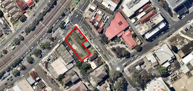
The development site is
outlined in red.
|
Executive Summary
Proposal
1. The
development application proposes demolition works and construction of a twelve
(12) storey shop top housing development comprising three (3) levels of
basement parking. Three (3) retail tenancies fronting Railway Parade are
proposed on the ground floor, with vehicular access proposed from Gray Street.
The total number of units proposed is fifty two (52) residential units (10 x 1
bedroom units, 39 x 2 bedroom units and 3 x 3 bedroom units). Communal open
space is provided on the first floor and on the rooftop.
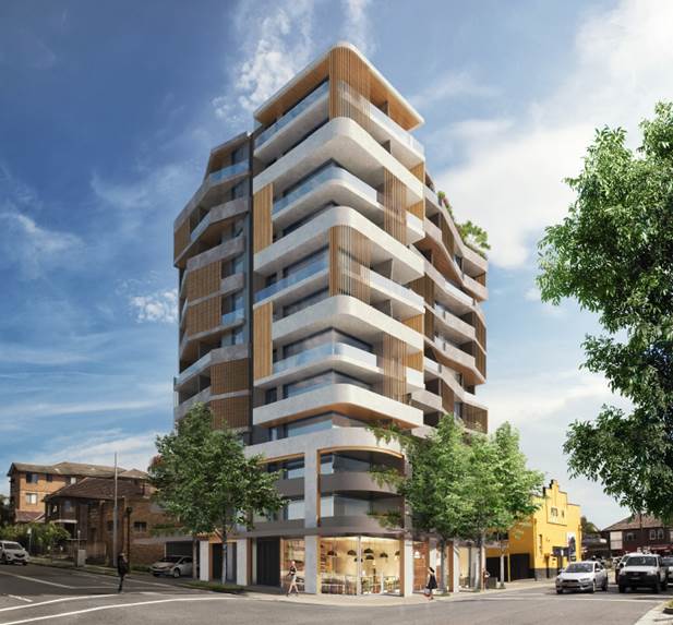
Figure
1: Photomontage of the proposal
Site and Locality
2. The
subject site is legally identified as Lot 11 in DP911188 and Lots 2 and 3 in
DP1753, and has a street address of 1B Gray Street and 172-174 Railway Parade,
Kogarah.
3. The
site is located on the corner of Railway Parade and Gray Street. The site
currently contains a single storey brick building on the corner of Railway
Parade and Gray Street.
4. The
intersection of Gray Street and Railway Parade is a signalised intersection.
5. The
wider locality features a diverse mix of land uses including primarily medical
related uses, commercial/retail activities, shop top housing and the St George
Hospital campus, further to the south east.
Zoning and Permissibility
6. The
site is zoned ‘B4 Mixed Use’ under the Kogarah Local Environmental
Plan 2012 (KLEP). The development is defined as shop top housing under KLEP
which is permissible with consent in this zone.
Submissions
7. The
development application was publicly exhibited in accordance with the
provisions of the Kogarah Development Control Plan 2013. Two (2) submissions
were received in response.
8. Amendments
to the application undertaken during the course of its assessment were not
required to be publicly notified in accordance with the development control
plan, as they did not result in significant additional environmental impacts.
Level of Determination
9. This
development application is referred to the Local Planning Panel for
consideration and determination as it comprises development to which State
Environmental Planning Policy No 65 – Design Quality of Residential
Apartment Development applies as required by the Ministerial Direction of 23
February 2018.
Conclusion
10. The
proposed development has been assessed having regard to the matters for
consideration under Section 4.15(1) of the Environmental Planning and
Assessment Act 1979. The proposal is acceptable and it is recommended for
approval subject to conditions.
Report in Full
Description of Proposal
11. The
development application proposes demolition works and construction of a 12
storey shop top housing development including three (3) levels of basement
parking. Three (3) retail tenancies fronting Railway Parade are proposed on the
ground floor, with vehicular access from Gray Street. The total number of
residential units proposed is 52 (10 x 1 bedroom units, 39 x 2 bedroom units
and 3 x 3 bedroom units). Communal open space is provided on the first floor
and on the rooftop.
12. Specifically,
the proposal includes the following:
Basement Levels
· Basement Level 1 - This basement level contains 18 parking spaces,
residential storage, bicycle parking, two (2) lift, egress stairs and plant.
· Basement Level 2 - This basement level contains 28 parking spaces,
residential storage, two (2) lifts, egress stairs and plant.
· Basement Level 3 - This basement level contains 29 parking spaces,
residential storage, two (2) lifts, egress stairs and plant.
Ground Floor
The
ground floor contains three (3) retail tenancies fronting Railway Parade, the
residential entry lobby from Gray Street, service and plant rooms, an
accessible WC, lift and stair access to the basements and levels above.
Vehicular access to the site is from Gray Street, and five parking spaces plus
a loading bay are located on this level, as well as the commercial and
residential bin store rooms.
Level 1
This
level contains five units (1 x 1 bedroom, 3 x 2 bedroom and 1 x 3 bedroom
units). An area of communal open space is also provided on this level at the
rear of the units.
Levels 2 and 3
These
levels contain five units each (1 x 1 bedroom, 3 x 2 bedroom and 1 x 3 bedroom
units).
Levels 4 to 10
These
levels contain five units at each level (1 x 1 bedroom and 4 x 2 bedroom
units).
Level 11
This
level contains 2 x 2 bedroom units and an area of communal open space and
supporting services.
Description of
the Site and Locality
13. The
subject site is legally identified as Lot 11 in DP911188 and Lots 2 and 3 in
DP1753, and has a street address of 1B Gray Street and 172-174 Railway Parade,
Kogarah. The site is located on the corner of Railway Parade and Gray Street.
The site
currently contains a single storey brick building in poor condition on the
corner of Railway Parade and Gray Street and a vacant allotment.
14. The
site is of an irregular shape, having street frontages of 26.72m to Railway
Parade, 28.395m to Gray Street, a depth of 45.185m along the south western site
boundary and an overall area of 1,097sqm.
15. The
intersection of Gray Street and Railway Parade is a signalised intersection.
16. Immediately
to the south west of the site is an at-grade car park and single storey
commercial building known as 176-178 Railway Parade. Immediately to the south
east at 1A Gray Street is a substation.
17. Across
Gray Street to the east are terraces at 4-14 Gray Street, which are listed in
Schedule 5 of Kogarah LEP 2102 as heritage items of local significance (Item
I75).
18. Across
Railway Parade from the site is the Illawarra Railway Line and associated
commuter car parking.
19. The
site is situated on the south western edge of the Kogarah Town Centre forming
part of a narrow strip of uses along the southern side of Railway Parade that
is in the process of transitioning from a mix of small scale residential and
commercial land uses into a range of commercial and residential uses permitted
under the Local Environmental Plan.
20. To
the north east of the site (the Town Centre) features a diverse mix of land
uses including primarily medical related uses, commercial/retail activities,
shop top housing and most prominently the St. George Hospital campus. Kogarah
railway station and the adjoining retail complex known as Kogarah Town Centre
are approximately 400m walking distance from the site.
21. The
character of development south and west of the site (with the exception of the
aforementioned strip along Railway Parade) is dominated by residential land
uses including dwelling houses, residential flat buildings and similar. The
scale of development generally diminishes with the distance from Railway Parade
and Gray Street to the south west.
22. The
current nature of the site and its immediate surrounds are illustrated in
figures 2 to 5 below.

Figure
2: The site as viewed from the
intersection of Railway Parade and Gray Street
Figure 3: The
site as viewed from Railway Parade
Figure
4: Substation at 1A Gray Street
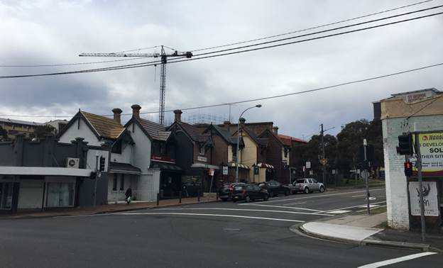
Figure
5: Development on the eastern side of
Gray Street
PLANNING
ASSESSMENT
23. The
subject site has been inspected and the development has been assessed under the
relevant Section 4.15, Matters for Consideration of the Environmental Planning
& Assessment Act 1979.
Environmental
Planning Instruments
State Environmental Planning Policies
24. Compliance
with relevant State Environmental Planning Policies is summarised in the table
as follows and discussed in more detail thereafter.
|
State
Environmental Planning Policy
|
Complies
|
|
State
Environmental Planning Policy No 55 - Remediation of Land
|
Yes
|
|
State
Environmental Planning Policy (Building Sustainability Index: BASIX) 2004
|
Yes
|
|
State
Environmental Planning Policy (Vegetation in Non-Rural Areas) 2017
|
N/A
|
|
State Environmental
Planning Policy No. 65 - Design Quality of Residential Apartment Development
|
Yes
|
|
State
Environmental Planning Policy – Infrastructure
|
Yes
|
State
Environmental Planning Policy No 55 - Remediation of Land
25. SEPP
55 aims to promote the remediation of contaminated land in order to reduce the
risk of harm to human health or any other aspect of the environment.
26. Clause
7 requires contamination and remediation to be considered in determining a
development application. The consent authority must not consent to the carrying
out of development on land unless it has considered whether or not the land is
contaminated.
27. A Detailed Investigation
Report was submitted with the application, which concludes:
‘At
the time of the site investigation, Lots 2 & 3 are vacant, and a
dilapidated building occupied Lot 11. Fibre cement sheeting which is expected
to contain asbestos was identified within the fabric of the dilapidated
building on Lot 11. The site was enclosed, although breaches in the wire mesh
fence were noted along the western boundary.
Soil
samples were recovered from a total of seven locations across the site for this
investigation, and the results of the sample analyses have shown that the
concentrations of chemical contaminants in the soils across the site are
generally low and at levels that would not present an unacceptable risk to
human-health for a commercial/high density residential land use setting.
Further, the site is not likely to be a source of unacceptable groundwater impacts.
However,
both bonded asbestos and friable asbestos/asbestos fines were identified in the
fill material on the southern half of the site. The concentrations of bonded
asbestos and friable asbestos/asbestos fines identified in BH5 and BH6A
respectively exceed the screening criteria. The asbestos impacted soil could
present a potential risk to human-health for a commercial/high-density
residential land use setting if
a) the
soil was to remain on the site and
b) if the
affected soil was to be accessible to site occupants.
Remediation
of the asbestos impacted soil will be necessary to make the site suitable for
the proposed mixed commercial and high-density residential redevelopment.
However, given that most of the site is proposed to be bulk excavated for a
basement car parking area, remediation might be achieved simply by redeveloping
the site in accordance with the proposed plans. Proposed excavation works at
the site should be carried out according to a remediation action plan (RAP).
The plan would define the remediation objectives and strategies to make the
land suitable for the intended use.
Further
soil sampling will be required to validate the success of the remedial
strategies.’
28. In
line with the requirements of SEPP 55, a Remedial Action Plan is required to be
submitted to Council prior to ensure the site complies with the provisions of
SEPP 55 and can be remediated to be fit for purpose. Whilst a contamination
assessment report has been submitted, a Remediation Action Plan has not. As this
information has not been lodged with the application and certainty is not
provided, the application is recommended to be deferred to enable the applicant
to prepare and submit the report.
State
Environmental Planning Policy (Building Sustainability Index: BASIX) 2004
29. The
State Environmental Planning Policy (Building Sustainability Index: BASIX) 2004
aims to ensure consistency in the implementation
of a scheme to encourage sustainable residential development throughout New
South Wales (also referred to as the ‘BASIX scheme’).
30. A
BASIX certificate accompanies the DA verifying that the relevant water, energy
and thermal comfort targets have been met by the proposal. Conditions of
consent have been included in the recommendation to ensure the commitments
required under the BASIX certificate will be satisfied by the proposed
development.
State Environmental Planning Policy (Infrastructure) 2007
31. The
aim of the Infrastructure SEPP is to facilitate the effective delivery of
infrastructure across the State.
32. The
DA was referred to Ausgrid on 10 May 2019 in accordance with Clause 45 of State
Environmental Planning Policy (Infrastructure) 2007. Comments were received on
26 September 2019 and 2 October 2019. A deferred commencement condition has been
recommended to address the issues raised by Ausgrid in their comments, which
include requirements for a Vibration Management Plan, a Displacement Monitoring
Plan, and amended shoring plans to the satisfaction of Ausgrid.
State Environmental Planning Policy (Vegetation in Non-Rural Areas)
2017
33. The
State Environmental Planning Policy (Vegetation in Non-Rural Areas) 2017
(‘Vegetation SEPP’) regulates clearing of native vegetation on
urban land and land zoned for environmental conservation/management that does
not require development consent.
34. The
Vegetation SEPP applies to clearing of:
a) Native
vegetation above the Biodiversity Offset Scheme (BOS) threshold where a
proponent will require an approval from the Native Vegetation Panel established
under the Local Land Services Amendment Act 2016; and
b) Vegetation
below the BOS threshold where a proponent will require a permit from Council if
that vegetation is identified in the council’s development control plan
(DCP).
35. The
Vegetation SEPP repeals clauses 5.9 and 5.9AA of the Standard Instrument -
Principal Local Environmental Plan, with the regulation of the clearing of
vegetation (including native vegetation) below the BOS threshold being through
any applicable DCP.
36. No
issues arise in terms of the provisions of the Vegetation SEPP, as there is no
significant vegetation on the site or within the footpath area or immediately
fronting the site. Further, there is no significant vegetation on immediately
adjoining properties in close proximity to the site.
State
Environmental Planning Policy No 65 – Design Quality of Residential
Apartment Development
37. The
State Environmental Planning Policy No 65 – Design Quality of Residential
Apartment Development (‘SEPP 65’) aims to improve the design
quality of residential apartment development in New South Wales.
38. The
proposed development meets the pre-requisites for the application of the SEPP
65 in that it constitutes development for the purpose of ‘shop top
housing’ in a proposed building of more than three (3) storeys and having
more than four (4) dwellings. Therefore, it must be assessed against the
provisions of SEPP 65 and the Apartment Design Guide (ADG).
39. A
design verification statement dated February 2018 has been provided by Jim
Apostolou Registered Architect (Registration No. 7490) in accordance with
Clause 50 of the Environmental Planning and Assessment Regulation 2000.
40. The
DA has been reviewed by the Design Review Panel (DRP) and their comments are
further detailed in the DRP discussions below.
Design
Review Panel
41. The
initial plans that accompanied the application were referred to the Design
Review Panel (DRP) on 5 July 2018. The design quality principles of SEPP 65 are
addressed as follows, in the context of the DRP comments. Commentary in
response has been provided by the Assessment Officer where necessary.
|
SEPP
65 – Design Quality of Residential Flat Buildings
|
DRP
Comment
|
General
comment
|
|
Context and Neighbouring
Character
Good design
responds and contributes to its context. Context is the key natural and
built features of an area, their relationship and the character they
create when combined. It also includes social, economic, health and
environmental conditions.
Responding
to context involves identifying the desirable elements of an area’s
existing or future character. Well-designed buildings respond to and
enhance the qualities and identity of the area including the adjacent sites,
streetscape and neighbourhood.
Consideration
of local context is important for all sites, including sites in established
areas, those undergoing change or identified for change.
|
The site
is in an area of transition to mixed use along Railway Parade. The land to
the south east is zoned R3 with a height control of 21m. To the immediate
south east of the site in Gray Street there is one (1) storey substation. To
the south west of the site there is a range of commercial buildings not yet
developed. The design responds well to the context by concentrating the
building to the north and north east portion of the site which minimises
overshadowing of properties to the south east. The location is subject to a
Sydney Airport Obstacle Limitation surface of AHD51m. The proposed highest
point of the building is RL66.20. The Council Planner’s notes state
that the application has been referred to Sydney Airport Corporation.
|
The
proposal is suitable for the site within the context of the locality which is
undergoing transition to a higher density of mixed use, commercial and
residential development.
Approval
for controlled activity has been granted by Sydney Airport.
|
|
Built
Form and Scale
Good design
achieves a scale, bulk and height appropriate to the existing or desired
future character of the street and surrounding buildings.
Good
design also achieves an appropriate built form for a site and the
building’s purpose in terms of building alignments, proportions,
building type, articulation and the manipulation of building elements.
Appropriate
built form defines the public domain, contributes to the character
of streetscapes and parks, including their views and vistas, and
provides internal amenity and outlook.
|
Satisfactory
- see above
The
recessed roller door shutter to the basement should be moved forward to align
with the electricity substation and to provide a clearly defined streetscape
interface.
|
The
proposed bulk, scale and height of the building are supported and will set a
positive example for future development in the locality. The ground floor
relates well to the public domain and is an improvement on the streetscape.
|
|
Density
Good design
achieves a high level of amenity for residents and each apartment, resulting
in a density appropriate to the site and its context.
Appropriate
densities are consistent with the area’s existing or projected
population. Appropriate densities can be sustained by existing or proposed
infrastructure, public transport, access to jobs, community facilities and
the environment.
|
Complies
|
The
proposed development has an FSR of 4:1 which complies with the LEP maximum
for the site of 4:1.
|
|
Sustainability
Good design
combines positive environmental, social and economic outcomes.
Good
sustainable design includes use of natural cross ventilation and sunlight for
the amenity and liveability of residents and passive thermal design
for ventilation, heating and cooling reducing reliance on technology and
operation costs. Other elements include recycling and reuse of materials and
waste, use of sustainable materials and deep soil zones for groundwater
recharge and vegetation.
|
Subject
to BASIX
Solar
access and cross ventilation is satisfactory.
|
The
proposal is BASIX compliant.
|
|
Landscape
Good
design recognises that together landscape and buildings operate as
an integrated and sustainable system, resulting in attractive developments
with good amenity. A positive image and contextual fit of well
designed developments is achieved by contributing to the landscape
character of the streetscape and neighbourhood.
Good
landscape design enhances the development’s environmental performance
by retaining positive natural features which contribute to the local
context, co-ordinating water and soil management, solar access,
micro-climate, tree canopy, habitat values and preserving green
networks.
Good
landscape design optimises useability, privacy and opportunities
for social interaction, equitable
access, respect for neighbours’ amenity and
provides for practical establishment and long term management.
|
The
proposal includes a communal open space on Level 1 to the rear of the
development and a communal roof top space. The proposal also includes
streetscape upgrades to Railway Parade and Gray Street.
The
following recommendations are made to improve communal open space on Level 1:
· Reconfiguration
of Unit 105 to provide direct access from the lift lobby to communal open
space. This would require review of the terrace proposed adjacent to the
communal open space which should still be accommodated, and designed to
ensure adequate privacy between the unit and communal area.
· Substitution
of the proposed species in the deep soil zone. It is recommended that taller
trees be used to replace the melaleuca stypholioides.
· Relocate
children’s play area to provide more planting and screening to private
open space
· Provide
a WC
The roof
top space is well designed and will provide very positive amenity for
residents. A WC is required.
|
The
landscaped communal open space areas located at the first floor and rooftop
are well designed and will provide high levels of amenity for residents.
Direct
access is provided from the lift lobby to the COS and greater separation and
planting is provided between the POS terrace of U1.05 and the COS.
|
|
Amenity
Good design
positively influences internal and external amenity for residents
and neighbours. Achieving good amenity contributes to positive living
environments and resident wellbeing.
Good
amenity combines appropriate room dimensions and shapes, access to sunlight,
natural ventilation, outlook, visual and acoustic privacy, storage, indoor
and outdoor space, efficient layouts and service areas and ease of access for
all age groups and degrees of mobility.
|
The
Panel discussed arrangements for collection of garbage bins. The method of
collection of residential garbage bins needs to be resolved in consultation
with Council‘s Waste Management Officer. The Panel was concerned that a
large number of bins could be lined along the kerb for collection
detrimentally impacting the streetscape. It is understood the commercial
garbage will be collected by a private contractor within the building.
At
fourth and sixth floors screens are shown on north facing terraces. The
impact of these screens in reducing solar access needs to be investigated.
Units
404, 504, 604, 704, 804, 904 and 1004 have a very narrow triangular section
of balcony adjacent to the bedrooms. This section of balcony is inaccessible
and will be difficult to clean and should be reconfigured.
Otherwise
satisfactory.
|
The proposal
will provide high levels of residential amenity with regard to solar access,
natural ventilation, communal open space and building facilities.
The bins
have been changed from 240L to 1,100L bins to reduce the number of bins
servicing the development and on the street on collection days.
The screens
have been relocated to the western elevation of the terraces to improve solar
access into the units.
These
balconies have been redesigned to provide a greater setback to the street and
are now a Juliette style balcony rather than an extension of the primary
balcony.
|
|
Safety
Good design
optimises safety and security within the development and the public domain.
It provides for quality public and private spaces that are clearly defined
and fit for the intended purpose.
Opportunities
to maximise passive surveillance of public and communal areas
promote safety.
A positive
relationship between public and private spaces is achieved through clearly
defined secure access points and well lit and visible areas that are easily
maintained and appropriate to the location and purpose.
|
An
additional bollard is required at the north west corner of the lift waiting
area in the basements.
Otherwise
satisfactory.
|
The design
is acceptable in terms of safety and security and the ground level commercial
spaces will activate the street and allow for casual surveillance. Bollards
have been nominated on floor plans.
|
|
Housing
Diversity and Social Interaction
Good design
achieves a mix of apartment sizes, providing housing choice for different
demographics, living needs and household budgets.
Well-designed apartment
developments respond to social context by providing housing and facilities to
suit the existing and future social mix.
Good design
involves practical and flexible features, including different types of
communal spaces for a broad range of people and providing opportunities for
social interaction among residents.
|
The
Panel recommends more three (3) bedroom units be provided in accordance with
ADG guidelines.
The
Panel recommends that there should be a mix of one (1) bedroom and two (2)
bedroom adaptable units.
A WC
should be provided to the rooftop communal open space and the Level 1
communal open space.
|
The
proposal provides the following unit mix:
10 x 1
Bedroom units
39 x 2
Bedroom
3 x 3
Bedroom units
The
adaptable units are all 1 bedroom units. A condition has been included that
at least one 2B unit is adaptable.
A WC has
not been provided on either COS level.
|
|
Aesthetics
Good design
achieves a built form that has good proportions and a balanced composition of
elements, reflecting the internal layout and structure.
Good design
uses a variety of materials, colours and textures.
The visual
appearance of a well designed apartment development responds to the
existing or future local context, particularly desirable elements and
repetitions of the streetscape.
|
Acceptable
|
The
proposed materials and finishes are suitable for the design of the building
and contribute positively to the streetscape and the broader locality.
|
Apartment
Design Guide
42. An
assessment of the proposed development against the relevant design criteria of
the Apartment Design Guide (ADG) is detailed in the compliance table as
follows.
Note:
where relevant, the figures/percentages in the ADG compliance table have been
rounded up/down to the nearest whole number.
|
Section
|
Design Criteria
|
Proposed
|
Comply
|
|
3D - Communal and public open space
|
Communal open
space has a minimum area equal to 25% of the site (1079 x 0.25 = 269.75sqm)
|
Communal open space is located on
the first floor (357sqm and on the rooftop (170sqm) totalling 527sqm or 48.8%
of the site area.
|
Yes
|
|
Developments
achieve a minimum of 50% direct sunlight to the principal usable part of the
communal open space for a minimum of 2 hours between 9 am and 3 pm on 21 June
(mid-winter)
|
2 hours of
sunlight is achieved to at least 50% of the
communal open space areas, with the roof top area receiving direct sunlight.
|
Yes
|
|
3E – Deep soil zones
|
Deep soil zones
are required at a sliding scale in this clause.
For a site area of
1079sqm, the deep soil zone requirement is a deep soil zone of 7% with
minimum 3m dimensions.
|
78sqm (7%) of deep
soil is provided on the eastern side of the site with dimensions of 4.5m x
18.29m.
|
Yes
|
|
3F – Visual privacy
|
Minimum required separation
distances from buildings to the side and rear boundaries are as follows:
· For building
height up to 12m / 4 storeys – Habitable rooms and balconies 6m; and
non-habitable rooms 3m.
· For building
height up to 25m / 5-8 storeys – Habitable rooms 9m; and non-habitable
rooms 4.5m.
· For building
height over 25m / 9+ storeys – Habitable rooms 12m; and non-habitable
rooms 6m
|
Setbacks to south-east boundary:
Ground – landscaped setback
to blank wall 4.5m.
Levels 1 to 3: Minimum of 15m to a
habitable window (13.6m to balcony edge L1).
Level 4: Minimum 15m to balcony
edge.
Level 5 to 10: Minimum 16m to
balcony edge
Level 11: there are no habitable
windows or balconies facing the southern boundary.
|
Yes
|
|
3J – Bicycle and car parking
|
For development in
the following locations:
· on sites that are within 800m of a railway station or light rail
stop in the Sydney Metropolitan Area; or
· on land zoned, and sites within 400 metres of land zoned, B3
Commercial Core, B4 Mixed Use or equivalent in a nominated regional centre
the minimum car
parking requirement for residents and visitors is set out in the Guide to
Traffic Generating Developments, or the car parking requirement prescribed by
the relevant council, whichever is less
The car parking
needs for a development must be provided off street
|
Required parking:
(10) 1B x 0.4 = 4
(39) 2B x 0.7 = 27
(3) 3B x 1.2 = 3.6
Visitor 1/7 (52) = 7.4
Total = 42 car spaces
Provided:
66 residential
8 visitor
6 retail
|
Yes
|
|
4A – Solar and daylight
access
|
Living rooms
and private open spaces of at least 70% of apartments in a building receive a
minimum of 2 hours direct sunlight between 9am and 3pm at mid-winter in the
Sydney Metropolitan Area and in the Newcastle and Wollongong local government
areas
|
100% of units achieve minimum 2
hours sunlight in mid-winter.
|
Yes
|
|
A maximum of
15% of apartments in a building receive no direct sunlight between 9am and
3pm at mid-winter
|
All units receive some level of
direct sunlight.
|
Yes
|
|
4B – Natural ventilation
|
At least 60% of
apartments are naturally cross ventilated in the first nine storeys of the
building. Apartments at ten storeys or greater are deemed to be cross
ventilated only if any enclosure of the balconies at these levels allows
adequate natural ventilation and cannot be fully enclosed.
|
60% of units are cross ventilated
(Levels 1-8).
Levels 9 to 11 all comply.
|
Yes
|
|
Overall depth
of a cross-over or cross-through apartment does not exceed 18m, measured
glass line to glass line.
|
All of the proposed units are less
than 18m in depth.
|
Yes
|
|
4C – Ceiling heights
|
Measured from
finished floor level to finished ceiling level, minimum ceiling heights are:
· Habitable
rooms 2.7m
· Non-habitable
rooms 2.4m
· For
2 storey apartments: 2.7m for main living area floor
2.4m for second
floor, where its area does not exceed 50% of the apartment area
· Attic
spaces: 1.8m at edge of room with a 30 degree minimum ceiling slope
· If
located in mixed use areas - 3.3m for ground and first floor to promote
future flexibility of use
These minimums
do not preclude higher ceilings if desired.
|
All of the proposed units have
ceiling heights of 2.8m.
|
Yes
|
|
4D – Apartment size and
layout
|
Apartments are
required to have the following minimum internal areas:
Studio – 35sqm
1 bedroom
– 50sqm
2 bedroom
– 70sqm
3 bedroom
– 90sqm
The minimum
internal areas include only one bathroom. Additional bathrooms increase the
minimum internal area by 5sqm each
A fourth
bedroom and further additional bedrooms increase the minimum internal area by
12sqm each.
|
All apartments meet the minimum
internal size requirements.
Calculated accordingly.
N/A
|
Yes
Yes
N/A
|
|
Every habitable
room must have a window in an external wall with a total minimum glass area
of not less than 10% of the floor area of the room. Daylight and air may not
be borrowed from other rooms.
|
All within the prescribed range.
It is noted that all bathrooms are
internal except for units X.05 which have a window
|
Yes
|
|
Habitable room depths are limited
to a maximum of 2.5m x the ceiling height.
|
All within the prescribed range.
|
Yes
|
|
In open plan
layouts (where the living, dining and kitchen are combined) the maximum
habitable room depth is 8m from a window
|
All within the prescribed range.
|
Yes
|
|
Master bedrooms
have a minimum area of 10sqm and other bedrooms 9sqm (excluding wardrobe
space)
|
All bedrooms comply.
|
Yes
|
|
Bedrooms have a
minimum dimension of 3m (excluding wardrobe space)
|
All bedrooms comply.
|
Yes
|
|
Living rooms or
combined living/dining rooms have a minimum width of:
· 3.6m for studio and 1 bedroom apartments
· 4m for 2 and 3 bedroom apartments
|
All living rooms comply.
|
Yes
|
|
The width of
cross-over or cross-through apartments are at least 4m internally to avoid
deep narrow apartment layouts.
|
All of the proposed units are in
excess of 4m in width internally.
|
Yes
|
|
4E – Private open space and
balconies
|
All apartments are
required to have primary balconies as follows:
· Studio apartments require 4sqm with no min depth
· 1 bedroom apartments require 8sqm with min depth 2m
· 2 bedroom apartments require 10sqm with min depth 2m
· 3+ bedroom apartments require 12sqm with minimum 2.4m depth
The minimum
balcony depth to be counted as contributing to the balcony area is 1m.
|
All primary balconies achieve the
minimum area and depth requirements.
Calculated accordingly.
|
Yes
Yes
|
|
For apartments at ground level or
on a podium or similar structure, a private open space is provided instead of
a balcony. It must have a minimum area of 15sqm and a minimum depth of 3m.
|
There are no ground floor units
proposed.
|
N/A
|
|
4F – Common circulation and
spaces
|
The maximum number
of apartments off a circulation core on a single level is eight.
|
A maximum of 5
units at each level.
|
Yes
|
|
For buildings of
10 storeys and over, the maximum number of apartments sharing a single lift
is 40.
|
Two lifts service
52 apartments and 3 levels of basement parking.
|
Yes
|
|
4G - Storage
|
In addition to
storage in kitchens, bathrooms and bedrooms, the following storage is
provided:
· Studio apartments require 4m3
· 1 bedroom apartments require 6m3
· 2 bedroom apartments require 8m3
· 3+ bedroom apartments require 10m3
At least 50% of
the required storage is to be located within the apartment.
|
All units have compliant total
storage volumes as per the Apartment Design Guide (ADG) volumes.
At least 50% of storage is located
within the apartments.
|
Yes
Yes
|
Draft
Environmental Planning Instruments
Draft
Environment SEPP
43. The
Draft Environment SEPP was exhibited from 31 October 2017 to 31 January 2018.
44. This consolidated SEPP proposes to simplify the planning
rules for a number of water catchments, waterways, urban bushland, and
Willandra Lakes World Heritage Property.
· Changes
proposed include consolidating the following seven existing SEPPs:
· State
Environmental Planning Policy No. 19 – Bushland in Urban Areas
· State
Environmental Planning Policy (Sydney Drinking Water Catchment) 2011
· State
Environmental Planning Policy No. 50 – Canal Estate Development
· Greater
Metropolitan Regional Environmental Plan No. 2 – Georges River Catchment
· Sydney
Regional Environmental Plan No. 20 – Hawkesbury-Nepean River (No.2-1997)
· Sydney
Regional Environmental Plan (Sydney Harbour Catchment) 2005
· Willandra
Lakes Regional Environmental Plan No. 1 – World Heritage Property.
45. The proposal is consistent
with the provisions of this Draft Instrument given there is no vegetation
impacted by the proposed development.
Draft
Remediation of Land SEPP
46. The
Department of Planning and Environment has announced a Draft Remediation of Land
SEPP, which will repeal and replace the current State Environmental Planning
Policy No 55—Remediation of Land.
47. The
main changes proposed include the expansion of categories of remediation work
which requires development consent, a greater involvement of principal
certifying authorities particularly in relation to remediation works that can
be carried out without development consent, more comprehensive guidelines for
Councils and certifiers and the clarification of the contamination information
to be included on Section 149 Planning Certificates.
48. Whilst the proposed SEPP will retain the key
operational framework of SEPP 55, it will adopt a more modern approach to the
management of contaminated land.
49. A Detailed Site Investigation Report has been
submitted with the DA which concludes:
“Soil samples were recovered from a
total of seven locations across the site for this investigation, and the
results of the sample analyses have shown that the concentrations of chemical
contaminants in the soils across the site are generally low and at levels that
would not present an unacceptable risk to human-health for a commercial/high
density residential land use setting. Further, the site is not likely to be a
source of unacceptable groundwater impacts.
However, both bonded asbestos and friable
asbestos/asbestos fines were identified in the fill material on the southern
half of the site. The concentrations of bonded asbestos and friable
asbestos/asbestos fines identified in BH5 and BH6A respectively, exceed the
screening criteria. The asbestos impacted soil could present a potential risk
to human-health for a commercial/high-density residential land use setting if
a) the soil was to remain on the site and b) if the affected soil was to be
accessible to site occupants.
Remediation of the asbestos impacted soil
will be necessary to make the site suitable for the proposed mixed commercial
and high-density residential redevelopment. However, given that most of the
site is proposed to be bulk excavated for a basement car parking area,
remediation might be achieved simply by redeveloping the site in accordance
with the proposed plans. Proposed excavation works at the site should be
carried out according to a remediation action plan (RAP). The plan would define
the remediation objectives and strategies to make the land suitable for the
intended use.
Further soil sampling will be required to validate the
success of the remedial strategies.”
50. In
line with the requirements of SEPP 55, a Remedial Action Plan is required to be
submitted to Council prior to ensure the site complies with the provisions of
SEPP 55 and can be remediated to be fit for purpose. Whilst a contamination
assessment report has been submitted, a Remediation Action Plan has not. As
this information has not been lodged with the application and certainty is not
provided, the application is recommended to be deferred to enable the applicant
to prepare and submit the report.
Kogarah Local
Environmental Plan 2012
Zoning and
Permissibility
51. The
site is located within the ‘B4 Mixed Use’ zone under the Kogarah
Local Environmental Plan 2012.
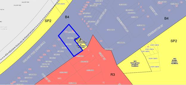
Figure 6: Zoning
map with the site outlined in blue
52. The
proposed development is defined as shop top housing, which is permissible in
the zone.
53. The
objectives for development in the B4 Mixed Use zone are as follows:
· To
provide a mixture of compatible land uses.
· To
integrate suitable business, office, residential, retail and other development
in accessible locations so as to maximise public transport patronage and
encourage walking and cycling.
· To
encourage development that contributes to economic growth and employment
opportunities.
· To
encourage development that contributes to an active, vibrant and sustainable
town centre.
· To provide opportunities for residential development, where
appropriate.
54. The
proposed development is consistent with the above objectives in that it
provides for additional residential accommodation and compatible commercial
tenancies at the ground floor level within close proximity to a range of
services and facilities including public transport options. The additional
residential accommodation and commercial tenancies will contribute to the
economic viability and social vibrancy of the Kogarah Town Centre.
55. An
assessment of the proposed development against the relevant provisions of
Kogarah LEP 2012 is detailed in the compliance table below.
|
Clause
|
Objectives/Provisions
|
Comment
|
Complies
|
|
4.3 - Height of buildings
|
The height of a
building on any land is not to exceed the maximum height shown for the land
on the Height of Buildings Map. In this case, the relevant map limits the height
of buildings on the subject site to 39m.
|
The proposal has a
building height of up to 38.85m.
|
Yes
|
|
4.4 - Floor space ratio
|
The maximum
floor space ratio for a building on any land is not to exceed the floor space
ratio shown for the land on the Floor Space Ratio Map. In this case, the
relevant map limits the floor space ratio for buildings on the subject site
to 4.5:1.
|
The proposal has a
floor space ratio of 4:1.
|
Yes
|
|
6.1 - Acid sulfate soils
|
The objective
of this clause is to ensure that development does not disturb, expose or
drain acid sulfate soils and cause environmental damage.
|
The subject site
is not identified on the Acid Sulfate Soils Map as being affected by any
particular class of acid sulfate soils.
|
N/A
|
|
6.2 - Earthworks
|
The objective
of this clause is to ensure that earthworks for which development consent is required
will not have a detrimental impact on environmental functions and processes,
neighbouring uses, cultural or heritage items or features of the surrounding
land.
|
Excavation is limited to the extent
required for the basement parking levels. Suitable conditions of consent have
been recommended to protect neighbouring properties and the public domain
during demolition and construction.
|
Yes
|
|
6.3 - Flood planning
|
The objectives
of this clause are as follows:
(a) to minimise the flood risk to life and property associated with the
use of land,
(b) to allow development on land that is compatible with the
land’s flood hazard, taking into account projected changes as a result
of climate change,
(c) to avoid significant adverse impacts on
flood behaviour and the environment.
|
The subject site is not identified
on the Flood Planning Map as being within a Flood Planning Area. Further,
Council’s records do not indicate the site is at or below the
‘flood planning level’.
|
N/A
|
|
6.5 - Airspace operations
|
The objective of
this clause is to protect airspace around airports
|
The proposed
development will penetrate prescribed airspace for Sydney Airport requiring a
‘controlled activity’ within the meaning of Division 4 of Part 12
of the Airports Act 1996. The applicant has obtained the necessary approval
for the controlled activity (refer to further commentary in the referrals
section of this report).
|
Yes
|
Development
Control Plans
Kogarah
Development Control Plan 2013
56. The
provisions of the Kogarah Development Control Plan 2013 (KDCP 2013) are
relevant to the proposed development. Several controls within the KDCP 2013 do
not align and significantly conflict with the scale of development now
permitted under the KLEP 2012 (as amended on 26 May 2017). As a consequence,
the proposed development will contravene a number of the controls including
significant variations to the height and floor space ratio controls.
57. The
significant variations to KDCP 2013 have resulted from the subsequent
amendments to KLEP 2012 which allows a higher density/scale of development. The
approach to support the development with significant variations to KDCP 2013
(but compliant with KLEP 2012) is consistent with recent judgements in the NSW
Land and Environment Court. In particular, in Michael Murr v Georges River
Council [2017] NSWLEC1369.
58. It
is also noted that in the hierarchy of planning controls, Development Control
Plans cannot prescribe more onerous corresponding controls than those in a
Local Environmental Plan.
59. An
assessment of the proposed development against the relevant controls in the
KDCP 2013 is detailed in the compliance table below.
|
Part B General Controls
|
|
Part
|
Objectives/Controls
|
Comments
|
Complies
|
|
B2 - Tree Management and Green Web
|
The objectives of
this part include the following:
· Ensure the protection of existing trees which contribute to the
visual amenity and environment of the City of Kogarah;
· Protect trees within and adjacent to development sites;
· Maximise healthy tree canopy coverage across the City of Kogarah.
|
Tree removal has
been assessed earlier in this report under the provisions of the Vegetation
SEPP.
The site is not
within a ‘habitat corridor’ or ‘habitat reinforcement
corridor’ under Council’s green web strategy.
|
N/A
|
|
B3 - Developments near Busy Roads
and Rail Corridors
|
The objectives of
this part are to:
· Ensure an appropriate acoustic amenity can be achieved for
development near transport corridors, particularly residential development
and other noise sensitive land uses;
· Provide additional acoustic design or mitigation measures that may
be necessary;
· Development fronting a busy road or a rail corridor should be
designed and sited to minimise noise impacts.
|
An Acoustic Report
has been submitted with the application and relevant conditions of consent
are recommended in this report to mitigate Rail noise.
|
Yes
|
|
B4 - Parking and Traffic
|
The objectives of
this part are to:
· Minimise traffic congestion and ensure adequate traffic safety and
management;
· Ensure an adequate environmental quality of parking areas
(including both safety and amenity);
· Provide adequate car parking for building users and visitors,
depending on building use and proximity to public transport.
|
The car parking
rates for the Kogarah Town Centre as specified in Part E1 of the DCP prevail
over those rates specified in this part. In accordance with the provisions of
clause 3.43(5) of the EP&A Act, this control has no effect.
|
N/A – Refer to the ADG assessment
earlier in this report. The car parking is compliant.
|
·
|
|
|
B5 - Waste Management and
Minimisation
|
The objectives of this part are to:
· Encourage best
practice in waste management that minimises waste generation, facilitates
waste separation and maximises reuse and recycling;
· Ensure quality
design of waste management facilities that complement the building design and
minimise noise, odour and visual impacts on adjacent uses and the public
domain;
· Ensure suitable
and efficient waste storage, recycling and collection in all development.
|
A waste management plan has been
submitted with the application and is considered acceptable for construction
and operation of the development.
|
Yes
|
|
B6 - Water Management
|
The objectives of
this part are to:
· Reduce flooding and drainage impacts within and downstream of the
development site;
· Reduce pollutant loads exported to the waterways via the
stormwater system;
· Conserve water and reduce mains water consumption.
|
A suitable
stormwater management plan has been provided and conditions of consent
provided by Council’s Development Engineer.
|
Yes
|
|
B7- Environment
Management
|
The objectives of
this part are to:
· Apply principles and processes that contribute to ecologically
sustainable development;
· Reduce the impacts of development on the environment;
· Increase the resilience of development to the effects of climate
change;
· Ensure that greenhouse gas emissions will be reduced;
· Reduce the use of potable water;
· Ensure that development can adapt to climate change.
|
A BASIX
certificate has been submitted with the application verifying that the
relevant water, energy and thermal comfort targets have been met by the
proposal.
Conditions of
consent have been included in the recommendation to ensure the commitments
required under the BASIX certificate will be satisfied by the proposed
development.
|
Yes
|
|
Part E1 Kogarah Town Centre -
Built Form
|
|
Part
|
Control
|
Proposed
|
Complies
|
|
3.4 - Building Heights
|
Maximum
building heights are shown in Figure 1 – Building Heights Plan.
Note: the
relevant figure prescribes a 12m height.
|
In accordance with
the provisions of clause 3.43(5) of the EP&A Act, this control has no
effect. In this regard, it is inconsistent with the building height standard
in KLEP 2012.
|
N/A - Refer to the KLEP 2012
assessment earlier in this report.
|
|
Articulation
Where buildings
are greater than four storeys, strong articulation should be provided in the
form of a setback at the 5th and 6th storey, a strongly marked balcony
cornice line (projection) and modulation in roof form.
|
The facades to
Railway Parade and Gray Street are highly articulated with the use of
recessed balconies, variations in balustrade treatments and a
‘stepped’ built form including distinctive facade treatments at
different levels.
|
Yes
|
|
3.5 - Building Density
|
The maximum
floor space ratios for the Kogarah Centre are specified in the Floor Space
Ratio Plan (Figure 4 below).
Note: the
relevant figure prescribes a 1.3:1 floor space ratio.
|
In accordance with
the provisions of clause 3.43(5) of the EP&A Act, this control has no
effect. In this regard, it is inconsistent with the floor space ratio
standard in KLEP 2012.
|
N/A – Refer to the KLEP 2012
assessment earlier in this report.
|
|
3.6 - Building Alignment
|
Buildings must
be built to the alignments specified in Figure 3.4 below, for the majority of
the facade length. This control requires the building to be built
predominantly to the specified building alignment; however buildings are not
to have straight, flat facades.
Note: the
relevant figure does not prescribe a setback to the subject site.
|
N/A
|
N/A
|
|
Buildings
require highly articulated facades with many projections such as stepped
facades, entry porches, bay windows and balconies to provide vertical
subdivisions and visual interest in the streetscape.
|
The facades to
Railway Parade and Gray Street are highly articulated with the use of
recessed balconies, variations in balustrade treatments and a
‘stepped’ built form including distinctive facade treatments at
different levels.
|
Yes
|
|
Lanes
For buildings
above 4m high, the whole of the building must be built to the alignments
specified in Figure 8.
Note: 3m
setback to lane required
|
Not applicable.
|
N/A
|
|
3.7 - Building Depth
|
New buildings are
to provide operable windows to all living and working environments.
|
All proposed units
include operable windows to enable cross ventilation.
|
Yes
|
|
Articulate
buildings using courtyards, atria and the like to achieve substantial day
lighting, cross ventilation and/or stack ventilation.
|
The rear of the
building is articulated to allow for separation to the adjacent properties
and to allow for solar access and ventilation to the X.01 and X.05 units at
each level.
The X.01 units are
located on a nil setback to the boundary and are all designed as
cross-through apartments.
|
Yes
|
|
The range of
maximum building depth for residential buildings in order to allow natural
light and cross ventilation should be 10m – 15m. This includes
sheltered balconies (which is a balcony with a roof over it), sunrooms and
the like.
|
In accordance with
the provisions of clause 6A (2) of SEPP 65, this control is of no effect.
|
N/A – Refer to the ADG
assessment earlier in this report.
|
|
3.8 - Floor to Ceiling Heights
|
Floor to ceiling
heights should be a minimum of 2.7m at upper storeys of buildings, to all
habitable rooms to allow for a range of uses, and to improve the
environmental performance and amenity of the building.
|
In accordance with
the provisions of clause 6A (2) of the SEPP 65, this control is of no effect.
|
N/A – Refer to the ADG
assessment earlier in this report.
|
|
3.9 - Parking Provision in the
Kogarah Town Centre
|
Car Parking
Residential
parking is to be provided in developments at the following rates:
(i) 1 resident car space is to be provided on-site
for each dwelling.
(ii) 1 visitor car space is to be provided on-site for each
5 dwellings.
(2) The number
of on-site resident and/or visitor car parking spaces for residential
development may be reduced at Council’s discretion if the applicant can
demonstrate a reduced parking need. Any negotiated/agreed reduction in
parking would have to be complemented by demonstrated tangible benefits which
are both complementary and consistent with the objectives of this Part.
(3) Specific
parking requirements apply to the following precincts: (i) Railway Parade
Precinct – Refer to Section 5.5 for requirements (ii) Railway Parade
South – Refer to Section 5.6 for requirements
(4) For
commercial/retail development and other land uses parking is to be provided
at the following rate: (i) 1 space per 40sqm for any floor space at ground
floor level. (ii) 1 space per 50sqm for all other floor space above ground
floor level.
(5) 1% of all
car parking spaces are to be designated “accessible” spaces for
people with mobility impairments, with a minimum of 1 space for facilities
such as medical suites.
(6) For car
parks between 10 to 99 spaces at least one “accessible” space must
be provided.
(7) Designated
“accessible” car spaces are to be treated as resident car spaces
in the calculation of the parking requirement.
|
In accordance with
the provisions of clause 3.43(5) of the EP&A Act, this control has no
effect.
|
N/A – Refer to the ADG
assessment earlier in this report.
|
|
Bicycle
Parking
Bicycle storage
is to be provided at the rate of:
(i) 1 secure bicycle storage facility per 2
residential units.
(ii) 1 bike space per 10 car spaces for the first 200
spaces then 1 space per 20 car spaces thereafter, for commercial and retail
land uses.
|
Required spaces =
26
Bicycle parking
(28 spaces) is provided in basement level 1.
|
Yes
|
|
|
Loading Bay
Facilities
(1) Loading bay
facilities are to be provided at the following rates:
Retail:
· floor area
15sqm to 500sqm - 1 bay required
· floor area
500sqm to 1500sqm - 2 bays required
Commercial:
· floor area
1000sqm to 5000sqm - 1 bay required
· floor area
5000sqm to 10000sqm - 2 bays required
(2) Loading bay
facilities are to be designed as follows:
· minimum
bay width - 3.5m
· minimum
bay length for Bay 1 - 9.5m
· minimum
bay length for Bay 2 - 6.5m
|
Three retail
tenancies are proposed (56sqm, 70sqm and 73sqm in size).
A loading bay is
provided on the ground floor, measuring 3.5m x 8.45m.
A condition has
been recommended requiring that the Loading Bay is compliant with
AS2890.1-2004 for the use at a minimum of Small Rigid Vehicles
|
Yes
|
|
Part E1 Kogarah Town Centre - Urban
Design
|
|
Part
|
Control
|
Proposed
|
Complies
|
|
4.1 Address and Active Street
Frontages
|
(1) Buildings
on the street frontage are to provide pedestrian amenity in the form of
active street frontages, building entrances and awnings.
(2) Buildings
setback from the street frontage, are to address the street with major
facades, entrances, stairs, low fences, substantial planting and other
streetscapes.
(3) In
predominantly residential areas, strengthen the interaction between the public
and private domain by providing multiple entrances for large developments,
locate shops where they will be most visible and minimise the vehicular
entrance width.
|
Active street
frontage is provided to Railway Parade through the tenancies. Gray Street is activated
by the entrance lobby to the residential apartments and vehicular entrance.
Suitable
façade and entry treatments are provided.
The tenancies are
oriented to Railway Parade and separated from the residential entry.
|
Yes
Yes
Yes
|
|
4.2 Corners
|
(1) Buildings
are to be sited on the street frontages at corners, addressing the corner.
(2) The street
intersection is to be addressed with splays, curves, building entries and
other special architectural elements.
(3) Architectural
corner elements may be slightly higher than the rest of the building. They
must not exceed 4.0m above the average street wall height. The floor space
they contain will be part of the total gross floor area of the building.
|
The building
addresses both street frontages as the development is a corner allotment.
Suitable
architectural elements are proposed to the corner at all levels of the
building.
The building is
compliant with the height limit for the site. The corner location is
pronounced with a variety of materials and finishes, articulation and screen
detailing.
|
Yes
Yes
Yes
|
|
4.3 - Architectural Articulation
|
Large areas of
flat facade are to be avoided. Facades should be articulated into separate
sections, using steps in the facade, expressed entries, panels, bay windows,
balconies, pergolas and other architectural elements.
|
There are no areas
of flat facade addressing the street frontages. The facades are articulated
into suitable elements by way of the change in built form between the base,
middle and top of the building and distinctive balcony treatments at these
levels.
|
Yes
|
|
Articulation
elements must be integral with the building design and should consider the
whole building - not just the street facade.
|
The facades addressing
all elevations are suitably articulated.
|
Yes
|
|
Changes of
texture and colour should complement facade articulation.
|
A suitable mix of
materials and finishes are proposed.
|
Yes.
|
|
Provide solar
protection elements as integral with the building design and massing.
|
The proposed units
are provided with suitably recessed, covered balconies which serve to provide
solar protection as well as articulation of the built form. The pergola
proposed for the rooftop communal open space will achieve a similar effect.
|
Yes
|
|
4.4 - Façade Composition
|
Provide a
balance of horizontal and vertical facade elements to relate to adjacent
facades in the streetscape. Avoid simple facade designs containing only
horizontal or vertical elements.
|
The street facades
include an appropriate balance of horizontal and vertical elements.
|
Yes
|
|
Subdivide long
facades with columns, windows and other vertical elements to provide a
vertical emphasis.
|
The vertical
emphasis is achieved through the use of consistent materials and vertical façade
treatments.
|
Yes
|
|
Provide
substantial cornices, balconies and other horizontal elements to subdivide
the facade into a base, middle and top.
|
The proposed
building achieves a base, middle and top through façade treatments,
balustrading and setbacks.
|
Yes
|
|
4.5 - Private Open Space and
Balconies
|
Every apartment
is to have at least one balcony directly accessible from the main living
area, of minimum size 10sqm.
|
In accordance with
the provisions of clause 6A (2) of SEPP 65, this control is of no effect.
|
N/A - Refer to the ADG assessment
earlier in this report.
|
|
The minimum
dimension in any direction is to be 2.5m.
|
In accordance with
the provisions of clause 6A (2) of SEPP 65, this control is of no effect.
|
N/A - Refer to the ADG assessment
earlier in this report.
|
|
There is no
minimum size for a bedroom balcony (eg Juliet balconies).
|
Noted.
|
N/A
|
|
Design
balconies which are recessed into the wall or enclosed with walls, columns or
roofs to provide sufficient enclosure and visual firmness.
|
The proposed
balconies are enclosed by walls, columns and a roof providing sufficient
enclosure and visual strength.
|
Yes
|
|
Design
balustrades which allow for views into and along the street, but avoid
all-glass and all-brick balustrades.
|
The proposed
balconies incorporate a mix of solid masonry and open-style balustrades.
|
Yes
|
|
Employ Juliet
balconies and French windows to articulate facades with architectural detail
and vertically proportioned windows.
|
The proposal
includes Juliet-style balconies as well as larder primary balconies.
|
Yes
|
|
Include
sunscreens, pergolas, shutters, operable walls to control sunlight, wind and
harsh environmental effects.
|
The proposed
balconies include shutters for climate control on the north/west facing units.
Notwithstanding, these balconies are substantially enclosed with solid
masonry elements and roofing such that climatic conditions are reasonably
controlled.
|
Yes
|
|
4.6 Awnings
|
(1) Step
awnings and other weather protection devices in relation to street level
changes and building entrances.
(2) Avoid
steeply pitched awnings which break the general alignment of awnings in the
street.
(3) Provide
architectural detail in the form of: (i) Posts (ii) exposed structures and
joints (iii) fascia motifs, patterns
(4) Provide
under-awning lighting to enhance safety.
(5) Awnings are
to be built to the street frontage where indicated in Figure 4.9
|
Both frontages
have a continuous awning. The substation site is unlikely to be developed and
the adjacent site is yet to be developed. The site is located in the Kogarah
Town Centre and the proposed awnings overhang the public footpath to provide
weather protection.
The proposed awnings
are not steeply pitched.
The exposed
elevations are suitably treated.
Can be
conditioned.
The site is not
required to provide awnings to the street frontage.
|
Yes
Yes
Yes
Yes – by condition
N/A
|
|
4.7 - Roof Designs
|
Articulate
roofs to provide a varied and interesting roofscape.
|
The roof is
articulated by way of the ‘stepping’ of the built form across the
site and provision of rooftop communal open space including landscaping and
pergola elements. As a result, the roofscape will be varied and interesting.
|
Yes
|
|
Design large
projections, shade structures and pavilions to enhance the appearance of flat
roofed buildings.
|
The main roof
incorporates a range of design elements to enhance the appearance of the
building including a recreational pavilion and shade structure.
|
Yes
|
|
Conceal lift
over-runs and plant equipment (incl. satellite dishes) within well designed
roof forms.
|
The lift over-run
is centrally located within the site.
|
Yes
|
|
Design steep
pitched roofs with strong roof forms. Roofs should be integral part of the
design of the building.
|
Although the roof
forms are not pitched, they are an integral part of the design of the
building.
|
No - but acceptable on merit.
|
|
Penthouses are
encouraged in residential developments, to create interesting skylines using
set back upper storeys, special fenestration and roof decks.
|
Two penthouse
apartments are proposed that accentuate the corner location of the site.
|
Yes
|
|
4.8 - Visual and Acoustic Privacy
|
Buildings are
to be sited so that walls containing windows to habitable rooms are a minimum
of 6m from a side or rear boundary. This will ensure a minimum distance of
12m is achieved between windows of habitable rooms.
|
In accordance with
the provisions of clause 6A (2) of SEPP 65, this control is of no effect.
|
N/A - Refer to the ADG assessment
earlier in this report.
|
|
Separation for
balconies and terraces is to be a minimum 8m balcony to another balcony, or
7m balcony to a window of a non-habitable room. (This assumes that only
habitable rooms will have balconies).
|
In accordance with
the provisions of clause 6A (2) of SEPP 65, this control is of no effect.
|
N/A - Refer to the ADG assessment
earlier in this report.
|
|
Overlooking
should be minimised by:
(i) building on the perimeter of the block and building to the
side boundaries of sites, with blank walls, to avoid overlooking;
(ii) locating habitable rooms within buildings away from privacy
sensitive areas.
|
In accordance with
the provisions of clause 6A (2) of SEPP 65, this control is of no effect.
|
N/A - Refer to the ADG assessment
earlier in this report.
|
|
Screen views
from windows and balconies by:
(i) using screens in front of windows and balconies to cut out
direct views;
(ii) offsetting windows opposite each other in neighbouring wall
(iii) using horizontal and vertical projecting
screens above, below and to the side of windows, to reduce overlooking.
|
The windows and
balconies of the proposed units are oriented towards Gray Street, Railway
Parade and the south east. No windows or balconies are oriented directly
towards the adjoining residential property to the south west to allow for a
continuous street wall development when the site is redeveloped.
|
Yes
|
|
Development is
to meet or exceed the sound insulation requirements for separating walls and
floors of adjoining dwellings of the Building Code of Australia.
|
This BCA
requirement is relevant to the construction certificate stage.
|
N/A
|
|
With particular
regard to timber flooring in residential developments, appropriate insulation
between floors is to achieve minimum sound attenuation of (50Rw).
|
This BCA
requirement is relevant to the construction certificate stage.
|
N/A
|
|
Site buildings
and design internal layouts of rooms, courtyards, terraces, to minimise
acoustic problems. The use of openings, screens and blade walls can reduce
acoustic problems.
|
The units and
balconies are suitably designed to minimise acoustic impacts.
|
Yes
|
|
Blank walls are
not desirable however blank walls may be built on the property boundary in
certain circumstances. They should be articulated, patterned or contain
appropriate public art.
|
The south-west
elevation is a blank wall and is suitably treated with render and paint until
such time the adjacent site is developed.
|
Yes
|
|
4.9 - Landscaping and Deep Soil
Planting
|
Deep soil
landscaping areas are to be provided where possible within the side boundary
setback area and to the front and rear setback areas, where more than one
building is located on the site, landscaping and deep soil planting should be
provided to assist in privacy screening.
|
In accordance with
the provisions of clause 6A (2) of SEPP 65, this control is of no effect.
|
N/A - Refer to the ADG assessment
earlier in this report.
|
|
Landscaping
should be of native species and should include species that are drought resistant
and require minimal watering once established, or plants that match the
rainfall and drainage conditions.
|
The proposed
landscaping to the first floor podium and rooftop open space area includes a
combination of native and exotic plant species. This mix of planting is
reasonable in an urban setting as it is not in proximity to any
environmentally sensitive areas and the limitations resulting from the site
conditions.
|
No - but acceptable on merit.
|
|
Limit turf to
usable outdoor spaces.
|
No turf is proposed.
|
Yes
|
|
4.10 Location of Car Parking Areas
|
(1) Car parking
should be provided below ground.
(2) In
residential areas where there is no retail or commercial development, a
basement car park may project a maximum 1m above-ground level. This may
provide natural ventilation to the carpark. However, openings should be
screened with landscaping.
(3) Like other
buildings, above ground car parks should fit within and complement the
existing streetscape.
(4) Car park
entrances should:
be
shared with adjoining properties where possible;
incorporate other facade elements such as overhanging balconies or side
planter boxes in the composition of the façade;
contain doors with a minimum recess into the wall of 300mm;
contain doors of a minimum width to allow the passage of vehicles.
|
Basement parking
is proposed.
Not applicable.
Not proposed.
Not possible for
this development.
The ground floor
overhangs the basement entry.
Complies.
Complies.
|
Yes
N/A
N/A
N/A
Yes
Yes
Yes
|
|
4.11 - Safety and Security
|
Orient
buildings towards the street, such that building frontages and entries
overlook and are clearly visible from the street and provide a sense of
address and visual interest.
|
The proposed
building is oriented to both street frontages.
|
Yes
|
|
Avoid blank
walls addressing streets and any other public spaces.
|
There are no
blanks walls addressing the streets.
|
Yes
|
|
Clearly design
buildings and spaces, and the entries to buildings, delineate public, semi
public and private space through the use of symbolic or actual barriers, such
as low fences or landscaping, post boxes, lighting and signage.
|
The entry to the
tenancies is clearly defined on the Railway Parade frontage and the residence
entry on Gray Street.
|
Yes
|
|
Avoid building
recess, alcoves or dense landscaping in places where concealment is possible.
|
The design does
not result in any unsuitable areas where concealment is possible.
|
Yes
|
|
4.13 - Housing Choice and Ancillary
Requirements
|
To achieve a
mix of living styles, sizes and layouts, all residential development (or
residential component within a mixed development) must provide a mix of one
bedroom, two bedroom and three bedroom apartments.
|
10 by 1 Bedroom
units
39 by 2 Bedroom
units
3 by 3 Bedroom
units
|
Yes
|
|
Residential
units must have the minimum net floor area as follows:
· 1
Bedroom unit = 75sqm
· 2
Bedroom unit = 100sqm
· 3
Bedroom unit = 115sqm
|
In accordance with
the provisions of clause 6A (2) of SEPP 65, this control is of no effect.
|
N/A - Refer to the ADG assessment
earlier in this report.
|
|
External
clothes drying facilities are encouraged. These should be provided in the
form of a screened balcony or terrace area.
|
Although external
clothes drying facilities are not included in the proposal, this is not a
requirement but rather a recommendation.
|
N/A
|
|
Part 5.6 Railway Parade South
Controls
|
|
Part
|
Objectives/Controls
|
Comments
|
Complies
|
|
5.1.8 Block Controls
Block 1
Option 1 Site A: 172-174 Railway
Pde
|
|
Front Setback
(Railway Pde)
|
Ground Floor: Min. 2m (level 1)
First floor:
Commercial –
min. 2m setback (Level 2)
Residential
– min.5m setback (Level 2)
Balconies/terraces
are permitted within the residential setback, but only in the form of punched
opening in the façade
Second floor
and above:
Min. 5.5m (L3 and
4)
Of this 5.5m, 2.5m
is to be setback to the edge of balconies /terraces with an
articulation zone of 3m
|
2m
Not proposed.
3.5m to 4.8m
Complies.
3.5m to 4.8m
0.319m to 2.7m
|
Yes
N/A
No
Yes
No
No
|
|
Setback (to side
street)
|
Min. 3m
|
1.3m to 4.2m
|
No
|
|
Comments of setbacks to Railway
Parade and Gray Street
Despite the numerical
non-compliance with the setback controls to Railway Parade, the design is
highly articulated and provides a variety of façade treatments
including landscaped planters, varied balcony design, vertical and horizontal
design elements, solid and glass balustrades and a neutral colour palette
that softens the built form and provides increased visual interest to each
frontage.
The variation to the setbacks is
supported given the site is a prominent corner location and the
façades are suitably treated such that the minor numerical
non-compliance is not apparent at street level to the casual observer and
will not adversely impact on future development to the south on Railway
Parade, or on the streetscape of either Gray Street or Railway Parade.
|
|
Rear Setback
|
|
In accordance with
the provisions of clause 6A (2) of the SEPP 65, this control is of no effect.
|
N/A - Refer to the ADG assessment
earlier in this report.
|
|
Setbacks
between buildings (between boundaries)
|
GF: Build to
boundary
FF: Build to
boundary
Second floor and
above:
Minimum 3m to
provide a break in building massing
|
Complies.
Complies
Built to boundary
for first 19m.
|
Yes
Yes
No
|
|
Land Uses
fronting Railway Parade and side streets
|
GF: Active uses
such as specialty retail/commercial
FF: Commercial or
Residential
Second floor and
above:
2nd floor -
Residential/ Commercial (Level 3)
Third floor
– Residential/
Commercial (Level 4)
|
Retail proposed.
Residential
proposed.
Residential
proposed.
Residential
proposed.
|
Yes
Yes
Yes
Yes
|
|
Density
|
|
In accordance with
the provisions of clause 3.43(5) of the EP&A Act, this control has no
effect. In this regard, it is inconsistent with the building height standard
in KLEP 2012.
|
N/A - Refer to the KLEP 2012
assessment earlier in this report.
|
|
Building height
Railway Parade
|
|
In accordance with
the provisions of clause 3.43(5) of the EP&A Act, this control has no
effect. In this regard, it is inconsistent with the building height standard
in KLEP 2012.
|
N/A - Refer to the KLEP 2012
assessment earlier in this report.
|
|
Building Height
Gray Street
|
|
In accordance with
the provisions of clause 3.43(5) of the EP&A Act, this control has no
effect. In this regard, it is inconsistent with the building height standard
in KLEP 2012.
|
N/A - Refer to the KLEP 2012
assessment earlier in this report.
|
|
Building height
rear boundary
|
|
In accordance with
the provisions of clause 3.43(5) of the EP&A Act, this control has no
effect. In this regard, it is inconsistent with the building height standard
in KLEP 2012.
|
N/A - Refer to the KLEP 2012
assessment earlier in this report.
|
|
Vehicular entry
|
For development sites ‘A’ and
‘C’, vehicular access is to be provided from Ocean Street, via a
right of way to the rear of properties.
For development site ‘B’,
vehicular access is to be provided via a right of way created over
development site ‘C’ benefiting development site ‘B’
and development site ‘A’.
|
The subject site
is identified as Site A in the DCP, however vehicular access is proposed from
Gray Street.
N/A
|
On merit - Proposed access from
Gray Street does not restrict access to Sites B and C in the future.
|
|
Temporary
vehicular access
|
|
Not applicable to
this site.
|
N/A
|
|
Car parking
|
The basement or
sub-basement must be located under the building footprints as far as
possible.
To ensure that a
continuous active frontage is provided, the basement is not to protrude above
natural ground level along the Railway Parade frontage.
|
Complies.
Complies.
|
Yes
Yes
|
|
Building depth
|
|
In accordance with
the provisions of clause 6A (2) of the SEPP 65, this control is of no effect.
|
N/A - Refer to the ADG assessment
earlier in this report.
|
|
Landscaping and awnings
|
Where deep soil
landscaping can be achieved, it is encouraged.
Development
fronting Railway Parade and within 20m from its intersection is to provide a
suspended awning across the full frontage of the development.
|
Deep soil
landscaping is provided between the proposed building and 1 Gray Street.
An awning is
provided along the full frontage to Railway Parade.
|
Yes
Yes
|
|
Dedication of
land to Council for a splay
|
Approval for development at the corner of
Gray Street and Railway Parade (being No. 172 Railway Parade) will be subject
to the dedication of land for the creation of a splay corner without cost to
Council.
The area to be dedicated will be taken
into account in calculating the permitted density of the development.
|
The plans indicate
a dedication of land for the creation of a splay corner.
|
Yes
|
Section 7.11
Contributions
60. Monetary
contributions are required under Section 7.11 of the Environmental Planning and
Assessment Act 1979, with respect to the proposed development. These
contributions have been calculated appropriately and a suitable condition of
consent has been included in the recommendation in this respect.
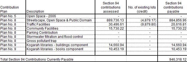
IMPACTS
Natural
Environment
61. The
proposed development is unlikely to result in adverse impacts on the natural
environment.
Built
Environment
62. The
proposed development is unlikely to result in adverse impacts on the built
environment.
63. In
particular, the proposal complies with the Height and FSR controls contained in
Kogarah LEP 2012, and is consistent with the bulk and scale of both existing
and emerging development in both the immediate and broader context.
Social
Impacts
64. The
development will provide additional housing stock to the area and cater to the
needs of families by providing a range of dwelling sizes through a mix of one,
two and three bedroom units.
Economic
Impacts
65. The
development will have a positive short term economic benefit associated with construction
employment and minimal adverse economic impacts over the longer term.
Suitability
of the site
66. The
subject site is inherently suitable for the proposed development having regard
to the emerging character of the surrounding locality which features several
multi-level buildings with residential accommodation and its location in close
proximity to public transport options and a wide range of services and
facilities. Further, there are no natural or man-made environmental constraints
(e.g. flooding/bushfire risks) that would render the site unsuitable for the
proposed development.
SUBMISSIONS
67. The
application was publicly exhibited from 7 June 2018 to 22 June 2018 in
accordance with the public notification provisions in Part A of the Kogarah
Development Control Plan 2013. Two (2) submissions objecting to the proposal
was received.
68. The
issues raised in the submission are addressed below.
Height of the
building is out of character
Comment:
The proposed building complies with the maximum height limit of 39m for the
site which resulted from the density increase in 2017.
Has enough
parking been provided for residents and visitors?
Comment:
The proposal complies with the required number of parking spaces for residents
and visitors as determined by the Apartment Design Guide.
Overshadowing
of the heritage listed terraces on Gray Street
Comment:
Due to the orientation of the site the heritage listed terraces are located to
the north-east known as 4-14 Gray Street (the terraces being northwest of the
site), the terraces will not be overshadowed by the proposed building.
Impact on the
heritage items on Gray Street
Comment:
Council’s Heritage Advisor has reviewed the proposal and is satisfied
that the proposal will not have an adverse impact on the listed items
(Terraces).
Impacts of
excavation on 1 Gray Street
Comment:
The recommendations in the Geotechnical Report submitted with the DA will be
included as conditions of consent.
Will waste
collection be undertaken from Gray Street?
Comment:
Council’s Waste Officer has reviewed the proposal and advised waste
collection for general waste will occur twice per week (3 x 1100L bins) which
will reduce the time taken to collect the waste as opposed to 240L bins, and
recycling will be collected once per week all from Gray Street.
69. The
amendments during the assessment of the proposal were not required to be
publicly notified in accordance with the DCP as they were considered to not
result in additional environmental impacts. In this regard, the amendments were
substantially in response to design issues raised by council officers and the
design review panel and generally improved the bulk/scale and associated
impacts of the proposal.
REFERRALS
Council
Referrals
Landscaping
70. No
objections were raised to vegetation removal and the proposed landscape plan
subject to conditions. Those conditions have been incorporated into the
recommended conditions.
Stormwater
71. No
objections were raised to the drainage design and stormwater discharge subject
to conditions. Those conditions have been incorporated into the recommended
conditions.
Property
Information
72. No
objections were raised subject to conditions in relation to public domain
works. Those conditions have been incorporated into the recommended conditions.
Health
73. No
objections were raised to the acoustic assessment subject to conditions. Those
conditions have been incorporated into the recommended conditions.
Waste
74. No
objections were raised to the proposal, subject to conditions. Those conditions
have been incorporated into the recommended conditions.
Building
75. No
objections were raised to the proposal, subject to conditions. Those conditions
have been incorporated into the recommended conditions.
Traffic
76. No
objections were raised to the proposal, subject to conditions. Those conditions
have been incorporated into the recommended conditions.
External
Referrals
Department of
Infrastructure, Regional Development and Cities
77. The
proposed development will penetrate prescribed airspace for Sydney Airport and
constitutes the need for a ‘controlled activity’ within the meaning
of Division 4 of Part 12 of the Airports Act 1996. The applicant has obtained
the necessary approval for the controlled activity.
Roads and
Maritime (RMS)
78. In
accordance with Schedule 3 of the SEPP (Infrastructure) 2007, the application
was referred to RMS for comment. No objection has been raised subject to
conditions of consent associated with obtaining a road occupancy licence and
awnings not to block sightlines
Ausgrid
79. The
DA was referred to Ausgrid in accordance with Clause 45 of SEPP (Infrastructure)
2007. Comments were received on 26 September 2019 and 2 October 2019. The
comments provided by Ausgrid have been included in the deferred commencement
condition in the consent.
Sydney Trains
80. In
accordance with Clause 86 of the SEPP (Infrastructure) 2007, the application
was referred to Sydney Trains for their concurrence. No objection has been
raised subject to conditions of consent.
CONCLUSION
81. The
proposal has been assessed using the matters for consideration listed in
Section 4.15 and 4.16(1) (a) of the Environmental Planning and Assessment Act
1979. Based on this assessment, the proposal is generally considered to be a
satisfactory outcome for subject site subject to appropriate conditions.
DETERMINATION
AND STATEMENT OF REASONS
Statement of
Reasons
· The
proposal is an appropriate response to the “up-zoning” of the site
(including increased Floor Space Ratio and height limits) afforded by the
Kogarah “New City Plan”. The building is consistent with the
desired future character of the B4 zone along Railway Parade and is
commensurate with nearby recent shop top housing developments.
· The
proposal is fully compliant with the maximum 4:1 FSR and 39m building height
limit that applies to the site under Kogarah Local Environmental Plan 2012.
· The
proposal’s bulk and scale is appropriately contained within a compliant
building envelope that is consistent with the desired future character of the
area in relation to height and FSR
· The
proposal has sufficient façade modulation and wall articulation that
will serve to provide visual interest and reduce the bulk of the building.
· The
proposal achieves compliance with the Apartment Design Guide with respect to
both internal and external amenity. Building separation requirements in
particular are fully compliant.
Determination
A. THAT the
determination of Development Application No. DA2018/0181 for demolition of
existing structure and construction of a twelve (12) storey shop top housing
development consisting of fifty two (52) residential apartments, ground floor
commercial/retail floor area and three (3) levels of basement car parking at
Lot 11 in DP911188 and Lots 2 and 3 in DP1753 and known as 1B Gray Street and
172-174 Railway Parade, Kogarah, be deferred and the applicant shall submit a
Remediation Action Plan in accordance with State Environmental Planning Policy
55 – Remediation of Land and the Managing Land Contamination Planning
Guidelines within 90 days.
B. The Remedial
Action Plan (RAP) must be prepared by an suitably qualified consultant in
accordance with NSW Department of Environment and Conservation (DEC) and NSW
Environmental Protection Authority (EPA) Guidelines and shall document all the
remedial works to be undertaken at the site and also contain an environmental
management plan and occupational health and safety plan for the remedial
works.
C. THAT pursuant
to Section 4.16(1)(a) of the Environmental Planning and Assessment Act 1979,
the Georges River Local Planning Panel delegate the function of determining
this application to the Manager Development and Building, subject to A and B
above being completed and generally in accordance with the conditions listed
below.
SECTION A –
DEFERRED COMMENCEMENT CONDITIONS
This Development
Application is a Deferred Commencement Consent under Section 4.16(3) of the
Environmental Planning and Assessment Act (as amended) 1979. Strict compliance
is required with all conditions appearing in Section A within thirty
six (36) months from the Determination Date of this consent. Upon
confirmation in writing from Georges River Council that the Section A
Conditions have been satisfied, the consent shall commence to operate as a
Development Consent for a period of five (5) years from the Determination
Date of this consent.
Pursuant to
Section 4.16(3) of the Environmental Planning and Assessment Act 1979, this
consent will not operate until the following requirements are satisfied:
Deferred Commencement Conditions
A. Deferred
Commencement - General - Pursuant to Section 4.16(3) of the Environmental
Planning and Assessment Act 1979, this consent will not operate until the
following requirements are satisfied:
(a) The
Applicant shall prepare and provide to Ausgrid for approval/certification the
following final version items:
(i) A Vibration Management Plan;
(ii) A Displacement Monitoring Plan; and
(iii)
Amended shoring plans to the satisfaction of Ausgrid.
Documentary
evidence as requested or the above information must be submitted within thirty
six (36) months of the granting of this deferred commencement consent.
Commencement
of the Consent cannot commence until written approval of the submitted information
has been given by Council.
Subject to the above being satisfied a development consent be issued,
subject to the following conditions:
SECTION B
– DEVELOPMENT CONDITIONS
Development
Details
1. Fit-out
of retail premises - No approval is granted for the use or fit-out of the
retail premises. Separate Development Consent for the use and fit-out is
required prior to the occupation of the retail component of the development.
2. Approved
Plans - The development must be implemented in accordance with the approved
plans and supporting documentation listed below which have been endorsed by
Council’s approved stamp, except where marked up on the plans and/or
amended by conditions of this consent:
|
Description
|
Reference No.
|
Date
|
Revision
|
Prepared by
|
|
Site Plan
|
A-0200
|
18/10/19
|
D
|
Architecture & Building Works
|
|
Basement 3 Plan
|
A-0400
|
18/10/19
|
D
|
Architecture & Building Works
|
|
Basement 2 Plan
|
A-0500
|
18/10/19
|
D
|
Architecture & Building Works
|
|
Basement 1 Plan
|
A-0600
|
18/10/19
|
D
|
Architecture & Building Works
|
|
Ground Floor
|
A-0700
|
18/10/19
|
D
|
Architecture & Building Works
|
|
First Floor
|
A-0800
|
18/10/19
|
D
|
Architecture & Building Works
|
|
Second Floor
|
A-0900
|
18/10/19
|
D
|
Architecture & Building Works
|
|
Third Floor
|
A-1000
|
18/10/19
|
D
|
Architecture & Building Works
|
|
Fourth Floor
|
A-1100
|
18/10/19
|
D
|
Architecture & Building Works
|
|
Fifth Floor
|
A-1200
|
18/10/19
|
D
|
Architecture & Building Works
|
|
Sixth Floor
|
A-1300
|
18/10/19
|
D
|
Architecture & Building Works
|
|
Seventh Floor
|
A-1400
|
18/10/19
|
D
|
Architecture & Building Works
|
|
Eighth Floor
|
A-1500
|
18/10/19
|
D
|
Architecture & Building Works
|
|
Ninth Floor
|
A-1600
|
18/10/19
|
D
|
Architecture & Building Works
|
|
Tenth Floor
|
A-1700
|
18/10/19
|
D
|
Architecture & Building Works
|
|
Eleventh Floor
|
A-1800
|
18/10/19
|
D
|
Architecture & Building Works
|
|
Roof Plan
|
A-1900
|
18/10/19
|
D
|
Architecture & Building Works
|
|
Elevations
|
A-2000 to A-2300
|
18/10/19
|
D
|
Architecture & Building Works
|
|
Sections
|
A-2500, A-2510 and A-2520
|
18/10/19
|
D
|
Architecture & Building Works
|
|
Adaptable Unit Details
|
A-4000
|
18/10/19
|
D
|
Architecture & Building Works
|
|
Material Sample
|
A-0002
|
18/10/19
|
D
|
Architecture & Building Works
|
|
Construction Management Plan
|
A-4300
|
18/10/19
|
D
|
Architecture & Building Works
|
|
Landscape Plan
|
ISO243DA1 to ISO243DA5
|
6/2/18
|
A
|
Isthmus Landscape Design
|
|
Traffic, Rail and Environmental Noise Assessment
|
2017-726
|
21/12/17
|
-
|
Acoustic Noise and Vibration Solutions Pty Ltd
|
|
Detailed Site Investigation
|
18/0222
|
February 2018
|
-
|
STS GeoEnvironmental Pty Ltd
|
|
Geotechnical Investigation
|
18/0109
|
January 2018
|
-
|
STS GeoEnvironmental Pty Ltd
|
|
Dilapidation Report - Substation 1A Gray St Kogarah
|
121040
|
5/3/19
|
-
|
ACSES Engineers
|
|
Further Geotechnical Assessment
|
19/0570
|
8/3/19
|
-
|
STS GeoEnvironmental Pty Ltd
|
|
Electromagnetic Field Testing Pre-Development Report
|
EMF856724
|
20/3/19
|
-
|
Ecolibria
|
|
Shoring Report
|
121040.R02
|
26/7/19
|
-
|
ACSES Engineers
|
|
Shoring Sections
|
Sheets 1 to 7
|
Feb 2019
|
A
|
ACSES Engineers
|
Separate Approvals Required Under Other Legislation
3. Vehicular
Crossing - Major Development - The following vehicular crossing and road
frontage works will be required to facilitate access to and from the proposed
development site:
a) Construct a 1.2 metre
wide footpath for the full length of the frontage of the site in Railway Parade
and Gray Street in accordance with Council’s Specifications applying at
the time construction approval is sought.
b) The thickness and design
of the driveway shall be in accordance with Council’s Specifications
applying at the time construction approval is sought.
c) Any existing vehicular
crossing and/or laybacks which are redundant must be removed. The kerb and
gutter, any other footpath and turf areas shall be restored at the expense of
the applicant. The work shall be carried out in accordance with Council’s
specification, applying at the time construction approval is sought.
Constructing a vehicular crossing and/or footpath requires separate
approval under Section 138 of the Roads Act 1993, prior to the
commencement of those works.
4. Hoarding
Application - Prior to demolition of the buildings on the site or the
commencement of work above ground level a separate application for the erection
of an A class (fence type) or a B class hoarding or C type scaffold, in
accordance with the requirements of Work Cover Authority of NSW, must be
erected along that portion of the footway/road reserve, where the building is
within 3.0 metres of the street boundary. An application for this work under
Section 68 of the Local Government Act 1993 and the Roads Act 1993 must be submitted
for approval to Council.
The following information is to be submitted with a Hoarding Application
under s68 of the Local Government Act and s138 of the Roads Act 1993:
(a) A site and location plan of the hoarding with detailed
elevation, dimensions, setbacks, heights, entry and exit points to/from the
site, vehicle access points, location of public utilities, electrical overhead
wire protection, site management plan and builders sheds location;
(b) Hoarding plan and details that are certified by an
appropriately qualified engineer;
(c) The payment to Council of a footpath occupancy
fee based on the area of footpath to be occupied and Council's Schedule of Fees
and Charges (available on our website) before the commencement of work;
(d) A Public Risk Insurance Policy with a minimum cover of
$10 million in relation to the occupation of and works within Council's road
reserve, for the full duration of the proposed works, must be obtained a copy
provided to Council. The Policy is to note Council as an interested party; and
(e) The application must be endorsement by the Roads &
Maritime Services (RMS) as the hoarding is located within 100m of an
intersection with traffic lights. For assistance you should contact the DA unit
at RMS and speak to Hans on 88492076. Or email
hans.pilly.mootanah@rms.nsw.gov.au to obtain concurrence for the hoarding
structure.
5. Below
ground anchors - Information to be submitted with S68 Application under LGA
1993 and S138 Application under Roads Act 1993 - In the event that the
excavation associated with the basement carpark is to be supported by the use
of below ground (cable) anchors that are constructed under Council’s
roadways/footways, an application must be lodged with Council under Section 68
of the Local Government Act 1993 and the Roads Act 1993 for
approval, prior to commencement of those works. The following details must be
submitted.
a) That cable
anchors will be stressed released when the building extends above ground level
to the satisfaction of Council.
b) The applicant
has indemnified Council from all public liability claims arising from the
proposed works, and provide adequate insurance cover to the satisfaction of
council.
c) Documentary
evidence of such insurance cover to the value of $20 million.
d) The applicant
must register a non-terminating bank guarantee in favour of Council for the
amount of [$50,000].
The
guarantee will be released when the cables are stress released. In this regard
it will be necessary for a certificate to be submitted to Council from a
structural engineer at that time verifying that the cables have been stress
released.
e) That in the
event of any works taking place on Council’s roadways/footways adjoining
the property while the anchors are still stressed, all costs associated with
overcoming the difficulties caused by the presence of the ‘live’
anchors will be borne by the applicant.
6. Section
138 Roads Act 1993 and Section 68 Local Government Act 1993 - Unless
otherwise specified by a condition of this consent, this Development Consent
does not give any approval to undertake works on public infrastructure.
Separate approval is required under Section 138 of the Roads Act 1993
and/or Section 68 of the Local Government Act 1993 for any of the
following activities carried out in, on or over a public road (including the
footpath) listed below.
An application is required to be lodged and approved prior to the
commencement of any of the following works or activities;
(a) Placing or storing materials
or equipment;
(b) Placing or storing waste
containers or skip bins;
(c) Erecting a structure or
carrying out work
(d) Swinging or hoisting goods
over any part of a public road by means of a lift, crane or the like;
(e) Pumping concrete from a public
road;
(f) Pumping water from the
site into the public road;
(g) Constructing a vehicular
crossing or footpath;
(h) Establishing a “works
zone”;
(i) Digging up or disturbing
the surface of a public road (eg Opening the road for the purpose of
connections to utility providers);
(j) Stormwater and ancillary
works in the road reserve;
(k) Stormwater and ancillary to
public infrastructure on private land; and
(l) If any excavation is to
be supported by the use of below ground (cable) anchors that are constructed
under Council’s roadways/footways.
These separate activity approvals must be obtained and evidence of the
approval provided to the Certifying Authority prior to the issue of the
Construction Certificate.
The relevant Application Forms for these activities can be downloaded
from Council’s website www.georgesriver.nsw.gov.au. For further
information, please contact Council’s Customer Service Centre on (02)
9330 6400.
7. Road
Opening Permit - A Road Opening Permit must be obtained from Council, in
the case of local or regional roads, or from the RMS, in the case of State
roads, for every opening of a public road reserve to access services including
sewer, stormwater drains, water mains, gas mains, and telecommunications before
the commencement of work in the road.
8. Public
Domain Plan and Works - A public domain plan is to be submitted to Council
consisting of full civil engineering drawings to Australian Standards.
Inclusive of new kerbing, driveway, drainage, paved footpath, landscape and
tree pits, and in accordance with Councils “Public Domain Streetscape
Works Specification“.
The Approved plans
for public domain works shall be constructed in accordance with the
specifications issued under the “Application for Driveway Crossing and
Associated Works on Council Road Reserve” Roads Act 1993 Section 138
Approval issued by Council’s Assets and Infrastructure Division.
Applications to be made at Georges River Council Customer Service Centre.
A separate
application approval is required under section 68 Local Government Act 1993 for
any modifications to Council’s drainage network.
The Plans are also
to generally reflect the requirements of the Kogarah Town Centre Public Domain
Strategy and Technical Manual. The Plan must be approved by Council’s
Assets and Infrastructure Division prior to issue of Construction Certificate .
A private contractor
shall carry out the above work, at the expense of the applicant and in
accordance with the approved Specifications for works.
The driveway and
road frontage works are to be completed before the issue of the Occupation
Certificate.
Requirements of Concurrence, Integrated & Other Government
Authorities
9. Sydney
Trains -
a) Prior to the issuing of a Construction
Certificate the Applicant is to submit to Sydney Trains for endorsement the
following final items in compliance with relevant ASA Standards
(https://www.transport.nsw.gov.au/industry/asset-standards-authority):
1.
Geotechnical and Structural report/drawings that meet Sydney Trains
requirements. The Geotechnical Report must be based on actual borehole testing
conducted on the site closest to the rail corridor.
2.
Construction methodology with construction details pertaining to structural
support during excavation. The Applicant is to be aware that Sydney Trains will
not permit any rock anchors/bolts (whether temporary or permanent) within its
land or easements.
3.
Cross sectional drawings showing the rail corridor, sub soil profile, proposed
basement excavation and structural design of sub ground support adjacent to the
rail corridor. All measurements are to be verified by a Registered Surveyor.
Any
conditions issued as part of Sydney Trains approval/certification of the above
documents will also form part of the consent conditions that the Applicant is
required to comply with.
b) The Applicant shall prepare an acoustic
assessment demonstrating how the proposed development will comply with the
Department of Planning’s document titled “Development Near Rail
Corridors and Busy Roads- Interim Guidelines”. The Applicant must
incorporate in the development all the measures recommended in the report. A
copy of the report is to be provided to the Principal Certifying Authority and
Council prior to the issuing of a Construction Certificate. The Principal
Certifying Authority must ensure that the recommendations of the acoustic
assessment are incorporated in the construction drawings and documentation
prior to the issuing of the relevant Construction Certificate.
c) Prior to the issue of a Construction
Certificate the Applicant is to engage an Electrolysis Expert to prepare a
report on the Electrolysis Risk to the development from stray currents. The
Applicant must incorporate in the development all the measures recommended in
the report to control that risk. A copy of the report is to be provided to the
Principal Certifying Authority with the application for a Construction
Certificate. The Principal Certifying Authority must ensure that the
recommendations of the electrolysis report are incorporated in the construction
drawings and documentation prior to the issuing of the relevant Construction
Certificate.
d) The design, installation and use of lights,
signs and reflective materials, whether permanent or temporary, which are (or
from which reflected light might be) visible from the rail corridor must limit
glare, reflectivity and illumination to the satisfaction of the light rail
operator. The Principal Certifying Authority is not to issue the Construction
Certificate until written confirmation has been received from Sydney Trains
confirming that this condition has been satisfied.
e) Prior to the issuing of a Construction
Certificate the Applicant must submit to Sydney Trains a plan showing all
craneage and other aerial operations for the development and must comply with
all Sydney Trains requirements. If required by Sydney Trains, the Applicant
must amend the plan showing all craneage and other aerial operations to comply
with all Sydney Trains requirements. The Principal Certifying Authority is not
to issue the Construction Certificate until written confirmation has been
received from the Sydney Trains confirming that this condition has been
satisfied.
f) If required, prior to the issue of a
Construction Certificate the Applicant is to contact Sydney Trains Engineering
& Maintenance Interface to determine the need for public liability
insurance cover. If insurance cover is deemed necessary this insurance be for
sum as determined by Sydney Trains and shall not contain any exclusion in
relation to works on or near the rail corridor, rail infrastructure and must be
maintained for the duration specified by Sydney Trains. The Applicant is to
contact Sydney Trains Engineering & Maintenance Interface to obtain the
level of insurance required for this particular proposal. Prior to issuing the
Construction Certificate the Principal Certifying Authority must witness
written proof of this insurance in conjunction with Sydney Trains written
advice to the Applicant on the level of insurance required.
g) If required, prior to the issue of a
Construction Certificate the Applicant is to contact Sydney Trains Engineering
& Maintenance Interface to determine the need for the lodgement of a Bond
or Bank Guarantee for the duration of the works. The Bond/Bank Guarantee shall
be for the sum determined by Sydney Trains. Prior to issuing the Construction
Certificate the Principal Certifying Authority must witness written advice from
Sydney Trains confirming the lodgement of this Bond/Bank Guarantee.
h) The Applicant must ensure that at all times they
have a representative (which has been notified to Sydney Trains in writing),
who: oversees the carrying out of the Applicant’s obligations under the
conditions of this consent and in accordance with correspondence issued by
Sydney Trains;
· acts
as the authorised representative of the Applicant; and
· is
available (or has a delegate notified in writing to Sydney Trains that is
available) on a 7 day a week basis to liaise with the representative of Sydney
Trains, as notified to the Applicant.
i) Without in any way limiting the
operation of any other condition of this consent, the Applicant must, during
demolition, excavation and construction works, consult in good faith with
Sydney Trains in relation to the carrying out of the development works and must
respond or provide documentation as soon as practicable to any queries raised
by Sydney Trains in relation to the works.
j) Where a condition of consent requires
consultation with Sydney Trains, the Applicant shall forward all requests
and/or documentation to the relevant Sydney Trains external party interface
team. In this instance the relevant interface team is Illawarra Interface and
they can be contacted via email on Illawarra_Interface@transport.nsw.gov.au.
k) Copies of any certificates, drawings,
approvals/certification or documents endorsed by, given to or issued by Sydney
Trains or RailCorp must be submitted to Council for its records prior to the
issuing of the applicable Construction Certificate or Occupation Certificate.
l) If required by Sydney Trains, prior
to the commencement of works or at any time during the excavation and
construction period deemed necessary by Sydney Trains, a joint inspection of
the rail infrastructure and property in the vicinity of the project is to be
carried out by representatives from Sydney Trains and the Applicant. These
dilapidation surveys will establish the extent of any existing damage and
enable any deterioration during construction to be observed. The submission of
a detailed dilapidation report will be required within 10 days following the
undertaking of the inspection, unless otherwise notified by Sydney Trains.
m) If required by Sydney Trains, prior to the issue
of the Occupation Certificate, or at any time during the excavation and
construction period deemed necessary by Sydney Trains, a joint inspection of
the rail infrastructure and property in the vicinity of the project is to be
carried out by representatives from Sydney Trains and the Applicant. These
dilapidation surveys will establish the extent of any existing damage and
enable any deterioration during construction to be observed. The Principal
Certifying Authority is not to issue the final Occupation Certificate until
written confirmation has been received from Sydney Trains confirming that this
condition has been satisfied
n) Sydney Trains or Transport for NSW (TfNSW), and
persons authorised by those entities for the purpose of this condition, must be
permitted to inspect the site of the development and all structures to enable
it to consider whether those structures have been or are being constructed and
maintained in accordance with the approved plans and the requirements of this
consent, on giving reasonable notice to the principal contractor for the
development or the owner or occupier of the part of the site to which access is
sought.
o) Any conditions issued as part of Sydney
Trains approval/certification of any documentation for compliance with the
Sydney Trains conditions of consent, those approval/certification conditions
will also form part of the consent conditions that the Applicant is required to
comply with.
10. Trade Waste
Agreements - A Trade Waste Agreement with Sydney Water may be required.
Details of any work required to comply with the agreement must be detailed on
the plans lodged with the Construction Certificate. If no trade waste agreement
or grease trap is required, a letter from Sydney Water to this effect must be
submitted with the application for the Construction Certificate.
11. Electricity
Supply - An application is required to be made to Ausgrid for a network
connection. This may require the network to be extended or its capacity
augmented. Evidence of this application being lodged with Ausgrid is required
to be provided to the Certifying Authority prior to the issue of a Construction
Certificate. For further details, you are advised to contact Ausgrid on 13 13
65 or www.ausgrid.com.au (Business and Commercial Services).
12. Electricity
Supply to Development - The electricity supply to the Development must be
underground including power lines within the road reserve adjacent to the site.
13. Geotechnical
Report - Prior to the issue of a Construction Certificate the Applicant
shall provide Sydney Trains with a Geotechnical Report and structural
drawings/report. These reports shall provide confirmation that there will be no
negative impact on Sydney Trains infrastructure and land. Written confirmation
shall be provided from Sydney Trains to the Certifying Authority confirming
this condition has been satisfied.
14. Sydney Water -
Tap in TM - The approved plans must be submitted to a Sydney
Water Tap inTM to determine whether the development application will
affect Sydney Water’s sewer and water mains, stormwater drains and/or
easements, and if further requirements need to be met. The approved plans
will be appropriately endorsed. For details please refer to
‘Plumbing, building and developing’ section of Sydney Water’s
web site at www.sydneywater.com.au then see ‘Building’, or
telephone 13000 TAP IN (1300 082 746). The Certifying Authority must
ensure that a Tap inTM agent has appropriately stamped the plans
prior to the issue of the Construction Certificate.
15. Notice of
Requirements for a Section 73 Certificate - A Notice of Requirements of
what will eventually be required when issuing a Section 73 Compliance
Certificate under the Sydney Water Act 1994 must be obtained from Sydney
Water Corporation. Application must be made through an authorised Water
Servicing Co-ordinator. Please refer to the ‘Plumbing, building and
developing’ section of the web site www.sydneywater.com.au then
refer to ‘Providers’ under ‘Developing’ or telephone 13
20 92 for assistance.
Following application, a ‘Notice of Requirements’ will advise
of water and sewer infrastructure to be built and charges to be paid.
Please make early contact with the Co-ordinator, as it can take some time to
build water/sewer pipes and this may impact on other services and building,
driveway or landscape design.
The Notice of requirements must be submitted prior to the commencement of
work. A Section 73 Compliance Certificate will be required at the completion of
development in accordance with further conditions.
Prior to the Issue of a Construction Certificate
16. Pre-Construction
Dilapidation Report - Private Land - A professional engineer specialising
in structural or geotechnical engineering shall prepare a Pre-Construction
Dilapidation Report detailing the current structural condition of adjoining
premises that shall be affected by the excavation as determined by the
consulting engineer.
The report shall be prepared at the expense of the applicant and
submitted to the satisfaction of the Certifying Authority prior to the issue of
the Construction Certificate.
A copy of the pre-construction dilapidation report is to be provided to
the adjoining properties (subject of the dilapidation report), a minimum of 5
working days prior to the commencement of work. Evidence confirming that a copy
of the pre-construction dilapidation report was delivered to the adjoining
properties must be provided to the PCA.
Should the owners of properties (or their agents) refuse access to carry
out inspections, after being given reasonable written notice, this shall be
reported to Council to obtain Council’s agreement to complete the report
without access. Reasonable notice is a request for access in no sooner than 14
days between 8.00am-6.00pm.
17. Railway
Noise - The site is affected by noise from the Eastern
Suburbs Illawarra railway corridor. An Acoustic Report prepared by a suitably
qualified acoustic consultant shall be submitted, prior to the issue of the
Construction Certficate, demonstrating that the development has been designed
to meet the internal noise and vibration levels specified in NSW Department of
Planning ‘Development Near Rail Corridors and Busy Roads - Interim
Guidelines’ and Clause 87 of State Environmental Planning Policy
(Infrastructure) 2007.
18. On Site
Detention - The submitted stormwater plan has been assessed as a concept
plan only. Final detailed plans of the drainage system, prepared by a
professional engineer specialising in hydraulic engineering, shall be submitted
for approval with the Construction Certificate.
An on-site detention (OSD) facility designed by a professional engineer
who specialises in Hydraulic Engineering must be designed, approved and
installed. The design must include the computations of the inlet and
outlet hydrographs and stage/storage relationships of the proposed OSD using
the following design parameters:
a) peak flow rates from the
site are to be restricted to a permissible site discharge (PSD) equivalent to
the discharge when assuming the site contained a single dwelling, garage, lawn
and garden,
b) at Annual Recurrence
Intervals of 2 years and 100 years.
Refer to Flow Controls in Council's Draft/Adopted
Stormwater Drainage Policy.
The OSD facility shall be designed to meet all legislated safety
requirements and childproof safety fencing around the facility must be provided
where the OSD facility is open or above ground when the design peak storage
depth is greater than 300mm. A durable metal plate or similar sign is to be
placed at the OSD facility and must bear the words:
"BEWARE:
This is an on-site detention basin/tank for rainwater which could overflow
during heavy storms."
Full details shall accompany the application for the
Construction Certificate.
19. Pump-Out System
Design for Stormwater Disposal - The design of the pump-out system for
storm water disposal will be permitted for drainage of basement areas only, and
must be designed in accordance with the following criteria:
a) The pump system shall
consist of two pumps, connected in parallel, with each pump being capable of
emptying the holding tank at the rate equal to the rate of inflow for the
one-hour duration storm. The holding tank shall be capable of holding one hour’s
runoff from a one-hour duration storm of the 1 in 20 year storm;
b) The pump system shall be
regularly maintained and serviced, every six (6) months; and
c) Any drainage disposal to
the street gutter from a pump system must have a stilling sump provided at the
property line, connected to the street gutter by a suitable gravity line.
Details and certification of compliance from a professional engineer
specialising in civil engineering shall be provided for approval with the
Construction Certificate application.
20. Driveway
Construction Plan Details - Detailed engineering plans for the driveway
shall be submitted with the Construction Certificate application for approval
that show:
a) Longitudinal and cross
sections, gradients, access onto the proposed lots, type of construction
materials designed in accordance with Council's Subdivision standards and
AS/NZS2890.1-2004.
b) The Loading Bay is
compliant with AS2890.1-2004 for the use at a minimum of Small Rigid Vehicles
c) Suitable underground
provision for the supply of all relevant services to the proposed lots
(proposed position of pipes and conduits).
d) The full length of the
driveway designed with a minimum 150mm thick reinforced concrete and minimum of
2.7m wide pavement/kerb face to kerb face width, and a non-slip surface.
21. Council
Property Shoring - Prior to the issue of the Construction Certificate,
plans and specifications prepared by a professional engineer specialising in
practising structural engineering must detail how Council’s property shall
be supported at all times.
Where any shoring is to be supporting, or located on Council’s
property, certified structural engineering drawings detailing; the extent of
the encroachment, the type of shoring and the method of removal, shall be
included on the plans. Where the shoring cannot be removed, the plans
must detail that the shoring will be cut to 150mm below footpath level and the
gap between the shoring and any building shall be filled with a 5MPa lean
concrete mix.
22. Fire Safety
Measures - Prior to the issue of a construction certificate a list of the
essential fire safety measures that are to be provided in relation to the land
and any building on the land as a consequence of the building work must
accompany an application for a construction certificate, which is required to
be submitted to either Council or a PCA. Such list must also specify the
minimum standard of performance for each essential fire safety measure included
in the list. The Council or PCA will then issue a Fire Safety Schedule for the
building.
23. Damage Deposit
- Major Works - In order to insure against damage to Council property the
following is required:
a) Pay Council, before the
issue of the Construction Certificate, a damage deposit for the cost of making
good any damage caused to any Council property as a result of the development: $68,122.14
b) Pay Council, before the
issue of the Construction Certificate, a non-refundable inspection fee to
enable assessment of any damage and repairs where required: $371.00
c) Submit to Council, before
the commencement of work, a dilapidation report of the condition of the Council
nature strip, footpath and driveway crossing, or any area likely to be affected
by the proposal.
At the completion of work Council will review the dilapidation report and
the Works-As-Executed Drawings (if applicable) and inspect the public works.
The damage deposit will be refunded in full upon completion of work where
no damage occurs and where Council is satisfied with the completion of works.
Alternatively, the damage deposit will be forfeited or partly refunded based on
the damage incurred.
24. Engineer’s
Certificate - A certificate from a professional Engineer specialising in
structural engineering certifying the structural adequacy of the existing
structure, to support all proposed additional superimposed loads shall be
submitted to the Certifying Authority prior to the issue of the Construction
Certificate.
25. Access for
Persons with a Disability - Access for persons with disabilities must be
provided throughout the site, including to all common rooms, lobby/terrace
areas and sanitary facilities in accordance with the requirements of the
Premises Standards, the Building Code of Australia and AS 1428.1. Details of
which must be submitted with the Construction Certificate Application.
In regards to the above, pedestrian access throughout basement levels
shall be highlighted/line marked and sign posted to safeguard egress.
26. Geotechnical
report - The applicant must submit a Geotechnical Report, prepared by a
suitably qualified Geotechnical Engineer who holds the relevant Certificate of
accreditation as required under the Building Professionals Act 2005 in relation
to dilapidation reports, all site works and construction. This is to be
submitted before the issue of the Construction Certificate and is to
include:
(a) Investigations
certifying the stability of the site and specifying the design constraints to
be placed on the foundation, any earthworks/stabilization works and any
excavations.
(b) Dilapidation
Reports on the adjoining properties prior to any excavation of site works. The
Dilapidation Report is to include assessments on, but not limited to, the
dwellings at those addresses and any external paths, grounds etc. This
must be submitted to the Certifying Authority and the adjoining residents as
part of the application for the Construction Certificate. Adjoining
residents are to be provided with the report five (5) working days prior to any
works on the site.
(c) On-site
guidance by a vibration specialist during the early part of excavation.
(d) Rock breaking
techniques. Rock excavation is to be carried out with tools such as rock
saws which reduce vibration to adjoining buildings and associated structures.
(e) Sides of the
excavation are to be piered prior to any excavation occurring to reinforce the
walls of the excavation to prevent any subsidence to the required setbacks and
neighbouring sites.
27. Vibration
Damage - To minimise vibration damage and loss of support to the buildings
in close proximity to the development, any excavation is to be carried out by
means of a rock saw and if available, in accordance with the guidelines of the
Geotechnical Engineer’s report.
Alternatively
where a hydraulic hammer is to be used within 30 metres of any building (other
than a path or a fence) a report from a qualified geotechnical engineer
detailing the maximum size of hammer to be used is to be obtained and the
recommendations in that report implemented during work on the site. The
report shall be submitted with the Construction Certificate application.
28. Slip Resistance
- All pedestrian surfaces in areas such as foyers, public
corridors/hallways, stairs and ramps as well as floor surfaces in the wet rooms
in any residential units must have slip resistance classifications, as
determined using test methods in either wet or dry conditions, appropriate to
their gradient and exposure to wetting. The classifications of the new
pedestrian surface materials, in wet or dry conditions, must comply with
AS/NZS4586:2004 - Slip Resistance Classifications of New Pedestrian Materials
and must be detailed on the plans lodged with the application for the
Construction Certificate
29. Heritage
Archaeology
As
required by the National Parks and Wildlife Service Act 1974 and the Heritage
Act 1977, in the event that Aboriginal cultural heritage or historical
cultural fabric or deposits are encountered/discovered where they are not
expected, works must cease immediately and Council and the Heritage Division of
the Office of Environment and Heritage (OEH) must be notified of the discovery.
In
the event that archaeological resources are encountered, further archaeological
work may be required before works can re-commence, including the statutory
requirement under the Heritage Act 1977 to obtain the necessary
approvals/permits from the Heritage Division of the OEH.
Note:
The National Parks and Wildlife Service Act 1974 and the Heritage
Act 1977 impose substantial penalty infringements and / or imprisonment for
the unauthorised destruction of archaeological resources, regardless of whether
or not such archaeological resources are known to exist on the site.
Photographic Archival Recording
Prior
to the commencement of any works, including the dismantling of fabric or
demolition, a Photographic Archival Recording shall be undertaken of the
building at 172 Railway Parade, Kogarah, and submitted to Council.
Written
confirmation must also be obtained from Council’s Heritage Advisor,
confirming that the Photographic Archival Recording is of an acceptable quality
that satisfies the requirements of this condition.
The
Photographic Archival Recording shall be prepared in accordance with the
guidelines "Archival Recording of Heritage Items Using Film or Digital
Capture" published by the Heritage Division of the Office of
Environment and Heritage.
Two
complete copies of the Photographic Archival Recording shall be submitted to
Council. Each copy should contain (for digital projects):
· A
brief report or introduction which explains the purposes of the Photographic
Archival Recording and gives a brief description of the subject site, as well
as details of the sequence in which images were taken. The report may also
address the limitations of the photographic record and may make recommendations
for future work;
· Plans
of the building marked up to indicate where the photographs were taken and the
direction of the photograph;
· The
report should include all technical details including camera and lenses, image
file size and format, technical metadata associated with the images, and colour
information;
· Catalogue
sheets, photographic plan, supplementary maps;
· Colour
thumbnail image sheets (e.g. A4 page with six images by six images) showing
images and reference numbers. The thumbnail sheets should be processed with
archivally stable inks on archivally acceptable photographic paper and cross
referenced to catalogue sheets;
· One
full set of 10.5x14.8cm (A6) colour prints OR, if a large project, a
representative set of selected images processed with archivally stable inks on
archivally acceptable photographic paper.
· A
CD or DVD containing electronic image files saved as RAW files with associated
metadata, and cross-referenced to catalogue sheets.
The report should be presented on archival quality paper
in a suitable archival binder and slipcase, and all storage of individual
components must be in archival quality packaging suitable for long term
storage.
30. Construction
Traffic Management Plan - A Construction Traffic Management Plan detailing:
(a) construction vehicle routes;
(b) anticipated number of trucks
per day;
(c) hours of construction;
(d) Access arrangements; and
(e) Proposed traffic measures to
minimise impacts of construction vehicles
must be submitted for the approval of Council’s
Engineers. Council’s Engineers must specify in writing that they are
satisfied with the Traffic Management Plan prior to the issue of the
Construction Certificate.
31. Use of Rooftop
open space - A Plan of Management (POM) for use of rooftop open space must
be submitted for approval of Council. The POM must outline the:
(i)
hours of use of the rooftop terrace which shall be restricted from 8am until
10pm;
(ii)
maximum number of users at any one time is restricted to 25;
(iii)
provisions for no amplified music to be played;
(iv)
and identify other measures to ensure that the amenity of persons within the
development and in nearby existing and future development is maintained.
The
approved POM shall be incorporated into the Owners Corporation by-laws in any
future Strata subdivision and a sign in the front entry of the building shall
be included to ensure the use of this space is monitored and understood by all
occupants.
32. Acoustic
Requirements - Compliance with submitted Acoustic Report - The
Construction Certificate plans shall demonstrate compliance with the Acoustic Assessment
submitted to Council, titled “Acoustic Report - Traffic &
Environmental Noise Assessment - For proposed development at No. 172-174
Railway Parade Kogarah. Prepared By: ACOUSTIC NOISE & VIBRATION
SOLUTIONS P/L Reference No.: 2017-726”
This means that
a review of glazing design and mechanical plant must be undertaken to ensure
that acoustic objectives will be met. Written verification from a
suitably qualified acoustic consultant must be submitted to Council validating
that the acoustic objectives contained within the aforementioned report will be
met, must be submitted to Council for approval. The Construction
Certificate will not be issued until Council approves this validation.
33. SEPP 65 Design
Verification Statement - A design verification statement, prepared by a
qualified designer, shall be submitted to the Certifying Authority verifying
that the plans and specifications achieve or improve the design quality of the
development for which development consent was granted, having regard to the
design quality principles set out under Schedule 1 of State Environmental
Planning Policy No 65 -Design Quality of Residential Flat Development.
34. Electromagnetic
Assessment - The Construction Certificate plans
shall demonstrate compliance with the recommendations of the Electromagnetic
Assessment submitted to Council, titled “Electromagnetic Field Testing
Pre-Development Report Prepared for Architecture & Building Works Site Assessed
- 172-174 Railway Parade, Kogarah, NSW. Report Date: Wednesday 20th March
2019 Report Number: EMF856724” depicting that Units 1.05, 2.05
and 3.05 be configured so that a bed is not placed within four (4) meters of
the substation (located at 1A Gray St Kogarah NSW 2217 Lot 12 DP 911188) wall
AND that retail location 1 is configured so that the Gray Street boundary is
used for display or storage and not as a location where people spend extended
periods of time.
35. Waste Storage -
Residential and Mixed Use Developments - The plans shall include details of
the waste storage area. The waste storage area shall not be visible from the
street. The waste storage area shall be located within the lot/building in
accordance with the approved plans.
The waste storage area shall be large enough to accommodate the required
number of bins for the development and located in an area to suitably
facilitate servicing on waste collection day.
The path to the bin room is to be at least 1.0 metres wide and kept clear
and unobstructed at all times.
Residential Waste
The development will require the provision of the following waste and
recycling facilities:
(a) Domestic Waste - 3 x 1100
litre mobile bins.
(b) Domestic Recycling - 19 x 240
litre mobile bins.
Commercial Waste
For the Commercial portion of the building appropriate waste and
recycling containers and facilities will need to be provided for all specific
end use businesses in accordance with the following waste generation rates:
(a) Retail Trading - shops, to 100
square metres - 0.1-0.2 cubic metres per 100 square metres of floor area per
day;
(b) Restaurants and Food Shops -
0.3-0.6 square metres per 100 meals, plus up to 0.15 cubic metres of beverage
containers per 100 meals; and,
(c) Office - 0.01-0.03 cubic
metres per 100 square metres of floor area per day.
36. Waste Handling
Systems - All waste handling equipment and systems used in conjunction with
the provision of waste and recycling services shall be manufactured, installed
and maintained in accordance with any applicable regulatory requirements,
relevant Australian Standards, and relevant manufacturer’s
specifications.
37. Fees to be paid
- The fees listed in the table below must be paid in accordance with the
conditions of this consent and Council’s adopted Fees and Charges
applicable at the time of payment (available at www.georgesriver.nsw.gov.au).
Payments must be made prior to the issue of the Construction Certificate
or prior to the commencement of work (if there is no associated Construction
Certificate).
Please contact Council prior to the payment of Section 7.11 Contributions
to determine whether the amounts have been indexed from that indicated below in
this consent and the form of payment that will be accepted by Council.
Council will only accept Bank Cheque or Electronic Funds Transfer (EFT)
for transaction values of $500,000 or over. Council must be contacted prior to
payment to determine correct total amount to be paid and bank account details
(if applicable).
A summary of the fees to be paid are listed below:
|
Fee Type
|
Fee
|
|
GENERAL FEES
|
|
Long Service
Levy (to Long Service Corporation) Or, provide evidence of Payment direct to
the Long Service Corporation. See https://portal.longservice.nsw.gov.au/bci/levy/
|
|
Builders Damage
Deposit
|
$68,122.14
|
|
Inspection Fee
for Refund of Damage Deposit
|
$371.00
|
|
DEVELOPMENT
CONTRIBUTIONS
|
|
Kogarah Section
94 Development Contributions Plan No.8 - Kogarah Town Centre - Streetscape,
Open Space
&
Public Domain
|
$884,856.96
|
|
Kogarah Section
94 Development Contributions Plan No.8 - Kogarah Town Centre - Traffic
Facilities
|
$20,616.81
|
|
Kogarah Section
94 Development Contributions Plan No.8 - Kogarah Town Centre - Community
Facilities
|
$15,730.22
|
|
Kogarah Section
94 Development Contributions Plan No.9 - Kogarah Libraries - Buildings
|
$14,660.94
|
|
Kogarah Section
94 Development Contributions Plan No.9 - Kogarah Libraries - Books
|
$10,453.19
|
General Fees
The fees and charges above are subject to change and are as set out in
the version of Council's Schedule of Fees and Charges or as required by other
Government Authorities, applicable at the time of payment.
Development Contributions
The Section 7.11 contribution is imposed to ensure that the development
makes adequate provision for the demand it generates for public amenities and
public services within the area.
Indexation
The above contributions will be adjusted at the time of payment to
reflect changes in the cost of delivering public amenities and public services,
in accordance with the indices provided by the relevant Section 94 Development
Contributions Plan.
Timing of Payment
The contribution must be paid and receipted by Council prior to the
release of the Construction Certificate.
Further Information
A copy of the all current Development Contributions Plans may be
inspected or a copy purchased at Council’s offices (Georges River Civic
Centre, MacMahon Street, Hurstville and Kogarah Library and Service Centre,
Kogarah Town Square, Belgrave Street, Kogarah) or viewed on Council’s
website www.georgesriver.nsw.gov.au.
38. Site Management Plan
- Major Development - A Site Management Plan must be submitted with the
application for a Construction Certificate, and include the following:
a) location of protective
site fencing;
b) location of site storage
areas/sheds/equipment;
c) location of building
materials for construction, e.g. stockpiles
d) provisions for public
safety;
e) dust control measures;
f) method used to
provide site access location and materials used;
g) details of methods of
disposal of demolition materials;
h) method used to provide
protective measures for tree preservation;
i) provisions for
temporary sanitary facilities;
j) location and
size of waste containers/skip bins;
k) details of proposed
sediment and erosion control measures;
l) method used to
provide construction noise and vibration management;
m) construction and demolition
traffic management details.
The site management measures are to be implemented prior to the
commencement of any works including demolition and excavation. The site
management measures are to be maintained throughout the works, to maintain
reasonable levels of public health, safety and amenity. A copy of the Site
Management Plan must be kept on site and is to be made available upon request.
39. BASIX Commitments
- All energy efficiency measures as detailed in the BASIX Certificate No.
892771M_02 must be implemented on the plans lodged with the application for the
Construction Certificate.
40. Required design
changes - The following changes are required to be made and shown on the
Construction Certificate plans:
(a) The Landscape Plans are to be updated to reflect the
approved architectural plans.
(b) Five (5) street trees of
species to be determined in consultation with council shall be provided in the
road reserve, generally in accordance with the Public Domain Strategy and
Technical Manual for Kogarah Town Centre.
(c) The stormwater concept plans shall be revised
satisfying the following and shown on the Construction Certificate plans:
· Details
of the Bioretention Basin that was shown on the architectural ground floor
plan.
· Please
note that all new commercial and industrial developments should incorporate
water efficiency measures, and where possible should aim to harvest and reuse
rainwater. It is recommended that at least 5 cubic meter of rainwater tank
shall be designed and installed. When a rainwater tank is used on the property
and is connected to supply toilet flushing and laundry demands,1/3 of the
provided storage volume can be used to offset the required volume for OSD.
· The
provided OSD storage volume in the stormwater concept plan is acceptable.
However, Stormwater Management Report (Stormwater Calculator) shall be revised
showing the impervious area percentage on the table.
(d) Submission to the satisfaction of Georges River
Council of a public domain plan generally in
accordance with the Public Domain Strategy and Technical Manual for Kogarah
Town Centre.
41. Erosion &
Sedimentation Control - Erosion and sediment controls must be provided to
ensure:
(a) Compliance with the approved
Erosion & Sediment Control Plan
(b) Removal or disturbance of
vegetation and top soil is confined to within 3m of the approved building area
(no trees to be removed without approval)
(c) All clean water runoff is
diverted around cleared or exposed areas
(d) Silt fences, stabilised
entry/exit points or other devices are installed to prevent sediment from
entering drainage systems or waterways
(e) All erosion and sediment
controls are fully maintained for the duration of demolition, excavation and/or
development works
(f) Controls are put into
place to prevent tracking of sediment by vehicles onto adjoining roadway
(g) All disturbed areas are
rendered erosion-resistant by turfing, mulching, paving or similar
(h) Compliance with Managing
Urban Stormwater - Soils and Construction (Blue Book) produced by Landcom 2004.
These measures are to be implemented prior to the commencement of work
(including demolition and excavation) and must remain until works are completed
and all exposed surfaces are landscaped/sealed.
42. Stormwater System - The
submitted stormwater plan has been assessed as a concept plan only. Final
detailed plans of the drainage system, prepared by a professional engineer
specialising in hydraulic engineering, shall be submitted for approval with the
Construction Certificate.
(a) All stormwater shall drain by gravity to
Council's drainage line directly in front of the development site in accordance
with the Australian/New Zealand Standard AS/NZS 3500.3: 2015 (as amended).
(b) Stormwater drainage plans including pipe sizes,
type, grade, length, invert levels, dimensions and types of drainage pits
prepared by a professional engineer who specialises in Hydraulic Engineering in
accordance with the Australian Institute of Engineers Australian Rainfall and
Runoff (2005 or 2016) and Council's Stormwater Drainage Guidelines, shall
accompany the application for the Construction Certificate.
(c) The underground basement car park must
pump to and all other stormwater must drain by gravity to the OSD system.
(d) The construction of the building and driveway
shall be designed to protect the underground basement from possible inundation
by surface waters. The crest of the driveway shall be set least 150 mm above
the top of the kerb levels.
(e) The sub soil drainage for the below ground
structures including basement car parks shall be designed in accordance
with the findings and recommendations in the geotechnical report. The
geotechnical report should assess any possible impact of the proposed
development upon existing ground water table and surrounding land and
buildings. Should the results of the report indicate that the site is likely to
experience issues associated with groundwater management, a fully-tanked dry
basement with no sub soil drainage collection or disposal and an allowance made
for any hydrostatic pressures.
43. Stormwater Drainage
Plan Details - Stormwater drainage plans including pipe sizes, type, grade,
length, invert levels, dimensions and types of drainage pits prepared by a
professional engineering specialising in hydraulic engineering shall be
submitted with the Construction Certificate application.
These plans shall be prepared in accordance with the Australian Institute
of Engineers Australian Rainfall and Runoff (2005 or 2016) and Council's Water
Management Policy (Kogarah Council), August 2006.
44. Structural details
- Engineer's details prepared by a practising Structural Engineer being used to
construct all reinforced concrete work, structural beams, columns and other
structural members. The details are to be submitted to the Principal Certifying
Authority for approval prior to construction of the specified works.
A copy shall be forwarded to Council where Council is not
the PCA.
45. Traffic Management -
Compliance with AS2890 - All driveways, access ramps, vehicular crossings
and car parking spaces shall be designed and constructed in accordance with the
current version of Australian Standards, AS 2890.1 (for car parking facilities)
and AS 2890.2 (for commercial vehicle facilities).
46. Waste Management Plan
- A Waste Management Plan incorporating all requirements in respect of the
provision of waste storage facilities, removal of all materials from the site
that are the result of site clearing, extraction, and, or demolition works and
the designated Waste Management Facility shall be submitted to the Certifying
Authority prior to the issue of any Construction Certificate.
47. Landscape Plans -
All landscape works shall be carried out in accordance with the approved
landscape plans and specifications, drawn by Isthmus Landscape Design,
reference numbers - ISO243 - DA1 - DA5. The landscaping shall be maintained in
accordance with the approved plans in perpetuity.
General
Landscape Requirements
a) The proposed tree and plant species, pot/
bag size and quantities of plants shall be in accordance with the proposed
plant schedule upon the landscape plan. If plant species, pot/ bag size and
quantities cannot be sourced, Council shall be contacted for alternatives.
b) The eight (8) trees proposed upon the
approved landscape plan shall comply with NATSPEC Specifying Trees: a guide to
assessment of tree quality (2003), and be planted and maintained in accordance
with Councils standard specification.
48. Allocation of street addresses
- In order to comply with AS/NZS 4819:2011 Rural and Urban Addressing & the
NSW Addressing User Manual (Geographical Names Board of NSW) and Georges River
Council’s requirements, the street addresses for the subject development
must be allocated as follows:
Street Address for Shops
· 172 Railway Parade KOGARAH NSW 2217
Street
Address for Residential Units
· 1B Gray Street KOGARAH NSW 2217
Details indicating compliance with this condition must be shown on the
plans lodged with any Construction Certificate for approval.
Prior to the Commencement of Work
49. Dilapidation Report
on Public Land - Prior to the commencement of works (including demolition
and excavation), a dilapidation report must be prepared for the Council
infrastructure adjoining the development site.
The
report must include the following:
(a) Photographs showing the existing condition
of the road pavement fronting the site,
(b) Photographs showing the existing condition
of the kerb and gutter fronting the site,
(c) Photographs showing the existing
condition of the footpath pavement fronting the site,
(d) Photographs showing the existing condition
of any retaining walls within the footway or road, and
(e) The full name and signature of the
structural engineer.
The Dilapidation
Report must be prepared by a professional engineer. The report must be provided
to the PCA and a copy provided to the Council.
The report is to
be supplied in electronic format in Word or PDF. Photographs are to be in
colour, digital and date stamped.
Note:
Council will use this report to determine whether to refund the damage deposit
after the completion of works.
50. Site Audit Report and
Site Audit Statement – After completion of all Remediation works, a
Site Audit Report and Site Audit Statement are to be submitted to Council.
These documents must clearly state that the site is suitable for the proposed
use.
Note: The Applicant must comply with clauses 17 ‘Guidelines and
notices: all remediation work’ and clause 18 ‘Notice of completion
of remediation work’ under State Environmental Planning Policy
No.55-Remediation of Land.
Note: Words and expressions used in these conditions have the same
meaning as in the Contaminated Land Management Act 1997.
51. Structural Engineers
Details - Supporting excavations and adjoining land - Prior to the
commencement of work in connection with the excavation of the site associated
with the basement car park, structural engineer’s details relating to the
method of supporting the excavation must be submitted.
52. Site contamination -
Additional information - Any new information that comes to light during excavation
(after demolition of the onsite structures and the conclusion of the detailed
site investigation) which has the potential to alter previous conclusions about
site contamination and remediation must be notified to Council and the
accredited certifier immediately.
The following steps must then be taken before any further works proceed
onsite:
A further detailed investigation of the site should then be prepared by a
suitably qualified contaminated land consultant and submitted to Council.
This report must consider whether the land is contaminated, and
· if
the land is contaminated, it is satisfied that the land is suitable in its
contaminated state (or will be suitable, after remediation) for the purpose for
which the development is proposed to be carried out, and
· if
the land requires remediation to be made suitable for the purpose for which the
development is proposed to be carried out, it is satisfied that the land will
be remediated before the land is used for that purpose.
Remediation Works
All remediation work must be carried out in accordance with: -
· the
Managing Land Contamination: Planning Guidelines SEPP 55 Remediation of Land;
and,
· the
EPA Guidelines made under the Contaminated Land Management Act 1997;
and in accordance with the Remedial Action Plan.
Validation Report
After completion of all Remediation works, a copy of the Validation and
Monitoring Report prepared by suitably qualified contaminated land consultant
shall be submitted to Council. The Construction Certificate shall not be
issued until Council approves this Report. The validation report shall be
prepared in accordance with the Office Environment and Heritage Guidelines, Consultants
Reporting on Contaminated Sites, and shall certify the suitability of the
site for the proposed development.
1 describe
and document all works performed;
2 include
results of validation testing and monitoring;
3 include
validation results of any fill imported on to the site;
4 show
how the objectives of the Remedial Action Plan have been met;
5 show
how all agreed clean-up criteria and relevant regulations have been complied
with; and
6 include
clear justification as to the suitability of the site for the proposed
development and the potential for off-site migration of any residual
contaminants.
53. Demolition &
Asbestos - The demolition work shall comply with the provisions of
Australian Standard AS2601:2001 - Demolition of Structures, NSW Work Health
& Safety Act 2011 and the NSW Work Health & Safety Regulation
2011. The work plans required by AS2601:2001 shall be accompanied by
a written statement by a suitably qualified person that the proposals contained
in the work plan comply with the safety requirements of the Standard. The work
plans and the safety statement shall be submitted to the PCA prior to the
commencement of works.
For demolition work which involves the removal of asbestos, the asbestos
removal work must be carried out by a licensed asbestos removalist who is
licensed to carry out the work in accordance with the NSW Work Health &
Safety Act 2011 and the NSW Work Health & Safety Regulation 2011
unless specified in the Act and/or Regulation that a license is not required.
All demolition work including the removal of asbestos, shall be
undertaken in accordance with the Demolition Code of Practice (NSW Work
Cover July 2015).
Note: Copies of the Act, Regulation and Code of Practice can be
downloaded free of charge from the SafeWork NSW website: www.SafeWork.nsw.gov.au.
54. Demolition
Notification Requirements - The following notification requirements apply
to this consent:
(a) The developer /builder must
notify adjoining residents five (5) working days prior to demolition.
Such notification is to be a clearly written note giving the date demolition
will commence, contact details of the developer/builder, licensed asbestos
demolisher and the appropriate regulatory authority. Notification is to be
placed in the letterbox of every premises (including every residential flat or
unit, if any) either side and immediately at the rear of the demolition site.
(b) Five (5) working days prior to
demolition, the developer/builder is to provide written notification to Council
advising of the demolition date, details of the SafeWork licensed asbestos
demolisher and the list of residents advised of the demolition.
(c) On demolition sites where
buildings to be demolished contain asbestos, a standard commercially
manufactured sign containing the words “DANGER ASBESTOS REMOVAL IN
PROGRESS” measuring not less than 400mm x 300mm is to be erected in a
prominent visible position (from street frontage) on the site. The sign is to
be erected prior to demolition work commencing and is to remain in place until
such time as all asbestos material has been removed from the site to an
approved waste facility.
55. Demolition work
involving asbestos removal - Work involving bonded asbestos removal work
(of an area of more than 10 square metres) or friable asbestos removal work
must be undertaken by a person who carries on a business of such removal work
in accordance with a licence under clause 458 of the Work Health and Safety
Regulation 2011.
56. Dial before your dig
- The applicant shall contact “Dial Before You Dig on 1100” to
obtain a Service Diagram prior to the issuing of the Construction
Certificate. The sequence number obtained from “Dial Before You
Dig” shall be forwarded to the Principal Certifying Authority (PCA) and
Council for their records.
57. Registered Surveyors
Report - During Development Work - A report must be submitted to the PCA at
each of the following applicable stages of construction:
a) Set out before commencing
excavation.
b) Floor slabs or foundation
wall, before formwork or commencing brickwork.
c) Completion of Foundation
Walls - Before any construction of flooring, detailing the location of the
structure relative to adjacent boundaries and floor levels relative to the
datum shown on the approved plans.
d) Completion of Floor Slab
Formwork - Before pouring of concrete/walls construction, detailing the
location of the structure relative to adjacent boundaries and floor levels
relative to the datum shown on the approved plans. In multi-storey
buildings a further survey must be provided at each subsequent storey.
e) Completion of any Pool
Formwork - Before concreting of pool shell, detailing the location of the pool
relative to the adjacent boundaries and its height relative to the datum shown
on the approved plans.
f) Completion of any
Roof Framing - Before roof covered detailing eaves/gutter setback from
boundaries.
g) Completion of all Work -
Detailing the location of the structure (including eaves/gutters) relative to
adjacent boundaries and its height relative to the datum shown on the approved
plans. A final Check Survey must indicate the reduced level of the main
ridge.
Work must not proceed beyond each stage until the PCA is satisfied that
the height and location of the building is proceeding in accordance with the
approved plans.
58. Utility Arrangements
- Arrangements are to be made with utility authorities in respect to the
services supplied by those authorities to the development. The cost associated
with the provision or adjustment of services within the road and footway areas
is to be at the applicant’s expense including the required undergrounding
of powerlines in the public domain adjacent to the site.
59. Railway Parade
Frontage - All existing overhead power lines within or adjacent to the
development site shall be relocated underground to the utility providers
standards and specifications. If not practicable to relocate the power line underground,
arrangements shall be made with the utility provider to place the conduit to
carry those power lines underground so that they can be utilised at a later
date by the utility provider. In this regard all associated costs shall be
borne by the applicant.
60. NBN Connection -
Prior to the issue of the Subdivision or Construction Certificate in connection
with a development, the developer (whether or not a constitutional corporation)
is to provide evidence satisfactory to the Certifying Authority that
arrangements have been made for:
(i) the
installation of fibre-ready facilities to all individual lots and/or premises
in a real estate development project so as to enable fibre to be readily
connected to any premises that is being or may be constructed on those lots.
Demonstrate that the carrier has confirmed in writing that they are satisfied
that the fibre ready facilities are fit for purpose; and
(ii) the
provision of fixed-line telecommunications infrastructure in the fibre-ready
facilities to all individual lots and/or premises in a real estate development
project demonstrated through an agreement with a carrier.
(iii) (Note real
estate development project has the meanings given in section 372Q of the
Telecommunications Act).
61. Electricity Supply
Development - The electricity supply to the Development must be
underground.
During Construction
62. Physical connection
of Stormwater to site - No work is permitted to proceed above the ground
floor slab level of the building until there is physical connection of the
approved stormwater drainage system from the land the subject of this consent
to Council's public drainage system.
Utility
Services
The
applicant shall undertake and bear all costs associated with the liaison,
approval and relocation of any utility services. All correspondence and
approvals between the Applicant and utility authorities shall be provided to
the Council in conjunction with engineering documentation for the stormwater
drainage works.
Drainage Works
Construction
inspections shall be required by Council’s Asset Engineer for the Council
stormwater drainage and connection works on public roads at the following hold
points: -
· Upon
excavation of trenches shown on the approved drainage drawings.
· Upon
installation of pipes and other drainage structures.
· Upon
backfilling of excavated areas and prior to the construction of the final
pavement surface.
An
inspection fee is applicable for each visit, and at least 24 hours’
notice will be required for the inspections.
63. Structural
Certificate During Construction - The proposed building must be constructed
in accordance with details designed and certified by the practising qualified
structural engineer. All structural works associated with the foundations,
piers, footings and slabs for the proposed building must be inspected and
structurally certified for compliance by an independent practising geotechnical
and structural engineer. In addition a Compliance or Structural
Certificate, to the effect that the building works have been carried in
accordance with the structural design, must be submitted to the Principal
Certifying Authority at each stage of Construction or prior issue of the
Occupation Certificate.
64. Site sign - Soil
& Erosion Control Measures - Prior to the commencement of works
(including demolition and excavation), a durable site sign, issued by Council
in conjunction with this consent, must be erected in a prominent location on
site. The site sign warns of the penalties which apply to pollution, storing
materials on road or footpath and breaches of the conditions relating to
erosion and sediment controls. The sign must remain in a prominent location on
site up until the completion of all site and building works.
65. Hours of construction
for demolition and building work - Any work activity or activity associated
with the development consent that requires the use of any tools (including hand
tools) or any power operated plant and machinery that creates noise on or
adjacent to the site shall not be performed, or permitted to be performed,
except between the hours of 7.00 am to 5.00 pm, Monday to Saturday inclusive.
No work or ancillary activity is permitted on Sundays, or Public Holidays.
Note: A penalty infringement notice may be issued for any offence.
66. Cost of work to be
borne by the applicant - The applicant shall bear the cost of all works
associated with the construction of the development that occurs on Council
property. Care must be taken to protect Council's roads, including the
made footway, kerbs, etc., and, where plant and vehicles enter the site, the
footway shall be protected against damage by deep-sectioned timber members laid
crosswise, held together by hoop iron straps and chamfered at their ends.
This construction shall be maintained in a state of good repair and condition
throughout the course of construction.
67. Obstruction of Road
or Footpath - The use of the road or footpath for the storage of any
building materials, waste materials, temporary toilets, waste or skip bins, or
any other matter is not permitted unless separately approved by Council under
Section 138 of the Roads Act 1993 and/or under Section 68 of the Local
Government Act 1993. Penalty infringement Notices may be issued for
any offences and severe penalties apply.
68. Waste Management
Facility - All materials removed from the site as a result of demolition,
site clearing, site preparation and, or excavation shall be disposed of at a
suitable Waste Management Facility. No vegetation, article, building material,
waste or the like shall be ignited or burnt.
Copies of all receipts for the disposal, or processing of all such
materials shall be submitted to the PCA and Council, where Council is not the
Principal Certifying Authority.
Prior to the issue of the Occupation Certificate
69. Major Development
- Internal driveways and parking spaces are to be adequately paved with
concrete or bitumen, or interlocking pavers to provide a dust-free
surface. All car parking spaces are to be line marked in accordance with
AS1742, ‘Australian Standard Manual of Uniform Traffic Control
Devices’ and the relevant guidelines published by the RMS.
70. Section 73 Compliance
Certificate - A Section 73 Compliance Certificate under the Sydney Water
Act 1994 must be submitted to the PCA prior to the issue of the
Occupation/Subdivision Certificate.
71. Connection to the
network will be required prior to the release of any Occupation Certificate
- Where works within the road reserve are to be carried out by the developer, a
Road Opening Permit must be obtained from Council's Customer Service Centre
before commencement of work.
72. SEPP 65 Design
Verification Statement - The PCA must not issue an Occupation Certificate
to authorise a person to commence occupation of the residential flat
development unless the PCA has received a design verification from a qualified
designer, being a statement in which the qualified designer verifies that the
residential flat development achieves the design quality of the development as
shown in the plans and specifications in respect of which the construction
certificate was issued, having regard to the design quality principles set out
in Part 2 of State Environmental Planning Policy No 65Design Quality of
Residential Flat Development.
73. Restriction to User
and Positive Covenant for On-Site Detention Facility - A Restriction on Use
of the Land and Positive Covenant shall be created and registered on the title
of the property, which places the responsibility for the maintenance of the
on-site stormwater management system on the owners of the land. The terms
of the instrument are to be in accordance with Council’s standard terms
and restrictions which are as follows;
Restrictions on Use of Land
The registered proprietor shall not make or permit or suffer the
making of any alterations to any on-site stormwater management system which is,
or shall be, constructed on the lot(s) burdened without the prior consent in writing
of Georges River Council. The expression “on-site stormwater management
system” shall include all ancillary gutters, pipes, drains, walls, kerbs,
pits, grates, tanks, chambers, basins and surfaces designed to manage
stormwater quantity or quality including the temporary detention or permanent
retention of stormwater storages. Any on-site stormwater management system
constructed on the lot(s) burdened is hereafter referred to as “the
system”.
Name of Authority having the power to release, vary or modify the
Restriction referred to is Georges River Council.
Positive Covenants
1. The registered
proprietor of the lot(s) hereby burdened will in respect of the system:
a) keep the system clean
and free from silt, rubbish and debris
b) maintain and repair at
the sole expense of the registered proprietors the whole of the system so that
if functions in a safe and efficient manner
c) permit the Council or
its authorised agents from time to time and upon giving reasonable notice (but
at any time and without notice in the case of an emergency) to enter and
inspect the land for the compliance with the requirements of this covenant
d) comply with the terms
of any written notice issued by the Council in respect of the requirements of
this covenant within the time stated in the notice.
2. Pursuant to Section 88F(3) of the
Conveyancing Act 1919 the Council shall have the following additional powers:
a) in the event that the
registered proprietor fails to comply with the terms of any written notice issued
by the Council as set out above the Council or its authorised agents may enter
the land with all necessary materials and equipment and carry out any work
which the Council in its discretion considers reasonable to comply with the
said notice referred to in part 1(d) above
b) the Council may
recover from the registered proprietor in a Court of competent jurisdiction:
i. any
expense reasonably incurred by it in exercising its powers under subparagraph
(i) hereof. Such expense shall include reasonable wages for the Council’s
employees engaged in effecting the work referred to in (i) above, supervising
and administering the said work together with costs, reasonably estimated by
the Council, for the use of materials, machinery, tools and equipment in conjunction
with the said work.
ii. legal costs on
an indemnity basis for issue of the said notices and recovery of the said costs
and expenses together with the costs and expenses of registration of a covenant
charge pursuant to section 88F of the Act or providing any certificate required
pursuant to section 88G of the Act or obtaining any injunction pursuant to
section 88H of the Act. Name of Authority having the power to release vary or
modify the Positive Covenant referred to is Georges River Council.
74. Maintenance Schedule
- On-site Stormwater Management - A Maintenance Schedule for the proposed
on-site stormwater management measures is to be prepared and submitted to
Council. The Maintenance Schedule shall outline the required maintenance works,
how and when these will be done and who will be carrying out these maintenance
works.
75. Works as Executed and
Certification of Stormwater works - Prior to the issue of an Occupation Certificate, the PCA must ensure that the stormwater drainage system has been
constructed in
accordance with
the
approved design and
relevant Australian
Standards. A works-as-executed drainage plan and certification must be
forwarded to the PCA and Council, from a professional engineer specialising in
hydraulic engineering.
This Plan and Certification shall confirm that the design and
construction of the stormwater drainage system satisfies the conditions of
development consent and the Construction Certificate stormwater design details
approved by the PCA.
The works-as-executed drainage plan must be prepared by a professional
engineer specialising in hydraulic engineering in conjunction with a Registered
Surveyor and must include the following details:
(a) The location of any detention basin/s with
finished surface levels;
(b) Volume of storage available in any detention
areas;
(c) The location, diameter, gradient and
material (i.e. PVC, RC etc.) of all stormwater pipes;
(d) The orifice size/s.
76. Requirements prior to
the issue of the Occupation Certificate - The following shall be completed
and or submitted to the PCA prior to the issue of the Occupation Certificate:
a) All the
stormwater/drainage works shall be completed in accordance with the approved
Construction Certificate plans prior to the issue of the Occupation
Certificate.
b) Work as Executed Plans
prepared by a Chartered Professional Engineer or a Registered Surveyor when all
the site engineering works are complete shall be submitted to the PCA prior to
the issue of the Occupation Certificate.
77. Vehicular crossing
& Frontage work - Major development - The following road frontage works
shall be constructed in accordance with Council's Specification for Vehicular
Crossings and Associated Works together with the Vehicular Crossing
Approval issued by Council’s Engineering Services Division:
(a) Construct footpath for the full length of the
frontage of the site in accordance with Council’s Specifications for
footpaths.
(b) Construct the vehicular crossing in accordance
with Council’s Specifications for vehicular crossings.
(c) Construct a new 150mm high concrete kerb
with 450mm wide gutter for the full frontage(s) of the site in accordance with
Council’s Specifications for kerb and guttering.
(d) Any existing vehicular crossing and/or laybacks
which are redundant must be removed. The kerb and gutter, any other footpath
and turf areas shall be restored at the expense of the applicant and in
accordance with Council’s Specification for Vehicular Crossings and
Associated Works.
The
above works shall be carried out at the expense of the applicant and in
accordance with Council’s Specification for Vehicular Crossings and
Associated Works.
The driveway and road frontage works are to be completed before the issue
of the Occupation Certificate.
78. Completion of Major
Works - Prior to the issue of a Final Occupation Certificate, the following
works must be completed at the applicant’s expense to the satisfaction of
Council’s Engineering Services section Reference generally in accordance
with public domain plan:
(a) Driveways and vehicular crossings within the
road related area;
(b) Removal of redundant driveways and vehicular
crossings;
(c) New footpaths within the road related
area;
(d) Relocation of any existing above ground
utility services
(e) Relocation/provision of street signs
(f) New or replacement street trees;
(g) New footway verges, where a grass verge exists,
the balance of the area between the footpath and the kerb or site boundary over
the full frontage of the proposed development must be turfed. The grass
verge must be constructed to contain a uniform minimum 75mm of friable growing
medium and have a total cover of turf predominant within the street.
(h) New or reinstated kerb and guttering within the
road related area; and
(i) New or reinstated road surface
pavement within the road.
Council’s
Engineering Services Section must advise in writing that the works have been
completed to their satisfaction prior to the issue of the Occupation
Certificate. Note: The damage deposit paid to Council will not be released
until the works have been completed to Council’s satisfaction.
79. Traffic Control
Devices - The internal road network, pedestrian facilities and parking
facilities (including visitor parking and employee parking) shall be designated
and line marked in accordance with Australian Standard - AS1742, Manual of
Uniform Traffic Control Devices.
If an exit from car park utilises a pedestrian footpath, then a warning
system such as flashing light and/or ‘alarm sound’ must be
installed on the subject property to alert pedestrians of vehicles exiting the
car park. The Alarm System must be designed and installed in accordance
with AS2890.1 -2004.
80. Dilapidation Report
on Public Land - Upon completion of works, a follow up dilapidation report
must be prepared for the items of Council infrastructure adjoining the
development site:
The dilapidation report must be
prepared by a professional engineer specialising in structural engineering, and
include:
(a) Photographs showing the condition of the
road pavement fronting the site
(b) Photographs showing the condition of the
kerb and gutter fronting the site
(c) Photographs showing the condition of
the footway including footpath pavement fronting the site
81. Stormwater drainage
works - Works As Executed - Prior to the issue of the Occupation
Certificate, storm water drainage works are to be certified by a professional
engineer specialising in hydraulic engineering, with Works-As-Executed drawings
supplied to Council detailing:
(a) Compliance with conditions of development
consent relating to stormwater;
(b) The structural adequacy of the On-Site Detention
system (OSD);
(c) That the works have been constructed in
accordance with the approved design and will provide the detention storage
volume and attenuation in accordance with the submitted calculations; and
(d) Pipe inverts levels and surface levels to Australian
Height Datum.
82. Fire Safety
Certificate before Occupation - In accordance with Clause 153 of the Environmental
Planning and Assessment Regulation 2000, on completion of building works
and prior to the issue of an Occupation Certificate, the owner must cause the
issue of a Final Fire Safety Certificate in accordance with Clause 170 of the
aforesaid Regulation. The Fire Safety Certificate must be in the form or to the
effect of Clause 174 of the Environmental Planning and Assessment Regulation, 2000.
In addition, in relation to each essential fire or other safety measure
implemented in the building or on the land on which the building is situated,
such a Certificate is to state:
(a) That the measure has been
assessed by a person (chosen by the owner of the building) who is properly
qualified to do so.
(b) That as at the date of the
assessment the measure was found to be capable of functioning at a standard not
less than that required at the time of the issuance of the Development
Occupation Certificate.
A copy of the certificate is to be given by the applicant to the
Commissioner of Fire & Rescue NSW and a further copy is to be displayed in
a frame and fixed to a wall inside the building's main entrance.
83. Slip Resistance -
At completion of work an in-situ (on-site) test, in wet and dry conditions,
must be carried out on the pedestrian floor surfaces used in the foyers, public
corridors/hallways, stairs and ramps as well as the floor surfaces in wet rooms
in any commercial/retail/residential units to ascertain the actual slip
resistance of such surfaces taking into consideration the effects of grout, the
gradients of the surface and changes from one material to another. The
in-situ test must be carried out in accordance with AS/NZS 4663:2002. Proof of
compliance must be submitted with the application for the Occupation
Certificate for approval.
84. Structural
Certificates - The proposed structure must be constructed in accordance
with details designed and certified by the practising qualified structural
engineer. In addition, Compliance or Structural Certificates, to the effect
that the building works have been carried in accordance with the structural
design, must be submitted to the Principal Certifying Authority prior issue of
the Occupation Certificate.
85. Acoustic
Certification - Prior to the issue of any Occupation Certificate, a
suitably qualified acoustic consultant shall certify that the operation of the
premises and plant equipment shall not give rise to a sound pressure level at any
affected premises that exceeds the acoustic criteria established by the
Acoustic Report required by a condition of this consent. The development shall
at all times comply with these noise levels post occupation.
86. BASIX Certificate
- All energy efficiency measures as detailed in the approved BASIX Certificate
in the plans approved with the Development Consent, must be implemented before
issue of any Occupation Certificate.
87. Acoustic Compliance
- Prior to the issue of any Occupation Certificate, a report prepared by a
suitably qualified acoustic consultant must be submitted to the PCA certifying
that the construction has incorporated the recommendations in the DA Acoustic
Report titled “Acoustic Report - Traffic & Environmental
Noise Assessment - For proposed development at No. 172-174 Railway Parade
Kogarah. Prepared By: ACOUSTIC NOISE & VIBRATION SOLUTIONS P/L
Reference No.: 2017-726”.
88. Noise from roof top
mechanical plant and equipment - CBD Only - Noise from the operation of
rooftop mechanical, equipment, ancillary fittings, machinery, mechanical
ventilation system and / or refrigeration systems must not exceed background
noise when measured at the nearest lot boundary of the site. Where noise
sensitive receivers are located within the site, noise from the operation of
mechanical plant and equipment must not exceed background noise when measured
at the nearest strata, stratum or community title boundary.
A professional acoustic engineer shall be engaged to certify that the
design and construction of the all sound producing plants and equipment
associated with the building complies with the above requirements.
Certification shall be submitted to the PCA prior to the issue of any
Occupation Certificate.
89. Electricity Supply
- Evidence shall be provided demonstrating that the development has been
connected to the Ausgrid, if required, and provided underground.
90. BASIX Compliance
Certificate - A Compliance Certificate must be provided to the PCA
regarding the implementation of all energy efficiency measures as detailed in
the approved BASIX Certificate before any Occupation Certificate is issued.
91. Completion of
Landscape Works - All landscape works must be completed before the issue of
the Final Occupation Certificate in accordance with approved landscape plans
and specifications, drawn by Isthmus Landscape Design, reference numbers
- ISO243 - DA1 - DA5. The landscaping shall be maintained in accordance with
the approved plans in perpetuity.
General
Landscape Requirements
a) The proposed tree and
plant species, pot/ bag size and quantities of plants shall be in accordance
with the proposed plant schedule upon the landscape plan. If plant species,
pot/ bag size and quantities cannot be sourced, Council shall be contacted for
alternatives.
b) The eight (8) trees
proposed upon the approved landscape plan shall comply with NATSPEC Specifying
Trees: a guide to assessment of tree quality (2003), and be planted and
maintained in accordance with Councils standard specification.
Street Tree Removal / Replacement by Council -
(a) Five (5) street trees
of species to be determined in consultation with council shall be provided in
the road reserve, in accordance with the Public Domain Strategy and Technical
Manual for Kogarah Town Centre.
(b) Council shall be appointed to remove and plant
all tree/s on public land. All costs associated with the removal of the tree/s
and the planting of replacement trees shall be met by the applicant. Fees and
charges outlined in the table below are subject to change and are set out in
the current version of Council's ‘Schedule of Fees and Charges’,
applicable at the time of payment.
|
Fee Type -
Tree removal on public land
|
Amount
|
|
Administration
Fee for Tree Removal
|
$154.50
|
|
Replacement Tree
Fee (per Tree) x 5
|
$185.40
|
|
Cost of tree
removal
|
To be
determined
|
|
Cost of Stump
Grinding
|
To be
determined
|
A copy of the Hurstville City Council’s Tree Removal and Pruning
Guidelines and Kogarah City Council, Street Tree Management Strategy and
Masterplan, can be downloaded from Council’s website www.georgesriver.nsw.gov.au.
92. Notice
to Council - Allocation of street addresses - Prior to the issue of any
Occupation Certificate, ‘as-built’ drawings detailing the installed
and allocated street/unit address and numbering must be submitted to the
satisfaction of Council.
Operational Conditions (Ongoing)
93. Noise Control -
The use of the premises must not give rise to the transmission of offensive
noise to any place of different occupancy. Offensive noise is defined in the Protection
of the Environment Operations Act 1997 (as amended).
94. Lighting - General
Nuisance - Any lighting on the site shall be designed so as not to cause a
nuisance to other residences in the area or to motorists on nearby roads and to
ensure no adverse impact on the amenity of the surrounding area by light
overspill or glare.
Flashing, moving or intermittent lights or signs are prohibited.
95. Activities and
storage of goods outside buildings - There shall be no activities including
storing or depositing of any goods or maintenance to any machinery external to
the building with the exception of waste receptacles.
96. Loading &
Unloading of vehicles - All loading and unloading of vehicles in relation
to the use of the premises shall take place wholly within a dedicated loading
dock/area.
97. Entering &
Exiting of vehicles - All vehicles shall enter and exit the premises in a
forward direction.
98. Annual Fire Safety
Statement - The owner of the building premises must ensure the Council is
given an annual fire safety statement in relation to each essential fire safety
measure implemented in the building. The annual fire safety statement must be
given:
(a) Within 12 months after the
date on which the fire safety certificate was received.
(b) Subsequent annual fire safety
statements are to be given within 12 months after the last such statement was
given.
(c) An annual fire safety
statement is to be given in or to the effect of Clause 181 of the Environmental
Planning and Assessment Regulation 2000.
(d) A copy of the statement is to
be given to the Commissioner of Fire & Rescue NSW, and a further copy is to
be prominently displayed in the building.
99. Outdoor Lighting
- To avoid annoyance to the occupants of adjoining premises or glare to
motorist on nearby roads, outdoor lighting must comply with AS 4282-1997:
Control of the obtrusive effects of outdoor lighting.
100. Amenity of the neighbourhood
- The implementation of this development shall not adversely affect the amenity
of the neighbourhood or interfere unreasonably with the comfort or repose of a
person who is outside the premises by reason of the emission or discharge of
noise, fumes, vapour, odour, steam, soot, dust, waste water, waste products,
grit, oil or other harmful products.
Operational
Requirements Under the Environmental Planning & Assessment Act 1979
101. Requirement for a Construction
Certificate - The erection of a building must not commence until a
Construction Certificate has been issued.
102. Appointment of a PCA - The
erection of a building must not commence until the applicant has:
(a) appointed a PCA for the
building work; and
(b) if relevant, advised the PCA
that the work will be undertaken as an Owner -Builder.
If the work is not going to be undertaken by an Owner - Builder, the
applicant must:
(a) appoint a Principal Contractor
to undertake the building work. If residential building work (within the
meaning of the Home Building Act 1989) is to be undertaken, the
Principal Contractor must be a holder of a contractor licence; and
(b) notify the PCA of the details
of any such appointment; and
(c) notify the Principal
Contractor of any critical stage inspections or other inspections that are
required to be carried out in respect of the building work.
An Information Pack is attached for your convenience should you wish to
appoint Georges River Council as the PCA for your development.
103. Notification Requirements of PCA
- No later than two days before the building work commences, the PCA must
notify:
(a) the consent authority and the
Council (if not the consent authority) of his or her appointment; and
(b) the applicant of the critical
stage inspections and other inspections that are to be carried out with respect
to the building work.
104. Notice of Commencement - The
applicant must give at least two days notice to the Council and the PCA of
their intention to commence the erection of a building.
A Notice of Commencement Form is attached for your convenience.
105. Critical Stage Inspections -
The last critical stage inspection must be undertaken by the PCA. The
critical stage inspections required to be carried out vary according to
Building Class under the Building Code of Australia and are listed in Clause
162A of the Environmental Planning and Assessment Regulation 2000.
106. Notice to be given prior to
critical stage inspections - The principal contractor for a building site,
or the owner-builder, must notify the PCA at least 48 hours before each
required inspection needs to be carried out.
Where Georges River Council has been appointed as the PCA, 48 hours
notice in writing, or alternatively 24 hours notice by facsimile or telephone,
must be given when specified work requiring inspection has been completed.
107. Occupation Certificate - A
person must not commence occupation or use of the whole or any part of a new
building unless an Occupation Certificate has been issued in relation to the
building or part.
Only the PCA appointed for the building work can issue the Occupation
Certificate.
An Occupation Certificate Application Form is attached for your
convenience.
Prescribed
Conditions
108. Clause 97A - BASIX Commitments
- This Clause requires the fulfilment of all BASIX Commitments as detailed in
the BASIX Certificate to which the development relates.
109. Clause 98 - Building Code of
Australia & Home Building Act 1989 - Requires all building work to be
carried out in accordance with the Building Code of Australia. In the
case of residential building work to which the Home Building Act 1989 relates,
there is a requirement for a contract of insurance to be in force before any
work commences.
110. Clause 98A - Erection of Signs
- Requires the erection of signs on site and outlines the details which are to
be included on the sign. The sign must be displayed in a prominent
position on site and include the name and contact details of the PCA and the
Principal Contractor.
111. Clause 98B - Home Building Act
1989 - If the development involves residential building work under the Home
Building Act 1989, no work is permitted to commence unless certain details
are provided in writing to Council. The name and licence/permit number of
the Principal Contractor or Owner Builder and the name of the Insurer by which
work is insured under Part 6 of the Home Building Act 1989.
112. Clause 98E - Protection &
support of adjoining premises - If the development involves excavation that
extends below the level of the base of the footings of a building on adjoining
land, this prescribed condition requires the person who benefits from the
development consent to protect and support the adjoining premises and where
necessary underpin the adjoining premises to prevent any damage.
113. Clause 98E - Site Excavation
- Excavation of the site is to extend only to that area required for building
works depicted upon the approved plans. All excess excavated material
shall be removed from the site.
All excavations and backfilling associated with the erection or demolition
of a building must be executed safely and in accordance with appropriate
professional standards.
All excavations associated with the erection or demolition of a building
must be properly guarded and protected to prevent them from being dangerous to
life or property.
If the soil conditions require it, retaining walls associated with the
erection or demolition of a building or other approved methods of preventing
movement of the soil shall be provided and adequate provision shall be made for
drainage.
Advice
114. Review
of Determination - Section 8.2 of the Environmental Planning and Assessment
Act confers on an applicant who is dissatisfied with the determination of the
application the right to lodge an application with Council for a review of such
determination. Any such review must however be completed within 6 months
from its determination. Should a review be contemplated sufficient time
should be allowed for Council to undertake public notification and other
processes involved in the review of the determination.
Note: Review
provisions do not apply to Complying Development, Designated Development, State
Significant Development, Integrated Development or any application determined
by the Sydney South Planning Panel or the Land & Environment Court.
115. Appeal Rights - Part 8
(Reviews and appeals) of the Environmental Planning and Assessment Act 1979
confers on an applicant who is dissatisfied with the determination of the
application a right of appeal to the Land and Environment Court of New South Wales.
116. Lapsing of Consent - This
consent will lapse unless the development is physically commenced within 5
years from the Date of Operation of this consent, in accordance with Section
4.53 of the Environmental Planning and Assessment Act 1979 as amended.
117. Access to NSW Legislations
(Acts, Regulations and Planning Instruments) - NSW legislation can be
accessed free of charge at www.legislation.nsw.gov.au
118. Council as PCA - Compliance with
the BCA - Should the Council be appointed as the PCA, the Construction
Certificate Application must be accompanied by the following details, with
plans prepared and certified by an appropriately qualified person demonstrating
compliance with the BCA:
a) Mechanical air handling,
ventilation and car park exhaust system.
b) Essential fire services
and equipment including hydrant systems, hose reels, sprinklers, mechanical air
handling system, portable fire extinguishers, emergency lights, exit signs,
smoke hazard management and warning systems, etc.
c) Smoke hazard management
system and associated alarm system, stair pressurisation and fire modelling
etc.
d) Emergency lights, exit
signs and warning systems.
e) Energy efficiency report
demonstrating compliance with the BCA.
f) Protection of wall
openings that stand less than 3 metres from the boundary or fire source
feature.
g) Fire Separation and
Construction between Occupancies
h) Sound Transmission &
Insulation between Occupancies
i) A new Fire
Engineered Building Report prepared by an accredited fire engineer, confirming
that the existing alternative solution implemented in the building will not be
rendered ineffective by the proposed building alterations and fit-out works.
j) Floor plan of
the whole of the existing building with sufficient details to enable assessment
for compliance with the BCA.
119. Energy Efficiency Provisions - Should
Council be appointed as the Principal Certifying Authority, a report prepared
and endorsed by an Energy Efficiency Engineer or other suitably qualified
person must be submitted, detailing the measures that must be implemented in
the building to comply with Section J of the BCA. The proposed measures and
feature of the building that facilitate the efficient use of energy must be
identified and detailed on the architectural plans. At completion of the
building and before the issue of an Occupation Certificate, a certificate
certifying that the building has been erected to comply with the energy
efficiency provisions must be submitted to the Principal Certifying Authority.
120. Compliance with Access, Mobility
and AS4299 - Adaptable Housing - Should the Council be appointment as the
PCA, the Construction Certificate Application must be accompanied by detailed
working plans and a report or a Certificate of Compliance from an Accredited
Access Consultant certifying that the building design and access to the
adaptable units complies with Council’s DCP and AS 4299 Adaptable
Housing.
121. Noise - Noise related
conditions - Council will generally enforce noise related conditions in accordance
with the Noise Guide for Local Government (http://www.environment.nsw.gov.au/noise/nglg.htm)
and the Industrial Noise Guidelines
(http://www.environment.nsw.gov.au/noise/industrial.htm) publish
by the Department of Environment and Conservation. Other state government
authorities also regulate the Protection of the Environment Operations Act
1997.
Useful links relating to Noise:
(a) Community Justice Centres -
free mediation service provided by the NSW Government (www.cjc.nsw.gov.au).
(b) Department of Environment and
Conservation NSW, Noise Policy Section web page (www.environment.nsw.gov.au/noise).
(c) New South Wales Government
Legislation home page for access to all NSW legislation, including the
Protection of the Environment Operations Act 1997 and the Protection of the
Environment Noise Control Regulation 2000 (www.legislation.nsw.gov.au).
(d) Australian Acoustical Society
- professional society of noise-related professionals (www.acoustics.asn.au/index.php).
(e) Association of Australian
Acoustical Consultants - professional society of noise related professionals (www.aaac.org.au).
(f) Department of Gaming and Racing - (www.dgr.nsw.gov.au).
122. Sydney Water Section 73
Certificates - The Section 73 Certificate must be a separate certificate
that relates specifically to this development consent. For example, if the
development consent relates to the subdivision of the land, a Section 73
Certificate for the construction of the building that is subject to a different
development consent will not suffice.
123. Electricity Supply - This
development may need a connection to the Ausgrid network which may require the
network to be extended or its capacity augmented. You are advised to contact
Ausgrid on 13 13 65 or www.ausgrid.com.au (Business and Commercial Services)
for further details and information on lodging your application to connect to
the network.
124. Access for persons with
disabilities - Should the Council be appointed as the PCA, an Access report
prepared by an Accredited Access Consultant may be required to be submitted
with the Construction Certificate Application, detailing the existing level of
compliance in the building with the above requirements, and to provide details of
proposed upgrading work necessary to bring the building into conformity with
the Premises Standards and the BCA. All recommendations of the accredited
access consultant must be incorporated in the plans to be submitted with the
Construction Certificate application.
125. Council as PCA - Total
Conformity with BCA - Should the Council be appointed as the Principal
Certifying Authority, the Construction Certificate Application must be
accompanied by the following details, with plans prepared and certified by an
appropriately qualified person demonstrating compliance with the BCA:
· Mechanical
ventilation, provided to bathroom, laundry and basement areas not afforded
natural ventilation.
· Fire-fighting
services and equipment including control centre facility, hydrant systems,
sprinkler systems, hose reels, mechanical air handling and stair pressurization
systems, portable fire extinguishers, smoke hazard management systems and sound
& warning systems.
· Emergency
lighting and exit signs throughout the premises including terrace, common
room/areas and basement areas.
· Fire
resistance and fire hazard levels of building elements including walls, floors,
roof tops, columns, and separation of electrical supply systems etc.
· Construction
of all fire doors (doors to swing in the direction of egress) including
operational and warning signage.
· Fire
compartmentation and fire wall separation details including all stairway, lift
and service shafts.
· Exit
travel distances and access grades including the number of required exits, the
distance between alternative exits and smoke separation of public corridors,
must demonstrate compliance.
· Re-entry
facilities from fire isolated exit stairways
· Stretcher
facility and emergency lift installation.
· Sound
transmission and insulation details.
· Disabled
access that complies with the BCA and with AS 1428.1.2009
· Spandrel
separation and the protection of openings.
· Window
schedule is to include the protection of openable windows.
In this regard, detailed construction plans and specifications that
demonstrate compliance with the above requirements of the BCA must be submitted
to the Principal Certifying Authority with the Construction Certificate
Application.
Should there be any non-compliance, an alternative method of fire
protection and structural capacity must be submitted, with all supporting
documents prepared by a suitably qualified person.
In the event that full compliance with the BCA cannot be achieved and the
services of a fire engineer are obtained to determine an alternative method of
compliance with the BCA, such report must be submitted to and endorsed by the
Principal Certifying Authority prior to issue of the Construction Certificate.
126. Referral to Fire and Rescue NSW
- Prior to the issue of a Construction Certificate the applicant may be
required, under Clause 144 of the Environmental Planning & Assessment
Regulation, 2000 to seek written comment from FR NSW about the location of
water storage tanks the construction of hydrant/booster pump and sprinkler
valve rooms, and any Fire Engineered Solution developed to meet the performance
requirements under the Category 2 Fire Safety Provisions.
The applicant is also advised to seek written advice from FR NSW on the location
and construction of the proposed Fire Control Centre Facility, Pump & Valve
rooms and the installation of the sites Fire Indicator Panel.
127. Long Service Levy - The Long
Service Corporation administers a scheme which provides a portable long service
benefit for eligible workers in the building and construction industry in NSW.
All benefits and requirements are determined by the Building and Construction
Industry Long Service Payments Act 1986. More information about the scheme and
the levy amount you are required to pay to satisfy a condition of your consent
can be found at http://www.longservice.nsw.gov.au.
The required Long Service Levy payment can be direct to the Long Service
Corporation via their web site https://online.longservice.nsw.gov.au/bci/levy.
Payments can only be processed on-line for the full levy owing and where the
value of work is between $25,000 and $6,000,000. Payments will be accepted for amounts
up to $21,000, using either MasterCard or Visa.
128. Security deposit administration
& compliance fee - Under Section 97 (5) of the Local Government Act
1993, a security deposit (or part) if repaid to the person who provided it
is to be repaid with any interest accrued on the deposit (or part) as a
consequence of its investment.
Council must cover administration and other costs incurred in the
investment of these monies. The current charge is $50.00 plus 2% of the bond
amount per annum.
The interest rate applied to bonds is set at Council's business banking
facility rate as at 1 July each year. Council will accept a bank
guarantee in lieu of a deposit.
All interest earned on security deposits will be used to offset the
Security Deposit Administration and Compliance fee. Where interest earned on a
deposit is not sufficient to meet the fee, it will be accepted in full
satisfaction of the fee.
129. Council as PCA - Deemed to
Satisfy Provisions of BCA - Should the Council be appointed as the PCA in
determining the Construction Certificate, the building must comply with all the
applicable deemed to satisfy provision of the BCA. However, if an
alternative fire solution is proposed it must comply with the performance
requirements of the BCA, in which case, the alternative solution, prepared by
an appropriately qualified fire consultant, accredited and having specialist
qualifications in fire engineering, must justifying the non-compliances with a
detailed report, suitable evidence and expert judgement. Council will also
require if deemed necessary, for the alternative solution to undergo an
independent peer review by either the CSIRO or other accredited
organisation. In these circumstances, the applicant must pay all costs
for the independent review.
130. Site Safety Fencing - Site
fencing must be erected in accordance with SafeWork Guidelines, to exclude
public access to the site throughout the demolition and/or construction work,
except in the case of alterations to an occupied dwelling. The fencing must be
erected before the commencement of any work and maintained throughout any
demolition and construction work.
A demolition licence and/or a high risk work license may be required from
SafeWork NSW (see www.SafeWork.nsw.gov.au).
131. Stormwater & Ancillary Works
- Applications under Section 138 Roads Act and/or Section 68 Local Government
Act 1993 - To apply for approval under Section 138 of the Roads Act 1993
and/or Section 68 Local Government Act 1993:
(a) Complete the Stormwater
Drainage Application Form which can be downloaded from Georges River
Council’s website at www.georgesriver.nsw.gov.au.
(b) In the Application Form, quote
the Development Consent No. (eg. DA2018/0***) and reference this condition number
(e.g. Condition 23)
(c) Lodge the application form,
together with the associated fees at Council’s Customer Service Centre,
during business hours. Refer to Council’s adopted Fees and Charges
for the administrative and inspection charges associated with stormwater
applications.
The developer must meet all costs of the extension, relocation or
reconstruction of any part of Council’s drainage system (including design
drawings and easements) required to carry out the approved development.
The preparation of all engineering drawings (site layout plans, cross
sections, longitudinal sections, elevation views together with a hydraulic
grade analysis) and specifications for the new stormwater drainage system to be
arranged by the applicant. The design plans must be lodged and approved
by Council prior to the issue of a Construction Certificate.
NOTE: A minimum of four weeks should be allowed for assessment.
ATTACHMENTS
|
Attachment ⇩1
|
Site Plan - 172-174 Railway Pde and 1B Gray St Kogarah
|
|
Attachment ⇩2
|
Elevations - 172-174 Railway Pde and 1B Gray St Kogarah
|
|
Georges
River Council - Georges River Local Planning Panel (LPP) - Thursday, 21
November 2019
LPP051-19 172-174 Railway Parade and 1B Gray Street
Kogarah
[Appendix
1] Site Plan - 172-174
Railway Pde and 1B Gray St Kogarah
|
Page 129
|
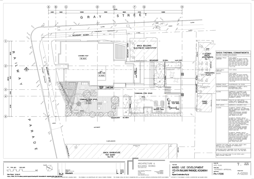
|
Georges
River Council - Georges River Local Planning Panel (LPP) - Thursday, 21
November 2019
LPP051-19 172-174 Railway Parade and 1B Gray Street
Kogarah
[Appendix
2] Elevations - 172-174
Railway Pde and 1B Gray St Kogarah
|
Page 133
|
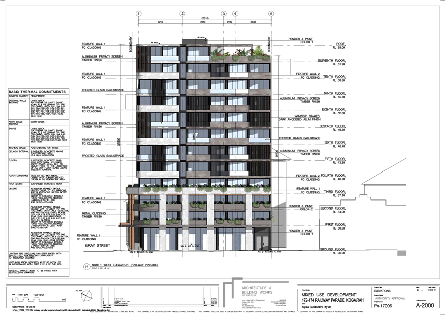
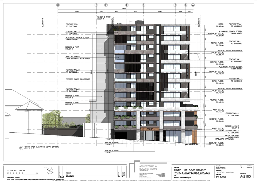

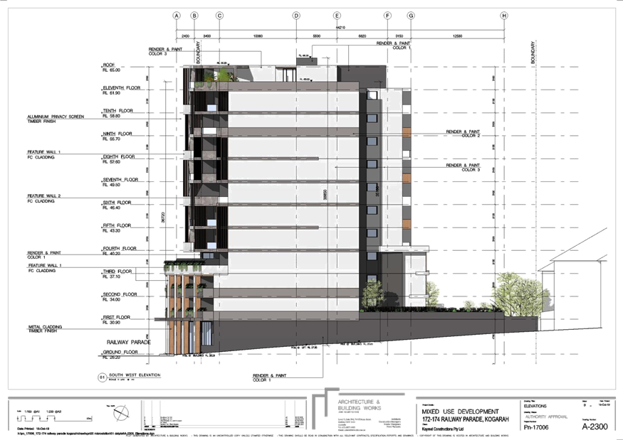
|
Georges River Council – Local Planning
Panel Thursday, 21 November 2019
|
Page 146
|
REPORT TO GEORGES RIVER COUNCIL
LPP MEETING OF Thursday, 21 November 2019
|
LPP Report No
|
LPP052-19
|
Development Application No
|
DA2018/0285
|
|
Site Address & Ward Locality
|
57-59 Trafalgar Street Peakhurst
Peakhurst Ward
|
|
Proposed Development
|
Demolition works and construction
of a 4 storey residential flat building containing 14 units, 21 car parking
spaces and site and landscaping works
|
|
Owners
|
Xia Li, F Mourad Pty Ltd, CPM
Property Management Pty Ltd, Younan Management Pty Ltd
|
|
Applicant
|
Cornerstone Design
|
|
Planner/Architect
|
Planner: BMA Urban, Architect: Cornerstone
Design
|
|
Date Of Lodgement
|
11/07/2018
|
|
Submissions
|
Two (2) submissions recieved
|
|
Cost of Works
|
$3,443,151.00
|
|
Local Planning Panel Criteria
|
SEPP 65 Design Quality of
Residential Apartment Development
|
|
List of all relevant s.4.15
matters (formerly s79C(1)(a))
|
State Environmental Planning Policy
No 55 - Remediation of Land, State Environmental Planning Policy BASIX 2004,
State Environmental Planning Policy No 65 - Design Quality of Residential
Apartment Development,
State Environmental Planning Policy
(Vegetation in Non-Rural Areas) 2017, Draft SEPP (Environment) 2017), Draft
Remediation SEPP, Greater Metropolitan Regional Environmental Plan No 2 -
Georges River Catchment,
Hurstville Local Environmental
Plan, Hurstville Development Control Plan No 1 - LGA Wide
|
|
List all documents submitted
with this report for the Panel’s consideration
|
Montage,
Architecutural Elevations,
Statement of Environmental Effects
Clause 4.6 Exception to Development
Standard
|
|
Report prepared by
|
Senior Development Assessment
Officer
|
|
Recommendation
|
That the application be refused in accordance with the
reasons included in the report.
|
|
|
Summary of matters for
consideration under Section 4.15
Have all recommendations in relation
to relevant s4.15 matters been summarised in the Executive Summary of the
assessment report?
|
Yes
|
|
Legislative clauses requiring
consent authority satisfaction
Have relevant clauses in all
applicable environmental planning instruments where the consent authority
must be satisfied about a particular matter been listed and relevant
recommendations summarised, in the Executive Summary of the assessment
report?
|
Yes
|
|
Clause 4.6 Exceptions to
development standards
If a written request for a
contravention to a development standard (clause 4.6 of the LEP) has been
received, has it been attached to the assessment report?
|
Clause
4.3 Height of Building HLEP 2012
|
|
Special Infrastructure
Contributions
Does the DA require Special
Infrastructure Contributions conditions (under s7.24)?
|
Not
Applicable
|
|
Conditions
Have draft conditions been provided
to the applicant for comment?
|
No,
as the application is recommended for refusal. The refusal reasons can be
viewed when the report is published.
|
|
Site Plan
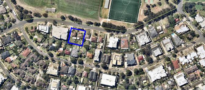
Figure 1: Aerial Photograph of the site. The allotment is
outlined in blue
|
Executive Summary
Proposal
1. The development
application seeks development consent for demolition works and construction of
a three (3) storey residential flat building containing fourteen (14) units,
twenty one (21) car parking spaces, site and landscaping works on land known as
57-59 Trafalgar Street, Peakhurst.
2. The proposal
comprises of two (2) x one (1) bedroom units, nine (9) x two (2) bedroom units,
three (3) x three (3) bedroom units, rooftop communal open space, one (1) level
of basement car parking. The proposal contains a centralised entry with direct
access to Trafalgar Street, Peakhurst.
3. The proposal
results in the isolation of the adjoining eastern property at 55 Trafalgar
Street, Peakhurst as development consent has been granted to a further property
at 51-53 Trafalgar Street, Peakhurst for a residential flat building
(DA2014/0949) on 14 November 2014.
4. The adjoining site
does not benefit from the 24m site frontage required for residential flat
building developments under the Development Control Plan (DCP). No evidence of
offers supported by valuations to the adjoining property owner has been
provided with this application, nor has any plan demonstrating that the
isolated site can be reasonably redeveloped in its own right have been
provided. Further, the proposal in itself does not make any accommodation it
its design to assist in the management of this issue in regards to increased
spatial separation.
5. The proposal seeks
a variation to Clause 4.3 Height of Building pursuant to the Hurstville Local
Environmental Plan 2012 (HLEP). This results in a variation of 13.1% which is
generated by the lift overrun and rooftop communal open space structures. A
Clause 4.6 Exception to Development Standard has been submitted for
Council’s consideration.
6. The
proposal is unsatisfactory having regarding to Clause 3D Communal and Public
Open Space and 3F – Visual Privacy of the Apartment Design Guide referred
to within State Environmental Planning Policy No 65 – Design Quality of
Residential Apartment Development.
7. The proposal does not comply regarding; accessible units, accessible car parking,
site isolation, excavation having regard to the Hurstville Development Control
Plan (DCP).
Site and
Locality
8. The subject site
is legally described as Lots 167 and 168 in DP 36317 and is known as 57-59
Trafalgar Street, Peakhurst. An easement is centrally located on site which
benefits 12 and 12A Gover Street to the rear which is an attached dual
occupancy.
9. The site area and
dimensions of the subject site are as follows:
|
Site Area
|
1,182sqm
|
|
North (frontage
to Trafalgar Street)
|
32.310m
|
|
West (side)
|
35.595m
|
|
South (rear)
|
32.310m
|
|
East (side)
|
36.590m
|
Zoning and Permissibility
10. 57-59 Trafalgar Street, Peakhurst
is subject to the provisions of the Hurstville Local Environmental Plan 2012
(LEP). The site is zoned R3 Medium Density Residential. A residential flat
building is a permissible use with development consent. The proposal meets the
residential flat building definition within the LEP.
Submissions
11. The application was notified
accordance with the provisions contained within the Hurstville Development
Control Plan (DCP). In response, two (2) submissions were received which has
been addressed in detail further within this report. The amended proposal was
not renotified as this did not generate a greater impact than the original
proposal.
Conclusion
12. The amended proposal results in the
isolation of the adjoining eastern property at 55 Trafalgar Street, Peakhurst
which is considered to result in a poor planning outcome especially in the
absence of investigations with regards to amalgamation and design responses to
the constraint imposed by the isolation. As such, the application is
recommended for refusal.
Report in Full
Proposal
13. The development application (DA)
seeks development consent for Demolition works and construction of a three (3)
storey residential flat building containing fourteen (14) units and twenty one
(21) car parking spaces site and landscaping works on land known as 57-59
Trafalgar Street, Peakhurst.
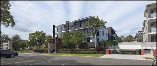
Figure 2 - Photomontage
of proposal at subject site (57-59 Trafalgar Street, Peakhurst) viewed from
Trafalgar Street, Peakhurst. The original montage adopts a similar street
presentation to that of the proposal as assessed (Source: Cornerstone Design,
2019).
14. In detail, the proposal as assessed
is described as follows;
Basement 1 Plan
§ Seventeen (17) residential car
parking spaces including two (2) accessible spaces;
§ Four (4) visitor spaces, one
doubling as a car wash bay;
§ Storage areas;
§ Meter room, egress stairs and 1
lift core;
§ Four (4) bicycle spaces;
§ Cleaners room; and
§ Garbage room
Ground
Floor Plan
§ Central entry from Trafalgar
Street, which include lift access;
§ One (1) x one (1) bedroom unit
(G.01 forms an accessible unit);
§ Three (3) x two (2) bedroom units;
§ One (1) x three (3) bedroom unit;
§ Courtyard areas;
§ Landscaping to the perimeter of the
site and over the car park roof;
§ Driveway along the east side
boundary;
§ Service areas, egress stairs and 1
lift core;
First
Floor Plan
§ One (1) x one (1) bedroom unit
(Unit 1.05 forms an accessible unit);
§ Three (3) x two (2) bedroom units;
§ One (1) x three (3) bedroom unit;
§ Service areas, egress stairs and 1
lift cores;
Second
Floor Plan
§ Three (3) x two (2) bedroom units;
§ One (1) x three (3) bedroom unit;
§ Service areas, egress stairs and
single lift cores;
Roof top Plan
§ Communal open space, communal
toilet, outdoor BBQ facilities situated below roofline and single lift core
15. The driveway crossing to Trafalgar
Street is to the north eastern corner of the allotment.
16. The proposal does not seek the
removal of trees on site or within the Council’s road reserve.
17. Deep soil areas are proposed along
the northern front setback and eastern setbacks. OSD is located within the
front setback.
18. Relocation of an easement along
western side boundary.
19. In summary the proposal comprises
of the following:
Residential unit composition
|
Unit
|
No. of Units
|
|
1 bedroom units
|
2
|
|
2 bedroom units
|
9
|
|
3 bedroom units
|
3
|
|
Total
|
14
|
Car parking and vehicular composition
|
Car parking
|
No. of spaces
|
|
Residential Car Parking
|
17
|
|
Visitor Car Parking
|
4
|
|
Bicycle Parking
|
4
|
HISTORY
20.
|
Date
|
Event
|
|
14 November 2014
|
Development consent granted by the
NSW Land and Environment Court for the construction of a residential flat
building comprising of thirteen (13) units at 51-53 Trafalgar Street,
Peakhurst located close to the subject site.
|
|
11 June 2018
|
Development Application received
for demolition works and construction of a four (4) storey residential flat
building containing fourteen (14) units on land known as 57-59 Trafalgar
Street, Peakhurst.
|
|
10 – 24 August 2018
|
Notification period
|
|
1 November 2018
|
Design Review Panel
|
|
13 August 2019
|
Request for additional information
requesting minor design changes to the building to improve occupant amenity.
|
|
18 July 2019
|
Additional
information provided
|
21. The proposal was amended improve
the amenity for the future occupants.
SITE AND
LOCALITY
22. The subject site is legally
described as Lots 1276 and 127 in DP 36317 and is known as 57-59 Trafalgar
Street, Peakhurst.
23. The combined area and dimensions of
the subject site are as follows:
|
Site Area
|
1,182sqm
|
|
North (frontage
to Trafalgar Street)
|
32.310m
|
|
West (side)
|
35.595m
|
|
South (rear)
|
32.310m
|
|
East (side)
|
36.590m
|
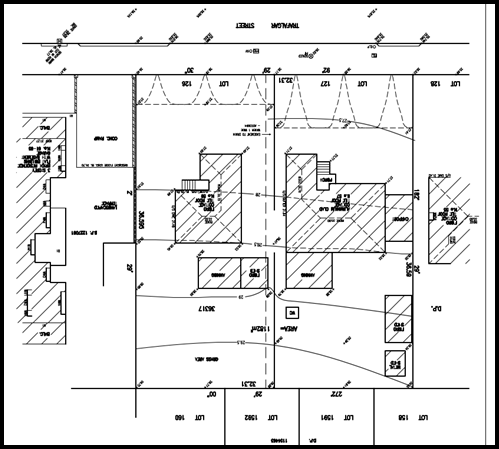
Figure 3 -
Survey of subject site being 57-59 Trafalgar Street, Peakhurst (Source: W
Buxton Pty Ltd Surveyors, 2017)
Figure 4 -
Photograph of subject site taken from Trafalgar Street, Peakhurst (Source:
Author. GRC 2019)
24. There appears to be no constraints
on the site as indicated by the registered survey submitted. A registered
easement traverses through the centre of the site benefiting 12 and 12A Gover
Street to the south (rear) which drains to Trafalgar Street to the front of the
site.
25. The site accommodates two (2) fibro
and weatherboard dwellings on each respective allotment.
26. Small shrubs and plantings are
located on the sites.
Surrounding
Area
27. The immediate surrounding area is
zoned R3 Medium Density Residential, Peakhurst Park is zoned RE1 Public
Recreation on the opposite side of Trafalgar Street from the site.
28. Council’s records indicate
that approval has been granted for a three storey residential flat building at
51-53 Trafalgar Street, Peakhurst (DA2014/0949). A Notice of Commencement was
forwarded to Council on 3 November 2019. Council records indicate that 55
Trafalgar Street, Peakhurst does not have any recent development approvals and
will be isolated by this development given the other approval is on place.

Figure 5 -
Photograph of adjoining residential property (51-53 Trafalgar Street,
Peakhurst) to the east (Source: Author, GRC 2019).
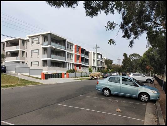
Figure 6 –
Photograph of adjoining residential property (61-65 Trafalgar Street,
Peakhurst) to the west (Source: Author, GRC 2019).
29. Electricity power lines are located
within the front Council reserve and will be required to be undergrounded by a
condition of consent.
Zoning and
Permissibility
30. The subject site is zoned R3 Medium
Density Residential under the provisions of the Hurstville Local Environmental
Plan 2012 (HLEP2012). The immediate surrounding area is zoned R3 Medium Density
Residential which comprises of residential flat buildings, dual occupancies and
dwelling houses. It is noted that the area is undergoing transitional change
from detached dwelling to generally newer infill residential flat buildings and
boarding houses.
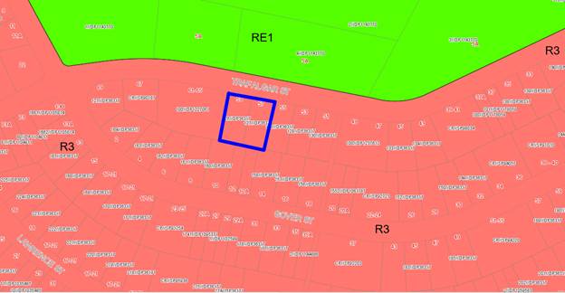
Figure 7 –
Zoning map – the site being 57-59 Trafalgar Street, Peakhurst the site is
outlined in blue.
Environmental
Planning and Assessment Regulations 2000 (EP&A) Regulation 2000
31. The proposed development satisfies
the relevant matters for consideration under the Regulations.
Objects of the EP&A Act
32. The consent authority is required
to consider the objects in Section 1.3 of the EP&A Act when making
decisions under the Act. Council has considered the object of the EP&A Act
in the Table below and is satisfied that the proposal complies with all
objects.
|
Objects
of the EP&A Act
|
Proposal
|
Complies
|
|
(a) to promote the social and economic welfare of the community
and a better environment by the proper management, development and
conservation of the State’s natural and other resources
|
The
proposal is not considered to be inconsistent with this objective.
|
Yes
|
|
(b) to facilitate ecologically sustainable development by
integrating relevant economic, environmental, and social considerations in
decision-making about environmental planning and assessment
|
The
proposal is accompanied by a BASIX Certificate which satisfies the
requirements under State Environmental Planning Policy (BASIX) 2004 and the
Regulations.
|
Yes
|
|
(c) to promote the orderly and economic use and development
of land
|
The
proposal is not considered to satisfy this clause at the proposal results in
the isolation of 55 Trafalgar Street, Peakhurst and insufficient information
has been provided to demonstrate that an orderly and appropriate planning outcome
cannot be achieved.
|
No
|
|
(d) to promote the delivery and maintenance of affordable housing
|
The
proposal seeks development consent for fourteen (14) units which are not for
affordable rental housing.
|
N/A
|
|
(e) to protect the environment, including the conservation of
threatened and other species of native animals and plants, ecological
communities and their habitats
|
The
proposal does not seek and removal of trees on site however Council’s
Consultant Arborist has recommended conditions to protect trees on adjoining
properties.
|
Yes
|
|
(f) to promote the sustainable management of built and
cultural heritage
|
The
proposal is not listed as a heritage item or within the immediate vicinity to
a heritage item or conservation area within a Local or Stage Heritage register.
|
Yes
|
|
(g) to promote good design and amenity of the built environment
|
The
proposal is considered to result in a reasonable design.
|
Yes
|
|
(h) to promote the proper construction and maintenance of
buildings, including the protection of the health and safety of their
occupants
|
The
proposal is considered to satisfy the intent of this control to ensure
appropriate construction and maintenance of which is supported by
Council’s Senior Building Surveyor.
|
Yes
|
|
(i) to promote the sharing of the responsibility for
environmental planning and assessment between the different levels of
government in the State
|
The
proposal was referred to the relevant applicable State Government authorities
for consideration as part of this Local Development.
|
Yes
|
|
(j) to provide increased opportunity for community
participation in environmental planning and assessment
|
The
proposal was notified in accordance with the HDCP. In response, two (2)
submissions were received; the concerns have been addressed in further detail
later in this report.
|
Yes
|
Ecologically Sustainable
Development (ESD)
33. The Act adopts the definition of
ESD found in the Protection of the Environment Administration Act 1991. Section
6(2) of that Act states that ESD requires the effective integration of economic
and environmental considerations in decision making processes and that ESD can
be achieved through the implementation of:
(a) the
precautionary principle;
(b) inter-generational
equity;
(c) conservation
of biological diversity and ecological integrity; and
(d) improved
valuation, pricing and incentive mechanisms.
34. Council has
assessed the proposed development in relation to the ESD principles and has
made the following conclusions;
(a) Precautionary Principle – the site has been
appropriately planned for the development and will not result in any serious or
irreversible environmental damage.
(b) Inter-Generational Equity – the proposal will
not have any adverse impacts on the environment for future generations.
(c) Biodiversity Principle – the site is within a
highly urbanised area and contains no significant flora or fauna.
(d) Valuation Principle – the proposal includes a
number of energy, water, and waste reducing measures to reduce the ongoing cost,
resource usage, and energy requirements of the development.
The proposal not
inconsistent with this criterion.
Environmental
Planning Instruments
State
Environmental Planning Policies
35. Compliance with the relevant State
Environmental Planning Policies is detailed and discussed below.
Greater Metropolitan Regional
Environmental Plan No 2 – Georges River Catchment
36. The site is within the area
affected by the Greater Metropolitan Regional Environmental
Plan No 2 — Georges River Catchment. The proposal, including the disposal
of stormwater, is considered to be consistent with Council's requirements for
the disposal of stormwater within the catchment.
37. All stormwater from the proposed
development will be managed and treated in accordance with Council’s
Water Management Policy and will therefore satisfy the relevant provisions of
the Deemed State Environmental Planning Policy – Georges River Catchment.
The proposal is supported by Council’s Development Engineer subject to
conditions.
State
Environmental Planning Policy No 55 - Remediation of Land
38. SEPP 55 aims to promote the
remediation of contaminated land in order to reduce the risk of harm to human
health or any other aspect of the environment.
39. Clause 7 requires contamination and
remediation to be considered in determining a development application. The
consent authority must not consent to the carrying out of development on land
unless it has considered whether or not the land is contaminated.
40. Council historical records indicate
that the site has been used for residential purposes
for extended periods of time, and such uses and/or development are not
typically associated with activities that would result in the contamination of
the site. A preliminary assessment (Phase 1) has been submitted and is
supported by Council’s Environmental Health Officer subject to
conditions.
41. SEPP 55 is considered to be
satisfied. An unexpected finds condition is recommended to be imposed should
contamination be found during the site works.
State
Environmental Planning Policy (Building Sustainability Index: BASIX) 2004
42. A BASIX Certificate prepared has
been issued for the proposed development. This is considered to be valid and
satisfies all water, thermal and energy requirements. In this regard, the
requirements of the SEPP have been reasonably satisfied.
State
Environmental Planning Policy (Infrastructure) 2007
43. The site is serviced currently and
the services can be extended to service this development. Relevant conditions
for service authorities would be imposed if the application was being
supported.
State
Environmental Planning Policy Vegetation 2017
44. The Vegetation SEPP regulates
clearing of native vegetation on urban land and land zoned for environmental
conservation/management that does not require development consent.
The
Vegetation SEPP applies to clearing of:
(a) Native vegetation above the Biodiversity Offset
Scheme (BOS) threshold where a proponent will require an approval from the
Native Vegetation Panel established under the Local Land Services Amendment Act
2016; and
(b) Vegetation below the BOS threshold where a
proponent will require a permit from Council if that vegetation is identified
in the council’s development control plan (DCP).
45. The Vegetation SEPP repeals clause
5.9 and 5.9AA of the Standard Instrument - Principal Local Environmental Plan
with regulation of the clearing of vegetation (including native vegetation)
below the BOS threshold through any applicable DCP.
46. The proposal is supported by
Council’s consulting arborist subject to conditions of consent.
State Environmental Planning Policy No
65 - Design Quality of Residential Apartment Development
47. Clause 28(2) of SEPP 65 requires
that the consent authority take into consideration the following as part of the
determination of DAs to which SEPP 65 applies:
a) the advice (if any) obtained from the design
review panel, and
b) the design quality of the development when
evaluated in accordance with the design quality principles, and
c) the Unit Design Guide.
48. The extent to which the proposed
development complies with the controls and principles in the State
Environmental Planning Policy 65 – Design Quality of Residential Unit Development
(SEPP 65) is detailed and discussed in the tables below.
Application of
SEPP 65
Compliance
with SEPP 65
|
Clause
|
Standard
|
Proposal
|
Complies
|
|
Clause 3 - Definitions
|
SEPP 65 applies to residential unit
development
The permitted uses within the zone
R3 Medium Density Residential Zone are detailed as follows;
Attached dwellings; Bed and
breakfast accommodation; Boarding houses; Car parks; Centre-based child care
facilities; Community facilities; Dual occupancies; Dwelling houses;
Environmental protection works; Flood mitigation works; Group homes; Hotel or
motel accommodation; Multi dwelling housing; Neighbourhood shops; Oyster
aquaculture; Places of public worship; Public administration buildings;
Recreation areas; Residential flat buildings; Respite day care centres;
Roads; Semi-detached dwellings; Seniors housing; Tank-based aquaculture.
|
The proposal seeks development
consent for a residential flat building, SEPP 65 applies.
A residential flat building is a
permissible use within the zone.
|
Yes
Yes
|
|
Clause 4 - Application of Policy
|
Development involves the erection
of a new RFB.
|
The proposal seeks development
consent for the construction of a residential flat building which meets the
prescribed criteria within the SEPP.
|
Yes
|
|
Clause 50 (1a) – Development
Applications
|
Design verification statement
provided by qualified designer
|
Design Verification Statement
provided by a Registered and practicing Architect:
Nick Lycenko
Registration Number: 3010
accompanies the application.
|
Yes
|
49. The DA was reviewed by the Design
Review Panel (DRP) at a meeting held on 1 November 2018 having regard to each
of the nine (9) Design Quality Principles.
50. The minutes of the DRP recommended
support of the application, subject to the issues raised being resolved as
contained within the table below. It is noted that the DRP indicates that the
application satisfied the design quality principles contained within SEPP65.
Compliance with the principles of
the Apartment Design Guide (ADG)
|
SEPP 65
– Design Quality of Residential Flat Buildings
|
DRP
Comment
|
Planner
Comment
|
|
Context and Neighbouring Character
Good design
responds and contributes to its context. Context is the key natural and
built features of an area, their relationship and the character they
create when combined. It also includes social, economic, health and
environmental conditions.
Responding
to context involves identifying the desirable elements of an area’s
existing or future character. Well designed buildings respond to
and enhance the qualities and identity of the area including the adjacent
sites, streetscape and neighbourhood.
Consideration
of local context is important for all sites, including sites in established
areas, those undergoing change or identified for change.
|
“The evolving context of
Trafalgar Street is three (3) storey medium density unit framework with a
frontage across Trafalgar Street to the park. These buildings are generally
rendered and painted in light grey/white colours with occasional brightly
coloured features. The proposal is appropriate in this context”.
|
Planner
comment:
Satisfactory.
|
|
Built
Form and Scale
Good design
achieves a scale, bulk and height appropriate to the existing or desired
future character of the street and surrounding buildings.
Good design
also achieves an appropriate built form for a site and the building’s
purpose in terms of building alignments, proportions, building type,
articulation and the manipulation of building elements.
Appropriate
built form defines the public domain, contributes to the character
of streetscapes and parks, including their views and vistas, and
provides internal amenity and outlook.
|
“The proposal complies
with the building height with minor exception for lift over run/roof garden
communal areas. This is acceptable. It is also compliant with setbacks along
all four (4) boundaries”.
|
Planner comment:
Satisfactory.
|
|
Density
Good design
achieves a high level of amenity for residents and each unit, resulting in a
density appropriate to the site and its context.
Appropriate
densities are consistent with the area’s existing or projected
population. Appropriate densities can be sustained by existing or proposed
infrastructure, public transport, access to jobs, community facilities and
the environment.
|
“Complies with FSR
requirements with the exception of the roof top common room. This minor non
compliance for communal space is acceptable”.
|
Applicant comment:
“The common room on the rooftop has had
the doors and windows removed from the southern side in order to open it up
to the elements. Therefore, the Gross Floor Area and the Floor Space Ratio
(FSR) are fully compliant”.
Planner comment:
The communal open room has been reduced in size. This amended
proposal complies in relation to FSR. However further to the above, the
enclosed area forward of the lift serves no material purpose and the proposed
glass and door along the northern and eastern elevation are to be deleted.
|
|
Sustainability
Good design
combines positive environmental, social and economic outcomes.
Good sustainable
design includes use of natural cross ventilation and sunlight for the amenity
and liveability of residents and passive thermal design for
ventilation, heating and cooling reducing reliance on technology and
operation costs. Other elements include recycling and reuse of materials and
waste, use of sustainable materials and deep soil zones for groundwater
recharge and vegetation.
|
“Comply with
BASIX
The on-site detention basin in
the front garden is acceptable as it is integrated with decorative front
landscaping”.
|
Planner comment:
Satisfactory
|
|
Landscape
Good
design recognises that together landscape and buildings operate as
an integrated and sustainable system, resulting in attractive developments
with good amenity. A positive image and contextual fit of well designed
developments is achieved by contributing to the landscape character of the
streetscape and neighbourhood.
Good
landscape design enhances the development’s environmental performance
by retaining positive natural features which contribute to the local
context, co-ordinating water and soil management, solar access,
micro-climate, tree canopy, habitat values and preserving green
networks.
Good
landscape design optimises useability, privacy and opportunities
for social interaction, equitable
access, respect for neighbours’ amenity and
provides for practical establishment and long term management.
|
“The proposal provides
acceptable deep soil zones however some additional larger trees should be
considered around the site perimeter and particularly associated with the
front setback.
The street trees may need to be
a little smaller to accommodate power lines (Water Gums as specified may be
appropriate here).
Roof garden as proposed is
appropriate and should result in very attractive space for residents.
The front landscaping including
detention basin should be designed to screen protruding parking
basement”.
|
Applicant comment:
“The
street tree species the Panel suggested were already shown, so a note is
added to the landscape plan. One of the smaller frontage trees has been
changed to a larger canopy variety as there’s no extra room for
additional trees. The side and rear already have trees or are restricted by
an easement, so there’s no space for additional planting. Extra screen
plants have been added directed adjacent to the basement wall to increase
screening – see amended landscape plan”.
Planner comment:
The proposed amendments are considered to be satisfactory. It is noted
that Council’s consulting arborist supports the proposal.
|
|
Amenity
Good design
positively influences internal and external amenity for residents
and neighbours. Achieving good amenity contributes to positive living
environments and resident well being.
Good
amenity combines appropriate room dimensions and shapes, access to sunlight,
natural ventilation, outlook, visual and acoustic privacy, storage, indoor
and outdoor space, efficient layouts and service areas and ease of access for
all age groups and degrees of mobility.
|
“Generally of
good quality and compliant with ADG standards. The following detailed matters
should be addressed:
· The entry
foyer should be enlarged to allow for more generous space and some seating
· There is a
privacy concern at the void interface between the foyers and the private
balconies on the northern side of the building at Levels 1 and 2
· Clear glass
balconies balustrades should be avoided”.
|
Applicant comment:
“The entry foyer has been enlarged and a seat provided as
recommended. In order to alleviate the privacy concern between the foyers and
the private balconies; glass block screens have been added to the balcony
edges or apartments 1.01 and 2.01. These screens have a maximum height of 1.7
thus providing balconies to the foyers whilst allowing natural light and
outlook from the foyers. Regarding the glass balcony balustrades –
please note that the plans have these balustrades nominated as
‘frameless glass balustrade with semi-translucent glass infill
panels’.
Planner comment:
The design has been amended to incorporate the recommendations of
the panel which results in a satisfactory outcome.
|
|
Safety
Good design
optimises safety and security within the development and the public domain.
It provides for quality public and private spaces that are clearly defined
and fit for the intended purpose. Opportunities to maximise passive
surveillance of public and communal areas promote safety.
A positive
relationship between public and private spaces is achieved through clearly
defined secure access points and well lit and visible areas that are easily
maintained and appropriate to the location and purpose.
|
“Acceptable”.
|
Applicant comment:
“As recommended, the entry canopy has been considerably
lowered and reconfigured to be less assertive”.
Planner comment:
Satisfactory.
|
Design Review Panel Recommendation
51. The final comments from the Design
Review Panel stated “The Panel supports the application subject to
the issues raised above being resolved to the satisfaction of Council”.
52. The proposal was amended within the
assessment process, the final design as assessed is considered to adequately
address the issues raised by the Panel, as a result the amended plans, the
subject of this assessment, were not re-referred to the Panel.
The design
quality of the development when evaluated in accordance with the design quality
principles
53. Clause 28 of SEPP65 requires the
consent authority to take into consideration the provisions of the Apartment
Design Guide (ADG). A compliance table assessment has been provided below to
detail how the proposed development, performs against the relevant provisions
of the ADG.
54. As demonstrated within the ADG
compliance table, the proposal is generally satisfactory when considered
against the relevant objectives, design criteria and design guidance for
residential flat buildings.
Clause
30 – Consideration of Unit Design Guide
55. The proposal has been considered in
accordance with the applicable controls as per below.
Compliance
with the ADG standards
|
Clause
|
Standard
|
Proposal
|
Complies
|
|
2G – Street setbacks
|
Align street setbacks with building
use. For example in mixed use buildings a zero street setback is appropriate
|
The proposal seeks a front setback
of 6m (solid wall, stairs, balcony and courtyard protrude) which is
considered to be compatible with the streetscape alignment.
|
Yes
|
|
3D-Communal and Public Open Space
|
1. Communal open space has a
minimum area equal to 25% of the site. (295.5% required)
-Where it cannot be provided on
ground level it should be provided on a podium or roof
-Where
developments are unable to achieve the design criteria, such as on small
lots, sites within business zones, or in a dense urban area, they should:
• provide
communal spaces elsewhere such as a landscaped roof top terrace or a common
room
• provide
larger balconies or increased private open space for units
• demonstrate good proximity
to public open space and facilities and/or provide contributions to public open
space
2. Developments achieve a minimum
of 50% direct
sunlight to the principal usable
part of the communal open space for a minimum of 2 hours between 9 am and 3
pm on 21 June (mid-winter)
|
Communal open
space of 278.35sqm (17.15sqm equating to 23.54%) has been provided which is
deficient.
This is
included in the reasons for refusal.
It also noted
that the revised landscape plan is inconsistent with the amended proposal
which shows the communal room enclosed which has been subsequently deleted
from the revised architectural plans.
This is
provided on the roof top and directly accessible from the central lift and is
located adjacent to a communal toilet which is covered.
The subject site is zoned R3 Medium
Density Residential, communal open space is located on the rooftop to
minimise acoustic impacts and maximise solar access.
The proposal provides slightly
oversized balconies for each unit; however the size of the balconies is not
effective compensation for the undersized communal open space area.
The rooftop communal open space
achieves 100% solar access given the aspect of the site and the neighbouring
development form.
|
No
Yes
Yes
|
|
3E-Deep Soil zones
|
1. Deep soil zones are to meet the
following minimum
requirements:
- 7%
minimum area
- 3m
minimum dimension
|
The proposed
development provides in excess of 7% of deep soil zone within the front, and
eastern setbacks
3m min
dimension
|
Yes
Yes
|
|
3F-Visual Privacy
|
Separation between windows and
balconies is provided to ensure visual privacy is achieved.
Minimum required separation
distances from buildings to the side and rear boundaries are as follows:
Habitable rooms and balconies:
Up to four storeys
(approximately 12m):
• 6m between habitable
rooms/balconies (setback to the boundary)
Non habitable setback 3m
|
North (front):
6m
West (side):
4.37- 6m, 11.37m spatial separation to RFB at 61-65 Trafalgar Street,
Peakhurst so total separation is non-compliant)
East (side): 6m
(min)
South (rear) 6m
The proposal
complies with this setback to the rear southern boundary which comprises of
blank walls for ensuites.
|
Yes
No
Yes
Yes
Yes
|
|
3G-Pedestrian access and entries
|
Building
entries and pedestrian access connects to and addresses the public domain
Multiple
entries (including communal building entries and individual ground floor
entries) should be provided to activate the street edge.
|
The proposal seeks one (1) central
entry point within the middle of the façade fronting Trafalgar Street,
Peakhurst.
The proposal provides multiple
entries within the main portico to unit G01 and G02 which is considered to be
satisfactory given the slope of the site which is too steep to accommodate
separate entry stairs.
|
Yes
Yes
|
|
3H-Vehicle Access
|
Vehicle access
points are designed and located to achieve safety, minimise conflicts between
pedestrians and vehicles and create high quality streetscapes.
|
Vehicular access is granted via a
two-way driveway for the first 5.5m of the site and is parallel with the
eastern side boundary. The driveway entry is suitably designed and located as
not to result in any adverse safety and does not detract from the visual
amenity of the area.
|
Yes
|
|
3J- Bicycle and car parking
|
For development in the following
locations:
- On sites that are within 800m of
a railway station or light rail stop in the Sydney Metropolitan Area;
- The minimum car parking
requirement for residents and visitors is set out in the Guide to Traffic
Generating
Developments, or the car parking
requirement prescribed by the relevant council, whichever is less
|
The site is located more than 800m
away from the closest Railway Station being Riverwood Railway Station to the
north. The proposal provides compliant car parking for future occupants
however it is deficient by one (1) accessible space.
This forms part of the reasons for
refusal.
|
No
|
|
4A- Solar Access
|
Living rooms and private open
spaces of at least 70% of units in a building receive a minimum of 2 hours
direct sunlight between 9 am and 3 pm at mid-winter in the Sydney
Metropolitan Area
A maximum of 15% of units in a
building receive no direct sunlight between 9 am and 3 pm at mid-winter
Daylight access is maximised where
sunlight is limited.
|
11 of 14 units received in excess
of 2 hours of sunlight equating to 78.57%.
All units receive some form of
sunlight.
Window placement appropriately located
to maximise natural light with 12 of the 14 units forming corner units.
|
Yes
Yes
Yes
|
|
4B-Natural Ventilation
|
At least 60% of units are naturally
cross ventilated in the first nine storeys of the building.
Overall depth of a cross-over or
cross-through unit does not exceed 18m, measured glass line to glass line.
|
12 of 14 are naturally cross
ventilated equating to 85.14%.
Less than 18m.
|
Yes
Yes
|
|
4C-Ceiling
Heights
|
Measured from
finished floor level to finished ceiling level, minimum ceiling heights are:
Habitable rooms
= 2.7m
Non-habitable
rooms = 2.4m.
Residential floor to floor height of 3.1m
|
2.7m.
3.1m floor to
floor provided.
|
Yes
Yes
|
|
4D-Unit size and layout
|
Units are required to have the following
minimum internal areas:
1 bedroom = 50sqm
2 bedroom = 70sqm
3 bedroom = 90sqm
The minimum internal areas include
only one bathroom. Additional bathrooms increase the minimum internal area by
5sqm each
Every habitable room must have a
window in an external wall with a total minimum glass area of not less than
10% of the floor area of the room. Daylight and air may not be borrowed from
other rooms
|
Range: 50sqm.
Range: 75.08—80.05sqm.
Range: 95sqm.
All units with additional bathroom
provide an additional 5sqm.
Each habitable room contains a
window which is not less than 10% of the floor area of the room. Daylight is
not borrowed from other rooms.
|
Yes
Yes
Yes
Yes
Yes
|
|
4D- Unit rooms, location and sizes
|
Habitable room depths are limited
to a maximum of 2.5 x the ceiling height
In open plan layouts (where the
living, dining and kitchen are combined) the maximum habitable room depth is
8m from a window
|
Habitable room
depths are provided in accordance with this clause.
Open plan
layouts contain a maximum depth of 8m from a window complying with this
clause.
|
Yes
Yes
|
|
4D- Unit rooms, location and sizes
|
Master bedrooms have a minimum area
of 10sqm and other bedrooms 9sqm (excluding wardrobe space)
Bedrooms have a minimum dimension
of 3m (excluding wardrobe space)
Living rooms or combined
living/dining rooms have a minimum width of:
- 3.6m for studio and 1 bedroom
- 4m for 2 and 3 bedroom units
|
The master bedrooms are greater
than 10sqm excluding wardrobes.
Other bedrooms are greater than
9sqm excluding wardrobes.
Each bedroom has a minimum
dimension of 3m excluding the wardrobe.
Living rooms wider than 3.6m for 1
bedroom units.
Living rooms wider than 4m for 2 +
bedroom units.
|
Yes
Yes
Yes
Yes
|
|
4E-Private Open space and
balconies
|
All units are required to have
primary balconies as follows:
1 bedroom = 8sqm/2m depth
2 bedroom = 10sqm/2m depth
3 bedroom = 12sqm/2m depth
The minimum balcony depth to be
counted as contributing to the balcony area is 1m
For units at ground level or on a
podium or similar structure, a private open space is provided instead of a
balcony. It must have a minimum area of 15sqm and a minimum depth of 3m
|
Range: 12.29 - 59.29sqm with
minimum depth of 2m
Range: 10.75-158.14sqm with minimum
depth of 2m.
12.13sqm – 160.86sqm with
minimum depth of 2.4m.
Where the private open space is
provided in the form a balcony achieve the minimum area required.
Units range from 59.02 –
160.86sqm.
|
Yes
Yes
Yes
Yes
|
|
4F- Circulation spaces
|
The maximum number of units off a
circulation core on a single level is 8, however where this is unable to be
achieved due to design criterion for increased internal amenity, no more than
12 units is permitted off a circulation core on a single level.
|
One lift provided to service each
level;
Basement – 21 vehicles
Level G: 5 units
Level 1: 5 units
Level 2: 4 units
|
Yes
|
|
4G- Storage
|
1. In addition to storage in
kitchens, bathrooms and bedrooms, the following storage is provided:
1 bedroom = 6m³
2 bedroom = 8m³
3 bedroom = 10m³
|
More than 6m³ provided for 1
bedroom units.
More than 8m³ provided for 2
bedroom units.
More than 10m³ for 3 bedroom
units.
|
Yes
|
|
4K- Unit mix
|
A variety of unit types is provided
|
The proposal seeks 14 units
composition comprising of:
The proposal comprises of the
following:
2 x 1 bedroom = 14.28%
9 x 2 bedroom = 64.29%
3 x 3 bedroom = 21.4%
|
Yes
|
|
4M-Facades
|
Facades should be well resolved
with an appropriate scale and proportion to the streetscape and human scale.
|
The façade is:
· Appropriate,
given the prominent location of the site.
· Balanced with an
appropriate scale along the vertical and horizontal planes.
· Is considered to
positively contribute to the streetscape along Trafalgar Street and is
consistent with recently constructed and approved development in this
precinct.
|
Yes
|
|
4N-Roof design
|
Roof treatments are integrated into
the building design and positively respond to the street. Opportunities to
use roof space for residential accommodation and open space are maximised.
Incorporates sustainability features.
|
Roof treatments are integrated into
the building.
|
Yes
|
|
4O-Landscape design
|
Landscape design is viable and
sustainable, contributes to the streetscape and amenity
|
The proposal seeks good levels of
landscape embellishment on site to positively contribute to the streetscape
and amenity for future occupants.
|
Yes
|
|
4P- Planting on structures
|
Planting on structures –
appropriate soil profiles are provided, plant growth is optimised with
appropriate selection and maintenance, contributes to the quality and amenity
of communal and public open spaces
|
The proposal seeks to
provide planting on the roof top and on ground level which are considered to
positively contribute to the amenity of the site for the future occupants and
the presentation of the development within the streetscape.
|
Yes
|
|
4Q-Universal design
|
Universal design – design of
units allow for flexible housing, adaptable designs, accommodate a range of
lifestyle needs
|
The proposal provides for a wide
variety of floor layouts and configurations.
|
Yes
|
|
4T- Awnings
|
Awnings and signage – awnings
are well located and compliment and integrate with the building design,
signage responds to the context and desired streetscape character.
|
The proposal incorporates awning
and canopy elements which are incorporated within the building design and
complement the streetscape.
|
Yes
|
|
4U- Energy Efficiency
|
Development incorporates passive
environmental design, passive solar design to optimise heat storage in winter
and reduce heat transfer in summer, natural ventilation minimises need for
mechanical ventilation.
|
The proposal adequately satisfies
the BASIX requirements.
|
Yes
|
|
4V
Water management and conservation
|
Potable water use is minimised
Urban stormwater is treated on site
before being discharged to receiving waters
Flood management systems are
integrated into site design.
|
The proposal adopts appropriate
drainage measures. The proposal complies with the BASIX requirements.
|
Yes
|
|
4W
Waste management
|
Waste storage facilities are
designed to minimise impacts on the streetscape, building entry and amenity
of residents
Domestic waste is minimised by
providing safe and convenient source separation and recycling.
|
The proposal incorporates waste
storage facilities contained within the basement level and is appropriate in
size.
|
Yes
|
|
4X
Building maintenance
|
Building design detail provides
protection from weathering
Systems and access enable ease of
maintenance
Material selection reduces ongoing
maintenance costs
|
The proposal seeks to utilise a
mixture of formwork, cladding and concrete which are materials that are
consistent in the locality and satisfies the objective of this clause.
|
Yes
|
56. As stated within the above table,
the proposal generally complies with the Apartment Design Guide (ADG)
requirements and therefore is considered to be acceptable.
Draft
Environmental Planning Instruments
Draft
Environment SEPP
57. The Draft Environment SEPP was
exhibited from 31 October 2017 to 31 January 2018. This consolidated SEPP proposes
to simplify the planning rules for a number of water catchments, waterways,
urban bushland, and Willandra Lakes World Heritage Property.
58. Changes proposed include
consolidating the following seven existing SEPPs:
· State
Environmental Planning Policy No. 19 – Bushland in Urban Areas
· State
Environmental Planning Policy (Sydney Drinking Water Catchment) 2011
· State
Environmental Planning Policy No. 50 – Canal Estate Development
· Greater
Metropolitan Regional Environmental Plan No. 2 – Georges River Catchment
· Sydney
Regional Environmental Plan No. 20 – Hawkesbury-Nepean River (No.2-1997)
· Sydney
Regional Environmental Plan (Sydney Harbour Catchment) 2005
· Willandra
Lakes Regional Environmental Plan No. 1 – World Heritage Property.
59. The proposal is not inconsistent
with the provisions of this Draft Instrument.
Draft
Remediation SEPP
60. The draft SEPP was exhibited from
31 January to 13 April 2018. The following are the aims of the SEPP as per
below:
· provide
a state-wide planning framework for the remediation of land
· maintain
the objectives and reinforce those aspects of the existing framework that have
worked well
· require
planning authorities to consider the potential for land to be contaminated when
determining development applications and rezoning land
· clearly
list the remediation works that require development consent
· introduce
certification and operational requirements for remediation works that can be
undertaken without development consent.
61. Given the above, a contamination
report was submitted which was reviewed and by Council’s Coordinator
Environmental Health, the proposal was considered acceptable subject to
conditions. In this regard, due consideration has been applied to the draft
SEPP.
Hurstville
Local Environmental Plan 2012
62. The extent to which the proposal
complies with the relevant standards of Hurstville Local Environmental Plan
2012 (HLEP2012) is outlined in the table below.
Assessment Table – Hurstville LEP 2012
Development Standards
63. The extent to which the proposed
development complies with the Hurstville Local Environmental Plan (HLEP) 2012
is detailed and discussed in the table below.
|
Clause
|
Standard
|
Proposed
|
Complies
|
|
1.2 – Aims of the Plan
|
In accordance with Clause 1.2 (2)
|
The proposal is considered to be
consistent with the aims of the plan.
|
Yes
|
|
1.4 - Definitions
|
“Residential flat building”
|
The proposed development meets
definition of “residential flat building”.
|
Yes
|
|
2.3 - Zone objectives and Land Use
Table
|
Site is zoned R3 Medium Density
Residential (see zoning map elsewhere in this report).
Meets objectives of R3
Medium Density zone
which state the following;
• To provide for the
housing needs of the community within a medium density residential
environment.
• To provide a variety of
housing types within a medium density residential environment.
• To enable other land
uses that provide facilities or services to meet the day to day needs of
residents.
• To ensure that a high
level of residential amenity is achieved and maintained.
Development must be permissible
with consent.
|
The development does not meet the
objectives of the controls as the proposal results in the isolation of
adjoining property at 55 Trafalgar Street, Peakhurst. This is considered to
result in adverse impacts in regards to residential amenity.
|
No
|
|
2.7 - Demolition
|
Demolition is permissible with
consent
|
The application seeks development
consent for demolition as part of this proposal.
|
Yes
|
|
4.3 – Height of Buildings
(HOB Map tile_002)
|
“M” = 12m
|
13.58m for the lift
overrun (RL41.75) and communal open space rooftop structure (RL40.15).
The remainder of building
is below the 12m height control.
|
No – refer to the CL4.6
discussion below
|
|
4.4 – Floor Space Ratio
(FSR Map Tile_002)
|
“N” = 1:1
(Site area = 1,182sqm)
|
1:1 equating to 1,182sqm.
|
Yes
|
|
4.6 Exceptions to development
standards
|
Written request for variation must
be considered
|
Development seeks a variation to
Clause 4.3 Height of Buildings. A request for the variation has been provided
for Council’s consideration and is discussed further in this report.
|
Yes
|
|
5.10 – Heritage Assessment
|
Objectives of clause
to be satisfied
|
The site is not identified as a
heritage item or within the vicinity to a heritage item or conservation area.
|
Yes
|
|
6.1 – Acid Sulphate Soils
|
The objective of this
clause is to ensure that development does not disturb, expose or drain acid
sulfate soils and cause environmental damage.
|
Not affected by Acid Sulphate
Soils.
|
Yes
|
|
6.3 – Flood Planning
|
Requires
assessment to minimise the flood risk to life and property associated with
the use of land; to allow development on land that is compatible with the land’s
flood hazard, taking into account projected changes as a result of climate
change; and to avoid significant adverse impacts on flood behavior and
the environment.
|
The site is not identified as a
Flood Control Lot.
|
Yes
|
|
6.7 Essential Services
|
Essential services
relating to water, electricity, sewerage, storm water or on site conservation
and suitable road and vehicular access to be provided
|
Essential services to be provided
as part of construction certificate requirements.
|
Yes
|
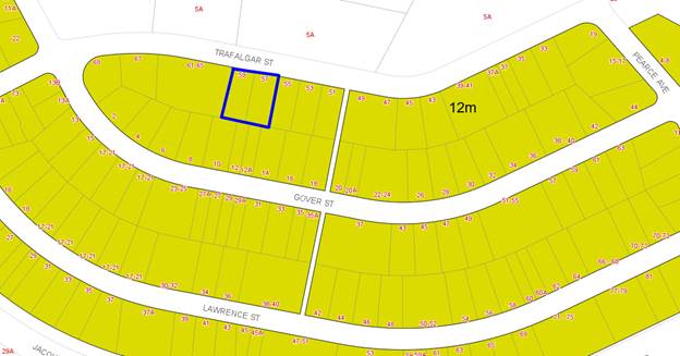
Figure 9 -
Height of Building Map
Clause 4.6
– Exceptions to Development Standards
Detailed
assessment of variation to Clause 4.3 Height of Buildings
64. The Hurstville LEP 2012 prescribes
a maximum building height of 12m for this site.
65. The proposal does not comply with
the 12m height control of the Hurstville LEP 2012. The extent of the
non-compliance, at the highest point being the top of the lift over-run equates
to 1,538mm or 13.16% above the 12m height limit which is considered to not be
out of character with recently approved developments.
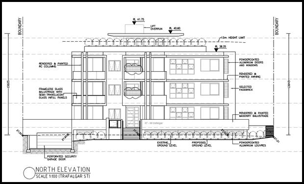
Figure 10: Extract of northern front elevation demonstrating
extent of non-compliance above 12m whereby the upper element of the lift
overrun exceeds the height of building (Source: Cornerstone Design, 2018)
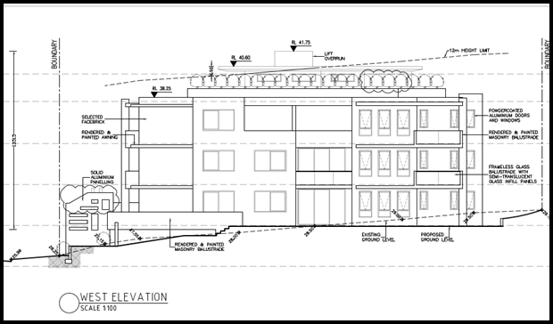
Figure
11: Extract of west side
elevation demonstrating extent of non-compliance above 12m whereby the upper
element of the lift overrun exceeds the height of building (Source: Cornerstone
Design, 2018)
66. To support the non-compliance, the
applicant has provided a request for a variation to Clause 4.3 in accordance
with Clause 4.6 of Hurstville Local Environmental Plan 2012 (LEP) for the
variation sought, of which points have been extracted justify the reasons in supporting
the variation. This Clause 4.6 request for variation is assessed as follows:
“Nos. 57-59 Trafalgar Street are located in an area that is
gradually transitioning from a low density neighbourhood to a medium density
residential neighbourhood characterised by predominately three (3) and four (4)
storey residential flat buildings.
As such, it is expected that the built form and scale within the sites
immediate and local context will change as properties are redeveloped to
commensurate with the current allowable building height and floor space ratio
development standards.
The proposed building will be of a form and scale that is a desired
future character, presenting an attractive facade to Trafalgar Street and
making a positive contribution to the streetscape character and urban form and
scale”
Is the
planning control in question a development standard?
67. Height of Buildings limitation
under Clause 4.3 of the HLEP 2012 is a development standard.
What are
the underlying objectives of the development standard?
68. The objectives of Height of
Buildings standard under Clause 4.3 of HLEP 2012 are:
“(1) The objectives of this clause are as follows:
(a) to ensure that buildings are compatible
with the height, bulk and scale of the existing and desired future character of
the locality,
(b) to minimise visual impact, disruption of
views, loss of privacy and loss of solar access to existing development and to public
areas and public domain, including parks, streets and lanes,
(c) to minimise the adverse impact of
development on heritage items,
(d) to nominate heights that will provide a
transition in built form and land use intensity,
(e) to establish maximum building heights that
achieve appropriate urban form consistent with the major centre status of the
Hurstville City Centre,
(f) to facilitate an appropriate
transition between the existing character of areas or localities that are not
undergoing, and are not likely to undergo, a substantial transformation,
(g) to minimise adverse environmental effects
on the use or enjoyment of adjoining properties and the public domain”
69. The applicant has provided the
following justification regarding the development’s consistency with the
above objectives.
70. Applicant’s Comments:
The proposed development achieves the objectives of the standard
notwithstanding non-compliance with the height of buildings control because:
“the proposed scale and massing of
the building is consistent with the desired future character of the locality;
the non-compliance relates to a roof structure over a communal open space area
and lift overrun and does not seek to
increase the number of storeys or density of the development. As such, there is
no tangible nexus between the height variation and
the overall land use intensity; the area
of non-compliance will not result in any adverse impacts on the adjoining land
uses with respect to overshadowing, loss of privacy, inappropriate scale
etc”.
71. Officer Comment: The
applicant’s justification is supported. As shown on the building height
blanket drawings (Figure 10), the extent of the height variation relates to the
lift overrun and communal roof top which is centrally sited within the building
footprint. The proposed variation does not comprise of floor space or area
which could be readily converted into floor space.
72. The height of the building results
in minimal additional impacts of overshadowing or visual bulk, when compared to
that of a numerically compliant building, the addition shadowing will fall to
the south of the site and not impacting other development given the topography
of the land.
73. Given the above, the proposed
variation is considered to be consistent with the objectives of Clause 4.3, and
is acceptable despite the numerical non-compliance.
What are
the underlying objectives of the zone?
74. The objectives of the R3 Medium
Density Residential zone are as follows:
· “To
provide for the housing needs of the community within a medium density
residential environment.
· To
provide a variety of housing types within a medium density residential
environment.
· To
enable other land uses that provide facilities or services to meet the day to
day needs of residents.
· To
ensure that a high level of residential amenity is achieved and maintained.
· To
provide for a range of home business activities, where such activities are not
likely to adversely affect the surrounding residential amenity”
75. Officer Comment: The
applicant has provided the following key points in addressing the above as
follows;
“As discussed above, the proposal is considered to be consistent
with the objectives of the building height standard, notwithstanding the
numerical variation.
• the underlying objective or purpose of the
standard is not relevant to the
development and therefore compliance is unnecessary;
Comment: The objectives of the building height standard
remain relevant and the proposal is consistent with, or at least is not
antipathetic to the objectives of the building height standard, notwithstanding
the numerical variation.
• the underlying object of purpose would be defeated or thwarted
if compliance was
required and therefore compliance is unreasonable”.
76. Officer Comment: The
applicant’s justification is considered to be reasonable and sound given
the underlying zone objectives and height objectives of the Development
Standard. The proposal is considered to positively contribute to the broadening
of the variety of housing types within the Medium Density Residential zone.
77. The objectives for Clause 4.3 Height of Buildings development standard
state the following:
“(1) The objectives of
this clause are as follows:
(a) to
ensure that buildings are compatible with the height, bulk and scale of the
existing and desired future character of the locality,
(b) to
minimise visual impact, disruption of views, loss of privacy and loss of solar
access to existing development and to public areas and public domain, including
parks, streets and lanes,
(c) to
minimise the adverse impact of development on heritage items,
(d) to
nominate heights that will provide a transition in built form and land use
intensity,
(e) to
establish maximum building heights that achieve appropriate urban form
consistent with the major centre status of the Hurstville City Centre,
(f) to
facilitate an appropriate transition between the existing character of areas or
localities that are not undergoing, and are not likely to undergo, a
substantial transformation,
(g) to
minimise adverse environmental effects on the use or enjoyment of adjoining
properties and the public domain”.
78. The applicant has provided the
following as previously addressed within this report.
79. Officer Comment: The
variation in height is to a maximum point of 1,580mm equating to 13.16%. The
applicant’s justification is considered to be reasonable and is
commensurate with other lift overrun heights and communal open spaces approved
within the locality. The extent of the variation from an amenity perspective is
minor, inconsequential and of minimal impact. Further consideration has been
applied to the variation having regard to the principles established under the
‘Five Part Test’ established by the NSW Land and Environment Court.
Councils may choose to not only use the principles of Clause 4.6 and SEPP1 but
also this five part test.
80. Court cases dealing with
applications to vary development standards resulted in the Land and Environment
Court setting out a five part test for consent authorities to consider when
assessing an application to vary a standard to determine whether the objection
to the development standards is well founded, consideration to these principles
and extent of variation have been considered as per below.
|
1. the
objectives of the standard are achieved notwithstanding noncompliance with
the standard;
|
Applicant’s
comment: “As discussed above, the proposal is considered to be
consistent with the objectives of the building height standard,
notwithstanding the numerical variation”.
|
|
|
Officer comment: The applicant’s justification is
considered to be sound given that the underlying objectives have been
satisfied.
|
|
2. the
underlying objective or purpose of the standard is not relevant to the
development and therefore compliance is unnecessary;
|
Applicant’s
comment: “The objectives of the building height standard remain
relevant and the proposal is consistent with, or at least is not antipathetic
to the objectives of the building height standard, notwithstanding the
numerical variation”.
|
|
|
Officer
comment: Given the above, the proposal is considered to be satisfactory
which results in a built form which is generally consistent with the maximum
height within the zone.
|
|
3. the
underlying object of purpose would be defeated or thwarted if compliance was
required and therefore compliance is unreasonable;
|
Applicant’s
comment: “The proposal is consistent with the objectives of the
building height standard, notwithstanding the numerical variation, and it
would not defeat the purpose of the standard”.
|
|
|
Officer
comment: It is considered that strict numerical compliance would result
in a negligible benefit and reduction of material impacts relating to
overshadowing and bulk and scale given the central sitting of the lift
overrun and communal rooftop.
|
|
4. the
development standard has been virtually abandoned or destroyed by the
council’s own actions in granting
consents
departing from the standard and hence compliance with the standard is
unnecessary and unreasonable;
|
Applicant’s
comment: “The building height standard has not been abandoned by
Council through its actions in granting consent for other buildings in the
vicinity that depart from the standard.
|
|
|
Officer
comment: Council has previously supported variations to the height of
building for lift overruns and communal open space structures. The extent of
the variation is considered to be similar to that of other approved
residential flat buildings within the locality.
|
|
5. the
compliance with development standard is unreasonable or inappropriate due to
existing use of land and current environmental character of the particular
parcel of land. That is, the particular parcel of land should not have been
included in the zone.
|
Applicant’s
comment: “The proposed residential flat building is a
permissible land use and the zoning of the site is considered to be
appropriate in this location and in the context of the surrounding land uses
and built form”.
|
|
|
Officer
comment: The applicant’s justification is considered to be
reasonable and sound given that the variation to the height of building
satisfies the objectives of the development standard and is of a negligible
impact.
|
Is the
variation to the development standard consistent with Clause 4.6 of the
Hurstville LEP 2012?
81. Clause 4.6(1):
The objectives of this clause are as follows:
(a) to provide an appropriate degree of flexibility in
applying certain development standards to particular development,
(b) to achieve better outcomes for and from
development by allowing flexibility in particular circumstances.
82. Comment: Flexibility in
applying the standard is appropriate and the requisite levels of satisfaction
permitted by the controls have been achieved in this case, given the extent of
variation relates to the lift overrun and communal open space rooftop
structures. The variation (at the highest point of the building being the
lift over-run) is proposed to ensure appropriate access is available to the
communal rooftop area.
Clause 4.6(2):
“Development consent may, subject to this clause, be granted for
development even though the development would contravene a development standard
imposed by this or any other environmental planning instrument. However, this
clause does not apply to a development standard that is expressly excluded from
the operation of this clause”
83. Comment: Clause 4.3 Height
of Buildings is not excluded from the operation of Clause 4.6.
Clause 4.6(3):
“Development consent must not be granted for development that
contravenes a development standard unless the consent authority has considered a
written request from the applicant that seeks to justify the contravention of
the development standard by demonstrating:
(a) that compliance with the development standard is
unreasonable or unnecessary in the circumstances of the case, and
(b) that there are sufficient environmental planning
grounds to justify contravening the development standard”
84. Comment: The applicant has
provided a written variation request prepared by Bernard Moroz and Associates.
A copy of this Clause 4.6 request for variation is provided for the
Panel’s consideration.
Clause 4.6(4):
“Development consent must not be granted for development that
contravenes a development standard unless:
(a) the consent authority is satisfied that:
(i) the applicant’s written
request has adequately addressed the matters required to be demonstrated by
subclause (3), and”
85. Comment: The written request
adequately addresses the matters in subclause (3). Strict compliance with the
standard is unreasonable and unnecessary because the development remains
consistent with the objectives of the R3 zone and height of building standard
as described above. It is considered that sufficient environmental planning
grounds to justify contravening the standard given that the non-compliance
provides for an improved amenity outcome while resulting in no adverse
environmental impacts. Furthermore, it is common that residential flat
buildings within the surrounding Peakhurst area contain communal open space on
the roof top with lift access.
(ii) the proposed development will be in
the public interest because it is consistent with the objectives of the
particular standard and the objectives for development within the zone in which
the development is proposed to be carried out, and
86. Comment: For the reasons
detailed above, the development is considered to be consistent with the
objectives of Clause 4.3 Height of Buildings and the R3 Medium Density
Residential zone.
(b) the concurrence of the Director-General has been
obtained.
87. Comment: As the application
seeks a variation to a Development Standard of over 10%. The proposed
residential flat building must be determined by the Local Planning Panel.
Conclusion
– Assessment of Clause 4.6 Request for Variation
88. The variation is considered minor
in extent for 1,538mm or 13.16% above the 12m height of building control.
89. In a recent Court
decision Initial Action Pty Ltd v Woollahra Municipal Council [2018] NSWLEC
118, Preston CJ further clarified the correct approach
in the consideration of clause 4.6 requests. This advice further confirms that
clause 4.6 does not require that a development that
contravenes a development standard must have a neutral or better environmental
planning outcome than one that does not. This is considered to be the case in
this instance given the additional height sought and minimal impact generated.
90. As held in
Randwick City Council v Micaul Holdings Pty Ltd [2016] NSWLEC 7 at [39],
Preston CJ confirmed (at[25]) that the test in 4.6 (4)(a)(i) does not
require the consent authority to directly form the opinion of
satisfaction regarding the matters specified. Rather, it needs to do so only indirectly in forming its opinion of
satisfaction that the applicant’s written request has adequately
addressed the matters required to be demonstrated.
91. By contrast, the
test in cl4.6(4)(a)(ii) requires that the consent authority must be directly
satisfied about the matter in that clause (at[26]); namely that the development
will be in the public interest because it is consistent with the objectives of
the development standard and the objectives for development of the zone in
which the development is proposed to be carried out.
92. The Clause 4.6
request has been considered and it concluded that overall, the non-compliance
in this instance is acceptable and the applicant’s request is well
founded.
93. However the
proposal is not supported due to other planning deficiencies with in regards to
site isolation, insufficient common open space, shortfall of accessible car
parking and an accessible unit and lack owners consent from the beneficiaries
regarding the relocation of the easement. In this regard, the Clause 4.6
Exception to development standard cannot be supported.
Any other
matters prescribed by the Regulations
94. The Regulations prescribe no other
matters for consideration for the proposed development.
Development
Control Plans
Hurstville
Development Control Plan No 1 (HDCP)
95. The proposed development is subject
to the provisions of the HDCP. The proposal has been considered in accordance
with the applicable controls within this DCP as follows.
Section 3.0 General Planning Consideration
Section 3.1 Vehicular Access and Parking and Manoeuvring
|
Section 3.1
|
Requirements
|
Proposal
|
Complies
|
|
General
|
|
|
|
|
Layout, Circulation, Access and
Egress
|
DS1.5
Refer to AS 2890.1 2004 and
AS2890.2 Part 2 for the design and layout of parking facilities.
|
Proposal meets Australian Standards.
|
Yes
|
|
|
DS1.6
Council does not encourage, but may
consider stacked parking for parking spaces in a controlled parking situation
which:
a. allows no more than two cars in
the stacked parking arrangement;
b. is likely to maintain a very low
turnover; or
c. is able to function easily
within the management of the site’s future operation.
|
The proposal incorporates a stacked
car parking configuration for units the stacked spaces are allocated to
Units; G.04, 1.04, 204.
|
Yes
|
|
Stencilling of Street and Driveways
|
DS1.7
All driveways in Hurstville are to
be finished in plain concrete.
|
Driveway to be plain concrete.
|
Yes
|
|
|
DS1.8
In streets which have brick paved
surfaces, driveways are constructed to Council’s Engineering
Specification including a concrete base with matching brick paving surface.
|
Surrounding area generally
comprises of concrete.
|
Yes
|
|
Ramps. Transitions and Driveways
|
DS1.9
Alignment levels for all points of
vehicular access must be obtained prior to submission of a development
application. These levels will be made available by Council’s
Engineering Department following the payment of the appropriate fee.
Note: Ramp grades are to be
designed in accordance with AS/NZS 2890.2 2004 Part 2.
|
Supported by Councils traffic
section.
|
Yes
|
|
|
DS1.10
The AS/NZS 2890.1 2004 Ground
Clearance Template is to be used as follows:
a. prepare a longitudinal section
of the grade change or irregularity to natural scale, and to the same scale
as the template – scale to be 1:20
|
Proposal complies with the
Australian Standards.
|
Yes
|
|
Underground/Basement Parking Areas
|
DS1.11 D
Underground parking areas are to be
concentrated under building footprints so as to maximise deep soil
landscaping.
|
Underground parking below the
building footprint to maximise deep soil.
|
Yes
|
|
|
DS1.12 S
Driveways to underground car parks
are to be designed so as to minimise the visual impact on the street, and to
maximise pedestrian safety. Pedestrian access to the development should be
separate and clearly defined.
|
Driveway located parallel with east
side boundary.
|
Yes
|
|
|
DS1.13 S
Access ways to underground car
parking areas is to be located away from doors and windows to habitable rooms
wherever possible.
|
Appropriate locations proposed
which are located away from habitable spaces.
|
Yes
|
|
|
DS1.14
Basement car parking is preferable
in commercial and residential flat buildings.
|
The basement car parking is located
below residential flat building footprint.
|
Yes
|
|
|
DS1.15
All underground parking areas are
to have security doors. Where mechanical ventilation is proposed the motor
room and exhaust shafts are to be shown on the development application plans.
|
Security doors proposed and the
area is to be mechanically ventilated. Conditioned to comply with BCA/NCC.
|
Yes
|
|
Parking for People with a
Disability
|
DS1.16
Parking complies with AS 1428
Design for access and mobility and AS/NZS 2890.6.
|
Proposal complies with Australian
Standards.
|
Yes
|
|
|
DS1.17
The provision of parking areas for
drivers with a disability is an important consideration in any development.
Council encourages the provision of parking for those with a disability
beyond the minimum requirements of the Australian Standards.
|
Two (2) accessible spaces provided.
One (1) additional accessible space can be conditioned to comply to meet
Council’s minimum accessible unit requirements; however, the
application is not supported for other reasons.
|
Yes
|
|
Car Washing Area
|
DS1.19
A designated car washing area
(which may also be a designated visitor car space) is required for service
stations and residential developments of four or more dwellings.
|
Car wash bay provided within a
visitor space within the basement.
|
Yes
|
|
|
DS1.20
Car wash bays which collect waste
water must be covered and discharge the water to the sewer in accordance with
the requirements of Sydney Water.
|
Standard conditions regarding car
wash bays imposed.
|
Yes
|
|
Environmental Design
|
DS2.1
Proposals for parking areas are to
be accompanied by a landscape plan, prepared by a qualified landscape
architect or designer, illustrating means to soften the visual impact of
parked cars and any associated structures, as per these landscaping controls.
|
Appropriate basement car parking
provided/ Council’s Consulting Arborist has supported the proposal
subject to conditions.
|
Yes
|
|
|
DS2.2
Significant environmental features
within the land such as rock outcrops, benches and trees are to be retained
as a landscaped feature of the parking area.
|
The proposal does not contain any
key physical environmental features however the basement and driveway are
integrated into the slope of the site and embellished with surrounding
landscaping.
|
Yes
|
|
|
DS2.3
Council considers that landscaping
needs to be included in every car parking design, within and on the
perimeters of the car parking area. Accordingly, the following is required:
a. planting beds fronting a street
or public place are to have a minimum width of 1 metre
b. shade trees are to be provided
in open parking areas at the ratio of 1 shade tree for every 6 spaces
c. plants to avoid are those which
have a short life, drop branches, gum or fruit or those which interfere with
underground pipes
|
The landscaping proposed is
supported by Council’s Consulting Arborist subject to appropriate
conditions.
|
Yes
|
|
|
DS2.4
Parking areas are to incorporate a
150mm concrete kerb or edge treatment to reduce the likelihood of vehicles
damaging adjoining landscaped areas. The use of bollards should also be
considered.
|
Can be conditioned if the proposal
was to be supported.
|
Yes
|
|
Drainage
|
DS2.5
All parking areas are to have adequate
drainage for runoff and seepage. Council requires that minimum gradients be
provided in car parks.
|
An adequate drainage design has
been provided and is supported by Council’s Development Engineer
subject to conditions of consent.
|
Yes
|
|
|
DS2.6
A detention tank or pipe with
reduced outlet should be offered, preferably integrated with a pollution
trap. Parking areas may provide for temporary detention of water to a maximum
depth of 150mm to reduce the velocity of stormwater run-off. Such parking areas
are to be designed to provide pollution traps around the perimeter so as to
reduce the impact of pollutants on the water quality of downstream
watercourses. See Council’s Drainage Code for further information.
|
On site detention is located within
the basement. Council’s Development Engineer supports the proposal
subject to conditions of consent.
|
Yes
|
|
Streetscape
|
DS2.7
Proposals for multi-level car
parking areas are to provide a facade at the street frontage which is
consistent with the streetscape and character of adjacent development.
|
Single level of basement car
parking proposed.
|
Yes
|
|
|
DS2.8
If a proposed parking area adjoins
a residential property Council requires fencing and/or mounding to be
included in the landscaping proposal to protect the privacy of the
residential property and reduce noise.
|
Acceptable landscaping proposed.
|
Yes
|
|
Safer By Design
|
DS3.1
On-site parking spaces are to be
located in areas visible from nearby habitable windows, entrances, public
spaces etc.
|
The onsite car parking layout is
considered to be appropriately located and designed in relation to access
points.
|
Yes
|
|
|
DS3.2
On-site driveways are to provide an
unobstructed view of passing pedestrians and vehicles.
|
Good sight lines provided to the
street from the access driveway.
|
Yes
|
|
Safety
|
DS3.3
Sloping ramps from car parks,
garages and other communal areas are to have at least one full car length of
level driveway before they intersect pavements and carriageways.
|
Compliant car parking provided.
|
Yes
|
|
Security
|
DS3.7
The intensity of lighting in the
entranceway to covered or underground car parks is to be graded from the most
bright (at the entrance proper), to minimum levels of accepted illumination
(away from entrances), to allow for the gradual adjustment of driver/pedestrian
“light” vision.
|
The can be conditioned if the
application is to be supported.
|
Yes
|
|
Pedestrians and Car Park Layouts
|
DS3.8
To help minimise the likelihood of
conflict when sites have both pedestrian and vehicular access, the following
is required:
a. parking areas are to be designed
so that through traffic is either excluded or appropriately managed
b. pedestrian entrances/exits are
to be separated from the vehicular entrances/exits (parking spaces must not
obstruct required exit doors)
c. developments generating a
significant amount of pedestrian movement throughout the car park (such as
shopping centres or office parks) are to establish clear and convenient
pedestrian routes. These routes should minimise the number of points which
cross vehicle paths and be appropriately marked to heighten driver awareness
(e.g. painting, use of contrasting materials, lighting and/or signage).
|
The car parking design and
pedestrian layout have been appropriately and reasonably designed for the
site and its context.
|
Yes
|
Section 3.3 Access and Mobility
|
Section 3.3
|
Requirements
|
Proposal
|
Complies
|
|
Residential Flat Buildings
including conversion of industrial buildings and shop top residential
developments.
|
In developments containing five or
more dwellings, a minimum of one adaptable dwelling, designed in accordance
with relevant Australian Standards must be provided for every ten dwellings
or part thereof.
Two accessible units required.
Access for all persons through the
principal entrance and access to any common laundry, kitchen, sanitary or
other common facilities in accordance with relevant Australian Standards.
One accessible parking space for
every adaptable dwelling designed in accordance with Australian Standards.
Two accessible spaces required.
|
Two adaptable units provided (G.03
and 3.01), Three (3) required, one (1) additional unit could be conditioned
to be an accessible unit however the proposal is not supported for other
reasons contained within this report.
Adequate access provided.
Two (2) accessible spaces provided
within the basement level. As outlined above a condition of consent could be
imposed to ensure that that three (3) accessible spaces are provided within
the development if the application was to be supported.
|
Yes
Yes
Yes
|
Section 3.4 Crime Prevention Through
Environmental Design
96. The proposal is
considered to satisfy the intent of this subsection by providing passive
natural surveillance to and from the street by way of the window and balcony
location and outlook. The ground floor units are
located above natural ground level sight lines. The proposed vegetation is of
an appropriate nature and maturity height to allow for casual surveillance
opportunities. The proposed design and layout does not result in any adverse
impacts given the sitting of the communal open space area on the roof top.
Given the above the proposal results in an acceptable built form in relation to
crime prevention through environmental design principles. The proposal can
provide appropriate lighting in entry and common areas to improve
functionality, security and safety if the application was to be supported.
Section 3.5 Landscaping
97. The proposal
provides acceptable landscaping in accordance with the requirements of this
subsection. The proposal is supported by Council’s Consulting Arborist
who has assessed the landscaping and tree impacts of the proposal.
Section 3.7 Stormwater
98. The proposal seeks
to drain to the street with on-site detention proposed within the basement.
Council’s Development Engineer has reviewed the proposal and supports the
design and relocation of an easement subject to conditions of consent.
Section 4 Specific Controls for Residential Development
|
Control
|
Provision
|
Proposal
|
Complies
|
|
General
Controls
|
|
PC1
Neighbouring Character
|
DS1.1.
The development
application is supported by a Statement of Environmental Effects that:
a. includes a
satisfactory neighbourhood and site description, including the identification
of the key features of the neighbourhood and site.
b. shows how
the siting and design response derives from and responds to the key features
identified in the neighbourhood and site description.
c. demonstrates
that the residential development proposal respects the existing or desired
neighbourhood character and satisfies objectives of the zone in the LEP.
|
Statement of
Environmental Effects includes satisfactory neighbourhood and site
description and context.
The proposal
has provided an analysis of the surrounding area.
Detailed within
the Statement of Environmental Effects.
|
Yes
Yes
Yes
|
|
PC2 Site
Frontage
|
DS2.1.
The minimum
street frontage is 24m
Note: minimum
street frontage may be reduced where development is proposed on an isolated
site.
|
32.310m
frontage to Trafalgar Street.
|
Yes
|
|
PC3 Isolated
Sites
|
DS3.1.
Where a site is
isolated (refer Figure 3 and Figure 4), Council will consider on merit an
application for a Residential Flat Building which does not meet the minimum
street frontage requirement contained in this DCP.
|
The site is
considered not to be isolated however results in the isolation of 55
Trafalgar Street, Peakhurst.
|
No (1), refer
to discussion below.
|
|
(1)
Site isolation
The subject
site being 57-59 Trafalgar Street, Peakhurst results in the isolation of the
adjoining allotment to the east being 55 Trafalgar Street, Peakhurst.
Development consent has been granted for 51-53 Trafalgar Street, Peakhurst
for a residential flat building comprising of thirteen (13) units.
Council’s controls prescribe a minimum street frontage of 24m to
accommodate a residential flat building. 55 Trafalgar Street Peakhurst
comprises approximately a 15m allotment width and site area of 580sqm which
is insufficient to accommodate a residential flat building with compliant
Apartment Design Guide (ADG) setbacks as depicted below.
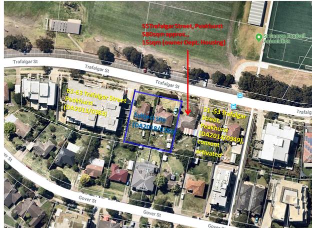
Figure 12:
Extract of subject site in relation to adjoining properties and development
approvals.
The applicant
has not addressed site isolation witin the application and therefore attempts
under planning principle “Karavelas ats Sutherland Council” have
not been undertaken. A diagram or schematic has not been provided to
demonstrate how a reasonable built form could be accommodated on No.55
Trafalgar Street, Peakhurst in consideration with the 6m spatial separation
to the eastern side boundary generated by the development and the 3m –
6m setbacks.
|
|
PC4 Building
Height
|
DS4.1.
The maximum
building height is in accordance with the Hurstville LEP 2012 and 3 storeys.
|
Three storey
built form proposed
|
Yes
|
|
PC5 Excavation
|
DS5.1.
The natural
ground level is not excavated more than 0.5m for the finished ground floor
level.
|
Ground floor
levels are located above natural ground level.
|
No (2) refer to
discussion below.
|
|
(2)
Excavation
Council’s
controls prescribe a maximum excavation of 500mm to accommodate the ground
floor levels. The proposal seeks a maximum excavation of 1m at the southern
rear elevation to accommodate 2 of the 5 ground floor units due to slope of
the site which falls from rear (high) to front (low). This is not considered
to result in any undue impacts in relation to solar access, privacy, amenity
or the like and is not dissimilar to other residential flat buildings on
sloping sites approved within the locality. However, the proposal is not
supported for other reasons contained within this report.
|
|
PC6 Setbacks
|
DS6.1.
The minimum
setback to a primary or secondary street is 6m.
Note: Setbacks
to the side and rear boundary and building separations are to be provided in
accordance with the design criteria in the Visual Privacy section of the
Apartment Design Guide (ADG).
DS6.2.
An articulation
zone allowing for lightweight elements such as eaves, sun-hoods, blade walls,
battens and the like may intrude up to 1m within a road boundary setback for
a maximum of 25% of the horizontal distance of the total facade.
|
6m
The ground
floor front balconies encroach the front setback by 2m. The balconies could
be conditioned to be setback a minimum of 5m from the front boundary, with
the podium area to be amended to form planter boxes however the proposal is
not supported for other reasons contained within this report.
|
Yes
Yes
|
|
PC7 Vehicle
Access, Parking and Manoeuvring
|
DS7.1.
Car parking is
provided on site in accordance with the following rates:
a. 1 resident
space for every studio, 1 or 2 bedroom dwelling
b. 2 spaces for
3 bedrooms/
developments of
4 dwellings or more, one visitor space per 4 dwellings or part thereof
|
11 spaces
4 6
spaces
4 spaces
There are 21
spaces nominated.
|
Yes
Yes
Yes
|
|
PC8 Landscape
Open Space
|
DS8.1.
The minimum
amount of landscaped open space is 20% of the site area.
DS8.2.
The minimum
dimension of landscaped open space is 2m in any direction.
DS8.3.
Landscaping
between the front of buildings and the street boundary achieves a balance
between reducing the visual impact of building when viewed from the street
and facilitating passive casual surveillance of the street.
DS8.4.
A development
application is to be supported by a landscape plan prepared by a qualified
person addressing the performance criteria and design solutions and in
particular addressing areas of communal open space and areas that are visible
from the street.
|
More than 25%
landscaped area provided.
2m minimum
dimension.
Appropriate
landscaping provided in accordance with this Clause however it is noted that
the front portico is excessive and detracts from the streetscape, this design
element is not supported.
A landscape
plan has been prepared by a Landscape Architect with good levels of planting
proposed within the rooftop communal area and within the ground floor
setbacks.
|
Yes
Yes
Yes
Yes
|
|
PC9 Solar
Access
|
DS9.1.
Development
allows for at least 3 hours of sunlight on the windows of main living areas
and adjoining principal private open space of adjacent dwellings between
9.00am and 3.00pm on 22 June.
Note 1:
development applications are to be supported by shadow diagrams demonstrating
compliance with this design solution.
Note 2:
Exemptions will be considered for developments that comply with all other
requirements but are located on sites with an east-west orientation.
|
3 hours of
solar access achieved to the neighbouring properties.
|
Yes
|
|
PC10 Noise
|
DS10.1.
Windows of
adjacent dwellings are separated by a distance of at least 3m
Note: this can
be achieved by an offset.
DS10.2.
Site layout separates
active recreation areas, parking areas, vehicle access-ways and service
equipment areas from bedroom areas.
DS10.3.
Dwellings are
designed so that the internal noise level from outside sources does not
exceed the parameters established by the NSW Environment Protection Authority
(EPA).
DS10.4.
Habitable rooms
located within 60m of a railway or facing a classified major road satisfy the
acoustic criteria contained within the NSW Government’s Development
Near Rail Corridors and Busy Roads – Interim Guideline (2008), or the
most recent version
DS10.5.
Where
development is likely to be subject to noise from a railway line, arterial or
state road or Sydney airport flight path, council may require the submission
of a report prepared by a qualified acoustic engineer to demonstrate that
internal noise levels will be acceptable.
|
Windows are
separated by at least 3m.
The car parking
layout and driveway location is positioned to minimise impacts to bedrooms.
Can be
conditioned if the application was to be supported.
Located more
than 60m away from a major classified Road.
The site is not
within close proximity to a railway line, arterial or state road or Sydney
Airport flight path.
|
Yes
Yes
Yes
Yes
Yes
|
|
PC11
Streetscape
|
Large expanses
of blank, unarticulated walls on any street frontage is not supported.
DS11.2.
In more urban
streetscapes, development emphasises corners by increased scale or massing
treatments compared to the remainder of the building.
Note:
compliance with maximum building height under the LEP must be achieved in
these situations.
DS11.3.
Roofs:
a. have a pitch
of up to 350, or up to 450 where an attic is involved
b. provide a
varied shape with hips, gables or other forms
c. mark the
entrance to a building by the use of a porch, portico or similar element.
DS11.5.
To reduce the
appearance of building bulk and provide visual interest through articulation,
maximum wall length in one plane is 6m at the street frontage
Note: Lengths
greater than this may be acceptable where the elevation incorporates visually
significant changes in massing and form and the use of articulation such as
recesses, projections, balconies, blade walls and similar
|
All walls are
appropriately modulated, articulated and detailed with contemporary design
elements.
The proposal
adopts a three storey built form with roof top terrace. As detailed earlier
within this report, the proposal complies with the 12m height of building
limit with the exception of the lift overrun and communal roof top open space
structures only.
The proposal
seeks a flat contemporary roof design with design treatment to mark the
entrance of the building from Trafalgar Street
Unrelieved wall
lengths do not exceed 6m as the proposal incorporates modulation to break up
the visual bulk using contemporary architectural cues.
|
Yes
Yes
Yes
|
|
PC12 Stormwater
|
DS12.1.
Stormwater
management is in accordance with section 3.7 of this DCP
|
The proposal
seeks to drain to Council’s existing infrastructure and is supported by
Council’s Development Engineer subject to conditions of consent.
|
Yes
|
|
PC13 Front
Fencing
|
DS13.1.
Fencing is in
accordance with Appendix 2 – Fences Adjacent to Public Roads
|
No front
fencing proposed.
|
Yes
|
|
PC14 Site
facilities
|
DS14.1.
Electricity and
telephone lines are provided underground unless there is the connection of
electricity and telephone lines directly from the service pole to the fascia
of the front dwelling.
DS14.2.
Mail and
garbage collection areas are integrated into the overall design of the
development.
DS14.3.
Development
provides space for the storage of recyclable goods, either in the curtilage
of each dwelling or in a central storage area in larger developments.
DS14.4.
A master TV
antenna is provided for any development of more than two dwellings.
DS14.5.
Storage is
provided in accordance with the design criteria of the ADG.
Note: Storage
in a basement means all non-habitable, secure (i.e. lockable) space located
in a basement or similar underground part of a building or structure that is
used solely for the purposes of domestic storage. The extent of the area is
measured from the boundaries of its enclosure to the top of the building or structural
slab above.
DS14.6.
Communal
outdoor clothes drying facilities must be visually screened from the street.
|
Services to be
provided in accordance with the utility providers requirements. This would be
conditioned if the application was to be supported.
Mail collection
is located along Trafalgar Street and is well integrated into the
development. Waste collection and storage area is located within basement
level.
Storage areas
are located to south east corner of the basement and suitable storage within
each unit.
Can be provided
and conditioned if the application was to be approved.
Storage areas
provided within the basement in the form of designated storage areas.
Communal
outdoor clothes drying facilities are located within the communal open space
and can be screened via a condition of consent.
|
Yes
Yes
Yes
Yes
Yes
Yes
|
|
|
|
|
|
Section 94
Contributions
99. A Section 7.11 Contribution of
$178,601.89 would be applied to the proposal via a condition of consent if the
application was being supported.
SUBMISSIONS
100. The proposal was notified in accordance with
the provisions of the Hurstville Development Control Plan No 1 (HDCP) for a
period of 14 days. In response, two (2) submissions were received. The amended
plans did not require re-notification given the minor extent of changes sought.
Drainage impacts
101. Concerns were raised in relation to drainage impacts
from the development and impacts on the easement.
102. Comment: The proposal seeks to drain to
the Trafalgar Street which includes the relocation of the easement which
benefits 12 and 12A Gover Street to the rear which is an attached dual occupancy.
The easement relocation is supported by Council’s Development
Engineer subject to conditions.
103. Bulk and scale, character of the area,
development type
Comment:
Concerns were raised regarding adverse impacts to the streetscape and character
of the area, whereby it was also suggested that a different built form such as
multi dwelling housing or a dual occupancy should be considered. The site is
zoned R3 Medium Density Residential whereby a residential flat building forms a
permissible use on the subject site. As discussed earlier within this report,
the proposal generally complies with the applicable planning controls. The
application is being recommended for refusal not based on the development type
or is design, it is being refused because adequate consideration has not been
given the site isolation of 55 Trafalgar Street Peakhurst and other design
elements that could be overcome if the applications was able to be supported.
104. Privacy impacts
Comment:
Concerns were raised in relation to privacy impacts in particular from the rear
elevation. The proposal is not considered to result in any unacceptable privacy
impacts as most rooms along this elevation are low use rooms and the proposal
complies with the required setbacks and contains a communal rooftop which is
appropriately designed and sited to minimised impacts to adjoining properties.
105. Overshadowing impacts to adjoining
properties
Comment:
The proposal complies with the ADG setbacks and generally the height, given the
central sitting of the proposal and orientation of the site. Given the northern
orientation of the site, it is considered that overshadowing to neighbouring
properties is not considered to be unreasonable given the uplift of the
locality. The height breach will not result in any additional overshadowing
onto the adjoining allotments, the additional shadow falls within the subject
site.
106. Devaluation of property
Comment:
This is not a matter for consideration under the Environmental Planning and
Assessment Act 1979.
REFERRALS
107. The proposal did not trigger and external
referrals mandated by any SEPP or legislation. The development application was
referred to the relevant officers within Council. The responses are outlined as
follows.
Council
Referrals
Landscape
Officer
108. The application was reviewed by
Council’s Consultant Arborist who supported the proposal subject to
conditions relating to removal, protection and tree replacement.
Environmental
Health Officer
109. The application was reviewed by Council’s
Coordinator Environmental Health who supported the proposal subject to
conditions.
Traffic
Engineer
110. The application has been reviewed by
Council’s Traffic Engineer who supports the proposal subject to
conditions.
111. Senior Building Surveyor
The
application has been reviewed by Council’s Senior Building officer who
supports the proposal subject to conditions.
Drainage
Engineer
112. The application was reviewed by
Council’s Development Engineer whom supported the proposal subject to
conditions.
113. Waste/Environmental Services
The
application has been reviewed by Council’s Coordinator Environmental
Sustainability Officer who supported the proposal subject to conditions.
IMPACTS
Natural
Environment
114. The proposed development is unlikely to
generate adverse impacts on the natural environment.
Built
Environment
115. The proposed development is likely to result
in adverse impacts on the built environment in particular to 55 Trafalgar
Street, Peakhurst given this allotment is isolated if the development was to
proceed.
Social
Impacts
116. The proposal is likely to result in any
adverse social impacts given the design and residential use of the site which
results in the isolation of the adjoining property at 55 Trafalgar Street,
Peakhurst which is unable to accommodate a residential flat building. It is
also noted that this site is also deficient in terms of being able to comply with
the minimum lot areas for multi-dwelling house or dual occupancy.
Economic
Impacts
117. The proposed development is likely to generate
adverse economic impacts in the form of unorderly economic development given
the residential nature of the development and the resultant site isolation of
55 Trafalgar Street, Peakhurst.
Suitability
of the Site
118. The proposal is not inconsistent with
Council’s Interim Policy. However the proposed physical built form is of
a scale and design that is not suitable for the site having regard to its size,
shape, topography, relationship to adjoining developments and evolving
character of Peakhurst and impact of site isolation to the adjoining property
at 55 Trafalgar Street, Peakhurst.
Public
Interest
119. The proposal is not considered to be in the
public interest for the reasons contained within this report as the proposal
results in the isolation of the adjoining property at 55 Trafalgar Street,
Peakhurst.
CONCLUSION
120. The development application has been assessed
having regard to the Matters for Consideration under Section 4.15 of the
Environmental Planning and Assessment Act 1979, the provisions of the relevant
State Environmental Planning Policies, Local Environmental Plans and
Development Control Plans.
121. The application DA2018/0285 for is recommended
to be determined by way of refusal under the provisions of Section 4.16(1)(a) of the Environmental Planning and
Assessment Act 1979.
DETERMINATION
AND STATEMENT OF REASONS
Statement
of Reasons
· The
proposal results in a built form which is inconsistent with the envisaged
desired character of the R3 Medium Density Residential Zone and results in the
isolation of 55 Trafalgar Street, Peakhurst.
· The
proposal result in poor occupant amenity.
Determination
THAT
Pursuant to Section 4.16(1)(b) of the Environmental Planning and Assessment Act
1979, as amended, the Georges River Local Planning Panel determine DA2018/0285
for demolition works and construction of a four (4) storey residential flat
building containing fourteen (14) units twenty one (21) car parking spaces,
site and landscaping works on Lots 167 and 168 in DP 36317 on land known as
57-59 Trafalgar Street, Peakhurst, should be refused.
1......... The proposal is unsatisfactory having
regarding to Object (c) which states “to promote orderly and economic use
and development of land” of the Environmental Planning and Assessment Act
1979.
2......... The proposal is unsatisfactory having
regarding to Clause 3D Communal and Public Open Space and 3F – Visual
Privacy of the Apartment Design Guide referred to within State Environmental
Planning Policy No 65 – Design Quality of Residential Apartment
Development in that the development has not provided adequate communal open
space to service the amenity for future occupants.
3......... The proposal does not satisfy the
following zone objectives as per Clause 2.3 – Zone Objectives and Land
Use Table (R3 Medium Density Residential) of Hurstville Local
Environmental Plan 2012:
• To provide for the
housing needs of the community within a medium density residential environment.
• To provide a variety
of housing types within a medium density residential environment.
• To enable other land
uses that provide facilities or services to meet the day to day needs of
residents.
• To ensure that a
high level of residential amenity is achieved and maintained.
4......... The proposal does not comply having
regard to Section 4.15(1)(a)(iii) the number of accessible units, accessible
car parking, site isolation, excavation having regard to the Hurstville
Development Control Plan.
5......... The proposal is unsatisfactory having
regard to Section 4.15(1)(b) of the Environmental Planning and Assessment Act
1979 as the development will cause adverse impacts upon the natural and built
environment.
6......... The proposed development is
unsatisfactory having regard to Section 4.15(1)(c) of the Environmental
Planning and Assessment Act 1979 in that the site is not suitable for the
development in its present form as the proposal results in the isolation the
adjoining property being No. 55 Trafalgar Street, Peakhurst.
7......... Approval of the development is not
considered to be in the public interest and contrary to Section 4.15(1)(e) of
the Environmental Planning and Assessment Act 1979.
8......... The proposal has not provided owners
consent from the benefiting properties at 12 and 12A Gover Street, Peakhurst in
relation to the relocation of the existing registered easement.
9......... An amended landscape plan has been
submitted which is inconsistent with the revised architectural plans.
ATTACHMENTS
|
Attachment ⇩1
|
Photo Montage - 57-59 Trafalgar St Peakhurst
|
|
Attachment ⇩2
|
Elevations and Roof Plan 57-59 Trafalgar Street Hurstville
|
|
Georges
River Council - Georges River Local Planning Panel (LPP) - Thursday, 21
November 2019
LPP052-19 57-59 Trafalgar Street Peakhurst
[Appendix
1] Photo Montage -
57-59 Trafalgar St Peakhurst
|
Page 188
|
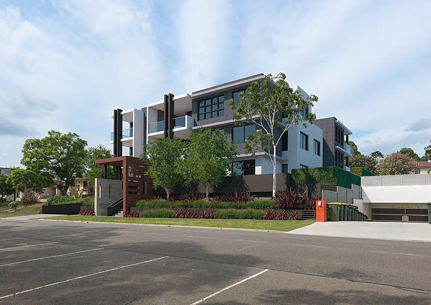
|
Georges
River Council - Georges River Local Planning Panel (LPP) - Thursday, 21
November 2019
LPP052-19 57-59 Trafalgar Street Peakhurst
[Appendix
2] Elevations and Roof
Plan 57-59 Trafalgar Street Hurstville
|
Page 191
|


|
Georges River Council – Local Planning
Panel Thursday, 21 November 2019
|
Page 224
|
REPORT TO GEORGES RIVER COUNCIL
LPP MEETING OF Thursday, 21 November 2019
|
LPP Report No
|
LPP053-19
|
Development Application No
|
DA2018/0573
|
|
Site Address & Ward Locality
|
268 Carrington Avenue Hurstville
Hurstville Ward
|
|
Proposed Development
|
Demolition of all structures,
boundary adjustment and construction of two semi-detached dwellings.
|
|
Owners
|
Mariam Boulos
|
|
Applicant
|
Magdy Iskander
|
|
Planner/Architect
|
None referenced
|
|
Date Of Lodgement
|
17/12/2018
|
|
Submissions
|
One (1) submission
|
|
Cost of Works
|
$748,000.00
|
|
Local Planning Panel Criteria
|
Variation to the minimum
subdivision lot size development standard which exceeds 10%
|
|
List of all relevant s.4.15
matters (formerly s79C(1)(a))
|
Environmental Planning Assessment
Act 1979; Environmental Planning and Assessment Regulations 2000;
Greater Metropolitan Regional
Environmental Plan No 2 – Georges River Catchment; State Environmental
Plan No. 55 – Remediation of Land; State Environmental Planning Policy
(Infrastructure) 2007; State Environmental Planning Policy BASIX; Hurstville
Local Environmental Plan 2012;
Hurstville Development Control Plan
No 1
|
|
List all documents submitted
with this report for the Panel’s consideration
|
Subdivision Plan and Architectural
Plans
Clause 4.6 Variation Request
|
|
Report prepared by
|
Development Assessment Planner
|
|
Recommendation
|
That the application be approved in accordance with the
conditions included in this report
|
|
|
Summary of matters for consideration
under Section 4.15
Have all recommendations in relation
to relevant s4.15 matters been summarised in the Executive Summary of the
assessment report?
|
Yes
|
|
Legislative clauses requiring
consent authority satisfaction
Have relevant clauses in all
applicable environmental planning instruments where the consent authority
must be satisfied about a particular matter been listed and relevant
recommendations summarised, in the Executive Summary of the assessment
report?
|
Yes
|
|
Clause 4.6 Exceptions to
development standards
If a written request for a
contravention to a development standard (clause 4.6 of the LEP) has been
received, has it been attached to the assessment report?
|
Yes
Clause
4.1 Minimum subdivision lot size
|
|
Special Infrastructure Contributions
Does the DA require Special
Infrastructure Contributions conditions (under s7.24)?
|
Not
Applicable
|
|
Conditions
Have draft conditions been provided
to the applicant for comment?
|
No,
standard conditions have been recommended with no design changes. The
conditions will be available for review when the report is published.
|
|
Site Plan
Subject site outlined in
blue
|
Executive Summary
Proposal
1. Council
is in receipt of an application seeking approval for the demolition of existing
structures, boundary adjustment, and construction of two (2) x two (2) storey
semi-detached dwellings, each with their own title.
2. Currently
there are two (2) titles associated with this proposal, the current structures
on the site are built over both allotments. This application is seeking to
remove all structures and relocate the boundary between the allotments to
provide equal width lots and lots of equal area. Each allotment will be 7.54m in
width and 40.03m in depth, with an area of 302sqm.
3. The
DA also proposes that, following the boundary adjustment, two (2) by two (2)
storey three (3) bedroom semi-detached dwellings with basements are to be
erected, one on each of the created lots and separated by a party wall. The
party wall is to align with new boundary alignment.
Site and
Locality
4. The
lots are legally identified as Lot 1 DP104955; and Lot 101 DP3406, and known as
268 Carrington Avenue Hurstville NSW 2220. Both lots are rectangular shaped and
are located on the south eastern side of Carrington Avenue Hurstville.
· Lot 1
– width 5.03m by 40.03m depth with an area of 196sqm.
· Lot
101 – width 10.06m by 40.03m depth with an area of 398.4sqm.
NOTE: The
areas referenced above are as shown on the Deposited Plans (DPs) for the
property – and given the age of the Deposited Plans, the areas have
inconsistencies. So the survey details provided with the application have been
used in the assessment.
Zoning and
Permissibility
5. The
site is zoned R2 Low Density Residential in accordance with the Hurstville
Local Environmental Plan 2012 (HLEP, 2012). ‘Semi-detached
dwellings’ and ‘subdivision’ are permissible with Council
consent pursuant to Clause 2.6 of the HLEP 2012. The proposed development
satisfies the objectives of the zone.
Clause 4.6
Variation – Minimum Lot Size
6. The
subject site is identified as 268 Carrington Avenue, Hurstville and comprises
of two (2) existing Torrens title lots. The proposal seeks a ‘Boundary
Adjustment’ of these two titles.
7. The
minimum lot size under the provisions of the Hurstville Local Environmental
Plan (HLEP) 2012 is 450sqm. The allotment sizes post boundary adjustment
(subdivision) will have areas of 302sqm, a variation of 148sqm or 33% from the
Minimum Allotment Size under HLEP 2012.
8. The
proposed subdivision (boundary adjustment) seeks to adjust the allotment widths
and site areas to be equal for both allotments. The following table presents
the existing allotment widths and site areas of both the existing allotments,
and also the proposed allotments (resulting from the boundary adjustment):
|
Lot
|
DP
|
Existing Lot Width
|
Existing Site Area
|
Proposed Lot Width and Lot Depth
|
Proposed Site Area
|
Variation
|
|
Lot 1
|
DP104955
|
5.03m
|
196.0sqm
|
7.54m x 40.03m
|
302sqm
|
An increase in 2.515m of the frontage and an increased
site area of 101.2sqm.
|
|
Lot 101
|
DP3406
|
10.06m
|
398.4sqm
|
7.54m x 40.03m
|
302sqm
|
Reduced frontage of 2.515m.
A loss of 101.2sqm of site area.
|
9. The
boundary adjustment will therefore result in each title having a site area of
302sqm, a variation of 148sqm or 33%.
The extent of
the variation is related primarily to the adjustment of the boundary between
the existing allotments which have dwelling entitlements. The new titles will
provide a more conventional subdivision pattern with equitable allotments for
the new dwellings, posing reduced and minimal impacts on the adjacent
neighbouring allotments.
Submissions
10. In
accordance with the provisions of Councils Public Notification policy, the
application was placed on neighbour notification between 25 January 2019 to 11
February 2019 where adjoining property owners were notified in writing of the
proposal and invited to comment. One (1) submission was received objecting to
the proposed development, this is addressed in detail later in this report.
Conclusion
11. This
application has been assessed having regard to the Matters for Consideration
under Section 4.15(1) and 4.15(3) of the Environmental Planning and Assessment
Act 1979, the provisions of the relevant State Environment Planning Policies,
Local Environmental Plan and Development Control Plan. The application seeks
approval for the demolition of existing structures, a boundary adjustment and
construction of two (2) semi-detached two (2) storey dwellings with basements.
12. Following
a detailed assessment it is recommended that Development Application No.
DA2018/0573 is approved subject to the recommended conditions at the end of
this report.
Report in Full
Proposal
13. Council
is in receipt of an application seeking approval for the demolition of existing
structures, a boundary adjustment and construction of two (2) semi-detached two
(2) storey dwellings each on a separate title. The proposed works are
specifically outlined below.
14. Demolition:
· The
proposal seeks to demolish the existing single storey brick and tile dwelling,
detached garage and the infilling of the existing inground swimming pool.
15. Semi-detached
Dwelling on Proposed Lot 101
Basement;
· Single
garage, entry landing area and porch, staircase connecting basement level to
ground floor,
Ground
Floor;
· Study
room, laundry, bathroom, kitchen/dining area, living area, rear alfresco,
ancillary staircase links;
First Floor:
· Three
(3) bedrooms, bathroom, master bedroom including ensuite, rear and front facing
balconies;
16. Semi-detached
Dwelling on Lot 1
Basement;
· Single
garage, entry landing area and porch, staircase connecting basement level to
ground floor,
Ground
Floor;
· Study
room, laundry, bathroom, kitchen/dining area, living area, rear alfresco,
ancillary staircase links;
First Floor:
· Three
(3) bedrooms, bathroom, master bedroom including ensuite, rear and front facing
balconies;
17. Boundary
Adjustment: The boundary adjustment will result in the following:
|
Address
|
Existing site area by DP
|
Proposed site area after
subdivision
(by calculation)
|
Existing
frontage
|
Proposed frontage after
subdivision
|
|
268 Carrington Avenue Hurstville
(Lot 101)
|
398.4sqm
|
302sqm
|
10.06m
|
7.54m
|
|
268 Carrington Avenue Hurstville
(Lot 1)
|
196sqm
|
302sqm
|
5.03m
|
7.54m
|
|
Combined area of both allotments
(see note below)
|
Existing Site Area (based on
current DPs): 594.4sqm
|
Proposed Site Area (based on
updated survey information): 604sqm
|
|
|
NOTE: According
to the current Deposited Plans, the site has a total area of 594.4sqm. However
this site area is based on the measurements taken for the Deposited Plans
prepared in 1897 (DP3406) and 1916 (DP104955). A more recent/more accurate
measurement of site area (produced for the survey plan for the site prepared in
2018) produces a total site area of 604.0sqm, based on combined site dimensions
of 15.09m frontage x 40.03m depth.
The Site and Locality
18. The
subject site observes a unique characteristic in being located over two
separate land titles. The lots are legally identified as Lot 1 DP104955; and
Lot 101 DP3406, both of which identified by the street address of 268
Carrington Avenue Hurstville NSW 2220. Both lots are rectangular shaped
allotments with a primary south western frontage onto Carrington Avenue. Lot
101 presents a frontage width of 10.6m, and a site area of 398.4sqm. Lot 1
presents a frontage width of 5.03m, and a site area of 196sqm. The sites slope
from the north eastern boundary (rear) to the south western boundary (front) at
an average height difference of 2.08m.
19. The
amalgamated site forms a rectangular shape with a combined area of 604.0sqm
with a consistent depth of 40.03m a front and rear boundary of 15.09m as
identified in the submitted Survey Plan prepared by NGEO Surveyors, lodged with
the Development Application.
20. The
site slopes towards the south west primary frontage (Carrington Avenue) with a
fall of approximately 2500mm and from side to side with a fall that varies from
300mm to approximately 800mm. NEGO Surveying have advised that upon the
preparation of a detailed site survey, it was identified that the current DPs
illustrated an inconsistency in land size when comparing actual surveyed land
to historic DPs.
21. By
calculation, the above site’s dimensions provide a sites area of 604sqm
(15.09 x 40.03). Consequently, this will result in each of the proposed lots
being 302sqm with consistent front and rear boundaries of 7.54m to each Lot. In
conclusion, with NGEO Surveying, they have noted that the marginal
inconsistency in land size (9.65sqm) from the 2018 land survey compared to the
areas shown on the DPs is a result of inaccurate DP’s that will be
updated as part of the boundary adjustment process.
22. Currently
existing on the site is a single storey brick and tiled roof dwelling house
with an attached garage along the northern side boundary. A driveway located
along the northern side boundary services the allotment. A veranda and an
in-ground swimming pool are located behind the primary dwelling; at the rear of
the allotment. The site includes minor trees (mostly non-native species) and
vegetation.
23. The
surrounding area is characterised by a variety of single and double storey
dwellings and dual occupancies. Development in the area is a mix of original
brick and tiled roof dwellings, with more contemporary homes becoming common.
These new homes provide a more varied material pallet, with rendered brick,
lighter colours, cladding, timber, concrete and low pitch to flat metal roofs.
Background
24. There
are no recent relevant applications pertinent to the above mentioned subject
allotment.
Zoning
25. The
subject site is zoned R2 - Low Density Residential and the proposed development
is defines as a “Semi-detached dwellings” in HLEP 2012, the
proposal is a permissible form of development with Council’s consent. The
proposed development satisfies the objectives of the zone which are;
· To
provide for the housing needs of the community within a low density residential
environment.
· To
enable other land uses that provide facilities or services to meet the day to
day needs of residents.
· To
encourage development of sites for a range of housing types, where such
development does not compromise the amenity of the surrounding area, or the
natural or cultural heritage of the area.
· To
ensure that a high level of residential amenity is achieved and maintained.
· To
encourage greater visual amenity through maintaining and enhancing landscaping
as a major element in the residential environment.
· To
provide for a range of home business activities where such activities are not
likely to adversely affect the surrounding residential amenity.
Figure
1: Zoning map of 268 Carrington
Avenue Hurstville (Source: Intramaps, 2019)
PLANNING ASSESSMENT
Environmental
Planning Instruments
26. The
site has been inspected and the proposed development has been assessed under
the relevant Section 4.15(1) Matters for Consideration under the Environmental
Planning and Assessment Act 1979.
State
Environmental Planning Policies
27. Compliance
with the relevant State Environmental Planning Policies is summarized and
discussed in more detail below.
Greater
Metropolitan Regional Environmental Plan No 2 – Georges River Catchment
28. This REP is applicable to the subject site and the aims of the plan are;
(a) to maintain and improve the water
quality and river flows of the Georges River and its tributaries and ensure
that development is managed in a manner that is in keeping with the national,
State, regional and local significance of the Catchment,
(b) to protect and enhance the
environmental quality of the Catchment for the benefit of all users through the
management and use of the resources in the Catchment in an ecologically
sustainable manner,
(c) to ensure consistency with local
environmental plans and also in the delivery of the principles of ecologically
sustainable development in the assessment of development within the Catchment
where there is potential to impact adversely on groundwater and on the water
quality and river flows within the Georges River or its tributaries,
(d) to establish a consistent and
coordinated approach to environmental planning and assessment for land along
the Georges River and its tributaries and to promote integrated catchment
management policies and programs in the planning and management of the
Catchment,
(e) (Repealed)
(f) to provide a mechanism
that assists in achieving the water quality objectives and river flow
objectives agreed under the Water Reform Package.
The proposal generally satisfies the
objectives and provisions of the Regional Environmental Plan (REP).
State
Environmental Planning Policy (Infrastructure) 2007
29. Clause
45 of the SEPP required consideration of the application by the local Energy
Provider. Council forwarded the application to Ausgrid for consideration,
however Ausgrid failed to respond. In accordance with the provisions a
period of 21 days has passed since Council referral and Council is permitted to
determine the application without further comment from the electricity
provider.
Clause 101 of
the State Environmental Planning Policy relates to development within a
classified road. Stoney Creek Road is located to the north of the Site. This
roadway is a classified arterial road, however, there is no access from the
site to this roadway.
As such
Clause 101 is not applicable in this case. Clause 102 of the State Environmental
Planning Policy (Infrastructure) relates to the assessment and consideration of
road noise or vibration on non-road development.
This clause
is applicable to developments that are “on land in or adjacent to the
road corridor for a freeway, a tollway or a transit way or any other road with
an annual average daily traffic volume of more than 20,000
vehicles”. The RMS website includes traffic volumes at various
locations.
State
Environmental Planning Policy No 55 - Remediation of Land
30. SEPP
55 aims to promote the remediation of contaminated land in order to reduce the
risk of harm to human health or any other aspect of the environment.
31. Clause
7 requires contamination and remediation to be considered in determining a
development application. The consent authority must not consent to the carrying
out of development on land unless it has considered whether or not the land is
contaminated.
32. The
site has a history of residential uses and as such, site contamination is not
suspected. In this regard, no further assessment is warranted with regard to
site contamination.
Draft Remediation of Land
SEPP
33. The
Department of Planning and Environment has announced a Draft Remediation of
Land SEPP, which will repeal and replace the current State Environmental
Planning Policy No 55 — Remediation of Land.
34. The
main changes proposed include the expansion of categories of remediation work
which requires development consent, a greater involvement of principal
certifying authorities particularly in relation to remediation works that can
be carried out without development consent, more comprehensive guidelines for
Councils and certifiers and the clarification of the contamination information
to be included on Section 10 Planning Certificates.
35. Whilst
the proposed SEPP will retain the key operational framework of SEPP 55, it will
adopt a more modern approach to the management of contaminated land.
36. The
subject site has a history of residential use and as such, site contamination
is not suspected. In this regard, no further assessment is warranted with
regards to site contamination.
Draft
Environment SEPP
37. The
Draft Environment SEPP was exhibited from 31 October 2017 to 31 January 2018.
This consolidated SEPP proposes to simplify the planning rules for a number of
water catchments, waterways, urban bushland, and Willandra Lakes World Heritage
Property.
· Changes
proposed include consolidating the following seven existing SEPPs:
· State
Environmental Planning Policy No. 19 – Bushland in Urban Areas
· State
Environmental Planning Policy (Sydney Drinking Water Catchment) 2011
· State
Environmental Planning Policy No. 50 – Canal Estate Development
· Greater
Metropolitan Regional Environmental Plan No. 2 – Georges River Catchment
· Sydney
Regional Environmental Plan No. 20 – Hawkesbury-Nepean River (No.2-1997)
· Sydney
Regional Environmental Plan (Sydney Harbour Catchment) 2005
· Willandra
Lakes Regional Environmental Plan No. 1 – World Heritage Property.
38. The
proposal is consistent with the provisions of this Draft Instrument given there
is no vegetation impacted by the proposed development.
Hurstville
Local Environmental Plan 2012
39. The
provisions of this local environmental plan are relevant to the proposal. The
extent to which the proposal complies with the relevant standards of the
Hurstville Local Environmental Plan 2012 (HLEP 2012) is outlined in the table
below.
|
Clause
|
Provision
|
Proposed
|
Complies
|
|
Part 1 – Preliminary
|
|
1.2 – Aims of the Plan
|
In accordance with Clause 1.2 (2)
|
The development is consistent with
the aims of the plan.
|
Yes
|
|
Part 2 – Permitted or
prohibited development
|
|
2.3 Zone objectives and Land
Use Table
|
The site is within
the R2 Low Density Residential zone.
The relevant
objective of the zone is to provide for the housing
needs of the community within a low density residential environment.
|
The proposal is not
inconsistent with the zone objectives.
|
Yes
Yes
|
|
2.6 Subdivision –
consent requirements
|
(1)
Land to which this Plan applies may be subdivided, but only with development
consent.
|
The application proposes a boundary
adjustment.
|
Yes
|
|
Part 4 – Principal
development standards
|
|
4.1 Minimum subdivision lot
size
|
(3) The size of any lot
resulting from a subdivision of land to which this clause applies is not to
be less than the minimum size shown on the Lot Size Map in relation to that land.
|
Lot size map: 450sqm
Lot 1: 302sqm
Lot 101:302sqm
|
No (1)
No (1)
See below
|
|
4.3 Height of Buildings
|
(2) The height of a building on any land is not to
exceed the maximum height shown for the land
on the Height of
Buildings Map - 9.0m
|
Semi-detached dwelling on Lot 101:
The proposed height of the
development is 7.7m, well within the maximum building height limit of 9m as
per HLEP 2012.
|
Complies
|
|
|
|
Semi-detached dwelling on Lot 1:
The proposed height of the
development is 7.4m, well within the maximum building height limit of 9m as
per HLEP 2012.
|
Complies
|
|
4.4 Floor Space Ratio
|
(2) The maximum floor space ratio for a building on
any land is not to exceed the floor space ratio shown for the land on the Floor Space
Ratio Map -
0.6:1
|
Semi-detached Dwelling on Lot 101:
The proposed development will
result in an increased gross floor area of 181.08sqm, or 60%
|
Complies
|
|
|
|
Semi-detached Dwelling on Lot 1:
The proposed development will
result in an increased gross floor area of 181.08sqm, or 60%
|
Complies
|
|
4.6 Exceptions to
development standards
|
The application proposes a
variation to the minimum lot size standard (450sqm) for 268 Carrington
Avenue, Hurstville
|
The lot size of 268 Carrington
Avenue Hurstville is currently 594.4sqm. However, this is based on calculations
for the deposited plans prepared in 1897 and 1916. A more accurate (recent)
calculation of site area produces a site area of 604sqm.
The proposed boundary adjustment
results in:
Lot 1 being 302sqm and
Lot 101 being 302sqm.
|
Refer to discussion on the request
for a variation to the lot size standard.
|
|
Part 5 - Miscellaneous
Provisions
|
|
5.10 Heritage Conservation
|
Heritage Item and or Heritage Conservation Area.
|
Not identified as heritage and or
in Conservation Area
|
Yes
|
|
5.11 Bush Fire Hazard
Reduction
|
Bush fire hazard reduction
work authorised by the Rural Fires
Act 1997 may be carried out on any land without development consent.
|
Not affected by Bushfire Prone Land
|
Yes
|
|
Part 6 - Additional Local
Provisions
|
|
6.1 Acid Sulfate Soils
|
(2) Development consent is required for the carrying
out of works described in the Table to this subclause on land shown on the Acid Sulfate
Soils Map as being of the
class specified for those works.
|
Not Affected by Acid Sulfate Soils
|
Yes
|
(1) Justification for Clause 4.1 - Minimum subdivision lot size
40. The
provisions of this Local Environmental Plan are relevant to the proposal. The
extent to which the proposal complies with the relevant standards of the
Hurstville Local Environmental Plan 2012 (HLEP 2012) is outlined in the table
below.
Proposed
Boundary Adjustment and Variation to Minimum Lot Size Standard
41. The subject site has a unique characteristic in being located over two
separate land titles. The lots are legally identified as Lot 1 DP104955; and
Lot 101 DP3406, both of which identified by the street address of 268
Carrington Avenue Hurstville, 2220.
42. Both lots are rectangular shaped allotments with a primary south western
frontage onto Carrington Avenue. Lot 101 presents a frontage width of 10.6m,
and a site area of 398.4sqm. Lot 1 presents a frontage width of 5.03m, and a
site area of 196sqm.
43. Neither the existing allotment sizes, nor the proposed allotment sizes,
comply with the minimum lot size prescribed in Hurstville LEP 2012. The
existing and proposed lot sizes are outlined in the table below.
|
Property
|
Min. Lot Size
|
Existing Lot Size
|
Proposed Lot Size
|
Complies
|
|
Lot 1 – 268
Carrington Avenue, Hurstville
|
450sqm
|
196.0sqm
|
302sqm
|
No
|
|
Lot 101 – 268
Carrington Avenue, Hurstville
|
450sqm
|
398.4sqm
|
302sqm
|
No
|
44. Clause 4.1 of the LEP states the minimum lot size is 450sqm. As stated above, both allotments are
under the minimum lot size. Due to the non-compliant size of the lots that
exist, the applicant has submitted a Clause 4.6 variation request, and is
discussed below.
Clause 4.6
– Exceptions to Development Standards – Clause 4.1 Minimum
subdivision lot size
45. The objectives of Clause 4.6(1) are as
follows: and;
(a) to
provide an appropriate degree of flexibility in applying certain development
standards to particular development,
(b)
to achieve better outcomes for and from development by allowing flexibility in
particular circumstances.
46. Applicant’s Comment: “Lot 1 and Lot 101 are existing
non-compliant site areas, when assessed under the provisions of the Hurstville
Local Environmental Plan (HLEP) 2012. The proposed works of the Boundary
Adjustment could otherwise be considered under the provisions of the State Environmental
Planning Policy (Exempt and Complying Development Codes) 2008, except that the
boundary adjustment sought is equivalent to an area of greater than 10%”.
47. Council Comment: The proposed development fails to comply with the
development standard for minimum subdivision lot size. Clause 4.1 in Hurstville
LEP 2012 stipulates a minimum lot size of 450sqm. However, an appropriate
subdivision pattern has been provided for assessment and the proposed
development does not create an adverse impact upon adjoining allotments or
affect the existing subdivision pattern of the Hurstville locality. In this
regard, the allotments as existing (i.e. Lot 1: 196sqm and Lot 101: 398.4sqm)
are both already under-sized compared to the existing minimum allotment size
prescribed in HLEP 2012. The proposed boundary adjustment only seeks to adjust
the boundary to provide equal allotment sizes upon which to construct new
semi-detached dwellings.
Is the
planning control in question a development standard?
48. The objectives of Clause 4.6(3)(a) are as follows:
(3)
Development consent must not be granted for development that contravenes a
development standard unless the consent authority has considered a written
request from the applicant that seeks to justify the contravention of the
development standard by demonstrating—
(a) that
compliance with the development standard is unreasonable or unnecessary in the
circumstances of the case, and;
(b) that
there are sufficient environmental planning grounds to justify contravening the
development standard.
49. Council Comment: To support the non-compliance, the applicant has provided a request
for a variation to Clause 4.1 in accordance with Clause 4.6 of HLEP 2012 as
Clause 4.1 is a development standard. The Clause 4.6 request for variation is
assessed as follows;
What
are the underlying objectives of the development standard?
50. The objectives of the lot size development standard set out in Clause
4.1(1) of HLEP 2012 are as follows:
4.1 Minimum subdivision lot size
(1) The objectives of this clause are as follows—
(a) to
retain the pattern of subdivision in residential zones while allowing infill
development of smaller lots in some areas,
(b) to
ensure lots have a minimum size that would be sufficient to provide useable
area for building and landscaping,
(c) to
require larger lots in the foreshore area or where the topography or other
natural features of the site limit its subdivision potential.
Compliance
is unreasonable or unnecessary in the circumstances of the case (clause
4.6(3)(a))
51. There have been several Court cases that have established provisions in
which to assess Clause 4.6 statements to ensure they are well founded and
address the provisions of Clause 4.6.
52. In Wehbe V
Pittwater Council (2007) NSW LEC 827 Preston CJ sets out ways of establishing
that compliance with a development standard is unreasonable or unnecessary.
This list is not exhaustive. It states, inter alia:
53. “An
objection under SEPP 1 may be well founded and be consistent with the aims set
out in clause 3 of the Policy in a variety of ways. The most commonly invoked
way is to establish that compliance with the development standard is
unreasonable or unnecessary because the objectives of the development standard
are achieved notwithstanding non-compliance with the standard.”
54. The judgement goes
on to state that:
55. “The
rationale is that development standards are not ends in themselves but means of
achieving ends. The ends are environmental or planning objectives.
Compliance with a development standard is fixed as the usual means by which
the relevant environmental or planning objective is able to be achieved.
However, if the proposed development proffers an alternative means of achieving
the objective strict compliance with the standard would be unnecessary (it is
achieved anyway) and unreasonable (no purpose would be served).”
56. Preston CJ in the
judgement then expressed the view that there are 5 different ways in which an
objection may be well founded and that approval of the objection may be
consistent with the aims of the policy, as follows (with emphasis placed on
number 1 for the purposes of this Clause 4.6 variation [our underline]):
1.
“The objectives of the standard are achieved
notwithstanding non-compliance with the standard;
2.
The underlying objective or purpose of the standard is not relevant to
the development and therefore compliance is unnecessary;
3.
The underlying object or purpose would be defeated or thwarted if
compliance was required and therefore compliance is unreasonable;
4.
The development standard has been virtually abandoned or destroyed
by the Council's own actions in granting consents departing from the standard
and hence compliance with the standard is unnecessary and unreasonable;
5.
The zoning of the particular land is unreasonable or inappropriate so that a
development standard appropriate for that zoning is also unreasonable and
unnecessary as it applies to the land and compliance with the standard that
would be unreasonable or unnecessary. That is, the particular parcel of land
should not have been included in the particular zone.”
57. The statement was
prepared in consideration of the recent court cases and their judgements.
58. Applicant’s Comment: “The NSW Land and Environment Court in
Four2Five Pty Ltd v Ashfield Council [2015] NSWLEC90, considered how this
question may be answered and referred to the earlier Court decision in Wehbe v
Pittwater Council [2007] NSW LEC 827. Under Wehbe, the most common way of
demonstrating that compliance is unreasonable or unnecessary, was whether the
objectives of the standard were still met despite the contravention of that
standard.
59. The following discussion provides a response to the
relevant "tests" of the 5-part Wehbe test, remembering only one (1)
of the tests has to be achieved, not all five (5).
60. Compliance with the minimum 450.0sqm site area is
unreasonable or unnecessary in the circumstances of this case because, as
explained in the table below, the objectives of the development standard are
achieved, notwithstanding non-compliance with the standard.
(a) to retain
the pattern of subdivision in residential zones while allowing infill
development of smaller lots in some areas,
Applicant Comment: The proposed boundary adjustment will
retain the existing subdivision pattern in the residential zone, and specifically
the immediate surrounding environment, whilst allowing infill development.
Officer Comment:
Council’s mapping system indicates similar subdivision patterns along
Dora Street and Carrington Avenue. Furthermore,
as the proposal relate to a boundary adjustment of an existing a lot where
building entitlements currently exist the proposal will result in a better
outcome in terms of pattern, built form and streetscape.
(b) to ensure
lots have a minimum size that would be sufficient to provide useable area for
building and landscaping,
Comment: The current allotments Lot 1, is only
5.03m metres wide with a site area of 196.0sqm, which renders it insufficient
to provide usable area for building an landscaping. The boundary adjustment
will provide for sufficient useable area for building and landscaping.
Officer Comment: To ensure compliance with the Australian
Standards and Council’s Development Control Plan; the proposed
subdivision pattern of a 7m frontage for each lot is suitable for the subject
site. The proposed development also seeks approval for landscaping works within
the front setback of the site; which provides comfortable articulation to the
streetscape along Carrington Avenue. Furthermore, as discussed previously the
proposal relate to a boundary adjustment of an existing a lot where building
entitlements currently exist the proposal will result in a better outcome in
terms of pattern, built form and streetscape.
(c) to require
larger lots in the foreshore area or where the topography or other natural
features of the site limit its subdivision potential.
Comment: The site is not located within foreshore
area. The topography is considered to be relatively flat with no specific
natural features of the site limiting the subdivision / boundary
adjustment.”
61. Council Comment: The proposed development contains an established dwelling and the
reduction in lot size will not impact the site functionality as semi-detached
dwellings are permitted within the zone and the proposal will not result in any
adverse impact on the streetscape presentation.
62. The site and adjoining properties are developed and the existing pattern
of development and the existing streetscape will be unaltered as a result of
the boundary adjustment. The boundary adjustment will facilitate an even
frontage to Carrington Avenue to enable appropriate access to each site. The
proposed development is considered to satisfy the objectives of the development
standard by providing additional residential accommodation.
Clause
4.6(3)(b) are there sufficient environmental planning grounds to justify
contravening the standard
63. Having regard to Clause 4.6(3)(b)
and the need to demonstrate that there are sufficient environmental planning
grounds to justify contravening the development standard, it is considered that
there is an absence of any negative impacts of the proposed non-compliance on
the environmental quality of the locality and amenity of adjoining properties.
64. Clause 4.6(4) states that:
“Development
consent must not be granted for development that contravenes a development
standard unless:
(a) the consent authority is satisfied that:
(i) the applicant’s written request has
adequately addressed the matters required to be demonstrated by subclause (3),
and”
(ii) the proposed development will be in the public
interest because it is consistent with the objectives of the particular
standard and the objectives for development within the zone in which the
development is proposed to be carried out,”
65. Applicant’s comment: “The breach of the standard allows for a
development that is consistent with the desired future character of the area
which is going through a transition. It is consistent in the transition of
perceived site area; and
66. The proposal
complies with the maximum permissible floor space ratio for the site, provides
a better designed building which results in improved amenity for the residents
of the development and those adjoining. It is a better allocation of floor
space across the sites, avoiding a short/squat built-form, thus maintaining the
human scale at street level.
67. Compliance with
the standard would be unreasonable or unnecessary, due to the existing controls
being virtually abandoned or destroyed from previous consents being granted.
o The subject
allotment is unique in configuration and size, narrower isolated site. The
boundary adjustment will allow for a visually interesting building, that
achieves high quality design for the occupants of the development and little
impact on the adjoining residents,
o The proposed new allotments
are compatible with the existing development and subdivision pattern in the
immediate context of the environment and with the emerging pattern of
development in the locality.
o There will be no loss to
any 'significant' views as a result of the breach of the standard,
o The shadow diagrams that
form part of this Development Application indicate that the area of
non-compliance with the lot size will not have an adverse impact on solar
amenity or overshadowing,
o It is considered that the
proposed non-compliances with the lot area does not result in any unreasonable
impact and is appropriate for the orderly and economic use of the land, and
o The proposed development
results in an improved urban design outcome and enhanced compliance.
The environmental planning benefits that
are facilitated by the variation of the minimum lot size relate to a boundary
adjustment and the achievement of the desired future character of the precinct.
It enables the provision of a generous
street setback and the creation of a modest residential dwelling. The variation
also facilitates the provision of generous building articulation.”
Officer Comment: The proposed development is compliant
with Council’s LEP and DCP Controls with the exception of the minimum lot
size – which as identified is an existing non-compliance and an existing
building entitlement on the separate allotments. The submitted Statement of
Environmental Effects (SEE) accompanied with the Development Application (DA)
provides a holistic environmental planning assessment of the proposed
development and concludes that there are sufficient environmental planning
grounds to support the development.
Council can conclude from its assessment
that the outcome is appropriate on environmental planning grounds the proposal
will result in a better outcome in terms of pattern, built form and
streetscape..
Whether
contravention of the development standard raises any matter of significance for
State or regional environmental planning (Clause 4.6(5)(a))
68. Applicant Comment: “There is no identified outcome
which would be prejudicial to planning matters of state or regional
significance that would result as a consequence of varying the development
standard as proposed by this application.”
69. Council Comment: Contravention of the lots size control development
standard proposed by this application does not raise any matter of significance
for State or regional environmental planning.
The public benefit in maintaining the development standard (Clause
4.6(5)(b))
70. Applicant Comment: “The proposed breach of
the standard facilitates public benefits through a built form outcome that
achieves the desired urban design principles. The proposal provides generous
setbacks and articulation, resulting in a building that will provide an improved
relationship to the public domain. It is also consistent with the objectives of
the zone.
71. The
breach of the standard does not result in any adverse environmental impacts to
the public domain or surrounding properties. Accordingly, there is no public
benefit in maintaining strict compliance with the development standard given
that there are no unreasonable impacts that will result from the variation to
the minimum lot size standard and hence there are very minor disadvantages. We
therefore conclude that the benefits of the proposal outweigh any disadvantage
and as such the proposal will have an overall public benefit.”
72. Council Comment: Is noted that in Initial Action Pty Ltd v Woollahra
Municipal Council [2018] NSWLEC 118, Preston CJ clarified what items a Clause
4.6 does and does not need to satisfy. Importantly, there does not need to be a
"better" planning outcome resulting from the non-compliance.
73. Clause 4.6 does
not directly or indirectly establish a test that the non-compliant development
should have a neutral or beneficial effect relative to a compliant development.
74. The second matter
was in cl 4.6(3)(b), where the Commissioner applied the wrong test in
considering this matter by requiring that the development result in a "better
environmental planning outcome for the site" relative to a compliant
development. Clause 4.6 does not directly or indirectly establish this test.
The requirement in cl 4.6(3)(b) is that there are sufficient environmental
planning grounds to justify contravening the development standard, not that the
development that contravenes the development standard have a better
environmental planning outcome than a development that complies with the
development standard.
75. Officer Comment: There will be no adverse amenity impacts generated by
the variation and the proposal satisfies the objectives of the zone and the
development standard. In this case the justification to vary the minimum
subdivision lot size control is considered to be a reasonable and a well-founded
request to enable an equitable distribution of land for the orderly development
of the lots, the Clause 4.6 is recommended to be supported.
Development
Control Plans
Hurstville
Development Control Plan No 1 – LGA Wide
76. The
proposed development is subject to the provisions of Hurstville Development
Control Plan No 1 - 2018. The following comments are made with respect to the
proposal considering the objectives and controls contained within Hurstville
DCP No 1.
|
DCP Control
|
Standards
|
Proposal
|
Complies
|
|
3.0 General Planning
Considerations
|
|
Underground/
Basement
Parking Areas
|
DS1.11 Underground parking
areas are to be concentrated under building footprints so as to maximise deep
soil landscaping.
|
Proposed basement is wholly located
below the building footprint and is limited to the front potion of the site
to minimize earthworks and impact on the environment and the amenity of
neighbours.
|
Complies
|
|
|
DS1.12 Driveways to
underground car parks are to be designed so as to minimise the visual impact
on the street, and to maximise pedestrian safety. Pedestrian access to the
development should be separate and clearly defined.
|
Driveway has been designed in
accordance with Australian Standard 2890.1-2004 and is of a modest street
width to minimize the impact on pedestrian movement, street safety, and on
street parking spaces. Pedestrian access to the site is separate from the
driveway to maximize safety.
|
Complies
|
|
|
DS1.13 Access ways to
underground car parking areas is to be located away from doors and windows to
habitable rooms wherever possible.
|
Access to basement parking is
located away from habitable rooms, doors and windows.
|
Complies
|
|
|
DS1.14 Basement car parking
is preferable in commercial and residential flat buildings.
|
Although this development type is
not commercial or a residential flat building, the proposed basement
maximizes the usable space available to the site; particularly due to the
limitations of the lot sizes.
|
Complies
|
|
Performance Criteria
|
Design Solution
|
|
4.4 Dwelling Houses on Standard
lots
|
|
Neighbourhood Character
|
|
Clause
|
Requirement
|
Proposed
|
Complies
|
|
PC1. Development is sited
and designed to respect existing neighbourhood and streetscape character.
|
DS1.1 The development
application is supported by a Statement of Environmental Effects.
|
An acceptable Statement of
Environmental Effects has been lodged with the DA.
|
Yes
|
|
Building Height
|
|
PC2. Building height:
|
DS2.1 Maximum building
height is in accordance with the LEP
DS2.2 Maximum ceiling height
is 7.2m above the existing ground level vertically below that point.
DS2.3 For flat roofed
dwellings, maximum height to the top of the parapet of the building is:
a. 7.8m above the existing ground
level vertically below that point.
|
7.4m height for Lot 101; and 7.7m
height limit for Lot 1
Semi-detached dwelling on Lot 101:
The proposed maximum ceiling height above the existing ground level is 6.31m.
Semi-detached dwelling on Lot 1:
The proposed maximum ceiling height above the existing ground level is 7.08m.
Semi-detached dwelling on Lot 1:
Maximum height to the top of the parapet is 7.7m.
Semi-detached dwelling on Lot 101:
Maximum height to the top of the parapet is 7.4m.
|
Yes
Yes
Yes
Yes
Yes
|
|
Setbacks
|
|
PC3. Setbacks:
|
DS3.1 Minimum setback from
the primary street boundary is:
a. 4.5m to the main building face
b. 5.5m to the front wall of
garage, carport roof or onsite parking space (Refer Figure 2)
DS3.3 For properties 15m or
less in width, the minimum setback to a secondary street boundary is in
accordance with the side boundary setback requirements.
DS3.4. The minimum side
setback outside the FSPA is 900mm (ground floor) and 1.2m (first floor)
DS3.6 Minimum rear boundary
setbacks are:
a. 3m for any basement and ground
floor level solid wall
b. 6m for first floor level solid
walls
c. where a first floor balcony is
proposed at the rear, 6m from the balustrade.
|
Semi-detached dwelling on Lot 1:
5.5m
Semi-detached dwelling on Lot 101:
5.5m
Semi-detached dwelling on Lot 1:
5.5m
Semi-detached dwelling on Lot 101:
5.5m
N/A
Semi-detached dwelling on Lot 101:
900m (ground floor), 1200mm first floor; and
Semi-detached dwelling on Lot 1:
900m (ground floor), 1200mm first floor
Semi-detached dwelling on Lot 1:
7.3m; and
Semi-detached dwelling on Lot 101:
7.3m
Semi-detached dwelling on Lot 101:
16.6m; and
Semi-detached dwelling on Lot 1:
16.6m.
Semi-detached dwelling on Lot 101:
12m; and
Semi-detached dwelling on Lot 1:
12m
|
Yes
Yes
Yes
Yes
Yes
Yes
Yes
Yes
Yes
Yes
Yes
|
|
Facades
|
|
PC4. Facades:
a. reduce the appearance of
building scale and bulk
b. facilitate engagement with and
activation of open space along the street
c. achieve a high level of design
and architectural quality
|
DS4.1 The dwelling house has a
front door or window to a habitable room facing the primary street frontage.
DS4.2 The dwelling house
incorporates at least two of the following building elements facing any
street frontage:
a. entry feature or portico
b. awnings or other features over
windows
c. eaves and sun shading
d. window planter box treatment
e. bay windows or similar features
f. wall offsets, balconies,
verandas, pergolas or the like
DS4.3 Garage doors are not wider
than 6m.
|
Each semi-detached dwelling
includes a front door and a window to a habitable room facing the primary
street.
Dwelling incorporates an entry
feature and balconies.
Entry feature;
N/A
Eaves
N/A
Windows
Balconies (Front and Rear)
Garage doors do not exceed 6m.
|
Yes
Yes
Yes
Yes
Yes
Yes
Yes
Yes
Yes
|
|
Views
|
|
PC5. Development is sited
and designed to facilitate view sharing while not restricting the reasonable
development of the site.
|
DS5.1 No design solution is
provided and each development application will be assessed on its individual
merits.
|
N/A
|
Yes
|
|
Solar Access
|
|
PC6. Development ensures an
appropriate amount of solar access to main living areas and areas of
principal private open space within the site and adjoining sites.
|
DS6.1 Development allows for at
least 3 hours of sunlight on the windows of main living areas and adjoining
principal private open space of adjacent dwellings between 9.00 am and 3.00
pm on 21 June.
Note 2: Exemptions will be
considered for developments that comply with all other requirements but are
located on sites with an east-west orientation.
DS6.2 Development complies with the
Energy Efficiency section in
Appendix 1 of this DCP and BASIX requirements.
|
Shadow diagrams have been submitted
with the Development Application.
The development allows for at least
3 hours of sunlight on adjoining principal private open space of adjacent
dwellings between 9.00am and 3.00pm on 21 June.
Due to the north east/south west
orientation of the site solar amenity to properties located to the south will
be impacted.
The development is well within the
height and floor space ratio limits and solar access to adjoining neighbours
has been taken into consideration as part of the overall design of the
development.
The rear of the allotments achieve
acceptable levels of sunlight which are the recreation areas of the
development.
BASIX Certification has been
submitted showing compliance for the dwellings.
|
Yes
Yes
Yes
Yes
Yes
|
|
Visual Privacy
|
|
PC7. Development minimises
direct overlooking between main living areas and areas of principal private
open space within the site and adjoining sites
|
DS7.1 Windows of proposed dwelling
must be offset from neighbouring windows by 1m, especially windows of
high-use rooms.
DS7.2 Windows for primary living
rooms must be designed so that they maintain privacy of adjoining
site’s principal private open space.
|
Windows of the proposed first floor
addition are considered to be offset and adequately separated.
Complies.
|
Yes
Yes
|
|
Noise
|
|
PC8. Habitable rooms, in
particular bedrooms, are not subject to unreasonable noise
|
DS8.1 Noise generators such as
plant and machinery including air conditioning units and pool pumps are
located away from windows or other openings of habitable rooms and are
screened to reduce noise or acoustically enclosed.
|
No plant nominated.
|
Yes
|
|
Vehicle access, parking and
manoeuvring
|
|
PC9. Car parking is provided
on site and:
|
DS.9.1 Car parking is provided on
site in accordance with the following minimum rates:
b. for 3 or more bedroom dwellings,
2 car parking spaces
DS.9.2 For all new dwellings, at
least 1 car space must be located behind the front building setback
DS.9.3 Enclosed or roofed car
accommodation, including garages and carports, are located at least 1m behind
the main setback.
DS.9.6 Vehicular crossing width at
the front property boundary is between 2.7 and 4.5m in width.
|
Two (2) car parking provided per
dwelling; in the form of a garage space and a hardstand area.
One (1) car space is located behind
the front building line.
Not applicable.
3.5m this will be endorsed via a
condition of consent.
|
Yes
Yes
Yes
Yes
Yes
|
|
Landscaped
areas and private open space
|
|
PC10. Landscaped open space
is provided on site and:
|
DS10.1 Where located outside the
FSPA, a minimum of 20% of site area is landscaped open space.
DS10.3 The minimum dimension of
landscaped open space is 2m in any direction.
DS10.4 A minimum of 15m2 of the
landscaped open space is provided between the front setback and the street
boundary in the form of a front yard.
DS10.5 An area of Principal Private
Open Space is to be provided which:
a. has
a minimum area of 30sqm
b. has
a minimum dimension of 5m
c. is
located at ground level and behind the front wall of the dwelling
d. is
directly accessible from a main living area
|
Semi-detached dwelling on Lot 1:
107.06sqm or 35.45%; and
Semi-detached dwelling on Lot 101: 107.06sqm
or 35.45%
Provided. The allotments provide 2m
in any direction;
Provided, as per the submitted
landscape plan.
Semi-detached dwelling on Lot 1:
107.06sqm or 35.45%; and
Semi-detached dwelling on Lot 101:
107.06sqm or 35.45%
Minimum dimension of 5.0m
Located at ground level
Is accessible from the main living
area.
|
Yes
Yes
Yes
Yes
Yes
Yes
Yes
Yes
Yes
|
|
Stormwater
|
|
PC11. Stormwater management
is provided on site:
|
DS11.1 Diversion of flows from one
drainage sub-catchment to another is not encouraged.
DS11.2 Stormwater drainage is to
occur by:
a. drainage by gravity to the
adjacent road kerb and Council’s drainage system
|
The proposed development was
referred to Council’s Drainage Engineer, who has supported the proposed
development subject to conditions of consent.
|
Yes
|
|
PC12. Basement
|
|
|
DS12.2 Basement do not protrude
more than 1m above existing ground level at any point.
|
Maximum 1m.
|
Complies
|
|
|
DS13.3 Only one driveway access is
permitted
|
One main driveway access shared
between both semi-detached dwellings, with one internal driveway per garage.
|
Complies
|
|
|
DS12.4 Driveway ramps providing
access to basement garage is perpendicular to the property boundary at the
street frontage.
|
Driveway providing access to garage
is perpendicular to the street frontage.
|
Complies
|
|
|
DS12.5 Exempt for driveway access,
other access to the basement is through internal stairs or lifts within the
dwelling house
|
Access to the basement is only
internal and through the driveway access ramp.
|
Complies
|
|
|
DS12.6 Access to the basement from
external access stairs is not permitted.
|
No external stairs proposed.
|
Complies
|
|
|
DS12.8 Maximum internal floor to
ceiling height is 2.4m.
|
2.4m
|
Complies
|
|
Balconies and Terraces
|
|
PC14. Balconies and
terraces:
|
DS14.2 balconies and terraces
include fixed planter boxes and or privacy screens.
|
Rear balconies provide privacy
screens to both side facades to minimise overlooking and privacy impacts to
adjoining properties.
|
Complies
|
|
|
|
|
|
IMPACTS
77. Natural
Environment
The proposed
development is not considered to have a significant impact on the natural
environment of the locality.
78. Built
Environment
The proposed
development is unlikely to result in adverse impacts on the built environment.
79. Social
Environment
The proposal
is unlikely to result in any adverse social impacts given the design and
residential use of the site.
80. Economic
Impact
The proposal
is unlikely to result to generate any adverse economic impacts given the
residential nature of the development.
81. The
suitability of the site for the development
It is
considered that the proposed development is suitable for the site having regard
to its size and shape, its topography, vegetation and relationship to adjoining
developments.
SUBMISSIONS AND THE PUBLIC INTEREST
82. In
accordance with the provisions of Councils Public Notification process, the
application was placed on neighbour notification between 25 January 2019 to 11
February 2019 where adjoining property owners were notified in writing of the
proposal and invited to comment. One (1) submission was received against the
proposed development.
83. One
(1) submission was received which has been summarised and paraphrased below.
Overshadowing
Impacts, Privacy and Boundary Configuration
“I am
writing in reference to a letter I received in my mail this afternoon. This
letter was a notice on the proposed development … The application number
is DA2018/0573 and the address of the property is 268 Carrington Avenue Hurstville NSW 2220. … and
I oppose of the proposal because of the following reasons:
1. As stated in the letter, the new property will consist of two semi-detached
dwellings which will be over 6 metres high. Due to this … will lack
sunlight and as a result, be dark.
2. As a reference to point 1, the height of the dwelling will make it an
invasion of privacy for my family as they can easily view many our
bedrooms.
3. The letter also stated boundary adjustment but it was not specified the
exact distance or whether they will make the building closer or further. The
width of their land is about 15m and if they were to build two semi-detached
dwellings, there is no doubt they would come very close to our boundary, and
once again give us a lack of privacy.”
84. Council’s
Comment: The adjoining property to the west accommodates a dwelling house
on an allotment with a west-east orientation, with a series of window openings
on the southern façade. Further, a series of solar panels occupy the
east facing roof plane. In addition, the adjoining property to east provides a
two storey dwelling with various windows along its western elevation.
85. The
DA is accompanied by shadow diagrams which depicts the impacts of the proposed
development in both plan and elevation form. The diagrams demonstrate there
will be some additional overshadowing of the adjoining property during the
mid-winter period. The overshadowing is predominately located within the
allotment located directly east of the site (266 Carrington Avenue,
Hurstville). The site will still achieve morning solar access during the period
of 9am on 21 June (winter solstice).
86. The
‘boundary adjustment’ does not relate to any building works to the
site or encroachment of any setbacks.
87. The
boundary adjustment relates to Clause 4.1 of the Hurstville Local Environmental
Plan; which has been addressed by the applicant and Council in the above
report.
88. The
proposed dwelling on the northern side is proposing two (2) windows on the
ground floor; in which one (1) window is for the staircase - which is to be
glazed and highlighted and the other one (1) to a dining room – which
will not cause an impact to any adjoining neighbouring property, due to the
windows being off-set from the adjoining neighbouring property. In addition,
the adjoining development is a single storey and the proposed bedrooms have
been orientated to northern aspect of the site to achieve appropriate solar
access. The proposal is consistent with Council’s planning controls in
relation to privacy and the development is not considered to be unreasonable on
merit in the circumstances of this case given the scale and type of development
proposed.
Development
Contributions
89. The
proposed development is subject to a contribution fee. The contributions have
been levied on the subject development pursuant to the provisions of the
Georges River Council Contributions Plan. Contributions have been levied
on the subject development by way of condition of consent, pursuant to the
Georges River Council – Contributions Plan with a total fee to paid
– prior to the issue of a Construction Certificate of $7,480.00
CONCLUSION
90. The
application has been assessed having regard to the Matters for Consideration
under Section 4.15 (1) of the Environmental Planning and Assessment Act 1979,
the provisions of the Hurstville Local Environmental Plan 2012 and Hurstville
Development Control Plan No. 1.
91. The
proposal meets the objectives of the minimum subdivision lot size development
standard and the Clause 4.6 variation request is considered to be well founded
and satisfies the provisions and requirements of Clause 4.6 of Hurstville LEP
2012.
92. Following
a detailed assessment it is considered that Development Application No.
DA2018/0573 should be approved subject to the recommended conditions.
DETERMINATION
AND STATEMENT OF REASONS
93. Statement
of Reasons
a) The
request to vary the development standard in relation to the minimum subdivision
lot size is well founded and worthy of support;
b) The
proposed development is considered to be appropriate for the site and the
character of the locality. Subject to the implementation of the recommended conditions,
the development will have no unacceptable adverse impacts upon the natural or
built environment; and
c) In
consideration of the aforementioned reasons, the proposed development is a
suitable and planned use of the site and its approval is not inconsistent with
the public interest.
94. Determination
THAT pursuant
to Section 4.16(1) of the Environmental Planning and Assessment Act 1979
(as amended) the Georges River Local Planning Panel accept the Clause 4.6
Variation to the lots size criterion and grant development consent to
Development Application DA2018/0573 for demolition, boundary adjustment
and construction of two x 2 storey semi-detached dwellings including
landscaping and site works at Lot 101 and Lot 1 in DP 3406 and DP 104955 and
known as 268 Carrington Street, Hurstville, subject to the following conditions
of consent:
Section A Development Details
1. Approved
Plans - The development must be implemented in accordance with the approved
plans and supporting documentation listed below which have been endorsed by
Council’s approved stamp, except where marked up on the plans and/or
amended by conditions of this consent:
|
Description
|
Reference No.
|
Date
|
Revision
|
Prepared by
|
|
Demolition Plan
|
A01 - P151
|
June 2018
|
1
|
M. Iskander
|
|
Site Plan/Analysis Plan
|
A02- P151
|
June 2018
|
1
|
M. Iskander
|
|
Boundary Adjustment Plan
|
A03- P151
|
June 2018
|
1
|
M. Iskander
|
|
Proposed Basement Plan
|
A04 - P151
|
June 2018
|
1
|
M. Iskander
|
|
Proposed Ground Floor Plan
|
A05- P151
|
June 2018
|
1
|
M. Iskander
|
|
Proposed First Floor Plan
|
A06- P151
|
June 2018
|
1
|
M. Iskander
|
|
Elevations 1 – 3
|
A07- P151
|
June 2018
|
1
|
M. Iskander
|
|
Elevations 2 – 3
|
A08- P151
|
June 2018
|
1
|
M. Iskander
|
|
Elevations 3 – 3
|
A09 -
|
June 2018
|
1
|
M. Iskander
|
|
Sections
|
A010 -
|
June 2018
|
1
|
M. Iskander
|
|
Schedule of Finishes
|
A011-
|
June 2018
|
1
|
M. Iskander
|
|
Concept Landscape Plan
|
A021-
|
June 2018
|
1
|
M. Iskander
|
Section B Separate
Approvals Required Under Other Legislation
2. Section
138 Roads Act 1993 and Section 68 Local Government Act 1993 - Unless
otherwise specified by a condition of this consent, this Development Consent
does not give any approval to undertake works on public infrastructure.
Separate approval is required under Section 138 of the Roads Act 1993
and/or Section 68 of the Local Government Act 1993 for any of the following
activities carried out in, on or over a public road (including the footpath)
listed below.
An application is required to be lodged and approved prior to the
commencement of any of the following works or activities;
(a) Placing or storing materials or equipment;
(b) Placing or storing waste containers or
skip bins;
(c) Erecting a structure or carrying out work
(d) Swinging or hoisting goods over any part
of a public road by means of a lift, crane or the like;
(e) Pumping concrete from a public road;
(f) Pumping water from the site into the
public road;
(g) Constructing a vehicular crossing or
footpath;
(h) Establishing a “works zone”;
(i) Digging up or disturbing the surface
of a public road (eg Opening the road for the purpose of connections to utility
providers);
(j) Stormwater and ancillary works in
the road reserve;
(k) Stormwater and ancillary to public infrastructure
on private land; and
(l) If any excavation is to be supported
by the use of below ground (cable) anchors that are constructed under
Council’s roadways/footways.
These separate activity approvals must be obtained and evidence of the
approval provided to the Certifying Authority prior to the issue of the
Construction Certificate.
The relevant Application Forms for these activities can be downloaded
from Council’s website www.georgesriver.nsw.gov.au.
For further information, please contact Council’s Customer Service Centre
on (02) 9330 6400.
3. Vehicular
Crossing - Minor Development - Constructing a vehicular crossing and/or
footpath requires a separate approval under Section 138 of the Roads Act 1993
prior to the commencement of those works.
To apply for approval, complete the Driveway Crossing on Council Road
Reserve Application Form which can be downloaded from Georges River
Council’s Website at www.georgesriver.nsw.gov.au. Lodge the application
form, together with the associated fees at Council’s Customer Service
Centre, during business hours. Refer to Section P1 and P2, in Council’s
adopted Fees and Charges for the administrative and inspection charges
associated with Vehicular Crossing applications.
An approval for a new or modified vehicular crossing will contain the
approved access and/or alignment levels which will be required to construct the
crossing and/or footpath. Once approved, all work shall be carried out in
accordance with Council’s specifications applicable at the time, prior to
the issue of an Occupation Certificate.
Section C Requirements of
Concurrence, Integrated & Other Government Authorities
4. Sydney
Water - Tap in TM - The approved plans must be submitted to a Sydney
Water Tap in TM to determine whether the development application will affect
Sydney Water’s sewer and water mains, stormwater drains and/or easements,
and if further requirements need to be met. The approved plans will be
appropriately endorsed. For details please refer to ‘Plumbing,
building and developing’ section of Sydney Water’s web site at www.sydneywater.com.au then see
‘Building’, or telephone 13000 TAP IN (1300 082 746). The
Certifying Authority must ensure that a Tap in TM agent has appropriately
stamped the plans prior to the issue of the Construction Certificate.
5. Notice
of Requirements for a Section 73 Certificate - A Notice of Requirements of
what will eventually be required when issuing a Section 73 Compliance
Certificate under the Sydney Water Act 1994 must be obtained from Sydney Water
Corporation. Application must be made through an authorised Water
Servicing Co-ordinator. Please refer to the ‘Plumbing, building and
developing’ section of the web site www.sydneywater.com.au then refer to
‘Providers’ under ‘Developing’ or telephone 13 20 92
for assistance.
Following application, a ‘Notice of Requirements’ will advise
of water and sewer infrastructure to be built and charges to be paid.
Please make early contact with the Co-ordinator, as it can take some time to
build water/sewer pipes and this may impact on other services and building,
driveway or landscape design.
The Notice of requirements must be submitted prior to the commencement of
work. A Section 73 Compliance Certificate will be required at the completion of
development in accordance with further conditions.
Section D Prior to the
Issue of a Construction Certificate
6. Fees
to be paid - The fees listed in the table below
must be paid in accordance with the conditions of this consent and
Council’s adopted Fees and Charges applicable at the time of payment
(available at www.georgesriver.nsw.gov.au).
Payments must be made prior to the issue of the Construction Certificate
or prior to the commencement of work (if there is no associated Construction
Certificate).
Please contact Council prior to the payment of Section 7.11 Contributions
to determine whether the amounts have been indexed from that indicated below in
this consent and the form of payment that will be accepted by Council.
Council will only accept Bank Cheque or Electronic Funds Transfer (EFT)
for transaction values of $500,000 or over. Council must be contacted prior to
payment to determine correct total amount to be paid and bank account details
(if applicable).
A summary of the fees to be paid are listed below:
|
Fee Type
|
Fee
|
|
GENERAL FEES
|
|
Long Service
Levy (to Long Service Corporation) Or, provide evidence of Payment direct to
the Long Service Corporation. See https://portal.longservice.nsw.gov.au/bci/levy/
|
|
Builders Damage
Deposit
|
$1,900.00
|
|
Inspection Fee
for Refund of Damage Deposit
|
$155.00
|
|
Georges River
Council Section 94A Development Contributions Plan 2017
|
$ 7,480.00
|
General Fees
The fees and charges above are subject to change and are as set out in
the version of Council's Schedule of Fees and Charges or as required by other
Government Authorities, applicable at the time of payment.
Development Contributions
The Section 7.11 contribution is imposed to ensure that the development
makes adequate provision for the demand it generates for public amenities and
public services within the area.
A Section 7.12 contribution has been levied on the subject development
pursuant to the Georges River Council Section 94A Contributions Plan.
Indexation
The above contributions will be adjusted at the time of payment to
reflect changes in the cost of delivering public amenities and public services,
in accordance with the indices provided by the relevant Section 94 Development
Contributions Plan.
Timing of Payment
The contribution must be paid and receipted by Council, prior to the
release of the Construction Certificate.
Further Information
A copy of the all current Development Contributions Plans may be
inspected or a copy purchased at Council’s offices (Georges River Civic
Centre, MacMahon Street, Hurstville and Kogarah Library and Service Centre,
Kogarah Town Square, Belgrave Street, Kogarah) or viewed on Council’s
website www.georgesriver.nsw.gov.au.
7. Damage
Deposit - Minor Works - In order to insure against damage to Council
property the following is required:
(a) Pay Council, before the issue
of the Construction Certificate, a damage deposit for the cost of making good
any damage caused to any Council property as a result of the development: $1,900.00
(b) Pay Council, before the issue
of the Construction Certificate, a non-refundable inspection fee to enable
assessment of any damage and repairs where required: $155.00
(c) Submit to Council, before the
commencement of work, a photographic record of the condition of the Council
nature strip, footpath and driveway crossing, or any area likely to be affected
by the proposal.
At the completion of work Council will inspect the public works, and the
damage deposit will be refunded in full upon completion of work where no damage
occurs. Otherwise the amount will be either forfeited or partly refunded
according to the amount of damage.
8. BASIX
Commitments - All energy efficiency measures as detailed in the BASIX
Certificate must be implemented on the plans lodged with the application for
the Construction Certificate.
9. Site
Management Plan - A Site Management Plan detailing all weather
access control points, sedimentation controls, fencing, builder’s site
sheds office, amenities, materials storage and unloading arrangements must be
submitted with the application for the Construction Certificate.
10. Erosion &
Sedimentation Control - Erosion and sediment controls must be provided to
ensure:
(a) Compliance with the approved Erosion &
Sediment Control Plan
(b) Removal or disturbance of vegetation and
top soil is confined to within 3m of the approved building area (no trees to be
removed without approval)
(c) All clean water runoff is diverted around
cleared or exposed areas
(d) Silt fences, stabilised entry/exit points
or other devices are installed to prevent sediment from entering drainage
systems or waterways
(e) All erosion and sediment controls are fully
maintained for the duration of demolition, excavation and/or development works
(f) Controls are put into place to
prevent tracking of sediment by vehicles onto adjoining roadway
(g) All disturbed areas are rendered
erosion-resistant by turfing, mulching, paving or similar
(h) Compliance with Managing Urban Stormwater -
Soils and Construction (Blue Book) produced by Landcom 2004.
These measures are to be implemented prior to the commencement of work
(including demolition and excavation) and must remain until works are completed
and all exposed surfaces are landscaped/sealed.
11. Traffic Management -
Compliance with AS2890 - All driveways, access ramps, vehicular crossings
and car parking spaces shall be designed and constructed in accordance with the
current version of Australian Standards, AS 2890.1 (for car parking facilities)
and AS 2890.2 (for commercial vehicle facilities).
12. Waste Management Plan
- A Waste Management Plan incorporating all requirements in respect of the
provision of waste storage facilities, removal of all materials from the site
that are the result of site clearing, extraction, and, or demolition works and
the designated Waste Management Facility shall be submitted to the Certifying
Authority prior to the issue of any Construction Certificate.
13. Required design
changes - The following changes are required to be made and shown on the
Construction Certificate. The submitted concept hydraulic plan shall be amended
to include –
1. On Site Detention System (OSD)
A system that processes runoff
from a minimum of 80% of the site area, including roof and pavement runoff, drains
by gravity to Council’s underground drainage system, and comprises
Either
(i) Detention
basins on the ground surface,
Or
(ii)
below ground tanks.
There is to be a minimum freeboard of 300mm
above the top water surface level and the finished floor level of the
dwellings.
2. Grated trench drains
Provision
is to be made at the lower end of the vehicle entrance ramp to the basement for
the interception of all driveway runoff.
3. Connection of the development stormwater disposal pipeline
to Council’s underground drainage system in Carrington Avenue.
4. Full details of downpipes, surface inlet pits and silt
arrestor pit with permanent galvanised mesh litter trap.
5. Basement ramp crest levels, and ramp retaining walls levels
providing protection of the basement from surface flows in a 1:100yr ARI storm
event.
The
design of the proposed drainage system with these design changes must be
prepared by a professional engineer who specialises in hydraulic engineering,
and be submitted for approval with the Construction Certificate Application.
14. Stormwater System
- The submitted stormwater plan has been assessed as
a concept plan only. Final detailed plans of
the drainage system, prepared by a professional engineer specialising in
hydraulic engineering, shall be submitted for approval with the Construction
Certificate.
(a) All stormwater shall drain by gravity to the upper level of
Council’s stormwater drainage pipeline located in Carrington Avenue in
accordance with the Australian/New Zealand Standard AS/NZS 3500.3: 2015 (as
amended).
(b) Stormwater drainage plans including pipe sizes, type,
grade, length, invert levels, dimensions and types of drainage pits prepared by
a professional engineer who specialises in Hydraulic Engineering in accordance
with the Australian Institute of Engineers Australian Rainfall and Runoff
(1987) and Council's Stormwater Drainage Guidelines, shall accompany the
application for the Construction Certificate.
15. Stormwater Systems
with Basement - The underground basement car park
may pump to and all other stormwater must drain by gravity to Council’s
stormwater pipeline in Carrington Avenue.
The design of the proposed drainage system must
be prepared by a professional engineer who specialises in hydraulic engineering
and be submitted for approval with the Construction Certificate application.
16. Protection of
basement from inundation of stormwater waters - A
crest is to be provided in the driveway, and driveway ramp retaining walls
constructed to levels that provide protection of the underground basement from
the inundation of surface waters in a 1:100yr ARI storm event.
Evidence from a professional engineer who
specialises in hydraulic engineering that this design requirement has been
adhered to shall be submitted with the Construction Certificate application.
17. On Site Detention
- The submitted stormwater plan has been assessed as
a concept plan only. Final detailed plans of the drainage system, prepared by a
professional engineer specialising in hydraulic engineering, shall be submitted
for approval with the Construction Certificate.
An on-site detention (OSD) facility designed by
a professional engineer who specialises in Hydraulic Engineering must be
designed, approved and installed. The design must include the
computations of the inlet and outlet hydrographs and stage/storage
relationships of the proposed OSD using the following design parameters:
(a) peak
flow rates from the site are to be restricted to a permissible site discharge
(PSD) equivalent to the discharge when assuming the site contained a single
dwelling, garage, lawn and garden,
(b) at
Annual Recurrence Intervals of 2 years and 100 years.
Refer to Flow Controls in Council's
Draft/Adopted Stormwater Drainage Policy.
The OSD facility shall be designed to meet all
legislated safety requirements and childproof safety fencing around the
facility must be provided where the OSD facility is open or above ground when
the design peak storage depth is greater than 300mm. A durable metal plate or
similar sign is to be placed at the OSD facility and must bear the words:
"BEWARE: This is an on-site detention
basin/tank for rainwater which could overflow during heavy storms."
Full details shall accompany the application
for the Construction Certificate.
18. Detailed Stormwater
Drainage Design - The submitted stormwater plan
has been assessed as a concept plan only. A detailed drainage design supported
by a catchment area plan and drainage calculations (including a Hydraulic Grade
Line Analysis) must be submitted with the Construction Certificate application.
19. Pump-Out System
Design for Stormwater Disposal - The design of
the pump-out system for storm water disposal will be permitted for drainage of
basement areas only, and must be designed in accordance with the following
criteria:
(a) The pump
system shall consist of two pumps, connected in parallel, with each pump being
capable of emptying the holding tank at the rate equal to the rate of inflow
for the one-hour duration storm. The holding tank shall be capable of holding
one hour’s runoff from a one-hour duration storm of the 1 in 20 year
storm;
(b) The pump
system shall be regularly maintained and serviced, every six (6) months; and
(c) Any
drainage disposal to Council’s drainage system from a pump system must
have a stilling sump provided at the property line, connected to the
underground pipeline in the street by a suitable gravity line.
Details and certification of compliance from a
professional engineer specialising in civil engineering shall be provided for
approval with the Construction Certificate application.
20. Stormwater
Drainage Plan Details - Stormwater drainage
plans including pipe sizes, type, grade, length, invert levels, dimensions and
types of drainage pits prepared by a professional engineering specialising in
hydraulic engineering shall be submitted with the Construction Certificate
application.
These plans shall be prepared in accordance
with the Australian Institute of Engineers Australian Rainfall and Runoff
(1987) and Council's Hurstville Development Control Plan 1, Appendix 2.
21. Geotechnical
report - The applicant must submit a Geotechnical
Report, prepared by a professional engineer specialising in geotechnical
engineering who holds the relevant Certificate of accreditation as required
under the Building Professionals Act 2005 in relation to dilapidation reports,
all site works and construction. This is to be submitted before the issue
of the Construction Certificate and is to include:
a) Investigations
certifying the stability of the site and specifying the design constraints to
be placed on the foundation, any earthworks/stabilization works and any
excavations.
b) Dilapidation
Reports on the adjoining properties including, but not limited to (address) and
(address) prior to any excavation of site works. The Dilapidation Report
is to include assessments on, but not limited to, the dwellings at those
addresses and any external paths, grounds etc. This must be submitted to
the PCA and the adjoining residents as part of the application for the
Construction Certificate. Adjoining residents are to be provided with the
report five (5) working days prior to any works on the site.
c) On-site
guidance by a vibration specialist during the early part of excavation to
minimise impacts during construction.
d) Measures
to minimise vibration damage and loss of support to other buildings. Where
possible any excavation into rock is to be carried out with tools such as rock
saws which reduce vibration to adjoining buildings and associated structures.
Where a hydraulic hammer is to be used within 30 metres of any building (other
than a path or a fence) the report shall detail the maximum size of hammer to
be used and provide all reasonable recommendations to manage impacts.
e) Sides of
the excavation are to be piered prior to any excavation occurring to reinforce
the walls of the excavation to prevent any subsidence to the required setbacks
and neighbouring sites.
22. Allocation of street
addresses - In order to comply with AS/NZS 4819:2011 Rural and Urban
Addressing, the NSW Addressing User Manual (Geographical Names Board of NSW)
and Georges River Council’s requirements, the street addresses for the
subject development is allocated as follows:
|
Dwelling description on plans
|
Location within development
|
Proposed street address to
comply with AS/NZS 4819:2011 and NSW Addressing Manual
|
|
Lot adjacent 270 Carrington Avenue
Hurstville
|
Northern dwelling
|
268A Carrington Avenue HURSTVILLE
NSW 2220
|
|
Lot adjacent 266 Carrington Avenue
Hurstville
|
Southern dwelling
|
268 Carrington Avenue HURSTVILLE
NSW 2220
|
Details
indicating compliance with this condition must be shown on the plans lodged
with any Construction Certificate for approval.
23. Landscape Plans -
All landscape works shall be carried out in accordance with the approved landscape
plans and specifications – Concept Landscape Plan”, reference
numbers – P151, A21. The landscaping shall be maintained in accordance
with the approved plans in perpetuity, subject to the following:
a) Two (2) of the four (4)
trees shall be of differing species and be of Australian native species , pot/
bag size minimum 45 litre trees and be able to reach a height at maturity of
nine (9) metres.
b) The proposed tree and
plant species, pot/ bag size and quantities of plants shall be in accordance
with the proposed plant schedule upon the landscape plan and reference above
within “a”. If plant species, pot/ bag size and quantities cannot
be sourced, Council shall be contacted for alternatives.
c) All trees proposed upon
the approved landscape plan shall comply with NATSPEC Specifying Trees: a
guide to assessment of tree quality (2003), and be planted and maintained
in accordance with Councils standard specification.
d) If the planted trees and
plants are found to be faulty, damaged, dying or dead within twelve (12) months
of planting then they must be replaced with the same species. If the trees are
found dead before they reach a height where they are protected by Councils Tree
Management Controls, they must be replaced with the same species and pot/bag
size.
e) A certificate of compliance
for the planting of all trees and shrubs proposed for the site. An AQF 5
Horticulturist shall be engaged and in writing certify that all trees have been
planted as per landscape plan and specifications and forwarded to the PCA
– Principal Certifying Authority.
24. Tree Protection and
Retention - The following trees shall be retained and protected:
|
Tree
Species
|
Location of
Tree/Tree No.
|
Tree
Protection Zone (metres)
Fencing
distance from trunk
|
|
Plumeria
acutifolia
Frangipani
|
Within front
side fence of 270 Carrington
|
2.0 metres
radially
|
Details of the
trees to be retained must be included on the Construction Certificate plans.
- The client shall
engage a qualified Arborist who holds an AQF Level 5 or above in Arboriculture
and who is a current financial member of Arboriculture Australia –
AA and or Institute of Australian Consulting Arboriculturists – IACA
- A certificate of
compliance for tree protection measures shall be completed and forwarded to the
PCA – Principal Certifying Authority, before works, during works and once
all building works have been completed, that tree protection measures have been
installed and maintained during the building process.
General Tree Protection Measures
(a) All
trees to be retained shall be protected before and maintained during
demolition, excavation and construction of the site.
(b) The
tree protection measures must be in undertaken in accordance AS4970 -2009
Protection of trees on development sites.
(c) Details
of the tree protection measures to be implemented must be provided with the
application for a Construction Certificate by a suitably qualified Arborist who
holds an AQF Level 5 or above in Arboriculture and who is a current financial
member of Arboriculture Australia – AA and or Institute of
Australian Consulting Arboriculturists – IACA.
(d) The
Project Arborist must be present on-site during the stages of excavation,
demolition and construction when works are being undertaken that could impact
on the tree canopy or root zone within the tree protection zone of each tree.
(e) Unless
otherwise specified in AS 4970-2009 Protection of trees on development sites, a
protective fence consisting of 2.4 x 1.8 metres high, fully supported chainmesh
fence shall be used. The distance of the fence from the base of each tree is to
be in accordance with the TPZ listed in the table above. A layer of organic
mulch 100 millimetres thick shall be placed over the protected area and no soil
or fill should be placed within the protection area.
(f) The
Tree Protection Zone of each tree, to be protected, shall be watered thoroughly
and regularly to minimise the effects of construction works.
(g) No
building products/ materials or services shall be installed within the TPZ of
the tree/s unless approved by Council. This fence shall be kept in place during
demolition, construction and also have a sign displaying ‘Tree Protection
Zone – DO NOT ENTER’ attached to the fence and must also include
the name and contact details of the Project Arborist.
Excavation
works near tree to be retained – Plumeria acutifolia
(h) Excavations
around the trees to be retained on site or the adjoining properties shall be
supervised by the Project Arborist to ensure that the root system will not
adversely be affected.
(i) Where
the Tree Protection Zone (TPZ) of trees on site or adjoining sites become
compromised by any excavation works, the Project arborist shall be consulted to
establish the position of any major roots and determine the necessary measures
to protect these roots. The recommendations of the Arborist shall be submitted to
Council prior to any further demolition or construction works taking place.
(j) Tree
Protection Zone around the trees to be retained are not to have soil level
changes, building product / materials stored or services installed in this
area. Any structures proposed to be built in this area of the trees are to
utilise pier and beam or cantilevered slab construction.
Details satisfying this condition shall be shown on the Construction
Certificate plans.
Removal or
pruning of any other tree (that would require consent of Council) on the site
is not approved. All pruning must be undertaken by a minimum certificate Level
3, Licenced and insured Tree surgeon / Arborist in accordance with AS4373 -2007
Pruning of Amenity Trees and Amenity Tree Industry, Code of Practice
(SafeWork NSW August 1998).
25. Tree Removal &
Replacement - Tree removal - Permission is granted for the removal
of the following trees:
|
Tree Species
|
Number of trees
|
Location
|
|
Chamaecyparis Spp
|
X3
|
Within backyard, north east corner
|
|
Archontophoenix cunninghamiana
|
X2
|
Front yard of 268 Carrington Ave
|
General Tree
Removal Requirements
(a) All tree removal shall be carried
out by a minimum certificate Level 3, Licenced and insured Tree
Surgeon/Arborist to ensure that removal is undertaken in a safe manner and
complies with the AS 4373-2007 - Pruning of Amenity Trees and Tree Works
Industry Code of Practice (Work Cover NSW 1.8.98).
(b) No trees are to be removed on the
site or neighbouring properties without the prior written approval of Council. A
copy of the Hurstville City Council’s Tree Removal and Pruning Guidelines
and Kogarah City Council, Street Tree Management Strategy and Masterplan, can
be downloaded from Council’s website www.georgesriver.nsw.gov.au.
Section E Prior to the
Commencement of Work (Including Demolition & Excavation)
26. Dial before your dig
- The applicant shall contact “Dial Before You Dig on 1100” to
obtain a Service Diagram prior to the issuing of the Construction
Certificate. The sequence number obtained from “Dial Before You
Dig” shall be forwarded to Council’s Engineers for their records.
27. Registered
Surveyors Report - During Development Work - A report must be submitted to
the PCA at each of the following applicable stages of construction:
(a) Set out before commencing excavation.
(b) Floor slabs or foundation wall, before
formwork or commencing brickwork.
(c) Completion of Foundation Walls - Before
any construction of flooring, detailing the location of the structure relative
to adjacent boundaries and floor levels relative to the datum shown on the
approved plans.
(d) Completion of Floor Slab Formwork - Before
pouring of concrete/walls construction, detailing the location of the structure
relative to adjacent boundaries and floor levels relative to the datum shown on
the approved plans. In multi-storey buildings a further survey must be
provided at each subsequent storey.
(e) Completion of any Pool Formwork - Before
concreting of pool shell, detailing the location of the pool relative to the
adjacent boundaries and its height relative to the datum shown on the approved
plans.
(f) Completion of any Roof Framing -
Before roof covered detailing eaves/gutter setback from boundaries.
(g) Completion of all Work - Detailing the
location of the structure (including eaves/gutters) relative to adjacent
boundaries and its height relative to the datum shown on the approved
plans. A final Check Survey must indicate the reduced level of the main
ridge.
Work must not proceed beyond each stage until the PCA is satisfied that
the height and location of the building is proceeding in accordance with the
approved plans.
28. Utility
Arrangements - Arrangements are to be made with utility authorities in
respect to the services supplied by those authorities to the development. The
cost associated with the provision or adjustment of services within the road
and footway areas is to be at the applicant’s expense.
Section F During
Construction
29. Site
sign - Soil & Erosion Control Measures - Prior to the commencement of
works (including demolition and excavation), a durable site sign, issued by
Council in conjunction with this consent, must be erected in a prominent
location on site. The site sign warns of the penalties which apply to
pollution, storing materials on road or footpath and breaches of the conditions
relating to erosion and sediment controls. The sign must remain in a prominent
location on site up until the completion of all site and building works.
30. Hours
of construction for demolition and building work - Any work activity or
activity associated with the development consent that requires the use of any
tools (including hand tools) or any power operated plant and machinery that
creates noise on or adjacent to the site shall not be performed, or permitted
to be performed, except between the hours of 7.00 am to 5.00 pm, Monday to
Saturday inclusive. No work or ancillary activity is permitted on Sundays, or
Public Holidays.
Note: A penalty infringement notice may be issued for any offence.
31. Ground
levels and retaining walls - The ground levels of the site shall not be
excavated, raised or filled, or retaining walls constructed on the allotment
boundary, except where indicated on approved plans or approved by Council.
32. Cost
of work to be borne by the applicant - The applicant shall bear the cost of
all works associated with the construction of the development that occurs on
Council property. Care must be taken to protect Council's roads,
including the made footway, kerbs, etc., and, where plant and vehicles enter
the site, the footway shall be protected against damage by deep-sectioned
timber members laid crosswise, held together by hoop iron straps and chamfered
at their ends. This construction shall be maintained in a state of good
repair and condition throughout the course of construction.
33. Obstruction
of Road or Footpath - The use of the road or footpath for the storage of any
building materials, waste materials, temporary toilets, waste or skip bins, or
any other matter is not permitted unless separately approved by Council under
Section 138 of the Roads Act 1993 and/or under Section 68 of the Local
Government Act 1993. Penalty infringement Notices may be issued for any
offences and severe penalties apply.
34. Waste
Management Facility - All materials removed from the site as a result of
demolition, site clearing, site preparation and, or excavation shall be
disposed of at a suitable Waste Management Facility. No vegetation, article,
building material, waste or the like shall be ignited or burnt.
Copies of all receipts for the disposal, or processing of all such
materials shall be submitted to the PCA and Council, where Council is not the
Principal Certifying Authority.
35. Physical connection
of Stormwater to site - No work is permitted to
proceed above the ground floor slab level of the building until there is
physical connection of the approved stormwater
drainage system from the land the subject of this consent to Council's
stormwater drainage pipeline in Carrington Avenue.
Section G Prior to the
issue of the Occupation Certificate
36. BASIX Compliance
Certificate - A Compliance Certificate must be provided to the PCA
regarding the implementation of all energy efficiency measures as detailed in
the approved BASIX Certificate before any Occupation Certificate is issued.
37. Vehicular crossing -
Minor development - The vehicular crossing and/or footpath works shall be
constructed by a private contractor at the expense of the applicant, in
accordance with the Vehicular Crossing Approval issued by Council’s
Engineering Services Division and in accordance with Council’s
Specification for Vehicular Crossings and Associated Works and the
issued.
Any existing vehicular crossing and/or laybacks which are redundant must
be removed. The kerb and gutter, any other footpath and turf areas shall be
restored at the expense of the applicant and in accordance with Council’s
Specification for Vehicular Crossings and Associated Works.
NOTE: No stencilled or coloured concrete may be used outside the boundary
of the property.
The work must be completed before the issue of an Occupation Certificate.
38. Restriction to User
and Positive Covenant for On-Site Detention Facility - A Restriction on Use
of the Land and Positive Covenant shall be created and registered on the title
of the property, which places the responsibility for the maintenance of the
on-site stormwater management system on the owners of the land. The terms
of the instrument are to be in accordance with Council’s standard terms
and restrictions which are as follows;
a) Restrictions
on Use of Land
The registered
proprietor shall not make or permit or suffer the making of any alterations to
any on-site stormwater management system which is, or shall be, constructed on
the lot(s) burdened without the prior consent in writing of Georges River
Council. The expression “on-site stormwater management system”
shall include all ancillary gutters, pipes, drains, walls, kerbs, pits, grates,
tanks, chambers, basins and surfaces designed to manage stormwater quantity or
quality including the temporary detention or permanent retention of stormwater storages.
Any on-site stormwater management system constructed on the lot(s) burdened is
hereafter referred to as “the system.
Name of Authority
having the power to release, vary or modify the Restriction referred to is
Georges River Council.”
b) Positive
Covenants
1.
The registered proprietor of the lot(s) hereby burdened will in
respect of the system:
a)
keep the system clean and free from silt, rubbish and
debris
b)
maintain and repair at the sole expense of the
registered proprietors the whole of the system so that if functions in a safe
and efficient manner
c) permit
the Council or its authorised agents from time to time and upon giving
reasonable notice (but at any time and without notice in the case of an
emergency) to enter and inspect the land for the compliance with the
requirements of this covenant
d)
comply with the terms of any written notice issued by
the Council in respect of the requirements of this covenant within the time
stated in the notice.
2. Pursuant
to Section 88F(3) of the Conveyancing Act 1919 the Council shall have the
following additional powers:
a)
in the event that the registered proprietor fails to
comply with the terms of any written notice issued by the Council as set out
above the Council or its authorised agents may enter the land with all
necessary materials and equipment and carry out any work which the Council in
its discretion considers reasonable to comply with the said notice referred to
in part 1(d) above
b)
the Council may recover from the registered proprietor
in a Court of competent jurisdiction:
i.
any expense reasonably incurred by it in exercising its
powers under subparagraph (i) hereof. Such expense shall include reasonable
wages for the Council’s employees engaged in effecting the work referred
to in (i) above, supervising and administering the said work together with
costs, reasonably estimated by the Council, for the use of materials,
machinery, tools and equipment in conjunction with the said work.
ii.
legal costs on an indemnity basis for issue of the said notices
and recovery of the said costs and expenses together with the costs and
expenses of registration of a covenant charge pursuant to section 88F of the
Act or providing any certificate required pursuant to section 88G of the Act or
obtaining any injunction pursuant to section 88H of the Act. Name of Authority
having the power to release vary or modify the Positive Covenant referred to is
Georges River Council.
39. Maintenance Schedule
– On-site Stormwater Management - A
Maintenance Schedule for the proposed on-site stormwater management measures is
to be prepared and submitted to Council. The
Maintenance Schedule shall outline the required maintenance works, how and when
these will be done and who will be carrying out these maintenance works.
40. Works as Executed and
Certification of Stormwater works - Prior to the issue of an Occupation Certificate, the PCA must ensure that the stormwater
drainage
system has been constructed in accordance
with the approved design and relevant
Australian
Standards. A works-as-executed drainage plan and certification must be
forwarded to the PCA and Council, from a professional engineer specialising in
hydraulic engineering.
This Plan and Certification shall confirm that
the design and construction of the stormwater drainage system satisfies the
conditions of development consent and the Construction Certificate stormwater
design details approved by the PCA.
The works-as-executed drainage plan must be
prepared by a professional engineer specialising in hydraulic engineering in
conjunction with a Registered Surveyor and must include the following details:
(a) The location of any detention basin/s with finished surface
levels;
(b) Finished site contours at 0.2 metre intervals (if
applicable)
(c) Volume of storage available in any detention areas;
(d) The location, diameter, gradient and material (i.e. PVC, RC
etc.) of all stormwater pipes;
(e) The orifice size/s;
(f) Details of any pumping systems installed (including wet
well volumes) (if applicable).
41. Requirements prior to
the issue of the Occupation Certificate - The
following shall be completed and or submitted to the PCA prior to the issue of the Occupation Certificate:
(a) All the stormwater/drainage works shall be completed in
accordance with the approved Construction Certificate plans prior to the issue
of the Occupation Certificate.
(b) The internal driveway construction works, together with the
provision for all services (conduits and pipes laid) shall be completed in
accordance with the approved Construction Certificate plans prior to the issue
of the Occupation Certificate.
(c) Construct any new vehicle crossings required.
(d) Replace all redundant vehicle crossing laybacks with kerb
and guttering, and replace redundant concrete with turf.
(e) A Section 73 (Sydney Water) Compliance Certificate for the
Subdivision shall be issued and submitted to the PCA prior to the issue of the
Occupation Certificate.
(f) Work as Executed Plans prepared by a Chartered Professional
Engineer or a Registered Surveyor when all the site engineering works are
complete shall be submitted to the PCA prior to the issue of the Occupation
Certificate.
(g) The connection of a drainage pipeline to Council’s
underground stormwater drainage system shall be completed in accordance with
the conditions and specifications of the Section 138 Drainage Application
Approval.
42. Vehicular
crossing - Minor development - The vehicular crossing and/or footpath works shall be
constructed by a private contractor at the expense of the applicant, in
accordance with the specifications contained in the ‘Application for
Driveway Crossing and Associated Works on Council Road Reserve’ approval
issued by Council’s Assets and Infrastructure Division and in accordance
with Council’s Specification for Vehicular Crossings and Associated Works
and the issued.
Any existing vehicular crossing and/or laybacks
which are redundant must be removed. The kerb and gutter, any other footpath
and turf areas shall be restored at the expense of the applicant and in
accordance with Council’s Specification for Vehicular Crossings and
Associated Works.
No stencilled or coloured concrete may be used
outside the boundary of the property.
The work must be completed before the issue of
an Occupation Certificate.
43. Stormwater drainage
works – Works As Executed - Prior to
the issue of the Occupation Certificate, stormwater drainage works are to be
certified by a professional engineer specialising in hydraulic engineering,
with Works-As-Executed drawings supplied to Council detailing:
(a) Compliance with conditions of
development consent relating to stormwater;
(b) The structural adequacy of the On-Site
Detention system (OSD);
(c) That the works have been
constructed in accordance with the approved design and will provide the
detention storage volume and attenuation in accordance with the submitted
calculations;
(d) Pipe invert levels and surface levels to
Australian Height Datum;
(e) Contours
indicating the direction in which water will flow over land should the capacity
of the pit be exceeded in a storm event exceeding design limits.
Council must advise in writing that they are
satisfied with the Works-As-Executed prior to the issue of an Occupation
Certificate.
44. Completion of Landscape Works - All
landscape works must be completed before the issue of the Final Occupation
Certificate in accordance with approved landscape plans and specifications -
Concept Landscape Plan”, reference numbers – P151, A21. The
landscaping shall be maintained in accordance with the approved plans in
perpetuity, subject to the following;
a) Two (2) of the
four (4) trees shall be of differing species and be of Australian native
species, pot/ bag size minimum 45 litre trees and be able to reach a height at
maturity of nine (9) metres.
b) The proposed tree
and plant species, pot/ bag size and quantities of plants shall be in
accordance with the proposed plant schedule upon the landscape plan and
reference above within “a”. If plant species, pot/ bag size and
quantities cannot be sourced, Council shall be contacted for alternatives.
c) All trees proposed
upon the approved landscape plan shall comply with NATSPEC Specifying Trees:
a guide to assessment of tree quality (2003), and be planted and maintained
in accordance with Councils standard specification.
d) If the planted
trees and plants are found to be faulty, damaged, dying or dead within twelve
(12) months of planting then they must be replaced with the same species. If
the trees are found dead before they reach a height where they are protected by
Councils Tree Management Controls, they must be replaced with the same species
and pot/bag size.
e) A certificate of
compliance for the planting of all trees and shrubs proposed for the site. An
AQF 5 Horticulturist shall be engaged and in writing certify that all trees
have been planted as per landscape plan and specifications and forwarded to the
PCA – Principal Certifying Authority.
Section H Operational
Conditions (Ongoing)
45. Outdoor Lighting
- To avoid annoyance to the occupants of adjoining premises or glare to
motorist on nearby roads, outdoor lighting must comply with AS 4282-1997:
Control of the obtrusive effects of outdoor lighting.
46. Amenity
of the neighbourhood - The implementation of this development shall not
adversely affect the amenity of the neighbourhood or interfere unreasonably
with the comfort or repose of a person who is outside the premises by reason of
the emission or discharge of noise, fumes, vapour, odour, steam, soot, dust,
waste water, waste products, grit, oil or other harmful products.
47. Noise Control - The
use of the premises must not give rise to the transmission of offensive noise
to any place of different occupancy. Offensive noise is defined in the
Protection of the Environment Operations Act 1997 (as amended).
Section I Operational
Requirements Under the Environmental Planning & Assessment Act 1979
48. Requirement for a
Construction Certificate - The erection of a building must not commence
until a Construction Certificate has been issued.
49. Appointment
of a PCA - The erection of a building must not commence until the applicant
has:
(a) appointed a PCA for the building work; and
(b) if relevant, advised the PCA that the work
will be undertaken as an Owner -Builder.
If the work is not going to be undertaken by an Owner - Builder, the
applicant must:
(c) appoint a Principal Contractor to
undertake the building work. If residential building work (within the meaning
of the Home Building Act 1989) is to be undertaken, the Principal Contractor
must be a holder of a contractor licence; and
(d) notify the PCA of the details of any such
appointment; and
(e) notify the Principal Contractor of any
critical stage inspections or other inspections that are required to be carried
out in respect of the building work.
A Information Pack is attached for your convenience should you wish to
appoint Georges River Council as the PCA for your development.
50. Notification
Requirements of PCA - No later than two days before the building work
commences, the PCA must notify:
(a) the consent authority and the Council (if
not the consent authority) of his or her appointment; and
(b) the applicant of the critical stage
inspections and other inspections that are to be carried out with respect to
the building work.
51. Notice
of Commencement - The applicant must give at least two days notice to the
Council and the PCA of their intention to commence the erection of a building.
A Notice of Commencement Form is attached for your convenience.
52. Critical
Stage Inspections - The last critical stage inspection must be undertaken
by the PCA. The critical stage inspections required to be carried out
vary according to Building Class under the Building Code of Australia and are
listed in Clause 162A of the Environmental Planning and Assessment Regulation
2000.
53. Notice
to be given prior to critical stage inspections - The principal contractor
for a building site, or the owner-builder, must notify the PCA at least 48
hours before each required inspection needs to be carried out.
Where Georges River Council has been appointed as the PCA, 48 hours
notice in writing, or alternatively 24 hours notice by facsimile or telephone,
must be given when specified work requiring inspection has been completed.
54. Occupation
Certificate - A person must not commence occupation or use of the whole or
any part of a new building unless an Occupation Certificate has been issued in
relation to the building or part.
Only the PCA appointed for the building work can issue the Occupation
Certificate.
An Occupation Certificate Application Form is attached for your
convenience.
Section J Prescribed
Conditions
55. Clause 97A - BASIX
Commitments - This Clause requires the fulfilment of all BASIX Commitments
as detailed in the BASIX Certificate to which the development relates.
56. Clause
98 - Building Code of Australia & Home Building Act 1989 - Requires all
building work to be carried out in accordance with the Building Code of
Australia. In the case of residential building work to which the Home
Building Act 1989 relates, there is a requirement for a contract of insurance
to be in force before any work commences.
57. Clause
98A - Erection of Signs - Requires the erection of signs on site and
outlines the details which are to be included on the sign. The sign must
be displayed in a prominent position on site and include the name and contact
details of the PCA and the Principal Contractor.
58. Clause
98B - Home Building Act 1989 - If the development involves residential
building work under the Home Building Act 1989, no work is permitted to
commence unless certain details are provided in writing to Council. The
name and licence/permit number of the Principal Contractor or Owner Builder and
the name of the Insurer by which work is insured under Part 6 of the Home
Building Act 1989.
59. Clause
98E - Protection & support of adjoining premises - If the development
involves excavation that extends below the level of the base of the footings of
a building on adjoining land, this prescribed condition requires the person who
benefits from the development consent to protect and support the adjoining
premises and where necessary underpin the adjoining premises to prevent any
damage.
60. Clause
98E - Site Excavation - Excavation of the site is to extend only to that
area required for building works depicted upon the approved plans. All
excess excavated material shall be removed from the site.
All excavations and backfilling associated with the erection or
demolition of a building must be executed safely and in accordance with
appropriate professional standards.
All excavations associated with the erection or demolition of a building
must be properly guarded and protected to prevent them from being dangerous to
life or property.
If the soil conditions require it, retaining walls associated with the
erection or demolition of a building or other approved methods of preventing
movement of the soil shall be provided and adequate provision shall be made for
drainage.
61. Review
of Determination - Section 8.2 of the Environmental Planning and Assessment
Act confers on an applicant who is dissatisfied with the determination of the
application the right to lodge an application with Council for a review of such
determination. Any such review must however be completed within 6 months
from its determination. Should a review be contemplated sufficient time
should be allowed for Council to undertake public notification and other
processes involved in the review of the determination.
Note: Review provisions do not apply to
Complying Development, Designated Development, State Significant Development,
Integrated Development or any application determined by the Sydney South
Planning Panel or the Land & Environment Court.
62. Appeal
Rights - Part 8 (Reviews and appeals) of the Environmental Planning and
Assessment Act 1979 confers on an applicant who is dissatisfied with the
determination of the application a right of appeal to the Land and Environment
Court of New South Wales.
63. Lapsing
of Consent - This consent will lapse unless the development is physically
commenced within 5 years from the Date of Operation of this consent, in
accordance with Section 4.53 of the Environmental Planning and Assessment Act
1979 as amended.
64. Long Service Levy
- The Long Service Corporation administers a scheme which provides a portable
long service benefit for eligible workers in the building and construction
industry in NSW. All benefits and requirements are determined by the Building
and Construction Industry Long Service Payments Act 1986. More information
about the scheme and the levy amount you are required to pay to satisfy a
condition of your consent can be found at http://www.longservice.nsw.gov.au.
The required Long Service Levy payment can be direct to the Long Service
Corporation via their web site https://online.longservice.nsw.gov.au/bci/levy.
Payments can only be processed on-line for the full levy owing and where the
value of work is between $25,000 and $6,000,000. Payments will be accepted for
amounts up to $21,000, using either MasterCard or Visa.
65. Security
deposit administration & compliance fee - Under Section 97 (5) of the
Local Government Act 1993, a security deposit (or part) if repaid to the person
who provided it is to be repaid with any interest accrued on the deposit (or
part) as a consequence of its investment.
Council must cover administration and other costs incurred in the
investment of these monies. The current charge is $50.00 plus 2% of the bond
amount per annum.
The interest rate applied to bonds is set at Council's business banking
facility rate as at 1 July each year. Council will accept a bank
guarantee in lieu of a deposit.
All interest earned on security deposits will be used to offset the
Security Deposit Administration and Compliance fee. Where interest earned on a
deposit is not sufficient to meet the fee, it will be accepted in full
satisfaction of the fee.
66. Council as PCA -
Deemed to Satisfy Provisions of BCA - Should the Council be appointed as
the PCA in determining the Construction Certificate, the building must comply
with all the applicable deemed to satisfy provision of the BCA. However,
if an alternative fire solution is proposed it must comply with the performance
requirements of the BCA, in which case, the alternative solution, prepared by
an appropriately qualified fire consultant, accredited and having specialist
qualifications in fire engineering, must justifying the non-compliances with a
detailed report, suitable evidence and expert judgement. Council will also
require if deemed necessary, for the alternative solution to undergo an
independent peer review by either the CSIRO or other accredited
organisation. In these circumstances, the applicant must pay all costs
for the independent review.
67. Stormwater
& Ancillary Works - Applications under Section 138 Roads Act and/or Section
68 Local Government Act 1993 - To apply for approval under Section 138 of
the Roads Act 1993:
(a) Complete the Driveway Crossing
on Council Road Reserve Application Form which can be downloaded from Georges
River Council’s Website at www.georgesriver.nsw.gov.au.
(b) In the Application Form, quote
the Development Consent No. (eg. DA2018/0148) and reference this condition
number (e.g. Condition 23)
(c) Lodge the application form,
together with the associated fees at Council’s Customer Service Centre,
during business hours. Refer to Council’s adopted Fees and Charges
for the administrative and inspection charges associated with Vehicular
Crossing applications.
An approval for a new or modified vehicular crossing will contain the
approved access and/or alignment levels which will be required to construct the
crossing and/or footpath. Once approved, all work shall be carried out by a
private contractor in accordance with Council’s specifications prior to
the issue of an Occupation Certificate.
The developer must meet all costs of the extension, relocation or
reconstruction of any part of Council’s drainage system (including design
drawings and easements) required to carry out the approved development.
The preparation of all engineering drawings (site layout plans, cross
sections, longitudinal sections, elevation views together with a hydraulic
grade analysis) and specifications for the new storm water drainage system to
be arranged by the applicant. The design plans must be lodged and
approved by Council prior to the issue of a Construction Certificate.
NOTE: A minimum of four weeks should be allowed for assessment.
68. Site
Safety Fencing - Site fencing must be erected in accordance with SafeWork
Guidelines, to exclude public access to the site throughout the demolition
and/or construction work, except in the case of alterations to an occupied
dwelling. The fencing must be erected before the commencement of any work and
maintained throughout any demolition and construction work.
A demolition licence and/or a high risk work license may be required from
SafeWork NSW (see www.SafeWork.nsw.gov.au).
ATTACHMENTS
|
Attachment ⇩1
|
Survey Plan - 268 Carrington Ave Hurstville
|
|
Attachment ⇩2
|
Site Plan - 268 Carrington Ave Hurstville
|
|
Attachment ⇩3
|
Front and Rear Elevation - 268 Carrington Ave Hurstville
|
|
Attachment ⇩4
|
Side Elevation (South) - 268 Carrington Ave Hurstville
|
|
Attachment ⇩5
|
Side Elevation (North) - 268 Carrington Ave Hurstville
|
|
Georges
River Council - Georges River Local Planning Panel (LPP) - Thursday, 21
November 2019
LPP053-19 268 Carrington Avenue Hurstville
[Appendix
1] Survey Plan - 268
Carrington Ave Hurstville
|
Page 239
|
|
Georges
River Council - Georges River Local Planning Panel (LPP) - Thursday, 21
November 2019
LPP053-19 268 Carrington Avenue Hurstville
[Appendix
2] Site Plan - 268
Carrington Ave Hurstville
|
Page 240
|
|
Georges
River Council - Georges River Local Planning Panel (LPP) - Thursday, 21
November 2019
LPP053-19 268 Carrington Avenue Hurstville
[Appendix
3] Front and Rear
Elevation - 268 Carrington Ave Hurstville
|
Page 241
|
|
Georges
River Council - Georges River Local Planning Panel (LPP) - Thursday, 21
November 2019
LPP053-19 268 Carrington Avenue Hurstville
[Appendix
4] Side Elevation
(South) - 268 Carrington Ave Hurstville
|
Page 242
|
|
Georges
River Council - Georges River Local Planning Panel (LPP) - Thursday, 21
November 2019
LPP053-19 268 Carrington Avenue Hurstville
[Appendix
5] Side Elevation
(North) - 268 Carrington Ave Hurstville
|
Page 243
|
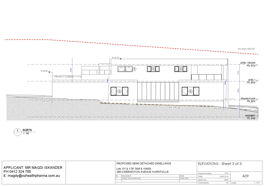
|
Georges
River Council – Local Planning Panel Thursday, 21
November 2019
|
Page 268
|
REPORT TO GEORGES RIVER COUNCIL
LPP MEETING OF Thursday, 21 November 2019
|
LPP Report No
|
LPP054-19
|
Development Application No
|
DA2019/0347
|
|
Site Address & Ward Locality
|
37 Plimsoll Street Sans Souci
Kogarah Bay Ward
|
|
Proposed Development
|
Demolition of existing structures,
and construction of a two storey dwelling house, swimming pool, detached
cabana, and front fence
|
|
Owners
|
Cathy and Michael Daher
|
|
Applicant
|
Michael Daher c/o City Plan
Strategy and Development
|
|
Planner/Architect
|
Boli Designs
|
|
Date Of Lodgement
|
22/08/2019
|
|
Submissions
|
No submissions
|
|
Cost of Works
|
$1,277,553.00
|
|
Local Planning Panel Criteria
|
Development contravenes a
development standard in excess of 10%
|
|
List of all relevant s.4.15
matters (formerly s79C(1)(a))
|
State Environmental Planning Policy
No 55 - Remediation Of Land; State Environmental Planning Policy
(Infrastructure); State Environmental Planning Policy (Building
Sustainability Index: BASIX) 2004; State Environmental Planning Policy
(Vegetation in Non-Rural Areas) 2017; Greater Metropolitan Regional
Environmental Plan No 2 – Georges River Catchment;
State Environmental Planning Policy
(Coastal Management) 2018; Draft Environment State Environmental Planning
Policy; Draft Remediation of Land State Environmental Planning Policy;
Kogarah Local Environmental Plan
2012; Kogarah Development Control Plan 2013
|
|
List all documents submitted
with this report for the Panel’s consideration
|
Architectural Plans;
Statement of Environmental Effects;
Clause 4.6 Request;
Arborist
Report;
Groundwater Infiltration Assessment
Report;
BASIX Certificate
|
|
Report prepared by
|
Development Assessment Planner
|
|
Recommendation
|
That the application be refused in accordance with the
reasons included in this report.
|
|
|
Summary of matters for
consideration under Section 4.15
Have all recommendations in relation
to relevant s4.15 matters been summarised in the Executive Summary of the assessment
report?
|
Yes
|
|
Legislative clauses requiring
consent authority satisfaction
Have relevant clauses in all
applicable environmental planning instruments where the consent authority
must be satisfied about a particular matter been listed and relevant
recommendations summarised, in the Executive Summary of the assessment
report?
|
Yes
|
|
Clause 4.6 Exceptions to
development standards
If a written request for a
contravention to a development standard (clause 4.6 of the LEP) has been
received, has it been attached to the assessment report?
|
Yes
- 22.5% variation to the Floor Space Ratio development standard.
|
|
Special Infrastructure
Contributions
Does the DA require Special
Infrastructure Contributions conditions (under s7.24)?
|
Not
Applicable
|
|
Conditions
Have draft conditions been provided
to the applicant for comment?
|
No
as the application is being recommended for refusal. The reasons for refusal
will be available upon the publishing.
|
|
Site Plan
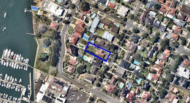
Figure 1: Aerial view of 37 Plimsoll Street Sans Souci
|
Executive Summary
Proposal
1. Development consent is sough for the demolition of
existing structures, and construction of a two storey dwelling house, swimming
pool, detached cabana, and front fence.
The proposal
fails to provide an adequate Clause 4.6 submission to justify the necessity for
the variation of the Kogarah Local Environmental Plan 2012 (KLEP) Floor Space
Ratio (FSR) development standard. The proposal seeks to vary the applicable FSR
of 0.43:1 (445.2sqm) seeking an FSR of 0.53:1 (545.4sqm) being a variation of
22.5%.
Site and
Locality
2. The
lot is rectangular in shape and has a total site area of 1,018sqm (by title)
and a 20.14m frontage to Plimsoll Street. The local topography surrounding the
site generally falls towards the west/south west (rear) toward Kogarah Bay. The
site’s topography slopes south-west being front to rear by two (2)
meters. The site has one street frontage being Plimsoll Street, where vehicular
access is gained.
Zoning and
Permissibility
3. The
site is zoned R2 - Low Density Residential under the provisions of Kogarah
Local Environmental Plan 2012 (KLEP 2012). Dwelling houses and ancillary
development are permitted with consent.
Submissions
4. No
public submissions were received at the close of the public notification period
or at the time this report was prepared being 8 November 2019.
Conclusion
5. Having
regard to the matters for consideration under section 4.15(1) of the
Environmental Planning and Assessment Act 1979 and following a detailed
assessment, the proposed Development Application (DA2019/0347) is recommended
for refusal for the reasons contained within this report.
Report in Full
PROPOSAL
6. Council
is in receipt of an application seeking development
consent for the demolition of existing structures, and construction of a
two storey dwelling house, swimming pool, detached cabana, and front fence.
A detailed
description of the proposal is as follows:
Demolition:
· Demolition
of existing structures being the brick and tiled dwelling, fibro garage, fibro
shed, driveway and vehicular crossing.
New Dwelling
Ground
Floor Level:
· Double
garage, workshop, study room, entry hall, guest bedroom with ensuite and walk
in robe, media room, wine cellar, pantry room, cool room, scullery, kitchen,
dining/living area, rear alfresco area with outdoor kitchen/BBQ area and
central courtyard between the media room and the living room.
First Floor
Level:
· Two
bedrooms with walk-in-robes and shared bathroom, leisure room, storage room,
bedroom with ensuite and walk-in-robe, laundry room, linen area, balcony
along southern façade, master suite with ensuite, separate WC and
dressing room, a terrace along eastern façade facing Plimsoll Street and
a void area adjacent to the master room.
Inground
Swimming Pool:
· Inground
swimming pool in rear yard with dimensions: 8.1m x 3.5m x 1.5m (average depth),
open pergola along pool area;
Detached
cabana:
· Open
roofed cabana area, bathroom;
Ancillary
Works:
· Ancillary
excavation;
· Masonry
Front fence (1.8m maximum);
· Below
ground rain water tank in the rear yard and a drainage system into rear
absorption trench;
· Ancillary
landscape works;
· Construction
of a new driveway and internal pedestrian footpath and gate;
· Water
feature along northern side boundary adjacent to the central courtyard;
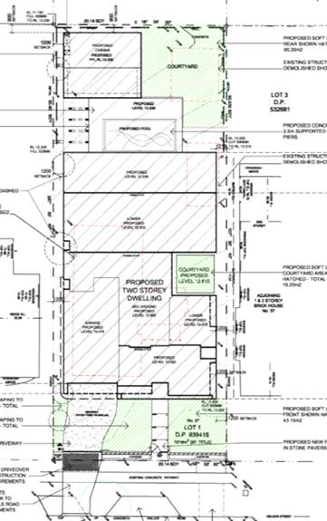
Figure
2: Proposed site plan - 37 Plimsoll
Street Sans Souci (Source: Boli Designs, 2019).
THE SITE AND LOCALITY
7. The
site is identified as Lot 1, DP 939418 known as 37 Plimsoll Street Sans Souci
NSW 2219.
The lot is
rectangular in shape and has a total site area of 1,018sqm (by title) and a
20.14m frontage to Plimsoll Street. The local topography surrounding the site
generally falls towards the west/south west (rear) toward Kogarah Bay. The
sites topography slopes south west being front to rear by 2m. The site has one
street frontage being Plimsoll Street, where vehicular access is gained.
The site is
currently occupied by a single storey brick and tiled residential dwelling with
a detached fibro shed and garage. Adjoining the site in all directions are
dwelling houses, ranging from one to two storeys in height, comprising of brick
or render exteriors with either a parapet, gabled or skillion roof. In
addition, the subject site is located approximately 105m from Kogarah Bay
located west and approximately 85m from Anderson Park located south west.
In the wider
context, the subject site is located in an established R2 Low Density
Residential Area containing a mixture of traditional and contemporary dwelling
houses, dual occupancies, and multi dwelling housing developments.
It is noted
that a Sydney Water sewer pipe traverses under the site at the rear. The matter
will be the subject of Sydney Water Tap In conditions if approval was to be
granted.
The
application was referred to Ausgrid in accordance with Clause 45(2) of the
State Environmental Planning Policy (Infrastructure) 2007 and no response was
received at the time this report was prepared (8 November 2019).
As part of
the proposal, six (6) trees have been nominated for removal. The application
was referred to Council’s Consultant Arborist and specific conditions of
consent have been recommended should the application be supported. No street
trees were nominated for removal.

Figure
3: Street view of subject site as per
site inspection - 37 Plimsoll Street Sans Souci
Background
8. Development
Application DA2019/0327 lodged for comparable works as the subject Development
Application DA2019/0347. This application was rejected on 1 August 2019 due to
insufficient stormwater information and at this time raised concerns with
regards to floor space exceedance.
Subject
Application
This
Development Application DA2019/0347 was lodged with Council on 22 August 2019.
Compliance and
Assessment
9. The
development has been assessed having regarding to Matters for Consideration
under Section 4.15(1) of the Environmental Planning and Assessment Act 1979.
STATE ENVIRONMENTAL
PLANNING INSTRUMENTS
10. Compliance
with the relevant State Environmental Planning Policies (SEPP) is detailed
below.
STATE
ENVIRONMENTAL PLANNING POLICY NO 55 – REMEDIATION OF LAND
11. SEPP
55 aims to promote the remediation of contaminated land in order to reduce the
risk of harm to human health or any other aspect of the environment. Clause 7
requires contamination and remediation to be considered in determining a
development application. The consent authority must not consent to the carrying
out of development on land unless it has considered whether or not the land is
contaminated.
A review of
the site history indicates that the site has been used for residential purposes
for extended periods of time, and such uses and/or development are not
typically associated with activities that would result in the contamination of
the site. The proposed works do not include any change to the use of the land
that would result in any concerns with respect to contamination. There is no
indication of previous uses that would cause contamination. In this regard
there is no indication that the land is contaminated.
STATE ENVIRONMENTAL PLANNING POLICY (BUILDING
SUSTAINABILITY INDEX: BASIX) 2004
12. The
trigger for BASIX Certification is when the estimated cost of works for
residential development (new dwelling(s)/alterations and additions) is equal to
or above $50,000. BASIX Certification is also triggered when proposing a
swimming pool with a volume of 40,000 litres.
A BASIX
Certificate prepared by Thermal Performance, dated 11 June 2019, certificate
number 1017478S, has been submitted with the Development Application satisfying
the minimum requirements of SEPP (Building Sustainability Index: BASIX) 2004.
STATE ENVIRONMENTAL PLANNING POLICY (VEGETATION IN NON-RURAL AREAS)
2017
13. The
Vegetation SEPP regulates clearing of native vegetation on urban land and land
zoned for environmental conservation/management that does not require
development consent.
The
Vegetation SEPP applies to clearing of:
(a) Native vegetation above the Biodiversity Offset
Scheme (BOS) threshold where a proponent will require an approval from the
Native Vegetation Panel established under the Local Land Services Amendment Act
2016; and
(b) Vegetation below the BOS threshold where a proponent
will require a permit from Council if that vegetation is identified in the
council’s development control plan (DCP).
The objectives of
the SEPP are to protect the biodiversity values of trees and other vegetation
in non-rural areas and preserve the amenity of non-rural areas through the
preservation of trees and other vegetation. This policy is applicable pursuant
to Clause 5(1) of the SEPP as the site is within both Georges River Council and
the R2 Low Density Residential zone.
Pursuant to
Clause 8(1) of the SEPP, clearing does not require authority under the policy
as it is a type of clearing that is authorised under Section 60O of
the Local Land Services Act 2013 (specifically, that associated with
a development consent issued under Part 4 of the Environmental Planning
and Assessment Act 1979).
As part of the
proposal, six (6) trees have been nominated for removal. The application was
referred to Council’s Consultant Arborist and specific conditions of
consent have been recommended if the application is to be supported. No street
trees were nominated for removal.
STATE ENVIRONMENTAL PLANNING POLICY (COASTAL MANAGEMENT) 2018
14. The
Coastal Management SEPP 2018 aims to: “Promote an integrated and
co-ordinated approach to land use planning in the coastal zone in a manner
consistent with the objects of the Coastal Management Act 2016 including the
management objectives for each coastal management area”.
The subject
site has not been identified as being located in a coastal vulnerability area
and a coastal environmental area as per NSW State Environmental Planning Policy
(Coastal Management) 2018 - Maps.
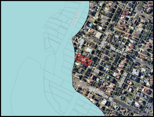
Figure
4: Coastal zone (identified in blue)
with 37 Plimsoll Street Sans Souci outside identified area
(Source:
Intramaps, 2019)
GREATER
METROPOLITAN REGIONAL ENVIRONMENTAL PLAN NO 2 — GEORGES RIVER CATCHMENT
15. The
main aims and objectives of this plan include but are not limited to the
following:
· To maintain and improve the water quality and river flows
of the Georges River and its tributaries and ensure that development is managed
in a manner that is in keeping with the national, State, regional and local
significance of the Catchment,
· To protect and enhance the environmental quality of the
Catchment for the benefit of all users through the management and use of the
resources in the Catchment in an ecologically sustainable manner,
· To ensure consistency with local environmental plans and
also in the delivery of the principles of ecologically sustainable development
in the assessment of development within the Catchment where there is potential
to impact adversely on groundwater and on the water quality and river flows
within the Georges River or its tributaries,
· To establish a consistent and coordinated approach to
environmental planning and assessment for land along the Georges River and its
tributaries and to promote integrated catchment management policies and
programs in the planning and management of the Catchment,
The proposed
stormwater drainage system has been assessed by Council’s Development
Engineer and has been found to be unsatisfactory.
Based on the Groundwater Infiltration Assessment
Report and the location of the absorption trench, the ground is not considered
suitable for water absorption as bedrock is experienced at a depth of only
1.3m. The result will be water runoff to downstream properties during
‘over average’ rainfall events. It is also important to note that the
location of the absorption system is likely to be over a Sydney Water sewer
main. The plans have not indicated the invert level of the sewer main or its
location with respect to the proposal.
DRAFT
ENVIRONMENTAL PLANNING INSTRUMENTS
Draft Environmental SEPP
16. The Draft Environment SEPP was exhibited from 31 October 2017 to 31
January 2018. This consolidated SEPP proposes to simplify the planning rules
for a number of water catchments, waterways, urban bushland and Willandra Lakes
World Heritage Property. Changes proposed include consolidating the following
seven existing SEPPs:
· State Environmental Planning Policy No. 19 – Bushland in Urban
Areas;
· State Environmental Planning Policy (Sydney Drinking Water
Catchment) 2011;
· State Environmental Planning Policy No. 50 – Canal Estate
Development;
· Greater Metropolitan Regional Environmental Plan No. 2 –
Georges River Catchment;
· Sydney Regional Environmental Plan No. 20 – Hawkesbury-Nepean
River (No.2-1997);
· Sydney Regional Environmental Plan (Sydney Harbour Catchment) 2005;
· Willandra Lakes Regional Environmental Plan No. 1 – World
Heritage Property.
The
proposal is not inconsistent with the provisions of this Draft Instrument.
Draft
Remediation of Land SEPP
17. The
Draft Remediation of Land SEPP was exhibited from 31 January
2018 to 13 April 2018. The proposed remediation of land SEPP will:
· Provide a state-wide planning framework for the remediation of land;
· Maintain the objectives and reinforce those aspects of the existing
framework that have worked well;
· Require planning authorities to consider the potential for land to
be contaminated when determining development applications and rezoning land;
· Clearly list the remediation works that require development consent;
· Introduce certification and operational requirements for remediation
works that can be undertaken without development consent.
The
proposal is not inconsistent with the provisions of this Draft Instrument.
KOGARAH LOCAL
ENVIRONMENTAL PLAN 2012
18. The
extent to which the proposed development complies with the Kogarah Local
Environmental Plan 2012 (KLEP 2012) is detailed and discussed in the table
below.
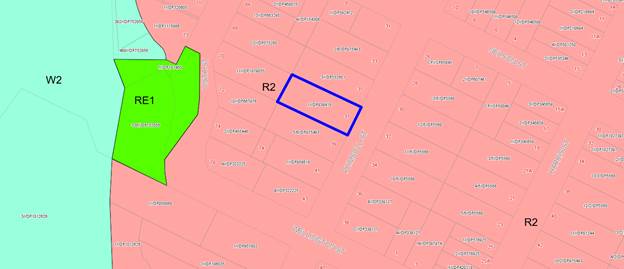
Figure
5: Land Zoning Map as per KLEP 2012
(subject site outlined in blue)
|
Clause
|
Standard
|
Proposed
|
Complies
|
|
Part 1 – Preliminary
|
|
1.2 – Aims of the Plan
|
In accordance with Clause 1.2 (2)
|
The development is not considered
to be consistent with the aims of the plan.
|
No, refer to comment (A)
|
|
1.4 - Definitions
|
Dwelling
House means:
a
building containing only one dwelling.
|
The proposed development is
consistent with the definition.
|
Yes
|
|
Part 2 - Permitted or prohibited
development
|
|
2.3 - Zone objectives and Land Use
Table
|
Meets objectives of R2- Low Density
Residential Zone.
Development must be permissible
with consent
|
The proposal fails to meets all
objectives.
The proposal is permissible with
development consent.
|
No, refer to comment (B)
Yes
|
|
Part 4 - Principal Development
Standards
|
|
4.3 – Height of Buildings
|
9m as identified on Height of
Buildings Map
|
The proposal has a maximum overall
height of 7.64m.
Cabana height is 3.47m.
|
Yes
|
|
4.4 – Floor Space Ratio
|
0.6:1 as identified on Floor Space
Ratio Map
|
Despite clause 4.4 (2), the floor
space ratio for residential accommodation on land in Zone R2 Low Density
Residential, Clause 4.4A applies.
|
Refer to Clause 4.4A
|
|
4.4A – Exceptions to
floor space ratio for residential accommodation in Zone R2
|
2)
Despite clause 4.4 (2), the floor space ratio for residential accommodation
on land in Zone R2 Low Density Residential is not to exceed the maximum floor
space ratio specified in the table to this subclause.
For
site area less than less than 1,500sqm but not less than 1,000sqm [(lot area
− 1,000) × 0.15 + 442.5] ÷ lot area:1
Site
area: 1,018sqm
0.43:1
or 445.2sqm
|
The proposed development has a
total FSR of 545.4sqm or 0.53:1
100.2sqm
exceedance or a 22.5% variation.
|
No, refer to comment (C)
|
|
4.6 – Exceptions to
development standards
|
In accordance with Clause 4.6 (1)
through to and including (8)
|
The proposal is accompanied by a
Clause 4.6 variation relating to the breach of the Floor Space Ratio standard
under Clause 4.4A.
|
No, refer to comment (D)
|
|
Part 5 - Miscellaneous
Provisions
|
|
5.7 – Development below mean
high water mark
|
(2) Development consent is required
to carry out development on any land below the mean high water mark of any
body of water subject to tidal influence (including the bed of any such
water).
|
The proposal does not involve works
below the Mean High Water Mark.
|
Yes
|
|
5.10 – Heritage conservation
|
In accordance with Clause 5.10 (2)
|
The site is not a heritage item and
not located within the vicinity of any heritage items.
Site is not in a heritage
conservation area.
|
Yes
|
|
5.11 – Bush Fire Hazard
Reduction
|
Bush fire hazard reduction work
authorised by the Rural Fires Act 1997 may be carried out on any land without
development consent.
|
The subject land is not within a
bush fire prone area.
|
Yes
|
|
Part 6 - Additional Local
Provisions
|
|
6.1 – Acid sulfate soils
|
(2) Development consent is required for the carrying out of
works described in the Table to this subclause on land shown on the Acid
Sulfate Soils Map as being of the class specified for those works.
Class 5: Works within 100 metres of adjacent Class 2, 3 or 4 land that is
below 5 metres Australian Height Datum and by which the watertable is likely
to be lowered below 1 metre Australian Height Datum on adjacent Class 2, 3 or
4 land.
|
Subject site is located in a Class
5 Acid Sulfate Soils Area.
Although land is within 100m of
adjacent class 2 area, the land is not below 5m AHD therefore an Acid Sulfate
management Plan is not required.
|
Yes
|
|
6.2 – Earthworks
|
(2) Development consent is required for earthworks
unless—
(a) the earthworks are exempt development under this Plan
or another applicable environmental planning instrument, or
(b) the earthworks are ancillary to development that is
permitted without consent under this Plan or to development for which
development consent has been given.
|
The proposed earthworks are
ancillary to the proposed development and are acceptable for this form of
development.
|
Yes
|
|
6.3
– Flood planning
|
(2) This clause applies to—
(a) land identified as “Flood
planning area” on the Flood Planning Map, and
(b) other land at or below the
flood planning level.
|
The proposed development is not
located in a mapped flood prone area.
|
Yes
|
|
6.4
– Limited development on
foreshore area
|
In accordance with Clause (2) and
(3)
|
The proposed development is not
located in the foreshore area.
|
Yes
|
(A) Aims of Plan
19. The
particular aims of the Kogarah Local Environmental Plan 2012 in relation to
Clause 1.2 (2) are as listed below:
· To guide the orderly and sustainable development
of Kogarah,
· To encourage a diversity of housing choice
suited to meet the needs of the current and future residents of Kogarah,
· To promote economic development and facilitate
the continued growth of commercial, medical-related and industrial
employment-generating opportunities,
· To protect and enhance Kogarah’s natural
environment, foreshores and waterways,
· To provide high quality open space and a range
of recreational areas and facilities suited to meet the needs of the residents
of Kogarah and its visitors,
· To conserve Kogarah’s environmental
heritage.
The development
is not considered to be consistent with the aims of the Kogarah Local
Environmental Plan 2012, as the proposal has not been designed to satisfy the
criteria relating to the orderly and sustainable development given the
insufficient drainage of the development and the bulk and scale/density
breaches. The proposal is not considered to be well suited to meet the needs of
the current and future residents of the locality.
(B) Zone Objectives
20. The
objectives of the R2 Low Density Residential Zone as identified in KLEP 2012
are as listed below:
· To
provide for the housing needs of the community within a low density residential
environment.
· To
enable other land uses that provide facilities or services to meet the day to
day needs of residents.
The proposed
development fails to satisfy all the R2 Low Density Residential zone objectives
as:
i. The development presents unreasonable visual
bulk and scale compromising the amenity of the surrounding area.
ii. The proposed development
will result in significant built form with a lack of emphasis on landscaping.
An adverse impact would result from the proposed development on the amenity of
the locality and adjoining neighbours and general expectations for a
residential dwelling form in a low density residential area.
(C) Exceptions to floor
space ratio for residential accommodation in Zone R2
21. The
proposed development seeks a total Floor space Ratio (FSR) of 0.53:1, being
545.4sqm, whilst Clause 4.4A of KLEP 2012 restricts the FSR to 0.43:1, being
445.2sqm, resulting in a non-compliance of 100.2sqm equating to 22.5%.
The Applicant has submitted a Clause 4.6 submission to vary the permissible FSR
and this is addressed at below (D).
Any assessment of
the intent and objective of the development standard must have regard to the
definitions for Gross Floor Area and Floor Space Ratio and their wording to
ascertain what form of building is proposed see below:
gross floor area means the sum of the floor area of each
floor of a building measured from the internal face of external walls, or from
the internal face of walls separating the building from any other building,
measured at a height of 1.4 metres above the floor, and includes:
(a) the area of a mezzanine, and
(b) habitable rooms in a basement or an attic, and
(c) any shop, auditorium, cinema, and the like, in a basement
or attic,
but excludes:
(d) any area for common vertical circulation, such as lifts and
stairs, and
(e) any basement:
(i) storage, and
(ii) vehicular access, loading areas, garbage and services, and
(f) plant rooms, lift towers and other areas used
exclusively for mechanical services or ducting, and
(g) car parking to meet any requirements of the consent
authority (including access to that car parking), and
(h) any space used for the loading or unloading of goods
(including access to it), and
(i) terraces and balconies with outer walls less than 1.4
metres high, and
(j) voids above a floor at the level of a storey or
storey above.
And
The floor space ratio of buildings on a site is the ratio of
the gross floor area of all buildings within the site to the site area.
The
submitted architectural plans in conjunction with the Statement of
Environmental Effects (prepared by City Plan dated July 2019 reference #19-064)
and Clause 4.6 of the LEP, seeks a variation of 15% to the maximum allowable
FSR control. Council’s assessment revealed that the Floor Space Ratio
breach is 100.2sqm or a 22.5% variation to Clause 4.4A of Kogarah LEP.
With reference to
the definition of gross floor area:
(g) car
parking to meet any requirements of the consent authority (including access to
that car parking),
As per Kogarah DCP
2013; B4 - Parking and Traffic, dwelling houses are required to provide two (2)
car spaces for residential dwellings. It is noted that the floor area of one
(1) car parking has been calculated as per the dimensions of a car with door
swing as per AS2890.1-2004 (3.0m x 5.5m = 16.5sqm). In this case, two car
spaces equating to 33sqm (16.5sqm + 16.5sqm) are required to be provided as per
Kogarah DCP 2013. All floor area within the garage in excess of 33sqm has
contributed to floor space.
(D) Clause 4.6
Exceptions to Development Standards
22. The
application was supported by a Clause 4.6 Development Standard variation
request (prepared by City Plan dated July 2019 reference #19-064). In
this instance the variation request is considered inadequate, particularly
having regard to the matters raised above.
23. Clause
4.6(1):
“The objectives of this clause are as follows:
(a) to provide an appropriate degree of flexibility in
applying certain development standards to particular development,
(b) to achieve better outcomes for and from
development by allowing flexibility in particular circumstances.”
Comment:
The proposed development seeks a total Floor Space Ratio (FSR) of 0.53:1, being
545.4sqm, whilst Clause 4.4A of KLEP 2012 restricts the FSR to 0.43:1, being
445.2sqm. The resultant non-compliance of 100.2sqm equates to 22.5%. The effect
of this non-compliance will increase the scale of the building and its visual
bulk. It is not considered appropriate to flexibly apply the standard in the
circumstances of this case as the outcome of contravening with the development
standard is not considered to be in the interest of the public and will have an
adverse environmental impact.
24. Clause
4.6(2):
“Development
consent may, subject to this clause, be granted for development even though the
development would contravene a development standard imposed by this or any
other environmental planning instrument. However, this clause does not apply to
a development standard that is expressly excluded from the operation of this
clause”
Comment:
Clause 4.4A – Exceptions to floor space ratio for residential
accommodation in Zone R2 identified as a development standard is not
excluded from the operation of Clause 4.6.
25. Clause
4.6(3):
“Development consent must not be granted for development that
contravenes a development standard unless the consent authority has considered
a written request from the applicant that seeks to justify the contravention of
the development standard by demonstrating:
(a) that compliance with the development standard is
unreasonable or unnecessary in the circumstances of the case, and
(b) that there are sufficient environmental planning
grounds to justify contravening the development standard”
The submitted
4.6 variation has responded to the FSR non-compliance by relying on the
following:
· The proposal complies with the maximum building height
identified in the LEP, the maximum wall height prescribed in the DCP, the
minimum deep soil area as well as the front, rear and side setback controls in
the DCP.
· The
proposed dwelling alterations and additions will promote good residential
amenity in that:
o The proposed dwelling maximises the opportunity for solar access into
the dwelling from the northern elevation, through the inclusion of two
courtyards and a large void.
o The proposed dwelling
has good residential amenity and is an improved dwelling to what is currently
on the site.
o Design has minimised windows and included privacy louvres and
landscaping where there is potential for overlooking into the site.
Comment: The applicant has provided a written variation request
prepared by prepared by City Plan dated July 2019 reference #19-064. A copy of
this Clause 4.6 request for variation is provided for the Panel’s
consideration.
26. Clause
4.6(4):
“Development consent must not be granted for development that
contravenes a development standard unless:
(a) the consent authority is satisfied that:
(i) the applicant’s written
request has adequately addressed the matters required to be demonstrated by
subclause (3), and
(ii) the proposed development will be in
the public interest because it is consistent with the objectives of the
particular standard and the objectives for development within the zone in which
the development is proposed to be carried out, and”
With regard
to the form and content of the Clause 4.6 Variation submission it is considered
to have addressed the relevant provisions, objectives, case law and information
as per Clause 4.6. However, review of the submission concludes that the
submission does not adequately justify the intent and purpose of the works and
the necessity for the substantial increase in Floor Space Ratio.
With regard to the
proposals compliance with the objectives for Clause 4.4A below:
(a) to ensure that the bulk
and scale of development are compatible with the size of the lot, and
(b) to
promote good residential amenity.
The proposal
seeks an FSR of 0.53:1 (545.4sqm) on an allotment of 1,018sqm whereas the
planning controls define a floor space for development of this type in this
locality of 0.43:1 (445.2sqm). The proposal is 100.2sqm in excess of the
standard. This is an excessive non-compliance with the FSR standard with
minimal justification provided for the need/demand for the additional floor
space, and will impose amenity impact on the amenity of surrounding properties.
It is contended
that the bulk and scale resulting from this breach creates an undesirable outcome
for a single dwelling house by creating a potential precedent where an
excessive floor space can be proposed simply on the basis that it complies with
the numerical height, setback, and landscape controls.
The design and
form of the development is considered to result in significant and visually
dominant built form which will adversely impact the opportunity of neighbouring
properties to receive sufficient solar amenity and adequate cross ventilation.
The design incorporates excessive voids across the first floor (approximately
85sqm of voids representing 36% of the floor area of the first floor).
The Clause 4.6
variation relies on compliance with two of the five justifications expressed in
the Land and Environment Court decision of Wehbe -v- Pittwater City Council
(2007) which set down criteria to justify a variation under State
Environmental Planning Policy No.1 (Development Standards) which has been
replaced in Planning Instruments by the standard Clause 4.6. The principals
espoused in the Appeal do however, remain relevant for consideration.
The Applicants
reliance on the first justification that “the
objectives of the development standard are achieved notwithstanding
non-compliance with the standard” remains questionable as,
although the works will not result in increased bulk and scale when viewed
directly from the Plimsoll Street, being a larger building when viewed from
other aspects, it promotes a building form and site density that is not
envisaged by the controls and would perpetuate similar building proposals which
would undermine the intent and objectives of the controls and diminishing the
amenity of adjoining properties.
In respect to
Prestons CJ judgement the NSW Land and Environment Court has established the
five part test (outlined above). In this case the development fails to satisfy
the five part test for the following reasons:
· The
objectives of the standard are not considered to be satisfied;
· The
underlying objective of the standard remains relevant and therefore compliance
is necessary and warranted;
· The
underlying objective has not been defeated or thwarted as recent development
applications within the vicinity have been designed to comply.
27. In
Initial Action Pty Ltd v Woollahra Council [2018] NSWLEC 2018, Preston CJ
observed that in order for there to be 'sufficient' environmental planning
grounds to justify a written request under clause 4.6 to contravene a
development standard, the focus must be on the aspect or element of the
development that contravenes the development standard.
The applicant
attempted to justify that that there are sufficient environmental planning
grounds to justify contravening the development standard. Although
justification has been provided in relation to the proposal complying with the
height controls, setbacks, in addition to privacy, views and overshadowing, the
request fails to justify contravening the development standard and fails to
adequately demonstrate that there are sufficient environmental planning grounds
to justify contravention so that the Council
In terms of
the proposal providing sufficient planning grounds to justify contravention of
the standard, the variation to the floor space development standard is
considered to increase the bulk, scale and massing of the building. The visual
dominance of the building will be increased and the scale of the building is
larger, bulkier and inconsistent with similar developments in the immediate
vicinity of the site. The proposed additional 100.2sqm internal floor space is
considered to be an overdevelopment of the site.
(b) the concurrence of the Director-General has been
obtained.”
Comment:
The concurrence of the Director-General is assumed and has been delegated to
the determining authority which is the Georges River Local Planning Panel as
the non-compliance exceeds 10%.
28. Clause
4.6(5):
“In deciding whether to grant
concurrence, the Secretary must consider-
(a) whether contravention of the development
standard raises any matter of significance for State or regional environmental
planning, and
(b) the public benefit of maintaining the
development standard, and
(c) any other matters required to be taken
into consideration by the Secretary before granting concurrence.”
Pursuant to
Clause 4.6(5) of KLEP 2012 the matter involves a variation of 22.5% and the
Secretary’s consideration of this extent of variation has been delegated
to the Local Planning Panel. Therefore the Panel is required to consider
the matters for consideration by the Secretary. In this instance the following
is relevant:
“the
public benefit of maintaining the development standard”
It is
Council’s active policy to generally seek compliance with the development
standards applicable and a variation of 22.5% is considered beyond what is
considered acceptable when considering a variation to the standard. Approval of
the subject proposal would create an unacceptable and unjustified precedent to
vary the standard in the low density residential locality. Being a
building larger than the set parameters, this would result in an undesirable
outcome that would set an undesirable precedent; notwithstanding that part of
the works would not be visible directly from Plimsoll Street. However, being an
above ground construction the dwelling will result in an excessive bulk and
built form when viewed from multiple aspects due to the additional 100.2sqm
internal floor space. A stringent application of the FSR standard in this
instance ensures a building form, scale and design that is compatible with
dwelling houses in a low density residential locality.
29. On
the basis of the commentary expressed above, the Clause 4.6 submission is not
acceptable and would result in an undesirable precedent building form that
would undermine the intent of the development standard as it applies to the low
density residential area.
DEVELOPMENT
CONTROL PLANS
30. The
proposed development is subject to the provisions of the Interim Policy -
Georges River Development Control Plan 2020 and the Kogarah Development Control
Plan 2013. The following comments are made with respect to the proposal
considering the objectives and controls contained within both DCPs.
Interim
Policy Georges River Development Control Plan 2020
31. The
proposed development is subject to the provisions of the Interim Policy Georges
River DCP 2020. Only the applicable aspects have been assessed with respect to
the Interim DCP. All other aspects have been thoroughly assessed under Kogarah
DCP 2013. The aim of an Interim Policy is to set a consistent approach for the
assessment of residential development within the Georges River Local Government
Area, until such a time as a comprehensive DCP is prepared and implemented.
Comments are made with respect to the proposal satisfying the objectives and
controls contained within the DCP.
|
Control
|
Standard
|
Proposed
|
Complies
|
|
Dwelling houses
|
|
Landscaped area
|
Where located outside the FSPA, a
minimum of 20% of site area is landscaped open space
The minimum dimension of landscaped
open space is 2m, designed in a useable configuration
A minimum of 15sqm of the
landscaped open space is provided between the front setback and the street
boundary in the form of a front yard
|
159sqm or 15%
Landscape areas provided are a
minimum 2m x 2m in dimension.
Greater than 15sqm provided
|
No, refer to discussion below
Yes
Yes
|
Landscaped
area
32. The
Georges River Council Interim DCP 2020 became effective on 22 July 2019. As
part of the Interim Policy, landscaping requirements for dwelling houses across
the LGA have been identified as 20% for lots outside Foreshore Scenic
Protection Areas (FSPA).
The subject
site being located in the former Kogarah City Council area is subject to the
controls listed in the Kogarah DCP 2013. The 20% landscape requirement
stipulated in the Interim Policy DCP exceeds the Kogarah DCP 2013 landscape
requirements of 15%.
The subject
proposal providing 159sqm or 15% of landscaping falls short of the required 20%
as per the Interim DCP 2020. Notwithstanding the 5% variance, Council has not
abandoned Kogarah DCP 2013 controls and has applied it consistently to
applications in the former Kogarah City Council LGA boundary. In this case, and
with reference to Kogarah DCP 2013, 1.3 Open Space (1) the 15% of landscaping
provided is considered to comply with the 15% landscape requirements of KDCP
2013.
C1-
Low Density Housing
|
Control
|
Standard
|
Proposed
|
Complies
|
|
1.2 Building Scale and Height
|
|
1.2.1 Floor space Requirements
|
(5) Blank walls and flat facades
should be avoided. Walls longer than 10m should be articulated by a minimum
300mm projection or indentation in the façade.
(6) The overall building should
present a building mass that is in proportion with the allotment size,
provides opportunities for modulation and articulation of the building and
does not detract from the satisfaction of any other applicable design principle.
(7) Where proposed development
includes a two (2) residential level element, then the second level should
not extend beyond 60% of the depth of the allotment measured from the street
boundary. Where side boundaries are of varying length, the second level is
limited to a line across the block between the points on both boundaries.
|
The proposed development is
sufficiently articulated albeit the bulk exceeds that envisaged in this zone.
The proposed building mass is not
considered to be suitable for the allotment size as the proposal exceeds the
floor space ratio development standard. The Clause 4.6 variation the
development standard has not been supported by the assessing officer.
60% depth = 30.36m
Proposed first floor element= 31m
Difference:
640mm
|
Yes
No, refer to comment (E)
No
|
|
1.2.2 Building Heights
|
(1) The maximum building height
must comply with the requirements specified in table below:
Dwelling Type
Single dwelling;
Maximum Height
7.2m to the underside of the upper
ceiling;
7.8m to the top of the parapet;
|
7.14m
7.64m
|
Yes
Yes
|
|
1.2.3 Rhythm of the Built Elements
in the Streetscape
|
(1) The primary building
façade should not exceed 40% of the overall width of the total
frontage.
(2) The secondary building
façade should be set back a minimum of 1.5 metres from the primary
building façade.
(3) Where the dominant built form
in the streetscape provides for a pitched hip or gable ended presentation to
the street, the new buildings and/or additions should reflect that roof form.
|
The primary façade does not
exceed 40% the width of the frontage.
The proposed
secondary building façade is setback 1.5m from the primary.
The streetscape is characterised by
a mix of pitched and parapet roofs. The proposed development incorporates a
parapet design which is acceptable.
|
Yes
Yes
Yes
|
|
1.2.4 Building Setbacks
|
1.2.4.2 Front Setbacks
(1) Where the setback of an
adjacent building is greater than 5m, an appropriate setback may be achieved
by ensuring development is set back:
(i) the same distance as one or the
other of the adjoining buildings, provided the difference between the setbacks
of the two adjoining buildings is less than or equal to 2.0m (Figure 9); or
1.2.4.3 Side & Rear Setbacks
(1) The side and rear boundary
setbacks should comply with the table below.
Rear Setback
Buildings are to have a minimum
rear setback of 15% of the average site length, or 6m, whichever is greater.
Side Setbacks
For buildings having a wall height
of 3.5m or less, the minimum side boundary setback is 900mm.
For buildings having a wall height
of greater than 3.5m, the minimum side boundary setback is 1200mm.
|
The proposed ground floor has an
average setback of 7.2m.
15% equates to 7.6m.
Development is setback 14.7m
Northern side setback
Ground floor: 1.2m
First floor: 1.2m
Southern side setback
Ground floor: 1.2m
First floor: 1.5m
|
Yes
Yes
Yes
Yes
|
|
1.2.5 Fenestration and External
Materials
|
(1) New buildings and alterations
and additions should present a primary building façade and roofing
that is constructed of materials, and within a colour range, that is
complementary to the dominant character of buildings in the streetscape.
(2) Garage doors should not
dominate the street front elevation (Figure 16).
(3) The roof should be similar to
the angle of pitch, materials and colour of roofs in the streetscape (Figure
14).
(4) The colours of garages, window
frames, and balustrading on main facades and elevations are to be integrated
with the external design of the building.
(5) Glazing shall be limited to a
maximum 35% of the total area of the overall street front façade. This
includes both primary and secondary façade bays (Figure 15).
(6) Where garaging is in the front
façade it should be limited to a maximum of two garage bays, with
separate garage door openings of a maximum width of 3m.
|
The proposed development is
considered to be consistent with the modern design demonstrated throughout
the immediate vicinity.
The proposed development includes
one garage door approximately 6.1m.
The immediate vicinity demonstrates
both pitched and parapet roofs, the proposal is consistent with the
streetscape.
The external facades of the proposed
development are considered appropriate for the locality.
The proposed front façade
does not exceed the maximum 35% glazing.
Although the proposal has one
double garage door, the streetscape includes several examples of such garage
doors (36, 39, 29 Plimsoll Street).
|
Yes
Yes
Yes
Yes
Yes
Yes
|
|
1.2.6 Street Edge
|
(1) New developments should provide
front fencing that complements fencing within the streetscape.
(2) Fencing is to be consistent
with the requirements of Section 4.2.
(3) Existing vegetation in the
front building line setback or on the street verge that contributes to the
character of the streetscape should be preserved.
(4) The driveway location should
not result in the removal of any street trees or removal of substantial trees
on the site.
|
The proposed development provides
sufficient front fencing to complement the streetscape.
Fencing is consistent with the
Section 4.2 requirements.
Six (6) trees have been nominated
for removal. The application was referred to Council’s Consultant
Arborist and the removal was supported subject to specific conditions of
consent being imposed should the application be supported. No street trees were
nominated for removal.
The proposed driveway does not
result in the removal of any street trees.
|
Yes
Yes
Yes
Yes
|
|
1.3 Open Space
|
|
1.3 Open Space
|
(1) 15% of the site area must be
deep soil landscaped area.
(2) Private open space should be
adjacent to and visible from the main living and/or dining rooms and be
accessible from those areas.
(3) Development should take
advantage of opportunities to provide north facing private open space to
achieve comfortable year round use.
(4) Where soil and drainage
conditions are suitable, unpaved or unsealed landscaped areas should be
maximised and designed to facilitate on site infiltration of stormwater.
(5) Existing significant trees and
vegetation must be incorporated into proposed landscape treatment.
|
159sqm or 15% (excluding below
round OSD and below ground rainwater tank area)
The proposed development includes a
satisfactory area for private open space.
The proposed private open space is
appropriately located.
The landscape area calculation has
excluded the turfed area above the below ground rainwater tank.
Six (6) trees have been nominated
for removal. The application was referred to Council’s Consultant
Arborist and the removal was supported subject to specific conditions of
consent if the proposal was to be supported. No street trees were nominated
for removal.
|
Yes. Although the Georges River
Development Control Plan 2020 Interim Policy requires 20% landscaping,
Kogarah DCP requires 15% landscaping.
Yes
Yes
Yes
Yes
|
|
1.4 Vehicular access, parking
and circulation
|
|
|
(1) Car parking is to be provided
in accordance with the requirements in Section B4.
(4) Crossings are to be
positioned so that on-street parking and landscaping on the site are
maximised, and removal or damage to existing street trees is avoided.
(5) Garaging should be setback
behind the primary façade.
(6) The maximum driveway width between
the street boundary and the primary building façade is 4m.
|
The proposed development is
satisfactory having regard to Section B4 of the KDCP 2013.
2 car spaces required and have been
provided (additional car spaces provided have contributed to FSR)
The proposed vehicular crossing
does not impact on existing on-street parking arrangements or landscaping.
The garage is setback behind the
primary façade.
The proposed development includes a
driveway between the side and the secondary street façade. The
proposed driveway is 3.1m.
|
Yes
Yes
Yes
Yes
|
|
1.5 Privacy
|
|
1.5.1 Visual Privacy
|
(1) Windows from active rooms are
to be offset between adjacent dwellings so as to avoid direct overlooking
onto neighbouring windows.
(2) Where terraces and balconies
are proposed and are elevated more than 1.5m above ground level (finished)
and are located behind the street front façade, they are restricted to
a maximum width of 2.5m and must be setback a minimum 3m from any adjoining property
boundary.
(3) The area of balconies or
terraces greater than 1.5m above ground level is limited to a cumulative
total of 40m2 per dwelling.
(5) For active rooms or balconies
on an upper level, the design should incorporate placement of room windows or
screening devices to only allow oblique views to adjoining properties
(Figures 18 and 19).
|
Glazing adjacent to the spiral
staircase on the northern façade of first floor level is considered to
directly overlook into neighbouring properties, and has not been
appropriately treated.
Although a side boundary balcony
has been proposed along the southern façade of the first floor it has
been appropriately treated by louvers as per 1.5.1 (4) Council may
consider a variation to the above requirements where it is considered that
the terrace or balcony will not result in a loss of privacy to neighbouring
properties.
The areas of balconies great than
1.5m above ground level do not exceed 40sqm.
The proposed development is
considered to have been appropriately treated to prevent any privacy
concerns.
|
No
Yes
Yes
Yes
|
|
1.6 Solar Access
|
|
|
(1) At least 50% of the primary
private open space of the proposed development should have access to a
minimum of four hours of sunlight between 9am–3pm on 21 June.
(3) Where the neighbouring
properties are affected by overshadowing, at least 50% of the neighbouring
existing primary private open space or windows to main living areas must
receive a minimum of 3 hours sunlight between 9am–3pm on 21 June
(Figure 21).
|
The proposed private open space
will receive the minimum 4 hours sunlight between 9am–3pm on 21 June.
The proposed development affects
the immediate neighbour to the south, however this property receives a
minimum of 3 hours sunlight between 9am–3pm to at least 50% of the
existing primary private open space on 21st June.
|
Yes
Yes. Although the proposed dwelling
satisfies the numerical solar amenity requirements, the additional built form
will prevent additional sunlight of reaching the adjoining allotments.
Compliant FSR would have the ability to increase solar access to this
allotment.
|
|
1.7 Views and view sharing
|
|
|
(1) Development shall provide for
the reasonable sharing of views. Note: Assessment of applications will refer
to the Planning Principle established by the Land and Environment Court in
Tenacity Consulting vs Warringah Council (2004) NSWLEC140
|
The proposed development is not
expected to impact any adjoining properties or public space access to view
corridors.
|
Yes
|
|
4.2 Fences and Walls
|
|
4.2.1 Front Fences
|
(1) In cases where an applicant can
demonstrate the need for a front fence higher than 1.4m, the maximum height
of the fence must not exceed 1.8m.
(2) Fences over 1.4m must be
setback 1.2m from the street alignment, except where Council considers a
lesser distance is warranted due to the siting of the existing residence,
levels or width of the allotment or exceptional circumstances of the site.
|
1.4m with the gate being 1.8m
Fence and gate elements above 1.4m
have been setback 700mm in lieu of the 1.2m required.
|
Yes
No
|
|
4.4 Outbuilding
|
|
|
(1) Outbuildings are not to be
located within the front building line and must be set back 900mm from the
site boundaries. Windows and glass doors must face into the yard, or be
frosted if facing a neighbour’s property.
(5) Maximum height of outbuildings
is 3.5m to the ridge and 2.5m to the underside of the eaves above natural
ground level.
|
Rear outbuilding is setback 900mm
to the rear and 1.2m to the southern side boundary.
Height of the outbuilding is 3.47m.
The height to the underside of the
ceiling is 3.1m.
|
Yes
Yes
No
|
|
4.6 Swimming pools, spas and
enclosures
|
|
|
(1) Swimming pools/ spas should be
located at the rear of properties.
(3) Swimming pools/spas must be
positioned a minimum of 900mm from the property boundary with the water line
being a minimum of 1500mm from the property boundary.
(4) In-ground swimming pools shall
be built so that the top of the swimming pool is as close to the existing
ground level as possible. On sloping sites this will often require excavation
of the site on the high side to obtain the minimum out of ground exposure of
the swimming pool at the low side.
(7) On steeply sloping sites,
Council may consider allowing the top of the swimming pool at one point or
along one side to extend up to 1m above natural ground level, provided that
the exposed face of the swimming pool wall is treated to minimise impact. The
materials and design of the retaining wall should be integrated with, and
complement the style of the swimming pool.
(8) Filling is not permitted
between the swimming pool and the property boundary. The position of the
swimming pool, in relation to neighbours and other residents, must be
considered to minimise noise associated with activities carried out in the
swimming pool or from the swimming pool equipment, such as cleaning
equipment.
(10) A pool fence complying with
the legislation should separate access from the residential dwelling on the
site to the pool.
(11) Safety and security measures
for swimming pools must comply with the relevant requirements of the Swimming
Pools Act and any relevant Australian Standards.
|
The proposed pool is located in the
rear yard of the property.
The proposed pool waterline is
located at least 1.5m from all boundaries.
The pool and paved area at the rear
is proposed to be raised 450mm. (mainly due to slope of land to the back and
to achieve a flat area and minimize cut).
The proposed development is not
located on a steep site. The proposal for the pool is satisfactory.
The proposal does not include fill
between the pool and the boundary.
Pool fencing is in accordance with
the relevant Australian Standards have been proposed. If the application was
to be supported a condition would be imposed accordingly.
Pool to comply with NCC and
relevant Australian Standard.
|
Yes
Yes
Yes
Yes
Yes
Yes
Yes
|
(E) Floor Space
Requirements:
33. As
established in the above assessment, the proposal seeks an FSR of 0.53:1
(545.4sqm) on an allotment of 1,018sqm whereas the planning controls define a
floor space for development of this type in this locality of 0.43:1 (445.2sqm).
The proposal is 100.2sqm in excess of the standard. This is an excessive
non-compliance with the FSR standard fails to satisfy the Floor Space
Requirements objectives as set out in Clause 1.2.1 of Kogarah DCP.
The objectives of
Clause 1.2.1 as per the DCP are as follows:
· In scale
with the allotment size;
Comment:
The floor space ratio applicable to the subject site is 0.43:1 (445.2sqm) as
per the Kogarah Local Environmental Plan 2012, while the proposal seeks an FSR
of 0.53:1 (545.4sqm). The proposal is not considered to be in scale with the
allotment size as the FSR is in excess of the standard by 100.2sqm or 22.5%.
· Provides
opportunities for modulation and articulation of the building form;
Comment:
The variation to the floor space development standard is considered to increase
the bulk, scale and massing of the building. The visual dominance of the
building will be increased and the scale of the building is larger, bulkier and
inconsistent with similar developments in the immediate vicinity of the site.
The proposed additional 100.2sqm internal floor space is considered to be an
overdevelopment of the site.
· Does not
detract from the satisfaction of any other requirement;
Comment:
The variation to the floor space development standard results in a number of
variations in relation to privacy and overlooking, amenity to neighbours, in
addition to failing to meet key objectives set out in Kogarah Local
Environmental Plan 2012.
IMPACTS
Natural
Environment
34. The
proposal seeks to remove a number of onsite
trees and the removal has been assessed and endorsed by Council’s
Consultant Arborist. If the application was to be supported conditions would be
imposed for replacement trees to be provided.
The proposed works
will not directly impact the natural environment with the built form but will
indirectly impact the environment through excavation works and drainage
management.
Built Environment
35. The built form of
the proposed development is of a bulk and scale that is inconsistent with
contemporary development in the locality. The
development presents unreasonable visual bulk impacts to the neighbouring
properties along both the northern and southern side elevations.
The proposal
will result in a dwelling of 545.4sqm, approximately 100.2sqm above the
permissible floor space, resulting in an FSR of 0.53:1 and a non-compliance of
22.5%. A Clause 4.6 variation was submitted in support of the
non-compliance but is considered to be inadequate. The primary building forms
planning concerns relating to the long term management of the floor space usage
where large void areas are proposed and have potential for alternative use in
an undesirable amenity environment. The proposal is thus recommended for
refusal.
During the
assessment of the application the proposed stormwater drainage system was found
to be unsatisfactory and unable to be supported by Council’s Development
Engineer. In addition, based on the Groundwater Infiltration Assessment Report and the
location of the absorption trench the ground is not considered suitable for
water absorption as bedrock is experienced at a depth of only 1.3m. The result
will be water runoff to downstream properties during over average rainfall
events. It is also important to note that the location of the absorption
system is likely to be over a Sydney Water sewer main. The plans have not
indicated the invert level of the sewer main or its location with respect to
the proposal.
Social Impact
36. The assessment
demonstrates that the proposal in its current form will have an adverse impact
on the character of the locality and the amenity of neighbouring residential
properties. The environmental impacts on the social environment are considered
to be unreasonable and the application is not supported.
Economic Impact
37. The proposal is not considered to result in unreasonable material
economic impact.
Suitability of the Site
38. The site is zoned R2
– Low Density Residential. Whilst the proposal being a dwelling and
ancillary works, is a permissible form of development in this zone, it is
considered that the proposal will have an adverse impact on the adjoining
properties and the streetscape in its current form. The proposal is considered
to constitute an overdevelopment and ultimately the site is unsuitable for the
development.
SUBMISSIONS, REFERRALS AND THE PUBLIC INTEREST
39. The application was
advertised and adjoining residents were notified by letter and given fourteen
(14) days in which to view the plans and submit any comments on the proposal. No
submissions were received during the neighbour notification period.
Council Referrals
Development Engineer
40. Council’s
assessment of the drainage system concluded that the proposal is unsatisfactory
the sub-surface is not suitable for drainage by means of an absorption trench,
and preferred method of drainage is through the provision of a drainage
easement which has not been provided.
Consultant Arborist
41. No objections were raised
for the removal of trees subject to replanting new trees, and the protection of
the four (4) trees on the adjoining sites during construction, and the
protection of the two (2) street trees. If the application was to be supported
conditions of consent would be imposed.
External Referrals
Ausgrid
42. The application was
referred to Ausgrid as per Clause 45(2) of the State Environmental Planning Policy
(Infrastructure) 2007. No communication was received at the time this report
was prepared (08 November 2019).
Contributions
43. The development is
subject to Section 7.12 (former Section 94A Contribution) contribution as the
proposed cost of works exceed $100,000.00. In accordance with Council’s
Section 94A Contributions Plan 2017, Section 7.12 – Fixed Development
Consent Levies are applicable to dwelling house developments. A condition of
consent requiring payment of the contribution will be imposed should the
application be supported.
CONCLUSION
44. Development consent is sough for the demolition of
existing structures, and construction of a two storey dwelling house, swimming
pool, detached cabana, and front fence.
The proposal
fails to provide an adequate Clause 4.6 submission to justify the necessity for
the variation of the Kogarah LEP 2012 requirement for Floor Space Ratio. The
proposal seeks to vary the 0.43:1 (445.2sqm) standard to 0.53:1 (545.4sqm) for
a total variation of 22.5%.
The proposal has been assessed in accordance with Section 4.15 (1) of the
Environmental Planning and Assessment Act, 1979. As discussed throughout this
report, the proposal fails to provide an adequate Clause 4.6 submission to
justify the necessity for the variation of the Kogarah LEP 2012 requirement for
Floor Space Ratio. The proposal seeks to vary the 0.43:1 (445.2sqm) standard to
0.53:1 (545.4sqm) for a total variation of 22.5%.The proposal also fails to
satisfy all the R2 Low Density zone objectives and a number of DCP controls.
The proposed development is not considered to be suitable for the site or its
locality and is likely to set an undesirable precedent.
It is considered that the proposed development is not of a scale and
design that is suitable for the site having regard to its size and shape, its
topography, vegetation and relationship to adjoining developments and the lack
of adequate justification supporting a significant FSR variation.
DETERMINATION AND STATEMENT OF REASONS
45. Statement
of Reasons
· The proposed development is not considered to be an
appropriate scale and form for the site and the character of the locality.
· The excessive non-compliance of the Floor Space
Ratio standard with minimal justification provided for the need/demand for the
additional floor space is considered unacceptable.
· The proposed development will have unacceptable adverse
impacts on the natural and built environments.
· The proposed development will result in unacceptable
adverse impacts on the amenity of adjoining residents and the locality and is likely
to set an undesirable precedent.
· In consideration of the aforementioned reasons, the
proposed development is not a suitable and planned use of the site and its
approval is not in the public interest.
Determination
46. THAT
pursuant to Section 4.16(1)(b) of the
Environmental Planning and Assessment Act 1979 (as amended) Council refuses
DA2019/0347 for demolition of existing
structures, and construction of a two storey dwelling house, swimming pool, detached
cabana, and front fence at Lot 1, DP 939418 and known as 37 Plimsoll Street,
Sans Souci, for the following reasons:
1......... Pursuant to Section 4.15 (1)(a)(i) of the
Environmental Planning and Assessment Act 1979, the proposed development does
not comply with the following sections of Kogarah Local Environmental Plan
2012:
a. Clause
2.3 – Zone Objectives (R2 Low Density Residential);
b. Clause
4.4A – Exceptions to floor space ratio for residential accommodation in
Zone R2, having regard to the extent of variation sought;
c. Clause
4.6 – Exceptions to development standards, having regard to lack of
adequacy in justifying the need for development standard variation.
2......... Pursuant to Section 4.15 (1)(a)(iii) of the
Environmental Planning and Assessment Act 1979, the proposed development does
not comply with the following sections of Kogarah Development Control Plan
2013:
a.... Control 1.2.1 Floor Space Requirements (6) and (7);
b.... Control 1.5.1 Visual Privacy (1);
3......... The proposal is unsatisfactory having regard to Section
4.15(1)(b) of the Environmental Planning and Assessment Act 1979 as the
development will cause adverse impacts upon the following aspects of the
environment:
a.... Built Environment: An adverse impact would result from
the proposed development on the amenity of adjoining premises relating to
building bulk, scale and form, and overlooking and impacts upon adjoining
neighbours. In addition, the proposed stormwater system will likely have an
impact on downstream properties.
b.... Social Impacts: An adverse impact would result from the
proposed development on the amenity of the locality and adjoining neighbours
and general expectations for a dwelling house in a low density residential
area;
4......... The proposed development is unsatisfactory having regard
to Section 4.15(1)(c) of the Environmental Planning and Assessment Act 1979 the
proposed development is not considered to be suitable for the site or its
locality and is likely to set an undesirable precedent.
5......... Approval of the development would not be in the public
interest and contrary to Section 4.15(1)(e) of the Environmental Planning and
Assessment Act 1979.
ATTACHMENTS
|
Attachment ⇩1
|
Site Plan - 37 Plimsoll Street Sans Souci
|
|
Attachment ⇩2
|
Elevations - 37 Plimsoll Street Sans Souci
|
|
Attachment ⇩3
|
Finishes Schedule - 37 Plimsoll Street Sans Souci
|
|
Georges
River Council - Georges River Local Planning Panel (LPP) - Thursday, 21
November 2019
LPP054-19 37 Plimsoll Street Sans Souci
[Appendix
1] Site Plan - 37
Plimsoll Street Sans Souci
|
Page 276
|

|
Georges
River Council - Georges River Local Planning Panel (LPP) - Thursday, 21
November 2019
LPP054-19 37 Plimsoll Street Sans Souci
[Appendix
2] Elevations - 37
Plimsoll Street Sans Souci
|
Page 277
|

|
Georges
River Council - Georges River Local Planning Panel (LPP) - Thursday, 21
November 2019
LPP054-19 37 Plimsoll Street Sans Souci
[Appendix
3] Finishes Schedule -
37 Plimsoll Street Sans Souci
|
Page 278
|
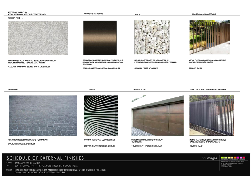
|
Georges
River Council – Local Planning Panel Thursday, 21
November 2019
|
Page 299
|
REPORT TO GEORGES RIVER COUNCIL
LPP MEETING OF Thursday, 21 November 2019
|
LPP Report No
|
LPP055-19
|
Development Application No
|
DA2019/0128
|
|
Site Address & Ward Locality
|
83A Kyle Parade Kyle Bay
Blakehurst Ward
|
|
Proposed Development
|
Alterations and additions to
existing dwelling including internal excavation
|
|
Owners
|
Cai Fu Ming and Qiang En Zhen
|
|
Applicant
|
Cai Qiang c/- Minto Planning
Services Pty Ltd
|
|
Planner/Architect
|
Minto Planning Services/MGA
Architects Pty Ltd
|
|
Date Of Lodgement
|
9/04/2019
|
|
Submissions
|
Nil
|
|
Cost of Works
|
$500,000.00
|
|
Local Planning Panel Criteria
|
Variation of Floor Space Ratio
Development Standard of greater than 10%.
|
|
List of all relevant s.4.15
matters (formerly s79C(1)(a))
|
State Environmental Planning Policy
55 – Remediation of Land State Environmental Planning Policy –
(Infrastructure) 2007,
State Environmental Planning Policy
(Vegetation in Non-Rural Areas ) 2017, State Environmental Planning Policy
BASIX 2004, State Environmental Planning Policy (Coastal Management) 2018,
Kogarah Local Environmental Plan
2012, Kogarah Development Control Plan 2013
|
|
List all documents submitted
with this report for the Panel’s consideration
|
Site Plan - MGA Architects Pty
Ltd, Survey Plan, SurvCheck Surveyors
Statement of Environmental Effects
- Minto Planning Services
Clause 4.6 Variation Submission -
Minto Planning Services
|
|
Report prepared by
|
Consultant Planner
|
|
Recommendation
|
That the application be refused in accordance with the
reasons contained within this report.
|
|
|
Summary of matters for
consideration under Section 4.15
Have all recommendations in relation
to relevant s4.15 matters been summarised in the Executive Summary of the
assessment report?
|
Yes
|
|
Legislative clauses requiring
consent authority satisfaction
Have relevant clauses in all
applicable environmental planning instruments where the consent authority
must be satisfied about a particular matter been listed and relevant
recommendations summarised, in the Executive Summary of the assessment
report?
|
Yes
|
|
Clause 4.6 Exceptions to
development standards
If a written request for a
contravention to a development standard (clause 4.6 of the LEP) has been
received, has it been attached to the assessment report?
|
Yes
- Variation to Floor Space Ratio Standard
|
|
Special Infrastructure
Contributions
Does the DA require Special
Infrastructure Contributions conditions (under s7.24)?
|
Not
Applicable
|
|
Conditions
Have draft conditions been provided
to the applicant for comment?
|
No,
the application is recommended for refusal. The refusal reasons can be
viewed when the report is published
|
|
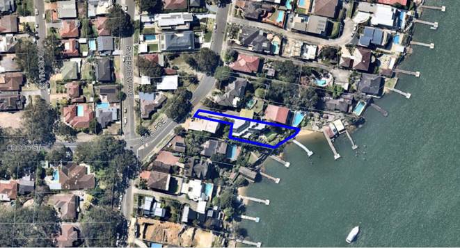
Site Plan – allotment outlined in blue.
|
Executive Summary
Proposal
1. The
development application seeks development consent for additions and alterations
to an existing multi-level terraced dwelling house (325sqm floors pace) in the
form of a semi-basement excavated development accommodating both habitable and
non-habitable floors pace which will exceed the permissible Floor Space Ratio
applicable to the land.
Site and Locality
2. The
application applies to land known as 83A Kyle Parade, Kyle Bay and legally
described as Lot 2 in DP 505481. The site is a battle-axe allotment located on
the eastern side of Kyle Parade, 100m north east of the intersection with
Riverview Avenue and Cross Street. The site has a 5.325m frontage to Kyle
Parade and the eastern boundary directly fronts Kyle Bay. The land has a total
site area of 872.6sqm and slopes to the street to Kyle Bay.
3. Adjoining
the site to the north and south and opposite to the west are existing one and
two storey dwelling houses. These dwellings are a mixture of older style brick
and tile homes along with modern/contemporary dwellings up to 3 or 4 storeys.
4. The
site is affected by a Foreshore Building Line restriction of 15m from the Mean
High Water Mark (MHWM). It is noted that the proposed works are located behind
the existing building on site therefore not encroaching upon the 15m setback
from the MHWM.
Zoning and Permissibility
5. The
subject site is zoned R2 - Low Density Residential, the proposed development is
defined as a “Dwelling house” in Kogarah Local Environmental
Plan 2012 (KLEP). The proposal is a permissible form of development with
Council’s consent.
Submissions
6. No
public submissions were received at the close of the public exhibition period
or at the time this report was prepared (6 November 2019).
Reasons for
Referral to the Local Planning Panel
7. This
application is referred to the Local Planning Panel for determination as the
proposal seeks a variation of the Floor Space Ratio (FSR) development standard
applicable to the land of greater than 10%, as referenced in the 9.1
Ministerial Direction of 23 February 2018.
Planning and
Design Issues
8. The
proposal fails to provide an adequate Clause 4.6 submission to justify the
necessity for the variation of the Kogarah LEP2012 requirement for Floor Space
Ratio. The proposal seeks to vary the 0.478:1 (417sqm) standard to 0.59:1
(517sqm) being a variation of 24%. The proposal is also considered to be
inconsistent with Objective (a) of Clause 4.4 Floor Space Ratio relating to
unreasonable intensity of development.
9. The
proposal fails to provide adequate information relating to the carrying out and
management of excavation of the land having regard to the location of services
in proximity to the proposed works and the treatment/transfer of any
contaminated soil, identified with high Copper levels, from the site. The
proximity of the proposed excavation works to neighbouring lands, warrants
preparation of dilapidation reports. It is acknowledged if the development was
to be supported these reports would be required as a condition of consent.
10. The
proposal will involve construction of large new retaining walls and also
replacement of existing structural support beams and walls of the dwelling,
however, no details have been provided on the structural nature of these walls
and the management of drainage around the walls during and post the works.
11. The
proposal has not provided a Soil and Sedimentation Plan or Stormwater
Management Plan for the control of drainage runoff during and post
construction, into Kyle Bay.
Conclusion
12. The
application has been assessed having regard to the Matters for Consideration
under Section 4.15 of the Environmental Planning and Assessment Act 1979, the
provisions of the relevant State Environmental Planning Policies, Local
Environmental Plan and Development Control Plans. The following deficiencies
have been identified:
a. The
proposal does not provide a satisfactory Clause 4.6 Variation submission to
address the variation of the Clause 4.4A Floor Space Ratio development standard
by 24% and is inconsistent with the Floor Space Ratio Objective 4.4.(a)
relating to unreasonable intensity of development.
b. The
Construction Methodology Report does not adequately address the excavation
construction works, considering the likely impacts on existing services, need
for disposal/treatment of contaminated soil and the potential structural
impacts on the existing neighbouring housing.
c. The
proposal lacks a Soil and Sedimentation Plan and Stormwater Management Plan for
the control of quality and quantity of runoff into Kyle Bay.
d. The
lack of structural detail provided to address the staging of construction of
significant new retaining walls and structural beams and drainage works
required to service the retaining walls.
Report in Full
PROPOSAL
13. Council
is in receipt of an application seeking approval for the additions and
alterations to an existing dwelling house with internal excavation works over
four (4) levels. The proposed works are illustrated in Figures 2 and 3 below
and specifically relate to:
Demolition:
Demolition of
existing internal walls, the creation of new openings in external walls
resulting from the additional floor area following excavation.
Existing
Dwelling Additions
Level 1:
Excavation behind
the existing Rumpus/Spa area to accommodate new storage rooms, bathroom,
theatre with a passageway to the new lift.
Level 2:
Excavation behind
existing bedrooms, bathroom and WC to accommodate a new study, lift, lobby and
extension of the existing guest bedroom.
Level 3:
Excavation behind
existing kitchen, dining and lounge to accommodate a bathroom, store room and
lift installation.
Level 4:
Installation of
the new lift as part of entry foyer level.
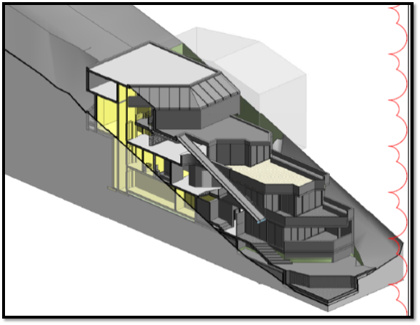
Figure
2: Proposed Development (Source:
MGA Architects, 2019).
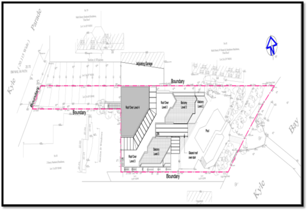
Figure 3:
Proposed site and roof plan, (Source: MGA Architects, 2019).
THE SITE AND
LOCALITY
14. The
site is identified as Lot 2 DP 505481 being 83A Kyle Parade, Kyle Bay. The site
is located on the eastern side of Kyle Parade approximately 100m north east of
the intersection between Kyle Parade, Cross Street and Riverview Avenue. The
locality is generally residential in character of various scale and form.
15. The
site is battle-axe shaped allotment with a 5.325m frontage to Kyle Parade, a
80.465m northern side boundary adjoining 79 and 81 Kyle Parade, a 30.48/37.015m
southern side boundary and 12.04m western boundary adjoining 83 Kyle Parade and
the eastern boundary directly fronts Kyle Bay. The land has a total site area
of 872.6sqm.
16. Existing
on site is a multi-level rendered and painted masonry dwelling, outdoor
swimming pool and a jetty. The site is landscaped and this will not be impacted
by the proposal.
17. The
site, excluding the access driveway handle, has a fall of 12.122m
measured from the south west corner of the boundary (RL 13.171) to the rear
boundary (RL 1.049), being the Kyle Bay frontage over a distance of 37m
(1:3).
18. The
site is affected by a Foreshore Building Line restriction of 15m from the Mean
High Water Mark (MHWM). It is noted that the proposed works are located behind
the existing building on site therefore not encroaching upon the 15m setback
from the MHWM.
19. Adjoining
the site to the north and south and opposite to the west are existing one and
two storey dwelling houses. These dwellings are a mixture of older style brick
and tile homes along with modern contemporary dwellings being 3 or 4 storeys.
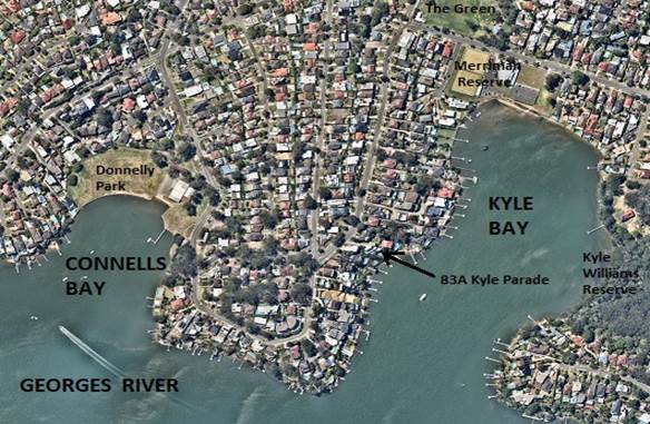
Figure 4:
Aerial Locality Plan for 83A Kyle Parade, (Source: Nearmaps, 2019)
20. The
subject land is located approximately 500m south of Merriman Reserve, The
Green, Connells Point Public School and Connells Point Sailing Club. The
property is approximately 1.5km from the intersection between Terry Street and
King Georges Road where bus services are available between Hurstville, Rockdale
and Sutherland Shire.
BACKGROUND
21. There
are no recent relevant applications pertinent to this allotment.
22. Council
on 23 May 2019 initially raised issues relating to exceedance of the
permissible floor space ratio (FSR), dimensioning of the floor plans and
adequacy of the Construction Methodology Report.
23. Applicant
lodged additional information in response to these issues on 15 July 2019.
STATE ENVIRONMENTAL
PLANNING POLICIES (SEPP)
24. Compliance with the relevant state
environmental planning policies is summarised in the table, and discussed in
more detail below.
|
State
Environmental Planning Policy
|
Complies
|
|
Greater
Metropolitan Regional Environmental Plan No 2 – Georges River Catchment
|
No
|
|
State
Environmental Planning Policy (Building Sustainability Index: BASIX) 2004
|
Yes
|
|
State
Environmental Planning Policy No 55 - Remediation of Land
|
No
|
|
State Environmental
Planning Policy (Infrastructure) 2007
|
Yes
|
|
State Environmental Planning Policy (Vegetation in Non-Rural
Areas) 2017
|
Yes
|
|
State Environmental Planning Policy (Coastal Management) 2018
|
Yes
|
Greater
Metropolitan Regional Environmental Plan No 2 – Georges River Catchment
25. The main aims and objectives of
this plan are (not limited to);
· to maintain and improve the water quality and river flows
of the Georges River and its tributaries and ensure that development is managed
in a manner that is in keeping with the national, State, regional and local
significance of the Catchment,
· to protect and enhance the environmental quality of the
Catchment for the benefit of all users through the management and use of the
resources in the Catchment in an ecologically sustainable manner,
· to ensure consistency with local environmental plans and
also in the delivery of the principles of ecologically sustainable development
in the assessment of development within the Catchment where there is potential
to impact adversely on groundwater and on the water quality and river flows
within the Georges River or its tributaries,
· to establish a consistent and coordinated approach to
environmental planning and assessment for land along the Georges River and its
tributaries and to promote integrated catchment management policies and
programs in the planning and management of the Catchment,
26. The application is not accompanied
by a concept stormwater plan and the application relies upon the existing
stormwater system servicing the existing dwelling. The works will involve
extensive excavation works and construction of new retaining walls requiring
suitable drainage. No Soil and Sedimentation Plan has been lodged in support of
the proposal and is required to ensure the quality of runoff draining into Kyle
Bay is acceptable and appropriately controlled.
27. The proposal is considered to be
inconsistent with the aims, objectives and purpose of the Regional Plan.
State
Environmental Planning Policy (Building Sustainability Index: BASIX) 2004
28. BASIX Certificate No.A268083_04
dated 31 March 2019 prepared by Max Brightwell has been issued for the proposed
development and the development can meet the provisions and minimum
requirements of BASIX in terms of water, thermal comfort and energy efficiency.
State
Environmental Planning Policy No 55 - Remediation of Land
29. SEPP 55 aims to promote the
remediation of contaminated land in order to reduce the risk of harm to human
health or any other aspect of the environment.
30. Clause 7 requires contamination and
remediation to be considered in determining a development application. The
consent authority must not consent to the carrying out of development on land
unless it has considered whether or not the land is contaminated.
31. A review of the site history
indicates that the site has been used for residential purposes for extended
periods of time, and such uses and/or development are not typically associated
with activities that would result in the contamination of the site. The Soil
Contamination and Waste Classification Screening Report that accompanies the
application, prepared by JK Environments, identifies a high level of Copper
contaminant at the site. In this regard, no further assessment was warranted
with regard to site contamination subject to any soil removed being suitably
disposed of at appropriately licensed facilities. If this application was to be
support than an appropriate condition could be imposed to address this issue.
Draft
Remediation of Land SEPP
32. The Department of Planning and
Environment has announced a Draft Remediation of Land SEPP which will repeal
and replace the current State Environmental Planning Policy No 55 —
Remediation of Land.
33. The main changes proposed include
the expansion of categories of remediation work which requires development
consent, a greater involvement of principal certifying authorities particularly
in relation to remediation works that can be carried out without development
consent, more comprehensive guidelines for Councils and certifiers and the
clarification of the contamination information to be included on Section 149
Planning Certificates.
34. Whilst the proposed SEPP will
retain the key operational framework of SEPP 55, it will adopt a more modern
approach to the management of contaminated land. The Draft SEPP will not
alter or affect the findings in respect to contamination of the Site. Should
the application be approved appropriate conditions should be included in
respect to any potential Copper contaminated soil or asbestos removal and an
unexpected finds condition would ensure that if any trace of contamination is
found appropriate measures in accordance with EPA requirements are implemented.
State
Environmental Planning Policy (Vegetation in Non-Rural Areas) 2017
35. The Vegetation SEPP regulates
clearing of native vegetation on urban land and land zoned for environmental
conservation/management that does not require development consent.
36. The Vegetation SEPP applies to clearing of:
(a) Native vegetation above the Biodiversity Offset
Scheme (BOS) threshold where a proponent will require an approval from the
Native Vegetation Panel established under the Local Land Services Amendment Act
2016; and
(b) Vegetation below the BOS threshold where a proponent
will require a permit from Council if that vegetation is identified in the
council’s development control plan (DCP).
37. The Vegetation SEPP repeals clause
5.9 and 5.9AA of the Standard Instrument - Principal Local Environmental Plan
with regulation of the clearing of vegetation (including native vegetation)
below the BOS threshold through any applicable DCP.
38. The proposed development does not
involve the removal of trees or vegetation.
State
Environmental Planning Policy (Coastal Management) 2018
39. SEPP (Coastal Management) 2018
updates and consolidates three SEPPs (SEPP 14 Coastal Wetlands, SEPP 26
Littoral Rainforests, SEPP 71 Coastal Protection) into one integrated Policy
and is a matter for consideration for the current DA.
40. Under SEPP (Coastal Management)
2018, the subject site is mapped as a Coastal Environment area and a Coastal
Use area. These have the following management objectives under the SEPP:
(a) to protect and enhance the coastal environmental
values and natural processes of coastal waters, estuaries, coastal lakes and
coastal lagoons, and enhance natural character, scenic value, biological
diversity and ecosystem integrity,
(b) to reduce threats to and improve the resilience of
coastal waters, estuaries, coastal lakes and coastal lagoons, including in
response to climate change,
(c) to maintain and improve water quality and estuary
health,
(d) to support the social and cultural values of
coastal waters, estuaries, coastal lakes and coastal lagoons,
(e) to maintain the presence of beaches, dunes and
the natural features of foreshores, taking into account the beach system
operating at the relevant place,
(f) to maintain and, where practicable, improve
public access, amenity and use of beaches, foreshores, headlands and rock
platforms.
41. The following is an assessment of
the matters for consideration listed under the SEPP as applicable to the
Coastal Environment Area and Coastal Use Area.
|
SEPP Control
|
Proposal
|
Complies
|
|
13. Development on land within
the coastal environment area
|
|
|
|
(1) Development consent must not be granted
to development on land that is within the coastal environment area unless the
consent authority has considered whether the proposed development is likely
to cause an adverse impact on the following:
|
|
|
|
(a) the integrity and resilience of the biophysical,
hydrological (surface and groundwater) and ecological environment,
|
Surface water runoff is proposed to
be managed in accordance with the existing stormwater drainage, direct to
Kyle Bay, which presently services the dwelling. The proposed excavation and
retaining wall treatments have not been addressed as part of the management
of stormwater runoff.
|
No – see discussion below
|
|
(b) coastal environmental values and natural coastal
processes,
|
|
(c) the water quality of the marine estate (within
the meaning of the Marine Estate Management Act 2014), in particular, the
cumulative impacts of the proposed development on any of the sensitive
coastal lakes identified in Schedule 1,
|
The site is not located on any of
the sensitive coastal lakes identified in Schedule 1.
|
Not applicable
|
|
(d) marine vegetation, native vegetation and fauna
and their habitats, undeveloped headlands and rock platforms,
|
An ecologist report has not been
submitted to address the impact upon native flora and fauna, the connectivity
to the Georges River foreshore, geological features or hydrology/water
quality.
A detailed assessment cannot be
carried out as insufficient information has been provided relating to the
control and discharge of stormwater.
|
No – see discussion below
|
|
(e) existing public open space and safe access to and
along the foreshore, beach, headland or rock platform for members of the
public, including persons with a disability,
|
The subject site is privately owned
and there is no public access to Georges River.
|
Yes
|
|
(f) Aboriginal cultural heritage, practices and
places,
|
The site is not known as a place of
Aboriginal significance. There is no impact in terms of Aboriginal heritage.
|
Yes
|
|
(g) the use of the surf zone.
|
The development is not located near
the surf zone.
|
Not applicable
|
|
(2) Development consent must not be granted
to development on land to which this clause applies unless the consent
authority is satisfied that:
|
|
|
|
(a) the development is designed, sited and will be
managed to avoid an adverse impact referred to in subclause (1), or
|
The existing dwelling on the land
is located within the coastal environment area. The proposed
works will create potential sedimentation and poor water quality impacts. The
proposal in its current form is not supported.
|
No – see discussion below
|
|
(b) if that impact cannot be reasonably
avoided—the development is designed, sited and will be managed to
minimise that impact, or
|
|
(c) if that impact cannot be minimised—the
development will be managed to mitigate that impact
|
|
14
Development on land within the coastal use area
|
|
|
|
(1) Development consent must not be granted
to development on land that is within the coastal use area unless the consent
authority:
|
|
|
|
(a) has considered whether the
proposed development is likely to cause an adverse impact on the following:
|
|
|
|
(i) existing, safe access to and along the foreshore, beach, headland
or rock platform for members of the public, including persons with a
disability,
|
The proposed development does not
provide public access to the Georges River.
|
Not applicable
|
|
(ii) overshadowing, wind funnelling
and the loss of views from public places to foreshores,
|
There are no unreasonable
overshadowing impacts generated by the proposal on public places or the
foreshore/waterways. It should be noted there are currently no views from the
public domain to the waterways that would be impacted by this proposed
development.
|
Yes
|
|
(iii)the visual amenity and scenic qualities of the coast, including
coastal headlands,
|
The proposal has no impact on the
visual quality when viewed from the waterways.
|
Yes
|
|
(iv)Aboriginal cultural heritage, practices and places,
|
The property is not a known site of
Aboriginal heritage.
|
Yes
|
|
(v) cultural and built environment
heritage, and
|
The site does not contain or adjoin
any heritage items.
|
Yes
|
|
(b) is satisfied that:
|
|
|
|
(i) the development is designed, sited and will be
managed to avoid an adverse impact referred to in paragraph (a), or
|
The proposal is not supported in
its current form. The proposal has a number of issues with regards to works
associated with the development works.
A detailed assessment can’t
be carried out as insufficient information has been provided.
|
No
|
|
(ii) if that impact cannot be reasonably avoided—the
development is designed, sited and will be managed to minimise that impact,
or
|
|
(iii) if that impact cannot be minimised—the development
will be managed to mitigate that impact, and
|
|
(c) has taken into account the surrounding coastal and
built environment, and the bulk, scale and size of the proposed development.
|
Development is non-compliant with
regards to Floor Space Ratio and Gross Floor Area development standard. The
proposed modified dwelling is considered excessive in bulk and scale and does
not satisfy built form controls and objectives in Kogarah Local Environmental
Plan and Kogarah Development Control Plan.
|
No
|
42. Generally, the proposed development
is consistent with the management objectives of the SEPP. However, the
application is not supported by documentation addressing the impact upon
threatened native flora and fauna, the connectivity to the Georges River
foreshore, geological features and hydrology/water quality.
43. A detailed assessment cannot be
undertaken as insufficient information has been provided.
ENVIRONMENTAL
PLANNING INSTRUMENTS
Kogarah Local
Environmental Plan 2012 (KLEP)
44. The
subject site is zoned R2 - Low Density Residential and the proposed development
is defined as a “Dwelling house” in KLEP 2012. The proposal
is a permissible form of development with Council’s consent. The proposed
development satisfies the objectives of the zone as follows:
Objectives of R2
Zone
· To
provide for the housing needs of the community within a low density residential
environment.
· To
enable other land uses that provide facilities or services to meet the day to
day needs of residents.
45. The
subject application seeks to increase the floor space within the existing four
bedroom dwelling and will not result in any additional housing in this
locality. The additions provide for storage space, increase in size of the
existing guest bedroom, new toilets/bathrooms, lift installation throughout and
a new study and theatre.
46. The
proposal will not accommodate any other land uses which would provide
facilities or services for the residents.
47. The
proposal, being a residential improvement, is considered to be consistent with
the objectives.
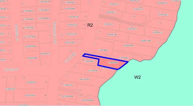
Figure
5: Zoning map of 83a Kyle Parade (Source:
Intramaps, 2019)
48. The
table below addresses the proposed development against the relevant provisions
of the Kogarah Local Environmental Plan:
Part 2 - Permitted or
prohibited development
|
Applicable LEP Clause
|
Standards
|
Proposal
|
Complies
|
|
2.7 Demolition
requires development consent
|
The demolition of a building or
work may be carried out only with development consent.
|
Proposed partial demolition of walls
to facilitate site excavation.
|
Yes
|
Part 4 - Principal Development
Standards
|
Applicable LEP Clause
|
Standards
|
Proposal
|
Complies
|
|
4.1B Minimum lot size for dual occupancies
|
(2)
Despite clause 4.1, development consent must not be granted for the erection
of a dual occupancy on a lot unless:
(a) the
lot is at least the minimum lot size shown on the Lot Size for Dual Occupancies Development Map in
relation to that land,
The Minimum Lot size requirement is
1000m²
|
The proposal does not seek to
develop a Dual Occupancy. The lot is 872.6sqm in area and would not achieve
the lot area requirement.
|
Yes as the application is not
seeking works to create a Dual Occupancy.
|
|
4.3 Height of Buildings
|
(2)
The height of a building on any land is not to exceed the maximum height
shown for the land on the Height of
Buildings Map - 9.0m
|
The proposal seeks no increase in
height of the existing dwelling. The new lift has been designed so there is
no mechanical plant on the roof.
|
Yes.
|
|
4.4 Floor Space Ratio
|
The objectives
of this clause are as follows:
(a) to ensure
the intensity of development is compatible with the desired future character
and zone objectives for the land,
(b) to limit the bulk and scale of
development.
|
The proposal seeks an increase in
permissible FSR by 24%. This raises concern with the overall intensity
of the development.
|
No (1)
|
|
4.4A Floor Space Ratio
|
(2) The floor space ratio for residential
accommodation on land in Zone R2 Low Density Residential is not to exceed the
maximum floor space ratio calculated as 0.478:1
|
The proposal seeks a Floor Space
Ratio of 0.59:1, representing a non-compliance of 24% or 100sqm.
|
No (1)
|
|
4.6 Exceptions to development standards
|
(3) Development consent must
not be granted for development that contravenes a development standard unless
the consent authority has considered a written request from the applicant
that seeks to justify the contravention of the development standard by
demonstrating:
(a) that compliance with
the development standard is unreasonable or unnecessary in the circumstances
of the case, and
(b) that there are
sufficient environmental planning grounds to justify contravening the
development standard.
(4) Development consent must
not be granted for development that contravenes a development standard
unless:
(a) the consent
authority is satisfied that:
(i) the
applicant’s written request has adequately addressed the matters
required to be demonstrated by subclause (3), and
(ii) the proposed
development will be in the public interest because it is consistent with the
objectives of the particular standard and the objectives for development
within the zone in which the development is proposed to be carried out, and
(b) the concurrence of
the Secretary has been obtained.
(5) In deciding whether to
grant concurrence, the Secretary must consider:
(a) whether
contravention of the development standard raises any matter of significance
for State or regional environmental planning, and
(b) the public benefit
of maintaining the development standard, and
(c) any other matters
required to be taken into consideration by the Secretary before granting
concurrence.
|
The proposal is accompanied by a
Clause 4.6 variation to support the breach of the Floor Space Ratio standard
under Clause 4.4A.
|
No (2)
|
Part 5 - Miscellaneous Provisions
|
Applicable LEP Clause
|
Standards
|
Proposal
|
Complies
|
|
5.7 Development below mean high water mark
|
(1) The objective of this
clause is to ensure appropriate environmental assessment for development
carried out on land covered by tidal waters.
(2) Development consent is
required to carry out development on any land below the mean high water mark
of any body of water subject to tidal influence (including the bed of any
such water).
|
The proposal does not involve works
below the Mean High Water Mark.
|
Yes
|
|
5.10 Heritage Conservation
|
(2) Requirement for consent Development consent is
required for any of the following:
(a) demolishing
or moving any of the following or altering the exterior of any of the
following (including, in the case of a building, making changes to its
detail, fabric, finish or appearance):
(i) a
heritage item,
(ii) an
Aboriginal object,
(iii) a
building, work, relic or tree within a heritage conservation area,
|
The subject land is not identified
as being a Heritage Item or within a Conservation Area.
|
Yes
|
|
5.11 Bush Fire Hazard
Reduction
|
Bush fire hazard reduction work authorised by the Rural Fires
Act 1997 may be carried
out on any land without development consent.
|
The subject land is not within a
bush fire prone area.
|
Yes
|
Part 6 - Additional Local Provisions
|
Applicable LEP Clause
|
Standards
|
Proposal
|
Complies
|
|
6.1 Acid Sulfate Soils
|
(2) Development consent is required for the carrying
out of works described in the Table to
this subclause on land shown on the Acid Sulfate
Soils Map as being of the class specified for those works.
|
The proposal results in
considerable excavation into the slope. The land is not identified as being
within Acid Sulfate Soil areas.
|
Yes
|
|
6.2 Earthworks
|
(2) Development consent is
required for earthworks unless:
(a) the earthworks are
exempt development under this Plan or another applicable environmental
planning instrument, or
(b) the earthworks are
ancillary to development that is permitted without consent under this Plan or
to development for which development consent has been given.
(3) Before granting
development consent for earthworks (or for development involving ancillary
earthworks), the consent authority must consider the following matters:
(a) the likely
disruption of, or any detrimental effect on, drainage patterns and soil
stability in the locality of the development,
(b) the effect of the
development on the likely future use or redevelopment of the land,
(c) the quality of the
fill or the soil to be excavated, or both,
(d) the effect of the
development on the existing and likely amenity of adjoining properties,
(e) the source of any
fill material and the destination of any excavated material,
(f) the likelihood of
disturbing relics,
(g) the proximity to,
and potential for adverse impacts on, any waterway, drinking water catchment
or environmentally sensitive area,
(h) any appropriate
measures proposed to avoid, minimise or mitigate the impacts of the
development.
|
The proposal will result in
excavation to accommodate the new built form. No details have been provided
relating to the quantities of excavated materials involved or extent of
works. It is noted in the Construction Report that the excavation will be
undertaken by hand only, as the site constraints are such that machinery
cannot access the area where the work is to take place.
Excavation works will be undertaken
in the south-western corner of the allotment where it is noted that a sewer
line and stormwater lines are located, see Figure 4, below.
No assessment of the likely impacts
associated with the excavation material on the land, neighbouring lands or
the waterway has been lodged with the application.
|
No (3)
Inadequate information has been
submitted detailing the volume of excavated material, sedimentation/
siltation controls, detail on the condition of the existing boundary/side
walls and a plan of existing services that may be impacted.
|
|
6.3 Flood planning
|
(2) This clause applies to:
(a) land identified as
“Flood planning area” on the Flood Planning Map, and
(b) other land at or
below the flood planning level.
|
The subject land is not identified
as being flood prone land or it being a flood affected lot.
|
Yes
|
|
6.4 Limited development on foreshore area
|
(2) Development consent must
not be granted to development on land in the foreshore area except for the
following purposes:
(a) the extension,
alteration or rebuilding of an existing building wholly or partly in the
foreshore area,
(b) the erection of a building
in the foreshore area, if the levels, depth or other exceptional features of
the site make it appropriate to do so,
(c) boat sheds, sea
retaining walls, wharves, slipways, jetties, works to enable pedestrian
access to the waterway, swimming pools, fences, cycleways or walking trails.
(3) Development consent must
not be granted under this clause unless the consent authority is satisfied
that:
(a) the development will
contribute to achieving the objectives for the zone in which the land is
located, and
(b) the appearance of
any proposed structure, from both the waterway and adjacent foreshore areas,
will be compatible with the surrounding area, and
(c) the development will
not cause environmental harm such as:
(i) pollution or
siltation of the waterway, or
(ii) an adverse effect
on surrounding uses, marine habitat, wetland areas, fauna and flora habitats,
or
(iii) an adverse effect
on drainage patterns,
|
The existing development in the
site is forward of the foreshore building line, however the proposed works do
not result in any of the additions being within this part of the site.
Rock outcrops are to be removed as
part of the excavation.
The works will result in new
excavation of top soil/fill to accommodate new retaining walls which will
disturb existing soil and potentially result in siltation or sedimentation
concerns. The proposal was not supported by a Sedimentation & Soil
Control Plan for the construction period or onwards.
|
Yes (4)
Note: Works are proposed which will
result in excavation below existing built form and the excavation has the
potential to result in sedimentation and slope instability for the subject and
neighbouring lands.
|
(1) Clause 4.4A
- Floor Space Ratio
49. The
proposed development seeks a total Floor Space Ratio (FSR) of 0.59:1, being
517sqm, whilst the KLEP2012 restricts the FSR to 0.478:1, being 417sqm,
resulting in a non-compliance of 100sqm equating to 24%. The Applicant has
submitted a Clause 4.6 submission to vary the development standard relating to
the permissible FSR which is assessed below.
50. Consideration
is given to the objectives for Floor Space Ratio (FSR) under Clause 4..4 below:
The objectives of this clause are as follows:
(a) to ensure the intensity of development is compatible with
the desired future character and zone objectives for the land,
(b) to
limit the bulk and scale of development.
51. The
proposal seeks an FSR of 0.59:1 which equates to a breach of 24% or 100sqm, in
excess of the permissible FSR of 0.478:1. The exiting dwelling has a calculated
floor space of 325sqm being 0.373:1. The proposal is for an additional 192sqm,
being a 59% increase in floor space. This additional floor space,
although not increasing the bedroom numbers, proposes a significant increase in
the guest bedroom size, as well as two additional large habitable rooms, a
study and theatre. Concerns are raised that the residential use will be intensified
due to the scale and form of the additions, which undermine the objective of
the controls with respect to scale and density. On this basis the proposal is
considered to be inconsistent with the Clause 4.4 objectives.
52. Although
the majority of the proposed floor space will be obscured from public view the
justification for the addition non-complying floor space is not substantiated.
With regard to the proposed works the following is noted:
· The
original property previously had no discernible storage areas whilst the
current proposal will provide approximately 80sqm of storage area, equivalent
to a standard two bedroom unit. Of this storage space approximately 52.5sqm
will be calculated as FSR with the remainder being under the existing ground
level. This represents over 50% of the non-complying FSR will be for storage
purposes.
· The
proposed theatre which is greater than 50sqm in area (equivalent to a one
bedroom unit) and an extension to the existing guest bedroom to be now 38sqm in
area (existing Bedrooms 2 and 3 total only 28sqm combined) are considered to be
excessive in area for their general purposes.
· The
size of the works, the areas of certain rooms and the accessibility of
individual levels by external stairs raises concerns at the potential for the
proposed development to be utilised as a dual occupancy, requiring only minor
modifications to include a kitchenette. This is only of concern as the
requirement for lot area for a dual occupancy in this location is 1000sqm
whereas the subject land is 872.6sqm.
· Had
the original application for the dwelling sought the proposed 0.59:1 FSR it is
likely that a different building form would have been designed to accommodate
the floor space where a minimum of basement floor space would be proposed. On
this basis it is considered that the proposed amendment to the approved
dwelling is not the most appropriate form for a dwelling on a sloping site.
53. Any
assessment of the intent and objective of the development standard must have
regard to the definitions for Gross Floor Area (GFA), Floor Space
Ratio (FSR) and Basement and their wording to ascertain what form of
building is proposed, see below:
gross floor area means the sum of the floor area of each
floor of a building measured from the internal face of external walls, or from
the internal face of walls separating the building from any other building,
measured at a height of 1.4 metres above the floor, and includes:
(a) the area of a mezzanine, and
(b) habitable rooms in a basement or an attic,
and
(c) any shop, auditorium, cinema, and the like,
in a basement or attic,
but excludes:
(d) any area for common vertical circulation,
such as lifts and stairs, and
(e) any basement:
(i) storage, and
(ii) vehicular access, loading areas, garbage
and services, and
(f) plant rooms, lift towers and other
areas used exclusively for mechanical services or ducting, and
(g) car parking to meet any requirements of
the consent authority (including access to that car parking), and
(h) any space used for the loading or unloading
of goods (including access to it), and
(i) terraces and balconies with outer
walls less than 1.4 metres high, and
(j) voids above a floor at the level of a
storey or storey above.
And
The floor space ratio of buildings on a site is the ratio of
the gross floor area of all buildings within the site to the site area.
And
basement means the space of a building where the floor
level of that space is predominantly below ground level (existing) and where
the floor level of the storey immediately above is less than 1 metre above
ground level (existing).
54. The
term basement clearly applies to works taking place below the existing ground
level and the intent of the Gross Floor Area (GFA) definition is to limit this
area of basement to service activities generally, being storage and car
parking. It was not the intent or purpose of the GFA or FSR or basement
definitions to encourage large areas of service activities or active habitable
rooms in a basement environment. In this instance the guest room extension, new
study and new theatre (totalling approximately 100sqm) are predominantly
assessed as being at basement level and normally would not be considered
acceptable within a basement, see Figure 6 below. In this particular instance
the Applicant has dismissed any restriction under these definitions by claiming
that the lack of added external bulk and minimal environmental amenity concerns
are adequate justification for the variation of the FSR development standard.
55. It
is reasonable to assume that had the Applicant sought the 0.59:1 FSR as part of
the original dwelling-house approval, that a vastly different building design
would have resulted.
56. It
is concluded that insufficient information and justification has been lodged
with the subject application to justify the large variation of permissible FSR
as proposed, equating to a 24% breach. A simple statement that the works are
not visible and thus have minor amenity impacts relating to bulk and visual
appearance is not adequate justification to vary the FSR standard to such a
degree and provide a “precedent” decision. This ideology undermines
the objectives of the clause.
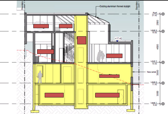
Figure 6:
Cross Section of proposed works with ground level shown as RED dotted line
(Source: Application plans)
(2) Clause 4.6
Exceptions to Development Standards
57. The
modified application was supported by a Clause 4.6 Development Standard
variation request. In this instance the variation request is considered
inadequate, particularly having regard to the matters raised at (1)
above.
58. Minto
Planning Services, by submission dated 15 July 2019, has responded to the FSR
non-compliance by relying upon the following :
· The proposed dwelling alterations and additions will not
result in any discernible increase in the bulk and scale of development, given
that the additions are wholly located within and below the existing building
footprint, and as such the dwelling in my opinion will remain compatible with
the size of the lot.
· The proposed dwelling alterations and additions will
promote good residential amenity in that:
o There will be no external impacts upon the amenity of
adjoining properties resulting from the proposed dwelling alterations and
additions, particularly in relation to a loss of privacy, overshadowing or loss
of outlook or views.
o The proposal will result in improved amenity for the
residents of the subject dwelling as a result of improved internal access and
facilities.
· The proposal is consistent with the objectives of the R2 -
Low Density Residential Zone in that the proposal will continue to ensure that
the site provides for the housing needs of the community within a low density
residential environment through the provision of a single dwelling house which
maintains its existing height, bulk and scale.
59. With
regard to the form and content of the Clause 4.6 Variation submission it is
considered to be an adequate submission addressing the relevant provisions,
objectives and local amenity. The review of the submission, however, concludes
that the submission does not adequately justify the intent and purpose of the
works and the necessity for the substantial increase in FSR.
60. The
conclusions reached by the Applicant relating to:
· the
bulk and scale of the building being visibly unaltered; and
· the
proposals compliance with the objectives of Clause 4.6; and
· the
proposals compliance with the objectives for the R2 Low Density Residential
Zone;
are concurred
with on the basis that the works are carried out to the rear of the existing
residence and are unlikely to be visible to the public, apart from additional
openings, windows/doors, within the existing building façade.
61. With
regard to the objectives under Clause 4.6 it is contended that the proposal is
not consistent with Objective (b):
(b) to achieve better outcomes for and from
development by allowing flexibility in particular circumstances.
As the proposed
works are not considered to be achieving a better outcome of development of the
land through an unjustified increase in the permissible Floor Space Ratio.
59. With
regard to the proposals compliance with the objectives for Clause 4.4A below:
(a) to ensure that the bulk and scale of
development are compatible with the size of the lot, and
(b) to
promote good residential amenity.
The proposal is
considered to be inconsistent. The bulk and scale of the building will appear
unaltered, however, the additions would result in more than one third of the
buildings floor space being located below, or partially below ground, including
three habitable rooms, a theatre, study and the extended guest room. These
rooms will have minimal amenity, ie natural light, air circulation, yet are
rooms of significant size for rooms of a secondary nature, indeed the extended
guest room is proposed to be almost three times larger than the existing second
and third bedrooms.
60. It
is contended that the bulk and scale, although not visually apparent, creates
an undesirable outcome for a single dwelling house by creating a potential
precedent where a major portion of a home can be located underground simply on
the basis that it has not added external bulk. In this instance, the proposal
seeks to partly utilise areas that were excavated and unfinished in the
original building form, but are supporting the structure, as well as excavate
further to accommodate the additional floor space. If this variation request is
supported an argument is evident for a building to be designed to step down the
slope on suspended slabs, rather than utilising the slope/bedrock to anchor the
building, and then seek a building modification to fill in the suspended areas,
similarly to the subject proposal. This approach would then circumvent any
possible disputes relating to bulk and scale objectives compliance for a
non-complying FSR as part of an original application.
61. The
proposal seeks an FSR of 0.59:1 (517sqm) on an allotment of 872.6sqm on the
waterfront, whereas the general expectancy for development in this locality
would be 0.478:1 (417sqm), being 100sqm (equivalent to a large 2 bedroom unit)
in excess of the standard. This is an excessive non-compliance of the FSR
standard with minimal justification provided for the need/demand for the
additional floor space.
62. The
design and form of the development, with stair access (internal/external) as
well as lift access, could provide opportunity for multiple occupancy of the
building in the future. Level 1 (accommodating two bathrooms) could
readily be converted for sole occupancy unit with the installation of cooking
facilities and utilising external stair access. These concerns have not been
adequately resolved in the design and the supporting documentation.
63. The
Clause 4.6 variation relies on compliance with one of the five justifications
expressed in the Land and Environment Court decision of Wehbe –v-
Pittwater City Council (2007) which set down criteria to justify a
variation under State Environmental Planning Policy No 1 (Development
Standards) which has been replaced in Planning Instruments by the standard
Clause 4.6. The principals espoused in the Appeal do however, remain relevant
for consideration. The Applicant’s reliance on the first justification
that:
(a) the objectives of the
development standard are achieved notwithstanding non-compliance with the
standard
Remains
questionable as, although the works will not result in increased bulk and scale
of the existing dwelling, it promotes a building form that would perpetuate
similar building proposals. Approval of the subject development would encourage
applications for a building form that presses the outer limits of building
envelopes normally not designed for, particularly on sloping land. This design
outcome would then enable lodgement of new applications to fill in undercroft
areas and exceed the permitted FSR controls, further undermining the relevance
of that standard. Or the excavation of rock outcrops or natural feature of the
site to facilitate additional floor space without impacting externally, this is
not the intent of the clause.
64. Pursuant
to Clause 4.6(5) of KLEP2012 the matter involves a variation of 24% and the
Secretary’s’ consideration of this extent of variation has been
delegated to the Local Planning Panel. Therefore the Panel is required to
consider the matters for consideration by the Secretary. In this instance
the following is relevant:
(b) the public
benefit of maintaining the development standard, and
65. It
is Council’s active policy to generally seek compliance with the
development standards applicable and a variation of 24% is considered beyond
the norm. Approval of the subject proposal would create an unacceptable and
unjustified precedent to vary the standard in this foreshore area. This would
be an undesirable outcome notwithstanding that the majority of the works would
not be readily visible. A stringent application of the FSR standard in this
instance ensures a building form, scale and design that is compatible with
housing generally and which does not take undue advantage of the slope of the
foreshore lands.
66. On
the basis of the arguments expressed above, the Clause 4.6 submission is not
acceptable and would result in an undesirable precedent in building form that
would undermine the intent of the development standard as it applies to the
foreshore area.
67. The
recent Land and Environment Court decision (Initial Action v Woollahra
Municipal Council the NSW Land and Environment Court established a “five
part test” for consent authorities to consider when assessing a clause
4.6 request for variation. These are set out below, together with commentary in
respect of the proposed development.
|
1. the
objectives of the standard are achieved notwithstanding non-compliance with
the standard;
|
Comment: This has been
addressed in the points above.
Although works will not result in
increased bulk and scale of the existing dwelling, it promotes a building
form that would perpetuate similar building proposals. Approval of the
subject development would encourage applications for a building form that
presses the outer limits of building envelopes normally not designed for,
particularly on sloping land. In addition it will seek to remove natural
features which are inconsistent with the LEP objectives.
|
|
2. The
underlying objective or purpose of the standard is not relevant to the
development and therefore compliance is unnecessary;
|
Comment:
The proposed works are accommodated beneath the existing dwelling and
excavated into the hillside, resulting in works that do not significantly add
to the original bulk and scale of the dwelling. The purpose of standard is to
control the bulk and scale of built form, particularly in foreshore locations
due to impacts on views, loss of natural features and visual impact from
waterways. The proposal, in isolation, is unlikely to result in impacts of
this nature; however, support of the unjustified increased FSR sets a
precedent for bulkier building forms on sloping sites. Had the proposed FSR
been sought as part of original dwelling house approval the building form
would have been vastly different and the non-complying FSR could have been
relevant grounds for a refusal.
|
|
3. The
underlying object or purpose would be defeated or thwarted if compliance was
required and therefore compliance is unreasonable;
|
Comment:
The underlying object or purpose of the control will not be thwarted or
defeated if compliance is achieved. Compliance with the standard
is reasonable and may be achievable through possible modification of the
layout design, including reconsideration of the suitability of the excavated
area for habitable floor space and/or the reduction in size of the habitable
rooms.
|
|
4. The
development standard has been virtually abandoned or destroyed by the
council’s own actions in granting
consents
departing from the standard and hence compliance with the standard is
unnecessary and unreasonable;
|
Comment:
No evidence of the abandonment of the standard by Council has been submitted
by the Applicant. Council has continued to pursue development
compliance with the FSR standard.
|
|
5. The
compliance with development standard is unreasonable or inappropriate due to
existing use of land and current environmental character of the particular
parcel of land. That is, the particular parcel of land should not have been
included in the zone.
|
Comment:
The subject land is foreshore frontage low density residential land and the
FSR standard application to the land is most appropriate. No evidence has
been submitted by the Applicant to support an argument that the particular
land should not have been included in the zone. It is relevant that
this development standard has particular application to foreshore lands as a
means to control bulk, scale and form, and protection of the nature features
to ensure protection of local amenity and to restrict development form
to an acceptable scale for all.
|
(3) Clause 6.2
Earthworks
68. The
proposal will result in excavation to accommodate the new built form. No details
have been provided relating to the quantities of excavated materials involved
or the extent of works proposed. It is noted in the Construction Report that
the excavation will be undertaken by hand only as the site constraints are such
that machinery cannot access the area where the excavation is to take place.
The objective of this clause is to ensure that earthworks for which
development consent is required will not have a detrimental impact on
environmental functions and processes, neighbouring uses, cultural or heritage
items or features of the surrounding land.
69. The
subject proposal is considered to be inconsistent with this objective as it has
not adequately addressed impacts on neighbouring lands with regard to services
and general amenity, including method of disposal of excavated material/fill
and identification of existing essential services.
70. Excavation
works will be undertaken in the south-west corner of the allotment where it is
noted that a sewer line and stormwater lines are located, see Figure 7 below.
Figure 7:
Servicing of the subject land and neighbours (Source: Intramaps)
71. No
assessment of the likely impacts associated with the excavation of material on
the land, neighbouring lands or the waterway have been lodged with the
application. It is evident that the proposed works will directly impact the
location of the sewer line and potentially the stormwater line.
72. Also
of relevance for consideration are the matters raised at 6.2(3):
(a) the likely disruption of, or any detrimental effect on,
drainage patterns and soil stability in the locality of the development,
(b) the effect of the development on the likely future use
or redevelopment of the land,
(c) the quality of the fill or the soil to be excavated, or
both,
(d) the effect of the development on the existing and
likely amenity of adjoining properties,
(e) the source of any fill material and the destination of any
excavated material,
(f) the likelihood of disturbing relics,
(g) the proximity to, and potential for adverse impacts
on, any waterway, drinking water catchment or environmentally sensitive area,
(h) any appropriate measures proposed to avoid, minimise or
mitigate the impacts of the development.
73. The
subject proposal and supporting documentation have failed to adequately address
the matters at (a), (d), (e), and (h) as they relate to earthworks.
74. On
the basis of this lack of excavation detail, the application is deficient in
addressing potential amenity/environment impacts. Should the application be
approved then appropriate “Deferred Commencement” conditions are
recommended to be included which require a detailed assessment of the
excavation works and manner of disposal of excavated material is required, as
well as a standard requirement for Dilapidation reports for neighbouring
properties.
(4) Clause 6.4
Limited Development on Foreshore Area
75. The
subject land is partially affected by the Foreshore Area, however, proposed
works will not be undertaken directly within the Foreshore Area, being the land
restricted to between Mean High Water Mark and the 15m foreshore building line,
see Figure 7 above.
76. The
proposed building works will result in new excavation of top soil/fill/basement
rock outcrop to accommodate new retaining walls which will disturb existing
soil and potentially result in siltation or sedimentation concerns. The
proposal was not supported by a Sedimentation & Soil Control Plan for the
construction period or onwards.
77. Works
result in excavation below the built form which could result in sedimentation
and slope stability issues for the subject and neighbouring lands.
Kogarah
Development Control Plan – 2013 (KDCP)
74. The
proposed development is subject to the provisions of Kogarah Development Control
Plan - 2013. The following comments are made with respect to the proposal
considering the objectives and controls contained within Kogarah DCP 2013.
C1- Low Density
Housing
|
1. Design Requirements
|
|
Control
|
Requirement
|
Proposal
|
Complies
|
|
1.1
Streetscape Character
|
1. A Streetscape Character Analysis
(SCA) must be submitted as part of any Development Application for the
following:
• new dwellings
• alterations to the front
elevation and/or two level additions to an existing dwelling
• attached dual occupancy
• detached dual occupancy
2. The SCA should comprise an
analysis of both the existing streetscape and the future desirable
streetscape.
|
The proposal does not modify the
dwelling at the street front as the allotment is a battle axe lot.
|
Yes
|
|
1.2 Building Scale and Height
|
|
1.2.1
Floor space Requirements
|
(1) The floor space ratio for
dwelling houses must comply with the requirements in the table below:
Site Area: Greater than 800sqm Less
than or equal to 1000sqm
Maximum FSR: (Site Area –
800) x 0.2 + 402.5
(3) Notwithstanding compliance with
the numerical requirements in Table 1, applicants must demonstrate that the
bulk and relative mass of the proposed development is acceptable in the
street and on adjoining dwellings, in terms of the following impacts:
(i) streetscape considerations
(bulk and scale);
(ii) building setbacks;
(iii) landscape requirements;
(iv) the existence of significant
trees/vegetation on site;
(v) the size and shape of the
allotment; and
(vi) topography of the site.
(4) Where alterations and additions
are proposed, and the existing floor space and/or floor space ratio of the
development exceeds the maximum requirements, the application will be
considered on merit. In these circumstances, Council will not support any increase
in the floor area of the development unless it is satisfied that the
development will meet the overall objectives of this Part.
(5) Blank walls and flat facades
should be avoided. Walls longer than 10m should be articulated by a minimum
300mm projection or indentation in the façade.
(6) The overall building should
present a building mass that is in proportion with the allotment size,
provides opportunities for modulation and articulation of the building and
does not detract from the satisfaction of any other applicable design
principle.
(7) Where proposed development
includes a two (2) residential level element, then the second level should
not extend beyond 60% of the depth of the allotment measured from the street
boundary. Where side boundaries are of varying length, the second level is
limited to a line across the block between the points on both boundaries.
|
Based upon the formula the
permissible FSR is 0.478:1. The proposal seeks an FSR of 0.59:1
The proposed works will not impact
upon the streetscape values of the locality as works are primarily below the
built form within the subject land which is a battle axe allotment.
The proposal seeks a variation of
the permissible FSR and therefore the application will be considered on its
merits, including general amenity issues and environmental impacts. A clause
4.6 variation has been lodged and assessed earlier in this report as being
unsupportable.
|
Yes
|
|
1.2.2 Building Heights
|
(1) The maximum building height
must comply with the requirements specified in table below:
Dwelling Type
Single dwelling; Dual occupancy;
Attached secondary dwelling.
Maximum Height
7.2m to the underside of the upper
ceiling;
7.8m to the top of the parapet;
9m to the top of the ridge (pitched
roof).
(2) The maximum number of
residential levels is two (2), except where the site has a slope exceeding
1:8 (12.5%), where the maximum number of residential levels is three (3).
(3) Regardless of the number of
levels, the maximum height of the building must be consistent with the
maximum height requirements.
(4) Foundation areas, garages,
basements, storage rooms or the like must not have an external wall height
greater than 1m above ground level (existing) at any point on the building.
(5) Where the dominant built form
in the streetscape is single level, new buildings and alterations and
additions should present as a single level building to the street. Any second
level element is to be setback a minimum of 10m from the street boundary.
(6) Council may, at its discretion,
approve an attic within dwelling houses provided that such development meets
the overall height requirements.
(7) The habitable area in an attic
is included as gross floor area for the purposes of determining the floor
space ratio.
(8) Where an attic is proposed, the
roof must have a pitch of between 30 degrees and 40 degrees and the attic
space:
(i) must be wholly within the roof
space;
(ii) must be designed to comply
fully with the building height; and
(iii) may only project beyond the
roof plane in the form of a traditional or non-traditional dormer, depending
on the streetscape, and are not to incorporate balconies
(9) Attics are prohibited in flat
roofed developments.
(10) Rooftop terraces are
prohibited in dwelling houses, dual occupancy development and secondary
dwellings.
|
The proposed development does not
propose an extension of the dwelling height and internal modifications appear
to be 7m - 8m in height against existing ground level measurements.
The subject land has a slope
exceeding 1:8, being 1:3 in the area of the works.
Works will not amend the building
height as the lift has been designed so there is no additional height for the
plant.
Acceptable – overall height
remains unaltered.
This remains unclear for the subject
proposal as insufficient sections have been provided to confirm compliance
with the height control. The concept, however, relies on works as floor space
and not basement area
Acceptable as no overall change in
height.
Not applicable.
Not applicable.
Not applicable.
Not applicable.
Not applicable.
|
Yes, as proposal does not alter the
building height but will result in new windows for the study.
|
|
1.2.3 Rhythm of the Built
Elements in the Streetscape
|
(1) The primary building
façade should not exceed 40% of the overall width of the total
frontage.
(2) The secondary building
façade should be set back a minimum of 1.5 metres from the primary
building façade.
(3) Where the dominant built form
in the streetscape provides for a pitched hip or gable ended presentation to
the street, the new buildings and/or additions should reflect that roof form.
|
Not applicable.
Proposal does not result in visible
external building form alterations at street level; the site is a battle axe
allotment.
Not applicable.
Not applicable.
|
Not applicable
|
|
1.2.4 Building Setbacks
|
1.2.4.2 Front Setbacks
(1) Where the setback of an
adjacent building is greater than 5m, an appropriate setback may be achieved
by ensuring development is setback:
(i) the same distance as one or the
other of the adjoining buildings, provided the difference between the
setbacks of the two adjoining buildings is less than or equal to 2.0m (Figure
9); or
(ii) the average of the setbacks of
the two adjoining buildings, if the difference between the setbacks of the
buildings is greater than 2.0m (Figure 10).
(2) Where the setbacks of the
adjacent buildings are 0m-5.0m, an appropriate setback may be achieved by
ensuring development is set back the same distance as one or the other of the
two adjoining dwellings (Figure 11).
(3) Where a development has a
frontage to two (2) streets, then the setback to the secondary street shall
be 1.2m, with the exception of dual occupancy (detached), where the setback
to the secondary street shall be 4.5m.
1.2.4.3 Side & Rear
Setbacks
(1) The side and rear boundary
setbacks should comply with the table below.
Dwelling Type
Single dwelling,
dual occupancy development and
Secondary dwellings (attached to
primary dwelling)
Rear Setback
Buildings are to have a minimum
rear setback of 15% of the average site length, or 6m, whichever is greater.
Where the existing pattern of
development displays an established rear setback, development should
recognise and respond to site features and cross views of neighbouring
properties.
Council may permit a variation to
the rear setback if it can be demonstrated that this will result in the
retention of significant trees or site features, has no adverse impacts on
neighbouring amenity.
Side Setbacks
For buildings having a wall height
of 3.5m or less, the minimum side boundary setback is 900mm.
For buildings having a wall height
of greater than 3.5m, the minimum side boundary setback is 1200mm.
The above numerical requirements
may be varied to ensure side boundary setbacks and building to building
relationships are consistent with those setbacks established within the
streetscape.
Dwelling Type
Secondary dwelling (detached from
primary dwelling)
|
Not applicable.
The proposal does not alter street
front façade as the allotment is a battle-axe lot.
Not applicable
Not applicable
Not applicable.
All works are proposed within or
below the existing building footprint and maintains the side/rear setbacks.
The existing setbacks generally
are:
Level 3 is 1200mm to the northern
boundary.
Level 2 is 900mm to southern
boundary and 1200mm to the northern boundary.
Level 1 internal retaining walls
are setback greater than 1500mm to northern side boundary.
The habitable works for the study
at Level 2 will include an area of wall 4m-8m in height and the Level 3
Theatre area has wall height of 5.5m so both would normally require a setback
of 1200mm, and are thus non-compliant. The plans indicate that no external
façade works will be altered apart from new windows to the study, the
setbacks are existing.
Not applicable as the works are
below the existing built form on site.
Not applicable.
Single dwelling only.
|
Not applicable
|
|
1.2.5 Fenestration and
External Materials
|
(1) New buildings and alterations
and additions should present a primary building façade and roofing
that is constructed of materials, and within a colour range, that is
complementary to the dominant character of buildings in the streetscape.
(2) Garage doors should not
dominate the street front elevation (Figure 16).
(3) The roof should be similar to
the angle of pitch, materials and colour of roofs in the streetscape (Figure
14).
(4) The colours of garages, window
frames, and balustrading on main facades and elevations are to be integrated
with the external design of the building.
(5) Glazing shall be limited to a
maximum 35% of the total area of the overall street front façade. This
includes both primary and secondary façade bays (Figure 15).
(6) Where garaging is in the front
façade it should be limited to a maximum of two garage bays, with
separate garage door openings of a maximum width of 3m.
|
Complies.
Building materials are proposed to
be complimentary to the existing.
Not applicable.
The garage is not proposed to be
altered.
Not applicable.
No roof works proposed. The
mechanical plant for the lift is not proposed to the roof.
Complies.
Building materials are proposed to
be complimentary to those existing.
Complies.
Not applicable.
The site is a battle axe lot.
|
Yes
|
|
1.2.6
Street Edge
|
(1) New developments should provide
front fencing that complements fencing within the streetscape.
(2) Fencing is to be consistent
with the requirements of Section 4.2.
(3) Existing vegetation in the
front building line setback or on the street verge that contributes to the
character of the streetscape should be preserved.
(4) The driveway location should
not result in the removal of any street trees or removal of substantial trees
on the site.
|
Not applicable.
Additions to an existing dwelling.
Not applicable.
Fencing unaltered.
Not applicable.
No impact on existing landscaping.
Not applicable.
No works proposed in the driveway.
|
Not applicable
|
|
1.3 Open Space
|
|
|
(1) 15% of the site area must be
deep soil landscaped area.
(2) Private open space should be
adjacent to and visible from the main living and/or dining rooms and be
accessible from those areas.
(3) Development should take
advantage of opportunities to provide north facing private open space to
achieve comfortable year round use.
(4) Where soil and drainage
conditions are suitable, unpaved or unsealed landscaped areas should be
maximised and designed to facilitate on site infiltration of stormwater.
(5) Existing significant trees and
vegetation must be incorporated into proposed landscape treatment.
|
Not applicable.
Existing open space is unaltered as
part of proposal.
|
Not applicable
|
|
1.4 Vehicular access, parking
and circulation
|
|
|
(1) Car parking is to be provided
in accordance with the requirements in Section B4.
(2) On corner sites with two street
frontages vehicular access should be provided to the secondary frontage.
(3) Garages should be accessed from
a rear lane where this is available.
(4) Crossings are to be positioned
so that on-street parking and landscaping on the site are maximised, and
removal or damage to existing street trees is avoided.
(5) Garaging should be setback
behind the primary façade.
(6) The maximum driveway width
between the street boundary and the primary building façade is 4m.
(7) Where the dominant provision of
garaging within the streetscape is provided to the rear or side of
developments, new developments and additions to existing development should
provide for a side driveway or garaging behind the main street front
elevation of the building.
(8) Basement parking is not
encouraged on flat sites. Garaging should be provided at ground level unless
the slope of the site exceeds 1:8 (12.5%) in which case a basement or
suspended garage may be acceptable.
(9) Where a basement garage is
proposed, the maximum height of the basement above ground level (existing) is
1m measured to the underside of the basement ceiling. Where the basement
exceeds 1m above ground level (existing), the basement will be considered to
be a floor (Figure 17).
Note: Floor means the space within
a building which is situated between one floor level and the floor level next
above or if there is no floor above, the ceiling or roof above.
(10) For basement garages the
maximum amount of excavation is to be limited to required car parking and any
manoeuvring areas, access stairwells, lift wells and storage areas.
(11) Storage areas within basements
or garages must not exceed 10sqm per dwelling (with a minimum width of
500mm).
(12) Car parking layout and
vehicular access requirements and design are to be in accordance with the
Australian Standards, in particular AS 2890.1-2004.
(13) Dual occupancy development
must have only one single fronted garage per dwelling. Where garaging is
required for 2 cars, this must be tandem parking.
|
Not applicable
Existing access and car parking
unaltered.
|
Not applicable
|
|
1.5 Privacy
|
|
1.5.1 Visual Privacy
|
(1) Windows from active rooms are
to be offset between adjacent dwellings so as to avoid direct overlooking
onto neighbouring windows.
(2) Where terraces and balconies
are proposed and are elevated more than 1.5m above ground level (finished)
and are located behind the street front façade, they are restricted to
a maximum width of 2.5m and must be setback a minimum 3m from any adjoining property
boundary.
(3) The area of balconies or
terraces greater than 1.5m above ground level is limited to a cumulative
total of 40sqm per dwelling.
(4) Council may consider a
variation to the above requirements where it is considered that the terrace or
balcony will not result in a loss of privacy to neighbouring properties.
(5) For active rooms or balconies
on an upper level, the design should incorporate placement of room windows or
screening devices to only allow oblique views to adjoining properties
(Figures 18 and 19).
(6) Loss of privacy to neighbouring
properties, as a result of a proposed development, will only be considered
where a variation is sought to the objective or the design solution for floor
space ratio, building height, building envelope, side boundary setbacks,
extent of second level development or size of balcony/terrace.
(7) In these circumstances, Council
will undertake an assessment of the impact of the proposed development on the
neighbouring properties having regard to:
(i) The types of rooms that are
located on the upper levels;
(ii) Whether the rooms are
“active” or “non-active”
(iii) The size and location of
proposed upper level windows, balconies, terraces and any other area
(elevated more than 1500mm above ground level).
(iv) The extent of overlooking onto
neighbouring properties.
(v) Notwithstanding the above,
where rooms on the upper levels are “non-active”, no
consideration will be given with respect to privacy issues.
Active rooms are rooms used for
normal domestic activities and include a living room, lounge room, music
room, television room, dining room, family room, kitchen, playroom, parents
retreat and the like.
Non-active rooms are rooms of a
generally passive nature and include bathroom, laundry, water closet, walk in
wardrobe, bedroom, sewing room and the like.
|
Complies.
The proposal will only include two
new windows to service the proposed new study at level 2. There is no
dwelling existing directly opposite these proposed windows.
Not applicable
Not applicable
Not applicable
Complies.
The proposed windows to the new
study will not adversely impact amenity on neighbouring land or overlook a
dwelling.
Should the application be approved
it is appropriate that a condition be imposed that suitable screening be
required to the new study windows to ensure the long term privacy of the
neighbouring property to the south.
The only room which proposes new
openings is the new study, being two new windows, on Level 2. The new
study is assessed as an “Active Room” which potentially could
result in overlooking of the neighbouring property to the south. If the
proposal was to be supported amelioration measures would need to be
implemented.
|
|
|
1.5.2
Acoustic Privacy
|
Residential development adjacent to
a rail corridor or a busy road should be designed and sited to minimise noise
impacts Refer to requirements in State Environmental Planning Policy –
Infrastructure and the NSW Department of Planning’s Development near
Rail Corridors and Busy Roads – Interim Guidelines.
|
Not applicable.
|
Not applicable
|
|
1.6 Solar Access
|
|
|
(1) At least 50% of the primary
private open space of the proposed development should have access to a
minimum of four hours of sunlight between 9am–3pm on 21 June.
(2) Where private open space is
proposed on the southern side of the building the distance from the southern
boundary of the open space to the nearest wall to the north must be a minimum
of 3m + h, where h is the height of the wall (Figure 20).
(3) Where the neighbouring
properties are affected by overshadowing, at least 50% of the neighbouring
existing primary private open space or windows to main living areas must
receive a minimum of 3 hours sunlight between 9am–3pm on 21 June
(Figure 21).
(4) Shadow diagrams are to be
submitted for the winter solstice (21 June) and the spring equinox (22
September).
(5) Shadow diagrams are required to
show the impact of the proposal on solar access to the open space of
neighbouring properties. Existing overshadowing by fences, roof overhangs and
changes in level should also be reflected in the diagrams.
|
Not applicable.
The proposal will not result in
external works that will overshadow open space areas.
Not applicable.
See comment above.
Not applicable.
See comment above.
No shadow diagrams submitted. The
work is below the existing built form.
See (4) above.
|
Not applicable
|
|
1.7 Views and view sharing
|
|
|
(1) Development shall provide for
the reasonable sharing of views. Note: Assessment of applications will refer
to the Planning Principle established by the Land and Environment Court in
Tenacity Consulting vs Warringah Council (2004) NSWLEC140
|
Not applicable.
Works predominantly underground and
do not add external bulk that would adversely impact views or shared views.
|
Not applicable
|
Variations
78. The
application seeks a variation to the floor space ratio requirement under the Development
Control Plan of 24%, or 100sqm, increasing it from 0.478:1 (417sqm) to 0.59:1
(517sqm).
79. This
non-compliance has been addressed through a request for variation under Clause
4.6 of the Kogarah Local Environmental Plan 2012. An assessment of this
request has been undertaken earlier in this report. The request for variation
of the Floor Space Ratio standard is considered to be unreasonable and
unjustified and approval has the potential to set an undesirable precedent
which could lead to an undermining of the intent of the standard, particularly
for sloping land or the foreshore locality.
Streetscape Character
and Amenity
80. The
proposed development satisfies the objectives and controls within the
development control plan relevant to:
· Building
Scale as constructed above ground,
· Rhythm
of Built Elements in the Streetscape,
· Fenestration
and External Materials, and
· Street
Edge
As
the allotment is a battle axe lot and does not have a streetscape interface.
Open Space
81. The
proposed development does not seek modification to the existing open space as
part of the existing dwelling and generally satisfies the relevant objectives
and controls of the Kogarah DCP.
Vehicular
access, Parking and Circulation
82. The
proposed development does not seek modification to the existing garaging or car
parking as part of the existing dwelling and generally satisfies the relevant
objectives and controls of the KDCP.
Privacy
83. The
proposed development generally satisfies the relevant objectives and controls
of the KDCP. Should the application be approved it is recommended that the new
study windows proposed at Level 2 be required to be screened.
Solar Access
84. The
proposed development does not seek modification to the existing external
building form to increase the existing dwelling bulk and generally satisfies
the relevant objectives and controls of the KDCP.
Views and View
Sharing
85. The
proposed development satisfies the relevant objectives and controls of the
KDCP.
Developer Contributions
86. The
proposed development if approved would not require the payment of developer contributions under Section 7.12 of the
Environmental Planning and Assessment Act 1979 as the proposal does not
increase the density of the locality.
Impacts
Natural Environment
87. The
proposed works will not directly impact the visible natural environment with
the built form, apart from new southern façade windows to the study, but
will indirectly impact the environment through excavation works and drainage
management. Insufficient detail has been provided on the extent of the
excavation works and the disposal of spoil associated with that excavation. The
site investigation undertaken has identified that soil used as fill associated
with the original dwelling construction has copper concentrations above the
recommended safety levels and this will warrant implementation of due safety
actions for removal and disposal which have not been detailed within the
submission
88. The
application proposes no specific drainage/stormwater runoff controls apart from
relying on the existing system servicing the existing house, including drainage
direct to Kyle Bay. The soil to be excavated is identified as being high in
copper concentrations and this will drain to the Bay along with stormwater
captured by the proposed retaining wall system. No details have been submitted to
identify how water will be collected and disposed of from the retaining walls
or how it will be treated before release into the Bay.
89. The
information submitted does not allow for a detailed assessment of the site and
works. Accordingly the application is recommended for refusal.
Built Environment
90. The
proposal seeks to maximise the area of land that can be excavated for the
expansion of the dwelling, in this instance back to the foundation walls.
The proposal will result in a dwelling of 517sqm, some 100sqm above the
permissible floor space, resulting in an FSR of 0.59:1 and a non-compliance of
24%. A Clause 4.6 Objection was submitted in support of the non-compliance but
is considered to be inadequate.
91. The
bulk and scale of the building is acceptable as it provides for floor space
expansion primarily within the undercroft and basement area and will only be
partly visible from neighbouring lands. The primary building form
planning concern relates to the long term management of the floor space usage
where large storage areas and submerged habitable floor space is proposed and
have potential for alternative use in an undesirable amenity environment.
The proposal is thus recommended for refusal.
Social Impact
92. No
adverse social impacts have been
identified as part of the assessment. However, the built form is not an
appropriate outcome for the site.
Economic Impact
93. The
proposed development has no apparent adverse economic impact.
Suitability of the site
94. The site is zoned R2 Low Density Residential. The proposal is a permissible land use
within the zone, subject to development consent.
95. The development does not satisfy the floor space
ratio permitted for the site. The proposed development is not of a scale
and character that is in keeping with other dwellings being constructed in the
locality. Accordingly, the proposal is considered to have an adverse impact on
the natural and built environment of the foreshore locality. As discussed
throughout this report, although the proposal will result in the majority of
development taking place below or partially below ground level, the Applicants
justification for the need of an excessive non-compliance with the standard,
being 24% or 100sqm, is not substantiated.
96. The
works will not result in traditional amenity concerns relating to increased
bulk, additional overshadowing, view loss or overlooking (some potential
overlooking may occur as a result of new windows for the proposed new study at
Level 2). In this particular instance the primary issue relates to the
undermining of the FSR development standard and how it relates to development
on sloping land generally. It is concluded that the subject proposal is a
deliberate attempt to circumvent the FSR standard through manipulation of the
slope of the land whilst dismissing the consideration of the
“basement” definition as part of the “Gross Floor Area”
assessment.
97. Although
the proposal does not unreasonably add external bulk to the dwelling by
utilising undercroft and excavated areas, the outcome will result in a dwelling
with approximately 33% of its floor space being below or partially below ground
level, which is not considered to be the intent of the “Gross Floor
Area” “Basement” or “Floor Space Ratio” definitions.
If the same outcome were proposed for a dwelling on a level site it is unlikely
that such a proposal would be supportable due to overall amenity concerns and
accessibility.
98. It
is considered that the proposed development is not of a scale and design that
is suitable for the site having regard to its size and shape, its topography,
vegetation and relationship to adjoining developments and the lack of adequate
justification supporting a significant FSR variation.
SUBMISSIONS
AND PUBLIC INTEREST
99. The
application was neighbour notified in accordance with Kogarah DCP and no public
submissions were lodged at the close of notification or at the time this report
was being prepared (6 November 2019).
REFERRALS
Council
Referrals
100. No
referrals were required as the application as for additions to an existing
dwelling relying on existing servicing arrangements and no vegetation was to be
impacted. In addition there was not stormwater or waste management plan
submitted for assessment.
External
Referrals
Ausgrid
101. The
application was referred to Ausgrid in accordance with Clause 45 of the State
Environmental Planning Policy (Infrastructure) 2007. No formal response was
provided in the prescribed time.
CONCLUSION
102. The
proposal has been assessed using the maters for consideration listed in Section
4.15 of the Environmental Planning and Assessment Act 1979. The
documentation supporting the application does not adequately address the
stormwater/drainage management, soil contamination treatment/disposal,
structural details for the retaining walls and drainage, and the proposal to
vary the permissible FSR has not been adequately justified.
103. The
proposed development fails to justify the floor space control standards
variation and does not provide an adequate Clause 4.6 Exceptions to
Development Standards submission to address the variation under the
provisions of KELP2012 to justify and support the non-compliance. The
application does not adequately address the definitions for Gross Floor
Area, Basement and Floor Space, as addressed previously in this report, and
therefore fails to satisfy the provision and requirements of Clause 4.6 of the
Kogarah Local Environmental Plan 2012.
104. The
proposed development has failed to adequately address the relevance and
application of clause 6.2 Earthworks and clause 6.4 Limited
development on foreshore area as it relates to these works in the
residential zone,
DETERMINATION
105. THAT
pursuant to Section 4.15(1)(b) of the Environmental Planning and Assessment Act
1979, and the provisions of the Kogarah Local Environmental Plan and Kogarah
Development Control Plan the Georges River Local Planning Panel as the consent
authority pursuant to Section 4.16 (1)(b) Environmental Planning and Assessment
Act 1979, refuse Development Application No.2019/0128 for additions and
alterations to an existing dwelling house with internal excavation works over
four (4) levels at Lot 2 DP 505481 and known as 83A Kyle Parade, Kyle Bay, for
the following reasons:
1. Environmental
Planning Instrument - Pursuant to Section 4.15 (1)(a)(i) of the
Environmental Planning and Assessment Act 1979, the proposed development does
not comply with the following sections of Kogarah Local Environmental Plan
2012:
a. Clause
2.3 - Zone Objectives (R2 Low Density Residential);
b. Clause
4.4 – Floor Space Ratio objectives relating to increased intensity;
c. Clause
4.4A – Exceptions to floor space ratio for residential accommodation in
Zone R2, having regard to the extent of variation sought;
d. Clause
4.6 – Exceptions to development standards, having regard to lack of
adequacy in justifying the need for standard variation;
e. Clause
6.2 – Earthworks, having regard to lack of detail on volume of material,
location of disposal and treatment during excavation/transport;
f. Clause
6.4 – Limited development on foreshore area, having regard to potential
for sedimentation and soil impacts on foreshore and waterway.
2. Development
Control Plan – Pursuant to Section 4.15 (1)(b) of the Environmental
Planning and Assessment Act 1979, the proposed development is likely to have an
adverse impact on the following aspects of the environment:
a) Building
form – The proposal would result in an undesirable building form where
approximately 33% of building floor space is located below existing grounds
level. This would set an undesirable precedent for similar forms of
development;
b) Built
environment – An adverse impact is likely to result from the proposed
development on the amenity of adjoining premises.
c) Social
impacts – An adverse impact would result from the proposed development on
the acoustic amenity of the locality and adjoining commercial/residential
premises.
3. Impact
on the Environment – Pursuant to Section 4.15 (1)(b) of the
Environmental Planning and Assessment Act 1979, the proposed development is
likely to have an adverse impact on the following aspects of the environment:
a) Built
Environment: An adverse impact would result from the proposed development on
the amenity of adjoining premises relating to building bulk and overlooking and
impacts upon existing services;
b) Social
Impacts: An adverse impact would result from the proposed development on the
amenity of the locality and adjoining neighbours and general expectations for a
residential building form in the foreshore area;
4. Suitability
of the Site – Pursuant to Section 4.15 (1)(c) of the Environmental
Planning and Assessment Act 1979, the proposed development is not considered to
be suitable for the site or its locality and is likely to set an undesirable
precedent.
5. Public
Interest – Pursuant to Section 4.15 (1)(e) of the Environmental
Planning and Assessment Act 1979, the proposed development is not considered to
be in the public interest and is likely to set an undesirable precedent.
ATTACHMENTS
|
Attachment ⇩1
|
Site Plan - 83A Kyle Parade Kyle Bay
|
|
Attachment ⇩2
|
Survey Plan - 83A Kyle Parade Kyle Bay
|
|
Georges
River Council - Georges River Local Planning Panel (LPP) - Thursday, 21
November 2019
LPP055-19 83A Kyle Parade Kyle Bay
[Appendix
1] Site Plan - 83A Kyle
Parade Kyle Bay
|
Page 326
|
|
Georges
River Council - Georges River Local Planning Panel (LPP) - Thursday, 21
November 2019
LPP055-19 83A Kyle Parade Kyle Bay
[Appendix
2] Survey Plan - 83A
Kyle Parade Kyle Bay
|
Page 327
|
|
Georges
River Council – Local Planning Panel Thursday, 21
November 2019
|
Page 342
|
REPORT TO GEORGES RIVER COUNCIL
LPP MEETING OF Thursday, 21 November 2019
|
LPP Report No
|
LPP056-19
|
Development Application No
|
DA2018/0577
|
|
Site Address & Ward Locality
|
72 Connells Point Road South
Hurstville
Blakehurst Ward
|
|
Proposed Development
|
Alterations and additions to the
South Hurstville RSL Club
|
|
Owners
|
South Hurstville RSL Club Limited
|
|
Applicant
|
South Hurstville RSL Club Limited
|
|
Planner/Architect
|
Architect - Axil Architects Pty Ltd
|
|
Date Of Lodgement
|
19/12/2018
|
|
Submissions
|
No submissions received
|
|
Cost of Works
|
$746,570.00
|
|
Local Planning Panel Criteria
|
Development requiring a club
licence under the Registered Clubs Act 1976 as referenced in the 9.1
Ministerial Direction of 28 February 2018.
|
|
List of all relevant s.4.15
matters (formerly s79C(1)(a))
|
State Environmental Planning Policy
No 55 - Remediation of Land, State Environmental Planning Policy (Vegetation in
Non-Rural Areas) 2017, State Environmental Planning Policy (Infrastructure)
2007,
Greater Metropolitan Regional
Environmental Plan No 2 – Georges River Catchment,
Hurstville Local Environmental Plan
2012, Hurstville Development Control Plan No 1
|
|
List all documents submitted
with this report for the Panel’s consideration
|
Architectural plans
Comments from NSW Police
Traffic impact assessment
|
|
Report prepared by
|
Development Assessment Planner
|
|
Recommendation
|
That the application be approved in accordance with the
conditions included in this report.
|
|
|
Summary of matters for
consideration under Section 4.15
Have all recommendations in relation
to relevant s4.15 matters been summarised in the Executive Summary of the
assessment report?
|
Yes
|
|
Legislative clauses requiring
consent authority satisfaction
Have relevant clauses in all
applicable environmental planning instruments where the consent authority
must be satisfied about a particular matter been listed and relevant
recommendations summarised, in the Executive Summary of the assessment
report?
|
Yes
|
|
Clause 4.6 Exceptions to
development standards
If a written request for a
contravention to a development standard (clause 4.6 of the LEP) has been
received, has it been attached to the assessment report?
|
Not
Applicable
|
|
Special Infrastructure
Contributions
Does the DA require Special
Infrastructure Contributions conditions (under s7.24)?
|
Not
Applicable
|
|
Conditions
Have draft conditions been provided
to the applicant for comment?
|
No,
however the applicant will be able to review the conditions when the report
is published.
|
|
Site Plan
Allotment outlined in blue
|
Executive
Summary
Proposal
1. Development
consent is sought for the alterations and additions to the existing South
Hurstville RSL.
2. More specifically
the works to the ground floor include, the extension of the entry awning,
refurbishment of the entry steps and ramp, enclosing the existing loading dock
area, extension of the terrace towards Connells Point Road, increasing the size
of the bistro, removal of the existing war memorial, removal of the gaming and
TAB area. The first floor additions will accommodate the new administration offices,
small terrace and new gaming and TAB area. The first floor alterations include
the removal of two (2) function rooms and its replacement with the gaming area,
outdoor gaming terrace and reduced store room. The built form will remain two
(2) storeys and have similar site coverage as the existing development albeit
additional bulk at the first floor level.
3. There are changes
proposed to the last approved hours of operation. The most recent approval that
mentions operating hours is from 1982 (D.A. 133/82), which prescribes hours of
operation of:
· Monday to Friday -
11:00am to 11:00pm,
· Saturday - 10:00am
to 12:00am,
· Sunday –
10:00am to 11:00pm.
4. The Statement of
Environmental Effects states that the hours of operation for the club are now proposed
to be:
· Monday - 10am to
11pm;
· Sunday, Tuesday
and Wednesday – 10am to midnight; and
· Friday and
Saturday - 10am to 1am (the following day).
5. This
change to the approved hours of operation is discussed and assessed in the body
of the report.
Site and
Locality
6. The site is
identified as 72 Connells Point Road, South Hurstville with a legal description
of Lot 100, DP 1114788. The allotment is an irregular
shaped lot with dual frontage to Connells Point Road (68.63m) and The Mall
(50.65m), with an area of 3111.00sqm. The subject site slopes towards the
intersection of Connells Point Road and The Mall.
7. Existing on the site is South Hurstville RSL and associated
parking, landscaped area and an existing war memorial (Councils has approved a
new war memorial within the existing carpark under DA2018/0301). This is
nominated on the plans as garden, therefore there is no impact on car parking.
Figure 1 – Site plan of approved War Memorial at South Hurstville RSL72 Connells
Point Road, South Hurstville
8. There is an existing brick building on the north corner of
the site that is being used as a restaurant separate to the RSL Club. Both the
RSL Club and the brick building are on the Deposited Plan registered in 2008.
No works are proposed to this brick building.
9. The locality surrounding the subject site contains a
mixture medium and low density residential development and a range of
commercial premises.
Zoning and
Permissibility
10. The site is zoned B2 – Local
Centre under the Kogarah Local Environmental Plan 2012 (LEP) and the proposal
is a permissible form of development with Council’s consent. The proposed
development satisfies all relevant objectives contained within the LEP.
Submissions
11. The application was notified for a
period of fourteen (14) days starting from 21 January 2018. No submissions were
received.
Reason for Referral to the Local Planning Panel
12. This DA is referred to the Georges
River Local Planning Panel for determination on the basis that the alterations
and additions to the club will require a new club licence due to the relocation
of the gaming and bar area.
Conclusion
13. The application has been assessed
having regard to the Matters for Consideration under Section 4.15 of
the Environmental Planning and Assessment Act 1979, the provisions of the
relevant State Environmental Planning Policies, Local Environmental Plans and
Development Control Plans. The application is recommended for approval subject
to suitable conditions.
Report in Full
Proposal
14. The development application seeks
consent for the alterations and additions to an established Club known as the
South Hurstville RSL. This venue offers food, drink, gaming and associated
activities. There will be no proposed changes to the hours of operation.
15. Further details of the proposal are
as follows:
· Ground
Floor
o The
existing ground floor TAB and gaming area will be relocated for lounge areas,
o The
outdoor terrace will be extended to the boundary of the western corner,
o Extension
of the bistro area in the space between the existing kitchen and the new
outdoor terrace,
o Addition
over the awning over the loading dock and extension of the awning over the
entry on the north west elevation,
o Relocation
of external stairs near the loading dock
o Removal
of the partitions in the entry area,
· First
Floor
o The
function room on the eastern corner and administrational offices will be opened
up through the removal of walls and this area is to be fitout out as the
outdoor gaming terrace, garden, store and a roof over the loading dock:
o The
function room on the north east boundary will become an outdoor gaming terrace
and a garden,
o Additional
first floor area that will include a new TAB (relocated from the ground floor)
and TAB smoking area, 3 offices and a CCTV and server room,
16. The hours of operation are proposed
to be;
· Monday
– 10:00am to 11:00pm,
· Tuesday
to Thursday – 10:00am to 12:00am,
· Friday
to Saturday – 10:00am to 1:00am (the following morning).
17. It is acknowledged that hours of
operation are considered to be “existing” from the applicant
however the most recent approval (D.A. 133/82) stated that the approved hours
of operation were:
· Monday to
Friday - 11:00am to 11:00pm,
· Saturday - 10:00am
to 12:00am,
· Sunday –
10:00am to 11:00pm.
The Site and
Locality
18. The site is identified as 72
Connells Point Road, South Hurstville and has a legal description of Lot 100, DP 1114788.
19. The
allotment is an irregular shaped site with dual frontage to Connells Point Road
(68.63m) and The Mall (50.65m), with an area of 3111.00sqm. The subject site
slopes towards the intersection of Connells Point Road and The Mall.
20. Existing
on the site is South Hurstville RSL and associated parking, landscaped area and
existing war memorial (Councils has approved a new war memorial within the
existing carpark under DA2018/0301 – see figure 1 above).
21. The
locality surrounding the subject site contains a mixture medium and low density
residential development and a range of commercial premises. Immediately to the
north east of the site is mixed use development, adjacent to the north-west is
a petrol station, and adjacent to the north east and south east boundary is
residential development within the B2 – Local Centre and R3 –
Medium density zone. King Georges Road is located in close proximity towards
the north of the subject site.
22. Photos of the surrounding area are
provided as follows:
Figure
2 - Existing Landscaped area and War
Memorial – 72 Connells Point Road, South Hurstville
Figure 3
- Area of site subject to DA2018/0301, regarding construction of New War
Memorial – 72 Connells Point Road, South Hurstville
Figure
4 – Existing entrance and
parking lot for South Hurstville RSL Club
Figure
5 – Existing Bistro Area inside
South Hurstville RSL Club
Figure
6 – Existing function room on
the First Floor – 72 Connells Point Road, South Hurstville
Applicable
Planning Controls
State Environmental Planning Policies (SEPPs)
23. Compliance with the relevant SEPPs
is summarised in the following table and discussed in further detail below it.
|
SEPP Title
|
Complies
|
|
Greater
Metropolitan Regional Environmental Plan No 2 – Georges River Catchment
|
Yes
|
|
State
Environmental Planning Policy No 55 - Remediation of Land
|
Yes
|
|
State Environmental Planning Policy (Vegetation in Non-Rural
Areas) 2017
|
Yes
|
|
State Environmental Planning Policy (Infrastructure) 2007
|
Yes
|
Greater Metropolitan Regional Environmental Plan No 2 – Georges
River Catchment
24. The primary relevant aims and
objectives of this plan are:
· to
maintain and improve the water quality and river flows of the Georges River and
its tributaries and ensure that development is managed in a manner that is in
keeping with the national, State, regional and local significance of the
Catchment,
· to
protect and enhance the environmental quality of the Catchment for the benefit
of all users through the management and use of the resources in the Catchment
in an ecologically sustainable manner,
· to
ensure consistency with local environmental plans and also in the delivery of
the principles of ecologically sustainable development in the assessment of
development within the Catchment where there is potential to impact adversely
on groundwater and on the water quality and river flows within the Georges
River or its tributaries,
· to
establish a consistent and coordinated approach to environmental planning and
assessment for land along the Georges River and its tributaries and to promote
integrated catchment management policies and programs in the planning and
management of the Catchment
25. The stormwater design was referred
to Council’s Development Engineer for review. It is proposed to direct
stormwater from the new covered areas to the existing stormwater system on
site. No objection was raised with respect to the management and disposal
of stormwater subject to the imposition of conditions of consent.
26. In summary, the proposal will not
contravene the aims, objectives or purpose of the Regional Plan subject to the
imposition of those conditions recommended by the Development Engineer.
State Environmental Planning Policy No 55 - Remediation of Land (SEPP
55)
27. SEPP 55 aims to promote the remediation of
contaminated land in order to reduce the risk of harm to human health or any
other aspect of the environment.
28. Clause 7 requires contamination and remediation
to be considered in determining a DA. The consent authority must not consent to
the carrying out of development on land unless it has considered whether or not
the land is contaminated.
29. A review of the site history indicates that the
site has been used for South Hurstville RSL since at least 1956 – as
indicated in a DA approved in 1982 which indicated that the previous use of the
site was a “registered club”. Accordingly, the site has been used
for purposes of a registered club during this time. This usage is not typically
associated with activities that would result in the contamination of land.
30. The proposed development will not involve major
excavation and the building footprint will remain mostly consistent with the
existing site coverage. The proposed alterations and additions will involve
works within the existing footprint, as well as minimal disturbance to existing
paved areas (such as car parking area etc.).
31. The application was also referred to
Council’s Environmental Health Officer who raised no objection in this
regard.
32. On this basis, there is no impediment to
approval of the DA under SEPP 55. However a condition has been recommended with
respect to unexpected finds should contamination be experienced during
excavation/construction.
State Environmental Planning Policy (Vegetation in Non-Rural Areas)
2017
33. The Vegetation SEPP aims to
protect the biodiversity values of trees and other vegetation in non-rural areas
of the State, and to preserve the amenity of non-rural areas of the State
through the preservation of trees and other vegetation.
34. The Vegetation SEPP applies to clearing of:
(a) Native vegetation above the Biodiversity Offset
Scheme (BOS) threshold where a proponent will require an approval from the
Native Vegetation Panel established under the Local Land Services Amendment Act
2016; and
(b) Vegetation below the BOS threshold where a
proponent will require a permit from Council if that vegetation is identified
in the council’s development control plan (DCP).
35. The Vegetation SEPP repeals clauses 5.9 and
5.9AA of the Standard Instrument - Principal Local Environmental Plan with
regulation of the clearing of vegetation (including native vegetation) below
the BOS threshold through any applicable DCP.
36. The proposal will result in a small vegetated
area on the southern corner, where the existing war memorial is located, being
removed, and this is to be re-located under a separate approval issued by
Council (DA2018/0301).
37. There is no significant vegetation that is
proposed to be removed from the site and it does not conflict with the
Vegetation in Non-Rural Areas SEPP.
State Environmental Planning Policy
(Infrastructure) 2007
38. The aim of the Infrastructure SEPP is to
facilitate the effective delivery of infrastructure across the State. The
infrastructure SEPP also contains a number of clauses requiring assessment if
the site is located on a main road (such as King Georges Road), and these clauses
do not apply to this development. The DA is generally consistent with the
provisions of the Infrastructure SEPP 2007 as there is adequate servicing of
the site that can be extended to service the new works.
Draft State
Environmental Planning Polices
Draft Environment SEPP
39. The Draft Environment SEPP was
exhibited from 31 October 2017 to 31 January 2018. This consolidated SEPP
proposes to simplify the planning rules for a number of water catchments,
waterways, urban bushland, and Willandra Lakes World Heritage Property.
40. Changes proposed include
consolidating the following seven existing SEPPs:
· State
Environmental Planning Policy No. 19 – Bushland in Urban Areas
· State
Environmental Planning Policy (Sydney Drinking Water Catchment) 2011
· State
Environmental Planning Policy No. 50 – Canal Estate Development
· Greater
Metropolitan Regional Environmental Plan No. 2 – Georges River Catchment
· Sydney
Regional Environmental Plan No. 20 – Hawkesbury-Nepean River (No.2-1997)
· Sydney
Regional Environmental Plan (Sydney Harbour Catchment) 2005
· Willandra
Lakes Regional Environmental Plan No. 1 – World Heritage Property
41. The proposal is consistent with the
provisions of this Draft Instrument.
Draft Remediation of Land SEPP
42. The Department of Planning and
Environment has announced a Draft Remediation of Land SEPP, which will repeal
and replace the current State Environmental Planning Policy No
55—Remediation of Land.
43. The main changes proposed include
the expansion of categories of remediation work which requires development
consent, a greater involvement of principal certifying authorities particularly
in relation to remediation works that can be carried out without development
consent, more comprehensive guidelines for Councils and certifiers and the
clarification of the contamination information to be included on Section 149
Planning Certificates.
44. Whilst the proposed SEPP will
retain the key operational framework of SEPP 55, it will adopt a more modern
approach to the management of contaminated land. The Draft SEPP will not alter
or affect the assessment in relation to contamination at the site.
Kogarah Local Environmental Plan
45. The zoning of the subject site is
B2 – Local Centre under the Kogarah Local Environmental Plan where
“registered club” is a permissible form of development. Refer to
the zoning map below (figure 7).
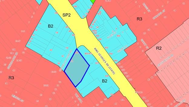
Figure
7 - Zoning Map with the allotment
outlined in blue
46. The objectives of the B2 -Local
Centres are as follows;
“• To
provide a range of retail, business, entertainment and community uses
that serve the needs of people who live in, work
in and visit the local area.
• To
encourage employment opportunities in accessible locations.
• To
maximise public transport patronage and encourage walking and cycling.”
47. The proposal satisfies the
objectives of the B2 zone as it will continue to provide “a range of retail, business, entertainment and
community uses that serve the needs of people who live in, work in and visit
the local area” and “encourage
employment opportunities in accessible locations”.
48. The proposal is fully compliant
with the relevant provisions of the KLEP, as detailed within the following
table.
|
Clause
|
Objectives/Provisions
|
Comment
|
Complies
|
|
4.3 - Height of buildings
|
The height of a
building on any land is not to exceed the maximum height shown for the land
on the Height of Buildings Map. In this case, the relevant map limits the height
of buildings on the subject site to 21m.
|
The proposal has a
building height of up to 10.06m
|
Yes
|
|
4.4 - Floor space ratio
|
The maximum
floor space ratio for a building on any land is not to exceed the floor space
ratio shown for the land on the Floor Space Ratio Map. In this case, the
relevant map limits the floor space ratio for buildings on the subject site
to 2.5:1.
|
The proposal has a
floor space ratio of 06:1.
|
Yes
|
|
5.10 – Heritage Conservation
|
The objectives
of this clause are;
(i) to conserve
the environmental heritage of Kogarah,
(ii) to
conserve the heritage significance of heritage items and heritage
conservation areas, including associated fabric, settings and views.
|
The site is not
listed a heritage item or within a heritage conservation area and is not
adjacent to a heritage item.
|
N/A
|
|
6.1 - Acid sulfate soils
|
The objective
of this clause is to ensure that development does not disturb, expose or
drain acid sulfate soils and cause environmental damage.
|
The subject site
is not identified on the Acid Sulfate Soils Map as being affected by any
particular class of acid sulfate soils.
|
N/A
|
|
6.2 - Earthworks
|
The objective
of this clause is to ensure that earthworks for which development consent is
required will not have a detrimental impact on environmental functions and
processes, neighbouring uses, cultural or heritage items or features of the
surrounding land.
|
There will be minimal earthworks
associated with the proposal.
|
Yes
|
|
6.3 - Flood planning
|
The objectives
of this clause are as follows:
(a) to minimise the flood risk to life and property
associated with the use of land,
(b) to allow development on land that is compatible with
the land’s flood hazard, taking into account projected changes as a
result of climate change,
(c) to avoid significant adverse impacts on
flood behaviour and the environment.
|
The subject site is not identified
on the Flood Planning Map as being within a Flood Planning Area.
|
N/A
|
Development
Control Plans
Kogarah
Development Control Plan 2013
49. The proposal is affected by the
provisions of Part 2 – General Controls and Part D – Commercial and
Industrial. These provisions are addressed in more detail within the following
table.
|
Kogarah Development Control Plan
2013
|
|
Part B General Controls
|
|
Controls
|
Required
|
Proposed
|
Complies
|
|
Part B2_ Tree Management and
Greenweb
|
The objectives of
this Part are:
(a) Establish the
criteria governing the removal or pruning of trees.
(b) Ensure that
appropriate information is submitted to Council regarding tree management.
|
This was discussed
in detail under the State Environmental Planning Policy (Vegetation in
Non-Rural Areas) 2017 commentary. There are no trees existing onsite
and therefore no additional consideration is required to be given to the
Greenweb.
|
Yes
|
|
Part B4 – Parking and Traffic
|
Development Type not listed in
Table 1 – base parking requirements on RMS Guide to Traffic Generating
Development.
|
A parking assessment has been
provided below in relation to the “Guide to Traffic Generating
Development”.
|
See below
|
|
Part B5 – Waste Management
and Minimisation
|
Submit a Waste
Management Plan with DAs involving:
· demolition;
· construction of a new building(s); or
· change of use or alterations/additions to existing premises (only
when this would result in a change of waste generation).
|
A waste management plan has been
provided.
|
Yes
|
|
Part B6 – Water management
|
All developments
requiring Council approval within the City of Kogarah require consideration
of the Water Management Policy.
|
The proposed
development predominantly involves internal works only and minimal increase
in impervious areas. This is occurring within the west corner of the site
where the war memorial will be replaced for a new terrace area. Stormwater
will be connected to the existing drainage system and appropriate conditions
have been imposed by Council Engineers.
|
Yes
|
|
Part D – Commercial and Industrial
|
|
D1 – 3.1 Streetscape
|
Facades are to
be ordered and articulated to visually break up the building massing, for
example through materials, colour and the design of openings. Large areas of
glass curtain walling and blank walls are to be avoided.
|
The façade
presents a variety of finishes and articulation to the street.
|
Yes
|
|
Enhance
pedestrian amenity through the provision of continuous awnings for weather
protection.
|
The proposal is
not considered to have an unreasonable impact on the amenity of pedestrians.
The changes to the entry and the ramps and the internal room layout will
facilitate access for all.
|
Yes
|
|
Promote safety
and security by providing a high level of activation to the street, employing
clear and direct lines of sight between the street and building entries, and
using appropriate signage and lighting to enhance the amenity of the public
domain.
|
The built form
change to the façade will not result in any sightline issues as stated
by Councils Traffic Engineer with respect to the manoeuvrability into and out
of the site and into and out of The Mall. There is also no proposed signage
and the lighting is subject to a condition to protect the public amenity.
|
Yes
|
|
D1 – 3.4 Building Heights
|
Building height
is to be in accordance with the Locality requirements.
|
This is discussed
under D2-19.1.1 – South Hurstville Height below.
|
See below (D2-19.1.1)
|
|
Buildings are
massed towards the street frontage and step down towards the rear, to be in
keeping with the existing retail/commercial built form pattern and compatible
with the scale and character of adjacent residential areas.
|
The building mass
is towards the south west boundary of the site. This is existing but the
extension will minimise the non-compliance. However it is considered that the
built form pattern is compatible within the existing built landscape. It is
acknowledged that the proposal is to an existing building and is not a new
building. Therefore it will not be possible to move the entire building
towards the street frontage.
|
Yes
|
|
Floor to
ceiling heights should be a minimum of 3m at ground floor level, to allow for
a range of uses including retail, commercial offices and home offices.
|
The floor to
ceiling heights are existing at 3.2m at the ground floor and 3.61m on the
first floor.
|
Yes
|
|
Floor to
ceiling should be a minimum of 2.7m at the upper storeys of the building, to
allow for a range of uses, and to improve the environmental performance and
amenity of the building.
|
The floor to
ceiling height of the upper floor is 6.31m, which is existing.
|
Yes
|
|
D1 – 3.5 Setbacks
|
Buildings
adjacent to public roads are generally to align with and be built to the
street frontage to provide continuity in the streetscape and encourage active
frontages to ground level.
|
The site has
minimal opportunity to align with additional building due to the existing
footprint that will undergo minor changes.
|
Yes
|
|
Street setbacks
at ground level are permitted only:
· Where the established
pattern is setback (for example where there are residential buildings within
the locality)
|
The existing
building in part has a zero setback and the extent of this will be increased
to the western side of the development as a result of this proposal.
|
Yes
|
|
Side setbacks
are generally not permitted in order to maintain the continuity of active
frontages, unless specified in the locality controls.
|
The development
proposes a minor extension along the frontages to Connells Point Road and The
Mall (northern and western sides), which will generally maintain existing
setbacks.
The development
also proposes alterations to existing floor space along the eastern side,
which retain existing setbacks to the eastern boundary.
|
Yes
|
|
Rear setbacks
are determined by the context including the amenity of neighbouring
residential uses and the amenity of any rear lanes. Refer to Locality
Controls within Part D2 for specific rear setback requirements.
|
The rear setback
will not be altered as a result of the proposal. In this regard, the
development involves louvres on the roof which does not result in a change to
the existing setbacks in the area in which they are proposed.
|
Yes
|
|
Setbacks on
corner blocks are to enable sufficient sightlines for traffic in accordance
with the relevant Australian Standard.
|
This has been
reviewed by Councils Traffic engineer and the development is considered
acceptable with respect to sightlines from the site and from The Mall.
|
Yes
|
|
D1 – 3.6 Building Design
|
Where
appropriate, integrate buildings into the streetscape by adopting a modular
form, which reflects the underlying narrow shop width of older buildings. Use
vertical elements, such as vertically proportioned windows, exposed party
walls, vertical balustrades, attached fins to express this modulation and
rhythm. Use horizontal elements such as roofs, parapets, balconies and
balustrades to align the building with its neighbours.
|
The proposal has existing elements
that integrate the RSL into the setback but the proposal will enhance this by
the addition of the ground floor terrace and new TAB smoking area on the
first floor.
|
Yes
|
|
Ensure that the
facade clearly expresses a bottom, middle and top related to the overall
proportion of the building.
|
The proposal has clear horizontal
proportions.
|
Yes
|
|
Incorporate
design characteristics such as projecting fins, corbelling, balconies with
variable materials and finishes, punctuated walls with visually recognisable
patterns, decorative features, rhythm and texture and a variable colour
palate to achieve façade modulation and articulation.
|
The design has incorporated
variations regarding the articulation, materials and finishes to compliment
the existing development.
|
Yes
|
|
Avoid curtain
walls, large expanses of glass and large expanses of concrete as these do not
create well-articulated and harmonious façades.
|
The proposal does not incorporate
these features.
|
Yes
|
|
Provide a
greater proportion of solid areas to void areas on all façades and
incorporate non-reflective materials.
|
There is a greater amount of solid
area to void areas on the façade. The materials have been required to
be non-reflective via a condition of consent.
|
Yes
|
|
Use
non-reflective glass or recess glass behind balconies to minimise
reflectivity.
|
This is been included as a
condition of consent.
|
Yes, via condition
|
|
Windows and
openings are to be generally of a vertical character and located within
vertical bays.
|
A majority of the existing windows
and openings are not proposed to be changed as are vertical in character.
|
Yes
|
|
Air-conditioning
units/fans/vents/stacks/hoods etc are to be inconspicuously located so as not
to be visible from the shopping street and any other major side street.
|
This is not proposed on any of the
elevations fronting a street.
|
Yes
|
|
Design building
openings at the ground floor to be in keeping with the overall building and
bay scale and proportions.
|
The modifications will remain in
proportion.
|
Yes
|
|
For cafe/dining
uses, provide openable window areas in association with seating overlooking
the street, to create the effect of outdoor dining.
|
The terrace on the ground floor
will provide the effect of outdoor dining.
|
Yes
|
|
Incorporate
continuous, independent and barrier free access to ground floor commercial
entries, including effective signage, sufficient illumination, tactile ground
surface indicators and pathways with limited cross-falls, sufficient width,
comfortable seating and slip-resistant floor surfaces.
|
Compliance will be ensured through
conditions for compliance with the BCA/NCC. This detail is to be included as
part of the construction certificate assessment.
|
Yes
|
|
Awnings should
retain any original awning features present that contribute to the desired
locality character.
|
The original awning will be
extended on the ground floor level to accommodate the ramp changes and will
also be constructed over the loading bay.
|
Yes
|
|
Provide under
awning lighting to improve public safety.
|
This is provided via a condition.
|
Yes, via condition
|
|
Design awnings
in the high range 3.6m – 4m and no higher or lower than adjoining
awnings.
|
The extension of the awning will
follow the height of the existing awning but is more than 4m in height.
|
Yes
|
|
Provide awnings
flat or near-flat in shape (not tilted upwards away from the facade), and
opaque in finish.
|
The awning/extension is flat and
will adopt the finishes of the existing awning.
|
Yes
|
|
Design
balustrades that allow for views into, and along the street.
|
The balustrading on the ground and
first floor will provide views to the street.
|
Yes
|
|
New development
and refurbishments are to comply with the requirements of the BCA and
Australian Standards.
|
Council Building Surveyor has
reviewed the proposal. No objections are raised subject to conditions of
consent.
|
Yes
|
|
Variation to
the existing pattern of roof forms may only occur where the parapet line is
not disrupted and where the new roof is not visible from the street below or
adjacent public areas.
|
A majority of the roof pattern will
remain as existing. The parapet line will be different in the roof areas
where the extension is proposed. It is considered that the change in roof
line is acceptable as it provides additional articulation of the development
and the materials are consistent with the existing development. The extension
of the roof is not considered to unreasonably impact on the public domain.
|
Yes
|
|
Comply with the
requirements of Part F1- Advertising and Signage.
|
There is no signage proposed and
the existing signage on the eastern building façade is proposed to
stay.
|
Yes
|
|
Where parking
requirements are not stated, reference should be made to the RTA’s
Guide to Traffic Generating Developments.
|
This is assessed in detail below.
|
Yes, see below
|
|
D1- 3.7 – Vehicular Access
and Parking
|
A minimum of 1
accessible car space required.
|
An accessible parking space does
not exist at present. A suitable condition of consent is recommended to
ensure compliance with this requirement.
|
Yes
|
|
Parking layout to
ensure pedestrian safety
|
The parking layout is not proposed
to be altered. The extension to the existing awning is to be constructed over
existing parking spaces and pedestrian walkways, without impacting on the
parking spaces or walkways.
|
N/A
|
|
Loading bay facilities are to be
provided at the rate of:
Commercial
Floor area
1000sqm to 5000sqm – 1 bay required
Floor area > 5000sqm to 10000sqm
– 2 bays required
|
The exiting bay will not be altered
except for the addition of an awning and roller door. As the floor area will
remain lower than 5000sqm, an additional bay is not required.
|
Yes
|
|
D1 – 3.12 Amenity
|
Utilise the site and building
layout to maximise the potential for acoustic privacy by providing adequate
building separation within the development and neighbouring properties.
|
A majority of the sites layout and
separation between other buildings will not be altered. The changes are to
the proposed outdoor gaming area that will include roof louvres and a new
outdoor terrace on the western corner. An acoustic assessment was submitted
and assessed by Council’s Health Unit and considered satisfactory
pending conditions of consent. The recommended conditions to mitigate any
noise issues that may arise due to the proposed development include
compliance with the submitted acoustic report; no amplified gaming machines
and live entertainment are to occur in outdoor gaming and smoking area, addition
of acoustic tiles, noise levels for licensed premises and verification of
acoustic report.
The new terrace to the intersection
of Connells Point Road and The Mall will be enclosed by a glass shield wall
in a manner which does not result in adverse impact on neighbouring
properties.
|
Yes – condition requiring
|
|
Locate all noise generating
equipment so as to protect the acoustic privacy of workers and adjoining
residents.
|
Has been reviewed by Council’s Health Unit and
considered satisfactory. Conditions about will be conditions of consent. The
acoustic report states that
“Any additional mechanical plant should be assessed
to ensure compliance with the requirements of the EPA Noise Policy for
Industry.” The conditions that will be imposed regarding acoustics are
compliance with the submitted acoustic report; no amplified gaming machines
and live entertainment are to occur in outdoor gaming and smoking area,
addition of acoustic tiles, noise levels for licensed premises and
verification of acoustic report. The built form is not proposed to be altered
by the conditions or acoustic report and relate to tiles, soffit lining and
door mechanism.
|
Yes
|
|
Retain existing, and incorporate
new indigenous trees, shrubs and ground cover
|
The west corner of the site has
minimal vegetation and no significant vegetation or trees. This has been
confirmed by Councils Arborist. The war memorial has been approved to be
relocated and there was no vegetation included with this proposal. A
condition has been imposed to add planter boxes along the perimeter of the
new terrace on the western corner. This is deemed as an acceptable solution
as there is currently no deep soil landscaping and will soften the appearance
of the streetscape.
|
Yes
|
|
Maximise
passive surveillance by orienting buildings towards the street, such that
building frontages and entries overlook and are clearly visible from the
street and provide a sense of address and visual interest.
|
The NSW Police Force has commented
on the proposal and a management and security plan has been provided. The
Police recommendations are included as conditions.
The layout of the site will only
have minor alterations and the orientation of the building, building
frontages and entries are not proposed to be altered.
|
Yes
|
|
D1 - 3.13 Open Space and
Landscaping
|
Retain
existing, and incorporate new indigenous trees, shrubs and ground cover where
appropriate.
|
The site has minimal existing
landscaping. This landscaping is used as a war memorial which will be
redundant due to the new war memorial approved (DA2018/0301). The existing
space is considered to be of a size to small to plant any large trees and
have deep soiling planting. This space is proposed to form part of the
terrace. This will result in space being useable and provided an active
frontage to the street and therefore engaging the corner. It is acknowledged
that the site will have minimal to no landscaping but due to the minimal
usability of the currently landscaping the proposal is deemed acceptable in
this regard.
|
Yes
|
|
D2 – 19.1.1 – South
Hurstville Height
|
The maximum
overall building height including any residential component (measured from
natural ground level) = 7m to the eave and 9m to the ridge.
The ground
floor is to have a minimum floor to ceiling height of 3.2m while all other
floors are to have a minimum floor to ceiling height of 2.7m.
Only one (1)
level or floor is permitted below natural ground level, which can only be
used for car parking purposes.
|
The existing heights are 8.16m to
the ceiling and 10.06m maximum height. The maximum height is not proposed to
be altered and the development is considerably lower than the maximum height
of 15m as stated in the LEP.
It is acknowledged that the DCP has
not been updated to reflect changes in the LEP; this is why there is
inconsistency in this regard.
The ground floor has a floor to
ceiling height of 3.2m and the first floor has a floor to ceiling height of
3.62m.
There is no level proposed below
natural ground.
|
No, justified
Yes
Yes
|
|
D2 – 19.1.1 – South
Hurstville Density
|
The maximum
permitted gross floor area of any building or buildings erected or proposed
to be erected on this land is 0.5:1.
The floor space
ratio, may be exceeded only if:
(i) the gross
floor area in excess of 0.5:1 is used only for the purposes
of dwellings;
and
(ii) the ratio
of the gross floor area of the building or buildings to the site area for the
respective zone does not exceed 1:1.
|
The proposed FSR
is 0.60:1. The permitted FSR under the LEP is 2.5:1 the proposal is
acceptable in this regard as it is acknowledged that the DCP has not
been updated to reflect changes in the LEP; this is why there is
inconsistency in this regard.
The area over FSR
is not used for a dwelling and as stated, the LEP allows for FSR. Beyond that
referenced in the DCP. As with the building height, it is acknowledged
that the DCP has not been updated to reflect changes in the LEP, hence why
there is inconsistency in this regard.
|
No, justified
No, justified
|
Car
Parking Assessment
50. The club has an
existing car park that accommodates 39 car parking spaces. The
RTA’s ‘Guide To Traffic Generating Development’ states
that it is difficult to determine a general amount of spaces required due to
the potential diversities between different clubs.
51. The RTA (RMS)
state that for extensions to an existing club, the assessment should be based
on the relevant club. A Traffic Impact Statement by Traffix was provided to
Council in which the traffic survey was provided. This survey was conducted on
5 October 2019 between 4:00pm – 8:00pm which was a Saturday of a long
weekend. An additional time on 19 October 2019 at 8:00pm was also
recorded.
52. This
information was forwarded to Councils Traffic Engineer for comment in which
there were no objections to the data used in the car parking assessment. It was
noted that the parking occupancy rates were worse in the hour that was surveyed
on 19 October 2019 and therefore the survey can be relied on. In this instance,
the existing parking provisions are considered acceptable.
53. Based on
previous clubs that Traffix’s have conducted surveys for, the demand was
5.54 car parking spaces per 100sqm of gross floor area. The additional GFA
which is proposed is 248sqm (report states 243sqm) and as per the figures above
this will result in an increased parking required of 13.7 (14) spaces. The
surveyed figures suggest that there will be an average of 56.8 spaces within
the surrounding street network at the times surveyed and therefore sufficient
parking spaces are available in the network to accommodate the additional 14
spaces required by this development.
54. Council’s
Traffic Engineers have also reviewed the proposal in terms of sight lines for
vehicles using the intersection of Connells Point Road and The Mall, as well as
in terms of pedestrian safety in this location. It is advised that the proposal
is acceptable in terms of sightlines for pedestrians and vehicles.
55. The proposal
from a car parking assessment is considered satisfactory in this regard.
Hours of
operation
56. The
proposed hours of operation are
· Monday –
10:00am to 11:00pm,
· Tuesday to
Thursday – 10:00am to 12:00am,
· Friday to Saturday
– 10:00am to 1:00am (the following morning).
57. The
most recent approval that mentions operating hours is from 1982 (D.A. 133/82).
The hours conditioned in this proposal are:
· Monday to Friday
- 11:00am to 11:00pm,
· Saturday - 10:00am
to 12:00am,
· Sunday –
10:00am to 11:00pm.
58. Although
the proposed hours of operation are stated in the Statement of Environmental
Effects as being unchanged from the existing situation, they are a slight
increase to the hours of operation approved in the 1982 approval.
59. The
KDCP does not include provisions for permitted hours of businesses in B2 Zones.
The existing club has not had a noise complaint since 2011 and there have only
been four (4) noise complaints recorded in approximately 37 years.
60. The
Acoustic report was prepared with the proposed/existing hours as part of the
assessment. This report has been assessed by Councils Environmental Health
Officer and a number of Acoustic conditions imposed which relate to compliance
with the submitted acoustic report, no amplified gaming machines and live
entertainment are to occur in outdoor gaming and smoking areas, addition of
acoustic tiles, noise levels for licensed premises between certain time frames
and verification of acoustic report.
61. The
hours that are proposed do not differ greatly from the hours approved in 1982.
Considering the acoustic conditions there is no objection to the proposed hours
of operation.
Section 7.12
Contributions
62. Monetary contributions are required
under Section 7.12 of the Environmental Planning and Assessment Act 1979, with
respect to the proposed development. These contributions have been calculated
appropriately and a suitable condition of consent has been included in the
recommended conditions at the end of this report.
IMPACTS
Natural
Environment
63. The site seeks minimal earthworks
which are considered to have no unreasonable impacts on the natural
environment. The proposal seeks the removal of small shrubs that are not
considered of significance. Planter boxes have been included as a condition of
consent to introduce some landscaping to the street frontage. In this regard,
the proposal is not considered to result in an adverse impact to the natural
environment.
Built
Environment
64. The proposed development will not
result in any adverse impacts upon the built environment for reasons discussed
throughout the report. In this regard, the proposal is not considered to result
in an adverse impact to the built environment.
Social and
Economic Impact
65. It is considered that the proposed
alterations and additions seek to update the existing development being South
Hurstville RSL Club by modernising the facilities needed to continue to meet
the social needs of the community. The proposal is unlikely to cause any
unreasonable social and/or economic impacts.
Suitability
of the Site
66. The site has been used as a ‘registered
club’ since at least 1956. It is considered that the proposed
development is of a scale and design that is suitable for the site having
regard to its size and shape, topography and relationship to adjoining
development and context.
REFERRALS
Council
Referral
Development
Engineering
67. The DA was referred to
Council’s Development Engineer for review and comment in relation to the
submitted stormwater plans. The application was supported subject to
conditions.
Traffic
Engineer
68. The DA was referred to
Council’s Traffic Engineer for review and comment in relation to the traffic
impact statement submitted. It was acknowledged that the traffic survey was
conducted on 5 October 2019 which was a long weekend. An additional survey was
conducted at 8:00pm on 19 October 2019 in which there were more spaces
available than 8:00pm on the 5th October. As a result,
Council’s Traffic Engineer supports the data used in the assessment of
the deficient car parking.
69. The sightlines were also assessed
as a result of the additions to the western corner. It was confirmed that the
additions to this corner were compliant with the Australian Standard for sight
lines being AS2890.1:2004.
Building
Surveyor
70. The DA was referred to
Council’s Building Surveyor for review and comment in relation to the
submitted plans. The application was supported subject to conditions.
Environmental
Health Officer
71. The DA was referred to
Council’s Environmental Health Officer for review and comment in relation
to the submitted plans and acoustic report. The application was supported
subject to conditions.
Waste
72. The DA was referred to
Council’s Environmental Sustainability and Waste Department for review
and comment in relation to the submitted plans. The application was supported
as “there are no major alterations to the property that would affect the
waste service”.
External
Referrals
NSW Police
Force
73. The application was referred to the
NSW Police for comment and review in relation to the submitted plans and
documentation. The application is supported subject to conditions.
CONCLUSION
74. The proposal has been assessed with
regard to the matters for consideration listed in Section 4.15 of the
Environmental Planning and Assessment Act 1979. The proposal is an appropriate
response to the context and constraints of the site and will result in alterations
to the existing South Hurstville RSL. The application is consistent with the
Kogarah Local Environmental Plan, Kogarah Development Control Plan and
applicable State Environmental Planning Policies. The proposal will adequately
respect the character of B2 zoned land and the proposal is appropriate on the
site.
75. For the above reasons, the proposal
is recommended for approval subject to the conditions included within the
recommendation below.
DETERMINATION
AND STATEMENT OF REASONS
Statement of Reasons
76. The reasons for this recommendation
are:
· The
proposal will facilitate alterations that will upgrade the existing ‘registered
club’.
· The
proposal will not create unreasonable impacts to the surrounding area.
· The
proposed development is considered to be appropriate for the site. Subject to
the implementation of the recommended conditions, the development will not
create unreasonable impacts upon the natural or built environment.
Determination
77. THAT pursuant
to Section 4.16(1) of the Environmental Planning and Assessment Act 1979
(as amended) the Georges River Local Planning Panel grant development consent
to Development Application DA2018/0577 for the alterations and additions
to South Hurstville RSL Club at Lot
100 DP 1114788, and known as 72 Connells Point Road, South Hurstville, subject
to the following conditions of consent:
Development
Details
1. Approved
Plans - The development must be implemented in accordance with the approved
plans and supporting documentation listed below which have been endorsed by
Council’s approved stamp, except where marked up on the plans and/or
amended by conditions of this consent:
|
Description
|
Reference No.
|
Date
|
Revision
|
Prepared by
|
|
Site Plan
|
A1.01
|
05/11/2018
|
-
|
Axil architects
|
|
Demolition Ground Floor Plan
|
A1.02
|
05/11/2018
|
|
Axil architects
|
|
Demolition First Floor Plan
|
A1.03
|
05/11/2018
|
-
|
Axil architects
|
|
Ground Floor Plan
|
A1.04
|
05/11/2018
|
-
|
Axil architects
|
|
First Floor Plan
|
A1.05
|
05/11/2018
|
-
|
Axil architects
|
|
Roof Plan
|
A1.06
|
05/11/2018
|
-
|
Axil architects
|
|
Elevations
|
A1.07
|
05/11/2018
|
-
|
Axil architects
|
|
Sections
|
A1.08
|
05/11/2018
|
-
|
Axil architects
|
|
External Finishes
|
EF.01
|
05/11/2018
|
-
|
Axil architects
|
Documents Relied on
|
Description
|
Reference No.
|
Date
|
Revision
|
Prepared by
|
|
Noise Impact Assessment
|
20181537.1
|
19/12/2018
|
1
|
Acoustic Logic
|
|
Management and Security Plan
|
-
|
28 November 2018
|
-
|
South Hurstville RSL Club
|
|
Traffic Impact Statement
|
19.491r01v01
|
21 October 2019
|
-
|
Traffix
|
Separate Approvals Required Under Other Legislation
2. Building
- Hoarding Application Prior to demolition of the buildings on the site, or
the commencement of work above ground level, a separate application for the
erection of an ‘A class’ (fence type) or a ‘B class’
(overhead type) hoarding or ‘C type’ scaffold, in accordance with
the requirements of SafeWork NSW, must be erected along that portion of
the footways/roadway where the building is within 3 metres of the street
boundary.
An application for this work under Section 68
of the Local Government Act 1993 and the Roads Act 1993 must be submitted for approval to
Council.
The following information is to be submitted with a Hoarding Application
under Section 68 of the Local Government Act 1993
and Section 138 of the Roads Act 1993:
a) A
site and location plan of the hoarding with detailed elevation, dimensions,
setbacks, heights, entry and exit points to/from the site, vehicle access
points, location of public utilities, electrical overhead wire protection, site
management plan and builders sheds location; and
b) Hoarding
plan and details that are certified by an appropriately qualified engineer; and
c) The
payment to Council of a footpath occupancy fee based on the area of footpath to
be occupied and Council's Schedule of Fees and Charges (available at www.georgesriver.nsw.gov.au) before the commencement of work; and
d) Public
Risk Insurance Policy with a minimum cover of $20 million in relation to the
occupation of and works within Council's road reserve, for the full duration of
the proposed works, must be obtained a copy provided to Council. The Policy is
to note Council as an interested party.
e) The application
must be endorsement by the Roads & Maritime Services (RMS) as the hoarding
is located within 100m of an intersection with traffic lights. For assistance
you should contact the DA unit at RMS and speak to Hans on 88492076. Or email
hans.pilly.mootanah@rms.nsw.gov.au to obtain concurrence for the hoarding
structure.
3. Section
138 Roads Act 1993 and Section 68 Local Government Act 1993 - Unless otherwise specified by a condition of this consent,
this Development Consent does not give any approval to undertake works on
public infrastructure.
Separate approval is required under Section 138 of the Roads Act 1993
and/or Section 68 of the Local Government Act 1993 for any of the
following activities carried out in, on or over a public road (including the
footpath) listed below.
An application is required to be lodged and approved prior to the
commencement of any of the following works or activities;
(a) Placing or storing materials
or equipment;
(b) Placing or storing waste
containers or skip bins;
(c) Erecting a structure or
carrying out work
(d) Swinging or hoisting goods
over any part of a public road by means of a lift, crane or the like;
(e) Pumping concrete from a public
road;
(f) Pumping water from the
site into the public road;
(g) Constructing a vehicular
crossing or footpath;
(h) Establishing a “works
zone”;
(i) Digging up or disturbing
the surface of a public road (eg Opening the road for the purpose of
connections to utility providers);
(j) Stormwater and ancillary
works in the road reserve;
(k) Stormwater and ancillary to
public infrastructure on private land; and
(l) If any excavation is to
be supported by the use of below ground (cable) anchors that are constructed
under Council’s roadways/footways.
These separate activity approvals must be obtained and evidence of the
approval provided to the Certifying Authority prior to the issue of the
Construction Certificate.
The relevant Application Forms for these activities can be downloaded
from Council’s website www.georgesriver.nsw.gov.au.
For further information, please contact Council’s Customer Service Centre
on (02) 9330 6400.
4. Driveway
Crossing - Minor Development - Constructing a driveway crossing and/or footpath requires a separate approval under Section
138 of the Roads Act 1993 prior to the commencement of those works.
To apply for approval, complete the “Application for Driveway
Crossing and Associated Works on Council Road Reserve” issued under
Section 138 Roads Act.” which can be downloaded from Georges River
Council’s Website at www.georgesriver.nsw.gov.au.
Lodge the application form, together with the associated fees at
Council’s Customer Service Centre, during business hours. Refer to
Section P1 and P2, in Council’s adopted Fees and Charges for the
administrative and inspection charges associated with Driveway Crossing
applications.
An approval for a new or modified driveway crossing will contain the
approved access and/or alignment levels which will be required to construct the
crossing and/or footpath. Once approved, all work shall be carried
out in accordance with Council’s specifications applicable at the time,
prior to the issue of an Occupation Certificate.
The design boundary level is to be received from Council prior to
construction of the internal driveway
5. Road
Opening Permit - A Road Opening Permit must be obtained from Council, in
the case of local or regional roads, or from the RMS, in the case of State
roads, for every opening of a public road reserve to access services including
sewer, stormwater drains, water mains, gas mains, and telecommunications before
the commencement of work in the road.
Requirements of Concurrence, Integrated & Other Government
Authorities
6. Liquor
Licence - Application shall be made to NSW Office of Liquor and Gaming for
a Liquor Licence under the Liquor Act 2007, prior to the issue of a
construction certificate. Evidence that the Licence has been issued shall be
provided to the PCA prior to the commencement of works.
Note: A use which is reliant on the obtaining of a Liquor Licence should
refrain from progressing until the Licence is obtained.
7. Sydney
Water - Tap in TM - The approved plans must be submitted to a
Sydney Water Tap inTM to determine whether the development
application will affect Sydney Water’s sewer and water mains, stormwater
drains and/or easements, and if further requirements need to be met. The
approved plans will be appropriately endorsed. For details please refer
to ‘Plumbing, building and developing’ section of Sydney
Water’s web site at www.sydneywater.com.au then
see ‘Building’, or telephone 13000 TAP IN (1300 082 746). The
Certifying Authority must ensure that a Tap inTM agent has
appropriately stamped the plans prior to the issue of the Construction
Certificate.
Prior to the Issue of a Construction Certificate
8. Required
design changes - The following changes are required to be made and shown on
the Construction Certificate plans:
a) Planter
boxers – Planter Boxes are to be added to the perimeter of the
outdoor terrace and outdoor terrace extension that are adjacent to The Mall and
Connells Point Road. There are to have a minimum width of 700mm and 60mm
high. The plant species are to be consistent with the
DCP.
9. Façade
Materials – The materials incorporated into the façade are not
to be reflective, this includes glass used as balustrading.
10. Fire Safety
Measures - Prior to the issue of a construction certificate a list of the
essential fire safety measures that are to be provided in relation to the land
and any building on the land as a consequence of the building work must
accompany an application for a construction certificate, which is required to
be submitted to either Council or a PCA. Such list must also specify the
minimum standard of performance for each essential fire safety measure included
in the list. The Council or PCA will then issue a Fire Safety Schedule for the
building.
11. Access for
Persons with a Disability - Access for persons with disabilities must be
provided to the site, including the carpark area in accordance with the
Building Code of Australia and AS 1428.1. Details must be submitted with the
Construction Certificate Application.
In the event that full compliance cannot be achieved the services of an
accredited access consultant is to be obtained to determine alternative methods
of compliance, such a report must be submitted to and endorsed by the
Certifying Authority prior to issue of the Construction Certificate.
12. Slip Resistance
- All new pedestrian surfaces must have slip resistance classifications, as
determined using test methods in either wet or dry conditions, appropriate to their
gradient and exposure to wetting. The classifications of the new
pedestrian surface materials, in wet or dry conditions, must comply with
AS/NZS4586:2004 - Slip Resistance Classifications of New Pedestrian Materials
and must be detailed on the plans lodged with the application for the
Construction Certificate.
13. Acoustic
Requirements - Compliance with submitted Acoustic Report - The
Construction Certificate plans shall demonstrate compliance with the Acoustic
Report submitted and approved by Council; titled Noise Impact Assessment
prepared by Acoustic Logic and dated 19 December 2018.
14. Fees
to be paid - The fees listed in the table below
must be paid in accordance with the conditions of this consent and
Council’s adopted Fees and Charges applicable at the time of payment
(available at www.georgesriver.nsw.gov.au).
Payments must be made prior to the issue of the
Construction Certificate or prior to the commencement of work (if there is no
associated Construction Certificate).
Please contact Council prior to the payment of
Section 7.11 Contributions to determine whether the amounts have been indexed
from that indicated below in this consent and the form of payment that will be
accepted by Council.
Council will only accept Bank Cheque or
Electronic Funds Transfer (EFT) for transaction values of $500,000 or over.
Council must be contacted prior to payment to determine correct total amount to
be paid and bank account details (if applicable).
A summary of the fees to be paid are listed
below:
|
Fee Type
|
Fee
|
|
GENERAL FEES
|
|
Long Service Levy (to Long Service Corporation) Or,
provide evidence of Payment direct to the Long Service Corporation. See
https://portal.longservice.nsw.gov.au/bci/levy/
|
|
Builders Damage Deposit
|
$3,750.00
|
|
Inspection Fee for Refund of Damage Deposit
|
$155.00
|
|
Georges River Council Section 94A Development
Contributions Plan 2017
|
$7,465.70
|
General Fees
The fees and charges above are subject to
change and are as set out in the version of Council's Schedule of Fees and
Charges or as required by other Government Authorities, applicable at the time
of payment.
Development Contributions
The Section 7.11 contribution is imposed to
ensure that the development makes adequate provision for the demand it
generates for public amenities and public services within the area.
A Section 7.12 contribution has been levied on
the subject development pursuant to the Georges River Council Section 94
Contributions Plan.
Indexation
The above contributions will be adjusted at the
time of payment to reflect changes in the cost of delivering public amenities
and public services, in accordance with the indices provided by the relevant
Section 94 Development Contributions Plan.
Timing of Payment
The contribution must be paid and receipted by
Council prior to the release of the Construction Certificate.
Further Information
A copy of the all current Development
Contributions Plans may be inspected or a copy purchased at Council’s
offices (Georges River Civic Centre, MacMahon Street, Hurstville and Kogarah
Library and Service Centre, Kogarah Town Square, Belgrave Street, Kogarah) or
viewed on Council’s website www.georgesriver.nsw.gov.au.
15. Damage Deposit
- Minor Works - In order to insure against damage to Council property the
following is required:
a) Pay Council, before the
issue of the Construction Certificate, a damage deposit for the cost of making
good any damage caused to any Council property as a result of the development: $3,750.00.
b) Pay Council, before the
issue of the Construction Certificate, a non-refundable inspection fee to
enable assessment of any damage and repairs where required: $155.00
c) Submit to Council, before
the commencement of work, a photographic record of the condition of the Council
nature strip, footpath and driveway crossing, or any area likely to be affected
by the proposal.
At the completion of work Council will inspect the public works, and the
damage deposit will be refunded in full upon completion of work where no damage
occurs. Otherwise the amount will be either forfeited or partly refunded
according to the amount of damage.
16. Site Management
Plan - A Site Management Plan detailing all weather access control points,
sedimentation controls, fencing, builder’s site sheds office, amenities,
materials storage and unloading arrangements must be submitted with the
application for the Construction Certificate.
17. Erosion &
Sedimentation Control - Erosion and sediment controls must be provided to
ensure:
(a) Compliance with the approved
Erosion & Sediment Control Plan
(b) Removal or disturbance of
vegetation and top soil is confined to within 3m of the approved building area
(no trees to be removed without approval)
(c) All clean water runoff is
diverted around cleared or exposed areas
(d) Silt fences, stabilised entry/exit
points or other devices are installed to prevent sediment from entering
drainage systems or waterways
(e) All erosion and sediment
controls are fully maintained for the duration of demolition, excavation and/or
development works
(f) Controls are put into
place to prevent tracking of sediment by vehicles onto adjoining roadway
(g) All disturbed areas are
rendered erosion-resistant by turfing, mulching, paving or similar
(h) Compliance with Managing
Urban Stormwater - Soils and Construction (Blue Book) produced by Landcom 2004.
These measures are to be implemented prior to the commencement of work
(including demolition and excavation) and must remain until works are completed
and all exposed surfaces are landscaped/sealed.
18. Stormwater
System - No stormwater plan for the proposed extensions to the existing
buildings has been submitted to Council. Stormwater plan for all proposed new
covered areas as shown in Figure 1 of “Statement of Environmental
Effects” shall be submitted to the PCA for approval. The plan shall
include collection of stormwater from down pipes and conveyance to existing
stormwater pipes/pits to form an integrated stormwater system. The existing
outlet/s into a legal point of discharge shall also be shown on the plan. Final
detailed plans of the drainage system, prepared by a professional engineer
specialising in hydraulic engineering, shall be submitted for approval with the
Construction Certificate.
19. Stormwater
Drainage Plan Details - Stormwater drainage plans including pipe sizes,
type, grade, length, invert levels, dimensions and types of drainage pits
prepared by a professional engineering specialising in hydraulic engineering
shall be submitted with the Construction Certificate application.
These plans shall be prepared in accordance with the Australian Institute
of Engineers Australian Rainfall and Runoff (1987) and Council's stormwater
drainage guide lines.
20. Structural
details - Engineer's details prepared by a practising Structural Engineer
being used to construct all reinforced concrete work, structural beams, columns
and other structural members. The details are to be submitted to the Principal
Certifying Authority for approval prior to construction of the specified works.
A copy shall be forwarded to Council where Council is not
the PCA.
21. Waste
Management Plan - A Waste Management Plan incorporating all requirements in
respect of the provision of waste storage facilities, removal of all materials
from the site that are the result of site clearing, extraction, and, or
demolition works and the designated Waste Management Facility shall be
submitted to the Certifying Authority prior to the issue of any Construction
Certificate.
Prior to the Commencement of Work (Including Demolition &
Excavation)
22. Hazardous or
Intractable Waste – Removal and Disposal - Hazardous or intractable
waste arising from the demolition or construction process shall be removed and
disposed of in accordance with the requirements of SafeWork NSW and the NSW
Environment Protection Authority and with the provision of:
· Work Health and Safety Act 2011 (NSW) (as amended);
· Work Health and Safety Regulation 2011 (as amended);
· Protection Of the Environment Operations Act 1997 (NSW) (as
amended); and
· Protection of the Environment Operations (Waste) Regulation 2014 (as
amended)
23. Demolition
& Asbestos - The demolition work shall comply with the provisions of
Australian Standard AS2601:2001 - Demolition of Structures, NSW Work Health
& Safety Act 2011 and the NSW Work Health & Safety Regulation
2011. The work plans required by AS2601:2001 shall be accompanied by
a written statement by a suitably qualified person that the proposals contained
in the work plan comply with the safety requirements of the Standard. The work
plans and the safety statement shall be submitted to the PCA prior to the
commencement of works.
For demolition work which involves the removal of asbestos, the asbestos
removal work must be carried out by a licensed asbestos removalist who is
licensed to carry out the work in accordance with the NSW Work Health &
Safety Act 2011 and the NSW Work Health & Safety Regulation 2011
unless specified in the Act and/or Regulation that a license is not required.
All demolition work including the removal of asbestos, shall be
undertaken in accordance with the Demolition Code of Practice (NSW Work
Cover July 2015).
Note: Copies of the Act, Regulation and Code of Practice can be
downloaded free of charge from the SafeWork NSW website: www.SafeWork.nsw.gov.au.
24. Demolition
Notification Requirements - The following notification requirements apply
to this consent:
(a) The developer /builder must notify
adjoining residents five (5) working days prior to demolition. Such
notification is to be a clearly written note giving the date demolition will
commence, contact details of the developer/builder, licensed asbestos
demolisher and the appropriate regulatory authority. Notification is to be
placed in the letterbox of every premises (including every residential flat or
unit, if any) either side and immediately at the rear of the demolition site.
(b) Five (5) working days prior to demolition,
the developer/builder is to provide written notification to Council advising of
the demolition date, details of the SafeWork licensed asbestos demolisher and
the list of residents advised of the demolition.
(c) On demolition sites where buildings to be
demolished contain asbestos, a standard commercially manufactured sign
containing the words “DANGER ASBESTOS REMOVAL IN PROGRESS”
measuring not less than 400mm x 300mm is to be erected in a prominent visible
position (from street frontage) on the site. The sign is to be erected prior to
demolition work commencing and is to remain in place until such time as all
asbestos material has been removed from the site to an approved waste facility.
25. Demolition work
involving asbestos removal - Work involving bonded asbestos removal work
(of an area of more than 10 square metres) or friable asbestos removal work
must be undertaken by a person who carries on a business of such removal work
in accordance with a licence under clause 458 of the Work Health and Safety
Regulation 2011.
26. Dial before
your dig - The applicant shall contact “Dial Before You Dig on
1100” to obtain a Service Diagram prior to the issuing of the
Construction Certificate. The sequence number obtained from “Dial
Before You Dig” shall be forwarded to the Principal Certifying Authority
(PCA) and Council for their records.
27. Registered
Surveyors Report - During Development Work - A report must be submitted to
the PCA at each of the following applicable stages of construction:
a) Set out before commencing
excavation.
b) Floor slabs or foundation
wall, before formwork or commencing brickwork.
c) Completion of Foundation
Walls - Before any construction of flooring, detailing the location of the
structure relative to adjacent boundaries and floor levels relative to the
datum shown on the approved plans.
d) Completion of Floor Slab
Formwork - Before pouring of concrete/walls construction, detailing the
location of the structure relative to adjacent boundaries and floor levels
relative to the datum shown on the approved plans. In multi-storey
buildings a further survey must be provided at each subsequent storey.
e) Completion of any Pool
Formwork - Before concreting of pool shell, detailing the location of the pool
relative to the adjacent boundaries and its height relative to the datum shown
on the approved plans.
f) Completion of any
Roof Framing - Before roof covered detailing eaves/gutter setback from
boundaries.
g) Completion of all Work -
Detailing the location of the structure (including eaves/gutters) relative to
adjacent boundaries and its height relative to the datum shown on the approved
plans. A final Check Survey must indicate the reduced level of the main
ridge.
Work must not proceed beyond each stage until the PCA is satisfied that
the height and location of the building is proceeding in accordance with the
approved plans.
28. Utility
Arrangements - Arrangements are to be made with utility authorities in
respect to the services supplied by those authorities to the development. The
cost associated with the provision or adjustment of services within the road
and footway areas is to be at the applicant’s expense.
During Construction
29. Contamination
– Should any unexpected contamination be experienced during
excavation/construction work is to cease immediately and a , a detailed site
investigation and remedial action plan (if required) shall be undertaken and
completed by a suitably qualified person in accordance with the relevant
guidelines approved by the Office of Environment and Heritage (OEH) and in
accordance with the requirements of the Contaminated Land
Management Act 1997.
Work
may only recommence given approval to recommence by a suitably qualified
person.
30. Road Opening Permit - A Road Opening Permit must
be obtained from Council for every opening of a public road reserve to access
services including sewer, water mains, gas mains, connecting of stormwater to
the kerb and telecommunication. This is for any work that involves
excavation through or within a public road, kerb and gutter, and or the public
footway between the road and the property boundary. The permit is to be
lodged prior to the commencement of works. Additional approval is
required from Roads and Maritime Services for works on a State Road.
31. Structural
Certificate during Construction - The proposed building works must be
constructed in accordance with details designed and certified by the practising
qualified structural engineer. All structural works must be inspected and
structurally certified for compliance by an independent practising structural
engineer. In addition a Compliance Certificate, to the effect that the
building works have been carried in accordance with the structural design, must
be submitted to the Certifying Authority at each stage of Construction or prior
issue of the Occupation Certificate.
32. Site sign -
Soil & Erosion Control Measures - Prior to the commencement of works
(including demolition and excavation), a durable site sign, issued by Council
in conjunction with this consent, must be erected in a prominent location on
site. The site sign warns of the penalties which apply to pollution, storing
materials on road or footpath and breaches of the conditions relating to
erosion and sediment controls. The sign must remain in a prominent location on
site up until the completion of all site and building works.
33. Hours of
construction for demolition and building work - Any work activity or
activity associated with the development consent that requires the use of any
tools (including hand tools) or any power operated plant and machinery that
creates noise on or adjacent to the site shall not be performed, or permitted
to be performed, except between the hours of 7.00 am to 5.00 pm, Monday to
Saturday inclusive. No work or ancillary activity is permitted on Sundays, or
Public Holidays.
Note: A penalty infringement notice may be issued for any offence.
34. Cost of work to
be borne by the applicant - The applicant shall bear the cost of all works
associated with the construction of the development that occurs on Council
property. Care must be taken to protect Council's roads, including the
made footway, kerbs, etc., and, where plant and vehicles enter the site, the
footway shall be protected against damage by deep-sectioned timber members laid
crosswise, held together by hoop iron straps and chamfered at their ends.
This construction shall be maintained in a state of good repair and condition
throughout the course of construction.
35. Obstruction of
Road or Footpath - The use of the road or footpath for the storage of any
building materials, waste materials, temporary toilets, waste or skip bins, or
any other matter is not permitted unless separately approved by Council under
Section 138 of the Roads Act 1993 and/or under Section 68 of the Local
Government Act 1993. Penalty infringement Notices may be issued for
any offences and severe penalties apply.
36. Waste
Management Facility - All materials removed from the site as a result of
demolition, site clearing, site preparation and, or excavation shall be
disposed of at a suitable Waste Management Facility. No vegetation, article,
building material, waste or the like shall be ignited or burnt.
Copies of all receipts for the disposal, or processing of all such
materials shall be submitted to the PCA and Council, where Council is not the
Principal Certifying Authority.
Prior to the issue of the Occupation Certificate
37. Works
as Executed and Certification of Stormwater works - Prior to the issue of an Occupation Certificate, the PCA must ensure that the stormwater
drainage
system has been constructed in accordance
with the approved design and relevant
Australian
Standards. A works-as-executed drainage plan and certification must be
forwarded to the PCA and Council, from a professional engineer specialising in
hydraulic engineering.
This Plan and Certification shall confirm that
the design and construction of the stormwater drainage system satisfies the
conditions of development consent and the Construction Certificate stormwater
design details approved by the PCA.
The works-as-executed drainage plan must be
prepared by a professional engineer specialising in hydraulic engineering in
conjunction with a Registered Surveyor and must include the following details
(as applicable):
(a) The
location of any detention basin/s with finished surface levels;
(b) Finished
site contours at 0.2 metre intervals (if applicable)
(c) Volume
of storage available in any detention areas;
(d) The
location, diameter, gradient and material (i.e. PVC, RC etc.) of all stormwater
pipes;
(e) The
orifice size/s (if applicable);
(f) Details
of any infiltration/absorption systems; and (if applicable);
(g) Details
of any pumping systems installed (including wet well volumes) (if applicable).
38. Requirements
prior to the issue of the Occupation Certificate - The
following shall be completed and or
submitted to the PCA prior to the issue of the Occupation Certificate:
(a) All the
stormwater/drainage works shall be completed in accordance with the approved
Construction Certificate plans prior to the issue of the Occupation
Certificate.
(b) Work as
Executed Plans prepared by a Chartered Professional Engineer or a Registered
Surveyor when all the site engineering works are complete shall be submitted to
the PCA prior to the issue of the Occupation Certificate.
(c) Council
must advise in writing that they are satisfied with the Works-As-Executed prior
to the issue of an Occupation Certificate.
39. Fire Safety
Certificate before Occupation or Use - In accordance with Clause 153 of the Environmental Planning
and Assessment Regulation 2000, on completion of building works and prior
to the issue of an Occupation Certificate, the owner must cause the issue of a
Final Fire Safety Certificate in accordance with Clause 170 of the aforesaid
Regulation. The Fire Safety Certificate must be in the form or to the effect of
Clause 174 of the Environmental Planning and Assessment Regulation, 2000. In
addition, in relation to each essential fire or other safety measure
implemented in the building or on the land on which the building is situated,
such a Certificate is to state:
(a) That the measure has been
assessed by a person (chosen by the owner of the building) who is properly
qualified to do so.
(b) That as at the date of the
assessment the measure was found to be capable of functioning at a standard not
less than that required.
A copy of the certificate is to be given by the applicant to the
Commissioner of Fire & Rescue NSW and a further copy is to be displayed in
a frame and fixed to a wall inside the building's main entrance.
40. Acoustic
Compliance - Prior to the issue of any Occupation Certificate, a report
prepared by a suitably qualified acoustic consultant must be submitted to the PCA
certifying that the construction has incorporated the recommendations in the DA
Acoustic Report titled Noise Impact Assessment, prepared by Acoustic Logic and
dated 19 December 2018.
Operational Conditions (Ongoing)
41. Hours of
operations - The hours of operations are not to exceed;
Monday
– 10:00am to 11:00pm,
Tuesday
to Thursday – 10:00am to 12:00am,
Friday
to Saturday – 10:00am to 1:00am (the following
morning).
42. Police Measures
- The premises are to be operated at all times in accordance with the Plan
of Management dated 28 November 2018, as may be varied from time to time after
consultation with the Local Area Commander of NSW Police Force and Georges
River Council.
A
copy of the Plan of Management is to be kept on the premises and made available
for inspection on the request of a police officer, council officer, or liquor
and gaming NSW inspector.
43. Noise Control
- The use of the premises must not give rise to the transmission of offensive
noise to any place of different occupancy. Offensive noise is defined in the Protection
of the Environment Operations Act 1997 (as amended).
44. Maintenance of
Sound Attenuation - Sound attenuation must be maintained in accordance with
the Acoustic Report submitted by Acoustic Logic titled Noise Impact Assessment
and dated 19 December 2018.
45. Final Acoustic
Report - Verification of Noise report - Within three months from the issue
of an Occupation Certificate, an acoustic assessment is to be carried out by an
appropriately qualified acoustic consultant, in accordance with the EPA's Noise Policy
for Industry and submitted to Council for consideration. This report
should include but not be limited to, details verifying that the noise control
measures as recommended in the acoustic report (submitted by Acoustic Logic
titled Noise Impact Assessment and dated 19 December 2018 are effective in attenuating noise to an acceptable
noise level and that the use is not calculated to give rise to ‘offensive
noise’ as defined under the provision of the Protection of the Environment Operation Act 1997
(as amended).
46. Lighting -
General Nuisance - Any lighting on the site shall be designed so as not to
cause a nuisance to other residences in the area or to motorists on nearby
roads and to ensure no adverse impact on the amenity of the surrounding area by
light overspill or glare.
Flashing, moving or intermittent lights or signs are prohibited.
47. Activities and
storage of goods outside buildings - There shall be no activities including
storing or depositing of any goods or maintenance to any machinery external to
the building with the exception of waste receptacles.
48. Food premises -
Restricted use (premises that are not cooking) - There shall be no cooking
(where heat is applied to food) permitted in the premises unless a separate
development application has been approved by Council for this purpose.
49. Outdoor
Gaming/Smoking Area - Smoke Free Compliance - The subject development
consent issued by Council does not imply or otherwise verify compliance with
the Smoke-Free Environment Act 2000 and/or the Smoke-Free Environment
Regulation 2016. The applicant and/or owner of the premises should seek
their own legal advice as to compliance with Act and/or Regulation if
proprietors of the premises intend allowing smoking in any area of the
premises, including that area subject of this consent.
50. Outdoor
Gaming/Smoking Area - Amplified Music - There is to be no entertainment in
the form of amplified music on any part of the outdoor gaming/smoking area at
any time.
51. Outdoor
Gaming/Smoking Area - Amplified Gaming Machines - There is to be no amplification
from any gaming machines on any part of the outdoor gaming/smoking area at any
time.
52. Outdoor
Gaming/Smoking Area - Not Visible to Public - Machines located within the
outdoor gaming/smoking area must not be visible from the public domain.
53. Outdoor
Gaming/Smoking Area - Air Lock Entry - There is to be air lock entry from
the main club or hotel area into the outdoor gaming/smoking area and doors must
be fitted with self-closing device.
54. Outdoor
Gaming/Smoking Area - Acoustic Ceiling - The ceiling of the outdoor
gaming/smoking area above the poker machines is to be acoustically treated by
the addition of acoustic tiles.
55. Licensed
Premises - Noise Levels (7.00am to 12midnight) - The LA10 noise
level emitted from the premises, measured between the hours of 7am and 12
midnight, is not to exceed the background noise level in any octave band
frequency (centred on 31.5Hz to 8 kHz inclusive) by more than 5 dB, when
measured at the boundary of any adjoining residence.
56. Licensed
Premises - Noise Levels (12 midnight to 7.00am) - The LA10 noise
level emitted from the premises, measured between the hours of midnight and
7am, is not to exceed the background noise level in any octave band frequency
(centred on 31.5Hz to 8 kHz inclusive), when measured at the boundary of any
adjoining residence.
57. Cashless
Machines - Gaming machines within the outdoor gaming/smoking area are to be
cashless and shall not dispense coins into coin trays.
58. Annual Fire
Safety Statement - The owner of the building premises must ensure the
Council is given an annual fire safety statement in relation to each essential
fire safety measure implemented in the building. The annual fire safety
statement must be given:
(a) Within 12 months after the
date on which the fire safety certificate was received.
(b) Subsequent annual fire safety
statements are to be given within 12 months after the last such statement was
given.
(c) An annual fire safety
statement is to be given in or to the effect of Clause 181 of the Environmental
Planning and Assessment Regulation 2000.
(d) A copy of the statement is to
be given to the Commissioner of Fire & Rescue NSW, and a further copy is to
be prominently displayed in the building.
59. Outdoor
Lighting - To avoid annoyance to the occupants of adjoining premises or
glare to motorist on nearby roads, outdoor lighting must comply with AS
4282-1997: Control of the obtrusive effects of outdoor lighting.
Operational Requirements Under the Environmental Planning &
Assessment Act 1979
60. Requirement for
a Construction Certificate - The erection of a building must not commence
until a Construction Certificate has been issued.
61. Appointment of
a PCA - The erection of a building must not commence until the applicant
has:
(a) appointed a PCA for the
building work; and
(b) if relevant, advised the PCA
that the work will be undertaken as an Owner -Builder.
If the work is not going to be undertaken by an Owner - Builder, the
applicant must:
(a) appoint a Principal Contractor
to undertake the building work. If residential building work (within the
meaning of the Home Building Act 1989) is to be undertaken, the
Principal Contractor must be a holder of a contractor licence; and
(b) notify the PCA of the details
of any such appointment; and
(c) notify the Principal
Contractor of any critical stage inspections or other inspections that are
required to be carried out in respect of the building work.
An Information Pack is attached for your convenience should you wish to
appoint Georges River Council as the PCA for your development.
62. Notification
Requirements of PCA - No later than two days before the building work
commences, the PCA must notify:
(a) the consent authority and the
Council (if not the consent authority) of his or her appointment; and
(b) the applicant of the critical
stage inspections and other inspections that are to be carried out with respect
to the building work.
63. Notice of
Commencement - The applicant must give at least two days notice to the
Council and the PCA of their intention to commence the erection of a building.
A Notice of Commencement Form is attached for your convenience.
64. Critical Stage
Inspections - The last critical stage inspection must be undertaken by the
PCA. The critical stage inspections required to be carried out vary
according to Building Class under the Building Code of Australia and are listed
in Clause 162A of the Environmental Planning and Assessment Regulation 2000.
65. Notice to be
given prior to critical stage inspections - The principal contractor for a
building site, or the owner-builder, must notify the PCA at least 48 hours
before each required inspection needs to be carried out.
Where Georges River Council has been appointed as the PCA, 48 hours
notice in writing, or alternatively 24 hours notice by facsimile or telephone,
must be given when specified work requiring inspection has been completed.
66. Occupation
Certificate - A person must not commence occupation or use of the whole or
any part of a new building unless an Occupation Certificate has been issued in
relation to the building or part.
Only the PCA appointed for the building work can issue the Occupation
Certificate.
An Occupation Certificate Application Form is attached for your
convenience.
Prescribed Conditions
67. Clause 98D -
Erection of sign for maximum number of persons - This prescribed condition
applies to entertainment venues, function centres, pubs, registered clubs and
restaurants. This condition requires the erection of a sign which states
the maximum number of persons (as specified in the consent) that are permitted
in the building.
68. Clause 98 -
Building Code of Australia & Home Building Act 1989 - Requires all
building work to be carried out in accordance with the Building Code of
Australia. In the case of residential building work to which the Home
Building Act 1989 relates, there is a requirement for a contract of insurance
to be in force before any work commences.
69. Clause 98A -
Erection of Signs - Requires the erection of signs on site and outlines the
details which are to be included on the sign. The sign must be displayed
in a prominent position on site and include the name and contact details of the
PCA and the Principal Contractor.
70. Clause 98E -
Protection & support of adjoining premises - If the development
involves excavation that extends below the level of the base of the footings of
a building on adjoining land, this prescribed condition requires the person who
benefits from the development consent to protect and support the adjoining
premises and where necessary underpin the adjoining premises to prevent any
damage.
71. Clause 98E -
Site Excavation - Excavation of the site is to extend only to that area
required for building works depicted upon the approved plans. All excess
excavated material shall be removed from the site.
All excavations and backfilling associated with the erection or
demolition of a building must be executed safely and in accordance with
appropriate professional standards.
All excavations associated with the erection or demolition of a building
must be properly guarded and protected to prevent them from being dangerous to
life or property.
If the soil conditions require it, retaining walls associated with the
erection or demolition of a building or other approved methods of preventing
movement of the soil shall be provided and adequate provision shall be made for
drainage.
72. Clause 98C -
Entertainment Venues - Schedule 3A of the Environmental Planning and
Assessment Regulation 2000 outlines the prescribed conditions which apply
to Entertainment Venues.
Advice
73. Review
of Determination - Section 8.2 of the Environmental Planning and Assessment
Act confers on an applicant who is dissatisfied with the determination of the
application the right to lodge an application with Council for a review of such
determination. Any such review must however be completed within 6 months
from its determination. Should a review be contemplated sufficient time
should be allowed for Council to undertake public notification and other
processes involved in the review of the determination.
Note: Review provisions do not apply to Complying Development,
Designated Development, State Significant Development, Integrated Development
or any application determined by the Sydney South Planning Panel or the Land
& Environment Court.
74. Appeal Rights -
Part 8 (Reviews and appeals) of the Environmental Planning and Assessment
Act 1979 confers on an applicant who is dissatisfied with the determination of
the application a right of appeal to the Land and Environment Court of New
South Wales.
75. Lapsing of
Consent - This consent will lapse unless the development is physically
commenced within 5 years from the Date of Operation of this consent, in
accordance with Section 4.53 of the Environmental Planning and Assessment Act
1979 as amended.
76. Council
Appointed as the CA - Should the Council be appointed as the Certifying
Authority in determining the Construction Certificate, the building must comply
with all the applicable deemed to satisfy provision of the BCA. However,
if an alternative solution is proposed it must comply with the performance
requirements of the BCA, in which case, the alternative solution, prepared by
an appropriately qualified fire consultant, accredited and having specialist
qualifications in fire engineering, must justify the non-compliances with a
detailed report, suitable evidence and expert judgement.
In this regard, detailed construction plans and specifications that
demonstrate compliance with the above requirements of the BCA, must be
submitted to the Certifying Authority with the Construction Certificate
Application.
Should there be any non-compliance, an alternative method of fire
protection and structural capacity must be submitted, with all supporting
documents prepared by a suitably qualified person.
In the event that full compliance with the BCA cannot be achieved and the
services of a fire engineer are obtained to determine an alternative method of
compliance with the BCA, such report must be submitted to and endorsed by the
Certifying Authority prior to issue of the Construction Certificate.
77. Compliance with
Access, Mobility and AS4299 - Adaptable Housing - Should the Council be
appointment as the PCA, the Construction Certificate Application must be
accompanied by detailed working plans and a report or a Certificate of
Compliance from an Accredited Access Consultant certifying that the building
design and access to the adaptable units complies with Council’s DCP and
AS 4299 Adaptable Housing.
78. Food Premises
- Information on Australian Standards can be obtained from www.standards.com.au.
Guidelines and Food Safety Standards may be obtained by contacting the
Food Standards Australia New Zealand Authority at foodstandards.gov.au
or the NSW Food Authority on 1300 552 406, email: contact@foodauthority.nsw.gov.au
or by visiting the website www.foodauthority.nsw.gov.au.
Notification of Food Business under Section 100 of the Food Act 2003 requires the proprietor of a
food business to give written notice, in the approved form, before conducting a
food business. Penalties apply for failure to comply.
79. Noise -
Noise related conditions - Council will generally enforce noise related
conditions in accordance with the Noise Guide for Local Government (http://www.environment.nsw.gov.au/noise/nglg.htm)
and the Industrial Noise Guidelines
(http://www.environment.nsw.gov.au/noise/industrial.htm)
publish by the Department of Environment and Conservation. Other state
government authorities also regulate the Protection of the Environment
Operations Act 1997.
Useful links relating to Noise:
(a) Community Justice Centres -
free mediation service provided by the NSW Government (www.cjc.nsw.gov.au).
(b) Department of Environment and
Conservation NSW, Noise Policy Section web page (www.environment.nsw.gov.au/noise).
(c) New South Wales Government
Legislation home page for access to all NSW legislation, including the
Protection of the Environment Operations Act 1997 and the Protection of the
Environment Noise Control Regulation 2000 (www.legislation.nsw.gov.au).
(d) Australian Acoustical Society
- professional society of noise-related professionals (www.acoustics.asn.au/index.php).
(e) Association of Australian
Acoustical Consultants - professional society of noise related professionals (www.aaac.org.au).
(f) Department of Gaming and
Racing - (www.dgr.nsw.gov.au).
80. Disability
Discrimination Act - This application has been assessed in accordance with
the Environmental Planning and Assessment Act 1979. No guarantee
is given that the proposal complies with the Disability Discrimination Act
1992. The applicant is responsible to ensure compliance with this and other
anti-discrimination legislation. The Disability Discrimination Act
1992 covers disabilities not catered for in the minimum standards called up
in the Building Code of Australia which refers to AS1428.1-Design for Access
and Mobility.
81. Access for
persons with disabilities - Should the Council be appointed as the PCA, an
Access report prepared by an Accredited Access Consultant may be required to be
submitted with the Construction Certificate Application, detailing the existing
level of compliance in the building with the above requirements, and to provide
details of proposed upgrading work necessary to bring the building into
conformity with the Premises Standards and the BCA. All recommendations of the
accredited access consultant must be incorporated in the plans to be submitted
with the Construction Certificate application.
82. Long Service
Levy - The Long Service Corporation administers a scheme which provides a
portable long service benefit for eligible workers in the building and
construction industry in NSW. All benefits and requirements are determined by
the Building and Construction Industry Long Service Payments Act 1986. More
information about the scheme and the levy amount you are required to pay to
satisfy a condition of your consent can be found at http://www.longservice.nsw.gov.au.
The required Long Service Levy payment can be direct to the Long Service
Corporation via their web site https://online.longservice.nsw.gov.au/bci/levy.
Payments can only be processed on-line for the full levy owing and where the
value of work is between $25,000 and $6,000,000. Payments will be accepted for
amounts up to $21,000, using either MasterCard or Visa.
83. Security
deposit administration & compliance fee - Under Section 97 (5) of the Local
Government Act 1993, a security deposit (or part) if repaid to the person
who provided it is to be repaid with any interest accrued on the deposit (or
part) as a consequence of its investment.
Council must cover administration and other costs incurred in the
investment of these monies. The current charge is $50.00 plus 2% of the bond
amount per annum.
The interest rate applied to bonds is set at Council's business banking
facility rate as at 1 July each year. Council will accept a bank
guarantee in lieu of a deposit.
All interest earned on security deposits will be used to offset the
Security Deposit Administration and Compliance fee. Where interest earned on a
deposit is not sufficient to meet the fee, it will be accepted in full
satisfaction of the fee.
84. Site Safety
Fencing - Site fencing must be erected in accordance with SafeWork
Guidelines, to exclude public access to the site throughout the demolition
and/or construction work, except in the case of alterations to an occupied
dwelling. The fencing must be erected before the commencement of any work and
maintained throughout any demolition and construction work.
A demolition licence and/or a high risk work license may be required from
SafeWork NSW (see www.SafeWork.nsw.gov.au).
85. Stormwater
& Ancillary Works - Applications under Section 138 Roads Act and/or Section
68 Local Government Act 1993 - To apply for approval under Section 138 of the Roads Act 1993 and/or
Section 68 Local Government Act 1993:
a) Complete
the ‘Stormwater Drainage Application Form’ which can be downloaded
from Georges River Council’s website at www.georgesriver.nsw.gov.au.
b) In
the Application Form, quote the Development Consent No. (eg. DA2018/0580 and
reference this condition number (e.g. Condition 23)
c) Lodge
the application form, together with the associated fees at Council’s
Customer Service Centre, during business hours. Refer to Council’s
adopted Fees and Charges for the administrative and inspection charges
associated with stormwater applications.
The developer must meet all costs of
the extension, relocation or reconstruction of any part of Council’s
drainage system (including design drawings and easements) required to carry out
the approved development.
The preparation of all engineering
drawings (site layout plans, cross sections, longitudinal sections, elevation
views together with a hydraulic grade analysis) and specifications for the new
storm water drainage system to be arranged by the applicant. The design
plans must be lodged and approved by Council prior to the issue of a Construction
Certificate.
NOTE: A minimum of four weeks should be allowed for assessment.
ATTACHMENTS
|
Attachment ⇩1
|
Site Plan - 72 Connells Point Road South Hurstville
|
|
Attachment ⇩2
|
First Floor Plan - 72 Connells Point Road South Hurstville
|
|
Georges
River Council - Georges River Local Planning Panel (LPP) - Thursday, 21
November 2019
LPP056-19 72 Connells Point Road South Hurstville
[Appendix
1] Site Plan - 72
Connells Point Road South Hurstville
|
Page 373
|
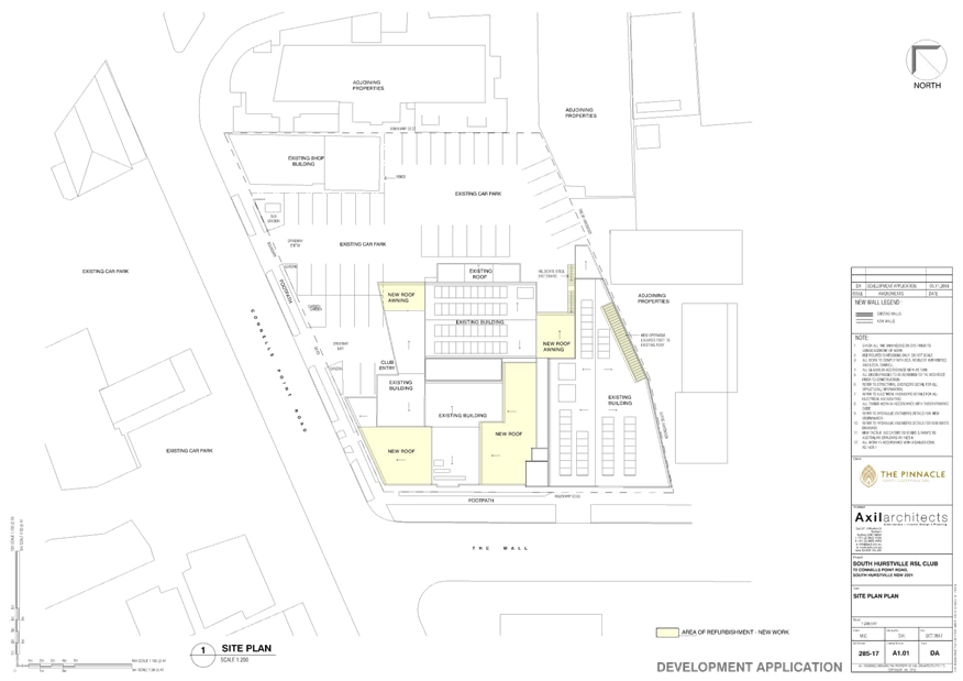
|
Georges
River Council - Georges River Local Planning Panel (LPP) - Thursday, 21
November 2019
LPP056-19 72 Connells Point Road South Hurstville
[Appendix
2] First Floor Plan -
72 Connells Point Road South Hurstville
|
Page 374
|