AGENDA - LPP
|
Meeting:
|
Georges River Local Planning
Panel (LPP)
|
|
Date:
|
Tuesday, 17 December 2019
|
|
Time:
|
4.00pm
|
|
Venue:
|
Council Chambers, Civic
Centre, Hurstville
|
|
Panel Members:
|
Paul Vergotis (Chairperson)
John Brockhoff (Expert Panel
Member)
Michael Leavey (Expert Panel
Member)
Annette Ruhotas (Community
Representative)
|
|
1. On Site Inspections - 1.00pm – 3.30pm
a) 23 Bay Road Oatley
b) Ramsgate Villiage - 193-201
Rocky Point Road, 66-68 Ramsgate Road and 2-6 Targo Road Ramsgate
c) 261 Princes Highway Carlton
d) 1-3 English Street Carlton
e) 296 Forest Road Hurstville
|
|
Break - 3.30pm
|
|
2. Public Meeting
– Consideration of Items 4.00pm – 6.00pm
|
|
Public Meeting Session Closed - 6.00pm
(Break – Light Supper served to Panel
Members)
|
|
Georges
River Council – Local Planning Panel Thursday, 17
December 2019
|
Page 2
|
|
3. Reports and
LPP Deliberations in Closed Session - 6.30pm
|
LPP061-19 296
Forest Road Hurstville (Central Plaza) - MOD2019/0191
(Report
by Consultant Planner)
LPP062-19 261
Princes Highway Carlton - DA2018/0059
(Report
by Consultant Planner)
LPP063-19 1-3
English Street Kogarah - DA2018/0358
(Report
by Senior Development Assessment Officer)
LPP064-19 Lot 23,
23 Bay Road Oatley - MOD2019/0097
(Report
by Independent Assessment)
LPP065-19 Ramsgate
Village Planning Proposal - 193– 201 Rocky Point Road, 66-68 Ramsgate
Road and 2-6 Targo Road, Ramsgate - PP2019/0001
(Report
by Independent Assessment)
|
4. Confirmation of Minutes
|
REPORT TO
GEORGES RIVER COUNCIL
LPP MEETING OF Tuesday, 17 December 2019
|
LPP Report No
|
LPP061-19
|
Development Application No
|
MOD2019/0191
|
|
Site Address & Ward Locality
|
296 Forest Road Hurstville (Central
Plaza)
Hurstville Ward
|
|
Proposed Development
|
Modification Application - Erection
of 4000mm wide by 2000mm deep LED Display Screen mounted on a 5200mm wide by
5000mm high stand with associated speakers and support columns
|
|
Owners
|
Georges River Council
|
|
Applicant
|
Georges River Council
|
|
Planner/Architect
|
Unilumin Group Co Ltd
|
|
Date Of Lodgement
|
23/10/2019
|
|
Submissions
|
One (1)
|
|
Cost of Works
|
N/A
|
|
Local Planning Panel Criteria
|
Georges River Council is the Owner
and Applicant of the application
|
|
List of all relevant s.4.15
matters (formerly s79C(1)(a))
|
State Environmental Planning Policy
Infrastructure 2007, State Environmental Planning Policy No.64 –
Advertising Signage, Greater Metropolitan Regional Environmental Plan No.2
– Georges River Catchment
Hurstville Local Environmental Plan
2012
Hurstville Development Control plan
No.2 (Amendment No.9)
|
|
List all documents submitted
with this report for the Panel’s consideration
|
LED Screen Elevation Plan
Steel support structure plan
LED Screen Plan
General Arrangement Site Plan
|
|
Report prepared by
|
Consultant Planner
|
|
Recommendation
|
That the application be approved in accordance with the
conditions included in the report.
|
|
|
Summary of matters for
consideration under Section 4.15
Have all recommendations in relation
to relevant s4.15 matters been summarised in the Executive Summary of the
assessment report?
|
Yes
|
|
Legislative clauses requiring
consent authority satisfaction
Have relevant clauses in all
applicable environmental planning instruments where the consent authority
must be satisfied about a particular matter been listed and relevant
recommendations summarised, in the Executive Summary of the assessment
report?
|
Yes
|
|
Clause 4.6 Exceptions to
development standards
If a written request for a
contravention to a development standard (clause 4.6 of the LEP) has been
received, has it been attached to the assessment report?
|
Not
Applicable
|
|
Special Infrastructure
Contributions
Does the DA require Special
Infrastructure Contributions conditions (under s7.24)?
|
Not
Applicable
|
|
Conditions
Have draft conditions been provided
to the applicant for comment?
|
No
- the applicant can review the conditions when the report is published.
|
|
Site Plan
Site outlined in red
|
Executive Summary
Proposal
1. The
proposal seeks to erect a LED Display Screen measuring 4000mm wide by 2000mm
deep on a 5200mm wide by 5000mm high stand together with speakers and their
support columns. The LED Display screen is proposed to be a feature facility
within the Hurstville Central Plaza (Plaza) and will enable community events,
feature events and the like to be televised and or displayed for the general
public. This is a compatible form of ancillary development within the Plaza
having regard to the proposed activities previously referred to within the:
- Central
Plaza Plan of Management 2016, prepared by JMD Design; and
- Independent
Hearing and Assessment Panel (IHAP) report of 18 May 2017 for approval of
DA2017/0049 for the creation of the Plaza.
Site and Locality
2. The site is within the Hurstville Town Centre, approximately 20m
from the Hurstville rail station, diagonally opposite the main pedestrian
entrance to the rail station from Forest Road. The site has an area of
approximately 1385sqm, is rectangular in shape and has dimensions of
approximately 26m wide x 60m long. The northern end of the site terminates at
an existing pedestrian ramp that provides access into the Westfield Shopping
Centre. This ramp is located within the road reserve of Crofts Avenue.
Zoning and Permissibility
3. The
site is zoned B3 Commercial Core under Hurstville Local Environmental Plan 2012
and the proposed development is assessed as an ancillary activity to the
primary use being a “Recreational Area”, known as Central Plaza,
this use is permissible in the zone.
Submissions
4. One
(1) submission was received which raised a question with regard to the use of
the LED digital screen for public entertainment purposes. The submitter was
unable to be contacted as phone calls were made and emails sent with no further
response being received. It is noted that the documentation accompanying the
application clearly identified that the LED screen would be used for community
notices and for special events, which may include public entertainment.
Conclusion
5. The application has been assessed having regard to the
Matters for Consideration under Section 4.15 of the Environmental Planning
and Assessment Act 1979, the provisions of the relevant State Environmental
Planning Policies, Local Environmental Plans and Development Control Plans. The
proposed LED digital screen, speakers and their supporting structures are
considered to be ancillary to the permitted use and the relevant assessment
provisions. As a result the application is recommended for approval subject to
conditions.
Report in Full
Proposal
DESCRIPTION OF
THE PROPOSAL
6. The
modification application (MOD2019/0191) is submitted under
the provisions of Section 4.55 (1A) and Section 4.15
Environmental Planning and Assessment Act 1979 seeking amendments to the
approved plans as outlined below:
· Installation
of a 4m long by 2m high LED display screen with side speakers on supporting
steel framework that elevates the LED screen 5m above ground level. The
proposed LED screen is to be located in the front section of the existing
landscaped garden bed at the southern end of Hurstville Central Plaza as
depicted in Figure 1 below.
· Installation
of four (4) Bose articulated array speakers (100W output) 2 to be fixed
adjacent to the proposed LED display screen and two (2) within the Plaza. These
speakers are proposed only to be used during special and cultural events with
the screen to be mute the remainder of the time.
· The
primary use of the LED display screen and speakers is as a community notice
board, community entertainment and for special event and cultural events on a
less frequent nature. In this regard it is proposed to be operated on a 24/7
loop for community and Georges River Council information and events updates.
DESCRIPTION OF
THE SITE AND LOCALITY
7. The subject site
is 296 Forest Road Hurstville being Lot 16 DP4799 and is located between Forest
Road to the south, Crofts Avenue to the north and Diment Way to the west. The
site to the east, 282 Forest Road is currently a construction site which
benefits from an approval for a multi-storey commercial and retail building.
8. The
site is within the Hurstville Town Centre, approximately 20m from the
Hurstville railway station, diagonally opposite the main pedestrian entrance to
the rail station from Forest Road.
9. The
site has an area of approximately 1385sqm, is rectangular in shape and has
dimensions of approximately 26m wide x 60m long. The northern end of the site terminates at an existing
pedestrian ramp that provides access into the Westfield Shopping Centre. This
ramp is located within the road reserve of Crofts Avenue.
10. As
can be seen in the photos below the Plaza is mostly complete with intricate
paving throughout, seating areas, landscaped areas and lighting, all combining
to create an outdoor area that can be utilised by the community both for
general outdoor recreational use as well as for staged events and cultural
celebrations.
Figure 1: Proposed location of the LED display
screen in the front section of the existing landscaped area highlighted in blue
Figure 2:
Onsite photo of “Hurstville Plaza” looking south towards Forest
Road where the screen is to be installed
Figure 3:
Mock-up of proposed LED display screen in Central Plaza (Source: Applicant
Document)
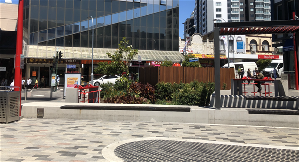
Figure 4: View
looking south to landscaped area where the LED display screen is proposed to be
positioned
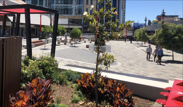
Figure 5:
View from back of landscaped area looking north across “Hurstville
Central Plaza” where the screen is to be installed
COMPLIANCE AND ASSESSMENT
11. The development has been
inspected and assessed under the relevant Section 4.15 "Matters for
Consideration" of the Environmental Planning and Assessment Act 1979.
ENVIRONMENTAL PLANNING INSTRUMENTS
Section 4.55
(1A) Modification under Environmental Planning & Assessment Act, 1979
12. The
proposal has been considered against the
relevant statutory provisions as a matter of minimal environmental impact as
follows;
(1A)
Modifications involving minimal environmental impact
A
consent authority may, on application being made by the applicant or any other
person entitled to act on a consent granted by the consent authority and
subject to and in accordance with the regulations, modify the consent if:
(a) it is satisfied that the proposed modification is of
minimal environmental impact, and
13. Comment:
The proposed LED display screen, speakers and support structures are considered
to be of minimal environmental impact having regard to the following:
· The
structures have a small physical footprint within the Hurstville Central Plaza
and will not unreasonably impact the public use of the Plaza;
· The
primary use of the LED display screen is to provide a 24/7 community event
displays which would not involve elevated volumes;
· The
LED display screen is proposed to be used to broadcast major social, sporting
or community events, which will be audible, these are estimated to be minimal
events in number annually.
14. Suitable conditions of consent, dealing with volume
controls and frequency of events broadcast, will ensure that the LED display
screen and speakers do not unreasonably impact the amenity of the public domain
or significantly impact nearby premises.
(b) it is satisfied that the development to which the
consent as modified relates is substantially the same development as the
development for which the consent was originally granted and before that
consent as originally granted was modified (if at all), and
15. Comment:
The proposed installation of the LED digital screen and speakers does not
change the intent of the original DA (DA2017/0049), which was to create a
public plaza in accordance with the Council endorsed (Hurstville Central Plaza)
Plan of Management (PoM) prepared by JMD Design, 2016. It is noted that the
proposed LED digital screen and speakers are considered to compliment the use
being part of the same approved development considering:
· PoM
identified activities in the Plaza to include Community Notices but does not
specify how this would be achieved, thus Display Screens/Speakers, or any other
form of fixed or portable notice board structure, would be an effective and
appropriate method to publicise community events.
· The
Independent Hearing and Assessment Panel (IHAP) report of 18 May 2017 which
granted consent for the creation of Central Plaza noted as follows:
- The Plaza would include
erection of a Council signage/notice board; and
- Identified that a location
adjacent to the Westfield ramp would be suitable for a LED screen structure for
screening of movies, community notices/events, sporting events and the like.
· The
proposed installation of the LED digital display screen and speakers will
compliment and strengthen the objectives of the Hurstville Plaza PoM,
specifically the recreational use of the Plaza for staging of events and
cultural celebrations (one of the key permitted uses under the Plaza PoM).
· The
original electrical plan layout for the Plaza provided suitable outlets in the positions
identified for the Screen and speakers, pre-empting future electrical
requirements within the Plaza.
· There
is no identifiable adverse impact on general amenity, privacy or overshadowing
by the proposal on the adjoining commercial and retail premises.
16. Suitable
conditions of consent can be imposed to ensure that the LED screen and speakers
do not adversely impact the amenity of the future public domain or nearby
premises, including:
i. Inclusion of a remote cut-out
switch should the noise generated create unacceptable amenity concerns for
future residents within the proximity of the Plaza;
ii. Requirement that a bi-annual acoustic
report be prepared, and submitted for Council consideration and action on any
appropriate recommendations, which carries out an analysis of noise generation
on six (6) occasions annually, inclusive of at least three (3) amplified
events, from monitoring points at each end of the Plaza, being Forest Road and
Crofts Avenue. This procedure should continue for six (6) years from the date
of approval to provide a broad analysis of the facilities operational impacts.
iii. Operation of amplified broadcasts from the
LED screen/speakers will be terminated by 10:00pm daily, except where major
events are programmed to occur, including festivals (eg Chinese New Year),
sporting events (eg Olympic Events) or musical presentations (eg Mardi Gras) or
the like, that have been notified to the general public through the LED
Screen/Speaker system for a minimum of 14 days prior to the event occurring to
ensure the general public are fully informed.
(c) it has notified the application
in accordance with:
(i) the regulations, if the regulations
so require, or
(ii) a development control plan, if the consent
authority is a council that has made a development control plan that requires
the notification or advertising of applications for modification of a
development consent, and
17. Comment:
In accordance with the provisions of Councils Public Notification process, the
application was placed on neighbour notification for 14 days and one (1)
submission was received. The submission was in the form of an enquiry as to the
purpose of the display screen whether it was for entertainment purposes. The
person who made the submission was contacted by telephone and email but has not
responded to these enquiries.
Section 4.15
Assessment
18. An
assessment of the application with regard to the matters for consideration
under Section 4.15 of the Environmental Planning and
Assessment Act 1979 is provided as follows.
(a)(i) any
environmental planning instrument,
19. Hurstville
Local Environmental Plan 2012 applies to the site. The relevant provisions of
this local environmental plan are addressed as follows.
Hurstville
Local Environmental Plan 2012
20. The
subject site is subject to the Hurstville Local
Environmental Plan 2012
Part 2 –
Permitted or Prohibited Development
Clause 2.1
– Land Use Zones
21. The subject site is zoned B3
Commercial Core and the approved use as a “recreation area”
is a permissible form of development with Council’s consent, the screen
and speakers are considered ancillary to this approved use.
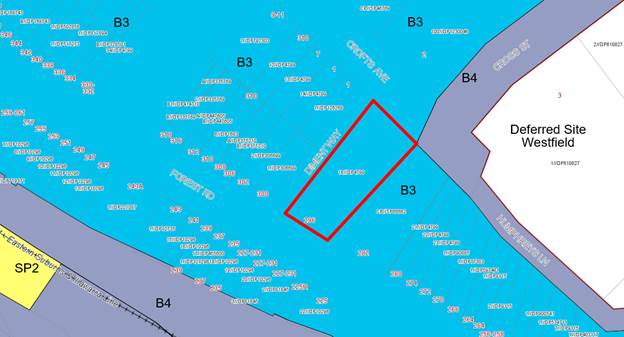
Figure 6 – Zoning map with the site outlined in red
22. The proposed installation of
the LED digital screen and speakers will strengthen the recreational use of
Hurstville plaza for staging of events and cultural celebrations
23. Accordingly the proposed
development satisfies the objectives of the zone.
|
Clause
|
Standard
|
Assessment
Under HLEP 2012
|
|
Part 2
– Permitted or Prohibited Development
|
B3
Commercial Core
“recreation area means a place used for outdoor
recreation that is normally open to the public, and includes:
(a) a children’s playground, or
(b) an area used for community sporting activities, or
(c) a public park, reserve or garden or the like,
and any ancillary buildings, but does not include a
recreation facility (indoor), recreation facility (major) or recreation
facility (outdoor).”
|
It is considered that the proposed development is an
ancillary use within a recreation area, being the “Hurstville Central
Plaza” under the Hurstville LEP2012
In the B3 zone, recreation areas are permissible with
consent and the subject LED screen and speakers proposed are ancillary to the
recreational use.
|
|
|
Objectives
of the Zone
|
It is
considered that the proposed development satisfies the objectives of the zone
as the public plaza will create a community land use to serve the needs of
the Hurstville Town Centre.
|
|
4.3
– Height of Buildings
|
9m as
identified on Height of Buildings Map
|
Noting
these are structure, however they do not exceed 5m in height.
|
|
4.4
– Floor Space Ratio
|
0.6:1 as
identified on Floor Space Ratio Map
|
N/A
|
|
4.5
– Calculation of floor space ratio and site area
|
FSR and
site area calculated in accordance with Cl.4.5
|
N/A
|
|
5.9
– Preservation of trees or vegetation
|
Consent
is required for pruning or removal of specified vegetation
|
N/A
|
|
5.9AA
– Trees or vegetation not prescribed by Development Control
Plan
|
Any tree
or vegetation to be removed that is not specified in DCP No.1
|
N/A
|
|
6.4
– Foreshore Scenic Protection Area
|
Council
cannot grant consent to the carrying out of development on land within a
Foreshore Scenic Protection Area unless consideration has been made to
relevant provisions.
|
N/A
|
|
6.7
– Essential Services
|
The
following services that are essential for the development shall be available
or that adequate arrangements must be made available when required:
* Supply of water, electricity and disposal and
management of sewerage
* Stormwater drainage or on-site conservation
* Suitable vehicular access
|
All
essential services are available and suitable for the demands of the proposed
development.
The plaza
will be pedestrian only with provision for Council service vehicles (cleaning
as required) and emergency vehicles. Secure bicycle parking hoops are
provided.
|
State Environmental Planning Policy No 64 –
Advertising Signage (SEPP 64)
24. The proposed information signage has been reviewed with regard to the
provisions of SEPP 64. It is considered that the signage will not change the
existing character or advertising theme of the area and is therefore consistent
with the aims of SEPP 64.
|
Schedule
1
Assessment
Criteria
|
Proposal
|
Complies
|
|
1. Character
of the area
· Is the proposal
compatible with the existing or desired future character of the area or
locality in which it is proposed to be located?
· Is the proposal
consistent with a particular theme for outdoor advertising in the area or locality?
|
Proposed LED
screen and speakers are located in the Hurstville CBD, within Hurstville
Plaza which is an area for outdoor entertainment and recreation.
|
Yes
|
|
2. Special
areas
· Does the
proposal detract from the amenity or visual quality of any environmentally
sensitive areas, heritage areas, natural or other conservation areas, open
space areas, waterways, rural landscapes or residential areas?
|
No
environmentally sensitive areas are affected by the proposed LED screen and
speakers.
Further conditions
of consent will ensure that noise and illumination will not adversely impact
any nearby areas.
|
Yes
|
|
3. Views
and vistas
· Does the
proposal obscure or compromise important views?
· Does the
proposal dominate the skyline and reduce the quality of vistas?
· Does the
proposal respect the viewing rights of other advertisers?
|
No important
views are affected by the proposal.
5m high screen
is located such that it does not affect the skyline or vistas.
No impacts on
any other signage in this locality.
|
Yes
Yes
Yes
|
|
4. Streetscape,
setting or landscape
· Is the scale,
proportion and form of the proposal appropriate for the streetscape, setting
or landscape?
· Does the
proposal contribute to the visual interest of the streetscape, setting or
landscape?
· Does the
proposal reduce clutter by rationalising and simplifying existing
advertising?
· Does the
proposal screen unsightliness
· Does the
proposal protrude above buildings, structures or tree canopies in the area or
locality?
· Does the
proposal require ongoing vegetation management?
|
The proposed
LED screen is an appropriate size given its intended use and its location in
the front of the existing landscaped area at the southern end of Hurstville
Plaza.
The screen will
add to the visual interest of this outdoor recreational and entertainment
venue.
Not applicable
The proposed
LED screen is a neat and attractive structure that is not unsightly.
The LED screen
is lower than all adjacent buildings in the area and is also lower than the
numerous light poles within the Plaza.
Existing
landscaped garden bed requires maintenance but this is independent of the LED
screen.
|
Yes
Yes
Yes
Yes
Yes
Yes
|
|
5. Site
and building
· Is the proposal
compatible with the scale, proportion and other characteristics of the site
or building, or both, on which the proposed signage is to be located?
· Does the
proposal respect important features of the site or building, or both?
· Does the
proposal show innovation and imagination in its relationship to the site or
building, or both?
|
The proposed
LED screen is an appropriate size given its intended use and its location in
the front of the existing landscaped area at the southern end of Hurstville
Plaza.
The screen has
been designed and proportioned to suit its purpose and the site conditions of
the Plaza in which it is situated.
Yes this modern
LED screen is an innovative way of providing information to the public.
|
Yes
Yes
Yes
|
|
6. Associated
devices and logos with advertisements and advertising structures
· Have
any safety devices, platforms, lighting
devices or logos been designed as an integral part of the signage or
structure on which it is to be displayed?
|
The screen is
at a height that keeps it safe from the public and the public safe from it
being elevated 5m at its highest point and 3m at its lowest point. The site
is well lit and located within the front of a landscaped area so is not a
hazard to pedestrians.
|
Yes
|
|
7. Illumination
· Would illumination
result in unacceptable glare?
· Would
illumination affect safety for pedestrians, vehicles or aircraft?
· Would
illumination detract from the amenity of any residence or other form of
accommodation?
· Can the
intensity of the illumination be adjusted, if necessary?
· Is the
illumination subject to a curfew?
|
The
illumination level of the proposed LED screen is approximately 14 to 18k
lumens. The 12 light poles in the Plaza give out 11.6k lumens each.
Accordingly the LED screen is not considered to provide an unnecessary degree
of illumination.
Further, it
will be conditioned that :
1. the illumination level must be adjustable so that if
illumination levels cause a public nuisance then the level of illumination
can be reduced.
2. a curfew can be made by a condition of consent if a
public nuisance is caused.
|
Yes
Yes
|
|
8. Safety
· Would the
proposal reduce the safety for any public road?
· Would the
proposal reduce the safety for pedestrians or bicyclists?
· Would the
proposal reduce the safety for pedestrians, particularly children, by
obscuring sightlines from public areas?
|
No, the screen
faces away from Forest Road and is at the opposite of the plaza to Crofts
Avenue, being some 55m away and unlikely to be affected as a pedestrian ramp
to Westfield runs between the Plaza and Crofts Avenue.
Proposed LED
screen is elevated 3m above ground level so it does not affect pedestrian or
bicycle safety.
Proposed LED
screen is elevated 3m above ground level so does not reduce sightlines for
pedestrians
|
Yes
Yes
Yes
|
Greater Metropolitan Regional Environmental Plan No 2
– Georges River Catchment
25. The site is within the area affected by the Greater
Metropolitan Regional Environmental Plan No 2 – Georges River Catchment. The
proposal does not generate any additional stormwater, therefore remaining
consistent with Council’s requirements for the disposal of stormwater in
the catchment.
State Environmental Planning
Policy (Infrastructure) 2007
26. Not
applicable.
State Environmental Planning
Policy No 55 (Remediation of Land)
27. The
proposal involves minor excavation works, excavated holes to accommodate
support poles, in a location that has recently been redeveloped for public
use. As part of the development application to create Central Plaza,
DA2015/0176, a Hazardous Building Materials Survey, dated 23 December
2014 and prepared by HIBBS & Associates Pty Ltd, was considered as part of
the approval of the demolition of the existing building on the land. It is
unlikely that any contamination issue would now eventuate from the proposed
minor excavation works.
DRAFT ENVIRONMENTAL PLANNING INSTRUMENTS
Draft
Remediation of Land SEPP
28. The
Department of Planning and Environment has announced a Draft Remediation of Land
SEPP, which will repeal and replace the current State Environmental Planning
Policy No 55—Remediation of Land.
29. The
main changes proposed include the expansion of categories of remediation work which
requires development consent, a greater involvement of principal certifying
authorities particularly in relation to remediation works that can be carried
out without development consent, more comprehensive guidelines for Councils and
certifiers and the clarification of the contamination information to be
included on Section 149 Planning Certificates.
30. Whilst
the proposed SEPP will retain the key operational framework of SEPP 55, it will
adopt a more modern approach to the management
of contaminated land.
31. Given the recent development of this location to
create the Central Plaza it is not considered the excavation for the footings is considered acceptable and it is not
unlikely that contamination will be experienced.
Draft
Environment SEPP
32. The
Draft Environment SEPP was exhibited from 31 October 2017 to 31 January 2018.
33. This consolidated SEPP proposes to simplify the
planning rules for a number of water catchments, waterways, urban bushland, and Willandra Lakes World Heritage
Property.
· Changes
proposed include consolidating the following seven existing SEPPs:
· State
Environmental Planning Policy No. 19 – Bushland in Urban Areas
· State
Environmental Planning Policy (Sydney Drinking Water Catchment) 2011
· State
Environmental Planning Policy No. 50 – Canal Estate Development
· Greater
Metropolitan Regional Environmental Plan No. 2 – Georges River Catchment
· Sydney
Regional Environmental Plan No. 20 – Hawkesbury-Nepean River (No.2-1997)
· Sydney
Regional Environmental Plan (Sydney Harbour Catchment) 2005
· Willandra
Lakes Regional Environmental Plan No. 1 – World Heritage Property.
The proposal is
generally consistent with the provisions of this Draft Instrument.
Any other matters prescribed by the regulations
34. The Regulations prescribe the following matters for
consideration for development in the Hurstville Council area:
DEVELOPMENT CONTROL PLANS
Hurstville Development Control Plan No 2 Amendment No 9
35. The
relevant Development Control Plan (DCP) is the
Hurstville DCP No 2 Amendment No 9, relating to the Hurstville town centre
“Retail Core”, which came into effect on 28 February 2019.
36. The
DCP calls up key principles of the Hurstville City Centre Concept Masterplan
2004 which included the creation of a new
sequence of linked public spaces comprising arcades, public squares and pocket
parks that capitalise on topography.
37. Part
4.5.2 of the DCP states the desired future character is for, “New
development will build on its highly active pedestrian environment, and multiple
narrow retail frontages, interlinked with laneways and arcades”.
Activating the ground level is recognised as important and within the public
domain the use of widened footpaths for passive activities (outdoor dining,
retailing, seating, landscaping) should generate a vibrant and lively
environment. The proposed modification to accommodate a LED Digital Screen and
associated speakers within the Hurstville Central Plaza reacts positively to
the public area policies by enhancing and increasing the use of the Plaza and
attracting people to this public space.
Part 6.1 of
Hurstville DCP No 2 Public Domain
38. Part
6.1 Public Domain of the DCP states that:
“The
public domain comprises the public space in the City Centre, the public face
and setting for buildings and structures. It is the parts of the City Centre
not privately owned. The streets, squares and parks that form the public domain
provide community activity and recreation space. The goal of public domain
design is to create an integrated space that is legible, comfortable, safe and
engaging, which encourages pedestrian use and increases the amount and quality
of public leisure spaces.
Clause 6.1.5.3 – Advertising Opportunities from New
Technologies..…….Controls….... (b) Signage involving animation,
video screens and other forms of movement are generally inappropriate, where
they are likely to adversely impact on residential areas or pedestrians amenity
or safety, or are likely to distract motorists.”
39. The
proposed LED Screen and Speaker concept is considered to be consistent with the
goals and intent of Part 6.1 as stated above, especially as the
advertising/broadcasting of special events and cultural events help attract and
entertain the public within the Hurstville Central Plaza and do not result in
unreasonable or adverse amenity concerns on residential properties.
Variations or Non-Compliances
40. The
proposed LED screen and speakers are considered to comply with the requirements
of Hurstville DCP No 2; accordingly there are no variations or non-compliances.
IMPACTS
Natural
Environment
41. There
are no natural environment issues associated with the proposed LED screen and
speakers.
Built
Environment/ Urban Design
42. The
proposed LED screen and speakers will enhance the built environment of the town
centre by attracting the public to this area and providing entertainment during
special events and cultural events, as well as providing the general public
with information at other times.
43. The
locality accommodates development that is commercial/retail in nature with the
nearest residential apartments being over 100 metres from the LED screen
position. On this basis late night operation of the LED screen would not
currently result in any significant amenity impacts. It is noted,
however, that shop top housing is a permissible form of housing within the B3
Commercial Core Zoning and therefore opportunity exists for residential
development to occur in the future in this locality and due regard needs to be given
to the amenity that would be available to that future residential component.
44. On
this basis it is considered appropriate to impose the following conditions on
the amplified operation of the LED screen during evenings that would ensure
reasonable evening/late night amenity can be maintained in the locality:
a) Inclusion of a remote cut-out
switch should the noise generated create unacceptable amenity concerns for
future residents within the proximity of the Plaza;
b) Requirement that a bi-annual acoustic
report be prepared, and submitted for Council consideration and action on any
appropriate recommendations, which carries out an analysis of noise generation
on six (6) occasions annually, inclusive of at least three (3) amplified
events, from monitoring points at each end of the Plaza, being Forest Road and
Crofts Avenue. This procedure should continue for six (6) years from the date
of approval to provide a broad analysis of the facility operational impacts.
c) Operation of amplified
broadcasts from the LED screen/speakers will be terminated by 10:00pm daily,
except where major events are programmed to occur, including festivals (eg
Chinese New Year), sporting events (eg Olympic Events) or musical presentations
(eg Mardi Gras) or the like, that have been notified to the general public
through the LED Screen/Speaker system for a minimum of 14 days prior to the
event occurring to ensure the general public are fully informed.
Social
Impact
45. It
is anticipated that the proposed development will have a positive social impact
upon the broader Hurstville community by providing a facility to broadcast
public information and significant events as well as enhancing the use of this
area for special and cultural events.
46. It
is relevant to consider the potential for Third Party Advertisements occurring
as part of the LED Digital Screen operation. Generally the screening of special
events may include unintended commercial advertising as part of these events
over which Council would have no control should the event be appropriate for
broadcast. Third Party Advertising use of the LED Digital Screen, whether for
local or wider community advertisers, is not unreasonable where due
consideration is given to:
· manner/nature of
advertising, ie intrusive flashing signage may not be suitable;
· content of the
advertisement, ie suitable language and attire should be encouraged;
· suitability of the
advertiser, ie alcohol or gaming industry may not be appropriate;
· community notices
remaining the predominant advertisement use of the facility.
Economic
Impact
47. It
is anticipated that the proposed development will have a positive economic
impact upon the broader Hurstville Centre by enhancing the operation of the
public domain and helping to make the centre a more attractive, desirable
destination and overall enhancing the value of adjoining development. Potential
also exists for community economic benefits through increased revenue from the
measured sale of third party advertising space, as referred to above at
paragraph 46, to appropriate advertisers whilst not being to the detriment of
community notice advertising.
Suitability
of the Site
48. The
site is suitable for the proposed development as it is an extension of the
Hurstville Central Plaza as an area for community notices, community functions,
entertainment, outdoor recreational activities and as a community meeting
place.
REFERRALS, SUBMISSIONS AND THE PUBLIC INTEREST
Pubic Submissions
49. The proposal was notified between 29 October 2019 to 12 November
2019. The day after the exhibition period one (1) submission was
received. The submission did not raise objection to the application but rather
questioned whether the proposal would be for entertainment purposes. Officers
of Council attempted to respond to the inquiry by both telephone and email but
have been unable to directly contact the submitter. It is considered that the
description of the development in the application clearly illustrates that the
LED Digital Screen would be utilised for both community and general notices and
broadcasting of events, which by their nature could be an entertainment event
in some instances.
50. It is concluded that no issues have been raised that would preclude the work proceeding
or give rise to the need for any significant amendments to the plans as
submitted.
Council
Referrals
51. The Development Application was reviewed by relevant technical officers of
Council and no issues have been raised that would preclude the work proceeding
or give rise to the need for any significant amendments to the plans as
submitted.
52. A series of conditions of consent have been put forward
that cover the range of interests from the various Council departments that
cover both the construction phase and the ongoing management of the space
(noise and lighting).
CONCLUSION
53. The application has been assessed having regard to Section
4.55(1A) and Section 4.15 of the Environmental Planning and Assessment Act
1979, and the provisions of the Hurstville Local Environmental Plan (LEP) and
the Hurstville Development Control Plan (DCP).
54. The proposal has been considered on its merits and is
considered to be acceptable for the reasons outlined within this report. The
proposal is reasonable given that the objectives of the controls have been
reasonably satisfied.
55. Following a detailed assessment contained within this
report, it is considered that MOD2019/0191 should be approved subject to the
modified conditions of consent which will ensure protection of late evening
amenity on residential apartments in the locality.
DETERMINATION AND STATEMENT OF REASONS
Statement of Reasons
56. The
erection of the LED Digital Screen, Speakers and support structures within the
Hurstville Central Plaza is recommended for approval having regard to:
· The
proposed use was considered to be an appropriate use within the Plaza during assessment
of the original approval to create the Plaza, DA2017/0049;
· The
proposed use is a suitable facility to promote community advertisements,
special events and public use of the Plaza;
· The
proposed use is considered to be an acceptable extension of the original
approved Plaza development;
· The
proposed use is unlikely to result in any significant adverse amenity impacts
for the locality;
· Suitable
noise and light controls can be implemented and managed to ensure that the
public amenity is not significantly impacted;
· The
proposal is considered to be a minor modification to the approved Plaza
development which remains substantially the same development.
57. That the Georges River Local Planning Panel, as the consent
authority, pursuant to Section 4.55 (1A) of the Environmental Planning and
Assessment Act, 1979, grant approval to the requested modifications for the
installation of an LED Digital Screen, Speakers and support structures (MOD2019/0191) to Development Consent DA 2017/0049 dated 27
June 2017 for construction of a public plaza including landscaping,
paving, seating and public amenities at 296
Forest Road (and Diment Way), Hurstville, submitted on 23 October 2019 subject
to the development consent being modified as follows:
1. Condition 1 to be modified as follows:
1. Approved Plans of Consent - The
development must be implemented in accordance with the approved plans,
specifications and details listed below and any supporting information
submitted with the Development Application except as amended by any conditions
attached to the Development Consent:
Architectural
plans – Submitted with Mod 2019/019, including:
|
Reference
No.
|
Date
|
Description
|
Revision
|
Prepared by
|
|
Dwg L2000
|
09/12/18
|
General
Arrangement Plan
|
J
|
Group GSA Pty
Ltd
|
|
N/A
|
Undated
|
LED Screen
Specifications and Elevations
|
N/A
|
N/A
|
|
N/A
|
Undated
|
Loudspeaker
Noise Impact Diagram
|
N/A
|
N/A
|
(This condition is amended as part
of MOD2019/0191 (DA2017/0049))
23. Health
- Lighting - General Nuisance - Any
lighting on the site shall be designed so as not to cause a nuisance to other
premises in the area or to motorists on nearby roads and to ensure no adverse
impact on the amenity of the surrounding area by light overspill or glare.
Flashing, moving or intermittent lights or signs are prohibited.
(This condition is amended as part
of MOD2019/0191 (DA2017/0049))
2. Conditions to be deleted:
Nil
3. Insert
the following additional conditions to be numbered in the consent as follows:
General Conditions
1C Modified Consent- Modification
Application MOD2019/0191 approval only relates to works for the erection of the
proposed LED screen and frame, the four (4) speakers and the use of the LED
screen and speakers.
Requirements
of other Government Agencies
6A Ausgrid-The proposed LED screen and
speakers must comply with relevant Ausgrid Network Standards and Safework NSW
Codes of Practice for construction works near existing electrical assets. The
“as constructed” minimum clearances to Ausgrids infrastructure must
not be encroached by the building development. It also remains the
responsibility of the developer and relevant contractors to verify and maintain
these clearances onsite.
Prior
to issue of Construction Certificate
9A Engineers Certification-The steel
frame and LED screen shall be constructed in accordance with details submitted
by a suitably qualified structural Engineer and the structure shall be
certified by this Engineer as structurally adequate (i.e. complies with AS/NZS
1170 Parts 1, 2, & 3.)
Prior
to issue of Occupation Certificate
20A Health - LED Screen Lighting Prior to the issue of
any Occupation Certificate, a suitably qualified consultant shall certify that
the lighting from the use of the LED screen shall comply with AS/NZS 4282:2019:
Control of the obstructive effects of outdoor lighting. The
development shall at all times comply with these standards.
Ongoing
Conditions
23A Health - LED Screen- The use of the LED screen shall
not cause a nuisance or annoy the occupants of nearby premises, nor cause a
nuisance to motorists on nearby roads. In this regard the use of the LED screen
must comply with AS/NZS 4282:2019 – Control of the obtrusive effects
of outdoor lighting
23B Health - LED
Screen Hours of operation - Hours of operation are approved as follows:
a) The core hours of
operation of the amplified speaker system shall be limited to 8am to 10pm daily, apart from those days of
operation for special events. Special events may include, festivals (e.g.
Chinese New Year), sporting events (e.g. Olympic Events), musical presentations
(e.g. Mardi Gras) or the like,
b) The core hours of
operation of the LED Screen shall be 24
hours daily. Should screen brightness become an identifiable issue for
local amenity then suitable restrictions are to be placed on screen lumen
levels from 10pm to 8am daily, through the use of an automatic dimmer switch or
by remote control via the operator.
c) Notwithstanding (a) and
(b) above, the manner and hours of operation of the LED screen and speakers may
be modified to accommodate the special events that may periodically occur and
where the modification has been suitably notified for a period of fourteen (14)
days on the LED screen display.
d) Council will review the
operation of the facilities on the bi-annual anniversary of the original
consent or as part of any modification request referred to in (c) above,
and will consider, among other things:
i. any acoustic assessment undertaken in
accordance with the conditions of consent for this modification application;
ii. the performance of the operator of the Plaza
facilities in relation to the compliance with the development consent
conditions;
iii. any substantiated complaints received; and
iv. any views expressed during public consultation or
from other stakeholders including the Police.
e) Following a review,
Council may allow the use to continue to operate for the hours specified in (a)
and (b) above, require the use to revert to the core hours of operation
specified in (a) and (b) above or otherwise modify the condition as considered
appropriate.
f) The purpose of the
reviewable condition is to allow ongoing assessment of the hours of operation
in relation to neighbourhood amenity, public safety and operational performance
and allow management to demonstrate successful practices in relation to the
above.
23C Health - Noise
Control - The use of the LED screen and
associated speakers must not give rise to the transmission of offensive noise
to any place of different occupancy. Offensive noise is defined in the
Protection of the Environment Operations Act 1997 (as amended).
23D Health - Acoustic
Certification - Prior to the commencement
of the use, a suitably qualified acoustic consultant shall certify that,
subject to any appropriate amelioration measures being undertaken, the
operation of the LED screen and associated speakers shall not give rise to an
‘offensive noise’ as defined in the Protection of the Environment
Operations Act 1997 (as amended) and Regulations.
23E Health - Periodic Acoustic Report -
Verification of Noise report – On a bi-annual basis for a minimum
period of six (6) years from the date of commencement of operation, an acoustic assessment is to be carried out by an
appropriately qualified acoustic consultant, in accordance with the EPA's Noise
Policy for Industry and submitted to Council for consideration. This report
should include but not be limited to:
i. an analysis of noise generation on six (6)
occasions annually, inclusive of at least three (3) amplified events (if at
least three events are held annually), carried out from monitoring points at
each end of the Plaza, being Forest Road and Croft Avenue.
ii. details
verifying that the noise control measures can be implemented which are
effective in attenuating noise to an acceptable noise level; and
iii. that the use is
not calculated to give rise to ‘offensive noise’ as defined under
the provision of the Protection of the Environment Operation Act 1997 (as
amended).
Consolidated
Conditions of Consent DA2017/0049
Schedule
A – Conditions of Consent
GENERAL CONDITIONS
These conditions
have been imposed to ensure that the development is carried out in accordance
with the approved plans and to ensure that the appropriate fees and bonds are
paid in relation to the development.
1. Approved Plans - The
development must be implemented in accordance with the approved plans and
supporting documentation listed below which have been endorsed by
Council’s approved stamp, except where marked up on the plans and/or
amended by conditions of this consent:
|
Reference
No.
|
Date
|
Description
|
Revision
|
Prepared by
|
|
DA_C2.01
|
16/02/17
|
Locality Plan
|
1
|
Northrop
|
|
DA_C3.01
|
06/03/17
|
Site work and
Stormwater Management Plan
|
2
|
Northrop
|
|
160861 1001
|
17/02/17
|
Landscape Plan
|
B
|
Group GSA Pty
Ltd
|
|
L144M_SK02-01
|
17/02/17
|
Lighting
category intent
|
B
|
N/A
|
|
L144M_SK02-02
|
17/02/17
|
Lighting design
intent
|
B
|
N/A
|
|
L144M_SK02-03
|
17/02/17
|
Lighting intent
legend
|
B
|
N/A
|
|
L144M_SK02-04
|
17/02/17
|
Propose
electrical equipment
|
B
|
N/A
|
|
Dwg L2000
|
09/12/18
|
General
Arrangement Plan
|
J
|
Group GSA
Pty Ltd
|
|
N/A
|
Undated
|
LED Screen
Specifications and Elevations
|
N/A
|
N/A
|
|
N/A
|
Undated
|
Loudspeaker
Noise Impact Diagram
|
N/A
|
N/A
|
(This condition is amended as
part of MOD2019/0191 (DA2017/0049))
1A. The
inground fixings and table settings adjacent to the north western boundary near
300 Forest Road are to be deleted.
1B. The
substation is to be placed underground if permitted by Ausgrid.
1C. Modified
Consent - Modification Application MOD2019/0191 approval only relates to
works for the erection of the proposed LED screen and frame, the four (4)
speakers and the use of the LED screen and speakers.
(This condition is added as part
of MOD2019/0191 (DA2017/0049))
2. Fees to be paid to Council - The fees listed in the table below must be paid
in accordance with the conditions of this consent and Council’s adopted
Fees and Charges applicable at the time of payment.
Payments must be made prior to the issue of the
Construction Certificate or prior to the commencement of work (if there is no
associated Construction Certificate).
Please
contact Council prior to the payment of Section 94 Contributions to
determine whether the amounts have been indexed from that indicated below in
this consent and the form of payment that will be accepted by Council.
Form
of payment for transactions $500,000 or over - Council will only accept Bank
Cheque or Electronic Funds Transfer (EFT) for transaction values of $500,000 or
over. Council must be contacted prior to payment to determine correct total
amount to be paid and bank account details (if applicable)
(a) Fees
to be paid:
Fee
types, bonds and contributions
|
Fee Type
|
|
Long Service
Levy (to Long Service Corporation)
|
3. Long Service Levy - Submit
evidence of payment of the Building and Construction Industry Long Service
Leave Levy to the Principal Certifying Authority. Note this amount is based on
the cost quoted in the Development Application, and same may increase with any
variation to estimated cost which arises with the Construction Certificate
application. To find out the amount payable go to www.lspc.nsw.gov.au
or call 131441. Evidence of the payment of this levy must be submitted with
the Construction Certificate application.
SEPARATE APPROVALS UNDER OTHER
LEGISLATION
These conditions
have been imposed to ensure that the applicant is aware of any separate
approvals required under other legislation, for example: approvals required
under the Local Government Act 1993 or the Roads Act 1993.
4. Engineering
- Section 138 Roads Act and Section 68 Local Government Act 1993
Unless
otherwise specified by a condition of this consent, this Development Consent does
not give any approval to undertake works on public infrastructure.
A
separate approval is required to be lodged and approved under Section
138 of the Roads Act 1993 and/or Section 68 of the Local
Government Act 1993 for any of the following activities
carried out in, on or over a public road (including the footpath):
(a) Placing
or storing materials or equipment;
(b) Placing
or storing waste containers or skip bins;
(c) Erecting
a structure or carrying out work
(d) Swinging or hoisting goods over any part of a public
road by means of a lift, crane or the like;
(e) Pumping
concrete from a public road;
(f) Pumping
water from the site into the public road;
(g) Constructing
a vehicular crossing or footpath;
(h) Establishing
a “works zone”;
(i) Digging up or disturbing the surface of a
public road (e.g. Opening the road for the purpose of connections to utility
providers);
(j) Stormwater
and ancillary works in the road reserve; and
(k) Stormwater
and ancillary to public infrastructure on private land
(l) If any excavation is to be supported by the use
of below ground (cable) anchors that are constructed under Council’s
roadways/footways.
These
separate activity approvals must be obtained and evidence of the approval
provided to the Certifying Authority prior to the issue of the Construction
Certificate.
The
relevant Application Forms for these activities can be downloaded from Georges
River Council’s website at: www.georgesriver.nsw.gov.au
For
further information, please contact Council’s Customer Service Centre on
(02) 9330 6400.
5. Building - Hoarding Application - Prior to demolition of the buildings on the site
or the commencement of work above ground level a separate application for the
erection of an A class (fence type) or a B class (overhead type) hoarding or C
type scaffold, in accordance with the requirements of Work Cover Authority of
NSW, must be erected along that portion of the footways/roadway where
the building is within 3.0 metres of the street boundary. An application for
this work under Section 68 of the Local Government Act 1993 and the Roads Act
1993 must be submitted for approval to Council.
The
following information is to be submitted with a Hoarding Application under
Section 68 of the Local Government Act and Section 138 of the Roads Act 1993:
(a) A site and location plan of the hoarding with detailed
elevation, dimensions, setbacks, heights, entry and exit points to/from the
site, vehicle access points, location of public utilities, electrical overhead
wire protection, site management plan and builders sheds location; and
(b) Hoarding plan and details that are certified by an
appropriately qualified engineer; and
(c) The payment to Council of a footpath occupancy
fee based on the area of footpath to be occupied and Council's Schedule of Fees
and Charges (available on our website) before the commencement of work; and
A
Public Risk Insurance Policy with a minimum cover of $10 million in relation to
the occupation of and works within Council's road reserve, for the full
duration of the proposed works, must be obtained a copy provided to Council.
The Policy is to note Council as an interested party.
REQUIREMENTS OF OTHER GOVERNMENT
AGENCIES
These conditions
have been imposed by other NSW Government agencies either through their role as
referral bodies, concurrence authorities or by issuing General Terms of
Approval under the Integrated provisions of the Environmental Planning and
Assessment Act 1979.
6. Sydney Water - Trade Waste Agreements - A Trade Waste Agreement with Sydney Water may be
required. Details of any work required to comply with the agreement must be
detailed on the plans lodged with the Construction Certificate. If no trade
waste agreement or grease trap is required, a letter from Sydney Water to this
effect must be submitted with the application for the Construction
Certificate.
6A Ausgrid-The proposed
LED screen and speakers must comply with relevant Ausgrid Network Standards and
Safework NSW Codes of Practice for construction works near existing electrical
assets. The “as constructed” minimum clearances to Ausgrids
infrastructure must not be encroached by the building development. It also
remains the responsibility of the developer and relevant contractors to verify
and maintain these clearances onsite.
(This condition is added as part
of MOD2019/0191 (DA2017/0049))
7A. Ausgrid
- Substation or Kiosk - Ausgrid shall be consulted to determine the
relocation of the substation from Diment Way and this is to be addressed as
follows:
(a) written confirmation of Ausgrid's requirements is to
be submitted prior to the issue of the Construction Certificate;
and
(b) Ausgrid's requirements are to be met before the issue
of the Occupation Certificate.
PRIOR TO THE ISSUE OF THE
CONSTRUCTION CERTIFICATE
These conditions
either require modification to the development proposal or further
investigation/information prior to the issue of the Construction Certificate to
ensure that there is no adverse impact.
7. Building - Vibration Damage - To minimise vibration damage and loss of support
to the buildings in close proximity to the development, any excavation is to be
carried out by means of a rock saw and if available, in accordance with the
guidelines of the Geotechnical Engineer’s report.
Alternatively
where a hydraulic hammer is to be used within 30 metres of any building (other
than a path or a fence) a report from a qualified geotechnical engineer
detailing the maximum size of hammer to be used is to be obtained and the
recommendations in that report implemented during work on the site. The
report shall be submitted with the Construction Certificate application.
8. Development Assessment - Construction Site Management Plan - Major Development - A Site Management Plan
must be submitted with the application for the Construction Certificate, and
must include the following measures:
· location
of protective site fencing;
· location
of site storage areas/sheds/equipment;
· location
of building materials for construction, e.g. stockpiles
· provisions
for public safety;
· dust
control measures;
· method
used to provide site access location and materials used;
· details
of methods of disposal of demolition materials;
· method
used to provide protective measures for tree preservation;
· provisions
for temporary sanitary facilities;
· location
and size of waste containers/skip bins;
· details
of proposed sediment and erosion control measures;
· method
used to provide construction noise and vibration management;
· construction
traffic management details.
The site management measures are to be implemented prior to the
commencement of any works including demolition and excavation. The site
management measures are to be maintained throughout the works, to maintain
reasonable levels of public health, safety and amenity. A copy of the
Site Management Plan must be retained on site and is to be made available upon
request.
9. Building - Structural details - Structural plans, specifications and design
statement prepared and endorsed by a suitably qualified practising structural
engineer who holds the applicable Certificate of Accreditation as required
under the Building Professionals Act 2005 shall be submitted along with the
Construction Certificate application to the Certifying Authority for any of the
following, as required by the building design:
(a) piers
(b) footings
(c) slabs
(d) columns
(e) structural
steel
(f) reinforced
building elements
(g) swimming
pool design
(h) retaining
walls
(i) stabilizing
works
(j) structural
framework
9A Engineers Certification - The
steel frame and LED screen shall be constructed in accordance with details
submitted by a suitably qualified structural Engineer and the structure shall
be certified by this Engineer as structurally adequate (ie complies with AS/NZS
1170 Parts 1, 2, and 3).
(This condition is added as part
of MOD2019/0191 (DA2017/0049))
10. Stormwater - Detailed
hydraulic plans indicating pipe diameters, pit sizes, invert and outlet levels
of the proposed pits and pipes and hydraulic grade line analysis for the
proposed pipe works shall be provided with the Construction Certificate
documents.
11. Development Assessment - Landscape Plan - A detailed landscape plan, drawn
to scale, by a qualified landscape architect or landscape designer, must be
submitted prior to the issue of the Construction Certificate. The plan must
include:
(i) Location
of existing and proposed structures on the site including existing trees (if
applicable);
(ii) Details of
earthworks including mounding and retaining walls and planter boxes (if
applicable);
(iii) Location, numbers
and type of plant species;
(iv) Details of
planting procedure and maintenance;
(v) Details of
drainage and watering systems.
(vi) Undergrounding of
the substation if permitted by Ausgrid
12. Building - Access for Persons with a Disability - Access and sanitary facilities for persons with
disabilities must be provided to the premises/building in accordance with the
requirements of the Premises Standards, the Building Code of Australia, and AS
1428.1. Details must be submitted with the Construction Certificate
application.
13. Building -
Compliance with Access, Mobility and Disability Discrimination Act - The
Construction Certificate application must be accompanied by detailed working
plans and a report or a Certificate of Compliance from an Accredited Access
Consultant certifying that the design and access through the plaza complies
with relevant Australian Standards for Access and the Disability
Discrimination Act 1992.
PRIOR TO THE
COMMENCEMENT OF WORK (INCLUDING DEMOLITION AND EXCAVATION)
These conditions
have been imposed to ensure that all pre-commencement matters are dealt with
and finalised prior to the commencement of work.
14. Building regulation - Site sign - Soil and Erosion Control
Measures - Prior to the
commencement of works (including demolition and excavation), the durable site
sign issued by Georges River Council in conjunction with this consent must be
erected in a prominent location on site. The site sign warns of the
penalties which apply to pollution, storing materials on road or footpath and
breaches of the conditions relating to erosion and sediment controls. The
sign must remain in a prominent location on site up until the completion of all
site and building works.
15. Development Assessment - Demolition and Asbestos - The demolition work shall comply with the
provisions of Australian Standard AS2601:2011 - Demolition of Structures, NSW
Work Health and Safety Act 2011 and the NSW Work Health and Safety Regulation
2011. The work plans required by AS2601-2001 shall be accompanied by a written
statement by a suitably qualified person that the proposals contained in the
work plan comply with the safety requirements of the Standard. The work plans
and the safety statement shall be submitted to the Principal Certifying
Authority prior to the commencement of works.
For
demolition work which involves the removal of asbestos, the asbestos removal
work must be carried out by a licensed asbestos removalist who is licensed to
carry out the work in accordance with the NSW Work Health and Safety Act 2011
and the NSW Work Health and Safety Regulation 2011 unless specified in the Act
and/or Regulation that a license is not required.
The
asbestos removal work shall also be undertaken in accordance with the How to
Safely Remove Asbestos: Code of Practice published by Work Cover NSW.
Copies
of the Act, Regulation and Code of Practice can be downloaded free of charge
from the Work Cover NSW website: www.workcover.nsw.gov.au
16. Development
Assessment - Demolition Notification Requirements - The following notification requirements apply to this
consent:
a) The developer /builder must notify
adjoining residents five (5) working days prior to demolition. Such
notification is to be a clearly written note giving the date demolition will
commence, contact details of the developer/builder, licensed asbestos
demolisher and the appropriate regulatory authority. Notification is to be
placed in the letterbox of every premises (including every residential flat or
unit, if any) either side and immediately at the rear of the demolition site.
b) Five (5) working days prior to demolition,
the developer/builder is to provide written notification to Georges River
Council advising of the demolition date, details of the WorkCover licensed
asbestos demolisher and the list of residents advised of the demolition.
c) On demolition sites where buildings to be
demolished contain asbestos, a standard commercially manufactured sign
containing the words “DANGER ASBESTOS REMOVAL IN PROGRESS”
measuring not less than 400mm x 300mm is to be erected in a prominent visible
position (from street frontage) on the site. The sign is to be erected prior to
demolition work commencing and is to remain in place until such time as all
asbestos material has been removed from the site to an approved waste facility.
17. Development
Assessment - Demolition work involving asbestos removal - Work involving
bonded asbestos removal work (of an area of more than 10 square metres) or
friable asbestos removal work must be undertaken by a person who carries on a
business of such removal work in accordance with a licence under clause 458 of
the Work Health and Safety Regulation 2011.
18. Engineering - Dial before your dig - The applicant shall contact “Dial Before
You Dig on 1100” to obtain a Service Diagram prior to the issuing of the
Construction Certificate. The sequence number obtained from “Dial
Before You Dig” shall be forwarded to Council’s Engineers for their
records.
DURING WORK
These conditions
have been imposed to ensure that there is minimal impact on the adjoining
development and surrounding locality during the construction phase of the development.
19. Building - Structural Engineer’s Certification during
construction - The proposed
building must be constructed in accordance with details designed and certified
by the practising qualified structural engineer. All structural works associated
with the foundations, piers, footings and slabs for the proposed building must
be inspected and structurally certified for compliance by an independent
practising geotechnical and structural engineer. In addition a Compliance or
Structural Certificate, to the effect that the building works have been carried
in accordance with the structural design, must be submitted to the Principal
Certifying Authority at each stage of construction or prior issue of the
Occupation Certificate.
PRIOR TO THE ISSUE OF THE
OCCUPATION CERTIFICATE
These conditions
have been imposed to ensure that all works have been completed in accordance
with the Development Consent prior to the issue of the Occupation Certificate.
20. Health - Noise from Mechanical plant and equipment - Noise from the operation of mechanical,
equipment, ancillary fittings, machinery, mechanical ventilation system and/or
refrigeration systems must not give rise to offensive noise as defined under
the Protection of the Environment Operations Act 1997 (as amended) and will
comply with the noise intrusion criteria as defined under the NSW Industrial
Noise Policy published by the Environment Protection Authority.
A
professional acoustic engineer shall be engaged to certify that the design and
construction of all sound producing plants and equipment associated with the
building complies with the above requirements. Certification shall be submitted
to the Principal Certifying Authority prior to the issue of any Occupation
Certificate.
20A. Health - LED Screen Lighting - Prior to
the issue of any Occupation Certificate, a suitably qualified consultant shall
certify that the lighting from the use of the LED screen shall comply with
AS/NZS 4282:2019: Control of the obstructive effects of outdoor lighting.
The development shall at all times comply with these standards.
(This condition is added as part
of MOD2019/0191 (DA2017/0049))
21. Building - The
proposed structure(s) must be constructed in accordance with details designed
and certified by the practising qualified structural engineer. In addition,
Compliance or Structural Certificates, to the effect that the building works
have been carried in accordance with the structural design, must be submitted
to the Principal Certifying Authority prior issue of the Occupation
Certificate.
22. Development Assessment - Completion of Landscape Works - All landscape works must be completed before the
issue of the Final Occupation Certificate.
ONGOING CONDITIONS
These conditions
have been imposed to ensure that the use or operation of the development does
not adversely impact on the amenity of the neighbourhood or environment.
23. Health - Lighting - General Nuisance - Any lighting on the
site shall be designed so as not to cause a nuisance to other premises in the
area or to motorists on nearby roads and to ensure no adverse impact on the
amenity of the surrounding area by light overspill or glare. Flashing, moving
or intermittent lights or signs are prohibited.
(This condition is aamended as
part of MOD2019/0191 (DA2017/0049))
23A. Health - LED Screen - The use of the
LED screen shall not cause a nuisance or annoy the occupants of nearby
premises, nor cause a nuisance to motorists on nearby roads. In this regard the
use of the LED screen must comply with AS/NZS 4282:2019 – Control of the
obtrusive effects of outdoor lighting
(This condition is added as part
of MOD2019/0191 (DA2017/0049))
23B. Health
- LED Screen Hours of operation - Hours of operation are approved as
follows:
a) The core hours of operation of the
amplified speaker system shall be
limited to 8am to 10pm daily, apart from those days of operation for special
events. Special events may include, festivals (eg Chinese New Year), sporting
events (eg Olympic Events), musical presentations (eg Mardi Gras) or the like,
b) The core hours of operation of the LED
Screen shall be 24 hours daily. Should
screen brightness become an identifiable issue for local amenity then suitable
restrictions are to be placed on screen lumen levels from 10pm to 8am daily,
through the use of an automatic dimmer switch or by remote control via the
operator.
c) Notwithstanding (a) and (b) above, the
manner and hours of operation of the LED screen and speakers may be modified to
accommodate the special events that may periodically occur and where the
modification has been suitably notified for a period of fourteen (14) days on
the LED screen display.
d) Council will review the operation of
the facilities on the bi-annual anniversary of the original consent or as
part of any modification request referred to in (c) above, and will consider,
among other things:
i. any acoustic assessment undertaken in accordance
with the conditions of consent for this modification application;
ii. the performance of the operator of the Plaza facilities
in relation to the compliance with the development consent conditions;
iii. any substantiated complaints received; and
iv. any views expressed during public consultation or from other
stakeholders including the Police.
e) Following a review, Council may allow
the use to continue to operate for the hours specified in (a) and (b) above,
require the use to revert to the core hours of operation specified in (a) and
(b) above or otherwise modify the condition as considered appropriate.
f) The
purpose of the reviewable condition is to allow ongoing assessment of the hours
of operation in relation to neighbourhood amenity, public safety and
operational performance and allow management to demonstrate successful
practices in relation to the above
(This condition is added as part
of MOD2019/0191 (DA2017/0049))
23C. Health - Noise
Control - The use of the LED screen and
associated speakers must not give rise to the transmission of offensive noise
to any place of different occupancy. Offensive noise is defined in the
Protection of the Environment Operations Act 1997 (as amended).
(This condition is added as part
of MOD2019/0191 (DA2017/0049))
23D. Health -
Acoustic Certification - Prior to the
commencement of the use, a suitably qualified acoustic consultant shall certify
that, subject to any appropriate amelioration measures being undertaken, the
operation of the LED screen and associated speakers shall not give rise to an
‘offensive noise’ as defined in the Protection of the Environment
Operations Act 1997 (as amended) and Regulations.
(This condition is added as part
of MOD2019/0191 (DA2017/0049))
23E. Health - Periodic Acoustic Report -
Verification of Noise report – On a bi-annual basis for a minimum
period of six (6) years from the date of commencement of operation, an acoustic assessment is to be carried out by an
appropriately qualified acoustic consultant, in accordance with the EPA's Noise
Policy for Industry and submitted to Council for consideration. This report
should include but not be limited to:
i. an
analysis of noise generation on six (6) occasions annually, inclusive of at
least three (3) amplified events (if at least three events are held annually),
carried out from monitoring points at each end of the Plaza, being Forest Road
and Croft Avenue.
ii. details verifying that
the noise control measures can be implemented which are effective in
attenuating noise to an acceptable noise level; and
iii. that the use is not calculated to give rise to
‘offensive noise’ as defined under the provision of the Protection
of the Environment Operation Act 1997 (as amended).
(This condition is added as part
of MOD2019/0191 (DA2017/0049))
24. Health - Amenity of the neighbourhood - The implementation of this development shall not
adversely affect the amenity of the neighbourhood or interfere unreasonably
with the comfort or repose of a person who is outside the premises by reason of
the emission or discharge of noise, fumes, vapour, odour, steam, soot, dust,
waste water, waste products, grit, oil or other harmful products.
No
vegetation, article, building material, waste or the like shall be ignited or
burnt whatsoever or in association with the work on site.
ADVICE
This advice has
been included to provide additional information and where available direct the
applicant to additional sources of information based on the development type.
Not applicable
Schedule
B – Prescribed Conditions
Prescribed
conditions are those which are mandated under Division 8A of the Environmental
Planning and Assessment Regulation 2000 and given weight by Section 80A
(11) of the Environmental Planning and Assessment Act 1979.
Detailed below is
a summary of all the prescribed conditions which apply to
development in New South Wales. Please refer to the full details of the
prescribed conditions as in force, at www.legislation.nsw.gov.au.
It is the
responsibility of the beneficiary of this consent to determine which prescribed
conditions apply.
25. Clause
98 – Building Code of Australia & Home Building Act 1989 -
Requires all building work to be carried out in accordance with the Building
Code of Australia. In the case of residential building work to which the
Home Building Act 1989 relates, there is a requirement for a contract of
insurance to be in force before any work commences.
26. Clause
98A – Erection of Signs - Requires the erection of signs on site and
outlines the details which are to be included on the sign. The sign must
be displayed in a prominent position on site and include the name and contact details
of the Principal Certifying Authority and the Principal Contractor.
27. Clause
98B – Home Building Act 1989 - If the development involves
residential building work under the Home Building Act 1989, no work is
permitted to commence unless certain details are provided in writing to
Council. The name and licence/permit number of the Principal Contractor
or Owner Builder and the name of the Insurer by which work is insured under
Part 6 of the Home Building Act 1989.
28. Clause
98E – Protection & support of adjoining premises - If the
development involves excavation that extends below the level of the base of the
footings of a building on adjoining land, this prescribed condition requires
the person who benefits from the development consent to protect and support the
adjoining premises and where necessary underpin the adjoining premises to
prevent any damage.
Schedule
C – Operational & Statutory Conditions
These conditions
comprise the operational and statutory conditions which must be satisfied under
the Environmental Planning and Assessment Act 1979 and the Environmental
Planning & Assessment Regulation 2000. Please refer to the full details of
the Act and Regulations as in force, at www.legislation.nsw.gov.au.
It is the
responsibility of the beneficiary of this consent to determine which
operational and statutory conditions apply.
29. Requirement
for a Construction Certificate - The erection of a building must not
commence until a Construction Certificate has been issued by the consent
authority, the Council (if the Council is not the consent authority) or an
accredited certifier.
An application form
for a Construction Certificate is attached for your convenience.
30. Appointment
of a Principal Certifying Authority - The erection of a building must not
commence until the beneficiary of the development consent has:
(a) appointed a Principal Certifying Authority (PCA) for the building
work; and
(b) if relevant, advised the PCA that the work will be undertaken as an
Owner-Builder.
If the work is not
going to be undertaken by an Owner-Builder, then the beneficiary of the consent
must:
(a) appoint a Principal Contractor to undertake the building work. If
residential building work (within the meaning of the Home Building Act 1989) is
to be undertaken, the Principal Contractor must be a holder of a contractor
licence; and
(b) notify the PCA of the details of any such appointment; and
(c) notify the Principal Contractor of any critical stage
inspections or other inspections that are required to be carried out in respect
of the building work.
An Information
Pack is attached for your convenience should you wish to appoint
Georges River Council as the Principal Certifying Authority for your
development.
31. Notification
of Critical Stage Inspections - No later than two (2) days before the
building work commences, the PCA must notify:
(a) the consent authority and the Council (if not the consent
authority) of his or her appointment; and
(b) the beneficiary of the development consent of the critical stage
inspections and other inspections that are to be carried out with respect to
the building work.
32. Notice
of Commencement - The beneficiary of the development consent must give at
least two (2) days notice to the Council and the PCA of their intention to
commence the erection of a building.
A Notice of
Commencement Form is attached for your convenience.
33. Critical
Stage Inspections - The last critical stage inspection must be undertaken
by the Principal Certifying Authority. The critical stage inspections
required to be carried out vary according to Building Class under the Building
Code of Australia and are listed in Clause 162A of the Environmental Planning
and Assessment Regulation 2000.
34. Notice
to be given prior to critical stage inspections - The principal contractor
for a building site, or the owner-builder, must notify the principal certifying
authority at least 48 hours before each required inspection needs to be carried
out.
Where Georges River
Council has been appointed PCA, forty eight (48) hours notice in writing, or
alternatively twenty four (24) hours notice by facsimile or telephone, must be
given to when specified work requiring inspection has been completed.
35. Occupation
Certificate - A person must not commence occupation or use of the whole or
any part of a new building unless an Occupation Certificate has been issued in
relation to the building or part.
Only the Principal
Certifying Authority appointed for the building work can issue the Occupation
Certificate.
An Occupation
Certificate Application Form is attached for your convenience.
ATTACHMENTS
|
Attachment ⇩1
|
Final Plans - 296 Forest Rd Hurstville
|
|
Georges
River Council - Georges River Local Planning Panel (LPP) - Tuesday, 17
December 2019
LPP061-19 296 Forest Road Hurstville (Central Plaza)
[Appendix
1] Final Plans - 296
Forest Rd Hurstville
|
Page 35
|
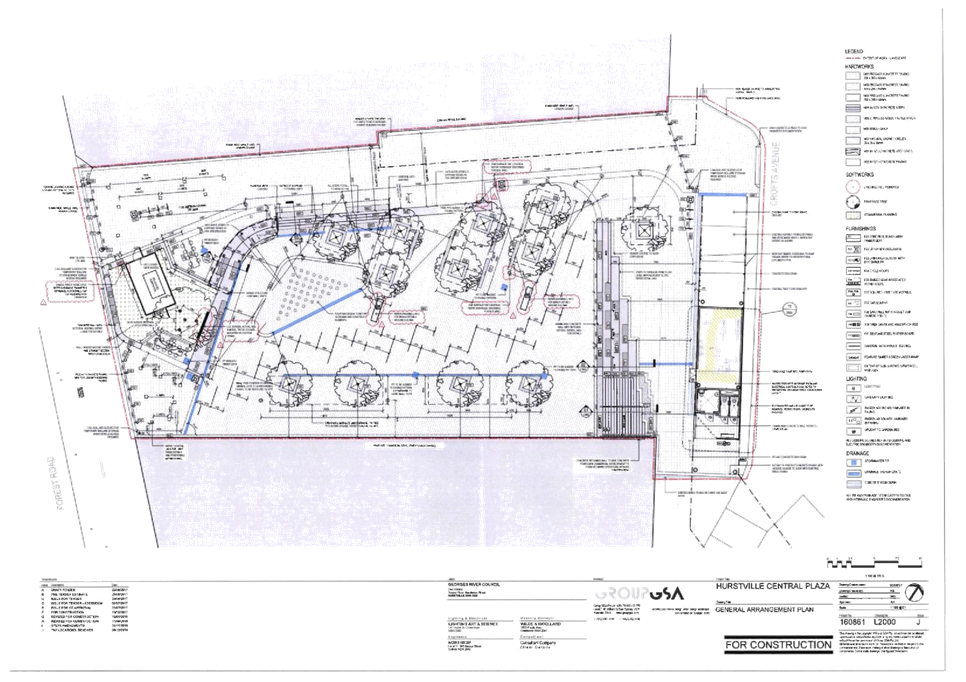

|
Georges River Council – Local Planning
Panel Thursday, 17 December 2019
|
Page 93
|
REPORT TO GEORGES RIVER COUNCIL
LPP MEETING OF Tuesday, 17 December 2019
|
LPP Report No
|
LPP062-19
|
Development Application No
|
DA2018/0059
|
|
Site Address & Ward Locality
|
261 Princes Highway Carlton
Kogarah Bay Ward
|
|
Proposed Development
|
Demolition of existing building,
lot consolidation, tree removal and construction of a new five (5) storey shop
top housing development including two (2) levels of basement parking
|
|
Owners
|
Kirshu Pty Ltd
|
|
Applicant
|
MHN Design Union
|
|
Planner/Architect
|
MHN Design Union
|
|
Date Of Lodgement
|
22/02/2018
|
|
Submissions
|
Two (2)
|
|
Cost of Works
|
$15,471,770.00
|
|
Local Planning Panel Criteria
|
SEPP 65 Application under Ministers
Direction of 23 February 2018
|
|
List of all relevant s.4.15
matters (formerly s79C(1)(a))
|
State Environmental Planning Policy
No.65 – Design Quality of Residential Apartment Development, State Environmental
Planning Policy (Vegetation in Non-Rural Areas) 2017,
State Environmental Planning Policy
(Building Sustainability Index: BASIX)2004, Greater Metropolitan Regional
Environmental Plan No.2 – Georges River Catchment, State Environmental
Planning Policy No.55 – Remediation of Land, Draft State Environmental
Planning Policy, Draft State Environmental Planning Policy –
Remediation of Land,
Kogarah Local Environmental Plan
2012, Kogarah Development Control Plan 2013
|
|
List all documents submitted with
this report for the Panel’s consideration
|
Architectural Plans, Statement of
Environmental Effects,
Cardno Flood Report, Hydraulic
Report
Traffic Assessment Report, Acoustic
Report, BASIX
|
|
Report prepared by
|
Consultant Planner
|
|
Recommendation
|
That the application be refused in accordance with the
reasons stated in the report.
|
|
|
Summary of matters for
consideration under Section 4.15
Have all recommendations in relation
to relevant s4.15 matters been summarised in the Executive Summary of the assessment
report?
|
Yes
|
|
Legislative clauses requiring
consent authority satisfaction
Have relevant clauses in all
applicable environmental planning instruments where the consent authority
must be satisfied about a particular matter been listed, and relevant
recommendations summarised, in the Executive Summary of the assessment
report?
|
Yes
|
|
Clause 4.6 Exceptions to
development standards
If a written request for a
contravention to a development standard (clause 4.6 of the LEP) has been
received, has it been attached to the assessment report?
|
Not
Applicable
|
|
Special Infrastructure
Contributions
Does the DA require Special
Infrastructure Contributions conditions (under s7.24)?
|
Not
Applicable
|
|
Conditions
Have draft conditions been provided
to the applicant for comment?
|
Not
Applicable Recommendation is for Refusal and the refusal reasons are
available at the time the report is published.
|
|
Site Plan
Figure 1: Aerial Photograph of the subject site and locality
outlined in red
|
Executive Summary
Proposal
1. The development
application (DA) seeks consent for the demolition of existing structures, lot
consolidation, tree removal and the construction of a five (5) storey shop top
housing development comprising thirty six (36) units (13 x 1 bedroom, 21 x 2
bedroom and 2 x 3 bedroom units), one level of
commercial/restaurant/café floor space, and two (2) levels of basement
car parking for a total of ninety-seven (97) car parking spaces, new
landscaping and associated site works. Two (2)
business/retail tenancies totalling 1,289sqm, with dual access points off Ecole
Street and Princes Highway, are to be located on the ground floor with
vehicular access and a loading bay proposed from Ecole Street. Communal open space is provided on the podium level
above the retail tenancy.
Figure 2: Photomontage
of the proposed development as viewed from the Princes Highway frontage and the
corner of Ecole Street (Source: MHN Union Architects).
Site and Locality
2. The subject site
is legally identified as Lots 33 - 36 in DP 13023, with a street address of
261-265 Princes Highway, Carlton. The site is located on the corner of Princes
Highway and Ecole Street, Carlton.
3. The subject site
is located within 900m of Carlton Railway Station and approximately 1.5km to
the south west of the Kogarah Town Centre.
4. The site is
located on the Princes H with a frontage of approximately 39.90m to Princes
Highway, a secondary frontage of 47.945m to Ecole Street with a splay to the
corner of Ecole Street and Princes Highway of 2.145m. The site is currently
occupied by a single storey; brick and iron roofed building previously used as
a timber centre and has been a petrol station in the past. A majority of
the site is hardstand area and access to the site is via Ecole Street.
5. The
site is generally square in shape with a total area of 2,066sqm and a slope of
approximately 1.0m from the northern corner to the western corner and a gentle
grade along the eastern boundary to the Princes Highway frontage. Vehicular and pedestrian access to the site is via Ecole Street.
6. Across the Princes Highway from the site at 124 Princes
Highway is the St Georges Leagues Club and associated child care centre, with
the Beverley Park Golf Club further to the south east. To the east of the
subject site across Ecole Street is the Carlton South Public School and 253
Princes Highway which currently has an application with Council for shop top
housing which is presently under appeal. On the western side of Jubilee Avenue
is 71-73 Jubilee Avenue which is the subject of a shop top housing development,
this application is being reported to the Georges River Local Planning Panel on
12 December 2019. On the opposite side of Jubilee Avenue is Jubilee Oval and
Kogarah Park. To the north and west of the site, in Ecole and Wheeler Streets,
are various forms of low scale residential development.
7. Council amended its planning controls on 26 May 2017 via
Kogarah Local Environmental Plan 2012 Amendment No.2, and introduced a new
zoning, B6 Enterprise Corridor applying to the land fronting the Princes
Highway between Westbourne Street and Jubilee Avenue, and half of the block
between Francis Street and Westbourne Street. The new zoning provides a height
and floor space uplift to allotments within this area to permit a higher
density of development.
Zoning and Permissibility
8. The site is zoned ‘B6 Enterprise Corridor’
under the Kogarah Local Environmental Plan 2012 (KLEP). The development is
defined as ‘shop top housing’ under KLEP, which is a permissible
land use with consent in this zone, subject to compliance with a 65% maximum
residential component under Clause 6.9.
Figure 3 - zoning of the subject site and surrounding allotments
Submissions
9. The development
application was publicly exhibited in accordance with the provisions of the
Kogarah Development Control Plan 2013. Two (2) submissions were received.
10. Amendments
to the application received during the course of its assessment were not
required to be publicly notified in accordance with the development control
plan, as they related primarily to drainage works and did not result in
significant additional environmental impacts.
Reason for referral to the Local
Planning Panel
11. This development application is
referred to the Local Planning Panel for consideration and determination as it
comprises development to which State Environmental Planning Policy No. 65
– Design Quality of Residential Apartment Development applies as required
by the Ministerial Direction of 23 February 2018.
Planning and
Design Issues
12. The proposal’s bulk, scale
and form is generally considered an appropriate design response to the site
when considered against the Design Quality Principles of State Environmental
Planning Policy No 65 – Design Quality of Residential Apartment
Development by the Design Review Panel. It is noted that a minor
non-compliance for side boundary setbacks (being 259mm or 4.3% variation)
to the western boundary with 3 Ecole Street occurs as a 6m minimum setback is
required due to habitable rooms facing this boundary.
13. The proposal also fails to comply with the additional local
provision for Development in Zone B6 contained within Clause 6.9 of KLEP 2012.
This clause requires that the proposed development must not contain more than
65% of the gross floor area for shop top housing and a land use other than shop
top housing have a minimum of 500sqm in gross floor area. The proposal provides
67.9% of its gross floor area as shop top housing and only 1289sqm (32.1%) of
its gross floor area as business/retail floor space. The 65% requirement under
Clause 6.9 is considered to be a development standard by definition and thus if
it cannot be achieved the development should be supported by a Clause 4.6
variation to justify the non-compliance. In this instance a Clause 4.6
submission has not been lodged and the proposal is considered to be a
prohibited development as it does not comply with the standard. Failure to meet
the minimum alternative use floor space is contrary to the intent of the
zoning and will create an undesirable and inappropriate precedent in this
recently up-zoned locality.
14. The B6 Enterprise Corridor zone was introduced to encourage
appropriate businesses and offer a range of employment opportunities. The
intent of the new B6 zone was to renew the enterprise corridor and activate the
street frontage through commercial/retail space, whilst also permitting a
percentage of residential floor area above. The design is inconsistent with the
desired future character of this precinct being the B6 Enterprise Corridor
zone, as the development has not been designed to cater for a range of
employment uses, including business, office, retail and light industrial
uses.
15. The subject land is identified as being subject to the 1 in
100 year flood inundation and inadequate reports/documentation has been
submitted to adequately address this concern, see Figure 4 below.
Figure 4:
Flooding Map and 1 in 100 year flow path (Source Intramaps).
Blue – Flood Planning Area
Blue hatched – 1 in 100 year flood extent
16. The subject land is within the 1 in 100 year flow path
extending from Carlton Station down to Beverley Park, and the proposed building
footprint will more than double the size of the existing commercial building
footprint currently constructed within the flow path. It is evident that
the larger structure will result in higher and broader flows and will adversely
impact the amenity of neighbouring land.
17. A public submission has raised concern with the orientation
of the balconies/windows towards Carlton Public School. It is noted that the
subject land is separated from the school by Ecole Street and thus acceptable
separation is achieved, whilst it is also noted that the potential for
overlooking is limited to the school carpark and back of the assembly hall
only. Concern was also raised at the timing of demolition and
construction periods, which should have suitable safety and remediation
measures in place and preferably be programmed for during school holiday
periods. Other amenity concerns raised related to traffic and whether the
proposal will comply with recently adopted development standards.
18. The location of the loading bay at ground level adjacent to
the entry ramp and residential entry points is not considered appropriate. The
proposed loading bay will rely on a turntable service to ensure medium rigid vehicles
can enter and leave the site in a forward direction. Vehicular and pedestrian
safety is a concern given the site is located fronting a main road and is
diagonally opposite the Carlton South Public School. The multiple vehicle and
pedestrian openings along Ecole Street is likely to lead to confusion and
potential conflicts in this location. The multiple pedestrian access points
along Princes Highway are not considered well designed and result in confusion
see Figure 5 below.
Figure 5:
Ground Plan extract – multiple street entries (Source MHNUnion
Architects).
Conclusion
19. The application has been assessed having regard to the
Matters for Consideration under Section 4.15 of the Environmental Planning
and Assessment Act 1979, the provisions of the relevant State Environmental
Planning Policies, Local Environmental Plan and Development Control Plans.
Given the non-compliance with the side
boundary setbacks under the Apartment Design Guidelines, the minimum alternative
use area requirements for the B6 zone, design concerns with the flooding
management, pedestrian and vehicular concerns with access/egress, overlooking
concerns from the balconies/windows, the proposed development is considered to
result in an unacceptable planning outcome.
20. As a result the application is recommended for refusal.
Report in Full
DESCRIPTION OF THE PROPOSAL
21. The development proposed is for the
demolition of existing structures, lot consolidation, tree removal and the
construction of a five (5) storey shop top housing development containing,
thirty six (36) residential units, and one level of business/retail floor space
above two (2) levels of basement car parking. In an attempt to resolve the
drainage issues various sets of plans were lodged for consideration.
22. The most recent set of amended
plans included a series of design changes which identified the need for the
introduction of stormwater culverts to be inserted below the ground floor
level, within the basement carpark, to drain flood water through to the Princes
Highway drainage system in order to retain the current flow path of the
overland flow across the site.
23. Details of the proposed design and
layout of the development are as follows:
Basement 2
Plan
- 57
Residential car parking spaces (which includes 1 x car wash bay, 1 x accessible
space and 7 of these spaces are for visitors).
- Sixteen
(16) bicycle parking spaces (12 resident and 4 visitor).
- Three
(3) lift and lobby areas.
- Thirty
six (36) Storage areas.
- Two
(2) fire egress stairs.
Basement 1
Plan
- 40
Car parking spaces comprising two (2) accessible
spaces.
- Eight (8) commercial bicycle
parking spaces.
- One (1) lift and lobby area (Only
lift 3 services this level).
- Two (2) fire egress stairs.
- Three (3) garbage rooms.
- Switch, communication and plant
rooms.
- Two (2) culverts for stormwater
transfer.
Ground Floor
Plan
- 1,272sqm
of commercial/retail floor space with no sanitary facilities.
- Lift
and lobby areas for the tenancies.
- Fire
stair access to residential levels.
- Three
(3) residential lift and lobby areas.
- Six
(6) fire egress stairs.
- Loading
bay with truck turntable, vehicular and pedestrian access off Ecole Street.
- Substation
room and fire hydrant boosters fronting Ecole Street.
- Service
entry for commercial tenancies from the loading bay area.
- Deep
soil zone (165sqm) located in the north western portion of the subject site.
- Pedestrian
pathways and tenancy bin storage adjacent to deep soil area.
- Two
(2) pedestrian commercial entries off Princes Highway, with lift accessible
access and two accesses off Ecole Street.
- Basement
driveway access.
Level 1
Floor Plan
- 4
x 1 bedroom apartments (one of which has a private courtyard).
- 6
x 2 bedroom apartments (all of which have private courtyards).
- Three
(3) Lift lobby areas and four (4) fire stairs.
- Communal
area comprising 528sqm with communal toilet.
Level 2 Floor
Plan
- 4
x 1 bedroom apartments.
- 6
x 2 bedroom apartments.
- Three
(3) Lift lobby areas and four (4) fire stairs.
- Suspended
walkway to connect two building elements and provide level access to lifts for
Units 2.09 and 2.10.
Level 3 Floor
Plan
- 4
x 1 bedroom apartments.
- 6
x 2 bedroom apartments.
- Three
(3) Lift lobby areas and four (4) fire stairs.
- Suspended
walkway to connect two building elements and provide level access to lifts for
Units 3.09 and 3.10.
Level 4 Floor
Plan
- 1
x 1 bedroom apartment.
- 3
x 2 bedroom apartments.
- 2
x 3 bedroom apartments.
- Two
(2) Lift lobby areas and three (3) fire stairs.
DESCRIPTION OF THE SITE AND
LOCALITY
24. The
subject site is legally identified as Lots 33 to 36 in DP 13023, and has a
street address of 261 Princes Highway, Carlton. The site is located on the
corner of Princes Highway and Ecole Street Carlton.
25. The subject site is located within
900m of Carlton Railway Station and approximately 1.5km to the south west of
the Kogarah Town Centre.
26. The site is a rectangular parcel of
land and has north eastern frontage of 50.08m to Ecole Street, a secondary
south eastern frontage of 41.295m to Princes Highway with a splay to the corner
of Ecole Street and Princes Highway of 2.145m. The site is currently occupied
by a single storey commercial building previously used as a timber centre and
has been a petrol station in the past with a majority of the site a hardstand
area. Vehicular and pedestrian access to the site is via Ecole Street.
27. The
site has a total area of 2,066.5sqm. The land has a slope of approximately 1.0m
from the rear to the front along the Ecole Street frontage and is relatively
flat along the Princes Highway frontage.
28. Immediately
to the east of the development site is 253 Princes Highway which accommodates
an existing commercial/retail building with an at grade car park accessed via
Ecole Street.
29. A
development application was lodged on this site for a six (6) storey shop top
housing development (DA2019/0116) which is currently under appeal with the Land
and Environment Court.
30. Immediately
further to the east of the site at 71-73 Jubilee Avenue has an application with
Council for a shop top housing development, this is being reported to Georges
River Local Planning Panel on 12 December 2019. The site currently accommodates
a vehicle hire facility, whilst further to the north east is Carlton South
Public School.
Figure 6:
Princes Highway photograph of development site (Source SEE, GSA
Planning).
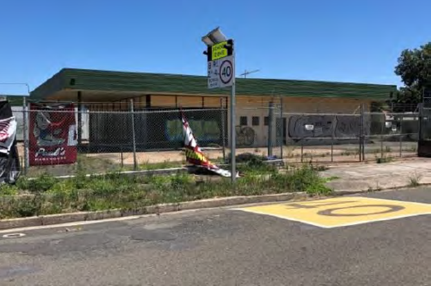
Figure 7: Ecole
Street photograph of development site (Source SEE, GSA Planning).
31. Across
the Princes Highway from the site at 124 Princes Highway is the St Georges
Leagues Club and associated child care centre, with the Beverley Park Golf Club
further to the south east. To the north east of the subject site across Jubilee
Avenue is Jubilee Oval and to the north east is Kogarah Park. To the west of
the site are commercial premises along Princes Highway and residential housing
in Ecole and Wheeler Streets.
32. The site
is suitably serviced for stormwater purposes, see Figure 8 below. As
illustrated at Figure 4 above, the site is impacted by overland flow
affectation and management of inundation is required. It should be noted that
Figure 8 indicatively identifies the Sydney Water service (Sewer) which extends
across the southern portion of Lot 33, which is considered to be impacted by
the development and may require relocation as part of any development of the subject
land.
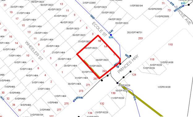
Figure 8: Development
Services impacting locality (Source Intramaps).
Olive green –
indicative location of Sydney Water infrastructure
Blue and Black lines and symbols – stormwater pit and pipes
Planning Assessment
33. The
subject site has been inspected and the development has been assessed under the
relevant Section 4.15, Matters for Consideration of the Environmental Planning
and Assessment Act 1979.
Environmental
Planning Instruments
State Environmental Planning Policies
34. Compliance with relevant State
Environmental Planning Policies is summarised in the table as follows and
discussed in more detail thereafter.
|
State
Environmental Planning Policy
|
Complies
|
|
State
Environmental Planning Policy No 55 - Remediation of Land
|
Yes
|
|
State Environmental
Planning Policy (Building Sustainability Index: BASIX) 2004
|
Yes
|
|
State
Environmental Planning Policy – Infrastructure
|
Yes
|
|
State
Environmental Planning Policy (Vegetation in Non-Rural Areas) 2017
|
No, refer to
discussion further within report.
|
|
State
Environmental Planning Policy No. 65 - Design Quality of Residential
Apartment Development
|
Yes
|
State
Environmental Planning Policy No 55 - Remediation of Land
35. SEPP 55 aims to promote the
remediation of contaminated land in order to reduce the risk of harm to human
health or any other aspect of the environment.
36. Clause 7 requires contamination and
remediation to be considered in determining a development application. The
consent authority must not consent to the carrying out of development on land
unless it has considered whether or not the land is contaminated.
37. As part of the sale of this land in
2015 by the previous landowner, Ausgrid, a Detailed Site Investigation Report,
dated July 2015 was prepared by Prensa and was submitted with the application,
which concludes:
“The
analytical results for soil and groundwater detected in samples analysed as
part of this investigation indicated that there were no exceedances above
adopted investigation levels, screening levels or groundwater assessment
criteria that are considered significant……………..
Based on
the review of historical information, the field observations, and the
analytical results from the soil and groundwater sampling, while the former
site uses indicated a potential source of contamination, the risk of the site
being significantly contaminated is considered to be
low…………….
It is
recommended that the USTs identified on site are removed, and a validation
assessment undertaken by a suitably qualified environmental consultant, to
assess the risk posed by the presence of residual contamination associated with
the USTs and to evaluate whether the site is suitable for a high density
residential or commercial/industrial land use.”
Additionally,
the application relies on an assessment under AS4976-2008 “The removal
and disposal of underground petroleum storage tanks” prepared by
Prensa. There is an Underground Petroleum Storage System Validation Report,
dated July 2015, which concluded as follows:
“Based
on the findings of the DSI and this UPSS Validation assessment completed by
Prensa in October-December 2014 and February-March 2015, respectively, we have
identified no reason with regard to potential for contamination that the site
would not be suitable for the proposed high density residential use or ongoing
commercial/industrial land use…………
With
respect to the lead contamination in soil remaining in situ at the site, the
site is currently not suitable for low density residential land use. In
the unlikely event that the site may be redeveloped for a low density
residential land use, the isolated soil displaying evidence of elevated lead
concentrations will require management to reduce the potential risk to human
health.”
38. Based on the information provided,
it is evident that the site remains contaminated with lead trapped between two
concrete slabs that will need to be removed and/or remediated as part of any
approval which requires excavation on site exposing the
contamination.
39. In conclusion, should approval be granted, a Remedial Action Plan
(RAP) will be required to address the contamination removal. Given the density
applicable to this site, it is likely that basement car parking will be
proposed resulting in excavation which will result in the removal of the
contaminated material and remediation of the site. Should contaminants not
covered by the RAP be experienced during the development of the site, the
development will need to cease and a remedial action plan being
developed. Appropriate conditions would be imposed if the development was
to be supported requiring remediation of the land to occur.
State
Environmental Planning Policy (Building Sustainability Index: BASIX) 2004
40. The State Environmental Planning
Policy (Building Sustainability Index: BASIX) 2004 aims to ensure consistency in the implementation of a scheme
to encourage sustainable residential development throughout New South Wales
(also referred to as the ‘BASIX scheme’).
41. A BASIX certificate accompanies the
DA verifying that the relevant water, energy and thermal comfort targets have
been met by the proposal. Conditions of consent have been included in the
recommendation to ensure the commitments required under the BASIX certificate
will be satisfied by the proposed development.
State Environmental Planning Policy (Infrastructure) 2007
42. The aim of the Infrastructure SEPP
is to facilitate the effective delivery of infrastructure across the State. The
Policy also examines and ensures that the acoustic performance of buildings
adjoining a rail corridor or busy arterial road is acceptable and internal
amenity within units is reasonable given the impacts of adjoining
infrastructure development
43. The DA was referred to Ausgrid on
17 September 2019 in accordance with Clause 45 of State Environmental Planning
Policy (Infrastructure) 2007. At the time of writing this report, no response
had been received. The DA may be determined in the event that no response has been
received from Ausgrid within twenty one (21) days, ie 8 October 2019.
44. Clauses
101 (Development with a frontage to a classified road), 102 (Impact of road
noise or vibration on non-road development) and 103 (Excavation in or
immediately adjacent to corridors) of the SEPP, are relevant to this DA on the
basis that the proposal involves the construction of residential accommodation
on land adjacent to the road corridor of Princes Highway (having an annual
average daily traffic volume exceeding 20,000 vehicles) and is likely to be
adversely affected by road noise and/or vibration.
45. The application was referred to Roads and Maritime Services
(RMS) for comment as the Princes Highway is an arterial road under their
jurisdiction and RMS concurrence is required in accordance with Clause 101 of
the Infrastructure SEPP. The proposal was forwarded to the RMS for concurrence
on 17 September 2019. RMS provided a formal response on 16 October 2019
and raised no objection to the proposed development subject to the imposition
of standard conditions, in particular the following:
“Detailed design plans and hydraulic calculations of
any changes to the Roads and Maritime’s stormwater drainage system are to
be submitted to Roads and Maritime for approval, prior to the commencement of
any works.”
If approval was to be granted, and suitable stormwater
management measures development for implementation, the recommended conditions
would be included as part of the consent.
46. Clause 102 of the SEPP is relevant and states:
“(3) If the development is for the purposes of residential
accommodation, the consent authority must not grant consent to the development
unless it is satisfied that appropriate measures will be taken to ensure that
the following LAeq levels are not exceeded:
(a) in
any bedroom in the residential accommodation—35 dB(A) at any time between
10 pm and 7 am,
(b) anywhere
else in the residential accommodation (other than a garage, kitchen, bathroom
or hallway)—40 dB(A) at any time.”
47. An
Acoustic Assessment Report was submitted with the application prepared by Renzo
Tonin and Associates, dated 20 March 2018. The report addresses road traffic
noise impact from Princes Highway and adjoining roads, and mechanical plant
noise. The Draft Guidelines (Development near Rail Corridors and Busy Roads
– Interim Guideline) include noise levels to be achieved for
habitable areas (living and dining spaces, excluding kitchens, garages,
hallways etc) of 40dB(A) at anytime.
48. If
the development approval was to be granted a condition on the consent would be
necessary to ensure the recommendations of the acoustic report are implemented
during the construction of the building and appropriately certified to be
consistent with the recommendations of the acoustic report after installation
and prior to occupation.
49. The
provisions and requirements of the Infrastructure SEPP have been addressed and
satisfied by the proposal.
State Environmental Planning Policy (Vegetation in Non-Rural Areas)
2017
50. The State Environmental Planning
Policy (Vegetation in Non-Rural Areas) 2017 (‘Vegetation SEPP’)
regulates clearing of native vegetation on urban land and land zoned for
environmental conservation/management that does not require development
consent.
51. The Vegetation SEPP applies to
clearing of:
a. Native vegetation above the Biodiversity Offset Scheme
(BOS) threshold where a proponent will require an approval from the Native
Vegetation Panel established under the Local Land Services Amendment Act
2016; and
b. Vegetation below the BOS threshold where a proponent
will require a permit from Council if that vegetation is identified in the
Council’s Development Control Plan (DCP).
52. The Vegetation SEPP repeals clauses
5.9 and 5.9AA of the Standard Instrument - Principal Local Environmental Plan,
with the regulation of the clearing of vegetation (including native vegetation)
below the BOS threshold being through any applicable DCP.
a. No issues arise in terms of the provisions of
the Vegetation SEPP, as there is no significant vegetation on the site or
within the footpath area of Ecole Street or Princes Highway immediately
fronting the site.
53. The
proposal seeks the removal of two (2) trees, T7 and T8 (Yellow Gum White
Ironbarks) which are both located adjacent to the Ecole Street boundary. T8 is
considered to be in poor health and should be removed whilst T7 is a healthy
eucalypt which is adjacent to the building footprint and will be adversely
impacted by the development.
54. T7
is considered able to be retained in a modified design, if the proposal had
regard to the tree position. A more considered design would enable the
retention of this tree and provide some bulk softening of the building
façade at this northeast corner of the site which adjoins low density
residential development. Should the application be approved then conditions
could be imposed where the two (2) trees to be removed be replaced by four (4)
trees within the deep soil western landscaped area.
State
Environmental Planning Policy No 65 – Design Quality of Residential
Apartment Development
55. The State Environmental Planning
Policy No 65 – Design Quality of Residential Apartment Development (SEPP
65) aims to improve the design quality of residential apartment development in
New South Wales.
56. The proposed development meets the
pre-requisites for the application of the SEPP 65 in that it constitutes
development for the purpose of ‘shop top housing’ in a proposed
building of more than three (3) storeys and having more than four (4) dwellings.
Therefore, it must be assessed against the provisions of SEPP 65 and the
Apartment Design Guide (ADG).
57. A design verification statement
dated 15 February 2018 has been provided by Brian Meyerson Registered Architect
(Registration No. 4907) in accordance with Clause 50 of the Environmental
Planning and Assessment Regulation 2000.
58. The DA has been reviewed by the
Design Review Panel (DRP) and their comments are further detailed in the DRP
discussions below.
Design
Review Panel
59. The initial plans that accompanied
the application were referred to the Design Review Panel (DRP) on 5 April 2018.
The application was previously reviewed at Pre DA Stage (PreDA2017/0028) and
the comments in relation to that submission are reiterated in the Table below
in italics, with comments in relation to the current application following. The
Panel was generally supportive of the form and character of the design.
60. Contextually this
property and a number of other properties between Westbourne Street and Jubilee
Avenue fronting the Princes Highway have been rezoned to B6 Enterprise Corridor
to allow for developments that permit a floor space of 2:1 and a maximum height
of 21m. The introduction of the B6 zone aims to ensure that bulky goods retail
is grouped at a highly accessible location close to the major centre, whilst
also permitting a mix of uses such as business, office and light industry.
Residential development is also permissible however, the main objective of the
zone is to encourage the redevelopment for commercial development there the
floor space associated with residential has been restricted. The subject
proposal needs to increase the amount of commercial space and reduce the amount
of residential floor space to be consistent with the intent of the zoning.
61. The design quality principles of
SEPP 65 are addressed as follows, in the context of the DRP comments.
Commentary in response has been provided by the Assessment Officer where
necessary.
|
SEPP 65
– Design Quality of Residential Flat Buildings
|
DRP
Comment
|
General
comment
|
|
Context and Neighbouring
Character
Good design
responds and contributes to its context. Context is the key natural and
built features of an area, their relationship and the character they
create when combined. It also includes social, economic, health and
environmental conditions.
Responding
to context involves identifying the desirable elements of an area’s
existing or future character. Well-designed buildings respond to
and enhance the qualities and identity of the area including the adjacent
sites, streetscape and neighbourhood.
Consideration
of local context is important for all sites, including sites in established
areas, those undergoing change or identified for change.
|
DA DRP
comments
The site is located
on the Princes Highway on a corner allotment and adjacent to Ecole Street.
The site is zoned B6 Enterprise Corridor under the KLEP and to the rear of
the site is a single storey house in an R2 zone. There are existing trees on
the north western rear boundary adjacent to the house. In this precinct the
existing development along the Highway is likely to see the zoning potential
taken up.
Princes Highway is
an arterial road and the subject site is exposed to constant high level
noise. Ecole Street is a quiet residential street with minimal traffic.
Pre DA DRP
comments
The site also adjoins low density residential areas especially to
the north west. Therefore this interface needs to be provided with deep soil
zone and existing trees must be retained and supplemented.
The site has been reasonably well described however the
transitioning zone and the high levels of traffic noise have not been
sufficiently prioritised in the current proposal.
|
The
proposal has been amended after advice received from the Pre-DA and DRP. The
building design has been altered from a U-shape to an L-shape building form
and relocated the landscaped area from the south west boundary to the north
west, providing a landscape buffer to the neighbouring low density housing.
The
modified plans have resulted in an increase in the residential floor space
and a reduction in the commercial floor space from 1,782sqm with a
residential component of 1,145sqm), to 1,289sqm of commercial with a
residential component of 2723sqm, resulting in only 32.1% retail or
commercial component.
The design
has been prepared with only limited regard to the flooding impacts affecting
to the site. Due regard to flood and overland flow treatment in the
design was required and this has been consistently raised as an ongoing
concern to address the management of the potential for flooding on site.
|
|
Built
Form and Scale
Good design
achieves a scale, bulk and height appropriate to the existing or desired
future character of the street and surrounding buildings.
Good design
also achieves an appropriate built form for a site and the building’s
purpose in terms of building alignments, proportions, building type,
articulation and the manipulation of building elements.
Appropriate
built form defines the public domain, contributes to the character
of streetscapes and parks, including their views and vistas, and
provides internal amenity and outlook.
|
Basic
plan form and massing is well considered and largely deals with the issues
relating to road noise, residential amenity, and north east orientation. The
communal open space at first floor level is generous in size, and easy to
access. It is positive that an over 5m setback on the rear/side boundary has
been provided to retain the existing trees and provide a buffer to the R2
zone.
The
following detailed issues should be addressed:
· Resolution of the internal floor levels with the street frontages
and public domain is problematic. The internal floor level is in some
instances 1.6m above the footpath. The architect advised this is due to
Council’s flood level requirements, however the Panel is concerned this
may be excessive and significantly compromises the street frontage. It is
recommended this be reviewed in further detail.
· The streetscape amenity on the Princes Highway is poor. Consider a
setback of the ground floor frontage to allow for an awning within the
subject site and sufficient space for the access stairs/wheelchair lifts.
This would further allow for tree planting along the length of the Princes
Highway frontage in the verge providing improved amenity for the units in the
development.
· Location of the substation in the deep soil zone appears to not
meet the usual access requirements of electricity supply authorities and
should be located closer to Ecole Street and clear of deep soil zone.
· Provide adequate screening to ensure satisfactory acoustic
conditions along open corridors and the courtyard space between the two (2)
blocks facing Princes Highway.
· Provide sun protection for retail frontages along both Princes
Highway and Ecole Street. The narrow awning on its own would be inadequate.
· Access from the commercial parking basement and the commercial
tenancy space has not yet been resolved. The location of the lift and a stair
needs to be considered taking into consideration potential for future
subdivision of the tenancy space. The following matters should be taken into
account - the accessibility risks of having one (1) lift and the needs of
people with shopping trolleys, prams and strollers, as well as non-ambulant
persons.
Pre DA DRP
comments
The
layout comprises a U shape form with two (2) open galleries to the south of
each wing. The circulation is awkward and does not provide universal access
to the central courtyard or through site visual links. Notably all of the
setbacks are insufficiently sized which is liable to create issues at DA
stage.
It
is recommended that the built form is amended to include the following:
· Extend the highway facing wing to create a zero setback at its
southern end
· Create a large garden facing the southern boundary
· Widen the Ecole Street wing to incorporate some double loaded
circulation and cross through units
· Provide a deep soil zone 6m wide to the north west boundary
· Relocate the driveway to allow for the deep soil zone (building to
bridge over it)
· Provide clear visual corridors into the communal open space; it is
better for lobbies to have clear views to the garden
· It appears to make more sense to have both residential entries
from Ecole Street, a residential street; and allow all commercial access from
Princes Highway.
|
The proposal complies with the permitted FSR development
standard under KLEP2012.
The proposals bulk and scale is an appropriate response
to the site up-zoning.
Concerns remain with design aspects of the proposal
relating to floor levels, street presentation, multiple entry points,
substation location and access level, and internal layout arrangements.
|
|
Density
Good design
achieves a high level of amenity for residents and each apartment, resulting
in a density appropriate to the site and its context.
Appropriate
densities are consistent with the area’s existing or projected
population. Appropriate densities can be sustained by existing or proposed
infrastructure, public transport, access to jobs, community facilities and
the environment.
|
DRP DA Comments
Complaint and
acceptable. However if minor exceedance is required to incorporate horizontal
circulation spaces and enclosures for acoustic reasons, this is not an issue
to the Panel given the generally high quality of the application.
Pre DA DRP comments
Acceptable provided
built form and acoustic and air quality issues are resolved.
|
The
proposal complies with the maximum FSR for the site.
Note:
Although compliant with the FSR control, the proposal fails to meet the
minimum commercial/retail floor space component of the FSR (which equates to
35% of the 2:1 floor space).
|
|
Sustainability
Good design
combines positive environmental, social and economic outcomes.
Good
sustainable design includes use of natural cross ventilation and sunlight for
the amenity and liveability of residents and passive thermal design
for ventilation, heating and cooling reducing reliance on technology and
operation costs. Other elements include recycling and reuse of materials and
waste, use of sustainable materials and deep soil zones for groundwater
recharge and vegetation.
|
DRP DA
Comments
Satisfactory
subject t BASIX
Pre DA DRP
comments
Alternative
methods of ventilating the Highway facing units will be required in this
case. Deep soil must meet ADG requirements and the existing trees on the
north west boundary must be kept.
The DA proposal
must include a well-considered raft of sustainability measures including the
use of solar panels, water collection and re-use and other means to reduce
energy use. Consider the use of kill switches for all units.
|
The proposal is BASIX compliant.
|
|
Landscape
Good
design recognises that together landscape and buildings operate as
an integrated and sustainable system, resulting in attractive developments
with good amenity. A positive image and contextual fit of well
designed developments is achieved by contributing to the landscape
character of the streetscape and neighbourhood.
Good
landscape design enhances the development’s environmental performance
by retaining positive natural features which contribute to the local
context, co-ordinating water and soil management, solar access,
micro-climate, tree canopy, habitat values and preserving green
networks.
Good
landscape design optimises useability, privacy and opportunities
for social interaction, equitable
access, respect for neighbours’ amenity and
provides for practical establishment and long term management.
|
DRP DA
Comments
The following is recommended:
· Further review of the
communal courtyard - this should consider a smaller series of spaces
alongside the larger space. This is to allow for capacity for a number of
residents to share the space for a range of activities.
· Provision of
additional facilities such as toilet (adjacent to or replacing the services
duct at the western end of the building), children’s play areas, bbq,
additional seating.
· Planting the narrow
paved zone between Units 1.08 and 1.09 - this would provide additional buffer
to the Princes Highway and provide privacy from overlooking from the bridge
· Provide additional
tree planting on the rear boundary to supplement the existing trees
· Move the
substation – refer comments above under ‘Built Form’
· Provide
street tree planting on the Princes Highway – refer comments above
under ‘Built Form’
Pre DA DRP comments
See notes above
about deep soil zone and the retention of existing trees. The Panel
recommends a landscape architect be consulted early in the design process to
resolve site layout issues. All communal spaces must be universally
accessible and clearly visible from all lobbies.
The Panel
encouraged the use of green screen planting to the façade along
Princes Highway. The Panel also encouraged the use of roof terraces for
communal open space.
Notably the
basement car park fills the site. This is unacceptable as deep soil to meet
ADG requirements is essential on this site. Set downs and provision for soil
depth to ADG standards are required for all communal open spaces proposed.
|
Landscaping
is provided at ground level and within the Level 1 Podium communal open space
area.
In response
to the DRP comments the applicant modified the proposal to introduce a
communal toilet at the Podium level and introduced a landscape buffer between
the residential building forms, between Units 1.08 and 1.09 at the Podium
level to provide additional screening.
|
|
Amenity
Good design
positively influences internal and external amenity for residents
and neighbours. Achieving good amenity contributes to positive living
environments and resident wellbeing.
Good
amenity combines appropriate room dimensions and shapes, access to sunlight,
natural ventilation, outlook, visual and acoustic privacy, storage, indoor
and outdoor space, efficient layouts and service areas and ease of access for
all age groups and degrees of mobility.
|
DRP DA
Comments
Generally
of very good standard, particularly in terms of solar access and ventilation.
A minor refinement would be to reconfigure the south eastern fire stair to
provide a wider opening to the southern unit’s main bedrooms minimising
the snorkel arrangement presently proposed.
The
long narrow corridors at the ground floor providing access to residential
lobbies 2 and 3 are spatially poor and claustrophobic. Some serious and
creative thought should be given to making the access experience for
residents pleasant and inviting.
The Panel was
concerned that the adaptation process for the adaptable units would involve
too many structural and plumbing changes and recommend that the plan of these
units should be as close to the post adaptation layout as possible. The Panel
also recommended that there should be more diversity in the adaptable units
with thought being given to concentrating them at the Level 1 with immediate
access to the communal area.
Pre DA DRP
comments
See notes above
regarding impacts of traffic noise and air quality as currently proposed. The
units in themselves are well designed, however some of them do not have well
resolved entries and their layouts adversely impact the building circulation
and through visual links. The units appear not to be provided with sufficient
storage.
See notes above
regarding insufficiently sized setbacks between the habitable spaces and
boundaries generally.
The driveway
location requiring the removal of existing trees is not acceptable.
Residential lobbies
should be more generous.
It
is recommended that the commercial space is resolved to work with the
residential layout, rather than vice versa.
|
The modified plans continue to have minor design issues
for the residential amenity, including the continued snorkel effect off the
master bedrooms for Units 1.10, 2.10 and 3.10, continuation with long
individual access corridors to the residential lobbies and the small street
front presentations for access to the lobbies
Apart from Units 1.10, 2.10 and 3.10, all units will
provide a high level of internal and external amenity and the development
complies overall with the ADG controls for solar access, cross ventilation,
unit sizes and private open space areas.
|
|
Safety
Good design
optimises safety and security within the development and the public domain.
It provides for quality public and private spaces that are clearly defined
and fit for the intended purpose.
Opportunities
to maximise passive surveillance of public and communal areas
promote safety.
A positive
relationship between public and private spaces is achieved through clearly
defined secure access points and well lit and visible areas that are easily
maintained and appropriate to the location and purpose.
|
DRP DA
Comments
See comments above
regarding to retail floor level and access to lobbies.
Pre DA DRP
comments
The large loading
dock needs to be secured to avoid security issues. Gates to the communal area
need to be provided from adjacent podium level residential courtyards.
|
Concerns
remain with the separation, and in some instances isolation of, the
residential lobby entries, particularly that adjacent to the
substation/basement car park entry. A design with a more consolidated
entry connecting the three lobby lifts would be more acceptable and provide a
safer more defined and prominent entry.
.
|
|
Housing
Diversity and Social Interaction
Good design
achieves a mix of apartment sizes, providing housing choice for different
demographics, living needs and household budgets.
Well-designed apartment
developments respond to social context by providing housing and facilities to
suit the existing and future social mix.
Good design
involves practical and flexible features, including different types of communal
spaces for a broad range of people and providing opportunities for social
interaction among residents.
|
DRP DA
Comments
See comments above
regarding to retail floor level and access to lobbies.
Pre DA DRP
comments
A good mix of units
has been proposed. However the layout requires substantial review as noted
above.
|
The plans
incorporate a combination of 1, 2 and 3 bedroom units.
A suitable
unit mix is proposed with a variety of unit layouts.
|
|
Aesthetics
Good design
achieves a built form that has good proportions and a balanced composition of
elements, reflecting the internal layout and structure.
Good design
uses a variety of materials, colours and textures.
The visual
appearance of a well designed apartment development responds to the
existing or future local context, particularly desirable elements and
repetitions of the streetscape.
|
DRP DA
Comments
Satisfactory
– high quality.
Pre DA DRP
Comments
The sheet of
reference examples includes a number of interesting architectural solutions
that could work very well for a unit in this context. However the building
language as proposed is undeveloped to achieve these aims.
|
The
schedule of colours, materials and finishes are suitable in the locality.
|
Apartment
Design Guide
62. Clause
28 of SEPP 65 requires the consent authority to take into consideration the
provisions of the Apartment Design Guide. An assessment of the proposed
development against the relevant design criteria of the Apartment Design Guide
(ADG) is detailed in the compliance table as follows.
|
Section
|
Design Criteria
|
Proposed
|
Comply
|
|
3D -
Communal and public open space
|
Communal
open space has a minimum area equal to 25% of the site (2066 x 0.25 =
516.6sqm)
Where it cannot be provided on
ground level it should be provided on a podium or roof
Developments
achieve a minimum of 50% direct sunlight to the principal usable part of the
communal open space for a minimum of 2 hours between 9 am and 3 pm on 21 June
(mid-winter)
|
The
primary area of communal open space is provided on the podium level and has
an area of 582sqm (28%).
2
hours of sunlight is achieved to at least 50% of the Podium Level communal
open space area, which is the principle area of communal open space for the
development. The deep soil area in the western portion of the site is also
available for use.
|
Yes
|
|
3E – Deep soil zones
|
Deep soil zones
are required at a sliding scale in this clause.
For a site area of
>1500sqm, the deep soil zone requirement is 7% with minimum 6m dimensions.
|
Deep soil area is
160sqm (7.7%) and 5.691m in width and extends across the western boundary of
the site and complies.
The ADG recommends
that on larger sites, >1500sqm, larger areas of deep soil should be
provided.
|
Yes - It is noted however, that the
site is square in shape and offers an opportunity for greater deep soil to be
provided.
|
|
3F
– Visual privacy
|
Separation between windows and
balconies is provided to ensure visual privacy is achieved.
Minimum required separation
distances from buildings to the side and rear boundaries are as follows:
Up to 12m (4 storeys)
Habitable - 6m
Non-habitable – 3m
Up to 25m (5-8 storeys)
Habitable – 9m
Non-habitable – 4.5m
|
Ground
to Level 4:
South -
Nil (blank wall)
West
– 5.471m
The upper
floor is the fifth level of the development
South -
Nil (blank wall)
West -
17m.
|
No - The
proposal has a 5.741m setback to the adjoining west residential boundary and
does not achieve the 6m standard
Yes
|
|
3G
– Pedestrian Access and Entries
|
Building entries and pedestrian
access connects to and addresses the public domain
Multiple entries (including
communal building entries and individual ground floor entries) should be
provided to activate the street edge
|
The
proposal provides for multiple residential entries to Princes Highway and
Ecole Street. These entries remain narrow and uninviting and could be
designed to provide a common highly legible entry point.
|
No - As
this situation could be addressed to provide a safer more pronounced and
defined entry point.
|
|
3H
– Vehicle Access
|
Vehicle access points are designed
and located to achieve safety, minimise conflicts between pedestrians and
vehicles and create high quality streetscapes
|
The main driveway access point has
been located from the secondary street frontage in Ecole Street.
A loading bay is also proposed at
ground level with separate driveway access from Ecole Street, relying on as
turntable for manoeuvrability.
|
No - The
location of the driveway is the most appropriate location for the subject
site given it is away from the corner. The congested design around the
driveway, loading bay, fire booster, substation and residential lobby
facilities is not an ideal outcome.
|
|
3J – Bicycle and car
parking
|
For development of
this nature the following standards would apply:
Commercial 1 space
per 40m²
Bulky Good 1 space
per 40m²
1.0 car space per
1 Bed Unit
1.5 car space per
2 Bed Unit
2.0 car space per
3 Bed Unit
1.0 visitor car
space per 5 Units
The car parking
needs for a development must be provided off street
|
Given the site is
over 800m from Carlton Railway Station the required residential parking is
calculated in accordance with the KDCP guidelines.
· 1 bed
units 1.0 x 13 = 13.0 spaces
· 2 bed
units 1.5 x 21 = 31.5 spaces
· 3 bed
units 2.0 x 2 = 4.0 spaces
· 1
Visitor space per 5 units = 7.2 spaces
Totalling 55.7
spaces with 57 provided.
Commercial/Bulky
Goods requires:
1,289/40 = 32.2
spaces
Proposal has 40
spaces
A visitor space
doubles as a carwash bay on basement level 2.
Twelve
(12) bicycle spaces have been provided for the residents and four (4) for
visitors.
Eight
(8) bicycle spaces have been provided for the commercial.
|
Yes.
|
|
4A – Solar and daylight
access
|
Living rooms
and private open spaces of at least 70% of apartments in a building receive a
minimum of 2 hours direct sunlight between 9am and 3pm at mid-winter in the
Sydney Metropolitan Area and in the Newcastle and Wollongong local government
areas
A maximum of
15% of apartments in a building receive no direct sunlight between 9am and
3pm at mid-winter
|
Application contends 100% (36
units) compliance achieved for a minimum of 2 hours sunlight in midwinter.
It appears questionable as to
whether Units 1.09, 2.09 and 3.09 will achieve the 2 hour standard; however,
even with these units excluded the proposal would achieve compliance with 33
units (92%)
N/A
|
Yes
N/A
|
|
4B – Natural ventilation
|
At least 60% of
apartments are naturally cross ventilated in the first nine storeys of the
building. Apartments at ten storeys or greater are deemed to be cross
ventilated only if any enclosure of the balconies at these levels allows
adequate natural ventilation and cannot be fully enclosed.
Overall depth
of a cross-over or cross-through apartment does not exceed 18m, measured
glass line to glass line.
|
72% (26 units) are cross
ventilated.
|
Yes
|
|
4C – Ceiling heights
|
Measured from
finished floor level to finished ceiling level, minimum ceiling heights are:
· Habitable
rooms 2.7m
· Non-habitable
rooms 2.4m
· For
2 storey apartments: 2.7m for main living area floor
2.4m for second
floor, where its area does not exceed 50% of the apartment area
· Attic
spaces: 1.8m at edge of room with a 30 degree minimum ceiling slope
· If
located in mixed use areas - 3.3m for ground and first floor to promote
future flexibility of use
These minimums
do not preclude higher ceilings if desired.
|
All of the proposed units have
ceiling heights of 2.7m.
The commercial component includes
floor to ceiling at ground of 4100mm and first floor residential has
2800mm. The proposal does not comply with the ADG flexibility
requirement, although this could be achieved conditionally, if required, as
the building is comfortably under the height control.
|
No - The desire for flexibility in
use over the first two floor levels is not supported by the proposed design.
The desirability for this flexibility is inherent in the B6 zoning of the
land and should be required.
|
|
4D – Apartment size and
layout
|
Apartments are
required to have the following minimum internal areas:
Studio –
35sqm
1 bedroom
– 50sqm
2 bedroom
– 70sqm
3 bedroom
– 90sqm
The minimum
internal areas include only one bathroom. Additional bathrooms increase the minimum
internal area by 5sqm each
A fourth
bedroom and further additional bedrooms increase the minimum internal area by
12sqm each.
|
All apartments meet minimum
internal size requirements.
N/A
56sqm
75sqm
95sqm
Calculated accordingly.
N/A
|
Yes
Yes
N/A
|
|
Every habitable
room must have a window in an external wall with a total minimum glass area
of not less than 10% of the floor area of the room. Daylight and air may not
be borrowed from other rooms.
|
Provided and within the prescribed range.
|
Yes
|
|
Habitable room depths are limited
to a maximum of 2.5m x the ceiling height.
|
All within the prescribed range.
|
Yes
|
|
In open plan
layouts (where the living, dining and kitchen are combined) the maximum
habitable room depth is 8m from a window
|
All within the prescribed range.
|
Yes
|
|
Master bedrooms
have a minimum area of 10sqm and other bedrooms 9sqm (excluding wardrobe
space)
|
All master bedrooms comply.
|
Yes
|
|
Bedrooms have a
minimum dimension of 3m (excluding wardrobe space)
|
All bedrooms comply.
|
Yes
|
|
Living rooms or
combined living/dining rooms have a minimum width of:
· 3.6m for studio and 1 bedroom apartments
· 4m for 2 and 3 bedroom apartments
|
All living rooms comply.
|
Yes
|
|
The width of
cross-over or cross-through apartments are at least 4m internally to avoid
deep narrow apartment layouts.
|
All of the proposed units are in
excess of 4m in width internally.
|
Yes
|
|
4E – Private open space
and balconies
|
All apartments are
required to have primary balconies as follows:
· Studio apartments require 4sqm with no min depth
· 1 bedroom apartments require 8sqm with min depth 2m
· 2 bedroom apartments require 10sqm with min depth 2m
· 3+ bedroom apartments require 12sqm with minimum 2.4m depth
The minimum
balcony depth to be counted as contributing to the balcony area is 1m.
For apartments at ground level or
on a podium or similar structure, a private open space is provided instead of
a balcony. It must have a minimum area of 15sqm and a minimum depth of 3m.
|
All balconies achieve the minimum
area and depth requirements associated with the unit type.
Calculated accordingly.
Units Fronting Ecole Street have
courtyards of 13sqm – 14sqm and 2-3m width, however, they also have
8sqm balconies and are considered to achieve the intent of the standard.
|
Yes
Yes
Although 15sqm and 3m in width is
not achieved, the resident amenity is satisfied.
|
|
4F – Common circulation
and spaces
|
The maximum number
of apartments off a circulation core on a single level is eight.
|
A maximum of 3
units at each level for each lift.
|
Yes
|
|
For buildings of
10 storeys and over, the maximum number of apartments sharing a single lift
is 40.
|
N/A
|
N/A
|
|
4G - Storage
|
In addition to
storage in kitchens, bathrooms and bedrooms, the following storage is
provided:
· Studio apartments 4m3
· 1 bed apartments 6m3
· 2 bed apartments 8m3
· 3+ bed apartments 10m3
At least 50% of
the required storage is to be located within the apartment.
|
All units have compliant total
storage volumes as per the ADG for each unit type.
N/A
7m³
9m³
10m³
At least 50% of the required
storage is located within the apartment.
|
Yes
Yes
|
|
4H – Acoustic Privacy
|
Adequate building separation is
provided within the development and from neighbouring buildings/adjacent uses.
Window and door openings are
generally orientated away from noise sources
Noisy areas within buildings
including building entries and corridors should be located next to or above
each other and quieter areas next to or above quieter areas
Storage, circulation areas and
non-habitable rooms should be located to buffer noise from external sources
|
An assessment in respect to the
acoustic compliance of the scheme has been discussed in detail above. If the
application was to be supported conditions would be imposed to achieve the
noise criterion set by RMS for internal amenity.
|
Yes
|
|
4J – Noise and Pollution
|
To minimise impacts the following
design solutions may be used:
• physical separation
between buildings and the noise or pollution source
• residential uses are
located perpendicular to the noise source and where possible buffered by
other uses
• buildings should respond to
both solar access and noise. Where solar access is away from the noise
source, non-habitable rooms can provide a buffer
• landscape design reduces
the perception of noise and acts as a filter for air pollution generated by
traffic and industry
|
The design solution within the ADG
which seeks to minimise noise and acoustic impacts have been considered
through the design and layout of apartments.
If the application was to be
supported than a condition for compliance with the acoustic criterion would
be imposed.
|
Yes
|
|
4K- Apartment Mix
|
A range of unit types and sizes is
provided to cater for different household types now and into the future
The unit mix is distributed to
suitable locations within the building
|
The development offers a mix of 1,
2 and 3 bedroom units in the following manner;
13 x 1 bedroom units = 36%
21 x 2 bedroom units = 58%
2 x 3 bedroom = 6%
|
Yes
|
|
4L – Ground floor
apartments
|
Street frontage activity is
maximised where ground floor units are located.
Design of ground floor units
delivers amenity and safety for residents
|
No ground floor units proposed.
|
N/A
|
|
4M- Facades
|
Facades should be well resolved
with an appropriate scale and proportion to the streetscape and human scale.
|
The building façade provides
articulation along the street frontages at an appropriate scale. Due to
the flood affected nature of the site, the ground level is elevated
1600mmabove the ground level along the Princes Highway frontage. It is noted
that the access arrangement to the residential lobbies is disjointed,
convoluted and sporadic along the frontages.
|
No - The design provides for
reasonable articulation but does not adequately respond to lobby entry needs
leading to a complex and busy and note well defined streetscape.
|
|
4N- Roof Design
|
Roof treatments are integrated into
the building design and positively respond to the street. Opportunities to
use roof space for residential accommodation and open space are maximised.
Incorporates sustainability features.
|
The roof design is a standard flat
roof form.
|
Yes
|
|
4O – Landscape Design
|
Landscape design is viable and
sustainable, contributes to the streetscape and amenity
|
Suitable landscaping has been
proposed which complies with minimum requirements.
|
Yes
|
|
4P – Planting on
structures
|
Planting on structures –
appropriate soil profiles are provided, plant growth is optimised with
appropriate selection and maintenance, contributes to the quality and amenity
of communal and public open spaces
|
Suitable landscaping is proposed as
part of formal Landscape Plan.
|
Yes
|
|
4Q – Universal Design
|
Universal design – design of
units allow for flexible housing, adaptable designs, accommodate a range of
lifestyle needs
|
Satisfactory, adaptable units
proposed for Units 1.04, 2.04, 3.04, 4.04, 1.07, 2.07 and 3.07.
|
Yes
|
|
4R – Adaptive reuse
|
Adaptive reuse as unit of existing
buildings- new additions are contemporary and complementary, provide
residential amenity while not precluding future adaptive reuse.
|
N/A as the development is new.
|
N/A
|
|
4S Mixed Use
|
Mixed use developments are provided
in appropriate locations and provide active street frontages that encourage
pedestrian movement
Residential levels of the building
are integrated within the development, and safety and amenity is maximised
for residents.
|
The proposal provides an active
street frontage and a practical connection between the development and the
public domain considering the flood level clearance requirements. This does,
however, result in a high street front commercial/retail entry which
physically disconnects the development from pedestrians at street level.
The residential units are located
from the first floor level and above and have been integrated into the
development.
The unit entry foyer locations and
sizes remain matters of concern for safety and amenity reasons, being narrow,
isolated and not well designed.
|
No
No
|
|
4U – Energy Efficiency.
|
Development incorporates passive
environmental design, passive solar design to optimise heat storage in winter
and reduce heat transfer in summer, natural ventilation minimises need for
mechanical ventilation
|
Appropriate building orientation
and a compliant BASIX certificate has been provided.
|
Yes
|
|
4V – Water management and
conservation
|
Water management and conservation
– potable water use is minimised, stormwater is treated on site before
being discharged, flood management systems are integrated into the site
design
|
The stormwater drainage plans have
been assessed and remain an issue for Council’s Drainage Engineers as
they do not adequately respond to the existing flooding and overland flow
issues and remains unsatisfactory.
|
No
|
|
4W – Waste Management
|
Waste management – storage
facilities are appropriately designed, domestic waste is minimised by
convenient source separation and recycling
|
The residential bin stores are
appropriately located within basement level 1.
The commercial bin stores are
located adjacent to the deep soil area and in proximity to the flooding
culverts and area considered inappropriately located and treated.
|
Yes
No, if the proposal is approved
would require relocation.
|
|
4X – Building Maintenance
|
Building design provides protection
form weathering
Enables ease of maintenance,
material selection reduces ongoing maintenance cost
|
Satisfactory.
|
Yes
|
Draft
Environmental Planning Instruments
Draft
Environment SEPP
63. The Draft Environment SEPP was
exhibited from 31 October 2017 to 31 January 2018.
64. This
consolidated SEPP proposes to simplify the planning rules for a number of water
catchments, waterways, urban bushland,
and Willandra Lakes World Heritage Property.
· Changes
proposed include consolidating the following seven existing SEPPs:
· State
Environmental Planning Policy No. 19 – Bushland in Urban Areas
· State
Environmental Planning Policy (Sydney Drinking Water Catchment) 2011
· State
Environmental Planning Policy No. 50 – Canal Estate Development
· Greater
Metropolitan Regional Environmental Plan No. 2 – Georges River Catchment
· Sydney
Regional Environmental Plan No. 20 – Hawkesbury-Nepean River (No.2-1997)
· Sydney
Regional Environmental Plan (Sydney Harbour Catchment) 2005
· Willandra
Lakes Regional Environmental Plan No. 1 – World Heritage Property.
65. The proposal is
generally consistent with the provisions of this Draft Instrument.
Draft
Remediation of Land SEPP
66. The Department of Planning and Environment
has announced a Draft Remediation of Land SEPP, which will repeal and replace
the current State Environmental Planning Policy No 55—Remediation of Land.
67. The main changes proposed include
the expansion of categories of remediation work which requires development
consent, a greater involvement of principal certifying authorities particularly
in relation to remediation works that can be carried out without development
consent, more comprehensive guidelines for Councils and certifiers and the clarification
of the contamination information to be included on Section 149 Planning
Certificates.
68. Whilst the proposed SEPP will
retain the key operational framework of SEPP 55, it will adopt a more modern approach to the management of
contaminated land.
69. As part of the sale of this land in
2015 by the previous landowner, Ausgrid, a Detailed Site Investigation Report,
dated July 2015 was prepared by Prensa and was submitted with the application,
which concludes:
“The
analytical results for soil and groundwater detected in samples analysed as
part of this investigation indicated that there were no exceedances above
adopted investigation levels, screening levels or groundwater assessment
criteria that are considered significant……………..
Based on
the review of historical information, the field observations, and the
analytical results from the soil and groundwater sampling, while the former
site uses indicated a potential source of contamination, the risk of the site
being significantly contaminated is considered to be
low…………….
It is
recommended that the USTs identified on site are removed, and a validation
assessment undertaken by a suitably qualified environmental consultant, to
assess the risk posed by the presence of residual contamination associated with
the USTs and to evaluate whether the site is suitable for a high density
residential or commercial/industrial land use.
Additionally,
the application relies on the findings of the Underground Petroleum Storage
System Validation Report, dated July 2015 prepared by Prensa, which concluded
as follows:
“Based
on the findings of the DSI and this UPSS Validation assessment completed by
Prensa in October-December 2014 and February-March 2015, respectively, we have
identified no reason with regard to potential for contamination that the site
would not be suitable for the proposed high density residential use or ongoing
commercial/industrial land use…………
With
respect to the lead contamination in soil remaining in situ at the site, the
site is currently not suitable for low density residential land use. In
the unlikely event that the site may be redeveloped for a low density
residential land use, the isolated soil displaying evidence of elevated lead
concentrations will require management to reduce the potential risk to human
health.”
70. Based on the information provided,
it is evident that the site remains contaminated with lead trapped between two
concrete slabs that will need to be removed and/or rehabilitated as part of any
possible approval which requires excavation on site exposing the
contamination.
71. In
conclusion, should approval be granted and excavation takes place, unexpected
contamination maybe found during demolition, excavation and construction.
Appropriate conditions would be required for the work to cease, investigations
to be undertaken and an details of the remediation of the land to occur to be
submitted to Council.
Kogarah Local
Environmental Plan 2012
Zoning and
Permissibility
72. The
subject site is zoned Zone B6 Enterprise Corridor under the provisions of the
Kogarah Local Environmental Plan 2012 (KLEP 2012). See figure 3 above.
73. The
proposed development contains residential accommodation and a commercial
component which are collectively defined as ‘shop top housing’ and
is permissible in the zone.
74. The objectives for development in
the B6 Enterprise Corridor zone are as follows:
· To
promote businesses along the main roads and to encourage a mix of compatible
uses.
· To
provide a range of employment uses (including business, office, retail and
light industrial uses).
· To
maintain the economic strength of centres by limiting retailing activity.
· To
provide for residential uses, but only as part of a mixed use development
75. The proposed development is
considered inconsistent with the economic basis of the above objectives. The
proposal provides commercial activities at ground level in two tenancies with a
floor space area equivalent to only 32.1% of the proposed floor space, and
inadequate floor to ceiling height at the first floor to accommodate possible
conversion to commercial if required in the future. The proposal fails to
provide sufficient commercial space to maintain opportunities for business and
retail development suitable to high exposure locations.
76. The introduction of the new land
use zone B6 – Enterprise Corridor Zone in 2017 was intended to ensure
that bulky goods retail, business, office, retail and light industry was
appropriately located and encouraged in this precinct. Failure to meet the
minimum commercial floor space defeats the intent of the zoning and the
amendments to the KLEP2012 in that regard. This will set an undesirable
precedent which undermines the objectives of the recently up-zoned area.
77. The requirement for commercial
floor space with an active street frontage is part of the strategic planning
outcome sought by the B6 rezoning. Residential apartments are permissible as
shop top housing style of development within the zone albeit with a restricted
component; however, the main objective of the zone is to encourage the renewal
of commercial/bulky goods retailing development. The amount of residential
floor space permitted in this zone is a maximum of 65% of the gross floor area and
in this instance the proposal seeks 67.9%.
78. Considering the objective of the B6
zone is to provide a range of employment uses including business, office,
retail, bulky goods and light industrial, failure to provide a suitable loading
bay would be inconsistent with the zone objectives in that these uses would not
be viable without an adequate loading bay facility. The proposal seeks to use a
turntable to enable a small rigid truck (9.3m in length) to access/egress the
site in a forward motion, this is considered to be constraint for tenants both
in the size of vehicles and accessibility, particularly for a bulky goods
operation, as is proposed.
79. An assessment of the proposed
development against the relevant provisions of Kogarah LEP 2012 is detailed in
the compliance table below:
|
Clause
|
Objectives/Provisions
|
Comment
|
Complies
|
|
2.2 Zone
|
B6 Enterprise
Corridor
|
The proposal is
defined as ‘shop top housing’ development which is a permissible
land use in the zone.
If the required
retail/ commercial floor space cannot be achieved then the development would
be prohibited by default.
|
No - Currently the development does
not achieve the 35% commercial floor space required.
|
|
2.3 Objectives
|
Objectives of
the zone
To promote businesses along main roads and to encourage a
mix of compatible uses.
To provide a range of employment uses (including
business, office, retail and light industrial uses).
To maintain the economic strength of centres by limiting
retailing activity.
To provide for residential uses, but only as part of a
mixed use development.
|
Only 32.1% of the
development is proposed to be commercial in two tenancies.
67.9% of the
development is residential, exceeding the 65% permitted.
The percentage of
floor space provided for commercial and residential uses is not consistent
with the zone objectives or Clause 6.9 of KLEP2012 in that it does not permit
a range of employment uses due to the restricted area of the commercial
tenancy. The focus on the zoning is to promote renewal of the up-zoned B6
sites along the Princes Highway through renewal of commercial development
permitting a residential use but only as a shop top housing development with
a restricted floor area.
The design and
configuration of the building does not cater for a suitably located loading
bay, carpark driveway, residential lobbies and service access that will cater
for a safe and effective commercial component of the development. Given the
zoning is focused on providing a range of employment uses, the lack of a
suitably located and sized loading bay does not meet the objectives of the
zone to service the needs of the commercial component of the development.
|
No
|
|
4.3 - Height of buildings
|
The height of a
building on any land is not to exceed the maximum height shown for the land
on the Height of Buildings Map. In this case, the relevant map limits the height
of buildings on the subject site to 21m.
|
The proposal has a
building height of up to
19.4m (to the top
of the lift overrun) or 18.8m (RL 27.62 to the top of the Parapet).
|
Yes.
|
|
4.4 - Floor space ratio
|
The maximum
floor space ratio for a building on any land is not to exceed the floor space
ratio shown for the land on the Floor Space Ratio Map. In this case, the
relevant map limits the floor space ratio for buildings on the subject site
to 2:1.
|
The proposal has a
floor space ratio of 1.94:1.
|
Yes
|
|
4.5 – Calculation of floor
space ratio and site area
|
FSR and site
area calculated in accordance with Cl 4.5
|
Calculated
accordingly.
|
Yes
|
|
4.6 Exceptions to Development
Standards
|
The objectives of this clause are as follows:
(a) - to provide an appropriate degree of
flexibility in applying certain development standards to particular
development,
(b) - to achieve better outcomes for and from
development by allowing flexibility in particular circumstances.
|
Nil.
|
N/A
|
|
5.10 - Heritage conservation
|
The
objectives of this clause are as follows:
(a) to conserve the environmental heritage of
Kogarah,
(b) to conserve the heritage significance of
heritage items and heritage conservation areas, including associated fabric,
settings and views,
(c) to conserve archaeological sites,
(d) to conserve Aboriginal objects and
Aboriginal places of heritage significance.
|
The subject site
is not identified as a heritage item or located within a heritage
conservation area, nor is it immediately adjoining a heritage item or
heritage conservation area. It is not a recognised archaeological sites or an
identified site of aboriginal significance.
The site is in proximity of a heritage item of local significance
known as Kogarah Park/Jubilee Oval (including Reserve, War Memorial and
Oval).
|
Yes
|
|
6.1 - Acid sulfate soils
|
The objective
of this clause is to ensure that development does not disturb, expose or
drain acid sulfate soils and cause environmental damage.
|
The subject site
is not identified on the Acid Sulfate Soils Map as being affected by any
particular class of acid sulfate soils.
|
N/A
|
|
6.2 - Earthworks
|
The objective
of this clause is to ensure that earthworks for which development consent is
required will not have a detrimental impact on environmental functions and
processes, neighbouring uses, cultural or heritage items or features of the
surrounding land.
|
The
proposed development includes excavation and associated earthworks to
accommodate two levels of basement car parking. The basement carpark
essentially extends the full length and width of the site apart from being
setback from the western boundary to accommodate the deep soil zone and the
TPZ for the healthy trees located along that boundary. This setback is
identified by the Applicant as sufficient to provide an adequate TPZ for the
retention of six (6) existing trees on the adjoining site.
|
Yes
|
|
6.3 - Flood planning
|
The objectives
of this clause are as follows:
(a) to minimise the flood risk to life and property
associated with the use of land,
(b) to allow development on land that is compatible with
the land’s flood hazard, taking into account projected changes as a
result of climate change,
(c) to avoid significant adverse impacts on
flood behaviour and the environment.
|
The subject land is classified as
flood affected in the Beverley Park Overland Flow Risk Management Study and
Plan 2007. The identified 1 in 100 ARI flooding level is identified as RL
9.9m (AHD) and recommended finished floor level is 10.4m (AHD).
A Flood Assessment was submitted
with the application. However, this has been assessed as inadequate, see
discussion in Stormwater Engineers comments, as the building is located
within the primary flow channel and will result in higher levels of flooding
on neighbouring lands.
|
No.
The development
has been assessed as unsatisfactory with respect to flood levels and
treatment of overland flow.
|
|
6.5 - Airspace operations
|
The objective of
this clause is to protect airspace around airports
|
The proposed development will not penetrate the
prescribed airspace for Sydney Airport and will not require a
‘controlled activity’ within the meaning of Division 4 of Part 12 of the Airports Act 1996.
|
Yes
|
|
6.9 – Development in Zone B6
|
The
objective of this clause is to provide viability of development and to
maintain opportunities for business and retail development that is suited to
high exposure locations.
No more than 65%
of the gross floor area of the building will be used for shop top housing or
tourist and visitor accommodation.
Consent must not
be granted for a land use other than shop top housing or tourist ad visitor
accommodation with a gross floor area of less than 500sqm.
|
The residential component of the shop top housing
development is 2,723sqm (67.9%)
The area of commercial uses (other land use) is proposed
to be 1,289sqm (32.1%).
|
No - A Clause 4.6
variation has not been provided.
|
80. The
proposed development fails to adequately respond to:
· The intent and
objectives of the B6 Zone Objectives,
· Flooding impacts
assessment and amelioration measures; and
· Commercial
operation expectations under Clause 6.9 of the KLEP;
81. On this basis the
proposal is recommended for refusal due to its non-compliance with the
objectives and standards under KLEP2012, and the lack of a Clause 4.6
Submission to support the variation of the development standard under Clause
6.9 – Development in Zone B6.
Development
Control Plans
Kogarah Development
Control Plan 2013
82. The provisions of
Kogarah Development Control Plan 2013 (KDCP 2013) are relevant to the proposed
development. Several controls within the KDCP 2013 are inconsistent with the
scale of development now permitted under the KLEP 2012 (as amended on 26 May
2017).
83. It is also noted
that in the hierarchy of planning controls, Development Control Plans cannot
prescribe more onerous corresponding controls than those in a Local
Environmental Plan.
84. An assessment of
the proposed development against the relevant controls in the KDCP 2013 is
detailed in the compliance table below.
|
Part B General Controls
|
|
Part
|
Objectives/Controls
|
Comments
|
Complies
|
|
B1 - Heritage Items and Heritage
Conservation Areas
|
The objectives of
this part are to:
· Ensure development protects and enhances the environmental and
cultural heritage of Kogarah;
· Ensure proposed development is sympathetic to heritage items and
Heritage Conservation Areas;
· Provide guidance on appropriate design, siting, bulk, materials,
landscaping and streetscape character.
|
The subject site is not a heritage
item and is not located in a heritage conservation area. It does not adjoin a
heritage item however there is a heritage item located in proximity of the
site, being Kogarah Park and Jubilee Oval. The proposed development will not
have an adverse impact upon these heritage items.
|
Yes
|
|
B2 - Tree Management and Green
Web
|
The objectives of
this part include the following:
· Ensure the protection of existing trees which contribute to the
visual amenity and environment of the City of Kogarah;
· Protect trees within and adjacent to development sites;
· Maximise healthy tree canopy coverage across the City of Kogarah.
|
The
applicant has provided an Arborist Report, dated 29 January 2018, prepared by
ELKE, which concludes two Yellow Gum White Ironbark trees should be removed
due to poor condition or likely impacts from the proposed development. Seven
(7) trees are to be retained and have been provided with adequate TPZ’s
and are to be accompanied by 4 replacement trees should the application be
approved.
|
No - Concern is raised at removal
of T7 being a healthy tree that could be retained where a suitable redesign
of the building footprint is pursued.
|
|
B3 - Developments near Busy Roads
and Rail Corridors
|
The objectives of
this part are to:
· Ensure an appropriate acoustic amenity can be achieved for
development near transport corridors, particularly residential development
and other noise sensitive land uses;
· Provide additional acoustic design or mitigation measures that may
be necessary;
· Development fronting a busy road or a rail corridor should be
designed and sited to minimise noise impacts.
|
An acoustic report was prepared and is deemed
satisfactory subject to noise mitigation measures been implemented.
This has
been discussed in detail above.
Should
the application be approved suitable conditions would need to be imposed to
ensure compliance with the report recommendation for internal amenity.
|
Yes
|
|
B4 -
Parking and Traffic
|
The
objectives of this part are to:
· Minimise traffic congestion and ensure
adequate traffic safety and management;
· Ensure an adequate environmental quality of
parking areas (including both safety and amenity);
· Provide adequate car parking for building
users and visitors, depending on building use and proximity to public
transport.
|
The site is over
800m from Carlton Railway Station and hence the required residential parking
is calculated in accordance with the KDCP guidelines.
Concerns
are raised relating to the truck access for the site and Ecole Street which
will necessitate trucks to traverse the two lanes to enable access/egress to
and from the loading bay via Ecole Street.
|
Yes the
proposal complies with car parking provision requirements.
No
Referenced
in the ADG traffic and access assessment earlier in this report.
|
|
Residential
Parking
|
The site
is located over 800m from Carlton Railway Station and is located outside the
strategic centre. The KDCP2013 car parking rates apply.
· 13 x 1 bedroom units x 1.0 = 13.0 required
· 21 x 2 bedroom units x 1.5 = 31.5 required
· 2 x 3 bedroom unit x 2.0 = 4.0 required
· Visitors 36 units (1 per 5) = 7.2 required
Total of
55.7 spaces required
57 spaces
have been provided
|
The plans have been designed to accommodate 57 car spaces
within Basement Level 2 to facilitate the residential needs of the
development.
|
Yes
|
|
Car wash bay
|
1 bay, which can also function as a
visitor space
|
1 car wash bay has been provided on
Basement Level 2 within a visitor space.
|
Yes
|
|
Bicycle
parking
|
Residential
1 space per 3
dwellings
(12 spaces) + 1
space per 10 dwellings for visitors (3.6 spaces)
= 15.6 spaces
required
Commercial
1 space per 5
car parking spaces = 40 spaces required
Total required = 8 spaces
|
12 resident and 4 visitor bicycle
parking spaces are provided within basement 2.
8 Commercial bicycle parking spaces
proposed within Basement Level 1.
|
Yes
|
|
Commercial
and Bulky Goods parking
|
1 space per 40sqm gross floor area
(offices/bulky goods)
|
Based on the
commercial floor area of 1,289sqm – 33 spaces are required.
40 spaces provided.
|
Yes
|
|
Loading
requirements
|
Retail
Floor area
15sqm to 500sqm – 1 bay required
Floor area
>500sqm to 1500sqm – 2 bays required
Commercial
Floor Area
1000sqm – 2000sqm - 1 bay required
Floor area >
500sqm to 10000sqm – 2 bays required
Design of
loading bay
Minimum bay
width - 3.5m
Minimum bay
length – 9.5m
|
The subject proposal has 1,289sqm
of commercial/bulky good floor space requiring a single loading bay.
The loading bay measures 9.5m x
9.85m and has been provided at ground level adjacent to the basement
driveway.
|
Yes
|
|
B5 - Waste Management and
Minimisation
|
The objectives of this part are to:
· Encourage best
practice in waste management that minimises waste generation, facilitates
waste separation and maximises reuse and recycling;
· Ensure quality
design of waste management facilities that complement the building design and
minimise noise, odour and visual impacts on adjacent uses and the public
domain;
· Ensure suitable
and efficient waste storage, recycling and collection in all development.
|
A Waste Management Plan (WMP) was submitted with the
application and was referred to Council’s Waste Officer.
The residential bin storage area is located within
basement level 1.
The commercial bin storage is proposed to be located
adjacent to the deep soil landscaping and the stormwater culvert inlets on
the western elevation. This arrangement is considered unsatisfactory due to
its proximity to the landscaped area/deep soil zone and neighbouring the
property.
There is
no dedicated area adjoining the bin room or within the development that can
be used for storing bulky goods.
|
No
The required residential bins have been provided.
Commercial bin storage area is unsatisfactory
No bulky storage area provided.
|
|
B6 - Water Management
|
The objectives of
this part are to:
· Reduce flooding and drainage impacts within and downstream of the
development site;
· Reduce pollutant loads exported to the waterways via the
stormwater system;
· Conserve water and reduce mains water consumption.
|
The
development has been assessed as having design concerns in order to manage
existing overland flood flows that impact the site. These impacts include the
necessity to raise the floor level some 1.6m above street level, and also
general management and redirecting of flows to the proposed culverts.
The
proposed method of stormwater management has been assessed by Council’s
Development Engineer and is unsatisfactory and requiring further review.
|
No
|
|
B7-
Environment Management
|
The objectives of
this part are to:
· Apply principles and processes that contribute to ecologically
sustainable development;
· Reduce the impacts of development on the environment;
· Increase the resilience of development to the effects of climate
change;
· Ensure that greenhouse gas emissions will be reduced;
· Reduce the use of potable water;
· Ensure that development can adapt to climate change.
|
A BASIX
certificate has been submitted with the application verifying that the
relevant water, energy and thermal comfort targets have been met by the
proposal.
Should the
application be approved, conditions of consent will be included to ensure the
commitments required under the BASIX certificate will be satisfied by the
proposed development.
|
Yes
|
Interim Policy – Georges River Development Control Plan 2020
85. Council
at its Environment and Planning Committee Meeting dated 24 June 2019 resolved to adopt
the Georges River Interim Policy DCP.
86. The Interim
Policy is a public policy that is to be used as a guide to set a consistent
approach for the assessment of residential development within the LGA. It is a
supplementary document, meaning that
current DCP controls will prevail if they are considered best practice. The
Interim Policy has no statutory recognition in the assessment of DAs pursuant
to the Environmental Planning and Assessment Act, 1979 (EP&A Act).
87. An assessment of
the proposal has been carried out against the provisions of the Interim Policy
as set out in the following table.
Interim Policy – Georges
River DCP 2020
|
Standard
|
Proposed
|
Complies
|
|
Site
Frontage
|
|
20m
|
47.935m
to Ecole Street and 39.90m to Princes Highway with splayed corner of 2.145m.
|
Yes
|
|
Building
Height
|
|
The relevant
LEP controls relating to building height will prevail over DCP controls that
relate to height in storeys
|
The proposal is fully compliant
with the KLEP 2012 height limit.
|
Yes
|
|
Private
Open Space
|
|
The ADG
requirements prevail over the DCP controls for private open space
|
The proposal is compliant with the
ADG’s private open space requirements.
Refer to “4E – Private
Open Space and Balconies” within the ADG Compliance Table above.
|
Yes,
As discussed at 4E above.
|
|
Communal
Open Space
|
|
The ADG
requirements prevail over the DCP controls for COS
|
The proposal complies with the
requirements of the Apartment Design Guide with respect to Communal Open
Space.
Refer to “3D – Communal
Open Space” within the ADG Compliance Table above.
|
Yes
|
|
Parking
|
|
In accordance
with 'A Plan for Growing Sydney' (Department of Planning and Environment):
· If
located in a strategic centre (ie Kogarah CBD and Hurstville CBD) and within
800m of a Railway, the “Metropolitan Regional Centre (CBD)” rates
apply.
· If
located within 800m of a railway and outside the strategic centres the
“Metropolitan Subregional Centre” rates apply.
· If
located outside of 800m of a Railway, the relevant DCP applies.
|
The site
is located >800m of Carlton Railway Station and is located outside the
strategic centre. As such the KDCP2013 rates apply.
· 13 x 1 bedroom units x 1.0 = 13.0 required
· 21 x 2 bedroom units x 1.5 = 31.5 required
· 2 x 3 bedroom unit x 2.0 = 4.0 required
· Visitors 36 units (1 per 5) = 7.2 required
Total of
55.7 spaces required
57 spaces
have been provided.
|
Yes
|
|
Solar
Access
|
|
The ADG requirements prevail over
the DCP controls for solar access
|
The
proposal is considered to be compliant with the Apartment Design Guide (ADG)
Solar Access requirements as detailed within the ADG Compliance Table above.
Refer to
“4A – Solar and Daylight Access” within the ADG Compliance
Table.
|
Yes
|
Developer Contributions
88. The
proposed development, if approved, would require the payment of developer contributions under Section 7.11 of the Environmental Planning and Assessment Act
1979 as the proposal is increasing the density of the locality by the
construction of 36 new apartments. If the development was to be approved a
condition outlining the required contributions would be imposed.
IMPACTS
Natural
Environment
89. The extent of excavation for the proposed development will
adversely affect the natural environment as the proposal in its current form
will result in impacts on T7 “Yellow Gum White Ironbark”, being a
healthy tree on the site which will be removed solely to accommodate the
development footprint. Preferably the extent of excavation should be reduced in
this area and the provision of an increased setback to the basement to ensure
the longevity, integrity and visual amenity of the existing mature tree on site
and within the residential allotment adjoining.
Built
Environment
90. The proposed development is consistent with the height and
floor space planning controls contained in KLEP 2012. Under Clause 6.9 –
Development in Zone B6, a restriction of 65% on the amount of residential floor
space associated with Shop Top Housing in the B6 Enterprise Corridor zone
applies. This restriction is considered to be a prohibition; the application
does not comply with the 65% standard. As noted at Paragraph 13 of this Report,
a Clause 4.6 variation to the standard has not been lodged in support of the
application and thus the proposal is a prohibited form of development.
91. The built form is considered acceptable and appropriate for
the site, noting the elevated ground level results from the flood impacts of
the site. The design attempts to achieve a scale, bulk and height that is
consistent with the desired character of the streetscape and surrounds for the
new B6 Enterprise Corridor objectives and zoning, however, the site flooding
constraint results in a commercial/retail component which will be disconnected
from street level pedestrian usage.
Social
Impact
92. The
proposed development, in principle, will cater for a cross-section of the
community and could assist with providing for additional housing in the area.
The construction of this shop top housing development, with the floor space
allocations as proposed, would be inconsistent with the B6 zoning of the land.
Economic
Impact
93. The
proposal does not satisfy the objectives of the B6 zone which focuses on the
ability of the Enterprise Corridor zone to encourage appropriate businesses and
offer a range of employment opportunities. The proposal fails to provide the
minimum floor space for the commercial component and this will adversely affect
the future economic viability of the zone. The overall commercial space is
restricted and limited on its function and use given the lack of floor space
assigned to the commercial component, whilst the residential floor space component
exceeds the calculated outcomes.
Suitability of the site
94. The site is zoned B6 –
Enterprise Corridor. The proposal is a permissible form of development in this
zone. The site is suitable for the construction of a shop top housing
development in an area that has been “up-zoned” for this
purpose. Although the site is suitable for this form of development, the overall design and amenity of the
development is not considered to be acceptable given the proposal is a
prohibited development as it fails to meet the intent and objectives of the
zoning through a balance of commercial and residential floor space, including
not exceeding 65% residential component, and the variation has not been
supported by a Clause 4.6 statement and an appropriate design response to the
flood prone nature of this land has not been achieved.
SUBMISSIONS AND THE PUBLIC
INTEREST
95. The
application was neighbour notified in accordance with Kogarah DCP 2013 for a
period of 14 days. Two (2) submissions were received from neighbouring property
owners. The concerns raised are summarised below.
· Does the bulk and scale conform with
the current planning controls
96. Comment: Objector
raised concern that the development should comply with the applicable
development controls relating to this form of development. As noted above the
proposal complies with height and FSR standards but does not comply with the
65% residential restriction applicable under Clause 6.9 of KLEP2012. On this basis the
objection is valid as the application will not achieve the standard under
Clause 6.9 and would result in a development form that is not consistent with
the intent/objectives for the B6 Zone. In order to achieve the standard an
option may be to convert some residential apartments to commercial use at the
Podium level, however to be effective this would require an increase in floor
to ceiling heights which raises the building overall height and further
increases the developments overall bulk.
· Loss of privacy and overlooking of
Carlton Public School.
97. Comment: Concern has
been raised by the Principal at Carlton South Public School that the proposed northern aspect facing
balconies/windows have the potential to overlook the school. It is noted that the
subject land is separated from the school by Ecole Street and thus acceptable
separation is achieved, whilst it is also noted that the potential for overlooking
is limited to the school carpark and back of the assembly hall only.
· Construction Impacts for Carlton
Public School.
98. Comment: The Principal
has raised concerns with on-going noise, vibration, heavy vehicles and dust
impacts that may eventuate during demolition and construction phases of the
development and
their likely impacts on amenity of the school operations and pupils in
attendance. It is recommended that the developer be encouraged to
undertake noisy works during school holiday periods and that suitable
notifications be provided to the school prior to such works being undertaken,
which would be imposed as conditions of consent during construction should the
application be supported.
· Traffic issues, increased congestion
and conflicts generated.
99. Comment: Increased
traffic congestion along the Ecole Street are raised as concerns having regard
to the narrowing of Ecole Street and existing traffic congestion generated by
school users. The applicants Traffic Assessment Report indicates that the
Princes Highway/Ecole Street intersection currently operates at an
“A” Service Level and this will not alter if this proposal was
constructed and that traffic can be adequately catered for within the
network. It is noted that for trucks to service the site they will need to traverse two (2)
traffic lanes to facilitate manoeuvrability into and out of the site within
Ecole Street and entering and leaving the Princes Highway. This arrangement,
coupled with slowing in a fast moving lane, may result in traffic congestion and
potential accident impacts.
100. The
issues raised are considered to be relevant amenity matters of relevance for a
development of this nature, having regard to the potential higher yielding
development capabilities of neighbouring lands adjacent to low density
residentially zoned lands. Hence, any design proposals for B6 zoned land
should have due regard to the amenity impacts on the low density housing
adjacent, with regards to traffic, servicing, building bulk/scale and proposed
land use operations of the site.
REFERRALS
Council
Referrals
Development
Engineer
101. The application was referred to Council’s Engineers
for comments. Council’s Drainage Engineer has advised the following:
“The
site is generally affected by mainstream overland flooding in the 1:100 year
ARI event. The proposed development of the site comprises a multi-storey
development with a basement parking area. Access to the basement parking is via
a driveway from Ecole Street. The proposed development footprint obstructs the
existing overland flow path and is likely to increase the risk of flooding to
upstream and adjacent properties. It is noted that the proposal as
indicated it would block the flood path through the site.
Council’s
policy for flood affected properties prohibits any proposed works that will
increase the quantity of flow through an adjoining property, concentrate or
redirect flow or otherwise aggravate stormwater overland flow characteristics
on adjoining properties. It is not suitable to redirect the flood flow path on
to the adjoining roadways.
In this
case, the rear of the site is inundated by flooding up to 0.70 m deep in the
1:100 year ARI event and 1.30m deep in the PMF event for the pre-development
scenario. The adopted flood levels for 1:100 year ARI event is RL9.90 m
AHD and RL10.35 m AHD in the PMF events.
……………………………
The
proposed design in its current form is not supported and it is not considered
to be compatible with the flood hazard of the land, and it will significantly
adversely affect the flood behaviour in pushing the flood flow onto the
adjoining properties and adjoining roadways. It is required for the flood flow
to run freely through the site by providing a void between the existing ground
level and the proposed finish floor level (FFL) (1:100 year ARI flood level
plus 0.5m freeboard). Open fencing can be used around the building perimeter.
…………………prior
to any approval of the development:
· The proposed
design shall be amended to show that the area below the building finish floor
and the existing ground levels must remain unobstructed at all times and not
enclosed allowing the free flow of floodwaters. It is required to keep the void
clear of obstructions to allow the free flow of surface waters to and from this
area.
· The existing
natural ground levels of the site shall not be raised or lowered or retaining
walls constructed.
· The engineering
submission shall include a section through the proposal showing the void
underneath the proposed finish floor, the existing surface levels and the 1:100
year ARI flood level.
· Provide
in the engineering submission a section through the driveway profile
including its crest.
· It is required
to estimate and show on plan, the depth of the flow during a frequent flood
event 1:10 year ARI event and its impact on the pedestrian movement around the
building.
· All electrical
services (such as power points and switches) must be located above the 1:100
year ARI flood level. In this case, a reference is made to the proposed
turntable electrical connections to be addressed.
· An adequate
access for pedestrians shall be provided to an area of refuge above the PMF
level either on site or off site.
· The openings to
perimeter walls at subfloor level is to be maximised to minimise the impact of
the proposal on the loss of flood storage and alterations to the flood
behaviour.
· All boundary
fencing within the floodway is to be pool type fencing.
· Any planting to
be low density.
· The report
shall proposed adequate flood warning systems, signage and exits shall be
available to allow safe and orderly evacuation without increased reliance upon
the SES services.
· No filling is
permitted within the floodway.”
102. The current proposal is not supported by Council’s
Development Engineer and any future design submission for the site should provide all the above detail, as
requested by Council’s Development Engineer. It is also noted that some
inconsistencies/errors appear to be evident in the Applicants flood management
documentation, including:
· Calculations provided with the Applicants stormwater system
proposal indicates an impervious area of 62.5% of the site when in reality the
impervious area exceeds 90% (only 160sqm is deep soil landscaping);
· At the Pre-DA meeting of 2017 Applicant was advised that
Council Policy does not support any increase of stormwater overland flow onto
neighbouring or public road systems, yet the modelling indicates increases in
flow heights in some instances;
· Substation appears to be at direct road level off the
access driveway which would place the facility in jeopardy of being inundated;
· Location of Tenancy Bins appear to be in front of the
proposed flood culverts and would impede the flows directed to the proposed
culvert;
· Design of the Flood culverts appears to provide for free fall
exit from under the building slab onto the footpath off Princes Highway. No
approval letter from RMS has been submitted in support of the action, as normal
practice is that such systems should be connected to the existing road system.
103. The
proposal in its current form and based on the current information provided is
not supported by Council’s Stormwater Engineer. At this time no
conditions of consent have been provided to support a decision to approve the
proposal.
Traffic
Engineer
104. The
application was referred to Council’s Traffic Engineer for comment. Comments received 2
November 2018. A series of issues were raised by the Traffic Engineer
including;
§ Provision for 7 residential
visitor spaces have been provided, however 8 is required. (36 units at 1
visitor space per 5 units = 7.2, this needs to be rounded up and not down).
§ Sight triangles for pedestrian
safety have not been provided for the loading dock. To be
provided in accordance with Fig 3.3 of AS2890.1.
§ Shared spaces to be indicated
and bollards installed in accordance with Fig 2.2 of AS2890.6.
§ Should the accessible spaces be
standalone spaces without a shared zone they must have 3.8m x 5.4m dimensions.
§ Residential / Visitor spaces to
be line marked / delineated.
§ How is it proposed to separate
the commercial and residential parking, i.e. what stops retail customers
finding residential visitor parking and parking in those spots, and vice versa.
§ A B99 vehicle swept path is to
be provided showing that simultaneous bi-directional travel is possible with
the dimensions of the access ramps.
§ It should also be conditioned
that no loading/unloading should take place during school pick up and drop off
periods as the submitted swept path shows high potential conflict at the
intersection of Ecole Street and Princes Highway.
105. Amended drawings have been provided which now provide:
· 8 visitor spaces, including one combined car wash bay in
Basement 2.
· Residential and visitor spaces have been delineated; and
· Truck swept paths have been provided for access to the site
and to/from Princes Highway. These paths illustrate the need to traverse two
traffic lanes to adequately manoeuvre into and out of Ecole Street and the
site.
106. The remainder of the issues raised, some of which could be
addressed conditionally if the application was to be support, remain
unresolved.
107. Certification was provided by the Applicant’s
consultant Terraffic Engineers confirming that the car parking area and
driveway is generally compliant with AS2890 and Council’s DCP. It
also undertook a traffic assessment for the site which found that the
intersection of Princes Highway and Ecole Street operates at an “A”
Level of Service and would continue to do so after a development is constructed
and operating.
108. General operational issues identified with the
proposed car park layout/loading bay arrangement also include:
· Access drive/ramp
is only approximately 5400mm in width for two way flow with side wall boundary
restrictions.
· Accessible car
parking bays rely on a shared space arrangement and this is impeded by the
location of a supporting structural column. An alternative space is
recommended which does not have structural impediments.
· Site vehicular
access should be restricted to being via the Princes Highway only to ensure
trucks do not enter/exit the location from the north of Ecole Street.
· The proposed
loading bay facility relies on Tenancy restricting service vehicles to trucks
of 8.8m length and no details have been provided how this would be
enforced/policed.
Environmental
Health Officer
109. Council’s
Environmental Health Officer has raised no objection and if
approval is granted this should be subject to standard conditions of consent.
Building
Surveyor
110. Council’s
Building Surveyor Officer has raised no objection and if approval
is granted this should be subject to standard conditions of consent.
Waste Services
111. The
application was referred to Council’s Waste Officer for comment. No
objection was raised in respect to the proposed waste arrangements subject to
the imposition of standard conditions if approval was to be granted and that
the commercial tenancy bins should be in the basement rather than located at
ground level along the western elevation.
External
Referrals
Sydney Airports
112. This application was not referred as the proposed
development will not penetrate prescribed airspace for Sydney Airport and does
not constitute the need for a ‘controlled activity’ within the
meaning of Division 4 of Part 12 of the Airports Act 1996.
Ausgrid
113. The application was referred to Ausgrid for comment on 17
September 2018 in accordance with Clause 45 of the Infrastructure SEPP. To date
no response has been provided and given the timeframe concurrence can be
assumed.
Roads and Maritime Services
114. The application was referred to RMS in accordance with
Clause 101 and 102 of State Environmental Planning Policy (Infrastructure)
2007. A formal response was provided and concurrence was obtained subject to the
imposition of conditions if the application was to be supported. The RMS
response noted that any stormwater design/hydraulic modifications to the
existing system, in this instance the proposal includes diverted flows
discharged to the street, would need to be submitted to and approved by the
RMS.
Department of
Education
115. The
NSW Department of Education has provided comments on the proposal due to the
site proximity to Carlton South Public School on the eastern side of Ecole
Street. Concerns raised are similar in nature to the issues raised by the
Principal of the school as detailed earlier in this report. These issues relate
to the construction noise/vibrations and potential for overlooking. It is noted that the subject land is separated from the school
by Ecole Street and thus acceptable separation is achieved, whilst it is also
noted that the potential for overlooking is limited to the school car park and
back of the assembly hall only. The Department’s concerns relating to
overlooking are acknowledged, however, in reality the potential for valid
amenity concerns are minor in this instance.
CONCLUSION
116. The application has been assessed having regard to the
Matters for Consideration under Section 4.15 of the Environmental Planning
and Assessment Act 1979, the provisions of the relevant State Environmental
Planning Policies, Local Environmental Plans and Development Control Plans
having due regard to the proposal, the
following concerns with the application involve:
· non-compliance with the minimum commercial area
requirements for the B6 zone results in the proposal being a prohibited form of
development.
· flooding and overland flow management issues,
· pedestrian and vehicular concerns with the loading bay
location,
· building form and access design issues,
· construction traffic, noise, dust, vibration concerns for
Carlton South Public School; and
· adverse impact upon trees on the subject site.
117. As a result of the above the proposed development is considered to be
an unacceptable planning outcome for this site.
DETERMINATION
AND STATEMENT OF REASONS
Statement of
Reasons
118. The
reasons for this recommendation are:
· The proposal
exceeds the maximum shop top housing component of 65% of the total site floor
area. The residential component of the proposed development is 2723sqm being
67.9% of the overall gross floor area being a variation of 4.5% of the
permitted floor area as referenced by clause 6.9(3) of Kogarah Local
Environmental Plan 2012. Hence, the proposal is inconsistent with a development
standard, unsupported by a Clause 4.6 variation submission, and thus a
prohibited form of development.
· The proposal is deficient in the amount of commercial floor
space required under the provisions of Clause 6.9 of Kogarah Local
Environmental Plan 2012. This would create an undesirable precedent in the area
and approval of the development in its current form is not in the public
interest.
· The B6 Enterprise Corridor along Princes Highway at Carlton
is undergoing transition to shop top housing with new controls allowing for a
greater density and scale. However, the
proposal fails to respond to the desired future character for development by
not providing the minimum required commercial floor space which is the primary
objective of the B6 – Enterprise Corridor zoning.
· The subject land is identified as being flood prone and
located within the 1 in 100 year ARI flow path from Carlton Station to Beverley
Park. The flood mitigation and overland flow path management proposed
are considered to be inadequate and are likely to result in adverse impacts on
neighbouring properties and the public road services;
· The proposed stormwater drainage concept is designed to
drain by culverts from the rear of the site to the Princes Highway via basement
culverts and appears to discharge onto the footpath. Any modification to the
drainage associated with the Princes Highway requires concurrence of the Roads
and Maritime Services and the application is not supported by documentation of
concurrence;
· The proposed building design and siting, in particular the
extent of excavation associated with the basement carpark, will adversely
affect the TPZ of the Yellow Gum White Ironbark Tree (T7) on the subject site
and its longevity, hydrology and integrity will be severely impacted. The
design and positioning of the proposed development is considered to be
unacceptable due to its likely impact on T7;
· The proposal does not comply with the standards and intent
of the Apartment Design Guidelines provisions particularly with regard to,
Clause 3F – Visual Privacy (requiring 6m boundary setbacks for habitable
rooms), Clause 4C – Ceiling Heights (recommends first 2 levels at 3.3m
for flexibility of use), Clause 4V – Water Management (relating to
provision of suitable stormwater services);
· The building design, particularly with regard to the Ecole
Street frontage, has a poor design presentation which is dominated by multiple
pedestrian and vehicular openings likely to result in general confusion for the
public and potentially lead to confrontations or accidents;
119. In consideration of the aforementioned reasons, the
proposed development is recommended for
refusal.
Determination
120. THAT pursuant
to Section 4.16(1) of the Environmental Planning and Assessment Act 1979
(as amended) the Georges River Local Planning Panel refuse development consent
to Development Application DA2018/0059 for demolition of the existing
structures on site, lot consolidation, tree removal and the construction of a
five (5) storey shop top housing development comprising of thirty six (36)
residential units, one level of commercial floor space and two (2) levels of
basement car parking for ninety seven (97) vehicles and associated site works at Lot 33, 34, 35 and 36 of DP13023 and known as 261-265 Princes Highway, Carlton,
for the following reasons:
1. Environmental
Planning Instrument - Pursuant to Section 4.15 (1)(a)(i) of the Environmental
Planning and Assessment Act 1979, the proposed development does not comply
with the relevant environmental planning instruments in terms of the following:
(a) the provisions of Kogarah Local
Environmental Plan 2012 as follows:
i. the aims and objectives for the B6 Enterprise
Corridor under Land Use Table and Zone Objectives;
ii. the objectives of Clause 6.3 Flood Planning as the
documentation on flood and overland flow management is inadequate and many
modifications may require building design modifications;
iii. the provisions of Clause 6.9 Development in Zone B6 relating
to the maximum shop top housing floor space on a site. The proposed
development does not limit residential component to 65% of floor space and this
non-compliance is not supported by a Clause 4.6 submission, the proposal is a
prohibited form of development;
(b) the requirements of State Environmental Planning
Policy (Vegetation in Non-Rural Areas) 2017 as the proposal has not adequately
addressed the retention of trees on the land;
(c) the design quality principles under Clause 28
relating to the Apartment Design Guide and Schedule 1 of the State
Environmental Planning Policy No 65 – Design Quality of Residential
Apartment Development, particularly having regard to habitable room separation
setbacks, the flooding constraints affecting the land, commercial density, land
use flexibility and the façade design fronting Ecole Street.
2. Development
Control Plan - Pursuant to Section 4.15 (1)(a)(iii) of the Environmental
Planning and Assessment Act 1979, the proposed development does not comply
with the following sections of Kogarah Development Control Plan 2013:
(a) Part
B2 Tree Management and Greenweb as the proposal does not adequately justify
removal of T7 tree which could be retained in an appropriate design;
(b) Part
B4 Parking and Traffic relating to the suitable design for service vehicle
access to the site, safe manoeuvring and façade design;
(c) Part
B5 Waste Management and Minimisation as it relates to the appropriate location
of commercial bins;
(d) Part
B6 Water Management with regard to the adequacy of documentation relied upon
for the design dealing with flooding and overland flow management.
3. Impacts
on the Environment - Pursuant to Section 4.15 (1)(b) of the Environmental
Planning and Assessment Act 1979, the proposed development is likely to
have an adverse impact on the following aspects of the environment:
(a) Create
amenity impacts for neighbouring lands and public roads through likely
redirection of volume and velocity of overland flows during flood times and
storm events;
(b) The
submitted flood design plan provides for channelising the storm/flood events
into two culverts and discharging to the Princes Highway which requires Roads
and Maritime Services (RMS) concurrence and is generally contrary to standard
RMS design procedures;
(c) Inadequate
details have been provided on how water would be redirected to the proposed
culverts proposed under the flood report, including any reshaping of the land
to create swales or the like;
(d) Unreasonably
reduce the existing trees on site where inadequate justification is provided
and a more appropriate design may safely retain the tree;
(e) Building
design provides for multiple entry in condensed location which may result in
public confusion and result in likely confrontations;
(f) Service
vehicle access to Ecole Street and the development site generally will result
in potential vehicle conflict due to turning path requirements for large rigid
trucks requiring the use of two traffic lanes;
(g) The
proposal is likely, if approved, to result in a precedent for developments that
inappropriately design buildings within flood paths and do not adequately
address the commercial expectations for the B6 zone;
(h) Overlooking
issues for a public school have been raised and require due consideration.
4. Suitability
of Site - Pursuant to Section 4.15 (1)(c) of the Environmental
Planning and Assessment Act 1979, the site is not considered suitable for
the proposed development for the following reasons:
(a) The
submitted development design is considered to be inappropriate for the subject
land considering the flood management submissions are inadequate and requiring
modification and hence the building design is likely to be modified
accordingly;
(b) Ecole
Street is a limited vehicle catchment local road and the management of public
and service vehicles entering/exiting this location would require suitable
management controls to be implemented to ensure vehicles do not approach the
development from the northern approaches of Ecole Street which are constricted
in nature.
5. Public
interest - Pursuant to Section 4.15 (1)(e) of the Environmental
Planning and Assessment Act 1979, the proposed development is not
considered to be in the public interest and is likely to set an undesirable
precedent.
ATTACHMENTS
|
Attachment ⇩1
|
Site Plan - 261 Princes Highway Carlton
|
|
Attachment ⇩2
|
Aerial Photograph - 261 Princes Highway Carlton
|
|
Attachment ⇩3
|
Elevations - 261 Princes Highway Carlton
|
|
Georges
River Council - Georges River Local Planning Panel (LPP) - Tuesday, 17
December 2019
LPP062-19 261 Princes Highway Carlton
[Appendix
1] Site Plan - 261
Princes Highway Carlton
|
Page 94
|
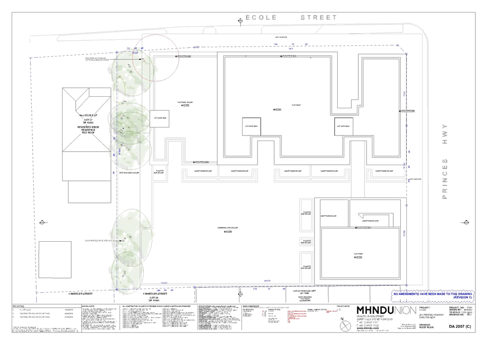
|
Georges
River Council - Georges River Local Planning Panel (LPP) - Tuesday, 17
December 2019
LPP062-19 261 Princes Highway Carlton
[Appendix
2] Aerial Photograph -
261 Princes Highway Carlton
|
Page 95
|
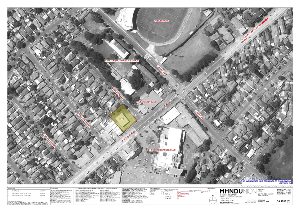
|
Georges
River Council - Georges River Local Planning Panel (LPP) - Tuesday, 17
December 2019
LPP062-19 261 Princes Highway Carlton
[Appendix
3] Elevations - 261
Princes Highway Carlton
|
Page 99
|
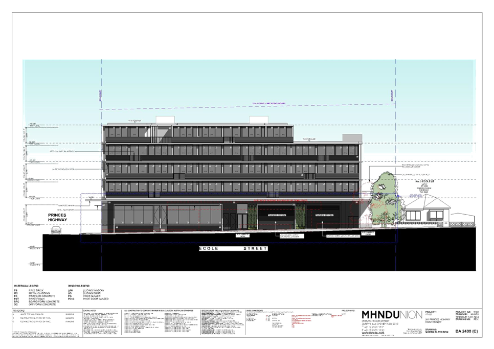
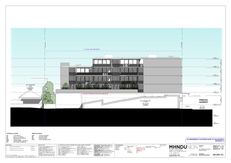
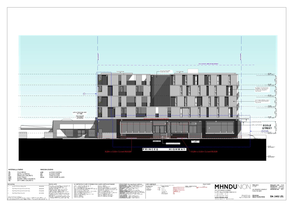
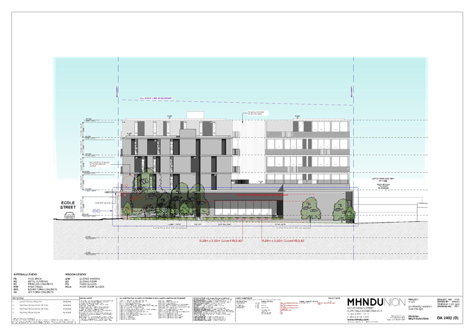
|
Georges River Council – Local Planning
Panel Thursday, 17 December 2019
|
Page 186
|
REPORT TO GEORGES RIVER COUNCIL
LPP MEETING OF Tuesday, 17 December 2019
|
LPP Report No
|
LPP063-19
|
Development Application No
|
DA2018/0358
|
|
Site Address & Ward Locality
|
1-3 English Street Kogarah
Kogarah Bay Ward
|
|
Proposed Development
|
Demolition, tree removal, lot
consolidation and construction of a seven storey residential flat building
comprising 23 units over basement parking under the State Environmental
Planning Policy (Affordable Rental Housing) 2009
|
|
Owners
|
21st Century Insulation
|
|
Applicant
|
Barrelle Guirguis Architects
|
|
Planner/Architect
|
Planner – Planning Ingenuity.
Architect – Barelle Guirguis Architects
|
|
Date Of Lodgement
|
31/08/2018
|
|
Submissions
|
Three (3) individual submissions
|
|
Cost of Works
|
$7,843,561.00
|
|
Local Planning Panel Criteria
|
The application relates to
development to which the State Environmental Planning Policy No 65 –
Design Quality of Residential Apartment Development Applies and the proposal
exceeds the height control development standard by more than 10%.
|
|
List of all relevant s.4.15
matters (formerly s79C(1)(a))
|
State Environmental Planning Policy
(Affordable Rental Housing) 2009, State Environmental Planning Policy No.65
– Design Quality of Residential Apartment Development, State
Environmental Planning Policy (Vegetation in Non-Rural Areas) 2017, State Environmental
Planning Policy (Building Sustainability Index: BASIX) 2004, Greater
Metropolitan Regional Environmental Plan No.2 – Georges River
Catchment,
State Environmental Planning Policy
No.55 – Remediation of Land, State Environmental Planning Policy
(Infrastructure) 2007, Draft State Environmental Planning Policy, Draft State
Environmental Planning Policy – Remediation of Land, Kogarah Local
Enivornmental Plan 2012, Kogarah Development Control Plan 2013
Draft Amendment to Part C2 –
Medium Density Development of Kogarah DCP 2013
|
|
List all documents submitted
with this report for the Panel’s consideration
|
Architectural Plans
Statement of Environmental Effects
– Planning Ingenuity
Acoustic Report – Day Design
Pty Ltd
Traffic & Parking Report
– Hemanote Consultants Pty Ltd
|
|
Report prepared by
|
Senior Development Assessment
Officer
|
P
|
Recommendation
|
That the application be refused in accordance with the
reasons stated in the report.
|
|
|
Summary of matters for
consideration under Section 4.15
Have all recommendations in relation
to relevant s4.15 matters been summarised in the Executive Summary of the
assessment report?
|
Yes
|
|
Legislative clauses requiring
consent authority satisfaction
Have relevant clauses in all
applicable environmental planning instruments where the consent authority
must be satisfied about a particular matter been listed and relevant
recommendations summarised, in the Executive Summary of the assessment
report?
|
Yes
|
|
Clause 4.6 Exceptions to
development standards
If a written request for a
contravention to a development standard (clause 4.6 of the LEP) has been
received, has it been attached to the assessment report?
|
Yes
- Clause 4.3 Height of Buildings
|
|
Special Infrastructure
Contributions
Does the DA require Special Infrastructure
Contributions conditions (under s7.24)?
|
Not
Applicable
|
|
Conditions
Have draft conditions been provided
to the applicant for comment?
|
No
as the application is being recommended for refusal and the refusal reasons
can be viewed when the report is published
|
|
Site Plan
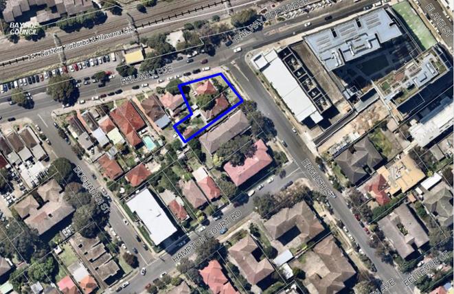
Site identified in blue
|
Executive Summary
Proposal
1. This
development application (DA) seeks consent for the demolition of existing
structures across two (2) sites, lot consolidation and the construction of a
seven (7) storey residential flat building (RFB) comprising of a total of
twenty three (23) apartments including two (2) levels of basement car parking
catering for a total of 31 car parking spaces.
2. The
proposed development has been proposed under the provisions of State
Environmental Planning Policy (Affordable Rental Housing) 2009; the proposal
includes five (5) units (21.7%) of the development to be dedicated as
affordable rental housing for a 10 year period. If a development application is
for a development that is for affordable housing with a CIV of $5 million, the
consent authority is the Sydney South Planning Panel (SSPP). As the proposed
percentage of affordable housing is only 21.7%, the consent authority is the
Georges River Local Planning Panel (LPP).
3. The proposal has two (2)
basement car parking levels with thirty one (31) residential car parking spaces
and five (5) residential visitor spaces. Vehicle access is provided via a
two-way driveway from English Street along the eastern boundary.
4. A Pre Development
Application Discussion (PDA) meeting was held on 30 November 2017, the
following issues were raised:
· The subject site is an undersized lot and fails to comply
with the minimum lot size contained within Clause 4.1A of Kogarah LEP 2012. The
applicant advised that the application would be submitted under the provisions
of the Affordable Rental Housing SEPP to overcome the deficient site area.
· Non-compliance with height control.
· Evidence must be provided to demonstrate compliance with
the Affordable Rental Housing SEPP.
· Site amalgamation - Map 8 – Carlton requires that
amalgamation of 1-3 English Street and 268 Railway Parade is required for
redevelopment.
· Design considerations – street access should be
provided to ground floor apartments. The proposed setback distances of 3m to
4.5m to the southern boundary are considered to be insufficient.
· The excavation for the basement is in close proximity to
the boundary and could adversely affect the trees on adjoining sites. An
arborist report should be provided.
· Limited planting opportunities due to the footprint of the
basement.
· A stronger architectural corner element at English Street
and Railway Parade should be provided.
· General amenity of unit layouts an configuration.
Although some of these matters were addressed in the plans
lodged as part of the development application, a number of the above issues
remain unresolved.
5. The
proposed development exceeds the height control. The non-compliance includes
habitable space, the lift overrun, fire stairs and the roof top terrace. A
Clause 4.6 Statement has been submitted for the variation to the height
development standard which has been assessed in detail later in this report and
is not supported.
6. Communal
open space is provided both at ground level to the southern side and on the
rooftop (Level 6) located adjacent to unit 23.
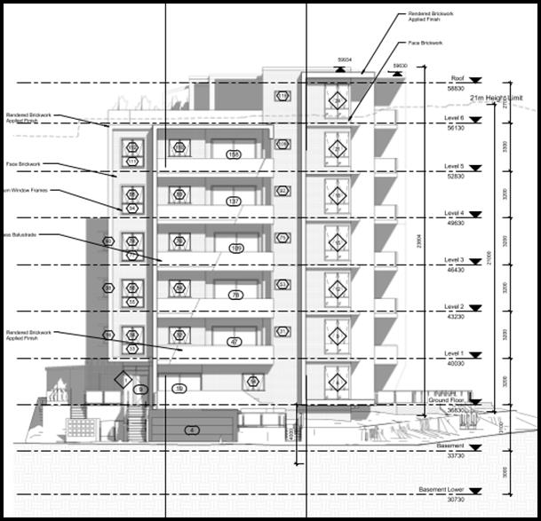
Figure 1:
Eastern Street elevation of the proposal (Source Courtesy Barelle Guirguis
architects, 2018)
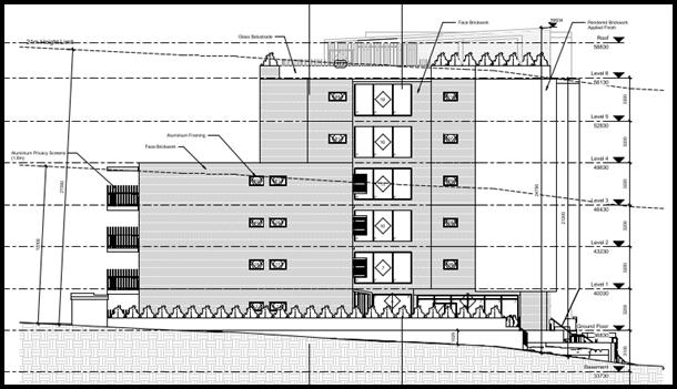
Figure 2: Southern
elevation of the proposal (Source Courtesy Barelle Guirguis architects, 2018)
Site and Locality
7. The
development site is located on the western side of English Street. The site is
legally identified as Lot A DP 374363 (1 English Street) and Lot 67 DP 1753 (3
English Street) and has a street address of 1 and 3 English Street, Kogarah.
8. The
development site is an irregular shaped allotment located off English Street
with a frontage of 22m to English Street, and a secondary frontage of 28.575m
to Railway Parade. The total combined site area is 991.1sqm. The land falls
from west to east towards English Street and from Railway Parade to the south.
9. Presently
situated on the development site at 1 English Street is a residential building
containing three (3) units and associated outbuildings with vehicular access
from Railway Parade, whilst at 3 English Street is a single storey residential
building which appears to be used as 3 separate occupancies with ancillary
structures.
10. This block located
between English Street and Buchanan Street is zoned R3 Medium Density
Residential and the block to the west is zoned B2 Local Centre and B4 Mixed Use
to the east on the other side of the substation which is zoned SP2. The site is
within an area that has been up-zoned in the Floor Space Ratio (FSR) to 2:1 and
a maximum height to 21m.
11. On the opposite side of
Railway Parade to the north is Carlton Railway Station. Kogarah Shopping
centre, which is zoned B4, is located to the east of the site. Opposite the
subject site in English Street on the opposite corner of Railway Parade and
English Street is an electrical substation.
Zoning and
Permissibility
12. The subject site
is zoned R3 Medium Density Residential under the provisions of Kogarah Local
Environmental Plan 2012 (KLEP 2012). The proposal involves the
construction of a residential flat building which is a permissible use in the
zone with development consent.
Submissions
13. The DA was publicly notified to neighbours for a period of
fourteen (14) days in accordance with the Kogarah Development Control Plan 2013
(KDCP 2013). A total of three (3) submissions were received raising concerns
with parking and traffic congestion, overshadowing, concerns regarding the
height, scale and bulk of the scheme, streetscape character, waste management
and overlooking issues. These issues are
discussed in greater detail in the body of this report.
Reason for Referral to the Local Planning Panel
14. This application is
referred to the Georges River Local Planning Panel for determination as the
proposal relates to a Residential Flat Building and the provisions of the State
Environmental Planning Policy No 65 – Design Quality of Residential Flat Development
apply and the proposal exceeds the height control by more than 10%.
Planning and Design Issues
15. The proposal exceeds the
21m height control permitted by the Kogarah Local Environmental Plan 2012
(LEP). This variation includes habitable floor space (Unit 23), along with the
lift overrun, fire stairs and ancillary structures associated with the roof top
communal open space located adjacent to Unit 23. The applicant has submitted a
Clause 4.6 Statement for this variation to the height control. Council has
expressed concern and has not recommended support of any variation to the
height control which includes habitable floor space. The Panel has been
supportive of this approach. Ancillary structures supporting the communal open
space would be considered.
16. The issues raised by the
DRP have not been resolved and include the following:
· Inadequate setbacks to all common boundaries resulting in
separation distances between properties substantially below the ADG
recommendations.
· Street setbacks inconsistent with adjacent properties.
· Bulk and scale inappropriate for its context.
· Proximity of vehicular and pedestrian access inappropriate.
· Poor configuration of basement carpark with southern and
western boundaries directly adjacent to adjoining properties.
· Adverse impact upon trees on adjacent properties.
· Rooftop unit should be deleted.
· Landscaping has not been adequately considered in the
design.
17. Council’s
Consultant Arborist has advised that the extent of excavation for the basement
will have an adverse impact upon the health of the trees located on the
adjoining properties. In particular the tree located on the western property
(268 Railway Parade), given the extent of excavation along the western
boundary.
18. The subject site is part
of an amalgamation pattern identified in KDCP 2013 requiring the amalgamation
of 1and 3 English Street and 268 Railway Parade. The proposed inability to
amalgamate all sites will result in an irregular shaped allotment and will
isolate 268 Railway Parade. Should the site be acquired this would then enable
the development to reach its full development potential whilst also providing a
more appropriate building design with appropriate setbacks that will respond to
the context within the immediate locality.
19. The proposal fails to satisfy
the Apartment Design Guide (ADG) building separation “design
criteria” with non-compliances on all levels with the exception of level
6 (Unit 23). The lack of separation along both side boundaries will
create adverse amenity impacts, to adjoining properties and the lack of
compliant separation distances in this case will not satisfy the objectives of
the ADG which aims to achieve to an “equitable” distribution of
separation between properties. Some encroachment is permissible subject to no
overlooking being generated and if encroachments occur other sensitive design
elements need to be employed including variations to the facades through
improved articulation, clever placement of window openings, smart materials and
finishes and the use of landscaping to soften and green spaces. The proposed
design falls short of achieving the intentions and purpose of the ADG, as the
proposed setbacks are considered to be insufficient and the building will be an
extremely large, imposing mass and form. These are
detailed within the ADG Compliance Table within this report
Conclusion
20. The application has been assessed having regard to the Matters
for Consideration under Section 4.15 of the Environmental Planning and
Assessment Act 1979, the provisions of the relevant State Environmental
Planning Policies, Local Environmental Plans and Development Control Plans. The proposed height,
setbacks, siting, design scale, form and bulk of the building is considered to
be an unsuitable planning and urban design response for the site. As a result
the application is recommended for refusal.
Report in Full
Description of the Proposal
21. The DA seeks consent for
the demolition of existing structures across two (2) sites, lot consolidation
and the construction of a seven (7) storey residential flat building (RFB)
comprising of a total of twenty three (23) apartments including two (2) levels
of basement car parking catering for a total of 31 car parking spaces (refer to
figure 3).
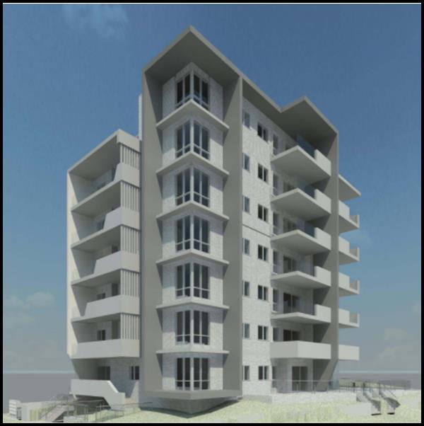
Figure 3: Artist’s
3D rendition of the proposal (Source Barelle Guirguis Architects, 2018)
22. Further details of the
proposal are as follows;
Lower Basement Plan
- Sixteen (16) residential car
parking spaces (including one accessible space with shared zone).
- Lift and fire stairs.
- Six (6) secure storage areas.
- Services room.
Basement Plan
- Fifteen (15) car parking spaces
comprising of the following:
· Five (5) visitors car parking spaces.
· Ten (10) residential car parking spaces (car spaces 12 and
13 and spaces 14 and 15 are in the form of stacked spaces).
- Two (2) secure storage lockers.
- Eight (8) residential bicycle
parking spaces.
- Lift and fire stairs.
- Services.
- Garbage Room.
Ground Floor Plan
- Four (4) residential apartments
on the ground floor as follows:
· 2 x 1 bedroom apartments (one is an affordable/adaptable
unit and the other is an affordable/liveable unit).
· 2 x 3 bedroom apartments (both are affordable
units)
- Dual lane vehicular access from
English Street located to the eastern side of the site.
- Access ramp with platform lift to
front entry.
- One (1) lift lobby and fire
stairs.
- Landscaped front setback with
communal residential access gate.
- Three (3) visitors bicycle parking
spaces.
First Floor Plan
- Four (4) residential
apartments on first floor as follows:
· 1 x 1 bedroom apartments (which is an affordable
unit)
· 1 x 2 bedroom apartments.
· 2 x 3 bedroom apartment (one is an affordable unit and the
other is a liveable unit).
· One (1) lift lobby and fire stairs.
Second Floor Plan
- Four (4) residential
apartments on second floor as follows:
· 1 x 1 bedroom apartments (which is an adaptable
unit)
· 1 x 2 bedroom apartments.
· 2 x 3 bedroom apartment (one of which is a liveable unit).
· One (1) lift lobby and fire stairs.
Third Floor Plan
- Four (4) residential
apartments on third floor as follows:
· 1 x 1 bedroom apartments (which is a liveable
unit)
· 1 x 2 bedroom apartments.
· 2 x 3 bedroom apartment (one of which is a liveable unit).
· One (1) lift lobby and fire stairs.
Fourth Floor Plan
- Four (4) residential
apartments on fourth floor as follows:
· 1 x 1 bedroom apartments.
· 1 x 2 bedroom apartments.
· 1 x 3 bedroom apartment.
· One (1) lift lobby and fire stairs.
Fifth Floor Plan
- Four (4) residential
apartments on fifth floor as follows:
· 1 x 1 bedroom apartments.
· 1 x 2 bedroom apartments.
· 1 x 3 bedroom apartment.
· One (1) lift lobby and fire stairs.
Sixth Floor Plan
· 1 x 3 bedroom apartment.
· One (1) lift lobby and fire stairs.
- Communal roof top open space area
comprising of the following:
· Approximately 178sqm of communal open space area.
· Multiple seating and outdoor eating areas both covered and
uncovered.
· BBQ facilities.
· Planter boxes provided to the southern and western side of
the roof top terrace infilled with a 1.5m high privacy screen.
· The apartment is setback between 11m and 15m from the
southern boundary.
· 1.5m high privacy screens and planter boxes surrounding
perimeter of roof top communal open space at the roofs edge.
DESCRIPTION OF THE SITE AND
LOCALITY
23. The development site is located on the western side of
English Street. The site is legally identified as Lot A DP 374363 (1 English
Street) and Lot 67 DP 1753 (3 English Street) and has a street address of 1 and
3 English Street, Kogarah.
24. The development site is
an irregular shaped allotment located off English Street with a frontage of 22m
to English Street, and a secondary frontage of 28.575m to Railway Parade. The
total site area is 991.1sqm. The land falls from west to east towards English
Street and from Railway Parade to the south.
25. Presently situated on the
development site at 1 English Street is a residential building containing three
(3) units and associated outbuildings with vehicular access from Railway
Parade, whilst at 3 English Street is a single storey residential building
which appears to be used as 3 separate occupancies with ancillary structures.
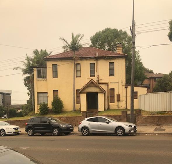
Figure 4: 1
English Street, Kogarah (as viewed from Railway Parade)
Figure 5: 3
English Street, Kogarah (as viewed from Railway Parade)
Figure 6: 1
and 3 English Street as viewed from English Street
26. Immediately adjoining the site to the south is 5–7 English
Street, Kogarah is a 4 storey residential flat building (RFB) with similar
scale RFB’s located further to the west to Neilsen Avenue, Kogarah where
at this point the zoning changes to R2 Low Density Residential containing
residential dwelling houses largely low scale in form and character.
Figure 7: 5-7
English Street, Kogarah
Figure 8: 9-11
English Street, Kogarah
27. This block located
between English Street and Buchanan Street is zoned R3 Medium Density Residential
and the block to the west is zoned B2 Local Centre and B4 Mixed Use to the east
on the other side of the substation which is zoned SP2. The site is within an
area that has been up-zoned in the Floor Space Ratio (FSR) to 2:1 and a maximum
height to 21m.
28. On the opposite side of Railway Parade to the north is
Carlton Railway Station. Kogarah Shopping centre, which is zoned B4 is located
to the east of the site. Opposite the subject site in English Street on the
opposite corner of Railway Parade and English Street is an electrical
substation.
Figure 9: Substation located on Railway Parade and
English Street
29. Properties immediately to the west of the site are
generally undeveloped and contain single and two storey detached dwelling houses.
Figure 10: 268 Railway Parade, Kogarah
Figure 11: Photos of the adjoining properties to the
west of the subject site
30. The immediate precinct is
undergoing a process of transition and transformation to larger scale medium
density residential developments and larger scale mixed use developments along
Railway Parade.
State Environmental Planning Policies (SEPPs)
31. Compliance with
the relevant SEPPs is summarised in the following table and discussed in
further detail below it.
Table 1: Compliance with State Planning Policies
|
SEPP Title
|
Complies
|
|
Greater
Metropolitan Regional Environmental Plan No 2 – Georges River Catchment
|
Yes
|
|
State
Environmental Planning Policy (Building Sustainability Index: BASIX) 2004
|
Yes
|
|
State Environmental
Planning Policy No 55 - Remediation of Land
|
Yes
|
|
State Environmental Planning Policy (Vegetation in Non-Rural
Areas) 2017
|
Yes
|
|
State Environmental Planning Policy
(Infrastructure) 2007
|
Yes
|
|
State Environmental Planning Policy (Affordable Rental Housing) 2009
|
No -
partial non-compliance
|
|
State Environmental Planning Policy No 65—Design Quality of
Residential Apartment Development
|
No - partial
non -compliance
|
Greater Metropolitan Regional Environmental Plan No 2 – Georges
River Catchment
32. The primary
relevant aims and objectives of this plan are:
· to
maintain and improve the water quality and river flows of the Georges River and
its tributaries and ensure that development is managed in a manner that is in
keeping with the national, State, regional and local significance of the
Catchment,
· to
protect and enhance the environmental quality of the Catchment for the benefit
of all users through the management and use of the resources in the Catchment
in an ecologically sustainable manner,
· to
ensure consistency with local environmental plans and also in the delivery of
the principles of ecologically sustainable development in the assessment of
development within the Catchment where there is potential to impact adversely
on groundwater and on the water quality and river flows within the Georges
River or its tributaries,
· to
establish a consistent and coordinated approach to environmental planning and
assessment for land along the Georges River and its tributaries and to promote
integrated catchment management policies and programs in the planning and
management of the Catchment
33. The DA includes a concept stormwater design prepared by
Pavel Kozarovski of Kozarovski and Partners. The application was referred to Council’s Engineering
Services for comment. There were concerns raised in respect to the stormwater
and drainage arrangement. The following comments were made;
“Insufficient information is provided in the Stormwater
Drainage Plans. Also, the plans are not clear. The Stormwater Drainage Plans
shall be amended addressing the following items and submitted to Council for
assessment.
a) OSD volume was determined using an impervious area of
52.5%. However, the Landscape Plan (Ground Floor) shows a high percentage of
impervious areas. The stormwater consultant is to revisit the Stormwater
Management Report calculations and revise the OSD tank details accordingly.
b) The council does not support the site drainage connection
to the street kerb and gutter. Considering a large site area of 991 square
metres, all stormwater shall drain by gravity to the existing kerb inlet pit
located at the corner of English Street and Railway Avenue. OSD tank shall be
designed with a sump at the outlet pipe location. OSD tank section should show
all inlet pipes including the levels and access grate dimensions.
c) Pump well pit volume and pump rate calculation
details shall be shown on the plan.”
34. These concerns remain
unresolved. The location of the OSD tank
within the area of communal open space is considered to be a poor planning and
urban design outcome. The location of the OSD will reduce the floor to ceiling
height of the garbage area. There are no sections or details clarifying the
impact of the OSD.
State Environmental Planning Policy (Building Sustainability Index:
BASIX) 2004
35. BASIX Certificate No.
925890M dated 12 June 2018 has been issued for the proposal and demonstrates
that it meets the provisions and minimum requirements of BASIX in terms of
water, thermal comfort and Energy efficiency. The architectural plans include
the commitments that are required to be shown at DA stage. The proposal
satisfies the requirements of the BASIX SEPP.
State Environmental Planning Policy No 55 - Remediation of Land (SEPP
55)
36. SEPP 55 aims to
promote the remediation of contaminated land in order to reduce the risk of
harm to human health or any other aspect of the environment.
37. Clause 7 requires
contamination and remediation to be considered in determining a DA. The consent
authority must not consent to the carrying out of development on land unless it
has considered whether or not the land is contaminated.
38. A review of the site
history indicates that the site has been used for residential purposes since
at least 1943. Residential usage is not typically associated with activities
that would result in the contamination of land.
39. A Preliminary Site
Investigation (PSI) Report No E18015KOG-R01F dated 17 August 2018 prepared by
geo-environmental engineering was submitted with the application, which
concludes:
“The review of the sites history revealed no evidence
of significant contaminating activities associated with the site and there was
no other evidence of contamination identified by the site inspection. With this
in mind, and taking into account the extent of the proposed development, which
includes excavation for a basement which will occupy the majority of the site,
further investigation, in the form of a Stage 2 Detailed Site Investigation, is
not considered to be warranted.”
40. Based on
the information provided, a Detailed Site Investigation (DSI) Report was not
required.
41. The report concludes that the site is suitable for the
proposal and the continued residential use of the land. This conclusion is
supported by Council’s Environmental Health Section who recommended
should the development be approved appropriate conditions of consent relating
to any contamination findings during demolition, excavation or construction,
and that a Clearance Certificate be obtained prior to the issue of an
Occupation Certificate.
State Environmental Planning Policy (Infrastructure) 2007
42. The aim of the
Infrastructure SEPP is to facilitate the effective delivery of infrastructure
across the State. The Infrastructure SEPP also examines and ensures that the
acoustic performance of buildings adjoining the rail corridor or busy arterial
roads is acceptable and internal amenity within apartments is reasonable given
the impacts of adjoining infrastructure.
43. Clause 87 of the SEPP
“Impact of rail noise or vibration on non-rail development”, is
relevant to this DA on the basis that the proposal involves the construction of
residential accommodation on land that is generally adjacent to the rail
corridor and is likely to be adversely affected by rail noise or vibration. As
a result, the following provisions of Clause 87 of the SEPP are relevant:
(3) If the development is for the
purposes of residential accommodation, the consent authority must not grant
consent to the development unless it is satisfied that appropriate measures
will be taken to ensure that the following LAeq levels are not exceeded:
(a) in any bedroom in the residential accommodation
— 35 dB(A) at any time between 10 pm and 7 am,
(b) anywhere else in the residential accommodation
(other than a garage, kitchen, bathroom or hallway) — 40 dB(A) at any
time.
44. An Acoustic Report (Rail
Noise and Vibration Assessment) Noise Assessment) was submitted with the DA,
dated 20 August 2018 and prepared by Day Design Pty Ltd. The report addresses
the provisions of the Policy with respect to achieving acoustic compliance. The
report suggests a series of construction methods and materials (eg 5mm –
6.5mm glass in all living areas and bedrooms, with full perimeter acoustic
seals).
45. The DA was also referred
to Ausgrid on 25 October 2019 in accordance with Clause 45 of State
Environmental Planning Policy (Infrastructure) 2007. At the time of writing
this report no response had been received. (6 December 2019).
46. The DA was referred to
Sydney Trains in accordance with the provisions of Clause 85 and Clause 86 of
the Infrastructure SEPP. To date no response has been received. Should the
proposal be recommended for approval, concurrence from Sydney Trains will be
required.
47. The provisions and
requirements of the Infrastructure SEPP have been addressed subject to
concurrence from Sydney Trains this is satisfied.
Draft Remediation of Land SEPP
48. The Department of
Planning and Environment has announced a Draft Remediation of Land SEPP, which
will repeal and replace the current State Environmental Planning Policy No 55—Remediation of Land.
49. The main changes proposed
include the expansion of categories of remediation work which requires
development consent, a greater involvement of principal certifying authorities
particularly in relation to remediation works that can be carried out without development
consent, more comprehensive guidelines for Councils and certifiers and the
clarification of the contamination information to be included on Section 149
Planning Certificates.
50. Whilst the proposed SEPP will retain
the key operational framework of SEPP 55, it will adopt a more modern approach
to the management of contaminated land. The Draft SEPP will not alter or affect
the findings in relation to contamination at the site.
51. A Preliminary Site
Investigation (PSI) Report No E18015KOG-R01F dated 17 August 2018 prepared by
geo-environmental engineering was submitted with the application, which
concludes:
“The review of the sites history revealed no evidence
of significant contaminating activities associated with the site and there was
no other evidence of contamination identified by the site inspection. With this
in mind, and taking into account the extent of the proposed development, which
includes excavation for a basement which will occupy the majority of the site,
further investigation, in the form of a Stage 2 Detailed Site Investigation, is
not considered to be warranted.”
52. Based on
the information provided, a Detailed Site Investigation (DSI) Report was not
required.
53. The report concludes that there is no evidence of
significant contaminating activities associated with the site and a Stage 2
Detailed Site Investigation is not considered warranted. This conclusion is
supported by Council’s Environmental Health Section who has undertaken an
assessment of the Preliminary Site Investigation (PSI) Report and raises no objection
to the proposal.
State Environmental Planning Policy (Vegetation in Non-Rural Areas)
2017
54. The Vegetation
SEPP aims to protect the biodiversity values of trees and other vegetation
in non-rural areas of the State, and to preserve the amenity of non-rural areas
of the State through the preservation of trees and other vegetation.
55. The Vegetation
SEPP applies to clearing of:
(a) Native
vegetation above the Biodiversity Offset Scheme (BOS) threshold where a
proponent will require an approval from the Native Vegetation Panel established
under the Local Land Services Amendment Act 2016; and
(b) Vegetation
below the BOS threshold where a proponent will require a permit from Council if
that vegetation is identified in the council’s development control plan
(DCP).
56. The Vegetation
SEPP repeals clauses 5.9 and 5.9AA of the Standard Instrument - Principal Local
Environmental Plan with regulation of the clearing of vegetation (including
native vegetation) below the BOS threshold through any applicable DCP.
57. Councils Consultant
Arborist has reviewed the proposed tree removal and raised concern with the
location and proximity of the basement to the southern and western boundaries.
The trees on the adjoining sites are located adjacent to the southern and
western boundaries. The tree on the western side has a TPZ of 10.8m with the
trees on the southern side having TPZs of 4.8m and 5.4m. To ensure the
retention of the trees on the adjoining sites, the basement needs to be setback
minimum of 5 – 6m from the boundary.
58. There
is an inadequate amount of deep soil landscaped area to the periphery of the
site as the basement parking levels extend to the site boundaries. The
Landscape Plan shows large trees along the front (Railway Parade frontage)
where the setback is only 1.5m which is too narrow to accommodate for the
planting of larger trees. There is also a large tree shown along the northern
side above the basement which cannot be achieved. There is no potential for
greenery and larger screen planting along the boundaries of the site due to the
extent of the basement area.
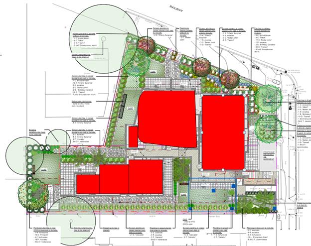
Figure 12: Landscape plan showing the proposed
landscaping. The dotted circles show the trees proposed to be removed
59. On this basis, the
proposal is inconsistent with relevant provisions of the Vegetation SEPP.
Draft Environment SEPP
60. The Draft Environment SEPP was exhibited from 31 October 2017 to 31
January 2018. This consolidated SEPP proposes to simplify the planning rules
for a number of water catchments, waterways, urban bushland, and Willandra
Lakes World Heritage Property.
61. Changes proposed include consolidating the following seven
existing SEPPs:
· State Environmental Planning Policy No. 19 – Bushland
in Urban Areas
· State Environmental Planning Policy (Sydney Drinking Water
Catchment) 2011
· State Environmental Planning Policy No. 50 – Canal
Estate Development
· Greater Metropolitan Regional Environmental Plan No. 2
– Georges River Catchment
· Sydney Regional Environmental Plan No. 20 –
Hawkesbury-Nepean River (No.2-1997)
· Sydney Regional Environmental Plan (Sydney Harbour Catchment)
2005
· Willandra Lakes Regional Environmental Plan No. 1 –
World Heritage Property
62. The proposal is consistent with the provisions of this Draft
Instrument.
State
Environmental Planning Policy (Affordable Rental Housing) 2009 (ARHSEPP)
63. The aim of this
Policy is;
· “to provide a consistent planning regime for the
provision of affordable rental housing,
· to facilitate the effective delivery of new affordable
rental housing by providing incentives by way of expanded zoning
permissibility, floor space ratio bonuses and non-discretionary development
standards,
· to facilitate the retention and mitigate the loss of
existing affordable rental housing,
· to employ a balanced approach between obligations for
retaining and mitigating the loss of existing affordable rental housing, and
incentives for the development of new affordable rental housing,”
64. The proposed
development incorporates an affordable housing component and dedicates a total
of five (5) apartments as “affordable”, therefore this Policy
applies to the development.
65. Part 2 Division 1
of the ARHSEPP relates to “infill affordable housing” and states as
follows;
“(1) This
Division applies to development for the purposes of dual occupancies,
multi-unit housing or residential flat buildings if:
(a) The
development concerned is permitted with consent under another environmental
planning instrument, and
(b) the
development is on land that does not contain a heritage item that is identified
in an environmental planning instrument, or an interim heritage order or on the
State Heritage Register under the Heritage Act 1977.
(2) Despite
subclause (1), this Division does not apply to development on land in the
Sydney region unless all or part of the development is within an accessible
area”
66. The proposed
residential flat building is a permissible land use within the R3 Medium
Density zone pursuant to Kogarah Local Environmental Plan 2012 (KLEP).
Clause
4 – Accessibility
67. Clause 4 of the
SEPP requires the site to be “accessible” which means the property
needs to satisfy the following provisions;
(a) 800
metres walking distance of a public entrance to a railway station or a wharf
from which a Sydney Ferries ferry service operates, or
(b) 400 metres
walking distance of a public entrance to a light rail station or, in the case
of a light rail station with no entrance, 400 metres walking distance of a
platform of the light rail station, or
(c) 400 metres
walking distance of a bus stop used by a regular bus service (within the
meaning of the Passenger Transport Act 1990) that has at least one bus per hour servicing the bus stop
between 06.00 and 21.00 each day from Monday to Friday (both days inclusive)
and between 08.00 and 18.00 on each Saturday and Sunday.
68. The proposal
satisfies subsection (a) above as the site is located within 800m walking
distance to the Carlton Railway Station. The site is some 250m from the station
(refer to Figure 13 below) which satisfies the SEPP “accessibility”
requirements.

Figure 13: Distance
from the subject site to Carlton Railway Station (courtesy Nearmaps)
69. The provisions of
Division 1 (In-fill affordable housing) are relevant to this development. The
development is not technically relying on a floor space bonus as the proposal
(inclusive of the affordable housing units) complies with the FSR of 2:1 as
stipulated in Clause 4.4 of the Kogarah Local Environmental Plan 2012 (KLEP),
however the provisions of Clause 13 (floor space ratio) is applicable as 20% of
the Gross Floor Area (GFA) of the development is taken up by affordable
housing.
Clause
13 – Floor Space ratios
70. Clause 13 of the
ARHSEPP is applicable if “the
percentage of the gross floor area of the development that is to be used for
the purposes of affordable housing is at least 20 per cent.”
In this case five (5) units
within the development have been designated as affordable (Units No.1, 2, 3, 4
and 8). The GFA for each unit is provided below;
GFA Unit No.1 (3 bedroom) =
102sqm
GFA Unit No.2 (1 bedroom) =
52sqm
GFA Unit No.3 (1 bedroom) =
55sqm
GFA Unit No.4 (3 bedroom) =
90sqm
GFA Unit No.8 (3 bedroom) =
95sqm
Total GFA = 394sqm
71. The Applicant has provided Gross Floor
Area (GFA) diagrams with the application however these calculations have
excluded some areas which need to be included being the circulation spaces (corridors and the garbage bin storage
area which is located partially above ground). Recalculations to include these
areas, the total GFA of the development is 1976sqm which amounts to a total FSR
of 1.99:1.
72. The affordable floor space component comprising of
394sqm makes up 20% of the total GFA of the development. This translates to a
bonus FSR of 0.2:1 in accordance with the ARHSEPP provisions and the maximum
FSR permissible for the site is 2.2:1. The proposal complies with this control
as the proposed FSR is 1.99:1.
Clause
14 – Standards that cannot refuse consent
73. Clause 14 of the
ARHSEPP outlines development standards that cannot be used to refuse consent.
Assessment against these provisions is considered in the table below.
Table 2:
Compliance Table (Clause 14, ARH SEPP)
|
Control
|
Numerical Requirement
|
Proposed Development
|
Complies
|
|
Site Area
|
450sqm
|
991.1sqm
|
Yes
|
|
Landscaped Area
|
30% of the site area
|
436sqm (Ground Floor)
44% of the site
|
Yes
|
|
Deep Soil Zones
|
15% of the site area
Min dimension of 3m
Two-thirds of the area
located at the rear
|
149sqm (15%)
The area calculated has a
min dimension of 3m.
40% (60sqm) of the deep
soil area is located at the rear
|
Yes
Yes
Yes
|
|
Solar Access
|
70% of dwellings receive 3 hours of
solar access between 9am and 3pm
|
This control is more onerous than
the ADG solar access requirement which requires a minimum of 70% of
apartments receiving a minimum of 2 hours of solar access during midwinter.
A total of nineteen (19) apartments
receive a minimum of 3 hours of direct solar access in mid- winter. This
amounts to 82% which is compliant.
|
Yes
|
|
Parking
|
The following provisions apply;
at least 0.5 parking spaces are provided for each dwelling
containing 1 bedroom,
at least 1 parking space is provided for each dwelling
containing 2 bedrooms and
at least 1.5 parking spaces are provided for each dwelling
containing 3 or more bedrooms
1 bedroom units
7 x 0.5 spaces = 3.5 spaces
2 bedroom units
5 x 1 spaces = 5 spaces
3 bedroom units
11 x 1.5 spaces = 16.5 spaces
Total required = 25 spaces
31 spaces proposed
|
The proposal complies with the
numerical parking requirements of the ARH SEPP.
Required – 25
Proposed - 31
|
Yes
|
|
Dwelling Size
|
Minimum GFA requirements for each
apartment
1 bedroom apartments =
50sqm
2 bedroom apartments =
70sqm
3 bedroom apartments =
95sqm
|
The development provides for the
following;
52sqm – 55sqm
80sqm
90sqm – 102sqm
|
Yes
Yes
No – see comments
below
|
|
Non-compliance with dwelling
size
Unit 4 which is a three bedroom
apartment is located in the four storey along the south western side of the
building has an internal area of 90sqm (as depicted on the area ground floor
plan DA119 Rev A) which is short of the minimum 95sqm as stipulated by the
ARHSEPP. The area of the apartment in general is not compromised by its size
and the deficiency of 5sqm will not impact the functionality of the internal
spaces. The internal layout of the unit and the other three bedroom units
within this section of the building are not well planned with a bedroom
punctuating the balcony area adjoining the living space. This is a poor
layout as the living space only has a small opening to access the balcony.
The issue of internal amenity and layout is detailed in the SEPP 65
assessment of the proposal. In terms of the overall size of the apartment it
is not considered to be unreasonable and the deficiency in overall area is
considered to be minor.
|
74. In accordance with Clause 14 of the ARHSEPP, the
development cannot be refused if the development satisfies the provisions
within Clause 14. In this case the development satisfies these provisions.
75. Clause 16 of the ARHSEPP requires the
assessment of the proposal against the provisions of SEPP 65 in respect to the
design quality of the proposed RFB. A detailed assessment against the
provisions of SEPP 65 is provided later in this report.
Clause
16A – Character Assessment
76. Under clause 16A of the State Environmental Planning
Policy (Affordable Rental Housing) 2009, a consent authority must “take
into consideration whether the design of the development is compatible with the
character of the local area”. As there are no specific
guidelines developed to inform how to apply this compatibility test a number of
court cases have provided some guidance as to how to assess the
“character” of a local area and what to consider to ensure an
affordable housing development is suitable.
77. In considering compatibility with neighbouring
character, in Sterling Projects v The Hills Shire Council [2011] the
Commissioner said that “Character is not limited to a consideration of
streetscape but includes the wider context of the site, in particular the
characteristics of the properties which adjoin the site”.
78. In the recent decision of Louden Pty Ltd v
Canterbury-Bankstown Council [2018] clause 16A played a prominent role
in Commissioner Gray’s judgement. Commissioner Gray stated that all
buildings of all typologies must be incorporated into the assessment of the
local area character. This assessment concurs with Commissioner Roseth SC who
in Project Venture Developments v Pittwater Council [2005] stated
that “Compatibility is thus different from sameness.
It is generally accepted that buildings can exist together in harmony without
having the same density, scale or appearance, though as the difference in these
attributes increases, harmony is harder to achieve.”
79. Further to this point of creating a harmonious
streetscape, the proposed building is very modern in its appearance and will
sit awkwardly in the streetscape given the existing character of development is
quite consistent in form, scale and design. The local character comprises of a
mix of buildings from different eras and therefore the architectural character
is different, however there are many similar features and architectural
elements that create a sense of consistency.
80. In order to establish a local character in a mixed,
diverse area the plans should reasonably match other structures in the vicinity
and should consider such aspects as building forms, setbacks and scale.
81. Firstly, the immediate context of the site could be
defined as the sites bounded by English Street, Railway Parade, Buchanan Street
and Hampton Court. Properties within this block are residential in nature.
Properties within the block are zoned R3 Medium Density so the character is
predominantly residential in nature. Buildings are varied in scale and form
with single storey detached Federation style cottages set among two storey
residential flat buildings and larger scaled three-four storey walk-ups. There
is obvious disparity between the scale and form of buildings within the block
but there are consistent architectural characteristics which create a generally
coherent character. All buildings include traditional low pitched, tiled roof
forms. This is a consistent feature of all properties. Most properties are
constructed of traditional face brickwork and this is a very obvious and
consistent finish.
82. There are a few rendered buildings but these are low
in scale (two storey) so they are not visually dominating. The relatively
modern electrical substation building to the south (across the road) has picked
up on these elements and finishes. It is constructed of face brickwork of
different tones which aims to sit more comfortably within the residential
streetscape. The modern screening and cladding that is integrated into the
design breaks up the form and introduces new, contemporary elements.
Other features and qualities within the streetscape are consistent front
setbacks and softly landscaped areas of open space at the front of properties
and face brick fences and front retaining walls.
83. Within the broader precinct development typologies are
varied and mixed given the change in zoning. Immediately to the east is the
electrical substation which is zoned Special uses (SP2) which permits
associated Infrastructure uses and then further to the east are mixed uses
located within the B4 Mixed use zone which permits a height of up to 39m and
FSR of 4:1. This is a very different landscape. Immediately to the west are
mixed use developments within the B2 Local Business zone however these are
still largely low scale traditional shop top housing developments which aim to
service residents and railway station patrons. The block in question within the
R3 zone is considered a transitional zone that sits between both commercial
zones and encourages medium density residential developments.
84. The proposed development will be located on a
prominent corner and will be a very visually dominating development. The scale
and form of the development will not sit comfortably within the streetscape and
will not establish a coherent or harmonious relationship with existing
adjoining developments.
85. The architectural treatment, design and proposed
materials and finishes create disharmony and will isolate this building from
its immediate surroundings. The large expanses of light, white and grey
rendered finishes, blade walls, glazed elements and aluminium louvres are all
very contemporary features which are not consistent with existing developments.
The proposed colour palette and tones proposed are inconsistent with the
existing earthy tones of developments within the adjoining streetscapes.
86. It is for these reasons that the design is not
considered to be consistent or in keeping with the existing character of
development within the streetscape and as such the proposal does not satisfy
the character test of Clause 16A of the ARHSEPP.
Clause
17 – Affordable Housing for ten (10) years
87. If the application is approved then standard
conditions will need to be imposed which will ensure that the apartments are
managed by a community housing provider and will need to be maintained as
“affordable” for a ten (10) year period.
Part 3
Retention of existing affordable rental housing
88. Part 3 (Retention of existing affordable rental
housing) needs to be considered given there exist on site three (3) apartments
which fall within the definition of “low-cost” accommodation. The
Applicant has submitted rental returns for the three (3) properties for the
past 24 month which confirms that the apartments fall within the low cost
rental housing category. At 3 English Street the property contains three (3) apartments consisting of the following:
· 2 x 2 bedroom apartments
· 1 x 1 bedroom apartment
89. The Applicant has argued that the removal of these
apartments is compensated by the provision of two (2) additional affordable
apartments within the development and there is technically no loss generated by
the removal of the existing low-cost rental units. Numerically, the provision
of five (5) affordable apartments is a net overall benefit by providing two (2)
additional affordable apartments however the removal of the 2 x 2 bedroom apartments
is not compensated by the provision of the same type of apartments (like for
like). The proposal will provide for two (2) x 1 bedroom apartments which will
adequately compensate for the loss of the existing one (1) bedroom apartment.
90. The provision of three (3) x 3 bedroom apartments is a
benefit however it is not directly compensating for the loss of the two (2) x 2
bedroom apartments and it is uncertain whether there is similar comparable
accommodation in the market to compensate for the loss.
91. Council’s records indicate that 1 English
Street, whilst being residential in form contains three apartments (with three
letterboxes) however no details of the form and type of accommodation has been
furnished. It is however highly likely that these apartments are also
“low cost affordable” accommodation and if this is the case, Part 3
of the ARH SEPP has not been satisfied as there could cumulatively be a loss of
one (1) apartment in the market.
92. In addition to the potential loss of rental accommodation
created by the development Part 3 of the Policy specifically requires an
assessment of the loss of existing low cost rental accommodation and if there
is a loss whether the market has comparable accommodation to compensate for
this loss. It aims at retaining this type of accommodation or ensuring that
occupants that will be displaced have the ability to rent a similar type of
accommodation within a 5km radius of the site. In this case, the
provision of 3 x 3 bedroom apartments does not directly compensate for the loss
of the 2 x 2 bedroom apartments as the displaced occupants may not require or
afford this accommodation as it is larger accommodation and most likely more
expensive than the existing 2 bedroom apartments. So the assessment to ensure
that the market place has similar comparable accommodation to compensate the
loss has not occurred.
If
approval is recommended this issue could be rectified in the following manner;
1. The
amount of low cost accommodation in the development is reconfigured to include
2 x 2 bedroom apartments so there is a like for like exchange and no net loss
of 2 bedroom apartments occurs on the basis that the GFA of the affordable
component remains at 20%. Or;
2. A
monetary contribution is applied in accordance with the Policy to compensate
for the loss of this form and type of accommodation.
93. This issue could be resolved by the provision of a
deferred commencement condition if Option No 1 (above) is adopted or a standard
condition imposed (if Option No 2 is preferred) which include the provision of
a monetary contribution to the State Government in accordance with the Policy
prior to the issuing of an Occupation Certificate for the development.
94. In addition to the points above if additional
information comes to light to suggest that the accommodation at 1 English
Street fits within the affordable category the loss of one (1) apartment can be
accommodated by dedicating an “additional” comparable
apartment as an affordable apartment and/or provide a monetary contribution to
compensate for this loss. The Applicant has not detailed the loss of affordable
rental accommodation accurately and in accordance with the provisions of Part 3
of the ARHSEPP.
95. The consideration and implementation of one or both
options above would resolve the issue subject to the provision of some
additional information in preserving and retaining low cost accommodation and
Part 3 of the ARHSEPP will then be satisfied.
State Environmental Planning Policy No 65 — Design Quality of
Residential Apartment Development
96. State
Environmental Planning Policy No.65 – Design Quality of Residential Flat
Buildings (SEPP 65) was gazetted on 26 July 2002 and applies to the assessment
of DAs for RFBs of three or more storeys in height (excluding car parking
levels) and containing at least four dwellings. Amendment 3 to SEPP 65
commenced on 17 July 2015 and implemented various changes including the
introduction of the Apartment Design Guide (ADG) to replace the Residential
Flat Design Code. Given the nature of the development proposed, SEPP 65
applies.
97. The proposal
involves the erection of a new 7 storey RFB (excluding basement car parking)
containing 23 apartments and is therefore affected by the SEPP.
98. In determining DAs
to which SEPP 65 relates, Clause 28(2) of the SEPP requires that the consent
authority take into consideration:
a) the
advice (if any) obtained from the design review panel, and
b) the
design quality of the development when evaluated in accordance with the design
quality principles, and
c) the
Apartment Design Guide.
99. The proposal was
considered by the Georges River Design Review Panel (DRP) on 11 April 2019. The
Panel assessed the merits of the development against each of the nine (9) Design Quality Principles and
the provisions of the Apartment Design Guide (ADG). The DRP’s comments
are included and addressed within the table below, along with further comment
from Council’s Planner.
100. The Panels comments are summarised
and addressed in table 4 below. “The recommendation from the meeting
was that the design cannot be supported in its present form and should be
amended to resolve the issues raised above for reconsideration by the
Panel.”
Table 3: Application of SEPP
65
|
Clause
|
Standard
|
Proposal
|
Complies
|
|
3
- Definitions
|
Complies
with definition of “Residential Apartment Development” (RAD)
|
Complies
with definition
Section
4 (1) (Application of Policy) of the SEPP 65 states that the policy “applies
to development for the purpose of a residential flat building, shop top
housing or mixed use development with a residential accommodation component
if:
(a) the development
consists of any of the following:
(i) the
erection of a new building,
(ii) the
substantial redevelopment or the substantial refurbishment of an existing
building,
(iii) the conversion
of an existing building, and
(b) the building concerned is at least 3 or more storeys
(not including levels below ground level (existing) or levels that are less
than 1.2 metres above ground level (existing) that provide for car parking),
and
the
building concerned contains at least 4 or more dwellings.”
|
Yes
|
|
4 -
Application of Policy
|
Development
involves the erection of a new RFB, substantial redevelopment or
refurbishment of a RFB or conversion of an existing building into a RFB. The
definition of an RFB in the SEPP includes mixed use developments.
|
The
erection of an RFB satisfies the SEPP’s definition of this residential
land use.
Refer to
definition and explanation above in relation to the applicability of the
Policy.
|
Yes
|
|
50 E P
& A Regulation - Development Applications
|
Design
verification statement provided by qualified designer
Registered
Architect Name and Registration No.
|
Design
Verification Statement provided by Registered Architect: Rasem Guirguis
(Registration No.6129)
|
Yes
|
Table 4: Part 2
Design Quality Principles under the SEPP
|
SEPP 65 – Design Quality of Residential Flat
Buildings
|
DRP Comment
|
Planners comment
|
|
Context and Neighbouring
Character
Good design responds and contributes to its context.
Context is the key natural and built features of an area, their
relationship and the character they create when combined. It
also includes social, economic, health and environmental
conditions.
Responding to context involves identifying the desirable
elements of an area’s existing or future character. Well
designed buildings respond to and enhance the qualities and identity of
the area including the adjacent sites, streetscape and neighbourhood.
Consideration of local context is important for all
sites, including sites in established areas, those undergoing change or
identified for change.
|
The site is located in a medium density residential area with one
(1) and two (2) storey dwelling houses to the west and two (2) and three (3)
storey residential flat buildings to the south. To the south there are two
(2) x four (4) storey residential flat buildings at 5 and 9 English Street.
To the south west of the site there is a two (2) storey dwelling
house at 268 Railway Parade, which very desirably should be amalgamated with
the subject site to provide a more rectangular development site. This
property fronts Railway Parade and its rear yard adjoins the western corner
of the subject site.
The site is located at the interface between the Mixed Use Zone
across English Street to the east and a large area to the south and west
which has been rezoned for Medium Density Residential with a FSR control of
2:1 and height of 21m. This is a prominent corner, located on the curved
section of the road and visible from the adjacent rail line and entrance and
exit from the town centre.
The application proposes 23 units and 20% of these (five (5)
units) are to be dedicated as Affordable Rental Housing. It seeks to
utilise the bonus FSR provisions available because of these five (5) units.
|
The scale,
form and design of the building is considered to be out of character with the
context of the immediate locality and not in keeping with nature and form of
adjoining residential properties. The materiality of the building is not
sympathetic with existing developments.
Council’s
KDCP requires site amalgamation with 268 Railway Parade. Although the
Applicant maintains they have attempted to purchase this site, the attempts
made to purchase this adjoining property are not considered to be
satisfactory and as a result this site will be isolated and the best planning
and design outcome in the longer term for this site is unlikely to be
achieved.
The desire
future character expected from the uplift will not be achieved.
|
|
Built Form and Scale
Good design achieves a scale, bulk and height appropriate
to the existing or desired future character of the street and
surrounding buildings.
Good design also achieves an appropriate built form for a
site and the building’s purpose in terms of building alignments,
proportions, building type, articulation and the manipulation of
building elements.
Appropriate built form defines the public domain,
contributes to the character of streetscapes and parks, including their
views and vistas, and provides internal amenity and outlook.
|
The application proposes a seven (7) storey unit block with a four
(4) storey wing to the south. It raises a range of serious concerns:
· Raised ground level, approximately 2.5m above street level.
This creates numerous stairs, ramps, blank walls, visible basement car park
and poor streetscape interface.
· The height exceeds the LEP control by one (1) floor level which
cannot be supported.
· Inadequate setbacks on both street frontages, this includes
balconies. The taller block intrudes substantially on the DCP setback
control requirements and is inconsistent with adjacent properties.
· Inadequate setback on all common boundaries including the south
and west. This results in separation distances between the existing
residential adjacent properties substantially below ADG recommendations.
· The combination of all these factors creates an unnecessarily
bulky mass that makes the building inappropriate for its context.
· English Street to the south has many mature and attractive street
trees. This character should be enhanced and reinforced by complementary
planting on this prominent corner site, but the design appears not to
recognise the importance of this issue or to provide adequate setbacks to
allow for such planting.
· The proximity of the vehicular and pedestrian entry points are
inappropriate.
· The location of the main entrance leads to an unattractive and
circuitous route to the main elevator.
· A redesign moving the pedestrian entry north or to Railway Parade
frontage would be advantageous, possibly along with the moving of the
vehicular access to the south towards the boundary.
· Provision of only a single lift to a development of this height
and scale is highly problematic given that it will inevitably be out of
service for substantial periods during its lifetime.
· Poor configuration of basement car park with southern and western
boundaries directly adjacent to adjoining properties. There are large
established trees on these adjacent properties that would be impacted and
this has not been considered in the design.
It is considered that the development needs to be completely
re-planned to address these issues.
|
The height
of the building exceeds the 21m height limit with habitable areas exceeding
the control. The scale and built form will establish an undesirable precedent
in the area.
The
applicant has submitted a Clause 4.6 Statement to support the height non-compliance,
this has been assessed in greater detail later in this report however the
height non-compliance will not satisfy the height control and zone objectives
and as such the Clause 4.6 Statement is not considered to be well founded.
The mass
and form of the development is overbearing and will be a visually dominating
element in the streetscape given the prime corner location.
The
building is also artificially elevated above the street and ground floor
level which further accentuates its height and visual bulk.
|
|
Density
Good design achieves a high level of amenity for
residents and each apartment, resulting in a density appropriate to the site
and its context.
Appropriate densities are consistent with the
area’s existing or projected population. Appropriate densities can be
sustained by existing or proposed infrastructure, public transport, access to
jobs, community facilities and the environment.
|
Appears to comply.
|
Generally compliant and
satisfactory.
|
|
Sustainability
Good design combines positive environmental, social and
economic outcomes.
Good sustainable design includes use of natural cross
ventilation and sunlight for the amenity and liveability of
residents and passive thermal design for ventilation, heating and cooling
reducing reliance on technology and operation costs. Other elements include
recycling and reuse of materials and waste, use of sustainable materials and
deep soil zones for groundwater recharge and vegetation.
|
No comment at this stage.
|
A compliant
BASIX certificate has been submitted with the application however further
environmental sustainable measures could be implemented to further improve
the performance of the building by integrating solar panels, skylights
and rain water tanks etc.
|
|
Landscape
Good design recognises that together landscape
and buildings operate as an integrated and sustainable system, resulting in
attractive developments with good amenity. A positive image and contextual
fit of well designed developments is achieved by contributing to
the landscape character of the streetscape and neighbourhood.
Good landscape design enhances the development’s
environmental performance by retaining positive natural features which
contribute to the local context, co-ordinating water and soil management,
solar access, micro-climate, tree canopy, habitat values and preserving green
networks.
Good landscape design optimises useability,
privacy and opportunities for social interaction, equitable
access, respect for neighbours’ amenity and provides
for practical establishment and long term management.
|
Landscape
has not been adequately considered in the design. The proposal includes a
series of awkward communal open spaces on raised ground floor podiums that
would pose privacy issues for units. Furthermore the number of stairs,
lifts and corridors reduces space for landscape and planting. The proposed
ground floor level, 2.5m above street level, would require retaining walls,
stairs, ramps, etc, that would create a very poor landscape interface to the
street.
The
proposed rooftop communal open space is potentially in conflict with the
rooftop unit. The rooftop communal open space should be retained and
rooftop unit be deleted.
See also comments above regarding character of street.
|
There is an inadequate
amount of deep soil landscaped area especially around the periphery of the
site as the basement parking levels extend to the boundaries of the site.
The Landscape Plan
shows large trees along the frontage (Railway Parade frontage) where the setback
is only 1.5m which is too narrow to support the planting of larger trees.
There is also a large tree shown along the northern side above the basement
which cannot be achieved. There is no potential for greenery and larger
screen planting along the boundaries of the site due to the large basement
area.
|
|
Amenity
Good design positively influences internal and external
amenity for residents and neighbours. Achieving good amenity contributes
to positive living environments and resident well-being.
Good amenity combines appropriate room dimensions and
shapes, access to sunlight, natural ventilation, outlook, visual and acoustic
privacy, storage, indoor and outdoor space, efficient layouts and service
areas and ease of access for all age groups and degrees of mobility.
|
The amenity would
generally be of acceptable standard and compliant with ADG recommendations.
The following
issues should be addressed:
· Improved amenity to balconies to provide
screening from wind, and ensure adequate privacy.
· Excessive exposure to northern and western
sunlight to the corner bedrooms.
In view of comments above under ‘Built Form’, the
floor plans will need to be totally reconsidered.
|
Some
apartments have poor internal amenity.
|
|
Safety
Good design optimises safety and security within the
development and the public domain. It provides for quality public and private
spaces that are clearly defined and fit for the intended purpose.
Opportunities to maximise passive surveillance
of public and communal areas promote safety.
A positive relationship between public and private spaces
is achieved through clearly defined secure access points and well-lit and
visible areas that are easily maintained and appropriate to the location and
purpose.
|
The convoluted
entry would be extremely unsafe.
|
Access to
ground floor areas of open space is awkward and paths of travel are poorly
defined and articulated. This adversely affects the useability and
functionality of spaces.
|
|
Housing Diversity and Social Interaction
Good design achieves a mix of apartment sizes, providing
housing choice for different demographics, living needs and household
budgets.
Well-designed apartment developments respond to
social context by providing housing and facilities to suit the existing and
future social mix.
Good design involves practical and flexible features,
including different types of communal spaces for a broad range of people and
providing opportunities for social interaction among residents.
|
Appropriate mix for the evolving context.
|
The mix of
unit types and sizes is considered to be generally satisfactory.
|
|
Aesthetics
Good design achieves a built form that has good
proportions and a balanced composition of elements, reflecting the internal
layout and structure. Good design uses a variety of
materials, colours and textures.
The visual appearance of
a well-designed apartment development responds to the existing or
future local context, particularly desirable elements and repetitions of the
streetscape.
|
Requires further consideration in relation to the comments above
in relation to ‘Built Form’, ‘Amenity’, etc.
|
As previously mentioned the design of the building is considered
to reflect poorly in respect to the surrounding developments and will not be
in keeping with the established residential neighbourhood character. The
materiality of the development is inconsistent and unsympathetic to the
locality.
|
101. In conclusion the Panel stated that “the
design cannot be supported in its present form and should be amended to resolve
the issues raised above for reconsideration by the Panel.”
102. No amended plans have been received
by Council since the date of that meeting so the assessment is based on the
original plans that were submitted with the application.
103. Clause 28 of SEPP 65 requires
the consent authority to take into consideration the provisions of the
Apartment Design Code. The table below assesses the proposal against these
provisions.
Table 5:
Design considerations of Part 3 and Part 4 of the Apartment Design Guide (ADG)
|
Clause
|
Standard
|
Proposal
|
Complies
|
|
3D - Communal open space
|
1. Communal open space has a
minimum area equal to 25% of the site.
-Where it cannot be provided on
ground level it should be provided on a podium or roof
-Where developments are unable to achieve the design
criteria, such as on small lots, sites within business zones, or in a dense
urban area, they should:
• provide
communal spaces elsewhere such as a landscaped roof top terrace or a common
room
• provide
larger balconies or increased private open space for apartments
• demonstrate good proximity
to public open space and facilities and/or provide contributions to public
open space
2. Developments achieve a minimum
of 50% direct
sunlight to the principal usable
part of the communal open space for a minimum of 2 hours between 9 am and 3
pm on 21 June (mid-winter)
|
Roof Terrace = 176sqm
Ground Floor = 75sqm
Total = 25.3%
|
Yes
Numerically compliant.
The ground floor areas of communal
open space could be increased however the design has segregated areas and
there is a more appropriate area for the communal open space (ie the deep
soil area along the western side which amounts to 60sqm is hard to access so
too is the other large space which has an area of 113sqm).
The design could be improved to
create meaningful and useable areas of communal open space on the ground
floor. This could be achieved if access arrangements to these spaces were
consolidated and the built form was reconfigured to create clearly defined
and well designed external landscaped areas for communal use.
Yes all areas of communal open
space on the ground floor and on the rooftop will achieve a minimum of 3
hours of solar access throughout the day in midwinter.
|
|
3E – Deep Soil zones
|
1. Deep soil zones are to meet the
following minimum
requirements:
Where the site has an area of
between 650sqm – 1,500sqm = 3m min dimension
Min deep soil area of 7% (69sqm)
|
Ground Floor 60sqm + 26sqm + 63sqm
= 149sqm
Provided 15%
|
There are three (3) distinct areas
of deep soil as part of the development. The area at the front of the site is
not included in the calculation as the space does not have a minimum
dimension of 3m. The amount of deep soil area provided is compliant.
Increased deep soil areas along the
boundaries of the site would be beneficial to be development to landscaping
and green areas would significantly improve the visual appearance of the
development and provide additional screening and a green edge together with
improved amenity from the adjoining allotments.
|
|
3F- Visual Privacy
|
Separation between windows and
balconies is provided to ensure visual privacy is achieved.
Minimum required separation
distances from buildings to the side and rear boundaries are as follows:
Up to 12m (4 storeys)
Habitable - 6m
Non-habitable – 3m
Up to 25m (5-8 storeys)
Habitable – 9m
Non-habitable – 4.5m
|
South
3m – 4.5m
Central section setback 9.9m
East
3m-5m
West
3m-4.5 (north western side)
6m (south eastern side)
|
No
No
No
Yes
See discussion below regarding
non-compliance with separation distances
|
|
Separation Distances (3F Visual Privacy)
The building fails to comply with the minimum separation
distances in accordance with the provisions of Part 3F of the Apartment
Design Guide (ADG) for most part of the Building. Part 3F of the ADG relates
to “visual privacy” and establishes minimum or reasonable
side setbacks for developments which allows for adequate separation distances
between buildings and therefore maintain privacy between properties.
The objective of the control is to provide “Adequate
building separation distances which are shared equitably between neighbouring
sites, to achieve reasonable levels of external and internal visual
privacy”. Along the southern side of the site the main building is
setback 5.5m on the ground floor then staggered at the upper levels with
varying setbacks of 4.5m (to Bedroom 2), 6m (to bathrooms) and over 9m to the
central lobby/corridor space.
The lower scaled four storey wing is setback 3m and
should be setback 6m. The building wall has been designed in a way to limit
the potential for any overlooking by including privacy screens to balconies
and highlight windows provided to secondary spaces (laundry and bathroom).
The proposed 3m side setback is considered to be insufficient as the bulk of
the building will be visually dominating when viewed from the adjoining
property. In addition, there is no potential for any substantial screen
planting along this boundary or landscaping that could soften the visual
appearance of the built form. The proposed main building being setback
4.5m-6m at every level falls short of the 6m minimum requirement to Level 4
and Level 5 and 6 requires a 9m setback. The development fails to comply
along this side with the minimum separation distances and although there will
be no overlooking generated the design creates a visually bulky structure
that lacks articulation and variation that would break up and modulate the
mass and form if minimum setbacks cannot be achieved. The visual bulk, scale
and dominance of the building along this side is unacceptable and will
adversely affect the visual amenity and outlook to the north of the adjoining
neighbour at 5 English Street. The pre-lodgement assessment raised this issue
and in the advice provided stated that “concern is raised with the
3m (ground floor to Level 3) and 4.5m (Level 4 and 5) building separation
proposed to the southern boundary. These setback distances are considered to
be insufficient, causing unreasonable amenity impacts for the adjoining
residential flat building”.
Along the eastern
side, facing English Street the building wall is setback 5m with the
balconies and blade walls setback 3m. This façade is important as it
addresses the street however the balcony elements protrude beyond the
established front building alignment and sit forward of the front balconies
to 5 English Street. This is an undesirable outcome given the building
alignment along this side of the street is relatively consistent and this
development should respect this and the balconies should be setback 5m to
maintain this consistent form. Although the encroachment on the 6m separation
distances again does not create any adverse amenity impacts given that the
electrical substation is located across the road, the lack of a larger
setback along this side adversely affects the continuity of built forms and
pattern of existing RFB’s.
Along the western
side of the site again the deficiency of any substantial deep soil areas
along the boundary severely limits the development in creating landscaped
areas along the edges of the site and assisting in softening and screening
the lower levels of the building. The 3m-4.5m side setback along the north
western side is deficient and at Levels 5 and 6, a 9m setback is required.
The reduced setbacks are a result of the limited site area to cater for the
density and compliant setbacks could be achieved if the adjoining site 268
Railway Parade was amalgamated in accordance with the provisions of Kogarah
Development Control Plan 2013.
The lack of separation
along both side boundaries will create adverse amenity impacts, to adjoining
properties and the lack of compliant separation distances in this case will
not satisfy the objectives of the ADG which aim to achieve to an
“equitable” distribution of separation between properties. The
ADG seeks to create minimum separation distances of some 12m between
properties (best case). Some encroachment are permissible subject to no
overlooking being generated and if encroachments occur other sensitive design
elements need to be employed including variations to the facades through
improved articulation, clever placement of window openings, smart materials
and finishes and the use of landscaping to soften and green spaces. The
proposed design falls short of achieving the intentions and purpose of the
ADG as the proposed setbacks are considered to be insufficient and the
building will be a large, imposing mass and form.
|
|
3G – Pedestrian Access and
entries
|
Building
entries and pedestrian access connects to and
addresses the public domain
Multiple entries (including communal building entries
and individual ground floor entries) should be provided
to activate the street edge
|
The main entry is off English
Street and includes a ramp for disabled access.
|
Yes – Entry off English
Street.
Despite general compliance the DRP
and Council’s Urban Designer raised concern with the design of the
lobby which is long, convoluted and not an easily defined or recognisable
area.
The lobby should be visually
prominent to assist in wayfinding and to distinguish between public and
private domain. Long footpaths and tight corners must be avoided.
The proposed entry and lobby is
convoluted and is hidden behind the blade wall and is not considered to be an
appropriate design solution for a main entry.
|
|
3H-Vehicle Access
|
Vehicle access
points are designed and located to achieve safety, minimise conflicts between
pedestrians and vehicles and create high quality streetscapes
|
The vehicular access point is
located centrally off English Street and has a width of 6.1m with a splay
along the northern side to improve sight lines for vehicles exiting the site.
|
The vehicle access point is
generally compliant however its location compromises the layout of the ground
floor courtyard area adjoining Unit 1.
The driveway should be located
further to the south in a similar location to where the existing driveway to
3 English Street is located. This will create a larger amount of deep soil area
along the north east of the site.
The driveway prominence should be
reduced. Its central location accentuates its visibility which is undesirable
for this element. A central, formal and attractive pedestrian access point
would be a better design solution along English Street.
|
|
3J-Bicycle and car parking
|
For development in the following
locations:
- On
sites that are within 800m of a railway station or light rail stop in the
Sydney Metropolitan Area; or
- On
land zoned and sites within 400m of land zoned B3 Commercial Core, B4 Mixed
Use or equivalent in a nominated regional centre
The minimum car parking requirement
for residents and visitors is set out in the Roads and Maritime Services
Guide to Traffic Generating
Developments (RMS), or the car parking
requirement prescribed by the relevant council, whichever is less.
In accordance with Section 5.4.3
(High Density Residential Flat Buildings) of the RMS Traffic Generating
Guidelines. The site is located within the “Metropolitan Sub-Regional
Centres” and the following provisions apply;
0.6 spaces per 1 bedroom unit
0.9 spaces per 2 bedroom unit
1.4 spaces per 3 bedroom unit
1 space per 5 units (visitor
parking)
The provision of at least one
loading dock for residential use is desirable, although a dock intended for
commercial uses may be sufficient.
|
The site is located within 800m of
Carlton Railway station as such the RMS provisions are applicable to this
assessment. The site also adjoins the B4 zone and is within 400m walking
distance.
Proposal relies on the following
car parking provisions;
7 x 1 bedroom units = 0.6 x 7 = 4.2
spaces
5 x 2 bedroom units = 0.9 x 5 = 4.5
spaces
11 x 3 bedroom = 1.4 x 11 = 15.4
spaces
Residential spaces required = 24
spaces
Visitor = 23/5 = 5 spaces
Total = 29 spaces
The proposal requires a total of
29 off street car parking spaces for residents and visitors
Total of 31 car parking spaces are
provided which are broken down into five (5) visitor spaces and twenty six
(26) resident spaces which include two (2) accessible spaces.
No designated Car Wash Bay
nominated.
The off street car parking
provision exceeds the requirements of RMS/ADG provisions.
|
The car parking arrangement and
number of car spaces provided complies with the ADG/RMS requirements.
The proposal complies with the
numerical requirements of the ADG given the accessible location of the site;
however Council’s Traffic Engineer has raised concerns regarding the
width of the internal driveway access ramp. The design has catered for the
provision of internal traffic signals which aim to avoid vehicular conflicts.
The internal ramp has a width of 6.2m which is non-compliant with AS2890. A
condition could be included to ensure compliance is achieved.
There are some layout issues with
car parking spaces. Car space 29 is awkwardly located and could pose issues
for vehicles accessing the ramp as this space could impede on the turning
circle and swept paths. Also there is a structural column along the north
eastern side of the lower basement which will obstruct access to the ramp.
The accessible space No.11 is also awkwardly positioned and it would be
complex to exit the vehicle and access the lift.
It is unlikely that Tandem spaces
No.14 and 15 are workable as the structural column next to these spaces will
severely restrict and obstruct the ability to access these spaces.
The bicycle parking spaces
adjoining the lift on the basement level will be hard to access if the
accessible space is occupied.
Although there is no designated car
wash bay if approval is recommended a visitor car space can double up as a
car wash bay and this could be conditioned to comply.
The car parking layout requires
redesign and there are spaces where access is difficult and compromised
simply by the location and layout.
|
|
4A- Solar and daylight access
|
Living rooms and private open
spaces of at least 70% of apartments in a building receive a minimum of 2
hours direct sunlight between 9am and 3pm at mid-winter in the Sydney
Metropolitan Area
A maximum of 15% of apartments in a
building receive no direct sunlight between 9am and 3pm in midwinter
|
All units 100% receive a minimum of
2 hours of solar access during mid-winter due to the orientation of the
apartments.
|
Complies
|
|
4B- Natural Ventilation
|
At least 60% of apartments are naturally
cross ventilated in the first nine storeys of the building.
Overall depth of a cross-over or
cross-through apartment does not exceed 18m, measured glass line to
glass line
The building
should include dual aspect apartments, cross through apartments and corner
apartments and limit apartment depths
|
A total of eighteen (18) apartments
have been designed to comply with minimum cross ventilation requirements
which amounts to 78% of the development.
No apartment exceeds 18m in depth.
Every apartment has a dual aspect.
|
Yes – complies
Yes
Yes
|
|
4C-Ceiling Heights
|
Measured from finished floor level
to finished ceiling level, minimum ceiling heights are:
Habitable rooms = 2.7m
Non-habitable rooms = 2.4m
3.3m for ground floor and first
floor in mixed use areas to promote flexibility of use.
|
Floor to floor heights vary from
3m-3.1m (basements) to 3.2m and 3.3m at all other levels. This leaves 600mm
for a slab which is acceptable and the floor to ceiling height of 2.7m will
be achieved.
The Sections show the slabs and
suspended ceilings which show that when these elements are taken into account
the floor to ceiling heights still achieve 2.7m.
|
Yes
|
|
4D- Apartment size and layout
|
Apartments are required to have the
following
minimum internal areas:
1 bedroom = 50sqm
2 bedroom = 70sqm
3 bedroom = 90sqm
The minimum internal areas include
only one bathroom. Additional bathrooms increase the minimum internal area by
5sqm each
Every habitable room must have a
window in an external wall with a total minimum glass area of not less than
10% of the floor area of the room. Daylight and air may not be borrowed from
other rooms
|
One bedroom units have minimum
areas of 52sqm-55sqm.
Two bedroom units have minimum area
of 80sqm.
Three bedroom units have minimum
internal areas of 90sqm-102sqm
Every habitable room has window
openings larger than 10% of the room area.
|
Complies
|
|
4D-2 Apartment size and layout
|
Habitable room depths are limited
to a maximum of 2.5m x the ceiling height
In open plan layouts (where the
living, dining and kitchen are combined) the maximum habitable room depth is
8m from a window
|
Satisfactory
With the minimum floor to ceiling
heights complying with the 2.7m minimum, all habitable room depths satisfy
the minimum requirements.
The apartments have open plan
living/dining room layouts.
|
Complies
|
|
|
Master bedrooms have a minimum area
of 10sqm and other bedrooms 9sqm (excluding wardrobe space).
Bedrooms have a minimum dimension
of 3m (excluding wardrobe space).
Living rooms or combined
living/dining rooms have a minimum width of:
-3.6m for studio and 1 bedroom
- 4m for 2 and 3 bedroom apartments
The width of cross-over or
cross-through apartments are at least 4m internally to avoid deep narrow
apartment layouts
|
All master bedrooms have a minimum
internal size of 10sqm.
All bedrooms have minimum
dimensions of 3m.
All living rooms have minimum
widths of 4m.
There are no cross-over or
cross-through apartments proposed.
|
Complies
|
|
4E- Private Open space and balconies
|
All apartments are required to have
primary balconies as follows:
-1 bedroom = 8sqm/2m depth
-2 bedroom = 10sqm/2m depth
-3+ bedroom = 12sqm/2.4m
The minimum balcony depth to be
counted as contributing to the balcony area is 1m
For apartments at ground level or
on a podium or similar structure, a private open space is provided instead of
a balcony. It must have a minimum area of 15sqm and a minimum depth of 3m
|
The proposed balconies and terraces
which are proposed for all apartments exceed the minimum sizes.
1 bedroom units
9sqm – 27sqm (width minimum
2m)
2 bedroom units
18sqm (width minimum 2m)
3 bedroom units
13sqm – 20sqm (width minimum
2.4m)
Noted
Unit 4 has access to a ground floor
courtyard with an area exceeding 20sqm.
Unit 3 has a courtyard at the front
to Railway Parade with a total area of 27sqm.
Unit 2 adjoins Unit 3 and has a
courtyard with an area of 21sqm. Unit 1 has a balcony at the front with a
minimum area of 17sqm.
|
Complies
Yes
Yes
|
|
4F- Common circulation areas
|
The maximum number of apartments
off a circulation core on a single level is eight
|
Maximum of 4 units have access to
the lobby at every level of the building up to Level 4 and Levels 4 and 5 has
3 units off the main lobby area.
Level 6 only has 1 unit.
|
Complies
|
|
4G- Storage
|
In addition to storage in kitchens,
bathrooms and
bedrooms, the following storage is
provided:
1 bedroom = 6m³
2 bedroom – 8m³
3 bedroom – 10m³
At least 50% of storage is to be
located within the apartment.
|
Each apartment has dedicated
internal storage spaces within each unit. Storage spaces vary from 3.8
m³ to 7.8 m³.
There are cages designated in the
basement levels however there are only six (6) spaces. From this several
units will fall short of complying with the minimum requirements.
|
No – some units do not have
the minimum required storage space
|
|
4H- Acoustic Privacy
|
Adequate building separation is
provided within the development and from neighbouring buildings/adjacent
uses.
Window and door openings are
generally orientated away from noise sources
Noisy areas within buildings
including building entries and corridors should be located next to or above
each other and quieter areas next to or above quieter areas
Storage, circulation areas and
non-habitable rooms should be located to buffer noise from external sources
|
The application is accompanied by a
Rail Noise and Vibration Assessment prepared by Day Design and dated 20
August 2018.
This acoustic assessment has
considered the impacts of rail noise from the T4 Eastern Suburbs and
Illawarra Line which adjoins the site to the north.
The report measured Train Vibration
levels in accordance with Section 3.6.3 of the “Development Near
Rail Corridor and Busy Roads – Interim Guidelines”. A Logger
was placed at the front (corner) of No.1 English Street which monitored noise
levels throughout the day.
Given the proximity of the rail
line and the noise generated from the trains, a number of acoustic measures
and construction techniques are recommended to be adopted to reduce noise
impacts. The report assumes that bedrooms are carpeted and the report
suggested a number of other construction measures to be implemented to
improve the acoustic performance of the building including certain construction
materials for external walls, ceiling and the roof systems, glazing and also
ensuring openings are well sealed etc. If these construction measures are
implemented then the development should be compliant with the minimum
acoustic requirements.
|
Complies
|
|
4J – Noise and Pollution
|
To minimise impacts the following
design solutions may be used:
• physical separation
between buildings and the noise or pollution source
• residential uses are
located perpendicular to the noise source and where possible buffered by
other uses
• buildings should respond to
both solar access and noise. Where solar access is away from the noise
source, non-habitable rooms can provide a buffer
• landscape design
reduces the perception of noise and acts as a filter for air pollution
generated by traffic and industry
|
The development can comply with the
provisions of 4J of the ADG should the application be approval.
If the development was setback
further from the side boundaries the acoustic outcome would be improved.
|
Yes
|
|
4K – Apartment Mix
|
A range of apartment types and
sizes is provided to cater for different household types now and into the
future
The apartment mix is distributed to
suitable locations within the building
|
The development offers a mix of 1,
2 and 3 bedroom apartments.
7 x 1 bedroom apartments
(30%)
5 x 2 bedroom apartments
(22%)
11 x 3 bedroom apartments
(48%)
The mix is considered to be
appropriate.
|
Complies
|
|
4L – Ground Floor
Apartments
|
Street frontage activity is
maximised where ground floor apartments are located.
Design of ground floor apartments
delivers amenity and safety for residents.
|
The ground floor apartments and
their balconies/courtyards are raised above the ground level but they are
able to be accessed from the street. It would be a more appropriate outcome
if the ground floor apartments can be accessed directly from the street level
at grade.
|
Complies
|
|
4M - Facades
|
Facades should be well resolved
with an appropriate scale and proportion to the streetscape and human scale.
|
The façade treatments and
overall aesthetic that is proposed is inconsistent with the character of
development in the street. The use of partially solid balustrades to
balconies, solid blade walls, aluminium louvres, rendered elements and the
white/grey colour palette is not sympathetic with existing developments in
the R3 zone.
|
No – the contemporary design
does not incorporate any materiality of the R3 zone and is considered
unsympathetic
|
|
4N – roof design
|
Roof treatments are integrated into
the building design and positively respond to the street. Opportunities to
use roof space for residential accommodation and open space are maximised.
Incorporates sustainability features.
|
Although the flat roof form is not
reflective of the character of rooves of existing adjoining buildings, the
flat roof is a modern element that is generally consistent with new
developments. It does offer the ability to include a communal area on the
roof which is a benefit for future occupants.
|
Complies
|
|
4O – Landscape Design
|
Landscape design is viable and
sustainable, contributes to the streetscape and amenity
|
The proposed landscape design is
considered to be insufficient and limits the full potential of providing substantial
areas of deep soil and meaningful and attractive areas of landscaping around
the periphery of the site. The lack of deep soil areas around the edges of
the site does not allow for any large trees or plants to be integrated to
assist in softening the lower levels of the development or assist in
screening and creating a green buffer around the boundaries of the site.
The landscape plan shows 3 x
Christmas Bush trees to be planted along the front of the site adjacent to
Railway Parade however these are to be located within the deep soil area
which has a min width of 1.5m and it is unlikely they can reach their mature
height of 8m. It is also impossible for the proposed large Tuckeroo located
along the north western side to exist in this location as it will be planted
above the basement. There are also a number of existing mature trees on
immediately adjoining sites which will be affected by the proposal especially
since the basement is located immediately to the western boundary. The
location of entries, ramps, driveway access and other such elements limits
the full potential of the English Street frontage to be landscaped and
planted with mature trees and plants. The lack of an arborist report is also
of concern as there is no evidence to suggest that the proposed excavation in
association with the basement will not adversely affect the integrity of the
existing trees on adjoining properties despite the intention for their
retention.
|
No insufficient landscaping and
planting
|
|
4P- Planting on Structures
|
Planting on structures –
appropriate soil profiles are provided, plant growth is optimised with
appropriate selection and maintenance, contributes to the quality and amenity
of communal and public open spaces
|
There are planter boxes proposed
around the periphery of the site at the ground floor level where the
excavation extends to the common boundary. There are also some planter boxes
at the front and on the roof terrace.
|
The use and integration of planter
boxes is considered to be satisfactory however additional planter boxes and
the arrangement of spaces could be better planned if the site included more
deep soil areas. Planter boxes should be secondary, complimentary elements to
the overall design of the development however the landscape design relies on
these elements.
|
|
4Q – Universal Design
|
Universal design – design of
apartments allow for flexible housing, adaptable designs, accommodate a range
of lifestyle needs
|
Satisfactory
|
Complies
|
|
4R – Adaptive reuse
|
Adaptive reuse as apartment of
existing buildings- new additions are contemporary and complementary, provide
residential amenity while not precluding future adaptive reuse.
|
This is a new development.
|
N/A
|
|
4U – Energy Efficiency.
|
Development incorporates passive
environmental design, passive solar design to optimise heat storage in winter
and reduce heat transfer in summer, natural ventilation minimises need for
mechanical ventilation
|
A compliant BASIX Certificate
accompanies the application.
|
Yes – could be improved with
the provision of solar panels on the roof and also designated ground floor
rainwater tanks which look to be included as part of the BASIX certificate
but not referenced on the plan.
|
|
4V – Water management and
conservation
|
Water management and conservation
– potable water use is minimised, stormwater is treated on site before
being discharged, flood management systems are integrated into the site
design
|
The proposed stormwater/drainage
design has been referred to Council’s Engineering Services section,
raising concerns with proposed stormwater/drainage design and have required
that all stormwater shall drain by gravity to the existing kerb inlet pit
located at the corner of English Street and Railway Parade.
|
No – unsatisfactory and
unresolved
|
|
4W – Waste Management
|
Waste management – storage
facilities are appropriately designed, domestic waste is minimised by
convenient source separation and recycling
|
The waste management arrangement
involves the provision of a garbage room in the basement which caters for
fifty (50) bins including recycling and green bins.
Bins will need to be taken to the
street level via the driveway.
The application was referred to
Council’s Waste Management Officer. The waste storage area adequately
caters for the waste requirements of Council.
|
Yes - satisfactory
|
|
4X – Building Maintenance
|
Building design provides protection
form weathering
Enables ease of maintenance,
material selection reduces ongoing maintenance cost
|
As previously mentioned, the
proposed external materials, colours and finishes are considered to be
unsympathetic
|
Yes - in general the proposed
materials and finishes will be low maintenance however the proposed raw
concrete finish is a contemporary aesthetic which is not representative of
current and new developments making this development more visually dominate.
This is a design consideration rather than a longer term maintenance.
|
Environmental Planning Instruments
Kogarah Local Environmental Plan 2012 (KLEP 2012)
Zoning
104. The subject site is zoned
Zone R3 Medium Density Residential under the provisions of the Kogarah Local
Environmental Plan 2012 (KLEP2012). Refer to zoning map below. The proposed
development is defined as a Residential Flat Building which is a permissible
land use in the zone.
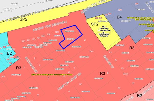
Figure
14: Zoning map extract from the KLEP
2012
105. The objectives of the zone are as
follows:
· To provide for the housing needs of the community within a
medium density residential environment.
· To provide a variety of housing types within a medium
density residential environment.
· To enable other land uses that provide facilities or
services to meet the day to day needs of residents.4
106. The proposal satisfies the objectives
of the R3 Zone as it will provide for a variety of residential apartments in a
medium density residential environment.
107. The extent to which the proposal complies with the
relevant standards of Kogarah Local Environmental Plan
2012 (KLEP2012) is outlined in Table 6 below.
Table 6: KLEP2012 Compliance Table
|
Clause
|
Standard
|
Proposed
|
Complies
|
|
2.2 Zone
|
R3
Medium Density Residential
|
The proposal is defined as a
Residential Flat Building (RFB) which is a permissible use within the zone.
|
Yes
|
|
2.3
Objectives
|
Objectives of the Zone
|
Consistent
with zone objectives.
|
Yes
|
|
4.1A Minimum lot sizes for
Residential Flat Buildings
|
Clause 4.1A requires a minimum site
area of 1,000sqm for the purpose of RFB’s in the R3 zone.
|
The total
Site area is 991.1sqm.
|
No
|
|
4.3 – Height of Buildings
|
21m as identified on Height of
Buildings Map
|
The
building exceeds the 21m height limit. The non- compliance includes habitable
space, the lift overrun, fire stairs and communal roof space exceeding the
height control.
A Clause
4.6 Statement has been submitted and is addressed in detail later in this
report.
|
No
|
|
4.4 – Floor Space Ratio
|
2:1 as identified on Floor Space
Ratio Map
|
1.99:1
|
Yes
|
|
4.5 – Calculation of floor
space ratio and site area
|
FSR and site area calculated in
accordance with Cl.4.5
|
The gross
floor area (GFA) calculation nominated by the applicant was considered to be
inaccurate as it did not include the common foyers.
The
inclusion of the common areas not previously calculated; still result in a
compliant FSR.
|
Yes
|
|
4.6 –
Exceptions to Development Standards
|
The objectives of this clause are as follows:
(a) - to provide an appropriate degree of
flexibility in applying certain development standards to particular
development,
(b) - to achieve better outcomes for and from
development by allowing flexibility in particular circumstances.
|
The
proposal exceeds the height control pursuant to Clause 4.3 of the KLEP and
therefore a Clause 4.6 Statement has been submitted to justify the non-compliance
with the control.
The
variation to the height standard includes habitable space in the form of a
unit along with ancillary services (lifts and stairs) associated with the
communal roof top terrace. The Clause 4.6 Statement has been provided to justify
the variation and the non-compliance is not considered to be reasonable and
is not supported.
A
detailed discussion in regards to this issue is provided in the
“Exception to Development Standards” section.
|
The
Clause 4.6 Statement for the variation to the height control is not supported
in this circumstance.
|
|
5.10 – Heritage Conservation
|
The objectives of
this clause are;
(i) to conserve the environmental
heritage of Kogarah,
(ii) to conserve the heritage
significance of heritage items and heritage conservation areas, including
associated fabric, settings and views.
|
The proposal does not adjoin any
heritage items nominated under KLEP 2012 and is not within a Conservation
Area.
|
Yes
|
|
6.1 Acid Sulphate Soils (ASS)
|
The objective of this clause is to ensure that development
does not disturb, expose or drain acid sulfate soils and cause environmental
damage
|
The site is not affected by Acid
sulfate Soils under KLEP 2012.
|
N/A
|
|
6.2 Earthworks
|
To ensure that earthworks do not
have a detrimental impact on environmental functions and processes,
neighbouring uses, cultural or heritage items or features of the surrounding
land
|
The proposed development includes
excavation and associated earthworks to accommodate two (2) levels of
basement car parking.
|
Yes subject to conditions.
|
|
6.5 Airspace Operations
|
The consent authority must not grant development consent to
development that is a controlled activity within the meaning of Division 4 of Part 12 of the Airports Act 1996 of the Commonwealth unless
the applicant has obtained approval for the controlled activity under
regulations made for the purposes of that Division.
|
The
height of the proposed development is below the Obstacle Limitation Surface
(OLS).
|
N/A
|
Exception
to Development Standards
Detailed assessment of variation to Clause 4.3 Height of
Buildings
108. Clause 4.3 (2) of the Kogarah Local
Environmental Plan 2012 (KLEP 2012) relates to maximum permitted building
height for a site and refers to the Height of Buildings Map. The relevant map
identifies the subject site as having a maximum height of 21m. Building Height
is defined as:
“Building height (or height of
building) means:
(a) In relation to the height of a
building in metres – the vertical distance from ground level (existing)
to the highest point of the building, or
(b) In relation to the RL of a
building the vertical distance from the Australian Height Datum to the highest
point of the building
Including plant and lift overruns, but
excluding communication devices, antennae, satellite dishes, masts, flagpoles,
chimneys, flues and the like.”
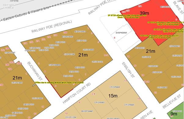
Figure 15: Extract
from the KLEP (Height Map_006) designated as “R” which notes a 21m
height limit
109. The development proposes a part seven
storey, part six and part four storey building which seeks a variation to the
development standard relating to height (Clause 4.3). The LEP identifies a
maximum height of 21m for the site (refer to Figure 15 above). The proposed
development will exceed the height by approximately 3.042m which comprises of
part of the ceiling and habitable space of Unit 23, the lift overrun, fire
stairs and the pergola feature located on the new roof terrace. Essentially it
is that part of the seventh storey of the building which is located on the
corner of Railway Parade and English Street which exceeds the control. This
breach is a 14% variation above the control. Any variation to the height can
only be considered under Clause 4.6 – Exceptions to Development Standards
of the KLEP.
110. Council’s calculation in
relation to the variation is slightly different. The survey plan shows the
existing ground floor RL at 35.63 which is the closest point to the corner of
the building. The uppermost (seven storey) point of the building along the
corner is RL59.934. The difference between the two is 3.3m (15%). Irrespective
of the slight difference in calculation the variation is just over 3m which
includes habitable floor space. The extent of the variation is shown in the
sectional plan below (Figure 16)
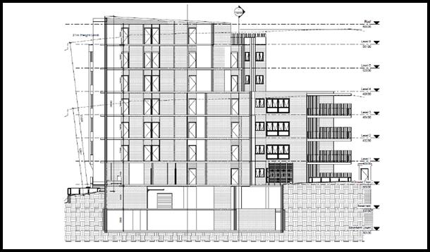
Figure 16: Section showing the height exceedance
(courtesy Planning Ingenuity)
111. Clause 4.6(1) outlines the objectives of the standard
which are to “provide an appropriate degree of flexibility in applying
certain development standards to particular development” and
“to achieve better outcomes for and from development by allowing
flexibility in particular circumstances”.
112. Clause 4.6(3) states that:
“Development consent must not be granted for development that
contravenes a development standard unless the consent authority has considered
a written request from the applicant that seeks to justify the contravention of
the development standard by demonstrating:
- that compliance with the development standard is unreasonable or unnecessary
in the circumstances of the case, and
- that
there are sufficient environmental planning grounds to justify contravening the
development standard”
113. To support the
non-compliance, the applicant has provided a request for a variation to Clause
4.3 in accordance with Clause 4.6 of KLEP 2012. The Clause 4.6 request for
variation is assessed as follows:
Is the planning control in question a development
standard?
114. The “Height of
Buildings” control under Clause 4.3 of the KLEP 2012 is a development
standard.
What are the underlying objectives of the
development standard?
115. The objectives of Height of
Buildings standard under Clause 4.3 of KLEP 2012 are:
(a) to establish the maximum height for buildings,
(b) to minimise the impact of overshadowing, visual
impact and loss of privacy on adjoining properties and open space areas,
(c) to provide appropriate scale and intensity of
development through height controls.
116. In order to address the
requirements of Subclause 4.6(4)(a)(ii), the objectives of Clause 4.3 are
addressed in turn below.
1(a) To establish the maximum height for buildings
117. Applicants Comments:
“The maximum height has been established at 21m for the site. However,
the proposed building height is a site specific response to the natural
gradient of the site (as it falls to English Street) and the proposal will be
contextually appropriate for the site. For these reasons the proposed height
meets Objective (a).”
118. Officer’s comment:
Objective (a) is aimed at establishing a maximum height for buildings so that
within a given zone there is consistency in the scale and built form of a
building. The exceedance in the height is located on the corner of the building
at the most visually prominent part of the site. The building is located on a
prominent corner and any additional height will be more obvious and visible
when looking at the site from the north, east and west.
119. The non-compliance comprises
largely of habitable area. The Panel has on previous occasions permitted the
exceedance in the height control of ancillary structures such as lift overruns,
pergolas and areas of communal open space as these are generally not adding to
the bulk of the building and do not comprise of habitable space. The fact that
the site is naturally elevated above the roadway does not provide an adequate
justification to allow for additional height. The elevated nature of the
building accentuates the height, bulk and scale of the development and creates
structures and elements that are overbearing and visually dominating such as
the ramps and stairs up to the entry.
1(b) To minimise the impact of overshadowing, visual impact and loss
of privacy on adjoining properties and open space areas
120. Applicants
Comment: “The
height non-compliance is limited to the uppermost unit of the building on the
northern elevation. The variation does not result in any more shadowing cast by
the proposal when considered against a compliant scheme (refer to shadow
diagrams submitted with the application that indicate the shadow cast by a
compliant built form overlayed with the shadow cast by the proposed built
form). The southern side of the building is compliant with the height limit.
The additional height is provided to the northern side of the building and the
departure from the standard will not result in any overshadowing to adjoining
properties or public open spaces beyond the shadow that would be otherwise cast
by a compliant building in this location.
All windows and the private open space
balcony of Unit 23 are oriented to the street frontages and so the
non-compliance does not result in any privacy impacts. The communal open space
area on the rooftop is provided with screen planting in planter boxes and
privacy screens along the western and southern edges to protect the privacy of
residents and neighbours.
The visual impact of the building is
suitable in the desired future character of the locality, being residential
flat buildings, and is in keeping with more recent modern construction in the
area, such as on the corner of Buchanan Street and Hampton Court Roads, and to
the north east along Railway Parade. The design of the building ensures
functional internal layouts and adopts a contemporary appearance with the
street front façades containing interesting and articulated presentation
through the use of balcony design and architectural elements. The building is
consistent with the street setbacks of the adjoining developments as per the
DCP resulting in a building which reinforces the streetscape and domestic
character of the area.
For these reasons the proposed height
meets Objective (b).”
121. Officer’s
Comment: Objective (b) relates to the amenity impacts that
may be generated by the exceedance. In this case the amount and degree of
overshadowing that is created by the variation, its visual impact and privacy
impact need to be considered.
122. In
terms of overshadowing, the Applicant has not highlighted the additional area
of shadowing created by the non-compliance however it seems that the seven
storey element and the variation extends beyond the impact that would be
created by a compliant form on this corner, the non-compliance creates
additional overshadowing so it cannot be said that there is a
“minimisation” in the impact of overshadowing as required by the
objective.
123. In
terms of visual impact the additional 3m of height on the corner (translating
to almost a whole storey) will be highly visible in this prominent corner
location. The visual bulk of the development is increased. In terms of
satisfying objective (b) it cannot be said that the proposal is
“minimising” the visual impact as it is accentuating the height, bulk,
scale and visual impact of the development simply given its highly visible
location. The additional level is not hidden, obscured or recessed by any other
elements or adjoining developments and it will establish a new precedent for
future development in the area. Sometimes increasing heights on landmark corner
sites are a good or desirable urban design outcome however this corner is not
considered a landmark corner as it is located within a R3 precinct and landmark
corner sites are more appropriate in commercial zones to define these
commercial centres or entries to them.
124. There
are no similar residential flat buildings that have been constructed of this
scale and form in the immediate locality.
125. In
terms of privacy, the top floor apartment Unit 23 has been sited so that it
overlooks Railway Parade to the north and the Electrical substation across the
road on English Street so in terms of overlooking the area of variation should
not affect any immediately adjoining residential property in terms of
overlooking, although again the proposal is not “minimising”
overlooking it is just not adversely affecting any adjoining property.
1(c) To provide appropriate scale and intensity of development through
height controls
126. Applicants comment:
“The non-compliance of the height at the English Street frontage does
not offend the objective of providing an appropriate scale and intensity of
development at the site. The proposal is in keeping with the desired built form
for the site and area to the west and south-west in accordance with the DCP
controls. The built form, bulk and scale is appropriate for the site and the
proposed non-compliance with height will have no adverse impacts on the
streetscape or achieving the desired character of the locality.
The proposal complies with the maximum FSR
for the site. The distribution of the height on the site meets the intent of
the standard and results in positive streetscape outcomes given the location of
the proposed non-compliance along the English Street frontage. The stepped
nature of the built from across the site and towards the rear ensures an
appropriate transition between the site and adjoin land which is yet to be
developed as per the applicable DCP and LEP controls.
For these reasons the proposed height meets
Objective (c).”
127. Officer’s comment:
This objective aims to create a consistent scale and form for development in
the area and within this zone. The height control of 21m generally caters for a
six storey building and it is considered that this is the scale that is
anticipated for this site. The additional height creates an additional level to
the building which is a highly dominating and visually prominent element.
128. Given that the height
anticipates a six storey scale, the development at seven storeys at the most
visible and prominent part of the site will establish an undesirable precedent
and will be visually bulky.
129. In conclusion, the increase
in the height does not satisfy the objectives of the height standard and the
non-compliance will establish an undesirable precedent in the immediate
locality.
Compliance is unreasonable or unnecessary in
the circumstances of the case (clause 4.6(3)(a))
130. In Wehbe V Pittwater Council (2007)
NSW LEC 827 Preston CJ sets out ways of establishing that compliance with a
development standard is unreasonable or unnecessary. This list is not
exhaustive. It states, inter alia:
“An objection under SEPP 1 may be well
founded and be consistent with the aims set out in clause 3 of the Policy in a
variety of ways. The most commonly invoked way is to establish that compliance
with the development standard is unreasonable or unnecessary because the
objectives of the development standard are achieved notwithstanding
non-compliance with the standard.”
131. The
judgement goes on to state that:
“The rationale is that development
standards are not ends in themselves but means of achieving ends. The ends are
environmental or planning objectives. Compliance with a development standard is
fixed as the usual means by which the relevant environmental or planning
objective is able to be achieved. However, if the proposed development proffers
an alternative means of achieving the objective strict compliance with the
standard would be unnecessary (it is achieved anyway) and unreasonable (no
purpose would be served).”
Preston CJ in the judgement then expressed
the view that there are 5 different ways in which an objection may be well
founded and that approval of the objection may be consistent with the aims of
the policy, as follows (with emphasis placed on number 1 for the purposes of
this Clause 4.6 variation [our underline]):
1. The objectives of the standard are achieved
notwithstanding non-compliance with the standard;
2. The underlying objective or purpose of the standard is
not relevant to the development and therefore compliance is unnecessary;
3. The underlying object or purpose would be defeated or
thwarted if compliance was required and therefore compliance is unreasonable;
4. The development standard has been virtually abandoned or
destroyed by the Council's own actions in granting consents departing from the
standard and hence compliance with the standard is unnecessary and
unreasonable;
5. The zoning of the particular land is unreasonable or
inappropriate so that a development standard appropriate for that zoning is
also unreasonable and unnecessary as it applies to the land and compliance with
the standard that would be unreasonable or unnecessary. That is, the particular
parcel of land should not have been included in the particular zone.”
132. Officer’s comment:
In respect to Prestons CJ judgement the NSW Land and Environment Court has
established the five part test (outlined above). In this case the development
fails to satisfy the five part test for the following reasons;
(a) As
previously discussed the objectives of the standard are not considered to be
satisfied.
(b) The
underlying objective of the standard remains relevant and therefore compliance
is necessary and warranted.
(c) Also
in this case the underlying objective has not been defeated or thwarted as
there are no other recent examples of developments in the immediate locality
that have been approved and exceed the control for anything other than
structures to support the roof top communal open space. This further justifies
that within the immediate vicinity of the site there have to date been no
variations to the height control for residential forms and as such the control
has not been abandoned or destroyed.
(d) The
R3 zone is an appropriate zoning for the site and this parcel of land which
acts as a transition between the immediately adjoining B2 and B4 commercial
zones.
Clause
4.6(3)(b) are there sufficient environmental planning grounds to justify
contravening the standard
133. Applicant’s comments:
“Having regard to Clause 4.6(3)(b) and the need to demonstrate that
there are sufficient environmental planning grounds to justify contravening the
development standard, it is considered that there is an absence of significant
impacts of the proposed non-compliance on the amenity of future building
occupants, on area character and on neighbouring properties.
The
non-compliance will have no adverse impacts on adjoining properties with regard
to visual impacts or overshadowing, and to require strict compliance would mean
removing parts of the building without resulting in a real planning benefit to
neighbourhood character or amenity. In addition, the proposed building is below
the maximum FSR permissible under the LEP.
On
“planning grounds” and in order to satisfy that the proposal meets
objective 1(b) of clause 4.6 in that allowing flexibility in the particular circumstances
of this development will achieve “a better outcome for and from
development”, the site is unique given its shape and topography. The
height is massed towards the street corner to ensure a positive streetscape
outcome at each frontage and compliance with the height limit at the
south-eastern boundary where the site adjoins existing residential development.
This provides a suitable transition to the north-west to the adjoining
properties likely to undergo a similar transition to higher density development
in the future.
The proposed
height encroachment will enable the orderly and economic redevelopment of the
subject site in accordance with the intentions of the Environmental Planning
and Assessment Act, 1979. There is no planning purpose to be served by limiting
the height strictly to the maximum height allowable given the absence of
amenity related impacts. There will be no additional shadow, no obstruction of
views and no opportunities for overlooking resulting from the sections of the
building exceeding the height control. Moreover, there would be direct planning
benefit created by the proposal through the creation of five affordable rental
housing units.
To require
strict compliance would therefore result in an unreasonable burden on the development
with no demonstrable built form or amenity benefits. As such the proposal
results in a high quality residential development which is suited to the site
and its context.”
134. It
is noted that in Initial Action Pty Ltd v Woollahra Municipal Council [2018]
NSWLEC 118, Preston CJ clarified what items a Clause 4.6 does and does not need
to satisfy. Importantly, there does not need to be a "better"
planning outcome achieved. However to address the issue of whether the
development is in the public interest the variation needs to satisfy the
objectives of development standard and objectives of the zone. The Clause 4.6
Statement doesn’t assess the non-compliance against the objectives of the
zone.
135. The
R3 Medium Density Residential zone objectives require the development to;
· To provide for the housing needs of the community within a
medium density residential environment.
· To provide a variety of housing types within a medium
density residential environment.
· To enable other land uses that provide facilities or
services to meet the day to day needs of residents.
136. Officer’s Comment:
The proposed development satisfies the objectives of the zone by providing a
mix and variety of medium density housing options and includes some affordable
rental housing which is a beneficial social outcome, although the form, type
and mix of housing can be maintained with a compliant development.
(d) the
concurrence of the Director-General has been obtained.
137. In accordance with clause 64
of the Environmental Planning and Assessment Regulation 2000, Council may
assume the Secretary’s concurrence for exceptions to development
standards for applications made under clause 4.6 of the LEP. This was further
confirmed by directions provided within Planning Circular PS 18-003 issued on
21 February 2018.
Whether
contravention of the development standard raises any matter of significance for
State or regional environmental planning (Clause 4.6(5)(a))
138. Contravention of the maximum
height development standard proposed by this application does not raise any
matter of significance for State or regional environmental planning.
Conclusion
– Assessment of Clause 4.6 Request for Variation
139. Despite the non-compliance in
terms of the height, the proposed variation is considered to be unacceptable
and does not satisfy the provisions of Clause 4.6. The encroachment and
variation affects habitable area and which adds visual bulk and an unreasonable
amount of additional height to the building.
140. The proposed development does
not satisfies the objectives of the height control as it will be a visually
dominating and bulky structure in this prominent corner location. The proposed
design response is not considered to be in the public interest and does not
minimise impacts as stipulated by the objectives of the height control. The
additional height is considered to establish and undesirable urban design and
planning precedent in the immediate locality and the scale of the development
will not be sympathetic with the existing scale and form of existing adjoining
developments.
141. For these reasons the Clause
4.6 Statement is not considered to be well-founded and cannot be supported in
this case.
Development Control Plans
KOGARAH DEVELOPMENT CONTROL PLAN NO 2013 (KDCP)
142. Apart from satisfying some of the provisions of the ADG and
SEPP 65 the controls within the KDCP are applicable. Part B, General Controls,
Part C2 Medium Density, controls in Appendix 4 relating to residential
development in the R3 zone are required to be considered in the design of the
proposal.
143. Table 7 below summarises the
compliance of the scheme in relation to these controls.
Table 7: KDCP2013 Compliance
Table
|
KDCP 2013 Compliance Table
|
|
PART B
– GENERAL CONTROLS
|
|
Required
|
Proposed
|
Complies
|
|
B2
Tree Management and Greenweb
|
|
Compliance with
provisions of Clause 5.9 Preservation of Trees or Vegetation of KLEP 2012
must be achieved.
|
There are a
number of existing mature trees on immediately adjoining sites which will be
affected by the proposal especially since the basement is located immediately
to the western boundary. The lack of an arborist report is also of concern as
there is no evidence to suggest that the proposed excavation in association
with the basement will not adversely affect the integrity of the existing
trees on adjoining properties despite the intention for their retention.
|
No
|
|
B3
– Development near busy roads and rail corridors
|
|
Acoustic assessment for noise
sensitive development may be required if located in the vicinity of a rail
corridor or busy roads
|
Subject site is adjacent to Railway Parade and located
within 25m of a rail corridor.
An Acoustic
report was prepared by Day Design Pty Ltd and assessed the development
against the provisions of Clause 87 of the Infrastructure SEPP.
The acoustic
report provided a series of recommendations in the form of implementing
construction techniques and materials that will assist in ameliorating
acoustic impacts on the internal areas of the building. A detailed discussion
regarding the acoustic compliance was conducted earlier in this report.
Note: Should the
proposal be approved, appropriate conditions will be imposed to ensure the
constructed building complies with the recommendations of the Acoustic
Report.
|
Yes
|
|
B4
Parking and Traffic
|
|
The site is
located within 270m of Carlton Railway Station and is located outside the
Strategic Centre. As such the “Metropolitan Subregional Centre”
rates apply.
Residential
parking:
7 x 1br units @
0.6 space per unit = 4.2 spaces required
5 x 2 br units
@ 0.9 spaces per unit = 4.5 spaces required.
11 x 3 bedroom
units @ 1.4 spaces per unit = 15.4 spaces required
Visitors 23
units (1 per 5) = 4.6 required
Total required
resident parking
= 29
spaces
|
Given
this development is within an accessible area under SEPP 65 and the ADG, the
requirements of the RMS Guide for Traffic Generating Development outlines the
assessment criterion.
31 residential parking spaces provided.
Lower Basement has a total of 16 spaces
Basement has a total of 15 spaces.
|
Yes
|
|
Car wash
bay:
1 bay, which
can also function as a visitor space
|
No car wash bay
has been (1 shared car wash/visitor bay could be provided).
|
No - Could be
conditioned to provide a visitors/car wash bay
|
|
Bicycle
Parking:
1 space per 3
dwellings = 8
|
8 residential bicycle parking spaces are provided in
Basement
|
Yes - however
cannot be accessed when a vehicle is parked in car space 11.
|
|
Bicycle
parking - Visitors
1 space per 10
dwellings for visitors = 3 spaces
|
3 visitor bicycle parking spaces are provided between the
front entry stairs and ramp in English Street.
|
Yes - however
the location of the visitors bicycle spaces in the front entry is not
desirable.
|
|
Car park access
and layout to comply with relevant Australian Standards
|
Clarification
from Councils Traffic Engineer is required regarding the circulation of the
ramp will be required. From the submitted swept path diagram the ramp shows
that only one way can be achieved on parts of the ramp given its width,
therefore it will be required that traffic is controlled on the
‘Basement’ level wanting to go down to ‘Lower
Basement’ level. Unless they are able to adjust the circular section of
the ramp and show that two-way circulation can be achieved
Access
to spaces 12, 13, 14 and 15 appear to be obstructed via structural columns
and will need to be addressed.
|
No
|
|
B5
– Waste Management and Minimisation
|
|
Submit Waste
Management Plan (WMP)
Provide a
dedicated caged area within the bin room for the storage of discarded bulky
items.
|
WMP was prepared by Barelle Guirguis Architects Pty Ltd.
The development includes a garbage room on the basement plan level.
The garbage room is suitably sized to cater for the
garbage bins as required. Bins will be collected from the street.
The waste disposal area and arrangement is considered to
be satisfactory and in accordance with Council’s requirements.
|
Yes
|
|
B6
– Water Management
|
|
All
developments require consideration of Council’s Water Management Policy
|
The proposed
stormwater/drainage design has been referred to Council’s Engineering
Services section concerns were raised regarding the proposed
stormwater/drainage design, it has been required that all stormwater shall
drain by gravity to the existing kerb inlet pit located at the corner of
English Street and Railway Avenue.
|
No - Amended plans will need to be provided to address
the concerns of Council’s Engineer.
|
|
B7
– Environmental Management
|
|
Building to be
designed to improve solar efficiency and are to use sustainable building
materials and techniques
|
Design, materials, siting and orientation generally
optimise solar efficiency, with a high proportion of north-facing window
openings. Glazing is minimised on the southern and western elevations. The
development is BASIX-compliant.
|
Yes
|
|
PART C2 – MEDIUM DENSITY
HOUSING
|
|
1.
Site isolation and amalgamation for medium density development
|
|
Adjoining sites
not to be left isolated.
Site
amalgamation requirements apply for specific sites.
|
The proposal will result in the site at 268 Railway
Parade being isolated as the amalgamation pattern required for an RFB
development site within this block will not be achieved.
|
No
|
|
Site
amalgamation requirements apply for specific sites.
|
There is a site amalgamation requirement for 268 Railway
Parade and 1 and 3 English Street Kogarah.
|
No
|
|
2.
Specific precinct controls – residential flat buildings
|
|
Specific
precinct controls apply to various sites and locations
|
The site is not
located in a specific precinct nominated in the DCP.
|
N/A
|
|
Map 8: Carlton
Amalgamation site: 268 Railway Parade and 1-3 English Street, Carlton.
|
|
Map 8 above is
the site amalgamation pattern required for RFB development in Carlton.
|
The highlighted
section above shows the sites to be amalgamated for residential flat building
development.
|
No - The
proposed development will isolate 268 Railway Parade.
|
|
4.
Medium site and density requirements
|
|
20m minimum
frontage for residential flat building
|
22m to English Street.
|
Yes
|
|
1.1sqm of site
area per square metre of dwelling
NOTE: The above
DCP control is over-ridden by KLEP 2012 minimum lot size requirement which is
1000sqm.
|
Site Area = 991.1sqm which does not comply with the LEP
requirement. This has been discussed in detail above under KLEP 2012. The
development has been proposed under the ARHSEPP, the lots size satisfies the
SEPP.
|
No
|
|
5.
Height and building envelope requirements
|
|
4-storey RFBs
have a “H1” height control of 12m; and a “H2” height
control of 14m.
(method for
calculating these heights are discussed in detail in KDCP 2013)
|
No, the
development has a maximum height of 24.042m with an apartment and some
ancillary structures on the roof exceeding this height.
The KDCP
has not been updated to reflect the LEP changes in 2017.
|
No – see comment below
|
|
Comment on Building Height
There is
incongruence between the KLEP 2012 and the KDCP 2013 building height limits,
and the KLEP 2012 heights prevail. The proposal is not compliant with the
maximum LEP height. The variation is not acceptable pursuant to Clause 4.6 of
KLEP 2012. Refer to KLEP 2012 discussion on building height and the Clause
4.6 assessment.
|
|
6.
Building setbacks
|
|
Front setbacks:
Maximum 75% of
width of building to be setback minimum 5m, remainder 25% being setback
minimum 7m
|
Front setback from English Street ranges from 3m front
courtyards and balconies and 5m to the wall.
|
No - The external wall of the building is setback 5m,
however the balconies and ground floor courtyard is located 3m from the front
boundary.
|
|
Side/rear setbacks: 3m + one quarter of the amount that
the wall height exceeds 3m.
[3m + (¼ x 12m)] = 6m required.
|
Ground floor – 3m
Levels 1-3 – 3m
Upper levels are setback 3m.
Note: SEPP 65/ADG prevails over the DCP provisions for a
residential flat building.
|
No – The proposal fails to comply with the side and
rear setback requirements within the KDCP as these have been prepared with
the expectation of a two storey development on the subject sites. The
provisions have not been updated to align with the height and FSR changes
that have occurred as part of the LEP uplift. With respect to side setbacks
the development fails to satisfy the SEPP 65 separation distances and
requires increased setbacks particularly at the upper levels. SEPP
65/ADG prevails over the DCP provisions for a residential flat building.
|
|
7.
Site coverage
|
|
Maximum 45%
(445.95sqm)
|
Site coverage amounts to 41% (407sqm)
|
Yes
|
|
8.
Open space
|
|
Courtyards for
ground floor units must be 35sqm with min. 3m dimension.
Otherwise all
dwellings must have a balcony 12sqm with min. 3m dimension.
(This control
superseded by ADG Requirements)
|
Ground floor units have varying sized courtyards being 1,
2 & 3 bedroom apartments. They are between 9sqm and 27sqm with widths
between 2 and 2.4m. They are however in accordance with the provisions of
SEPP 65/ADG.
Again the provisions of SEPP 65 override the DCP
provisions.
|
No but generally the ground floor courtyards meet the
SEPP65/ADG private open space requirements.
|
|
Common open
space – 30sqm per dwelling with min. overall area of 75sqm and min.
dimension of 5m.
i.e. 30sqm x 23
units = 690sqm
(This control
is superseded by ADG Requirements)
|
Total
area of open space that is provided is 251sqm as follows:
Rooftop:
176sqm
Ground
level: 75sqm
Total
= 251sqm
This is
some 439sqm short of the requirement.
The DCP provision is more onerous
than the SEPP65/ADG provisions. The SEPP65/ADG provisions prevail.
|
No but SEPP 65
compliant.
|
|
Maximum 55%
impervious area amounting to 545.05sqm
|
Impervious area
is 555.1sqm or 56%
|
No. however the development provides for more than the
required amount of deep soil area and communal open space in accordance with
SEPP 65/ADG which prevails.
|
|
9.
Vehicular access, parking and circulation
|
|
Car parking to
be provided in accordance with Part B4
|
Development complies with the KDCP numerical parking
requirements.
|
Yes
|
|
Residential
parking:
7 x 1
bedroom units x 0.6 = 4.2 required
5 x 2
bedroom units x 0.9 = 4.5 required
11 x 3
bedroom unit x 1.4 = 15.4 required
Visitors 23 units (1 per 5) = 4.6 Total required
resident parking
= 29
spaces
|
Given
this development is within an accessible area the requirements of the RMS
Guide for Traffic Generating Development are triggered by SEPP 65 and the
Apartment Design Guide.
31 residential car parking spaces proposed, the
development is compliant.
A total of 29 spaces are required (which include the
visitor car spaces).
Lower Basement has 16 spaces and Basement has a total of
15 spaces.
|
Yes
|
|
Car wash
bay:
All residential
flat buildings to provide car wash bay, which can also function as a visitor
space
|
There is no
designated car wash bay however the KDCP allows for a visitor space to double
as a car wash bay.
|
No - could be conditioned should the application be
approved.
|
|
Bicycle
Parking:
1 space per 3
dwellings = 8
|
8 residential bicycle parking spaces are provided in
Basement
|
Yes - however
they cannot be accessed when a vehicle is parked in car space 11.
|
|
Bicycle
parking - visitors
1 space per 10
dwellings for visitors = 3 spaces
|
3 visitor bicycle parking spaces are provided between the
front entry stairs and ramp in English Street.
|
Yes - however
the location of the visitors bicycle spaces in the front entry is not
desirable.
|
|
Garages to be
accessed from rear lane where available
|
Access to the
basement is off English Street, no rear lane access available.
|
N/A
|
|
11.
Solar access
|
|
Where the
neighbouring properties are affected by overshadowing, at least 50% of the
neighbouring existing primary private open space or windows to main living
areas must receive a minimum of 3 hours sunlight between 9am–3pm on the
winter solstice (21 June)
|
The development affects the properties to the south.
The north western facing balconies and windows of the RFB at No 5-7 English
Street are unaffected at 9am, with the shadow being cast over the rear yard
of the property at 268 Railway Parade.
At 12 noon the balconies of the units of 5–7
English Street suffer overshadowing form the building.
The north east facing balconies and windows retain the
existing amount of sunlight.
At 3pm the shadow is cast over the building at
5–7 English.
Whilst it is expected that any
increase in height from the existing site buildings will result in
overshadowing, it is anticipated that this could be reduced or minimised
through a more compliant building (height and setbacks) that is designed with
emphasis on minimising overshadowing to the southern property.
|
No
|
|
12.
Views and view sharing
|
|
Provide for
reasonable sharing of views
|
The location
does not have significant views. The proposal will
not adversely affect or impact on any existing views or outlook from
adjoining properties.
|
Yes
|
|
13.
Adaptable and accessible housing
|
|
The minimum number of adaptable
units designed in accordance with AS4299 - 1995 Adaptable Housing must be
incorporated into the above developments:
(i) 3-10 units – 1 adaptable
unit
(ii) 11-20 units – 2
adaptable units
(ii) 21-30
units – 3 adaptable units
23 units
proposed – Three (3) adaptable units required
|
Twenty Three (23) units are proposed which requires that
three (3) adaptable units are provided.
Three (3) adaptable units are proposed.
|
Yes
|
Interim Policy – Georges River Development Control Plan 2020
144. Council at its Environment and
Planning Committee Meeting dated 11 June 2019 resolved to adopt the Georges
River Interim Policy DCP.
145. The Interim Policy is a public policy that is to
be used as a guide to set a consistent approach for the assessment of
residential development within the LGA. It is a supplementary document, meaning that current DCP controls will prevail
if they are considered best practice. The Interim Policy has no statutory
recognition in the assessment of DAs pursuant to the Environmental Planning and
Assessment Act, 1979 (EP&A Act).
146. An assessment of the proposal has been carried out
against the provisions of the Interim Policy as set out in the following table.
Table 8: Interim Policy Compliance Table
|
Interim
Policy – Georges River DCP 2020
|
|
Standard
|
Proposed
|
Complies
|
|
Site
Frontage
|
|
20m
|
22m to English Street
|
Yes
|
|
Building
Height
|
|
The relevant
LEP controls relating to building height will prevail over DCP controls that
relate to height in storeys
|
The
proposal exceeds the height control but is supported by the provision of a
Clause 4.6 Statement. This statement is not considered to be well founded and
has been discussed in detail earlier in this report.
|
No
|
|
Private
Open Space
|
|
The ADG
requirements prevail over the DCP controls for private open space
|
The
proposal is fully compliant with the ADG’s private open space
requirements.
Refer to
“4E – Private Open Space and Balconies” within the ADG
Compliance Table above.
|
Yes
|
|
Communal
Open Space
|
|
The ADG
requirements prevail over the DCP controls for COS
|
The
proposal is considered to comply with the requirements of the ADG with
respect to COS.
Refer to
“3D – Communal Open Space” within the ADG Compliance Table
above.
|
Yes
|
|
Parking
|
|
In accordance
with 'A Plan for Growing Sydney' (Department of Planning and
Environment):
· If
located in a strategic centre (i.e. Kogarah CBD and Hurstville CBD) and
within 800m of a Railway, the “Metropolitan Regional Centre
(CBD)” rates apply.
· If
located within 800m of a railway and outside the strategic centres the
“Metropolitan Subregional Centre” rates apply.
· If
located outside of 800m of a Railway, the relevant DCP applies.
|
The site
is located within 800m of Carlton Railway Station.
The
proposal exceeds the Metropolitan Subregional Centre parking rates. See
below.
|
Yes
|
|
Residential
parking:
7 x 1
bedroom units x 0.6 = 4.2 required
5 x 2
bedroom units x 0.9 = 4.5 required
11 x 3
bedroom unit x 1.4 = 15.4 required
Visitors 23 units (1 per 5) = 4.6 Total required
resident parking
= 29
spaces
|
Given
this development is within an accessible area the requirements of the RMS
Guide for Traffic Generating Development are triggered by SEPP 65 and the
Apartment Design Guide.
A total of 29 spaces are required (which include the
visitor car spaces). The development provides for 31 spaces in total which
satisfies Council’s requirement.
Lower Basement level has 16 spaces and Basement level has
a total of 15 spaces.
|
Yes
|
|
Bicycle
Parking:
1 space per 3
dwellings = 8
|
8 residential bicycle parking spaces are provided in
Basement
|
Yes
|
|
1 space per 10
dwellings for visitors = 3 spaces
|
3 visitor bicycle parking spaces are provided between the
front entry stairs and ramp in English Street.
|
Yes, however
the location is not desirable.
|
|
Solar
Access
|
|
The ADG requirements prevail over
the DCP controls for solar access
|
The
proposal is acceptable on merit with the ADG Solar Access requirements as detailed
within the ADG Compliance Table above.
Refer to
“4A – Solar and Daylight Access” within the ADG Compliance
Table.
|
Yes
|
Draft Amendment to Part C2 – Medium Density
Development of Kogarah DCP 2013
147. Arising from the significant
increase in development activity as a result of the New City Plan (Amendment No
2) to the Kogarah Local Environmental Plan gazetted in May 2017 which permitted
greater density (2.5:1 and 2:1) and height (21m), Council immediately proceeded
to prepare an amendment to Part C of the Kogarah Development Control Plan
148. Council on 25 November 2019 adopted a report which will result in
an amendment to Part C2 – Medium Density Housing in Kogarah DCP 2013.
This amendment will be on public exhibition from 20 January 2020. As such this
draft amendment is now a statutory planning document it must be considered in
any assessment.
Table 9: Draft Amendment to
Part C2 - Medium Density Development of Kogarah DCP 2013 Compliance Table
|
Draft Amendment to Part C2-
Medium Density Development of Kogarah DCP 2013
|
|
Part 1
Residential Flat Buildings
|
|
Required
|
Proposed
|
Complies
|
|
1.
Minimum site requirements
|
|
1000sqm minimum
lot size
24m minimum
frontage
|
991.1sqm
22m
|
No
No
|
|
2. Site
isolation and amalgamation
|
|
Adjoining sites
not to be left isolated.
|
The proposal will result in the site at 268 Railway
Parade being isolated in the proposed amalgamation pattern required for RFB
development within this block not being achieved.
|
No
|
|
Site
amalgamation requirements apply for specific sites.
|
There is a site amalgamation requirement for 268 Railway
Parade and 1 and 3 English Street
|
No
|
|
3.
Building Setbacks
|
|
Front
setbacks
Up to four (4) storeys – 5m
Above four (4)
storeys – 8m
Ground floor
private open space may encroach up to 2m into the 5m front setback leaving a
min 3m of landscaped area to the street.
|
Front setback from English Street ranges from 2.6m to 5m
with the building continuing this reduced setback through to the upper
levels.
|
No - The setback is not considered to be acceptable and
increased setbacks should be provided in line with the controls as the height
of the building increases. This is inconsistent with the future and desired
street setbacks.
|
|
Front
Setback
Ground floor
private open space may encroach up to 2m into the 5m front setback leaving a
min 3m of landscaped area to the street.
|
Private open space/balcony. Courtyard encroaches 2m in 5m
setback
|
Yes
|
|
Private open
space and balconies must comply with Part 4E of the ADG.
|
Complies
|
Yes
|
|
Side boundary
setbacks
Up to four (4) storeys – 6m
Ground floor
private open space may encroach up to 3m into the side and rear setbacks
leaving a min 3m landscaped buffer
|
Ground floor – 3m
Levels 1-3 – 3m
Upper levels are setback 3m.
Note: SEPP 65/ADG prevails over the DCP provisions for a
residential flat building.
|
No – the proposal fails to comply with the side and
rear setback requirements within the KDCP as these have been prepared with
the expectation of a development with less height. The provisions have not
been updated to align with the height and FSR changes that have occurred as
part of the LEP uplift. With respect to side setbacks the development
generally fails to satisfy the SEPP 65 separation distances and requires
increased setbacks particularly at the upper levels. SEPP 65/ADG
prevails over the DCP provisions for a residential flat building.
|
|
Above four (4)
storeys – 9m
|
4.5m– 6m setback provided to the southern side
boundary.
|
No
|
|
Rear
boundary setbacks
Up to four (4) storeys – 6m
Ground floor
|
3m - 6m
|
No
|
|
Up to four (4)
storeys – 6m
Levels 1-3
|
3m - 6m
|
No
|
|
Above four (4)
storeys – 9m
|
3m - 6m
|
No
|
|
Private open
space and balconies must comply with Part 4E of the ADG.
|
Complies
|
Yes
|
|
4.
Basement Setbacks
|
|
3m from site boundaries
South
West
North
East
|
Nil
Nil
– 3m
1.5m
5m
|
No
No
No
Yes
|
|
Basement
setback areas are to be deep soil areas as defined in the ADG
|
The
basement setback areas provided are deep soil.
|
Yes
|
|
Driveways and
crossings are to be located a minimum of 1.5m from a side boundary
|
Western
side - 7.54m
Eastern
Side – 8.8m
|
Yes
Yes
|
|
5.
Façade Treatment and Street Corners
|
|
Building
facades to be clearly articulated with high quality materials and finishes.
|
Unsatisfactory
|
No
|
|
Modulation
and articulation in the building form to be explored.
|
Unsatisfactory
|
No
|
|
Large areas of
blank, minimally or poorly articulated walls are not acceptable.
Façade treatments such as wall cladding and green walls should be
considered as alternatives.
|
Unsatisfactory
|
No
|
|
Clear glazing
balustrades to be avoided where they are visible from the public domain.
|
Unsatisfactory
|
No
|
|
6.
Landscaped area and Private Open Space
|
|
A minimum 10%
of the site is to be landscaped area that is not impeded by buildings or
structures above or below ground level with a minimum dimension of 2m on two
axes.
|
Deep Soil zone provided is 15%.
Again the provisions of SEPP 65 override the DCP
provisions.
|
Yes - However SEPP65/ADG provisions prevail.
|
|
Private open
space to be adjacent to and visible from the main living area/dining rooms
and be accessible
|
Provided
|
Yes
|
|
Private open
space and balconies must comply with Part 4E of the ADG
|
Complies
|
Yes
|
|
7.
Common Open space
|
|
Common Open
Space to be a minimum of 25% of the site area with a minimum dimension of 5m.
|
Total
area of open space that is provided is 251sqm (25.3%) as follows:
Rooftop:
176sqm
Ground
level: 75sqm
Total
= 251sqm
|
Yes
|
|
A maximum of
50% of common open space may be provided above ground level.
|
Roof top
communal open space is 176sqm, which is more than 50% of the total common
open space
|
No - but considered acceptable, the DCP provision is more
onerous than the SEPP65/ADG provisions. The SEPP65/ADG provisions prevail.
|
|
At least 50% of
the required common open space area is to receive 2 hours of direct sunlight
between 9am and 3pm on 21 June.
|
Complies
|
Yes
|
|
A minimum of
50% of the total area of common open space provided at ground level is to
comprise unpaved landscape area.
|
Complies
|
Yes
|
|
The useable and
trafficable area of any rooftop common open space is to be setback a minimum
of 2.5m from the edge of the roof of the floor below with landscape planters
to prevent overlooking.
|
Nil
setback from the edge of roof. The proposal has incorporated planter boxes
and 1.5m high privacy screening to minimise overlooking.
|
No
|
|
Roof top open
space areas should include equitable access.
|
Equitable
access through a lift has been provided. No accessible toilet has been
provided on the roof top communal space.
|
Yes - although an accessible toilet should also be
provided.
|
|
Ancillary
structures such as lift overruns and staircases should be centralised to
reduce their visual dominance.
|
Fire
stairs and lift over runs are centrally located.
|
Yes
|
|
8. Solar
Access
|
|
Where the
neighbouring properties are affected by overshadowing, at least 50% of the
neighbouring existing primary private open space or windows to main living
areas must receive a minimum of 3 hours sunlight between 9am–3pm on the
winter solstice (21 June)
|
The development affects the properties to the south.
The north western facing balconies and windows of the RFB at 5-7 English
Street are unaffected at 9am, with the shadow being cast over the rear yard
of the property at 268 Railway Parade.
At 12 noon the balconies of the units of 5–7
English Street suffer overshadowing form the building.
The north east facing balconies and windows retain the
existing amount of sunlight.
At 3pm the shadow is cast over the building at
5–7 English.
Whilst it is expected that any increase in height from
the existing site buildings will result in overshadowing, it is anticipated
that this could be reduced or minimised through a more compliant building
that is designed with emphasis on minimising overshadowing to the southern
property.
|
No
|
|
9.
Vehicular access, parking and circulation
|
|
Car parking to
be provided in accordance with Part B4 unless objective 3J-1 of the ADG
applies.
|
Development complies with the KDCP numerical parking
requirements.
|
Yes
|
|
Residential
parking:
7 x 1
bedroom units x 0.6 = 4.2 required
5 x 2
bedroom units x 0.9 = 4.5 required
11 x 3
bedroom unit x 1.4 = 15.4 required
Visitors 23 units (1 per 5) = 4.6 Total required
resident parking
= 29
spaces
|
Given
this development is within an accessible area the requirements of the RMS
Guide for Traffic Generating Development are triggered by SEPP 65 and the
Apartment Design Guide.
A total of 29 spaces are required (which include the
visitor car spaces) The development provides for 31 spaces in total which
satisfies Council’s requirement.
Lower Basement level has 16 spaces and Basement level has
a total of 15 spaces.
|
Yes
|
|
Bicycle
Parking:
1 space per 3
dwellings = 8
|
8 residential bicycle parking spaces are provided in
Basement
|
Yes
|
|
1 space per 10
dwellings for visitors = 3 spaces
|
3 visitor bicycle parking spaces are provided between the
front entry stairs and ramp in English Street.
|
Yes - however
location is not desirable.
|
|
Car parking
layout and vehicular access complies with AS2890.1-2004
|
Swept paths need to be provided to confirm that
circulation of the ramp will meet AS2890. From the submitted swept path
diagram the ramp shows that only one way can be achieved on parts of the ramp
due to its width.
Confirmation that a vehicle can access car parking spaces
12, 13, 14 and 15.
|
No
|
|
All residential
flat buildings to provide car wash bay
|
No car wash bay has been proposed. The KDCP allows for a
visitor space to double as a car wash bay.
|
No - however could be conditioned.
|
|
10.
Views and view sharing
|
|
Provide for
reasonable sharing of views
|
The location does not have significant views. The
development generally complies with height requirements and is reasonable in
terms of view sharing.
|
Yes
|
|
11.
Dwelling Mix
|
|
Dwellings that
propose more than 20 dwellings are to provide a mix of dwellings as
follows:
Studio
apartments -15% max
1 bed
apartments - 30% max
2 bed
apartments – 40% min
3 bed
apartments – 15% min
|
The proposal includes the following unit mix:
7 x 1
bedroom apartments = 30%
5 x 2
bedroom apartments = 22%
11 x 3 bedroom apartments = 48%
|
No - The proposal provides a mix of 1, 2 & 3 bedroom
apartments. It however exceeds the maximum amount of 3 bedroom apartments.
|
|
12.
Adaptable and accessible housing
|
|
3-10 units
– 1 adaptable
11-20
units – 2 adaptable
21-30
units – 3 adaptable
23 units
proposed – 3 adaptable units required
Every adaptable
unit needs to have an accessible car space.
|
Twenty Three (23) units are proposed which requires that
three (3) adaptable units are provided.
Three (3) adaptable units are proposed
Provision has not been made for accessible parking for
each adaptable unit.
|
Yes
Yes
No
|
DEVELOPER CONTRIBUTIONS
149. The proposed development if
approved would require the payment of developer contributions under Section
7.11 of the Environmental Planning and Assessment Act 1979 as the proposal is
increasing the density of the locality by the construction of 23 new
apartments. If the development consent was to be approved a condition
outlining the required contributions will be imposed.
IMPACTS
Natural
Environment
150. The extent of excavation for the proposed development
will adversely affect the natural environment as the proposal in its current
form will affect the health of the tree located on the adjoining site at 268
Railway Parade, Kogarah. The extent of excavation will need to be reduced in
this area and the provision of an increased setback to the basement is required
to ensure the longevity, integrity and visual amenity of the existing mature trees
will be able to be retained as the building footprint substantially affects the
TPZ of trees on adjoining properties.
Built
Environment
151. The proposal represents a poor planning outcome for
the site with respect to its bulk, scale and density, façade
articulation and expression and is an inappropriate response to the context of
the site.
152. The built form is inconsistent with
the future and desired streetscape character and fails to provide an effective
transition between adjoining developments. The lack of articulation to the
building façade, non-compliant height and setbacks along with the extent
of excavation of the basement to the boundary is an inappropriate response to
the site.
Social
Impact
153. No adverse social impacts have been
identified as part of the assessment. The proposed development, in principle,
will cater for a cross-section of the community and will assist with providing
for additional housing in the area. The construction of residential apartments
on the site is consistent with the residential zoning of the land. The proposal
includes the provision of five (5) affordable housing apartments consistent
with the aims of the SEPP.
Economic
Impact
154. There is no apparent adverse economic impact that is
likely to result within the locality due to the construction of additional
apartments. The construction of these apartments was to be reasonably expected
as a result of the New City Plan’s gazettal. The impact of new
development on nearby property values is not a matter for consideration under
Section 4.15 of the Environmental Planning and Assessment Act 1979. It is
likely there will be a small positive economic impact as a result of the
construction of the development.
Suitability of the site
155. The site is zoned R3 – Medium Density Residential.
The proposal is a permissible form of development in this zone. This immediate precinct is going through a process of
change and transition through the increase in FSR and
height. Although the site is suitable for this form of development the overall
design and amenity of the development is not considered to be acceptable.
SUBMISSIONS AND THE
PUBLIC INTEREST
156. The
application was neighbour notified in accordance with Kogarah DCP 2013 for a
period of fourteen (14) days between 12 December 2018
until 13 February 2019 and three (3) submissions were received as a result.
In summary the following issues and concerns were raised;
· Non-compliance with the height limit
157. Officer
Comment: The overall height
of the development exceeds the maximum height and includes habitable space
along with the ancillary rooftop structures including the lift overrun,
staircase and WC.
158. Council/Panel
has allowed for exceedances in the height control for ancillary rooftop
structures. The Clause 4.6 assessment has resulted in the variation not being
supported.
· Out of character with the existing
locality and existing smaller scale adjoining developments and future of
development
159. Officer
Comment: Although it is
recognised that this development will be taller than the existing residential
developments to the south which are four (4) storeys RFB’s and the west
which are single dwelling houses fronting Railway Parade, the zoning within
this area does permit a building of up to 21m with an FSR of 2:1.
160. There have been
a number of design and amenity issues associated with the development
identified throughout the various meetings including but not limited to
boundary setbacks, amalgamation of sites, height of building and lack of deep
soil that are all contributing the building that is inconsistent with the
desired and future streetscape. It is expected that any future proposal will be
more sympathetic to adjoining sites and the streetscape through increased
setbacks, reduced height and provision of more deep soil zones.
161. The increase in
height and FSR of this precinct did not include a transition between existing
lower scale development and the new 21m height control. Draft amendment to Part
C2 of Kogarah DCP 2013 was endorsed by Council on 25 November 2019. This
amendment will be on public exhibition from 20 January 2020. The proposed
development has been assessed against these draft controls and as mentioned
within the report is not consistent with the intent and objectives of the ADG and
the new draft controls.
· Overshadowing created to properties to
the south
162. Officer
Comment: This issue has been
addressed in detail earlier in this report. The development affects the
properties to the south. The north western facing balconies and windows of the
RFB at 5-7 English Street are unaffected at 9am, with the shadow being cast
over the rear yard of the property at 268 Railway Parade. At 12 noon the
balconies of the units of 5–7 English Street suffer overshadowing form
the building. The north east facing balconies and windows retain the existing
amount of sunlight. At 3pm the shadow is cast over the building at 5–7
English. Whilst it is expected that any increase in height on the
existing site will result in overshadowing. It is anticipated that this could
be reduced or minimised through a more compliant building that is designed with
emphasis on minimising overshadowing to the southern property.
· Increased traffic generation from the
cumulative impact of larger scale developments
163. Officer
Comment: The application was accompanied by a
Traffic assessment report prepared by Hemanote Consultants Pty Ltd Traffic
Engineering & Design Consultants. Traffic generation caused by the
development has been considered in accordance with the provisions of RMS Guide
to Traffic Generating Developments, Section 3 – Land Use Traffic
Generation and based the calculations on a high density residential flat
development. This issue was discussed in greater detail earlier in this report. It is recognised
the development will generate some additional pressure on the local road
network, however the impact is not considered to be adverse or detrimental to
warrant the refusal of the application.
· Adverse impact on street parking
164. Officer
Comment: There will be an increase in the
demand for on-street parking however this is public parking and is available
for the community at large. The proposal complies with the number of required
car parking, which provides five (5) visitor spaces.
· Waste Management
165. Officer
Comment: Concern is raised how the waste will
be managed. Council’s Waste Officer has advised that the waste will be
kerbside collection and no objection is raised to the provisions made within
the basement for storage of bins.
REFERRALS
Council
Referrals
Development
Engineer
166. The
application was referred to Council’s Development Engineers for comment.
There were concerns raised in respect to the stormwater and drainage
arrangement. The following comments were made;
“ Insufficient information is provided in the Stormwater
Drainage Plans.. Also, the plans are not clear. The Stormwater Drainage Plans
shall be amended addressing the following items and submitted to Council for
assessment.
a) OSD volume was determined using an impervious area of 52.5%.
However, the Landscape Plan (Ground Floor) shows a high percentage of
impervious areas. The stormwater consultant is to revisit the Stormwater
Management Report calculations and revise the OSD tank details
accordingly.
b) The council does not support the site drainage connection to the
street kerb and gutter. Considering a large site area of 991 square metres, all
stormwater shall drain by gravity to the existing kerb inlet pit located at the
corner of English Street and Railway Avenue. OSD tank shall be designed with a
sump at the outlet pipe location. OSD tank section should show all inlet pipes
including the levels and access grate dimensions.
c) Pump well pit volume and pump rate calculation details shall be
shown on the plan.”
167. These
concerns remain unresolved. The location
of the OSD tank within the area of communal open space is considered to be a
poor planning and urban design outcome. It seems that the location of the OSD
will reduce the floor to ceiling height of the garbage area.
Urban Designer
168. The application was referred to
Council’s Urban Designer for comment. Similar concerns to the DRP were
raised and included the following:
“The rigid, rectangular form of the proposal and the
flat, sombre grey colour palette present a visually callous and intrusive urban
design outcome. The rigid corner should be ameliorated through the
incorporation of natural materials and curvilinear forms (e.g. rounded
corners). It is also recommended that the development adopt a warm/neutral colour
palette instead of grey.
The use of render/painted concrete should be minimised on
facades visible from the public domain (i.e the blank wall on the southern
elevation). The development should not rely on the use of colour to create
visual interest.
The lobby should be visually prominent to assist in
wayfinding and to distinguish between the public and private domains. Long
footpaths and tight corners must be avoided as CPTED measures.
The proposal presents a potential conflict between
pedestrian traffic and vehicle access due to the location of the residential
lobby entrance at the eastern corner of the site.”
Traffic
Engineer
169. The
application was referred to Council’s
Traffic Engineer for comment. The following comments were received:
“Clarification is required regarding the circulation
of the ramp will be required. From the submitted swept path diagram the ramp
shows that only one way can be achieved on parts of the ramp, therefore it will
be required that traffic is controlled on the ‘Basement’ level
wanting to go down to ‘Lower Basement’ level. Unless they are able
to adjust the circular section of the ramp and show that two-way circulation
can be achieved.”
Environmental Health Officer
170. Council’s Environmental Health Officer has raised no
objection subject to conditions of consent being attached if approval is
granted.
Arborist
171. Council’s Arborist has raised concerns with the extent of excavation
and the lack of planting proposed for the subject development. Comments were as
follows:
“There
are several trees upon the site and several trees on adjoining properties. My
concern is that the basement plan, DA102, Rev B, shows the basement walls are
very close if not on the boundary on the southern side and also on the western
side boundary.
Unfortunately,
the trees on adjacent sites are on the south and western sides, with a tree
protection zone for a tree on the west side being 10.8 metres radially from its
trunk and two trees on the south adjoining property having tree protection
zones of 5.4 and 4.8 metres radially from their trunks.
I believe
for the retention of trees on adjoining sites, the basements need to come in to
approximately 5 to 6 metres, thereabouts.
In regards
to the landscape plan, there is approximately seven (7) trees proposed and I
would like to see a minimum ten (10) trees, native and all a minimum 75 litre
pot/ bag size planted.”
The above concerns of the various specialists remains
unresolved.
Waste
Services
172. The application was referred
to Council’s Waste Officer for comment. No objection was raised in
respect to the proposed waste arrangement subject to the imposition of standard
conditions.
External
Referrals
Ausgrid
173. The
application was referred to Ausgrid in accordance with Clause 45 of State
Environmental Planning Policy (Infrastructure) 2007. At the time of writing, no
response has been received.
Sydney Airport
174. The
application was referred to Sydney Airport. A formal response was provided and
concurrence was obtained.
Sydney Trains
175. The
application was referred to Sydney Trains in accordance with Clause 85 and 86 of
State Environmental Planning Policy (Infrastructure) 2007. To date (6 December
2019) no formal concurrence has been received. Should approval be granted concurrence
from Sydney Trains will be required prior to consent being issued.
CONCLUSION
176. The proposal has been
assessed using the matters for consideration listed in Section 4.15 of the
Environmental Planning and Assessment Act 1979. The
proposal is considered to be an unreasonable intensification of the site and
the proposed additional height, setbacks to boundaries is considered to be an
unacceptable planning and design outcome for this site and will affect the
character of development in the street and immediate locality. The inability to
acquire the adjoining site at 268 Railway, Kogarah reduces the development
potential for the site and results in a number of design and amenity issues.
177. The proposal has been assessed
against the provisions of the Kogarah Local Environmental Plan 2012 and Kogarah
Development Control Plan 2013. The proposal
satisfies the key planning controls in the Kogarah Local Environmental Plan
apart from exceeding the height limit. A Clause 4.6 Statement has been
submitted with the application in support of this variation.
178. The proposed development
fails to satisfy the objectives of the height control standards and in this
case the Clause 4.6 Statement is not considered to be well founded and fails to
satisfy the provision and requirements of Clause 4.6 of the KLEP.
DETERMINATION
AND STATEMENT OF REASONS
Statement
of Reasons
179. The reasons for this recommendation
are:
· This part of
Kogarah is undergoing transition to medium density residential flat buildings
with new controls allowing for a greater density and scale. However, the
proposal fails to respond to both the existing context of the streetscape and
the desired future character for development.
· The proposed
development fails to satisfy the objectives of Clause 4.3 (Height of Buildings)
control within the KLEP, the exceedance in the height of the building will
adversely affect the future and desired character of the streetscape and will
be inconsistent with development that has been approved within this precinct.
· The prosed
development is part of an amalgamation pattern which includes 1 and 3 English
Street and 268 Railway Parade, Kogarah. The inability to acquire 268 Railway
Parade will isolate this site. This also impacts on the development site to
achieve compliance with setbacks and to provide a design that will suitably
respond to the immediate locality.
· In this case the Clause 4.6 Statement is not considered to
be well founded and the non-compliance with the height control is unreasonable
in the circumstances of the case.
· The proposal is
unsympathetic with the established residential streetscape character in the
street and the immediate locality and is inconsistent with the provisions of
Clause 16A of the State Environmental Planning Policy
(Affordable Rental Housing) 2009.
· The application fails to adequately detail and address the
provisions of Clause 50 of the State
Environmental Planning Policy (Affordable Rental Housing) 2009 and will not provide for an adequate amount and type of
“comparable” affordable rental housing.
· The proposed
development presents an excessive bulk and scale with limited consideration for
deep soil/buffer landscaping addressing the site edges. It does not provide a
sympathetic response to the predominant (existing as well as evolving)
footprint scale or the desired landscape character of the surrounding context.
· The lack of deep
soil landscaping and the reduced side setbacks as well as other amenity, layout
and design concerns indicates that the proposal is an overdevelopment of the
site.
· The proposal with
reduced setbacks and encroachment into the upper level setback zones presents
an overbearing mass when viewed from the neighbouring properties located
immediately to the south and west. The bulk and scale of the building will also
be highly visible and dominating when viewed from English Street and Railway
Parade.
· The proposal
provides a visually dominant interface between the residential dwellings to the
south and west of the site.
· The proposed
basement car park severely limits the opportunity for a large consolidated deep
soil area on site and limits the ability to achieve an appropriate landscape
buffer to adjacent residential buildings and the public domain.
· The proposed
stormwater and drainage plan and arrangement has not been updated to reflect
Council’s engineering concerns.
· The layout of the
basement car park and associated car parking spaces are convoluted and car
spaces No.12, 13, 14 and 15 are difficult to access and unlikely they satisfy
the provisions of AS2890.1.
· The proposed
building design and siting, in particular the extent of excavation associated
with the basement carpark will adversely affect the TPZ of the tree located on the adjoining site (268 Railway Parade) and its longevity,
hydrology and integrity will be severely impacted. More than a 10% encroachment
on the TPZ is anticipated which is considered to be unacceptable.
· The proposal is considered to establish an undesirable
precedent in the area and will not be in the public interest.
· In consideration of the aforementioned reasons, the
proposed development is recommended for refusal.
Determination
180. THAT pursuant to Section
4.16(1) of the Environmental Planning and Assessment Act, 1979 (as amended) the
Georges River Local Planning Panel, refuse development consent to Development
Application DA2018/0358 for demolition, tree removal,
site consolidation and construction of a seven (7) storey Residential Flat
Building development comprising twenty three (23) residential units with two
(2) levels of basement car parking for thirty one (31) vehicles and associated
landscaping and site works under the provisions of the State Environmental
Planning Policy (Affordable Rental Housing Policy) 2009 on Lot A DP 374363 and
Lot 67 DP 1753 known as 1and 3 English Street, Kogarah for the following
reasons:
1. The
proposed development fails to satisfy the provisions of Section 4.15 (1)(a)(i)
of the Environmental Planning and Assessment Act 1979 in that the development
fails to satisfy the control and objectives of Clause 4.3 (Height of Buildings)
of the KLEP 2012 as the additional height and scale of the building will
adversely affect the character of development in the streetscape.
2. The
proposed development fails to satisfy the provisions of Section 4.15 (1)(a)(i)
of the Environmental Planning and Assessment Act 1979 in that the proposed Clause 4.6 variations in respect to the
height control is not considered to be well founded in this case as the design
of the development fails to satisfy the objectives of the planning controls
therefore failing to satisfy the provisions of Clause 4.6
3. The
proposed development fails to satisfy the provisions of Section 4.15 (1)(a)(i) of
the Environmental Planning and Assessment Act 1979,
in that the proposal fails to satisfy Part 2, Division 1, Clause 16A (Character
of local area) of the State Environmental Planning Policy (Affordable Rental
Housing) 2009 as the proposed development is unsympathetic with the established
residential character in the street and immediate locality and will
create and undesirable precedent for future development.
4. The
proposed development fails to satisfy the provisions of Section 4.15 (1)(a)(i) of
the Environmental Planning and Assessment Act 1979,
in that the proposal fails to satisfy Part 3, (Retention of existing affordable
rental housing), Clause 50 of the State Environmental Planning Policy
(Affordable Rental Housing) 2009 as the application fails to adequately detail
and address the provisions of Clause 50 of the ARH SEPP and will not provide
for an adequate amount and type of “comparable” affordable rental
housing.
5. The proposed development fails to satisfy the provisions of
Section 4.15 (1)(a)(i) of the Environmental Planning and Assessment Act 1979 in
that the additional height of the
building does not represent the desired future character for development in the
street and precinct and will adversely affect the nature of existing
development in the precinct.
6. The
proposed development fails to satisfy the provisions of Section 4.15
(1)(a)(iii) of the Environmental Planning and Assessment Act 1979 in that the proposed basement car parking arrangement and design fails
to satisfy the provisions of Part B4 (Parking and Traffic) of the Kogarah
Development Control Plan in that manoeuvrability and access to car parking
spaces No’s 12, 13, 14 and 15 is difficult and fails to comply with
AS2890.1. No swept path diagrams have been provided to ensure access to these
spaces can be achieved.
7. The
proposed development fails to satisfy the provisions of Section 4.15
(1)(a)(iii) of the Environmental Planning and Assessment Act 1979 in that the
proposed development fails to satisfy the requirements of KDCP 2013 in that the
proposed development does not follow the amalgamation pattern as required by
Part C2 of KDCP 2013 resulting in a development that has adverse impacts upon
the adjoining properties and the streetscape.
8. The
proposed development fails to satisfy the provisions of Section 4.15
(1)(a)(iii) of the Environmental Planning and Assessment Act 1979, in that the
proposal does not satisfy the provisions of Part B2 of the Kogarah Development
Control Plan as the proposed building design and siting, in particular the
extent of excavation for the basement car park will adversely affect the Tree
Protection Zone and canopy spread of the tree to the west located on 268
Railway Parade and its longevity, hydrology and integrity will be severely
impacted and no arborist report has been provided to support the proposal.
9. The
proposed development fails to satisfy the provisions of Section 4.15
(1)(a)(iii) of the Environmental Planning and Assessment Act 1979, in that the
proposal does not satisfy the provisions of Part C2 Section 11 of the Kogarah
Development Control Plan as at least 50% of the neighbouring properties primary
private open space or windows to main living areas will not receive a minimum
of 3 hours sunlight between 9am-3pm in mid-winter.
10. The proposed
development fails to satisfy the provisions of Section 4.15 (1)(a)(iii) of the
Environmental Planning and Assessment Act 1979, in that the proposed development
fails to meet Design Quality Principle No 6 (Amenity) of SEPP 65 in respect to
the proposed built form, siting, design and setbacks for the building. The
building height and reduced setbacks create a visually dominating built form
with a poor interface between the properties to the south and west of the site.
The bulk, scale and proposed mass of the building will create a poor planning
and urban design response for this site.
11. The proposed
development fails to satisfy the provisions of Section 4.15 (1)(a)(iii) of the
Environmental Planning and Assessment Act 1979, in that the proposed
development fails to satisfy the Apartment
Design Guide (ADG) building separation “design criteria”
non-compliances on the ground floor and levels 1 – 5. The lack of separation
along both side boundaries will create adverse amenity impacts, to
adjoining properties and the lack of compliant separation distances in this
case will not satisfy the objectives of the ADG which aim to achieve to an
“equitable” distribution of separation between properties. The
proposed design falls short of achieving the intentions and purpose of the ADG
as the proposed setbacks are considered to be insufficient and the building
will be an extremely large, imposing mass and form.
12. The proposed
development fails to satisfy the provisions of Section 4.15 (1)(e) of the
Environmental Planning and Assessment Act 1979 in that the proposed development
in its current form will through its scale, bulk and mass of the building is
considered to be an overdevelopment of the site and will establish an
undesirable precedent in the area and will not be in the public interest.
13. The proposed
development fails to satisfy the provisions of Section 4.15 (1)(e) of the
Environmental Planning and Assessment Act 1979 in that the proposed built form
and the additional scale of the building will be out of character with existing
and recently approved developments and does not reflect the desired future
character for development in the street. The transition and interface of the
building to the lower scale residential developments to the west and south of
the site is considered to be unacceptable and unsympathetic with the form of
these neighbouring properties.
ATTACHMENTS
|
Attachment ⇩1
|
Site Plan - 1-3 English St Kogarah
|
|
Attachment ⇩2
|
East and West Elevations - 1-3 English St Kogarah
|
|
Attachment ⇩3
|
South Elevation - 1-3 English St Kogarah
|
|
Attachment ⇩4
|
North Elevation - 1-3 English St Kogarah
|
|
Georges
River Council - Georges River Local Planning Panel (LPP) - Tuesday, 17
December 2019
LPP063-19 1-3 English Street Kogarah
[Appendix
1] Site Plan - 1-3
English St Kogarah
|
Page 187
|
|
Georges
River Council - Georges River Local Planning Panel (LPP) - Tuesday, 17
December 2019
LPP063-19 1-3 English Street Kogarah
[Appendix
2] East and West
Elevations - 1-3 English St Kogarah
|
Page 188
|
|
Georges
River Council - Georges River Local Planning Panel (LPP) - Tuesday, 17
December 2019
LPP063-19 1-3 English Street Kogarah
[Appendix
3] South Elevation -
1-3 English St Kogarah
|
Page 189
|
|
Georges
River Council - Georges River Local Planning Panel (LPP) - Tuesday, 17
December 2019
LPP063-19 1-3 English Street Kogarah
[Appendix
4] North Elevation -
1-3 English St Kogarah
|
Page 190
|
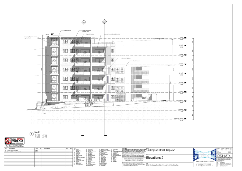
|
Georges
River Council – Local Planning Panel Thursday, 17
December 2019
|
Page 230
|
REPORT TO GEORGES RIVER COUNCIL
LPP MEETING OF Tuesday, 17 December 2019
|
LPP Report No
|
LPP064-19
|
Development Application No
|
MOD2019/0097
|
|
Site Address & Ward Locality
|
Lot 23, 23 Bay Road Oatley
Peakhurst Ward
|
|
Proposed Development
|
Modification of consent number
DA2017/0198 – Modification involves a new driveway, an additional room
on the top level, amended floor to floor height within the approved building
height, amend roof layout and replace external materials
|
|
Owners
|
M and Z Moussa
|
|
Applicant
|
M Moussa
|
|
Planner/Architect
|
Planner – DA Plus
Planner Architect – Ghazi Al Ali
|
|
Date Of Lodgement
|
12/06/2019
|
|
Submissions
|
Nil
|
|
Cost of Works
|
Nil
|
|
Local Planning Panel Criteria
|
The application is seeking a
Section 4.55(2) modification of an application approved by the Panel.
|
|
List of all relevant s.4.15
matters (formerly s79C(1)(a))
|
State Environmental Planning Policy
(Vegetation in Non-Rural Areas) 2017, State Environmental Planning Policy
(Building Sustainability Index: BASIX) 2004, Greater Metropolitan Regional
Environmental Plan No.2 – Georges River Catchment,
State Environmental Planning Policy
No.55 – Remediation of Land, State Environmental Planning Policy
(Infrastructure) 2007, Draft Evironmental State Environmental Planning
Policy, Draft State Environmental Planning Policy – Remediation of
Land,
Kogarah Local Environmental Plan
2012, Kogarah Development Control Plan 2013
|
|
List all documents submitted
with this report for the Panel’s consideration
|
Architectural Plans
|
|
Report prepared by
|
Independent Assessment
|
|
Recommendation
|
That the application be approved in accordance with the
conditions included in the report.
|
|
|
Summary of matters for
consideration under Section 4.15
Have all recommendations in relation
to relevant s4.15 matters been summarised in the Executive Summary of the
assessment report?
|
Yes
|
|
Legislative clauses requiring
consent authority satisfaction
Have relevant clauses in all
applicable environmental planning instruments where the consent authority
must be satisfied about a particular matter been listed, and relevant
recommendations summarised, in the Executive Summary of the assessment
report?
|
Yes
|
|
Clause 4.6 Exceptions to
development standards
If a written request for a
contravention to a development standard (clause 4.6 of the LEP) has been
received, has it been attached to the assessment report?
|
Not
Applicable
|
|
Special Infrastructure
Contributions
Does the DA require Special
Infrastructure Contributions conditions (under s7.24)?
|
Not
Applicable
|
|
Conditions
Have draft conditions been provided
to the applicant for comment?
|
Yes
- the amended conditions will be available when the report is published
|
|
Site Plan
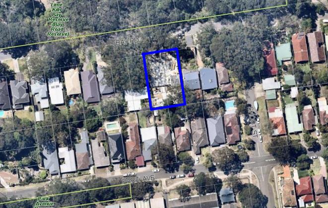
The subject site is
highlighted in blue
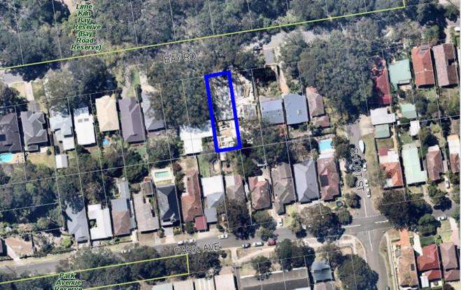
The Lot the subject of
the new crossing and driveway access is highlighted in blue.
|
Executive Summary
Proposal
1. The modification application (DA) seeks to amend the
consent granted for the demolition of all existing structures on site and the
construction of two (2)/three (3) storey dwelling house and associated
site works. This application is seeking to add an additional room to level 2,
reworking of the floor plates on each level, amended materials and finishes,
the removal of Tree 36, relocation of a Council stormwater pit amend the access
arrangements, installation of a new driveway including the removal of a rock
outcrop and level changes in the public domain together with amending
associated conditions of consent relating to the dwelling being constructed on
Lot 23.
Site and Locality
2. The site is legally identified as Lot 23 Section 10 DP 3230 and
commonly known at 23 Bay Road, Oatley. The site is a rectangular shaped
allotment having a width / frontage to Bay Road of 12.19m and depth of 40.235m,
yielding a total site area of 490.5sqm. With respect to topography a cross-fall
from the rear boundary towards the front boundary / street frontage of
approximately 6m is noted.
3. The site contains
significant vegetation which is also located forward in the Council verge and
is also identified as being Bushfire Prone Land. In respect to surrounding
development, to the north, on the opposite side of Bay Road is Lime Kiln Bay
Reserve. Dwellings houses adjoin the east, south and west boundaries of the
site.
4. Construction activity associated with the original consent
(DA2017/0198), approved on 24 October 2018 is occurring on site as demonstrated
in figures 2 and 3 below.
Zoning and Permissibility
5. The
subject site is zoned R2 Low
Density Residential under the provisions of the Hurstville Local Environmental Plan 2012 (HLEP2012). The proposal involves alterations
and additions to an approved dwelling house, which is permissible with consent
in the zone.
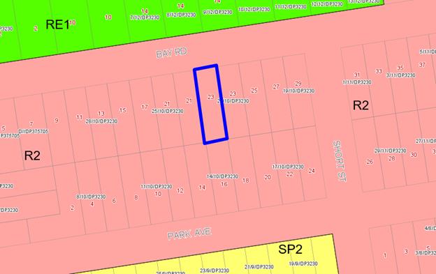
Figure 1:
Zoning Map with the site outlined in blue
Submissions
6. The
DA was notified to adjoining properties in accordance with the Hurstville
Development Control Plan 2013 (DCP2013) for a statutory notification period of
14 days. No submissions were received.
Conclusion
7. The application has been assessed having regard to the
Matters for Consideration under Section 4.15 of the Environmental Planning
and Assessment Act 1979, the provisions of the relevant State Environmental
Planning Policies, Local Environmental Plans and Development Control Plans. The
proposed built form relating to an additional room to level 2, reworking
of the floor plates on each level, amended materials and finishes, the removal
of Tree 36, relocation of a Council stormwater pit amend the access
arrangements, installation of a new driveway including the removal of a rock
outcrop and level changes in the public domain together with amending
associated conditions of consent is recommended for
approval subject to amended and additional conditions of consent.
Report in Full
DESCRIPTION
OF THE PROPOSAL
8. The
modification application (MOD2019/0097) is submitted under the provisions of
Section 4.55(2) and Section 4.15 Environmental Planning and Assessment Act 1979
seek amendments to the approved plans as outlined below:
· Provision of a driveway and direct vehicular access from the Bay
Road frontage of Lot 23 in lieu of the approved scheme that incorporated a
common driveway / right of way access over the adjoining site to the east (Lot
22);
· Alterations to the internal floor plan and external openings as
follows:
Garage Level - Removal of bathroom,
provision of a groceries lift to ground floor kitchen and reconfiguration of
internal stair access;
Ground Floor - Size of living and
dining room reduced, fireplace removed and floor to ceiling height increased by
200mm to 3.2m. Two (2) window openings are also incorporated to the east and
west side elevations of the living room;
Level 01 - Enlargement of WIR to Master
bed and relocation Bed 2 built in robe;
Level 02 - Front external wall relocated
forward by 3.7m to create additional bedroom and separate study to align with
adjoining dwelling (Lot 22). Lounge replaced with laundry and 200mm reduction
in floor to ceiling height to 2.8m. Openings to the front and rear elevation
are amended and originally approved forward balcony subsequently reduced in
size.
· Materials and finishes are amended with feature elements to external
wall elevations, being cladding replaced with cement render with horizontal
scoring and western cedar clad replaced with Cemintel Territory (Woodlands Teak
Cladding). A light grey coloured metal garage door is also to be
utilised.
· Design changes require the relocation of a stormwater pit, removal
of one (1) street tree (T36) and saw cutting to a large rock outcrop within the
road reserve and level changes to the public domain.
DESCRIPTION
OF THE SITE AND LOCALITY
9. The site is legally identified as Lot 23 Section 10 DP 3230 and
commonly known at 23 Bay Road, Oatley. The site is a rectangular shaped
allotment having a width / frontage to Bay Road of 12.19m and depth of 40.235m,
yielding a total site area of 490.5sqm. With respect to topography a cross-fall
from the rear boundary towards the front boundary / street frontage of
approximately 6m is noted.
10. The site contains significant vegetation which is also located
forward in the Council verge and is also identified as being Bushfire Prone
Land. In respect to surrounding development, to the north, on the opposite side
of Bay Road is Lime Kiln Bay Reserve. Dwellings houses adjoin the east, south
and west boundaries of the site.
11. Construction
activity associated with the original consent (DA2017/0198), approved on 24
October 2018 is occurring on site as demonstrated in figures 2 and 3 below.
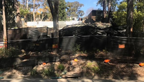
Figure 2:
Street frontage of the site
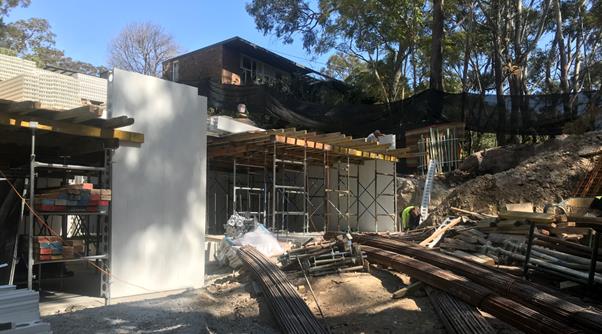
Figure 3:
Construction activity on site
Background
12. On
24 October 2018 the Georges River Local Planning Panel granted development
consent for the demolition of the existing development on site and the
construction of two (2) three (3) storey dwelling houses and associated site
works.
13. The
approval saw a common driveway access to service both dwellings (Lot 22 and Lot
23) with easements for access, this application seeks to remove the common
driveway and provide individual access points.
COMPLIANCE AND
ASSESSMENT
14. The
development has been inspected and assessed under the Section 4.55(2)
‘Matters for Consideration’ of the Environmental Planning and
Assessment Act 1979.
ENVIRONMENTAL
PLANNING INSTRUMENTS
Section 4.55(2)
Modification under Environmental Planning & Assessment Act, 1979
15. The
proposal has been considered against relevant statutory provisions of Section
4.55(2) as follows;
(2)
Other Modifications
A
consent authority may, on application being made by the applicant or any other
person entitled to act on a consent granted by the consent authority and
subject to and in accordance with the regulations, modify the consent if:
(a) it is satisfied that the development to
which the consent as modified relates is substantially the same development as
the development for which consent was originally granted and before that
consent as originally granted was modified (if at all), and
16. Comment:
Applications under section 4.55 of the Act cannot be granted if the modified
development is not substantially the same as that which consent was originally
granted. In this regard, the modification should not be so substantial as to
cause the application to lose its original identity.
17. The application relates
primarily to reconfiguration of the driveway access with minor amendments to approved
floor plans and external openings. The building envelope remains largely
consistent with that approved and thus in essence the proposal
is considered to remain ‘substantially the same’ with modifications
not resulting in it losing its original identity.
(b) it
has consulted with the relevant Minister, public authority or approval body
(within the meaning of Division 4.8) in respect of a condition imposed as a
requirement of a concurrence to the consent or in accordance with the general
terms of an approval proposed to be granted by the approval body and that
Minister, authority or body has not, within 21 days after being consulted,
objected to the modification of that consent, and
18. Comment:
The application was referred to the NSW Rural Fire Service (RFS) in accordance
with requirements of Part 4.14 of the Environmental Planning and Assessment Act
1979. The RFS provided correspondence dated 26 August 2019 and raised no
objection to the proposed development subject to the imposition of amended
conditions (incorporated within recommendation of this report).
(c) it has notified the application in
accordance with:
(i) the regulations, if the
regulations so require, or
(ii) a development control plan, if the
consent authority is a council that has made a development control plan that
requires the notification or advertising of applications for modification of a
development consent, and
(d) it
has considered any submissions made concerning the proposed modification within
the period prescribed by the regulations or provided by the development control
plan, as the case may be.
19. Comment:
In accordance with the provisions of Councils Public Notification process, the
application was placed on neighbour notification for 14 days between 24 June
2019 and 8 July 2019. During this time no submissions were received by Council.
State Environmental Planning Policies
20. Compliance
with the relevant state environmental planning policies is summarised in the
table, and discussed in more detail below.
Table 1:
State Environmental Planning Policy
|
State
Environmental Planning Policy
|
Complies
|
|
Greater
Metropolitan Regional Environmental Plan No 2 – Georges River Catchment
|
Yes
|
|
State
Environmental Planning Policy (Building Sustainability Index: BASIX) 2004
|
Yes
|
|
State
Environmental Planning Policy No 55 - Remediation of Land
|
Yes
|
|
State Environmental Planning Policy (Vegetation in Non-Rural
Areas) 2017
|
Yes
|
|
State
Environmental Planning Policy (Infrastructure) 2007
|
Yes
|
Greater
Metropolitan Regional Environmental Plan No 2 – Georges River Catchment
21. The main aims and objectives of this plan are (not limited
to);
· to maintain and improve the water quality and river flows
of the Georges River and its tributaries and ensure that development is managed
in a manner that is in keeping with the national, State, regional and local
significance of the Catchment;
· to protect and enhance the environmental quality of the
Catchment for the benefit of all users through the management and use of the
resources in the Catchment in an ecologically sustainable manner;
· to ensure consistency with local environmental plans and
also in the delivery of the principles of ecologically sustainable development
in the assessment of development within the Catchment where there is potential
to impact adversely on groundwater and on the water quality and river flows
within the Georges River or its tributaries; and
· to establish a consistent and coordinated approach to environmental
planning and assessment for land along the Georges River and its tributaries
and to promote integrated catchment management policies and programs in the
planning and management of the Catchment.
The proposed system and method of stormwater disposal to
the newly relocated kerb inlet pit within Bay Road.
State
Environmental Planning Policy (Building Sustainability Index: BASIX) 2004
22. A BASIX Certificate has been issued for the proposed
development. The BASIX Certificate No.832120S_03 is dated 27 May 2019 and the
proposal meets the minimum provisions and requirements of BASIX in terms of
water, thermal comfort and Energy efficiency. The conditions of consent will be
amended to reflect the revised BASIX certificate.
State
Environmental Planning Policy No 55 - Remediation of Land
23. SEPP
55 aims to promote the remediation of contaminated land in order to reduce the
risk of harm to human health or any other aspect of the environment.
24. Clause
7 requires contamination and remediation to be considered in determining a
development application. The consent authority must not consent to the carrying
out of development on land unless it has considered whether or not the land is
contaminated.
25. The
site has been used for residential purposes, it is considered the possibility
for contamination referred to in SEPP 55 being located on site is minimal as a
result the development is considered to meet with criterion of SEPP55.
State
Environmental Planning Policy (Infrastructure) 2007
26. The
aim of the Policy is to facilitate the effective delivery of infrastructure
across the State. The Policy also examines and ensures that the acoustic
performance of buildings adjoining the rail corridor or busy arterial roads is
acceptable and internal amenity within apartments is reasonable given the
impacts of adjoining infrastructure.
27. This
being a residential street the application does not trigger the need for any
conditions relating to this SEPP.
Draft Remediation of
Land SEPP
28. The
Department of Planning and Environment has announced a Draft Remediation of
Land SEPP, which will repeal and replace the current State Environmental
Planning Policy No 55 — Remediation of Land.
29. The
main changes proposed to this SEPP include the expansion of categories of
remediation work which requires development consent, a greater involvement of
principal certifying authorities particularly in relation to remediation works
that can be carried out without development consent, more comprehensive
guidelines for Councils and certifiers and the clarification of the
contamination information to be included on Section 149 Planning Certificates.
30. Whilst
the proposed SEPP will retain the key operational framework of SEPP 55, it will
adopt a more modern approach to the management of contaminated land. The Draft
SEPP will not alter or affect the findings in respect to low probability of
contamination on the site.
State Environmental
Planning Policy (Vegetation in Non-Rural Areas) 2017
31. The
Vegetation SEPP regulates clearing of native vegetation on urban land and land
zoned for environmental conservation/management that does not require
development consent.
32. The
Vegetation SEPP applies to clearing of:
(a) Native
vegetation above the Biodiversity Offset Scheme (BOS) threshold where a
proponent will require an approval from the Native Vegetation Panel established
under the Local Land Services Amendment Act 2016; and
(b) Vegetation
below the BOS threshold where a proponent will require a permit from Council if
that vegetation is identified in the council’s development control plan
(DCP).
33. The
Vegetation SEPP repeals clause 5.9 and 5.9AA of the Standard Instrument -
Principal Local Environmental Plan with regulation of the clearing of
vegetation (including native vegetation) below the BOS threshold through any
applicable DCP.
34. The
proposed development involves the removal of T36. The proposed tree to be
removed is considered to be significant tree species. Council’s Landscape
Officer has reviewed the application and has recommended that the tree remain.
35. The
design of the development to provide a driveway to access to Lot 23, T36 cannot
be retained. The scheme has been reviewed to ascertain if a redesign would
result in the retention of this tree. Given the site constraints a redesign
cannot be achieved.
36. Whilst
it is desirable to retain the tree it is not possible in this design, the
remaining trees within the vicinity of the proposed driveway will be retained
and protected during construction in accordance with the imposed conditions of
consent.
37. The
application is therefore considered acceptable with the loss of T36 and
condition for replanting.
Draft Environment SEPP
38. The Draft Environment SEPP
was exhibited from 31 October 2017 to 31 January 2018. This consolidated SEPP
proposes to simplify the planning rules for a number of water catchments,
waterways, urban bushland, and Willandra Lakes World Heritage Property.
39. Changes proposed include consolidating the following seven
existing SEPPs:
· State Environmental Planning Policy No 19 – Bushland
in Urban Areas
· State Environmental Planning Policy (Sydney Drinking Water
Catchment) 2011
· State Environmental Planning Policy No 50 – Canal
Estate Development
· Greater Metropolitan Regional Environmental Plan No. 2
– Georges River Catchment
· Sydney Regional Environmental Plan No 20 –
Hawkesbury-Nepean River (No 2-1997)
· Sydney Regional Environmental Plan (Sydney Harbour
Catchment) 2005
· Willandra Lakes Regional Environmental Plan No 1 – World
Heritage Property.
The proposal is consistent with the provisions of this Draft
Instrument.
Any Other
Matters Prescribed By The Regulations
40. The
Regulations prescribe the following matters for consideration for development
in the Hurstville Council area:
Planning for
Bushfire Protection 2006
41. A
bushfire risk assessment accompanied the subject application. Referral was
provided to the NSW Rural Fire Service who
raised no objections subject to amended conditions (incorporated within recommendation
of this report).
Section 4.15
Assessment
An
assessment of the application with regard to the matters for consideration
under Section 4.15 of the Environmental Planning and Assessment Act 1979 is
provided as follows.
(a)(i) any
environmental planning instrument,
Environmental Planning Instruments
Hurstville Local Environmental Plan 2012 (HLEP)
Zoning
42. The subject site is zoned R2 Low
Density Residential under the provisions of the Hurstville Local Environmental Plan 2012 (HLEP). Refer to zoning map (Figure 1) above. The proposed
development is alterations and additions to an approved dwelling house which is
a permissible land use in the zone and satisfy the objectives referenced below:
• To provide for the housing
needs of the community within a low density residential environment.
• To enable other land uses
that provide facilities or services to meet the day to day needs of residents.
• To encourage development of
sites for a range of housing types, where such development does not compromise
the amenity of the surrounding area, or the natural or cultural heritage of the
area.
• To ensure that a high level
of residential amenity is achieved and maintained.
• To encourage greater visual
amenity through maintaining and enhancing landscaping as a major element in the
residential environment.
• To provide for a range of
home business activities where such activities are not likely to adversely
affect the surrounding residential amenity.
43. The
extent to which the proposal complies with the relevant standards of HLEP 2012
is outlined in the table below.
Table 2: Hurstville Local
Environmental Plan 2012
|
Clause
|
Standard
|
Proposed
|
Complies
|
|
4.3 - Height of Buildings
|
9m as identified on Height of
Buildings Map
|
Maximum approved building height
(7.34m) is not altered.
|
Yes
|
|
4.4 - Floor Space Ratio
|
0.6:1 as identified on Floor Space
Ratio Map
|
0.48:1
|
Yes
|
|
6.1 - Acid sulfate soils
|
Works within 500m of adjacent Class
1, 2, 3 or 4 land that is below 5m Australian Height Datum and by which the
watertable is likely to be lowered below 1m Australian Height Datum on
adjacent Class 1, 2, 3 or 4 land.
|
Site is located within 500m of
adjacent class 2 and 5 land. As concluded in the original assessment report
the extent of excavation dictates that an acid sulfate soils assessment is
not necessary. The modified proposal remains consistent with this conclusion.
|
Yes
|
|
6.4 - Foreshore Scenic Protection
Area
|
Subclause (3) provides that
development consent must not be granted to development on land to which this
clause applies unless the consent authority has considered how the
development would-
(a) affect
the natural environment, including topography, rock formations, canopy
vegetation or other significant vegetation, and
(b) affect
the visual environment, including the views to and from the Georges River,
foreshore reserves, residential areas and public places, and
(c) affect
the environmental heritage of Hurstville, and
(d) contribute
to the scenic qualities of the residential areas and the Georges River by
maintaining the dominance of landscape over built form.
|
Site is within the Foreshore Scenic
Protection Area.
Modified development seeks to
remove one tree and approximately 1.5m of an existing rock outcrop to provide
vehicular access to the site access. Noting the heavily vegetated context of
the site and surrounds, removal of the subject tree is not unreasonable to
facilitate the intended access. The component of rock to be removed
represents only a minor component of its formation and will not compromise
its significance or contribution to the area.
Modified development will not
compromise the visual environment, noting that an appropriate building
envelope and form is retained as well as a landscaped setting.
The site is not in the immediate
vicinity of any heritage items or conservation areas.
The modified development retains a
building envelope consistent to that approved and subsequently maintains an
appropriate scenic quality.
|
Yes
|
|
6.5 - Gross floor areas of
dwellings in residential zones
|
Site Area ≤ 630sqm
FSR 0.55 (GFA 269.5sqm)
|
FSR 0.48:1 (234.57sqm)
|
Yes
|
|
6.7 - Essential Services
|
The following services that are
essential for the development shall be available or that adequate
arrangements must be made available when required:
* Supply of
water, electricity and disposal and management of sewerage
* Stormwater
drainage or on-site conservation
* Suitable
vehicular access
|
Essential services available to the
development. Proposed modifications seek to provide more effective vehicular
access with a direct access point / driveway from Bay Road in lieu of the
approved Right of Way configuration over Lot 22.
The existing services available to
the site can be extended to service this development.
|
Yes
|
Development
Control Plans
Hurstville Development
Control Plan No 1 - LGA Wide
44. The
proposal has been assessed against requirements of Section 4.4 of
Council’s Development Control Plan No 1 - LGA Wide as shown below.
Non-compliant aspects of the proposal are discussed at the end of the table.
|
Section
4.4
|
|
Control
|
Standard
|
Proposed
|
Complies
|
|
PC1
Neighbourhood Character
|
Development is sited and designed
to respect existing neighbourhood and streetscape character.
|
The dwelling retains an appropriate
siting and design.
|
Yes
|
|
PC2
Building Height
|
Maximum building height is in
accordance with the LEP.
Maximum ceiling height is 7.2m
above the existing ground level vertically below that point.
Maximum height to the top of the
parapet is 7.8m above existing ground level vertically below.
For steep or sloping sites, the
building is sited and designed to be staggered or stepped into the natural
slope of the land.
|
The modified proposal complies with
9mheight control of HLEP 2012 (8.6m).
Upper level addition results in a
corresponding wall height of 6m (east) and 6.7m (west).
Maximum parapet height is not
altered from that approved. The changes in levels of the building did not
result in the need for the parapet height to be altered.
Development appropriately stepped
to reflect the natural topography of the site.
|
Yes
Yes
Yes
Yes
|
|
PC3
Setbacks
|
Front Setback
Minimum setback from the primary
street boundary is:
4.5m to main building face
5.5m to front wall of the garage
OR
Within 20% of the average setback
of dwellings on adjoining lots
Side Setbacks
900mm (ground floor) FSPA
1.5m (first floor) FSPA
Rear Setback
6m
|
9m (as approved)
Min 1.76m (east) as approved.
Min 2m (west) as approved
10.252m (as approved)
|
Yes
Yes
Yes
Yes
|
|
PC4
Facades
|
The dwelling
house has a front door or window to a habitable room facing the primary
street frontage.
The dwelling house incorporates
design elements.
Garage doors not wider than 6m
|
Windows to habitable rooms and
balconies are retained to the primary street frontage.
Suitable design elements and
architectural quality retained.
5.8m
|
Yes
Yes
Yes
|
|
PC5
Views
|
Development is
sited and designed to facilitate view sharing
|
The development as modified is not
foreseen to result in any adverse view loss impacts.
|
Yes
|
|
PC6
Solar access
|
Development
allows for at least 3 hours of sunlight on the windows of main living areas
and adjoining principal private open space of adjacent dwellings between
9.00am and 3.00pm on 21 June
|
The solar access remains largely
unchanged result in in excess of 3 hours being provided.
|
Yes
|
|
PC7
Visual privacy
|
Windows of
proposed dwelling must be offset from neighbouring windows by 1m, especially
windows of high-use rooms.
Windows for
primary living rooms must be designed so that they maintain privacy of
adjoining site’s principal private open space.
|
Two windows are introduced to the
side elevations of the ground floor living room and both provided with 1.5m
sill heights which mitigates overlooking.
Complies
|
Yes
Yes
|
|
PC8
Noise
|
Noise
generators such as plant and machinery including air conditioning units and pool
pumps are located away from windows or other openings of habitable rooms and
are screened to reduce noise or acoustically enclosed.
|
Standard conditions of consent
relating to noise retained.
|
Yes
|
|
PC9
Vehicle access, parking and
manoeuvring
|
Min. 2 spaces for 3 bed or more
Enclosed or
roofed car accommodation, including garages and carports, are located at
least 1m behind the main setback.
Driveway
gradients must be constructed in accordance with Australian Standard
2890.1(2004).
|
2 spaces provided
Garage alignment remains consistent
with that approved.
Design appears to be capable of
achieving compliance (conditions are imposed).
|
Yes
Acceptable
Yes
|
|
PC10
Landscaped Areas (min. width 2m)
Private Open Space
|
25% of the Site Area (122sqm in
this case) FSPA
15sqm of landscaped area to be
provided in the front yard
Principal Private Open Space Min.
dimension of 4m minimum area of 30sqm and directly accessible from a living
area
|
41.8%
41.78sqm
Consistent with approved.
|
Yes
Yes
Acceptable
|
|
PC12
Basements
|
Basements do not protrude more than
1m above existing ground level at any point.
Only one driveway access is
permitted.
Internal Floor to Ceiling min.
2.1m, max. 2.4m
> 1.5m excavation requires
Geotechnical Report
|
Basement footprint and elevation is
not altered.
A single driveway access from Bay
Road is proposed in lieu of approved right of way over Lot 22.
Consistent with approved.
Extent of excavation remains
consistent with that approved, noting also that a Geotech report was
referenced. The addition excavation proposed is to facilitate the driveway
access to meet with the garage as constructed.
|
Yes
Yes
Acceptable
Acceptable
|
|
PC14
Balconies & Terraces
|
Direct access from a habitable room
(at same floor level)
Overlooking impacts can be
minimized with use of privacy screens between 1.5m-1.8m.
Terraces must not be visible from
the street
|
Complies
Balconies to the front elevation of
the dwelling are retained and do not necessitate screening. It is noted that
modifications to the upper level (02) reduce the size of this balcony.
As concluded within the initial
assessment report the terraces provide a modulated building, adding
architectural merit and takes advantage of the outlook available from the
subject site.
|
Yes
Yes
Acceptable
|
DEVELOPER CONTRIBUTIONS
45. The
applicant has detailed the amendments proposed do not result in the change in
the cost of works as the development is currently under construction and will
be built into the construction. As a result there is no change to the levied
contributions.
IMPACTS
Natural Environment
46. In
respect to vehicular access, the approved development requires an easement to
be granted for a right of access way over Lot 22. The Applicant has identified
that the driveway is convoluted, requires additional vehicle manoeuvring and
poses a safety risk to the future residents of Lots 22 and 23 due to lack of
sight lines. Upon review of approved plans this conclusion is considered
accurate, noting particularly that if the garage of the subject site were
occupied, subsequent vehicles would be required to reverse back out, and across
Lot 22.
47. The
proposed modification subsequently seeks to introduce direct vehicular access
to the site from Bay Road frontage. The proposed driveway requires removal of
one street tree which is a mature Blackbutt (Eucalyptus pilularis)
identified as T36.
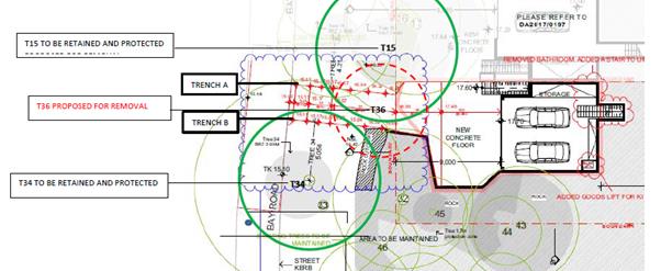
Figure 4:
Tree / Trench Location Plan (Source: Root Mapping Investigation Report - NSW
Tree Services)
48. A
Root Mapping Investigation prepared by NSW Tree Services has been submitted to
identify the impact of the proposed driveway. Council’s Arborist has reviewed
the report and identified that T36 is of good condition and thus does not
support removal with TPZ incursions to T15 and T34 also noted.
49. From
a planning perspective, direct vehicular access to the site is considered to be
both warranted and reasonable in this instance and whilst removal of the
subject tree is not desirable it is accepted. The heavily vegetated site
context is noted, and thus despite removal, a landscaped setting is retained,
noting also Condition 49 of the consent which required plantation of three
advanced native species capable of reaching a mature height of 9m. With respect
to abovementioned incursions to T15 and T34, tree protection measures
identified in Part 6 of the Root Mapping Investigation which relate to
construction and post development care are noted and have been referenced
within the recommendation of this report.
50. Lastly,
a component of the rock outcrop within the street verge forward of the site
requires removal to facilitate the required driveway width. As the component of
rock to be removed / saw cut is limited to approximately 1.5m, representing a
small component of its overall formation and contained to the narrower eastern
extremity, its significance and subsequent contribution to the area will not be
unduly compromised.
Built Environment
51. The
proposed development as modified would not result in any adverse impacts upon
the built environment, noting reasons discussed throughout this report.
Social and Economic
Impact
52. The
proposed development would not result in any adverse social and/or economic
impacts within the locality.
Suitability of the site
53. Having
regard to the assessment contained within this report, the site is considered
to remain suitable for the intended development.
SUBMISSIONS AND THE
PUBLIC INTEREST
54. In
accordance with the provisions of Councils Public Notification process, the
application was placed on neighbour notification for 14 days between 24 June
2019 and 8 July 2019. During this time no submissions were received by Council.
REFERRALS
Council
Referrals
Development Engineer
55. The
application was referred to Council’s Development Engineer. No objections
were raised subject to the provision of conditions which are incorporated.
Traffic Engineer
56. The
application was referred to Council’s Traffic Engineer for comment. No
concerns were raised with the design
Consultant Arborist
57. The
application was referred to Council’s Consultant Arborist for review. In
principle objection was raised to the removal of tree 36 that is located within
the Council verge with the TPZ incursions to T15 and T34 also noted. Further
discussion has been provided within this report with respect to the tree
removal.
Assets and
Infrastructure Engineer
58. The
application was referred to Council’s Assets and Infrastructure Engineer.
No objection was raised subject to the provision of conditions which related to
gradient detail of the proposed driveway, stormwater pit relocation and the
proposed retaining walls within the road reserve (incorporated within
recommendation of this report).
External Referrals
Rural Fire Service
(RFS)
59. The
application was referred to the NSW Rural Fire Service (RFS) in accordance with
requirements of Part 4.14 of the Environmental Planning and Assessment Act 1979.
The RFS raised provided correspondence dated 26 August 2019 and raised no
concerns to the proposed development subject to the imposition of conditions.
Those conditions have been incorporated into the recommendation.
Ausgrid
60. The
application was referred to Ausgrid on 19 June 2019, not response has been
received at the time of writing this report (9 December 2019), concurrence can
therefore be assumed.
CONCLUSION
The application
has been assessed having regard to Section 4.55(2) and Section 4.15 of the
Environmental Planning and Assessment Act 1979, and provisions of Hurstville
Local Environmental Plan 2012 and Development Control Plan.
The proposal has
been considered on its merits and is considered to be acceptable for the
reasons outlined within this report. The proposal is reasonable given that the
objectives of the controls have been reasonably satisfied.
61. Following
detailed assessment contained within this report, it is considered that
MOD2019/0097 should be approved subject to modified conditions of consent.
DETERMINATION
AND STATEMENT OF REASONS
Statement
of Reasons
62. The
reasons for this recommendation are:
· The proposed development complies with the requirements of
the relevant environmental planning instruments and development control plan;
· The proposal has been designed to generally satisfy the key
provisions of the control relating to the environmental amenity and landscape
setting design even through T36 is recommenced for removal.
· The proposed modifications to the approved plans are
moderate in nature; however they do not result in any unreasonable impact on
the natural and built environment.
· The proposal aims to provide a high-quality dwelling that
is consistent with the character of the locality.
Determination
63. That the Georges River Council
Local Planning Panel, as the consent authority, pursuant to Section 4.55(2) of
the Environmental Planning and Assessment Act, 1979, grant approval to the
requested modifications (MOD2019/0097) seeking to add an additional room to
level 2, reworking of the floor plates on each level, amended materials and
finishes, the removal of Tree 36, relocation of a Council stormwater pit amend
the access arrangements, installation of a new driveway including the removal
of a rock outcrop and level changes in the public domain together with amending
associated conditions of consent to Development Consent DA2017/0198 dated 24
October 2018 for demolition of existing and construction of a two/three storey
dwelling at Lot 23 Section 10 DP 3230 and
known as 23 Bay Road, Oatley, subject to the consent being modified as follows:
1. Conditions
to be modified are as follows:
Conditions 1, 10,
20, 22, 23, 33, 34, 35, 36, 38, 44, 46, 49, 51 and 52.
2. Conditions
to be deleted are as follows:
Conditions 5,
6 and 7.
3. Conditions
added are as follows:
Conditions
17A and 23A.
Schedule
A – Site Specific Conditions
Section A Development Details
1. Approved
Plans – The development must be implemented in accordance with the
approved plans and supporting documentation listed below which have been
endorsed by Council’s approved stamp, except where marked up on the plans
and/or amended by conditions of this consent:
|
Description
|
Reference No.
|
Date
|
Revision
|
Prepared by
|
|
Demolition Plan
|
A1110
|
20/12/17
04.03.19
|
B
D
|
Ghazi Al Ali Architects
|
|
Street Level
|
A1201
|
03/07/18
04.02.19
04.11.10
|
C
D
E
|
Ghazi Al Ali Architects
|
|
Ground & Level 01
|
A1202
|
03/07/18
04.02.19
04.11.19
|
C
D
E
|
Ghazi Al Ali Architects
|
|
Level 02 & Roof
|
A1203
|
03/07/18
04.02.19
04.11.19
|
C
D
E
|
Ghazi Al Ali Architects
|
|
Elevations
|
A1301
|
03/07/18
04.02.19
04.11.19
|
C
D
E
|
Ghazi Al Ali Architects
|
|
Elevations
|
A1302
|
03/07/18
04.02.19
04.11.19
|
C
D
E
|
Ghazi Al Ali Architects
|
|
Sections
|
A1401
|
03/07/18
04.02.19
04.11.19
|
C
D
E
|
Ghazi Al Ali Architects
|
|
Material Schedule
|
A2201
|
03/07/18
04.02.19
04.03.19
|
C
D
D
|
Ghazi Al Ali Architects
|
|
Material Schedule
|
A2202
|
03/07/18
04.02.19
04.03.19
|
C
D
D
|
Ghazi Al Ali Architects
|
|
Landscape Plans
|
LPDA 17 – 355/1
LPDA 17 – 355/2
LPDA 1/ - 355/3
|
27/3/18
|
B
|
Conzept
|
|
Stormwater Concept
|
SW200, SW201, SW202, SW203, SW300 and SW400
20170131
SW101 issue C
SW200 issue C
SW201 issue C
SW202 issue C
SW203 issue C
SW204 issue C
SW300 issue C
SW400 issue C
|
22/6/17
15.11.19
|
A
C
|
SGC
SGC Consulting Engineers
|
|
Root Mapping Report
|
RMR-GAA(O)-U11/19
|
14.11.19
|
|
NSW Tree Services Pty Ltd
|
|
Public Domain Works
|
20170131
Cover page
C201 revision 02
C301 revision 02
|
03.12.19
|
|
SGC Consulting Engineers
|
(This condition is amended as part of MOD2019/0097
(MOD2019/0096) (DA2017/0198))
Section B Separate Approvals Required Under Other Legislation
4. Section
138 Roads Act and Section 68 Local Government Act 1993 - Unless otherwise
specified by a condition of this consent, this Development Consent does not
give any approval to undertake works on public infrastructure.
A separate approval is required to be lodged and approved under Section
138 of the Roads Act 1993 and/or Section 68 of the Local Government Act 1993
for any of the following activities carried out in, on or over a public
road (including the footpath):
(a) Placing or storing materials or equipment;
(b) Placing or storing waste containers or skip bins;
(c) Erecting a structure or carrying out work
(d) Swinging or hoisting goods over any part of a public road
by means of a lift, crane or the like;
(e) Pumping concrete from a public road;
(f) Pumping water from the site into the public road;
(g) Constructing a vehicular crossing or footpath;
(h) Establishing a “works zone”;
(i) Digging up or disturbing the surface of a public road
(e.g. Opening the road for the purpose of connections to utility providers);
(j) Stormwater and ancillary works in the road reserve;
and
(k) Stormwater and ancillary to public infrastructure on
private land
These separate activity approvals must be obtained and evidence of the
approval provided to the Certifying Authority prior to the issue of the
Construction Certificate.
The relevant Application Forms for these activities can be downloaded
from Georges River Council’s website at: www.georgesriver.nsw.gov.au
For further information, please contact Council’s Customer Service
Centre on (02) 9330 6400.
5. Engineering - Road Opening Permit - A Road
Opening Permit must be obtained from Council, in the case of local or regional
roads, or from the Roads and Maritime Services, in the case of State roads, for
every opening of a public road reserve to access services including sewer,
stormwater drains, water mains, gas mains, and telecommunications before the
commencement of work in the road.
Section C Requirements of
Concurrence, Integrated & Other Government Authorities
6. Sydney Water
- Tap in TM - The approved plans must be submitted to a Sydney Water Tap
in TM to determine whether the development application will affect Sydney
Water’s sewer and water mains, stormwater drains and/or easements, and if
further requirements need to be met. The approved plans will be
appropriately endorsed. For details please refer to ‘Plumbing,
building and developing’ section of Sydney Water’s web site at www.sydneywater.com.au then see
‘Building’, or telephone 13000 TAP IN (1300 082 746). The
Certifying Authority must ensure that a Tap in TM agent has appropriately
stamped the plans prior to the issue of the Construction Certificate.
Section D Prior to the
Issue of a Construction Certificate
7. Easement and
Right of Way - An easement to drain water 1m wide and a Right of Way
minimum 3.5m wide burdening Lot 22 in favour of Lot 23 shall be created and
registered with LPI NSW.
Written documents and evidence of the creation of the registered
easement and Right of Way shall be submitted to Council before the issue of a
Construction Certificate.
(This condition is deleted as part of MOD2019/0097
(MOD2019/0096) (DA2017/0198))
8. Easement for
Services – An easement for services minimum 1m wide burdening
Lot 22 in favour of Lot 23 shall be created and registered with LPI NSW.
Written documents and evidence of the creation of the registered
easement and Right of Way shall be submitted to Council before the issue of a
Construction Certificate.
(This condition is deleted as part of MOD2019/0097
(MOD2019/0096) (DA2017/0198))
9. Amended
Stormwater Plan – An amended detailed stormwater plan showing
an inter allotment drainage easement burdening Lot 22 in favour of Lot
23 in order to drain Lot 23 via gravity to the street shall be submitted to
Council before the issue of a Construction Certificate.
(This condition is deleted as part of MOD2019/0097
(MOD2019/0096) (DA2017/0198))
10. Section 4.14 Bushfire Risk
Assessment Certificate - All bushfire measures as recommended in the
Bushfire Hazard Assessment, prepare by Barry Eadie Consulting Pty Ltd dated 18
April 2019 version A, except where amended by the conditions of this
consent Bushfire Risk Assessment Report No.171096B, prepared by
Building Code & Bushfire Hazard Solutions Pty Limited and dated 7 February
2018, and in the Bushfire Risk Assessment Certificate approved by Building Code
& Bushfire Hazard Solutions (Certification No. BPAD9400), must be
implemented and the details of bushfire safety measures must be submitted with
the Construction Certificate application.
(This condition is amended as part of MOD2019/0096 (DA2017/0198))
11. Bushfire Attack Level - The
proposed development is to fully comply with all requirements applicable to a
Bush Fire Attack Level (BAL) of FZ 40 (Northern, Eastern and Western
Elevations) and 29 (Southern Elevation). With regard to the construction
requirements both Addendum: Appendix 3 Planning for Bush Fire Protection 2006,
and AS3959 -2009 Construction of Buildings in Bush Fire prone areas shall be
referenced. Full details of proposed method of compliance are to be submitted
with the Construction Certificate application.
a. At
the commencement of building works and in perpetuity the entire property shall
be managed as an inner protection area (IPA) as outlined within Section 4.1.3
and Appendix 5 of ‘Planning for Bushfire Protection 2006’ and the
NSW Rural Fire Service’s document ‘Standards for asset protection
zones’.
b. Water,
electricity and gas are to comply with Section 4.1.3 of ‘Planning for
Bushfire Protection 2006’.
c. New
construction, other than the southern elevation, shall comply with Section 3
and 8 (BAL40) Australian Standard AS3959-2009 ‘Construction of buildings
in bush fire-prone areas’ or NASH Standard (1.7.14 updated)
‘National Standard Steel Framed Construction in Bushfire Areas –
2014’ as appropriate and section A3.7 Addendum Appendix 3 of
‘Planning for Bushfire Protection 2006’.
d. New
construction, to the southern elevation, shall comply with Section 3 and 7 and
(BAL29) Australian Standard AS3959-2009 ‘Construction of buildings in
bush fire-prone areas’ or NASH Standard (1.7.14 updated) ‘National
Standard Steel Framed Construction in Bushfire Areas – 2014’ as
appropriate and section A3.7 Addendum Appendix 3 of ‘Planning for
Bushfire Protection 2006’.
e. Landscaping
to the site is to comply with the principles of Appendix 5 of ‘Planning
for Bushfire Protection 2006’.
(This condition is amended as part of MOD2019/0096
(DA2017/0198))
12. Fees to be paid - The fees
listed in the table below must be paid in accordance with the conditions of
this consent and Council’s adopted Fees and Charges applicable at the
time of payment (available at www.georgesriver.nsw.gov.au).
Payments must be made prior to the issue of the Construction Certificate
or prior to the commencement of work (if there is no associated Construction
Certificate).
Council will only accept Bank Cheque or Electronic Funds Transfer (EFT)
for transaction values of $500,000 or over. Council must be contacted prior to
payment to determine correct total amount to be paid and bank account details
(if applicable).
A summary of the fees to be paid are listed below:
|
Fee Type
|
Fee
|
|
GENERAL FEES
|
|
Long Service
Levy (to Long Service Corporation) Or, provide evidence of Payment direct to
the Long Service Corporation. See https://portal.longservice.nsw.gov.au/bci/levy/
|
|
Builders Damage
Deposit
|
$1,900.00
|
|
Inspection Fee
for Refund of Damage Deposit
|
$155.00
|
|
Street Tree
Removal – Replacement Street Tree Fee
|
$452.00
|
|
DEVELOPMENT
CONTRIBUTIONS
|
|
Georges River
Council Section 94A Development Contributions Plan 2017
|
$7,491.57
|
A
Tree Preservation and Protection Bond shall be implemented as per Georges River
Councils Assets & Infrastructure Tree Management 1.11.
· Minimum
Fee per tree > 5m in height (per application)
$633.50
The tree/s with a Tree Preservation and Protection Bond are listed in the
table below.
|
Tree Species
|
Location of
Tree / Tree No.
|
Tree
Preservation and Protection Bond
|
|
Eucalyptus
pilularis
|
Council street
tree /T33
|
$633.50
|
|
Eucalyptus
pilularis
|
Council street
tree /T34
|
$633.50
|
|
Angophora sp
|
Council street
tree /T35
|
$633.50
|
|
Eucalyptus
pilularis
|
Council
street tree /T36
|
$633.50
|
|
Total
|
|
$2,534.00
|
General Fees
The fees and charges above are subject to change and are as set out in
the version of Council's Schedule of Fees and Charges or as required by other
Government Authorities, applicable at the time of payment.
Development Contributions
A Section 7.12 contribution has been levied on the subject development
pursuant to the Georges River Council Section 94A Contributions Plan.
Timing of Payment
The contribution must be paid and receipted by Council prior to the release of the Construction Certificate.
Further Information
A copy of the all current Development Contributions Plans may be
inspected or a copy purchased at Council’s offices (Georges River Civic
Centre, MacMahon Street, Hurstville and Kogarah Library and Service Centre,
Kogarah Town Square, Belgrave Street, Kogarah) or viewed on Council’s
website www.georgesriver.nsw.gov.au.
(This condition is amended as part of MOD2019/0097
(MOD2019/0096) (DA2017/0198))
13. Low reflectivity roof -
Roofing materials must be low glare and reflectivity. Details of finished
external materials including colours and texture must be provided to the
Certifying Authority.
14. Erosion & Sedimentation
Control - Erosion and sediment controls must be provided to ensure:
(a) Compliance with the approved Erosion & Sediment
Control Plan
(b) Removal or disturbance of vegetation and top soil is confined to
within 3m of the approved building area (no trees to be removed without
approval)
(c) All clean water runoff is diverted around cleared or
exposed areas
(d) Silt fences, stabilised entry/exit points or other devices are
installed to prevent sediment from entering drainage systems or waterways
(e) All erosion and sediment controls are fully maintained for the
duration of demolition, excavation and/or development works
(f) Controls are put into place to prevent tracking of sediment by
vehicles onto adjoining roadway
(g) All disturbed areas are rendered erosion-resistant by turfing,
mulching, paving or similar
(h) Compliance with Managing Urban Stormwater - Soils and Construction
(Blue Book) produced by Landcom 2004.
These measures are to be implemented prior to the commencement of work
(including demolition and excavation) and must remain until works are completed
and all exposed surfaces are landscaped/sealed.
15. Pre-Construction Dilapidation
Report - Private Land - A professional engineer specialising in structural
or geotechnical engineering shall prepare a Pre-Construction Dilapidation
Report detailing the current structural condition of adjoining premises
including but not limited to:
(a) All neighbouring buildings likely to be affected by the excavation as
determined by the consulting engineer.
The report shall be prepared at the expense of the applicant and
submitted to the satisfaction of the Certifying Authority prior to the issue of
the Construction Certificate.
A copy of the pre-construction dilapidation report is to be provided to
the adjoining properties (subject of the dilapidation report), a minimum of 5
working days prior to the commencement of work. Evidence confirming that a copy
of the pre-construction dilapidation report was delivered to the adjoining
properties must be provided to the PCA.
Should the owners of properties (or their agents) refuse access to carry
out inspections, after being given reasonable written notice, this shall be
reported to Council to obtain Council’s agreement to complete the report
without access. Reasonable notice is a request for access in no sooner than 14
days between 8.00am-6.00pm.
16. Damage Deposit - Minor Works
- In order to insure against damage to Council property the following is
required:
(a) Pay Council, before the issue of the Construction Certificate, a
damage deposit for the cost of making good any damage caused to any Council
property as a result of the development: $1,900.00
(b) Pay Council, before the issue of the Construction Certificate, a
non-refundable inspection fee to enable assessment of any damage and repairs
where required: $155.00
(c) Submit to Council, before the commencement of work, a photographic
record of the condition of the Council nature strip, footpath and driveway
crossing, or any area likely to be affected by the proposal.
At the completion of work Council will inspect the public works, and the
damage deposit will be refunded in full upon completion of work where no damage
occurs. Otherwise the amount will be either forfeited or partly refunded
according to the amount of damage.
17. Structural details -
Engineer's details prepared by a practising Structural Engineer being used to
construct all reinforced concrete work, structural beams, columns and other
structural members. The details are to be submitted to the Principal Certifying
Authority for approval prior to construction of the specified works.
A copy shall be forwarded to Council where Council is not
the PCA.
17A. Driveway Crossing - Minor
Development - Constructing a driveway crossing and/or footpath requires a
separate approval under Section 138 of the Roads Act 1993
prior to the commencement of those works.
To apply for
approval, complete the ‘Application for Driveway Crossing and Associated
Works on Council Road Reserve issued under Section 138 Roads Act’ which
can be downloaded from Georges River Council’s website at www.georgesriver.nsw.gov.au.
Lodge the application form, together with the associated fees at
Council’s Customer Service Centre, during business hours. Refer to
Section P1 and P2, in Council’s adopted Fees and Charges for the
administrative and inspection charges associated with driveway crossing
applications.
An approval for
a new or modified vehicular crossing will contain the approved access and/or
alignment levels which will be required to construct the crossing and/or
footpath. Once approved, all work shall be carried out in accordance
with Council’s specifications applicable at the time, prior to the issue
of an Occupation Certificate.
The design
boundary level is to be received from Council prior to construction of the
internal driveway.
a) Driveway Detail - The applicant is
to submit as part of the application the profile (longitudinal section)
demonstrating/reinforcing the access clearance by the B85 Design Vehicle (85%
percentile vehicle in accordance with AS2890.1:2004).
This profile
(scale 1:20) is to show levels and grades from road centreline to the internal
garage floor level including but not limited to levels of, Road centreline,
changes of grade on road surface, lip of gutter, invert of gutter, back of
vehicular crossing (gutter layback), front of path (1.95m from property
Boundary), back of path (0.45m away from property boundary) and boundary.
Additional profiles are to be provided on either side of driveway when
longitudinal grade of road exceeds 8%. Profiles provided are to also include
the natural surface of the land as well as the proposed design including cut
and fill dimensions.
All turf areas
adjacent to the driveway works are to be re-graded topsoiled and turfed to
Council specifications and to suit design levels, the applicant is to show the
extents of the nature strip re-grading either side of the driveway, the grade
is not to exceed 16.5%.
The profile will
cross check the driveway levels and grades meet the garage levels of the
dwelling. The driveway is to be designed so as not to increase stormwater
runoff from the street entering the property.
All nearby
services within the public domain are to be accurately located on the plans. It
is to be noted that the cost of any service relocation is to be borne by the
applicant. Should the work to the public domain result in any impacts on the
trees to be protected beyond those assessed as part of the Development
Application the Arborist is to be consulted and Council’s Consultant
Arborist advised.
b) Stormwater Pit Relocation - The
applicant is to provide detailed stormwater plans which show the stormwater pit
and lintel to be relocated at least 0.3m(MIN) outside the wings of the
driveway. The plan is to show all relevant pipes and chambers that may be
affected by the pit reconstruction and driveway construction; all costs
associated with these works are to be borne by the applicant and are subject to
approval from Councils drainage engineers. Approval for the relocation of the
stormwater pit must be obtained prior to the issue of the construction certificate.
c) Vehicular crossing - Minor
development - The vehicular crossing shall be constructed by a private
contractor at the expense of the applicant, in accordance with the
specifications contained in the ‘Application for Driveway Crossing and
Associated Works on Council Road Reserve’ approval issued by
Council’s Assets and Infrastructure Division and in accordance with
Council’s Specification for Vehicular Crossings and Associated Works and
the issued.
Any existing
vehicular crossing and/or laybacks which are redundant must be removed. The
kerb and gutter, any other footpath and turf areas shall be restored at the
expense of the applicant and in accordance with Council’s Specification
for Vehicular Crossings and Associated Works.
No stencilled or
coloured concrete may be used outside the boundary of the property.
d) Proposed Retaining Walls on Councils Road Reserve:
Prior to Councils approval the applicants
will be required to submit a structural design for any
retaining walls to be located within Councils Road reserve.
The provision of retaining walls maybe restricted due to
the presence of utility services, street trees, driveways, and kerb and path
alignment. Approval is subject to the following requirements,
o Plan and sections 1:20
to be lodged showing construction method and constraints to works.
o Structural design to be
provided and certified by a practicing structural engineer.
o Materials for
construction to be indicated on plan
o All nearby services are
to be accurately located on plans
o Hand railing to be
provided in accordance with Building Code of Australia.
o Certification must be
provided from a practising structural engineer that the walls comply with
Australian Standards, and are structurally adequate.
o The design proposed must
take into account pedestrian movements along the frontage of property and site
distance requirements exiting the property.
o The design is to comply
with AS2890.1:2004 3.2.4. ‘Sight distance at access driveway
exits’
o The design will be
assessed by council and additional conditions may
be provided.
o Upon completion of
approved works, the property owner will be required to furnish proof of
Certifications from a practising structural engineer that the walls comply with
Australian Standards, and the new works are structurally adequate.
o Any retaining walls
greater than 1.0 m in height will require a 1.0m high fence.
o The Owner must enter
into a positive covenant with Council so that any liability arising from
the structure on Council land will be their legal responsibility. Draft terms
of Positive covenant for encroaching structures are below;
Council requires
a positive covenant to be prepared and registered at the property owners
expense on the title of the property that complies with the following terms:
TERMS OF
POSITIVE COVENANT FOR THE ENCROACHMENT STRUCTURES ON COUNCIL’S ROAD
RESERVE OR PROPERTY UNDER THE CARE AND CONTROL OF COUNCIL.
a) The registered proprietor shall,
at their expense, cause the appropriate document reflecting the covenant to be
registered with either: The General Registry of Deeds, or, NSW Lands and
Property Information (using the correct & prescribed Form). If the
latter, then Land Title Dealing Forms can be found at;
http://rgdirections.lpi.nsw.gov.au/land_title_dealing_forms#P
b) The registered proprietor shall,
in respect to the encroaching structures including stairs, fencing, paving and
associated retaining structures erected in Council’s road reserve (the
burdened land):
(i)
Ensure that the encroaching structures are maintained to avoid injuries and
ensure its structural stability is maintained;
(ii) Not
make alteration or additions to the encroaching structures or parts thereof without
the written consent of the Council;
(iii) Accept
full responsibility for the maintenance, repair and restoration of the
encroaching structures;
(iv) Replace,
repair, alter and renew the whole or part of the encroaching structures, within
the time and manner specified by a written notice issued by the Council.
(v) Carry
out the matter referred to in paragraphs (i) to (iv) at the registered
proprietor’s expense.
c) The registered proprietor
indemnifies the Council and must at all times maintain and provide to the
Council , evidence of public liability insurance ( including
liability for such indemnity ) in the name of the registered proprietor and
noting the Council's interest for twenty million dollars ($20m) for any
one claim or such other amount as reasonably required by Council from
time to time against any action, claim or demand that may arise from the
construction or use of the encroaching structures.
d) In
the event of the registered proprietor failing to comply with the terms of any
written Notice served in respect to the matters in Clause (a), the Council or
its authorised agents may enter with all necessary equipment and carry out any
works required to ensure the safe operation of the encroaching structures and
recover from the registered proprietor the costs of carrying out of the works,
and if necessary, recover any amount due by legal proceedings (including any
legal costs and fees) and entry of a Covenant charge on the land under Section
88f of the Conveyancing Act 1919.
e) The
Council is solely empowered to release, vary or modify the Positive Covenant.
f) In
this Covenant, “the Council” means Georges River Council.
(This condition is added as part of MOD2019/0097
(MOD2019/0096) (DA2017/0198))
18. Geotechnical report -
Geotechnical Reports: The applicant must submit a Geotechnical Report, prepared
by a professional engineer specialising in geotechnical engineering who holds
the relevant Certificate of accreditation as required under the Building
Professionals Act 2005 in relation to dilapidation reports, all site works and
construction. This is to be submitted before the issue of the
Construction Certificate and is to include:
(a) Investigations certifying the stability of the site and specifying
the design constraints to be placed on the foundation, any
earthworks/stabilization works and any excavations.
(b) Dilapidation Reports on the adjoining properties including, but not
limited to (address) and (address) prior to any excavation of site works.
The Dilapidation Report is to include assessments on, but not limited to, the
dwellings at those addresses and any external paths, grounds etc. This
must be submitted to the PCA and the adjoining residents as part of the
application for the Construction Certificate. Adjoining residents are to
be provided with the report five (5) working days prior to any works on the
site.
(c) On-site guidance by a vibration specialist during the early part of
excavation.
(d) Measures to minimise vibration damage and loss of support to other
buildings. Where possible any excavation into rock is to be carried out with
tools such as rock saws which reduce vibration to adjoining buildings and
associated structures.
(e) Sides of the excavation are to be piered prior to any excavation
occurring to reinforce the walls of the excavation to prevent any subsidence to
the required setbacks and neighbouring sites.
19. Site Management Plan - A
Site Management Plan detailing all weather access control points, sedimentation
controls, fencing, builder’s site sheds office, amenities, materials
storage and unloading arrangements must be submitted with the application for
the Construction Certificate.
20. Traffic Management - Compliance
with AS2890 - All driveways, access ramps, vehicular crossings and car
parking spaces shall be designed and constructed in accordance with the current
version of Australian Standards, AS 2890.1 (for car parking facilities) and AS
2890.2 (for commercial vehicle facilities).
21. Waste Management Plan - A
Waste Management Plan incorporating all requirements in respect of the
provision of waste storage facilities, removal of all materials from the site
that are the result of site clearing, extraction, and, or demolition works and
the designated Waste Management Facility shall be submitted to the Certifying
Authority prior to the issue of any Construction Certificate.
22. Compliance with submitted
Arborist Report - The recommendations outlined in the Arborist’s
Report titled Arboricultural Impact Assessment (Report Reference: AIA -
GAA (L23) 07/18) prepared by NSW Tree Services Pty Ltd dated 03 July
2018, must be implemented throughout the relevant stages of construction.
Details of tree protection measures to be implemented must be detailed and
lodged with the Construction Certificate application for approval and shall be
in accordance with Section 4 - Australian Standard AS 4970-2009: Protection of
trees on development sites.
The tree/s to be protected are listed in the table below.
|
Tree Species
|
Location of
Tree / Tree No.
|
Tree
Protection Zone (metres)
|
|
Cupressus
sempervirens
|
Rear of
property /T25
|
6.6m
|
|
Cupressus
sempervirens
|
Rear of
property /T26
|
3.6m
|
|
Eucalyptus
pilularis
|
Front of
property /T32
|
2.4m
|
|
Eucalyptus
pilularis
|
Council street
tree /T33
|
2.4m
|
|
Eucalyptus pilularis
|
Council street
tree /T34
|
7.8m
|
|
Angophora sp
|
Council street
tree /T35
|
2.0m
|
|
Eucalyptus
pilularis
|
Council
street tree /T36
|
7.44m
|
|
Prunus sp
|
Neighbouring
tree /T37
(21 Bay Road)
|
2.0m
|
|
Prunus sp
|
Neighbouring tree /T38
(21 Bay Road)
|
2.16m
|
|
Schefflera
sp
|
Neighbouring tree /T39
(Rear neighbouring tree in Lot 14
Park Avenue)
|
2.0m
|
|
Syagrus
romanzoffiana
|
Neighbouring tree /T40
(Rear neighbouring tree in Lot 14
Park Avenue)
|
4.0m
|
|
Eucalyptus
pilularis
|
Neighbouring tree /T43
(21 Bay Road – Tree partly
owned by 23 Bay Road)
|
6.96m
|
|
Eucalyptus pilularis
|
Neighbouring tree /T44
(located on 21 Bay Road)
|
2.76m
|
|
Eucalyptus pilularis
|
Retain tree
/T45
|
2.4m
|
|
Eucalyptus
pilularis
|
Retain tree
/T46
(Fronting 21
Bay Road)
|
8.4m
|
(This condition is amended as part of MOD2019/0097
(MOD2019/0096) (DA2017/0198))
23. Landscape Plans - All
landscape works shall be carried out in accordance with the approved landscape
plans. The landscaping shall be maintained in accordance with the approved
plans in perpetuity.
23A. Drainage
Pipes – The drainage from the development site associated with Lot 23
is to discharge into the relocated kerb inlet pit within Bay Road.
(This condition is added as part of MOD2019/0097 (MOD2019/0096)
(DA2017/0198))
24. Tree Removal & Replacement
- Tree removal - Permission is granted for the removal of the following
trees:
|
Tree species
|
Number of
trees
|
Location
|
|
Eucalyptus
pilularis
|
T27
|
Front of
property
|
|
Eucalyptus
pilularis
|
T28
|
Front of
property
|
|
Jacaranda
mimosifolia
|
T29
|
Within the site
|
|
Eucalyptus
pilularis
|
T30
|
Front of
property
|
|
Eucalyptus
pilularis
|
T31
|
Front of
property
|
|
Eucalyptus
pilularis
|
Council
street tree T36
|
7.44m
|
General Tree Removal Requirements
(a) All tree removal shall be carried out by a certified Tree
Surgeon/Arborist to ensure that removal is undertaken in a safe manner and
complies with the AS 4373-2007 - Pruning of Amenity Trees and Tree Works
Industry Code of Practice (Work Cover NSW 1.8.98).
(b) No trees are to be removed on the site or neighbouring properties
without the prior written approval of Council.
(This condition is amended as part of MOD2019/0097
(MOD2019/0096) (DA2017/0198))
25. BASIX Commitments - All
energy efficiency measures as detailed in the BASIX Certificate No. 832120S
and 832114S_02 dated 8 March 2019 prepared by Sustainable Thermal Solutions and
832114S_03 dated 8 March 2019 prepared by Sustainable Thermal Solutions must be
implemented on the plans lodged with the application for the Construction
Certificate.
(This condition is amended as part of MOD2019/0097
(MOD2019/0096) (DA2017/0198))
Section G Prior to the
Commencement of Work (Including Demolition & Excavation)
26. Asset Protection Zones - At
the commencement of building works, and in perpetuity, the entire property
shall be managed as an Inner Protection Area (IPA) as outlined within section
4.1.3 and Appendix 5 of 'Planning for Bush Fire Protection 2006' and the NSW
Rural Fire Service's document 'Standards for asset protection zones'.
27. Water and Utilities - Water,
electricity and gas are to comply with the requirements of section 4.1.3 of
'Planning for Bush Fire Protection 2006'.
28. Demolition & Asbestos -
The demolition work shall comply with the provisions of Australian Standard
AS2601:2001 - Demolition of Structures, NSW Work Health & Safety Act 2011
and the NSW Work Health & Safety Regulation 2011. The work plans
required by AS2601:2001 shall be accompanied by a written statement by a
suitably qualified person that the proposals contained in the work plan comply
with the safety requirements of the Standard. The work plans and the safety
statement shall be submitted to the PCA prior to the commencement of works.
For demolition work which involves the removal of asbestos, the asbestos
removal work must be carried out by a licensed asbestos removalist who is
licensed to carry out the work in accordance with the NSW Work Health &
Safety Act 2011 and the NSW Work Health & Safety Regulation 2011 unless
specified in the Act and/or Regulation that a license is not required.
All demolition work including the removal of asbestos, shall be
undertaken in accordance with the Demolition Code of Practice (NSW Work Cover
July 2015)
Note: Copies of the Act, Regulation and Code of Practice can be
downloaded free of charge from the SafeWork NSW website:
www.SafeWork.nsw.gov.au.
29. Dial before your dig - The applicant
shall contact “Dial Before You Dig on 1100” to obtain a Service
Diagram prior to the issuing of the Construction Certificate. The
sequence number obtained from “Dial Before You Dig” shall be
forwarded to Council’s Engineers for their records.
30. Demolition Notification
Requirements - The following notification requirements apply to this
consent:
(a) The developer /builder must notify adjoining residents five (5)
working days prior to demolition. Such notification is to be a clearly written
note giving the date demolition will commence, contact details of the
developer/builder, licensed asbestos demolisher and the appropriate regulatory
authority. Notification is to be placed in the letterbox of every premises
(including every residential flat or unit, if any) either side and immediately
at the rear of the demolition site.
(b) Five (5) working days prior to demolition, the developer/builder is
to provide written notification to Council advising of the demolition date,
details of the SafeWork licensed asbestos demolisher and the list of residents
advised of the demolition.
(c) On demolition sites where buildings to be demolished contain
asbestos, a standard commercially manufactured sign containing the words
“DANGER ASBESTOS REMOVAL IN PROGRESS” measuring not less than 400mm
x 300mm is to be erected in a prominent visible position (from street frontage)
on the site. The sign is to be erected prior to demolition work commencing and
is to remain in place until such time as all asbestos material has been removed
from the site to an approved waste facility.
31. Demolition work involving
asbestos removal - Work involving bonded asbestos removal work (of an area
of more than 10 square metres) or friable asbestos removal work must be
undertaken by a person who carries on a business of such removal work in
accordance with a licence under clause 458 of the Work Health and Safety
Regulation 2011.
32. Registered Surveyors Report -
During Development Work - A report must be submitted to the PCA at each of
the following applicable stages of construction:
(a) Set out before commencing excavation.
(b) Floor slabs or foundation wall, before formwork or commencing
brickwork.
(c) Completion of Foundation Walls - Before any construction of flooring,
detailing the location of the structure relative to adjacent boundaries and
floor levels relative to the datum shown on the approved plans.
(d) Completion of Floor Slab Formwork - Before pouring of concrete/walls
construction, detailing the location of the structure relative to adjacent
boundaries and floor levels relative to the datum shown on the approved
plans. In multi-storey buildings a further survey must be provided at
each subsequent storey.
(e) Completion of any Roof Framing - Before roof covered detailing
eaves/gutter setback from boundaries.
(f) Completion of all Work - Detailing the location of the structure
(including eaves/gutters) relative to adjacent boundaries and its height
relative to the datum shown on the approved plans. A final Check Survey
must indicate the reduced level of the main ridge.
Work must not proceed beyond each stage until the PCA is satisfied that
the height and location of the building is proceeding in accordance with the
approved plans.
33. Utility Arrangements -
Arrangements are to be made with utility authorities in respect to the services
supplied by those authorities to the development. The cost associated with the
provision or adjustment of services within the road and footway areas is to be
at the applicant’s expense.
34. Retention of Trees -
a) The project Arborist be on site BEFORE any works have
commenced to identify and TAG the trees for RETENTION and to oversee tree
protection fencing in accordance with AS 4970 – 2009, Protection of trees
on development sites and the arborist reports prepared by Sam Allouche, from
NSW Tree Services Pty Ltd. The project Arborist to certify that these measures
have been implemented.
b) The project arborist to be on site and to identify the
trees for REMOVAL and whilst the trees for removal are being removed.
c) Tree protection fencing shall be installed as one (1)
continuous fencing installation as to isolate all areas and tree protection
zones, under the guidance of the project Arborist, who prepared the Arborist
Reports.
d) All tree protection fencing zones shall be mulched at 75
– 100mm of matured organic leaf mulch and watered periodically.
Section E During
Construction
35. Rock Outcrop - The rock
outcrop at the front of the site outside the property boundary must be
preserved and retained at all times except for partial removal of the rock
outcrop to facilitate the new driveway access to Lot 23 as outlined in the
approved Public Domain Plans and conditions of consent relating to the public
domain within this consent.
(This condition is amended as part of MOD2019/0097
(MOD2019/0096) (DA2017/0198))
36. Physical connection of
Stormwater to site - No work is permitted to proceed above the ground floor
slab level of the building until there is physical connection of the approved
stormwater drainage system from the land the subject of this consent to Council's
relocated inlet pit within Bay Road.
(This condition is amended as part of MOD2019/0097 (MOD2019/0096)
(DA2017/0198))
37. Cost of work to be borne by the
applicant - The applicant shall bear the cost of all works associated with
the construction of the development that occurs on Council property. Care
must be taken to protect Council's roads, including the made footway, kerbs,
etc., and, where plant and vehicles enter the site, the footway shall be
protected against damage by deep-sectioned timber members laid crosswise, held
together by hoop iron straps and chamfered at their ends. This
construction shall be maintained in a state of good repair and condition
throughout the course of construction.
38. Design and Construction - The
northern, eastern and western elevations including the roof shall comply with
Sections 3 and 9 8 (BAL FZ 40) of Australian Standard
AS3959-2009 'Construction of buildings in bush fire-prone areas' or NASH
Standard (1.7.14 updated) ‘National Standard Steel Framed Construction in
Bushfire Areas - 2014’ as appropriate. Except for window frames, there
shall be no flaming and no exposed timber.
The southern elevation shall comply with Sections 3 and 8 7 (BAL 40
29) Australian Standard AS3959-2009 'Construction of buildings in bush
fire-prone areas' or NASH Standard (1.7.14 updated) ‘National Standard
Steel Framed Construction in Bushfire Areas - 2014’ as appropriate and
section A3.7 Addendum Appendix 3 of 'Planning for Bush Fire Protection 2006'.
(This condition is amended as part of MOD2019/0097 (MOD2019/0096)
(DA2017/0198))
39. Landscaping - Landscaping to
the site is to comply with the principles of Appendix 5 of “Planning for
Bush Fire Protection 2006”.
40. Site sign - Soil & Erosion
Control Measures - Prior to the commencement of works (including demolition
and excavation), a durable site sign, issued by Council in conjunction with
this consent, must be erected in a prominent location on site. The site sign
warns of the penalties which apply to pollution, storing materials on road or
footpath and breaches of the conditions relating to erosion and sediment
controls. The sign must remain in a prominent location on site up until the
completion of all site and building works.
41. Obstruction of Road or Footpath
- The use of the road or footpath for the storage of any building materials,
waste materials, temporary toilets, waste or skip bins, or any other matter is
not permitted unless separately approved by Council under Section 138 of the
Roads Act 1993 and/or under Section 68 of the Local Government Act 1993.
Penalty infringement Notices may be issued for any offences and severe
penalties apply.
42. Hours of construction for
demolition and building work - Any work activity or activity associated
with the development consent that requires the use of any tools (including hand
tools) or any power operated plant and machinery that creates noise on or
adjacent to the site shall not be performed, or permitted to be performed,
except between the hours of 7.00 am to 5.00 pm, Monday to Saturday inclusive.
No work or ancillary activity is permitted on Sundays, or Public Holidays.
Note: A penalty infringement notice may be issued for any offence.
43. Tree Removal on Private Land
- The trees identified as ‘to be removed’ on the approved plans or
by conditions of this consent shall be removed in accordance with AS4373 -2007
and the Amenity Tree Industry Code of Practice (SafeWork NSW, August 1998).
44. Excavation works near tree to be
retained - Excavation around the tree/s to be retained on site or the
adjoining properties shall be supervised by the Project Arborist to ensure that
the root system will not be adversely affected.
Where the Tree Protection Zone of trees on site or adjoining sites become
compromised by any excavation works, the Project Arborist shall be consulted to
establish the position of any major roots and determine the necessary measures
to protect these roots. The recommendations of the Arborist shall be submitted
to Council prior to any further demolition or construction works taking place.
45. Waste Management Facility -
All materials removed from the site as a result of demolition, site clearing,
site preparation and, or excavation shall be disposed of at a suitable Waste
Management Facility. No vegetation, article, building material, waste or the
like shall be ignited or burnt.
Copies of all receipts for the disposal, or processing of all such
materials shall be submitted to the PCA and Council, where Council is not the
Principal Certifying Authority.
Section F Prior to the
issue of the Occupation Certificate
46. Requirements prior to the issue
of the Occupation Certificate - The following shall be completed and or
submitted to the PCA prior to the issue of the Occupation Certificate:
(a) All the stormwater/drainage works including
the kerb inlet pit and the retaining walls shall be completed in accordance
with the approved Construction Certificate plans prior to the issue of the
Occupation Certificate.
(b) Driveway must be constructed as per approved plan and to
the satisfaction of Council.
(c) A works-as-executed plan of the
new kerb inlet pit and certification must be forwarded to the PCA and Council,
from a professional engineer specialising in hydraulic engineering.
(d) Council
must advise in writing that they are satisfied with the Works-As-Executed plan
prior to the issue of an Occupation Certificate.
(e) Certification from a practising
structural engineer stating the construction of the retaining wall is
structurally adequate and complies with AS 4678:2002.
(This condition is amended as part of MOD2019/0097 (MOD2019/0096)
(DA2017/0198))
47. BASIX Certificate - All
energy efficiency measures as detailed in the approved BASIX Certificate in the
plans approved with the Development Consent, must be implemented before issue
of any Occupation Certificate.
48. BASIX Compliance Certificate
- A Compliance Certificate must be provided to the PCA regarding the
implementation of all energy efficiency measures as detailed in the approved
BASIX Certificate before any Occupation Certificate is issued.
49. Driveways and parking spaces -
Minor Development - Internal driveways and parking spaces are to be
adequately paved with concrete or bitumen, or interlocking pavers to provide a
dust-free surface.
50. Completion of Landscape Works
- All landscape works must be completed before the issue of the Final
Occupation Certificate.
51. Plantation of Trees - A
minimum of five (5) x 75 litre Australian native trees that are able to reach a
maturity of at least nine (9) metres shall be planted within both - LOT 22 AND
LOT 23, total of six (6) trees, upon the site and be implemented, forming part
of the proposed landscape plans prepared by Conzept Landscape Architects,
before Occupation Certificate
(This condition is amended as part of MOD2019/0097 (MOD2019/0096)
(DA2017/0198))
Section H Operational
Conditions (Ongoing)
52. Noise Control – The
use of the premises must not give rise to the transmission of offensive noise
to any place of different occupancy. Offensive noise is defined in the Protection
of the Environment Operations Act 1998 (as amended).
53. Maintenance of Landscaping -
All trees and plants forming part of the landscaping must be maintained.
Maintenance includes watering, weeding, removal of rubbish from tree bases,
fertilizing, pest and disease control, replacement of dead or dying plants and
any other operations required to maintain healthy trees, plants and turfed
areas.
Section I Operational
Requirements Under the Environmental Planning & Assessment Act 1979
54. Requirement
for a Construction Certificate - The erection of a building must not
commence until a Construction Certificate has been issued by the consent
authority, the Council (if the Council is not the consent authority) or an
accredited certifier.
The works
associated with MOD2019/0097 will require the issue of a Construction
Certificate.
An application
form for a Construction Certificate is attached for your
convenience.
(This condition is amended as part of MOD2019/0097 (MOD2019/0096)
(DA2017/0198))
55. Appointment
of a Principal Certifying Authority - The erection of a building must not
commence until the beneficiary of the development consent has:
(a) appointed a Principal Certifying Authority (PCA) for the building
work; and
(b) if relevant, advised the PCA that the work will be undertaken as an
Owner-Builder.
If the work is not
going to be undertaken by an Owner-Builder, then the beneficiary of the consent
must:
(a) appoint a Principal Contractor to undertake the building work. If
residential building work (within the meaning of the Home Building Act 1989) is
to be undertaken, the Principal Contractor must be a holder of a contractor
licence; and
(b) notify the PCA of the details of any such appointment; and
(c) notify the Principal Contractor of any critical stage
inspections or other inspections that are required to be carried out in respect
of the building work.
56. Notification
of Critical Stage Inspections - No later than two (2) days before the
building work commences, the PCA must notify:
(a) the consent authority and the Council (if not the consent
authority) of his or her appointment; and
(b) the beneficiary of the development consent of the critical stage
inspections and other inspections that are to be carried out with respect to
the building work.
57. Notice
of Commencement - The beneficiary of the development consent must give at
least two (2) days notice to the Council and the PCA of their intention to
commence the erection of a building.
58. Critical
Stage Inspections - The last critical stage inspection must be undertaken
by the Principal Certifying Authority. The critical stage inspections
required to be carried out vary according to Building Class under the Building
Code of Australia and are listed in Clause 162A of the Environmental Planning
and Assessment Regulation 2000.
59. Notice
to be given prior to critical stage inspections - The principal contractor
for a building site, or the owner-builder, must notify the principal certifying
authority at least 48 hours before each required inspection needs to be carried
out.
Where Georges
River Council has been appointed PCA, forty eight (48) hours notice in writing,
or alternatively twenty four (24) hours notice by facsimile or telephone, must
be given to when specified work requiring inspection has been completed.
60. Occupation
Certificate - A person must not commence occupation or use of the whole or
any part of a new building unless an Occupation Certificate has been issued in
relation to the building or part.
Only the
Principal Certifying Authority appointed for the building work can issue the
Occupation Certificate.
Section J Prescribed
Conditions
61. Clause 97A – BASIX
Commitments - This Clause requires the fulfilment of all BASIX Commitments
as detailed in the BASIX Certificate to which the development relates.
62. Clause 98 – Building Code
of Australia & Home Building Act 1989 - Requires all building work to
be carried out in accordance with the Building Code of Australia. In the
case of residential building work to which the Home Building Act 1989 relates,
there is a requirement for a contract of insurance to be in force before any
work commences.
63. Clause 98A – Erection of
Signs - Requires the erection of signs on site and outlines the details
which are to be included on the sign. The sign must be displayed in a
prominent position on site and include the name and contact details of the
Principal Certifying Authority and the Principal Contractor.
64. Clause 98B – Home Building
Act 1989 - If the development involves residential building work under the
Home Building Act 1989, no work is permitted to commence unless certain details
are provided in writing to Council. The name and licence/permit number of
the Principal Contractor or Owner Builder and the name of the Insurer by which
work is insured under Part 6 of the Home Building Act 1989.
65. Clause 98E – Protection
& support of adjoining premises - If the development involves
excavation that extends below the level of the base of the footings of a
building on adjoining land, this prescribed condition requires the person who
benefits from the development consent to protect and support the adjoining
premises and where necessary underpin the adjoining premises to prevent any
damage.
END CONDITIONS
66. Review of
Determination - Section 8.2 of the Environmental Planning and Assessment
Act confers on an applicant who is dissatisfied with the determination of the
application the right to lodge an application with Council for a review of such
determination. Any such review must however be completed within 6 months
from its determination. Should a review be contemplated sufficient time
should be allowed for Council to undertake public notification and other
processes involved in the review of the determination.
Note: Review provisions do not apply to Complying Development,
Designated Development, State Significant Development, Integrated Development
or any application determined by the Sydney South Planning Panel or the Land
& Environment Court.
67. Appeal Rights - Part 8
(Reviews and appeals) of the Environmental Planning and Assessment Act 1979
confers on an applicant who is dissatisfied with the determination of the
application a right of appeal to the Land and Environment Court of New South
Wales.
68. Lapsing of
Consent - This consent will lapse unless the development is physically
commenced within 5 years from the Date of Operation of this consent, in
accordance with Section 4.53 of the Environmental Planning and Assessment Act
1979 as amended.
69. Noise - Noise related
conditions - Council will generally enforce noise related conditions in
accordance with the Noise Guide for Local Government (http://www.environment.nsw.gov.au/noise/nglg.htm)
and the Industrial Noise Guidelines (http://www.environment.nsw.gov.au/noise/industrial.htm)
publish by the Department of Environment and Conservation. Other state
government authorities also regulate the Protection of the Environment
Operations Act 1997.
Useful links relating to Noise:
(a) Community Justice Centres - free mediation service provided by the
NSW Government (www.cjc.nsw.gov.au).
(b) Department of Environment and Conservation NSW, Noise Policy Section
web page (www.environment.nsw.gov.au/noise).
(c) New South Wales Government Legislation home page for access to all
NSW legislation, including the Protection of the Environment Operations Act
1997 and the Protection of the Environment Noise Control Regulation 2000 (www.legislation.nsw.gov.au).
(d) Australian Acoustical Society - professional society of noise-related
professionals (www.acoustics.asn.au/index.php).
(e) Association of Australian Acoustical Consultants - professional
society of noise related professionals (www.aaac.org.au).
(f) Department of Gaming and Racing - (www.dgr.nsw.gov.au).
70. Disability Discrimination Act
- This application has been assessed in accordance with the Environmental
Planning and Assessment Act 1979. No guarantee is given that the proposal
complies with the Disability Discrimination Act 1992. The applicant is
responsible to ensure compliance with this and other anti-discrimination
legislation. The Disability Discrimination Act 1992 covers disabilities
not catered for in the minimum standards called up in the Building Code of
Australia which refers to AS1428.1-Design for Access and Mobility.
71. Site Safety Fencing - Site
fencing must be erected in accordance with SafeWork Guidelines, to exclude
public access to the site throughout the demolition and/or construction work,
except in the case of alterations to an occupied dwelling. The fencing must be
erected before the commencement of any work and maintained throughout any
demolition and construction work.
A demolition licence and/or a high risk work license may be required from
SafeWork NSW (see www.SafeWork.nsw.gov.au).
72. Long Service Levy - The Long
Service Corporation administers a scheme which provides a portable long service
benefit for eligible workers in the building and construction industry in NSW.
All benefits and requirements are determined by the Building and Construction
Industry Long Service Payments Act 1986. More information about the scheme and
the levy amount you are required to pay to satisfy a condition of your consent
can be found at http://www.longservice.nsw.gov.au.
The required Long Service Levy payment can be direct to the Long Service
Corporation via their web site
https://online.longservice.nsw.gov.au/bci/levy. Payments can only be
processed on-line for the full levy owing and where the value of work is
between $25,000 and $6,000,000. Payments will be accepted for amounts up to
$21,000, using either MasterCard or Visa.
73. Security deposit administration
& compliance fee - Under Section 97 (5) of the Local Government Act
1993, a security deposit (or part) if repaid to the person who provided it is
to be repaid with any interest accrued on the deposit (or part) as a
consequence of its investment.
Council must cover administration and other costs incurred in the
investment of these monies. The current charge is $50.00 plus 2% of the bond
amount per annum.
The interest rate applied to bonds is set at Council's business banking
facility rate as at 1 July each year. Council will accept a bank
guarantee in lieu of a deposit.
All interest earned on security deposits will be used to offset the
Security Deposit Administration and Compliance fee. Where interest earned on a
deposit is not sufficient to meet the fee, it will be accepted in full
satisfaction of the fee.
74. Stormwater & Ancillary Works
- Applications under Section 138 Roads Act and/or Section 68 Local Government
Act 1993 - To apply for approval under Section 138 of the Roads Act 1993:
(a) Complete the Driveway Crossing on Council Road Reserve Application
Form which can be downloaded from Georges River Council’s Website at
www.georgesriver.nsw.gov.au.
(b) In the Application Form, quote the Development Consent No. (eg.
2012/DA****) and reference this condition number (e.g. Condition 23)
(c) Lodge the application form, together with the associated fees at
Council’s Customer Service Centre, during business hours. Refer to
Council’s adopted Fees and Charges for the administrative and inspection
charges associated with Vehicular Crossing applications.
An approval for a new or modified vehicular crossing will contain the
approved access and/or alignment levels which will be required to construct the
crossing and/or footpath. Once approved, all work shall be carried out by a
private contractor in accordance with Council’s specifications prior to
the issue of an Occupation Certificate.
The developer must meet all costs of the extension, relocation or
reconstruction of any part of Council’s drainage system (including design
drawings and easements) required to carry out the approved development.
The preparation of all engineering drawings (site layout plans, cross
sections, longitudinal sections, elevation views together with a hydraulic
grade analysis) and specifications for the new storm water drainage system to
be arranged by the applicant. The design plans must be lodged and
approved by Council prior to the issue of a Construction Certificate.
NOTE: A minimum of four weeks should be allowed for assessment.
ATTACHMENTS
|
Attachment ⇩1
|
Site Plan - Lot 23 - 23 Bay Road Oatley
|
|
Attachment ⇩2
|
Elevations Lot 23 - 23 Bay Road Oatley
|
|
Georges
River Council - Georges River Local Planning Panel (LPP) - Tuesday, 17
December 2019
LPP064-19 Lot 23, 23 Bay Road Oatley
[Appendix
1] Site Plan - Lot 23 -
23 Bay Road Oatley
|
Page 231
|
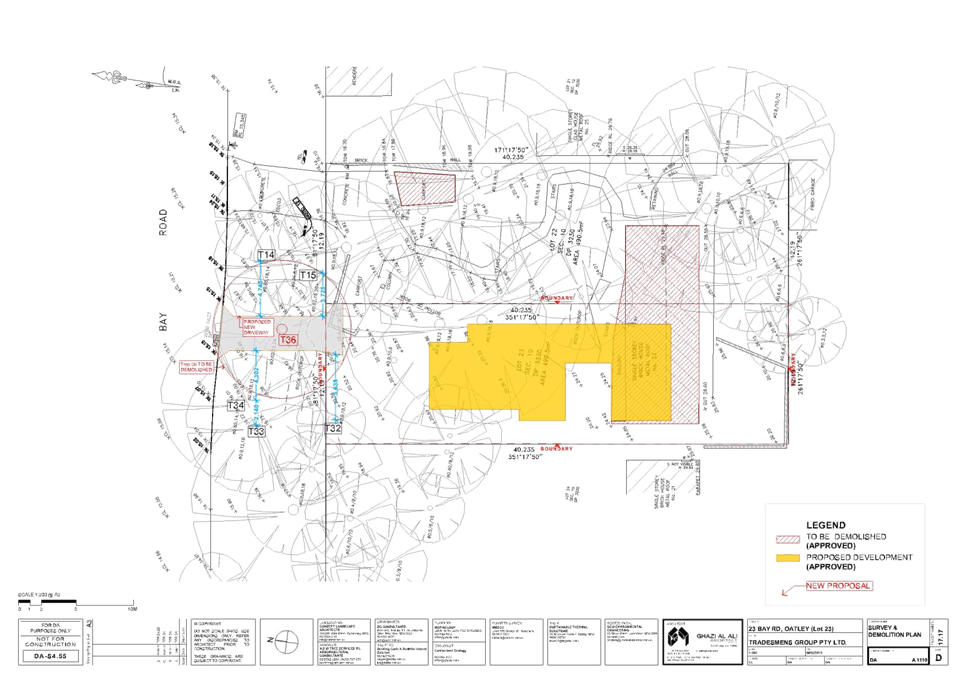
|
Georges
River Council - Georges River Local Planning Panel (LPP) - Tuesday, 17
December 2019
LPP064-19 Lot 23, 23 Bay Road Oatley
[Appendix
2] Elevations Lot 23 -
23 Bay Road Oatley
|
Page 234
|
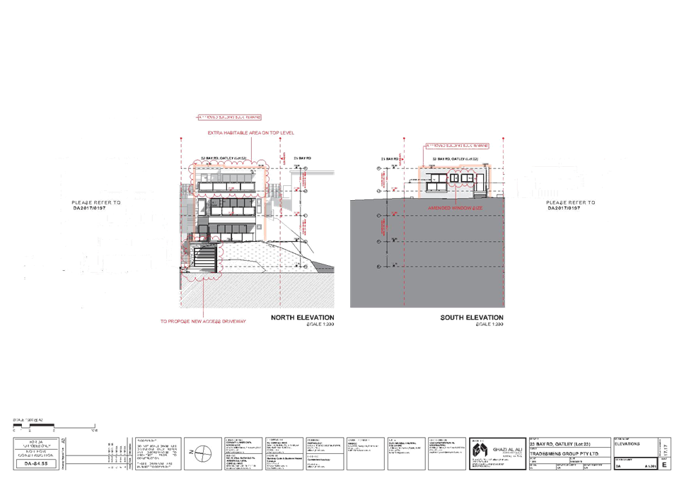
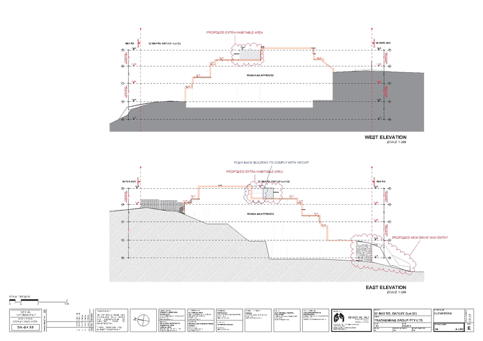
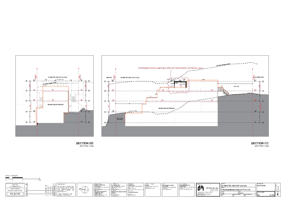
|
Georges River Council – Local Planning
Panel Thursday, 17 December 2019
|
Page 295
|
REPORT TO GEORGES RIVER COUNCIL
LPP MEETING OF Tuesday, 17 December 2019
|
LPP Report No
|
LPP065-19
|
Development Application No
|
PP2019/0001
|
|
Site Address & Ward Locality
|
Ramsgate Village Planning Proposal
- 193– 201 Rocky Point Road, 66-68 Ramsgate Road and 2-6 Targo Road,
Ramsgate
Kogarah Bay Ward
|
|
Proposed Development
|
The Planning Proposal requests that
Council initiate an amendment to the Kogarah Local Environmental Plan 2012
summarised as follows;
• Rezone
the site from B2 Local Centre and R3 Medium Density, to B2 Local Centre
across the entire site;
• Increase
maximum height controls across the site from 15m and 21m to 16m, 25m, 29m,
31m and 35m; and
• Increase
the maximum FSR of the site from 2.5:1 and 1.5:1 to 3.2:1.
|
|
Owners
|
Capital Hill Group
|
|
Applicant
|
Ethos Urban
|
|
Planner/Architect
|
Ethos Urban
|
|
Date Of Lodgement
|
17/01/2019
|
|
Submissions
|
N/A
|
|
Cost of Works
|
N/A
|
|
Local Planning Panel Criteria
|
Direction from the
Minister for Planning under Section 9.1 of the Environmental Planning and
Assessment Act 1979 and the Charter of the Georges River Council Local
Planning Panel 2018 both specify that the Planning Proposal is to be referred
to the Local Planning Panel before it is forwarded for Gateway Determination
(approval).
|
|
List of all relevant s.4.15
matters (formerly s79C(1)(a))
|
N/A
|
|
List all documents submitted
with this report for the Panel’s consideration
|
Refer to list below
|
|
Report prepared by
|
Independent Assessment
|
PLANNING
|
Recommendation
|
That the Georges River Local Planning Panel recommend to
Council the Planning Proposal not progress to the Department of Planning,
Infrastructure and Environment for a Gateway Determination, for the reasons
summarised below:
1. It
lacks strategic merit where:
i. It
is inconsistent with Objectives: 2, 10, and 14 of the Greater Sydney Region
Plan and respective corresponding Planning Priorities: S1 and E1, S5 and E5
and S12 and E10 of the South District Plan and Eastern City District Plan,
which seek to align and integrate growth with infrastructure;
ii. It
is inconsistent with the objectives and detailed requirements of s.9.1
Ministerial Directions pursuant to the Environmental Planning &
Assessment Act 1979, including 3.1 Residential Zones and 3.4
Integrating land use and transport;
iii. It
is inconsistent with the priorities contained within the Georges River
draft Local Strategic Planning Statement, including P1 which seeks to
connect people with efficient transport and P2 which seeks to provide roads
free of congestion;
iv. It
is inconsistent with the strategic directions and key actions contained
within the draft Commercial Centres Strategy, which seeks to retain
existing height and FSR development standards for Ramsgate Village;
2. It
lacks site specific merit where:
i. The
bulk and scale of the concept development is vastly out of context with the
surrounding locality;
ii. The
Ramsgate local centre does not currently have, nor is likely to have in the
next ten years, the level of road or rail infrastructure required to
support a development such as that proposed;
iii. The
proposed development would result in increased pressure on the surrounding
road network and public transport (bus) services and infrastructure, due to
the development of 197 new dwellings and subsequent increase in population;
iv. The
redevelopment of the site would result in the isolation of the two heritage
sites; the residential flat building ‘Roma’ at 70 Ramsgate Road
(I145) and shops at 211-219 Rocky Point Road (I146), which are not included
in the total site area the subject of this Planning Proposal; and
v. The
proposed development would result in significant adverse impacts on the
adjoining residential properties, including overshadowing and visual
impacts.
3. Investigations
for increased density as part of a more holistic and place-based planning
approach for Ramsgate Village should inform future Local Environmental Plan
reviews, as recommended in the draft Commercial Centres Strategy. This will
ensure that redevelopment of the site is consistent with the strategic
planning principles envisioned for Ramsgate.
4. As
the Planning Proposal seeks to amend LEP controls that are less than five
years old and does not meet the strategic merit test, pursuant to the
Department of Planning, Industry and Environment’s A guide to
preparing planning proposals, there is a presumption against a Rezoning
Review request.
|
|
Attachments
|
Attachment 1: Planning Proposal
Attachment 2: Urban Design Report
Attachment 3: Survey Plan
Attachment 4: Landscape Concept Plan
Attachment 5: Heritage Impact Statement
Attachment 6: Traffic Impact Assessment
Attachment 7: Social and Economic Benefits Analysis
Attachment 8: Urban Design Peer Review
Attachment 9: Voluntary Planning Agreement Offer
|
|
|
Summary of matters for
consideration under Section 4.15
Have all recommendations in relation
to relevant s4.15 matters been summarised in the Executive Summary of the
assessment report?
|
Not
Applicable
|
|
Legislative clauses requiring
consent authority satisfaction
Have relevant clauses in all
applicable environmental planning instruments where the consent authority
must be satisfied about a particular matter been listed, and relevant
recommendations summarised, in the Executive Summary of the assessment
report?
|
Yes
|
|
Clause 4.6 Exceptions to
development standards
If a written request for a
contravention to a development standard (clause 4.6 of the LEP) has been
received, has it been attached to the assessment report?
|
Not
Applicable
|
|
Special Infrastructure
Contributions
Does the DA require Special
Infrastructure Contributions conditions (under s7.24)?
|
Not
Applicable
|
|
Conditions
Have draft conditions been provided
to the applicant for comment?
|
Not
Applicable
|
|
Site Plan
 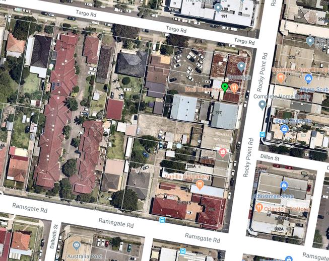 Figure 1- Site Locality (Source: Nearmaps 2019) Figure 1- Site Locality (Source: Nearmaps 2019)
|
Executive
Summary
Proposal
1. This
report provides an assessment of an amended Planning Proposal (PP2019/0001)
submitted to Georges River Council (Council) on 3 September 2019.
2. The
Planning Proposal requests that Council initiate an amendment to the Kogarah
Local Environmental Plan 2012 (KLEP 2012) summarised as follows;
· Amend the KLEP
2012 Land Zoning Map to rezone the Site from B2 Local Centre and R3 Medium
Density, to B2 Local Centre across the entire Site;
· Amend the KLEP
2012 Height of Buildings Map to increase maximum height controls across the
Site from 15m and 21m to 16m, 25m, 29m, 31m and 35m; and
· Amend the KLEP
2012 Maximum Floor Space Ratio (FSR) Map to increase the maximum FSR from 2.5:1
and 1.5:1 to 3.2:1.
3. The
Planning Proposal seeks to amend the KLEP 2012 (summarised above), to allow for
a mixed-use development to be known as ‘Ramsgate Village’,
comprising a village square, lower ground and ground floor retail premises
(including a supermarket), commercial floor space and residential buildings
above ranging from six storeys to ten storeys (15m – 35m).
4. The
Development Concept seeks to deliver 197 residential apartments, 6,847sqm Gross
Floor Area (GFA) of retail and commercial space, within a total of 22,627sqm of
GFA and 561 underground car parking spaces.
5. Council
received a letter of offer to enter into a planning agreement, dated 17 January
2019, in conjunction with the Planning Proposal (see Attachment 9). The
offer provides for a range of additional public benefits including a community
facility space, public square, public wi-fi access, through site link/laneway,
public domain improvements and landscaping, contribution for traffic improvements
and assistance to local sporting clubs.
6. The
Planning Proposal is not supported by a draft site-specific Development Control
Plan.
Site
and Locality
7. The
Planning Proposal relates to land located at 193-201 Rocky Point Road, 66-68
Ramsgate Road and 2-6 Targo Road, Ramsgate (the Site), located within the
Georges River Local Government Area (LGA). Figure 1 earlier in the
report provides an aerial photo of the Site.
8. The
Site has a total area of 7,116sqm and has street frontages of:
· 65m to Rocky Point
Road
· 90m to Targo Road
· 30m to Ramsgate
Road.
9. The
Site comprises a total of 16 individual land parcels which are sought to be
amalgamated to facilitate the proposed development.
10. The
Site is located on the eastern edge of the LGA, being located to the west of
Rocky Point Road. Some areas located to the east of Rocky Point Road are
included in the Bayside LGA.
11. Ramsgate
Centre itself is not located on a train line. Carlton station is the
closest train station to the Site, approximately 2km to the north west.
Kogarah station is also located to the north west, approximately 2.3km from the
Site. There are bus stops located adjacent to the Site on both Ramsgate
Road and Rocky Point Road, which service the following routes:
· 476:
Rockdale to Dolls Point (loop service)
· 477:
Miranda to Rockdale; and
· 947:
Kogarah to Hurstville via Dolls Point
12. The
subject site currently accommodates the following development:
· Fronting Rocky
Point Road - mixed-use developments which range from two to four storeys with
retail uses fronting Rocky Point Road at ground floor level and combination of
residential and commercial uses above;
· Fronting Targo
Road - carpark servicing the mixed-use development fronting Rocky Point Road
and five detached dwellings between one and two storeys in height; and
· Fronting Ramsgate
Road - two single storey detached dwellings.
Zoning
and Permissibility
13. The
Site is currently zoned B2 Local Centre and R3 Medium Density Residential
pursuant to the KLEP 2012.
14. Ramsgate
Centre was subject to uplift during Council’s amendment to the KLEP 2012,
which was gazetted on 26 May 2017. This resulted in significant uplifts
to associated density development standards reflected in the current LEP.
15. Considering
the recent gazettal of the current zoning for the Site, the proposed increased
density controls are premature.
16. Any Planning Proposal which seeks to amend LEP
controls that are less than five years old and does not meet the strategic
merit test, pursuant to the Department of Planning, Industry and
Environment’s A guide to preparing planning proposals, there is a
presumption against a Rezoning Review request.
17. The
draft Geroges River Commercial Centres Strategy makes recommendations for the
proposed KLEP 2020. Specific recommendations in regards to the controls
for Ramsgate include:
· Retain
existing B2 Local Centre zoning
· Retain
existing height and FSR development standards
· Implement
a minimum non-residential FSR requirement in the centre of 0.3:1
· Enable
the permissibility of self-storage units to complement the everyday retail
functions of existing stores
· Review
and incorporate active street frontage provisions into the Georges River
Development Control Plan 2020 (GRDCP 2020) to enhance the centre’s
connectivity and vibrancy.
18. Accordingly, no immediate alterations
envisioned proposed to the planning controls for the Site under Council’s
draft Commercial Centres Strategy.
Assessment
of Strategic Merit
19. The
Planning Proposal lacks strategic merit where:
i. It
provides a high density development and subsequent increased population with no
access to adequate public transport infrastructure. This contravenes Objectives
2, 10 and 14 of the Greater Sydney Region Plan and corresponding Planning
Priorities S1, S5, and S12 of the South District Plan and E1, E5 and E10 of the
Eastern City District Plans respectively.
ii. It
is inconsistent with the following Priorities of the Georges River draft Local
Strategic Planning Statement:
· P1 - We have a
range of frequent, efficient transport options to connect people, goods,
services, business and educational facilities; and
· P2 - Roads,
footpaths and cycleways are safe, accessible and free of congestion.
iii. It
is inconsistent with the strategic directions and key actions contained within
the draft Commercial Centres Strategy, which seeks to retain existing height
and FSR development standards for Ramsgate Centre. The expansion of the B2
zones under the draft Commercial Centres Strategy has yet to be investigated
and the proposal’s expansion of B2 zone in Ramsgate Centre is considered
premature; and
iv. It
is inconsistent with the objectives and detailed requirements of Section 9.1
Ministerial Directions pursuant to the Environmental Planning & Assessment
Act 1979, including:
· 3.1 Residential
zones –where it seeks to provide a significant uplift in residential
development with inadequate access to existing or proposed infrastructure; and
· 3.4 Integrating
land use and transport - where the proposed residential density sought does not
align with suitable provision of public transport and thus will result in
further congestion to the surrounding road network which is already at
capacity.
Assessment
of Site Specific Merit
20. The
Planning Proposal lacks site specific merit where:
i. The
proposed concept development and controls are considered to be excessive and
out of context with the surrounding locality, where it seeks to increase the
maximum building height from a maximum of 21m to a maximum of 35m (equivalent
to ten storeys) and density increases from 1.5:1 and 2.5:1 to 3.2:1. This is at
odds with the surrounding highest permissible building height of 21m and
tallest building in the vicinity of six storeys and the surrounding lower scale
built form;
ii. The
Planning Proposal provides no adequate justification for this significant
height increase compared to the surrounding locality, nor is there
justification for the proposed overall density of development proposed by an
adopted Regional, District or Local Strategy;
iii. The
Ramsgate local centre does not currently have, nor is likely to have in the
next ten years, the level of road or rail infrastructure required to support a
development such as that proposed;
iv. The
proposed development would result in increased pressure on the surrounding road
network and public transport (bus) services and infrastructure, due to the
development of 197 new dwellings and subsequent increase in population;
v. The
redevelopment of the site would result in the isolation of the two heritage
sites; the residential flat building ‘Roma’ at 70 Ramsgate Road
(I145) and shops at 211-219 Rocky Point Road (I146), which are not included in
the total site area the subject of this Planning Proposal; and
vi. The
proposed development would result in significant adverse impacts on the
adjoining residential properties, including overshadowing and visual impacts.
21. The
applicant’s responses to the issues raised regarding the planning
proposal are contained later within this report.
Recommendations
22. That
the Georges River Local Planning Panel recommend to Council the Planning
Proposal not progress to the Department of Planning, Infrastructure and
Environment for a Gateway Determination, for the reasons summarised below.
23. It lacks strategic merit where:
i. It is inconsistent with Objectives: 2, 10, and 14
of the Greater Sydney Region Plan and respective corresponding Planning
Priorities: S1 and E1, S5 and E5 and S12 and E10 of the South District Plan and
Eastern City District Plan, which seek to align and integrate growth with
infrastructure.
ii. It is inconsistent with the objectives and detailed
requirements of s.9.1 Ministerial Directions pursuant to the Environmental
Planning & Assessment Act 1979, including 3.1 Residential Zones and 3.4
Integrating land use and transport.
iii. It is inconsistent with the priorities contained within the
Georges River draft Local Strategic Planning Statement, including P1 which
seeks to connect people with efficient transport and P2 which seeks to provide
roads free of congestion.
iv. It is inconsistent with the strategic directions and key
actions contained within the draft Commercial Centres Strategy, which seeks to
retain existing height and FSR development standards for Ramsgate Centre.
24. It lacks site specific merit where:
i. The bulk and scale of the concept development is
vastly out of context with the surrounding locality;
ii. The Ramsgate local centre does not currently have, nor
is likely to have in the next ten years, the level of road or rail infrastructure
required to support a development such as that proposed;
iii. The proposed development would result in increased pressure
on the surrounding road network and public transport (bus) services and
infrastructure, due to the development of 197 new dwellings and subsequent
increase in population;
iv. The redevelopment of the site would result in the isolation
of the two heritage sites; the residential flat building ‘Roma’ at
70 Ramsgate Road (I145) and shops at 211-219 Rocky Point Road (I146), which are
not included in the total site area the subject of this Planning Proposal; and
v. The proposed development would result in significant
adverse impacts on the adjoining residential properties, including
overshadowing and visual impacts.
25. Investigations for increased density as part of
a more holistic and place-based planning approach for Ramsgate Centre should
inform future Local Environmental Plan reviews, as recommended in the draft
Commercial Centres Strategy. This will ensure that redevelopment of the site is
consistent with the strategic planning principles envisioned for Ramsgate.
26. As the Planning Proposal seeks to amend LEP
controls that are less than five years old and does not meet the strategic
merit test, pursuant to the Department of Planning, Industry and
Environment’s A guide to preparing planning proposals, there is a
presumption against a Rezoning Review request.
Report in Full
1. BACKGROUND
27. The Planning Proposal has been developed around
a number of revisions to a Masterplan for the Site.
28. The history of the Planning Proposal is
summarised in Table 1 below:
Table 1 – History of the Planning Proposal
|
Date
|
Milestone
|
|
December 2015
|
Original Planning
Proposal was lodged by Design and Build Group with the former Kogarah City
Council
|
|
16 February 2016
|
The St George Design
Review Panel (DRP) considered the original Planning Proposal
|
|
June 2016
|
Revised sketch plans,
Economic Feasibility Report and Urban Design Report were submitted to Council
in response to the DRP
|
|
21 March 2018
|
A new preliminary design
concept with additional sites sought to be amalgamated was submitted to
Georges River Council by Ethos Urban at a pre-lodgement meeting
|
|
9 May 2018
|
Council sent a letter to
the applicant outlining a range of issues (including excessive height and
scale) and inadequate information
|
|
June 2018
|
An updated concept
proposal was submitted
|
|
11 July 2018
|
Revision 3 of the concept
proposal was submitted
|
|
2 August 2018
|
Design Review Panel
meeting was held to consider the amended Planning Proposal
|
|
18 January 2019
|
A revised Planning
Proposal was lodged with Council
|
|
14 March 2019
|
The original Planning
Proposal (submitted in December 2015) was withdrawn
|
|
3 May 2019
|
External assessment
recommended that the Planning Proposal be withdrawn
|
|
20 May 2019
|
Director of Environment
and Planning and council officers met with the applicant to discuss the
issues raised in the review of the PP
|
|
31 May 2019
|
Amended concept plans
were received addressing the issues raised in the meeting
|
|
13 June 2019
|
Amended concept plans
were presented to the Councillor briefing (by Council officers) for
feedback. There was no support for the amended scheme lodged 31 May
2019. The Councillors requested a more compliant scheme with the
current controls that addressing Site isolation (includes Nos. 203 and
215/219 Rocky Point Road).
|
|
24 June 2019
|
Meeting with applicant to
discuss Councillor feedback. Applicant advised to formally submit the
amended PP for consideration and assessment if they wish to proceed to
rezoning review process.
|
|
3 September 2019
|
Amended Planning Proposal
submitted to Council
|
|
3 October 2019
|
External assessment of
amended Planning Proposal undertaken and letter requesting the Planning
Proposal be withdrawn issued to the applicant.
|
|
31 October 2019
|
Meeting held with the
applicant to discuss the assessment of the Planning Proposal.
|
2. SITE
DESCRIPTION
2.1 Overview of
the site
29. The
Planning Proposal relates to the Site located at 193-201 Rocky Point Road,
66-68 Ramsgate Road and 2-6 Targo Road, Ramsgate, located within the Georges
River Local Government Area (LGA). The Site has a total area of 7,116m2
and has street frontages of:
· 65m to Rocky Point
Road
· 90m to Targo Road
· 30m to Ramsgate
Road.
30. The
Site at 193-201 Rocky Point Road, 66-68 Ramsgate Road and 2-6 Targo Road, is
located on the eastern edge of the LGA, being located to the west of Rocky
Point Road. Some areas located to the east of Rocky Point Road are
included in the Bayside LGA.
31. The
Site is generally flat, with a slight decline running west to east, and is
irregular in shape as it does not include the properties located at 203-219
Rocky Point Road, as shown in Figure 2 below.
32. The
Site comprises a total of 16 lots which are sought to be amalgamated to
facilitate the proposed development. Their legal description, address and
ownership are shown in Table 2 and Figure 2.
Table 2 Existing lots and
ownership
|
Address
|
Lot
and DP
|
Ownership
|
|
193 Rocky Point Road
|
Lot 8 DP 653883
Lot A DP 311887
Lot B DP 311887
|
Capital Hill Group Pty Ltd
|
|
197 Rocky Point Road
|
SP 83814
Lot 301 DP 1142822
|
Various options to purchase
granted to Capital Hill Group Pty Ltd
|
|
199 Rocky Point Road
|
SP 77494
|
Various options to purchase
granted to Capital Hill Group Pty Ltd
|
|
201 Rocky Point Road
|
Lot 3 DP 213885
|
Currently registering
acquisition to Capital Hill Group Pty Ltd
|
|
66 Ramsgate Road
|
Lot B DP 371250
|
Capital Hill Group Pty Ltd
|
|
68 Ramsgate Road
|
Lot 12 DP 455810
Lot 13 DP 455810
Lot 14 DP 455810
|
Capital Hill Group Pty Ltd
|
|
2 Targo Road
|
Lot 1 DP 133817
Lot 2 DP 133817
Lot 1 DP 970852
|
Capital Hill Group Pty Ltd
|
|
4 Targo Road
|
Lot B DP 347589
|
Capital Hill Group Pty Ltd
|
|
6 Targo Road
|
Lot A DP 347589
|
G & J Paffas with option to
purchase granted to Capital Hill Group Pty Ltd
|
Figure 2 Land
Parcels pertaining to the Site
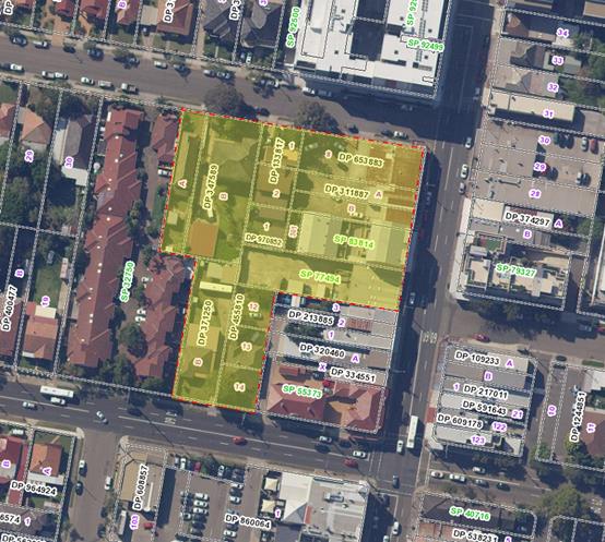
Source:
Sixmaps
33. Rocky
Point Road, in the centre of Ramsgate, is a State road and the primary
thoroughfare through the suburb connecting the Princes Highway to the north
through to Sutherland Shire, via the Captain Cook Bridge in the south.
Development along Rocky Point Road generally varies from 2-6 storeys and
consists of ground floor retail, with residential above.
34. Ramsgate
is not located on the train line. Carlton station is the closest station
to the Site, approximately 2km to the north west. Kogarah station is
approximately 2.3km to the north west. There are bus stops located
adjacent to the Site on both Ramsgate Road and Rocky Point Road, which service
the following routes:
· 476: Rockdale to
Dolls Point (loop service)
· 477: Miranda to
Rockdale; and
· 947: Kogarah to
Hurstville via Dolls Point
35. The
site is currently occupied by mixed use developments which range from two to
four storeys with retail uses fronting Rocky Point Road at ground floor level
and combination of residential and commercial uses above.
36. Development
on the Site fronting Targo Road is characterised by a carpark servicing the
mixed-use development fronting Rocky Point Road, and five detached dwellings
between one and two storeys in height.
37. Development
on the Site fronting Ramsgate Road consists of two single storey detached
dwellings.
38. Figure
3 illustrates the Site in context.
Figure 3 The
Site in context

Source:
Googlemaps
2.2 Surrounding Development
39. Surrounding
development includes:
· A six-storey mixed
use development to the north, between the corner of Targo Road and Rocky Point
Road and Ramsgate Community Church (refer to Figure 4). This
development is currently the largest in Ramsgate, with the predominant building
form being one-two storeys. Development along Rocky Point Road previously
only extended to four storeys.
· A single to four
storey retail and residential developments to the east of the Site along Rocky Point
Road, with one to two storey detached residential dwellings located to the rear
(refer to Figures 4 - 5).
· Properties which
comprise the remainder of the block to the corner of Rocky Point Road and
Ramsgate Road to the south, including heritage items at 211-219 Rocky Point
Road (Figure 7) and 70 Ramsgate Road (Figure 8). These
properties comprise two storey retail developments and a two-storey residential
unit block respectively.
· A pub known as the
‘Intersection Tavern’, with an at-grade car park and standalone TAB
and post office (refer to Figure 9) is located on the block further to
the south on Ramsgate Road. Retail developments continue along the length
of Rocky Point Road, with detached one to two storey residential dwellings to
the rear (refer to Figure 10).
· A number of
one-two storey, semi-detached and detached residential dwellings to the west of
the Site. The Beverley Park Golf Club is 300m to the west, beyond the
residential dwellings. Examples of these residential dwellings are shown
in Figure 11 below.
40. It
should be noted that in terms of future development within Ramsgate, at present
there are no planning proposals lodged with the Department of Planning,
Industry and Environment (DPIE), nor are there any large-scale Development Applications
(DAs) lodged with Council at the time of reporting.
Figure
4 Development at the corner of Targo Road and Rocky
Point Road
 Source: Google maps
Figure
5 Existing single and three storey development opposite
the Site (view from intersection with Targo Road)
 Source: Google maps
Figure
6 Existing single and three storey development opposite
the Site (view from intersection with Ramsgate Road)
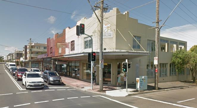 Source: Google maps
Figure
7 Heritage items along Rocky Point Road
 Source: Google maps
Figure
8 70 Ramsgate Road
 Source: Google maps
Figure
9 The Intersection Tavern
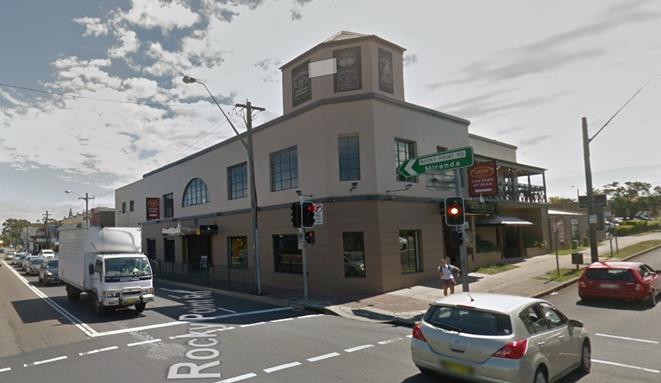 Source: Google maps
Figure
10 Continued development down Rocky Point Road
 Source: Google maps
Figure
11 Typical 1-2 storey residential development along Targo Road
 Source: Google maps
3. PLANNING
STRATEGIES, POLICIES AND CONTROLS
3.1 Existing Planning Controls
41. The
subject Site is currently zoned B2 Local Centre and R3 Medium Density
Residential and has height controls of 15m and 21m and FSR controls of 2.5:1
and 1.5:1. Figure 12 under Part 4.2 of the report demonstrates the
existing and proposed controls under the KLEP 2012.
42. The
Site is located adjacent to heritage items 145 (residential flat building
‘Roma’ at 70 Ramsgate Road’ and 146 (shops at 211-219 Rocky
Point Road), as listed in Schedule 5 of the KLEP 2012.
4. PLANNING PROPOSAL REQUEST
4.1 Background
43. The
subject Planning Proposal follows the lodgement of previous versions which were
submitted in July 2016 and January 2019 respectively. Details of these previous
Planning Proposals is provided below.
44. A
Planning Proposal was originally submitted to Council in March 2018.
Council undertook a preliminary assessment of the design concept for the Site
against Council’s key strategic planning documents. A letter was
sent to the applicant on 9 May 2018 outlining fundamental concerns, which were
summarised as follows:
· Excessive height
and scale;
· Need for
amalgamation of Sites;
· Addressing traffic
and Pedestrian Access;
· Inadequate
consideration of heritage; and
· Achieving the
Centres Study.
45. Council
recommended that the Planning Proposal be withdrawn until the completion of the
Commercial Centres Strategy. Notwithstanding, in June 2018, the applicant
updated the concept proposal and requested that the Planning Proposal be
referred to the Design Review Panel (DRP).
46. The
DRP reviewed the proposal in August 2018, and expressed concerns regarding the
following:
· Context and
Neighbourhood Character;
· Built Form and
Scale;
· Density;
· Sustainability;
· Landscape;
· Amenity;
· Safety;
· Housing Diversity
and Social Interaction; and
· Aesthetics.
47. In
January 2019, a revised Planning Proposal was lodged with Council and in March
2019, the original Planning Proposal (submitted in December 2015) was
withdrawn.
48. Elton
Consulting undertook the external assessment of the Planning Proposal lodged in
January 2019 and recommended that the Planning Proposal should be withdrawn,
due to a lack of strategic merit, as well as its excessive bulk and scale being
vastly out of context with the surrounding locality.
49. A
revised Planning Proposal was submitted on 3rd September 2019 and is the
subject of this assessment report.
50. The
history of the Planning Proposal is summarised in Table 1 above.
4.2 Summary
of Planning Proposal
51. The
amended Planning Proposal requests that Council initiate an amendment to the
KLEP 2012 as follows:
· Rezone
the part of the Site which is currently zoned R3 Medium Residential to B2 Local
Centre so that the B2 zoning covers the entirety of the Site;
· Amend
the FSR from 1.5:1 and 2.5:1 to 3.2:1 (2.5:1 above ground level); and
· Amend
the height from 15m and 21m to a range of heights; 16m, 25m, 29m, 31m and 35m.
52. A
comparison of existing and proposed zoning and relevant controls under the KLEP
2012 is provided in Figure 12 below:
Figure
12 Comparison of existing and
proposed controls under the KLEP 2012
|
KLEP 2012 provision
|
Existing
|
Proposed
|
|
Zone
|
|
|
|
B2
Local Centre
· 193 – 201 Rocky Point Road
R3
Medium Density
· 66 – 68 Ramsgate Road
· 2 – 6 Targo Road
|
B2
Local Centre
· Entire site
|
|
Maximum
building height
|
|
|
|
21m
· 193 – 201 Rocky Point Road
15m
· 66 – 68 Ramsgate Road
· 2 – 6 Targo Road
|
Building
heights are proposed to range from 16m – 35m:
· 16m
· 25m
· 29m
· 31m
· 35m
|
|
Floor
Space Ratio
|
|
|
|
2.5:
1
· 193 – 201 Rocky Point Road
1.5:1
· 66 – 68 Ramsgate Road
· 2 – 6 Targo Road
|
3.2:
1
· Entire site
|
5. ASSESSMENT OF THE PLANNING
PROPOSAL
53. The
Department of Planning, Infrastructure and Environment’s A Guide to
Preparing Planning Proposals - issued under s3.33 (3) of the Environmental
Planning and Assessment Act 1979 provides guidance and information on the
process for preparing and assessing Planning Proposals. The assessment of the
submitted Planning Proposal has been undertaken in accordance with the latest
version of this Guide (dated August 2016).
5.1 Strategic
Planning Context
Greater Sydney Region Plan (A Metropolis of Three Cities) and the
South and Eastern City District Plans
54. The
Greater Sydney Region Plan was finalised and released by the Greater Sydney
Commission in March 2018 and establishes the aspirations for the region over
the next 40 years. The Region Plan is framed around 10 directions relating to
infrastructure and collaboration, liveability, productivity and sustainability.
55. The
Eastern and South District Plans are 20-year plans to manage growth in the
context of economic, social and environmental matters to achieve the 40-year
vision for greater Sydney. They contain planning priorities and actions for
implementing the Region Plan at a district level, and are the bridge between
regional and local planning.
56. The
Site and the nearest strategic centre and Health and Education Precinct of Kogarah
are located in the South District, while Ramsgate, which has been identified as
a local centre, is located in the Eastern City District. Accordingly,
consistency with the South District Plan has been assessed, whilst also taking
into account the objectives of the Eastern City District Plan.
57. The
proponent has provided an assessment against the Region and District Plans and
states that the Planning Proposal is capable of delivering on the majority of
the Planning Priorities. It is noted, however, that the Planning Proposal is
not consistent with a number of the Planning Priorities. These inconsistencies
are summarised and discussed below in Table 3 below.
Table 3 Assessment of Proposal against South District Plan
|
Directions
and objectives
|
District
Planning Priority
|
Proponents
Comments
|
Assessment
|
|
Infrastructure and
collaboration
|
|
A city supported by
infrastructure
|
|
Objective 2: Infrastructure
aligns with forecast growth – growth infrastructure compact.
|
S1 and E1: Planning for a city
supported by infrastructure
|
The Site is located on an
identified corridor for a ‘Train Link/Mass Transit Visionary’,
‘Road Investigation 0-10 years’ and ‘Road Visionary’.
The planning proposal allows for future forecast growth on the Site, which aligns
with the proposed future infrastructure in the vicinity to align with this
objective.
|
Inconsistent
The proposed development would
result in significant population growth (197 new dwellings) and increased
patronage, in an area without a railway station, placing pressure on the
existing road network through increased traffic volumes and limited public
transport services (bus connections).
Further, the cumulative impact
on traffic and infrastructure of development activity (and potential
development resulting under existing controls) within the area and
adjoining Bayside LGA should be considered.
The Planning Proposal has been
supported by a Traffic and Parking Impact Assessment Report (27 August 2019),
which states that the development will generate 673 vehicles per hour (vph)
and 735vph during the Thursday evening and Saturday peak periods respectively.
With no identified plans for
increased public transport services or significant road upgrades, the
development would result in adverse impacts in terms of traffic congestion.
Similarly, the Traffic and
Parking Impact Assessment Report indicates that the intersections of Rocky
Point Road and Ramsgate Road and Rocky Point Road and Targo Road are
currently affected by southbound queue on Rocky Point Road. The
intersection of Rocky Point Road with Targo Road would be required to be
upgraded to traffic signals to facilitate the right turn movements into and
out of Targo Road.
It is considered that
significant infrastructure upgrades would be required to support this growth,
and until the aforementioned train link/road upgrades are confirmed, the
proposal is considered to be unjustified.
The Planning Proposal also
contends that that the Site is located close to the ‘Train Link/Mass
Transit Visionary’, ‘Road Investigation 0-10 years’ and
‘Road Visionary’ corridors. However as stated, these
infrastructure plans are all visionary at this stage. No significant
infrastructure upgrades within Ramsgate have been committed to.
As these infrastructure
upgrades are only ‘visionary’ at present, the Planning Proposal
has not adequately demonstrated how the proposed development could be
supported should these upgrades not take place.
|
|
Liveability
|
|
A city for people
|
|
Objective 6: Services and
infrastructure meet communities’ changing needs
|
S3 and E3: Providing services
and social infrastructure to meet people’s changing needs
|
The planning proposal includes
significant public benefits and infrastructure to meet the changing needs of
the community, including a large new public space, community facilities and
the provision of other services not yet provided in Ramsgate including a full
line supermarket.
|
To be determined
An offer to enter into a
planning agreement has been provided which includes provision for the
following:
» Community
facility
» Public
Square
» Public
wifi
» Through
Site link/laneway
» Public
domain improvements and landscaping
» Public
art
» Funds
for traffic improvements
» Assistance
with local sporting clubs
However, no assistance has been
provided in terms of funding for upgrades to schools or public
transport. Consultation with the Department of Education (DoE) would
need to be undertaken in order to determine whether contributions to an
education establishment would be required, as it is understood that a school
could not be accommodated on the Site.
Similarly, consultation with
Transport for NSW (TfNSW) would be required in order to determine the level
of public transport upgrades which would need to occur as a result of the
proposed development.
|
|
Objective 7: Communities are
healthy, resilient and socially connected
|
S4 and E4: Fostering healthy,
creative, culturally rich and socially connected communities
|
The planning proposal will
allow for infrastructure and services to increase the health, resilience and
social connection of the local community. It envisages a new public
‘heart’ of Ramsgate which will allow for social interaction and
public events including markets. The indicative development proposal includes
medical suites to support the local health needs of the community.
|
Consistent
The proposed development would
increase activity and social interaction through the provision of a new town
square and public open space.
A mixed-use neighbourhood close
to centres and public transport would improve the opportunity for people to
walk and cycle to local shops and services. This will increase the
healthy habits of residents while also decreasing traffic congestion around
Ramsgate local centre.
|
|
Housing the city
|
|
Objective 10: Greater Housing
Supply
|
S5 and E5: Providing housing
supply, choice and affordability, with access to jobs, services and public
transport
|
The indicative development
scheme includes 197 residential apartments to meet the housing targets of the
LGA under the District Plans.
|
Inconsistent
The draft Planning Proposal
plans to provide 197 residential units comprising 1, 2 and 3 bedroom
apartments to meet the need of the Georges River 0-5 year housing targets in
the South District. Georges River has a target of 4,800 new dwellings by
2021.
Although housing is required,
the Georges River LGA is currently not under significant housing pressure.
The proposed development would
result in significant population growth (197 new dwellings) and increased
patronage, in an area without a railway station, placing pressure on the
existing road network through increased traffic volumes and limited public
transport services (bus connections).
A development of this density
is more appropriately located around major transport corridors such as train
stations.
|
|
Objective 11: Housing is more
diverse and affordable
|
The indicative development
scheme includes provision for a range of 1, 2 and 3 bed apartments to
increase the housing diversity in the local area. A greater supply of housing
types will assist in making housing more affordable in the local area.
Being co-located with other
retail and medical facilities also allows the local areas aging demographic
the ability to more easily “age in place” and reduce strain on
local health infrastructure.
|
Inconsistent
Across Greater Sydney, both
home renters and purchasers face housing affordability challenges as Greater
Sydney has been measured as being one of the least affordable housing markets
globally and is the least affordable Australian city.
A range of housing choices,
including affordable rental housing reduces the need for people to go into
social housing and also supports a pathway for people to move out of social
housing.
The Plan recommends Affordable
Rental Housing Targets as a mechanism to deliver an additional supply of
affordable housing for very low to low-income households in Greater
Sydney.
The Planning Proposal aims to
provide a diverse range of apartments from 1 to 3 bedrooms. However, no
provision has been made for affordable rental housing. It is considered
that approximately 5–10% of new residential floor space should be
allocated to affordable housing.
|
|
A city of great places
|
|
Objective 12: Great places that
bring people together
|
S6 and E6: Creating and
renewing great places and local centres, and respecting the District’s
heritage.
|
Key improvements to the public
domain envisaged under this proposal include a major public space, with
significant landscaping elements as shown in the Landscape Concept Plan at
Appendix C. It is envisaged that this space will bring people together
through community events such as markets and everyday use and activation.
|
Consistent
It is expected that the
proposed redevelopment of the Site would include a high-quality public domain
and communal open spaces for the proposed residents.
The proposed development would
be walkable and would accommodate formal and informal opportunities to
develop and maintain social connections, through the establishment of the
central square.
|
|
Objective 13: Environmental
heritage is identified, conserved and enhanced
|
Whilst there are no heritage
items on the subject Site, the impact of the planning proposal on adjacent
heritage items has been assessed in the Statement of Heritage Impact at
Appendix D, and further assessed in Section 8.7. The assessment concludes
that the planning proposal will have an acceptable impact on the heritage
significance of the heritage items in the vicinity.
|
Consistent
The Site is located adjacent to
two locally listed heritage items; the residential flat building
‘Roma’ at 70 Ramsgate Road and shops at 211-219 Rocky Point
Road. A Heritage Impact Statement has been prepared, which states that
the proposed development would have acceptable or positive heritage impacts
on the adjacent heritage items.
Council’s
internal heritage review has provided comment that the Planning Proposal will
alter the visual context and backdrop of the two heritage items, however the
appreciation of the character and relationships between the heritage items
can still be appropriately managed and retained and the conceptual building
envelopes introduce improved transitions in scale to pull the future building
heights away from the heritage items.
While detailed
building designs have not been developed as part of the Planning Proposal,
the merits of any future development will be considered as part of future
Development Applications.
|
|
Productivity
|
|
A well-connected city
|
|
Objective 14: A Metropolis of
Three Cities – integrated land use and transport creates walkable and
30-minute cities
|
S12 and E10: Delivering
integrated land use and transport planning and a 30-minute city
|
The planning proposal intends
to enable a mixed-use development which will allow residents direct access to
retail uses that support everyday living. Notwithstanding the existing bus
services available on the Site, the Site is located on an identified corridor
for a ‘Train Link/Mass Transit Visionary’, ‘Road
Investigation 0-10 years’ and ‘Road Visionary’ which will
further increase the ability of the Site to meet this objective.
|
Inconsistent
A number of major committed and
potential transit corridors that will improve connectivity in the Eastern,
Central and Western cities are identified in Future Transport 2056. The
infrastructure initiatives related to the Site include:
· Greater Sydney
committed initiatives (0-10 years) - F6 Extension – Stage 1 West Connex
to President Avenue, Kogarah
· Greater Sydney
initiatives for investigation (0-10 years) - The F6 extensions, Kogarah to
Loftus
· Greater Sydney
initiatives for investigation (10-20 years) - Parramatta to Kogarah Mass
Transit/Train Link
The F6 extension is the only
infrastructure upgrade which has been committed to and would impact the Site
in the next ten years.
The proposed development is
based on the ‘visionary’ investigations. There is no
certainty that these investigations will result in actual works. The
increase in population as a result of the proposed development would put
increased pressure on the existing road network and bus services. Improvement
would be required to be considered as part of this proposal.
|
|
Jobs and skills for the city
|
|
Objective 22: Investment and
business activity in centres
|
S11: Supporting growth of
targeted industry sectors
E11: Growing investment,
business opportunities and jobs in strategic centres
|
The location of the
‘Ramsgate’ local centre under the Eastern District Plan is
between the existing Ramsgate Beach and Ramsgate Centre. The merits of
accommodating investment and business activity in Ramsgate Centre are
articulated in Section 6.1.2. On this basis in addition to the Site-specific
merits of the proposal, further investment and business activity in Ramsgate
will be enabled by this application which will meet this objective.
|
Consistent
Ramsgate has been identified as
a local centre. Local centres are important for access to day-to-day
goods and services. These centres create a strong sense of place within the
local community. Local centres are collections of shops and health, civic or
commercial services.
Larger local centres, such as
those anchored by a supermarket, can form the focus of a neighbourhood.
Supermarket-based centres also provide local employment, accounting for close
to 18% of all Greater Sydney’s jobs. This is the view for
Ramsgate under the proposed development.
There is a need to consider
whether the supermarket should be a neighbourhood supermarket to respond to
the hierarchy of the centre.
The Plan states that increasing
the level of residential development within walking distance of centres with
a supermarket is a desirable liveability outcome.
|
|
Sustainability
|
|
A city in its landscape
|
|
Objective 30: Urban tree canopy
cover is increased
|
S15 and E17: Increasing urban
tree canopy cover and delivering Green Grid connections
|
As demonstrated by the
Landscape Concept Plan at Appendix C, an increase in the tree canopy on Site
is proposed to meet this objective.
|
Consistent
The proposed development
includes the delivery of new landscaped public open space, which would
improve the connectivity of the area and increase the urban tree canopy.
|
|
Objective 31: Public open space
is accessible, protected and enhanced
|
S16 and E18: Delivering high
quality open space
|
A significant new public space
of a scale not currently existing in Ramsgate is proposed under this Planning
Proposal. It connects to all adjacent streets, with surrounding buildings
oriented to ensure maximum amenity.
|
Consistent
The proposed development would
provide a new village square and area of public open space and associated
street landscaping. The public open space would be easily accessible
from Targo Road and Rocky Point Road with a through Site link from Ramsgate
Road.
|
|
Objective 32: The Green Grid
links parks, open spaces, bushland and walking and cycling paths
|
The Site is nearby to parts of
the Green Grid corridor identified in the District Plans five blocks to the
east. The development ultimately enabled by this Planning Proposal will
greatly benefit from access to these linked spaces.
|
Consistent
The Greater Sydney Green Grid
connects communities to the landscape. The Site is located in close
proximity to Green Grid connections.
|
5.2 Council’s
Local Strategic Plans
58. Consideration
of the Planning Proposal in relation to Council’s Local Strategic Plans
is provided below:
Georges River LSPS 2040 - Draft Local Strategic Planning Statement
April 2019
59. The
draft Local Strategic Planning Statement (LSPS) 2040 outlines the 20-year
vision for land use planning in the LGA. Underpinned by the five
interrelated themes, the draft LSPS 2040 will assist in implementing actions in
the Regional and District Plans, and Council’s own priorities in its
Community Strategic Plan:
· Access and
movement
· Infrastructure and
community
· Housing and
neighbourhoods
· Economy and
centres
· Environment and
open space
60. The
draft LSPS for Georges River was placed on exhibition until 7 August 2019.
61.
An assessment of the Planning Proposal against the draft LSPS Planning
Priorities is provided in Table 4 as follows:
Table 4 – Draft LSPS Planning Priorities
|
Planning
Priority
|
Consistency
|
|
Access and movement
|
|
P1 We have a range of frequent,
efficient transport options to connect people, goods, services, business and
educational facilities
|
Inconsistent
The proposed development would
result in significant population growth (197 new dwellings) and increased
patronage, not close to a railway station, placing pressure on the existing
road network through increased traffic volumes and limited public transport
services (bus connections).
The Planning Proposal contends
that that the Site is located close to the ‘Train Link/Mass Transit
Visionary’, ‘Road Investigation 0-10 years’ and ‘Road
Visionary’ corridors. However as stated, these infrastructure
plans are all visionary at this stage. No infrastructure upgrades
within Ramsgate have been committed to.
As these infrastructure
upgrades are only ‘visionary’ at present, the Planning Proposal
hasn’t adequately demonstrated how the proposed development could be supported
should these upgrades not take place.
Further, the cumulative impact
on traffic and infrastructure of development activity (and potential
development resulting under existing controls) within the area and
adjoining Bayside LGA should be considered.
|
|
P2 Everyone can navigate and
experience the LGA is safety
|
Consistent
The proposed development would
increase activity and social interaction through the provision of a new town
square and public open space.
A mixed-use neighbourhood close
to centres and public transport would improve the opportunity for people to
walk and cycle to local shops and services. This will increase the
healthy habits of residents while also decreasing traffic congestion around
Ramsgate local centre.
|
|
P3 Roads, footpaths and
cycleways are safe, accessible and free of congestion
|
Inconsistent
The Planning Proposal has been
supported by a Traffic and Parking Impact Assessment Report (27 August 2019),
which states that the development will generate 673 vehicles per hour (vph)
and 735vph during the Thursday evening and Saturday peak periods
respectively.
With no identified plans for
increased public transport services or road upgrades, the development would
result in significant adverse impacts in terms of traffic congestion.
Similarly, the Traffic report
indicates that the intersections of Rocky Point Road and Ramsgate Road and
Rocky Point Road and Targo Road are currently affected by southbound queue on
Rocky Point Road. The intersection of Rocky Point Road with Targo Road
would be required to be upgraded to traffic signals to facilitate the right
turn movements into and out of Targo Road.
It is considered that
significant infrastructure upgrades would be required to support this growth,
and until the aforementioned train link/road upgrades are confirmed, the
proposal is considered to be unjustified.
|
|
Infrastructure and Community
|
|
P4 Collaboration supports
innovation and delivers infrastructure, services and facilities
|
Consistent
An offer to enter into a
planning agreement has also been provided which includes provision for the
following:
· Community
facility
· Public Square
· Public wifi
· Public domain
improvements and landscaping
· Assistance with
local sporting clubs
However, no assistance has been
provided in terms of funding for upgrades to schools or public
transport. Consultation with the DoE would need to be undertaken in
order to determine whether contributions to an education establishment would
be required, as it is understood that a school could not be accommodated on
the Site.
Similarly, consultation with
TfNSW would be required in order to determine the level of public transport
upgrades which would need to occur as a result of the proposed development.
The cumulative impact of
additional development activity (and potential development resulting under
existing controls) within the area and adjoining Bayside LGA would apply
additional pressure on infrastructure and services including schools.
|
|
P5 The community is involved in
planning our future
|
N/A
|
|
P6 Everyone has access to
efficient digital connectivity
|
Consistent
Public wifi is proposed.
|
|
Housing and neighbourhoods
|
|
P7 Residential suburbs will be
protected and retained unless identified as areas of change or investigation
|
Consistent
The Site will contain
residential apartments within a mixed-use development.
|
|
P8 Place based development,
quality building design and public art deliver liveable places
|
Yet to be determined
The built form of the proposed
development
The development will result in
the provision of a public art programme for the Ramsgate Centre which will
brief, select and commission a variety of public art installations within the
centre.
|
|
P9 A mix of well-designed
housing for all life stages caters for a range of needs and incomes
|
Consistent
The draft Planning Proposal
plans to provide 197 residential units comprising 1, 2 and 3 bedroom
apartments to meet the need of the Georges River 0-5 year housing targets in
the South District. Georges River has a target of 4,800 new dwellings
by 2021.
Although housing is required,
the Georges River LGA is currently not under significant housing pressure.
|
|
P10 Homes are supported by
safe, accessible, green, clean, creative and diverse facilities, services and
spaces
|
Consistent
The proposed development would
provide a new village square and area of public open space and associated
street landscaping. The public open space would be easily accessible
from Targo Road and Rocky Point Road with a through Site link from Ramsgate
Road.
|
|
P11 Aboriginal and other
heritage is protected and promoted.
|
Inconsistent
The Site is located adjacent to
two locally listed heritage items; the residential flat building
‘Roma’ at 70 Ramsgate Road and shops at 211-219 Rocky Point
Road. A Heritage Impact Statement has been prepared, which states that
the proposed development would have acceptable or positive heritage impacts
on the adjacent heritage items.
Council’s
internal heritage review has provided comment that the Planning Proposal will
alter the visual context and backdrop of the two heritage items, however the
appreciation of the character and relationships between the heritage items
can still be appropriately managed and retained and the conceptual building
envelopes introduce improved transitions in scale to pull the future building
heights away from the heritage items.
While detailed building designs
have not been developed as part of the Planning Proposal, the merits of any
future development will be considered as part of future Development Applications.
|
|
Economy and Centres
|
|
P12 Land is appropriately zoned
for ongoing employment growth
|
Consistent
Ramsgate has been identified as
a local centre. Local centres are important for access to day-to-day
goods and services. These centres create a strong sense of place within the
local community. Local centres are collections of shops and health, civic or
commercial services.
Larger local centres, such as
those anchored by a supermarket, can form the focus of a neighbourhood.
Supermarket-based centres also provide local employment, accounting for close
to 18% of all Greater Sydney’s jobs. This is the view for
Ramsgate under the proposed development.
There is a need to consider
whether the supermarket should be a neighbourhood supermarket to respond to
the hierarchy of the centre.
The Plan states that increasing
the level of residential development within walking distance of centres with
a supermarket is a desirable liveability outcome.
|
|
P13 Planning, collaboration and
investment delivers employment growth and attractive, lively and productive
centres
|
|
P14 Hurstville, Beverley Hills
and Kogarah are supported to grow safe night-time entertainment, dining and
other recreational opportunities
|
N/A
|
|
P15 All centres are supported
for long-term viability
|
Consistent
Refer above.
|
|
Environment and Open Space
|
|
P16 Our waterways are healthy
and publicly accessible
|
Consistent
The proposed development would
provide a new village square and area of public open space and associated
street landscaping. The public open space would be easily accessible
from Targo Road and Rocky Point Road with a through Site link from Ramsgate
Road.
The proposed development
includes the delivery of new landscaped public open space, which would
improve the connectivity of the area and increase the urban tree canopy.
|
|
P17 Tree canopy, bushland,
landscaped settings and biodiversity are protected, enhanced and promoted
|
|
P18 Environmentally friendly
development is applied to all new development
|
|
P19 Everyone has access to
quality, clean useable, passive and active open and green spaces and
recreation places
|
|
P20 Development is managed to
appropriately respond to hazards and risks.
|
62. The
LSPS states that Georges River has 48 local and neighbourhood centres of
different sizes, character and function. Ramsgate is an identified
neighbourhood centre as shown in Figure 13 below. It has also been
identified as part of ‘Centre Expansion Investigation (Jobs and/or
housing)’ and ‘Future Centres Growth Investigation LEP 2025’
and beyond.
63. It
is noted that the Site has not been identified as a ‘Future Housing
Investigation LEP 2025 & Beyond’ area.
64. As
shown in Figure 13, A ‘Future Mass Transit/Train Link is
identified to the east of the Site. A Road Visionary (Central City
Strategic Road Corridor) is identified as travelling through the Site east to
west.
Figure
13 Structure Plan

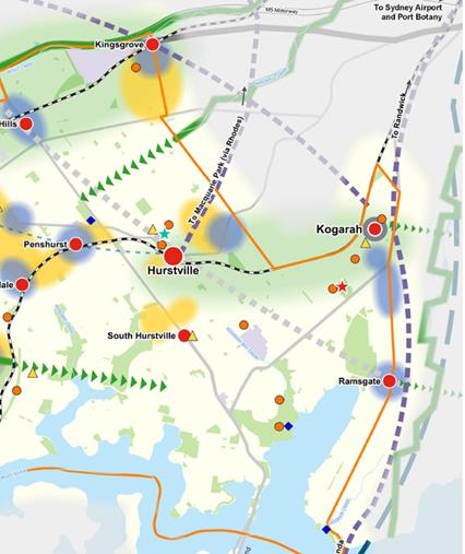
Source:
GRC Draft LSPS
Georges River Draft Commercial Centres Strategy
65. The
draft Commercial Centres Strategy for Georges River has been prepared to inform
the incremental approach to strategic planning throughout the LGA.
66. Part
1 Centres Analysis was put on exhibition from 26 June 2019 to 7 August 2019.
67.
Part 1 conducts a stocktake of 48 commercial centres in the Georges River LGA
and develops an existing centres hierarchy. This has been completed with
the aim of preparing a planning framework that effectively governs the future
development of these centres to support their ongoing viability and the growth
of local businesses and jobs in line with the draft LSPS 2040 vision.
68. The
primary purpose of Part 1 is to inform the preparation of the LEP 2020 and its
accompanying DCP. Part 2 of the Strategy is currently being
prepared.
69. A
new land use planning framework is being prepared through a harmonised Georges
River LEP and developed as follows, in accordance with the actions nominated by
the draft LSPS 2040:
· LEP 2020
(Harmonisation and Housing) will be based on the current and emerging evidence
base and community engagement outcomes. The focus of this LEP will be on
delivery of housing targets, housing choice and harmonising the existing
planning instruments.
· LEP 2022 (Jobs and
Activation) will require further detailed studies and investigations to focus
on the ongoing viability, competitiveness and activation for centres
· LEP 2025 and
beyond will be informed by the above LEPs and future strategic planning work to
respond to longer-term housing and jobs forecasts and community values.
70. The
Georges River Draft Commercial Centres Strategy has identified Ramsgate as a
‘Village’, as shown in Figure 14, which ‘supports a
local resident and worker population with 3,000 to 5,000m2 of retail
floor space and typically includes a small supermarket or convenience
store’. The classifications of local centres, villages, small
villages and neighbourhood centres are comprised of a combination of B1
Neighbourhood Centre and B2 Local Centre zoned land.
71. The
strategy states that there are opportunities to review the existing centres
hierarchy based on the recommendations of the Study. Place-based analysis
is required in Part 2 of this Strategy to inform LEP 2022 and beyond. No
rezoning or changes to the built form controls will occur until this work is
complete.
72. The
strategy makes land use recommendations to be implemented in LEP 2020. It
also recommends minimum non-residential FSR required to meet 2036 demand.
For villages, this is 0.67:1. It proposes that the minimum
non-residential FSR for the proposed LEP 2020 for villages should be retained
as 0.3:1.
73. LEP
2020, 2022 and 2025 recommendations are as follows:
a. LEP
2020 recommendation:
i. Retain
existing B2 Local Centre zoning
ii. Retain
existing height and FSR development standards
iii. Implement
a minimum non-residential FSR requirement in the centre of 0.3:1
iv. Enable
the permissibility of self-storage units to complement the everyday retail
functions of existing stores
v. Review
and incorporate active street frontage provisions into DCP 2020 to enhance the
centre’s connectivity and vibrancy
b. LEP
2022 recommendation:
i. Review
the minimum non-residential FSR requirement in centres with the aim of
providing sufficient non-residential floor space to meet the 2036 demand
ii. Conduct
place-based analysis to activate centres and ensure its ongoing viability
– including investigating the existing height and FSR development
standards, infrastructure provisions and public domain outcomes
c. LEP
2025 and beyond recommendation:
i. Conduct
further investigation to determine the suitability of the possible promotion to
“local centre” classification in the centres hierarchy
ii. Introduce
design excellence mechanisms to facilitate good design
iii. Review
development standards as required
iv. Investigate
expansion of the centre’s boundary to meet the demand for additional
employment floor space.
Figure
14 Existing Centres Hierarchy

Source:
Draft LSPS
Other Local
Strategies
74. Consideration
of the Planning Proposal in relation to Council’s Local Strategic Plans
is provided in Table 5 and Table 6 below:
Table 5. Compliance with Council’s local strategies and/or local
strategic plans
|
Plan/Strategy
|
Summary
|
Compliance
|
|
Georges River Community
Strategic Plan 2018-2028 (2018)
|
The Community Strategic Plan
(CSP) sits above Council's planning framework and sets out the strategic
direction for Council's Delivery Program and Operations Plans and include the
following key themes:
· A protected
environment and green open spaces
· Quality, well planned
development
· Active and accessible
places and spaces
· A diverse and productive
economy
|
Inconsistent
The Site at Ramsgate is not
located in a strategic centre, nor is it connected to substantial transport
links and has not been identified for economic development under the plan.
Accordingly, it is considered that the proposed density of the development is
not adequately justified.
|
|
Georges River Council Economic
Development Strategy 2018-2022 (2018)
|
This Strategy takes a
place-based approach to local economic development. It acknowledges that
competing for economic success in a modern economy requires ‘creating
places where workers, entrepreneurs and businesses want to locate, invest and
expand’.
The strategy defines key
centres as places with high levels of employment and employment opportunity,
or places expected to experience significant population growth. These
key centres are:
» Kogarah
» Hurstville
» Kingsgrove
» Peakhurst
» Riverwood
However, two emerging centres;
Beverley Hills and Ramsgate-Beverley Park, have the potential, if encouraged
and managed well, to develop into key centres providing additional employment
and lifestyle opportunities.
|
Inconsistent
The Strategy states that
Ramsgate-Beverley Park has the potential to develop into a key centre.
However, this is not expected to occur within the immediate future. Therefore,
the scale of development proposed at present, is considered to be
unjustified.
|
|
Kogarah Employment Lands and
Economic Development Strategy (2013)
|
The aim of the Kogarah
Employment Lands and Economic Development Strategy (KELEDS) was to assist with
the creation of the new standard LEP for Kogarah and to provide
recommendations for revised planning controls to be included in KLEP
2013.
At the time of the Strategy, it
was found that there was an undersupply of supermarket and grocery floor
space of around 7,500m2 included recommendations for supermarkets.
|
Consistent
The inclusion of a full-line
Coles supermarket within the proposed development needs to take into
consideration the hierarchy of the centre. The scale of the proposed
development has been based on the inclusion of a full-scale supermarket. It
is considered that inclusion of a smaller scale supermarket should be
considered so not to detract from Kogarah and other centres higher on the
retail hierarchy.
|
|
Kogarah Council Housing
Strategy 2031 (2014)
|
The Kogarah 2031 Housing
Strategy is Council’s commitment to managing housing supply over the
next 20 years.
|
Inconsistent
Refer to Table 6 below.
|
Table 6 Consistency
with Kogarah Council Housing Strategy 2031
|
Key
objectives
|
Assessment
|
|
1. Housing across the City of
Kogarah designed so that it provides choice, is affordable and is suited to
the needs of our community.
|
Inconsistent
The planning proposal provides
for a range of housing options, in the form of 1, 2 and 3 bedroom
apartments. These smaller housing options will assist in catering for
the needs of the older population.
However, no provision of
affordable housing is made, although it is noted that increasing the supply
assists with affordability issues.
|
|
2. Local centres within the
City of Kogarah are distinctive and vibrant, providing opportunities for
small businesses to flourish throughout the city.
|
Consistent
The proposed development would
increase the population within the local centre of Ramsgate, bringing more
customers and new businesses.
The addition of a new mixed-use
development would contribute to the revitalisation of Ramsgate centre.
|
|
3. Kogarah City residents can
get to where they need to go in a way that is accessible, safe and efficient.
|
Inconsistent
The Site is located in an area
serviced by public transport connections. However, the scale of the
development proposed would require upgrades to these existing connections,
which is not proposed. The most accessible areas are those where there
are commercial centres, railway lines and main roads. Ramsgate is not a
commercial centre and does not have a railway.
|
|
4. Development in Kogarah
maintains and enhances the character and amenity of our neighbourhoods, town
centres and local centres.
|
Inconsistent
The proposed development is of
a scale and density far greater than any surrounding development, and
proposes to exceed the height controls of the Kogarah strategic centre.
The development does not respond to the context of the existing
neighbourhood.
|
|
5. Comply with State Government
requirements for housing targets throughout the Sydney Metropolitan Area.
|
Consistent
The proposed development would
provide for an additional 197 dwellings within the Kogarah LGA.
|
5.3 Other
plans and strategies
75. An
assessment of other relevant plans and strategies in provided in Table 7
below.
Table 7 Assessment
against other relevant Plans and Strategies
|
Plan/Strategy
|
Summary
|
Compliance
|
|
Future Transport Strategy 2056
- Greater Sydney Services and Infrastructure Plan
|
The transport vision for
Greater Sydney has been developed to support the GSC’s vision for
Greater Sydney as a metropolis of three cities, where people have access to
jobs and services within 30 minutes by public transport.
The NSW Government has identified
policy, service and infrastructure initiatives to support the customer
outcomes and deliver the future networks. Initiatives have been prioritised
on the basis of delivering on existing commitments, addressing network
constraints and supporting growth.
|
Inconsistent
All current initiatives are focused
on improving connections to Kogarah, approximately 2km from the subject
Site. Given this distance from the strategic centre and associated
transport links, and considering the lack of associated infrastructure
improvements to and within Ramsgate, the scale of the proposed development is
unjustified.
|
|
KLEP 2012
|
The subject Site is currently:
» zoned
R3 Medium Density Residential and B2 Local Centre
» has
a height limit of 15m and 21m
» has
an FSR of 1.5:1 and 2.5:1
» is
located adjacent to the following heritage items:
> 145:
Residential Flat Building ‘Roma’ at 70 Ramsgate Road
> 146:
Shops at 211-219 Rocky Point Road
|
Inconsistent
The Planning Proposal for
Ramsgate has been prepared to justify a rezoning of the R3 part of the Site
to B2, an increase in height to 16m, 25m, 29m, 31m and 35m and an increase in
FSR to 3.2:1.
The proposed maximum height
control for the Site, of 35m is only 4m below the current 39m maximum height
control within Kogarah, a nominated strategic centre under the District
Plans. The proposed FSR of 3.2:1 is also not far behind the maximum
FSRs in Kogarah of 4:1 and 4.5:1.
There is little to no
justification as to why a local centre with minimal transport links, should
have such substantial height controls. The scale of the proposed
development is out of keeping with the level of development currently
envisaged for Ramsgate. The local centre does not currently have, nor
is likely to have in the next ten years, the level of road or rail
infrastructure required to support such a development.
It should also be noted that
the current FSR and height controls for the Site have only recently been
gazetted in 2017 (under KLEP 2012 Amendment No.2). The new planning
controls were prepared having regard to the new City Plan, hence the Site
already has development controls slightly out of keeping with those for local
centres.
Similarly, LEP 2020
recommendations are as follows:
> Retain
existing B2 Local Centre zoning
> Retain
existing height and FSR development standards
> Implement
a minimum non-residential FSR requirement in the centre of 0.3:1
Consequently, the proposed
amendments to the KLEP 2012 controls so soon after previous amendments is
considered inappropriate.
The DPIE’s ‘A
Guide to Preparing Planning Proposals’ states that there will be a
presumption against a Rezoning Review request that seeks to amend LEP
controls that are less than 5 years old unless the proposal can clearly
justify that it meets the strategic merit test, which this proposal does not.
In addition, the proposed
development does not encompass the heritage items located at 70 Ramsgate Road
and 211-219 Rocky Point Road. The proposed development would result in
adverse impacts to these heritage items.
|
|
Draft Greener Places:
Establishing an urban Green Infrastructure policy for NSW (2017)
|
Greener Places is a draft Green
Infrastructure Policy released by the Government Architect NSW in October
2017. Greener Places is structured around four key principles of Green
Infrastructure.
|
Consistent
The proposal is generally
consistent with the four principles and objectives of the policy summarised
as follows;
» implements
increased tree cover at ground level, with the indicative scheme also
including many roof gardens at different levels throughout the Site.
» accessible
from all surrounding streets to enhance pedestrian and cyclist permeability
in and around the Site.
» a
range of green spaces are provided throughout the Site, including landscaped
areas at ground level and roof gardens at different levels throughout the
Site, which offer different spaces for different times, audiences and
purposes.
|
|
Better placed: An integrated
design policy for the built environment of NSW (2017)
|
Better Place is a strategic
document to guide the future of urban environmental planning such that it
works towards the creation of better designed places throughout NSW.
|
Inconsistent
The planning proposal has
responded to the objectives of the policy summarised as follows;
Ramsgate Village has been
strongly influenced by its context, ensuring that various constraints and
opportunities provided by the Site’s surroundings are adequately
responded to in the proposed planning controls. Ways in which the planning
proposal does this include:
» transitioning
appropriately to neighbouring residential areas and heritage items;
» orienting
the public space to ensure maximum solar access and amenity; and
» respecting
neighbouring items of environmental heritage.
Notwithstanding, it is
considered that the design of Ramsgate Village development is vastly out of
context with surrounding development and does not provide a gentle transition
from smaller to larger scale development. The tallest building in
Ramsgate is currently 6 storeys. The proposed development seeks a
maximum height of 10 storeys.
|
|
NSW Planning guidelines for
Walking and Cycling 2004
|
These guidelines aim to assist
land–use planners and related professionals to improve consideration of
walking and cycling in their work.
|
Consistent
It is noted that the vision for
Ramsgate:
» will
provide for increased quality and quantity of public realm through the
provision of a car-free public plaza encouraging pedestrian activity
» will
capitalise on existing bus public transport availability and be
well-positioned for long-term visionary mass transit projects
» all
car parking will be provided underground, reducing any conflict with
pedestrians or cyclists at street level.
|
5.4 State and Regional
Statutory Framework
76. The Planning Proposal has been
assessed against the below relevant State Environmental Planning Policies
(SEPPs).
Table 8 Draft
Planning Proposal consistency with the relevant State Environmental Planning
Policies
|
Description
|
Assessment
|
|
SEPP No. 32 Urban Consolidation
(Redevelopment of Urban Land)
|
|
This Policy aims to promote the
orderly and economic use and development of land by enabling urban land which
is no longer required for the purpose for which it is currently zoned or used
to be redeveloped for multi-unit housing and related development.
The policy also seeks to
implement a policy of urban consolidation which will promote the social and
economic welfare of the State and a better environment by enabling:
(i) the location of
housing in areas where there are existing public infrastructure, transport
and community facilities, and increased opportunities for people to live in a
locality which is close to employment, leisure and other opportunities, and
(ii) the reduction in the
rate at which land is released for development on the fringe of existing
urban areas.
|
Inconsistent
The Planning Proposal seeks to
provide high density development in an area where there is inadequate public
transport infrastructure.
The Planning Proposal does not
align with any infrastructure upgrades which are realisable within the next
ten years.
|
|
SEPP No. 55 — Remediation
of Land
|
|
This policy aims to promote the
remediation of contaminated land for the purpose of reducing the risk of harm
to human health or any other aspect of the environment.
|
Consistent
The Site is currently used for
retail and residential land uses and therefore is unlikely to be
contaminated.
|
|
SEPP No. 65 — Design
Quality of Residential Apartment Development
|
|
SEPP No 65 — Design
Quality of Residential Apartment Development (SEPP 65) Raises the design
quality of residential apartment development across the state through the
application of a series of design principles and an accompanying guideline
Apartment Design Guideline (ADG) which are required to be considered as part
of the assessment process for residential flat buildings.
|
To be determined
An Urban Design Report was
submitted with the Draft Planning Proposal which demonstrates that the
principles of SEPP 65 have been considered in the preparation of the Master
Plan.
The peer review of the Urban
Design Report by Architectus indicated that the majority of the aspects of
the development would be able to comply with the requirements of the ADG.
Detailed compliance with SEPP
65 and the ADG would be required at the DA stage.
|
|
SEPP (Building Sustainability
Index: BASIX) 2004
|
|
Operates in conjunction with
provision of the EP&A Regulation to encourage sustainable residential
development (BASIX scheme).
The SEPP ensures consistency in
the implementation of BASIX throughout the State by overriding competing
provisions in other environmental planning instruments and development
control plans, which would otherwise add to, subtract from or modify any
obligations arising under the BASIX scheme.
|
N/A
Detailed compliance with SEPP
(BASIX) would be a matter of consideration as part of a future DA.
|
|
SEPP (Infrastructure) 2007
|
|
This policy aims to facilitate
the effective delivery of infrastructure across the State along with
providing for consultation with relevant public authorities during the
assessment process. The SEPP supports greater flexibility in the location of
infrastructure and service facilities along with improved regulatory
certainty and efficiency.
In particular, the SEPP
requires specific consideration of the following clause given the location of
the Site adjacent to the T2 East-Hills Train line and services;
· Development
adjacent to rail corridors (Clause 85)
· Excavation in,
above, below or adjacent to rail corridors (Clause 86)
· Impact of rail
noise or vibration on non-rail development (Clause 87)
· Development
adjacent to pipeline corridors (Clause 66C).
|
Inconsistent
The Planning Proposal does not
align with any future infrastructure upgrades which are realisable within the
next ten years.
However, it should be noted
that an offer to enter into a planning agreement includes $29.5 million as
part of the Planning Proposal. This offer includes approximately $1
million towards traffic improvements.
Traffic improvements would
involve the creation of controlled intersections at the Ramsgate and Rocky
Point Road intersections with Targo Road.
In addition, any new DA will be
required to pay s 7.11 contributions.
|
|
SEPP (Affordable Rental
Housing) 2009
|
|
Provides a consistent planning
regime for the provision of affordable rental housing and aims to facilitate
the effective delivery of new affordable rental housing through incentives.
|
Inconsistent
No provision has been made for
affordable housing.
|
|
SEPP (vegetation in non-rural
areas) 2017
|
|
The aims of the Policy are:
to protect the biodiversity
values of trees and other vegetation in non-rural areas of the State, and
to preserve the amenity of
non-rural areas of the State through the preservation of trees and other
vegetation.
|
Consistent
There are currently no
significant trees on the Site.
|
5.5 S9.1 Ministerial
Directions
77. Ministerial
Directions under Section 9.1 (formerly S117) of the EP&A Act set out a range
of matters to be considered when preparing an amendment to a Local
Environmental Plan.
78. The
Planning Proposal is inconsistent with the following Ministerial Directions:
· 3.1 Residential
zones – the Planning Proposal is inconsistent with this direction where
it seeks to provide a significant uplift in residential development with
inadequate access to existing or proposed infrastructure.
· 3.4 Integrating
land use and transport – the Planning Proposal does not give effect to
the objectives of this direction where the proposed residential density sought
does not align with suitable provision of public transport and thus will result
in further congestion to the surrounding road network which is already at
capacity.
6. URBAN DESIGN ASSESSMENT
79. The
preliminary design concept was presented to Council officers at a meeting on 21
March 2018, seeking a 1-19 storey mixed use development including the
following:
· Three
levels of basement car parking
· Supermarket
floor space of 4,350sqm
· Retail
floor space of 1,555sqm
· Commercial
floor space of 935sqm
· 287
residential apartments
80. The
preliminary assessment raised the issues identified below in Table 9.
Comments have been provided as to whether the current Planning Proposal has
addressed these issues.
81. Furthermore,
an assessment of the proposed design has been undertaken against the relevant
controls within the Kogarah Development Control Plan 2013 – Chapter E3
Ramsgate Centre (2013).
Table 9 Urban
design assessment
|
Council
Issue
|
Comment
|
Have
Council’s issues been addressed in the current proposal?
|
|
Height and scale
|
Consideration of the
Site’s strategic location must be made when assessing the preliminary
proposal. Although the proposal supports the principles of the Greater Sydney
Region Plan and the South District Plan in providing local employment and
housing in local centres particularly supermarket-based centres, the subject
Site is not identified as a local centre in these plans. Ramsgate Local
Centre as identified in the Eastern City District Plan is located close to
Ramsgate Beach, within the Bayside Council LGA.
However, it is considered that
the subject Site has the potential to play a role for the local area and
there is opportunity to provide a focal point for the neighbourhood with more
local housing and access to goods and services.
The proposed height and scale
of the development is excessive and is incompatible with and not justified in
the context of the surrounding development particularly compared to the
overall building height and scale of recent new mixed use development in both
the Georges River Council LGA and the opposite side of Rocky Point Road
(Bayside Council).
The KLEP 2012 sets maximum
building heights between 15m-21m for the Site. Through the extensive review
and consultation of the recent KLEP 2012 (Amendment No. 2 i.e. New City
Plan), Council envisioned lower height limits to the rear of development
Sites along Rocky Point Road (western side of subject Site) so as to provide
an appropriate transition to the adjoining low and medium density residential
development. The proposed height and scale of the development will adversely
impact on the amenity of the surrounding dwellings and does not provide
adequate transition. Building separation distances must also comply with the
Department of Planning and Environment’s Apartment Design Guide, with
compliance demonstrated through the submission of cross section diagrams.
|
No
It is agreed that the subject
site has the potential to play a role for the local area. However, the
proposed height and scale of the proposed development remains excessive and
significantly out of context with any existing or proposed surrounding
development, with the largest development in Ramsgate currently standing at
six storeys.
The proposed development, at
its highest, would reach up to 35m. This height is beyond any
development proposed either in Ramsgate, or the strategic centre of Kogarah,
and is considerably higher than the existing maximum height control for the
Site (21m).
It is not considered that a
development of this scale is suitable for Ramsgate town centre, being
identified only as a local centre in the relevant strategic documents, and
lacking any form of transport interchange or services, beyond a limited bus
network.
The proposed heights at the
rear of the development of between 1-6 storeys (Building B) and 1-8 storeys
(Building C) would result in considerable adverse impacts to the low scale
two storey residential developments adjoining.
Accordingly, it is not
considered that the concerns raised by Council, or the original assessment
have been addressed.
|
|
Amalgamation
|
It is recommended that the
remaining adjoining Sites on the corner of Rocky Point Road and Ramsgate Road
(203 -219 Rocky Point Road, Ramsgate) be acquired and integrated into the
development to avoid their isolation. This would achieve a greater planning
outcome with better access and utilisation of the Site. It would also ensure
that development adjacent to the heritage item is undertaken in a manner that
is sympathetic to the character, scale, form and siting of the item.
Written documentation providing
evidence that reasonable attempts have been made to acquire the remaining
adjoining Sites into the redevelopment and documentation of the negotiations
between the owners of the properties is to be submitted to Council for
review. This is to include copies of correspondence between parties and any
formal financial offers and responses to offers.
|
No
Council recommended that
reasonable attempts be made to acquire 203-1219 Rocky Point Road, however
this has not been achieved.
The property at 211-219 Rocky
Point Road is a heritage item and contended by the applicant to have
‘limited development potential’. However, it is noted that
Site is subject to a 21m height limit and a 2.5:1 FSR control, offering some
development potential. Consequently, it is considered that the heritage
item may be able to be incorporated into the proposed development, which
would result in a far better development outcome than isolated lots.
It is also noted that written
documentation providing evidence that reasonable attempts have been made to
acquire the aforementioned Sites, has not been provided.
|
|
Traffic and pedestrian access
|
The preliminary proposal does
not include the provision of a new rear laneway connecting Targo Road and
Ramsgate Road. New rear lane access is a requirement of Part E3 Ramsgate
Centre under the Kogarah DCP 2013 when lots are amalgamated. The DCP
specifies that there is potential for a new rear lane to be introduced to buffer
existing low scale residential development from higher, denser mixed use
developments. The lane would also facilitate easy movement onto Rocky Point
Road and discourage movement back onto residential side streets.
There is potential for the lane
to be made a shareway for pedestrian/vehicle access with retail uses fronting
the laneway. The DCP envisions that the laneways connecting Rocky Point Road
to the rear streets are wide enough to accommodate a pedestrian/ shopping
refuge from the noise of Rocky Point Road which links to the residential
street network.
Street activation along Rocky
Point Road also has the potential to be improved. Retail and shop entrances
to the Site from Rocky Point Road will encourage activation of the main
street frontage.
A detailed Traffic Report must
be prepared by a qualified traffic consultant to assess all of the proposed
traffic movements including the service delivery vehicles. Nearby
intersections and access points on Targo Road and Ramsgate Road will also be
required to be assessed. The assessment of a similar sized development and
recommendations are to form part of the submission.
A separate detailed Traffic
Management Plan is to be submitted for the loading dock proposed from
Ramsgate Road. As a minimum it is to include size of vehicles, their route to
and from the Site, number of deliveries and staging of deliveries.
|
No
The development proposes a
through Site link/laneway to Rocky Point Road and Ramsgate Road in the
eastern and southern connections of the proposed square, connecting Targo
Road and Ramsgate Road.
It is considered that the
streetscape along Rocky Point Road would be able to be adequately activated
as a result of the proposed development.
A Traffic Report has been
prepared by The Transport Planning Partnership, which states that the
development will generate 673 vph and 735 vph for the Thursday evening and
Saturday peak periods respectively.
As outlined above, it is
considered that significant infrastructure upgrades would be required to
support this growth.
A detailed Traffic Management
Plan for the loading dock has not been submitted.
|
|
Heritage
|
The subject Site adjoins two
heritage items at 70 Ramsgate Road and 211-219 Rocky Point Road. The heritage
items have not been acquired and it is difficult to ensure adequate
transition between the two-storey heritage building at 211-219 Rocky Point
Road and adjoining development along Rocky Point Road. There is no guarantee
the isolated Site will be developed to provide a transition between the
subject Site and the heritage item. It is recommended that the remaining
adjoining Sites on the corner of Rocky Point Road and Ramsgate Road be
acquired and integrated into the development to ensure appropriate transition
to the heritage items. The form of future development adjacent to 211-219
Rocky Point Road should continue to reflect traditional shops along this
section of Rocky Point Road with parapets, shopfronts and street awnings.
The proposed six storey
development adjacent to the heritage item at 70 Ramsgate Road is
inappropriate, does not respond to the existing one and two storey
residential development in this section of Ramsgate Road, and will have an
adverse impact on the setting of the heritage item. The form of new
development adjacent to 70 Ramsgate Road should ideally be perceived as a
stand-alone building with its size and volume being similar to the heritage
item.
To preserve views and visual
appreciation of 70 Ramsgate Road, development adjacent to the heritage item
should be set back a minimum 3 metres from the front boundary. The height of
development along Ramsgate Road should ideally not exceed the height of the
ridge of the heritage item. This should limit development fronting Ramsgate
Road to two stories for the full depth of the adjacent heritage item.
|
No
The Planning Proposal states
that the property at 211-219 Rocky Point Road has ‘limited development
potential’. It has consequently not been acquired. Written
documentation providing evidence that reasonable attempts have been made to
acquire the aforementioned Sites, has not been provided.
In terms of the development at
70 Ramsgate Road, a Heritage Impact Statement has been prepared, which states
that the proposed development would have acceptable or positive heritage
impacts on the adjacent heritage items.
The proposed 1-6 storey
development adjacent to the heritage item at 70 Ramsgate Road has not been
reduced in height to be similar to that of the heritage item, nor has it been
altered to be a standalone building.
However, the proposed building
envelopes, present a better relationship in scale to the two heritage items
than the previous scheme. The proposed envelopes will envisage future
buildings that are much taller than the heritage items, it is acknowledged that
the primary elevation of the heritage items is oriented to address Rocky
Point Road and Ramsgate Road and the future development would not obscure the
primary views to the two heritage items.
While the visual context of the
two heritage items will be altered, the appreciation of the character and
relationships between the heritage items can still be appropriately managed
and retained.
|
82. The
DRP assessed the proposal at the panel meeting held on 2 August 2018. The
details of the assessment are outlined in Table 10 below. The
Planning Proposal has been reassessed against the below provisions of SEPP 65
in order to determine whether Council’s issues have been adequately
addressed.
Table
10 Proposal assessed against DRP comments
|
Panel
issue – SEPP 65 Design Quality of Residential Flat Buildings
|
DRP
Comments
|
Have
the DRP’s comments been addressed in the current proposal?
|
|
Context and Neighbourhood
Character
Good design responds and
contributes to its context. Context is the key natural and built features of
an area, their relationship and the character they create when combined. It
also includes social, economic, health and environmental conditions.
Responding to context involves
identifying the desirable elements of an area’s existing or future character.
Well designed buildings respond to and enhance the qualities and identity of
the area including the adjacent Sites, streetscape and neighbourhood.
Consideration of local context
is important for all Sites, including Sites in established areas, those
undergoing change or identified for change.
|
The following comments in the
2016 report of the Panel remain relevant.
“This is a Planning
Proposal for rezoning land and major increase in height and density well
beyond existing and those proposed in the New City Plan. The Site has 3
frontages to Targo Road, Rocky Point Road and Ramsgate Road. Rocky Point Road
represents the major interface with the local retail centre whereas Ramsgate
Road is much more road oriented. Targo Road predominately services a residential
area. There are 2 substantial street trees on Targo Road.
The Site adjoins a medium
density townhouse development to the west which is zoned under the new City
Plan R3 (15m height limit) and unlikely to be redeveloped in the foreseeable
future. It is important that any development on the subject Site does not
have unacceptable impacts on the adjoining existing residential zone.
To the south of the Site a
number of low scale retail and mixed use developments front Rocky Point Road
and Ramsgate Road. These may develop at some stage in the future. There is a
heritage listed building adjacent to the Site at 211-219 Rocky Point Road
which also has frontage to Ramsgate Road. This is only 2 storeys in height
and is unlikely to change.
Along Rocky Point Road on the
east side there are a number of recently completed new residential mixed use
development only 4 storeys in height, and on the Targo Road / Rocky Point
Road corner a very new development of 6 storeys height which was approved on
the basis of the New City Plan. This establishes a new benchmark in relation
to height and density on Rocky Point Road.”
The current zoning for the Site
has recently been gazetted. The Council informed the Panel that the subject
Site is identified as being within a local centre in the Eastern District
Plan; however, this does not infer that height and density need to be
substantially increased. Council also advises that it is unable to find a
reference to a new train link in the Future Transport Strategy 2056, as shown
on the applicant’s “Ramsgate Town Centre in Focus Plan”.
The proponent argues that high density is required to support this
unidentified transport imperative, although the current density controls are
already relatively high for a local centre.
Therefore, the Panel cannot
agree with the proponent that the Site warrants such an increase in density
and height as proposed. Nor does the proposal appear to build on the
character of the existing retail strip and its current planning regime.
|
No
Limited amendments have been
made to what was previously proposed and what the new Planning Proposal
proposes in terms of density controls. The alterations include:
· No amendment has been
made to the proposed zoning of B2 Local Centre across the entire Site.
· Proposed FSR has been
reduced from 3.8:1 to 3.4:1 to 3.2:1
· Proposed height has
been reduced from a range of 15m-51m to a range of 15m-46m, to a range of
16m-35m.
Although changes have been
made, the density controls proposed would still result in a density well
beyond that existing or proposed for the area.
The DRPs original comments
stated that it was important that the proposed development did not have
unacceptable impacts on the adjoining residential zone. However, given
the proposed scale of the scheme, significant adverse impacts on the 2 storey
residential properties to the rear of the Site would be unavoidable.
It is agreed that considering
the recent gazettal of the current zoning for the Site, the proposed
increased density controls are premature.
The proposed development is
located in proximity to an investigation corridor, no transport upgrades in
close proximity to the Site have been committed to. Consequently, this
is not considered to be an adequate justification of the proposed density.
|
|
Built Form and Scale
Good design achieves a scale,
bulk and height appropriate to the existing or desired future character of
the street and surrounding buildings.
Good design also achieves an
appropriate built form for a Site and the building’s purpose in terms
of building alignments, proportions, building type, articulation and the
manipulation of building elements.
Appropriate built form defines
the public domain, contributes to the character of streetscapes and parks,
including their views and vistas, and provides internal amenity and outlook.
|
The Panel were not convinced
that the proposed space could legitimately be termed “a village
square” for the following reasons:
· The square
doesn’t integrate with its existing retail strip and residential
surrounds.
· The 15 storey
tower overwhelms the square.
· The depth and
width of the square and built form would create poor amenity for residents
and the public (noise, privacy, wind etc).
· The square
layout reads as an entrance to a supermarket and other retail/commercial
tenancies and not as a viable lively space in public ownership.
The Panel were also concerned
that the Site is almost entirely built out and there are larger buildings
distributed over the Site which impose heavily on adjacent lower scale
buildings, including heritage items. Furthermore, the proposed change to the
zoning would further reduce opportunities to provide deep soil which is a
critical factor in providing large trees within the Site and acting as a
buffer to adjacent lower density residential areas.
The Panel indicated that a high
rise building on this Site is not justified. There appears to be no logic in
the applicant’s claim that there needs to be a “marker in the
centre of Ramsgate”. If a supermarket is the best outcome for the Site
it could include an entirely different built form outcome. This could include
an amenable and activated cross Site link, substantial trees and public
space, completely within the current height and density controls.
|
No
The revised Planning Proposal
proposes the following:
· Amend the zoning
map so that the entire Site is B2 Local centre
· Amend the FSR
map to increase the FSR from 1.5:1 and 2.5:1 to 3.2:1
· Amend the height
of buildings map to increase the maximum building height from the existing
controls of 15m and 21m to a range of heights from 16-35m
It is proposed to include a
village square, ground floor retail including a subterranean supermarket,
space for community facilities including child care centre, four levels of
basement accommodating the supermarket and underground parking and 197
residential apartments.
It is considered that the
design of the village square would be able to integrate with surrounding
development in terms of the retail area of Ramsgate town. However, the
size of the square remains substantial and could easily be reduced. The
village square has been separated from the residential development to the
rear of the Site.
The proposed maximum height of
the development has been reduced from 46m to 35m, but remains overwhelming
and excessive in height.
The depth and width of the
square may result in adverse impacts in terms of noise and privacy, however
the level of this impact and potential measures that could be taken to
mitigate these adverse impacts would need to be determined at the DA stage.
The Site remains almost
entirely built out, with large buildings imposing heavily on adjacent two
storey residential developments. The heritage items have not been
incorporated into the overall design, but have instead been left as isolated
Sites due to their limited development potential.
The sheer size and scale of the
proposed development is not justified on this Site, given the lack of
existing or proposed infrastructure to support it, the lack on identification
of the Site as a strategic centre within the District Plans, no immediate
alterations proposed to the planning controls for the Site under
Council’s Commercial Centres Strategy and considering that the area was
subject to uplift during Councils amendment to the KLEP 2012 in 2017.
|
|
Density
Good design achieves a high
level of amenity for residents and each apartment, resulting in a density
appropriate to the Site and its context.
Appropriate densities are
consistent with the area’s existing or projected population.
Appropriate densities can be sustained by existing or proposed
infrastructure, public transport, access to jobs, community facilities and
the environment.
|
The density proposed is not
supported.
|
No
Although the proposed density
has been reduced, the current strategic plans for the area do not provide any
justification for the increase in density, particularly as the panning
controls were amended in 2017.
The proposed density is 4
storeys over the largest existing development within Ramsgate and is
therefore not consistent with its surrounds.
Considering that Ramsgate has
not been identified as a strategic centre, intended for significant growth in
terms of infrastructure upgrades and employment, the volume of additional
housing proposed may not be justified in the locality.
|
|
Sustainability
Good design combines positive
environmental, social and economic outcomes.
Good sustainable design
includes use of natural cross ventilation and sunlight for the amenity and
liveability of residents and passive thermal design for ventilation, heating
and cooling reducing reliance on technology and operation costs. Other
elements include recycling and reuse of materials and waste, use of
sustainable materials and deep soil zones for groundwater recharge and
vegetation.
|
Refer comments above in Built
Form related to deep soil.
|
Yes
It is considered that good
sustainable design outcomes would be able to be achieved on Site in terms of
natural cross ventilation and sunlight for the proposed apartments.
Additional sustainable design
initiatives would be able to implemented at the DA stage.
No
In terms of deep soil, the
proposed supermarket and basement car park occupy all of the available
footprint, no deep soil zone is provided. Therefore, this issue has not
been addressed.
|
|
Landscape
Good design recognises that
together landscape and buildings operate as an integrated and sustainable
system, resulting in attractive developments with good amenity. A positive
image and contextual fit of well designed developments is achieved by
contributing to the landscape character of the streetscape and neighbourhood.
Good landscape design enhances
the development’s environmental performance by retaining positive
natural features which contribute to the local context, co-ordinating water
and soil management, solar access, micro-climate, tree canopy, habitat values
and preserving green networks.
Good landscape design optimises
useability, privacy and opportunities for social interaction, equitable
access, respect for neighbours’ amenity and provides for practical
establishment and long term management.
|
Refer comments above under
Built Form.
|
Yes
It is considered that the
landscape concept creates an activated and interesting public open space with
positive amenity for those using the space.
However, the bulk and scale of
the proposed development surrounding the space is not supported.
The details of proposed
landscape design should be provided at the DA stage to support a development
of an acceptable scale.
|
|
Amenity
Good design positively influences
internal and external amenity for residents and neighbours. Achieving good
amenity contributes to positive living environments and resident well being.
Good amenity combines
appropriate room dimensions and shapes, access to sunlight, natural ventilation,
outlook, visual and acoustic privacy, storage, indoor and outdoor space,
efficient layouts and service areas and ease of access for all age groups and
degrees of mobility.
|
The Panel is concerned that the
current proposal will impact negatively on the amenity of the surrounding
neighbourhood including lower scale residential buildings, shopfront and
streetscape.
The high rise tower as proposed
is lengthy and intrusive on surrounding context.
|
No
The proposed development, even
with the proposed 11m height reduction from the previous scheme, could result
in a development up to 10 storeys in height, which is four storeys over the
height of the tallest development in Ramsgate.
There are a number of 2 storey
residential developments at the rear of the Site, all of which would
experience significant adverse impacts in terms of amenity (visual and
acoustic privacy, solar access) as a result of the proposed scheme.
The provision of the communal
open space areas for residents of Ramsgate is not an offset for these
impacts.
|
|
Safety
Good design optimises safety
and security within the development and the public domain. It provides for
quality public and private spaces that are clearly defined and fit for the
intended purpose. Opportunities to maximise passive surveillance of public
and communal areas promote safety.
A positive relationship between
public and private spaces is achieved through clearly defined secure access
points and well lit and visible areas that are easily maintained and
appropriate to the location and purpose.
|
The Panel is concerned that the
cross Site link is narrow, liable to be inactive during the evening and does
not provide sufficient pedestrian amenity to function as an active and secure
lane. The 6m width includes 3m not on the subject Site and a requirement for
vehicular traffic.
|
Yes
The cross Site link from Targo
Road to Ramsgate Road is 6.6m and the pedestrian through Site link to Rocky
Point Road is 4m. It is considered that CPTED arrangements could be
successfully implemented to ensure pedestrian safety and security both in the
laneways and the public spaces.
|
|
Housing Diversity and Social
Interaction
Good design achieves a mix of
apartment sizes, providing housing choice for different demographics, living
needs and household budgets.
Well designed apartment
developments respond to social context by providing housing and facilities to
suit the existing and future social mix.
Good design involves practical
and flexible features, including different types of communal spaces for a
broad range of people and providing opportunities for social interaction
among residents.
|
It is expected that this Site
will include high quality public domain and communal open space for the
proposed residents.
|
Yes
It is considered that the
proposed development has a good design in theory, and would provide a mix of
apartment sizes and housing choice. Although there should be some
provision made for the inclusion of affordable housing.
|
|
Aesthetics
Good design achieves a built
form that has good proportions and a balanced composition of elements,
reflecting the internal layout and structure. Good design uses a variety of
materials, colours and textures.
The visual appearance of a well
designed apartment development responds to the existing or future local
context, particularly desirable elements and repetitions of the streetscape.
|
The many perspectives provided
of the Planning Proposal demonstrate to the Panel that the proposal is too
dense and high and would have an adverse impact on the existing context.
|
No
It is considered that the
development would be able to achieve a good built form, if the development
was at a reduced scale.
The development does not have
good proportions. It remains too dense and too high and consequently
would have an adverse impact on surrounding developments.
|
7. SITE SPECIFIC
MERIT ASSESSMENT
83. If
there is no strategic framework in place, or the proposal is inconsistent with
the strategic planning framework, an assessment of the proposal against the
Site-Specific Merit tests in accordance with the assessment criteria of the
“A Guide to Preparing Local Environmental Plans” should be
undertaken.
7.1 Natural Environment
84. The
Site is already developed and located within the Ramsgate town centre, hence
the Site does not contain any significant environmental values.
7.2 Development surrounding
the Site
85. The proposed mixed-use development in its
location along Rocky Point Road, would be in keeping with surrounding retail
and commercial development and would assist in activating the Site and
rejuvenating Ramsgate Town Centre. However, the bulk and scale of the
development is vastly out of context with its surroundings.
86. The tallest building in Ramsgate at present
stands at six storeys. The subject Site currently has height limits of
15m and 21m, which could result in a seven storey development fronting Rocky
Point Road. A development which complies with the existing height
controls, whilst being the largest development in Ramsgate, would still be in
keeping with the surrounding development and likely future development.
87. The proposed development, reaching a maximum of
ten storeys, would be out of context with the current or future vision for the
Site, creating a dominating development within the centre of Ramsgate.
7.3 Services and
Infrastructure
88. The proposed development would result in
significant population growth (197 new dwellings) and increased traffic
movement, placing pressure on the existing road network through increased
traffic volumes and limited public transport services (bus connections).
89. The Planning Proposal has been supported by a
Traffic and Parking Impact Assessment Report which states that the development
will generate 673 vph and 735 vph for the Thursday evening and Saturday peak
periods respectively. With no identified plans for increased public
transport services or road upgrades, the development would result in
significant adverse impacts in terms of traffic congestion.
90. The Traffic report indicates that the
intersections of Rocky Point Road and Ramsgate Road and Rocky Point Road and
Targo Road are currently operating either ‘satisfactory’ or
‘near capacity’ during Thursday and Saturday peak hours. As a
result of the proposed development these intersections would operate at
‘near capacity’ or ‘unsatisfactory with excessive queuing
levels’.
91. There are currently no plans to upgrade this
road infrastructure, and although the planning agreement offer includes funds
($1 million) for traffic improvements, such as the creation of controlled intersections
at the Ramsgate and Rocky Point Road intersections with Targo Road, it is
considered that further substantial upgrade works would be required in order to
accommodate the increased traffic volumes which would result from the proposed
development.
92. As Ramsgate is a designated local centre, it
has not been focused on in terms of improvement in transport connections.
Kogarah is the closest strategic centre to the Site and has therefore been the
focus of new and improved transport connections.
93. The extent of public transport which services
the Site comprises a bus network, with stops along both Ramsgate Road and Rocky
Point Road.
94. There is currently no train station within
Ramsgate, nor is there one proposed.
95. No public transport upgrades are proposed as
part of the planning proposal. Considering the vast pressure, the
proposed development is likely to place on existing bus services, this is
something that will need to be taken into account. It is considered that
consultation with TfNSW would be required in order to determine the level of
public transport upgrades which would need to occur as a result of the proposed
development.
96. The proposed development would create some
social infrastructure with an offer to enter into a planning agreement
including provision for the following:
a. Community facility
b. Public Square
c. Public wifi
d. Public domain improvements and landscaping
e. Assistance with local sporting clubs
97. Consultation with the Department of Education
(DoE) would need to be undertaken in order to determine whether contributions
to an education establishment would be required, as it is understood that a
school could not be accommodated on the Site.
8. INTERNAL
REFERRALS
8.1 Traffic
98. The
Traffic section supports the report that was presented to Council by ttpp in
support of the Planning Proposal. The report was robust in addressing
what is needed at the planning proposal stage in that it utilised fair and
accurate Traffic generation rates and in doing so they modelled the affected
intersections with three different scenarios:
· Existing
Conditions;
· Future
Base Case Traffic Conditions – this is based on background future growth
without the traffic generation from the planning proposal; and
· Future
Development Case Traffic Conditions – this is based on background future
growth and the traffic generation from the planning proposal.
99. The
study was technical and fair in reporting that the affected intersection would
fail in the third scenarios (being the Future Development Case Traffic
Conditions), if the affected intersections were not upgraded to address
deficiency.
100. The
report recommended the following mitigating measures under which the
intersection would operate at an acceptable level of service if the planning
proposal was to go ahead. These measures are as follows:
· Targo Road
intersection with Rocky Point Road would require to be signalised. In addition,
the removal of kerbside parking along Rocky Point Road;
· The new signalised
Rocky Point Road and Targo Road intersection would operate with a three-phase
traffic signal sequence with a leading right turn from Rocky Point Road
southbound into Targo Road. The existing mid-block pedestrian crossing in Rocky
Point Road located north of Targo Road is to be removed as signalised crossings
would be provided on all legs at the new Targo Road signalised intersection;
and
· Ramsgate Road
intersection with Targo Road intersection would need to be signalised so that a
right turn movement from Ramsgate Road into Targo Road could be catered for.
The proposed traffic signals would also operate with a three-phase traffic
signal sequence. In addition, one of the eastbound departure lane on Ramsgate
Road is proposed to be converted into an approach right turn lane.
101. The
Traffic Section welcomes these upgrades as they would improve traffic in the
subject area. However, before Council can commit to the Planning
Proposal, Capital Hill Group will have to demonstrate and prove to Council that
The Roads and Maritime Services (RMS) would agree and approve the
above-mentioned mitigating measures at the intersections of Targo Road, Rocky
Point Road and Ramsgate Road.
102. Signalising
the above-mentioned intersections will have to be approved by RMS as it forms part
of their SCAT system and will become their infrastructure to control and
manage, If RMS do not approve these proposed changes then the planning proposal
could not be supported.
103. Furthermore,
in addition to RMS’s approval, the developers will need to submit
feasibility study demonstrating total costs of the upgrades to the subject
intersections including any services relocation that might be needed to allow
the installation of the traffic light poles and associated structures.
The feasibility study with all necessary RMS approvals, concept designs,
underground details of footings and similar structures will need to be
presented to Council’s Design section for review and approval.
104. All
costs associated with the upgrade of the intersections will need to be bourne
by the developers Capital Hill Group.
105. For
the Proposed Vehicle Access Arrangements, being:
· Vehicular access
to the basement car park off Targo Road and Ramsgate Road;
· The car park
access on Ramsgate Road would be configured to permit only left-in movement
from Ramsgate Road, while the access on Targo Road would permit all traffic
movements; and
· A second access is
proposed on Ramsgate Road to service the loading dock. This access is proposed
to provide left-in and left-out movements only.
106. The
Traffic section accepts the proposed arrangement however swept path diagrams of
their largest vehicle that would access the Site would need to be submitted to
demonstrate that trucks can access and leave the Site in a safe manner and in a
forward direction.
107. In
conclusion the traffic section supports the Planning Proposal only if the
mitigating measures at the affected intersections are carried out at no cost to
Council.
8.2 Stormwater/Overland
Flow
108. The
Site will need to incorporate On-Site Stormwater Detention in accordance with
Council’s Stormwater Management Policy.
109. The
Site will need to incorporate Water Sensitive Urban Design principles and meet
Stormwater Quality targets as specified in Council’s Stormwater Management
Policy.
110. The
Site would be affected by some overland flow in heavy storm events from a small
catchment area to the west of the Site.
111.
An overland flow path assessment would need to be undertaken to determine the
effect of this overland flow path upon the proposal and to include design
requirements that allow the overland flow for all storms up to the 100-year ARI
event to travel safely through the Site. It will need to be shown that all
buildings including their basements are protected from these overland flows,
and that any overland flows within areas subject to pedestrian and vehicle
movements are maintained at safe and low hazard levels.
112. It
will also need to be proven that the proposal will not increase, concentrate or
aggravate any flooding conditions within other properties or the adjacent
roadways. This will include that existing flow paths from the neighbouring
property at 8 Targo Road to the west of the Site are maintained.
113. The
overland flow path assessment will need to provide evidence that overland flow
would not enter the proposed driveway accesses at Targo Road and Ramsgate Road
in storms up to the 100 year ARI event.
114. There
is a Council stormwater pipe in the vicinity of the north east corner of the
Site. Although unlikely this pipe may encroach partially into the Site. This
would need to be determined prior to a development consent as an encroachment
may impact upon the basement.
8.3 Voluntary
Planning Agreement
115. Council
received a letter of offer to enter into a Planning Agreement dated 17 January
2019, in conjunction with the Planning Proposal (see Attachment 9). The
offer provides for a range of additional public benefits including a community
facility space, public square, public wi-fi access, through Site link/laneway,
public domain improvements and landscaping, contribution for traffic
improvements and assistance to local sporting clubs.
116. As
the Planning Proposal is not supported and is recommended for refusal, an
assessment of the offer and proposed public benefits under Council’s
Policy on Planning Agreements 2016 has not be undertaken. Only when the
Planning Proposal is supported in principle would an assessment of the planning
agreement offer be undertaken.
8.4 Heritage
117. This Planning Proposal has
previously been referred for heritage review and comment in April 2019, which
identified two main issues that were recommended to be resolved prior to the
Planning Proposal proceeding. These include:
· Consideration of the potential heritage significance of the building
at 201-205 Rocky Point Road for its important contribution to the historical
significance of the development of the Ramsgate shopping precinct of the early
20th century and the direct associational significance to the two listed items
of local heritage significance having been built by the Pittorino Brothers;
·
The need to accommodate a greater transition in the
scale of the proposed building envelopes to ensure future built forms do not
adversely impact on the visual setting and occupant amenity of the heritage
items.
118. The Planning Proposal has
since been revised and while the overall quantum of the proposal remains the
same, the indicative building envelopes have been revised to incorporate minor
changes in the building heights, through introducing greater transition in the
scale of future buildings and to improve their relationship to the two heritage
items. The Planning Proposal incorporates the building at 201-205 Rocky Point
Road and as per the previous comments, this building has potential heritage
significance for its associations with the Pittorino Brothers who were
responsible for the construction of the two buildings presently identified as
items of heritage significance. The building at 201-205 Rocky Point Road
features the name of Pittorino Brothers in the parapet façade and is the
only building in the group to provide any tangible evidence that directly
associates the buildings to the Brothers. Indeed the building has been
cosmetically modified and those changes have diminished the design integrity of
the building. It remains however, substantially intact and reinforces the
low-scale commercial built form character of the streetscape and attributed to
the Inter-War period, whereby contributing to and reinforcing the setting of
the two heritage items adjacent. It is recommended that the Planning Proposal
incorporate design / development controls to retain the façade of the
building at 201-205 Rocky Point Road and its incorporation into any future
development.
119. It is acknowledged that this
Planning Proposal seeks to set in place conceptual building envelopes and the
merits of any specific development proposal will be considered as part of
future Development Applications. Still, it is necessary to consider whether the
envisaged future development resulting from the conceptual building envelopes
will have a harmonious relationship to the two heritage items on the site and
therefore have an acceptable heritage impact.
120. Specifically, the Planning
Proposal as revised, introduces improvements to the transition in scale of the
multi-storey buildings through varying setbacks to create a lower podium level,
yet still retains the overall volume of the built form as a backdrop to the
heritage items. The revised building envelopes however, present a better
relationship in scale to the two heritage items and while the proposed
envelopes will envisage future buildings that are much taller than the heritage
items, it is acknowledged that the primary elevation of the heritage items is
oriented to address Rocky Point Road and Ramsgate Road and the future
development would not obscure the primary views to the two heritage items.
While the visual context of the two heritage items will be altered, the
appreciation of the character and relationships between the heritage items can
still be appropriately managed and retained.
121. The proposed buildings are
centered around a public square which will ‘pull the (future) buildings
apart’ and allow for a sense of building separation and solar amenity to
the residential occupants of the building known as ‘Roma’. A series
of shadow diagrams have been provided showing the overshadowing to the heritage
items from the conceptual building envelopes, which although results in
overshadowing to the heritage items, still affords a reasonable amount of solar
amenity to the occupants of the residential building (Roma). The impact of
overshadowing and visual privacy and the merits of any future built forms will
be considered in more detail once detailed building designs have been developed
as part of future Development Applications. However, based on the ‘worst
case scenario’, the amended building envelopes provide for reasonable
solar amenity.
122. The Planning Proposal will
alter the visual context and backdrop of the two heritage items, however the
appreciation of the character and relationships between the heritage items can
still be appropriately managed and retained and the conceptual building
envelopes introduce improved transitions in scale to pull the future building
heights away from the heritage items. While detailed building designs have not
been developed as part of the Planning Proposal, the merits of any future
development will be considered as part of future Development Applications.
However, the Planning Proposal will set in place a planning regime that
envisages the redevelopment of the site with a built form that can be reasonably
accommodated in the backdrop to the heritage items.
123. As outlined above, it is
recommended that the Planning Proposal incorporate design / development
controls to retain the façade of the building at 201-205 Rocky Point
Road and its incorporation into any future development.
9. PROPONENT’S
RESPONSE
124. The proponent has provided a response below to the issues
raised in the preliminary assessment of the amended Ramsgate Village Planning
Proposal which was submitted to Georges River Council on 3 September 2019. This
letter provides a response to the key matters raised, particularly with regard
to the strategic and site-specific merit of the Planning Proposal.
Strategic merit
125. District Plan consistency:
The Planning Proposal is consistent with the applicable District Plan (South
District Plan and East District Plan) for the reasons set out comprehensively
in Section 6.1.2 of the Planning Proposal report (Attachment 1) prepared by
Ethos Urban and dated 3 September 2019.
· The proponent’s traffic analysis has determined that the
construction of 197 dwellings on the site can be accommodated within the
traffic network.
· The development of the site under the existing controls would yield
approximately 157 dwellings, with the Planning Proposal effectively only
seeking an additional 40 dwellings (the majority of additional floor space
would be attributed to the supermarket).
· The existing capacity of all developable sites in the Ramsgate Local
Centre (and their redevelopment) would result in well excess of an additional
197 dwellings.
126. The proponent does not agree
with the simple conclusion that the proposal is inconsistent with the District
Plan because 197 additional dwellings cannot be accommodated based on the
provision of existing or future infrastructure. This is because:
· The proponent’s traffic analysis has determined that the
construction of 197 dwellings on the site can be accommodated within the
traffic network.
· The development of the site under the existing controls would yield
approximately 157 dwellings, with the Planning Proposal effectively only
seeking an additional 40 dwellings (the majority of additional floor space
would be attributed to the supermarket).
· The existing capacity of all developable sites in the Ramsgate Local
Centre (and their redevelopment) would result in well excess of an additional
197 dwellings.
127. Draft LSPS consistency:
The Planning Proposal is consistent with the Draft Georges River LSPS, for the
reasons set out comprehensively in Section 6.1.3 of the Planning Proposal
report (Attachment 1) prepared by Ethos Urban and dated
3 September 2019.
128. The proponent does not agree
that the Planning Proposal is inconsistent with Planning Priorities P1 and P3
of the Draft LSPS, as these planning priorities are transport related
(contained within the ‘Access and Movement’ chapter of the Draft LSPS).
These planning priorities provide Council a framework in the LSPS to advocate
to the State Government for the construction of more transport infrastructure
in the LGA. Planning Priority P1, which advocates for the LGA to “have a
range of frequent, efficient transport options”, is not relevant or
applicable to the Planning Proposal, which seeks to facilitate the delivery of
a public plaza, a supermarket and some additional dwelling capacity to offset
the costs of these assets.
129. More relevantly, the Draft
LSPS identifies that 14,000 dwellings will be required in the LGA through to
2036 to house the growing population of Georges River, however foreshadows a
2,000 dwelling shortfall in the capacity of existing controls (noting that the
capacity under existing controls is approximately 12,000 dwellings).
Accordingly, the Planning Proposal will contribute to this shortfall in
capacity through a minor increase in dwelling capacity on the subject site.
130. Draft Commercial Centres
Strategy consistency: The Planning Proposal is
consistent with the draft Centres Strategy as the proposed retail component is
generally consistent with the scale of Ramsgate and its position within the
retail hierarchy. Whilst the retail proposed under the indicative concept
scheme represents growth greater than anticipated under the Strategy, this is
considered acceptable given Ramsgate is envisaged to have a greater share of
future retail under the Strategy, and the fact that the proposed employment is
commensurate with providing a new focal point for Ramsgate, centred around an
activated public square.
131. The proponent does not believe there is
sufficient justification to substantiate putting the Planning Proposal on hold
for any reason. The Planning Proposal seeks to amend the controls to deliver a
rational supermarket floor plate (the current zoning boundary prohibits this);
noting that the amount of supermarket floor space proposed can already be
delivered under the existing planning controls, therefore raising no centres
hierarchy concerns. The opportunity presented by the Planning Proposal is the
amalgamated, large consolidated parcel of land in single ownership, capable of
providing a critical mass of retail, commercial and retail uses and the
financial means to deliver a public plaza and undergrounded supermarket
(unlocked by a modest amount of additional floor space which would make the
outcome feasible).
132. Consistency with
DPIE Planning Proposal Guide: The DPIE’s A Guide to preparing
Planning Proposals states that “there will be a presumption against a
Rezoning Review request that seeks to amend LEP controls that are less than 5
years old, unless the proposal can clearly justify that it meets the
Strategic Merit Test” (emphasis bold). For the reasons set out in the
Planning Proposal reported dated 3 September 2019 and this letter response, the
proposal achieves the strategic merit test, principally because it will give
effect to the relevant district plan.
133. Importantly, it is also noted
that at the time of the gazettal of the current controls, the site was not
amalgamated to form the significant opportunity which it currently presents,
nor was there are a proposal for a public plaza or full line supermarket.
Site Specific Merit
134. Built form: The
Planning Proposal report (Attachment 1) in Section 8.1 and its supporting
studies sets out a comprehensive analysis of the built form and demonstrates
its appropriateness in the context of Ramsgate. The assessment finds that the
impacts on and transition to neighbouring properties are acceptable, and that
the proposal will not appear out of context, forming a focal point and
‘anchor’ for the town centre.
135. Given the additional height
and relatively modest increase in floor space proposed are primarily a function
of feasibly delivering and creating sufficient space on the site for a
substantial public plaza, underground supermarket and parking, it is considered
that the site specific merits of the proposal from a built form perspective are
highly evident and outweigh any perceived impact.
136. Traffic / infrastructure:
Section 8.8 of the Planning Proposal report and its accompanying Traffic Impact
Assessment Report confirm that the traffic and parking impacts of a future
proposal constructed in accordance with the development standards sought would
be satisfactory subject to the future signalisation of the intersections at
Rocky Point Road with Targo Road. In this respect, the proposal has site
specific merit as the services and infrastructure that are or will be available
can meet the demands arising from a proposal built to the proposed controls.
137. Heritage: Section 8.7
of the Planning Proposal Report and its accompanying Heritage Impact Statement
confirm that the indicative development concept enabled by the Planning
Proposal will have an acceptable impact on the heritage items in the vicinity.
This conclusion is made on the basis that: o the massing of the buildings has
been carefully considered and is designed to step up away from the heritage
items to diminish the dominance of the buildings over the corner heritage
buildings;
· all existing views to and from the heritage items in the vicinity
will be retained and conserved; and
· the planning proposal is consistent with the heritage objectives of
the KLEP 2012 and the KDCP 2013.
138. In conclusion, the
proponent’s view is that all concerns raised have either been addressed
already in detail through the comprehensive design work undertaken and in
responding on numerous occasions, or, commentary relating to the
proposal’s shortcomings in relation to strategic and site specific merit
are not substantiated.
139. The
combination of a new full line supermarket, new public square and new public
car park would deliver a significant public benefit for Ramsgate and will
preserve its importance as a local centre and catalyse the wider centre’s
future renewal. These initiatives are only possible with significant additional
cost, principally as inclusion of the public square requires the undergrounding
of the supermarket and associated car parking, all of which translates to a
substantial and costly excavation and works programme. Such significant costs
are unable to be supported by a fully compliant development scheme. It is
simply not financially viable to provide this much public benefit without some
trade off in additional floor space and height, albeit accepting that the
majority of additional floor space is to be provided below ground.
10. SUMMARY OF
ASSESSMENT/CONCLUSION
140. An
assessment of the above-mentioned Planning Proposal has been undertaken against
the relevant key strategic planning framework, in order to ascertain the
strategic and site-specific planning merit.
141. Fundamentally,
the sheer size and scale of the proposed development is not justified on this
Site, given the context, lack of existing or proposed infrastructure to support
it, the lack of identification of the Site as a strategic centre within the
Region and District Plans, no immediate changes proposed to the planning
controls for the Site under Council’s Commercial Centres Strategy
142. The
Ramsgate local centre does not currently have, nor is likely to have in the
next ten years, the level of road or rail infrastructure required to support a
development such as that proposed.
143. The
proposed development would inevitably result in significant population growth
(197 new dwellings) and increased traffic movement, placing pressure on the
existing road network through increased traffic volumes and limited public
transport services (bus connections).
144. Given
that the planning controls for the Site were gazetted in 2017 and that the
Commercial Centres Strategy recommends that no changes be made to the planning
controls for the Site as part of the LEP 2020 review, it is considered that the
proposed increased density controls and expansion of the B2 zone are premature.
145. Although
a number of positive changes have been made since the Planning Proposal was
originally lodged, the controls proposed would still result in a density well beyond
that which is existing or proposed for the area.
11. RECOMMENDATIONS
146. That
the Georges River Local Planning Panel recommend to Council the Planning
Proposal not progress to the Department of Planning, Infrastructure and
Environment for a Gateway Determination, for the reasons summarised below:
147. It
lacks strategic merit where:
i. It
is inconsistent with Objectives: 2, 10, and 14 of the Greater Sydney Region
Plan and respective corresponding Planning Priorities: S1 and E1, S5 and E5 and
S12 and E10 of the South District Plan and Eastern City District Plan, which
seek to align and integrate growth with infrastructure;
ii. It
is inconsistent with the objectives and detailed requirements of s.9.1
Ministerial Directions pursuant to the Environmental Planning &
Assessment Act 1979, including 3.1 Residential Zones and 3.4 Integrating
land use and transport;
iii. It
is inconsistent with the priorities contained within the Georges River draft
Local Strategic Planning Statement, including P1 which seeks to connect people
with efficient transport and P2 which seeks to provide roads free of
congestion; and
iv. It
is inconsistent with the strategic directions and key actions contained within
the draft Commercial Centres Strategy, which seeks to retain existing height
and FSR development standards for Ramsgate Centre.
148. It
lacks site specific merit where:
i. The
bulk and scale of the concept development is vastly out of context with the
surrounding locality;
ii. The
Ramsgate local centre does not currently have, nor is likely to have in the
next ten years, the level of road or rail infrastructure required to support a
development such as that proposed;
iii. The
redevelopment of the site would result in the isolation of the two heritage
sites; the residential flat building ‘Roma’ at 70 Ramsgate Road
(I145) and shops at 211-219 Rocky Point Road (I146), which are not included in
the total site area the subject of this Planning Proposal; and
iv. The
proposed development would result in significant adverse impacts on the
adjoining residential properties, including overshadowing and visual impacts.
149. Investigations
for increased density as part of a more holistic and place-based planning
approach for Ramsgate Village should inform future Local Environmental Plan
reviews, as recommended in the draft Commercial Centres Strategy. This will
ensure that redevelopment of the site is consistent with the strategic planning
principles envisioned for Ramsgate.
150. As
the Planning Proposal seeks to amend LEP controls that are less than five years
old and does not meet the strategic merit test, pursuant to the Department of
Planning, Industry and Environment’s A guide to preparing planning
proposals, there is a presumption against a Rezoning Review request.
12. CONSULTATION
151. Should
the Planning Proposal proceed through Gateway, the Draft Planning Proposal will
be subject to community consultation in accordance with Section 3.34(2)(c) of
the Environmental Planning and Assessment Act 1979. The specific requirements
for community consultation will be listed in the Gateway determination,
including any governmental agencies that are to be consulted in relation to the
Planning Proposal.
13. NEXT STEPS
152. The
Planning Proposal will be considered at a future Georges River Council
Environment and Planning Committee meeting, including the LPP recommendations.
The minutes of the Environment and Planning Committee meeting will subsequently
be considered at a future Georges River Council Meeting.
153. If
the Planning Proposal is endorsed by Council it will be forwarded to the
delegate of the Greater Sydney Commission for a Gateway Determination under
Section 3.34 of the Environmental Planning and Assessment Act 1979.
File Reference
PP2019/0001
Attachments - available on Council’s
Planning Proposal webpage
Attachment 1:
Planning Proposal
Attachment 2:
Urban Design Report
Attachment 3:
Survey Plan
Attachment 4:
Landscape Concept Plan
Attachment 5:
Heritage Impact Statement
Attachment 6:
Traffic Impact Assessment
Attachment 7:
Social and Economic Benefits Analysis
Attachment 8:
Urban Design Peer Review
Attachment 9:
Public Benefit Offer
