AGENDA - LPP
|
Meeting:
|
Georges River Local Planning
Panel (LPP)
|
|
Date:
|
Thursday, 5 March 2020
|
|
Time:
|
4.00pm
|
|
Venue:
|
Council Chambers, Civic
Centre, Hurstville
|
|
Panel Members:
|
Sue Francis (Chairperson)
Milan Marecic (Expert Panel
Member)
Jason Perica (Expert Panel
Member)
Erin Sellers (Community
Reperesentative)
|
|
1. On Site Inspections - 1.00pm – 3.30pm
a) 16 Peake Parade Peakhurst
b) 977 Forest Road Lugarno
c) 655-659 Princes Highway
Blakehurst
d) 19-23 Empress Street
Hurstville
e) 546 Railway Parade
Hurstville
|
|
Break - 3.30pm
|
|
2. Public Meeting
– Consideration of Items 4.00pm – 6.00pm
|
|
Public Meeting Session Closed - 6.00pm
(Break – Light Supper served to Panel
Members)
|
|
Georges
River Council – Local Planning Panel Thursday, 5 March 2020
|
Page 2
|
|
3. Reports and
LPP Deliberations in Closed Session - 6.30pm
|
LPP007-20 977
Forest Road Lugarno - REV2020/0001
(Report
by Senior Development Assessment Planner)
LPP008-20 655-659
Princes Highway Blakehurst - DA2017/0408
(Report
by Senior Development Assessment Planner)
LPP009-20 546
Railway Parade Hurstville - DA2018/0584
(Report
by Senior Development Assessment Planner)
LPP010-20 16
Peake Parade Peakhurst - REV2020/0003
(Report
by Senior Development Assessment Officer)
LPP011-20 19-23
Empress Street Hurstville - DA2019/0329
(Report
by Senior Development Assessment Planner)
|
4. Confirmation of Minutes
|
REPORT TO
GEORGES RIVER COUNCIL
LPP MEETING OF Thursday, 05 March 2020
|
LPP Report No
|
LPP007-20
|
Development Application No
|
REV2020/0001
|
|
Site Address & Ward Locality
|
977 Forest Road Lugarno
Peakhurst Ward
|
|
Proposed Development
|
Review of Determination - Fit-out
and use of the ground floor of an existing church building to be used as an
early childhood education facility for 34 children, associated landscaping and
car parking works
|
|
Owners
|
The Congregational Christian Church
of Samoa Parish of Sydney Inc.
|
|
Applicant
|
The Congregational Christian Church
of Samoa Parish of Sydney Inc.
|
|
Planner/Architect
|
Planner - Lee Environmental
Planning; Draftsman - JMH Living Design
|
|
Date Of Lodgement
|
8/01/2020
|
|
Submissions
|
Eighteen (18) submissions received.
|
|
Cost of Works
|
$10,000.00
|
|
Local Planning Panel Criteria
|
The application is referred to the
Local Planning Panel for determination as DA2019/0042 was determined by way
of refusal by the Panel on 7 November 2019 and more than 10 unique
submissions were recveived objecting to the application.
|
|
List of all relevant s.4.15
matters (formerly s79C(1)(a))
|
State Environmental Planning Policy
No 55 – Remediation of Land, State Environmental Planning Policy
(Educational Establishments and Childcare) 2017, State Environmental Planning
Policy (Vegetation in Non-Rural Areas) 2017, State Environmental planning
Policy – Infrastructure 2007, Greater Metropolitan Regional Environmental
Plan No 2 - Georges River, State Environmental Planning Policy Infrastructure
2007,
Draft Environment State
Environmental Planning Policy, Draft Remediation State Environmental Planning
Policy,
Hurstville Local Environmental Plan
2012, Hurstville Development Control Plan 2013
|
|
List all documents submitted
with this report for the Panel’s consideration
|
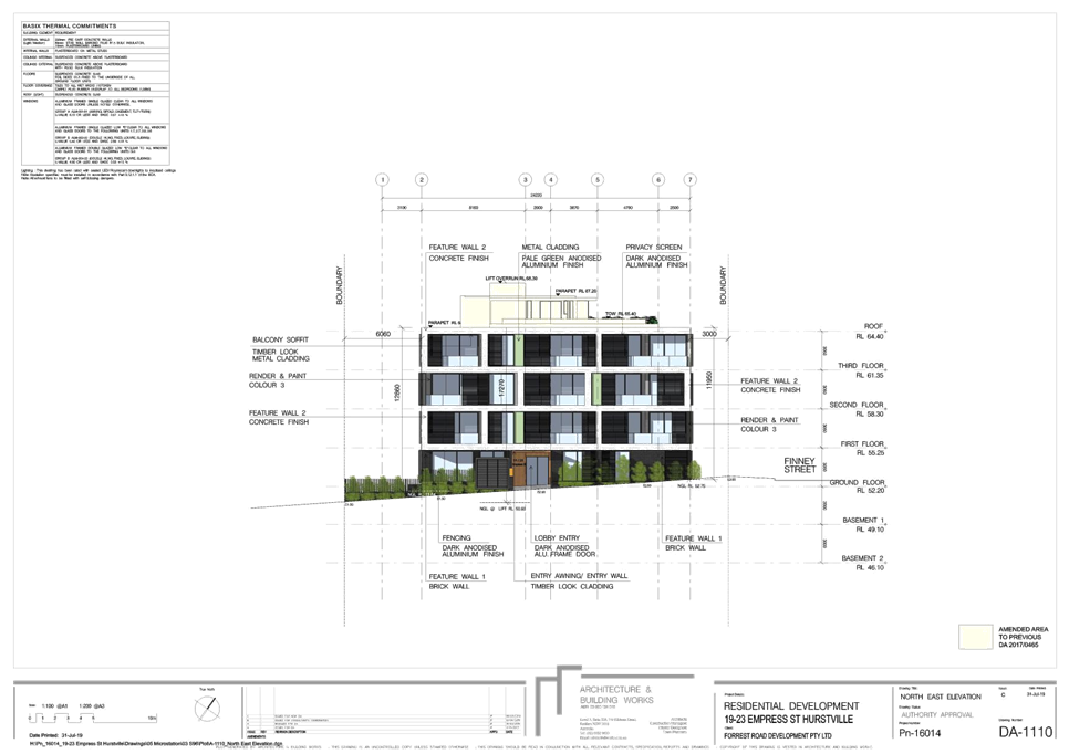
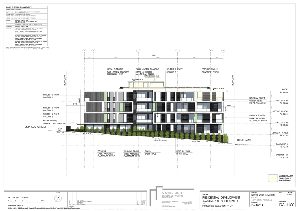
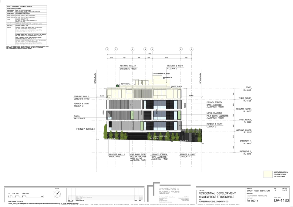
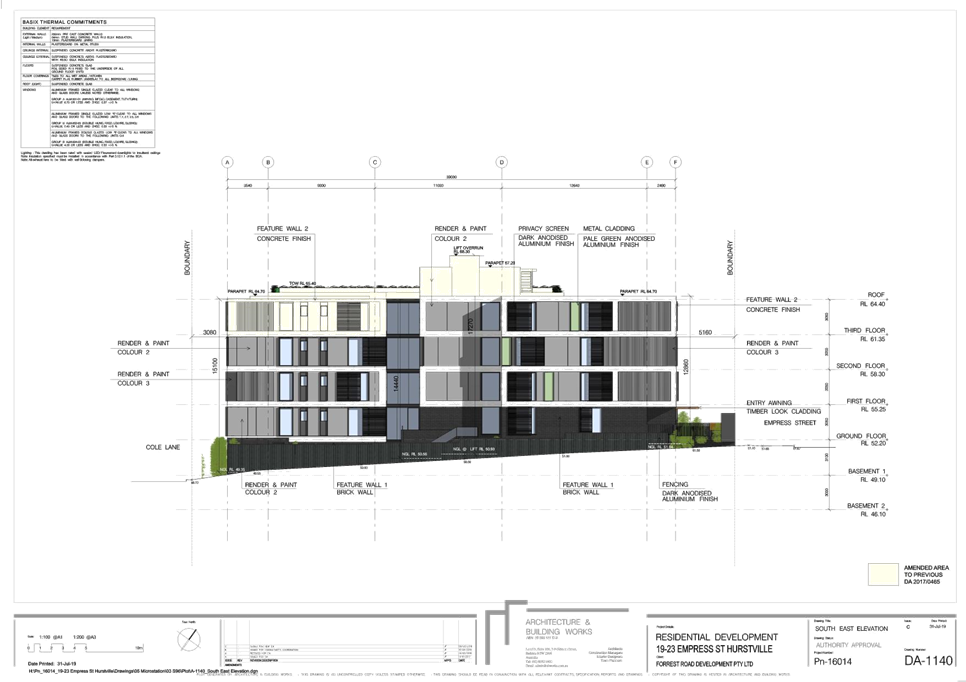
Site Plan
Elevations
|
|
Report prepared by
|
Senior Development Assessment
Planner
|
|
Recommendation
|
That the application be refused for the reasons referenced
at the end of this report.
|
|
|
Summary of matters for
consideration under Section 4.15
Have all recommendations in relation
to relevant s4.15 matters been summarised in the Executive Summary of the
assessment report?
|
Yes
|
|
Legislative clauses requiring
consent authority satisfaction
Have relevant clauses in all
applicable environmental planning instruments where the consent authority
must be satisfied about a particular matter been listed and relevant
recommendations summarised, in the Executive Summary of the assessment
report?
|
Yes
|
|
Clause 4.6 Exceptions to
development standards
If a written request for a
contravention to a development standard (clause 4.6 of the LEP) has been
received, has it been attached to the assessment report?
|
Not
Applicable
|
|
Special Infrastructure
Contributions
Does the DA require Special
Infrastructure Contributions conditions (under s7.24)?
|
Not
Applicable
|
|
Conditions
Have draft conditions been provided
to the applicant for comment?
|
No,
the application is recommended for refusal, the refusal reasons will be
available to view when the agenda is published.
|
|
Site Plan
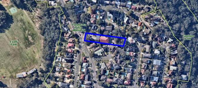
Site plan with the
allotment outlined in blue
|
Executive Summary
Proposal
1. Council is in
receipt of a Section 8.2 Review application relating to an application for the
fitout and use of the ground floor of an existing church building for use as an
early childhood education centre for 34 children, landscaping and car parking
works at 977 Forest Road, Lugarno.
2. The information
provided by the planning consultant states:
“Rather than amend the development application, the
application for review is based upon clarification and confirmation of
information. The Development Application remains for a 34 place child care centre,
to occupy lower ground floor space within an existing building where the upper
ground floor is lawfully occupied and used by the Congregational Christian
Church Samoa Parish of Sydney.”
Site and Locality
3. The site is
rectangular in shape with a splayed south western corner 1.83m in length which
fronts Forest Road and a frontage of 24.69m to Ponderosa Place and a northern
boundary of 120.120m and a southern boundary of 118.77m. The allotment has an
area of 3140sqm.
4. The site is
located on the eastern side of Forest Road and Ponderosa Place. The allotment
has a fall to the rear north eastern corner of 4.81m and a fall within the
existing building footprint, comprising a church building and attached rear
part one (1) part two (2) storey hall, of 2.72m.
5. A single storey
church/sanctuary building with attached rear part one/two storey hall with
sub-floor is located on the western side of the site. This building has a
2.313m setback from the southern boundary and a variable setback from the
northern boundary (3.54m to 6.71). The northern boundary setback is occupied by
a driveway that provides vehicular access to the rear (eastern side) of the
site and the existing dwelling house at the rear.
6. Adjoining the site to
the north are five (5) residential neighbours comprising dwelling houses. There
are also five (5) existing dwelling houses existing to the north of the site
and five (5) existing dwellings exist to the south and two (2) adjoining
dwelling houses to the east of the proposal.
Zoning and Permissibility
7. The subject site
is zoned R2 Low Density Residential under the provisions of Hurstville Local
Environmental Plan 2012 (HLEP 2012). The proposal involves the fitout and use
of the ground floor of an existing church building for use as “centre-based
child care facility” for 34 children, landscaping and car parking
works.
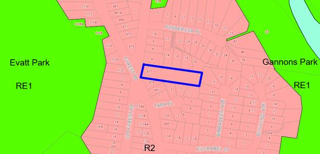
Figure 1 -
zoning map with the allotment outlined in blue
Submissions
8. The application
was placed on neighbouring notification between 20 January 2020 and 17 February
2020. Eighteen (18) submissions were received objecting to the proposed
development.
Referrals
9. The Review
application was referred to the following council officers:
· Traffic
Engineer - the proposal is not supported as it fails to comply with the relevant
Australian Standards for access and parking, will have adverse impacts on
pedestrian and children’s safety, and proposes works on council property
for which consent has not been provided.
· Building
Surveyor – BCA issues could be addressed at Construction Certificate
stage.
· Environmental
Health – the proposal is not supported as it fails to demonstrate how
acoustic issues will be mitigated.
· Consultant
Arborist – the proposal could be supported subject to the provision of a
Landscape Plan and conditions of consent should the application be approved.
10. The Review application did not
contain stormwater management plans and as such the Review application was not
referred to the Development Engineer. Comments within this report with regard
to stormwater were provided in the assessment of DA2019/0042 – refer to
comments in the DCP section of this report.
Reasons for
Referral to the Local Planning Panel
11. The application is referred to the
Georges River Local Planning Panel (LPP) for consideration and determination as
the original application (DA219/0042) was refused by the Panel at its meeting
on 7 November 2019 and more than 10 unique submissions were received objecting
to the application.
Conclusions
12. The application has been assessed
having regard to the Matters for Consideration under Section 8.2 and Section
4.15 of the Environmental Planning and Assessment Act 1979, the provisions
of the relevant State Environmental Planning Policies, and in particular
against the requirements of the State Environmental Planning Policy
(Educational Establishments and Child Care Facilities) 2017, the Hurstville
Local Environmental Plan (LEP) 2012 and Hurstville Development Control Plan No.
1 (DCP). The proposal has not adequately addressed the reasons for refusal of
the original Development Application and is therefore recommended for refusal.
Report in Full
Proposal
13. Council is in receipt of a Section
8.2 Review application for the fitout and use of the ground floor of an
existing church building for use as an “centre-based child care
facility” for 34 children, landscaping and car parking works at 977
Forest Road, Lugarno.
14. The following documentation was
submitted with the review application:
· Application
form;
· Covering
letter from planning consultant;
· Document
from planning consultant addressing the reasons for refusal;
· Architectural
plans;
· Solar
access diagrams;
· Arborist
Report;
· Acoustic
report; and
· Letter
from Traffic Engineer Consultant.
15. The information provided by the
planning consultant states:
“Rather than amend the development application, the
application for review is based upon clarification and confirmation of
information. The Development Application remains for a 34 place child care
centre, to occupy lower ground floor space within an existing building where
the upper ground floor is lawfully occupied and used by the Congregational
Christian Church Samoa Parish of Sydney.”
16. The Statement of
Environmental Effects, dated November 2018, provided in support of the original
application (DA2019/0042), describes the proposal as:
“The proposed
development is for a proposed Childcare Centre use within the ground floor of
an existing two story building where the upper level floor is occupied by an
existing Place of Public Worship.
It involves the
internal fit-out of the building space and there will be no built form changes
externally to the existing bulk, scale and height of the church building.
The proposed child
care centre will operate between 7am until 6pm Monday to Friday, and will
accommodate 34 children and 7 staff.
The proposed child
care centre will operate on the ground floor at the rear of the existing church
building with outdoor space being located to the east of the building with a
north and east aspect.
Car parking will be
provided at both the front of the site for drop off and pick up and for staff
and other visitor vehicles to the rear of the building. Both of these areas are
already utilised as parking areas for the Church use.”
17. Detail on the
proposal and its’ operations is tabulated in the SEE as follows, it is
acknowledged there is discrepancy in the staff numbers, the assessment has been
based on 6:
The centre will provide places for thirty four (34) children
as follows:
· 0-2 year olds – Twelve (12) children
· 2-3 year olds – Twelve (12) children
· 3-5 year olds – Ten (10) children
These children will be supervised by a total of six (6) staff
members.
The following car parking is proposed for the site:
· Six (6) spaces for child care staff; and
· Five (5) spaces for children drop off/pickup, including one
accessible space.
(these spaces are used by the Church when in operation,
these spaces are not in addition to the spaces currently allocated to the
Church)
18. Provision of the proposed car parking spaces within the front
setback of the existing Church building will require preservation measures to
be implemented to protect the three (3) canopy trees, including a Grey Gum (Eucalyptus
punctata), a Blackbutt (Eucalyptus pilularis) and a Willow Gum (Eucalyptus
scoparia). Provision of the formal car parking at the rear of the site will
require protection measures to be implemented for one (1) significant Willow
Gum (Eucalyptus scoparia) and an exempt Silky Oak (Grevillea robusta).
19. Vehicular
access to the site is to be amended to provide an additional driveway on the
southern side of the site providing a circular drive through arrangement at the
front of the site. This proposal will enable vehicles to enter and exit the
site in a forward direction.
20. The
application also proposes an adjustment to the existing road line-marking and
traffic island arrangement. The existing arrangement is shown in Figure 2.
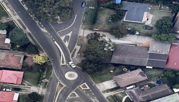
Figure 2: Existing corner intersection design (Source:
GoogleMaps)
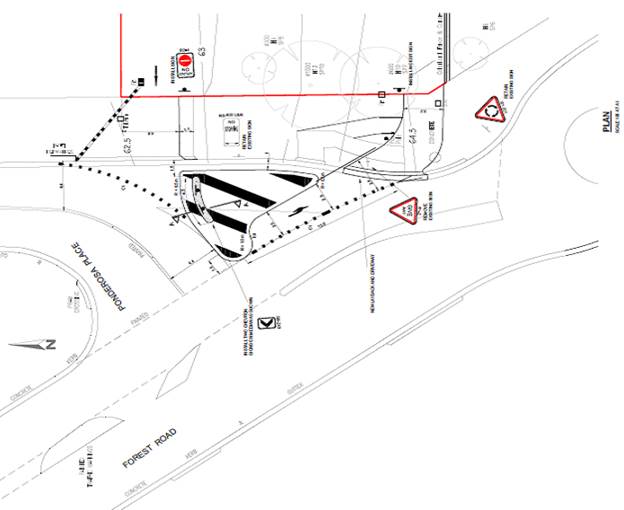
Figure
3: Modified road/access design
(Source: Applicant DA2019/0042)
21. The Application proposes the adoption of a new southbound slip-lane
exit from Ponderosa Place to Forest Road to service the development, see Figure
3 above. The proposed new road markings will require south-bound
traffic on Ponderosa Place to utilise the existing right turn lane to turn left
onto Forest Road.
22. The
applicant has not lodged the required application for approval for these road
network changes with Council (Section 138 application). Further discussion is
provided in this report in the traffic referral section.
23. Stormwater disposal from the site
is proposed to be by way of a charged line to Council’s drainage system
in Ponderosa Place.
The Site and Locality
24. The site is rectangular in shape
with a splayed south western corner 1.83m in length which fronts Forest Road
and a frontage of 24.69m to Ponderosa Place and a northern boundary of 120.120m
and a southern boundary of 118.77m. The allotment has an area of 3140sqm.
25. The site is located on the eastern
side of Forest Road and Ponderosa Place. The allotment has a fall to the rear
north eastern corner of 4.81m and a fall within the existing building
footprint, comprising a church building and attached rear part one (1) part two
(2) storey hall, of 2.72m.
26. A single storey church/sanctuary building
with attached rear part one/two storey hall with sub-floor is located on the
western side of the site. This building has a 2.313m setback from the southern
boundary and a variable setback from the northern boundary (3.54m to 6.71m).
The northern boundary setback is occupied by a driveway that provides vehicular
access to the rear (eastern side) of the site and the existing dwelling house
at the rear.
27. Adjoining the site to the north are five
(5) residential neighbours comprising dwelling houses. There are also five (5)
existing dwelling houses existing to the north of the site and five (5)
existing dwellings exist to the south and two (2) adjoining dwelling houses to
the east of the proposal.
28. Photos of the site area provided in the
figures below.
Figure
4: The site as viewed from Ponderosa
Place
Figure
5: The front setback to Forest Road
Figure
6: The existing driveway providing
vehicular access to the rear of the property
Figure
7: Lower ground level (northern
elevation) – area of proposed child care centre within the area bounded
by the blue brickwork
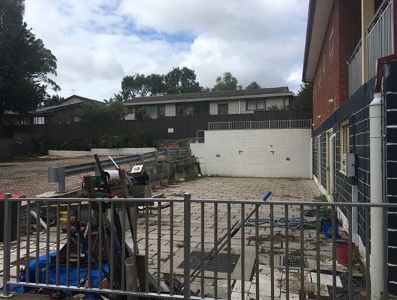
Figure
8: Proposed area for outdoor play and
rear car park to the left
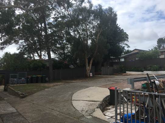
Figure
9: Rear car park
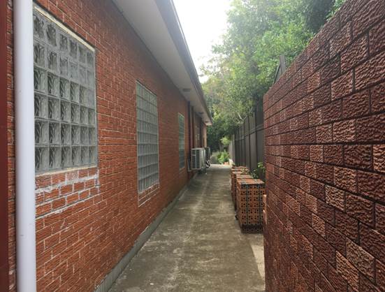
Figure
10: Southern elevation of the
existing ground level
Background
|
Date
|
Event
|
|
23 March 2007
|
Deferred commencement consent
granted for an extension to the existing church building including the
provision of a church hall under 06/DA-372.
|
|
21 May 2007
|
Deferred commencement activated for
06/DA-372.
|
|
28 September 2010
|
Pre-application advice is provided
to the applicant in relation to the potential lodgement of a child care
centre application.
|
|
15 July 2011
|
Development application for a child
care centre lodged under 11/DA-236 for the provision of additional
sub-floor area under the approved church hall for use as a child care centre.
|
|
July - November 2011
|
Unauthorised excavation works for
the provision of the rear child care centre commence on site, increasing the
excavation permitted under a previous consent for the church hall.
|
|
6 December 2011
|
Section 96 modification lodged
under 06/DA-372REV01 for the provision of additional excavation to
increase the area of the ground/sub-floor level underneath the approved
church hall.
|
|
7 March 2012
|
11/DA-236 is refused for
variations to the Hurstville Local Environmental Plan 2012, numerous
variations to Hurstville Development Control Plan No 1, insufficient
information, traffic and parking issues and safety concerns.
|
|
4 April 2012
|
Development modification 06/DA-372REV01
considered at a Council meeting where the application was approved by
Council.
|
|
3 June 2014
|
Pre-lodgement application for a
child care centre lodged under PRE2014/0010.
|
|
7 August 2014
|
The Hurstville Traffic Advisory
Committee considered proposed alterations under PRE2014/0010 at the
intersection of Forest Road and Ponderosa Place for a proposed child care
centre. The committee resolved:
“THAT
the proposed channelisation of the intersection of Forest Road and Ponderosa
Place to improve road safe at the vehicular access points of the
Congregational Christian Church in Samoa and the proposed child care centre
at 977 Forest Road Lugarno be approved.
THAT a Section
138 Application under the Roads Act 1993 be lodged to Council’s Traffic
Section for determination. A detailed plan of the proposed channelisation of
the intersection of Forest Road and Ponderosa Place, Lugarno be incorporated
with the application.
THAT all costs
associated with the proposed works be borne by the applicant.
FURTHER THAT the applicant be advised of Council’s
decision.”
|
|
17 September 2014
|
Formal pre-development advice
provided to the applicant detailing issues with the proposed plans including
tree removal, traffic, parking and disabled access. The applicant was advised
to lodge plans/information that addressed these issues in detail.
|
|
23 December 2015
|
Application for child care centre
lodged DA2015/0443.
|
|
2 February 2016
|
Council requests provision of
acoustic report and landscape plan
|
|
15 March 2016
|
Council receives complaint from
neighbour relating to unauthorised fit out of the ground/sub-floor level
|
|
16 March 2016
|
Stop work order issued in relation
to the fit out works.
|
|
27 May 2016
|
Acoustic Consultant,
“Acoustic Dynamics” requested to prepare acoustic report on
behalf of Council in relation to the proposal.
|
|
27 October 2016
|
DA2015/0443 for a
Child Care Centre for 34 children at ground level – Refused.
|
|
18 December 2018
|
DA2018/0570 lodged
seeking to operate an Early Childhood Education facility within the existing
building.
|
|
7 January 2019
|
DA2018/0570
rejected due to inadequacies in drainage, traffic, parking and need for
Pre-lodgement meeting
|
|
13 February 2019
|
DA2019/0042 application
seeking consent for fit out and use of the ground floor as a childcare centre
lodged.
|
|
3 October 2019
|
Noise complaint relating
to Church activities currently before the Court.
|
|
7 November 2019
|
DA2019/0042 was
refused by the Georges River Local Planning Panel.
|
|
8 January 2020
|
REV2020/0001
lodged seeking a review of the determination of DA2019/0042.
|
|
20 January – 17
February 2020
|
Neighbour notification
period – Two (2) submissions were received.
Plus an additional
sixteen (16) following the formal notification period.
|
29. DA2019/0042 sought consent for the
fit-out and use of the ground floor of an existing church building for use as
an early childhood education centre for 34 children, landscaping and car
parking works on the subject site. The application was referred to the Georges
River Local Planning Panel as more than 10 unique submissions were received (48
in total) on the proposed development. The Panel refused the application at its
meeting on 7 November 2019. The reasons for refusal were:
1. Refusal Reason -
Environmental Planning Instrument - Pursuant to Section 79C(1)(a)(i)
of the Environmental Planning and Assessment Act 1979, the proposed development
does not comply with the relevant environmental planning instruments in terms
of the following:
a) Clause 2.3 Zone objectives – the
proposal does not satisfy the following objective of the zone: To ensure that a high level of residential amenity is
achieved and maintained. The noise emission from the indoor play area will not
provide for appropriate adjoining neighbour amenity when the windows and doors
are open.
b) Clause 5.9 and Clause 6.4
– The removal of landscaped areas along the street frontage and likely
detrimental impacts on existing trees. These trees are significant in terms of
their height and dimensions and species and contribute significantly to the
visual and environmental amenity of the Foreshore Scenic Protection Area.
c) Clause 6.7 –
inadequate vehicular access is available to the site.
2. The proposed
development is unsatisfactory having regard to Section 4.15(b), 4.15(c),
4.15(d) and 4.15(e) of the Environmental Planning and Assessment Act 1979 (NSW)
in that the site is not suitable for the development and will have an adverse
impact for the reasons as follows:
a) The proposed siting and design of the outdoor
play structure and acoustic fence results in unnecessary visual bulk and scale
which results in an adverse impact to the built environment. Additionally
inadequate setback and screen landscaping is proposed adjacent to the acoustic
fence.
b) The design and sitting of the building
addition results in an urban form which is incompatible with the immediate
surrounding residential context.
c) The proposal results in adverse built
environment and social impacts and is therefore not considered to be in the
public interest.
3. Refusal Reason -
Development Control Plan - Pursuant to Section 79C(1)(a)(iii) of the
Environmental Planning and Assessment Act 1979, the proposed development does
not comply with the following sections of Development Control Plan No 1 - LGA
Wide
a) Section 3.1 Car Parking –
insufficient car parking, vehicular access and pedestrian safety is provided on
site for a child care centre use and church operating concurrently.
b) Section 3.5 Energy Efficiency
– insufficient solar access and natural ventilation is available to the
child care centre.
c) Section 3.11 Preservation of Trees
and Vegetation – the proposal does not satisfactorily provide for the
preservation of significant trees on site.
d) Section 5.3 Child Care Centres
– the proposal does not comply with various specific requirements for
child care centres.
4. Refusal Reason -
Regulation - Pursuant to Section 79C(1)(a)(iv) of the Environmental
Planning and Assessment Act 1979, the proposed development does not comply with
the relevant State Environmental Planning Policy (Educational Establishments
and Child Care facilities) 2017, Educations and Care
Services National Regulations and the Child Care Planning Guidelines NSW 2017
as they relate to provisions dealing with: in terms of the
following:
a) Streetscape impacts;
b) Provision of natural light and
ventilation;
c) identifying a suitable site
based upon compatibility with the existing streetscape character;
d) disclosure of the educational
programming and practice to be provided at the Facility;
e) ensuring and illustrating
that the development retains a landscaped character complimentary to the
streetscape;
f) ensuring and
illustrating that outdoor open space areas have adequate solar access to 30% of
the area year round;
g) ensuring and illustrating
that the internal floor space is appropriately designed to be naturally
ventilated and natural lighting; and
h) illustrating that the facility has a visible
presence from the public road and safe/secure accessibility.
5. Refusal Reason - Impacts on the
Environment - Pursuant to Section 79C(1)(b) of the Environmental Planning
and Assessment Act 1979, the proposed development is likely to have an adverse
impact on the following aspects of the environment:
a) Natural Environment – The
proposal requires the removal of front landscaping area and potentially results
in the loss of significant trees.
b) Social Impact – The proposal
will result in an intensification of the existing noise, parking and traffic
impacts on surrounding neighbours.
6. Refusal Reason -
Suitability of Site - Pursuant to Section 79C(1)(c) of the
Environmental Planning and Assessment Act 1979, the site is not considered
suitable for the proposed development for the following reasons:
a) The site has two (2) significant
trees on the front boundary that require retention. Adequate vehicular access
and car parking cannot be provided to the site on this basis.
b) Inappropriate solar access
and cross ventilation for a child care centre use is available to the existing
building.
7. Refusal Reason -
Lack of Information
(a) The submitted plans and documentation are
inaccurate and inconsistent and are therefore insufficient to assess the
proposal.
(b) Insufficient information has been submitted
to demonstrate compliance with relevant government guidelines and to determine
whether the use is a permissible activity within the R2 Low Density Residential
zone.
30. REV2020/0001 (the current
application) was lodged on 8 January 2020. The application seeks consent for
the fit-out and use of the ground floor of an existing church building for use
as “centre-based child care facility” for 34 children,
landscaping and car parking works on the subject site.
Division 8.2
Reviews
31. Division 8.2 of the Environmental
Planning and Assessment Act requires the following provisions (section 8.3) to
be considered in the assessment of an application to review a determination:
(1) An applicant for development consent may request
a consent authority to review a determination or decision made by the consent
authority. The consent authority is to review the determination or decision if
duly requested to do so under this Division.
(2) A determination or decision cannot be reviewed
under this Division:
(a) after the period within which any appeal
may be made to the Court has expired if no appeal was made, or
(b) after the Court has disposed of an appeal
against the determination or decision.
(3) In requesting a review, the applicant may amend
the proposed development the subject of the original application for
development consent or for modification of development consent. The consent
authority may review the matter having regard to the amended development, but
only if it is satisfied that it is substantially the same development.
32. The statutory considerations
pursuant to Division 8.2 Reviews have been met. The application has been lodged
within an appropriate timeframe and is considered to be substantially the same
as the original application (DA2019/0042).
Discussion
on reasons for refusal and the Review application
33. An assessment of how the review
application has addressed the reasons for refusal is provided in the following
table.
|
Reason for refusal
|
Review - applicant’s
comments
|
Council Officer Comment
|
|
1. Refusal Reason - Environmental Planning Instrument
- Pursuant to Section 79C(1)(a)(i) of the Environmental Planning and
Assessment Act 1979, the proposed development does not comply with the
relevant environmental planning instruments in terms of the following:
|
|
a) Clause
2.3 Zone objectives – the proposal does not satisfy the following
objective of the zone: To ensure that a high
level of residential amenity is achieved and maintained. The noise emission
from the indoor play area will not provide for appropriate adjoining
neighbour amenity when the windows and doors are open.
|
This claim is not supported by
the acoustic assessment report that confirms that the proposed child care
centre will perform to an acceptable level and will not give rise to
unacceptable acoustic impacts upon any adjoining residential property. No
evidence to the contrary has been made available to support this reason for
refusal.
|
The amended acoustic report states
compliance will be achieved only if all windows are closed and mechanical
ventilation is provided or the windows are left open with additional acoustic
treatment to the building.
The plans submitted with this
application do not address either option.
Council’s Environmental
Health Officer has reviewed the amended acoustic report and does not support
the assessment or recommendations contained within the report as it does not
consider the existing use of the site for a church and associated events.
|
|
a) Clause
5.9 and Clause 6.4 – The removal of landscaped areas along the street frontage
and likely detrimental impacts on existing trees. These trees are significant
in terms of their height and dimensions and species and contribute
significantly to the visual and environmental amenity of the Foreshore Scenic
Protection Area.
|
Clause 5.9 of the Hurstville
Local Environmental Plan 2012 has been repealed for some time, so
self-evidently it cannot be a reason for refusal of a Development Application
lodged and assessed under the provisions of HLEP2012.
Clause 6.4 makes reference to
the Foreshore Scenic Protection Area map. It is acknowledged that the site
falls within the broad scenic protection area, however the site is not a
foreshore location by any definition. The trees in question are not proposed
to be removed in any event so the claim of significant impact is disputed.
|
Clause 5.9 of the HLEP2012 has been
repealed.
The existing trees on the site
(three in the front and two in the rear) are to be retained as indicated in
the plans submitted with the Review application, however a Landscape Plan has
not been submitted and there are inconsistencies in the arborist report
(discussed in further detail later in this report).
|
|
a) Clause 6.7
– inadequate vehicular access is available to the site.
|
The proposed vehicular access to
the site has previously been considered and agreed by Council as being
acceptable. This issue is discussed in detail in the submission prepared by
Traffic Impact Services.
|
Council’s Traffic Engineer
has reviewed the documentation submitted with the Review application and does
not support the proposal. Details are provided later in this report.
|
|
1. The proposed development is unsatisfactory having regard to
Section 4.15(b), 4.15(c), 4.15(d) and 4.15(e) of the Environmental Planning
and Assessment Act 1979 (NSW) in that the site is not suitable for the
development and will have an adverse impact for the reasons as follows:
|
|
a) The
proposed siting and design of the outdoor play structure and acoustic fence
results in unnecessary visual bulk and scale which results in an adverse
impact to the built environment.
Additionally
inadequate setback and screen landscaping is proposed adjacent to the
acoustic fence.
|
This is demonstrably not the
case. The perspective and architectural drawings prepared by JMH Living
Design should assist in understanding the location and heights of the
recommended acoustic screens for the outdoor play area, relative to the
adjoining properties.
|
The application fails to
demonstrate the proposal (including the proposed acoustic screening) will not
have an adverse acoustic impact on neighbouring residential properties
despite the proposed acoustic treatment to the existing building and as such
the screens are not worthy of support if it cannot be concluded thy will adequately
acoustically screen the outdoor play area.
A Landscape Plan has not been
submitted with the Review application to enable a proper assessment of the
proposal as a whole.
|
|
b) The
design and sitting of the building addition results in an urban form which is
incompatible with the immediate surrounding residential context.
|
The child care centre occupies
existing lower ground floor space within the building. There is no building
extension, nor change to bulk, scale or character of the building.
|
The proposed child care centre is
located within the existing building, however the required acoustic privacy
screens around the outdoor play area and lack of landscaping detail provided
in the Review application does not enable a proper assessment to be made of the
proposal as a whole.
|
|
c) The
proposal results in adverse built environment and social impacts and is
therefore not considered to be in the public interest.
|
As noted above, there are no
adverse built form impacts.
In relation to social
environment, rather than having adverse impacts, the contrary is more likely.
Child care centres are necessary within our urban environments, including
residential environments. They are generally considered positive contributors
to the life of a community.
A combination of uses upon one
site, including church and education uses, is not by any means an unusual or
harmful combination from a social perspective - quite the opposite in fact,
which is probably why there are so many examples of this type of mixed use
across all forms of residential environments. What is critical is proper
management and coordination of uses to avoid the potential impacts that could
arise if all uses attempted to operate simultaneously. Church activities do
not occur during child care centres hours and child care centre activities do
not occur during church times.
|
The application fails to
demonstrate the proposal will not have an adverse impact on the amenity of
neighbouring residential properties, and as such it is considered that the
proposal is not in the public interest.
|
|
3. Refusal Reason - Development Control Plan -
Pursuant to Section 79C(1)(a)(iii) of the Environmental Planning and
Assessment Act 1979, the proposed development does not comply with the
following sections of Development Control Plan No 1 - LGA Wide
|
|
a) Section 3.1 Car Parking – insufficient car parking, vehicular
access and pedestrian safety is provided on site for a child care centre use
and church operating concurrently.
|
The proposed development
provides for 11 on site spaces, compared with the minimum requirement of 7.
Put another way, the development provides 160% of the DCP requirement.
It does so by utilising both
existing parking areas in the most efficient fashion. It allows for short
stay drop off parking at the front of the site and long stay staff parking
(one movement in/one movement out) to the rear. It provides safe pedestrian
movements through a well defined path of travel directly into the front
reception area of the centre. The revised drawings from JHM Living Design
specifically highlights this.
|
Council’s Traffic Engineer
has reviewed the documentation submitted with the Review application and does
not support the proposal. Details are provided later in this report (in the
DCP and Council’s Referrals sections).
This has not taken into
consideration the co-located uses.
|
|
b) Section 3.5 Energy Efficiency – insufficient solar access and
natural ventilation is available to the child care centre.
|
The proposed development
complies with the legislated requirements. Refer to drawings.
|
Insufficient information has been
provided to enable a proper assessment of solar access and ventilation in
accordance with the Guidelines and the BCA.
|
|
c) Section 3.11 Preservation of Trees and Vegetation – the
proposal does not satisfactorily provide for the preservation of significant
trees on site.
|
Refer to Arborist report.
|
The existing trees on the site are
proposed to be retained; however there are inconsistencies in the arborist
report (discussed in further throughout this report – DCP section and
Council’s Referrals section).
|
|
d) Section 5.3 Child Care Centres – the proposal does not
comply with various specific requirements for child care centres.
|
The proposed development
complies with the legislated requirements. Refer to drawings.
|
No assessment of compliance has
been provided with the Review application of the proposal against the DCP or
Guidelines.
The assessment contained in this
report indicates the proposal fails to meet a number of controls contained in
the SEPP Guidelines and the DCP.
|
|
4. Refusal Reason - Regulation - Pursuant to
Section 79C(1)(a)(iv) of the Environmental Planning and Assessment Act 1979,
the proposed development does not comply with the relevant State
Environmental Planning Policy (Educational Establishments and Child Care
facilities) 2017, Educations and Care Services National
Regulations and the Child Care Planning
Guidelines NSW 2017 as they relate to provisions dealing with: in
terms of the following:
|
|
a) Streetscape impacts;
|
The dominant streetscape element
is the existing building that is not undergoing any external alterations and
therefore remains unchanged when viewed from the street. In relation to the
existing trees that are a feature of the front of the site, refer to the
Arborist report.
|
No landscaping detail has been
provided in the Review application, and therefore a proper assessment of the
impacts of the proposed carpark on the streetscape cannot be made.
|
|
b) Provision of natural light and ventilation;
|
The work associated with the
existing building to create the child care centre will be compliant with the
relevant Australian Standard in terms of natural light and ventilation
|
Inadequate information has been
provided to conclude compliance can be achieved (no BCA report provided with
the application, and the existing internal layout does not appear to be
compliant).
|
|
c) identifying a suitable site based upon compatibility with
the existing streetscape character;
|
See comments above. The
potential impact upon streetscape is related directly to existing trees.
|
No landscaping detail has been
provided in the Review application, and therefore a proper assessment of the
impacts of the proposed carpark on the streetscape cannot be made.
|
|
d) disclosure of the educational programming and practice to
be provided at the Facility;
|
Council does not have any
jurisdiction on specific programming and practice of any child care centre
through the Development Application process. Similar with all other
registered child care centres, adherence to the Education and Care Services
National Regulations will be required.
|
No information has been provided
with the application detailing whether the centre complies with the
Regulations in this regard. Inadequate information has been provided for
council to assess whether the childcare centre is an additional use on the
site or an ancillary service to the church i.e. religious instruction rather
than early education facility.
|
|
e) ensuring and illustrating that the development retains a
landscaped character complimentary to the streetscape;
|
The proposed development seeks
to occupy an existing building. The outdoor play area will occupy an existing
concrete pad to the rear of the building. There is no diminution of landscape
area from the site.
|
No landscaping detail has been
provided in the Review application which does not enable a proper assessment
to be made of the proposal as a whole.
|
|
f) ensuring and illustrating that outdoor open space areas
have adequate solar access to 30% of the area year round;
|
Refer to submitted architectural
plans prepared by JMH Living Design
|
The solar access plans submitted
with this application do not adequately demonstrate that 30% of the outdoor
play area receives solar access year round.
|
|
g) ensuring and illustrating that the internal floor space is
appropriately designed to be naturally ventilated and natural lighting; and
|
Refer to submitted architectural
plans prepared by JMH Living Design
|
Insufficient information has been
provided to enable a proper assessment of solar access and ventilation.
|
|
h) illustrating that the facility has a visible presence from the
public road and safe/secure accessibility.
|
Refer to submitted architectural
plans prepared by JMH Living Design. There is a safe and dedicated pedestrian
access way into the building.
|
The entry to the child care centre
is located at the front of the existing building and is identifiable from the
street.
|
|
5. Refusal Reason - Impacts on the Environment -
Pursuant to Section 79C(1)(b) of the Environmental Planning and Assessment
Act 1979, the proposed development is likely to have an adverse impact on the
following aspects of the environment:
|
|
(a) Natural Environment – The proposal requires the removal of front
landscaping area and potentially results in the loss of significant trees.
|
This is not a true reflection of
either the existing circumstance or of the future outcomes. The front area of
the site is not a landscaped area - it is a car park area already heavily
utilised by the Church at those times when Church activities are being held.
It does accommodate Trees 1, 2 and 3 as per the Arborist report, but the
trees are not being removed.
|
The front setback is not currently
approved for car parking.
No landscaping detail has been
provided in the Review application which does not enable a proper assessment
to be made of the proposal as a whole.
In addition, the updated arborist
report submitted with the application contains conflicting data and outdated
plans and site information. Further discussion is provided in the council
referrals section of this report.
|
|
(b) Social Impact – The proposal will result in an
intensification of the existing noise, parking and traffic impacts on
surrounding neighbours.
|
Refer to the submitted Acoustic
report. The child care centre use will not give rise to any noise impacts.
This should be acknowledged on the basis of the factual report prepared by
Acoustic Works and submitted in support of this application.
The measurable acoustic
performance that is achievable by this proposed development must be then
separated from any previous or ongoing concerns that Council may have in
relation to the acoustic performance of the operation of the Church, which
occurs under a different consent, within a different component of the
building and at different times to what is proposed for the child care
centre.
In relation to traffic and
parking, refer to the submitted Traffic and Parking response from Traffic
Impact Services. More than the required number of onsite car parking spaces
to service the child care centre are provided. The Church activities do not
overlap and therefore an appropriate number of on site spaces are available
for the proposed use.
|
Council’s Environmental
Health Officer has reviewed the amended acoustic report and does not support
the assessment or recommendations contained within the report as it does not
consider the existing use of the site for a church and associated events. An
analysis of the child care centre cannot be separated from the existing uses
on the site for which legal action is pending in relation to noise impacts.
Council’s Traffic Engineer
has reviewed the documentation submitted with the Review application and does
not support the proposal. Details are provided later in this report. Further
discussion is provided in the council referrals section of this report.
|
|
6. Refusal Reason - Suitability of Site - Pursuant
to Section 79C(1)(c) of the Environmental Planning and Assessment Act 1979,
the site is not considered suitable for the proposed development for the
following reasons:
|
|
(a) The site has two (2) significant trees on the front boundary that
require retention. Adequate vehicular access and car parking cannot be
provided to the site on this basis.
|
Refer to Arborist report. The
area in question at the front of the site is already utilised as a car
parking area being fully occupied at all times when the Church activities are
happening on weekends. This area has been a car parking area for all of the
time that church activities have been undertaken on the site. The trees in
question remain in good health notwithstanding this. This is an issue resolvable
through the implementation of appropriate conditions of consent.
|
The front setback is not approved
for car parking.
The arborist report contains
outdated information and fails to assess the health of the trees in their
current state.
No landscaping detail has been
provided in the Review application which does not enable a proper assessment
to be made of the proposal as a whole.
|
|
(b) Inappropriate solar access and cross ventilation for a
child care centre use is available to the existing building.
|
Refer to Architectural Drawings
prepared by JMH Living Design. The proposal will be compliant with
AS1428.1-2009. This is also a matter that can be the subject of an
appropriate condition of development consent, with compliance confirmed in
Construction Certificate documentation.
|
Insufficient information has been
provided to enable a proper assessment of solar access and ventilation.
|
|
7. Refusal Reason - Lack of Information
|
|
(a) The submitted plans and documentation are inaccurate
and inconsistent and are therefore insufficient to assess the proposal.
(b) Insufficient information has been submitted to
demonstrate compliance with relevant government guidelines and to determine
whether the use is a permissible activity within the R2 Low Density
Residential zone.
|
The information submitted with
the review application is accurate and consistent.
Throughout the assessment
process of DA2019 /0042, the question of permissibility was never raised with
the applicant and the justification for why this has been included as a
reason for refusal remains unclear.
The land use zone of the site is
R2 Low Density Residential. A centre-based child care facility is defined as
under both the State Environmental Planning Policy (Educational
Establishments and Child Care Facilities) 2017 and Hurstville Local
Environmental Plan 2012, as being:
A building or place used for the
education and care of children that provides anyone or more of the following:
1. Long day care,
2. Occasional child care,
3. Out-of-school-hours care (including
vacation care),
4. Preschool care.
Under the State policy, the R2
Low Density Residential zone is a prescribed zone and therefore the proposal
is permissible development. Childcare Centres are also permissible within the
R2 Low Density Residential Zone of HLEP2012.
There has never been any doubt
that the proposed development constitutes a centre based child care facility.
This reason for refusal should be set aside.
|
The plans and documentation, or
lack thereof, remain inconsistent which does not enable a proper assessment
of the proposal as a whole.
|
State
Environmental Planning Policies
34. Compliance with the relevant state
environmental planning policies is summarised in the following table, and
discussed in more detail below.
|
State Environmental
Planning Policy
|
Complies
|
|
State Environmental Planning Policy
(Educational Establishments and Child Care Facilities) 2017
|
No
|
|
Greater Metropolitan Regional
Environmental Plan No 2 – Georges River Catchment
|
Yes
|
|
State Environmental Planning Policy
No 55 - Remediation of Land
|
Yes
|
|
State
Environmental Planning Policy (Vegetation in Non-Rural Areas) 2017
|
Yes
|
|
State
Environmental Planning Policy (Infrastructure) 2007
|
Yes
|
State
Environmental Planning Policy (Educational Establishments and Child Care
Facilities) 2017
35. State
Environmental Planning Policy (Educational Establishments and Child Care
Facilities) 2017 (Education and Child Care SEPP) commenced on 1 September 2017
and aims to facilitate the effective delivery of educational establishments and
early education and care facilities across the State.
36. Clause 22 of the Education and
Child Care SEPP indicates that the consent authority cannot grant consent to a
development for the purpose of a centre-based child care facility except with
the concurrence of the Regulatory Authority. However, concurrence of the
Regulatory Authority is only required if the floor area of the building and the
proposed outdoor spaces do not satisfy Parts 107 and 108 of the Education and
Care Services National Regulations.
37. Part 107(2) of the Regulations
states that, for each child being educated and cared for by the service, the
education and care service premises is to have at least 3.25sqm per child of
unencumbered indoor space equating to 111sqm for the proposed thirty four (34)
children.
38. The proposed unencumbered indoor
space is 317sqm equating to 9.32sqm per child, which exceeds the
minimum requirement.
39. Part 108(2) of the Regulations
states that, for each child being educated and cared for by the service, the
education and care service premises has at least 7.0sqm of unencumbered outdoor
space equating to 238sqm for the proposed thirty four (34) children.
40. The outdoor space proposed is to be
247sqm equating to 7.26sqm per child, which exceeds the minimum requirement.
41. Clauses 25 and 26 of the SEPP are
addressed in the table below.
|
Clause
|
Control
|
Proposal
|
Complies
|
|
25 Centre-based
child care facility—non discretionary development standards
|
(1)
The object of this clause is to identify development standards for particular
matters relating to a centre-based child care facility that, if complied
with, prevent the consent authority from requiring more onerous standards for
those matters.
|
Proposal
has considered the applicable standards within this assessment.
|
Yes
|
|
|
(2) The following are non-discretionary development
standards for the purposes of section 4.15 (2) and (3) of the Act in relation
to the carrying out of development for the purposes of a centre-based child
care facility:
(a) location—the development may be
located at any distance from an existing or proposed early education and care
facility,
(b) indoor or outdoor space
(i) for development to which regulation 107
(indoor unencumbered space requirements = 3.25sqm per child) or 108 (outdoor
unencumbered space requirements = 7sqm per child) of the Education and Care
Services National Regulations
applies—the unencumbered area of indoor space and the unencumbered area
of outdoor space for the development complies with the requirements of those
regulations, or
(ii) for development to which clause 28
(unencumbered indoor space and useable outdoor play space) of the Children (Education and
Care Services) Supplementary Provisions Regulation 2012 applies—the development complies with
the indoor space requirements or the useable outdoor play space requirements
in that clause,
(c) site area and site dimensions—the
development may be located on a site of any size and have any length of
street frontage or any allotment depth,
(d) colour of building materials or shade
structures—the development may be of any colour or colour scheme unless
it is a State or local heritage item or in a heritage conservation area.
|
Noted
Noted
Indoor
unencumbered area = 9.32sqm per child.
Outdoor
unencumbered area = 7.26sqm per child.
Noted
Noted
Noted.
The site is not identified as a State or Local heritage item and is not
located in a heritage conservation area.
|
Yes
Yes
Yes
Yes
Yes
Yes
Yes
|
|
26 Centre-based child care facility—development
control plans
|
(1) A provision of a development control plan that
specifies a requirement, standard or control in relation to any of the
following matters (including by reference to ages, age ratios, groupings,
numbers or the like, of children) does not apply to development for the
purpose of a centre-based child care facility:
(a) operational or management plans or
arrangements (including hours of operation),
(b) demonstrated need or demand for child care
services,
(c) proximity of facility to other early
education and care facilities,
(d) any matter relating to development for the
purpose of a centre-based child care facility contained in:
(i) the design principles set out in Part 2 of
the Child Care Planning Guideline, or
(ii) the matters for consideration set out in
Part 3 or the regulatory requirements set out in Part 4 of that Guideline
(other than those concerning building height, side and rear setbacks or car
parking rates).
|
The
proposal seeks development consent for centre-based child care
facility (CCC) for thirty four (34)
children. This clause overrides any applicable control within the Hurstville
instruments.
Plans
of Management (POM) are not enforceable for the CCC, however, in this
instance the site accommodates multiple uses and the necessity for a POM is
evident. The applicant states in their application that the Church is working
on a POM; however it has not been submitted with this application.
Demand
is accepted.
No
other CCC is noted as a deterrent for the subject CCC
See
table below.
See
table below.
|
Yes
Noted
Yes
Yes
See below
See below
|
|
|
(2)
This clause applies regardless of when the development control plan was made.
|
This
clause has been considered as part of this assessment.
|
Noted
|
42. Clause 23 of the SEPP requires the
consent authority to consider the applicable provisions of the Child Care
Planning Guideline. An assessment of the proposal against the Guidelines is
provided in the table below.
|
Child Care Planning Guideline
Compliance Table
|
|
Controls
|
Requirement
|
Proposed
|
Complies
|
|
1.3 What are the planning
Objectives
|
The planning objectives of this Guideline are to:
· promote high quality planning and design of child care
facilities in accordance with the physical requirements of the National
Regulations
· ensure that child care facilities are compatible with the
existing streetscape, context and neighbouring land uses
· minimise any adverse impacts of development on adjoining
properties and the neighbourhood, including the natural and built
environment.
· deliver greater certainty to applicants, operators and
the community by embedding the physical requirements for service approval
into the planning requirements for child care facilities.
|
The
proposal does not achieve this Objective as the CCC design simply aims to
accommodate the facility in an existing lower ground floor of a building with
evident ventilation, solar and amenity concerns.
Acceptable
as CCC will be located at rear of the site, the car parking at front will
impact the streetscape appearance and noise concerns to neighbouring
properties.
Noise
issues, traffic and car parking concerns are raised for neighbouring amenity
and have not been adequately addressed.
Noted.
|
No
Acceptable
No
– Further discussion is provided in the council referrals
section of this report.
Noted.
|
|
3.1 Site selection and location
|
C1- For
proposed developments in or adjacent to a residential zone consider:
|
|
§ the acoustic and privacy impacts of the
proposed development on the residential properties
|
An
acoustic report accompanies the proposal which recommends the windows and
doors are closed and internal play area air-conditioned when active.
An
acoustic fence is proposed along the outdoor play area due to potential
impacts on neighbouring allotments.
|
No
|
|
Comments on acoustic privacy
Council’s Environmental
Health Officer has reviewed the amended acoustic report and does not support
the assessment or recommendations contained within the report as it does not
consider the existing use of the site for a church and associated events.
Further discussion is provided in
the council referrals section of this report.
|
|
§ the setbacks and siting of buildings within
the residential context
|
The
proposal will be accommodated within the existing building footprint on the
land.
|
Yes
|
|
§ traffic and parking impacts of the proposal on
residential amenity
|
The
proposal seeks to provide eleven (11) car spaces on site which meets
Council’s Development Control Plan requirements for the CCC.
However, should the activity operate whilst church activities are operating
then there would be a shortfall of nine (9) spaces.
|
No
|
|
|
Comments on parking
Council’s Traffic Engineer
has reviewed the documentation submitted with the Review application and does
not support the proposal. In summary the proposal fails to comply with access
and parking standards, and proposes works on council land for which approval
has not been sought.
Further discussion is provided in
the council referrals section of this report.
|
|
|
C2 - When selecting a site, ensure that:
|
|
|
§ the location and surrounding uses are
compatible with the proposed development or use
|
The
location of the proposed child care centre is generally compatible with
residential development where noise and traffic control measures are
implemented.
|
No
-
Insufficient information has been provided to make a proper
assessment.
|
|
|
§ the site is environmentally safe including
risks such as flooding, land slip, bushfires, coastal hazards
|
The site is not impacted by any
affectations such as flooding, landslip, bushfire or coastal hazards.
|
Yes
|
|
|
§ there are no potential environmental
contaminants on the land, in the building or the general proximity, and
whether hazardous materials remediation is needed
|
A
site contamination report has not been submitted to confirm the site is
suitable for the use.
|
No
|
|
|
§ the characteristics of the site are suitable
for the scale and type of development proposed having regard to:
-
size of street frontage, lot configuration, dimensions and overall size
-
number of shared boundaries with residential properties.
-
the development will not have adverse environmental impacts on the
surrounding area, particularly in sensitive environmental or cultural areas.
|
The proposal is located on the
corner of Forest Road (Main Road) and Ponderosa Place (Local Road) adjacent
to a roundabout intersection in a predominantly residential environment.
The property adjoins eleven (11)
residential properties.
Issues related to noise, traffic
and car parking have been identified as directly impacting neighbouring
amenity.
|
Yes
No
No
|
|
|
§ there are suitable drop off and pick up areas,
and off and on street parking
|
The
proposal provides car parking on site, with 5 spaces at the front of the site
and 6 behind the building.
The
Traffic Report relies on the CCC and Church activities to operate at
different times to ensure there is adequate onsite car parking.
|
No
|
|
|
Comments on parking and access
Council’s Traffic Engineer
has reviewed the documentation submitted with the Review application and does
not support the proposal. In summary the proposal fails to comply with access
and parking standards, and proposes works on council land for which approval
has not been sought.
Further discussion is provided in
the council referrals section of this report.
|
|
|
§ the type of adjoining road (for example
classified, arterial, local road, cul-de-sac) is appropriate and safe for the
proposed use
|
Ponderosa
Place is a local road. This road is not identified as a collector road within
the Hurstville DCP 2013. Forest Road is a Main Collector and the access
is to be modified.
|
Yes
|
|
|
§ it is not located closely to incompatible social
activities and uses such as restricted premises, injecting rooms, drug
clinics and the like, premises licensed for alcohol or gambling such as
hotels, clubs, cellar door premises and sex services premises.
|
The
subject site is located in a residential setting and is not impacted by any
of the criterion listed within this clause.
|
Yes
|
|
|
C3 - A child care facility should be located:
|
|
|
§ near compatible social uses such as schools
and other educational establishments, parks and other public open space,
community facilities, places of public worship
|
The subject site
is surrounded by residential uses within the immediate vicinity and the site
accommodates a place of public worship and is within 500m of a shopping
precinct (Chivers Hill), parks and school.
|
Yes
|
|
|
§ near
or within employment areas, town centres, business centres, shops
|
The
subject site is located relatively close to Lugarno commercial precinct known
as Chivers Hill and Lime Kiln Road.
|
Yes
|
|
|
§ with access to public transport including rail, buses,
ferries
|
Bus
stops are located along Forest and Old Forest Roads.
|
Yes
|
|
|
§ in areas with pedestrian connectivity to the
local community, businesses, shops, services and the like.
|
The
subject site has pedestrian connectivity to the Lugarno commercial precinct
known as Chivers Hill.
|
Yes
|
|
|
C4- A child care facility should be located to avoid
risks to children, staff or visitors and adverse environmental conditions
arising from proximity to:
|
|
|
§ heavy or hazardous industry, waste transfer
depots or landfill sites
§ LPG tanks or service stations
§ water cooling and water warming systems
§ odour (and other air pollutant) generating
uses and sources or sites
§ which, due to prevailing land use zoning, may
in future accommodate noise or odour generating uses
§ extractive industries, intensive agriculture,
agricultural spraying activities
|
The
site is not located within proximity to any of the risks identified within
this clause.
|
Yes
|
|
|
§ any other identified environmental hazard or
risk relevant to the site and/ or existing buildings within the site.
|
No other hazards identified.
|
Yes
|
|
3.2 Local character, streetscape and the public domain
interface
|
C5 - The proposed development should:
|
|
|
§ contribute to the local area by being designed
in character with the locality and existing streetscape
|
The
proposal utilises the existing church built form and will not be visible from
the street.
|
No - The car parking will however result in the loss of
landscaped area at the street front and will detract from the streetscape.
|
|
|
§ reflect the predominant form of surrounding
land uses, particularly in low density residential areas
|
The
proposal utilises the existing church built form and will not be visible from
the street. This is considered to be not incompatible with the built forms
within the immediate vicinity.
|
Yes
|
|
|
§ recognise predominant streetscape qualities,
such as building form, scale, materials and colours
|
The
existing building form is not inconsistent with the character of the existing
streetscape as it cannot be seen from the streetscape.
|
Yes
|
|
|
§ include design and architectural treatments that respond
to and integrate with the existing streetscape
|
The
proposal relies on the existing building form with the exception of the works
required to address the acoustic treatment.
|
No - The street front appearance will be adversely impacted
due to increased hardstand surfaces for car parking which detracts from the
streetscape and may lead to the loss of existing mature trees located in the
setback.
|
|
|
§ use landscaping to positively contribute to
the streetscape and neighbouring amenity
|
The
proposal will result in an overall reduction in site landscaping due to the
creation of car parking in the front setback.
|
No - The
car parking in the front setback will replace landscaping and inadequate
information has been provided on how additional landscaping will mitigate the
adverse impacts of the increased hard surface area.
|
|
|
§ integrate car parking into the building and
site landscaping design in residential areas.
|
Car
parking is proposed to be formalised at the rear of the Church Hall and also
for parental use at the street front.
|
No - The car
parking in the front setback will replace landscaping and inadequate
information has been provided on how additional landscaping will mitigate the
adverse impacts of the increased hard surface area.
|
|
|
C6 - Create a threshold with a clear transition between
public and private realms, including:
|
|
|
§ fencing to ensure safety for children entering
and leaving the facility
|
Appropriate
fencing is proposed, and would be conditionally required if approved, to
ensure safe child access from the street and car parks into the CCC.
|
Yes
|
|
|
§ windows facing from the facility towards the
public domain to provide passive surveillance to the street as a safety
measure and connection between the facility and the community
|
CCC
is to be located in the existing level which is below the Church Hall and
will not have a visual presence from the street to provide for passive
surveillance.
|
No - There is no surveillance available from inside the centre to the
public domain.
|
|
|
§ integrating existing and proposed landscaping
with fencing.
|
Landscaping
is being replaced with car parking and a Landscape Plan was not submitted
with the Review.
|
No - A landscape plan was not submitted with the Review application.
|
|
|
C7- On sites with multiple buildings and/or entries,
pedestrian entries and spaces associated with the child care facility should
be differentiated to improve legibility for visitors and children by changes
in materials, plant species and colours.
|
The
application seeks to provide another pathway from the proposed front carpark
adjacent to the ramp leading up into the Church at the front of the site.
This new access pathway will be adjacent to the driveway access. A new office
space is to be created internally for the parents/carers to sign the children
in. However the entry into the internal and external play areas associated
with the child care centre requires a parent/carer to leave the Church
building and then enter the childcare centre at the rear of the site. There
are significant changes in levels internally which has not been appropriately
detailed. Or a person needs to walk down the driveway to access ramp
providing access to the child care centre.
The
accessibility to the centre is poorly resolved.
|
No
- The entry to the centre is not easily identifiable, it is convoluted and dangerous.
|
|
|
C9- Front fences and walls within the front setback
should be constructed of visually permeable materials and treatments. Where
the site is listed as a heritage item, adjacent to a heritage item or within
a conservation area front fencing should be designed in accordance with local
heritage provisions.
|
No
front fence is proposed. The site is not listed as a heritage item or within
a conservation area.
|
Yes
|
|
|
C10- High solid acoustic fencing may be used when
shielding the facility from noise on classified roads. The walls should be
setback from the property boundary with screen landscaping of a similar
height between the wall and the boundary.
|
Forest
Road is not a classified road in this location although it is a local
collector road.
|
N/A
|
|
3.3 Building orientation, envelope and design
|
C11- Orient a development on a site and design the
building layout to:
|
|
|
§ ensure visual privacy and minimise potential
noise and overlooking impacts on neighbours by:
- facing doors and windows away from private
open space, living rooms and bedrooms in adjoining residential properties
- placing play equipment away from common boundaries
with residential properties
- locating outdoor play areas away from
residential dwellings and other sensitive uses
|
The
proposal has no choice in location of outdoor play area, as it is confined to
the area adjacent to rear of the hall and bounded by a car park.
Noise
issues are proposed to be addressed by the use of hooded screens over the
play area.
High
screening walls, partly roofed, are proposed to address noise from the
outdoor play area.
This
wall will have visual impacts as well as funnelled noise concerns.
|
No
|
|
|
Comments on acoustic privacy
Council’s
Environmental Health Officer has reviewed the amended acoustic report and
does not support the assessment or recommendations contained within the
report as it does not consider the existing use of the site for a church and
associated events.
Further
discussion is provided in the council referrals section of this report.
|
|
|
§ optimise solar access to internal and external
play areas
|
The
CCC is located within the lower level of the building beneath the church hall
but has a northerly aspect for the windows/doors along this façade.
The
outdoor play area is proposed to be heavily screened and partly roofed,
whilst being located on the eastern end of the hall building. Solar access will
be hindered by the construction of the acoustic treatment. The Applicant has
not submitted any solar access analysis.
|
Insufficient information has been provided to enable a proper
assessment of solar access and ventilation.
|
|
|
§ avoid overshadowing of adjoining residential
properties
|
Proposal
will not result in structures which adversely overshadow neighbouring lands.
|
Yes
|
|
|
§ minimise cut and fill
|
The
proposal seeks no cut and fill, this has already been completed.
|
Yes
|
|
|
§ ensure buildings along the street frontage
define the street by facing it
|
The
proposal involves no external building works on the front façade of
the Church.
|
Yes
|
|
|
§ ensure that where a child care facility is
located above ground level, outdoor play areas are protected from wind and
other climatic conditions.
|
The
proposal is located at ground level with appropriate shelter protection from
the elements.
|
Yes
|
|
|
C12- The following matters may be considered to minimise
the impacts of the proposal on local character:
|
|
|
§ building height should be consistent with
other buildings in the locality
|
The
proposal involves no external building additions that can be seen from the
street, however acoustic screens are proposed over the outdoor play area
which have not been demonstrated to mitigate acoustic impacts and will have
an adverse visual impact from adjoining properties to the side of the subject
site.
|
No
|
|
|
§ building height should respond to the scale
and character of the street
|
The
overall building height is unaltered. The works where the CCC is proposed is
existing.
|
Yes
|
|
|
§ setbacks should allow for adequate privacy for
neighbours and children at the proposed child care facility
|
The
building position remains unaltered.
|
Yes
|
|
|
§ setbacks should provide adequate access for
building maintenance
|
The
building position is unaltered.
|
Yes
|
|
|
§ setbacks to the street should be consistent
with the existing character.
|
The
building position is unaltered.
|
Yes
|
|
|
C13- Where there are no prevailing setback controls
minimum setback to a classified road should be 10m. On other road frontages
where there are existing buildings within 50m, the setback should be the
average of the two closest buildings. Where there are no buildings within
50m, the same setback is required for the predominant adjoining land use.
|
The
building position is unaltered.
|
Yes
|
|
|
C14- On land in a residential zone, side and rear
boundary setbacks should observe the prevailing setbacks required for a
dwelling house.
|
The
building position is unaltered.
|
Yes
|
|
|
C15- The built form of the development should contribute
to the character of the local area, including how it:
|
|
|
§ respects and responds to its physical context
such as adjacent built form, neighbourhood character, streetscape quality and
heritage
|
The
front setback is proposed to provide parking and vehicular access for the childcare
centre. No landscape plan has been submitted with the Review application to
demonstrate how the increase in hard surface will be mitigated by
landscaping.
|
No
|
|
|
§ contributes to the identity of the place
|
The
building position is unaltered.
|
Yes
|
|
|
§ retains and reinforces existing built form and
vegetation where significant
|
The
proposal seeks to retain trees on the site and within the front setback but
pave the front setback for access and parking.
|
No
|
|
|
§ considers heritage within the local neighbourhood
including identified heritage items and conservation areas
|
The
subject site and immediate surrounding area are not identified as being
heritage listed or within a conservation area.
|
Yes
|
|
|
§ responds to its natural environment including
local landscape setting and climate
|
The
proposal seeks to retain trees on the site and within the front setback but
pave the front setback for access and parking.
|
No
|
|
|
C16- Entry to the facility should be limited to one
secure point which is:
|
|
|
§ located to allow ease of access, particularly
for pedestrians
§ directly accessible from the street where
possible
§ directly visible from the street frontage
§ easily monitored through natural or camera surveillance
§ not accessed through an outdoor play area.
§ in a mixed-use development, clearly defined
and separate from entrances to other uses in the building.
|
The
proposal seeks a main entry along the northern side elevation which is
accessed from Ponderosa Place via a pedestrian walkway.
The
rear car park access is via a ramp along the northern facade.
The
proposal seeks a dual entry/exit arrangement to provide a circular drive to
the front hard stand car parking area. This arrangement raises safety
and manoeuvring concerns in this area as well as conflict with the driveway
to the rear of the site as discussed in report.
|
No
- The entry to the centre is not easily identifiable from the street.
|
|
|
C17- Accessible design can be achieved by:
|
|
|
§ providing accessibility to and within the
building in accordance with all relevant legislation
§ linking all key areas of the site by level or
ramped pathways that are accessible to prams and wheelchairs, including
between all car parking areas and the main building entry
§ providing a continuous path of travel to and
within the building, including access between the street entry and car
parking and main building entrance. Platform lifts should be avoided where
possible
§ minimising ramping by ensuring building
entries and ground floors are well located relative to the level of the
footpath.
§ NOTE: The National Construction Code, the
Discrimination Disability Act 1992 and the Disability (Access to Premises
– Buildings) Standards 2010 set out the requirements for access to
buildings for people with disabilities.
|
The
proposal is accompanied by an Access Report which concludes that the CCC will
be suitably accessible in accordance with the requirements of the National
Construction Code and relevant Australian Standards.
|
Yes
|
|
3.4 Landscaping
|
C18- Appropriate planting should be provided along the
boundary integrated with fencing. Screen planting should not be included in
calculations of unencumbered outdoor space. Use the existing landscape where
feasible to provide a high quality landscaped area by:
|
|
|
§ reflecting and reinforcing the local context
§ incorporating natural features of the site,
such as trees, rocky outcrops and vegetation communities into landscaping.
|
The
front setback is proposed to provide parking and vehicular and pedestrian
access for the childcare centre. A landscape plan has not been submitted with
the Review application to demonstrate how the increase in hard surface will
be mitigated by landscaping.
|
No
|
|
|
C19- Incorporate car parking into the landscape design of
the site by:
|
|
|
§ planting
shade trees in large car parking areas to create a cool outdoor environment
and reduce summer heat radiating into buildings
§ taking into account streetscape, local
character and context when siting car parking areas within the front setback
§ using low
level landscaping to soften and
screen parking areas.
|
It
has not been demonstrate the car parking is integrated with the landscape design
as a landscape plan has not been submitted with the Review application.
|
No
|
|
|
C21- Minimise direct overlooking of indoor rooms and
outdoor play spaces from public areas through:
|
|
|
§ appropriate site and building layout
§ suitably locating pathways, windows and doors
§ permanent screening and landscape design
|
The
proposal has been designed to reasonably satisfy the requirements of this
clause.
|
Yes
|
|
|
C22 Minimise direct overlooking of main internal living
areas and private open spaces in adjoining developments through:
|
|
|
§ appropriate site and building layout
§ suitable location of pathways, windows and
doors
§ landscape design and screening.
|
The
centre is proposed to occupy the existing lower ground level of the church building
and will not overlook neighbours.
|
Yes
|
|
|
C23- A new development, or development that includes
alterations to more than 50 per cent of the existing floor area, and is
located adjacent to residential accommodation should:
|
|
|
§ Provide an acoustic fence along any boundary
where the adjoining property contains a residential use. (An acoustic fence
is one that is a solid, gap free fence).
|
New
works and use are proposed and acoustic screening and roof over to the
northern and southern sides of the outside play area has been proposed as a
result of the recommendations of the acoustic report.
|
Council’s Environmental
Health Officer has reviewed the amended acoustic report and does not support
the assessment or recommendations contained within the report as it does not
consider the existing use of the site for a church and associated events.
|
|
|
C24- A suitably qualified acoustic professional should
prepare an acoustic report which will cover the following matters:
|
|
|
|
|
§ identify an appropriate noise level for a
child care facility located in residential and other zones
§ determine an appropriate background noise
level for outdoor play areas during times they are proposed to be in use
§ determine the appropriate height of any
acoustic fence to enable the noise criteria to be met.
|
The
acoustic report has identified an appropriate background noise and requires
an acoustic fence to an overall height of 2.4m, with pitched roof, along the
northern Outdoor Play Area (OPA) and a roof element to 4m in height above the
existing 3.12m high southern boundary wall OPA. The acoustic report was
reviewed by Council’s Coordinator Environmental Health who raised
concern that the internal areas will need to be air-conditioned rather than naturally
ventilated.
|
No.
|
|
|
Comments on acoustic privacy
Council’s
Environmental Health Officer has reviewed the amended acoustic report and
does not support the assessment or recommendations contained within the
report as it does not consider the existing use of the site for a Church and
associated events.
Further discussion is
provided in the Council referrals section of this report.
|
|
3.6 Noise and air pollution
|
C25 Adopt design solutions to minimise the
impacts of noise, such as:
§ creating physical separation between buildings
and the noise source
§ orienting the facility perpendicular to the
noise source and where possible buffered by other uses
§ using landscaping to reduce the perception of
noise
§ limiting the number and size of openings
facing noise sources
§ using double or acoustic glazing, acoustic
louvres or enclosed balconies (winter gardens)
§ using materials with mass and/or sound
insulation or absorption properties, such as solid balcony balustrades,
external screens and soffits
§ locating cot rooms, sleeping areas and play
areas away from external noise sources.
|
The
proposal incorporates an acoustic fence with roof over around the outdoor
play area.
The
proposal has incorporated design elements consistent with the intent of this
clause to respond to potential noise impacts from the centre.
|
Council’s Environmental
Health Officer has reviewed the amended acoustic report and does not support
the assessment or recommendations contained within the report as it does not
consider the existing use of the site for a church and associated events.
|
|
|
C26- An acoustic report should identify appropriate noise
levels for sleeping areas and other non-play areas and examine impacts and
noise attenuation measures where a child care facility is proposed in any of
the following locations:
• on industrial zoned land
• where the ANEF contour is between 20 and 25,
consistent with AS 2021 – 2000
• along a railway or mass transit corridor, as
defined by State Environmental Planning Policy (Infrastructure) 2007
• on a major or busy road
• other land that is impacted by substantial
external noise.
|
An
amended acoustic report was submitted with the Review application.
|
Council’s Environmental
Health Officer has reviewed the amended acoustic report and does not support
the assessment or recommendations contained within the report as it does not
consider the existing use of the site for a church and associated events.
|
|
|
C27- Locate child care facilities on sites which avoid or
minimise the potential impact of external sources of air pollution such as
major roads and industrial development.
|
The
site is located on a local road, with partial frontage to the collector road
Forest Road, and is not within close proximity to any industrial uses.
|
Yes
|
|
|
C28- A suitably qualified air quality professional should
prepare an air quality assessment report to demonstrate that proposed child
care facilities close to major roads or industrial developments can meet air
quality standards in accordance with relevant legislation and guidelines.
The air quality assessment report should evaluate design
considerations to minimise air pollution.
|
The
subject site is located away from potential impacts from external sources.
Therefore an air quality assessment report was not required.
|
N/A
|
|
3.7 Hours of operation
|
C29- Hours of operation within areas where the
predominant land use is residential should be confined to the core hours of
7.00am to 7.00pm weekdays. The hours of operation of the proposed child care
facility may be extended if it adjoins or is adjacent to non-residential land
uses.
|
The
proposal seeks consent to operate between 7.00am – 6.00pm Monday to
Friday. Closed on Saturday, Sunday and Public Holidays.
|
Yes
|
|
3.8 Traffic, parking and pedestrian circulation
|
C31 Off street car parking should be provided at the
rates for child care facilities specified in a Development Control Plan that
applies to the land.
|
Compliant
car parking provided on site in accordance with the Hurstville Development
Control Plan 2013, where the Centre use operates exclusively of the church
activities only.
|
Council’s Traffic Engineer
has reviewed the documentation submitted with the Review application and does
not support the proposal. Details are provided later in this report.
|
|
|
C33- A Traffic and Parking Study should be prepared to
support the proposal to quantify potential impacts on the surrounding land
uses and demonstrate how impacts on amenity will be minimised.
|
|
|
§ the amenity of the surrounding area will not
be affected
§ there will be no impacts on the safe operation
of the surrounding road network
|
An
addendum letter to the Traffic and Parking study has been submitted with the
DA.
|
Council’s Traffic Engineer has
reviewed the documentation submitted with the Review application and does not
support the proposal. Details are provided later in this report.
|
|
|
C36- The following design solutions may be incorporated
into a development to help provide a safe pedestrian environment:
|
|
|
§ separate pedestrian access from the car park
to the facility
|
The
proposal provides separate pedestrian and vehicular access from Ponderosa
Place
|
Yes
|
|
|
§ pedestrian paths that enable two prams to pass
each other
|
The
ramp design does not cater for two prams to pass each other. In addition,
visitors to the centre are required to enter the lobby then exit the building
and re-enter from the ramp to access the indoor play area.
|
No
|
|
|
§ delivery and loading areas located away from
the main pedestrian access to the building and in clearly designated,
separate facilities
|
Council’s
Traffic Engineer has reviewed the documentation submitted with the Review
application and does not support the proposal. Details are provided later in
this report.
|
No
|
|
|
§ vehicles can enter and leave the site in a
forward direction.
|
Council’s
Traffic Engineer has reviewed the documentation submitted with the Review
application and does not support the proposal. Details are provided later in
this report.
|
No
|
|
|
C38 Car parking design should:
|
|
|
§ include a child safety fence to separate car
parking areas from the building entrance and play areas
§ provide clearly marked accessible parking as
close as possible to the primary entrance to the building in accordance with
appropriate Australian Standards
|
The
proposal provides a separate pedestrian entry to that of the lower floor
entry. Requiring safety fence and markings will result in the driveway not
being wide enough to meet relevant standards.
|
No
|
43. The proposed
development is unsatisfactory in design and form when assessed against the
broad principle provisions of the Education and Care Services National
Regulations and the Child Care Planning Guidelines NSW 2017. Of
particular note are the non-compliances with provisions relating to the
following:
a) Identifying a suitable site
based upon compatibility with the existing streetscape character. The locality,
although adjacent to a roundabout, remains a low density residential area with
soft landscaping the predominant visual feature which is not attainable with
the current proposed design;
b) Disclosure of the educational
programming and practice at the facility is required to be provided. This is a
necessary requirement for the subject application to clearly illustrate that
the facility will achieve the requirements for the definition of a Centre-Based
Child Care Facility to be a permissible land use;
c) Ensuring and illustrating that
the development retains a landscaped character complimentary to the streetscape
as identified in point (a) above;
d) Ensuring and illustrating that
outdoor open space areas have adequate solar access to 30% of the area year
round. The current proposal seeks to introduce large arched acoustic walls
around the outdoor play area to minimize noise for neighbouring properties.
With the arched design and high wall height it is questionable whether the
outdoor play area can achieve direct solar access to 30% of the play area year
round and the Applicant has failed to illustrate that this is achievable;
e) Ensuring and illustrating that
the internal floor space is appropriately designed to be naturally ventilated
and achieves adequate natural lighting. Generally internal areas should not
have a depth greater than 2.5 times the room height to ensure reasonable
natural ventilation and lighting can be achieved. In this instance the height
at 2.42m provides for only an acceptable depth of 6.05m whilst the subject
design provides an internal play area depth of 12.2m;
f) Illustrating that the
facility has a visible presence from the public road and safe/secure
accessibility. In this instance the entry to the facility will be :
· in excess of 25m from the street front;
· not easily identifiable from the street;
· located 15m behind the existing church building alignment; and
· will not be able to provide visual security surveillance of the
access pathway or the car park area at the street front.
44. With
design modifications these issues may be resolvable, or improved, however, the
general landscaping, car parking, accessibility, tree retention, streetscape,
ventilation and solar access requirements under the Regulations/Guidelines
appear to be issues that require significant re-assessment and redesign in
order to achieve an acceptable outcome.
45. On
the basis of this assessment, it is concluded that the current application
design/form does not conform to the aims and objectives of the Regulations or
Guidelines and is therefore not an appropriate form of development under those
instruments.
Deemed State Environmental Planning Policy – Georges River
Catchment
46. The subject land
is located within the Georges River Catchments and as such The Greater
Metropolitan Regional Environmental Plan No 2 - Georges River applies to the
application.
47. Georges River
Catchment generally aims to maintain and improve the water quality and river
flows of the Georges River and its tributaries. The existing development drains
to the front of the site being Ponderosa Place.
State
Environmental Planning Policy Vegetation 2017
48. The Vegetation
SEPP regulates clearing of native vegetation on urban land and land zoned for
environmental conservation/management that does not require development
consent.
49. The Vegetation SEPP applies to
clearing of:
(a) Native vegetation above the Biodiversity Offset
Scheme (BOS) threshold where a proponent will require an approval from the
Native Vegetation Panel established under the Local Land Services Amendment Act
2016; and
(b) Vegetation below the BOS threshold where a
proponent will require a permit from Council if that vegetation is identified
in the council’s development control plan (DCP).
50. The Vegetation SEPP repeals clause
5.9 and 5.9AA of the Standard Instrument - Principal Local Environmental Plan
with regulation of the clearing of vegetation (including native vegetation)
below the BOS threshold through any applicable DCP.
51. The proposal has been reviewed by
Council’s consulting arborist who supports the retention of existing
trees subject to the paving of the car park be a specific porous style of
paving. However a Landscape Plan has not been submitted with the Review
application to enable a proper assessment of the proposal as a whole.
State Environmental Planning Policy No 55 - Remediation of land
52. SEPP
55 aims to promote the remediation of contaminated land in order to reduce the
risk of harm to human health or any other aspect of the environment.
53. Clause
7 requires contamination and remediation to be considered in determining a
development application. The consent authority must not consent to the carrying
out of development on land unless it has considered whether or not the land is
contaminated.
54. A
contamination report was not submitted with the Review application. The
provisions of SEPP 55 have not been met.
State Environmental Planning Policy (Infrastructure) 2007
55. The
aim of the Infrastructure SEPP is to facilitate the effective delivery of
infrastructure across the State.
56. The
application was referred to Ausgrid on 11 January 2020 in accordance with
Clause 45 of State Environmental Planning Policy (Infrastructure) 2007. A
response was received on 16 January 2020. No objection was raised by Ausgrid to
the proposal.
57. The
provisions and requirements of the Infrastructure SEPP have been addressed and
satisfied by the proposal.
Draft
Environmental Planning Instruments
Draft Environment
SEPP
58. The Draft Environment SEPP was exhibited from 31 October
2017 to 31 January 2018. This consolidated SEPP proposes to simplify the
planning rules for a number of water catchments, waterways, urban bushland and
Willandra Lakes World Heritage Property. Changes proposed include consolidating
the following seven existing SEPPs:
· State Environmental Planning Policy No. 19 – Bushland in Urban
Areas;
· State Environmental Planning Policy (Sydney Drinking Water
Catchment) 2011;
· State Environmental Planning Policy No. 50 – Canal Estate
Development;
· Greater Metropolitan Regional Environmental Plan No. 2 –
Georges River Catchment;
· Sydney Regional Environmental Plan No. 20 – Hawkesbury-Nepean
River (No.2-1997);
· Sydney Regional Environmental Plan (Sydney Harbour Catchment) 2005;
· Willandra Lakes Regional Environmental Plan No. 1 – World
Heritage Property;
59. The proposal is not inconsistent
with the provisions of this Draft Instrument.
Draft Remediation
SEPP
60. The draft SEPP was exhibited from
31 January to 13 April 2018. The following are the aims of the SEPP as per
below;
· provide
a state-wide planning framework for the remediation of land;
· maintain
the objectives and reinforce those aspects of the existing framework that have
worked well;
· require
planning authorities to consider the potential for land to be contaminated when
determining development applications and rezoning land;
· clearly
list the remediation works that require development consent; and
· introduce
certification and operational requirements for remediation works that can be
undertaken without development consent.
61. A
contamination report was not submitted with the Review application. The
provisions of SEPP 55 have not been met.
ENVIRONMENTAL
PLANNING POLICIES
Hurstville Local Environmental
Plan 2012
62. The provisions of this local
environmental plan are relevant to the proposal. The extent to which the
proposal complies with the relevant standards of Hurstville Local
Environmental Plan 2012 (HLEP2012) is outlined in the table below.
|
Clause
|
Standard
|
Assessment Under HLEP 2012
|
|
Part 2 –
Permitted/ Prohibited Development
|
R2 Low Density
Residential
|
The Application is for a centre
based childcare facility. For the purposes of definition the Applicant
seeks approval as a child care centre (CCC) which is permissible in the zone.
See comments below.
|
|
|
Objectives of the Zone
|
The proposal does not comply with
two objectives of the zone (refer to discussion following this table).
|
|
4.3 – Height of Buildings
|
9m as identified on Height of
Buildings Map
|
As existing - 8.9m.
|
|
4.4 – Floor Space Ratio
|
0.6:1 as identified on Floor Space
Ratio Map
|
As existing - 0.48:1, inclusive of
church/hall and residence.
|
|
4.5 – Calculation of floor
space ratio and site area
|
FSR and site area calculated in
accordance with Cl.4.5
|
N/A as existing.
|
|
6.4 – Foreshore Scenic
Protection Area
|
Council cannot grant consent to the
carrying out of development on land within a Foreshore Scenic Protection Area
unless consideration has been made of the following:
“(3)(a) affect the natural
environment, including topography, rock formations, canopy vegetation or
other significant vegetation, and
(b) affect the visual environment,
including the views to and from the Georges River, foreshore reserves,
residential areas and public places, and
(c) affect the environmental
heritage of Hurstville, and
(d) Contribute to the scenic
qualities of the residential areas and the Georges River by maintaining the
dominance of landscape over built form.”
|
The site is located in the
Foreshore Scenic Protection Area. The proposal has been assessed against the
matters for consideration and is concluded to be unacceptable.
The development comprises work that
reduces the landscaped area within the front setback and is replaced with
paving for car parking.
There are no views afforded to
properties in this area.
The proposal will not impact on any
items of environmental heritage listed under Schedule 5 of the LEP.
The proposed car park at the front
of the site, and the lack of landscaping detail provided in the Review
application, does not result in the “dominance of landscape over built
form” being achieved.
|
|
6.7 – Essential Services
|
The following services that are
essential for the development shall be available or that adequate
arrangements must be made available when required:
* Supply of water, electricity and
disposal and management of sewerage
* Stormwater drainage or on-site
conservation
* Suitable vehicular access
|
Adequate facilities for the supply
of water and for the removal of sewage and drainage are available to this
land.
Appropriate stormwater disposal is
proposed.
An existing charged system was
approved via DA2006/0372 for the Church Hall and additions.
Vehicular access from Ponderosa
Place/Forest Road is proposed subject to agreement being reached on
modifications to the intersection. This is presently not supported by
Council’s Traffic Engineers.
|
Part 2 – Permitted or
Prohibited Development
Clause 2.1 – Land Use Zones
63. The
subject site is zoned R2 Low Density Residential and the Applicant seeks
approval of an early childhood education centre which is being assessed
as a “Centre-Based Child Care Facility” being a permissible
form of development with consent, and defined as follows:
centre-based child care facility means:
(a) a building or place used for
the education and care of children that provides any one or more of the
following:
(i) long day care,
(ii) occasional child care,
(iii) out-of-school-hours care
(including vacation care),
(iv) preschool care, or
(b) an approved family day care
venue (within the meaning of the Children (Education and
Care Services) National Law (NSW)),
Note. An approved family
day care venue is a place, other than a residence, where an approved family day
care service (within the meaning of the Children (Education and
Care Services) National Law (NSW)) is provided.
but does not include:
(c) a building or place used for
home-based child care or school-based child care, or
(d) an office of a family day
care service (within the meanings of the Children (Education and
Care Services) National Law (NSW)), or
(e) a babysitting, playgroup or
child-minding service that is organised informally by the parents of the
children concerned, or
(f) a child-minding service that
is provided in connection with a recreational or commercial facility (such as a
gymnasium) to care for children while the children’s parents are using
the facility, or
(g) a service that is concerned
primarily with providing lessons or coaching in, or providing for participation
in, a cultural, recreational, religious or sporting activity, or providing
private tutoring, or
(h) a child-minding service that
is provided by or in a health services facility, but only if the service is
established, registered or licensed as part of the institution operating in the
facility.
64. With
regard to the subject application the Applicant has not clarified the basis for
the proposals compliance with the definition with regard to :
· What
is the educational role of the facility as required by (a) and (g)? and;
· Whether
the Education Facility has a religious role and thus would be excluded from the
definition.
65. At
this time the Applicant has failed to confirm that the proposed activity is
consistent with the definition for a “Centre-Based Child Care Facility”.
66. Where
the facility is determined not to be a “Centre-Based Child Care
Facility” (CCC), the Applicant would need to rely on the facility
operating as an ancillary use to the existing “Place of Public
Worship” use to be assessed as being permissible. Reliance on
this approach to permit the activity would necessitate the Applicant
illustrating that the “Place of Public Worship” use would
remain the dominant land use considering that the CCC Facility is proposed to
operate 5 days weekly and the Church only on weekends this seems unlikely.
Objectives of
Zone
67. The objective
of the R2 zone are:
• To provide for the housing needs of the
community within a low density residential environment.
• To enable other land uses that provide
facilities or services to meet the day to day needs of residents.
• To encourage development of sites for a
range of housing types, where such development does not compromise the amenity
of the surrounding area, or the natural or cultural heritage of the area.
• To ensure that a high level of
residential amenity is achieved and maintained.
• To encourage greater visual amenity
through maintaining and enhancing landscaping as a major element in the
residential environment.
• To provide for a range of home business
activities where such activities are not likely to adversely affect the
surrounding residential amenity.
68. The proposed
use fails to satisfy the following objective of the zone:
· To enable other land uses that provide facilities or
services to meet the day to day needs of residents.
69. A CCC is a service that provides
for the day to day needs of residents and the wider community. However, the
plans and reports provided in support of the proposal do not sufficiently
demonstrate that the proposal can provide a satisfactory facility which can
suitably accommodate the children and maintain reasonable neighbour amenity.
70. This assessment identifies that the
proposal has not been suitably designed to provide:
· appropriate
car parking and vehicular site egress/access;
· appropriate
indoor/outdoor space to safely and securely accommodate the children whilst
providing sufficient natural light and ventilation to the centre;
· appropriate
noise amelioration measures to ensure preservation of the neighbouring
residential property amenity; and
· landscaping
details of the front setback.
71. The proposed
use also fails to satisfy the following objective of the zone:
· To ensure that a high level of residential amenity is
achieved and maintained.
72. The
use of the existing building for church activities has already proved to be
insufficient, in terms of acoustic treatment, to provide a satisfactory level
of acoustic amenity to adjacent neighbours. The provision of a child care
centre in the existing building without adequately addressing the noise impact
from the indoor/outdoor play spaces associated with the child care centre use
remains unsatisfactory.
73. The
application has not demonstrated that the proposal achieves suitable acoustic
amenity from the use of indoor areas. The Acoustic Dynamics 2016 report,
commissioned by Georges River Council, had previously advised that:
“…the calculated noise emission from the
indoor playground will not achieve compliance with the relevant noise emission
criteria when windows and sliding doors are open. Accordingly Acoustic Dynamics
advises that air conditioning should be installed to service the Child Care
Centre. This will provide the option for mechanical ventilation of the Child
Care Centre, and provide the occupants with the option to leave external doors
and windows closed.”
74. The
Applicant’s current acoustic report prepared by Acoustic Works, dated 19
December 2019, recommends the following:
“8.2 Indoor play area
Based on the predicted noise levels and
subjective assessment of the site and surrounds, noise impacts from the indoor
play area at the residential receiver locations are predicted to comply on the
condition that either closed windows plus alternative ventilation (Section
8.2.1) or open windows with additional acoustic treatment (Section 8.2.2) are
implemented.
8.2.1 Option 1 – Alternative
ventilation
All windows and doors located in the indoor
play area must remain closed when being utilised by children or staff. It is
recommended that the indoor play area have the provision for an alternative
ventilation system (in accordance with National Construction Code 2016
requirements and AS1668.2) similar to air-conditioning or mechanical
ventilation to allow doors and windows to be closed.
8.2.2 Option 2 – Acoustic treatment
To allow windows to remain open at all
times, the following treatment options would be required:
• The total area
of open windows in the indoor play area must not exceed 10% of the total wall
area.
• Install 185sqm
of acoustic treatment to the indoor play area ceiling using 12mm square hole
Echostop back with 70mm thick 14k/m3 insulation within the ceiling cavity to
achieve an NRC 0.8.
• Acoustic
barriers shall be constructed with the height and extent of the recommended
acoustic barriers presented in Figure 4. The acoustic barriers should be
constructed using either 20mm lapped timber (minimum 40% overlap), masonry, 9mm
fibre cement sheet, Hebel, Perspex, plywood, or other materials with a minimum
surface density of 11kg/sqm and shall be free of gaps and holes.”
75. The
suggested resolution of the internal noise generation impact, involving keeping
windows/doors closed during use, will appropriately address noise generation,
however, for the operation of the child care centre it is considered to be a
poor amenity outcome. A Plan of Management (POM) is warranted,
considering the multiple use activities of this site, to ensure suitable action
is taken by the child care centre operator when necessary. The applicant has
stated that a Plan of Management is being ‘worked on’ by the
Church.
76. Although
reliance on air-conditioning is not a preferred outcome, (no details of where
the condensers would be placed has been provided), for a child care centre,
indeed the SEPP encourages natural ventilation, it is an option where noise
levels during active periods is unreasonable and this is generally acknowledged
as an option by the SEPP provisions. Air-conditioning is not an appropriate
option where there is no enforceable POM available to instruct the centre
operators.
77. As such, the proposal cannot
provide for appropriate acoustic amenity for the adjoining neighbours and
therefore fails to satisfy the objective of the LEP.
78. Additionally,
the proposed development involves increased paved areas within the front
setback thus reducing the potential landscaped area further. No landscape plan
has been submitted with the Review application to enable a proper assessment of
the proposal as a whole.
Development
Control Plans
Hurstville
Development Control Plan 2013
79. The proposal has been considered in
accordance with the applicable subsections and considerations below.
DEVELOPMENT
CONTROL PLAN NO 1 – LGA WIDE – SECTION 3.1 CAR PARKING
|
Section
3.1
|
Requirements
|
Proposed
|
Complies
|
|
3.1.4.1 (table) – Child care
centres refers requirements under 5.4.10
|
1 space per 2 staff (7 staff
required) = 3.5 car spaces
Short term drop off and pick up
spaces at 1 space per 10 children (single access driveways)
(34 children) = 4 car spaces
Total required = 8 car spaces
|
6 proposed
5 proposed
11 proposed spaces
|
Yes
Yes
Yes
|
|
3.1.4.1
Place of Public Worship
|
1 space per 10 seats or 1 space per
10sqm GFA whichever is greater)
GFA is 839.279sqm = 84 spaces
|
11 available – shared with
proposed child care centre use
(Church original approval required
the provision of 9 spaces including 2 accessible spaces)
|
No
|
|
3.1.4.1 Residential –
controls under 4.1
|
Dwelling House
2 car parking spaces required for 3
or more bedrooms
|
Single garage – 1 space
|
No
|
On
site car parking
80. As demonstrated
in the table above, the child care centre development proposes a compliant
number of car parking spaces for the proposed child care centre use. For each
individual activity taking place on the subject land, the proposed car parking
is considered to be adequate, noting that the Church activity was approved with
a requirement for nine (9) spaces. However, concerns remain that without
appropriate management conditions applying to all uses of the land, the
likelihood of multiple uses occurring on the land simultaneously is high. As
the site is unsuitable to provide for appropriate car parking for both proposed
uses, being the church and the child care centre, operating concurrently the
application is recommended for refusal.
Intensification
of car parking demand
81. The car parking
approved for the site as part of the previous extensions to the hall under 06/DA-372
and later modified under 06/DA-372REV01 included the provision of nine (9) car
parking spaces at the rear of the church hall. Two (2) of these spaces were to
be designated accessible spaces. Two (2) additional spaces were provided for
the existing dwelling house resulting in a total of eleven (11) spaces for the
site.
82. The original Council report
identified a shortfall of car parking provision of fifty (50) spaces for the
site for the church and church hall use. This existing shortfall of fifty (50)
spaces was permitted to be increased (when the sub-floor area was increased in
size) on the basis that existing congregation numbers were demonstrated to be
low and the parking provided on site would be sufficient for the existing
congregation size. The justification claimed the additional floor space would
not result in an intensification of the use. This was supported by Council with
the provision of the following condition of consent:
65.
The proposed hall shall be used for purposes
ancillary to the church only and shall not be hired or let to other persons for
private use.
79B.
The approved hall shall only be used for church activities and is
not permitted to be leased for commercial activities, functions or the like.
83. The intention of these conditions
was to ensure the intensity of use of the hall was in accordance with the
existing approved place of public worship. That is the church hall was to be
used by parishioners that would otherwise attend the church itself and that
eleven (11) spaces were sufficient.
84. The “Assessment of Traffic
and Parking Implications” dated November 2018, and the addendum
letter dated 12 December 2019 submitted with the Review application, both
prepared by Traffic Impact Services Pty Ltd, specifies that the weekday use of
the proposed child care centre “will not conflict with the church
activities which are held only on a Sunday” and “In the unlikely
event that a church activity was to occur on a weekday, this would be
restricted to the hours of 9.30am–3.30pm or 7pm – 9pm which would
be outside the child care centre drop off and pick up times.”
85. However timetable information
provided by the Church in previous applications indicates that the occasional
Church related activity occurs during the week. On occasions where Church use
and child care centre use overlap, it is claimed that Church events during the
week “would be restricted to the hours of 9.30am-3.30pm which would be
outside the child care drop off and pick up times.”
Demonstration of how events would be restricted has not been provided.
86. Potential instances of parking
overlap are problematic where the church/church hall use and the proposed child
care centre use operate concurrently, significant deficiencies in car parking
would result. Insufficient information has been provided to demonstrate that
there will be no parking conflict between any use of the church/church hall and
the child care centre during the week.
87. Existing conditions of consent
relating to the use of the church and church hall do not specify that the
church and ancillary uses cannot occur during the week. There is no capacity to
provide conditions of consent under the current application that will prevent
multiple activities overlapping.
88. As such there is no certainty that
the combined uses, church and facility related, will not result in an
intensification of car parking demand and its spill over into the surrounding
road network. Insufficient management strategies, ie no plan of management,
have been provided in support of the application to demonstrate how this issue
can be avoided through general agreement arrangements.
Summary
89. The child care
centre use will increase the current car parking demand for the site and the
subject application has not adequately addressed the following:
· Landscaping
to mitigate the paving of the front setback for the proposed car park;
· The
rear car parking cannot be supported for use by visitors to the child care
centre as it raises a safety issue for pedestrians accessing the child care
centre via the driveway and potential conflicts in passing vehicles along the
access drive;.
· The
site cannot provide suitable vehicular access and car parking on site to
accommodate the demand of concurrently operating activities and as such is not
supported.
DEVELOPMENT
CONTROL PLAN NO 1 – LGA WIDE – SECTION 3.3 ACCESS AND MOBILITY
90. This section of
Development Control Plan No 1 requires the provision of
“access for all persons through the principal entrance and access to
appropriate sanitary facilities in accordance with the BCA and relevant
Australian Standards.”
91. The Development Application
(DA2019/0042) was accompanied by an “Accessibility Report”
prepared by Accessibility Solutions Pty Ltd, dated 10 October 2017, which
relies on outdated plans for the development, including a larger car park at
the rear. The conclusions reached relating to the accessibility of the existing
building remain relevant as no changes are proposed as part of this
application. The Consultant concluded as follows:
“The
plans confirm the new works will provide appropriate ramped entry and internal
circulation to essential features and amenities for children and staff with
disabilities, including outdoor play areas in a manner that can comply with the
abovementioned standards and legislation”.
92. No Access Report was submitted with
the Review application.
93. If the application was to be
supported than a condition would be imposed to have the Construction
Certificate plans reviewed to ensure compliance prior to the issue of the
Construction Certificate.
DEVELOPMENT
CONTROL PLAN NO 1 – LGA WIDE – SECTION 3.4 CRIME PREVENTION THROUGH
ENVIRONMENTAL DESIGN
|
Section 3.4
|
Requirements
|
Proposed
|
Complies
|
|
Fencing
|
Allows natural surveillance to
street
|
The front of the site has no fences
and the proposal will not alter the existing level of natural surveillance to
the street currently available, however surveillance is not available from
the child care centre given its recessed location within site.
|
Yes
|
|
Blind Corners
|
To be avoided
|
Blind corners, such as to the car
parks, are generally overlooked by windows by the church above.
This clause could only be satisfied
if the Church was operating at the same time as the child care facility.
|
No
|
|
Communal Areas
|
Provide opportunities for natural
surveillance
|
The child care centre entry and
outdoor play spaces are visible from within the centre or the adjacent Church
office.
|
Yes
|
|
Entrances
|
Clearly visible and not confusing
|
The entry to the child care centre
is at front/side of the premises and pedestrian access is via a designated
pathway adjacent to the driveway.
This may be confusing without
appropriate signage.
|
No
|
|
Site and Building Layout
|
- Provide
surveillance opportunities
- Building
addresses street
- Offset
windows
|
Surveillance opportunities provided
at the rear of the premises only. The existing church provides street
surveillance opportunities from the office window but this is proposed to be
replaced with doors. To maintain this casual surveillance any doors
introduced in this area should be glass doors.
As the adequacy of surveillance is
only achieved where the church is functioning concurrently which would raise
parking demand issues.
|
No
|
|
Lighting
|
- Diffused/movement
sensitive lighting provided externally
- Access/egress
points illuminated
- No
light spill towards neighbours
- Hiding
places illuminated
- Lighting
is energy efficient
|
Can be conditioned to satisfy these
requirements, should the application be approved.
|
Yes
|
|
Landscaping
|
- Avoid
dense medium height shrubs
- Allow
spacing for low growing dense vegetation
- Low
ground cover or high canopy trees around car parks and pathways
|
A landscape plan has not been
submitted with the Review application.
|
No
|
|
Building Identification
|
- Clearly
numbered buildings
- Entrances
numbered
- Unit
numbers provided at entry
|
Can be conditioned to satisfy these
requirements, should the application be approved.
|
Yes
|
|
Security
|
Provide an appropriate level of
security
|
Sufficient level of security
provided.
|
Yes
|
|
Ownership
|
Use of fencing, landscaping, colour
and finishes to imply ownership
|
Ownership is implied by the church
building and appropriate signage could be installed to direct the users of
the childcare centre if the proposal was supported.
|
Yes
|
DEVELOPMENT
CONTROL PLAN NO 1 – LGA WIDE – SECTION 3.5 ENERGY EFFICIENCY
94. The
provisions of Section 3.5.2.1 specify a number of requirements relevant to the
proposal.
Solar Access
95. Solar
access to buildings is encouraged in order to provide for energy efficiency.
The indoor play area occupies a central area of the floor plan and is 19.8m
deep measured from the doors; hence, solar access to the majority of the indoor
play area is unavailable. No openings, and therefore no solar access or natural
lighting, is provided to the southern or western rooms in the child care centre
as this portion of the centre is underground.
96. The
solar access analysis submitted with the Review application does not illustrate
that reasonable solar access can be provided to either the internal of the
centre or the outdoor play areas.
Windows and cross ventilation
97. As described
above, no windows are provided to any of the southern or western rooms of the
child care centre and the indoor play area will not be cross ventilated should
the doors to the rear play area be closed as required by Council’s
Acoustic Consultant (providing advice on a similar proposal under DA2015/0443)
where no air conditioning is proposed. The design for the conversion of the
area below the Church Hall is considered to be inappropriate for a child care
centre in that natural light and ventilation is not provided to the majority of
the centre.
DEVELOPMENT
CONTROL PLAN NO 1 – LGA WIDE – SECTION 3.7 DRAINAGE AND ON SITE
DETENTION
98. A hydraulic
plan was not submitted with the Review application.
99. The hydraulic
plan provided with DA2019/0042 relates to a previous design of the proposal
(plans), including having ten (10) car parking spaces at the rear. This plan
does not take into account the excavation undertaken for the provision of the
outdoor play area to the rear and the drainage of this area has not been
detailed appropriately. It is acknowledged that the proposal seeks to utilise
the existing site drainage system, including an existing pump-out arrangement
for the rear car park. Insufficient information has been provided to enable a
final assessment of the stormwater disposal from the site in accordance with
this section of Development Control Plan No 1. The building form is as approved
and relies on the existing stormwater system whilst the outdoor paving and car
parking areas are to be drained to existing pump out system shown on plans.
DEVELOPMENT
CONTROL PLAN NO 1 – LGA WIDE – SECTION 3.9 WASTE MANAGEMENT
100. A waste management plan
was not submitted with the Review application.
101. A waste management plan
was provided in DA2019/0042. A final detailed waste management plan for
construction will be required in order to undertake a full assessment of the
proposal. Inclusion of a plan of management with appropriate details of
waste storage and disposal required for the child care centre and the Church
uses needs to be provided. On this basis insufficient information has been
provided to demonstrate compliance with this section of Development Control
Plan No 1.
DEVELOPMENT
CONTROL PLAN NO 1 – LGA WIDE – SECTION 3.11 PRESERVATION OF TREES
AND VEGETATION
102. The architectural plans
and arborist report submitted with the Review application state the trees on
the site are to be retained, however as discussed in this report, a landscape
plan has not been submitted and there continue to be inconsistencies within the
arborist report that claims to have been updated, still contains information
obtained at the site over 8 years ago. The lack of, and inconsistency between
information in relation to trees and landscaping does not enable a proper
assessment of the proposal as a whole, and forms part of the reasons for
refusal of the application.
DEVELOPMENT
CONTROL PLAN NO 1 – LGA WIDE – SECTION 5.3 CHILD CARE CENTRES
103. The proposed child care
centre has been assessed against the requirements of Section 5.3 of
Council’s Development Control Plan No 1 – LGA Wide as shown below.
|
Section 5.3
|
Standard
|
Proposed
|
Complies
|
|
DS2.1-DS2.13
Locational Criteria
|
Should be located close to
community focal points
|
The site is located diagonally
opposite Lugarno Public School.
|
Yes
|
|
Minimum site area of 500sqm
|
3140sqm
|
Yes
|
|
Min. frontage of
18m where a separate entry and exit is provided
|
24.69m
|
Yes
|
|
Sites must not have a property
boundary to a state road
|
The site does not adjoin a state
road.
|
Yes
|
|
Site must be at least 300m away
from telecommunications towers, large over-head power wires, any other
inappropriate area
|
High tension power lines,
telecommunications towers or other inappropriate structures or uses are not
located within 300m of the site.
|
Yes
|
|
Approval will not be given to sites
which are less than 55m from an LPG above ground gas tank or tanker unloading
position
|
The site is not located near an LPG
tank or tanker unloading position.
|
Yes
|
|
Analysis of existing and/or
potential site contamination
|
As the previous and current use of
the site is a place of public worship, no significant contamination is likely
to be present on the site.
|
Yes
|
|
Approval will not be given to sites
located within cul-de-sacs or closed roads
|
The site is not located within a
cul-de-sac or closed road, but the site is located on an intersection with
Ponderosa Place which is a cul-de-sac requiring all vehicles to exit/enter
from this intersection.
|
Yes
|
|
Child care centres are not to be
located on bushfire or flood prone land, or located adjoining drug clinics or
other inappropriate land uses
|
The site is not bushfire or flood
prone land.
|
Yes
|
|
Proposals must be accompanied by a
Traffic Impact Statement provided by a qualified Consultant
|
A traffic report has been provided.
It has been assessed by Council’s Traffic Engineers as being
unacceptable.
|
Yes
|
|
DS3.1-DS3.4
Cumulative Impacts from Centres
within Residential Areas
|
Only one child care centre is
permitted at an intersection
|
No other child care centres are
located at the intersection.
|
Yes
|
|
Child care centres will not be
permitted on land adjoining any other existing or approved child care centre
|
The site does not adjoin any other
existing or approved child care centres.
|
Yes
|
|
Only one child care centre is
permitted per street block
|
No other child care centre is
located on the same block.
|
Yes
|
|
DS5.1-DS5.3
Size of Centres and Child Age
Groups
|
Maximum 40 children within the R2 -
Low Density Residential
|
Maximum 34 proposed.
|
Yes
|
|
Minimum number of places within the
0-2 year age group is to be the same as the % of 0-2 year olds in the under 5
years population at most recent census (which is 35% from the 2011
census) = 12 children
|
12 children = 35.29%
|
Yes
|
|
DS6.1-DS6.3
Building Form
|
Height – Single storey in the
R2 Low Density Residential Zone
|
Within existing part single part
two storey building.
|
Yes
|
|
DS6.4 –DS6.6
Setbacks
|
Front Setback
5.5m to primary front
|
>5.5m.
|
Yes
|
|
Side Setback - 0.9m
|
>0.9m to 2.313m
|
Yes
|
|
Rear Setback – 3m
|
48.1m and there is a dwelling
separating the child care centre and the rear boundary.
|
Yes
|
|
DS6.7-DS6.12
Relationships to Adjoining
Properties
|
Impacts of the following to be
considered:
· Play areas
– indoor and outdoor
· Windows and
doors (particularly those associated with indoor play areas)
· Verandahs
· Point of entry
· Pick-up and
drop-off points
· Any plant
equipment which may be required within the context of the centre
· Openings such as
windows and doors should not correspond with existing opening on adjoining
properties
|
Acoustic barriers relating to the
outdoor play areas may be designed so as to meet satisfy acoustic amenity.
Indoor play areas have not been demonstrated to be capable of achieving
appropriate acoustic amenity for adjacent neighbours.
Acoustic separation between
internal spaces and the adjacent neighbours does not provide appropriate
acoustic amenity when windows are open.
No verandah play areas are
proposed.
The entry lobby is adjacent to the
rear yards of the northern neighbours at the front of the site for sign in
and to the side when entering the playroom. The Acoustic Dynamics report of
10 August 2016 (prepared on behalf of Council for DA2016/0443) has concluded
that the child care centre may provide appropriate acoustic separation with a
2.2m high acoustic barrier along the northern boundary and the undertaking of
all internal play with windows closed and mechanical ventilation provided.
The current design however is considered inadequate as the acoustic barrier
cannot operate in compliance with the DCP or Regulation whilst also achieving
the provision of natural light and ventilation.
|
No
No
N/A
No
|
|
DS6.13—DS6.15
Solar Design and Energy Efficiency
|
A minimum of 3 hours sunlight
between 9am and 3pm is to be maintained to adjoining private open space,
habitable rooms and solar collectors
|
Complies (no change to the existing
building height or setbacks).
|
Yes
|
|
DS6.16
Streetscape Assessment
|
Streetscape and
the design principles used to improve the existing streetscape
|
The front setback is proposed to be
provided as car parking and no landscape plan has been submitted to mitigate
the increase in hard surface.
|
No
|
|
DS6.17
Building Detail
|
The design of the centre must
provide strong visual links between indoor and outdoor spaces
|
Provided through two glazed double
doors.
|
Yes
|
|
DS7.1– DS7.11
Parking and Driveway
|
1 space per 2 staff
7 staff = 4 spaces
1 space per 15 children
34 children = 3 spaces
Total = 7 spaces
|
See assessment.
Only adequate where other uses do
not operate concurrently.
|
No
|
|
Vehicles must be able to enter and
leave the site in a forward direction
|
Vehicles can enter and exit the
site in a forward direction, however the car park design and driveway along
the northern boundary do not comply with the relevant Australian Standards
(refer to Traffic Engineer comments).
|
No
|
|
Bike racks must be provided on
site.
1 required
|
No bike racks proposed.
|
No
|
|
Driveway crossing on corner
allotments must not be located closer than 9m to the property alignment at
the intersection
|
11m from roundabout. The access
arrangements are being requested to be altered and are not supported by
Council’s Traffic Engineers.
|
Yes
|
|
Landscaping and paving design
associated with driveways must achieve the following:
· Pedestrian
safety and visibility
· Level, hard
surface from vehicles to entry point
· Satisfactory
manoeuvrability for disabled persons and/or prams
· Clear
delineation between driveway and yard areas
|
Driveway and pedestrian access
provides for inappropriate pedestrian safety.
|
No
|
|
A “Neighbourhood Parking
Policy” and a “Motor Vehicle and Pedestrian Risk Assessment
Report” must be submitted for Council’s consideration
|
The submitted Traffic Report
considers pedestrian safety and on street parking.
It has been assessed as unsuitable.
|
No
|
|
Physical demarcation is required to
be provided between pedestrians and vehicular access ways to ensure
pedestrian safety
|
Any shared position is to be
demarcated by use of bollards/fencing to ensure separation, however it will
affect the width of the driveway which would result in a non-compliance with
the relevant standards.
|
No
|
|
DS7.12- DS7.
Traffic Considerations
|
Council to consider traffic and
safety impacts
|
A Traffic Report was submitted with
the application. The report has been reviewed by Council’s Senior
Traffic Engineer who does not support the proposed car park design, access
arrangements and changes to the road network.
|
No
|
|
Consideration of traffic impacts
between 7.30am-9am and 3.30pm-6pm.
|
The submitted traffic report has
considered traffic impacts. Council’s Senior Traffic Engineer who does
not support the proposed car park design, access arrangements or changes to
the road network.
|
No
|
|
DS7.15-DS7.16
Access for Persons with Limited
Mobility
|
A 1m wide landscaped area is
required to be provided along the front setback
|
A landscape plan was not submitted
with the Review application; however the architectural plans indicate the
three trees in the front setback are to be retained.
|
Yes
|
|
Disabled access is to be provided
from the street to the main entrance
|
The Applicant’s Accessibility
Report indicates that the site will be accessible; it fails to demonstrate
the current plans are capable of compliance as the report is based on a
previous revision of plans.
|
No
|
|
Disabled access ramp is to be
provided to the playground areas
|
An accessible access ramp is
provided between the playground area and the entry lobby. Also along the
northern side of the child care centre.
|
Yes
|
|
DS8.1-DS8.8
Tree Preservation and Planting
|
A 1m wide landscaped area is
required to be provided along the front setback
Screen planting is to be provided
along the side boundaries
|
A landscape plan was not submitted
with the Review application; however the architectural plans indicate the
three trees in the front setback are to be retained.
|
Yes
|
|
Tree retention where required by
Council’s Tree Officer/Arborist
|
A landscape plan was not submitted
with the Review application; however the architectural plans indicate the
three trees in the front setback are to be retained.
|
Yes
|
|
DS8.8.7
Drainage
|
Play areas must be capable of rapid
clearance of surface water
|
A hydraulic plan was not submitted
to enable assessment.
|
No
|
|
DS11.1-11.3
Hours of Operation
|
Max. 7.00am – 6.30pm
|
Monday – Friday: 7.00am
– 6.00pm.
|
Yes
|
|
DS12.1-12.2
Visual Privacy
|
Minimise overlooking through
screening etc.
|
A 2.4m high acoustic barrier (1.8m
wall to 2.4m pitched roof) along the northern boundary of outdoor play area
(OPA) and 4m barrier (3.12m wall to 4m roof pitch) along the southern
boundary of OPA is proposed. The indoor play area is not visible from
adjacent properties.
|
Yes
|
|
Play equipment to be setback 3m
from boundaries adjoining residential
|
No details of play equipment
provided but sufficient outdoor play space is available.
|
Yes
|
|
DS12.3-12.4
Acoustic Amenity
|
Acoustic Report by a suitably
qualified consultant to be provided
|
An Acoustic Report has been
provided by Acoustic Works Pty Ltd.
|
Yes
|
|
DS12.5-12.6
Fencing
|
Where it is essential that side
street boundaries be fully fenced, they are to be designed to allow
landscaping along the boundary.
|
Boundary fencing is retained as
existing.
|
Yes
|
|
Stormwater Assessment
|
|
|
Existing Stormwater System
|
A hydraulic plan was not submitted
with the Review application.
The proposal does not provide
sufficient information to facilitate assessment.
|
|
Proposed Stormwater System
|
As existing. However the car park
and the outdoor play area has not been assessed or considered.
|
|
Stormwater objectives for
development type met?
|
No (pump systems not permitted).
It is acknowledged that a pump out
system exists on this site approved via DA2016/0372 for the approval of the
church hall and additions.
However no consideration has been
given to the hard surfaces that result from this application.
|
|
Slope to rear (measured centreline
of site)
|
Yes by approximately 3m, RL63.62 to
RL60.60.
|
|
Gravity to street (from property
boundary to street kerb)?
|
Yes from front property boundary,
but is charged to this point.
|
|
Discharge into the same catchment?
|
Yes
|
|
Easement required?
|
No
|
Developer Contributions
104. The proposed development, if approved, would
not require the payment of developer contributions
under Section 7.12 of the Environmental Planning and Assessment Act 1979 as the
proposal has a value less than $100,000.
105. Note: The applicant has
indicated the cost of development as $10,000, which is questionable given the
extent of the works proposed and the fit-out work necessary to operate a
compliant child care centre.
IMPACTS
Natural Environment
106. The proposal fails to adequately demonstrate
that the proposal will not result in adverse impacts to the natural environment
with respect to the existing trees on the site. A landscape plan was not submitted with the Review application,
inadequate information is provided with respect to the likelihood of survival
of the site trees given the proposed porous paving in the car parks. The
arborist report submitted with the Review application, dated December 2019,
contains references to site information from over 8 years ago, references
incorrect plans and cannot be relied upon for a proper assessment of the
proposal currently before the Panel.
Built Environment
107. The documentation submitted with the
application fails to demonstrate the proposal will not have adverse impacts on
the built environment with respect to acoustic and traffic impacts.
Social Impact
108. The documentation submitted with the
application fails to demonstrate the proposal will not have adverse impacts on
the amenity of neighbouring properties.
Economic Impact
109. There is no apparent adverse economic impact
that is likely to result within the locality in relation to the proposed child
care centre.
Suitability
of the site
110. The site is zoned R2 Low Density Residential.
The proposal is a permissible form of development in this zone. However the
Review application fails to demonstrate how the child care centre can be accommodated
on site without adversely impacting the acoustic amenity of neighbouring
properties, provide adequate and compliant vehicular access and parking, and
provide landscaping to mitigate the increase in hard surface area within the
front setback.
SUBMISSIONS
111. The application was notified between 20
January 2020 and 17 February 2020 in accordance with the provisions within the
Hurstville DCP No. 1. In response, eighteen (18) submissions were received. All
submissions have been read and considered as part of the assessment of the
application and a summary of the issues raised, relevant to the Review
application, in the submissions include:
Traffic
and Parking
112. Concerns regarding safety, congestion,
conflict between church and child care uses.
113. Comment: Council’s Senior Traffic
Engineer has reviewed the plans and documentation submitted with the Review
application and does not support the proposal as it fails to comply with
relevant Australian Standards for access and car parking. In addition, the
application fails to adequately address the community and council concerns
regarding the multiple existing and proposed uses on the site and competition
for car parking.
Acoustic
Impacts
114. Concerns regarding the accuracy of the
acoustic report and effectiveness of the acoustic screens proposed.
115. Comment: Council’s Environmental
Health Officer has reviewed the plans and documentation submitted with the
Review application and does not support the proposal as it fails to adequately
demonstrate how the proposal can meet the required acoustic limitations for the
proposed use and sufficiently mitigate the impacts on the amenity of
neighbouring residential properties and the future occupants of the childcare
centre.
Solar
access
116. The internal area will not receive sufficient
solar access.
117. Comment: The application fails to
demonstrate the internal and external play areas of the childcare centre will
receive the required amount of solar access.
Ventilation
118. The internal areas cannot be naturally
ventilated.
119. Comment: The application fails to
demonstrate the internal areas of the child care centre can be adequately
ventilated.
Use of the
site for many purposes
120. Concern is raised that despite the applicant
claiming no church uses will occur while the childcare is open, many other
services are provided on site seven (7) days per week.
121. Comment: The application fails to
adequately address the community and Council concerns regarding the multiple
existing and proposed uses on the site.
REFERRALS
Council’s
Referrals
Building Surveyor
122. Council’s Building Surveyor has carried
out an assessment of the proposal. A BCA report has not been provided with this
application for the purposes of a thorough assessment; however compliance with
the BCA could be achieved subject to upgrade works and appropriate
documentation provided to the Certifying Authority.
Traffic Engineer
123. Council’s Traffic Engineer has carried
out an assessment of the proposal and provided the following comments:
Works on Council’s assets without approval
The
Traffic Section cannot accept the one way configuration that is proposed at the
front of the site along Ponderosa Place as the applicant has not completed the
required authorisation from Council’s Assets and Infrastructure Section.
A Section
138 application for the proposed treatment on Ponderosa Place has not been
submitted to Council’s Assets and Infrastructure department. The
traffic section will simply not consider this treatment until detailed survey
and designs of this channelization conforming to Australian standards and RMS
technical directions is submitted to Council’s design section (located
within the Asset and Infrastructure Department) for review and approval.
The
applicant had five years to submit his plans and work with Council in
investigating if the channelization will be feasible and to explore if it will
conform to the required Australian Standards and RMS technical
direction. The Traffic Advisory’s agreement was for the channelization
to be considered, it is not the final approval. Accordingly until the applicant
submits the section 138 for the channelization treatment in Ponderosa Place and
receives approval from Council’s Design section, the traffic section will
refuse to allow the drive in drive out configuration at the front of the site
and will demand that it be removed from the architectural plans as this
constitutes to illegal work on Council’s assets.
Furthermore
the applicant needs to be made aware that all works associated with the
channelization if approved will be a condition of consent that the
applicant pay for all the works, including final designs and
construction/line marking to Council’s specification.
Australian
Standards
The aisle
width of the car parking spaces at the front of the site are not sufficient, it
needs to be a minimum of 5.8m or 6.1m if the other side is confined by a high
vertical obstruction to the nominal edge of the aisle ( such as the trees that
are located at the front of the site). Current drawings did not clarify the
proposal.
AS2890.1:2004,3.2.2
requires that on long driveways, passing opportunities should be provided at
least every 30m. The proposed driveway leading to the rear parking spaces is
more than 50m long without any passing opportunities. This could result in
cars reversing along the driveway. Reversing manoeuvres are not favoured
in particular in developments where young children are involved such as in
child care centres.
Safety
The rear
parking spaces are directly outside the outdoor Play Space. A crash
barrier such as crash Omni-STOP ENERGY Absorbing Bollards would be required to
be installed at a spacing no more than 1.2m apart (measured centre to centre)
to protect the outdoor play area from accidental crashes of vehicles from the
parking lot.
Space 6 at
the rear of the site can cause cars to reverse into the proposed pedestrian
pathway. Once more this is not a favourable outcome as reversing around
children is not encouraged.
Consultant Arborist
124. Council’s Arborist has carried out an
assessment of the proposal and has identified inconsistencies within the
Arborist Report, dated 1 October 2015 (updated December 2019) as follows:
· The
dates have changed on the front page, the photos used within the latest plan
are referenced as being on the 9/10/2012, some eight years ago and of interest
is the tree assessment “tree health and condition assessment schedule,
page 20” has exactly the same heights, spreads, DBH and comments as the
first arborist report some eight years ago. It appears and I assume that the arborist
has only changed the arborist report details and hasn’t attended the site
of late.
· The
arborist report still references the plans from 2012.
· Apart
from the inconsistencies and out of date Arborist report, my recommendations
are:
- The
three trees at the front of the site need to be retained protected and growing
conditions improved.
- The
proposal shall retain the location of the existing driveway entrance close to
the southern boundary.
- The
utilisation of a permeable turfpave or similar product NOT paving that
eventually clogs up and restricts air and moisture movement through to the
roots and subsequent decline in mature trees.
- The
reconfiguration of driveway and parking spaces between the building and trees,
so as to maximise free open garden bed under and around the three trees to be
retained and allowing a workable traffic solution.
- If
amended material is forwarded, that updated landscape plans and arborist
reports are synchronising and changes have been made to place a higher priority
on the retention of trees that contribute to the locale generally.
Environmental Health Officer
125. Council’s Environmental Health Officer
has carried out an assessment of the and provided the following comments:
“Background:
The
proposal is attached to a building which consists of church and church hall.
In
addition to church services, the Church hall is used for the following:
- Weddings;
- Birthdays;
- Funerals;
- Special
events (such as "fashion event");
- Christmas
celebration;
- Easter
celebration;
- Meetings;
- Women’s
Bingo;
- Choir
Practice;
- Language
classes; and
- Youth
group activities.
The above
activities can be on any weekday or weekend. The use of the hall which is on
the first floor above the proposed child care centre has been known to cause a
noise nuisance to adjoining residents.
Due to the
ongoing noise nuisance Council is involved in legal action against the church.
Assessment:
Food
handling assessment:
Minimum
details showing on the plan this can be conditioned at the Construction
Certificate stage.
Ownership
confirmation:
The name
of Council records and previous application differ slightly from the name on
the review application.
On the
application is Congregational Christian Church Samoa Parish of Sydney.
On Council
record system – The Congregational Christian Church of Samoa Parish of
Sydney Incorporated.
Previous
application and ABN searches show: Congregational Christian Church in Samoa.
Evidence
of ownership is required to ensure documents are issued to the correct
identity.
Noise
Assessment Report:
Acoustic
report prepared by Acoustic Works dated 19 December 2019 received with the
application addresses the use of the ground floor as a child care centre and
did not mention the use of the rest of the building as church and church hall.
The
introduction of the child care centre will increase the percentage of hours
each day that residents are subjected to the use from this property, whether it
is minor in nature or not. Given this, it is not comprehensible to assess the
child care centre without consideration to the use of the building wholly.
Currently
there are legal actions taken against the church for noise nuisance from the
use of the church building including the church hall on the first floor at the
top of the proposed childcare. This matter has been going on for a number of
years now and a resolution has yet to be achieved. The most affected adjoining
resident is No. 3 Tara Place Lugarno, identified as receiver no. 5 in the
acoustic report.
Applicant
needs to provide evidence and commitments that the use of the building as whole
will not have a negative impact of adjoining residential properties.
The
supporting statement attached to the application acknowledge that there is
current noise nuisance issues “To be clear, the Church has confirmed that
there is not and will not be, any organized Church activities between 7am and
6pm, Monday to Friday. To this effect, an appropriate condition of consent can
be imposed upon a consent if a consent is to be granted. This is possible event
to extent that any previous consents relevant to the Church use are overridden
or require some for modification to ensure no inherent conflicts between development
approvals.
It also
refers to Management Plan previously submitted to Council. This management plan
was a template given to Mr Malifa (the applicant) to use as reference and was
partly completed and send back to Council. The management plan wasn’t
satisfactory and also did not prove it was working as noise complaints are
still received from adjoining residents.
Matter
for discussion:
Considering
all the above and operating approval (06/DA-372) for the church building has
the following condition:
Condition
75 of the DA 06/DA-372 - consent stated,
“75.
ZC14 - Amplified music/public address systems must not be audible outside the
premises, unless approved by Hurstville City Council. “
I
recommend considering the proposal and the supporting documents received with
the current consent and request a modification to current consent when
realistic measurable conditions can be used to solve this ongoing matter as
whole.”
The Public Interest
126. The application fails to demonstrate how the
proposed centre based child care centre will not have adverse impacts on the
natural and built environment and therefore is not in the public interest.
CONCLUSION
127. The application has been assessed having
regard to the Matters for Consideration under Section 8.2 Review and Section
4.15 (1) of the Environmental Planning and Assessment Act 1979 and relevant
statutory provisions. The proposal is found to be unsuitable for the site. The
application fails to demonstrate compliance with vehicular access and car parking
standards, natural ventilation, solar access, landscaping controls, acoustic
impacts and will have adverse amenity impacts on the neighbouring residential
properties.
128. The proposal fails to satisfy the aims and
objectives of State Environmental Planning Policy (Educational Establishments
and Child Care Facilities) 2017.
129. The proposal has been assessed against the
provisions of both Hurstville Local Environmental Plan 2012 and Hurstville
Development Control Plan No. 1. The proposal fails to comply with the
objectives of the zone and a number of objectives and controls in the DCP.
130. Inadequate information has been submitted with
the Review application to enable a proper assessment of the proposal.
131. For the above reasons, the proposal is recommended
for refusal.
DETERMINATION AND STATEMENT OF REASONS
Statement of
Reasons
132. The reasons for this recommendation are:
· The
proposal fails to satisfy the aims and objectives of State Environmental
Planning Policy (Educational Establishments and Child Care Facilities) 2017.
· The
proposal has been assessed against the provisions of both Hurstville Local
Environmental Plan 2012 and Hurstville Development Control Plan No. 1. The
proposal fails to comply with the objectives of the zone and a number of
objectives and controls in the DCP.
· Inadequate
information has been submitted with the Review application to enable a proper
assessment of the proposal.
· The
proposal is unsuitable for the site and would establish an undesirable
precedent in the area. Its approval is not in the public interest.
Determination
133. THAT pursuant to Section 4.16(1)
of the Environmental Planning and Assessment Act 1979 (as amended) the
Georges River Local Planning Panel refuse development consent to Review
Application REV2020/0001 for the fitout and use of the ground floor of an
existing church building for use as an early childhood education centre for 34
children, landscaping and car parking works at Lot
2 in DP 405732 known as 977 Forest
Road, Lugarno, for the following reasons:
1. Environmental
Planning Instrument - Pursuant to Section 4.15(1)(a)(i) of the
Environmental Planning and Assessment Act 1979, the proposed development is
inconsistent with State Environmental Planning Policy (Educational
Establishments and Child Care Facilities) 2017, Educations
and Care Services National Regulations and the Child
Care Planning Guidelines NSW 2017 as they relate to provisions in
terms of the following:
a) Streetscape impacts;
b) Provision of natural
light and ventilation;
c) Identifying a
suitable site based upon compatibility with the existing streetscape character;
d) Disclosure of the
educational programming and practice to be provided at the Facility;
e) Ensuring and
illustrating that the development retains a landscaped character complimentary
to the streetscape;
f) Ensuring and
illustrating that outdoor open space areas have adequate solar access to 30% of
the area year round;
g) Ensuring and
illustrating that the internal floor space is appropriately designed to be
naturally ventilated and natural lighting; and
h) Illustrating that the facility has
a visible presence from the public road and safe/secure accessibility.
2. Environmental
Planning Instrument - Pursuant to Section 4.15(1)(a)(i) of the
Environmental Planning and Assessment Act 1979, the proposed development fails
to demonstrate compliance with State Environmental Planning Policy No. 55
– Remediation of Land as a preliminary site
contamination report was not submitted with the application.
3. Environmental
Planning Instrument - Pursuant to Section 4.15(1)(a)(i) of the
Environmental Planning and Assessment Act 1979, the proposed development is
inconsistent with the objectives of the R2 Low Density Residential zone under
Hurstville Local Environmental Plan 2012 in terms of the following:
a) The
proposal does not ensure a high level of residential amenity is achieved and
can be maintained, and
b) Visual
amenity of the site is not enhanced through landscaping in keeping with the
landscaped residential setting of the site.
4. Development
Control Plan - Pursuant to Section 4.15(1)(a)(iii) of the Environmental
Planning and Assessment Act 1979, the proposed development is
inconsistent with the provisions of Hurstville Development Control Plan No. 1
with respect to:
a) Section 3.1 Car Parking –
insufficient car parking, vehicular access and pedestrian safety are provided
on site for a child care centre use and church operating concurrently.
b) Section 3.5 Energy Efficiency –
insufficient solar access and natural ventilation is available to the child
care centre.
c) Section 5.3 Child Care Centres
– the proposal does not comply with various specific requirements for
child care centres.
5. Adequacy
of Information - Pursuant to Section 4.15(1)(a)(iii) of the Environmental
Planning and Assessment Act 1979, the proposed development fails to demonstrate
compliance with relevant standards and controls in relation to:
a) Acoustic impacts on neighbouring
properties;
b) Safe and adequate vehicular access
and car parking;
c) Solar access and natural ventilation;
and
d) Permissibility of the use on the site
with regard to the existing approved uses.
6. Impacts
on the Environment - Pursuant to Section 4.15(1)(b) of the
Environmental Planning and Assessment Act 1979, the proposed development is
likely to have an adverse impact on the following aspects of the environment:
a) Natural
environment:
i. The proposal fails to provide adequate and
consistent information in relation to the retention of the existing trees on
the site and provision of additional landscaping on the site to maintain the
landscaped residential setting of the site.
b) Built
environment:
i. The proposal fails to adequately demonstrate
the building is suitable for the use of child care centre.
7. Suitability
of Site - Pursuant to Section 4.15(1)(c) of the Environmental
Planning and Assessment Act 1979, the site is not considered suitable for the
proposed development for the following reasons:
a) The proposed siting and design of
the outdoor play structure and acoustic fence results in unnecessary visual
bulk and scale which results in an adverse impact to the built environment.
Additionally an inadequate setback and screen landscaping is proposed adjacent
to the acoustic fence.
8. Public
interest - Pursuant to Section 4.15(1)(e) of the Environmental
Planning and Assessment Act 1979, the proposed development is not considered to
be in the public interest and is likely to set an undesirable precedent within
the locality.
Appeal Rights
- Part 8 (Reviews and appeals) of the Environmental
Planning and Assessment Act 1979 confers on an applicant who is dissatisfied with the determination of the
application a right of appeal to the Land and Environment Court of New South
Wales.
ATTACHMENTS
|
Attachment ⇩1
|
Site Plan - 977 Forest Rd Lugarno
|
|
Attachment ⇩2
|
Elevations - 977 Forest Rd Lugarno
|
|
Georges
River Council - Georges River Local Planning Panel (LPP) - Thursday, 5 March
2020
LPP007-20 977 Forest Road Lugarno
[Appendix
1] Site Plan - 977
Forest Rd Lugarno
|
Page 77
|
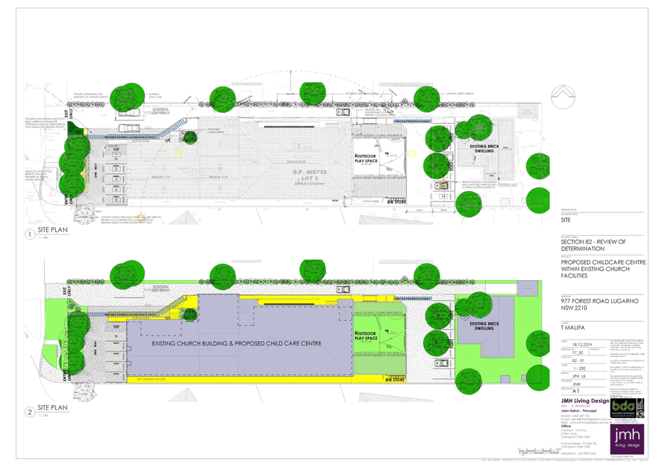
|
Georges
River Council - Georges River Local Planning Panel (LPP) - Thursday, 5 March
2020
LPP007-20 977 Forest Road Lugarno
[Appendix
2] Elevations - 977
Forest Rd Lugarno
|
Page 78
|
|
Georges
River Council – Local Planning Panel Thursday, 5 March 2020
|
Page 79
|
REPORT TO GEORGES RIVER COUNCIL
LPP MEETING OF Thursday, 05 March 2020
|
LPP Report No
|
LPP008-20
|
Development Application No
|
DA2017/0408
|
|
Site Address & Ward Locality
|
655-659 Princes Highway Blakehurst
Blakehurst Ward
|
|
Proposed Development
|
Demolition of all structures, site
consolidation and the construction of shop top housing development including
three (3) retail tenancies and a residential flat building containing a total
of 50 apartments with basement car parking for 118 vehicles, roof top
communal open space and associated site works
|
|
Owners
|
Cro Developments
|
|
Applicant
|
Cro Developments
|
|
Planner/Architect
|
Planning Ingenuity and Peter Dunn
Architects
|
|
Date Of Lodgement
|
14/09/2017
|
|
Submissions
|
Nine (9) submissions to the
original proposal with a submission containing 39 signatures and a further
three (3) submissions to the latest amended plans.
|
|
Cost of Works
|
$20,510,837
|
|
Local Planning Panel Criteria
|
The development falls within the
requirements of State Environmental Planning Policy, Design of Residential
Flat Development. The application has also received more that ten (10) unique
submissions.
|
|
List of all relevant s.4.15
matters (formerly s79C(1)(a))
|
Environmental Planning and
Assessment Act 1979, Environmental Planning and Assessment Regulation 2000,
State Environmental Planning Policy No 55 – Remediation of Land, State
Environmental Planning Policy No 65 – Design Quality of Residential
Apartment Development, State Environmental Planning Policy (Building and Sustainability
Index: 2004), State Environmental Planning Policy (Infrastructure) 2007,
State Regional Environmental Plan No 2 – Georges River Catchment, State
Environmental Planning Policy (Vegetation in Non-Rural Areas) 2017, Draft
Environment State Environmental Planning Policy, Draft State Environmental
Planning Policy –Remediation of Land
Kogarah Local Environmental Plan
2012
Kogarah Development Control Plan
2012
|
|
List all documents submitted
with this report for the Panel’s consideration
|
Statement of Environmental Effects
– Planning Ingenuity Amended Architectural Plans – Peter Dunn and
AssociatesUpdated, Traffic Impact Assessment – Terraffic P/L
Landscape Plan – Stuart Noble
Associates
Ecological Assessment –
Cumberland Ecology
Updated Clause 4.6 Statement
– Planning Ingenuity
|
|
Report prepared by
|
Senior Development Assessment
Planner
|
|
Recommendation
|
That the application be refused in accordance with the
reasons stated in the report.
|
|
|
Summary of matters for
consideration under Section 4.15
Have all recommendations in relation
to relevant s4.15 matters been summarised in the Executive Summary of the
assessment report?
|
Yes
|
|
Legislative clauses requiring
consent authority satisfaction
Have relevant clauses in all
applicable environmental planning instruments where the consent authority
must be satisfied about a particular matter been listed and relevant
recommendations summarised, in the Executive Summary of the assessment
report?
|
Yes
|
|
Clause 4.6 Exceptions to
development standards
If a written request for a
contravention to a development standard (clause 4.6 of the LEP) has been
received, has it been attached to the assessment report?
|
Yes
The
proposal exceeds the height (Clause 4.3 Height of Buildings)
|
|
Special Infrastructure
Contributions
Does the DA require Special
Infrastructure Contributions conditions (under s7.24)?
|
Not
Applicable
|
|
Conditions
Have draft conditions been provided
to the applicant for comment?
|
No
the application is recommended for refusal and the refusal reasons can be viewed
when the report is published.
|
|
Site Plan
The subject site
outlined red
|
Executive Summary
Proposal
1. Council is in receipt of a
development application (DA2017/0408) which originally sought planning
permission for site consolidation and the construction of a part eight (8),
part seven (7) storey mixed use development containing fifty five (55)
apartments, three (3) retail tenancies and basement car parking for one hundred
and twenty one (121) vehicles with access off a new service lane, a rooftop
area of communal open space and associated landscaping and site works at the
subject site being 655-659 Princes Highway, Blakehurst. A photomontage of the
original scheme is shown in Figure 1.
Figure 1: Photomontage of the proposed development as originally
proposed (courtesy Peter Dunn Architects)
2. The proposal has been amended on
two occasions. On 6 June 2019 the Applicant amended the design by reducing the
number of units from fifty five (55) to fifty three (53) with a total reduction
in the overall floor space from 6,663sqm to 6,354sqm to now be compliant with
the maximum FSR of 2.5:1. The design included changes to accommodate the RMS
required road widening acquisition along the Princes Highway. The amendments
included an additional area of rooftop as communal open space, and removed the
two (2) points of access at the rear, making the rear a service lane as the
only point of access. The photomontage of this amended scheme is provided at
Figure 2.
Figure 2: Photomontage of the amended development (first set of
amended plans May 2019) (courtesy Peter Dunn Architects)
3. The first set of amended plans were
reviewed by Council Officers and there were still concerns relating to the
architectural treatment and merit of the building and the amount and degree of
exceedance with the height limit. On 26 September 2019 Council wrote to the
Applicant outlining the main planning and environmental issues which included
the following;
- The
architectural design of the building along Princes Highway required further
refinement and improvement. The enclosure of balconies acting as winter gardens
was considered to add unnecessary visual bulk.
- The Gross
Floor Area (GFA) calculations required to be updated to include enclosed
balcony areas and ensure all areas within the building were included in
accordance with the definition of GFA in the Kogarah LEP.
- The design
of the proposed rear service lane was of concern given its design is not at
grade and its inclusion will remove the existing trees onsite.
- The proposed
removal of the significant and mature trees onsite required further
justification. An Ecological report was required to consider the status of the
Sydney Blue Gum (Eucalytus Saligna) as it could potentially be part of a
threatened and Endangered Ecological Species (EEC).
4. The Applicant made further
amendments to the design and lodged the modified plans on 23 October 2019
(these plans are identified as Issue 3). The changes that have been made
include the following;
o The
height of the building has been reduced by one (1) storey.
o Improving
the appearance and articulation of the building in particular the front
façade facing Princes Highway.
o Increasing
the amount of soft landscaped area within the central courtyard.
o Increasing
the separation distances between the two buildings onsite by increasing the
central area of communal open space.
o Reduction
in the overall density from 53 units to 50 units.
o Reduction
in the GFA to be below the 2.5:1 maximum.
5. The most recent plans are relied on
as part of this assessment. A photomontage of the latest scheme is provided as
Figure 3 below.
Figure 3: Photomontage of the proposed development as recently
amended (October 2019 Issue 3) (courtesy Peter Dunn Architects)
State
Environmental Planning Policy – State and Regional Development 2011 (SRD
SEPP)
6. The proposed development was originally classified as
“Regional” development as it had a Capital Investment Value (CIV)
of $20,510,837. This exceeded the $20 million threshold as outlined in Clause 2
of Schedule 7 of the State Environmental
Planning Policy (State and Regional Development) 2011 for this type of development at the time of lodgement.
The CIV threshold pursuant to the SEPP increased to $30 million on 18 October
2017 as a result of the Environmental Planning and Assessment Amendment Bill
2017 being passed. Given the application was lodged prior to the Bill being
passed the previous CIV provisions applied.
7. However, Planning Circular (PS 10-008) issued 10 May 2010
defines the Capital Investment Value and clearly states that GST is excluded as
part of the CIV. The application was accompanied by a detailed Quantity Surveys
report prepared by MMD Construction Consultants and the total CIV included GST.
By excluding the GST the CIV value of the project will be $18,646,215 which is
below the $20million threshold. As a result the assessment of the application
is therefore delegated to the Local Planning Panel. This was confirmed in
writing by the South Sydney Regional Planning Panel Secretariat on 15 January
2020.
Site and
locality
8. The
subject site comprises of four (4) parcels of land known as 655-659 Princes
Highway, Blakehurst. 655 Princes Highway is legally known as Lot 4 DP13988.
Existing onsite is a two storey commercial/retail brick building with driveway
access along the northern side off the Princes Highway with access to a rear
brick garage. This site is a rectangular shaped allotment with a frontage of
13.41m to Princes Highway, depth of 49.96m and total site area of 673.7sqm.
9. The
Applicant originally relied on an outdated Survey Plan dated 25 February 2013
prepared by Burton and Field Surveyors. Council’s Intramap system
includes an updated Survey Plan prepared by Paul Davis-Raiss, dated 8 August
2018 which was formally registered on 13 September 2018. The Applicant lodged
an updated survey which was amended on 24 October 2018 to capture the proposed
road acquisitions and dedications along the of Princes Highway frontage
required by RMS (refer to Figure 4 below). This survey plan was submitted with
the second set of amended plans which ensured the building is now sited to
consider the RMS road dedication and required works along Princes Highway. The
survey was prepared by Burton and Field and dated 25 February 2013 with the
boundary dimensions adjusted (the survey reference details remained unaltered).
10. The
updated survey is relevant when considering the three (3) allotments known as
659 Princes Highway. These remaining three (3) allotments are known as Lots 29,
30 and 31 in DP1246418 and have respective areas of 654.7sqm, 624sqm and
597sqm. These three allotments have restrictions on their title identifying
parts of the front of the site as an area to be acquired by RMS and dedicated
as public road under Section 10 of the Roads Act, 1993 after any construction
is completed on site. 659 Princes Highway was previously occupied by a Caltex
Service Station however the site has been remediated and a Site Validation
Report accompanies the application. These sites are currently vacant as can be
seen in the site plan.
Figure 4: Extract from the updated survey plan showing the
subject sites (courtesy Burton and Field February, 2013 with updated boundary
dimensions)
11. The
total site area of the subject site is 2,549.4sqm.
12. The
site adjoins smaller scale residential developments to the west; to the east is
Todd Park and a Caltex Petrol Station located on the corner of Princes Highway
and Bunyala Street. To the north are smaller scale two storey retail/commercial
properties fronting Princes Highway with a new seven storey shop top housing
development nearing completion at 621-635 Princes Highway, Blakehurst. To the
south is Church Street Reserve which includes a public car park. The locality
comprises of a mixture of land uses.
Zoning and
Kogarah LEP 2012 (KLEP) Compliance
13. The
site is zoned B2 Local Centre and the proposed “shop top housing”
and “residential flat building” development is permissible pursuant
to the provisions of the Kogarah Local Environmental Plan 2012 (KLEP).
14. The
proposal meets the definition of a “residential flat building”
(RFB) which is “a building containing 3 or more dwellings, but does not
include an attached dwelling or multi dwelling housing” for the rear
section of the development and the front part of the building facing Princes
Highway is defined as “shop top housing” which is defined as
“one or more dwellings located above ground floor retail premises or
business premises”. Both land uses are permissible within the zone. The
proposal also satisfies the objectives of the B2 zone. However the rear RFB
could also be considered as “shop top housing” given that the
building sits above some retail parking and the loading dock area it could be
considered as fulfilling this definition.
15. The
site has a height limit of 21m in accordance with the provisions of Clause 4.3
of the KLEP. The height of the building has been reduced however still exceeds
the height limit. The application is accompanied by a Clause 4.6 Statement
which seeks to justify the exceedance of the control. The variation to the height
control comprises of the lift overrun, pergola feature on the roof, planter
boxes and WC which are structures associated with the rooftop area of communal
open space. A detailed assessment of the Clause 4.6 Statement is provided later
in this report. In summary, the variation is considered to be generally
acceptable however the Clause 4.6 Statement cannot be supported as there is a
lack of appropriate information provided in justifying that the variation
satisfies the objectives of the height control. There is a lack of evidence
produced to ensure there are no amenity impacts generated by the
non-compliance. Unfortunately in this case the Clause 4.6 statement is not
considered to be well-founded.
16. The
floor space ratio (FSR) for the site is 2.5:1 in accordance with Clause 4.4 of
the KLEP. Originally the floor space exceeded the maximum Floor Space Ratio
control. Council clearly stipulated that it will not support any exceedance in
the GFA. The development was modified on two occasions and is now compliant
with the maximum GFA being 2.47:1 which is below the max FSR.
State
Environmental Planning Policy
17. The
proposal has been considered to be satisfactory in regards to the following
policies which have been considered in respect to the application:
· Environmental
Planning and Assessment Act 1979.
· Environmental
Planning and Assessment Regulation 2000.
· State
Environmental Planning Policy No 55 – Remediation of Land.
· State
Environmental Planning Policy No 65 – Design Quality of Residential Apartment
Development.
· State
Environmental Planning Policy (Building and Sustainability Index: 2004).
· State
Environmental Planning Policy (Infrastructure) 2007.
· State Regional
Environmental Plan No 2 – Georges River Catchment.
· State
Environmental Planning Policy (Vegetation in Non-Rural Areas) 2017.
18. A
detailed assessment of the proposal against the provisions of these policies is
provided in the body of this report.
Outstanding
Planning and Environmental Issues
19. At
the time of preparing this report there were a series of unresolved issues and
insufficient information provided in order to assess the proposal. The
following issues remain outstanding;
· Transmission
lines exist at the front of the site along the Princes Highway. These are managed
and owned by State Rail as they are classed as rail infrastructure. State Rail
concurrence is required in accordance with the Infrastructure SEPP to ensure
the location of the building and its design, construction and ongoing use does
not interfere with the operation of these lines. A series of plans, a Blow Out
report, and additional information that was initially required by State Rail
has been submitted for their consideration. As of Thursday 13 February 2020
State Rail provided the Applicant with a register of outstanding matters that
need to be addressed and then re-referred to State Rail’s Engineers to
ensure compliance is achieved. Given the sensitive nature of this matter
concurrence is required prior to determination being issued, given the time
delays to date Council needs to determine the matter.
· Roads and
Maritime Services (RMS) were also notified of the proposed development in
accordance with the provisions of the Infrastructure SEPP as the development
fronts the Princes Highway which is a classified road. RMS have acquired a
small section of the Site for future road widening purposes and have provided
draft plans for the Applicant to include as part of any future design so that
the road widening is catered for. Amended details were submitted to RMS for
their concurrence. To date no response from this agency has been received.
· 659 Princes
Highway was a former service station and the site has, to date, been remediated
and validated. Council’s Environmental Services Unit has confirmed that
the validation and remediation has occurred and is satisfactory. However no
contamination details have been provided for the building and land at 655
Princes Highway which forms part of this development site. In accordance with
the provisions of SEPP 55 a Phase 1 contamination report needs to be prepared
to assess the degree (if any) the site is affected. The report will confirm the
site is clear of any contamination or may require further detailed assessment
to occur. Prior to determination the consent authority needs to be satisfied
that the site is suitable for its intended use. This report has not been
received. Given the length of time the application has been under assessment no
further extensions in time have been provided.
· The Clause
4.6 Statement which was amended and updated in December 2019 to address the
changes in the height and density of the development. The statement is not
considered to be well founded as the statement does not reflect the accurate
variations in the height control and fails to provide a clear, accurate and
supportable argument in respect to degree of non-compliance. The report fails
to justify that the breaches and non-compliance satisfies the objectives of the
height control (Clause 4.3) in KLEP.
· In terms of
the overall built form and massing the most recent design is considered to be
satisfactory and reflect a modern aesthetic that is consistent with the
anticipated form and scale for development in this area. The internal amenity
of apartments is very good and the separation distances between apartments and
neighbouring properties is considered acceptable and reasonable. One area of
concern remaining is the transition of the rear building and its relationship
to the small scale residential buildings to the west.
· Council’s
Landscape Officer is not supportive of the removal of the mature trees that
exist across the site/s and strongly suggests the retention of Trees 1, 4 and
5. There are no solid grounds to support the removal of these trees as they are
in good condition and good vigour, form part of an existing green corridor and
make a significant visual contribution to the streetscape and immediate
surrounds. They also act as a buffer, screen and delineate the transition from
the business zone to the residential zone immediately to the west.
20. Although
the Design Review Panel was not supportive of the original design and first set
of amendments, the Panel wanted to see an alternative built form. They were
critical of the rear service lane and removal of the large Sydney Blue Gum (now
identified as a Flooded Gum) and associated mature vegetation on site. The
Panel felt the performance of the proposed internal communal courtyard would be
poor as it would be largely overshadowed by both buildings. The DRP comments
have been considered in detail and the final design has not been referred to
the Panel as it is felt it still would not adequately address their concerns.
The alternative built form that could be considered would be one single
building on the site which is not considered the best design solution from a
planning and design perspective. The two built forms substantially improve the
amenity of apartments especially fronting Princes Highway as these are dual
aspect apartments with two balconies and acoustic impacts are substantially
improved by this layout and arrangement.
· The overall
design changes to the front façade facing Princes Highway create a more
harmonious and balanced building with strong, defined bays. There are several
additional design changes that could be implemented to improve the aesthetics
and visual appearance of the building and these could be conditioned if consent
was to be granted. These issues are addressed in more detail in the SEPP 65
(ADG Table) section of the report.
Kogarah
Development Control Plan 2013 (KDCP)
21. The
provisions of Part B (General Controls) and Part D1 (Development in the B1
Neighbourhood Centres and B2 Local Centre zones) and Part D2 (Commercial
Locality Guides) are applicable to this development as the site is located
within the Blakehurst precinct. A detailed assessment of compliance with these
provisions is outlined later in this report.
22. The
built form in general is considered to be an acceptable urban design and
planning response for this Site subject to the reconsideration of other issues
(i.e. tree retention and the treatment and transition of the scale and form of
the building at the rear). The proposal generally satisfies the applicable
provisions contained within the Kogarah Development Control Plan (KDCP).
Submissions
23. In
response to the public exhibition period, nine (9) submissions were received,
in addition to a submission containing 39 signatories. The final amended plans
were renotified and generated a further three (3) submissions. The issues
raised in the submissions have been summarised as follows:
· Development
exceeds permitted maximum building height and will establish a poor precedent
for future development. The development is considered to be an overdevelopment
of the site in terms of bulk and scale, and is not compatible with the low
density character of surrounding development.
· The proposed scale
and form of the development will detrimentally affect the small scale
residential properties immediately to the west along Water Street and the
development will overlook and overshadow these neighbouring homes.
· Traffic impacts:
o Significant traffic
impacts will be created by the development on the surrounding road network.
Existing traffic is extremely congested at the Water Street intersection and
the development creating in excess of 121+ vehicles will increase this
congestion and cause significant delays and traffic queuing.
o The traffic report
prepared with the DA is not accurate and has referred to the old petrol station
on the site which has not been in operation for over 10 years.
o The driveway entrance on
Water Street is not located in an appropriate position as traffic is already
queued up in this area in peak hours.
o Water Street is too
narrow to accommodate a development of this scale;
o The development would
impact upon the existing commuter/customer car park on Water Street as there
would be no car parks available as they would be used by residents of the
development;
o That the carpark on
Water Street would be occupied by residents of the development and there would
be no spaces available for customers of the nearby businesses as the Princes
Highway is already a clearway along that section of road;
o That the development
will require the closure of the pedestrian footpath on Princes Highway, how
will customers parking in the Water Street carpark access the business along
Princes Highway – there is no alternative access.
24. These
issues have been addressed in greater detail later in this report.
Conclusion
25. Having
regard to the matters for consideration Section 4.15 and Section 4.16(1)(a) of
the Environmental Planning and Assessment Act 1979 and following a detailed
assessment of the proposed application, DA2017/0408 is recommended for refusal
as insufficient information has been provided. The reasons for refusal are
referenced as the end of this report.
Report in Full
Site and
Locality
26. The subject site comprises of four (4)
allotments which are legally identified as follows;
· 655 Princes Highway – Lot 4 DP 13988
27. This site has an area of 673.7sqm and contains
a traditional two storey commercial brick and fibro building with a detached garage structure at the rear. The
property has a formal driveway along the northern side providing direct
vehicular access to the rear of the site from Princes Highway.
The
site is regular in shape with a frontage of 13.41m to Princes Highway and depth
of 49.96m.
· 659 Princes Highway – Comprises of Lots 29, 30 and 31 in
DP 1246418
28. These
three (3) allotments have respective areas of 654.7sqm, 624sqm and 597sqm. Each
allotment has a restriction on their title identifying
parts of the front of the site as an area to be acquired by RMS and dedicated
as public road under Section 10 of the Roads Act, 1993 after any construction
is completed on site. The proposal has been designed to consider the required
RMS dedications and RMS have confirmed formally that no objection is raised to
the proposed development subject to the imposition of conditions.
29. These
sites are currently vacant (previously the site accommodated a Service Station)
with some small insignificant features on each such as a few low brick
retaining walls. The most significant feature is the Sydney Blue Gum Tree which
I located along the south west corner of the site.
30. Combined the site has a frontage of some
52.08m and varying depths of 47.99m to Water Street and 49.96m along the
northern boundary with a total site area of 2,549.4sqm. The whole site has a
gradual fall from the rear (west) to the front (east) by approximately 2m.
Photo 1: Subject sites when viewed from Water Street
To the east
31. Immediately to the
east of the site is a Service Station located on the corner of Princes Highway
and Bunyala Street, together with Todd Park.
Photo 2: Properties to the east of the site including Todd Park
To the west
32. Immediately to the west are a series of lower
scale residential properties comprising predominantly
of single and two storey dwelling houses and dual occupancy developments.
33. 3, 5 and 7 Water Street are a series of
detached single storey dwelling houses with 1 Water Street located on the corner
of Water and Vaughan Street comprising of a two storey detached dwelling house.
34. The properties along Vaughan Street at the
rear of the subject site being 12, 14 and 16 Vaughan Street comprise of single
storey detached weatherboard cottages.
Photo 3: 5 and 7 Water Street immediately to the west of the
site
To the north
35. Properties immediately to the north comprise
of mixed uses and commercial/retail tenancies which form part of the small
Blakehurst Neighbourhood commercial centre.
36. This small scale centre comprises of a variety
of shops and commercial/retail premises including two storey modern style shop
top housing developments.
37. 621-635 Princes Highway comprises of a newly
constructed and completed seven (7) storey “shop top housing”
development which was approved on 11 May 2017 (DA2016/0157).
Photo 4: 655 Princes Highway and adjoining retail/commercial
properties to the north within the small Blakehurst Commercial centre.
To the south
38. To the south of the
site is Church Street Reserve which includes a designated public car park which
accommodates some thirty (30) car parking spaces that are accessed off Water
Street and Church Street.
Photo 5: Public car parking area to the south with access off
Water Street and Church Street
Photo 6: Church Street Reserve to the south
39. The immediate locality comprises of a variety
and diversity of land uses. The site is well located and accessible to a
variety of large areas of open space including Carss Park and Todd Park and
retail/commercial uses although the neighbourhood centre at present does not
include a shopping centre or supermarket of a viable scale and size to
accommodate the local community.
40. The proposed development includes a large
retail/commercial tenancy which could introduce this land use. Alternatively
the newly constructed shop top housing development at 621-635 Princes Highway
may be able to accommodate or facilitate this use as it seems some of its
spaces are still vacant.
41. The site is within close proximity to bus
stops which provide direct access to the larger commercial centres such as
Hurstville and Kogarah.
Proposal
42. The
amended proposal seeks approval for the amalgamation of the existing sites and
construction of a part six (6) part seven (7) storey “shop top
housing” development and “residential flat building” designed
as two separate built forms containing a total of fifty (50) apartments with
two and a half levels of basement car parking accommodating one hundred and
eighteen (118) car parking spaces, with access off Water Street through a
service lane including roof top communal open space and associated landscaping
and site works at the property known as 655-659 Princes Highway,
Blakehurst.
43. The
proposal has been amended and its design and layout improved. More specific
details of the current design (based on Issue 3 plans) and layout are provided
below.
Lower Basement
Plan
· A total of
fifty eight (58) car parking spaces allocated in the following way;
- 1
x visitor space No.11 which doubles up as a carwash bay.
- 57
x resident spaces (including 2 x accessible spaces, 2 x small car parking
spaces (No.s 111 and 115)
· A designated
motorbike parking area
· Three (3)
lift lobbies
· Garbage and
recycling room
· Four (4) x
Individual storage areas
· Electrical
and plant and pump rooms and
· Fire stairs
towards.
Upper Basement
Plan
· A total of
forty six (46) car parking spaces allocated in the following way;
- 10
x visitor spaces
- 8
x retail spaces
· 28 x
resident spaces (including 6 x accessible spaces)
· A designated
motorbike parking area
· Secure bike
storage room
· Bulky good
storage area
· Rainwater
tank
· Garbage and
recycling room
· Three (3)
lift lobbies
· Seven (7) x
Individual storage areas
· Electrical
and plant and pump rooms and
· Fire stairs.
Ground Floor
Plan
· Vehicular access
off the western side of the site via a newly designed service lane.
· Retail space
No.1 with total GFA of 81sqm
· Retail space
No.2 with a total GFA of 410sqm
· 2 x formal
lift lobbies off Princes Highway
· Loading Dock
with associated garbage holding bay
· Lobby No.3
with access off Water Street
· Stormwater
detention tank
· Bicycle
Parking areas and
· A total of
fourteen (14) car parking spaces allocated in the following way;
- 13
x retail spaces (including 1 x small car space and 1 x accessible space)
- 1
x residential space
Level 1 Plan
· Building 1
(facing Princes Highway)
- 3
x 2 bedroom apartments
- 1
x 3 bedroom apartment
· Retail space
No.3 with access off Water Street and includes a GFA of 35sqm
· Forty one
(41) independent residential storage spaces
· Switch room,
electrical substation
· Three lift
lobbies
· Stormwater
detention tank, switch room and plant rooms and
· Central
courtyard space and landscaped area with direct access off Water Street.
Level 2 Plan
· Building 1
(facing Princes Highway)
- 3
x 2 bedroom apartments
- 1
x 3 bedroom apartment
· Building 2
(rear building)
- 5
x 1 bedroom apartments
- 3
x 2 bedroom apartments
Level 3 Plan
· Building 1
(facing Princes Highway)
- 3
x 2 bedroom apartments
- 1
x 3 bedroom apartments
· Building
2 (rear building)
- 3
x 1 bedroom apartments
- 2
x 2 bedroom apartments
- 2
x 3 bedroom apartments
Level 4 Plan
· Building 1
(facing Princes Highway)
- 3
x 2 bedroom apartments
- 1
x 3 bedroom apartment
· Building 2
(rear building)
- 1
x 1 bedroom apartments
- 3
x 2 bedroom apartments
- 1
x 3 bedroom apartment
· Three (3)
separate garden terraces at the rear.
Level 5 Plan
· Building 1
(facing Princes Highway)
- 3
x 2 bedroom apartments
- 1
x 3 bedroom apartment
· Building 2
(rear building)
- 1
x 1 bedroom apartments
- 1
x 2 bedroom apartments
- 2
x 3 bedroom apartment
Level 6 Plan
· Building 1
(facing Princes Highway)
- 2
x 3 bedroom apartment
· Building 2
(rear building)
- 1
x 1 bedroom apartments
- 1
x 2 bedroom apartments
- 2
x 3 bedroom apartment
Level 7 Plan
· Three (3)
separate of communal rooftop terrace area for common use.
· Photovoltaic
solar panels located on the roof of the rear building.
The proposed
fifty (50) residential apartments comprise the following mix:
· 11 x 1
bedrooms (22%);
· 25 x 2
bedrooms (50%) and;
· 14 x 3
bedrooms (28%)
Statutory framework
Environmental Planning and
Assessment Act 1979 (EP&A) Act 1979
44. The
proposal has been assessed and considered against the provisions of Section
4.15 of the Environmental Planning and Assessment Act 1979 (EP&A Act), the
objects of the EP&A Act, and the principles of ecologically sustainable
development as follows.
Objects of the
EP&A Act
45. Consent
authority is required to consider the objects in Section 1.3 of the EP&A
Act when making decisions under the Act. Council has considered the object of
the EP&A Act in the Table below and is satisfied that the proposal complies
with all objects.
Table 1:
Compliance with the objects of the EP and A Act
|
Objects
of the EP&A Act
|
Proposal
|
Complies
|
|
(a) to promote the social and economic welfare of the community
and a better environment by the proper management, development and
conservation of the State’s natural and other resources
|
The
proposal results in the urban infill development of a “shop top
housing” development and a “residential flat building”
within this neighbourhood business precinct that is currently in a process of
transition to medium density developments.
|
Yes
|
|
(b) to facilitate ecologically sustainable development by
integrating relevant economic, environmental, and social considerations in
decision-making about environmental planning and assessment
|
The
design considers the principles of ESD. The building has been designed to
comply with all BASIX commitments.
|
Yes
|
|
(c) to promote the orderly and economic use and development
of land
|
The
development has been designed to largely satisfy the key planning controls
for this site. The built form as proposed is considered to reflect the
desired future character for development within the locality and for this
precinct, subject to some further design changes and concurrences from
government agencies.
|
Yes
|
|
(d) to promote the delivery and maintenance of affordable housing
|
The
development does not accommodate any affordable housing component as part of
the scheme however it does include a mix of accommodation styles and types
with eleven (11) smaller one bedroom units.
|
Yes
|
|
(e) to protect the environment, including the conservation of
threatened and other species of native animals and plants, ecological
communities and their habitats
|
The
site includes a large and significant Sydney Blue Gum Tree. Although sitting
in isolation on the site it could be considered to be part of the remnant
vegetation and part of the assemblage of trees along Church Street Reserve
and if it forms part of this vegetation then it could be considered to be
part of an EEC as the Sydney Blue Gum Forest is identified as a Threatened
species. The Applicant has been requested to provide an ecological assessment
of this tree and its association with adjoining vegetated areas. This report
is forthcoming.
|
Yes
|
|
(f) to promote the sustainable management of built and
cultural heritage
|
The
Site is not a designated Heritage Item nor is it located within a Heritage
Conservation Area.
|
Yes
|
|
(g) to promote good design and amenity of the built environment
|
This
report assesses the proposal’s design and amenity against SEPP 65, the
ADG Guidelines and KDCP.
Concerns
were raised regarding the design of the original scheme and first set of
amended plans. The massing, bulk, scale and proportions of the building were
considered to be unacceptable. The current set of amended plans (Issue 3
plans) provide more verticality and balanced articulation to the front
façade and reconsideration of the massing and reduction in scale by
reducing the height of the building. This is considered to improve the visual
appearance of the building when viewed from Princes Highway in particular.
|
Yes
|
|
(h) to promote the proper construction and maintenance of
buildings, including the protection of the health and safety of their
occupants
|
The
proposal will achieve this object by complying with Council’s
recommended consent conditions relating to the construction phase of the
development.
|
Yes
|
|
(i) to promote the sharing of the responsibility for
environmental planning and assessment between the different levels of
government in the State
|
The
proposal does not fall into the category of regionally significant
development and therefore the Georges River Local Planning Panel is the
consent authority.
|
Yes
|
|
(j) to provide increased opportunity for community
participation in environmental planning and assessment
|
The
submissions section of this report outlines Council’s public exhibition
of the proposal, including an assessment and consideration of all public
submissions.
The
original plans and final set of amended plans were notified to adjoining
properties in accordance with the advertising and notification requirements
of the KDCP.
|
Yes
|
Section 4.15
Assessment
46. In
accordance with Clause 4.15 of the Act the following assessment has been
conducted;
(1) Matters for consideration—general In
determining a development application, a consent authority is to take into
consideration such of the following matters as are of relevance to the
development the subject of the development application:
(a) the
provisions of:
(i) any
environmental planning instrument
47. The
proposal has been considered under the relevant statutory provisions as per
below:
o Environmental Planning and
Assessment Act 1979.
o Environmental Planning and
Assessment Regulation 2000.
o Greater Metropolitan Regional
Environmental Plan No 2 – Georges River Catchment
o State Environmental Planning
Policy No 55 – Remediation of Land.
o State Environmental Planning
Policy No 65 – Design Quality of Residential Apartment Development.
o State Environmental Planning
Policy (Building and Sustainability Index: 2004).
o State Environmental Planning
Policy (Infrastructure) 2007.
o State Regional Environmental
Plan No 2 – Georges River Catchment.
o State Environmental Planning
Policy (Vegetation in Non-Rural Areas) 2017.
o Draft Environment State
Environmental Planning Policy.
o Kogarah Local Environmental
Plan 2012.
48. The
development has been assessed against these provisions.
Draft
Environment SEPP
49. The
Draft Environment SEPP was exhibited from 31 October 2017 to 31 January 2018.
50. This
consolidated SEPP proposes to simplify the planning rules for a number of water
catchments, waterways, urban bushland, and Willandra Lakes World Heritage
Property. The SEPP’s intent is to create a systematic and integrated
approach for the protection and management of the natural environment across
the State.
51. Changes
proposed include consolidating the following seven existing SEPPs:
· State
Environmental Planning Policy No. 19 – Bushland in Urban Areas
· State
Environmental Planning Policy (Sydney Drinking Water Catchment) 2011
· State
Environmental Planning Policy No. 50 – Canal Estate Development
· Greater
Metropolitan Regional Environmental Plan No. 2 – Georges River Catchment
· Sydney
Regional Environmental Plan No. 20 – Hawkesbury-Nepean River (No.2-1997)
· Sydney
Regional Environmental Plan (Sydney Harbour Catchment) 2005
· Willandra
Lakes Regional Environmental Plan No. 1 – World Heritage Property.
52. The
proposed development will not affect the intentions of the Draft SEPP in
relation to the management and protection of catchments, waterways, bushland or
any protected areas. However, there are a series of mature, established and
significant trees on site that are proposed to be removed and assessment of
their condition and reasoning for their removal needs to be accounted for as
part of this assessment.
53. The
application was accompanied by an Aboricultural Assessment report prepared by
TALC dated 2013. It acknowledged that there are six (6) trees existing on site,
all of which will be affected by the proposed development. Figure 5 below shows
the location of all the existing trees on site.
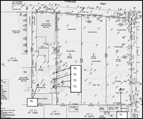
Figure 5: Location and siting of all existing trees on site
(courtesy TALC, April 2014)
54. Tree
No.1 is identified as a Sydney Blue Gum (Eucalyptus saligna) in all
reports. This tree is classified as mature, in fair condition with no diseases
and good vigour. This is a large and significant tree that provides a visual
contribution to the immediate area. Much of the contribution this tree makes is
accentuated by the fact the site is vacant and as such this feature is visually
dominating.
55. The
other five (5) trees on site are clustered and located on 655 Princes Highway.
They include a Cheese Tree (T2) in poor condition, Avocado Tree (T3) in poor
condition, 2 x Lemon Scented Gum Trees (T4 and T5) in fair condition and
achieving heights of approximately 18m and a Mango Tree (T6) which is in poor
condition. The trees that are rated poor are due to the supressed nature of the
trees. The arborist assessment supports the removal of these trees as “it
is considered that the amenity the trees provide is minimised due to the number
of trees present within neighbouring lands and could be replaced through the
replanting of trees, shrubs and ground covers as part of landscape works for
the development”.
56. An
updated Arboricultural Report was provided to Council dated 6 February 2018
prepared by TALC and provided some additional information as to why the Gum
tree cannot be retained. The reasoning is based on the location of the service
lane and basement being too close to the trunk of the tree/s, the Gum tree has
“developed a spreading form due to its open growing location with production of a
predominately horizontal branching habit.
Pruning in
accordance with 4373-2007 “Pruning of Amenity Trees” of the tree to
accommodate the elevation of development would remove 50% of the trees crown
area introducing an imbalance further impacting upon the trees structural
integrity.” The
Arborist also believes the existing green environment will not be adversely
affected by the removal of this tree.
57. Council’s
Landscape Officer has reviewed the Arborist assessments and considered the
visual qualities and character of the Sydney Blue Gum (Eucalyptus saligna)
as significant and the amenity offered by this tree is high. Despite this
species sitting essentially on its own it could form part of a remnant species
as the site adjoins Todd Park and more immediately the Church Street Reserve
which are areas of open space and include a number of trees that look to
include similar species. The Scientific Committee, established by the
Threatened Species Conservation Act, has made a Final Determination to list the
Blue Gum High Forest in the Sydney Basin Bioregion, as a critically endangered
ecological community in Part 2 of Schedule 1A of the Biodiversity Act, and as a
consequence omit reference to the Blue Gum High Forest in Part 3 of Schedule 1
of the Act. Listing of critically endangered ecological communities is provided
for by Part 2 of the Act. This tree may form part of an assemblage of trees
that make up the EEC located at Todd Park or Church Street Reserve. Due to the
potential significance of this tree the Applicant has been requested to prepare
and submit an Ecological report which will detail the importance and provide a
detailed assessment of the tree in respect to its immediate setting and current
condition.
58. Cumberland
Ecology has prepared an Ecological assessment of the proposed tree with their
report dated 7 February 2020. One of the key findings of the report confirms
that the tree in question is not a Eucalyptus saligna (Sydney Blue Gum)
but in fact a Eucalyptus grandis (Flooded Gum). There is a fine distinction
between the two species based on the fruit characteristics. The report states
that the “Eucalyptus grandis (Flooded Gum) is distinct from Eucalyptus
saligna (Sydney Blue Gum) in having fruit with four to five (predominately
five) broad-triangular, incurved valves when dehisced. The latter species
consistently has fruit with four narrow-acuminate, erect valves when dehisced.”
59. The
ecological assessment has made a detailed assessment of the tree and its
immediate environment and made the following conclusions:
· The
tree in question was planted after 1943. In 1943 a structure was located where
the tree now exists (refer to Figure 7 below). It was individually planted.
· This
species is not endemic to the area and occurs more commonly in the North Coast
in taller wet forests or rainforest margins. “As such this species is
not considered to be naturally occurring within the subject land, or the
adjoining Todd Park and Church Street Reserve”.
· OEH
vegetation mapping has mapped an area of the Church Street Reserve as Coastal
Enriched Sandstone Dry Forest. This community is a tall open eucalypt forest
with an understorey of dry sclerophyll shrubs with ferns…it is commonly
encountered on the upper slopes and dry gullies of Sydney Urban Areas.
· Trees
and vegetation within Todd Park comprises of non-endemic species and exotic
species.
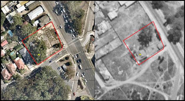
Figure 7: Location and siting of all trees on site as existing
(left) and in 1943 (right) (courtesy Cumberland Ecology, February 2020)
60. Based
on the conclusions of the Ecological assessment the existing tree does not form
part of a Threatened species, namely the Blue Gum High Forest and the tree is
not endemic to the area. Given these findings its removal is warranted and the
provision of a minimum of three (3) street trees along Water Street will
compensate for the loss of some existing vegetation on site.
61. Council’s
Landscape Officer has reviewed this report and all the arboricultural
assessments conducted in association with this application. Like the Design
Review Panel, Council’s Landscape Officer does not support the removal of
several trees across the site and believes the assessments do not adequately
justify their removal. This issue is discussed in greater detail later in this
report however in summary the following concerns are raised;
· The existing
trees on site are in very good condition and good vigour.
· The trees
add to the visual quality and amenity of the streetscape and immediate area.
· The trees
form part of an existing green corridor and canopy linkage.
· There is
limited potential for compensatory planting across the site given the
development will not cater for any substantial deep soil areas.
· Trees No.1,
4 and 5 should be retained and form part of the redevelopment of the site/s.
Greater Metropolitan Regional
Environmental Plan No 2 – Georges River Catchment
62. The
site is within the area affected by the Greater Metropolitan Regional
Environmental Plan No 2 – Georges River Catchment. The proposal,
including the disposal of stormwater, is considered to be consistent with the
Council’s requirements for the disposal of stormwater in the catchment.
The site is not located within a flood prone area.
63. All
stormwater from the development will be managed by the proposed stormwater
system and will be treated in accordance with Council’s Water Management
Policy and would therefore satisfy the relevant provisions of the Deemed State
Environmental Planning Policy – Georges River Catchment.
64. Council’s
Development Engineers have not raised any issues with the proposed method of
stormwater disposal subject to the imposition of standard conditions if
approval is to be granted.
State Environmental Planning
Policy no. 55 – Contamination of Land (SEPP 55)
65. SEPP
55 applies to the land and Clause 7 stipulates that a consent authority must
not consent to the carrying out of any development on land unless it has
considered matters for consideration contained in Clause 7.
66. 659-661
Princes Highway, Blakehurst which comprises of three allotments used to be a
Caltex Service Station and in 2010 the site was formally remediated and site
validation works undertaken by Coffey Environment Pty Ltd. A Site Validation
Report accompanies the site which was prepared by Coffey Environments Pty Ltd
and dated 30 September 2010.
67. Remediation
of the site included the removal of the existing five (5) UST’s,
associated pipework and contaminated soils. Validation of the site was
completed through the collection and laboratory analysis of representative soil
samples from excavation faces, text pits and stockpiled soils. The report
concluded that “the results of the site validation program indicated
that identified soil contamination has been excavated from the site and the
site validated”. Council’s Coordinator Environmental Health is
satisfied with this process.
68. The
process of validation included soils excavated from the site which were
stockpiled and classified to enable either off-site disposal or on-site re-use.
All stockpiled soils were assessed as being suitable for re-use to backfill
excavations on-site. Stockpiles were disposed of as either General Solid Waste
in accordance with the Waste Classification Guidelines (NSW, DECC, 2009)
or disposed of as Hazardous Waste. Imported fill soils were similarly
classified to ensure their suitability on site.
69. In
terms of groundwater, tests found that most concentrations of the contaminants
in the water were within acceptable levels with the exception of traces of
copper and zinc captured in a few monitoring wells. Coffey stated that in
relation to these contaminants “concentrations of copper and zinc are
considered likely to be representative of naturally occurring concentrations in
regional groundwater rather than on-site activities associated with the former
occupation of the site as a service station.”
70. The
report concluded that “based on the results of soil and groundwater
validation works, Coffey Environments considers that the site has been
remediated to a standard which does not prevent the use of the property for any
use expressly permitted under the current zoning of the property which is 3(a)
Business, permitting the development of child care centres.”
71. In
2010 the site was zoned Business 3 (a) - Business (Local Centre) Zone pursuant
to the provisions of the Kogarah Local Environmental Plan 1998. The objectives
of the zone were to “provide opportunities for retail and other
business development and to encourage multi-unit housing to be developed in
conjunction with businesses, where appropriate”. This zone permitted
a variety and mixture of land uses including residential uses, child care
centres and shop top housing. The KLEP 1998 was comprehensively updated in 2012
and the Kogarah LEP 2012 zoned the site B2 Local Centre which is very similar
to the previous Business 3 (a) zone. The validation results would still be
applicable to this zone as similar uses are permissible.
72. 655
Princes Highway includes a two storey traditional commercial building with a
detached brick garage structure at the rear. The historical uses associated
with this site are unlikely to generate any contamination but given it adjoined
a Service Station some contaminants could have infiltrated this site. The
Applicant has approached EI Australia to prepare a Detailed Site Investigation.
On 7 February 2020 correspondence confirms that the preparation of this report
is ongoing and that it is unlikely that the site is contaminated given the
adjoining site has been remediated. At this stage with insufficient information
in relation to this matter it is unclear whether No.655 Princes Highway is
suitable for its intended land use and as such does not satisfy the provisions
and requirements of SEPP 55.
Draft State
Environmental Planning Policy – Remediation of Land
73. The
Department of Planning and Environment (‘DPE‘) has announced a
Draft Remediation of Land SEPP (‘Draft SEPP‘) which will repeal and
replace the current State Environmental Planning Policy No 55—Remediation
of Land (‘SEPP 55‘).
74. The
main changes proposed include the expansion of categories of remediation work
which requires development consent, a greater involvement of principal
certifying authorities particularly in relation to remediation works that can
be carried out without development consent, more comprehensive guidelines for
Councils and certifiers and the clarification of the contamination information
to be included on Section 149 Planning Certificates.
75. Whilst the proposed SEPP will retain the key
operational framework of SEPP 55, it will adopt a more modern approach to the
management of contaminated land.
76. As
discussed above the proposal fails to satisfy the provisions of SEPP 55 and
therefore will also fail to satisfy the provisions of the Draft Remediation of
Land SEPP.
State Environmental Planning
Policy – Building Sustainability Index BASIX– 2004 (SEPP BASIX)
2004
77. The
objectives of this Policy ensure that the performance of the development
satisfies the requirements to achieve water and thermal comfort standards that
will promote a more sustainable development.
78. A
current BASIX (Building Sustainability Index) certificate No.999501M was
prepared and is dated 21 February 2020 which assesses the most recent set of
amended plans (Issue 3) against the provisions of BASIX and found the proposal
to be compliant.
State Environmental Planning
Policy – Infrastructure 2007 (SEPP) Infrastructure 2007
79. The
aim of the Policy is to facilitate the effective delivery of infrastructure
across the State.
Clause 101
(Development with frontage to a Classified Road)
80. Division
17, Subdivision 2 of the Infrastructure SEPP relates to Development that is in
or adjacent to road corridors and road reservations. The Pacific Highway is a
Classified Road and in accordance with Clause 101 concurrence from the Roads
and Maritime Services Authority (RMS) is required.
81. The
original application was referred to RMS and the agency’s initial
response on 24 October 2017 stated that “The subject property is
affected by the proposed Princes Highway from King Georges Road to Torrens
Street Tidal Flow Removal Project, as shown in PINK on the attached Sketch
– "5R4948".
However,
Roads & Maritime would raise no objections on property grounds to the
submitted application provided any new building or structures (other than
pedestrian footpath awnings), together with any improvements integral to the
future use of the site, are erected clear of the land required for road
(unlimited in height or depth).
The submitted proposal does not comply with the Roads and Maritime
requirement that any proposed improvements (including buildings &
structures) in respect of a development application must be clear of the land
required for road (unlimited in height or depth). Roads and Maritime would be
prepared to further consider the subject application upon receipt of amended
plans that clearly show all proposed buildings & structures, together with
any improvements essential to the future use of the site are not within the
land required for a road (unlimited in height or depth).”
82. RMS
have acquired small sections of the front of 659 Princes Highway for road
widening purposes (refer to the most up to date Survey plan provided at figure
4). The original design did not facilitate or include the road dedication. RMS
in its response also provided the applicant with detailed plans of the proposed
road works and associated design that is required to be accommodated by any
development on the subject site (refer to plan at Figure 8).
83. The
most recent amended plans (Issue 3) have included the design changes and
acquisition requirements of the RMS in accordance with their requirements.
These plans were referred to RMS. To date no response has been received and
formal concurrence from RMS is required in accordance with the Infrastructure
SEPP provisions. As such Clause 101 of the Infrastructure SEPP has not been
satisfied.
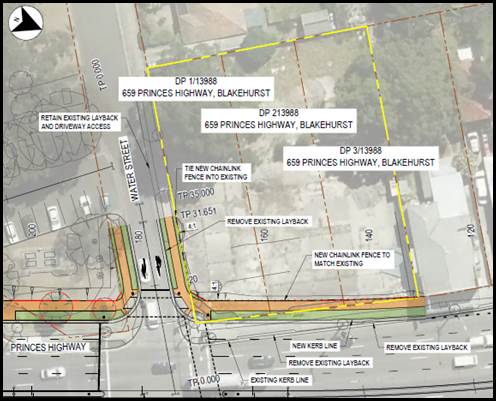
Figure 8: RMS Design Plan for the road dedication at the
subject site (courtesy RMS, 2018)
Clause 102
(Impact of road noise or vibration on non-road development)
84. Clause
102 of the Infrastructure SEPP relates to impact of road noise or vibration on
non-road development. This clause
applies to development for any of the following purposes that is on land in or
adjacent to the road corridor for a freeway, a tollway or a transit way or any
other road with an annual average daily traffic volume of more than 20,000
vehicles (based on the traffic volume data published on the website of RMS) and
that the consent authority considers is likely to be adversely affected by road
noise or vibration on residential accommodation.
85. Princes Highway generates traffic volumes
of over 40,000 vehicles daily near the subject site and as such the development
will need to consider these acoustic impacts. A Noise Impact Assessment was
prepared by Acoustic Logic and dated 4 September 2017. Although the development
scheme has been redesigned the built form and general layout has remained
unaffected and the original acoustic report and its findings is considered to still
be applicable to the currently amended scheme. The main acoustic standards that
need to be met by the development are stipulated in both the KDCP and the
Infrastructure SEPP. Clause 102(3) of the Infrastructure SEPP states the
following;
If the development is for the purposes of
residential accommodation, the consent authority must not grant consent to the
development unless it is satisfied that appropriate measures will be taken to
ensure that the following LAeq levels are not exceeded:
(a) in any bedroom in
the residential accommodation—35 dB(A) at any time between 10 pm and 7
am,
(b) anywhere else in
the residential accommodation (other than a garage, kitchen, bathroom or
hallway)—40 dB(A) at any time.
86. Noise monitoring was conducted on site
with three (3) acoustic monitoring locations selected being one location point
being the closest point along the boundary with 7 Water Street, the front of
the site along the Princes Highway frontage and one central location (refer to
Figure 9 for exact locations). Loggers reported anticipated background noise
impacts (predominantly attributed to traffic noise) exceeding 72dB(A) for a 24
hour period. The report concluded that noise transmission through window and
door openings is the greatest whilst transmission will not be significant
through masonry elements.
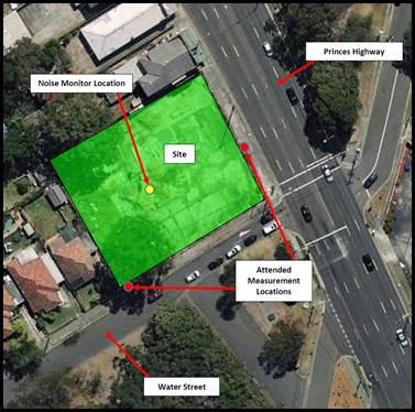
Figure 9: On site noise logger locations (courtesy Acoustic
Logic, 2017)
87. In order for the proposal to comply with
the required standards, some additional construction treatments and finishes will
be required to reduce acoustic impacts internally within apartments.
Construction measures to be implemented include double glazing to windows,
increasing door thicknesses and seals, specific requirements for roof design
and materials. The recommendations of the acoustic report will be included as a
condition if consent was recommended.
88. In relation to mechanical ventilation the
report states that “With respect to natural ventilation of the
dwelling, the NSW Department of Planning document “Development near Busy
Roads and Rail Corridors - Interim Guideline” dictates that:
If internal noise levels with windows or doors open
exceed the criteria by more than 10dB(A), the design of the ventilation for
these rooms should be such that occupants can leave windows closed, if they so
desire, and also to meet the ventilation requirements of the Building Code of
Australia.”
89. On that basis with windows open, the
allowable internal noise goal of 10dB(A) higher than when the windows are
closed is permitted and this translates to an allowable level of 45dB(A) in
bedrooms and 50dB(A) in living rooms. Internal spaces within the rear
building facing Water Street will achieve the levels as these spaces will be
screened and buffered by the front building, however, habitable spaces facing
Princes Highway will exceed the noise limits and will need to rely on
mechanical ventilation. The building has been designed to consider the impacts
of noise from Princes Highway and as a result the Applicant has created
“winter gardens” or enclosed balconies in the form of sunrooms.
90. These spaces adjoin the living room and
bedrooms to some apartments at most levels. These spaces could potentially
improve the internal amenity of spaces within apartments but they will impact
on the visual bulk and appearance of the building when viewed from the Princes
Highway. In addition, these elements need to be included as floor space in
accordance with the Gross Floor Area (GFA) definition within the KLEP. There
are a number of concerns with the design of these areas, namely;
· The enclosed balconies are divided
(partitioned) into two separate spaces being a “winter garden” and
an “enclosed balcony” which reduces the size and limits the
functionality of the space.
· The enclosed balconies become protrusions
to the built form and increase the visual bulk.
· The disadvantage to the design is that
there is additional glazing required and limits the opportunity to have access
to an open style balcony, even if most of the time the internal spaces may rely
on mechanical ventilation. Flexibility in the use of this space is restricted.
· The spaces may assist in improving noise
transmission but the reliance on mechanical ventilation is not reduced by the
implementation of these enclosed balconies.
· Most of the apartments facing Princes
Highway have a dual orientation with a small balcony off the Princes Highway
frontage and the rear of the units looking into the central courtyard.
91. For the reasons noted above, it is not
considered that these design features add value to the design nor do they
improve internal amenity of the apartments. It is suggested if approval is
considered that a condition be imposed that the “enclosed
balconies” are opened up and not enclosed with the winter gardens to
remain. This will further improve the visual appearance of the façade
and create indentations in the building which will reduce the visual bulk and
improve articulation.
92. The noise transmission impacts and
reliance on mechanical ventilation will remain the same as anticipated by the
acoustic report. In order to minimise impacts of noise transmission to
adjoining residential properties to the west, and if the development is
recommended for approval a condition will require the location of mechanical
ventilation to be sensitively sited away from common residential boundaries. In
addition a condition should require validation and certification that the
recommendations of the acoustic report have been implemented prior to the
issuing of an Occupation Certificate.
Clause 103
(Excavation in or immediately adjacent to corridors)
93. The proposed development relies on two levels of basement
parking which amounts to over 6m of excavation along all boundaries. Given the
extent of earthworks, Clause 103 of the Infrastructure SEPP is relevant to
consider. Subclause 2 of the SEPP states that;
“Before determining a development application (or
an application for modification of a consent) for development to which this
clause applies, the consent authority must—
(a) give written
notice of the application to RMS within 7 days after the application is made,
and
(b) take into
consideration—
(i) any
response to the notice that is received within 21 days after the notice is
given, and
(ii) any guidelines
that are issued by the Secretary for the purposes of this clause and published
in the Gazette, and
(iii) any implications of
the ground penetration for the structural integrity of the road or project, and
(iv) any cost implications
for the road or project of the ground penetration.
(3) The consent authority
must provide RMS with a copy of the determination of the application within 7
days after the determination is made.”
94. RMS has not provided formal concurrence to the development
and to date the proposal fails to satisfy Clauses 101 and 103 of the
Infrastructure SEPP.
Clause 86 (Excavation in, above, below or adjacent to rail
corridors)
95. Whilst the development is not adjoining a rail corridor in
accordance with Clause 86 of the Infrastructure SEPP it adjoins rail
infrastructure and assessment in accordance with Clause 45 is required.
96. This section of the Princes Highway includes a 33kV High
Voltage Aerial Transmission Line which immediately adjoins the proposed
development and is operated by RailCorp.
97. RailCorp has provided State Rail with delegation to act as
the electricity supply authority and to process the review for this development
application which adjoins the rail electricity power line. State Rail required
the following information from the Applicant;
· Cross Section drawing showing the proposed development in relation
to the Sydney Trains electrical asset, including: ground surface, sub soil
profile, electrical asset (High Voltage aerial line/conductors and pole);
proposed basement excavation and structural design. All horizontal and vertical
measurements must be accurate to Sydney Trains satisfaction.
· Pending review of the above cross section, Sydney Trains
may also require a blow-out report for review. The blow-out report must show
the proposed development in relation to the Sydney Trains electrical asset, blow-out
design and calculations, and compliance with all relevant Safety and Electrical
Standards including AS7000 and ISSC 20, Work Cover requirements and the Safe
Approach Distances (SADs) in the Sydney Trains Document titled
“SMS-06-GD- Working Around Electrical Equipment”. In addition, the
report must take into account the construction methodology for the proposed
development, including unloading of building materials and/use of equipment.
98. The Applicant provided the additional information to satisfy
State Rail standards and therefore should not adversely impact upon the
electrical asset. However, to date their concurrence has not been received and
therefore the proposal does not satisfy the provisions of Clause 86 of the
Infrastructure SEPP.
99. On the 4
February 2020 State Rail confirmed that they were still in the process of
assessing the information. The one issue State Rail raised was the scheduling
of proposed construction works at the site and timing of the RMS Tidal Flow
road works. If HV (high voltage) lines are still active when works are
to begin on site that will influence the need for any isolation of the Sydney
Trains/RailCorp lines. If the lines are already removed by RMS when the
development site works begin, then there is no need for isolation. Further correspondence received by Council on 6 February
and on 13 February 2020 confirmed State Rail has progressed the
matter, however are waiting on the Applicant to address the additional plans
and documentation that is required.
100. To date no conditions or formal concurrence has
been provided. Given the technical issues, concurrence in this case cannot be
assumed.
Subdivision 2 Development likely to affect an electricity
transmission or distribution network
101. Clause 45 of the Infrastructure
SEPP applies to development that “involves penetration of ground
within 2m of an underground electricity power line or an electricity
distribution pole or within 10m of any part of an electricity tower or within
or immediately adjacent to an easement for electricity purposes (whether or not
the electricity infrastructure exists), or immediately adjacent to an
electricity substation, or within 5m of an exposed overhead electricity power
line”
102. The application was
referred to Ausgrid for comment in accordance with the requirements of Clause
45(2) of the Infrastructure SEPP. On 13 October 2017 Ausgrid raised
objection to the proposed development on the following grounds;
“Proximity to Existing Network Assets -
Overhead Powerlines
There are existing overhead electricity network assets in Princes
Highway and Water Street.
The proposed awning over the Princess Hwy footpath area extends into
Ausgrid’s pole allocation area. The drawing shows the awning as being cut
out around the existing poles however; when these poles need to be replaced the
new pole is typically replaced approximately 2m away from the existing pole in
the same alignment. The proposed awning will significantly impact on Ausgrid's
ability to replace these poles when required.
Safework NSW Document – Work Near Overhead Powerlines: Code of
Practice, outlines the minimum safety separation requirements between these
mains/poles to structures within the development throughout the construction
process. It is a statutory requirement that these distances be maintained
throughout construction. Special consideration should be given to the
positioning and operating of cranes and the location of any scaffolding.
The “as constructed” minimum clearances to the mains
should also be considered. These distances are outlined in the Ausgrid Network
Standard, NS220 Overhead Design Manual.
The proposed development may encroach the statutory clearances of
nearby powerlines as per the requirements set out in AS7000 and Ausgrid
Standard NS220.
The developer is required to either:
• Engage an Accredited
Service Provider Level 3 (ASP3) to confirm that the development does maintain
the statutory clearances to the powerlines (this must include wind impacts), or
• Make suitable
arrangements to have powerlines relocated so that statutory clearances are not
encroached.”
103. In order to address and satisfy Ausgrid
requirements, the overhead power lines would require relocation to allow for
minimum safety clearances and sufficient clearance distances will need to be
maintained in perpetuity. The Applicant has prepared a report by a Level
3 service provider (Shelmerdines) which states that State Rail power lines and
Ausgrid power lines are to be located below ground. Although it seems that the
revised layout will not impact on the location of the one existing Ausgrid pole
at the northern end of the sites and the proposed setback from this pole and
cabling comfortably exceeds Ausgrid’s requirements. Formal confirmation
that this arrangement is satisfactory from Ausgrid has not been received.
State
Environmental Planning Policy – Vegetation in Non-Rural Areas 2017
(Vegetation SEPP)
104. The State Environmental Planning Policy
(Vegetation in Non-Rural Areas) 2017 replaces Clause 5.9 of KLEP 2012
(Preservation of Trees and Vegetation).
105. The intent of this SEPP is “to protect the biodiversity values of trees and other
vegetation in non-rural areas of the State, and to preserve the amenity of
non-rural areas of the State through the preservation of trees and other
vegetation”.
106. The tree initially identified as a Sydney Blue Gum
tree which has since been formally identified as a Flooded Gum by the
Ecological Assessment confirmed that this tree is not a threatened or
endangered species (EEC).
State Environmental Planning
Policy No. 65 – Design Quality of Residential Flat Buildings (SEPP 65)
107. SEPP 65 is applicable to the proposed development
and the extent to which the proposal complies with the controls and principles
of the SEPP and the Apartment Design Guide are outlined in the tables below.
Table 2: Compliance with Part 1 -
Application of SEPP 65
|
Clause
|
Standard
|
Proposal
|
Complies
|
|
3. Definitions
|
Complies with definition of
“Residential Apartment Development” (RAD) and “Shop top
housing”
|
The proposed development complies
with the definitions.
|
Yes
|
|
4. Application of Policy
|
Development involves the erection
of a new RFB, shop top housing or mixed use development of (at least 3
storey’s and the building contains more than 4 dwellings)
|
The proposal is for the erection of
a new residential flat building and shop top housing development which
satisfies the definition of the policy.
|
Yes
|
|
5. Development Applications
|
Design verification statement
provided by qualified designer
Registered Architect Name and
Registration No.
|
A Design Verification Statement has
been provided by Registered Architect Peter Dunn (Nominated Architect
No.4470).
|
Yes
|
108. Council’s Design Review Panel considered the
original design on the 17 November 2017 and later reviewed the first set of
amended plans at its meeting held on 12 September 2019.
109. The Panel raised concerns regarding the design and
built form of the development on both occasions. A detailed Request for
Information (RFI) letter was sent to the Applicant on 24 September 2019
highlighting outstanding design issues focusing on the need to address the
visual appearance and improve the design of the building.
110. Other issues raised included the non-compliance
with the height and it was made clear that Council cannot support the degree of
non-compliance and that the bulk and scale of the development needs to be
reconsidered. In addition, the Applicant was requested to address the issue of
removing the Sydney Blue Gum Tree (as it was identified at the time) and to
outline the intention and purpose of the proposed Service Lane.
111. The Applicant modified the proposal and the final
set of amended plans were not presented to the Design Review Panel (DRP) as the
plans did not alter the built form and massing of the development and therefore
did not address the main concerns of the Panel. It is Council’s assessing
staffs opinion that the current plans improve the overall appearance and
presentation of the building and reasonably address the issues of statutory
non-compliance. Table 3 below summarises the DRP comments. Comments in
italix reflect the Panel’s initial comments and those in bold reflect the
Panel’s comments in regard to the first amended scheme.
Table 3: Compliance with Part 2 - Design
Quality Principles under SEPP 65
|
Principle
|
Panels Comments
|
Council’s comments
|
|
Context and Neighbourhood
character
Good design responds and contributes to its context.
Context is the key natural and built features of an area, their relationship
and the character they create when combined. It also includes social,
economic, health and environmental conditions.
Responding to context involves identifying the desirable
elements of an area’s existing or future character. Well-designed
buildings respond to and enhance the qualities and identity of the area
including the adjacent sites, streetscape and neighbourhood.
Consideration of local context
is important for all sites, including sites in established areas, those
undergoing change or identified for change.
|
The
proposal is for a major mixed use development of eight (8) levels to the
highway and six (6) levels Water Street and the rear of the site. The form of
the proposal creates a very substantial building element which in future will
be replicated to some degree on nearby sites along the highway.
The
building form fits more comfortably with the highway frontage than the
adjacent sites on Water Street. A central courtyard with perimeter
development is proposed. The courtyard itself is highly complex in its
planning and would provide visual amenity, but very limited use as a communal
space. The proponent argues that adequate levels of solar access can be
provided to all units.
The
proposal has been resubmitted with an increased setback to the Princes
Highway. This impacts significantly on the courtyard which is greatly
reduced in width, especially at its southern end. Now, the proposal is
plagued by building separation and privacy issues across an inadequately
sized courtyard and to sites on the west. Together with the issues around the
aforementioned trees and unresolved lane proposal, the proposed courtyard typology
appears not to work. The Panel recommends that alternative built form
options are investigated.
As
proposed development largely complies with the LEP height control except for
the corner element which exceeds the control, but is considered to be acceptable
due to lack of offsite impacts.
It
appears that the 8 storey “corner element” now extends for
roughly 70 percent of the Princes Highway elevation. This is not
acceptable to the Panel.
In
order to address the major concerns (tree retention and vehicle access in
particular) it would be necessary to address the following:
· Retention of at least the most significant tree adjacent to Water
Street
· Provision of service access from service lane (possibly with
turntable), rather than as proposed from Water Street
· Provision of parking access either from dedicated service lane or
from Water Street north of the tree to be retained
· Possible relocation of units lost due to tree retention to the
east corner of Water Street and the highway (this will cause penetration
through the height plane, however it is considered that no unacceptable
impacts should result)
· The RMS requires an increased setback to the highway from the
corner Water Street. This needs to be clearly understood and complied with.
· Access to roof top communal space from all buildings (see
· comments below under ‘Social issues’ and
‘Landscape’)
In
order to resolve these issues it is considered that some additional height in
excess of the LEP height control would be reasonable on the highway frontage
block, provided that other issues are resolved and the design complies with
the FSR control.
These issues
have not been adequately addressed and require resolution as set out above.
|
On both occasions
the Panel felt that the proposed built form which proposes two distinct
buildings separated by a central courtyard is not considered to be an
appropriate design solution for the site and an alternate built form should
be investigated.
An alternative
design could be to create one traditional building at the site similar to the
form reflected at 621-635 Princes Highway (north of the site). The built form
at this site is one L-shaped building with a rear area of open space. This
site has the benefit of three road frontages and adjoins a laneway to the
rear which provides additional separation distances.
The proposed
building form is considered to be a reasonable design response for this site
as it creates a rear service lane which could provide benefits for the future
redevelopment of sites to the north and the central courtyard establishes
apartments with a dual aspect and will have better amenity than single aspect
apartments especially fronting the Princes Highway.
The issue of tree
retention has been addressed earlier in this report. The Panel on two
occasions have accepted additional height along the corner of the site
however the exceedance in the height of habitable areas is not supported by
Council Officers and the Applicant has amended the design and reduced the
height and scale so that the encroachment is minimal and only affects the
lift overrun and the roof top area of communal open space.
The Panel also
requested the retention of the existing significant trees. Council’s
Landscape Officer has assessed and considered the condition of the trees. It
is agreed that the trees are attractive and significant. Council’s
Landscape Officer does not support the removal of a series of trees across
the site.
The Panel
suggested that to address some of the issues some additional height may be
able to be captured. Council Officers do not encourage the utilization of any
additional height for habitable areas. The latest amended design reduces the
height of the development and now the only encroachments are the lift
overruns and some areas of communal open space located on the roof.
The proposed
service lane has been retained and could offer an alternative point of access
to properties further to the north and remove access off Princes Highway.
The latest plans
aim to address and satisfy the RMS and State Rail requirements.
Access to rooftop
open space is provided at both buildings and every central lobby area
provides access to the roof.
|
|
Built Form and Scale
Good design achieves a scale, bulk and height appropriate
to the existing or desired future character of the street and surrounding
buildings.
Good design also achieves an appropriate built form for a
site and the building’s purpose in terms of building alignments,
proportions, building type, articulation and the manipulation of building
elements.
The appropriate built form
defines the public domain, contributes to the character of streetscapes and
parks, including their views and vistas, and provides internal amenity and
outlook.
|
The
proposal is for a major mixed use development of eight (8) levels to the
highway and six (6) levels Water Street and the rear of the site. The form of
the proposal creates a very substantial building element which in future will
be replicated to some degree on nearby sites along the highway.
The
building form fits more comfortably with the highway frontage than the
adjacent sites on Water Street. A central courtyard with perimeter
development is proposed. The courtyard itself is highly complex in its
planning and would provide visual amenity, but very limited use as a communal
space. The proponent argues that adequate levels of solar access can be
provided to all units.
The
proposal has been resubmitted with an increased setback to the Princes
Highway. This impacts significantly on the courtyard which is greatly reduced
in width, especially at its southern end. Now, the proposal is plagued
by building separation and privacy issues across an inadequately sized
courtyard and to sites on the west. Together with the issues around the
aforementioned trees and unresolved lane proposal, the proposed courtyard
typology appears not to work. The Panel recommends that alternative
built form options are investigated.
As
proposed the development complies with the LEP height control except for the
corner element which exceeds the control, but is considered to be acceptable
due to lack of offsite impacts.
It
appears that the 8 storey “corner element” now extends for
roughly 70 percent of the Princes Highway elevation. This is not
acceptable to the Panel.
In
order to address the major concerns (tree retention and vehicle access in
particular) it would be necessary to address the following:
· Retention of at least the most significant tree adjacent to Water
Street
· Provision of service access from service lane (possibly with
turntable), rather than as proposed from Water Street
· Provision of parking access either from dedicated service lane or
from Water Street north of the tree to be retained
· Possible relocation of units lost due to tree retention to the
east corner of Water Street and the highway (this will cause penetration
through the height plane, however it is considered that no unacceptable
impacts should result)
· The RMS requires an increased setback to the highway from the
corner Water Street. This needs to be clearly understood and complied with.
· Access to roof top communal space from all buildings (see comments
below under ‘Social issues’ and ‘Landscape’)
In
order to resolve these issues it is considered that some additional height in
excess of the LEP height control would be reasonable on the highway frontage
block, provided that other issues are resolved and the design complies with
the FSR control.
These issues
have not been adequately addressed and require resolution as set out above.
|
The increased
setback to Princes Highway has been required by the RMS who have acquired a
section of the front of the site for road widening. The amended plans reflect
the requirements of the RMS.
The central
courtyard is irregular in shape with the central section achieving an average
separation distance of some 9m with a lesser separation distance at the entry
to this space between Lobby 2 and 3 of some 6m.
Further to the
north this area opens up to become larger and have a separation distance of
over 12m. This is generally considered acceptable as the perspective of the
space opening up to the north will provide a greater sense of space and
separation. The intention is to landscape this area and create an attractive
space with mounds and planter boxes as well as seating and a large water
feature. Despite the separation distances being less than the 12m requirement
along the southern side this space is still functional and the units have
been designed so there is no opportunity for overlooking between units.
The Panel
supported an exceedance in the height of the building however Council
Officers will not support any habitable area above the height limit. The
current amended plans have removed a level of the building and this involves
deleting three (3) apartments. This reduces the physical scale and height of
the building and now only the lift overruns exceed the height.
In respect to the
proposed service Lane, the Applicant has justified its design and purpose for
the following reasons;
· It aims to assist in facilitating the future redevelopment of
sites that are isolated and have no rear lane access to the north.
· Alternate access to the basement can be provided and the retention
of the tree achieved however the access point would be sited closer to the
east and this could affect the intersection with Princes Highway. The access
point would be located too close to the intersection and queuing and
conflicts could occur.
Communal open space on
the roof has been integrated as part of the most recent changes.
|
|
Density
Good design achieves a high level of amenity for
residents and each apartment, resulting in a density appropriate to the site
and its context.
Appropriate densities are consistent with the
area’s existing or projected population. Appropriate densities can be
sustained by existing or proposed infrastructure, public transport, access to
jobs, community facilities and the environment.
|
The density as
proposed is marginally above the LEP 2.5:1 control. This needs to be reviewed
in the context of addressing the recommendations above.
With the
required RMS setbacks and complex challenges raised by the existing trees and
the rear lane it appears that the density proposed is not able to be
achievable on the site.
|
The current amended plans
have reduced the density of the development and removed a further three (3)
apartments which existed on the top level of the building. The GFA
calculation has been confirmed and the development in its amended form
complies with the maximum FSR of 2.5:1 with a GFA of 6,294sqm which amounts
to an FSR of 2.47:1. This calculation includes the winter gardens and
enclosed balconies.
|
|
Sustainability
Good design combines positive environmental, social and economic
outcomes.
Good sustainable design includes
use of natural cross ventilation and sunlight for the amenity and liveability
of residents and passive thermal design for ventilation, heating and cooling
reducing reliance on technology and operation costs. Other elements include
recycling and reuse of materials and waste, use of sustainable materials and
deep soil zones for groundwater recharge and vegetation.
|
Subject to BASIX, however it is expected that a development of
this scale would exhibit best sustainability initiatives including:-
· Rainwater harvesting and reuse
· Deep soil planting
· Solar energy capture
· Reuse of stormwater from toilet flushing
It is noted by
the Panel that the revised proposal is liable to create a very dark courtyard
with limited amenity and/or landscape potential. The proposal does
however provide useful roof top communal open space and solar collectors on
one of the buildings.
The scheme does
not retain the significant existing trees which is very negative
environmental outcomes.
|
The proposal
includes an updated BASIX Certificate which confirms compliance.
The latest set of
amended plans have significantly improved the environmental outcomes and
improved sustainability for the future of the scheme by including a series of
photovoltaic solar panels on the roof.
The Applicant has
justified why it is impossible to retain the trees on the site. A significant
TPZ would need to be included which would render the site undevelopable and
the majority of the trees on site are not considered to be in good condition.
The provision of a minimum three (3) street trees along Water Street as part
of the development would improve the streetscape outcome.
A rainwater reuse
tank is designated within the upper basement in the north-western side of the
basement area.
|
|
Landscape
Good design recognises that together landscape and
buildings operate as an integrated and sustainable system, resulting in
attractive developments with good amenity. A positive image and contextual
fit of well-designed developments is achieved by contributing to the
landscape character of the streetscape and neighbourhood.
Good landscape design enhances the development’s
environmental performance by retaining positive natural features which
contribute to the local context, coordinating water and soil management,
solar access, micro-climate, tree canopy, habitat values and preserving green
networks.
Good landscape design optimises useability, privacy and
opportunities for social interaction, equitable access, respect for
neighbours’ amenity and provides for practical establishment and
long-term management.
|
The site design
has ignored the constraint presented by the existing mature trees on the
site. These trees appear, upon limited visual inspection, to be healthy. They
make a strong contribution to the visual environment and would offer
significant amenity to residents if retained, especially in the context of a
busy highway. The trees also contribute to level of canopy cover which
delivers a variety of benefits to the environment both above and below ground
and the deep soil area required to retain these trees is valuable both on
site and beyond the site itself. The trees will help mitigate the scale of
the building to the west where it interfaces with a lower density residential
area, as well as contribute to solar passive performance by providing shade.
In the case where the adjoining sites are developed, retention of the trees
will provide a visual buffer and separation. It is critical to develop
environmentally responsible design options to retina these trees.
This is the
critical issue that has not been addressed in the site planning or building
design. As noted above, this requires an alternate building form to at
a minimum retain the 3 very large existing site trees as noted in
“context”.
Likewise, the
design must consider the likely form, habit and soil requirements of street
trees as they mature and this must be accommodated in the design. For
example, awnings must have sufficient cut-out, space must be allowed to
accommodate tree guards without impacting pedestrian movement, conflict with
other street elements must be minimised and the trees must be located in a
position that maximises available soil volume and passive watering.
The current
built form significantly impacts on capacity to provide adequate space for
street trees. The awning could be largely removed / reduced on Water
Street and set back on the Princes Highway to allow for tree growth.
The communal
open space on level one is inadequate for a development of this scale.
Its long narrow layout limits capacity for use and will create privacy
issues. It may also be noisy and could be largely overshadowed with
future development.
There is an
excellent opportunity to create a high quality communal open space with deep
soil that retains the existing site trees on the rear of the site. This
would contribute significantly to the amenity for residents, as well as
supporting wider neighbourhood.
|
The Panel in their
comments acknowledged that large, mature street trees could be introduced
which will improve the visual appearance of the development whilst creating a
greener streetscape. If consent is recommended a condition will require the
implementation/integration of a minimum four (4) street trees along Water
Street.
There is scope for
street trees along Princes Highway is limited given that this roadway is
under the jurisdiction of RMS a condition could include the provision of a
minimum 4 street trees to be planted along this side subject to the type,
style, form and location satisfying relevant government agencies i.e. State
Rail and Roads and Maritime Services if approval is recommended.
The Panel raised
concerns regarding the potential for overlooking between apartments. It is
acknowledged that there may be some overlooking between units but on the
whole the design has limited and reduced this impact through window openings,
room location and layout and balconies being offset so that living spaces
don’t overlook each other.
Issues outlined by
the Panel in relation to the type, style form and design of awnings along
Water Street and Princes Highway can be conditioned appropriately to ensure
they satisfy Council’s requirements.
|
|
Amenity
Good design positively influences internal and external
amenity for residents and neighbours. Achieving good amenity contributes to
positive living environments and resident well being.
Good amenity combines appropriate room dimensions and
shapes, access to sunlight, natural ventilation, outlook, visual and acoustic
privacy, storage, indoor and outdoor space, efficient layouts and service
areas and ease of access for all age groups and degrees of mobility.
|
Generally
well considered. The impact of the highway in relation to noise and pollution
is a major challenge which has been addressed by way of glazing and louvers
to the balcony facades. This should in principle resolve concerns with the
exception that this then will necessitate mechanical ventilation to bedrooms
fronting the highway. Other options should be explored, for example it may be
that acceptable acoustic conditions could be a result - at least at upper
levels - if adequate acoustic treatment were to be provided to balcony
soffits and end walls. Note that the use of louvres to enclose private open
spaces for the purpose of sound attenuation SHOULD NOT result in enclosed
balconies being included in floor space calculations.
The
Panel has concerns about the design and program for the central courtyard
communal open space and recommends that adequate communal spaces be provided
as roof terraces accessible from each block.
While
roof terraces have been provided, the courtyard has now been reduced in width
and has become a space that is liable to be dark and overshadowed. The
building separation across this space is also compromised and is liable to
lead to a poor residential outcome.
The
communal space program must include recreational opportunities for children
and families. This area should include shade, change facilities and elements
that engage children such as pattered paving, interactive elements and areas
where a scooter or similar could be used (not necessarily fixed play
equipment). Passive surveillance and safety in design must be considered.
This
should be provided at roof level. As noted above, there is capacity to
provide a landscape garden incorporating remnant trees for communal outlook
and amenity at ground level.
|
The Panel was concerned about the
design of apartments facing Princes Highway and the impact of noise for
internal areas.
Most apartments that are located
along the Princes Highway frontage have been well designed as dual aspect
apartments and include winter gardens/partially enclosed balconies which will
mitigate traffic and noise from the highway. As previously discussed the
proposed “enclosed balconies” along the Princes Highway frontage
are proposed to be “opened up” if approval is recommended. This
will still allow for the winter gardens to exist Despite the
Panel’s recommendations not to include enclosed balconies in the GFA
both the winter gardens and enclosed gardens have been included as per the
definition. The GFA definition in the KLEP does not offer flexibility in its
calculation. If the enclosed balconies are opened up they will be excluded
for the calculation and the FSR will be further reduced.
Although the central courtyard
isn’t very large, it offers a secondary space for some passive
recreation and also allows for a green space that will improve the visual
connection of the built forms on site. Communal open space has been
integrated on the roof level which will also improve the amenity of the
development for future occupants.
|
|
Safety
Good design optimises safety and security within the
development and the public domain. It provides for quality public and private
spaces that are clearly defined and fit for the intended purpose.
Opportunities to maximise passive surveillance of public and communal areas
promote safety.
A positive relationship between public and private spaces
is achieved through clearly defined secure access points and well-lit and
visible areas that are easily maintained and appropriate to the location and
purpose.
|
Acceptable.
The “rear
lane” is in fact an open sunken driveway lacking in activation or
passive surveillance. Therefore, this space could become an unsafe
environment.
|
The proposed rear lane will act as
a service lane. It is functional and could create benefits for future
development to the north which could link up and connect to this roadway.
The entry to the lane is at grade
from Water Street; however it then ramps down so as to connect to the
basement parking levels.
Objection has been raised in
relation to the subterranean nature of the lane. The siting of the lane will
still allow for the redevelopment of the adjoining sites which could have
their basement levels connecting through to this lane.
If approval is granted a condition
will be required so that the laneway will become an easement for access and
in future will allow for the potential connection for development further to
the north.
It is not proposed as a laneway
dedicated to Council.
|
|
Housing Diversity and Social
Interaction
Good design achieves a mix of apartment sizes, providing
housing choice for different demographics, living needs and household
budgets.
Well designed apartment developments respond to social
context by providing housing and facilities to suit the existing and future
social mix.
Good design involves practical and flexible features,
including different types of communal spaces for a broad range of people and
providing opportunities for social interaction among residents.
|
Appears
appropriate in relation to the residential units.
Toilets will
need to be provided to serve ground floor commercial tenancies.
The design of
communal open spaces will require reconsideration. It is recommended that two
(2) separate spaces be provided serving the northern and southern blocks
respectively and accessible directly by lifts from those blocks. Each should
be provided with attractive landscaped deck/terrace, small enclosed space
fitted with kitchenette and toilet, and a children’s play space.
See notes
above.
|
The building has been designed to
include a diversity of apartment types, forms and styles. No affordable
housing is proposed.
|
|
Aesthetics
Good design achieves a built form that has good
proportions and a balanced composition of elements, reflecting the internal
layout and structure. Good design uses a variety of materials, colours and
textures.
The visual appearance of a well-designed apartment
development responds to the existing or future local context, particularly
desirable elements and repetitions of the streetscape.
|
It is suggested
that the large relatively bland façade to the highway be further
articulated to express inherent structure, and as well include some
additional variation in colours and finishes.
While the
aesthetic presentation of the building is promising, a substantial number of
issues described above must be resolved before its aesthetics can be
substantially addressed.
|
The Applicant has substantially
improved the front façade and dominant elevation to Princes Highway.
Council Staff was concerned about
the visual bulk of the building and the undefined bays. Council Staff felt
the façade wasn’t well articulated and could be improved by
creating better defined recessive elements, and by reducing the number of
enclosed balconies.
The modified scheme has created
distinct ‘broken up’ vertical bays or wings with the sections
being defined with varying materials, colours and finishes.
|
112. The proposal has been amended to create a more
reasonable planning and design response for the Site. The issue of the service
lane, its functionality and design is discussed in more detail in the section
of the assessment against the provisions of the KDCP.
Consideration of Apartment Design
Guide (ADG) under Clause 30 of SEPP 65
Table 4:
Compliance with Design Provisions in Part 3 and Part 4 of the ADG
|
Clause
|
Standard
|
Proposal
|
Complies
|
|
Part 3 – Siting the
development
|
|
3D-1
Communal and public open space
|
1. Communal open space has a
minimum area equal to 25% of the site.
-Where it cannot be provided on
ground level it should be provided on a podium or roof
-Where
developments are unable to achieve the design criteria, such as on small
lots, sites within business zones, or in a dense urban area, they should:
• provide
communal spaces elsewhere such as a landscaped roof top terrace or a common
room
• provide
larger balconies or increased private open space for apartments
• demonstrate good proximity
to public open space and facilities and/or provide contributions to public
open space
2. Developments achieve a minimum
of 50% direct sunlight to the principal usable part of the communal open
space for a minimum of 2 hours between 9 am and 3 pm on 21 June (mid-winter)
|
There are two areas of communal
open space within the development;
i) Central
Courtyard – 400sqm.
ii) Roof
top area of open space – 3 separate areas totalling 395sqm.
The total area of communal open
space is around 795sqm which amounts to 30%.
The central courtyard includes
seating and planting and a water feature. The roof top areas of open space
also includes seating and planting as well as a WC.
There is a bridge at the roof level
which connects the rear building to the area of roof top communal open space
at the front (and vice versa).
It is recommended that this bridge
element be removed and the buildings read as two (2) independent/separate
built forms when viewed from the southern side if approval was recommended.
There is no need for the connection as every building has its own designated
roof top area of open space.
A condition would ensure that each
space on the roof includes some seating. A WC is provided on communal roof
terrace No.2 and all residents should be able to access this space (via Lobby
2) if they utilise the area for a longer period of time. Providing WC’s
in the other spaces is not encouraged as it would add undue bulk to the roof
space.
The landscape plans prepared by
Stuart Noble (refer to Fig 10) show well designed landscaped areas within the
development that would be visually attractive. The provision of larger
planter boxes in the central courtyard should be able to cater for larger
trees within this space. Conditions could be imposed to ensure the courtyard
includes mature trees if the application was to be supported. The rooftop
areas of open space will receive full solar access throughout the day.
All roof top areas of open space
will receive very good solar access given their elevated location and
orientation.
|
Yes
|
|
3E-1
Deep Soil Zones
|
1. Deep soil zones are to meet the
following minimum requirements:
Where the site is between 650sqm -
1500sqm = 3m minimum dimension
Deep soil = 7%
Achieving the design criteria may
not be possible on some sites including where:
• the location and building
typology have limited or no
space for deep soil at ground level
(eg central business district, constrained sites, high density areas, or in
centres)
• there is 100% site coverage
or non-residential uses at ground floor level
Where a proposal does not achieve
deep soil requirements, acceptable stormwater management should be achieved
and alternative forms of planting provided such as on structure.
|
The proposal requires a minimum of
7% of the site comprising of deep soil area.
There is no deep soil area
proposed. This fails to satisfy the minimum requirements.
The central courtyard has been
designed so that there are large sections and planter boxes and mounds which
are raised to accommodate deeper soil profiles to allow for dense planting
and the planting of trees or taller palms etc. in this space. Although these
spaces could accommodate some deeper soil profiles and accommodate some
larger trees and vegetation as they are above structure they cannot be
classified as deep soil. In addition not all areas have a minimum width of 3m
and as such would fail to satisfy the definition of “deep soil”.
The design guidance provisions
within the ADG do make allowances for some instances where deep soil areas
are not able to be achieved. The ADG states that;
“achieving design
criteria many not be possible on some sites including where:
- The
location and building typology have limited or no space for deep soil ground
level (e.g. central business district, constrained sites, high density areas,
or in centres)
- There
is 100% site coverage or non-residential uses at ground floor level.
Where a proposal does not
achieve deep soil requirements, acceptable stormwater management should be
achieved and alternative forms of planting provided such as on
structure.”
The proposed development fits
within the category stipulated above being located as it is within Blakehurst
Centre.
The built form, and the need to
provide retail floor space and the service lane, restricts the capacity to
create a deep soil zone.
Without the presence or integration
of the service lane at the rear a deep soil area could be included however
this would create adverse traffic and access issues, and the provision of the
access lane could provide future benefits to developments further to the
north.
The development has created a
central courtyard space which will be well landscaped (refer to Figure 10
below) and include plantings on structure. This courtyard space has been well
designed and treated with a variety of plants and species, seating, planter
boxes and includes a large water feature. It will allow for passive
recreation, a pleasant meeting space and will improve the visual quality of
the development by focusing the outlook of the rear units to look down on
this area. Given that the site is opposite Todd Park and Church Street
Reserve and within close proximity to Stuart Park the lack of deep soil areas
will not adversely affect or compromise the functionality of the areas of
open space within the development.
|
No
|
|
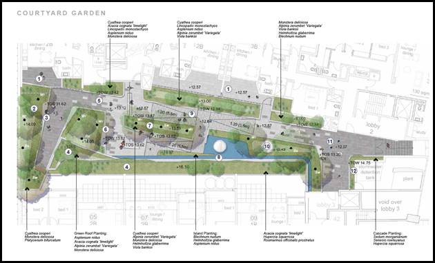
Figure 10: Landscaping proposed within the central courtyard
space (courtesy Sturt Noble, 2019)
|
|
3F-1
Visual Privacy
|
1. Separation
between windows and balconies is provided to ensure visual privacy is
achieved.
Minimum required separation
distances from buildings to the side and rear boundaries are as follows:
-Up to 12m (4 storeys)
Habitable rooms and balconies = 6m
Non-habitable rooms = 3m
|
North – Nil side
setback as this property adjoins retail/commercial developments as part of
the Blakehurst Commercial Centre and a nil side setback is required to ensure
continuity of mixed use developments and encourage active frontages, and an
appropriate street-edge along the Princes Highway.
There are no openings along the
northern side of the front building facing Princes Highway. This is
satisfactory and complies with the ADG. The rear building however is setback
some 3m from the northern boundary and includes a series of windows along
Levels 1-5. The intention for these windows is to capture solar access up
until the adjoining site to the north redevelops. These windows could quite
easily be redesigned to become snorkel windows and this elevation becomes a
defensive wall so that no potential for future overlooking occurs. Balconies
can include privacy screens or blade walls. Also along the upper levels (5
and 6) the balconies along the northern side could become non-trafficable.
Design changes could easily be adopted to satisfy the ADG provisions and
achieve no window openings within 6m of the boundary.
South – The site
adjoins Water Street and across the road is Church Reserve which includes a
public parking area. The building hugs the corner of Princes Highway and
Water Street and is setback between 3m - 5.5m on the ground floor with the
upper level balconies located on the boundary.
Given the ground floor commercial
components and the provision of an awning the siting of the upper levels on
the boundary are generally consistent with the character and nature of
development within a commercial zone.
East - The eastern part of
the building is located on the front boundary and aligned with the Princes
Highway frontage which is consistent with the character and nature of
development on main roads. The development will include an awning above the
ground floor shops.
West – The western,
rear side of the development includes the service lane which is setback 8m at
the ground floor level. The upper level units are setback a minimum of 6m at
Levels 1 - 4 with the building wall setback 9m for Levels 5 and 6 in
accordance with the ADG separation distances.
A few additional conditions would
be imposed if the application was to be supported to improve privacy between
properties including:
- The
staircase along the western side of Lobby 3 shall include obscure glazed
openings to reduce the potential for overlooking to the residential lots to
the rear.
- All
western facing balconies shall include a sliding privacy screen along each
balcony to reduce the potential for overlooking and also provide additional
solar protection.
- The
proposed garden terraces on Level 4 located along the western side which are
dedicated to Units 31, 32 and 33 are to become non-trafficable landscaping
areas that are communal and will be open style spaces which include a series
of low scale plants.
|
Yes
|
|
3J-1
Bicycle and car parking
|
1. For development in the following
locations:
- On sites that
are within 800m of a railway station or light rail stop in the Sydney
Metropolitan Area;
- The minimum
car parking requirement for residents and visitors is set out in the Guide to
Traffic Generating
Developments, or the car parking
requirement prescribed by the relevant Council, whichever is less.
|
This section of the ADG is not
applicable to this development.
The proposal is not located in an
“accessible” area and the parking provisions to be relied upon
are the provisions within the Kogarah DCP.
Parking rates are assessed later in
this report.
Appropriate designated bike parking
has been provided.
|
N/A as the site is not located
within an “accessible” area
|
|
4A-1
Solar and daylight access
|
1. Living rooms
and private open spaces of at least 70% of apartments in a building receive a
minimum of 2 hours direct sunlight between 9 am and 3 pm at mid-winter in the
Sydney Metropolitan Area
3. A maximum of
15% of apartments in a building receive no direct sunlight between 9 am and 3
pm at mid-winter
|
The development has been designed
to comply with the solar access provisions of the ADG.
A total of 35 apartments out of 50
receive a minimum of 2 hours of solar access in accordance with the ADG
requirements which amounts to 70%.
Most apartments will have dual
orientation and therefore will achieve the minimum solar access requirements
with a couple of the southern facing apartments not complying due to their
orientation.
Also apartments in the rear wing
which face east and look onto the central courtyard will be partially
overshadowed by the front building.
|
Yes
|
|
4B-3
Natural Ventilation
|
1. At least 60%
of apartments are naturally cross ventilated in the first nine storeys of the
building.
Apartments at ten storeys or
greater are deemed to be cross ventilated only if any enclosure of the
balconies at these levels allows adequate natural ventilation and cannot be
fully enclosed
2. Overall
depth of a cross-over or cross-through apartment does not exceed 18m,
measured glass line to glass line
|
Since the design has created two
built forms and separate buildings the building depth complies with the 18m
maximum depth from glass line to glass line.
The eastern building facing Princes
Highway has a maximum glass line to glass line building depth of 15m.
The western building is wider and
has a depth of some 18m which satisfies the ADG provisions.
In terms of cross ventilation, most
apartments have dual aspect and therefore comply with the minimum cross
ventilation requirements. Thirty five (35) apartments are designed to allow
for cross-ventilation which amounts to 70% of the development which exceeds
the 60% minimum requirement.
|
Yes
|
|
4C-1
Ceiling heights
|
1.Measured from
finished floor level to finished ceiling level, minimum ceiling heights are:
Habitable rooms = 2.7m
Non-habitable rooms = 2.4m
Ground floor heights for
commercial/retail uses are 3.3m to promote future flexibility
|
The floor to floor heights are
3.05m which is slightly lower than the 3.1m suggested by the ADG however this
is only a small non-compliance and the development will still be able to
achieve a minimum floor to ceiling height of 2.7m with appropriate servicing
solutions.
Retail area No.2 on the ground
floor has a floor to ceiling height of 3.3m which satisfies the provision.
This tenancy is located on the
corner of Princes Highway and Water Street and due to the existing ground levels
and topography (sloping from north to south) part of this tenancy will be
located below the ground level.
There is an internal ramp providing
access to this space. It is a relatively large tenancy 410sqm and this
arrangement and design will not compromise its use and functionality.
Retail Unit No.1 faces Princes
Highway and has a floor to ceiling height of 3.248 which is marginally short
of the 3.3m minimum. The non-compliance is not considered to adversely affect
the operation of this space.
The retail tenancy which is
designated as a “coffee shop” located along Water Street is only
a small space some 35sqm in area. It has a floor to ceiling height of 3m.
Although this is below the 3.3m requirement given the size and location of
this small retail tenancy the floor to ceiling height is acceptable in this
case as it will act as a small retail or potentially commercial tenancy for
the future. The space will likely be used for a small local business and the
necessity to comply with the floor to ceiling height provision is not
necessary.
The exact location and form of the
proposed mechanical plant has not been designated on the plan.
|
Yes
Partial non-compliance
|
|
4D-1
Apartment size and layout
|
1. Apartments
are required to have the following minimum internal areas:
1 bedroom = 50sqm
2 bedroom = 70sqm
3 bedroom = 90sqm
The minimum internal areas include
only one bathroom. Additional bathrooms increase the minimum internal area by
5sqm each
Every habitable room must have a
window in an external wall with a total minimum glass area of not less than
10% of the floor area of the room. Daylight and air may not be borrowed from
other rooms
|
The design and internal size of
each apartment has been designed to comply with the minimum provisions of the
ADG as noted below.
1 bedroom = 54sqm and above
2 bedroom = 90sqm and above
3 bedroom = 115sqm and over
The one bedroom apartments have one
bathroom. Two bedroom apartments include ensuites, this clarifies why these
apartments are larger than the minimum required. This also applies for the
three bedroom apartments
At least one window is provided to
each room.
|
Yes
Yes
Yes
|
|
4D-2
|
Habitable room depths are limited
to a maximum of 2.5m x the ceiling height
In open plan layouts (where the
living, dining and kitchen are combined) the maximum habitable room depth is
8m from a window
|
Within range.
Open plan layouts are 8m or less
from window or balcony.
The depth of all kitchens do not
exceed 8m from a window, balcony or opening.
The apartments facing Princes
Highway have been designed to consider the acoustic implications generated by
this busy roadway.
The design includes balconies which
are generally enclosed (partially as winter gardens).
To improve the visual appearance of
the balconies and reduce their visual bulk the winter gardens should be
maintained but the “enclosed balcony” elements should be
‘opened up’ and include a consistent balustrade with the winter
gardens.
This can be imposed as a condition
if the proposal was to be supported. This would create some additional
recessive features rather than the majority of the façade being
enclosed and solid which increases the visual bulk. Opening up parts of the
balcony will lighten and soften the eastern (front) façade.
|
Yes
Yes
|
|
|
Master bedrooms have a minimum area
of 10sqm and other bedrooms 9sqm (excluding wardrobe space)
Bedrooms have a minimum dimension
of 3m (excluding wardrobe space)
Living rooms or combined
living/dining rooms have a
minimum width of:
-3.6m for studio and 1 bedroom
- 4m for 2 and 3 bedroom apartments
|
Every master bedroom has a minimum
area of 10sqm.
Bedrooms are well proportioned and
sized, having minimum dimensions of 3m.
The width of living/dining spaces
for one-bedroom apartments have a minimum width of 3.6m.
The width of living/dining rooms
for the two and three-bedroom apartments is a minimum of 4m.
|
Yes
Yes
Yes
Yes
|
|
4E-1
Private Open space and balconies
|
All apartments are required to have
primary balconies as follows:
- one-bedroom = 8sqm/2m depth
- two-bedroom = 10sqm/2m depth
- 3+
bedroom = 12sqm/2.4m depth
The minimum balcony depth to be
counted as contributing to the balcony area is 1m
For apartments at ground level or
on a podium or similar structure, a private open space is provided instead of
a balcony. It must have a minimum area of 15sqm and a minimum depth of 3m
|
All balcony areas are at or greater
than the minimum specified and the minimum dimensions are observed for
primary balconies as required.
All one bedroom apartments comply
with the minimum 8sqm balcony size if the winter gardens are included along
the front elevation facing Princes Highway.
All two bedroom apartments have
balconies with minimum areas of 10sqm when including the winter gardens along
Princes Highway frontage.
The three bedroom apartments have
minimum balcony sizes of 12sqm if winter gardens are included.
There are no balconies with depths
of 1m or less.
There are no ground floor
apartments. Apartments on Level 1 in the front building have balconies facing
Princes Highway and courtyards that face the central courtyard space. They
have access to two sets of external spaces which is a benefit to the design
and provide these units with better internal amenity than most apartments
which face busy arterial roadways as these largely only have one orientation.
|
Yes
|
|
4F-1
Common circulation spaces
|
The maximum number of apartments
off a circulation core on a single level is eight
|
There are three lift cores.
Lift Lobby 1 provides access to two
(2) apartments at every level of the building.
Lift Lobby 2 provides access to two
(2) apartments at every level of the building.
Lift Lobby 3 provides access to
eight (8) apartments (Level 2) five (5) apartments on Level 4 and three (3)
apartments on Levels 5 and 6.
|
Yes
|
|
4G-1
Storage
|
In addition to storage in kitchens,
bathrooms and bedrooms, the following storage is provided:
1 bedroom = 6m³
2 bedroom – 8m³
3 bedroom – 10m³
|
All apartments have storage
cupboards that comply with the requirements with dedicated independent
storage rooms for 51 apartments in the basement. The provision of storage in
association with this development is considered to be appropriate and
compliant.
|
Yes
|
|
4H
Acoustic Privacy
|
Noisy areas within buildings
including building entries and corridors should be located next to or above
each other and quieter areas next to or above quieter areas
|
The development has been
sensitively designed to respect the context of the area.
This application is accompanied by
an Acoustic report and the noise assessment and findings of the report were
discussed earlier in this report.
The benefit of this design is that
the creation of two (2) buildings mitigates noise impacts from the roadway to
internal spaces ie the front building will act as a barrier and shield to a
large degree noise from Princes Highway to the rear building. Most apartments
within the front building have dual aspect so the courtyards facing the
internal communal open space will be quieter spaces than the front balconies.
The noise impacts have been largely
mitigated and minimised through the design of the development.
|
Yes
|
|
4J
Noise and Pollution
|
Design solutions to mitigate noise
include:
limiting the number and size of
openings facing noise sources
providing seals to prevent noise
transfer through gaps using double or acoustic glazing, acoustic louvres or
enclosed balconies (wintergardens) using materials with mass and/or sound
insulation or absorption properties e.g. solid balcony balustrades, external
screens and soffits
|
This has been discussed above and
is considered to be acceptable from a design perspective.
|
Yes
|
|
4K
Apartment Mix
|
A range of apartment types and
sizes is provided to cater for different household types now and into the
future
|
The development provides a variety
and mix of apartment types.
· 11 x 1 bedrooms
(22%);
· 25 x 2 bedrooms
(50%) and;
· 14 x 3 bedrooms (28%)
|
Yes
|
|
4L
Ground Floor Apartments
|
Direct street access should be
provided to ground floor apartments
Privacy and safety should be
provided without obstructing casual surveillance.
|
Not applicable to this form of
mixed use development where retail/commercial uses dominate the ground floor.
This is the preferred land use for this site and within this zone in
accordance with the KLEP provisions for “shop-top” housing
development.
|
N/A
|
|
4M
Facades
|
Facades should be well resolved
with an appropriate scale and proportion to the streetscape and human scale.
|
The front façade of the
building has been redesigned on three (3) occasions and the most recent
amended design (refer to Figure 9 below) is considered to be an improvement
particularly in respect to the buildings visual presentation to Princes
Highway.
The front façade is more
ordered and balanced. It includes defined bays which break up the bulk and
length of the built form.
The reduction in the height and
scale of the building also improves its visual appearance to the street. The
corner element remains a strong feature which distinguishes the retail/mixed
use element (fronting Princes Highway) and the more residential form and
character facing Water Street.
Contemporary materials and finishes
have been employed and the colour palette is consistent with the character of
modern developments in the street and immediate locality.
The development relies on a number
of architectural elements which enhance its visual appearance and break up
the mass and form of the buildings. It is proposed to further soften the
front façade by “opening up” the “enclosed
balconies” which will introduce some recessive elements along the front
façade whilst also reducing the visual bulk and prominence of the
these elements which will be protrusive.
|
Yes
|
|
 Figure 11: Final front façade to Princes Highway
(courtesy Peter Dunn and Associates, 2019) Figure 11: Final front façade to Princes Highway
(courtesy Peter Dunn and Associates, 2019)
|
|
4N
Roof
|
Roof treatments are integrated into
the building design and positively respond to the street.
Opportunities to use roof space for
residential accommodation and open space are maximised. Incorporates
sustainability features.
|
The proposed roof is a standard
flat roof form with the inclusion of roof top areas of open space.
The roof has been amended to
include a series of photovoltaic panels and also the inclusion of a
ventilation system on the roof which is considered to be environmentally
sustainable.
|
Yes
|
|
4O
Landscape Design
|
Landscape design is viable and
sustainable, contributes to the streetscape and amenity
|
A detailed Landscape design has
been prepared and included as part of this assessment prepared by Sturt
Noble. The planting and landscaping area and arrangement is considered to be
well designed (see Figure 12 below).
|
Yes
|
|
Figure 12: Landscaping proposed around the development and
within the rooftop (courtesy Sturt Noble, 2019)
|
|
4P
Planting on structures
|
Planting on structures –
appropriate soil profiles are provided, plant growth is optimised with
appropriate selection and maintenance, contributes to the quality and amenity
of communal and public open spaces
|
Landscaping includes planter boxes
in areas where deep soil cannot be achieved and where there is a podium. This
is largely within most of the site but in particular within the central
courtyard area.
There are substantial planter boxes
proposed in this space and include a variety of other features (water
features and spaces for seating). This space even though in the future with
development occurring to the north will be overshadowed could still be an
attractive space that adds amenity to the utilisation of apartments. It is
essentially a private space for the exclusive use of the development and the
lack of sunlight is compensated by the use of the roof top areas which will
have good solar access throughout the day.
|
Yes
|
|
4Q
Universal Design
|
Universal design – design of
apartments allow for flexible housing, adaptable designs, accommodate a range
of lifestyle needs
|
The various sizes and designs of
apartments allows for use by differing lifestyles.
The design of apartments is
flexible and considered to be appropriate. There are two (2) adaptable units (7
and 18) proposed which adds to the flexibility of the design.
|
Yes
|
|
4R
Adaptive Reuse
|
New additions to existing buildings
are contemporary and complementary and enhance an area's identity and sense
of place
|
This is a purpose built building.
|
N/A
|
|
4S
Mixed Use
|
Mixed use developments are provided
in appropriate locations, provide active street frontages, residential levels
of the building are integrated within the development and safety and amenity
is maximised for residents
|
The development is classified as a
mixed use development and satisfies the provisions of the ADG in respect to
these types of developments.
|
Yes
|
|
4T
Awnings and signage
|
Awnings and signage – awnings
are well located and compliment and integrate with the building design,
signage responds to the context and desired streetscape character
|
An awning is proposed along the
Princes Highway frontage.
The design complies with
Council’s requirements however if approval is recommended standard
conditions will ensure the awning and associated public works (footpath
detailing, street tree location and type) will be compliant and in accordance
with Council’s requirements.
Consideration will also be given to
the requirements of the RMS and Rail Corp given the infrastructure within
Princes Highway frontage.
|
Yes
|
|
4U
Energy Efficiency
|
Development incorporates passive
environmental design, passive solar design to optimise heat storage in winter
and reduce heat transfer in summer, natural ventilation minimises need for
mechanical ventilation
|
The development incorporates BASIX
commitments in the design to provide appropriate energy efficiency features.
A compliant BASIX certificate accompanies this application.
The development has been amended to
include a series of environmentally sustainable initiatives which is
considered to satisfy the intention of the ADG.
|
Yes
|
|
4V
Water management and
conservation
|
Water management and conservation
– potable water use is minimised, stormwater is treated on site before
being discharged, flood management systems are integrated into the site
design
|
Development incorporates
appropriate stormwater measures and Council’s Development Engineers are
satisfied with the design.
|
Yes
|
|
4W
Waste Management
|
Waste management – storage
facilities are appropriately designed, domestic waste is minimised by
convenient source separation and recycling
|
Waste facilities are provided in
the basement. There are a number of designated garbage rooms for both the
residential and the retail/commercial component included within the design.
Council’s Waste/Sustainability
Officer is satisfied with the number and arrangement of bins. The development
also caters for a bulky goods storage room and ample space to store garbage
next to the loading bay.
|
Yes
|
|
4X
Building maintenance
|
Building maintenance –
building design provides protection form weathering, enables ease of
maintenance, material selection reduces ongoing maintenance cost
|
The design incorporates a mix of
external finishes that require minimal maintenance.
The proposed finishes and materials
are considered to be durable and the inclusion of brick finishes and simple
materials will require less maintenance in the longer term.
|
Yes
|
|
|
|
|
|
Kogarah Local
Environmental Plan 2012
Zoning
113. The subject site is zoned B2 Local Centre
under the provisions of the Kogarah Local Environmental Plan (KLEP) 2012. Refer
to Figure 13 below.
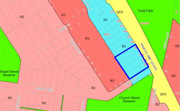
Figure 13: Zoning of the area with the site outlined in blue.
114. The proposal is defined as “shop top
housing” which is defined as “one or more dwellings located
above ground floor retail premises or business premises”. The rear
building is designed as a residential flat building (RFB) as it doesn’t
include retail uses on the ground floor. However this part of the building sits
above retail car spaces and the loading zone which services the
retail/commercial component. An RFB is also a permissible land use in the zone.
115. The proposal generally satisfies the objectives of
the zone which include;
· To provide a range of retail, business, entertainment and
community uses that serve the needs of people who live in, work in and visit
the local area.
· To encourage employment opportunities in accessible
locations.
· To maximise public transport patronage and encourage
walking and cycling.
Table 5: Compliance with KLEP2012
|
Clause
|
Standard
|
Proposed
|
Complies
|
|
2.2 Zone
|
B2
Local Centre zone
|
The proposal is defined as shop top
housing and a residential flay building which is a permissible use within the
zone.
|
Yes
|
|
2.3 Objectives
|
Objectives of the Zone
|
Consistent with zone objectives as
discussed above.
|
Yes
|
|
4.3 – Height of Buildings
|
21m as identified on Height of
Buildings Map
|
The building exceeds the 21m height
limit and achieves an overall height at the highest point of 24.74m. The lift
overrun and the rooftop area of communal open space are the only elements
which exceeds the height control.
The non-compliance at the highest
point is a 23% non-compliance with the control however this only relates to
one lift overrun. The other structures are lower and about 2.4m above the
control (11% variation beyond the control) and 1m for planter boxes (4%
non-compliance).
|
No – see discussion below
regarding Clause 4.6 Statement which has been submitted.
|
|
4.4 – Floor Space Ratio
|
2.5:1 as identified on Floor Space
Ratio Map
|
The proposed FSR is 2.5:1. The
proposal complies with a maximum GFA of 6,373.5sqm. The proposal provides a
GFA of 6,294sqm which amounts to a total FSR of 2.47:1
|
Yes
|
|
4.5 – Calculation of floor
space ratio and site area
|
FSR and site area calculated in
accordance with Cl.4.5
|
The GFA calculations provided by
the Applicant are accurate and in accordance with the definition of GFA in
accordance with the KLEP provisions.
There are in fact some areas the
Applicant has included which should be “excluded” in accordance
with the GFA calculation including the “switch room” on Level 1,
“plant room” on the ground floor, the “retail
garbage” area which is partially below ground (basement). These
elements should be excluded. The winter gardens and enclosed balconies have
been included in accordance with the definition.
The rooftop WC has been excluded
but this element should be included. It amounts to some 8sqm and its
inclusion would increase the GFA calculation marginally and the FSR would
stay at 2.47:1. If the proposed “enclosed balconies” were
‘opened up’ to become traditional balconies the gross floor area
would be further reduced.
|
Yes
|
|
5.10 – Heritage
Conservation
|
The objectives of
this clause are;
(i) to conserve the environmental
heritage of Kogarah,
(ii) to conserve the heritage
significance of heritage items and heritage conservation areas, including
associated fabric, settings and views.
|
The site is not a designated item
of heritage nor is it within a Conservation Area. The closest item is I131 which
is “Carss Park”. This item is physically separated from the site
by the highway and Todd Park. The proposal will not have any adverse impacts
on the integrity, aesthetics and historical importance of this item.
|
Yes
|
|
6.1 Acid Sulphate Soils (ASS)
|
The objective of this clause is to ensure that development
does not disturb, expose or drain acid sulfate soils and cause environmental
damage
|
The site is located within the
Class 5 ASS zone. Class 5 relates to “works within 100m of adjacent
Class 2, 3 or 4 land that is below 5 metres Australian Height Datum and by
which the water table is likely to be lowered below 1m Australian Height
Datum on adjacent Class 2, 3 or 4 land.
Subclause 3 states that “Development consent must not be granted
under this clause for the carrying out of works unless an acid sulfate soils
management plan has been prepared for the proposed works in accordance with
the Acid Sulfate Soils Manual and has been provided to the consent
authority.”
The subject site adjoins Class 3
ASS and therefore an Acid Sulphate Soils Management Plan is a mandatory
requirement pursuant to the provisions of the KLEP. The Applicant has
justified why a detailed management plan is not required;
- Extensive
testing of soils during the process of remediation did not suggest the
presence of any Acid Sulphates.
- The
Botany Bay Acid Sulphates Soil Risk map does not show the presence of any
acid sulphate soils (ASS).
- The
method of basement construction (fully sealed, tanked basement) will not
impact or lower the water table.
Despite this justification which
may be accurate and reasonable an Acid Sulphate Soils management plan needs
to be provided which would potentially support these arguments.
The wording within the LEP requires
this report to be submitted.
|
Yes
|
|
6.2 Earthworks
|
To ensure that earthworks do not
have a detrimental impact on environmental functions and processes,
neighbouring uses, cultural or heritage items or features of the surrounding
land
|
The proposal includes the provision
of two levels of basement car parking.
This is a standard amount of
excavation and site works to accommodate a development of this scale and
density and is similar to the basement car parking arrangement that has been
constructed at 621 Princes Highway.
The proposed earthworks are not
considered to be unreasonable.
|
Yes
|
|
6.3 Flood Planning
|
The objectives of this clause are as follows—
(a) to minimise the flood risk to life and
property associated with the use of land,
(b) to allow development on land that is
compatible with the land’s flood hazard, taking into account projected
changes as a result of climate change,
(c) to avoid significant adverse impacts on
flood behaviour and the environment.
|
The site is not affected by any
flood planning restrictions.
|
Yes
|
|
6.5 Airspace Operations
|
The consent authority must not grant development consent to
development that is a controlled activity within the meaning of Division 4 of
Part 12 of the Airports Act
1996 of the Commonwealth unless the applicant has obtained approval for
the controlled activity under regulations made for the purposes of that
Division.
|
The height of the proposed
development is above the Obstacle Limitation Surface (OLS) level of 15.24m.
The application was referred to
Sydney Airports for their formal concurrence.
To date no response has been
received. If a response has not been received within 21 days then concurrence
can be assumed.
The proposed RL at the highest
point of the building is at RL35.90 (lift overrun).
The roof parapet sits at
approximately RL27.8 and approximately RL30.9
The assessment needs to ensure the
height of the building does not exceed the “prescribed airspace”
which is governed by the Obstacle Limitation Surface (OLS). In Kogarah closer
to the airport the OLS is 51m. The proposed development is well within the
OLS so there should be no penetration within the prescribed airspace.
|
Yes
|
Clause 4.6 Exceptions to development standards
Detailed assessment of variation to Clause 4.3 Height of
Buildings
116. The
proposed development seeks a variation to the development standard relating to
building height, Clause 4.3(2) of the KLEP. The LEP identifies a maximum height
of 21m for the Site (refer to Figure 14 below). The height of the building has
been determined by complying with the definition of building height which
means;
(a) in relation the height of a building in metres
– the vertical distance from ground level (existing) to the highest point
of the building, or
(b) in relation to the RL of a building – the
vertical distance from the Australian Height Datum to the highest point of the
building, including plant and lift overruns, but excluding communication
devices, antennae, satellite dishes, masts, flagpoles, chimneys, flues and the
like.
117. Taking this definition into account, the proposed
development will exceed the height control by approximately 4.8m (at the
highest point) which comprises of the lift overrun, open style pergola, planter
boxes and WC which are located on the roof top and forms part of the communal
area of open space. This is a 23% variation above the control. Although the
exceedance seems substantial it only affects the lift overrun to that degree.
The pergola and WC structures only exceed the control by some 2.4m- 2.6m which
amounts to an 11%-12% variation and the fixed planter boxes exceed the control
by approximately 1m, a 5% variation.
118. These variations to the height can only be considered under
Clause 4.6 – Exceptions to Development Standards of the KLEP. The
area and degree of non-compliance with the height is shown in Figure 12 below.
The amended Clause 4.6 Statement was based on the plans as noted in Figure 12
however the heights of structures were not included and plans have been
updated after Council wanted plans showing the RL’s of the structures on
the roof (pergola, lift and fire stairs, planter boxes, WC etc). Figure 13
shows the updated section showing the modified heights.
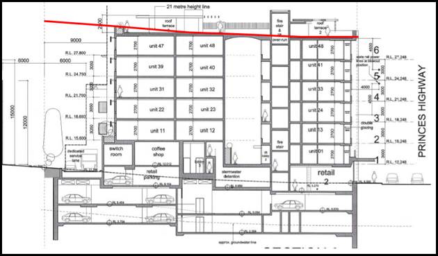
Figure 14: Red line showing the areas of the building that exceed
the 21m height limit (courtesy Peter Dunn Architects)
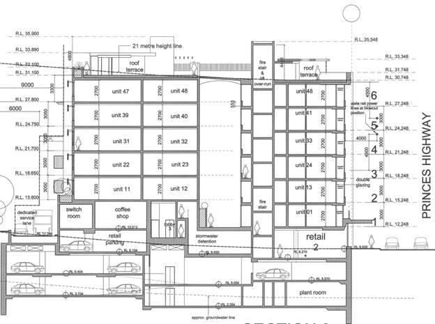
Figure 15: Updated sections showing actual RL’s to the top
of the building (courtesy Peter Dunn Architects Feb 2020).
119. Clause
4.6(1) outlines the objectives of the standard which are to “provide
an appropriate degree of flexibility in applying certain development standards
to particular development” and “to achieve better
outcomes for and from development by allowing flexibility in particular
circumstances”.
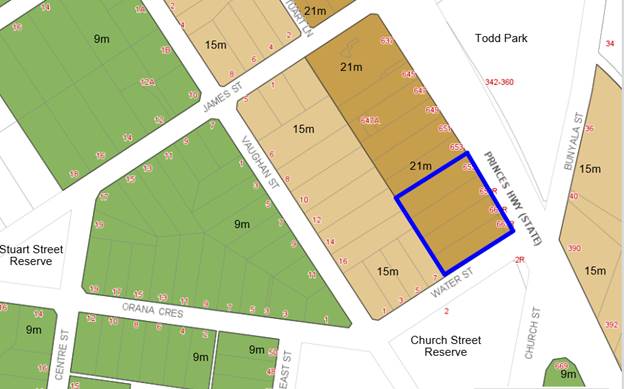
Figure 16: Height
Map – site outlined in blue
120. Clause 4.6 (3) of the KLEP states that:
“Development consent must not be granted for development that
contravenes a development standard unless the consent authority has considered
a written request from the applicant that seeks to justify the contravention of
the development standard by demonstrating:
- that compliance with
the development standard is unreasonable or unnecessary in the circumstances of
the case, and
- that there are sufficient environmental
planning grounds to justify contravening the development standard”
121. To support the non-compliance, the applicant has
provided an updated request for a variation to Clause 4.3 in accordance with
Clause 4.6 of KLEP 2012 which assesses the final development scheme however
bases the conclusions on the plans shown in Figure 12 not Figure 13 with the
updated plans and height confirmation. The Clause 4.6 request for variation is
assessed as follows:
Is
the planning control in question a development standard?
122. Height of Buildings limitation under Clause 4.3 of
the KLEP 2012 is a development standard.
What
are the underlying objectives of the development standard?
123. The objectives of Height of Buildings standard
under Clause 4.3 of KLEP 2012 are:
(a) to establish the
maximum height for buildings,
(b) to minimise the impact
of overshadowing, visual impact and loss of privacy on adjoining properties and
open space areas,
(c) to provide
appropriate scale and intensity of development through height controls.
124. In order to satisfy the requirements of Subclause
4.6(3) (outlined above) and 4.6(4) which states;
Development consent must not be granted
for development that contravenes a development standard unless;
(a) the consent authority is satisfied
that—
(i) the
applicant’s written request has adequately addressed the matters required
to be demonstrated by subclause (3), and
(ii) the proposed
development will be in the public interest because it is consistent with the
objectives of the particular standard and the objectives for development within
the zone in which the development is proposed to be carried out,
125. The proposal needs to satisfy both the development
standard and zone objectives in order to determine whether the development is
in the public interest. The issue of achieving a better design solution for the
site (with the variation) is not a consideration. In supporting the
non-compliance the Clause 4.6 Statement is discussed in greater detail below.
126. In respect to compliance with the objectives of
the height control, the Applicant has provided the following justification:
a) To establish a maximum height for
buildings
127. Applicants Comment: “This
objective articulates the ultimate function of the height of buildings
development standard. The maximum height for buildings on land within the
former Kogarah Local Government Area is identified on the Height of Buildings
Map. As previously described, the maximum building height permitted on the
subject site is 21m and the maximum height of the proposal is 24.74m. The
proposal contravenes the standard, which has prompted the preparation of this
written variation request. Despite the nature and scale of the development
proposed by this Development Application, Clause 4.3 achieves the objective of
establishing a maximum building height for the site, using the Height of
Buildings Map as a mechanism to do so. This written request identifies the
extent of variation proposed and explains why the variation is acceptable in
the circumstances.”
128. Council’s comment: The Clause 4.6
Statement was amended and updated in December 2019 and based on the final set
of drawings. The statement alludes to the height of the lift overrun exceeding
the control by 3.74m. It is unclear how this figure was derived since the final
plans (refer to Figure 12) did not include an RL to the uppermost part of the
building. Council raised this issue with the Applicant who in February provided
amended elevations and sections showing the lift overrun to be higher than
originally anticipated and higher than the Clause 4.6 Statement reflected. The
Clause 4.6 Statement was not updated to reflect this change.
129. The up to date sections (see Figure 15 above) show
clearly the RL’s to the uppermost part of the building. The plans relied
upon by the Clause 4.6 statement dated December 2019 do not include any
RL’s to the top of the roof structures (refer to Figure 14 above). The
more accurate and up to date sections show the non-compliance to be in the
order of 4.8m which is a further 1.06m higher than the assumption used by
Planning Ingenuity to prepare their updated Clause 4.6 Statement.
130. Although this additional height may not be
considered substantial in the overall scope of works it has not been taken into
account when preparing the Clause 4.6 Statement which makes the statement
inaccurate and therefore the request cannot be considered to be well-founded as
it isn’t based on the most up to date information.
b) To minimise the impact of overshadowing,
visual impact and loss of privacy on adjoining properties and open space areas
131. Applicants comment: “The height
variation relates to the lift overruns and shading structures at the rooftop
terraces 2 and 3. These built forms are relatively central to the site, and
will therefore have no substantial impact on overshadowing to adjoining
properties. For the same reason, the visual impact will also be acceptable.
Landscaping is provided to the edges of Terrace 3 to ensure overlooking to
adjacent lower density residential areas is minimised. Due to the minimal
nature of the items that breach the maximum building height, the impacts to
overshadowing, visual impact and privacy are minor”.
132. Council comment: At the time of preparing
this report no updated shadow diagrams have been prepared considering the
additional shadowing of the rooftop structures and their associated impacts.
The Statement does not provide enough information to ensure that the impacts (overshadowing,
visual impacts and loss of privacy) are minimised. There are no sight lines
provided that ensure the rooftop communal open space at the top of the rear
building (where it exceeds the height limit) will not overlook the adjoining
residential properties.
133. The evidence to demonstrate impacts are minimised
and the exceedance in the height does not adversely affect the amenity of the
street and adjoining properties has not been presented to adequately justify
that this objective has been met.
c) To provide appropriate
scale and intensity of development through height controls
134. Applicants comment: “The extent of
the building height non-compliance varies as a result of the topographic
characteristics of the site and the massing arrangement that has been adopted.
It is important to note that the building height variation is not a by-product
of non-compliant development density. The scale and intensity of development
from a building density perspective is consistent with that of a compliant development,
as evidenced by compliance with the maximum FSR of 2.5:1. Importantly, the
proposal has been amended to ensure that no habitable floor space is located
above the maximum building height.
135. The proposal concentrates the building mass at
the south-eastern corner of the development site and this is an appropriate
response to the ‘gateway’ location of the land in that this
arrangement gives prominence to the corner which is the southern-most block in
the Blakehurst Local Centre and the first block one encounters when travelling
in the northbound lane. The variation in the development scale and intensity
across the site is appropriate for the reasons described above and importantly
the proposal complies with the maximum FSR of 2.5:1.”
136. Council comment: The proposed scale of the
building is considered generally satisfactory and consistent with similar
contemporary mixed-use developments in the immediate locality (ie 621 Princes Highway).
The 21m height limit anticipates a development of 6-7 storeys which this
proposal satisfies. Given the site is located on a prominent corner location
some additional height may be warranted and acceptable provided no impacts are
generated.
137. As the southern side of Water Street includes a
public car park and associated reserve, it is unlikely any adverse impacts will
be created however the additional height could be in the form of an
architectural element or roof element not a lift overrun as this is a solid
ancillary structure which does not add value or architectural merit to the
building.
138. It is also accepted that the buildings on site
complies with the floor space permitted however, the way the massing and built
form is translated across the site is important to consider. The proposed bulk
and scale is generally considered acceptable and given the proposal has been
amended and density and overall height reduced the urban design response is
considered to be more in line with the expected form for development within
this zone.
139. So in respect to the proposal (as amended)
satisfying the objectives of the height control it is considered that the
justification for the non-compliance is not warranted or well supported by
appropriate evidence and documentation.
140. The argument in the Clause 4.6 Statement is
considered to be too weak and does not provide clarity and enough substance to
ensure impacts are minimised and the degree and extent of variation in this
case is reasonable or necessary. In addition the justification has been derived
using the incorrect height.
141. The objectives of the B2 Local Centre zone are;
· To
provide a range of retail, business, entertainment and community uses that
serve the needs of people who live in, work in and visit the local area,
· To
encourage employment opportunities in accessible locations,
· To
maximise public transport and patronage and encourage walking and cycling.
142. When considering compliance against the zone
objectives the Applicant provides the following:
143. Applicants comment: “The proposal
incorporates commercial floor space at ground level and it is anticipated that
this space will be tenanted by a range of retail and business uses that serve
the needs of people who live, work and visit Blakehurst Local Centre, The
commercial floor space comprises two tenancies measuring 81sqm and 410sqm which
will allow for a range of uses and business sizes. The larger of the tenancies
is suitable for small format supermarket. A coffee shop is also provided on the
Water Street frontage at Level 1, serving the needs of local residents both
within the subject site and in the adjoining residential areas.
144. The commercial floor space proposed will
potentially be tenanted by a range of retail and business uses and the
extension will create employment opportunities. The site currently contains two
small commercial tenancies which are vacant and therefore offers few viable
employment opportunities at present. The development will markedly improve the
range and quantum of jobs available in this locality. The site is accessible in
that it is proximate to a number of north and south bound bus stops serviced by
numerous bus routes, including 958 providing services to Hurstville and
Kogarah, route 959 providing a loop service to Hurstville and route 970
providing a service to Miranda and Hurstville and route 971 providing a service
to Cronulla and Hurstville.
145. The proposal includes bike storage and will
therefore encourage the user of bicycles as an alternative transport option. By
increasing residential density in this location, the development will
undoubtedly maximise patronage of local bus services, even if only a small
portion of residents utilise public transport services as opposed to driving.
Furthermore by co-locating residential and commercial uses residents will be
less inclined to leave the site by car if they are able to obtain the necessary
goods and services on site.”
146. Council comment: It is fair to say that the
development delivers and satisfies the zone objectives. Currently this small
shopping precinct has local shopfronts and include a series of commercial uses
which are not primary retail or commercial uses but secondary in nature. There
is a lack of decently proportioned retail shops to service the local community.
147. The new development at 621 Princes Highway
includes a child care centre on the ground floor; however this too restricts
retail activation at this location. The proposal provides for a larger retail
tenancy that could be utilised as a supermarket which would be a well-resourced
and well serviced land use as no other is provided in this precinct. The other
two tenancies offer diversity in retail/commercial activities that could be
catered for at the site. In this case and through the design of the development
the zone objectives have been satisfied and met.
148. In considering the breach and preparation of the
Clause 4.6 Statement, the Department of Planning and Environment’s
publication “Varying development standards: A Guide” (August
2011), assists and outlines the matters that should be considered when
varying a development standard. The Guide has essentially adopted a 5 point
test for consideration which was also set out by the Land and Environment Court
in Wehbe v Pittwater Council (2001) NSW LEC 827, specifically that there are
five different ways in which compliance with a development standard can be
considered unreasonable or unnecessary, namely:
· the
objectives of the standard are achieved notwithstanding non-compliance with the
standard;
149. Comment: As discussed above, the degree of
variation as depicted in the Clause 4.6 Statement is not consistent with the
updated elevation and therefore justifying the non-compliance is not considered
to be accurate. In this case it cannot be said that the objectives of the
standard have been achieved despite the variation.
· the underlying objective or purpose of the
standard is not relevant to the development and therefore compliance is
unnecessary;
150. Comment: The objectives of the building
height standard remain relevant and as discussed above the Statement has not
calculated the variation accurately and therefore determining the impacts of
the breach are not considered to be up to date or accurate (ie the lack of
updated shadow diagrams and the lack of any sight lines to ensure overlooking
from the rooftop is minimised despite non-compliance has not been provided).
151. As such there is inadequate information to justify
that the variation is acceptable and satisfies the objectives of the control.
· the underlying object of purpose would be
defeated or thwarted if compliance was required and therefore compliance is
unreasonable;
152. Comment: If by chance the variation is
considered to be acceptable in the circumstances the object and purpose would
not be defeated or thwarted as the breaches only relate to ancillary structures
and do not relate to any habitable areas. As such the majority of the buildings
on site comply with the control.
· the development standard has been virtually
abandoned or destroyed by the Council's own actions in granting consents
departing from the standard and hence compliance with the standard is
unnecessary and unreasonable;
153. Comment: The building height standard has
not been abandoned by Council through its actions and the granting of consent
for other buildings in the vicinity that depart from the standard.
· the zoning of the particular land is
unreasonable or inappropriate so that a development standard appropriate for
that zoning is also unreasonable and unnecessary as it applies to the land and
compliance with the standard would be unreasonable or unnecessary. That is, the
particular parcel of land should not have been included in the particular zone.
154. Comment: The proposed mixed-use development
is a permissible land use and the zoning of the site is considered to be
appropriate in this location and in the context of the surrounding land uses
and built form.
155. In light of the above, the Applicant has failed to
demonstrate that the first test under the Wehbe method has been met, and as
such the Clause 4.6 Statement in this case cannot be supported and is not
considered to be well founded.
156. The Clause 4.6 Statement fails to accurately
account for the actual degree and amount of variation sought and does not
provide sufficient evidence to ensure compliance with the objectives of the
height control and that these have been met despite the non-compliance. As such
there are insufficient environmental planning grounds to justify contravening
the standard as per the requirements of Clause 4.6(3)(b) of the KLEP and the
variation in this case is not in the public interest.
(d) the
concurrence of the Director-General has been obtained.
157. In accordance with clause 64 of the Environmental
Planning and Assessment Regulation 2000, Council may assume the
Secretary’s concurrence for exceptions to development standards for
applications made under clause 4.6 of the LEP. This was further confirmed by
directions provided within Planning Circular PS 18-003 issued on 21 February
2018.
Whether
contravention of the development standard raises any matter of significance for
State or regional environmental planning (Clause 4.6(5)(a))
158. Contravention of the maximum height development
standard proposed by this application does not raise any matter of significance
for State or regional environmental planning.
Conclusion
– Assessment of Clause 4.6 Request for Variation
159. Despite the non-compliance in terms of the height,
the proposed variation is considered to be unreasonable given that the Clause
4.6 Statement does not accurately detail the degree of non-compliance and lacks
acceptable justification to prove that the variation satisfies the building height
standard objectives and fails to convince Council that the non-compliance is in
the public interest.
160. It is considered that the Clause 4.6 Statement
lodged with the application and as updated in December 2019 is not well founded
as the height of the building is inaccurately documented and there are
insufficient environmental planning grounds to justify contravening the
standard in accordance with the provisions of Clause 4.6.
KOGARAH DEVELOPMENT CONTROL PLAN 2013
161. The Kogarah Development Control Plan 2013 (KDCP)
is applicable to this development. Part B (General Controls) and Part D
(Commercial and Industrial) of the Plan are relevant. The following compliance
table considers the main controls in accordance with the plan.
Table 6:
Compliance Table – Kogarah Development Control Plan No. 1
|
Performance Criteria
|
Design Solution
|
Proposal
|
Complies
|
|
Part B General Controls
|
|
B2 Tree Management and Green Web
|
(2) Development consent or a
Council permit is required to ringbark, cut down, top, lop, remove, injure or
wilfully destroy any tree, whether on private or public land, which has:
(i) A height greater than 3.5m, or
(ii) A branch spread exceeding 3
metres in diameter
(3) An application to ringbark, cut
down, top, lop, remove, injure or wilfully destroy any tree shall contain the
following information:
(i) An application on the
prescribed form.
(ii) The written consent of the
land owner unless the application is for pruning a tree over the
applicant’s property from a tree on the neighbouring property. (iii)
Details as to the reasons for the pruning/removal of the tree.
|
This issue has been discussed in
greater detail above.
There are a number of trees that
are proposed to be removed. Most species are considered to be significant and
important given their condition and vigour. Although the arborists report
alludes to their development being compromised and supressed to a large
degree due to the development across the site and also the fact most of the
site is concreted Council’s Landscape Officer does not agree with this
observation.
Discussion regarding the
significance of existing trees on site and their removal has been addressed
earlier in this report.
The subject site is not identified
as being part of the Green Web Within a Habitat Corridor or Habitat
Reinforcement Corridor) however the reserve across the road is designated as
a Green Web site.
The site has a cluster of trees
however these are not identified as significant in council’s mapping
system and noted as “Urban/Exotic/Native species”. The
Site is not subject to a Biodiversity Offset Scheme. The Applicant has
provided quite a lot of information regarding the proposed removal of the
trees onsite however Council’s Landscape Officer is not satisfied with
the reasoning for their removal. Council’s Landscape Officer states
that the trees are important and significant species which add aesthetic and
visual value to the immediate area. They provide a substantial green buffer
between the business and residential zone and given their condition there is
no justification for their removal. The retention of the key trees (No.1, 4
and 5) as requested by Council’s Landscape Officer will supress and limit
development across the Site due to the TPZ’s that will need to be
provided. However no alternative development scheme has been considered
despite the DRP’s concerns expressed relating to tree removal and in
the need to explore a different built form.
|
Yes
|
|
B3 Development near Busy Roads
and Rail Corridors
|
Acoustic assessments for noise
sensitive developments as defined in clauses 87 and 102 of the Infrastructure
SEPP may be required if located in the vicinity of a rail corridor or busy
roads.
|
This issue has been addressed
earlier in the report in detail, The application was accompanied by an
Acoustic Report which has been considered and assessed in detail. If approval
is recommended then the recommendations of the report are to be endorsed by
way of a condition on the consent.
|
Yes
|
|
B4 Parking and Traffic
The car parking rate for
development types are outlined in Table 1 – Parking Requirements. In
the event of a discrepancy between the parking rates specified in this Part
of the DCP and another Part of the DCP, the specific requirements identified
within the detailed controls for a locality/area shall prevail.
It should be noted that the parking
spaces required by this DCP are minimum numbers. Some uses, due to the nature
of their operation, may warrant additional parking spaces and these may be
required by Council.
|
1 bedroom unit = 1 space/unit
2 bedroom unit = 1.5 spaces/unit
3 bedroom unit = 2 spaces/unit,
plus 1 visitor space/5 units or
part thereof, and 1 designated car wash bay which may also be a visitor space
A minimum of 1% of the total number
of car parking spaces within the development are to be designated
“accessible” spaces for people with mobility impairments. For
developments with less than 100 car spaces, a minimum of one accessible space
must be provided Designated accessible car spaces may be treated as resident
car spaces in the calculation of parking requirements.
Shops/retail
1space/25m² of gross leasable
floor area
For commercial developments or for
the commercial component of a mixed development – 1 space per 5 car
parking spaces.
For the residential component in a
mixed use/shop top housing development – 1 space per 3 dwellings plus 1
space per 10 dwellings (visitors).
Bicycle parking facilities
are to be designed in accordance with Australian Standard AS2890.3 –
1993 (Parking Facilities – Part 3 Bicycle Parking Facilities).
Internal car park layouts,
space dimensions, ramp grades, access driveways, internal circulation aisles
and service vehicle areas shall be designed in accordance with the
requirements set out in AS 2890.1 (2004) and AS 2890.2 (2002) for off street
parking and commercial vehicles.
Loading Bay
Retail floor area 15sqm –
500sqm – One loading dock is required
500sqm – 1500sqm – 2
loading docks are required.
|
11 x 1 space (1 bed) =
11 spaces
25 x 1.5 spaces (2 bed) =
37.5 spaces
14 x 2 spaces = 28 spaces
Required
Residential Total = 77 spaces
Visitor spaces = 50/5 = 10 spaces
and one designated as a carwash bay.
Retail = 526sqm/25sqm = 21 spaces
Subtotal = 108 spaces
Provided
86 resident spaces (including 8
accessible spaces)
11 visitor spaces (1 space doubles
up as a car wash bay No.11).
21 retail spaces (1 x accessible
retail spaces)
Subtotal = 118 spaces
The proposal exceeds the numerical
requirements for car parking pursuant to the KDCP which are minimum
requirements.
The development includes six (6)
small car spaces but given that the number of spaces exceeds the minimum
requirement by 10 spaces this is considered satisfactory. If consent is to be
granted a condition should be included to define and delineate each small
space (retail/visitor or residential).
The proposal requires a minimum of
1 accessible space for persons with a disability. The proposal provides for
five (5) accessible spaces provided on upper basement level plan.
As there is no commercial component
no parking for the retail component is required.
For the residential component, 17
bicycle spaces are required and 5 spaces for visitors.
Total of 22 bicycle parking
spaces are to be provided
Total of some 7 spaces are provided
along the entry (adjoining Lobby 1 and 3) There is also a designated bike
storage area that aims to cater for over 20 bikes in the form of traditional
parking and including wall racking.
The car parking spaces and general
parking layout is compliant with Australian Standards and in accordance with
Council’s controls.
Although technically 2 loading
docks are required the retail floor space is 526sqm which is marginally over
the 500sqm minimum before it triggers the need for 2 loading docks.
Also given there is one larger
retail space this would be the only use generating the regular need/demand
for the loading dock. The other two retail tenancies are small (81sqm and
35sqm) and these would not rely heavily on the need of a loading dock for
servicing the uses.
One large, well designed loading
dock has been provided that complies with the minimum bay width of 3.5m and
length of over 6.5m which will cater for an MRV (medium rigid vehicle)
The development also has two large
designated spaces for motor bike parking. The KDCP does not specify a minimum
requirement for the amount of motorbike parking.
|
Yes
Yes
Yes
Yes
Partial non-compliance with loading
bay requirements but considered satisfactory
|
|
B5
Waste Minimisation
|
Prepare the Waste Management Plan
in accordance with the requirements in Kogarah Waste Not Plan 2012.
For residential flat buildings with
a passenger lift, the development shall incorporate a garbage chute system
which complies with the following requirements:
(i) Garbage chutes are to be
accessed from communal internal garbage and recycling rooms located on every
floor.
(ii) Domestic waste deposited into
the chute system is to be bagged and transferred to the garbage bins.
|
A waste management plan accompanies
the application which has been assessed by Council’s Waste Management
Officer.
Although garbage chutes are not
included as part of the development the general waste management arrangement
is considered to be satisfactory.
There are several spaces designated
for waste disposal within the basement levels. The number and location of
bins and associated storage is considered to be acceptable.
No chute system proposed.
|
Yes
|
|
B7 Environmental Management
|
Development is to be designed and
constructed to reduce the need for active heating and cooling by
incorporating passive design measures including design, location and thermal
properties of glazing, natural ventilation, and appropriate use of thermal
mass and external shading, including vegetation.
|
The development has been amended to
include a series of environmentally sustainable measures. The proposal
includes the provision of a series of photovoltaic solar panels on the roof
and skylights. This will improve the environmental performance of the
building. A rainwater tank is located within upper basement level.
If approval is granted a condition
could be imposed to require a space within the basement to be designated to
accommodate a car battery charging facility.
|
Yes
|
|
Part D Commercial and Industrial
|
|
D1 Development in the B1 and B2
zones
3.1 Streetscape
3.2
Shop-top housing
3.4
Building Heights
3.5
Setbacks
3.6
Building Design
3.6.7
Public Art
3.6.8
Roof forms and parapets
3.6.9 Signage
3.8
Dwelling mix
3.9
Home Office
3.10 Storage
3.12 Amenity
3.13 Open space and Landscaping
|
Facades are to be ordered and
articulated to visually break up the building massing, for example through
materials, colour and the design of openings. Large areas of glass curtain
walling and blank walls are to be avoided.
Enhance pedestrian amenity through
the provision of continuous awnings for weather protection.
Site and design vehicular access
(driveways, parking facilities, service access and garages) away from the
main street frontage, from rear lanes or secondary streets
The ground floor level of buildings
shall maintain active retail/commercial uses facing the street.
Residential uses are only be
permitted subject to demonstration of satisfactory amenity for building
occupants, particularly in relation to impacts from noise, fumes and
vibration on heavily trafficked streets.
Building heights are to be in
accordance with the Locality Controls.
Buildings are massed towards the
street frontage and step down towards the rear, to be in keeping with the
existing retail/commercial built form pattern and compatible with the scale
and character of adjacent residential areas.
Where allotment adjoins a low
density residential area, buildings should be: (i) reduced in height in
accordance with the locality controls; and
(ii) setback from the adjoining
property boundary
Floor to ceiling heights should be
a minimum of 3m at ground floor level, to allow for a range of uses including
retail, commercial offices and home offices.
Floor to ceiling should be a
minimum of 2.7m at the upper storeys of the building, to allow for a range of
uses, and to improve the environmental performance and amenity of the
building.
Buildings adjacent to public roads
are generally to align with and be built to the street frontage to provide
continuity in the streetscape and encourage active frontages to ground level.
Side setbacks are generally not
permitted in order to maintain the continuity of active frontages, unless
specified in the locality controls.
Where the locality abuts a
residential zone and/or a residential allotment, the side setbacks are
generally to be a minimum 3m, except where the locality character is
established by the existing footprints and the allotment capacity of the
locality would be unreasonably constrained. Refer to the Locality Controls of
Part D2 for specific side setback requirements.
Ensure that corner buildings
respond to the characteristics of the two streets they address, reinforcing
the corner elements.
Encourage identifiable, good
quality entry spaces to lobbies, foyers or individual dwelling entrances.
Each apartment is to have at least
one primary balcony.
Primary balconies are to have a
minimum depth of 2.5m and a minimum size of 10sqm.
Development on sites over 1000sqm
should, where possible include the provision of high quality artwork within
development in a publicly accessible location.
The artwork should be prepared
having regard to links between the Locality and details of such artwork and
the proposed location are to be submitted with the Development Application.
Variation to the existing pattern
of roof forms may only occur where the parapet line is not disrupted and
where the new roof is not visible from the street below or adjacent public
areas.
Ensure that signage is in keeping
with the scale of development, quality and overall design.
Provide a mix of studios, 1, 2 and
3 or more bedroom apartments in varying layouts.
Clearly identify the home office
area, ideally by designing it so that it can be closed off from the rest of
the apartment. The design should be sufficiently flexible to allow later or
alternate use as part of the residence.
All developments must provide a
designated secure storage space (in addition to any areas set aside for off
street parking) to a minimum floor area of 4m2 for each dwelling or unit.
Visual Privacy
Design building separation for
parallel ranges of buildings to at least the following standards for the
residential component:
· 12m between habitable
rooms/the edge of their balconies
· 9m between habitable
rooms/the edge of their balconies and non-habitable rooms.
· 6m between non-habitable
rooms
Offset facade openings from
existing openings in adjacent development to minimise direct overlooking of
rooms and private open spaces.
Retain existing, and incorporate
new indigenous trees, shrubs and ground cover where appropriate.
Maximise deep soil zones to provide
for substantial landscaping and mature trees.
Submit a landscape plan prepared by
a qualified landscape architect.
|
The amended design has altered and
the visual appearance of the front façade has been improved by
breaking up the bulk and mass of the building by creating vertical bays and
dividing up sections of building.
A continuous awning is proposed
that wraps around the corner of the site. A condition will be imposed to
ensure the height, type, style and design detailing of the awning is
consistent with Council’s requirements and that of the RMS and
RailCorp.
The proposal through its design has
created a service lane at the rear which will act as a form of
“secondary” access and will separate the driveway from the busy
corner of Water Street and Princes Highway. This arrangement also avoids any
access being provided off Princes Highway. A more detailed discussion in
respect to the service lane is provided later in this report.
The ground floor includes retail
uses in accordance with the DCP.
RFB’s are permitted land uses
within the B2 zone and the general design of the development satisfies the
ADG.
Refer to this discussion which is
provided below.
The original design created a
taller building towards the corner however this additional level exceeded the
statutory height control and the degree of variation could not be supported.
The additional storey has been removed and the corner is still well
articulated and includes some architectural treatment (through varying
materials and finishes) to define this prominent location.
The allotment adjoins the R3 zoned
residential properties to the west.
The height of the building at the
rear complies with the overall height control of 21m. The rear building has
not been designed to transition down towards this residential zone (which
permits a maximum height of 15m).
The rear building is setback
between 6m and 9m which generally complies with the separation distances that
are required in accordance with the ADG.
A better outcome would be
achieved if the rear building would be reduced in scale by one storey so that
there would be a step in the built form tapering from 7 storeys at Princes
Highway down to 5 storeys down to the residential zone to the west which
permits built forms of 4-5 storeys.
The floor to ceiling heights of 3m
and 2.7m respectively are satisfied and are also in accordance with the ADG
The building aligns to all street
frontages (Water Street and Princes Highway) in accordance with the DCP
control.
The front building has a nil side
setback to Water Street and to 653 Princes Highway whilst the back RFB is
setback 3-4m from the northern boundary which is a benefit for this building
as it allows for cross ventilation into the apartments and offers a dual
aspect and until the building to the north is developed good solar access.
Any potential future development to
the north can still be built on the boundary and can be designed to have a
defensive wall.
The building at the rear is setback
6-9m from the rear (western) boundary
The building has been designed to
enhance the corner location by including a blade wall that defines the
development and its location. The differentiation in design along Princes
Highway (which exemplifies a more commercial mixed use style) and Water
Street (which exemplifies a more residential character) ensures that the
development addresses each street and its different character.
Lobbies are considered to be wide
and spacious.
Most units have two balconies which
are compliant with the requirements for balcony sizes in accordance with the
ADG. The one bedroom apartments will not comply with the DCP controls and
neither will the width of the balconies for the two bedroom apartments as
widths are 2m not 2.5m. Satisfies the ADG provisions. In addition many units
have two sets of balconies which substantially improves the amenity of these
spaces.
The site is over 1,000sqm. The
provisions in respect to the incorporation of public art in accordance with
the DCP has not been strictly implemented to date. This development has been
designed so that it can accommodate a sculptural feature or public art within
the central courtyard space and could be included as a condition of consent
if this is considered to be a reasonable request.
The central courtyard is
essentially a private area and therefore CPTED issues would arise if members
of the public could freely access this space. Alternatively a sculpture could
be included at the front of the site along Water Street and could be provided
within the outdoor front terrace area adjoining the proposed café.
This would be a better location and could be easily appreciated by members of
the public and add interest to this building.
The proposed flat roof form is
consistent with the type and style of roof forms in the locality and this
caters for the ability to have communal open space within the roof.
A small parapet is proposed but
this is not designed to be a high or dominating feature and is sympathetic
with the anticipated character for new contemporary developments.
The only signage proposed is along
the corner of the Site which is a standard building identification sign which
outlines the street/building name.
The proposal provides a mix of 1, 2
and 3 bedroom apartments of varying styles, layouts and sizes.
Not proposed. The small study areas
are located within some apartments (i.e. unit 03, 15, 26, 35, 43) however
these spaces are not designed to be home offices in the true sense.
The development has been well
designed and includes independent storage spaces for each unit in the
basement The area of each storage space satisfies the ADG requirement of 6
cubic metres, 8 cubic metres and 10 cubic metres for each 1, 2 and 3 bedroom
apartments respectively. The ADG provisions override the DCP provisions and the
development would not satisfy the 4sqm requirement as this would require a
minimum space of 1m x 4m or 2m x 2m to be designated for storage which is
quite a large area.
As previously discussed the
internal separation distance between buildings is generally 12m however there
are sections of the communal courtyard that do not achieve the 12m minimum
however apartments have been designed so that overlooking is minimised
between apartments.
This issue has been discussed in
greater detail earlier in this report in respect to separation distances
under the ADG.
Window openings have been
sensitively designed and orientated away from other apartments and internal
spaces.
The proposal fails to satisfy the
DCP control and seeks to remove all the existing vegetation on site. As
previously mentioned Council’s Landscape Officer does not support the
proposed approach and believes the existing trees add valuable visual amenity
to the area and are significant visual features in good condition.
|
Yes
Yes
Yes
Yes
Yes
No
No see further discussion below
Yes
Yes
Yes
Yes
Yes
Yes
No but acceptable and balcony sizes
and dimensions comply with the ADG
No but could be dealt with via a
condition
Yes
Yes can also be regulated through
conditions
Yes
Yes
Yes
No but generally considered
acceptable
Yes
No discussed in greater detail
below
|
|
D2 – Commercial Locality
Guides
12. Blakehurst
|
|
12.3 Design Solutions
12.3.1 Height
12.3.2 Preferred Land Use
12.3.3 Amalgamation
12.3.5 Pedestrian Entry
12.3.6
Car parking
12.3.8 Balconies
|
The street wall height to the
Princes Highway/King Georges Road is to maintain a two (2) storey
façade.
The maximum number of levels = 3.
The maximum overall height (to the
uppermost habitable part of the building) = 10.2m. The total overall building
height (including roofs and any projections such as plant, lift overruns,
blades or the like) shall not exceed 2m above the habitable part of the
building. No development is permitted in the roof void.
Ground floor - retail, first floor
- commercial/residential and second floor –commercial/residential
The DCP anticipates the
amalgamation of the three lots at 659 Princes Highway to facilitate the
development.
Should be obtained from Princes
Highway and side streets
Off street parking is to be
provided for any new development either underground or at the rear of the
properties.
Where a basement is provided as
part of a development, no part of the basement is to be elevated above ground
level fronting the Princes Highway.
To maintain the privacy of the
adjoining properties to the rear of sites fronting the Princes Highway, balconies
along the rear elevations of buildings are to be designed to prevent down
viewing onto the adjoining residential properties. This is a particularly
important consideration for properties between James Street and Water Street.
|
The height provisions proposed for
this precinct in accordance with the KDCP are not in line with the updated
statutory height control of 21m in the KLEP. The LEP controls take precedence
and the DCP controls have not been updated to reflect these changes and are
therefore not applicable.
The proposal satisfies the
preferred and intended land uses for this mixed use development.
Satisfies the proposed amalgamation
plan. The proposal includes No.655 Princes Highway which does not form part
of this site however its inclusion will not isolate any allotments and
suitable built form outcomes will still be able to be achieved if sites are
consolidated and redeveloped immediately to the north.
Two lobbies are provided with
access off Princes Highway and one lobby off Water Street which complies with
the DCP requirement for pedestrian access to the development.
The development has been designed
to provide driveway access through the provision of a “service
lane” at the rear of the site.
The basement levels are not elevated
and do not protrude above existing ground levels.
The balconies at the rear of the
building are setback 6 - 9m from the residential development to the west. A
condition should be imposed if the application as to be supported for these
balconies to include sliding, full height privacy screens to balconies at all
levels as this will reduce the potential for overlooking but also enable some
greater solar protection to these spaces as they face west.
|
No but height control superseded by
KLEP provisions
Yes
Yes
Yes
Yes
Yes
Yes
|
Provision of
a service lane/accessway at the rear
162. The desired character statement for development
within the Blakehurst locality states that “Vehicular access to sites
should be from Stuart Street, via Stuart Lane (where the rear lane already
exists). For the properties fronting the Princes Highway, between James Street
and Water Street, vehicular access from the rear or side streets may be more
difficult to achieve. It is considered that the creation of rear lane access
between James Street and Water Street may not be a viable option. In this
regard, the creation of rear lane access between James Street and Water Street
will not be required. Where possible, access via a right of way should be
provided from 659 Princes Highway. For the sites 645-649 Princes Highway,
vehicular access from the Princes Highway may be the only acceptable solution.
This would be subject to approval from the RTA.”
163. Although the DCP recognises that access from the
rear (via the creation of a new service lane) may be difficult to achieve if it
works and is a viable option it should be considered. In this case the
development relies on a service lane which provides access to the basement. The
lane starts at grade from Water Street but slopes down and becomes lower than
the existing ground level so that access below ground is achieved.
164. It would seem that the intent of the DCP would be
an at grade rear service lane that would link up to James Street. Although this
would be the preferred design solution the proposed design is such that it
would allow for future redevelopments to the north 651 and 653 Princes Highway
to link up to this access point even though it may be partially submerged.
165. It would reduce the need for access off Princes
Highway. The service lane would need to become an easement or right of way on
the title so that future development could potentially utilise it. If approval
is granted an easement on the title will need to be worded such that the
service lane could potentially be utilised by future developments to the north.
This could be a deferred commencement condition. The provision of the service
lane does have its benefits as it removes the likelihood of a podium over the
basement which may occur if no service lane was created.
Parking and
traffic
166. An updated Traffic and Parking assessment report
was prepared by Terraffic dated 24 March 2019. This was prepared in response to
the first set of amended plans that were prepared. The report considers the
parking layout and its numerical compliance. As stipulated earlier in this
report the numbers of car parking spaces that have been provided are in
accordance with Council’s DCP and the 118 spaces exceed the minimum
required. The traffic assessment report also assessed the parking layout and
general arrangement and made the following observation;
“The
proposed car parking areas and access ramps have been designed to generally
satisfy the following requirements of the Australian Standard AS/NZS2890.1:2004
– “Off-street car parking”:
• Class
1A long-stay residential parking spaces have a minimum length of 5.4m
and width of 2.4m
• Class
3A short-stay retail spaces have a minimum length of 5.4m and width of
2.7m
• Small
car spaces are a minimum 5.0m long and 2.3m wide
• The
access/manoeuvring aisles for the Class 1A spaces are a minimum
5.8m wide
• The
access/manoeuvring aisles for the Class 3A spaces are a minimum
6.2m wide
• An
additional 0.3m has been provided for spaces adjacent to a wall or obstruction
• 1.0m
wide dead-end aisle extensions have been provided where necessary
• Pavement
cross-falls at parking spaces do not exceed 5% (1 in 20) in any direction
• Columns
have been located in accordance with Clause 5.2 of the Standard
• The
first 6m of the access ramp from the property boundary does not exceed 5% (1 in
20)
• Maximum
ramp grades do not exceed 20% (1 in 5) and are measured along the inside curve
• Ramp
transitions do not exceed 12.5% (1 in 8) over a distance of 2.0m
• Two-way
access ramps have a minimum roadway width of 5.5m with 2 x 300mm kerbs
• A
minimum headroom clearance of 2.2m has been provided throughout the basement
car park
• Pedestrian
sight lines in accordance with Figure 3.3 of the Standard have been provided at
the property boundary to enhance pedestrian safety
The disabled
parking spaces have also been designed in accordance with the Australian
Standard AS/NZS2890.6:2009 – “Off-street parking for people
with disabilities” as follows:
• A
5.4m long x 2.4m wide dedicated (non-shared) parking space
• An
adjacent shared area that is also 5.4m long x 2.4m wide
• A
2.4m long x 2.4m wide shared area that is located within the
access aisle (not marked)
• A
minimum headroom of 2.5m above the disabled spaces
• Pavement
cross-falls in disabled spaces do not exceed 2.5% (1 in 40) in any
direction
167. The proposed development includes a dedicated
loading bay which measures 10m x 4m in the ground level car park. The loading
bay has been designed to comply with the Australian Standard AS2890.2:2002
accommodating an 8.8m long Medium Rigid Vehicle (MRV) with a headroom clearance
of 4.5m.
168. The ability of the MRV to access the loading dock
was tested by Terraffic using the Autodesk Vehicle Tracking software. This
program has been specifically created for the simulation of vehicle turning
manoeuvres and includes all vehicles specified by the Australian Standards and
Austroads. In this case the proposal satisfies the requirements for
accommodating vehicles of this nature.
169. Council’s traffic and parking provisions
require two (2) loading bays to be provided. This is not considered reasonable
as the retail component of the development has been designed to include one
larger tenancy and two small ones. The small tenancies are unlikely due to
their size (80sqm and 35sqm) to generate the need for MRV’s to distribute
goods or services to these spaces. The one large tenancy (over 400sqm) could
cater for a small convenience store or small supermarket and it is this use
that is likely to take advantage of the loading dock as well as the occasional
reliance by units which may have tenants moving in or out.
170. The retail scale, type and use of the development
are unlikely to generate the need for two loading bays. The proposal complies
numerically with Council’s controls in terms of the number of car parking
spaces required and the deficient loading bay is considered acceptable in this
instance.
Traffic Generation
171. In respect to the traffic generation created by
the development the density has been further reduced with the final set of
plans proposing 50 apartments. The results of the traffic generation that is
proposed will be slightly less given that change. The updated traffic
assessment was conducted on the basis of the development catering for a density
of 53 apartments and 3 retail tenancies having an area of some 526sqm.
172. The submissions received by neighbouring
properties have raised significant concern regarding vehicular movements along
this street and current congestion being worsened by the development. It is
recognised that Water Street is one of the only streets along this immediate
stretch off Princes Highway that allows for vehicles to access Princes Highway
to travel southward. This arrangement means that Water Street attracts vehicles
from other streets adjoining the site creating congestion along Water Street at
peak times in particular.
173. Many residents were concerned that the vehicular
access point for the development is too close to the busy intersection and
public carpark and traffic generated by the development will adversely affect
and influence this key intersection that locals rely on. It is fair to
say that the Princes Highway along this part of Blakehurst is exceptionally
busy and generates a lot of traffic movement during any day of the week. The
vehicular access point has been altered and moved from its originally proposed
location (more central) and is now located some 45m from the intersection with
Princes Highway. This is at the furthest point of the site from the
intersection which will reduce potential conflicts and considered acceptable
given that the only other option for access is off Princes Highway and this
will not be permitted by the RMS. The residents raised a series of valid issues
that are currently occurring which should be addressed and improved. There are
potentially a whole series of options that could be adopted that would reduce
congestion (i.e. restricting access to the public car park from Water Street
only and closing off Church Street access as this additional access to the car
park means cars are cutting through any queues and obstructing traffic flows.
There are improvements that could be considered however these would need to be
flagged with Council and considered by the Local Traffic Committee.
174. The existing trip generation rates were considered
assuming the service station (former use) was operating and in addition to this
the commercial premises at No.655 was counted and considered. On this basis at
the worst case the land uses would generate 83 trips per hour in peak periods.
The traffic assessment considered that the residential component was classed or
categorised as “high density residential” and generated 0.29vtmph.
High density developments in the RMS guidelines relate to developments in
Metropolitan CBD areas and close to public transport.
175. This site is not considered to qualify as
“high density” and should be considered as medium density and
generation rates revised to be consistent with this form of development
(0.50vtmph for 2 bedroom units and 0.65vtmph for the 3 bedroom units need to be
calculated as per medium density rates). This amounts to 31 movements per hour
in peak for the residential component (as opposed to 15 anticipated by the
assessment) and the retail component remains as approximately 25 traffic
movements (although the retail floor space has been marginally reduced since
the initial and amended assessment was conducted). The development would
generate a total of some 56 vehicular traffic movements in total as opposed to
the 40 originally predicted by the assessment. Terraffic’s assessment of
the former uses (service station and commercial office building) generate
approximately 83 trips per hour in the peak period and the proposed development
generating a total of 56 trips is less and not considered to have an adverse
impact on the local residential streets. Despite some residents stating that
the previous service station use is no longer in operation that land use
shouldn’t be considered. The previous use was a legal and legitimate use
which although no longer in operation did have an impact and should be
considered as part of the assessment.
176. What also needs to be taken into consideration is
the current tidal flow situation along Princes Highway. As previously mentioned
this section of the roadway is very busy and pressure is also placed on
immediately adjoining streets. RMS proposes substantial works along Princes
Highway between James Street south of Torrens Street to improve traffic
movements and flows. Part of these works are reflected by the RMS acquiring
sections of sites (including the subject site and across the road along the
Todd park frontage). The proposed works are extensive and include the
following;
• Widening
Princes Highway between James Street and south of Torrens Street to accommodate
the removal of the existing tidal flow arrangement
• Removing
the existing tidal flow arrangement on Princes Highway to allow a freeflow of
traffic, with four northbound lanes and three southbound lanes between James
Street and south of Torrens Street
• Strip
acquisition of the southern verge of Todd Park, adjacent to Princes Highway, to
accommodate the widening of Princes Highway
• Construction
of new medians on Princes Highway and upgrade of traffic signals at the
intersections of Princes Highway and Torrens Street, Water Street and Bunyala
Street
• Realigning
the access into Torrens Street from Princes Highway to accommodate the widening
of Princes Highway
• Removal of
two car parking spaces near the access into Torrens Street from Princes Highway
to accommodate the realignment
• Strip and
property acquisition of residential and business premises on Princes Highway to
accommodate the widening of Princes Highway
• Realigning
the access into Church Street from Princes Highway to accommodate the widening
of Princes Highway
• Adjusting
the access into the Church Street car park from Church Street, and relocating
of a water bubbler to accommodate the widening on Princes Highway
• Relocating
the existing north bound bus stop on Princes Highway, from south of Church
Street, to closer to the Church Street car park
• Installing
a new signalised pedestrian crossing on Princes Highway, south of Torrens
Street
• Installing
new signalised pedestrian crossings on Bunyala Road, Water Street and Torrens
Street, at the Princes Highway intersections
• Adjusting
existing footpaths on Princes Highway, Torrens Street and Church Street
• Upgrading
and relocating the existing street lighting, utilities, signage and drainage
• Tree
removal, trimming and landscaping.
177. The timing and scheduling of these works is
unclear however once implemented should improve traffic flows and movement
within along the Princes Highway as well as within the immediate vicinity of
the highway.
Built form
and transition to the residential zone
178. The side setback controls within the KDCP state
that “where the locality abuts a residential zone and/or a residential
allotment, the side setbacks are generally to be a minimum 3m, except where the
locality character is established by the existing footprints and the allotment
capacity of the locality would be unreasonably constrained. Refer to the
Locality Controls of Part D2 for specific side setback requirements.”
In addition to the setback controls the objectives of the DCP also seek to
create a development that respects the siting and location of lower scaled
residential dwellings. The subject site is located in a business zone and
immediately to the west the small scale residential zone has been up-scaled
although the zoning remains residential in nature (R3). Although the LEP
encourages a medium density form of development achieving a maximum height of
15m there is a difference of some 6m (2 levels) between the subject site and
the potential that can be achieved to the west if sites were redeveloped to
their full potential.
179. Currently the adjoining residential properties to
the west are modest small scale residential dwelling houses.
180. The second set of amended plans dated May 2019
showed the rear building as 5-6 storeys in scale (west elevation shown in
Figure 17). This shows the rear building at 6 storeys along the south western
corner, then tapering and stepping down to 5 storeys with an RL27.80 at this
point.
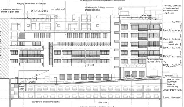
Figure 17: Western
elevation (courtesy Peter Dunn Architect, May 2019)
181. The proposed built form was altered in October
2019 and although these final plans reduce the height and scale of the
development when viewed from Princes Highway, the development increased the
scale of the building at the rear to read as 6 storey’s with a maximum
height reaching RL30.80 as opposed to the previous 5 storey height (RL27.80).
This adds a substantial amount of bulk to the rear despite only catering for
two apartments (Units 45 and 46). The scale and form at the rear is now greater
than the amended scheme presented in May 2019 (refer to Figure 18) and
fails to satisfy the transitional provisions as the scale along this rear
portion needs to respect the lower scaled residential properties.
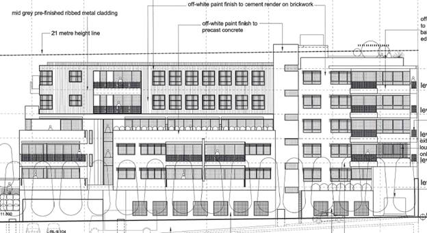
Figure 18: Western
elevation (courtesy Peter Dunn Architect, October 2019)
182. The most recent changes add unnecessary bulk and
scale at the rear and fail to provide an appropriate degree of transition in
scale and form to the west. In addition, the new level will further reduce the
provision of solar access to the central courtyard space. The removal of units
45 and 46 will create a fifth level at the rear which is considered to be a
more appropriate scale and form. The 6 storey section along the south western
corner may be acceptable if there are no amenity impacts generated by its form.
Interim Policy
– Georges River Development Control Plan 2020
183. Council at its Environmental and Planning
Committee Meeting dated 24 June 2019 resolved to adopt the Georges River
Interim Policy DCP which became effective on 24 July 2019.
184. The Interim Policy is a public policy is to be
used as a guide to set a consistent approach for the assessment of residential
development within the LGA. It is a supplementary document meaning that current
DCP controls will prevail if they are considered to be best practice. The
interim policy has no statutory recognition in the assessment of Development
Applications pursuant to the Environmental Planning and Assessment Act, 1979
(EP and A Act)
185. An assessment of the proposal has been carried out
against the provisions of the Interim Policy as set out in the following table.
Table 7:
Compliance against the Interim Policy – Georges River DCP 2020
|
Standard
|
Proposed
|
Complies
|
|
Site Frontage
|
|
20m
|
The frontage of the site along Princes
Highway is 53m and the frontage to Water Street is some 48m
|
Yes
|
|
Building Height
|
|
The relevant LEP controls relating
to height will prevail over the DCP controls that relate to storeys
|
The height of the building exceeds
the statutory height limit but only with the ancillary structures (lift
overruns and pergola feature to the rooftop area of open space) exceeding the
control. A Clause 4.6 statement has been submitted which justifies the amount
and degree of non-compliance.
|
No The building exceeds the height
limit and the Clause 4.6 statement is not considered to be well founded as
its assessment fails to consider the potential impacts and does not take into
consideration the updated heights of the ancillary roof structures.
|
|
Private Open Space
|
|
The ADG requirements prevail over
the DCP controls for private open space
|
Satisfies the ADG provisions for
private open space and exceeds these requirements for several units.
|
Yes
|
|
Parking
|
|
The RMS parking provisions apply if
the site is located within an “accessible” area pursuant to the
provisions of the ADG
|
The site is not within an
“accessible” area and therefore the KDCP parking rates apply.
This has been discussed earlier and the development complies with the
numerical requirements for a development of this scale.
|
Yes
|
|
Solar Access
|
|
The ADG requirements prevail over
the DCP controls for solar access.
|
The solar access provisions of the
ADG have been complied with.
|
Yes
|
(iii)
any planning agreement that has been entered into under section 7.4, or any
draft planning agreement that a developer has offered to enter into under
section 7.4, and,
186. Comment: there are no planning agreements
that pertain to this site.
(iv)
the regulations (to the extent that they prescribe matters for the
purposes of this paragraph), that apply to the land to which the development
application relates,
187. Comment: There are no further prescribed
matters under the Regulations apart from compliance with the National Building
Code of Australia (BCA) and meeting the Australian Standards for parts of the
design.
188. If approval is granted standard conditions will be
included in regards to the building and construction process and ensure that
any proposed materials and finishes i.e. cladding complies with the provisions
of the National Construction Code and conditions relating to construction
management would be imposed.
(b)
the likely impacts of that development, including environmental impacts on both
the natural and built environments, and social and economic impacts in the
locality,
Natural
Environment
189. The submission of a detailed Ecological Report has
quantified and assessed the importance and status of the existing trees on
site. The larger trees are not endemic to the area however their removal is not
supported by Council’s Landscape Officer. Council’s Landscape
Officer believes the trees are of good quality and condition and add to the
visual amenity and quality of the area and Site. There is limited potential to
replace these types of trees within the development site.
Built
Environment
190. The proposed development is unlikely to result in
adverse impacts to the built environment and on the whole provide a positive
contribution to this precinct which is in the process of undergoing and is in
need of change (subject to changes to the design to address planning and
environmental issues raised in this report). The architectural design, intended
use of high quality materials and finishes should create an interesting and
vibrant built form and assist in revitalising this local centre and activating
the street frontage. The development is considered to create a positive
contribution to the streetscape and will enhance the public domain subject to
the amendments referenced throughout this report.
Social Impact
191. The proposed development will have no serious
adverse social impact in fact it will fulfil a much needed housing requirement
in the area by providing more accommodation in this generally accessible and
convenient location subject to a reconsideration of the scale and form of the
rear building as discussed to create a better transition to the lower scale
residential properties to the west.
Economic Impact
192. The proposed development will have no adverse
economic impact in fact it will benefit the longer term viability and the
sustainability of this local centre through the provision of the three (3)
commercial tenancies. Also through the construction process the development
will ensure employment in this industry in the short term if this development
is approved.
(c)
the suitability of the site for the development,
193. Comment: The site has a series of
impediments and constraints but these should not preclude it from being
suitable for the proposed development subject to the concurrence from a series
of government agencies and incorporating some design changes. The site is zoned
to permit larger scaled mixed uses developments.
(e) any
submissions made in accordance with this Act or the regulations,
194. Comment: The proposal has been notified and
all submissions received have been considered in detail below.
(f) the
public interest.
195. Comment: The proposal at this stage fails
to satisfy all the provisions within the key Environmental Planning Instruments
and as such it cannot be concluded that the development is in the public
interest at this point in time.
196. The application at this point in time fails to
satisfy a number of planning controls and provisions and the insufficient
information at the time of assessment results in a failure to address and
provide details in relation to a series of outstanding planning and design
issues.
Environmental Planning and
Assessment Regulations 2000 (EP&A)
197. The proposed development satisfies the relevant
matters for consideration for development under the Regulations.
Development
Contributions
198. The proposed development would require the payment
of contributions in accordance with Section 7.11 and 7.12 (Contributions
towards the provisions or improvement of amenities or services) based on the
provisions of additional dwellings on the subject site and retail
tenancies/floor space. The contribution amount is not calculated as the
application is recommended for refusal.
SUBMISSIONS AND
THE PUBLIC INTEREST
199. The application was notified to immediately
adjoining properties and they were given a 14 day period in which to comment.
The original proposal generated a total of nine (9) written submissions and a
submission containing thirty nine (39) signatures. The latest plans were
renotified and a further three (3) submissions were received. The following
issues were raised by the submitters.
· The
density of the development is too large and the scale and height of the
development is inappropriate in this location and exceeds the height control.
200. Officer Comment: The original application
was amended and the height and floor space reduced. The density of the
development has been reduced by five (5) dwellings with a small decrease in
retail floor space. But it has increased in height to the residential interface
which is not considered to be an appropriate design and built form outcome
along this side of the Site.
· An
unacceptable degree of overshadowing will occur to the west.
201. Officer Comment: The amended application is
not accompanied by updated shadow diagrams however the scale and height of the
development has been reduced along the Princes Highway and as such the
shadowing impacts are likely to be reduced in some areas. The scale of the building
has increased in height to the residential interface which will increase
shadowing to some degree The development in mid-winter at 9am will overshadow
No.5 and 7 Water Street and to a lesser degree the eastern boundary of No.3
Water Street. From 12 noon onwards the development will not overshadow any
adjoining residential property as it falls on Water Street and the Princes
Highway. From 12pm until 3pm the development will overshadow the public car
park and the eastern section of Church Street Reserve. The south-western part
of the reserve is unaffected and this is the largest and more private area of
the parkland. From 3pm onwards the development affects a small section of Todd
Park, Caltex Service Station and the Princes Highway.
202. As such the immediately adjoining residential
properties will not be affected by the development in the afternoon in
midwinter. This is considered to be an acceptable planning outcome as
immediately adjoining residences will receive a minimum of 3 hours of sunlight
during the day in midwinter.
· The scale
of the development at the rear is inappropriate and the transition to the
residentially zoned properties to the west is not acceptable.
203. Officer comment: Currently the residential
properties along Water Street are single and two storey detached dwelling
houses. These properties have been up-zoned like the subject site to
accommodate medium density development achieving a maximum height of 15m for
future development. This equates to some 4-5 storeys. The proposed development
has been reduced in height so that the parapet and all habitable areas are
located within the 21m height limit however the most recent set of amended
plans increases the scale along the western side to reflect a 6 storey
building. The second set of amended plans showed this section of the building
at five (5) storeys which is a better scale and transition to this residential
precinct.
204. The proposed encroachments to the height control
consist of the lift overrun, pergola feature, WC and planter boxes which are
all ancillary elements to the rooftop areas of open space. The Applicant has
submitted a Clause 4.6 Statement which seeks to justify the amount and degree
of non-compliance. In this case the statement lacks appropriate detail and information
to justify the exceedance and is therefore is not considered to be well founded
in this case.
205. Despite this the proposed form and scale of
development as proposed is generally consistent with the anticipated scale that
the controls envisage along the Princes Highway frontage however, the scale of
the rear building as amended by the plans in October 2019 has increased the
height of the rear building from 5 to 6 storeys. This is a poor outcome as the
development will not step down to the lower residential properties. The
proposed amended design in May 2019 had the majority of the rear building
achieving 5 storeys in scale. Part of this issue could be resolved by lowering
the building and removing apartments 45 and 46.
206. This issue has been discussed in greater detail in
this report and it is concluded that the amended design doesn’t provide
an appropriate transition to the west and is not in accordance with the
objectives of the KDCP.
· An
unacceptable degree of overlooking will occur
207. Council comment: The rear building has been
designed so that it provides for compliant separation distances of 6m-9m along
this side. If consent is granted there are a number of conditions that could be
implemented to further reduce overlooking such as sliding fixed louvered
screens to balconies to provide additional screening. Also the garden terraces
along Level 4 should become a small communal spaces and landscaped elements
rather than private areas. Landscaping around and within this space should be
increased. Also the provision of raised planter boxes along the western
boundary adjoining the western boundary should include species that can achieve
heights of 3-4m to provide some additional screening and greenery (i.e. bamboo
or the like).
· Increase
in traffic, parking and congestion problems.
208. Council comment: This is a key planning
concern that has been raised by most submitters. All residents are concerned
that the cumulative impacts of the development in terms of traffic movements
that will increase the current level of congestion along Water Street. Water
Street is one-way and one of the few streets in the immediate locality that
permits a south bound turn onto Princes Highway, hence it attracts a large
amount of vehicles in the AM peak (in particular) who are heading south. This
is evident by the photos provided by one resident (see Figure 19 and 20 below).
The issue of congestion and trip generation has been discussed in more detail
earlier in this report.
209. Added to this, congestion of the vehicles that travel
up Church Street and turn into the public car park and access Water Street that
way is a current issue. This creates a clear banking up of traffic and cars
that are approaching the intersection (Princes Highway and Water Street) from a
number of points from the west. One submitter suggested that the originally
proposed driveway into the development should not be located opposite the
public car park exit.
210. In addressing this issue the driveway to the
development has been relocated further to the west and will be offset from the
car park access point. This goes some way to address this resident’s
concerns.
211. The issue of traffic generation has been addressed
in greater detail earlier in this assessment and the projected levels by
McLaren have been scrutinised and considered to be inaccurate however even a
recalculation of traffic generation levels created by the development seems
there will be less traffic movements than when the service station was fully
functional. The issue of traffic congestion in Water Street is largely a result
of the existing traffic conditions in the broader locality funnelling residents
into Water Street. This is not an issue that can be resolved by this
application alone. This is a larger issue which needs Council’s and the
Local Traffic Committee’s attention.
212. A series of mechanisms should be considered such
as closing access through to the public car park from Church Street. This will
to some degree remove and limit access to and from Church Street. Other traffic
calming mechanisms could be adopted however a more detailed study of the whole
precinct would need to occur. In addition congestion should improve after RMS
Tidal flow improvements occur.
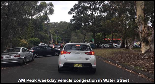
Figure 19: Extract
from one of the submissions showing the congestion along Water Street at peak
times
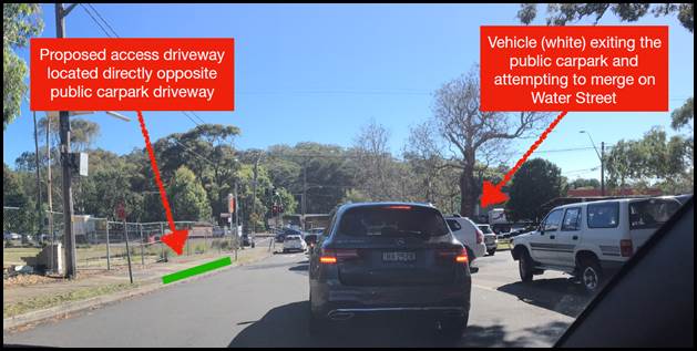
Figure 20: Extract
from one of the submissions showing the queuing and conflicts with additional
cars cutting through to Water Street from the public car park.
· Public
Transport is limited in this location which increases the reliance on cars
213. Council comment: It is acknowledged that
this site is not considered to be “accessible” in planning terms.
If a site is classified as “accessible” onsite parking provisions
are reduced in accordance with RMS requirements. As the development is not
accessible the development needs to comply with Council’s minimum parking
requirements in accordance with the Kogarah Development Control Plan (KDCP).
The proposal complies with Council’s numerical controls pertaining to car
parking.
· House
shown at 7 Water Street on the amended plans is inaccurate.
214. Officer comment: This issue has been
addressed above. The proposed built form at 7 Water Street as shown in the
amended elevations and is only an indicative built form model for possible
future redevelopment opportunities at this site. In assessing the proposal
Council considers the existing situation and factors in the potential for
future redevelopment of adjoining sites.
REFERRALS
Council
Internal Referrals
Landscape Officer
215. Council’s Landscape Officer has reviewed the
application and has raised an objection to the removal of the larger and more
significant trees on site. The following formal comments were provided;
216. “The following reports have been reviewed
and considered;
- I
have the Arborist report from TALC dated 16th April 2014
- I
have a Statement prepared by TALC dated 6th February 2018, Ref:4431
- Tree
Assessment – Cumberland Ecology, dated 7th Feb 2020.
a) The
Arborist Report provided and dated 2014, assessed six (6) trees with four trees
being of Australian Native, significant, with the Author rating Tree 1, 4, 5
having good vigour and a Sustainable Retention Index Value (SRIV) of MGVF9 (Medium
term, potential for longer with improved growing conditions). My site visit
this morning, some six years later still confirms these ratings and trees
having good vigour. The size of the trees has also increased since 2014.
b) The
comment from the 2014 report – “It is considered that the amenity
the trees provide is minimised due to the number of trees present within
neighbouring lands and could be replaced through the replanting of trees,
shrubs and ground covers as part of landscape works for the development” (5.
Discussion). This comment is not supported and the importance of canopy
linkage is evidenced in the reserve to the south, the parks trees to the east
and general canopy cover within the Todd Park/Carrs Park precinct. These trees
provide an important canopy link throughout the area.
.
c) The
Arborist Report dated 2014 recommends removal of all trees – 1, 2, 3, 4,
5 and 6 and yet the report mentions within Appendix D “Tree Protection
Guidelines’ and Appendix E “Tree Protection Zone Standard
Procedure”… and yet no trees are being retained which contradicts the
conclusion to some degree.
d) The
Statement provided by TALC, dated 6th February, states that the
“feasibility for retention” for the one tree, being Tree 1.
There are several other trees upon the proposed site that are of equal
importance, notably Corymbia citriodora x 2. Again the statement – Amenity
issues – “The area in general is that of a leafy nature supporting
multiple trees minimising any perceived impacts upon the amenity of the
immediate area through the removal of the subject tree”. This statement
cannot be supported. The author states as well that “any amended design
would require a setback of 12 metres radius to be considered impacting upon the
viability of the development”. This statement demonstrates that the main
focus is the viability of the development as opposed to the viability of the
subject tree. Yes I believe the proposal needs amending to cater for the
subject tree (tree No.1) and cater for the other trees not mentioned within
this statement as they contribute greatly to the canopy link throughout the
area and broader community.
e) Of
note this subject site is classed as B2 with the land directly to the west of
this site being R3, being a lower residential height limit. These trees provide
a break from this dissection in zoning boundaries and future occupant’s
privacy from both sites.
f) The
Tree Assessment by Cumberland Ecology has mentioned that the tree1 was
misdiagnosed by TALC and in fact a Eucalyptus grandis. The findings within this
tree Assessment by Cumberland Ecology are that the trees do not form part of
threatened ecological communities. With this in mind, it still demonstrates the
importance of a greening canopy linkage, and the contribution these trees have
on the greening of this community as a whole.
217. As of the site visit this morning, 19/2/20
there is a minimum seven (7) tree species that have seeded from the
surrounding seed bank of trees. These trees range in DBH (Diameter at Breast
Height) of .150mm up to .300mm, classed as trees under Georges River Councils
tree management Policy 2019. The Arborist report only shows one tree evaluation
matrix. Another evaluation matrix called STARS – Significance of a Tree
Assessment Rating System, shows that trees 1, 4 and 5 are rated as having a
HIGH Significance (must have min 3 criteria) being;
1
– The tree is in good condition and good vigour
2
– The tree has a form typical for the species
3
– The tree is rare or uncommon in the local area (Cumberland Ecology A.5.
Discussion)
4 – The
tree is visually prominent and visible from a considerable distance when viewed
from most directions within the landscape due to its size and scale and makes a
positive contribution to the local amenity
218. My recommendations are that trees 1, 4 and 5 be
retained and the proposal redesign to cater for these significant trees”.
Development
Engineer
219. Council’s Development Engineer has raised no
objection to the proposed stormwater/drainage design subject to conditions of
consent being attached to any consent granted. An OSD tank is proposed with the
site draining towards the Princes Highway being the low point of the site. A
series of sumps are proposed along the eastern side which will manage surface
runoff. This design has been adopted as a result of the recommendations of the
Geotechnical Report (prepared by EI and dated 22 March 2016). The Geotechnical
report acknowledged that the basement levels will intersect ground water
levels. The report suggested that this can be controlled by a conventional sump
and pump system. Conditions would need to be imposed to ensure that a
well-designed ground water controlled system is designed and that careful
ongoing inspections and maintenance programs are adopted.
220. The stormwater plans are concept only and would
require a detailed design prior to the issuing of the Construction Certificate.
Traffic
Engineer
221. Council’s Traffic Engineer has examined the
application and has raised no objection to the development in principle subject
to conditions of consent requiring the car spaces to comply with the Australian
Standards. Council’s Traffic Engineers reviewed the updated Traffic and
Parking assessment and have not made any detailed assessment or comments on the
road network.
Environmental
Health Officer
222. Council’s Environmental Health Officer has
reviewed the application and confirmed in writing that the site of the former
Service Station at 659 Princes Highway has been appropriately remediated and
validation provided. Council’s Environmental Health Officer stated;
“Submitted Site Validation
Report Former Caltex Blakehurst Service Station (ID: 22162S) 659-661 Princess
Highway Blakehurst prepared by Coffey Environments Pty Ltd ( Project Ref
# ENVIRHOD00595AB) dated 3 September 2010 indicates that identified soil contaminants
have been excavated from the site and the resulting excavations validated. A
summary of previous assessment work by Coffey Environments Pty Ltd included the
following:
1. Divestment Risk
Assessment (DRA) dated 2008a;
2. Register of Hazardous
Materials dated 2008 b ;
3. Environmental Site
Assessment dated 2009 and
4. Remediation Action Plan
(RAP) dated 2010.
Remediation of the site included the removal of all identified USTs,
associated pipework, and contaminated soils. The results of the site validation
program indicated that identified soil contamination has been excavated from
the site and the site validated. Excavated soils from the site were stockpiled
and classified to enable off-site disposal or on-site re-use. Imported fill
soils were classified as VENM and therefore suitable for use as backfill within
on-site excavations. Concentrations of contaminants of potential concern were
reported less than the adopted acceptance criteria with the exception of copper
and zinc which are considered likely to be representative of naturally
occurring concentrations in regional groundwater than on-site activities
associated with former occupation of the site as a service station. According
to the Coffey Environments the site has been adequately remediated to a
standard which does not prevent the use of the property for any use expressly
permitted under the current zoning of the property 3(a) Business.”
223. Despite appropriate remediation occurring at 659
Princes Highway Council is still not satisfied that 655 Princes Highway is
suitable for its intended use as no preliminary or detailed site inspection has
occurred and as such the provisions of SEPP 55 have not been satisfied.
Coordinator
Environment Sustainability and Waste
224. Council’s Coordinator Environment
Sustainability and Waste reviewed the proposal and has raised no objection
“in principle” subject to conditions of consent being attached to
any consent. One comment that was raised in the referral was the type of
concrete floor i.e. “To allow access to the garbage truck onto the
property the concrete floor which requires the truck to drive onto the property
needs to be reinforced to adequately hold a 27tonne truck. An indemnity
needs to be filled out to give permission for the contractor to enter the
property. The Height clearance for the truck to enter the property needs to be
4m along the length of the distance to be used by the truck.” This
issue can be addressed by conditions if approval is to be granted.
225. The waste arrangement has been designed to cater
for on-site removal of waste twice a week by a private contractor. The
arrangement is in accordance with the Waste Management Plan that was lodged
with the application.
External
Referrals
Roads and
Maritime Services (RMS)
226. The application was referred to RMS in accordance
with the provisions of Clause 102 and 106 of the Infrastructure SEPP. RMS to
date have not provided formal concurrence to the application.
Ausgrid
227. The application was referred to Ausgrid who raised
a series of issues regarding the design of the proposal and its potential
impacts onto existing electrical transmission lines. The Applicant has been
liaising with Ausgrid but to date no information has been provided to state
that Ausgrid are satisfied with the scheme. The proposal fails to satisfy
‘Subdivision 2’ (Clause 45) of the Infrastructure SEPP. It does
seem the outstanding issue could possibly be resolved with the cabling being
provided underground. Given this site is located next to sensitive State
infrastructure it’s important that Ausgrid is satisfied with the proposed
arrangement.
State Rail
228. The application was referred to State Rail on
several occasions. Additional information was required to be prepared in
respect to a ‘Blow Out’ report and updated Sections. The amended
information was provided to State Rail for their assessment and consideration.
To date their concurrence in accordance with Clauses 86 and 103 of the
Infrastructure SEPP has not been provided. As of February 2020 State Rail were
in the process of reviewing the new engineering information however had not
finalised their assessment.
CONCLUSION
229. The application has been assessed having regard to
the Matters for Consideration under Clause 4.15 of the Environmental Planning
and Assessment Act 1979, the provisions of the relevant State Environmental
Planning Policies, Local Environmental Plans and Development Control Plans.
230. The application seeks approval for the
consolidation of the existing four (4) allotments, demolition of all structures
and the construction of a part six (6), part seven (7) storey mixed use
development comprising fifty (50) residential units, over two and a half levels
of basement car parking catering for one hundred and eighteen (118) car parking
spaces, associated landscaping in the form of a central courtyard space and
roof top communal terrace areas and associated site works.
231. The proposed design has been amended a series of
times and the final design is considered to be an improvement and is considered
an acceptable design response for this Site subject to the scale and form of
the rear building being reconsidered and reduced and consideration given to
retaining the existing trees.
232. There is also a series of outstanding information
that has not been provided and the insufficient information means that the
development in its current form fails to satisfy a series of Environmental
Planning Instruments and cannot be recommended for approval. Deferred
Commencement consent cannot be issued as the information required is mandatory
and concurrence required prior to determination.
233. It is considered that Development Application No
DA2017/0408 should be refused subject to the following reasons.
DETERMINATION
AND STATEMENT OF REASONS
234. The reasons for this recommendation in summary
are:
§ The
proposal fails to satisfy the objectives of Clause 4.3 (Height of Buildings
control) as part of the Kogarah Local Environmental Plan 2012 (KLEP). The
degree of non-compliance with the height has been inaccurately calculated and
considered and the lack of updated shadow diagrams fails to justify the amenity
impacts generated by the variation are considered to be reasonable and
acceptable in this case.
§ The
proposed development fails to satisfy the provisions of Clause 4.6 of the
Kogarah Local Environmental Plan (KLEP) in respect to calculating the degree of
non-compliance with the height control. The updated Clause 4.6 Statement is not
considered to be well-founded and fails to accurately assess the degree of
variation; with respect to the height control.
§ The proposal fails to
satisfy the provisions of Clause 6.1 of the Kogarah Local Environmental Plan
(KLEP) as the site is located within the Class 5 Acid Sulphate Soils (ASS)
zone. The subject site adjoins Class 3 ASS and therefore an Acid Sulphate Soils
Management Plan is a mandatory requirement pursuant to the provisions of the
KLEP. The ASS Management Plan has not been prepared and as such Subclause 3 of
Clause 6.1 has not been satisfied.
§ The provisions of State
Environmental Planning Policy No.55 have not been satisfied as it is unclear
whether No. 655 Princes Highway is suitable for its intended use. To date no
site investigations have occurred and the obligations and requirements of SEPP
55 have not been satisfied.
§ Clauses 86 and 103 of
the State Environmental Planning Policy (Infrastructure) have not been
satisfied as State Rail have not provided formal concurrence for the proposed
development.
§ Clause 101 of the State
Environmental Planning Policy (Infrastructure) has not been satisfied as Roads
and Maritime Services have not provided their formal concurrence for the
proposed development.
§ The provisions of Clause
45 of the State Environmental Planning Policy (Infrastructure) have not been
satisfied as Ausgrid have not provided their formal concurrence to the proposed
development.
§ Council’s
Landscape Officer is not in support of the removal of the large, significant
existing trees (Trees No.1, 4 and 5) on site given their good condition and
vigour and the fact that they contribute significantly to the aesthetic and
visual quality of the area and streetscape.
§ The six (6) storey scale
of the rear building is inappropriate and fails to satisfy the Kogarah Development
Control Plan provisions which require new development to respect and create an
appropriate transition between properties to the rear.
§ The proposal is not in
the public interest given the number of submissions received and non-compliance
with the objectives of the Height of Buildings Control.
Determination
235. THAT pursuant to Section 4.16(1) of the
Environmental Planning and Assessment Act, 1979, as amended, the Georges River
Local Planning Panel, refuses development consent to Development Application
DA2017/0408 for site consolidation of the existing four (4) allotments,
demolition of all structures and the construction of a part six (6), part seven
(7) storey mixed use development comprising fifty (50) residential units, over
two and a half levels of basement car parking catering for one hundred and
eighteen (118) car parking spaces, associated landscaping in the form of a
central courtyard space and roof top communal terrace areas and associated site
works, at the site known as Lot 4 in DP13988 and Lots 29, 30, 31 in DP 124618
at 655-659 Princes Highway, Blakehurst subject to the following reasons:
1. The
proposed development fails to satisfy the objectives of Clause 4.3 (Height of
Buildings control) of the Kogarah Local Environmental Plan 2012 in that the
degree of non-compliance with the height control has not appropriately
justified that the variation will “minimise” amenity impacts such
as overshadowing, visual impact and overlooking. In this case the
non-compliance is considered to be unreasonable and unnecessary.
2. The
proposed development fails to satisfy the provisions of Clause 4.6 of the
Kogarah Local Environmental Plan 2012 in respect to calculating the degree of
non-compliance with the height control. The updated Clause 4.6 Statement is not
considered to be well-founded as it fails to accurately assess the degree of
variation; as such the proposal is not in the public interest and does not
satisfy the objectives of the height standard and provisions of Clause 4.6.
3. The
proposal fails to satisfy the objectives and provisions of Clause 6.1(3) of the
Kogarah Local Environmental Plan 2012 as an Acid Sulphate Soils Management Plan
has not been prepared and the provisions and requirements of Clause 6.1 of the
Kogarah Local Environmental Plan 2012 have not been satisfied.
4. The
proposal fails to satisfy the provisions of State Environmental Planning Policy
No.55 – Remediation of Land as it is unclear whether No.655 Princes
Highway is suitable for its intended use as no Preliminary (Phase 1) or
Detailed (Phase 2) site investigations have occurred.
5. Clauses
86 and 103 of the State Environmental Planning Policy - Infrastructure have not
been satisfied as State Rail has not provided formal concurrence for the
proposed development and its associated design given that State Rail
infrastructure immediately adjoins the site and the impact (or lack of) from
the proposal on these assets has not been determined.
6. Clause
45 of the State Environmental Planning Policy - Infrastructure have not been
satisfied as Ausgrid has not provided formal concurrence for the proposed
development, its associated design.
7. Clause
101 of the State Environmental Planning Policy - Infrastructure has not been
satisfied as Roads and Maritime Services have not provided their formal
concurrence to the proposed development and design given the siting of the
proposal is on a classified roadway.
8. The
proposal fails to satisfy the objectives of Section 3.4, Part D of the
Development Control Plan 2012 in respect to Building Heights as an appropriate
transition to the lower scaled residential buildings to the west has not been
achieved. The proposed six-storey scale and form of the rear building is
considered inappropriate and will adversely affect the smaller scaled
residential properties to the rear along Water Street.
9. The
proposed removal of the existing substantial trees on site (Trees No.1, 4 and
5) is not supported given the visual and aesthetic qualities and contribution
of these trees to the locality and streetscape and their good condition and
vigour. Their removal will be detrimental to the quality of streetscape and
immediate surrounds.
10. The
development is not in the public interest given the number of submissions
received and the exceedance in the height of the building above the height
control.
Review of Determination - Section 8.2 of
the Environmental Planning and Assessment Act confers on an applicant who is dissatisfied with the determination of the application
the right to lodge an application with Council for a review of such
determination. Any such review must however be completed within 6 months
from its determination. Should a review be contemplated sufficient time
should be allowed for Council to undertake public notification and other
processes involved in the review of the determination.
Note: Review provisions
do not apply to Complying Development, Designated Development, State Significant Development, Integrated Development or any application determined
by the Sydney South Planning Panel or the Land & Environment Court.
Appeal Rights - Part 8 (Reviews and
appeals) of the Environmental Planning and Assessment
Act 1979 confers on an applicant who is dissatisfied
with the determination of the application a right of appeal to the Land and
Environment Court of New South Wales.
Lapsing of Consent - This consent will lapse unless the development is physically commenced within 5 years from the Date of Operation of this consent, in accordance with
Section 4.53 of the Environmental Planning and Assessment Act 1979 as amended.
ATTACHMENTS
|
Attachment ⇩1
|
South Elevation - 655-659 Princes Hwy Blakehurst
|
|
Attachment ⇩2
|
North Elevation - 655-659 Princes Hwy Blakehurst
|
|
Attachment ⇩3
|
Eastern Elevation - 655-659 Princes Hwy Blakehurst
|
|
Attachment ⇩4
|
Western Elevation - 655-659 Princes Hwy Blakehurst
|
|
Attachment ⇩5
|
Roof Plan - 655-659 Princes Hwy Blakehurst
|
|
Georges
River Council - Georges River Local Planning Panel (LPP) - Thursday, 5 March
2020
LPP008-20 655-659 Princes Highway Blakehurst
[Appendix
1] South Elevation -
655-659 Princes Hwy Blakehurst
|
Page 184
|
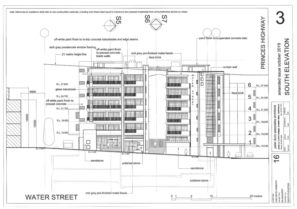
|
Georges
River Council - Georges River Local Planning Panel (LPP) - Thursday, 5 March
2020
LPP008-20 655-659 Princes Highway Blakehurst
[Appendix
2] North Elevation -
655-659 Princes Hwy Blakehurst
|
Page 185
|
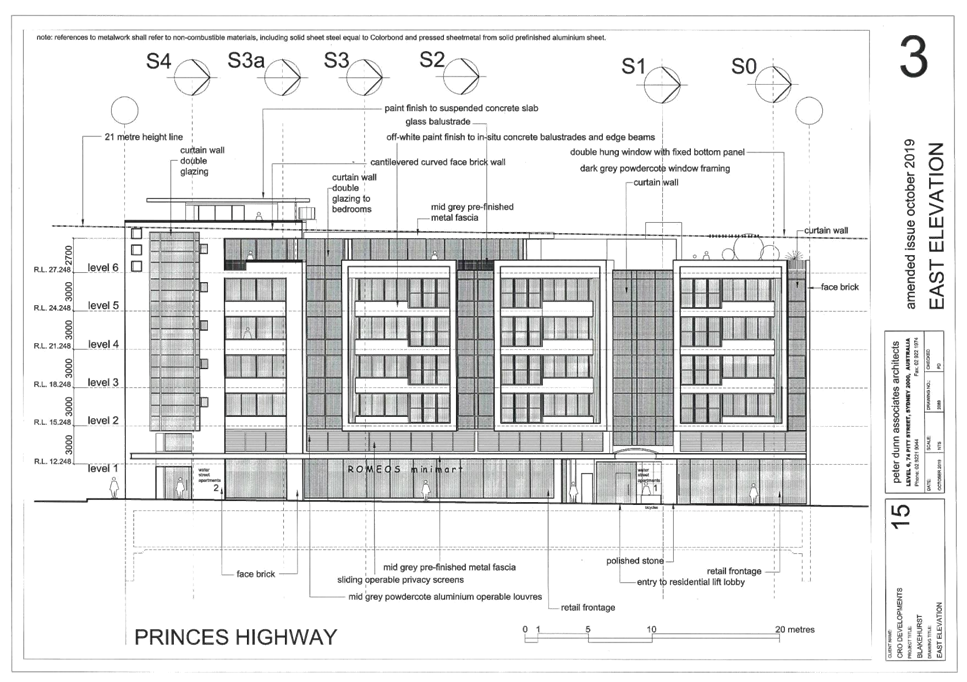
|
Georges
River Council - Georges River Local Planning Panel (LPP) - Thursday, 5 March
2020
LPP008-20 655-659 Princes Highway Blakehurst
[Appendix
3] Eastern Elevation -
655-659 Princes Hwy Blakehurst
|
Page 186
|

|
Georges
River Council - Georges River Local Planning Panel (LPP) - Thursday, 5 March
2020
LPP008-20 655-659 Princes Highway Blakehurst
[Appendix
4] Western Elevation -
655-659 Princes Hwy Blakehurst
|
Page 187
|
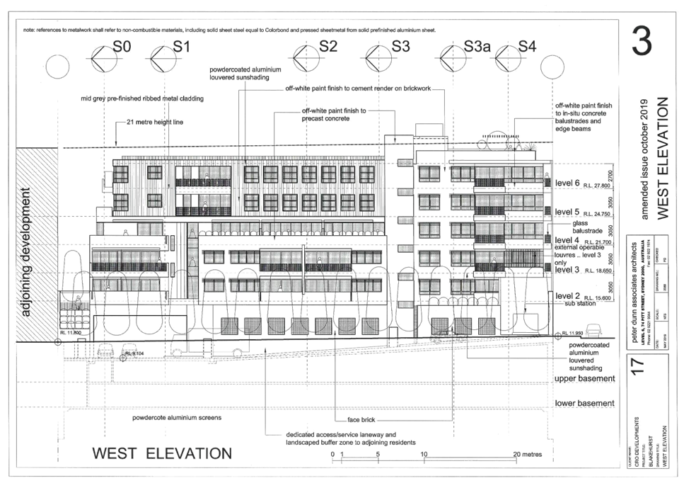
|
Georges
River Council - Georges River Local Planning Panel (LPP) - Thursday, 5 March
2020
LPP008-20 655-659 Princes Highway Blakehurst
[Appendix
5] Roof Plan - 655-659
Princes Hwy Blakehurst
|
Page 188
|
|
Georges
River Council – Local Planning Panel Thursday, 5 March 2020
|
Page 189
|
REPORT TO GEORGES RIVER COUNCIL
LPP MEETING OF Thursday, 05 March 2020
|
LPP Report No
|
LPP009-20
|
Development Application No
|
DA2018/0584
|
|
Site Address & Ward Locality
|
546 Railway Parade Hurstville
Kogarah Bay Ward
|
|
Proposed Development
|
Demolition and construction of a
ten storey residential flat building comprising 17 units and 2 levels of
basement car park.
|
|
Owners
|
Marija Komandina
|
|
Applicant
|
Cornerstone Design
|
|
Planner/Architect
|
Architect: Nick Lycenko; Planner:
Rod Logan Planning
|
|
Date Of Lodgement
|
21/12/2018
|
|
Submissions
|
Four (4)
|
|
Cost of Works
|
$6,919,849.00
|
|
Local Planning Panel Criteria
|
The proposed development is a
residential flat building and is subject to the provisions of State
Environmental Planning Policy No. 65.
|
|
List of all relevant s.4.15
matters (formerly s79C(1)(a))
|
State Environmental Planning Policy
No. 65 – Design Quality of Residential Apartment Development, State
Environmental Planning Policy (Vegetation in Non-Rural Areas) 2017, State
Environmental Planning Policy (BASIX) 2004, Greater Metropolitan Regional
Environmental Planning Policy No 2- Georges River Catchment,
State Environmental Planning Policy
No. 55 – Remediation of Land, State Environmental Planning Policy
(Infrastructure) 2007, Draft Environment State Environmental Planning Policy,
Draft Remediation of Land State Environmental Planning Policy,
Kogarah Local Environmental Plan
2012, Kogarah Development Control Plan 2013
|
|
List all documents submitted
with this report for the Panel’s consideration
|
Site and Elevation Plans
|
|
Report prepared by
|
Senior Development Assessment
Planner
|
|
Recommendation
|
The application is recommended for refusal for the
reasons detailed in this report.
|
|
|
Summary of matters for
consideration under Section 4.15
Have all recommendations in relation
to relevant s4.15 matters been summarised in the Executive Summary of the
assessment report?
|
Yes
|
|
Legislative clauses requiring
consent authority satisfaction
Have relevant clauses in all
applicable environmental planning instruments where the consent authority
must be satisfied about a particular matter been listed and relevant
recommendations summarised, in the Executive Summary of the assessment
report?
|
Yes
|
|
Clause 4.6 Exceptions to
development standards
If a written request for a
contravention to a development standard (clause 4.6 of the LEP) has been
received, has it been attached to the assessment report?
|
Yes
- Clause 4.3 Height of buildings
|
|
Special Infrastructure
Contributions
Does the DA require Special Infrastructure
Contributions conditions (under s7.24)?
|
Not
Applicable
|
|
Conditions
Have draft conditions been provided
to the applicant for comment?
|
No,
the application is recommended for refusal, and the refusal reasons can be
reviewed when the report is published.
|
|
Site Plan
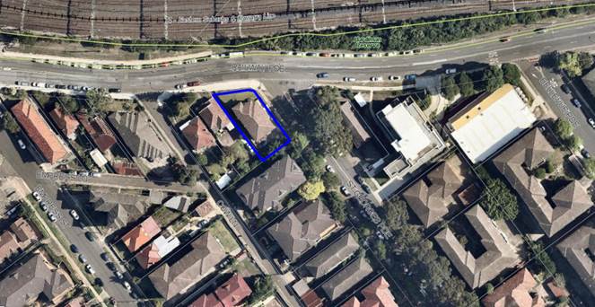
The site is outlined in
blue
|
Executive Summary
Proposal
1. The development
application proposes demolition works and construction of a 10 storey
residential flat building comprising 17 units and 2 levels of basement parking.
The proposed unit mix is 4 x 1 bedroom units and 13 x 2 bedroom units. Communal
open space is provided on the rooftop. The car parking will operate via a
mechanical parking system.
Figure
1: Photomontage of the proposal
Site and Locality
2. The subject site
is legally identified as CP/SP13440, and has a street address of 546 Railway Parade,
Hurstville.
3. The site is
located on the southern side of Railway Parade between St Georges Parade and
Cow Lane. The site is currently occupied by a three (3) storey residential flat
building with a drainage easement registered through the rear of the site.
Figure
2: Built form existing on the
development site.
4. The wider locality
is characterised by a mix of old and new residential flat buildings and older
single storey housing stock. The T4 – Eastern Suburbs and Illawarra Rail
Line is located to the north of the site across Railway Parade.
Zoning and Permissibility
5. The site is zoned
‘R4 High Density Residential’ under the Kogarah Local Environmental
Plan 2012 (KLEP). The development is defined a residential flat building under
KLEP, which is permissible with consent.
Submissions
6. The development
application was publicly exhibited in accordance with the provisions of the
Kogarah Development Control Plan 2013. Four (4) submissions were received as a
result.
Level of Determination
7. This development
application is referred to the Local Planning Panel for consideration and
determination as it comprises development to which State Environmental Planning
Policy No. 65 – Design Quality of Residential Apartment Development
applies as required by the Ministerial Direction of 23 February 2018.
Conclusion
8. The
application has been assessed having regard to the Matters for Consideration
under Section 4.15 of the Environmental Planning and Assessment Act, 1979, the
provisions of the relevant State Environmental Planning Policies, Local
Environmental Plan and Development Control Plans. The proposal results in an
unreasonable planning and urban design outcome in the context of the site and
performs poorly against the design quality principles of State Environmental
Planning Policy No 65. The Clause 4.6 Objection in relation to the building
height development standard is considered to not be well-founded. As a result
the application is recommended for refusal.
Report in Full
Description of Proposal
9. The development
application proposes demolition works and construction of a 10 storey
residential flat building with two levels of basement parking. The proposal
contains 4 x 1 bedroom units and 13 x 2 bedroom units. Communal open space is
provided on the rooftop. The car parking will operate via a mechanical parking
system.
10. Specifically, the proposal includes
the following:
Basement
Levels
Two levels of
basement are proposed to accommodate an automated car stacking system that
provides parking for 23 vehicles.
Ground
Floor
The ground
floor contains the residential entry lobby from St Georges Parade, a pump room,
bin store room; cleaners room and lift access to the levels above. Vehicular
access to the site is proposed from St Georges Parade via a driveway which
provides access to the car stacker system from the ground floor. 1 x 2 bedroom
unit is located adjacent to the Railway Parade frontage.
Fire stairs
from the residential units discharge at this level and lift access is provided
from the ground floor to the rooftop communal open space area.
Levels 1
to 3
These levels
contain two units per floor (2 x 2 bedroom units) with lift access and egress
stairs.
Levels 4
to 7
Each level
contains 1 x 1 bedroom unit and 1 x 2 bedroom unit with lift access and egress
stairs.
Level 8
This level
contains 1 x 2 bedroom unit and an area of communal open space (56.56sqm) on
the south eastern side of the building, with lift access and egress stairs.
Level 9
This level
contains 1 x 2 bedroom unit with lift access and egress stairs.
Rooftop
Communal Open Space
The roof
level provides a second area of communal open space (101.12sqm), a common room
with WC, including covered and open areas, a BBQ and landscaped planters along
the edges. Lift access and egress stairs are provided to this level.
11. The site is an irregular shape,
having a primary street frontage of 16.435m to Railway Parade, a splay of 2.66m
and a secondary frontage to St Georges Parade of 27.205m and an overall area of
510.2sqm. A 1.0m wide drainage easement traverses the site at the rear, between
the existing detached garage and the flat building, which drains 548 Railway
Parade to the south west. A substation exists to the St George Parade,
Hurstville frontage.
12. Immediately to the west of the site
is a single storey dwelling house known as 548 Railway Parade, Hurstville. The
property immediately to the south is known as 1-3 St Georges Parade, Hurstville
and contains a four storey residential flat building.
13. Opposite on St Georges Parade to
the east is a two storey residential flat building with attached garages known
as 542 Railway Parade, Hurstville.
14. The wider locality is characterised
by a mix of old and new residential flat buildings and older single storey
housing stock. The T4 – Eastern Suburbs and Illawarra Rail Line is
located to the north of the site on the opposite side of Railway Parade,
Hurstville.
15. The built form immediately
adjoining the site is illustrated in figures 3, 4 and 5 below.
Figure
3: 548 Railway Parade (west of the
site)
Figure
4: 1-3 St Georges Parade (south of
the site)
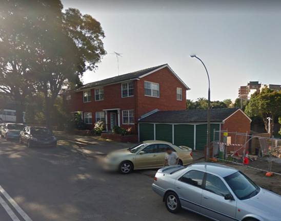
Figure
5: 542 Railway Parade (opposite to
the east)
PLANNING
ASSESSMENT
16. The subject site has been inspected
and the development has been assessed under the relevant Section 4.15, Matters
for Consideration of the Environmental Planning and Assessment Act 1979.
Environmental
Planning Instruments
State Environmental Planning Policies
17. Compliance with relevant State
Environmental Planning Policies is summarised in the table as follows and
discussed in more detail thereafter.
|
State
Environmental Planning Policy
|
Complies
|
|
State
Environmental Planning Policy No 55 - Remediation of Land
|
Yes
|
|
State
Environmental Planning Policy (Building Sustainability Index: BASIX) 2004
|
Yes
|
|
State
Environmental Planning Policy (Vegetation in Non-Rural Areas) 2017
|
N/A
|
|
State
Environmental Planning Policy No. 65 - Design Quality of Residential
Apartment Development
|
Yes
|
|
State
Environmental Planning Policy (Infrastructure) 2007
|
Yes
|
State
Environmental Planning Policy No 55 - Remediation of Land
18. SEPP 55 aims to promote the
remediation of contaminated land in order to reduce the risk of harm to human
health or any other aspect of the environment.
19. Clause 7 requires contamination and
remediation to be considered in determining a development application. The
consent authority must not consent to the carrying out of development on land
unless it has considered whether or not the land is contaminated.
20. A
Preliminary Site Investigation Report was submitted with the application, which
concludes:
“Asbestos has been identified as a contaminant of potential
concern in the identified AECs. The NSW EPA endorsed guidance around intrusive
investigations for asbestos in soils, prefers the use of excavated test pits.
Access to soils in AEC01, AEC02 and AEC03 with conventional excavation
equipment, is currently constrained by the presence of a retaining wall, as
well as the presence of existing buildings. Access to soils in AEC01 with
conventional excavation equipment, is currently constrained by the presence of
an existing building and concrete hardstand materials.
Based on AG's assessment of the desktop review information and
fieldwork data, in the context of the proposed the proposed high-density
residential development, AG makes the following conclusions:
• Four areas of environmental concern
(AEC) have been identified for the site; and
• The site could be made
suitable (from a land contamination perspective) for the proposed residential
subdivision, subject to validation of the absence (or removal) of potential
contamination risks in the identified AEC.
Based on these conclusions, AG makes the following recommendations:
• a remedial action plan
(RAP) should be prepared, which includes a strategy for:
o validating
residual soils in AEC01, AEC02 and AEC03, following demolition and basement
excavation works;
o validating
soils in AEC04, following demolition and removal of overlying structures and
pavements;
o managing
unacceptable contamination risks, if identified during validation works;
• a hazardous building
materials survey should be undertaken on existing structures, prior to
demolition works being undertaken;
• a hazardous building
materials clearance certificate should be obtained following hazardous building
material removal/abatement works on existing structures, and prior to
commencement of demolition works;
• a waste classification
of soils proposed for excavation on site, should be prepared to
facilitate their offsite disposal; and;
• the RAP and clearance
certificate should be prepared by a suitably experienced environmental
consultant.”
21. Based on the information provided demonstrating that contaminants are present on the site, a Detailed
Site Investigation Report is required. This report was not provided and has not
been requested at this time given the application is recommended for refusal.
State
Environmental Planning Policy (Building Sustainability Index: BASIX) 2004
22. The State Environmental Planning
Policy (Building Sustainability Index: BASIX) 2004 aims to ensure consistency in the implementation of a scheme
to encourage sustainable residential development throughout New South Wales
(also referred to as the ‘BASIX scheme’).
23. A BASIX certificate accompanies the
DA verifying that the relevant water, energy and thermal comfort targets have
been met by the proposal. Conditions of consent have been included in the
recommendation to ensure the commitments required under the BASIX certificate
will be satisfied by the proposed development.
State Environmental Planning Policy (Infrastructure) 2007
24. The aim of the Infrastructure SEPP
is to facilitate the effective delivery of infrastructure across the State.
25. The DA was referred to Ausgrid on
10 January 2019 in accordance with Clause 45 of State Environmental Planning
Policy (Infrastructure) 2007. Conditions of consent were received from Ausgrid
on 19 February 2019.
State Environmental Planning Policy (Vegetation in Non-Rural Areas)
2017
26. The State Environmental Planning
Policy (Vegetation in Non-Rural Areas) 2017 (‘Vegetation SEPP’)
regulates clearing of native vegetation on urban land and land zoned for
environmental conservation/management that does not require development
consent.
27. The Vegetation SEPP applies to
clearing of:
a. Native vegetation above the Biodiversity Offset
Scheme (BOS) threshold where a proponent will require an approval from the
Native Vegetation Panel established under the Local Land Services Amendment
Act 2016; and
b. Vegetation below the BOS threshold where a
proponent will require a permit from Council if that vegetation is identified
in the Council’s Development Control Plan (DCP).
28. The Vegetation SEPP repeals clauses
5.9 and 5.9AA of the Standard Instrument - Principal Local Environmental
Plan, with the regulation of the clearing of vegetation (including native
vegetation) below the BOS threshold being through any applicable DCP.
29. No issues arise in terms of the
provisions of the Vegetation SEPP, as there is no significant vegetation on the
site or within the footpath area of either street immediately fronting the
site. Further, there is no significant vegetation on immediately adjoining
properties in close proximity to the site.
State
Environmental Planning Policy No 65 – Design Quality of Residential
Apartment Development
30. The State Environmental Planning
Policy No 65 – Design Quality of Residential Apartment Development (SEPP
65) aims to improve the design quality of residential apartment development in
New South Wales.
31. The proposed development meets the
pre-requisites for the application of the SEPP 65 in that it constitutes
development for the purpose of a ‘residential flat building’ in a
proposed building of more than three (3) storeys and having more than four (4)
dwellings. Therefore, it must be assessed against the provisions of SEPP 65 and
the Apartment Design Guide (ADG).
32. A design verification statement
dated December 2018 has been provided by N. Lycenko Registered Architect
(Registration No. 3010) in accordance with Clause 50 of the Environmental
Planning and Assessment Regulation 2000.
33. The DA has been reviewed by the
Design Review Panel (DRP) and their comments are further detailed in the DRP
discussions below.
Design
Review Panel
34. A Pre DA Application was considered
by the Design Review Panel (DRP) on 8 February 2018 (comments in italics in the
table below and comments on this application are in standard font) and the
plans that accompanied the application were referred to the DRP on 9 May 2019.
The design quality principles of SEPP 65 are addressed as follows, in the
context of the DRP comments. Commentary in response has been provided by the
Assessment Officer where necessary.
|
SEPP 65
– Design Quality of Residential Flat Buildings
|
DRP
Comment
|
Planner’s
comment
|
|
Context and Neighbouring
Character
Good design
responds and contributes to its context. Context is the key natural and
built features of an area, their relationship and the character they
create when combined. It also includes social, economic, health and
environmental conditions.
Responding
to context involves identifying the desirable elements of an area’s
existing or future character. Well-designed buildings respond to
and enhance the qualities and identity of the area including the adjacent
sites, streetscape and neighbourhood.
Consideration
of local context is important for all sites, including sites in established
areas, those undergoing change or identified for change.
|
The Panel
believes that the planning controls applying to this site are inappropriate
for the context, both individually and cumulatively. A 4:1 FSR is most
appropriate for a mixed use town centre, transit-oriented development. A
building height of 33m would have generated ten (10) storeys prior to the ADG
requirement of 3.1m floor-to-floor height which would now generate twelve
(12) floors to facilitate 4:1.
Given that the
adjacent development to the south east is essentially three (3) storeys and
largely developed, this will make a very dramatic transition.
The proposal is for
a substantially lower density than 4:1 which reflects the constrained nature
of the site. The proposal has been amended with larger setbacks to the rear
to address the issues of transition and impacts on the property to the south
east.
The St Georges
Parade streetscape is exemplary and provides a fine framework for three (3)
storey RFBs. The site area is not sufficient to support the ground floor
infrastructure required of a development of this scale in a manner which does
not compromise its presentation to the street.
The Panel believes
that major modifications should be made to the built form to establish a
substantial setback in compliance with the DCP (5-7m for the full height of
the building) and the provision of substantial canopy trees to extend the
pattern of large trees in the front setback within the existing streetscape
and built form context.
The Panel
strongly recommends that the site be amalgamated with the two (2) single
house lots to the west. The applicant should demonstrate development options
for these sites.
The applicant has
demonstrated that the zero (0) southern setback would not inhibit development
of 548 and 550 Railway Parade.
|
Note:
comments provided against the latest DRP comments (not the italicised
comments).
The
proposal has a FSR of 2.79:1 and complies with the required ADG separation
distances.
The
proposed setbacks to the street frontages do not comply with the DCP, and
range between 2.375m and 3.250m, resulting in a series of disconnected deep
soil areas incapable of accommodating substantial landscaping or canopy
trees.
The
proposed nil setback to the SW boundary will not inhibit future development
of the adjoining site.
|
|
Built
Form and Scale
Good design
achieves a scale, bulk and height appropriate to the existing or desired
future character of the street and surrounding buildings.
Good
design also achieves an appropriate built form for a site and the
building’s purpose in terms of building alignments, proportions,
building type, articulation and the manipulation of building elements.
Appropriate
built form defines the public domain, contributes to the character
of streetscapes and parks, including their views and vistas, and
provides internal amenity and outlook.
|
The Panel feels
that the proposal’s form and scale is inappropriate for its context.
This however is problematic in relation to the former Kogarah Council’s
relatively new LEP and unformed DCP.
The Panel feels
that the site can be developed in a manner which is sympathetic to the
context; however this may not achieve maximum yield expectations for the
site.
With new setbacks,
tree planting and greater attention to the Railway Parade setback in
particular, the Panel believes that an amenable small floor plate tower
building could be successfully achieved.
However this will
require re-planning to accommodate two (2) units per floor and the refinement
of the form with the deletion of the projecting winter gardens from the upper
levels.
In addition
the building must meet the ground in a more amenable and appropriate manner.
It may be better for example to dedicate the entire ground floor to lobby,
and even café space, so that there is more leeway to engage directly
with its topography and streetscape.
The proposal is
a very narrow tower which depends on a party wall with the adjacent site.
This may or may not be possible to achieve in an acceptable manner. The
context and the zoning suggest a freestanding residential building and this
will be difficult to achieve on this small site.
The proponent has
demonstrated that a party wall in this location is able to facilitate
appropriate development on the western property. Given that the party wall
will be exposed for an indefinable period it is crucial that it is
appropriately expressed using a well-considered language consistent with the
rest of the building, which is sensitive to the context.
The parking should
be re-planned to relocate the mechanical car parking spaces within the
Railway Parade frontage to the rear basement underneath the proposed
driveway.
|
The front
setbacks remain non-compliant, being half of that required by the DCP, and
result in a series of disconnected deep soil areas incapable of accommodating
substantial landscaping or canopy trees.
The winter
gardens remain at Levels 4 to 8.
The ground
floor remains an entry lobby, service area and one residential unit, with a
ground level street wall presentation to St Georges Parade which adds to the
bulk of the building at the lower level.
The exposed
elevation is proposed to have a painted concrete finish with a grid-like
pattern. Had the application been worthy of support, a condition could have
been included for the elevation to be more suitably treated.
The
proposed car stacking arrangement is not support by Council’s Traffic
Engineer (refer to comments in the council referral’s section of this report).
The size and dimensions of the site are insufficient for traditional basement
parking to be provided, and this forms one of the reasons for refusal.
|
|
Density
Good design
achieves a high level of amenity for residents and each apartment, resulting in
a density appropriate to the site and its context.
Appropriate
densities are consistent with the area’s existing or projected
population. Appropriate densities can be sustained by existing or proposed
infrastructure, public transport, access to jobs, community facilities and
the environment.
|
The proposed
density is too high for the site as demonstrated by the breach of the height
control, the need for a party wall and dominance over St Georges Parade. The
parking solution has not been demonstrated.
Clearly the density
of 4:1 is unachievable on this site. The current proposal needs to be
substantially modified if it is to successfully achieve the density as
proposed.
|
The
proposal complies with the maximum FSR for the site, however as discussed in
this report, the proposed scale fails to achieve appropriate design quality
as per the advice of the panel.
|
|
Sustainability
Good design
combines positive environmental, social and economic outcomes.
Good
sustainable design includes use of natural cross ventilation and sunlight for
the amenity and liveability of residents and passive thermal design
for ventilation, heating and cooling reducing reliance on technology and
operation costs. Other elements include recycling and reuse of materials and
waste, use of sustainable materials and deep soil zones for groundwater
recharge and vegetation.
|
It will be difficult to provide sustainable solutions for this
problematic small site.
The
front setback (Railway Parade) is critical to providing deep soil zones for
ground water recharge and vegetation. As noted above substantial canopy trees
in this zone will improve the local environment and contribute to reduced
reliance on heating and cooling systems.
The
proposal has high levels of cross ventilation and solar access.
The
information provided did not indicate stormwater collection. This should be
utilised in the development.
Otherwise
subject to BASIX.
|
The
proposal is BASIX compliant.
|
|
Landscape
Good
design recognises that together landscape and buildings operate as
an integrated and sustainable system, resulting in attractive developments
with good amenity. A positive image and contextual fit of well
designed developments is achieved by contributing to the landscape
character of the streetscape and neighbourhood.
Good
landscape design enhances the development’s environmental performance
by retaining positive natural features which contribute to the local
context, co-ordinating water and soil management, solar access,
micro-climate, tree canopy, habitat values and preserving green
networks.
Good
landscape design optimises useability, privacy and opportunities
for social interaction, equitable
access, respect for neighbours’ amenity and
provides for practical establishment and long term management.
|
The landscape
proposal is compromised by the footprint. Streetscape presentation is
critical at this gateway location to St Georges Parade and street planting is
important to both streetscapes.
Refer to comments
above under ‘Built Form’ regarding the Railway Parade setback as
noted above. This is a gateway location and the landscape proposal needs to
integrate large trees to not only reflect existing planting but also to
mitigate the scale of the building. Current design includes small trees which
are inappropriate. Large trees such as Gums or Brushbox would be more
appropriate for the neighbourhood context.
Furthermore the
landscape needs to be improved by relocating the basement car parking and the
re-planning Unit G01 (including reviewing internal levels and redesigning the
external courtyards).
Roof gardens on
the top floor require a demonstrated program of use and variety of spaces for
different demographics, and relevant amenity including shade and planting. In
addition a small amenities room is recommended to support use of the communal
open space.
Communal open
spaces are provided at the eighth floor and rooftop. Both spaces would
benefit from more shelter. The rooftop common room as proposed is not
functional due to the arrangement of the lift and three (3) doorways and
should be re-planned to enable the placement of furniture.
Other
recommendations are:
· Change species proposed on Railway Parade to larger trees such as
Tallowwoods
· Provide additional street tree on St Georges Parade and reposition
the proposed replacement street tree (provide two (2) trees in this location)
· Relocate electrical substation clear of landscape zones and
integrate into the building footprint
· Review proposed species on rooftops to provide increased shade
|
The front
setbacks remain non-compliant, being half of that required by the DCP, and
result in a series of disconnected deep soil areas incapable of accommodating
substantial landscaping or canopy trees.
The
proposed car stacking arrangement is not support by Council’s Traffic
Engineer. The size and dimensions of the site are insufficient for
traditional basement parking to be provided, and this forms one of the
reasons for refusal.
Minimal
shelter is proposed at each level. The common room remains small and is
considered not to be functional.
Two Water
Gums are proposed.
One
Tallowood is proposed.
The
substation remains within the landscaped area on St Georges Parade frontage.
Plants
proposed will reach a height of 1m and will not provide shade.
|
|
Amenity
Good design
positively influences internal and external amenity for residents
and neighbours. Achieving good amenity contributes to positive living
environments and resident wellbeing.
Good
amenity combines appropriate room dimensions and shapes, access to sunlight,
natural ventilation, outlook, visual and acoustic privacy, storage, indoor
and outdoor space, efficient layouts and service areas and ease of access for
all age groups and degrees of mobility.
|
Overshadowing analysis
is insufficient to substantiate increased height impacts.
Separation with
neighbours is inadequate.
Separation between
neighbours has been improved at the rear of the site. The zero (0) setback on
the south western boundary is discussed under ‘Built Form’.
The proposal
does not comply with ADG requirements for separation eastern boundary and the
change in zoning.
See above.
The ease of use
of the car parking, including access for visitors, has not been demonstrated.
The proposal is
proposed to install a car stacking device. Details are required on matters
such as queuing and delivery times of the vehicles.
The car park
arrangements mean that no basement storage is available. The ADG volume
requirements must be satisfied in the units in a functional manner.
Adaptable units
were not demonstrated by before and after drawings, as currently shown the
bathrooms combined with the laundries cannot meet AS4299.
See notes above
regarding ground floor level and its relationship with streetscape and topography.
|
The proposal
complies with the required separation distances of the ADG; however the built
form is inappropriate for a site of this size due to the proposed street
setbacks, a nil setback to the south west boundary, lack of landscaped areas
around the building.
Council’s
Traffic Engineer does not support the proposed car stacking system, and this
forms one of the reasons for refusal.
Two units
have been nominated as adaptable units but no pre- and post- drawings have
been provided.
Refer to comments
above.
|
|
Safety
Good design
optimises safety and security within the development and the public domain.
It provides for quality public and private spaces that are clearly defined
and fit for the intended purpose.
Opportunities
to maximise passive surveillance of public and communal areas
promote safety.
A positive
relationship between public and private spaces is achieved through clearly
defined secure access points and well lit and visible areas that are easily
maintained and appropriate to the location and purpose.
|
Access to and
security of the car park has not been demonstrated.
Satisfactory.
|
The
proposal meets the requirement of CPTED.
|
|
Housing
Diversity and Social Interaction
Good design
achieves a mix of apartment sizes, providing housing choice for different
demographics, living needs and household budgets.
Well-designed apartment
developments respond to social context by providing housing and facilities to
suit the existing and future social mix.
Good design
involves practical and flexible features, including different types of
communal spaces for a broad range of people and providing opportunities for
social interaction among residents.
|
The vast
majority of the building is comprised of two (2) bedroom apartments, limiting
options for different demographics.
Given the
constraints of the site, the unit mix is satisfactory.
|
A suitable
unit mix is proposed with a variety of unit layouts.
|
|
Aesthetics
Good design
achieves a built form that has good proportions and a balanced composition of
elements, reflecting the internal layout and structure.
Good design
uses a variety of materials, colours and textures.
The visual
appearance of a well designed apartment development responds to the
existing or future local context, particularly desirable elements and
repetitions of the streetscape.
|
The proposal
does not sit well within its context. The Panel feels that the aesthetics are
severely compromised by the attempt to achieve height and density controls,
specifically the proposed party wall. The Panel finds it difficult to
comprehend an acceptable aesthetic solution due to the height and density
controls.
The 3D images
demonstrate an appropriate approach to the corner location. However the
massing of the building could be further refined with the reduction of
projecting winter gardens for example and more attention to the alignment of
the vertical bays with projections such as awnings. While the building expression
and building materials are acceptable, the proposed terracotta coloured
vertical blade disrupts the clarity of the architectural composition.
As noted above a building of this scale needs to come to ground
elegantly and create a welcoming amenable environment. This will require
amendments to setback and use on ground floor level as noted above.
|
The winter
gardens (and replicated rounded balcony edges beginning at the ground level)
remain a prominent feature of the building at the upper levels. The base of
the building remains bulky encroaching the required front setbacks and
results in an unacceptable presentation to the public domain.
Additionally,
due to the site failing to meet the minimum site width control for flat
buildings, the sub-station, OSD and pump room are located on the St Georges
Parade elevation, which creates a façade to the street that is not
activated with large blank rendered walls which is an unacceptable outcome.
|
Apartment
Design Guide
35. An assessment of the proposed
development against the relevant design criteria of the Apartment Design Guide
(ADG) is detailed in the compliance table as follows.
Note:
where relevant, the figures/percentages in the ADG compliance table have been
rounded up/down to the nearest whole number.
|
Clause
|
Standard
|
Proposal
|
Complies
|
|
Objective 3D-1
|
Communal open space has minimum
area equal to 25% of site area
|
Communal open space (on the 8th
floor and rooftop) = total 157.68sqm or 30% of site area.
|
Yes
|
|
|
50% direct sunlight to principal
usable part of communal open space area for minimum of 2 hours between 9am
and 3pm at mid-winter.
|
2 hours of sunlight is achieved to
at least 50% of the rooftop communal open space area.
|
Yes
|
|
Objective 3E-1
|
Minimum 7% deep soil zone
|
15% deep soil.
|
Yes – refer to comments
below.
|
|
Comments on deep soil zones
The SEE submitted
with the DA states 15% of the site is deep soil area. A review of the
proposal reveals the areas that could be included as deep soil within the
street setbacks are of insufficient size and dimension to accommodate canopy
trees and substantial landscaping.
The absence of suitably
consolidated deep soil zones and insufficient building setbacks to the street
frontages precludes the planting of significant canopy trees within the site
itself to ameliorate the scale of the building and reduce its visual impact.
|
|
Objective 3F-1
|
Up to 4 storeys: Minimum setback to
adjoining allotment boundary:
· Habitable rooms:
6m
· Non-habitable:
3m
5-8 storeys:
· Habitable rooms:
9m
· Non-habitable:
4.5m
9+ storeys:
· Habitable rooms:
12m
· Non-habitable:
6m
Additional 3m separation required
where sites adjoin a low density residential zone.
|
Nil setback proposed to common
boundary with 548 Railway.
South Eastern Setbacks:
Ground floor – garage
and service rooms – 6.065m
Levels 1 to 3:
Habitable: 9.005m
Non-habitable: 9.005m
Level 4:
Habitable: 12.005m
Non-habitable: 10.505m
Levels 5 – 7:
Habitable: 12. 005m
Non-habitable: 10.505m
Level 8:
Habitable: 12.225m (COS)
Non-habitable: NA
Level 9:
Habitable: NA
Non-habitable: 16.985m
|
Refer to comments below.
|
|
Comments on building separation
The proposal
includes a nil setback/blank wall to the common boundary to 548 Railway
Parade, and complies numerically with the building separation controls to 1-3
St Georges Parade, however the intent for redevelopment of these and other
similarly located R3 and R4 zoned sites is to provide residential flat
development with landscaped setbacks and suitable setbacks to street boundaries.
The proposal
fails to meet the required street setbacks, as discussed below, and fails to
provide suitably dimensioned deep soil areas that can accommodate substantial
canopy planting. For these reasons the proposal is an unacceptable response
to the site size and dimension, which forms part of the reasons for refusal
of the application.
|
|
Objective 3J-1
|
For sites within 800m of a railway
station in Sydney Metropolitan Area, the minimum car parking requirement for
residents and visitors is set out in the Guide to Traffic Generating
Developments, or the car parking requirement prescribed by the relevant
council, whichever is less.
The rate used is the medium
density RMS rates
1 per unit (17)
+
1 per 5x2B (3.4)
Total = 20.4 spaces
|
The site is located 450m from
Hurstville Station.
The proposed parking arrangement
within the two basement levels is an automated car stacking system for 23
cars.
|
Yes -
The proposed parking arrangement is
not supported by Council’s Traffic Engineer and forms a reason for
refusal.
|
|
Objective 4A-1
|
Living rooms and private open
spaces of at least 70% of dwellings to receive minimum of 2 hours of direct
sunlight between 9am and 3pm at mid-winter
|
All units receive a minimum of 2
hours sunlight during midwinter.
|
Yes
|
|
Objective 4B-3
|
60% of apartments to be naturally
cross ventilated
|
All units are naturally cross
ventilated.
|
Yes
|
|
Objective 4C-1
|
Minimum ceiling height of 2.7m for
habitable rooms and 2.4m for non-habitable rooms
|
2.7m for all rooms.
|
Yes
|
|
Objective 4D-1
|
Apartments to have the following
minimum internal areas:
· 1-bed: 50sqm
· 2-bed: 70sqm
· 3-bed: 90sqm
Additional bathrooms increase the
requirement by 5sqm.
|
1 bedroom dwellings are a minimum
of 54sqm.
2 bedroom dwellings are a minimum
of 79sqm.
No 3 bedroom units provided.
All units with additional bathrooms
provide the additional floor space required.
|
Yes
|
|
Objective 4D-2
|
Habitable room depths are limited
to a maximum of 2.5 x ceiling height
|
Within range
|
Yes
|
|
|
In open plan layouts the maximum
habitable room depth is 8m from window
|
Within range
|
Yes
|
|
Objective 4D-3
|
Master bedrooms have minimum area
of 10sqm and other bedrooms 9sqm excluding wardrobe space
|
All bedrooms comply
|
Yes
|
|
|
Bedrooms have a minimum dimension
of 3m excluding wardrobe space
|
All bedrooms comply
|
Yes
|
|
|
Living rooms or combined
living/dining rooms have a minimum width of 4m for 2 and 3 bedroom apartments
|
All living rooms comply
|
Yes
|
|
Objective 4E-1
|
All apartments are required to have
primary balconies as follows:
· 2-bed: 8sqm area
and 2m depth
· 3-bed: 12sqm
area and 2.4m depth
|
All balconies comply in terms of
minimum area and depth requirements.
|
Yes
|
|
|
Ground level apartments to provide
minimum private open space area of 15sqm with minimum depth of 3m
|
The ground level unit has a private
open space area and width that complies with these requirements.
|
Yes
|
|
Objective 4F-1
|
Maximum number of apartments off
circulation core on a single level is 8
|
2 units are proposed per floor.
|
Yes
|
|
Objective 4G-1
|
In addition to storage in kitchens,
bathrooms and bedrooms, the following storage is to be provided:
· 1-bed: 6 cubic metres
· 2-bed: 8 cubic metres
· 3-bed: 10 cubic metres
|
Each unit has the required amount
of storage in the unit, no storage in the basement.
|
Yes
|
|
|
|
|
|
Draft
Environmental Planning Instruments
Draft
Environment SEPP
36. The Draft Environment SEPP was
exhibited from 31 October 2017 to 31 January 2018.
37. This
consolidated SEPP proposes to simplify the planning rules for a number of water
catchments, waterways, urban bushland,
and Willandra Lakes World Heritage Property.
· Changes
proposed include consolidating the following seven existing SEPPs:
· State
Environmental Planning Policy No. 19 – Bushland in Urban Areas
· State
Environmental Planning Policy (Sydney Drinking Water Catchment) 2011
· State
Environmental Planning Policy No. 50 – Canal Estate Development
· Greater
Metropolitan Regional Environmental Plan No. 2 – Georges River Catchment
· Sydney
Regional Environmental Plan No. 20 – Hawkesbury-Nepean River (No.2-1997)
· Sydney
Regional Environmental Plan (Sydney Harbour Catchment) 2005
· Willandra
Lakes Regional Environmental Plan No. 1 – World Heritage Property.
38. The proposal is
consistent with the provisions of this Draft Instrument given there is no
vegetation impacted by the proposed development.
Draft
Remediation of Land SEPP
39. The Department of Planning and
Environment has announced a Draft Remediation of Land SEPP, which will repeal
and replace the current State Environmental Planning Policy No 55—Remediation
of Land.
40. The main changes proposed include
the expansion of categories of remediation work which requires development
consent, a greater involvement of principal certifying authorities particularly
in relation to remediation works that can be carried out without development
consent, more comprehensive guidelines for Councils and certifiers and the
clarification of the contamination information to be included on Section 149
Planning Certificates.
41. Whilst the proposed SEPP will
retain the key operational framework of SEPP 55, it will adopt a more modern approach to the management of
contaminated land.
“Asbestos has been identified as a contaminant of potential
concern in the identified AECs. The NSW EPA endorsed guidance around intrusive
investigations for asbestos in soils, prefers the use of excavated test pits.
Access to soils in AEC01, AEC02 and AEC03 with conventional excavation
equipment, is currently constrained by the presence of a retaining wall, as
well as the presence of existing buildings. Access to soils in AEC01 with
conventional excavation equipment, is currently constrained by the presence of
an existing building and concrete hardstand materials.
Based on AG's assessment of the desktop review information and
fieldwork data, in the context of the proposed the proposed high-density
residential development, AG makes the following conclusions:
• Four areas of
environmental concern (AEC) have been identified for the site; and
• The site could be
made suitable (from a land contamination perspective) for the proposed
residential subdivision, subject to validation of the absence (or removal) of
potential contamination risks in the identified AEC.
Based on these conclusions, AG makes the following recommendations:
• a remedial action plan (RAP) should
be prepared, which includes a strategy for:
o validating
residual soils in AEC01, AEC02 and AEC03, following demolition and basement
excavation works;
o validating
soils in AEC04, following demolition and removal of overlying structures and
pavements;
o managing
unacceptable contamination risks, if identified during validation works;
• a hazardous
building materials survey should be undertaken on existing structures, prior to
demolition works being undertaken;
• a hazardous building
materials clearance certificate should be obtained following hazardous building
material removal/abatement works on existing structures, and prior to
commencement of demolition works;
• a waste classification of soils
proposed for excavation on site, should be prepared to
facilitate their offsite disposal; and
• the RAP and clearance certificate
should be prepared by a suitably experienced
environmental
consultant.”
42. Based on the information provided, a Detailed Site Investigation
Report is required. This report has not been requested from the applicant as
the application is recommended for refusal.
Kogarah Local
Environmental Plan 2012
Zoning and
Permissibility
43. The
site is located within the ‘R4 High Density Residential’ zone under
the Kogarah Local Environmental Plan 2012.
44. The proposed development is defined
as a residential flat building which is permissible in the zone.
Figure 6: Extract from the NSW legislation website including the
subject site outlined in yellow
45. The objectives for development in
the R4 High Density Residential zone are as follows:
• To provide for the housing
needs of the community within a high density residential environment.
• To provide a variety of
housing types within a high density residential environment.
• To enable other land uses
that provide facilities or services to meet the day to day needs of residents
46. The proposed development is
consistent with the above objectives in that it provides for additional
residential accommodation.
47. An assessment of the proposed
development against the relevant provisions of Kogarah LEP 2012 is detailed in
the compliance table below.
|
Clause
|
Objectives/Provisions
|
Comment
|
Complies
|
|
4.3 - Height of buildings
|
The height of a
building on any land is not to exceed the maximum height shown for the land
on the Height of Buildings Map. In this case, the relevant map limits the height
of buildings on the subject site to 33m.
|
35.245m (exceeds
the maximum height by 2.245m).
|
No – refer to the assessment
of the Clause 4.6 variation request following this table.
|
|
4.4 - Floor space ratio
|
The maximum
floor space ratio for a building on any land is not to exceed the floor space
ratio shown for the land on the Floor Space Ratio Map. In this case, the
relevant map limits the floor space ratio for buildings on the subject site
to 4:1.
|
2.79:1
|
Yes
|
|
6.2 - Earthworks
|
The objective
of this clause is to ensure that earthworks for which development consent is
required will not have a detrimental impact on environmental functions and
processes, neighbouring uses, cultural or heritage items or features of the
surrounding land.
|
Excavation is limited to the extent
required for the basement parking levels. If approved, suitable conditions of
consent can be imposed during construction to protect neighbouring property
from damage and undermining.
|
Yes
|
|
6.5 - Airspace operations
|
The objective of
this clause is to protect airspace around airports
|
The proposed
development will penetrate prescribed airspace for Sydney Airport requiring a
‘controlled activity’ within the meaning of Division 4 of Part 12
of the Airports Act 1996. The applicant has obtained the necessary approval
for the controlled activity (refer to further commentary in the referrals
section of this report).
|
Yes
|
Exception to Development Standards
– Clause 4.6
Detailed
assessment of variation to Kogarah Local Environmental Plan 2012 (LEP) - Clause
4.3 Height of Buildings
48. The objectives of Clause 4.6 are as
follows:
(a)
to provide an appropriate degree of flexibility in applying certain development
standards to particular development,
(b)
to achieve better outcomes for and from development by allowing flexibility in
particular circumstances.
49. The
proposed development seeks a variation to the development standard relating to
height (Clause 4.3). The LEP identifies a maximum height of 33m for the site
and the proposed development reaches a maximum height of 35.245m. The building
exceeds the height by 2.245m which comprises of the stair and lift overrun on
the rooftop. This amounts to a 6.8% variation to the control.
50. Any
variation to a statutory control can only be considered under Clause 4.6
– Exceptions to Development Standards of the KLEP. An assessment of the
proposed height against the survey plan levels was conducted to indicate the
Applicant’s calculations are generally accurate.
Figure 7: Section plan of the proposal showing proposed height
variation
Is the
planning control in question a development standard?
51. Height of Buildings control under
Clause 4.3 of the KLEP 2012 is a development standard. The maximum permissible height
is 33m.
52. Clause 4.6(3) states that:
“Development consent must not be granted for development that
contravenes a development standard unless the consent authority has considered
a written request from the applicant that seeks to justify the contravention of
the development standard by demonstrating:
- that compliance with the development
standard is unreasonable or unnecessary in the circumstances of the case, and
- that there are sufficient
environmental planning grounds to justify contravening the development
standard”
53. To support the non-compliance, the
applicant has provided a request for a variation to Clause 4.3 in accordance
with Clause 4.6 of KLEP 2012. The Clause 4.6 request for variation is assessed
as follows:
What are
the underlying objectives of the development standard?
54. The objectives of Height of
Buildings standard under Clause 4.3 of KLEP 2012 are:
(a) to establish the maximum height for
buildings,
(b) to minimise the impact of overshadowing,
visual impact and loss of privacy on adjoining properties and open space areas,
(c) to provide appropriate scale and intensity
of development through height controls.
Compliance is unreasonable or unnecessary in the circumstances of
the case (clause 4.6(3)(a))
55. There have been several Court cases
that have established provisions to assist in the assessment of Clause 4.6
statements to ensure they are well founded and address the provisions of Clause
4.6. In Wehbe V Pittwater Council (2007) NSW LEC 827 Preston CJ set out
ways of establishing that compliance with a development standard is
unreasonable or unnecessary.
56. Preston CJ in the judgement then
expressed the view that there are 5 different ways in which an objection may be
well founded and that approval of the objection may be consistent with the aims
of the policy, as follows (with emphasis placed on number 1 for the purposes of
this Clause 4.6 variation:
1. The objectives of the standard are
achieved notwithstanding non-compliance with the standard;
2. The underlying objective or purpose of
the standard is not relevant to the development and therefore compliance is
unnecessary;
3. The underlying object or purpose would
be defeated or thwarted if compliance was required and therefore compliance is
unreasonable;
4. The development standard has been
virtually abandoned or destroyed by the Council's own actions in granting
consents departing from the standard and hence compliance with the standard is
unnecessary and unreasonable;
5. The zoning of the particular land is
unreasonable or inappropriate so that a development standard appropriate for
that zoning is also unreasonable and unnecessary as it applies to the land and
compliance with the standard that would be unreasonable or unnecessary. That is,
the particular parcel of land should not have been included in the particular
zone.
57. The Clause 4.6 Statement was
prepared in consideration of the recent court cases and their judgements.
58. Applicants
comment: “The objectives of Clause 4.6 are considered
to be satisfied in that:
(a) the use of an appropriate degree of flexibility is
justified in relation to the variation to the maximum height control for this
particular development as the variation does not detract from the objectives of
the control, is of an appropriate scale and density for the locality (as the
permitted residential floor space is achieved within the building height
control), the building is considered to be a high quality urban form and the
non compliance does not detract from that impression of the building; and the
variation does not detract from the ability of adjoining sites or the public
domain to receive exposure to sunlight or views of the sky having regard to the
minor nature and extent of the elements of the building that breach the 33 m
height limit; and
(b) allowing flexibility in the particular
circumstances of the proposed development of this site will allow an
appropriately scaled and sited development which would be consistent within the
context of the anticipated future development of the locality, particularly in
terms of the recent increase in the development potential of the area allowing
for 10-11 storey development, and the variation allows for the specific
provision of a rooftop communal open space area, which provides a significant
improvement to the amenity of the development t and is a better outcome for the
development.”
“The development will now be assessed against each of these five
ways in turn:
1. The objectives of the standards are achieved notwithstanding
noncompliance with the standards.
The objectives for the height of buildings development standard is as
follows:
· To
establish a maximum height for buildings.
· To
minimise the impact of overshadowing, visual impact and loss of privacy on adjoining
· properties
and open space areas.
· To
provide appropriate scale intensity of development through height controls.
The proposed development achieves the objectives of the standard
notwithstanding non-compliance with the height of buildings control because:
• The proposed
building largely complies with the statutory height limit, with the exception
of a small portion of the stairwell, common room and lift overrun. However, due
to the position and orientation, the additional height of the stair and lift
overrun above the 33m standard will not cause any significantly greater
overshadowing or a loss of sky exposure to the adjoining properties or
surrounding public domain. Further, the non-compliance with the height standard
does not contribute to an unreasonable visual impact or loss of privacy to
adjoining properties.
• As noted above,
despite the non-compliance, the scale, form and intensity of the building is
consistent with the intended potential of the land and the desired future
character of the locality.
• The variation in
height is to a maximum point of 3.075m or 9.3% for the lift overrun, which is a
minor built element within the roofscape, with the remainder of the area in
breach of the height standard being a small portion of the common room roof and
the access stair which, at the maximum point due to the site fall, is a
variation of 1.675m or 5%. These minor variations have no consequence on the
general appreciation of the scale intensity of the development.
The following graphic projects the 33m building height limit as a
plane over the site and clearly demonstrates the nature, location and extent of
the height breach. The shadow diagrams that have been prepared demonstrate that
the overshadowing cast by the area that is in breach would present minimal
additional impact and arises primarily through the lift overrun.
The variation to the standard does not impair the capacity of the
development to meet all of the Objectives of the standard despite that
non-compliance. More generally the variation does not establish an unusual
precedent in the locality that would undermine the applicability of the
development standard to other development of comparable sites located within
the local context due to the very minor nature and extent of the variation that
this particular development proposes.
Conclusion
As noted in Wehbe, the rationale behind this way of showing that
compliance with a development standard is unreasonable or unnecessary:
‘is that development standards are not ends in themselves but
means of achieving ends. The ends are environmental or planning objectives.
Compliance with a development standard is fixed as the usual means by which the
relevant environmental or planning objective is able to be achieved. However, if
the proposed development proffers an alternative means of achieving the
objective, strict compliance with the standard would be unnecessary (it is
achieved anyway) and unreasonable (no purpose would be served).’
In view of the above, the requirement to strictly adhere to the
development standard for height of building is considered to be unreasonable
and unnecessary in this instance as the proposed development achieves and is
consistent with the relevantly applicable objectives of the standard.
2. The underlying objective or purpose of
the standard is not relevant to the development and therefore compliance is not
necessary.
Comment: The purpose of the standard is considered to be
relevant to the development and on that basis this way is not applicable ground
for justification of the variation.
3. The underlying object of purpose would
be defeated or thwarted if compliance was required and therefore compliance is
unreasonable.
Comment: The underlying purpose of the standard is to
influence building form and scale and limit possible impact on solar access and
privacy impact on adjoining lands. The underlying object of purpose of the
standard would not be defeated or thwarted if compliance was required and on
that basis this way is not applicable ground for justification of the
variation.
4. The development standard has been
virtually abandoned or destroyed by the council’s own actions in granting
consents departing from the standard and hence compliance with the standard is
unnecessary and unreasonable.
Comment: Council has not generally abandoned this
development standard, despite Council conceding similar variations of this
nature and scale on other like developments elsewhere in the Council area, and
on that basis this way is not applicable ground for justification of the
variation.
5. Compliance with the development
standard is unreasonable or inappropriate due to existing use of land and
current environmental character of the particular parcel of land. That is, the
particular parcel of land should not have been included in the zone.
Comment: The current use and character of the land is
generally for high density residential purposes with an emerging wave of
contemporary development that is consistent with the current strategic
direction for the precinct, the current zoning of the land and applicable
development controls. Intensification of the use of the site for that purpose
under the applicable zoning is appropriate and can be readily facilitated and
on that basis this way is not applicable ground for justification of the
variation.”
Clause
4.6(3)(b) are there sufficient environmental planning grounds to justify
contravening the standard
59. Having regard to
Clause 4.6(3)(b) and the need to demonstrate that there are sufficient
environmental planning grounds to justify contravening the development
standard, it is considered that there is an absence of any negative impacts of
the proposed non-compliance on the environmental quality of the locality and
amenity of adjoining properties in terms of overshadowing, overlooking or view
loss.
60. Applicants
comment: “It is considered that there are sufficient
environmental planning grounds to justify contravening the requirement of Cl
4.3 (2) regarding the maximum height building standard in this particular
instance on the basis that: -
• Despite the lift
overrun, common room and access stair exceeding the height of buildings
principal development standard, the remainder of the building sits within and
below the 33m height limit. As such, the overall bulk and scale of the building
is considered to be acceptable in terms of its urban form and no additional
floor space is generated by the proposed variation.
• The additional height
does not constitute an additional storey and maintains a building of a scale
and form that is appropriate for the location, providing visual interest and a
varied building profile, and
• Despite the increased
height above the statutory height limit, the proposed development will not have
an unreasonable impact on adjoining sites in terms of significant additional
overshadowing, loss of solar access or impact on views.
• The site is located
within close proximity to local shopping and services and the proposed
development is of a form and scale that is appropriate for the locality. The
development on site is sustainable given its proximity to public transport and
the facilities and services available in the Hurstville Town Centre.
• Strict compliance with
the development standard would result in a failure to achieve an appropriate
increase in permitted residential density, by the resultant need to reduce the
building by a residential floor, in a highly appropriate location, consistent
with the underlying objectives of the zoning of the land, which is considered
contrary to the orderly and economic use of the land.
On that basis, the proposed variation is considered to be consistent
with the relevant objects of the Environmental Planning and Assessment Act,
1979, the applicable Zone and Standard Objectives and is not contrary to
the public interest. The proposal satisfies the underlying intent of the
relevantly applicable objectives of the control and, as such, compliance is
considered unnecessary or unreasonable in the circumstances of this case. The
above discussion demonstrates that there are sufficient environmental planning
grounds to justify the departure from the control.”
Clause
4.6(4)(a)(ii) the proposed
development will be in the public interest because it is consistent with the
objectives of the particular standard and the objectives for development within
the zone in which the development is proposed to be carried out
61. Clause 4.6(4)
states that:
“Development consent must not be granted for development that
contravenes a development standard unless:
(a) the
consent authority is satisfied that:
(i) the applicant’s written
request has adequately addressed the matters required to be demonstrated by
subclause (3), and
(ii) the proposed development will be in
the public interest because it is consistent with the objectives of the
particular standard and the objectives for development within the zone in which
the development is proposed to be carried out,”
62. Applicants
comment: “As stated elsewhere in this submission the development
is considered to satisfy the objectives of the standards that are proposed to
be varied. The relevant objectives of the zone are to:
· To
provide for the housing needs of the community within a high density
residential environment.
· To
provide a variety of housing types within a high density residential
environment.
It is considered that the development is of a type and nature that
satisfies the objectives of the zone as:
• The development is of
a form and scale that will provide for the housing needs of the community in a
manner that is consistent with the high density housing zoning of the land and
anticipated building form for the locality, having regard to the height and
floor space ratio provisions that apply; and
• The locality is
capable of supporting increased population within its catchment area and the
proposed development provides for a range of unit types and sizes.
Accordingly, granting consent to the proposed development is
considered to be in the public interest. In accordance with the provisions of
Clause 4.6(4) Council can be therefore be satisfied that this written request
has adequately addressed the matters required to be demonstrated by Clause
4.6(3).”
63. Officer Comment: The
proposed development has been designed to ensure all habitable areas are
located within the height limit and the only protrusions are in relation to the
rooftop communal open space area, stair access and the lift overrun. The lift
overrun is the highest structure that exceeds the height control.
64. The proposal generally satisfies
the objectives of the development standard in the following ways:
(a) to
establish the maximum height for buildings,
65. Officer Comment: The site
and its immediately adjoining properties to the west have been up scaled to
allow for medium to larger scaled development. In part this is due to the
proximity of the site to Hurstville Town Centre and Hurstville railway station. Figure 8 shows the
extent of the immediate precinct which allows for a maximum height of 15m, 21m
and 33m. The proposed variation is located at the rear of the building, and
accordingly will not be perceptible from the public domain. The building
generally will read as being of a compliant height.
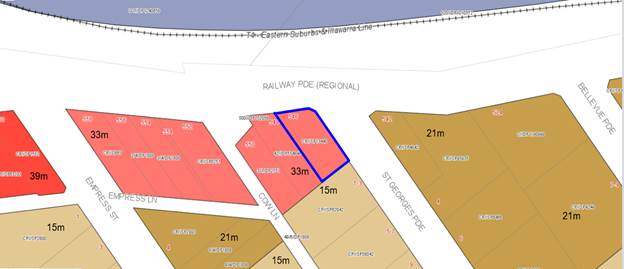
Figure
8: Extract from KLEP 2012 Height of
buildings map
(b) to minimise the impact of overshadowing,
visual impact and loss of privacy on adjoining properties and open space areas,
66. Officer Comment: This
objective relates to considering the amenity impacts associated with the
non-compliance. In terms of visual impact the structures are generally
centrally located which reduces their visual appearance from the immediately
adjoining streetscapes.
67. The objective seeks to
“minimise” the visual impact, it is not requiring it to be
eliminated or totally negated, and as this is a small scale ancillary structure
which will not be highly visible or intrusive. It will not be visible from
immediately adjoining properties and streetscapes given that it is centrally
located. With regard to the overshadowing impacts, the proposal will overshadow
adjoining properties however the shadows cast result in the private open spaces
and living areas of adjacent development continuing to receive the required
minimum 3 hours of solar access in midwinter. There will be no adverse impacts
in terms of overlooking to adjoining properties as balconies and communal open
spaces are oriented to Railway Parade and St Georges Parade.
(c) to
provide appropriate scale and intensity of development through height controls.
68. Officer Comment: New
developments of a similar scale have been approved in the area and have
established a precedent for development in the street and immediate area. The
proposed development is consistent with the pattern of development that is
slowly being established in the up-zoned precinct; however for other reasons
discussed in this report, the proposal has an unacceptable built form, despite
the height encroachment.
69. The non-compliant
height of the building which only relates to the stair and lift access to the
roof can be catered for in this location given the siting and orientation,
however the proposed non-compliances with the site width, front setback
control, car parking design and impervious areas, the proposal is not
supported.
70. Officer Comment: The
height non-compliance does not undermine the objectives of the zone. The
development on an undersized allotment (in terms of site width) is the reason
for the compromised built form which results in the development not satisfying
the residential amenity objective of the zone.
71. The proposal however fails
to satisfy the “public interest” test as the exceedance of the
control does not meet the objectives of the zone which include the following:
· To
provide for the housing needs of the community within a high density
residential environment.
72. Officer Comment: The redevelopment of this site would contribute
to the housing needs of the community. However it is the scale, form and
density of the development proposed that is unsuitable for the site. The
compromised built form directly results from the narrow width of the allotment,
with the built form failing to compensate for the lack of pervious areas,
undersized and disconnected pockets of deep soil, encroachment of the required
front setbacks and unsuitable carpark design and operation. It is considered
the proposal is an overdevelopment of the site, resulting in adverse impacts on
the public domain.
· To
provide a variety of housing types within a high density residential
environment.
Officer Comment: The proposal provides 17
residential apartments, being a combination of 1 and 2 bedrooms units.
· To
enable other land uses that provide facilities or services to meet the day to
day needs of residents.
Officer Comment: This objective is not
relevant to the proposed development as it is a residential flat building.
Whether
contravention of the development standard raises any matter of significance for
State or regional environmental planning (Clause 4.6(5)(a))
73. Contravention of the
maximum height development standard proposed by this application does not raise
any matter of significance for State or regional environmental planning.
The public
benefit in maintaining the development standard (Clause 4.6(5)(b))
74. It
is noted that in Initial Action Pty Ltd v Woollahra Municipal Council [2018]
NSWLEC 118, Preston CJ clarified what items a Clause 4.6 does and does not need
to satisfy. Importantly, there does not need to be a "better"
planning outcome resulting from the non-compliance.
75. Clause
4.6 does not directly or indirectly establish a test that the non-compliant
development should have a neutral or beneficial effect relative to a compliant
development.
76. The
second matter was in cl 4.6(3)(b), where the Commissioner applied the wrong
test in considering this matter by requiring that the development result in a
"better environmental planning outcome for the site" relative to a
compliant development. Clause 4.6 does not directly or indirectly establish
this test. The requirement in cl 4.6(3)(b) is that there are sufficient
environmental planning grounds to justify contravening the development
standard, not that the development that contravenes the development standard
have a better environmental planning outcome than a development that complies
with the development standard.
77. The
proposal generates adverse bulk, scale and streetscape impacts and fails to
satisfy the objectives of the zone and a number of Kogarah DCP 2013 controls.
The request to vary the development standard is not supported.
Kogarah
Development Control Plan 2013
78. The provisions of
Kogarah Development Control Plan 2013 (KDCP 2013) are relevant to the proposed
development. Several controls within the KDCP 2013 are inconsistent with the
scale of development now permitted under the KLEP 2012 (as amended on 26 May
2017). As a consequence, the proposed development will contravene a number of
the controls including significant variations to the height and floor space
ratio controls as contained in the DCP.
79. The significant
variations to KDCP 2013 have resulted from the subsequent amendments to KLEP
2012 which allows a higher density/scale of development. The approach to
support the development with significant variations to KDCP 2013 (but compliant
with KLEP 2012) is consistent with recent judgements in the NSW Land and
Environment Court. In particular, in Michael Murr v Georges River Council
[2017] NSWLEC1369.
80. It is also noted
that in the hierarchy of planning controls, Development Control Plans cannot
prescribe more onerous corresponding controls than those in a Local
Environmental Plan.
81. An assessment of
the proposed development against the relevant controls in the KDCP 2013 is
detailed in the compliance table below.
|
Part B General Controls
|
|
Part
|
Objectives/Controls
|
Comments
|
Complies
|
|
B2 - Tree Management and Green Web
|
The objectives of
this part include the following:
· Ensure the protection of existing trees which contribute to the
visual amenity and environment of the City of Kogarah;
· Protect trees within and adjacent to development sites;
· Maximise healthy tree canopy coverage across the City of Kogarah.
|
Refer to earlier
comments regarding the provisions of the Vegetation SEPP.
The site is not
within a ‘habitat corridor’ or ‘habitat reinforcement
corridor’ under Council’s green web strategy.
|
N/A
|
|
B3 - Developments near Busy Roads
and Rail Corridors
|
The objectives of
this part are to:
· Ensure an appropriate acoustic amenity can be achieved for
development near transport corridors, particularly residential development
and other noise sensitive land uses;
· Provide additional acoustic design or mitigation measures that may
be necessary;
· Development fronting a busy road or a rail corridor should be
designed and sited to minimise noise impacts.
|
An acoustic report
has been submitted with the DA to assess the rail noise/vibration and road
noise/vibration provisions in clauses 87 and 102 of State Environmental
Planning Policy (Infrastructure) 2007 that are relevant to this proposal.
The report provides
recommendations that could be imposed as conditions of consent should the
application be approved.
|
Yes
|
|
B4 - Parking and Traffic
|
The objectives of
this part are to:
· Minimise traffic congestion and ensure adequate traffic safety and
management;
· Ensure an adequate environmental quality of parking areas
(including both safety and amenity);
· Provide adequate car parking for building users and visitors,
depending on building use and proximity to public transport.
|
Given this
development is within an accessible area the requirements of the RMS Guide
for Traffic Generating Development are triggered by SEPP 65 and the Apartment
Design Guide.
|
N/A – Refer to the ADG
assessment earlier in this report.
It is noted that the proposed
automated car stacking arrangement is not supported by Council’s
Traffic Engineers.
|
|
B5 - Waste Management and
Minimisation
|
The objectives of this part are to:
· Encourage best
practice in waste management that minimises waste generation, facilitates
waste separation and maximises reuse and recycling;
· Ensure quality
design of waste management facilities that complement the building design and
minimise noise, odour and visual impacts on adjacent uses and the public
domain;
· Ensure suitable
and efficient waste storage, recycling and collection in all development.
|
An acceptable waste management plan
has been submitted with the application.
|
Yes
|
|
B6 - Water Management
|
The objectives of
this part are to:
· Reduce flooding and drainage impacts within and downstream of the
development site;
· Reduce pollutant loads exported to the waterways via the
stormwater system;
· Conserve water and reduce mains water consumption.
|
A suitable
stormwater management plan has been provided and conditions of consent
provided by Council’s Development Engineer.
The proposed
method of drainage for the site is by gravity to St Georges Parade via an
on-site detention system.
|
Yes
|
|
B7- Environment
Management
|
The objectives of
this part are to:
· Apply principles and processes that contribute to ecologically sustainable
development;
· Reduce the impacts of development on the environment;
· Increase the resilience of development to the effects of climate
change;
· Ensure that greenhouse gas emissions will be reduced;
· Reduce the use of potable water;
· Ensure that development can adapt to climate change.
|
A BASIX
certificate has been submitted with the application verifying that the
relevant water, energy and thermal comfort targets have been met by the
proposal.
|
Yes
|
|
PART C2 – MEDIUM DENSITY
HOUSING
|
|
1. Site isolation
and amalgamation for medium density development
|
|
Adjoining sites
not to be left isolated.
Site
amalgamation requirements apply for specific sites.
|
The proposal
does not cause any site isolation.
The site is not
subject to any amalgamation requirement.
|
Yes
N/A
|
|
2.
Specific precinct controls – residential flat buildings
|
|
Specific
precinct controls apply to various sites and locations
|
The site is not
located in a specific precinct nominated in the DCP.
|
N/A
|
|
4. Medium
site and density requirements
|
|
20m minimum
frontage for residential flat building
|
16m Railway
|
No –
refer below
|
|
Comments on
site width
The DCP states the minimum site width for residential flat
buildings is 20m. The site has a primary frontage of 16m to Railway Parade
which does not comply with the control. The Interim Policy - Georges River
Development Control Plan 2020 also requires a 20m site frontage.
The applicant has stated compliance with the control as the
secondary frontage to St Georges Parade is 27m in length. The use of the
secondary frontage length to justify the non-compliance with the primary
frontage width is not supported.
The ADG also
prescribes minimum separation requirements between buildings, with which the
proposal numerically complies, however the intent for redevelopment of these
and other similarly located R3 and R4 zoned sites is to provide residential
flat building developments with landscaped setbacks and suitable setbacks to
street boundaries.
The proposal
fails to meet the required street setbacks, as discussed below, fails to
provide suitably dimensioned deep soil areas that can accommodate substantial
canopy planting and cannot provide a suitable, functioning car parking design
that does not result in adverse impacts. For these reasons the proposal is an
unacceptable response to the site size and dimension, which forms part of the
reasons for refusal of the application.
|
|
1.1sqm of site
area per square metre of dwelling
|
In accordance with
the provisions of clause 3.43(5) of the EP&A Act, this control has no
effect. In this regard, it is inconsistent with the floor space ratio
standard in KLEP 2012.
|
N/A – Refer to the KLEP 2012
assessment earlier in this report.
|
|
5. Height
and building envelope requirements
|
|
4-storey RFBs
have a “H1” height control of 12m; and a “H2” height
control of 14m.
(method for
calculating these heights are discussed in detail in KDCP 2013)
|
In accordance with the provisions
of clause 3.43(5) of the EP&A Act, this control has no effect. In this
regard, it is inconsistent with the building height standard in KLEP 2012.
|
N/A - Refer to
the KLEP 2012 assessment earlier in this report.
|
|
6.
Building setbacks
|
|
Front setbacks:
Maximum 75% of
width of building to be setback minimum 5m, remainder 25% being setback
minimum 7m
|
To Railway
Parade:
2.25m to 3.25m
To St Georges
Parade:
2.375m to
3.035m
|
No –
refer to comments below.
|
|
Comment on Front
Setback
The front
setback does not comply with the minimum standard detailed by KDCP
2013. The DCP requires a front setback between 5m and 7m to Railway
Parade.
The varied
setback to the street frontages results in small pockets of landscaping that
cannot accommodate substantial areas of landscaping or canopy trees and
results in the built form dominating the streetscape, which is not the
desired character for residential development in this locality and is not
consistent with the zone objectives.
|
|
Side/rear
setbacks: 3m + one quarter of the amount that the wall height exceeds 3m.
[3m + (¼
x 12m)] = 7.5m required.
|
Nil setback to
south western site boundary.
6m to 9m to south
eastern site boundary.
|
No – refer to comments below
|
|
Comments on setbacks:
Since the
adoption of the Kogarah New City Plan in 2017, many of the controls within
the KDCP 2013 do not align and significantly conflict with the scale of
development now permitted under the KLEP 2012 (as amended on 26 May 2017).
The significant
variations to KDCP 2013 have resulted from the subsequent amendments to KLEP
2012 which allows a higher density/scale of development. The approach to
support the development with significant variations to KDCP 2013 (but
compliant with KLEP 2012) is consistent with recent judgements in the NSW
Land and Environment Court.
The ADG also
prescribes minimum separation requirements between buildings, with which the
proposal numerically complies only for the south-eastern site boundary,
however the intent for redevelopment of these and other similarly located R3
and R4 zoned sites is to provide residential flat building developments with
landscaped setbacks and suitable setbacks to street boundaries.
The proposal
fails to meet the required street setbacks, as discussed above, and fails to
provide suitably dimensioned deep soil areas that can accommodate substantial
canopy planting. For these reasons the proposal is an unacceptable response
to the site size and dimension, which forms part of the reasons for refusal
of the application.
|
|
7. Site
coverage
|
|
Maximum 45%
(229sqm)
|
67%
In accordance with
the provisions of clause 3.43(5) of the EP&A Act, this control has no
effect. In this regard, it is inconsistent with the floor space ratio
standard in KLEP 2012.
|
N/A – Refer to the KLEP 2012
assessment earlier in this report.
|
|
8. Open
space
|
|
Private open
space (POS) – 35sqm with min. 3m dimension for ground level dwellings
and 12sqm with min. 3m dimension for other dwellings
|
The ground floor
unit has a private courtyard area of 57sqm and meets the minimum dimensions,
however will have poor amenity due to its proximity to the street frontages
and lack of area for substantial landscaping to provide privacy.
|
No
|
|
Common open
space – 30sqm per dwelling with min. overall area of 75sqm and min.
dimension of 5m.
i.e.
30sqm x 18 units = 540sqm
|
In accordance with
the provisions of clause 6A (2) of SEPP 65, this control is of no effect.
|
N/A – Refer to the ADG
assessment earlier in this report.
|
|
Maximum 55%
impervious area
|
Impervious area
is 432sqm or 84.6%.
|
No –
refer to comments below.
|
|
Comments on
impervious area
Since the
adoption of the Kogarah New City Plan in 2017, many of the controls within
the KDCP 2013 do not align and significantly conflict with the scale of
development now permitted under the KLEP 2012 (as amended on 26 May 2017).
The significant
variations to KDCP 2013 have resulted from the subsequent amendments to KLEP
2012 which allows a higher density/scale of development. The approach to
support the development with significant variations to KDCP 2013 (but
compliant with KLEP 2012) is consistent with recent judgements in the NSW
Land and Environment Court.
However, the
variation to the site coverage control is not supported. The applicant has
justified the exceedance of the maximum impervious area by stating:
- provides
deep soil areas that numerically exceed the 7% required as per the Apartment
Design Guide, that can accommodate suitably scaled trees and shrubs;
- has an
acceptable built form for the site; and
- a suitable
stormwater management system is provided.
As discussed
earlier in this report, the absence of suitably consolidated deep soil zones
and insufficient building setbacks to the street frontages precludes the
planting of significant canopy trees within the site itself to ameliorate the
scale of the building and reduce its visual impact.
As discussed
elsewhere in this report, the proposed built form is not supported.
|
|
9.
Vehicular access, parking and circulation
|
|
Car parking to
be provided in accordance with Part B4
|
Compliant
parking provided as detailed in Part B4 above, however the automated car
stacking system is not supported.
|
No
|
|
Garages to be
accessed from rear lane where available
|
Access off St
Georges Parade, no rear lane available
|
N/A
|
|
All residential
flat buildings to provide car wash bay
|
No car wash bay
provided as an automated car stacking system is proposed and cannot be
accommodated.
|
No - The
proposed parking arrangement is unsuitable for the site; therefore a carwash
bay is unable to be provide onsite, or even condition to be provided, which is
unacceptable.
|
|
11. Solar
access
|
|
Primary open
space to achieve 4 hours of direct sunlight between 9am and 3pm at mid-winter
|
In accordance with
the provisions of clause 6A (2) of SEPP 65, this control is of no effect.
|
N/A – Refer to the ADG
assessment earlier in this report.
|
|
Neighbours’
private open space and living areas to maintain 3 hours of direct sunlight
between 9am and 3pm at mid-winter
|
Neighbours’
private open space and living areas will maintain 3 hours of direct sunlight
between 9am and 3pm mid-winter.
|
Yes
|
|
12. Views
and view sharing
|
|
Provide for
reasonable sharing of views
|
The location
does not have significant views that will be impacted by the proposal.
|
Yes
|
|
13.
Adaptable and accessible housing
|
|
2 adaptable
units required for developments with 11-20 units
|
2 adaptable
dwellings nominated – Units 402 and 502.
|
Yes
|
|
|
|
|
Interim Policy
– Georges River Development Control Plan 2020
82. Council at its
Environment and Planning Committee Meeting dated Council at its Environment and Planning Committee Meeting dated 24 June
2019 resolved to adopt the Georges River Interim Policy Development Control
Plan which became effective on 22 July 2019.
83. The Interim
Policy is a public policy that is to be used as a guide to set a consistent approach
for the assessment of residential development within the LGA. It is a
supplementary document, meaning that current Development Control Plan controls
will prevail if they are considered best practice. The Interim Policy has no
statutory recognition in the assessment of DAs pursuant to the Environmental
Planning and Assessment Act, 1979 (EP&A Act).
84. An assessment of
the proposal has been carried out against the provisions of the Interim Policy
as set out in the following table.
|
Interim
Policy – Georges River Development Control Plan 2020
|
|
Standard
|
Proposed
|
Complies
|
|
Site
Frontage
|
|
24m
|
Railway Parade – 16.43m
|
No – see Kogarah Development
Control Plan compliance table above for discussion.
|
|
Building
Height
|
|
The relevant
LEP controls relating to building height will prevail over Development
Control Plan controls that relate to height in storeys
|
The proposal has been assessed
against the Kogarah Local Environmental Plan 2012 height standard. The
proposal does not currently comply.
|
No – See Kogarah Local
Environmental Plan 2012 Compliance Table above for further details.
|
|
Private
Open Space
|
|
The ADG
requirements prevail over the Development Control Plan controls for private
open space
|
The proposal is fully compliant
with the ADG’s private open space requirements.
Refer to “4E – Private
Open Space and Balconies” within the ADG Compliance Table above.
|
Yes
|
|
Communal
Open Space
|
|
The ADG
requirements prevail over the Development Control Plan controls for COS under
the Interim Policy
|
The proposal is fully compliant
with the ADG’s communal open space requirements.
Refer to “3D – Communal
and Public Open Space” within the ADG Compliance Table above.
|
Yes
|
|
Parking
|
|
In accordance
with 'A Plan for Growing Sydney' (Department of Planning and
Environment):
· If located
in a strategic centre (i.e. Kogarah CBD and Hurstville CBD) and within
800m of a Railway, the “Metropolitan Regional Centre (CBD)” rates
apply.
· If
located within 800m of a railway and outside the strategic centres the
“Metropolitan Subregional Centre” rates apply.
· If
located outside of 800m of a Railway, the relevant Development Control Plan
applies.
|
The site is located more than 800m
away from a railway station and is not within a strategic centre.
The proposal has been assessed
against the Development Control Plan controls and proposes the requisite
number of parking spaces, however does so in the form of an automated car
stacking system, which is not supported by Council staff.
|
No
The proposed parking arrangement is
not supported by Council’s Traffic Engineer and forms a reason for
refusal.
|
|
Solar
Access
|
|
The ADG requirements prevail over
the Development Control Plan controls for solar access under the Development
Control Plan
|
The proposal is deemed to be
compliant with the solar access provisions of the ADG.
Refer to “4A – Solar
and Daylight Access” within the ADG Compliance Table above.
|
Yes
|
Developer Contributions
85. The
proposed development if approved would require the payment of developer contributions under Section 7.11 of the
Environmental Planning and Assessment Act 1979 as the proposal is increasing
the density of the locality by the construction of 17new apartments. If the
development was to be approved a condition outlining the required contributions
would be imposed.
Impacts
Natural
Environment
86. The
absence of suitably consolidated deep soil zones and insufficient building
setbacks to the street frontages precludes the planting of significant canopy
trees within the site itself to ameliorate the scale of the building and reduce
its visual impact.
87. Accordingly
the application is recommended for refusal.
Built
Environment
88. The
proposal exceeds the building height development standard of Kogarah Local
Environmental Plan 2012. A Clause 4.6 Objection has been submitted in support
of the non-compliance.
89. The
exceedance of this standard is
unreasonable and unacceptable in the site’s context and the
neighbourhood’s character. The proposal is inconsistent with various DCP
controls (as detailed above) and does not reflect the desired future planning
and design outcome for the site. The bulk of the building, its inadequate
setbacks and deep soil area, the unsuitable car parking design and its
functionality, combined with the undersized allotment result in an unacceptable
outcome for the site and will set an undesirable precedent, and is thus
recommended for refusal.
Social
Impact
90. No
adverse social impacts have been
identified as part of the assessment. The provision of additional dwellings
would in principle provide for additional housing in close proximity to a local
centre for a cross-section of the community. However, the built form is not an
appropriate outcome for the site.
Economic
Impact
91. The
proposed development has no apparent adverse economic impact. There may be a
small positive economic impact as a result of the construction of the
development.
Suitability
of the site
92. The site is zoned R4 High Density Residential. The
proposal is a permissible land use within the zone, subject to development
consent.
93. The subject site in isolation is not suitable for
the construction of a Residential Flat Building as the site does not meet the
minimum site width control and therefore cannot achieve suitable setbacks to
the street frontages resulting in an unacceptable built form for the site.
94. This residential flat building has not been
sensitively designed to respond to the constraints of the site, in particular
the land’s dimensions, area and context, as evidenced by its various
non-compliances with relevant building envelope controls as detailed previously
within this report.
SUBMISSIONS
95. The application
was publicly exhibited between 25 January 2019 and 11 February 2019 in
accordance with the public notification provisions in Part A of the Kogarah
Development Control Plan 2013. Four (4) submissions plus one submission
containing eleven (11) signatories objecting to the proposal were received.
96. The issues raised
in the submission are addressed below.
Impacts
on neighbouring properties from excavation
97. Comment:
The application is recommended for refusal, however should the application be
approved conditions of consent would be included requiring dilapidation reports
be prepared for adjacent properties prior to excavation commencing.
Overshadowing
to units at 1-3 St Georges Parade
98. Comment:
The proposal will cast shadow over neighbouring properties at different times
of the day, however overall the proposal complies with the solar access
controls in the DCP that require neighbours to receive at least 3 hours of
sunlight during midwinter.
Impacts
during construction on neighbours
99. Comment: If
the application was to be approved, standard conditions of consent for
construction activity would be imposed.
Noise
during construction
100. Comment: If the application
was to be approved, standard conditions of consent for construction activity
would be imposed.
Privacy
101. Comment: The proposal
does not include any private balconies overlooking neighbouring properties and
the proposed setback of the building to the boundaries of residential
allotments complies with the relevant planning controls. The Level 8 communal
open space area is setback in excess of 12m from the neighbouring property and
the rooftop communal open space is oriented to Railway Parade, not adjoining
dwellings.
Out
of context for the locality
102. Comment: The proposed
development is recommended for refusal for a number of built form and
functionality reasons, including front setbacks, deep soil areas and parking.
No
ROC provided for access to 548 Railway Parade
103. Comment: The proposal
is not required to provide an easement for access from any future development
on 548 Railway Parade.
Easement
to be created to drain water from 548 Railway Parade
104. Comment: The
application proposes drainage of the site by gravity to St Georges Parade via
an on-site detention system. The existing easement for drainage that benefits
548 Railway Parade is not affected by the proposed development.
REFERRALS
Council
Referrals
Landscaping
105. No objections were raised subject to
conditions if the application were to be approved.
Stormwater
106. The application proposes drainage of the site
by gravity to St Georges Parade via on site detention. No objections were
raised subject to conditions if the application were to be approved. It is
noted that the OSD is proposed within the front setback to St Georges Parade,
between the proposed driveway and the building entry, with 1.2m high pool
fencing above the retaining wall proposed around the OSD which is 1m from the
substation. Council’s Engineer has advised it will not impact the
drainage of the site but will result in an unacceptable impact on the
streetscape.
Property
Information
107. No objections were raised subject to
conditions if the application were to be approved.
Health
108. No objections were raised subject to
conditions if the application were to be approved.
Traffic
109. Council’s Traffic Engineer does not
support the proposed car stacking parking arrangement for the following reasons:
a. The applicant has not provided queue length
calculations in accordance with the relevant Australian Standard
(AS2890.1:2004);
b. A Plan of Management and Technical
Specifications have not been submitted with the application and therefore an assessment
of the functionality and reliability cannot be made;
c. The provision of mechanical parking systems is
not best practice for basement parking and is not supported for this site; and
d. It is considered that visitors to the building
will choose not to use the system due to unfamiliarity with it and will choose
instead to park on the surrounding streets, placing unnecessary pressure on
street parking when developments are required to provide visitor parking on
site.
This forms one of the reasons for refusal.
External
Referrals
Department of
Infrastructure, Regional Development and Cities
110. The proposed development will penetrate
prescribed airspace for Sydney Airport and hence constitutes a
‘controlled activity’ within the meaning of Division 4 of Part 12
of the Airports Act 1996. The applicant has obtained the necessary approval for
the controlled activity.
Ausgrid
111. The
application was referred to Ausgrid in accordance with Clause 45 of State Environmental
Planning Policy (Infrastructure) 2007. Conditions of consent were received on
19 February 2019. Notwithstanding, the DA is recommended for refusal due to
significant built form issues.
CONCLUSION
112. The
proposal has been assessed using the matters for consideration listed in
Section 4.15 of the Environmental Planning and Assessment Act 1979. The
proposal is found to be an unreasonable overdevelopment of the site, with
excessive visual bulk and unmitigated scale and inadequately proportioned deep
soil zones. As such, it represents an unacceptable planning and design outcome
for this site and would adversely affect both the character of development in
the street and the immediate locality and the residential amenity of the area.
113. The
proposal is inconsistent with various design quality principles of State
Environmental Planning Policy 65 including context and neighbourhood character,
built form and scale, landscape, amenity and aesthetics.
114. The
application fails to demonstrate how the proposed mechanical car parking system
meets the relevant standards with regard to vehicle queuing and the time for
the operation of the system to park a vehicle, a plan of management or
technical specifications. The proposed system is not supported.
115. The
proposal has been assessed against the provisions of both Kogarah Local
Environmental Plan 2012 and Kogarah Development Control Plan 2013. The proposal
exceeds the building height development standard of Kogarah Local Environmental
Plan 2012. The Clause 4.6 Objection submitted in support of this variation is
not supported as the development is recommended for refusal.
116. The
proposal also fails to comply with various built form controls of Kogarah
Development Control Plan 2013 including the minimum site width, minimum front
setback and maximum impervious area controls.
117. For
the above reasons, the proposal is recommended for refusal.
DETERMINATION
AND STATEMENT OF REASONS
Statement of
Reasons
118. The
reasons for this recommendation are:
· The
proposal fails to achieve a suitably dimensioned area of deep soil as required
by the Apartment Design Guide that is capable of accommodating substantial
landscaping and canopy trees.
· The
proposal is not suitable for the site due to the area and width of the site and
it therefore fails to achieve an acceptable scale and built form for the site.
· The
proposal does not relate well to the site context, results in an unacceptable
interface with adjoining properties and the public domain.
· The
application fails to demonstrate the site is suitable for the proposal with
regard to the provisions of State Environmental Planning Policy No 55 -
Remediation of Land as the preliminary investigation report recommends the
preparation of a Detailed Site Investigation Report and a Remedial Action Plan,
which have not been submitted with the application.
· The
proposal fails to meet the maximum building height permitted on the site
pursuant to Clause 4.3 (Height of Buildings) of Kogarah Local Environmental
Plan 2012 and the Clause 4.6 Objection submitted is not supported.
· The
site fails to meet the primary frontage minimum width control contained in the
Kogarah DCP 2013.
· The
proposal fails to meet the required Development Control Plan setbacks to
Railway Parade and St Georges Parade.
· The
proposed automated car stacking system is not supported due to a lack of
technical information and an assessment of queuing times provided with the application and the undersized allotment does
not appear to be able to provide the required car parking within a traditional
basement layout.
· The
proposal exceeds the maximum impervious area control in the Development Control
Plan.
· The
proposal represents an overdevelopment of the site and establishes an
undesirable precedent in the area. Its approval is not in the public interest.
Determination
119. THAT pursuant
to Section 4.16(1) of the Environmental Planning and Assessment Act 1979
(as amended) the Georges River Local Planning Panel refuse development consent
to Development Application DA2018/0584 for demolition of existing
structures and construction of a 10 storey residential flat building with
basement parking at Lot CP/SP13440 known as 546 Railway Parade, Hurstville,
for the following reasons:
1. Refusal
Reason – Environmental Planning Instrument - Pursuant to Section
4.15(1)(a)(i) of the Environmental Planning and Assessment Act 1979, the
proposed development does not comply with the relevant environmental planning
instruments in terms of the following:
(a) The proposal fails to satisfy Part 4 of State
Environmental Planning Policy No 65 – Design Quality of Residential
Apartment Development as it is inconsistent with various design quality
principles of State Environmental Planning Policy No 65 with respect to its
response to the site’s context and neighbourhood character and its built
form and scale, density, landscape and aesthetics. The proposal does not
achieve an acceptable built form with insufficient front setbacks to minimise
the visual dominance of the building when viewed from the public domain.
2. Refusal
Reason – Environmental Planning Instrument - Pursuant to Section
4.15(1)(a)(i) of the Environmental Planning and Assessment Act 1979, the
proposed development does not comply with State Environmental Planning Policy No
55 - Remediation of Land as the preliminary investigation report recommends the
preparation of a Detailed Site Investigation Report and Remedial Action
Plan, which have not been submitted with the application.
3. Refusal
Reason - Development Control Plan - Pursuant to Section 4.15(1)(a)(iii) of
the Environmental Planning and Assessment Act 1979, the proposed development
does not comply with Kogarah Development Control Plan 2013, Chapter C2 –
Medium Density Housing:
a. Section
4 Minimum site and density requirements - the site has a frontage of 16.4m,
which fails to comply with the minimum 20m required by the Development Control
Plan.
b. Section
6(1) Building Setbacks – the proposal encroaches the minimum front
setbacks required by the Development Control Plan.
c. Section
8 Open Space – the proposal exceeds the maximum impervious area control
of the Development Control Plan.
These
non-compliances result in the site being unsuitable for the proposed
development and it having unreasonable adverse impacts on the streetscape
setting an undesirable precedent.
4. Refusal
Reason – Impacts on the Environment - Pursuant to Section 4.15(1)(b)
of the Environmental Planning and Assessment Act 1979, the proposed development
is likely to have an adverse impact on the following aspects of the
environment:
(a) Natural environment – The proposal
does not provide sufficient front setbacks which precludes the planting of
canopy trees around the perimeter of the site to provide a landscaped setting
for the proposal and ameliorate the scale of the building. In addition, the
location of the OSD basin its setback to St Georges Parade, and its required
fencing for safety, is an unsuitable outcome for the site and reduces the
opportunity for landscaping in the front setback.
(b) Built environment – The proposal
does not respond to the context of the site nor the neighbourhood’s
character on the basis that it exceeds the maximum building height that applies
to the site and fails to provide the minimum required front setbacks envisaged
for the site and adjoining development.
5. Refusal
Reason – Suitability of Site - Pursuant to Section 4.15(1)(c) of the
Environmental Planning and Assessment Act 1979, the site is not considered
suitable for the proposed development for the following reasons:
(a) The site cannot adequately accommodate the
proposed built form without significant adverse impacts on the amenity of the
locality with respect to built form, visual dominance, bulk and scale.
6. Refusal
Reason – Public interest - Pursuant to Section 4.15(1)(e) of the
Environmental Planning and Assessment Act 1979, the proposed development is not
considered to be in the public interest and is likely to set an undesirable
precedent within the locality.
Review of Determination - Section 8.2 of
the Environmental Planning and Assessment Act confers on an applicant who is dissatisfied with the determination of the application
the right to lodge an application with Council for a review of such
determination. Any such review must however be completed within 6 months
from its determination. Should a review be contemplated sufficient time
should be allowed for Council to undertake public notification and other
processes involved in the review of the determination.
Note: Review provisions
do not apply to Complying Development, Designated Development, State Significant Development, Integrated Development or any application determined
by the Sydney South Planning Panel or the Land & Environment Court.
Appeal Rights - Part 8 (Reviews and
appeals) of the Environmental Planning and Assessment
Act 1979 confers on an applicant who is dissatisfied
with the determination of the application a right of appeal to the Land and
Environment Court of New South Wales.
Lapsing of Consent - This consent will lapse unless the development is physically commenced within 5 years from the Date of Operation of this consent, in accordance with
Section 4.53 of the Environmental Planning and Assessment Act 1979 as amended.
ATTACHMENTS
|
Attachment ⇩1
|
Site Plan - 546 Railway Pde Hurstville
|
|
Attachment ⇩2
|
Elevations - 546 Railway Pde Hurstville
|
|
Georges
River Council - Georges River Local Planning Panel (LPP) - Thursday, 5 March
2020
LPP009-20 546 Railway Parade Hurstville
[Appendix
1] Site Plan - 546
Railway Pde Hurstville
|
Page 237
|
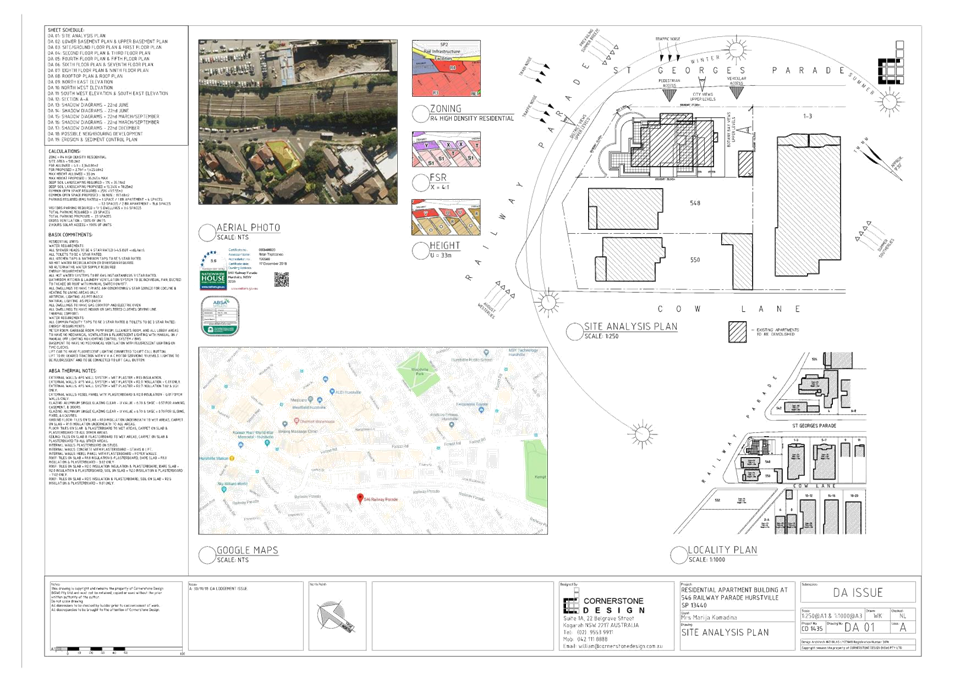
|
Georges
River Council - Georges River Local Planning Panel (LPP) - Thursday, 5 March
2020
LPP009-20 546 Railway Parade Hurstville
[Appendix
2] Elevations - 546
Railway Pde Hurstville
|
Page 240
|
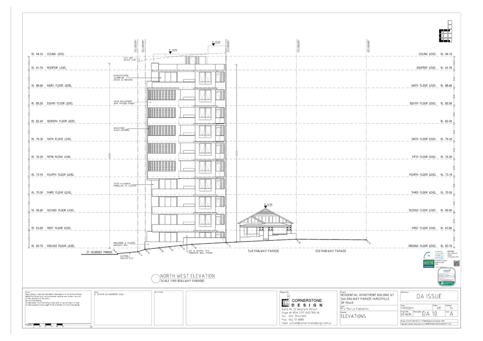
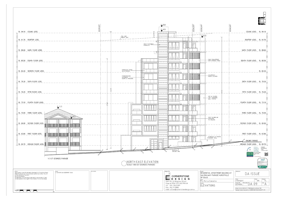
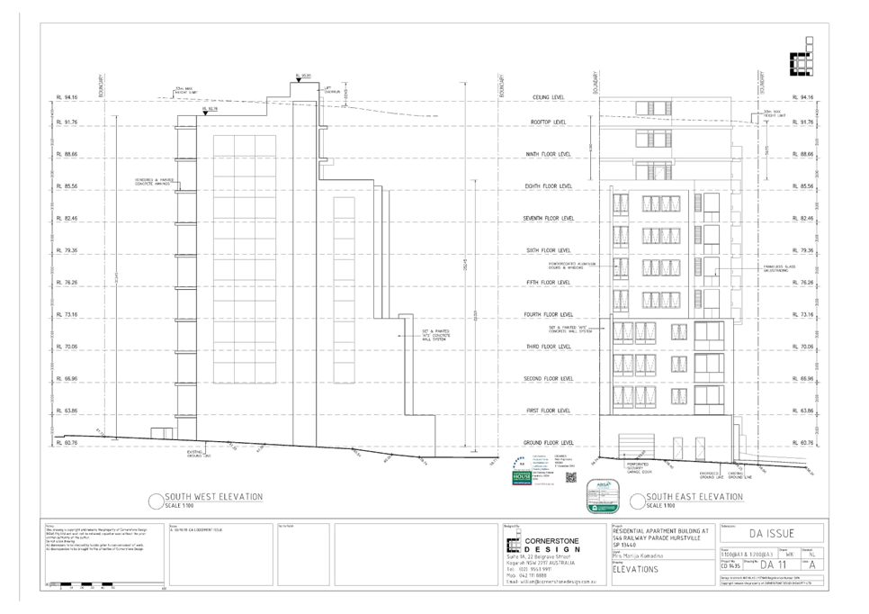
|
Georges River Council – Local Planning
Panel Thursday, 5 March 2020
|
Page 295
|
REPORT TO GEORGES RIVER COUNCIL
LPP MEETING OF Thursday, 05 March 2020
|
LPP Report No
|
LPP010-20
|
Development Application No
|
REV2020/0003
|
|
Site Address & Ward Locality
|
16 Peake Parade Peakhurst
Peakhurst Ward
|
|
Proposed Development
|
Review of Determination of
Application No DA2017/0627 for demolition of existing structures and
construction of three (3) levels of residential flat building with one (1)
level of parking
|
|
Owners
|
Mr J Staninovski, Mrs S Staninovski
Mr Z Kevilovski
|
|
Applicant
|
Cornerstone Design
|
|
Planner/Architect
|
Planner: BMA Urban, Architect:
Cornerstone Design
|
|
Date Of Lodgement
|
17/01/2020
|
|
Submissions
|
One (1) unique submission
|
|
Cost of Works
|
$1,782,715.55
|
|
Local Planning Panel Criteria
|
The original development
application was refused by the Georges River Local Planning Panel (LPP).
Pursuant to S8.3 (5) of the Environmental Planning and Assessment Act 1979,
the S8.2 Review is to be determined by the Georges River Local Planning
Panel.
|
|
List of all relevant s.4.15
matters (formerly s79C(1)(a))
|
State Environmental Planning Policy
No. 65 – Design Quality of Residential Apartment Development, State
Environmental Planning Policy (Vegetation in Non-Rural Areas) 2017, State
Environmental Planning Policy (BASIX) 2004,
Greater Metropolitan Regional Environmental
Planning Policy No 2- Georges River Catchment, State Environmental Planning
Policy No. 55 – Remediation of Land, State Environmental Planning
Policy (Infrastructure) 2007,
Hurstville Local Environmental Plan
2012, Hurstville Development Control Plan No. 1, Draft Environment State
Envrionmental Planning Policy, Draft Remediation of Land State Environmental
Planning Policy
|
|
List all documents submitted
with this report for the Panel’s consideration
|
Architectural Plans
Statement of Environmental Effects
Landscape Plans
|
|
Report prepared by
|
Senior Development Assessment
Officer
|
|
Recommendation
|
That the application be refused in accordance with the
reasons stated at the end of this report.
|
|
|
Summary of matters for
consideration under Section 4.15
Have all recommendations in relation
to relevant s4.15 matters been summarised in the Executive Summary of the
assessment report?
|
Yes
|
|
Legislative clauses requiring
consent authority satisfaction
Have relevant clauses in all
applicable environmental planning instruments where the consent authority
must be satisfied about a particular matter been listed and relevant
recommendations summarised, in the Executive Summary of the assessment
report?
|
Yes
|
|
Clause 4.6 Exceptions to
development standards
If a written request for a
contravention to a development standard (clause 4.6 of the LEP) has been
received, has it been attached to the assessment report?
|
Yes
- Clause 4.3 Height of buildings
|
|
Special Infrastructure
Contributions
Does the DA require Special
Infrastructure Contributions conditions (under s7.24)?
|
Not
Applicable
|
|
Conditions
Have draft conditions been provided
to the applicant for comment?
|
No,
the application is recommended for refusal. The refusal reasons can be viewed
when the report is published.
|
|
Site Plan
Subject site outlined in
red
|
Executive Summary
Proposal
1. Council
is in receipt of an application to Review a Determination in accordance with
the provisions of Section 8.2 of the Environmental Planning and Assessment Act.
Development Application DA2017/0627 was refused by the Local Planning Panel on
19 September 2019.
2. This
application proposed the demolition of existing structures, tree removal and
construction of a three (3) levels of residential flat building over a level of
parking, comprising six (6) units (3 x 2 bedroom units and 3 x 3 bedroom units)
and eleven (11) car parking spaces within the parking level. The application
was refused on the following grounds:
1. Pursuant to Section 4.15(1)(a)(i) of
the Environmental Planning and Assessment Act 1979, the proposed development
does not comply with the relevant environmental planning instruments in terms
of the following:
a) The proposal fails
to satisfy Part 4 of State Environmental Planning Policy No 65 – Design
Quality of Residential Apartment Development as it is inconsistent with various
design quality principles of State Environmental Planning Policy No 65 with
respect to its response to the site’s context and neighbourhood character
and its built form and scale, density, landscape and aesthetics, and fails to
comply with the corresponding design criteria of the Apartment Design Guide.
The proposal does not achieve an acceptable built form with insufficient
setbacks and separation to minimise the visual dominance of the building when
viewed from both the public domain and adjoining properties. In addition, the
proposal fails to provide any 6m wide deep soil landscaped area on the site.
b) The proposal fails
to satisfy Part 4 of State Environmental Planning Policy No 65 – Design
Quality of Residential Apartment Development on the basis that it fails to
either achieve or adequately demonstrate compliance with the design criteria of
the Apartment Design Guide with respect to internal solar access, cross
ventilation and the minimum area of communal open space.
2. Pursuant to Section 4.15(1)(a)(iii) of the Environmental Planning
and Assessment Act 1979, the proposed development does not comply with
Hurstville Development Control Plan No. 1, Chapter 4.1 Residential Flat
Buildings, Section DS2.1 Site Frontage or Section DS3.1 Isolated Sites.
The site has a frontage of 15.8m, which fails to comply with the minimum 24m
required by the Development Control Plan. The site is not deemed to be an
isolated site and no evidence has been provided from the applicant to indicate
attempts have been made to purchase adjoining sites for amalgamation with the
subject site. Together these non-compliances result in the site being
unsuitable for the proposed development and it having unreasonable adverse
impacts on neighbouring properties.
3. Pursuant to Section 4.15(1)(b) of the
Environmental Planning and Assessment Act 1979, the proposed development is
likely to have an adverse impact on the following aspects of the environment:
a) Natural
environment – The proposal does not meet the deep soil zones design
criteria of the Apartment Design Guide nor provide sufficient front or side
setbacks which precludes the planting of canopy trees around the perimeter of
the site to provide a landscaped setting for the proposal and ameliorate the
scale of the building. Furthermore, no landscaped boundary setback is provided
on the north eastern side of the vehicle driveway.
b) Built
environment – The proposal does not respond to the context of the site
nor the neighbourhood’s character on the basis that it exceeds the
maximum building height that applies to the site, encroaches on the minimum
required side and rear setbacks expected on the site, and fails to demonstrate
a suitable level of internal amenity for the proposed apartments.
c) Basement car
park – The layout of the basement car park is unsatisfactory and does not
provide for appropriate manoeuvrability for vehicles.
4. Pursuant to Section 4.15(1)(c) of the
Environmental Planning and Assessment Act 1979, the site is not considered
suitable for the proposed development for the following reasons:
(a) The site cannot
adequately accommodate the proposed built form without significant adverse
impacts on the amenity of adjacent and nearby properties with respect to built
form, visual dominance, bulk and scale.
5. Pursuant to Section 4.15(1)(3) of the Environmental Planning and
Assessment Act 1979, the proposed development is not considered to be in the
public interest and is likely to set an undesirable precedent within the
locality.
Figure 1:
Photomontage of the proposed development
Site and Locality
3. The
application applies to land known as 16 Peake Parade, Peakhurst, and is legally
described as Lot 292 in DP 36537.
4. The
site has a boundary to Peake Parade of 15.85m, side boundary lengths of 40.845m
and 43.54m, and a rear boundary length of 10.06m and 6.40m combined, giving a
site area of 677.9sqm.
5. The
land falls by 4.25m from the street to the rear boundary.
6. The
site is located within an R3 Medium Density Residential precinct. A number of
properties in the locality have been redeveloped from single dwelling houses to
residential flat buildings and dual occupancies.
Zoning and Permissibility
7. The
subject site is zoned R3 Medium Density Residential under the provisions of
Hurstville Local Environmental Plan 2012 (HLEP 2012). The proposal is for a
residential flat building which is permissible with consent in the zone.
Figure 2: Zoning
Map – the site is outlined in blue
Submissions
8. The DA
was notified to adjoining properties in accordance with the Hurstville
Development Control Plan No. 1 (HDCP) for a statutory notification period of 14
days between 29 January and 12 February 2020. One (1) submission was received.
Reason for
Referral to the Local Planning Panel
9. This
application is referred to the Georges River Local Planning Panel (LPP) for
consideration and determination, as the original application was refused by the
LPP in September 2019. Pursuant to Section 8.3(5) of the Environmental Planning
and Assessment Act 1979, the Section 8.2 Review is to be undertaken by the
Georges River Local Planning Panel.
10. A new Clause 4.6
statement has been submitted with the Section 8.2 Review application seeking a
variation to the height control (Clause 4.3) in accordance with the provisions of
the Hurstville Local Environmental Plan 2012 to justify and support the
non-compliance.
Planning and Design Issues
11. The proposal fails to
comply with the building height development standard of 12m that applies to the
site under Hurstville Local Environmental Plan 2012. The lift overrun, communal
WC and awning over the rooftop communal open space area exceeds the height
limit, with the top of the lift overrun having a height of 14.4m (20%
variation). A variation request to the building height development standard has
been submitted pursuant to Clause 4.6 of Hurstville Local Environmental Plan
2012; however it has been assessed as being not well founded, as discussed in
this report.
12. The proposal fails to
achieve the required setbacks pursuant to the Apartment Design Guide (ADG) and
the design treatment of the side elevations will result in poor internal
amenity for many of the units.
13. Insufficient communal
open space is provided, and there is insufficient information provided to
enable a full and proper assessment of the solar access and natural ventilation
available to the proposed units.
14. The subject site is
15.85m wide and does not comply with the minimum 24m site width control in the
Hurstville Development Control Plan (DCP), resulting in an unacceptable design
outcome for the site and the streetscape. The justification for the proposed
residential flat building on an under-width lot relies on the site being an
isolated lot; this justification is not accepted by Council Assessment Staff.
Conclusion
15. The application has been
assessed having regard to the Matters for Consideration under Section 4.15 and
Section 8.2 of the Environmental Planning and Assessment Act, 1979, the
provisions of the relevant State Environmental Planning Policies, Local
Environmental Plan and Development Control Plans. The proposal is an unreasonable planning and urban design
outcome in the context of the site and performs poorly against the design
quality principles of State Environmental Planning Policy No 65. The Clause 4.6
Objection in relation to the building height development standard is considered
to not be well-founded. As a result the Section 8.2 Review application is
recommended for refusal.
Report in Full
Description of the Proposal
16. Council is in receipt
of a Section 8.2 Review application relating to a development application (DA)
that seeks consent for the proposed demolition of existing structures, tree
removal and construction of a three (3) levels of residential flat building
over a level of parking, comprising six (6) units (3 x 2 bedroom units and 3 x
3 bedroom units one being nominated as adaptable) and eleven (11) car parking
spaces within the parking level.
17. Essentially the
building is a five (5) storey building which contains three (3) levels of
residential apartments, car parking level and an enclosed common area
containing a kitchen and BBQ area on the rooftop area adjacent to the communal
open space.
18. Further details of
the proposal are as follows:
Car park
- Nine
(9) residential car parking spaces (of which one is an accessible parking
space) and two (2) visitor car parking spaces;
- Residential
storage allocated to individual apartments;
- Bicycle
parking for two (2) bicycles;
- Service
areas;
- Egress
stairs; and
- Lift
access to the upper levels.
Ground Floor
- Two
(2) apartments comprising a 2 bedroom and a 3 bedroom apartment which is
nominated as adaptable.
- Shared
communal pedestrian access from the street is proposed along the south western
side boundary.
- Dual
width driveway access from Peake Parade is located in the south eastern corner
of the site adjacent to 14A Peake Parade. The driveway and ramp is located in
close proximity to the eastern boundary which does not provide a sufficient
width for planting.
- The
waiting bay adjacent to the car park access requires a vehicle to reverse into
the public domain to manoeuvre to access the car park, this results in
pedestrian and vehicle conflict.
- Bin
store area adjacent to the entry foyer (western side).
- The
service and circulation spaces of the building are centrally located, with the
lift being to the eastern side of the building and the circulation stair to the
western side.
First and Second Floors
- Two
(2) apartments on each level comprising of a 2 bedroom and a 3 bedroom
apartment.
- The
service and circulation spaces of the building are centrally located, with the
lift being to the eastern side of the building and the circulation stair to the
western side.
Rooftop
- Rooftop
area of communal open space (113.61sqm) with a shading device over the northern
section with a BBQ, and an enclosed area which contains a common WC and a
kitchen.
- Perimeter
landscaping around the communal open space within planter boxes.
19. The proposal
involves the removal of five (5) trees/shrubs from within the site.
The Site and Locality
20. The subject site
is known as 16 Peake Parade, Peakhurst and is legally described as Lot 292 in
DP36537.
21. The site has a
frontage to Peake Parade of 15.85m and a site area of 677.9sqm. The property
shares a rear boundary with Peake Avenue Reserve and the site has a fall of
4.25m from the street to the rear.
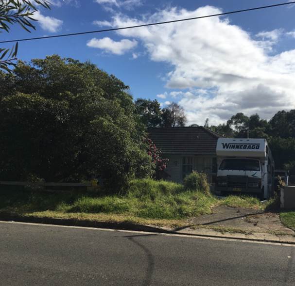
Figure 3:
The site as viewed from Peake Parade
22. The site is
currently occupied by a single storey dwelling house and scattered vegetation,
none of which is significant.
23. The site is
located in a residential neighbourhood characterised by recently constructed
residential flat buildings and dual occupancy developments. The property to the
east is occupied by a two storey attached dual occupancy development (Figure
4). The property to the west is currently occupied by dwelling houses, however
approval has been granted for a three storey residential flat building on the
corner of Peake Parade and Pearce Avenue (DA2016/0366) (Figure 5).
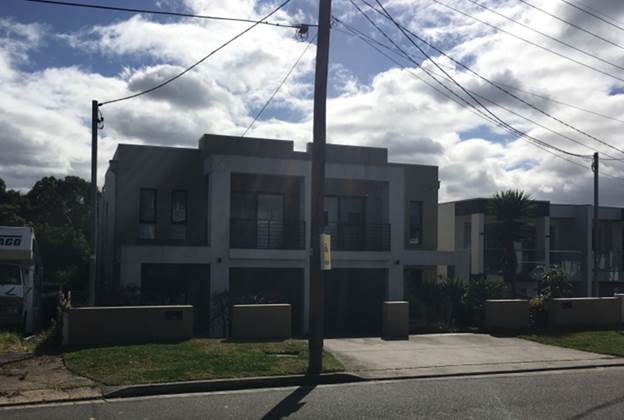
Figure 4: Dual
occupancy at 14A and 14B Peake Parade (east of the site)
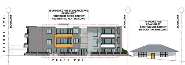
Figure 5:
Approved residential flat building at 18-20 Peake Parade (west of the site)
Background
24. DA2017/0627 sought
consent for the demolition of one detached dwelling house and the construction
of a three (3) storey residential flat building containing 6 residential
apartments. Car parking is contained within a semi-basement level containing 11
car parking spaces for residents and visitors. The application was refused by
the Local Planning Panel at its meeting held on 19 September 2019 for the
following reasons:
1. Pursuant to
Section 4.15(1)(a)(i) of the Environmental Planning and Assessment Act 1979,
the proposed development does not comply with the relevant environmental
planning instruments in terms of the following:
a) The proposal
fails to satisfy Part 4 of State Environmental Planning Policy No 65 –
Design Quality of Residential Apartment Development as it is inconsistent with
various design quality principles of State Environmental Planning Policy No 65
with respect to its response to the site’s context and neighbourhood
character and its built form and scale, density, landscape and aesthetics, and
fails to comply with the corresponding design criteria of the Apartment Design
Guide. The proposal does not achieve an acceptable built form with insufficient
setbacks and separation to minimise the visual dominance of the building when
viewed from both the public domain and adjoining properties. In addition, the
proposal fails to provide any 6m wide deep soil landscaped area on the site.
b) The proposal
fails to satisfy Part 4 of State Environmental Planning Policy No 65 –
Design Quality of Residential Apartment Development on the basis that it fails
to either achieve or adequately demonstrate compliance with the design criteria
of the Apartment Design Guide with respect to internal solar access, cross
ventilation and the minimum area of communal open space.
2. Pursuant to Section 4.15(1)(a)(iii) of the Environmental Planning
and Assessment Act 1979, the proposed development does not comply with
Hurstville Development Control Plan No. 1, Chapter 4.1 Residential Flat
Buildings, Section DS2.1 Site Frontage or Section DS3.1 Isolated Sites.
The site has a frontage of 15.8m, which fails to comply with the minimum 24m
required by the Development Control Plan. The site is not deemed to be an
isolated site and no evidence has been provided from the applicant to indicate
attempts have been made to purchase adjoining sites for amalgamation with the
subject site. Together these non-compliances result in the site being
unsuitable for the proposed development and it having unreasonable adverse
impacts on neighbouring properties.
3. Pursuant to
Section 4.15(1)(b) of the Environmental Planning and Assessment Act 1979, the proposed development is likely to have an
adverse impact on the following aspects of the environment:
a) Natural
environment – The proposal does not meet the deep soil zones design
criteria of the Apartment Design Guide nor provide sufficient front or side
setbacks which precludes the planting of canopy trees around the perimeter of
the site to provide a landscaped setting for the proposal and ameliorate the
scale of the building. Furthermore, no landscaped boundary setback is provided
on the north eastern side of the vehicle driveway.
b) Built
environment – The proposal does not respond to the context of the site
nor the neighbourhood’s character on the basis that it exceeds the
maximum building height that applies to the site, encroaches on the minimum
required side and rear setbacks expected on the site, and fails to demonstrate
a suitable level of internal amenity for the proposed apartments.
c) Basement car
park – The layout of the basement car park is unsatisfactory and does not
provide for appropriate manoeuvrability for vehicles.
4. Pursuant to
Section 4.15(1)(c) of the Environmental Planning and Assessment Act 1979, the
site is not considered suitable for the proposed development for the following
reasons:
a) The site
cannot adequately accommodate the proposed built form without significant
adverse impacts on the amenity of adjacent and nearby properties with respect
to built form, visual dominance, bulk and scale.
5. Pursuant to Section 4.15(1)(3) of the Environmental Planning and
Assessment Act 1979, the proposed
development is not considered to be in the public interest and is likely to set
an undesirable precedent within the locality.
Division 8.2 Reviews
25. Division
8.2 of the Environmental Planning and Assessment Act requires the following
provisions (Section 8.3) to be considered in the assessment of an application
to review a determination:
(1) An applicant for development
consent may request a consent authority to review a determination or decision
made by the consent authority. The consent authority is to review the
determination or decision if duly requested to do so under this Division.
(2) A determination or decision cannot
be reviewed under this Division:
(a) after the period within which any appeal may be made
to the Court has expired if no appeal was made, or
(b) after the Court has disposed of an appeal against the
determination or decision.
(3) In requesting a review, the
applicant may amend the proposed development the subject of the original
application for development consent or for modification of development consent.
The consent authority may review the matter having regard to the amended
development, but only if it is satisfied that it is substantially the same
development.
26. The statutory
considerations pursuant to Division 8.2 Reviews have been met. The application
has been lodged within an appropriate timeframe and is considered to be
substantially the same as the original application (DA2017/0627).
Discussion
on reasons for refusal and the Review application
27. The Applicant has made the following amendments to the design and
lodged the modified plans on 20 January 2020 in conjunction with the Section
8.2 review application. The changes that have been made include the following;
Car park level
- Removal of storage
spaces behind car spaces 5, 7 and 9 to accommodate the deep soil planting at
the front of the allotment.
- Removal of
external paths and reconfiguration of external stairs to accommodate deep soil
planting in the north western portion of the site.
- Removal of one
bollard and relocation of the second bollard outside the lift in the car park.
- Increase in car
park aisle widths from 5.8m to 6.25m and 6.2m to 6.36m.
Ground floor
- Removal of splayed
walls on the western elevation for bedrooms 1 and 3 of unit G.02.
- Increase in deep
soil planting to the north western part of the site.
- Increase in deep
soil planting centrally within the front setback of the site.
- Reduction in the
size of the south facing terrace for unit G.01 from 37.12sqm to 19.56sqm.
- Stairs providing
access from the north western corner of the site to the ground floor
reconfigured.
First floor
and second floor
- Removal of splayed
walls on the western elevation for bedrooms 1 and 3 of units 1.02 and 2.02.
Roof top
- Squaring off of
the roof form on the western side of the building consistent with the removal
of the angled walls in the levels below.
Elevations
- The removal of the
angled walls has now resulted in the provision of west facing windows for
bedrooms 1 and 3 in units G.01, 1.01 and 2.01.
Table 1: Comments on reasons for refusal
|
Reason for refusal
|
Applicants comments
|
Officer comment
|
|
Refusal Reason - 1. Pursuant to Section 4.15(1)(b) of the
Environmental Planning and Assessment Act 1979, the proposed development does
not comply with the relevant environmental planning instruments in
terms of the following:
(a) The proposal fails to satisfy Part 4 of State
Environmental Planning Policy No 65 – Design Quality of Residential
Apartment Development as it is inconsistent with various design quality
principles of State Environmental Planning Policy No 65 with respect to its
response to the site’s context and neighbourhood character and its
built form and scale, density, landscape and aesthetics, and fails to comply
with the corresponding design criteria of the Apartment Design Guide. The
proposal does not achieve an acceptable built form with insufficient setbacks
and separation to minimise the visual dominance of the building when viewed
from both the public domain and adjoining properties. In addition, the
proposal fails to provide any 6m wide deep soil landscaped area on the site.
(b) The proposal fails to satisfy Part 4 of State
Environmental Planning Policy No 65 – Design Quality of Residential
Apartment Development on the basis that it fails to either achieve or
adequately demonstrate compliance with the design criteria of the Apartment
Design Guide with respect to internal solar access, cross ventilation and the
minimum area of communal open space.
|
It is considered that the proposed development now
satisfies the relevant provisions detailed in Part 4 of SEPP 65 as described
in the accompanying evaluation of the SEPP 65 design quality principles
prepared by Nicholas Lycenko.
Furthermore, the proposal is considered to appropriately
respond to the design criteria detailed in the Apartment Design Guide (Refer
to part 4.4.3 of this document.
The appropriateness of the built
form within its context has been adequately addressed in the assessment of
the design quality principles accompanying this application.
With regards to deep soil, Part 3E
of the ADG identifies a minimum required dimension of 3m for any provided deep
soil zone and % of site area of 7% both of which the development complies
with.
Refer to Part 4.4.3 of this
document being an excerpt of the design architects address of the relevant
design criteria of the ADG.
|
The built form is still
inappropriate for the subject site. The non-compliance with the minimum lot
width creates a number of non-compliances with the ADG, communal open space,
visual privacy, vehicle access, solar access, storage and façade
treatment.
It is noted that the site has
provided 8.43% of landscaped area with a minimum 3m dimension consistent with
Part 3E of the ADG. This part of the reason for refusal has now been amended
to remove this non compliance.
Inadequate information has been
provided to confirm compliance, it would appear unlikely that there would be
solar penetration into living rooms of street facing units given this is the
southern side of the development.
|
|
2. Pursuant to Section 4.15(1)(a)(iii) of the
Environmental Planning and Assessment Act 1979, the proposed development does
not comply with Hurstville Development Control Plan No. 1, Chapter 4.1
Residential Flat Buildings, Section DS2.1 Site Frontage or Section DS3.1
Isolated Sites. The site has a frontage of 15.8m, which fails to comply with
the minimum 24m required by the Development Control Plan.
The site is not deemed to be an
isolated site and no evidence has been provided from the applicant to
indicate attempts have been made to purchase adjoining sites for amalgamation
with the subject site. Together these non- compliances result in the site being
unsuitable for the proposed development and it having unreasonable adverse
impacts on neighbouring properties.
|
An assessment of how this development responds to the
relevant design provisions of Hurstville DCP No 1 is detailed in Part 4.8.1
of this document.
In terms of site isolation, attempts have been made to
acquire the neighbouring sites at 14 and 14A Peake Parade. Refer to Part
5.3.7 of this document. The suitability of the proposed development on the
site is discussed in Part 5.4 of this document.
|
The proposed development does not
comply with the minimum 24m frontage. This non-compliance results in a
development that has unreasonable impacts upon the amenity of the adjoining
properties and provides inadequate internal amenity.
The applicant has provided some
documentation to indicate that attempts have been made to acquire the
neighbouring sites at 14 and 14A Peake Parade, Peakhurst however no evidence
of any attempt to acquire the neighbouring sites at 18-20 Peake Parade,
Peakhurst have been provided.
|
|
3 Pursuant to Section 4.15(1)(b) of the Environmental
Planning and Assessment Act 1979, the proposed development is likely to have
an adverse impact on the following aspects of the environment:
(a) Natural environment – The proposal does not
meet the deep soil zones design criteria of the Apartment Design Guide nor
provide sufficient front or side setbacks which precludes the planting of
canopy trees around the perimeter of the site to provide a landscaped setting
for the proposal and ameliorate the scale of the building.
Furthermore, no landscaped boundary setback is provided
on the north eastern side of the vehicle driveway.
(b) Built environment – The proposal does not
respond to the context of the site nor the neighbourhood’s character on
the basis that it exceeds the maximum building height that applies to the
site, encroaches on the minimum required side and rear setbacks expected on
the site, and fails to demonstrate a suitable level of internal amenity for
the proposed apartments.
(c) Basement car park – The
layout of the basement car park is unsatisfactory and does not provide for
appropriate manoeuvrability for vehicles.
|
As detailed in Part 4.4.3 of this document, the proposed
development provides deep soil zones that comply with both the area and width
requirements relevant to this form of development consistent with the
provisions of Part 3E of the ADG.
In terms of the provisions of a landscaped buffer along
the north eastern side of the driveway, the accompanying landscape plan
prepared by Zenith landscape design nominates the provision of native grasses
in this location.
Refer to accompanying SEPP 65 Design Principles
Statement, Part 5.3.4 (visual privacy) and Part 4.4.3 (ADG table) of this
document in address of this reason for refusal. A Clause 4.6 variation is
provided (Appendix A) in address of the height standard variation.
Vehicular manoeuvring within the
basement has been design in accordance with the relevant standards.
|
It is noted that the amended plans
now provide 8.43% of deep soil landscaped area with a minimum 3m dimension
consistent with Part 3E of the ADG.
The proposed development still
fails to provide a suitable landscape buffer to the north eastern side of the
driveway.
The proposal fails to comply with
the minimum separation distances for habitable areas and the maximum building
height. It is considered the scale and form of the development is
inappropriate for the site given its present allotment width.
The applicant has submitted a new
Clause 4.6 variation to the height development standard. This has not been
well founded and is not supported.
Council’s Traffic Engineer
has reviewed the documentation submitted with the review application and has
raised concerns with the manoeuvrability within the car park and access to
car spaces.
|
|
4. Pursuant to Section 4.15(1)(c) of the Environmental
Planning and Assessment Act 1979, the site is not considered suitable for the
proposed development for the following reasons:
(a) The site cannot adequately
accommodate the proposed built form without significant adverse impacts on
the amenity of adjacent and nearby properties with respect to built form,
visual dominance, bulk and scale.
|
The accompanying SEPP 65 Design Quality Principles
Statement and the detailed assessment against the provisions of 4.15 (c)
undertaken within this document, both confirm that the subject site is
capable of accommodating the proposed development in a manner that will not
unreasonably impact the amenity of neighbouring properties nor will it result
in a built form and scale that is visually at odds with that of the existing
or anticipated future development within the context.
|
The subject site in isolation is
not suitable for the construction of a RFB within a medium density
environment as the site does not meet the minimum site width control and is
unable to achieve suitable setbacks to neighbouring properties. As a result
the development is unsuitable with respect to the amenity impacts on the
adjoining allotment and the amenity for future occupants.
|
|
5. Pursuant to Section 4.15(1)(3) of the Environmental
Planning and Assessment Act 1979, the proposed development is not considered
to be in the public interest and is likely to set an undesirable precedent
within the locality.
|
Having regard to the amendments made and the assessment
contained within this Statement, the development is considered to be in the
public interest.
|
The proposal is still considered to
be an overdevelopment of the site given the narrow width of the allotment to
accommodate a RFB in its current form. The proposal is not considered to be
in the public interest.
|
State Environmental Planning
Policies (SEPPs)
28. Compliance with
the relevant State Environmental Planning Policies is summarised in the
following table and discussed in further detail below it.
Table
2: Compliance with State Planning Policies
|
State Environmental Planning Policy Title
|
Complies
|
|
Greater
Metropolitan Regional Environmental Plan No 2 – Georges River Catchment
|
Yes
|
|
State
Environmental Planning Policy (Building Sustainability Index: BASIX) 2004
|
Yes
|
|
State
Environmental Planning Policy No 55 – Remediation of Land
|
Yes
|
|
State
Environmental Planning Policy (Infrastructure) 2007
|
Yes
|
|
State Environmental Planning Policy (Vegetation in Non-Rural
Areas) 2017
|
Yes
|
|
State Environmental Planning Policy No 65—Design Quality of
Residential Apartment Development
|
No – Non-compliance with
respect to Design Quality Principles 1 and 2. Refer to State Environmental
Planning Policy No 65 section below.
|
|
Draft
Environment State Environmental Planning Policy
|
Yes
|
|
Draft
Remediation of Land State Environmental Planning Policy
|
Yes
|
Greater Metropolitan Regional
Environmental Plan No 2 – Georges River Catchment
29. The primary relevant
aims and objectives of this plan are:
· to
maintain and improve the water quality and river flows of the Georges River and
its tributaries and ensure that development is managed in a manner that is in
keeping with the national, State, regional and local significance of the
Catchment,
· to
protect and enhance the environmental quality of the Catchment for the benefit
of all users through the management and use of the resources in the Catchment
in an ecologically sustainable manner,
· to
ensure consistency with local environmental plans and also in the delivery of
the principles of ecologically sustainable development in the assessment of
development within the Catchment where there is potential to impact adversely
on groundwater and on the water quality and river flows within the Georges
River or its tributaries,
· to
establish a consistent and coordinated approach to environmental planning and
assessment for land along the Georges River and its tributaries and to promote
integrated catchment management policies and programs in the planning and
management of the Catchment,
30. The stormwater
design was referred to Council’s Engineering Section for review. The
plans propose the same drainage as per the original application where no
objection was raised with respect to the management and disposal of stormwater
subject to the imposition of deferred commencement conditions (for an easement
to drain water from the site to the open drain in council’s reserve to
the north of the site) if consent was to be granted.
31. In summary, the proposal
is consistent with the aims, objectives or purpose of the Regional Plan if
approved with appropriate conditions of consent.
State Environmental Planning
Policy (Building Sustainability Index: BASIX) 2004
32. BASIX Certificate
No. 879258M_03 dated 18 December 2019 was lodged with the Section 8.2 Review
application and indicates that the proposal meets the provisions and minimum
requirements of BASIX in terms of water, thermal comfort and Energy efficiency.
State Environmental Planning
Policy No 55 - Remediation of Land (State Environmental Planning Policy
55)
33. State
Environmental Planning Policy No 55 aims to promote the remediation of
contaminated land in order to reduce the risk of harm to human health or any
other aspect of the environment.
34. Clause 7 requires
contamination and remediation to be considered in determining a DA. The consent
authority must not consent to the carrying out of development on land unless it
has considered whether or not the land is contaminated.
35. Though a
Preliminary Investigation Assessment report was not submitted with the DA, a
review of historic aerial photography indicates that the site has been used for
residential purposes since at least 1943. Residential usage is not
typically associated with activities that would result in the contamination of
land. On this basis, the site is likely to be suitable for residential
development in its current state for the development proposed with respect to
contamination.
State Environmental Planning
Policy (Vegetation in Non-Rural Areas) 2017
36. The Vegetation
State Environmental Planning Policy aims to protect the biodiversity
values of trees and other vegetation in non-rural areas of the State, and to
preserve the amenity of non-rural areas of the State through the preservation
of trees and other vegetation.
37. The Vegetation
State Environment Planning Policy applies to clearing of:
(a) Native
vegetation above the Biodiversity Offset Scheme (BOS) threshold where a
proponent will require an approval from the Native Vegetation Panel established
under the Local Land Services Amendment Act 2016; and
(b) Vegetation
below the BOS threshold where a proponent will require a permit from Council if
that vegetation is identified in the council’s development control plan
(Development Control Plan).
38. The Vegetation
State Environmental Planning Policy repeals clauses 5.9 and 5.9AA of the
Standard Instrument - Principal Local Environmental Plan with regulation of the
clearing of vegetation (including native vegetation) below the BOS threshold
through any applicable development control plan (Development Control Plan).
39. The proposal involves the
removal of five (5) trees from the site. Council’s Consultant Arborist
has reviewed the proposed tree removal and raised no objection to the removal
of the five (5) trees subject to appropriate replacement tree planting both on
site and within the public domain should the application be supported. The
recommended conditions provided by the consultant arborist require one
additional tree to be planted within deep soil areas of the site in addition to
those shown on the submitted landscape plans, and one street tree to be planted
within the road frontage.
40. On this basis, the
proposal, should it be supported, is consistent with relevant provisions of the
Vegetation State Environmental Planning Policy.
Draft Remediation of Land State
Environmental Planning Policy
41. The Department of
Planning and Environment has announced a Draft Remediation of Land State
Environmental Planning Policy, which will eventually repeal and replace the
current State Environmental Planning Policy No 55 — Remediation of Land.
42. The main changes
proposed include the expansion of categories of remediation work which requires
development consent, a greater involvement of principal certifying authorities
particularly in relation to remediation works that can be carried out without
development consent, more comprehensive guidelines for Councils and certifiers
and the clarification of the contamination information to be included on
Section 149 Planning Certificates.
43. Whilst the
proposed State Environmental Planning Policy will retain the key operational
framework of State Environmental Planning Policy 55, it will adopt a more
modern approach to the management of contaminated land. The Draft State
Environmental Planning Policy will not alter or affect the findings with
respect to State Environmental Planning Policy 55 detailed above.
Draft Environment State
Environmental Planning Policy
44. The Draft
Environment State Environmental Planning Policy was exhibited from 31 October
2017 to 31 January 2018. This consolidated State Environmental Planning Policy
proposes to simplify the planning rules for a number of water catchments,
waterways, urban bushland, and Willandra Lakes World Heritage Property.
45. Changes proposed
include consolidating the following seven existing State Environmental Planning
Policies:
· State Environmental Planning Policy No. 19 – Bushland
in Urban Areas
· State Environmental Planning Policy (Sydney Drinking Water
Catchment) 2011
· State Environmental Planning Policy No. 50 – Canal
Estate Development
· Greater Metropolitan Regional Environmental Plan No. 2
– Georges River Catchment
· Sydney Regional Environmental Plan No. 20 –
Hawkesbury-Nepean River (No.2-1997)
· Sydney Regional Environmental Plan (Sydney Harbour
Catchment) 2005
· Willandra Lakes Regional Environmental Plan No. 1 –
World Heritage Property.
46. The proposal is
consistent with the provisions of this Draft Instrument.
State Environmental
Planning Policy No 65 — Design Quality of Residential Apartment Development
47. State Environmental Planning Policy No 65 –
Design Quality of Residential Flat Buildings (State
Environmental Planning Policy 65) was gazetted on 26
July 2002 and applies to the assessment of DAs for residential flat
developments of three or more storeys in height and containing at least four
dwellings. Amendment 3 to State Environmental Planning Policy 65 commenced on 17 July 2015 and implemented various
changes including the introduction of the Apartment Design Guide (ADG) to
replace the Residential Flat Design Code. Given the nature of the development
proposed, State Environmental Planning Policy
65 applies.
48. Clause 28(2) of State Environmental Planning Policy 65 requires that the consent authority take into
consideration the following as part of the determination of DAs to which State
Environmental Planning Policy 65 applies:
a) the advice (if any) obtained from the
design review panel, and
b) the design quality of the development
when evaluated in accordance with the design quality principles, and
c) the Apartment Design Guide.
49. The review application
was not referred to the DRP given the application did not substantially change
and the application was lodged with insufficient time for the matter to be
reviewed by the DRP again prior to the expiry of the review period.
50. As detailed within the table earlier in this report, the
proposal fails to satisfy various Design Quality Principles and provisions of
the ADG, particularly where they relate to context and neighbourhood character,
built form and scale, density and façade design. The proposal also fails
to meet various design criteria of the ADG with respect to residential amenity
of the apartments.
51. The tables below provide a comprehensive assessment against
the principles, objectives and controls of State Environmental Planning
Policy 65 and the ADG.
Table
3: Application of State Environmental Planning Policy 65
|
Clause
|
Standard
|
Proposal
|
Complies
|
|
3 - Definitions
|
Complies with definition of
“Residential Apartment Development” (RAD) Section 4 (1)
(Application of Policy) of the State Environmental Planning Policy 65 states
that the policy “applies to development for the purpose of a
residential flat building, shop top housing or mixed use development with a
residential accommodation component if:
(a) the development consists
of any of the following:
(i) the erection of a new
building,
(ii) the substantial redevelopment
or the substantial refurbishment of an existing building,
(iii) the conversion of an existing
building, and
(b) the building concerned is
at least 3 or more storeys (not including levels below ground level
(existing) or levels that are less than 1.2 metres above ground level
(existing) that provide for car parking), and
(c) the building concerned contains at least
4 or more dwellings.”
|
The proposal
is over five (5) levels, with three (3) levels of residential flat building
and one (1) level of parking and an enclosed room adjacent to the rooftop
communal open space.
|
Yes
|
|
4 - Application of Policy
|
Development involves the erection
of a new RFB, substantial redevelopment or refurbishment of a RFB or
conversion of an existing building into a RFB. The definition of an RFB in
the State Environmental Planning Policy includes mixed use developments.
|
This application is for the
erection of an RFB which satisfies the State Environmental Planning Policy’s
definition.
|
Yes
|
|
50 – Development Applications
|
Design verification statement
provided by qualified designer
Registered Architect Name and
Registration No.
|
Design Verification Statement
provided by Registered Architect: N Lycenko (Registration No.3010)
|
Yes
|
52. Clause 28 of State Environmental Planning Policy 65 requires the consent authority to take into
consideration the provisions of the ADG. The Table below assesses the proposal
against these provisions, with relevant assessment comments provided
where non-compliances are proposed.
Table 4: Part
3 and Part 4 – Consideration of Apartment Design Guide
|
ADG
Compliance Table
|
|
Standard
|
Proposal
|
Complies
|
|
3D – Communal Open Space (COS)
|
|
Provide COS at least 25% of the site area (169.48sqm)
Located on a podium or roof if it cannot be located on
ground level
At least 50% direct sunlight to the principal usable part
of the COS for at least 2 hours between 9am and 3pm on 21 June (mid-winter)
|
16.76%
(113.61sqm).
COS
located on roof level.
Complies
for the COS provided, however the COS provide is substantially less than the
COS required.
|
No
Yes
Yes
|
|
Comment on Communal Open Space
The proposal does not provide the
communal open space specified by the Apartment Design Guide. It is noted that
the narrowness of the site and the scale of the building mean that there is
little opportunity for the provision of compliant and quality areas of
communal open space on the site.
The units in the proposal do not
benefit from larger balconies to compensate for the deficient COS, and the
ground floor is heavily disrupted by the protruding basement and
service/circulation areas, meaning there is no alternative location for
additional open space.
|
|
3E – Deep Soil Zones
|
|
Site area is 650sqm - 1,500sqm = 3m
min dimensions
Min deep soil area of 7% (47sqm)
|
Amended plans show that the deep
soil area proposed achieves the minimum 3m dimensions.
57.13sqm (8.43%)
|
Yes
Yes
|
|
Comment on Deep Soil Zones
The building has been redesigned
and now provides sufficient deep soil zones with minimum dimensions of 3m and
a minimum total area of 8.43% of the site area, as required by the ADG for a
site of this size.
|
|
3F – Visual Privacy
|
|
Minimum
separation to side and rear boundaries:
Up to 12m (4
storeys):
3m
non-habitable rooms
6m habitable
rooms and balconies
|
Levels G – 2
East Elevation:
· Between 2.345m
and 4.825m to habitable/balcony
West Elevation:
· Between 2.615m
and 4.125m to habitable rooms
|
No
No
|
|
Comment on Visual Privacy
The proposed development fails to
achieve the required separation distances to adjoining properties, and in the
plans refused under the original DA used ungainly angled windows to manage
privacy impacts. These angled windows have been removed from the western side
of the building and replaced with standard windows which also fail to satisfy
the ADG requirements. The angled walls on the eastern side of the building
remain, which restrict the amount of potential light within the building.
The inadequate separations will
impose unreasonable impacts on the developments either side of the site, and
accordingly will form part of the reasons for refusal.
It is noted that the failure to
provide separation is a result of the narrow width of the site in its present
form. The lack of separation along both side boundaries will create adverse
amenity impacts to adjoining properties and the lack of compliant separation
distances in this case will not satisfy the objectives of the ADG, which aim
to achieve an “equitable” distribution of separation between
properties.
|
|
3G – Pedestrian Access and Entries
|
|
Building
entries and pedestrian access connects to and addresses the public domain
Multiple
entries (including communal building entries and individual ground floor
entries) should be provided to activate the street edge
|
One entry provided (western side)
with access from Peake Parade.
One communal entry (western side)
and one entry to Unit G.01 via a terrace.
|
Yes
Yes
|
|
3H – Vehicle Access
|
|
Vehicle access
points are designed and located to achieve safety, minimise conflicts between
pedestrians and vehicles and create high quality streetscapes
|
The driveway has an insufficient
setback along the south eastern boundary. Landscaping between the driveway
and the boundary shared with 14A Peake Parade, will be visually dominant in
the streetscape relative to the development.
The waiting bay adjacent to the
driveway does not enable manoeuvring into the car park and will require a
vehicle to reverse into the public domain resulting in vehicle and pedestrian
conflict.
|
No – see comment below
|
|
Comment on Vehicle Access:
The proposed driveway off Peake
Parade has an insufficient setback from the south eastern boundary and occupies
34% of the site frontage thereby forming a dominant feature with respect to
the streetscape character of the development.
The failure to provide a strip of
landscaping (eg 1.5m) to enable a softening of the harshness and sterile
nature of the driveway, and the dominance of the driveway with respect to the
site width both indicate that the proposed driveway design will not deliver a
sufficiently high quality streetscape. In conjunction with the pedestrian
entries including access stairs and ramps, this will cumulatively result in
hard surfaces dominating the streetscape.
As the driveway is not able to be
reduced for reasons of satisfying Australian Standards for design, this
indicates that the site is not wide enough to accommodate the development as
proposed, and forms part of the refusal reasons.
Concern is also raised with the
conflict between pedestrian and vehicles as the waiting bay area located to
the west of the driveway is of insufficient depth and requires that the
vehicle reverses back into the public domain before entering the car park.
|
|
3J – Bicycle and Car Parking
|
|
Car parking provided in accordance
with RMS GTTGD
(Applies to sites that are within
800m of a railway station or light rail stop in the Sydney Metropolitan Area)
|
Not applicable – site is more
than 1km from Riverwood Station and therefore the Development Control Plan
(DCP) rates apply to the proposal.
Required:
1 space/1B or 2B = 3 spaces
2 spaces/3B= 6 spaces
1 visitor space/4 units = 2
spaces
Proposed:
9 resident spaces
2 visitor spaces
|
N/A
Yes
Yes
|
|
4A – Solar and Daylight
Access
|
|
Living rooms and private open space
receive 2 hours direct sunlight between 9am and 3pm in midwinter for 70% of
apartments
Max. 15% of apartments receive no
direct sunlight between 9am and 3pm in midwinter
|
Inadequate
information provided to confirm compliance – unlikely to achieve solar
penetration into living rooms of street facing units given this is the
southern side of the development.
3/6
apartments = 50%
|
No
– see comment below
No
|
|
Comment on Solar and Daylight
Access
The shadow diagrams submitted with
the application fail to provide solar access diagrams for the proposed units
and do not show the penetration of direct sunlight into the units. It is
likely that the living rooms of the street facing units will not receive 2
hours of sunlight in winter as required by the ADG, particularly if the site
to the east is developed in a similar manner into the future. On this basis,
compliance with the Solar and Daylight Access design criteria has not been
demonstrated and the proposal is deemed unacceptable.
It is noted that although the ADG
requires provision of separation distances primarily for reasons of privacy
in Part 3, Part 2F (which relates to preparation of building controls) notes
that separation is also important to assist in providing residential amenity
with respect to sunlight and daylight access. Given the proposal is on a site
that is below the required site width, it is relevant to note that the
inability to deliver solar access to the required number of units is a direct
symptom of the inadequate width of the site.
This matter forms part of the
reasons for refusal.
|
|
4B – Natural Ventilation
|
|
At least 60% of apartments are
naturally cross ventilated in the first nine storeys of the building.
Overall depth of a cross-over or
cross-through apartment does not exceed 18m, measured glass line to
glass line
The building
should include dual aspect apartments, cross through apartments and corner apartments
and limit apartment depths
|
Inadequate
information provided to make a proper assessment.
13m
maximum
Achieved
|
The proposal appears to comply,
however further information is required to confirm this criterion given the
insufficient setbacks.
Yes
Yes
|
|
Comment on natural ventilation
The SEE submitted with the
application states all units are designed and configured to permit natural
cross ventilation, and the layout of the units appear to comply, however no
ventilation diagrams were provided with the architectural plans to
demonstrate compliance with the control, given the compromised design to
address the inadequate setbacks provided.
This
forms part of the reasons for refusal.
|
|
4C – Ceiling Heights
|
|
Minimum ceiling heights measured
from FFL to finished ceiling level:
Habitable rooms = 2.7m
Non-habitable rooms = 2.4m
|
All rooms have 2.7m internal
ceiling height.
|
Yes
|
|
4D – Apartment Size and Layout
|
|
Minimum internal areas:
1br: 50sqm
2br: 70sqm
3br: 90sqm
(Add 5sqm if second bathroom
proposed)
Each habitable room must have a
window in an external wall with a total minimum glass area of at least 10% of
the floor area of the room.
|
All apartments meet minimum
internal sizes.
Calculated accordingly.
Each habitable room has a suitably
sized window.
|
Yes
Yes
Yes
|
|
Habitable room depths are limited
to a maximum of 2.5 x the ceiling height
In open plan layouts (where the
living, dining and kitchen are combined) the maximum habitable room depth is 8m
from a window
|
All rooms compliant.
Street facing units measure depth
from balcony door to “front” of kitchen (7.4m) while rear facing
units are measured to the rear wall of the kitchen (8m).
|
Yes
Yes
|
|
Master bedrooms have a minimum area
of 10sqm and other bedrooms 9sm (excluding wardrobe space)
Bedrooms have a minimum dimension
of 3m (excluding wardrobe space)
Living rooms or combined
living/dining rooms have a minimum width of:
- 3.6m for studio and 1 bedroom
- 4m for 2 and 3 bedroom apartments
Internal width of cross-over or
cross-through apartments are at least 4m
|
All bedrooms meet minimum internal
sizes (excluding wardrobe space).
All bedrooms meet minimum
dimensions excluding wardrobe space as specified.
All living rooms comply.
All such apartments meet the
minimum width requirement.
|
Yes
Yes
Yes
Yes
|
|
Comment on Apartment Size and
Layout
To overcome the width of the site
being 37% below the required 24m site frontage for RFBs under the Hurstville
Development Control Plan (DCP), and the inability of the proposed building to
achieve the required setbacks to the side boundaries for visual privacy, the
design treatment of the side elevations of the building includes
‘hooded’ windows facing the rear of the site. This results in
poor internal amenity for most bedrooms, and the living and dining rooms of
the street-facing units, in terms of solar access, ventilation and outlook.
This forms a reason for refusal.
|
|
4E – Private Open Space and Balconies
|
|
Minimum primary balcony sizes:
1br: 8sqm area, 2m depth
2br: 10sqm area, 2m depth
3+br: 12sqm area, 2.4m depth
The minimum balcony depth to be
counted as contributing to the balcony area is 1m
For apartments at ground level or
on a podium or similar structure, a private open space is provided instead of
a balcony. It must have a minimum area of 15sqm and a minimum depth of 3m.
|
All 2 bedroom units compliant in
area and width.
All 3 bedroom units compliant in
area and width.
Calculated accordingly.
G.01 complies.
|
Yes
Yes
Yes
Yes
|
|
4F – Common Circulation Areas
|
|
Maximum 8 apartments off a
circulation core on a single level
|
2 units per level.
|
Yes
|
|
4G – Storage
|
|
In addition to storage in kitchens,
bathrooms and bedrooms, the following storage is provided:
1br: 6m³
2br: 8m³
3+br: 10m³
At least 50% of storage is located
within the apartment
|
2br G.01, 1.01 & 2.01 <8m3
3br G.02, 1.02 & 2.02<10m3
Units G.01, 1.01 and 2.01
> 50% of storage is in basement.
|
No
No
No
|
|
4H – Acoustic Privacy
|
|
Adequate building separation is
provided within the development and from neighbouring buildings/adjacent
uses.
Window and door openings are
generally orientated away from noise sources
Noisy areas within buildings
including building entries and corridors should be located next to or above
each other and quieter areas next to or above quieter areas
Storage, circulation areas and
non-habitable rooms should be located to buffer noise from external sources
|
Refer to 3F – Visual Privacy.
Bedrooms generally oriented away
from the street.
Achieved
Generally achieved where
practicable.
|
No
Yes
Yes
Yes
|
|
4J – Noise and Pollution
|
|
To minimise impacts the following
design solutions may be used:
· physical
separation between buildings and the noise or pollution source
· residential uses
are located perpendicular to the noise source and where possible buffered by
other uses
· buildings should
respond to both solar access and noise. Where solar access is away from the
noise source, non-habitable rooms can provide a buffer
· landscape design
reduces the perception of noise and acts as a filter for air pollution
generated by traffic and industry
|
The site is not located in close
proximity to any noise or pollution sources.
|
Yes
|
|
4K – Apartment Mix
|
|
A range of apartment types and
sizes is provided to cater for different household types now and into the
future.
The apartment mix is distributed to
suitable locations within the building.
|
Each floor contains the following
unit mix:
· 1 x 2 bedroom
unit
· 1 x 3 bedroom
unit.
|
Yes
|
|
4L – Ground Floor Apartments
|
|
Street frontage activity is
maximised where ground floor apartments are located
Design of ground floor apartments
delivers amenity and safety for residents
|
Unit G.01 has direct access from
Peake Parade however the courtyard is almost 1m below the street level on the
southern side of the building, and is located between the driveway and
communal pedestrian access for the building.
Accordingly it is considered this
is a poor design outcome and is not appropriate.
This forms part of the reasons for
refusal.
|
No
|
|
4M – Facades
|
|
Facades should be well resolved
with an appropriate scale and proportion to the streetscape and human scale
|
The bulk of the building is too
large for a site having a width of 15.85m, and the inability to achieve
suitable setbacks to the side boundaries further exacerbates the scale of the
building being out of character in the streetscape and the broader locality.
This forms a refusal reason of the
application.
|
No
|
|
4N – Roof Design
|
|
Roof treatments are integrated into
the building design and positively respond to the street. Opportunities to
use roof space for residential accommodation and open space are maximised.
Incorporates sustainability
features
|
Clean, simple roof form, lift
overruns centralised over the building, open space on rooftop achieved.
Acceptable shading to apartment
openings.
|
Yes
Yes
|
|
4O – Landscape Design
|
|
Landscape design is viable and
sustainable, contributes to the streetscape and amenity
|
Insufficient room for canopy trees
along the perimeter of the site.
|
No
– see comment below
|
|
Comment on Landscape Design
The amended proposal provides a larger area of
deep soil however there are still limited opportunities for significant
canopy tree planting to ameliorate the scale of the building regulate the
local microclimate and contribute to a landscaped setting in the locality,
particularly between buildings.
|
|
4P – Planting on Structures
|
|
Planting on structures –
appropriate soil profiles are provided, plant growth is optimised with
appropriate selection and maintenance, contributes to the quality and amenity
of communal and public open spaces
|
Planter boxes would need to be of
appropriate depth by condition of consent if approved
|
Achievable by a condition of
consent if approved.
|
|
4Q – Universal Design
|
|
Universal design – design of
apartments allow for flexible housing, adaptable designs, accommodate a range
of lifestyle needs. Benchmark of 20% liveable dwellings.
|
No liveable dwellings proposed.
|
No
|
|
4R – Adaptive Reuse
|
|
Adaptive reuse as apartment of
existing buildings- new additions are contemporary and complementary, provide
residential amenity while not precluding future adaptive reuse.
|
N/A – not an adaptive
re-reuse as the building is new.
|
N/A
|
|
4U – Energy Efficiency
|
|
Development incorporates passive
environmental design, passive solar design to optimise heat storage in winter
and reduce heat transfer in summer, natural ventilation minimises need for
mechanical ventilation
|
Appropriate building orientation,
natural ventilation, passive solar design, exceeds BASIX target for energy
efficiency.
|
Yes
|
|
4V – Water Management and Conservation
|
|
Water management and conservation
– potable water use is minimised, stormwater is treated on site before
being discharged, flood management systems are integrated into the site
design
|
Suitable.
|
Yes
|
|
4W – Waste Management
|
|
Waste management – storage
facilities are appropriately designed, domestic waste is minimised by
convenient source separation and recycling
|
Can be addressed through conditions
of consent if approved.
|
Achievable
|
|
4X – Building Maintenance
|
|
Building design provides protection
form weathering
Enables ease of maintenance,
material selection reduces ongoing maintenance cost
|
Suitable.
|
Yes
|
53. The proposal is therefore
unsatisfactory with regards building separation, solar access, site landscaping, provision of communal open space, driveway dominance and
other amenity matters.
54. The majority of
these issues are driven by the narrow width of the site. In the context that
the site fails to achieve an acceptable level of design with regards to the
matters identified in Apartment Design Guide for a site that is not isolated.
Accordingly the design issues outlined above will form part of the reasons for
refusal of the application.
Environmental
Planning Instruments
Hurstville Local Environmental Plan 2012
Zoning
55. The subject site is zoned R3 Medium
Density Residential under the provisions of the Hurstville Local Environmental
Plan 2012 (HLEP2012) (see zoning map below). The proposed development is for a
residential flat building which is a permissible land use in the zone.
Figure 6: Zoning
map – the site is outlined in blue
56. The objectives of the zone are as
follows:
• To provide for the housing needs of
the community within a medium density residential environment.
• To provide a variety of
housing types within a medium density residential environment.
• To enable other land
uses that provide facilities or services to meet the day to day needs of
residents.
• To ensure that a high
level of residential amenity is achieved and maintained.
• To provide for a range
of home business activities, where such activities are not likely to adversely
affect the surrounding residential amenity.
57. The proposal does not satisfy all of
the objectives of the R3 Medium Density Residential zone. Although it provides
a variety of residential apartments in a medium density residential
environment, it does not achieve or maintain a high level of residential
amenity, given the lack of building separation which is as a result of the non
compliant allotment width.
58. The
non-compliance with the minimum allotment width results in a number of non-
compliances with the ADG, in particular the minimum building separation
requirements, and as a result has an adverse impact upon the amenity between
adjoining properties.
59. The extent to which the proposal
complies with the relevant standards of Hurstville Local Environmental Plan
2012 (HLEP2012) is outlined in the table below.
Table
5: HLEP2012 Compliance Table
|
Clause
|
Standard
|
Proposed
|
Complies
|
|
2.2 Zone
|
R3
Medium Density Residential
|
The proposal is defined as a residential
flat building which is a permissible use within the zone.
|
Yes
|
|
2.3
Objectives
|
Objectives of the Zone:
- To
provide for the housing needs of the community within a medium density
residential environment.
- To
provide a variety of housing types within a medium density residential
environment.
- To
enable other land uses that provide facilities or services to meet the day to
day needs of residents.
- To
ensure that a high level of residential amenity is achieved and maintained.
- To
provide for a range of home business activities, where such activities are
not likely to adversely affect the surrounding residential amenity.
|
The proposal is inconsistent with
the zone objectives in that the proposed building fails to ensure that a high
level of residential amenity is achieved and maintained.
This is as a result of the lack of
separation along both side boundaries which will create adverse amenity
impacts to the adjoining properties. The reduced setbacks are a result of the
limited site width to cater for the density proposed.
Compliant setbacks could be
achieved if the site was to amalgamate with an adjoining site which in turn
would assist in meeting the objective in relation to residential amenity.
|
No
|
|
4.3 – Height of Buildings
|
12m as identified on Height of
Buildings Map
|
The building exceeds the 12m height
limit and proposes an overall height at the highest point of 14.4m.
|
No – see discussion below
regarding Clause 4.6 Statement submitted.
|
|
4.4 – Floor Space Ratio
|
1:1 as identified on Floor Space
Ratio Map
|
The
proposed FSR is 0.96:1.
|
Yes
|
|
4.5 – Calculation of floor
space ratio & site area
|
FSR and site area calculated in
accordance with Cl.4.5
|
The GFA calculations provided by
the Applicant have been verified and are considered satisfactory.
|
Yes
|
|
6.2 Earthworks
|
To ensure that earthworks do not
have a detrimental impact on environmental functions and processes,
neighbouring uses, cultural or heritage items or features of the surrounding
land
|
Excavation for the car parking
level is proposed. Suitable conditions of consent could be imposed to protect
neighbouring properties during construction should the application be
approved.
|
Yes
|
Clause 4.6 Exceptions to development standards
Detailed assessment of variation to Clause 4.3 Height of Buildings
60. Clause
4.3 of Hurstville Local Environmental Plan (HLEP2012) relates to the maximum
permitted building height for a site and refers to the Height of Buildings Map.
The relevant map identifies the subject site as having a maximum height of 12m.
Building Height is defined as:
“Building height (or height of
building) means:
(a) In relation to the height of a
building in metres – the vertical distance from ground level (existing)
to the highest point of the building, or
(b) In relation to the RL of a
building the vertical distance from the Australian Height Datum to the highest
point of the building
Including plant and lift overruns, but
excluding communication devices, antennae, satellite dishes, masts, flagpoles,
chimneys, flues and the like.”
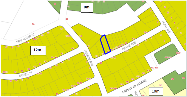
Figure 7: Extract from the HELP
(height Map_005) designated as “M” notes a 12m height limit
61. The
proposed development seeks a variation to the development standard relating to
height (Clause 4.3). The Local Environmental Plan identifies a maximum height
of 12m for the site (refer to Figure 8 below) and the proposed development will
exceed the height by 2.4m which comprises of the lift overrun, fire stairs,
enclosed common area, and the pergola over the rooftop communal open space
area. This is a 20% variation above the control. Any variation to the height
can only be considered under Clause 4.6 – Exceptions to Development
Standards of the Hurstville Local Environmental Plan 2012.
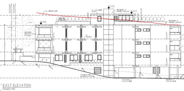
Figure 8: Red line showing the
areas of the building that exceed the 12m height limit (courtesy Cornerstone
Design).
62. Clause 4.6(1) outlines the objectives
of the standard which are to “provide an appropriate degree of
flexibility in applying certain development standards to particular development” and “to achieve better outcomes for and
from development by allowing flexibility in particular circumstances”.
63. Clause 4.6(3) states that:
“Development consent must not be
granted for development that contravenes a development standard unless the
consent authority has considered a written request from the applicant that
seeks to justify the contravention of the development standard by
demonstrating:
- that compliance with the development standard is
unreasonable or unnecessary in the circumstances of the case, and
- that there are sufficient environmental planning grounds to
justify contravening the development standard”
64. To support the non-compliance, the
applicant has provided a request for a variation to Clause 4.3 in accordance
with Clause 4.6 of HLEP2012. The Clause 4.6 request for variation is assessed
as follows:
Is the planning control in question
a development standard?
65. The
Height of Buildings control under Clause 4.3 of the Hurstville Local Environment
Plan 2012 is a development standard.
What are the underlying objectives of the development
standard?
66. The
objectives of Height of Buildings standard under Clause 4.3 of Hurstville Local
Environmental Plan 2012 are:
(a) to ensure that
buildings are compatible with the height, bulk and scale of the existing and
desired future character of the locality,
(b) to minimise visual
impact, disruption of views, loss of privacy and loss of solar access to
existing development and to public areas and public domain, including parks,
streets and lanes,
(c) to minimise the
adverse impact of development on heritage items,
(d) to nominate heights
that will provide a transition in built form and land use intensity,
(e) to establish maximum
building heights that achieve appropriate urban form consistent with the major
centre status of the Hurstville City Centre,
(f) to facilitate
an appropriate transition between the existing character of areas or localities
that are not undergoing, and are not likely to undergo, a substantial
transformation,
(g) to minimise adverse
environmental effects on the use or enjoyment of adjoining properties and the
public domain.
Compliance is unreasonable or unnecessary
in the circumstances of the case (clause 4.6(3)(a))
67. There
have been several Court cases that have established provisions in which to
assess Clause 4.6 statements to ensure they are well founded and address the
provisions of Clause 4.6.
68. In Wehbe V Pittwater Council (2007) NSW LEC 827
Preston CJ sets out ways of establishing that compliance with a development
standard is unreasonable or unnecessary. This list is not exhaustive. It
states, inter alia:
“An objection under State Environmental Planning Policy 1 may be well founded and be consistent with the aims set
out in clause 3 of the Policy in a variety of ways. The most commonly invoked
way is to establish that compliance with the development standard is
unreasonable or unnecessary because the objectives of the development standard
are achieved notwithstanding non-compliance with the standard.”
69. The Judgment goes on to state that:
“The rationale is that development standards are
not ends in themselves but means of achieving ends. The ends are environmental
or planning objectives. Compliance with a development standard is fixed as the
usual means by which the relevant environmental or planning objective is able
to be achieved. However, if the proposed development proffers an alternative
means of achieving the objective strict compliance with the standard would be
unnecessary (it is achieved anyway) and unreasonable (no purpose would be
served).”
70. Preston CJ in the
judgement then expressed the view that there are 5 different ways in which an objection may be well founded and that approval of the objection may
be consistent with the aims of the policy, as follows (with emphasis placed on
number 1 for the purposes of this Clause 4.6 variation):
1. The
objectives of the standard are achieved notwithstanding non-compliance with the
standard;
2. The
underlying objective or purpose of the standard is not relevant to the
development and therefore compliance is unnecessary;
3. The
underlying object or purpose would be defeated or thwarted if compliance was
required and therefore compliance is unreasonable;
4. The
development standard has been virtually abandoned or destroyed by the Council's
own actions in granting consents departing from the standard and hence
compliance with the standard is unnecessary and unreasonable;
5. The zoning of
the particular land is unreasonable or inappropriate so that a development
standard appropriate for that zoning is also unreasonable and unnecessary as it
applies to the land and compliance with the standard that would be unreasonable
or unnecessary. That is, the particular parcel of land should not have been
included in the particular zone.”
71. The statement was
prepared in consideration of the recent court cases and their judgements.
72. Applicants
comment: “Preston CJ identifies 5 options in Wehbe V
Pittwater Council (2007) NSW LEC 827 which can be used to analyse whether the
application of the standard to a particular building is unreasonable or
unnecessary in the circumstances of the case.
Preston CJ at [16] states as follows:
“As to the first matter required by cl
4.6(3)(a), I summarised the common ways in which an applicant might demonstrate
that compliance with a development standard is unreasonable or unnecessary in
Wehbe v Pittwater Council at [42] – [51]. Although that was said in the
context of an objection under State Environmental Planning Policy No 1 –
Development Standards to compliance with a development standard, the discussion
is equally applicable to a written request under cl 4.6 demonstrating that
compliance with a development standard is unreasonable or unnecessary.”
In Wehbe, Preston CJ identified five ways in
which it could be shown that application of a development standard was
unreasonable or unnecessary. However, his Honour said that these five ways are
not exhaustive; they are merely the most commonly invoked ways. Further, an
applicant does not need to establish all of the ways.
The five methods outlined in Wehbe are:
1. The
objectives of the standard are achieved notwithstanding non-compliance with the
standard (first method).
2. The
underlying objective or purpose of the standard is not relevant to the development
and therefore compliance is unnecessary (Second method).
3. The
underlying object of purpose would be defeated or thwarted if compliance v/as
required and therefore compliance is unreasonable (Third method).
4. The
development standard has been virtually abandoned or destroyed by the Council's
own actions in granting consents departing from the standard and hence
compliance with the standard is unnecessary and unreasonable (Fourth method).
5. The zoning of
the particular land is unreasonable or inappropriate so that a development
standard appropriate for that zoning is also unreasonable and unnecessary as it
applies to the land and compliance with the standard that would be unreasonable
or unnecessary. That is, the particular parcel of land should not have been
included in the particular zone (Fifth method).
Of particular assistance in this matter, in
establishing that compliance with a development standard is unreasonable or
unnecessary are the First and Fourth methods.
First method – Achieves the objectives
of the standard
The objectives of the height of buildings
principal development standard area:
(a) to ensure that
buildings are compatible with the height, bulk and scale of the existing and
desired future character of the locality,
(b) to minimise visual
impact, disruption of views, loss of privacy and loss of solar access to
existing development and to public areas and public domain, including parks,
streets and lanes,
(c) to minimise the
adverse impact of development on heritage items,
(d) to nominate heights
that will provide a transition in built form and land use intensity,
(e) to establish maximum
building heights that achieve appropriate urban form consistent with the major
centre status of the Hurstville City Centre,
(f) to facilitate
an appropriate transition between the existing character of areas or localities
that are not undergoing, and are not likely to undergo, a substantial
transformation,
(g) to minimise adverse
environmental effects on the use or enjoyment of adjoining properties and the
public domain.
It is considered that the proposed
development achieves the objectives of the standard for the following reasons:
The underlying purpose of objective (a) is
to ensure that any future development is designed in a manner whereby any
resulting building height will appropriately respond to both the existing and
future context in a controlled manner. The recessive nature of the height
breach particularly from the Peake Parade frontage and notable site slope,
enable the proposed building to visually integrate with that of neighbouring
development both current and future, serving as an affirmation of the objective
and not that of a building that abandons height controls.
The proposal is compliant in height along
the Peake Parade Street frontage consistent with the height and scale envisaged
by the standard. Due to the minor non-compliance being limited to the lift
overrun and ancillary structures servicing the roof top communal open space,
the development is generally indistinguishable from a fully compliant scheme
when viewed from the Peake Parade frontage and neighbouring properties.
Objective (b) seeks to minimise the visual
impact, disruption of views, loss of privacy and loss of solar access to
existing development and the adjoining public domain from buildings.
Visual Impact
The visual impact of the non-compliant
height elements are not significant because:
· The height breaching elements are suitably integrated into
the overall design of the building and are of a form and materiality that do
not create any unwarranted visual impact;
· The portion of the building that exceeds the building
height is limited to the centre of the building away from the building edges
and therefore, does not impose on either the neighbouring properties, public
reserve adjoining the site to the rear or streetscape along Peake Parade.
· The landscaped treatments proposed to the roof of the
building will serve to soften the visual presentation of the building.
Having regard to the above, the elements in
breach of the height will be largely imperceptible when compared to a height
compliant building on this site, most notably when observed from the public
domain along Peake Parade
Disruption of Views
The location of the subject site, its
relationship with adjoining properties and extent of available views offered to
neighbouring properties both existing and future; none of which are considered
of any appreciable significance, will not be compromised by the extent of
building height breach observed by this building height variation.
Loss of Privacy
The non-compliant building elements, notably
those that are proposed to be trafficable, are sited within the centre of the
building generously setback from the building edges. Furthermore, planter boxes
are proposed along the accessible perimeters of the communal rooftop space
excluding that with direct address to Peake Parade. The aforementioned design
measures will further mitigate the ability for privacy impacts to be incurred
by either neighbouring properties or by persons utilising the public reserve
for recreation purposes located to the rear of the site.
Solar Access to neighbouring buildings,
parks and the public domain
The height breaching elements of the
building will not unreasonably impact the extent of available solar access
capable of being provided to either the neighbouring properties, adjoining
reserve or public domain. The envisaged impact of additional shadowing
anticipated to be cast on neighbouring development is demonstrated in Figures
20 and 21 of the Clause 4.6 variation. This analysis demonstrates that the
extent of additional shadowing that will be incurred by the height breach (highlighted
in red), is limited to the solid and unfenestrated components of the
neighbouring developments. Importantly, the diagrams display the likely impact
to be incurred by the approved but yet to be constructed residential flat
building at 18-20 Peake Parade and not that of the existing dwelling.
On this basis, the proposal is consistent
with objective (b).
There are no heritage items in the vicinity
of the subject site and therefore objective (c) is met.
Objective (d) seeks to nominate heights that
will provide a transition in built form and land use intensity.
The proposed development complies with the
allowable FSR made available to the land and therefore, there is no
identifiable nexus between the height variation and the extent of density
afforded to the land.
Further to the above, the breaching height
elements are suitably integrated into the overall design of the building and
are of a form and materiality that do not create any unwarranted visual impact.
The areas that exceed the height standard are inconsequential when viewed from
the public domain and do not contribute to the scale and density of the
building in terms of its visual perception to contributing bulk. Where the
rooftop building elements servicing the communal open space area exceed the
height standard, they have been designed in a manner where they are centrally
located and do not increase the scale or intensity of development when viewed
by the casual observer.
The site is not located within Hurstville
City Centre and is therefore, objective (e) is not relevant to this development.
In relation to objective (f), the locality
maintains a largely medium density development character whereby undeveloped
lands within the definable context are all afforded with height and density
controls consistent with that observed on the subject site.
In response to objective (g) which seeks to
minimise adverse environmental effects on the use or enjoyment of adjoining
properties and the public domain, the extent of height breach proposed in a
largely centralised location on the roof, will not result in any future
restriction on the ability for adjoining properties or general public to
continue utilising their identifiable spaces in a manner that remains
uncompromised by the extent of building height breach.
Having regard to the address of the building
height objectives above, it is evident that the proposed development remains
consistent with the objectives for maximum height, despite the numeric
non-compliance.
Fourth Method - Development standard has
been virtually abandoned or destroyed by the granting of consents departing
from the standard in similar cases to this
Compliance with the clause 4.3 Height of
buildings development standard is also unreasonable or unnecessary in the
circumstances of this case because the development standard has been virtually
abandoned as far as it relates to equitable roof top access to communal open
space. We do not say that it has been abandoned as far as it relates to
habitable floors above the maximum building height.
Other residential flat buildings in this
locality encroach the maximum 12m height standard for the communal rooftop and
associated structures relating to that rooftop, being lift overrun, stairs,
amenities and shade structures.”
73. Officer
Comment: The proposed development is seeking approval for a residential
flat building on a site that is 15.85m wide, which is considerably below the
minimum 24m site width nominated within the Hurstville Development Control Plan
(DCP).
74. The
proposal is an overdevelopment of the site and the design does not respond
appropriately to the topography of the land and the slope of the site to the
rear, resulting in the non-compliance with the 12m height limit.
75. The proposal fails to satisfy the objectives of the
development standard as follows:
(a) to ensure that buildings are compatible
with the height, bulk and scale of the existing and desired future character of
the locality,
76. Officer Comment: The
proposal is not compatible with the height, bulk or scale of the desired future
character of the locality. The adjoining buildings (existing and approved)
comply with the height limit and are a suitable response to their respective
sites. The site fails to achieve the minimum
site width required for residential flat buildings, as such the development
proposed is constrained when attempting to satisfy the provisions of State Environmental Planning Policy 65 and the ADG resulting in a compromised built form
providing reduced amenity to the future occupants and an undesirable built form
outcome presenting to the street. The proposal is not suitable for the site.
(b) to minimise visual
impact, disruption of views, loss of privacy and loss of solar access to
existing development and to public areas and public domain, including parks,
streets and lanes
77. Officer Comment: This
objective relates to the amenity impacts generated by the exceedance in the
height control. The non-compliance will not result in any adverse overlooking, overshadowing
(lift core is centralised so the lift overrun will overshadow the building
itself), view loss or outlook generated by the variation and it will not
adversely affect the public domain.
(c) to minimise the
adverse impact of development on heritage items,
78. Officer Comment: The
site is not located within proximity of any heritage items.
(d) to nominate
heights that will provide a transition in built form and land use intensity,
79. Officer Comment: Objective (d) is aimed at establishing a maximum height for
buildings so that within a given zone there is consistency in the scale and
built form of the building.
80. It is accepted that the
exceedance at its worst point is centrally located within the roof form however
the design of the building fails to respond appropriately to the slope of the
site to the rear and is an overdevelopment on an undersized (narrow) allotment,
rendering it unsuitable for the proposed development.
81. The non-compliance is not
considered minor as it relies on the roof level area for its only area of
communal open space as this is the only area for passive recreation for the
development. The building envelope and built form, as proposed, is
non-compliant with the ADG separation distances and therefore the additional
scale and height is not considered to reflect the desired future planning and
design outcome that is sought/envisaged for this precinct.
(e) to establish
maximum building heights that achieve appropriate urban form consistent with
the major centre status of the Hurstville City Centre,
82. Officer Comment: The
site is not
located within the Hurstville City Centre.
(f) to
facilitate an appropriate transition between the existing character of areas or
localities that are not undergoing, and are not likely to undergo, a
substantial transformation,
83. Officer Comment: Given
the non-compliant width of the site, the proposed development does not provide
an appropriate transition between the approved residential flat building to the
west (which complies with the height control) and the existing two storey dual
occupancy to the east. A more appropriate development for the site would be a
dual occupancy as a compliant built form could be achieved and the amenity
afforded to the future occupant’s and the adjoining allotments would
greatly improve.
(h) to minimise
adverse environmental effects on the use or enjoyment of adjoining properties
and the public domain.
84. Officer Comment: The
non-compliance will not result in any adverse overlooking, overshadowing (lift
core is centralised so the lift overrun will overshadow the building itself),
view loss or loss of outlook generated by the variation and it will not
adversely affect the public domain.
Clause 4.6(3)(b) are there sufficient environmental
planning grounds to justify contravening the standard
85. Having regard to Clause
4.6(3)(b) and the need to demonstrate that there are sufficient environmental planning
grounds to justify contravening the development standard, It is considered that
the Clause 4.6 Statement lodged with the review application addresses all the
information required pursuant to Clause 4.6, however the statement is not
considered to be well founded and there are insufficient environmental planning
grounds to justify contravening the standard given that in this case the
proposal does not satisfy the objectives of the height control.
86. Clause 4.6(4) states
that:
“Development consent must not be
granted for development that contravenes a development standard unless:
(a) the consent authority is satisfied that:
(i) the applicant’s written request has adequately
addressed the matters required to be demonstrated by subclause (3), and
(ii) the proposed development will be in the public interest
because it is consistent with the objectives of the particular standard and the
objectives for development within the zone in which the development is proposed
to be carried out,”
87. Applicant’s
comment: “Clause 4.6(3) b of the HLEP 2012, requires the consent
authority to be satisfied that the applicants written request has adequately
addressed clause 4.6(3)(b) by demonstrating:
“That there are sufficient environmental planning
grounds to justify contravening the development standard.”
The environmental planning grounds relied on in the written
request under Clause 4.6 must be sufficient to justify contravening the
development standard. The focus is on the aspect of the development that contravenes
the development standard, not the development as a whole. Therefore, the
environmental planning grounds advanced in the written request must justify the
contravention of the development standard and not simply promote the benefits
of carrying out the development as summarised in (Initial Action Pty Ltd v
Woollahra Municipal Council [2018] NSWLEC 118.
On ‘planning grounds’ and in order to satisfy
that the proposal meets objective 1(b) of Clause 4.6 in that allowing
flexibility in the particular circumstances of this development will achieve
“a better outcome for and from development”, it is considered that
the current proposal will facilitate greater amenity for future residents on a
site that is highly suited for such purposes and in a configuration that will
not detract from the existing approved developments or future anticipated
development on neighbouring properties.
The height departure relates to the encroachment of the
lift over run, protruding shelter structure and a portion of the balustrade
with the remainder of the building positioned below the maximum building height
limit. The lift overrun is a core service element of the development and is
setback significantly from the Peake Parade façade and will not be
readily visible from the street level. The shelter structure provides necessary
amenity benefits to residents using the communal area.
There are sufficient environmental planning grounds to
justify the variation of the height control, particularly given that:
· The development has been designed to minimise impacts where
practicable on neighbouring properties and future adjoining properties;
· Strict compliance with the building height standard would
result in no material built form benefits;
· The proposed height non-compliance relates to parts of the
building that will be imperceptible to the casual observer when viewed from the
adjacent street frontage, public reserve or from private properties;
· The height breach dies not unreasonably contribute to the
extent of overshadowing cast on neighbouring properties or public reserve nor
will it result in any identifiable loss of privacy to these areas; and
· The non-compliant sections of the building do not result in
view loss.
The benefit of exercising flexibility in the application of
the height of building control in this instance is improved residential amenity
for occupants by the provision of quality communal open space with equitable
access.
88. Officers comment: The objectives of the R3 Medium Density Residential zone
are:
• To provide for the housing needs of the community within a
medium density residential environment.
• To provide a variety of housing types within a medium
density residential environment.
• To enable other land uses that provide facilities or
services to meet the day to day needs of residents.
• To ensure that a high level of residential amenity is
achieved and maintained.
• To provide for a range of home business activities, where
such activities are not likely to adversely affect the surrounding residential
amenity.
89. The
height non-compliance does not undermine the objectives of the zone. The
development on an undersized allotment is the reason for the poor amenity
outcomes and the compromised built form which results in the development not
satisfying the residential amenity objective of the zone.
90. The
proposal however fails to satisfy the “public interest” test as the
exceedance of the control does not meet the objectives of the zone which
include the following:
· To provide for the housing needs of the community within a
medium density residential environment.
91. Officer Comment: The
redevelopment of this site would contribute to the housing needs of the
community. However it is the scale, form and density of the development
proposed that is unsuitable for the site. The compromised built form directly
results from the narrow width of the allotment with the built form attempting
to ameliorate the non-compliances of the design having regard to State Environmental Planning Policy 65 and the ADG compliance. It is considered the proposal
is an overdevelopment of the site, resulting in adverse impacts on neighbouring
properties and the public domain.
· To provide a variety of housing types within a medium
density residential environment.
92. Officer Comment: The
development incorporates two and three bedroom apartments.
· To enable other land uses that provide facilities or
services to meet the day to day needs of residents.
93. Officer
Comment: The development is residential in nature and does not include any
additional land uses. This objective is offering some greater flexibility in
the provision of land uses within this zone broadly.
· To ensure that a high level of residential amenity is
achieved and maintained.
94. Officer Comment: The
development fails to demonstrate compliance with a number of State Environmental Planning Policy 65 and the ADG controls, including solar access and
natural ventilation, resulting in poor internal amenity for future occupants.
· To provide for a range of home business activities, where
such activities are not likely to adversely affect the surrounding residential
amenity
95. Officer Comment: This
development
does not include any additional business activities or land uses.
96. It
is considered that the Clause 4.6 Statement lodged with the review application
addresses all the information required pursuant to Clause 4.6. The non
compliance comprises habitable area. The Panel has on previous occasions
permitted the exceedance in the height control of ancillary structures such as
lift over runs, pergolas and areas of communal open space as these areas are
generally not adding to the bulk of the building and do not comprise habitable
space. If the development was of a scale, form and density that was able to be
supported, and the areas of habitable space were removed, which are contributing
the visual bulk, the clause 4.6 would likely have assessing officer support.
97. However,
the proposal fails to achieve the minimum site width required for residential
flat buildings. The undersized allotment therefore fails to comply with the State Environmental Planning Policy 65 and ADG criterion in relation to communal open space,
building separation, solar access and internal apartment amenity. In addition,
the proposal fails to meet a number of Development Control Plan controls,
including landscaped area, streetscape presentation, built form and scale.
Whether contravention of the development standard raises
any matter of significance for State or regional environmental planning (Clause
4.6(5)(a))
98. Contravention
of the maximum height development standard proposed by this application does
not raise any matter of significance for State or Regional environmental
planning.
The public benefit in maintaining the development standard
(Clause 4.6(5)(b))
99. It is noted that in
Initial Action Pty Ltd v Woollahra Municipal Council [2018] NSWLEC 118, Preston
CJ clarified what items a Clause 4.6 does and does not need to satisfy.
Importantly, there does not need to be a "better" planning outcome
resulting from the non-compliance.
100. Clause 4.6 does not directly or
indirectly establish a test that the non-compliant development should have a
neutral or beneficial effect relative to a compliant development.
101. The second matter was in cl
4.6(3)(b), where the Commissioner applied the wrong test in considering this
matter by requiring that the development result in a "better environmental
planning outcome for the site" relative to a compliant development. Clause
4.6 does not directly or indirectly establish this test. The requirement in cl
4.6(3)(b) is that there are sufficient environmental planning grounds to
justify contravening the development standard, not that the development that
contravenes the development standard have a better environmental planning
outcome than a development that complies with the development standard.
102. The proposal generates adverse bulk,
scale and streetscape impacts and fails to satisfy the objectives of the zone
and a number of SEPP 65 and ADG criterion and controls within the Development
Control Plan.
Any other matters required to be taken into consideration
by the Planning Secretary before granting concurrence (Clause 4.6(5)(c))
103. In accordance with clause 64 of the
Environmental Planning and Assessment Regulation 2000, Council may assume the
Secretary’s concurrence for exceptions to development standards for
applications made under clause 4.6 of the LEP. This was further confirmed by
directions provided within Planning Circular PS 18-003 issued on 21 February
2018.
Conclusion – Assessment of Clause 4.6 Request for
Variation
104. Despite the non-compliance in terms of the height, the
proposed variation is considered to be unacceptable and does not satisfy the
provisions of Clause 4.6. The variation to the maximum building height includes
habitable space, which results in additional visual bulk and an unreasonable
amount of additional height to the building
105. The proposed development does not satisfy the objectives of
the height control as it will be a visually dominating and bulky structure in this
location. The building proposes habitable space adjacent to the communal roof
top open space area, which exceeds the maximum building height. The proposed
design response is not considered to be in the public interest and does not
minimise impacts as stipulated by the objectives of the height control. The
additional height for the habitable space is considered to establish an
undesirable urban design and planning precedent in the immediate locality and
the scale of the development will not be sympathetic with the existing scale
and form of existing adjoining developments.
106. For these reasons the Clause 4.6 Statement is not
considered to be well-founded and cannot be supported in this case.
Development Control Plans
HURSTVILLE DEVELOPMENT CONTROL PLAN NO 1 (HDCP)
107. The proposal is subject to the
provision of Hurstville Development Control Plan No.1 Chapter 3 and Chapter
4.1. These provisions are addressed in more detail below.
Table 6: HDCP
Compliance Table
|
Development
|
Requirements
|
Proposed
|
Complies
|
|
3.1 Vehicle Access and Parking
|
DS1.5 Refer to AS 2890.1 2004 and
AS2890.2 Part 2 for the design and layout of parking facilities. DS1.6
Council does not encourage, but may
consider stacked parking for parking spaces in a controlled parking situation
which:
a. allows no more than two cars in
the stacked parking arrangement;
b. is likely to maintain a very low
turnover; or
c. is able to function easily
within the management of the site’s future operation
A designated car washing area
(which may also be a designated visitor car space) is required for service
stations and residential developments of four or more dwellings.
|
Turning and manoeuvring into and
out of car spaces and aisle widths are not in accordance with the Australian
Standards.
The proposal includes 6 car parking
spaces, which are in the form of 3 stacked spaces (residents) and five single
spaces (three resident and two visitor spaces).
A car wash bay has not been
provided.
|
No - Council’s Traffic
Engineer has raised concerns with manoeuvrability and parking spaces within
the car park.
Yes
No – could be conditioned if
the proposal was to be supported as a visitor space can double as a car wash
bay.
|
|
Numerical parking controls
|
Residential Accommodation
Dwelling (1-2 bedrooms):
1 space per dwelling
Dwelling (3 bedrooms and over):
2 spaces per dwelling Visitor
spaces:
1 space per 4 dwellings (or part
thereof)
|
3 x 2B = 3 spaces
3 x 3B = 6 spaces
2 visitors spaces
11 spaces required
11 spaces proposed
|
Yes - although the at grade visitor
spaces provided result in a reduction in landscaped area to accommodate the
required spaces.
|
|
3.3 Access and Mobility
|
In developments containing five or
more dwellings, a minimum of one adaptable dwelling, designed in accordance
with relevant Australian Standards must be provided for every ten dwellings
or part thereof.
Access for all persons through the
principal entrance and access to any common laundry, kitchen, sanitary or
other common facilities in accordance with relevant Australian Standards.
|
Unit G-02 is nominated as an
adaptable apartment.
In general, access through the
building for people with a disability has been catered for and lift access
has been provided to all levels including the roof communal open space.
|
Yes - pre and post development
plans not provided and were not pursued given the application was being
recommended for refusal.
Yes
|
|
3.4 Crime Prevention through
Environmental Design
|
Ensures that the way in which the
site, and the buildings within the site, are laid out enhance security and
feelings of safety.
Ensures that private and public
spaces are clearly delineated
Ensures that the design of the
development allows for natural surveillance to and from the street and
between individual dwellings or commercial units within the site
|
The design of the building generally
complies with the objectives and controls.
|
Yes
|
|
3.5 Landscaping
|
Site layout and design, including
buildings, structures and hardstand, ensures the long term retention and
health of existing significant trees and vegetation.
Where significant trees or
vegetation are required to be removed to allow for site development, they are
to be replaced with the same or similar species achieving the same coverage
at maturity.
|
8.43% of
the site is deep soil area and is located in small, irregular pockets along
the site boundaries resulting in an inability to appropriately landscape the
site.
The proposal results in the
reduction of landscaped area to provide at grade parking at the rear which
restricts the potential for a suitable an appropriate landscape setting
around the building.
|
No
|
|
3.6 Public Domain
|
Development contributes to the
creation of attractive, comfortable and safe streets that comprise consistent
and high quality paving, street furniture and street tree plantings.
|
The front
setback is predominantly hard surface area with the small pocket of deep soil
area unable to support significant landscaping to soften the built form of
the building.
|
No
– forms part of reasons for refusal.
|
|
3.7 Stormwater
|
A development application is
supported by a concept stormwater management plan showing how surface and
roof waters are to be discharged by gravity to the street or easement and the
size of all pipes.
|
Council’s
Engineers have reviewed the proposed drainage and stormwater arrangement and
have raised no objection subject to the imposition of conditions.
|
Yes
|
|
4.1 Residential Flat Buildings
|
|
PC2 Site frontage
|
Min Street frontage 24m
|
Street
frontage 15.85m
|
No
|
|
PC3 Isolated sites
|
Where a site is isolated, Council
will consider on merit an application for a RFB which does not meet the
minimum street frontage requirement contained this DCP.
|
The
Applicant has provided documentation relating to offers presented to the
neighbours at 14 and 14A Peake Parade which have not been accepted, however
no approach was made to the property owners of 18–20 Peake Parade, who
have a RFB approved, on acquiring their development site for consolidation
with the subject site.
|
No
– Council Officers are not satisfied that the site is isolated. The
assessment of the adjoining RFB DA2016/0366 (18-20 Peake Parade) states that
the subject site is not in fact isolated as consolidation with 14A and 14B
Peake Pde remains possible in order for the sites to achieve their highest
and best use development potential.
Regardless
of this a merit assessment has determined that the proposed development is
unsuitable for the subject site.
|
|
Isolated sites
|
Where an application for a
residential flat building will result in the creation of an isolated site,
the applicant must show that reasonable efforts have been made to amalgamate
the site. Where this has not been achieved, it must be shown that the
isolated site is capable of accommodating a suitable development in the
future.
In order to satisfy this
requirement the applicant must provide:
a. evidence of
offers made to acquire the site to be isolated (e.g. correspondence including
responses to offers) based on at least two independent valuations. These
valuations must be based on the site to be isolated forming part of the
development site.
b. a schematic
design which demonstrates how the isolated site may be developed.
|
The site
is not an isolated site as 18-20 Peake Parade has an existing approval for a
RFB and 14 and 14A Peake Parade currently contains a dual occupancy
development.
|
No
|
|
Comments on Residential Flat
Buildings
The site width of the subject
allotment is substantially below the 24m width required under the Development
Control Plan applying to the site.
The site does not meet the minimum
site frontage nominated in the Development Control Plan, the lack of width
leads to issues with the character of the locality (given the inadequate
space provided between buildings), amenity, privacy, a compromised carpark
arrangement and a lack of communal open space, as such a variation to the frontage
required could be supported.
The non-compliance with site
frontage therefore forms part of the reasons of refusal.
In addition, the Interim Georges
River Development Control Plan came into effect in July 2019. The Interim Policy is a public policy that is to
be used as a guide to set a consistent approach for the assessment of
residential development within the LGA. It is a supplementary document,
meaning that current Development Control Plan controls will prevail if they
are considered best practice. The Interim Development Control Plan still
requires a 24m site frontage for residential flat buildings and notes
that the control will not be varied unless the development site is an
isolated site.
|
|
PC4 Building Height
|
In accordance with HLEP 2012 and 3
storeys.
|
A
variation is requested to the 12m height control and is not supported (see
Clause 4.6 assessment in this report)
The
development is over 5 levels.
|
No
|
|
PC5 Excavation
|
The maximum excavation for any
building’s finished ground floor level facing a public street is 0.5m
below natural ground level.
|
Excavation
exceeds the minimum controls but this is an anticipated design response given
the site and the precedent that has been established for new medium density
development in the street given the slope of the allotments.
|
Acceptable
on merit
|
|
PC6 Setbacks
|
The minimum setback to a primary or
secondary street is 6m
|
6m to
building façade.
5.2m to
balcony edge.
|
Yes
Yes
|
|
PC8 Landscaping
|
Minimum amount of landscaped area
of open space is 20% of the site area
Min dimension of landscaped open
space is 2m
|
8.43% of
the site is deep soil area and is located in small, irregular pockets along
the site boundaries resulting in an inability to appropriately landscape the
site.
Complies
|
No -
forms part of reasons for refusal
Yes
|
|
Comments
on Landscaping
The lack
of building separation and the proposed construction of the building and
driveways within close proximity to the boundary, results in the inability to
provide a landscape interface between the building and the property boundary.
|
|
PC9 Solar access
|
Development allows for at least 3
hours of sunlight on the windows of main living areas and adjoining principal
private open space of adjacent dwellings between 9.00am and 3.00pm on 21
June.
|
Complies
|
Yes
|
|
PC10 Noise
|
Windows of adjacent dwellings are
separated by a distance of at least 3m
|
Complies
|
Yes
|
|
PC11 Streetscape
|
Development creates a high quality
interface between the public and private domain
|
The building is generally well
articulated however is an overdevelopment of the site as it is unable to
achieve the required setbacks due to the lot width.
The
narrow width of the site imposes a relatively tall and narrow building that
will be out of character with regard to the prevailing streetscape.
The
dominance of stairs, ramps and driveway along with other servicing such as
hydrant boosters on the site do not provide an acceptable interface between
the building and the public domain.
|
No
– forms reasons for refusal.
|
|
PC13 Fencing
|
Provides appropriate levels of
privacy, security and noise attenuation
|
Front
fencing between 1m and 1.8m is proposed.
|
Yes
|
|
PC14 Site Facilities
|
Development provides space for the
storage of recyclable goods, either in the curtilage of each dwelling or in a
central storage area in larger developments.
|
Storage
is provided within the units and in the carpark.
|
No -
changes to the car park has resulted in a reduction in storage and is now not
compliant with the ADG provisions.
|
|
|
|
|
|
|
Interim Policy – Georges
River Development Control Plan 2020
108. Council at its Environment and Planning Committee
Meeting dated Council at its
Environment and Planning Committee Meeting dated 24 June 2019 resolved to adopt
the Georges River Interim Policy Development Control Plan which became effective
on 22 July 2019.
109. The Interim Policy is a public policy that is to
be used as a guide to set a consistent approach for the assessment of
residential development within the LGA. It is a supplementary document, meaning
that current Development Control Plan controls will prevail if they are
considered best practice. The Interim Policy has no statutory recognition in
the assessment of DAs pursuant to the Environmental Planning and Assessment
Act, 1979 (EP&A Act).
110. An assessment of the proposal has been carried out
against the provisions of the Interim Policy as set out in the following table.
Table 7: Interim Policy Compliance Table
|
Interim
Policy – Georges River Development Control Plan 2020
|
|
Standard
|
Proposed
|
Complies
|
|
Site
Frontage
|
|
24m
|
Peake Parade – 15.85m
|
No – see Hurstville
Development Control Plan compliance table above for discussion.
|
|
Building
Height
|
|
The relevant
LEP controls relating to building height will prevail over Development
Control Plan controls that relate to height in storeys
|
The proposal has been assessed
against the Hurstville Local Environmental Plan 2012 height standard. The
proposal does not currently comply.
|
No – See Hurstville Local
Environmental Plan 2012 Compliance Table above for further details and in the
Clause 4.6 assessment.
|
|
Private
Open Space
|
|
The ADG
requirements prevail over the Development Control Plan controls for private
open space
|
The proposal is fully compliant
with the ADG’s private open space requirements.
Refer to “4E – Private
Open Space and Balconies” within the ADG Compliance Table above.
|
Yes
|
|
Communal
Open Space
|
|
The ADG
requirements prevail over the Development Control Plan controls for COS under
the Interim Policy
|
No – the proposal is
substantially short of providing the required COS.
|
No – forms part of the
reasons for refusal.
|
|
Parking
|
|
In accordance
with 'A Plan for Growing Sydney' (Department of Planning and
Environment):
· If
located in a strategic centre (i.e. Kogarah CBD and Hurstville CBD)
and within 800m of a Railway, the “Metropolitan Regional Centre
(CBD)” rates apply.
· If
located within 800m of a railway and outside the strategic centres the
“Metropolitan Subregional Centre” rates apply.
· If
located outside of 800m of a Railway, the relevant Development Control Plan
applies.
|
The site is located more than 800m
away from a railway station and is not within a strategic centre.
The proposal has been assessed
against the Development Control Plan controls and is fully compliant. Refer
to the Hurstville Development Control Plan No. 1 compliance table above.
|
N/A
|
|
Solar
Access
|
|
The ADG requirements prevail over
the Development Control Plan controls for solar access under the Development
Control Plan
|
The proposal is deemed to be
non-compliant with the solar access provisions of the ADG.
Refer to “4A – Solar
and Daylight Access” within the ADG Compliance Table above.
|
No – see ADG compliance table
for discussion.
|
DEVELOPER Contributions
111. The proposed development if
approved would require the payment of developer contributions under Section 7.11 of the Environmental Planning
and Assessment Act 1979 as the proposal is increasing the density of the
locality by the construction of six new apartments. If the development was to
be approved a condition outlining the required contributions will be imposed.
Impacts
Natural Environment
112. The proposed tree removal has
been assessed by Council’s Consultant Arborist as being acceptable
subject to appropriate conditions of consent requiring replacement tree
planting both within the site and in
the public domain adjacent to the site. However, the absence of ADG compliant
deep soil zones with minimum 6m dimensions and insufficient building setbacks
precludes the planting of significant canopy trees within the site itself to
ameliorate the scale of the building and reduce its visual impact.
Accordingly
the application is recommended for refusal.
Built Environment
113. The proposal exceeds the
building height development standard of Hurstville Local Environmental Plan
2012. A Clause 4.6 Objection has been submitted in support of the
non-compliance.
114. The exceedance of this standard is unreasonable and unacceptable in
the site’s context and the neighbourhood’s character. The proposal
is inconsistent with State Environmental Planning Policy 65 Design Quality
Principles (as detailed above) and does not reflect the desired future planning
and design outcome for the site. The bulk of the building, its inadequate
setbacks, deep soil areas and communal open space area result in an
unacceptable outcome for the site and will set an undesirable precedent.
It is further
noted that the narrow, tall form of the building provides proportions that are
not anticipated by the Development Control Plan that applies to the locality,
and accordingly the proposal is inconsistent with the existing and future
desired character of the precinct and is thus recommended for refusal.
Social Impact
115. No adverse social impacts have been identified as part of the
assessment. The provision of additional dwellings would in principle provide
for additional housing in close proximity to a local centre for a cross-section
of the community. However, the built form is not an appropriate outcome for the
site.
Economic Impact
116. The proposed development has
no apparent adverse economic impact. There may be a small positive economic
impact as a result of the construction of the development.
Suitability of the site
117. The site is zoned R3 Medium Density Residential. The proposal is a
permissible land use within the zone, subject to development consent.
118. The subject site in isolation is not suitable for the construction of an
RFB within a medium density
environment as the site does not meet the minimum site width control and
therefore cannot achieve suitable setbacks to neighbouring properties.
119. This RFB has not been sensitively designed to respond to the constraints
of the site, in particular the land’s dimensions, area and context, as
evidenced by its various non-compliances with relevant building envelope
controls as detailed previously within this report.
Submissions
and the Public Interest
120. The application was neighbour notified in accordance with
Hurstville Development Control Plan between 29 January and 12 February 2020.
One (1) submission was received as a result.
121. The issues
raised in the submission are summarised as follows, with a response provided to
each.
Over Development in the area
122. Concern was raised with regard to the number of
residential flat buildings in Peake Parade and the
wider locality in general.
Officer Comment: The site is located within a Zone R3 Medium
Density Residential area that has received an uplift with respect to Floor
Space Ratio and building heights under the Hurstville LEP 2012. As such, the
area is likely to undergo a transition over time in the form of additional
residential flat buildings. However, this particular proposal represents a poor
outcome for the site as the site does not meet the minimum 24m site width
control and as such cannot achieve compliance with a number of other controls
including setbacks deep soil. The proposal is recommended for refusal
Parking Impacts
123. Concern is raised that the proposal will result in
reduced street parking.
Officer Comment: The proposal makes provision for an acceptable amount of on-site car
parking for residents and visitors consistent with the off street parking
requirements of the Hurstville Development Control Plan. This does not
constitute a reason for refusal in this instance.
Privacy Impacts
124. Concern has been raised that the proposed
development will have adverse privacy impacts on neighbouring properties.
Officer Comment: The proposal fails to meet the required setbacks
to the side boundaries and Council considers the privacy of neighbouring
properties will be adversely affected as result. The application is recommended
for refusal.
Referrals
Council Referrals
Development Engineer
125. Council’s Development
Engineer reviewed the amended proposal. The stormwater plans have not changed
from the DA and as such no objection is raised with respect to the proposed
stormwater drainage design, subject to conditions of consent being imposed.
Deferred commencement conditions were recommended, if the application was to be
approved in relation to the applicant obtaining an easement to drain water into
the open drain in the council reserve at the rear of the subject site.
Traffic Engineer
126. The DA was referred to
Council’s Traffic Engineer. Council’s Traffic Engineer has raised
concerns with manoeuvrability within the carpark and to car spaces in the
carpark.
Consultant Arborist
127. Council’s Consultant
Arborist reviewed existing tree conditions and raised no objection to the
removal of the existing trees subject to conditions of consent if approval is
granted. Those conditions require replacement tree planting on site and within
the street to offset the loss of existing trees.
Waste Officer
128. The original DA was referred
to Council’s Waste Officer for review. The Waste Officer advised that the
proposal would require 4 x 240L waste bins (2 x waste and 2 x recycling), all
collected twice a week. A bin store area is located adjacent to the walkway
from the street and the common building entry foyer. A garbage store room is
also indicated in the carpark area. Council’s waste officer requires a
dedicated bin store room to meet certain design and operational criteria.
Conditions of consent could be included should the application be approved to
delete the ground level bin store room and include the design requirements for
the carpark bin store room. Given that the proposal has only had minor changes
the previous comments are still relevant.
Building Surveyor
129. Council’s Building
Surveyor raised no objection subject to conditions of consent if
approval is granted.
External Referrals
Ausgrid
130. The application was referred
to Ausgrid in accordance with Clause 45 of State Environmental Planning Policy
(Infrastructure) 2007. Comments were received from Ausgrid on 5 February 2020
and they have raised no objection to the proposed development.
CONCLUSION
131. The proposal has been assessed
having regard to the Matters for Consideration under Section 8.2 and Section
4.15 of the Environmental Planning and Assessment Act. The proposal is found to
be an unreasonable overdevelopment of the site, with excessive visual bulk and
unmitigated scale, inadequately proportioned deep soil zones, lack of storage
for units, inadequate landscaped areas and communal open space areas and
encroachment on required setbacks (from adjoining properties). As such, it
represents an unacceptable planning and design outcome for this site and would
adversely affect both the character of development in the street, which is
intended to be buildings set in a landscaped setting, the immediate locality
and the residential amenity of the area. The building façade is dominated
by the driveway, stairs and ramps which does not provide an appropriate scale
and proportion to the streetscape.
132. The proposal is inconsistent
with various design quality principles of State Environmental Planning Policy
65 including context and neighbourhood character, built form and scale,
landscape, amenity and aesthetics.
133. The proposal has been
assessed against the provisions of both Hurstville Local Environmental Plan
2012 and Hurstville Development Control Plan No. 1. The proposal exceeds the
building height development standard of Hurstville Local Environmental Plan
2012. The Clause 4.6 Objection submitted in support of this variation is not
supported.
134. The proposal also fails to
comply with various built form controls of Hurstville Development Control Plan
No. 1 including the site frontage and landscaped area controls.
135. For the above reasons, the
proposal is recommended for refusal.
DETERMINATION
AND STATEMENT OF REASONS
Statement of Reasons
136. The reasons for this recommendation
are:
· The proposal fails to satisfy the provisions of the maximum
building height permitted on the site pursuant to Clause 4.3 (Height of
Buildings) of HLEP2012. The new Clause 4.6 statement is not considered to be
well founded and as such is not supported.
· The proposal does not achieve the minimum side and rear
setbacks required by the Apartment Design Guide and would create unacceptable
amenity impacts upon the adjoining properties.
· The proposal fails to achieve the minimum communal open
space and storage requirements of the ADG. In addition the proposal fails to
provide adequately sized areas along the common boundaries to provide
significant landscape features to soften the building and contribute positively
to the buildings setting.
· The
site has a frontage of 15.85m, which fails to comply with the minimum 24m
required by the Development Control Plan resulting in an unacceptable design
outcome for the site. The justification for the proposed residential flat
building on an under-width lot relies on the site being an isolated lot; this
justification is not accepted by Council Assessment Staff.
· The development is also found to be deficient with a number
of residential amenity requirements of the Apartment Design Guide and is deemed
to fail to meet the Apartment Design Guide’s solar access and cross
ventilation criteria on the basis that insufficient information has been
received to confirm compliance.
· The proposal represents an overdevelopment of the site and
would establish an undesirable precedent in the area. Its approval is not in
the public interest.
Determination
137. THAT pursuant to Section
4.16(1) of the Environmental Planning and Assessment Act 1979 (as amended), the
Georges River Local Planning Panel refuse development consent to Review
Application REV2020/0003 (DA2017/0627) for demolition of existing structures,
tree removal and construction of three (3) levels of residential flat building
with one (1) level of parking at Lot 292
in DP36537 known as 16 Peake Parade,
Peakhurst, for the following reasons:
1. Refusal
Reason – Environmental Planning Instrument - Pursuant to Section
4.15(1)(a)(i) of the Environmental Planning and Assessment Act 1979, the
proposed development does not comply with the relevant environmental planning
instruments in terms of the following:
a) The proposal
fails to satisfy Part 3 and 4 of State Environmental Planning Policy No 65
– Design Quality of Residential Apartment Development as it is
inconsistent with various design quality principles of State Environmental
Planning Policy No 65 with respect to its response to the site’s context
and neighbourhood character and its built form and scale, density, landscape and
aesthetics, and fails to comply with the corresponding design criteria of the
Apartment Design Guide. The proposal does not achieve an acceptable built form
with insufficient setbacks and separation to minimise the visual dominance of
the building when viewed from both the public domain and adjoining properties.
b) The proposal
fails to satisfy Part 3 and 4 of State Environmental Planning Policy No 65
– Design Quality of Residential Apartment Development on the basis that
it fails to either achieve or adequately demonstrate compliance with the design
criteria of the Apartment Design Guide with respect to internal solar access,
cross ventilation and the minimum area of communal open space.
2. Refusal
Reason – Environmental Planning Instrument - Pursuant to Section
4.15(1)(a)(i) of the Environmental Planning and Assessment Act 1979, in that
the development fails to meet the objectives of the R3 Medium Residential zone
in that the proposed development does not ensure that a high level of
residential amenity is achieved and maintained. The lack of separation along
both side boundaries will create adverse amenity impacts to adjoining
properties and the lack of compliant separation distances in this case will not
satisfy the ADG which aim to achieve an “equitable” distribution of
separation between properties.
3. Refusal
Reason - Development Control Plan - Pursuant to Section 4.15(1)(a)(iii) of
the Environmental Planning and Assessment Act 1979, the proposed development
does not comply with Hurstville Development Control Plan No. 1, Chapter 4.1
Residential Flat Buildings, Section DS2.1 Site Frontage or Section DS3.1
Isolated Sites. The site has a frontage of 15.85m, which fails to comply with
the minimum 24m required by the Development Control Plan. The site is not deemed
to be an isolated site and no evidence has been provided from the applicant to
indicate attempts have been made to purchase all adjoining sites for
amalgamation with the subject site. Together these non-compliances result in
the site being unsuitable for the proposed development and has unreasonable
adverse impacts on neighbouring properties.
4. Refusal
Reason – Impacts on the Environment - Pursuant to Section 4.15(1)(b)
of the Environmental Planning and Assessment Act 1979, the proposed development
is likely to have an adverse impact on the following aspects of the
environment:
a) Natural
environment – The proposal does not meet the deep soil zones design
criteria of the Apartment Design Guide nor provide sufficient front or side
setbacks which precludes the planting of canopy trees around the perimeter of
the site to provide a landscaped setting for the proposal and ameliorate the
scale of the building. Furthermore, no landscaped boundary setback is provided
on the north eastern side of the vehicle driveway.
b) Built
environment – The proposal does not respond to the context of the site
nor the neighbourhood’s character on the basis that it exceeds the
maximum building height that applies to the site, encroaches on the minimum
required side and rear setbacks expected on the site, and fails to demonstrate
a suitable level of internal amenity for the proposed apartments.
c) The car park
layout is unsatisfactory and does not provide for appropriate manoeuvrability
for vehicles.
5. Refusal
Reason – Suitability of Site - Pursuant to Section 4.15(1)(c) of the
Environmental Planning and Assessment Act 1979, the site is not considered
suitable for the proposed development for the following reasons:
a) The site cannot
adequately accommodate the proposed built form without significant adverse
impacts on the amenity of adjacent and nearby properties with respect to built
form, visual dominance, bulk and scale.
6. Refusal
Reason – Public interest - Pursuant to Section 4.15(1)(e) of the
Environmental Planning and Assessment Act 1979, the proposed development is not
considered to be in the public interest and is likely to set an undesirable
precedent within the locality.
Appeal Rights - Part 8 (Reviews and
appeals) of the Environmental Planning and Assessment
Act 1979 confers on an applicant who is dissatisfied
with the determination of the application a right of appeal to the Land and
Environment Court of New South Wales.
ATTACHMENTS
|
Attachment ⇩1
|
Rooftop Plan and Streetscape Elevation - 16 Peake Pde Peakhurst
|
|
Georges
River Council - Georges River Local Planning Panel (LPP) - Thursday, 5 March
2020
LPP010-20 16 Peake Parade Peakhurst
[Appendix
1] Rooftop Plan and
Streetscape Elevation - 16 Peake Pde Peakhurst
|
Page 296
|
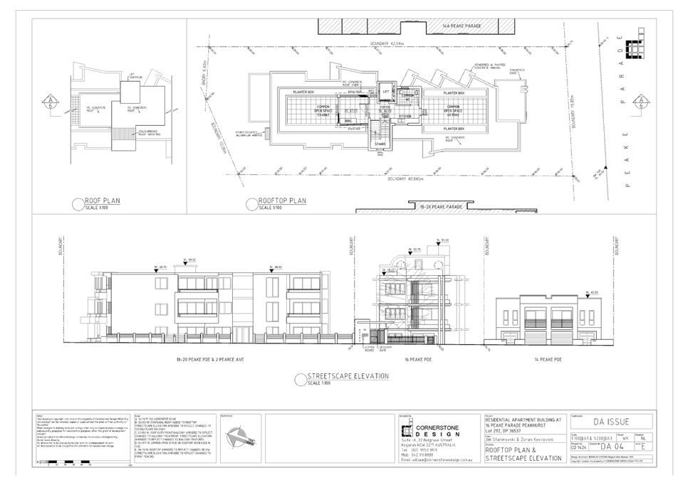
|
Georges
River Council – Local Planning Panel Thursday, 5 March 2020
|
Page 375
|
REPORT TO GEORGES RIVER COUNCIL
LPP MEETING OF Thursday, 05 March 2020
|
LPP Report No
|
LPP011-20
|
Development Application No
|
DA2019/0329
|
|
Site Address & Ward Locality
|
19-23 Empress Street Hurstville
Hurstville Ward
|
|
Proposed Development
|
Construction of a four storey
residential flat building containing 28 residential apartments and basement
car parking
|
|
Owners
|
JB Empress Pty Ltd
|
|
Applicant
|
AB Works (now known as Loucas
Architects Pty Ltd)
|
|
Planner/Architect
|
Architect: AB Works (now known as
Loucas Architects Pty Ltd); Planner: Andrew Robinson Planning Services
|
|
Date Of Lodgement
|
31/07/2019
|
|
Submissions
|
Nil
|
|
Cost of Works
|
$7,933,967.00
|
|
Local Planning Panel Criteria
|
The application relates to
development to which the State Environmental Planning Policy No. 65 –
Design Quality of Residential Apartment Development applies and the variation
to the LEP height standard exceeds 10%.
|
|
List of all relevant s.4.15
matters (formerly s79C(1)(a))
|
State Environmental Planning Policy
No 65 – Design Quality of Residential Apartment Development, State
Environmental Planning Policy (Affordable Rental Housing) 2009, State
Environmental Planning Policy (Vegetation in Non-Rural Areas) 2017, State Environmental
Planning Policy (Building Sustainability Index: BASIX) 2004,
Greater Metropolitan Regional
Environmental Plan No 2 – Georges River Catchment, State Environmental
Planning Policy No 55 - Remediation of Land, State Environmental Planning
Policy (Infrastructure) 2007, Greater Metropolitan Regional Environmental
Plan No 2 – Georges River Catchment,
Kogarah Local Environmental Plan
2012, Kogarah Development Control Plan 2012
|
|
List all documents submitted
with this report for the Panel’s consideration
|
Site Plan
Elevations
|
|
Report prepared by
|
Senior Development Assessment
Planner
|
|
Recommendation
|
That the application be approved in accordance with the
conditions included in this report.
|
|
|
Summary of matters for
consideration under Section 4.15
Have all recommendations in relation
to relevant s4.15 matters been summarised in the Executive Summary of the
assessment report?
|
Yes
|
|
Legislative clauses requiring
consent authority satisfaction
Have relevant clauses in all
applicable environmental planning instruments where the consent authority
must be satisfied about a particular matter been listed and relevant
recommendations summarised, in the Executive Summary of the assessment
report?
|
Yes
|
|
Clause 4.6 Exceptions to
development standards
If a written request for a
contravention to a development standard (clause 4.6 of the LEP) has been
received, has it been attached to the assessment report?
|
Yes
- Clause 4.3 Height of buildings
|
|
Special Infrastructure
Contributions
Does the DA require Special
Infrastructure Contributions conditions (under s7.24)?
|
Not
Applicable
|
|
Conditions
Have draft conditions been provided
to the applicant for comment?
|
No,
standard conditions have been attached with no design changes, the conditions
can be reviewed when the report is published.
|
|
Site Plan
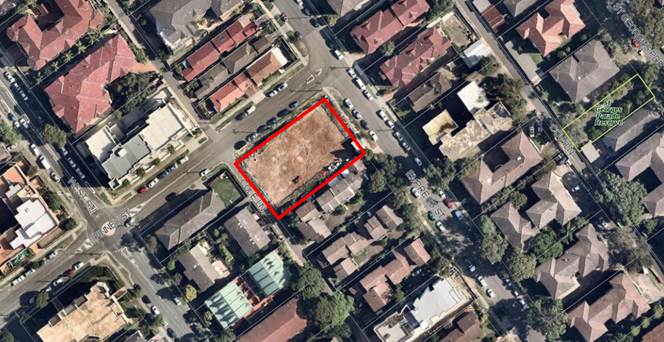
The site is outlined in
red
|
Executive Summary
Proposal
1. The
development application proposes lot consolidation and construction of a four
(4) storey residential flat building over two (2) levels of basement parking.
The total number of residential units proposed is 28, including five (5)
affordable rental housing units (2 x 1 bedroom units, 25 x 2 bedroom units and
1 x 3 bedroom unit). Communal open space and associated structures is provided
on the rooftop.
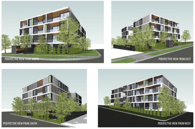
Figure
1: Photomontages of the proposal
Site and Locality
2. The
site is identified as 19-23 Empress Street, Hurstville and it consists of three
(3) individual lots having a legal description of Lots 36-38 Sec 6 in DP 1808.
The site is a regularly shaped parcel of land and is located on the south
western side of Empress Street with a secondary frontage to Finney Street. Cole
Lane adjoins the site to the rear.
3. The
site has an area of 1425.85sqm and street frontages to both Empress Street and
Cole Lane of 30.18m and Finney Street of 47.245m.
4. The
locality contains a mixture of single storey dwellings which are yet to be
redeveloped, multi-dwelling housing and multi storey residential flat buildings
of varying scales.
Zoning and Permissibility
5. The
site is zoned ‘R3 Medium Density Residential under the Kogarah Local
Environmental Plan 2012 (KLEP). The development is defined as a residential
flat building under KLEP which is permissible with consent in this zone.
Submissions
6. The
development application was publicly exhibited in accordance with the
provisions of the Kogarah Development Control Plan 2013. No submissions were
received.
Level of Determination
7. This
development application is referred to the Local Planning Panel for
consideration and determination as it comprises development to which State
Environmental Planning Policy No 65 – Design Quality of Residential
Apartment Development applies as required by the Ministerial Direction of 23
February 2018.
Conclusion
8. The
proposed development has been assessed having regard to the matters for
consideration under Section 4.15(1) of the Environmental Planning and
Assessment Act 1979. The proposal is acceptable and it is recommended for
approval subject to conditions.
Report in Full
Background
9. The
Georges River Local Planning Panel granted consent for ‘Demolition of
existing structures and construction of a four-storey residential flat building
containing twenty six (26) residential units and basement car parking’ on
7 May 2018 (DA2017/0465).
10. This
application generally retains the approved built form of DA2017/0465, and
proposes an additional two units, providing five affordable rental housing
units under the provisions of SEPP (Affordable Rental Housing) 2009, and
relocates the communal open space to the rooftop.
11. The
site is now vacant with the demolition of the structures previously on site
undertaken in accordance with the approval of DA2017/0465.
Description of Proposal
12. The
development application proposes lot consolidation and construction of a four
(4) storey residential flat building over two (2) levels of basement parking.
The total number of residential units proposed is 28, including five (5)
affordable rental housing units (2 x 1 bedroom units, 25 x 2 bedroom units and
1 x 3 bedroom unit). Communal open space and associated structures is provided
on the rooftop.
13. Specifically,
the proposal includes the following:
Basement Levels
· Lower Basement - 20 parking spaces, residential storage, two (2)
motorcycle parking spaces, lift and egress stairs.
· Upper Basement - 14 parking spaces, residential storage, garbage
room, service rooms, bicycle parking, cleaners room and accessible WC, lift,
egress stairs and plant.
Ground Floor
The
ground floor contains six units (1 x 1 bedroom, 4 x 2 bedroom and 1 x 3 bedroom
units). Entry to the basement parking is proposed from Cole Lane, pedestrian
access to the building is provided from Empress Street. Each unit is afforded a
private open space area including a terrace and landscaped courtyard. An area
of communal open space is also provided on the south eastern side of the
building at ground level.
A
secondary pedestrian pathway is proposed from Cole Lane through the communal
open space to a second lobby on the south eastern side of the ground floor. A
platform lift is provided for accessible entry to the building. The hydrant
booster is located adjacent to the entrance on Empress Street (however a
condition of consent is recommended for it to be relocated to Finney Street).
Levels 1, 2 and 3
These
levels contain seven units each (7 x 2 bedroom units).
Rooftop Terrace
The
rooftop level contains the primary area of communal open space, and includes a
semi-enclosed kitchen, seating area, accessible WC and perimeter planting
within planter boxes.
Description of
the Site and Locality
14. The
site is identified as 19-23 Empress Street, Hurstville and it consists of three
(3) individual lots having a legal description of Lots 36-38 Sec 6 in DP 1808.
The site is a regularly shaped parcel of land and is located on the south
western side of Empress Street with a secondary frontage to Finney Street. Cole
Lane adjoins the site to the rear.
15. The
site has an area of 1425.85sqm and street frontages to both Empress Street and
Cole Lane of 30.18m and Finney Street of 47.24m.
16. The
locality contains a mixture of single storey dwellings which are yet to be
redeveloped, multi-dwelling housing and multi storey residential flat buildings
of varying scales.
17. Adjoining
the site to the south east at 25-27 Empress Street, Hurstville is a two (2)
storey townhouse development containing five (5) dwellings. The north western
elevation of this development can be seen in the site photo below being Figure
2.
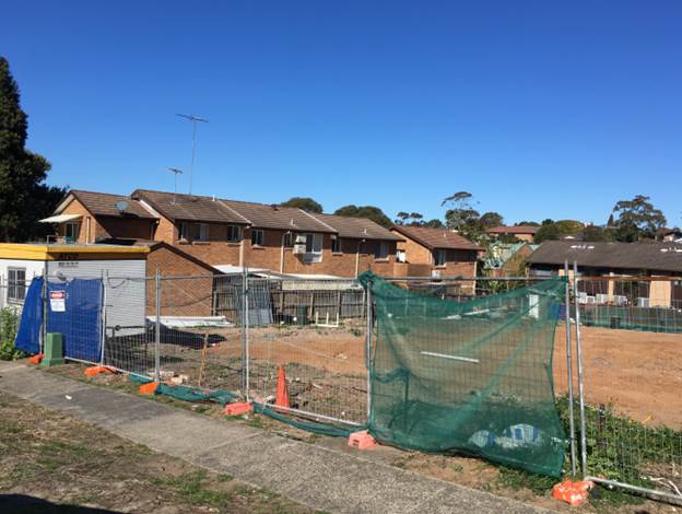
Figure
2: The site as viewed from Empress
Street
PLANNING
ASSESSMENT
18. The
subject site has been inspected and the development has been assessed under the
relevant Section 4.15, Matters for Consideration of the Environmental Planning
and Assessment Act 1979.
Environmental
Planning Instruments
State Environmental Planning Policies
19. Compliance
with relevant State Environmental Planning Policies is summarised in the table
as follows and discussed in more detail thereafter.
|
State
Environmental Planning Policy
|
Complies
|
|
State
Environmental Planning Policy No 55 - Remediation of Land
|
Yes
|
|
State
Environmental Planning Policy (Building Sustainability Index: BASIX) 2004
|
Yes
|
|
State
Environmental Planning Policy (Vegetation in Non-Rural Areas) 2017
|
N/A
|
|
State
Environmental Planning Policy No. 65 - Design Quality of Residential Apartment
Development
|
Yes
|
|
State
Environmental Planning Policy – Infrastructure
|
Yes
|
|
State
Environmental Planning Policy (Affordable Rental Housing) 2009
|
Yes
|
State
Environmental Planning Policy No 55 - Remediation of Land
20. SEPP
55 aims to promote the remediation of contaminated land in order to reduce the
risk of harm to human health or any other aspect of the environment.
21. Clause
7 requires contamination and remediation to be considered in determining a
development application. The consent authority must not consent to the carrying
out of development on land unless it has considered whether or not the land is
contaminated.
22. A
Preliminary Investigation Report was submitted with the application, which
concludes:
‘STS
consider that the site may be suitable for the proposed development provided it
is developed as per proposed plans. Due to the presence of historical fills
from unknown sources and that deep soil areas are being proposed, it would be
necessary to implement an Unexpected Finds Protocol (UFP). As such, a UFP
should be prepared for implementation at the commencement of any further ground
disturbance activity.’
23. Based on the information provided, a contingency condition has been
included in the recommended conditions detailing what is required to take place
should unexpected contamination be found during demolition, excavation and
construction.
State
Environmental Planning Policy (Building Sustainability Index: BASIX) 2004
24. The
State Environmental Planning Policy (Building Sustainability Index: BASIX) 2004
aims to ensure consistency in the implementation
of a scheme to encourage sustainable residential development throughout New
South Wales (also referred to as the ‘BASIX scheme’).
25. A
BASIX certificate accompanies the DA verifying that the relevant water, energy
and thermal comfort targets have been met by the proposal. Conditions of
consent have been included in the recommendation to ensure the commitments
required under the BASIX certificate will be satisfied by the proposed
development.
State Environmental Planning Policy (Infrastructure) 2007
26. The
aim of the Infrastructure SEPP is to facilitate the effective delivery of
infrastructure across the State.
27. The DA was referred to Ausgrid on 8
August 2019 in accordance with Clause 45 of State Environmental Planning Policy
(Infrastructure) 2007. At the time of writing this report, no response had been
received. The DA may be determined in the event that no response has been
received from Ausgrid within twenty one (21) days, ie 29 August 2019.
State Environmental Planning Policy (Vegetation in Non-Rural Areas)
2017
28. The
State Environmental Planning Policy (Vegetation in Non-Rural Areas) 2017
(‘Vegetation SEPP’) regulates clearing of native vegetation on
urban land and land zoned for environmental conservation/management that does
not require development consent.
29. The
Vegetation SEPP applies to clearing of:
a) Native
vegetation above the Biodiversity Offset Scheme (BOS) threshold where a
proponent will require an approval from the Native Vegetation Panel established
under the Local Land Services Amendment Act 2016; and
b) Vegetation
below the BOS threshold where a proponent will require a permit from Council if
that vegetation is identified in the Council’s Development Control Plan
(DCP).
30. The
Vegetation SEPP repeals clauses 5.9 and 5.9AA of the Standard Instrument -
Principal Local Environmental Plan, with the regulation of the clearing of
vegetation (including native vegetation) below the BOS threshold being through
any applicable DCP.
31. No
issues arise in terms of the provisions of the Vegetation SEPP, as there is no
significant vegetation on the site or within the footpath area or immediately
fronting the site. Further, there is no significant vegetation on immediately
adjoining properties in close proximity to the site.
State Environmental Planning
Policy (Affordable Rental Housing) 2009 (ARHSEPP)
32. The
proposal incorporates an affordable housing component and dedicates five (5)
units as affordable rental units. Therefore this Policy applies to the
development.
33. The
aims of this Policy are:
· to provide a consistent planning regime for the provision
of affordable rental housing,
· to facilitate the effective delivery of new affordable
rental housing by providing incentives by way of expanded zoning
permissibility, floor space ratio bonuses and non-discretionary development
standards,
· to facilitate the retention and mitigate the loss of
existing affordable rental housing,
· to employ a balanced approach between obligations for
retaining and mitigating the loss of existing affordable rental housing, and
incentives for the development of new affordable rental housing
Accessibility
34. Clause
4 of the SEPP requires the site to be “accessible”, meaning the
proposal needs to satisfy the following provisions being:
(a) 800 metres walking distance of a public
entrance to a railway station or a wharf from which a Sydney Ferries ferry
service operates, or
(b) 400 metres walking distance of a public
entrance to a light rail station or, in the case of a light rail station with
no entrance, 400 metres walking distance of a platform of the light rail
station, or
(c) 400 metres walking distance of a bus stop
used by a regular bus service (within the meaning of the Passenger Transport Act 1990)
that has at least one bus per hour servicing the bus stop between 06.00 and
21.00 each day from Monday to Friday (both days
inclusive) and between 08.00 and 18.00 on each Saturday and Sunday.
35. The
proposal satisfies subsection (a) as the site is located 500m walking distance
from Hurstville railway station. The site is considered to be
“accessible” in accordance with the SEPP provisions.
36. The
provisions of Part 2 Division 1 (In-fill affordable housing) are relevant to
this development. The provisions of Clause 13 (floor space ratio) and Clause 14
(standards that cannot be used to refuse consent) are considered in the table
below.
|
Control
|
Numerical Requirement
|
Proposed Development
|
Complies
|
|
Floor Space
|
KLEP 2012, Clause 4.4 stipulates an
FSR of 1.5:1.
20% (468sqm) of the total gross
floor area (GFA) is provided as affordable housing and in accordance with
Clause 13(2) of the ARH SEPP this permits a bonus FSR of 0.2:1.
On this basis the maximum FSR that
is permissible is 1.7:1.
|
Affordable housing units GFA =
468sqm (20%)
Total GFA = 2,324sqm
FSR = 1.63:1
|
Yes
|
|
Site Area
|
450sqm
|
1,425.85sqm
|
Yes
|
|
Landscaped Area
|
30% of the site area
|
31% of the site.
|
Yes
|
|
Deep Soil Zones
|
15% of the site area
|
26% of the site area.
|
Yes
|
|
Solar Access
|
70% of dwellings receive 3 hours of
solar access between 9am and 3pm
|
71% (20 of 28 units) receive 3
hours or more of sunlight in midwinter between 9am and 3pm.
|
Yes
|
|
Parking
|
(ii) in
any other case—at least 0.5 parking spaces are provided for each
dwelling containing 1 bedroom, at least 1 parking space is provided for each
dwelling containing 2 bedrooms and at least 1.5 parking spaces are provided
for each dwelling containing 3 or more bedrooms:
2 x 1B
units = 1 space
25 x 2B
units = 25 spaces
1 x 3B
unit = 1.5 spaces
Total
required = 27.5
|
30 resident spaces and 4 visitor
spaces are proposed.
A condition of consent has been
recommended to provide 28 resident spaces and 6 visitor spaces in accordance
with the Kogarah DCP parking controls (this is the assessment criteria for
the application not the RMS criterion).
|
Yes
|
|
Dwelling Size
|
1 bedroom apartments = 50sqm
2 bedroom apartments = 70sqm
3 bedroom apartments = 95sqm
|
52sqm
75sqm
95sqm
|
Yes
|
37. In
accordance with Clause 14 of the ARHSEPP, the development cannot be refused if
the development site does not comply with the minimum requirements relating to
site area, landscaped area, deep soil zones, solar access, parking and dwelling
size in accordance with the ARHSEPP. In this case the development satisfies
these provisions. The solar access diagrams submitted by the Applicant indicate
that 71% of units will receive a minimum of 3 hours of solar access between 9am
to 3pm in midwinter which satisfies the minimum requirement.
Character assessment
38. Clause
16 of the ARHSEPP requires consideration against the provisions of SEPP 65
which apply to this development. A detailed assessment of the development
against the provisions of SEPP 65 is provided below.
39. Under
clause 16A of the State Environmental Planning Policy (Affordable
Rental Housing) 2009, a consent authority must not consent to a development
if the design is incompatible with the character of the local area.
No guidelines were developed to inform how to apply the compatibility test. A
number of court cases have provided some guidance as to how to assess the
“character” of a local area and what to consider ensuring an
affordable housing development is suitable.
40. In
considering compatibility with neighbouring character, in Sterling Projects v
The Hills Shire Council [2011] the Commissioner said that “character
is not limited to a consideration of streetscape but includes the wider context
of the site, in particular the characteristics of the properties which adjoin
the site”.
41. In
the recent decision of Louden Pty Ltd v Canterbury-Bankstown
Council [2018] clause 16A played a prominent role in Commissioner
Gray’s judgement. Commissioner Gray stated that all buildings of all
typologies must be incorporated into the assessment of the local area
character. This assessment concurs with Commissioner Roseth SC who in Project
Venture Developments v Pittwater Council [2005] stated that “compatibility is
thus different from sameness. It is generally accepted that
buildings can exist together in harmony without having the same density, scale
or appearance, though as the difference in these attributes increases, harmony
is harder to achieve.” Therefore in order to establish a local
character in a mixed, diverse area the plans should reasonably match other
structures in the vicinity and should consider such aspects as building forms,
setbacks and scale.
42. The
subject site is located within a precinct that is undergoing change and
transition from a lower scale residential environment to a medium density
landscape. This transition is evident in the immediate locality on Empress
Street, Finney Street and West Street where land is zoned R3 and multi-storey
Residential Flat Building (RFB) developments are under construction or have
been finalised. The locality can be described as diverse in its character as it
comprises of small scale residential developments in the form of detached
dwelling houses, and a medium density residential development with a mix of
multi-dwelling housing developments and 3-4 storey residential flat buildings.
The proposed development is considered to be consistent with the character of
the locality and the future character envisaged by the planning controls. The
scale and form of the development is consistent with newly constructed
RFB’s within the immediate context of the site. The development also
satisfies the objectives of the R3 zone which include:
• To provide for the
housing needs of the community within a medium density residential environment.
• To provide a variety
of housing types within a medium density residential environment.
• To
enable other land uses that provide facilities or services to meet the day to
day needs of residents.
43. The
proposal is well located and is within walking distance if the Hurstville City
Centre. The proposed built form is considered to be a sympathetic and desirable
response for this site in terms of its scale and design intent and will be in
keeping with the anticipated development outcome for the area.
44. The
site is afforded three street frontages, and the design of the building is such
that its primary address is Empress Street. The front façade presents as
four storeys which is in keeping with existing residential developments in the
immediate locality. Vehicular access to the development is from Cole Lane. The
setback to the Finney Street frontage contains deep soil planting and private
open space at ground level, with private terraces at the upper level to provide
casual surveillance to the street and a height that complements the existing
development on Finney Street to the south-west.
45. The
height and scale of the building and the orientation of private terraces
primarily to the street frontages, is in keeping with more recent construction
in Empress Street and Finney Street. As such the proposal satisfies the
objectives and intent of Clause 16A.
State
Environmental Planning Policy No 65 – Design Quality of Residential
Apartment Development
46. The
State Environmental Planning Policy No 65 – Design Quality of Residential
Apartment Development (‘SEPP 65’) aims to improve the design
quality of residential apartment development in New South Wales.
47. The
proposed development meets the pre-requisites for the application of the SEPP
65 in that it constitutes development for the purpose of a residential flat
building being more than three (3) storeys and having more than four (4)
dwellings. Therefore, it must be assessed against the provisions of SEPP 65 and
the Apartment Design Guide (ADG).
48. A
Design Verification Statement dated February 2018 has been provided by Jim
Apostolou Registered Architect (Registration No. 7490) in accordance with
Clause 50 of the Environmental Planning and Assessment Regulation 2000.
Design
Review Panel
49. Given
the general retention of the approved built form under DA2017/0465, the subject
application was not referred to the Design Review Panel for comment.
Apartment
Design Guide
50. An
assessment of the proposed development against the relevant design criteria of
the Apartment Design Guide (ADG) is detailed in the compliance table as
follows.
Note:
where relevant, the figures/percentages in the ADG compliance table have been
rounded up/down to the nearest whole number.
|
Section
|
Design Criteria
|
Proposed
|
Comply
|
|
3D - Communal and public open space
|
Communal open
space has a minimum area equal to 25% of the site (1425.85 x 0.25 =
356.25sqm)
|
Landscaped communal open space is
located on the ground floor (205sqm) and on the rooftop (200sqm) totalling
405sqm or 28.4% of the site area. The primary area of COS is the rooftop as
it provides a BBQ, kitchen, seating and an accessible WC.
|
Yes
|
|
Developments
achieve a minimum of 50% direct sunlight to the principal usable part of the
communal open space for a minimum of 2 hours between 9am and 3pm on 21 June
(mid-winter)
|
2 hours of
sunlight is achieved to at least 50% of the
communal open space areas, with the roof top area receiving direct sunlight
throughout the day.
|
Yes
|
|
3E – Deep soil zones
|
Deep soil zones
are required at a sliding scale in this clause.
For a site area of
1425.85sqm, the deep soil zone requirement is a deep soil zone of 7% with
minimum 3m dimensions.
|
376sqm (26%) of
deep soil is provided on the site with dimensions of at least 3m.
|
Yes
|
|
3F – Visual privacy
|
Minimum required separation
distances from buildings to the side and rear boundaries are as follows:
· For building
height up to 12m / 4 storeys – Habitable rooms and balconies 6m; and
non-habitable rooms 3m.
· For building
height up to 25m / 5-8 storeys – Habitable rooms 9m; and non-habitable
rooms 4.5m.
· For building
height over 25m / 9+ storeys – Habitable rooms 12m; and non-habitable
rooms 6m
|
Setbacks to south east boundary:
All levels – minimum 6m to
the south eastern boundary.
The other site boundaries are
street frontages (to which this control does not apply) with setbacks between
3m and 5m.
Rooftop COS – 9m to the south
eastern boundary.
|
Yes
|
|
3J – Bicycle and car parking
|
For development in
the following locations:
· on sites that are within 800m of a railway station or light rail
stop in the Sydney Metropolitan Area; or
· on land zoned, and sites within 400 metres of land zoned, B3
Commercial Core, B4 Mixed Use or equivalent in a nominated regional centre
The minimum car
parking requirement for residents and visitors is set out in the Guide to
Traffic Generating Developments, or the car parking requirement prescribed by
the relevant council, whichever is less
The car parking
needs for a development must be provided off street.
|
30 resident spaces and 4 visitor
spaces are proposed.
A condition of consent has been
recommended to provide 28 resident spaces and 6 visitor spaces in accordance
with the Kogarah DCP parking controls (this is the assessment criteria for
the application not the RMS criterion).
|
Yes
|
|
4A – Solar and daylight
access
|
Living rooms
and private open spaces of at least 70% of apartments in a building receive a
minimum of 2 hours direct sunlight between 9am and 3pm at mid-winter in the
Sydney Metropolitan Area and in the Newcastle and Wollongong local government
areas
|
71% of units achieve minimum 2
hours sunlight in mid-winter.
|
Yes
|
|
A maximum of
15% of apartments in a building receive no direct sunlight between 9am and
3pm at mid-winter
|
All units receive some level of
direct sunlight.
|
Yes
|
|
4B – Natural ventilation
|
At least 60% of
apartments are naturally cross ventilated in the first nine storeys of the
building. Apartments at ten storeys or greater are deemed to be cross
ventilated only if any enclosure of the balconies at these levels allows
adequate natural ventilation and cannot be fully enclosed.
|
71% of units are cross ventilated.
|
Yes
|
|
Overall depth
of a cross-over or cross-through apartment does not exceed 18m, measured
glass line to glass line.
|
All of the proposed units are less
than 18m in depth.
|
Yes
|
|
4C – Ceiling heights
|
Measured from
finished floor level to finished ceiling level, minimum ceiling heights are:
· Habitable
rooms 2.7m
· Non-habitable
rooms 2.4m
· For
2 storey apartments: 2.7m for main living area floor
2.4m for second
floor, where its area does not exceed 50% of the apartment area
· Attic
spaces: 1.8m at edge of room with a 30 degree minimum ceiling slope
· If
located in mixed use areas - 3.3m for ground and first floor to promote
future flexibility of use
These minimums
do not preclude higher ceilings if desired.
|
All of the proposed units have
ceiling heights of 2.8m.
|
Yes
|
|
4D – Apartment size and
layout
|
Apartments are
required to have the following minimum internal areas:
Studio –
35sqm
1 bedroom
– 50sqm
2 bedroom
– 70sqm
3 bedroom
– 90sqm
The minimum
internal areas include only one bathroom. Additional bathrooms increase the
minimum internal area by 5sqm each
A fourth
bedroom and further additional bedrooms increase the minimum internal area by
12sqm each.
|
All units meet the minimum internal
size requirements.
Minimum 52sqm
Minimum 75sqm
Minimum 95sqm
Calculated accordingly.
N/A
|
Yes
Yes
N/A
|
|
Every habitable
room must have a window in an external wall with a total minimum glass area
of not less than 10% of the floor area of the room. Daylight and air may not
be borrowed from other rooms.
|
All within the prescribed range.
|
Yes
|
|
Habitable room depths are limited
to a maximum of 2.5m x the ceiling height.
|
All within the prescribed range.
|
Yes
|
|
In open plan
layouts (where the living, dining and kitchen are combined) the maximum
habitable room depth is 8m from a window
|
All within the prescribed range.
|
Yes
|
|
Master bedrooms
have a minimum area of 10sqm and other bedrooms 9sqm (excluding wardrobe
space)
|
All bedrooms comply.
|
Yes
|
|
Bedrooms have a
minimum dimension of 3m (excluding wardrobe space)
|
All bedrooms comply.
|
Yes
|
|
Living rooms or
combined living/dining rooms have a minimum width of:
· 3.6m for studio and 1 bedroom apartments
· 4m for 2 and 3 bedroom apartments
|
All living rooms comply.
|
Yes
|
|
The width of
cross-over or cross-through apartments are at least 4m internally to avoid
deep narrow apartment layouts.
|
All of the proposed units are in
excess of 4m in width internally.
|
Yes
|
|
4E – Private open space and
balconies
|
All apartments are
required to have primary balconies as follows:
· Studio apartments require 4sqm with no min depth
· 1 bedroom apartments require 8sqm with min depth 2m
· 2 bedroom apartments require 10sqm with min depth 2m
· 3+ bedroom apartments require 12sqm with minimum 2.4m depth
The minimum
balcony depth to be counted as contributing to the balcony area is 1m.
|
All primary balconies achieve the
minimum area and depth requirements.
Calculated accordingly.
|
Yes
Yes
|
|
For apartments at ground level or
on a podium or similar structure, a private open space is provided instead of
a balcony. It must have a minimum area of 15sqm and a minimum depth of 3m.
|
Ground floor units have courtyards
greater than 15sqm with a depth greater than 3m.
|
Yes
|
|
4F – Common circulation and
spaces
|
The maximum number
of apartments off a circulation core on a single level is eight.
|
A maximum of 7
units at each level.
|
Yes
|
|
4G - Storage
|
In addition to
storage in kitchens, bathrooms and bedrooms, the following storage is
provided:
· Studio apartments require 4m3
· 1 bedroom apartments require 6m3
· 2 bedroom apartments require 8m3
· 3+ bedroom apartments require 10m3
At least 50% of
the required storage is to be located within the apartment.
|
All units have compliant total
storage volumes as per the Apartment Design Guide (ADG) volumes.
At least 50% of storage is located
within the units.
|
Yes
Yes
|
Draft
Environmental Planning Instruments
Draft
Environment SEPP
51. The
Draft Environment SEPP was exhibited from 31 October 2017 to 31 January 2018.
52. This consolidated SEPP proposes to simplify the planning
rules for a number of water catchments, waterways, urban bushland, and
Willandra Lakes World Heritage Property.
· Changes
proposed include consolidating the following seven existing SEPPs:
· State
Environmental Planning Policy No. 19 – Bushland in Urban Areas
· State
Environmental Planning Policy (Sydney Drinking Water Catchment) 2011
· State
Environmental Planning Policy No. 50 – Canal Estate Development
· Greater
Metropolitan Regional Environmental Plan No. 2 – Georges River Catchment
· Sydney
Regional Environmental Plan No. 20 – Hawkesbury-Nepean River (No.2-1997)
· Sydney
Regional Environmental Plan (Sydney Harbour Catchment) 2005
· Willandra
Lakes Regional Environmental Plan No. 1 – World Heritage Property.
53. The proposal is consistent
with the provisions of this Draft Instrument given there is no vegetation
impacted by the proposed development.
Draft
Remediation of Land SEPP
54. The
Department of Planning and Environment has announced a Draft Remediation of Land
SEPP, which will repeal and replace the current State Environmental Planning
Policy No 55—Remediation of Land.
55. The
main changes proposed include the expansion of categories of remediation work
which requires development consent, a greater involvement of principal
certifying authorities particularly in relation to remediation works that can
be carried out without development consent, more comprehensive guidelines for
Councils and certifiers and the clarification of the contamination information
to be included on Section 149 Planning Certificates.
56. Whilst the proposed SEPP will retain the key
operational framework of SEPP 55, it will adopt a more modern approach to the
management of contaminated land.
57. A
Preliminary Investigation Report was submitted with the application, which
concludes:
‘STS
consider that the site may be suitable for the proposed development provided it
is developed as per proposed plans. Due to the presence of historical fills
from unknown sources and that deep soil areas are being proposed, it would be
necessary to implement an Unexpected Finds Protocol (UFP). As such, a UFP
should be prepared for implementation at the commencement of any further ground
disturbance activity.’
58. Based on the information provided, a contingency condition has been
included in the recommended conditions detailing what is required to take place
should unexpected contamination be found during demolition, excavation and
construction.
Kogarah Local
Environmental Plan 2012
Zoning and
Permissibility
59. The
site is located within the ‘R3 Medium Density Residential’ zone
under the Kogarah Local Environmental Plan 2012.
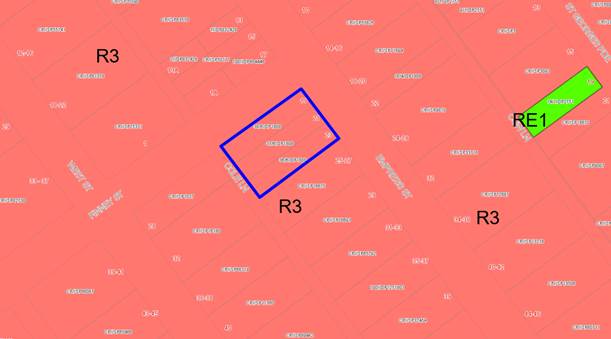
Figure 3: Zoning
map with the site outlined in blue
60. The
proposed development is defined as a residential flat building, which is
permissible in the zone.
61. The
objectives for development in the R3 Medium Density Residential zone are as
follows:
• To provide for the
housing needs of the community within a medium density residential environment.
• To provide a variety of
housing types within a medium density residential environment.
• To enable other land
uses that provide facilities or services to meet the day to day needs of
residents.
62. The
proposed development is consistent with the above objectives in that it
provides for additional residential accommodation within close proximity to a
range of services and facilities including public transport options.
63. An
assessment of the proposed development against the relevant provisions of
Kogarah LEP 2012 is detailed in the compliance table below.
|
Clause
|
Objectives/Provisions
|
Comment
|
Complies
|
|
4.1A – Minimum lots sizes
|
A minimum 1000m2 lot
area is required for the purpose of residential flat buildings.
|
A consolidated lot area of
1425.85sqm is provided.
|
Yes
|
|
4.3 - Height of buildings
|
The height of a
building on any land is not to exceed the maximum height shown for the land
on the Height of Buildings Map. In this case, the relevant map limits the height
of buildings on the subject site to 15m.
|
The proposal has a
building height of up to 17.3m.
|
No – a Clause 4.6 variation
request has been submitted and discussed following this table.
|
|
4.4 - Floor space ratio
|
The maximum
floor space ratio for a building on any land is not to exceed the floor space
ratio shown for the land on the Floor Space Ratio Map. In this case, the
relevant map limits the floor space ratio for buildings on the subject site
to 1.5:1.
|
The proposal has a
floor space ratio of 1.63:1.
|
No – however the application
has the benefit of a floor space bonus permitted under SEPP (Affordable
Rental Housing) 2009.
|
|
6.2 - Earthworks
|
The objective
of this clause is to ensure that earthworks for which development consent is
required will not have a detrimental impact on environmental functions and
processes, neighbouring uses, cultural or heritage items or features of the
surrounding land.
|
Excavation is limited to the extent
required for the basement parking levels. Suitable conditions of consent have
been recommended to protect neighbouring properties and the public domain
during demolition and construction.
|
Yes
|
|
6.3 - Flood planning
|
The subject site
is identified in the Kogarah Bay Creek Floodplain Risk Management Study and
Plan 2009 and is within the 1 in 100 year floor extents
|
The proposed development has been
designed to comply with the requirements established by the Flood Study
prepared by WMA Water with respect to FPLs within the development ensuring
that the proposal does not result in any off-site impacts.
|
Yes- Discussed in more detail below
|
|
6.5 - Airspace operations
|
The objective of
this clause is to protect airspace around airports
|
The proposed
development will penetrate prescribed airspace for Sydney Airport requiring a
‘controlled activity’ within the meaning of Division 4 of Part 12
of the Airports Act 1996. The applicant has obtained the necessary approval
for the controlled activity (refer to further commentary in the referrals
section of this report).
|
Yes
|
Flood Planning
64. The
subject site is identified in the Kogarah Bay Creek Floodplain Risk Management
Study and Plan 2009 and is within the 1 in 100 year flood extents.
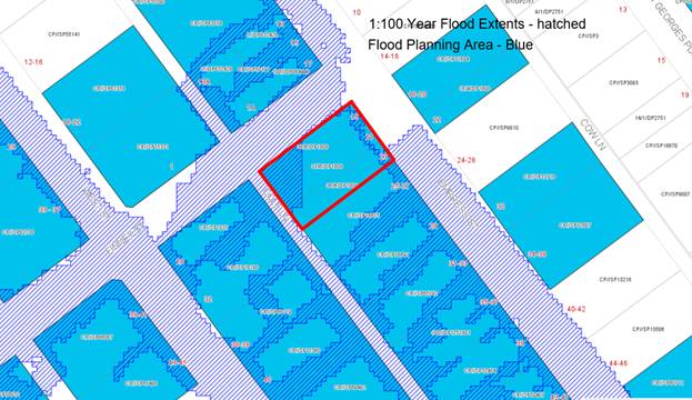
Figure 4: Flood
Planning Map – site outlined in red
65. The
flood planning levels provided by Council apply to the whole of the site
despite there being a significant level difference across the site from Empress
Street to Cole Lane. In order to establish flood planning levels (FPLs) and 1%
AEP Levels that are more specific to the site and relevant to the proposed
development a detailed Flood Study has been undertaken by WMA Water.
66. The
Flood Study concludes:
As per Council policy, habitable areas must have a minimum floor
level that is at or above the FPL of the 1% AEP (100-year ARI) peak flood level
plus a 0.5m freeboard. Therefore, the minimum residential floor level for the
proposed development was found to be 51.9m AHD, corresponding to the FPL at
location I.
As per Council policy, non-habitable areas, such as garages and
basements, must be protected to a FPL of the 1% AEP (100-year ARI) peak flood
level. This typically applies to all possible ingress points to the car park
such as vehicle entrances and exits, ventilation ducts, windows, light wells,
lift shaft openings, risers and stairwells. As such, the minimum non-habitable
entry levels for the proposed development are:
• 49.4m AHD at the driveway entrance
fronting Cole Lane, with the driveway corresponding to location E and F, and;
• 51.4m AHD at the pedestrian access
stair-well at the west of the site, corresponding to location I.
67. Council’s
Drainage Engineer has reviewed the proposal and supports the application
subject to conditions of consent in relation to the flood study being updated
and certification of the building once constructed by the flood consultant.
Exception to Development Standards
– Clause 4.6
Detailed
assessment of variation to Kogarah Local Environmental Plan 2012 (LEP) - Clause
4.3 Height of Buildings
68. The objectives of Clause 4.6 are as
follows:
(a) to
provide an appropriate degree of flexibility in applying certain development
standards to particular development,
(b) to
achieve better outcomes for and from development by allowing flexibility in
particular circumstances.
69. The
proposed development seeks a variation to the development standard relating to
height (Clause 4.3). The LEP identifies a maximum height of 15m for the site
and the proposed development reaches a maximum height of 17.3m. The building
exceeds the height by 2.3m which comprises the stair; lift overrun and communal
open space structures on the rooftop. This amounts to a 15.3% variation to the
control.
70. Any
variation to a statutory control can only be considered under Clause 4.6
– Exceptions to Development Standards of the KLEP 2012. An assessment of
the proposed height against the survey plan levels was conducted to indicate
the Applicant’s calculations are accurate.
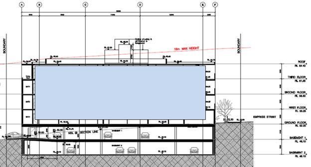
Figure 5: Section plan of the proposal showing proposed height
variation
Is the
planning control in question a development standard?
71. Height of Buildings control under
Clause 4.3 of the KLEP 2012 is a development standard. The maximum permissible
height is 15m.
72. Clause 4.6(3) states that:
“Development consent must not be granted for development that
contravenes a development standard unless the consent authority has considered
a written request from the applicant that seeks to justify the contravention of
the development standard by demonstrating:
- that compliance with the development
standard is unreasonable or unnecessary in the circumstances of the case, and
- that there are sufficient
environmental planning grounds to justify contravening the development
standard”
73. To support the non-compliance, the
applicant has provided a request for a variation to Clause 4.3 in accordance
with Clause 4.6 of KLEP 2012. The Clause 4.6 request for variation is assessed
as follows:
What are
the underlying objectives of the development standard?
74. The objectives of Height of
Buildings standard under Clause 4.3 of KLEP 2012 are:
(a) to establish the maximum height for
buildings,
(b) to minimise the impact of overshadowing,
visual impact and loss of privacy on adjoining properties and open space areas,
(c) to provide appropriate scale and intensity
of development through height controls.
Compliance is unreasonable or unnecessary in the circumstances of
the case (clause 4.6(3)(a))
75. There have been several Court cases
that have established provisions to assist in the assessment of Clause 4.6
statements to ensure they are well founded and address the provisions of Clause
4.6. In Wehbe V Pittwater Council (2007) NSW LEC 827 Preston CJ set out
ways of establishing that compliance with a development standard is
unreasonable or unnecessary.
76. Preston CJ in the judgement then
expressed the view that there are 5 different ways in which an objection may be
well founded and that approval of the objection may be consistent with the aims
of the policy, as follows (with emphasis placed on number 1 for the purposes of
this Clause 4.6 variation:
1. The objectives of the standard are
achieved notwithstanding non-compliance with the standard;
2. The underlying objective or purpose of
the standard is not relevant to the development and therefore compliance is
unnecessary;
3. The underlying object or purpose would
be defeated or thwarted if compliance was required and therefore compliance is
unreasonable;
4. The development standard has been
virtually abandoned or destroyed by the Council's own actions in granting
consents departing from the standard and hence compliance with the standard is
unnecessary and unreasonable;
5. The zoning of the particular land is
unreasonable or inappropriate so that a development standard appropriate for
that zoning is also unreasonable and unnecessary as it applies to the land and
compliance with the standard that would be unreasonable or unnecessary. That
is, the particular parcel of land should not have been included in the
particular zone.
77. The Clause 4.6 Statement was
prepared in consideration of the recent court cases and their judgements.
78. Applicants
comment: “As described earlier, the lift overrun
exceed the 15m maximum building height by a maximum of 2.3m, representing a
variation of 15.3% above the development standard. In numerical terms this
represents a relatively significant variation to the principal development
standard. Notwithstanding, as demonstrated in the NSW LEC decisions in Micaul
Holdings Pty Limited v Randwick City Council and Moskovich v Waverley Council there
should be no artificial conservatism about the use of Clause 4.6 based on the
numerical extent of the variation being sought, given that the purpose of
Clause 4.6 is to allow flexibility and to achieve better outcomes for a site by
allowing developments to exceed height and/or FSR where there are justifiable
circumstances.
An important finding in Micaul Holdings Pty Limited was that while the
judgement did not directly overturn the Four2Five v Ashfield decision, the
Chief Judge indicated that one of the obligations of a consent authority is to
be satisfied that the applicant’s written request has adequately
addressed the matters in Clause 4.6(3),
namely……………that compliance with the development
standard is unreasonable and unnecessary in the circumstances of the
case………….and that there are sufficient environmental
planning grounds to justify contravening the development standard. In this
particular instance, it is considered that compliance with the development
standard is unreasonable and unnecessary and that there is sufficient
environmental planning merit to justify the proposed non-compliance, as
described below:
The objectives of the height of buildings principal development
standard are:
(a) to establish the maximum height for buildings,
(b) to minimise the impact of
overshadowing, visual impact and loss of privacy on adjoining properties and
open space areas,
(c) to
provide appropriate scale and intensity of development through height controls.
It is considered that the proposed development achieves the objectives
of the standard for the following reasons:
· the
proposed scale and massing of the building is consistent with the desired
future character of the locality;
· the
non-compliance relates to the roof and lift overrun associated with the roof
top communal open space and does not seek to increase the number of storeys or
density of the development. As such, there is no tangible nexus between the
height variation and the overall land use intensity. The non-compliance allows
equitable access to this communal area without impacting on the amenity of
surrounding properties;
· the
area of non-compliance will not result in any adverse impacts on the adjoining
land uses with respect to overshadowing, loss of privacy, inappropriate scale
etc.
In consideration of the above, Council’s attention is also drawn
to the Department of Planning and Environment’s publication “Varying
development standards: A Guide” (August 2011), which outlines the matters
that must be considered when varying a development standard. The Guide has
essentially adopted the 5 point test for consideration set out by the Land
& Environment Court in Wehbe v Pittwater Council (2001) NSW LEC 827, specifically
that there are five different ways in which compliance with a development
standard can be considered unreasonable or unnecessary, namely:
· the
objectives of the standard are achieved notwithstanding non-compliance with the
standard;
79. Officer Comment: As discussed
above, the proposal is considered to be consistent with the objectives of the
building height standard, notwithstanding the numerical variation.
· the
underlying objective or purpose of the standard is not relevant to the
development and therefore compliance is unnecessary;
80. Officer Comment: The
objectives of the building height standard remain relevant and the proposal is
consistent with, or at least is not antipathetic to the objectives of the
building height standard, notwithstanding the numerical variation.
· the
underlying object of purpose would be defeated or thwarted if compliance was
required and therefore compliance is unreasonable;
81. Officer Comment: The
proposal is consistent with the objectives of the building height standard,
notwithstanding the numerical variation, and it would not defeat the purpose of
the standard.
· the
development standard has been virtually abandoned or destroyed by the Council's
own actions in granting consents departing from the standard and hence
compliance with the standard is unnecessary and unreasonable;
82. Officer Comment: The
building height standard has not been abandoned by Council through its actions
in granting consent for other buildings in the vicinity that depart from the
standard.
· the
zoning of the particular land is unreasonable or inappropriate so that a
development standard appropriate for that zoning is also unreasonable and unnecessary
as it applies to the land and compliance with the standard would be
unreasonable or unnecessary. That is, the particular parcel of land should not
have been included in the particular zone.
83. Officer Comment: The
proposed residential flat building is a permissible land use and the zoning of
the site is considered to be appropriate in this location and in the context of
the surrounding land uses and built form.
84. In light of
the above, it has been demonstrated that the first test under the Wehbe method
has been met, such that the requirement to strictly adhere to the numerical
development standard for building height is considered to be unreasonable and
unnecessary in this instance.
Clause
4.6(3)(b) are there sufficient environmental planning grounds to justify
contravening the standard
85. Having regard to
Clause 4.6(3)(b) and the need to demonstrate that there are sufficient
environmental planning grounds to justify contravening the development
standard, it is considered that there is an absence of any negative impacts of
the proposed non-compliance on the environmental quality of the locality and
amenity of adjoining properties in terms of overshadowing, overlooking or view
loss.
86. Applicants
Comment: Based on the discussion above, it is considered that there are
sufficient environmental planning grounds to justify contravening the
development standard. Key environmental planning grounds to support the
variation include:
· Despite
a portion of the roof and the lift overrun exceeding the height of buildings
principal development standard, the remainder of the building sits within the
15m height limit. As such, the overall bulk and scale of the building is
considered to be acceptable in terms of its scale and built form and the
relationship of the building to the adjoining residential development;
· The
additional height of the roof and lift overrun does not constitute an
additional storey and maintains a building of a scale and form that is
appropriate for the location, providing visual interest and a varied building
profile; and
· Despite
the increased height of the roof and lift overrun above the statutory height
limit, the proposed development will not have an unreasonable impact on
adjoining sites in terms of overshadowing, loss of privacy or views.
87. Officer Comment:
Clause 4.6(4)(a)(ii) the proposed development will be in the public interest
because it is consistent with the objectives of the particular standard and the
objectives for development within the zone in which the development is proposed
to be carried out.
88. Clause 4.6(4)
states that:
“Development consent must not be granted for development that
contravenes a development standard unless:
(a) the
consent authority is satisfied that:
(i) the applicant’s written request
has adequately addressed the matters required to be demonstrated by subclause
(3), and
(ii) the proposed development will be in
the public interest because it is consistent with the objectives of the
particular standard and the objectives for development within the zone in which
the development is proposed to be carried out,”
89. Applicants
Comments: The proposed development will be in the public interest
because it is consistent with the objectives of the particular standard and the
objectives for development within the zone in which the development is proposed
to be carried out.
The table below demonstrates that the proposed development will be in
the public interest because it will be consistent with both the height of
buildings principal development standard objectives and the R3 Medium Density
Residential zone objectives of the LEP.
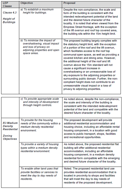
Figure
6: Applicant’s justification
against zone and standard objectives
90. Officer Comment: The
proposed development has been designed to ensure all habitable areas are
located within the height limit and the only projections are in relation to the
rooftop communal open space area, stair access and the lift overrun.
91. The proposal generally satisfies
the objectives of the development standard in the following ways:
(a) to
establish the maximum height for buildings,
92. Officer Comment: The site
and its immediately adjoining properties have been up scaled to allow for
medium to larger scaled development. Figure 7 shows
the extent of the immediate precinct which allows for a maximum height of 15m.
The proposed variation is located centrally within the building, and
accordingly will not be perceptible from the public domain. The building generally
will read as being of a compliant height.
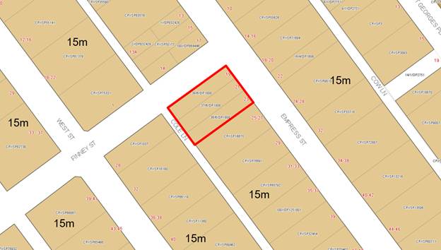
Figure
7: Height of buildings map –
site outlined in red
(b) to minimise the impact of overshadowing,
visual impact and loss of privacy on adjoining properties and open space areas,
93. Officer Comment: This
objective relates to considering the amenity impacts associated with the
non-compliance. In terms of visual impact the structures are generally
centrally located which reduces their visual appearance from the immediately
adjoining streetscapes.
94. The objective seeks to
“minimise” the visual impact, it is not requiring it to be
eliminated or totally negated, and as this is a small scale ancillary structure
which will not be highly visible or intrusive given the scale and proportions
of the building. In respect to the more dominant elements like the lift overrun
accessing the roof terrace, this will be a visible element when viewed from a
distance. It will not be visible from immediately adjoining properties and
streetscapes given that it is centrally located. There will be no adverse
impacts in terms of overshadowing or overlooking to adjoining properties and
the additional height will not result in any additional impact to the
neighbouring properties due to its central location and distance form site
boundaries.
(c) to
provide appropriate scale and intensity of development through height controls.
95. Officer Comment: New
developments of a similar nature have been approved in this precinct and have
established a precedent for development in the street and immediate area. The
proposed development is consistent with the pattern of development that is
slowly being established in the precinct.
96. The non-compliant
height of the building which only relates to certain sections of the uppermost
level, rooftop communal open space and lift access to the roof can be catered
for in this location given the siting, orientation and the fact the buildings
comply with the anticipated building envelope which is compliant with the ADG
and KDCP in terms of the separation distances, landscaped area requirements,
front setback control etc. The proposed development is considered to satisfy
the objectives of the development standard.
97. The exceedance in
the control generally satisfies the objectives of the zone for the following
reasons:
· To
provide for the housing needs of the community within a medium density
residential environment.
· To
provide a variety of housing types within a medium density residential
environment.
· To
enable other land uses that provide facilities or services to meet the day to
day needs of residents
98. The proposal
provides 28 residential units, being a combination of 1, 2 and 3 bedrooms in a
highly accessible location. In addition five units are dedicated as affordable
rental housing units and will be conditioned accordingly.
99. The level and
location of the non-compliance is not considered to be unreasonable and will
not establish an undesirable precedent. It will not have any adverse effect on
the surrounding locality, which is emerging to be characterised by residential
flat building development of comparable character. The proposal promotes the
economic use and development of the land consistent with its zone and purpose.
The Panel is requested to invoke its powers under Clause 4.6 to permit the
variation proposed.
100. The public benefit of the
variation is that it will appropriately facilitate the provision of residential
accommodation on a R3 zoned site and provide for a range of new housing stock,
including affordable rental housing. It is noted that in Initial Action Pty Ltd
v Woollahra Municipal Council [2018] NSWLEC 118, Preston CJ clarified what
items a Clause 4.6 does and does not need to satisfy. Importantly, there does
not need to be a "better" planning outcome resulting from the
non-compliance.
101. The second matter was in cl
4.6(3)(b), where the Commissioner applied the wrong test in considering this
matter by requiring that the development, which contravened the height
development standard, results in a "better environmental planning outcome
for the site" relative to a development that complies with the height
development standard (in [141] and [142] of the judgment). Clause 4.6 does not
directly or indirectly establish this test. The requirement in cl 4.6(3)(b) is
that there are sufficient environmental planning grounds to justify
contravening the development standard, not that the development that
contravenes the development standard have a better environmental planning
outcome than a development that complies with the development standard.
102. The roof top area and its
associated ancillary structures could be deleted and the building largely be
compliant however this space will add value and provide greater functionality
for the future occupants, providing additional open space and amenity for
residents.
103. In this case the proposal
seeks to establish a preferred and appropriate design and built form outcome
for this site with the building complying in large with the height standard.
There will be no adverse amenity or visual impacts generated by the variation,
the proposal satisfies the objectives of the zone and the development standard
objectives. In this case the justification to vary the height control is
considered to be a reasonable and well-founded request.
Clause 4.6(b) the
concurrence of the Secretary has been obtained.
104. Concurrence from the
Secretary has been obtained and can be assumed in this case.
105. It is considered that the
Clause 4.6 Statement lodged with the application addresses all the information
required pursuant to Clause 4.6 and the statement is considered to be well
founded as there are sufficient environmental planning grounds to justify
contravening the standard given that in this case the proposal satisfies the
objectives of the zone and development standard (Clause 4.3 building height
control).
Development
Control Plans
Kogarah
Development Control Plan 2013
106. The
provisions of the Kogarah Development Control Plan 2013 (KDCP 2013) are
relevant to the proposed development. Several controls within the KDCP 2013 do
not align and significantly conflict with the scale of development now
permitted under the KLEP 2012 (as amended on 26 May 2017). As a consequence,
the proposed development will contravene a number of the controls including
significant variations to the height and density controls.
107. The
significant variations to KDCP 2013 have resulted from the subsequent
amendments to KLEP 2012 which allows a higher density/scale of development. The
approach to support the development with significant variations to KDCP 2013 (but
compliant with KLEP 2012) is consistent with recent judgements in the NSW Land
and Environment Court. In particular, in Michael Murr v Georges River
Council [2017] NSWLEC1369.
108. It
is also noted that in the hierarchy of planning controls, Development Control
Plans cannot prescribe more onerous corresponding controls than those in a
Local Environmental Plan.
109. An
assessment of the proposed development against the relevant controls in the
KDCP 2013 is detailed in the compliance table below.
|
Kogarah Development Control Plan
2013
|
|
Part B General Controls
|
|
Controls
|
Required
|
Proposed
|
Comply
|
|
Part B2_ Tree Management and
Greenweb
|
The objectives of
this Part are:
(a) Establish the
criteria governing the removal or pruning of trees.
(b) Ensure that
appropriate information is submitted to Council regarding tree management.
|
An assessment in
relation to vegetation management is discussed in detail under the State
Environmental Planning Policy (Vegetation in Non-Rural Areas) 2017 commentary
earlier in this report.
|
Yes
|
|
Part B4 – Parking and Traffic
|
The parking
requirements for a residential flat building is:
(i) 1 space per
1-bedroom apartment
(ii) 1.5 spaces
per 2-bedroom apartment
(iii) 2 spaces per
3-bedroom apartment
(iv) 1 visitor
space per 5 apartments
1 designated car
wash bay which may also be a visitor space.
|
30 resident spaces and 4 visitor
spaces are proposed.
A condition of consent has been
recommended to provide 28 resident spaces and 6 visitor spaces in accordance
with the Kogarah DCP parking controls (this is the assessment criteria for
the application not the RMS criterion).
|
Yes
|
|
Part B5 – Waste Management
and Minimisation
|
Submit a Waste
Management Plan with DAs involving:
· demolition;
· construction of a new building(s); or
· change of use or alterations/additions to existing premises (only
when this would result in a change of waste generation).
For residential
developments that include six or more dwellings, a dedicated caged area may
be required within the bin room for the storage of discarded bulky items
which are awaiting removal. This area must be easily accessible to all
residents.
Waste storage
facilities must be easily accessible from residential units and appropriately
located to facilitate the removal of waste to the Council collection point.
Waste and recycling
storage areas must be visually and physically integrated into the design of
the development. Design elements such as fencing, landscaping and roof
treatments may be used to screen the waste and recycling storage area
|
The proposal is accompanied by a
waste management Plan for construction and occupation of the building.
Demolition of the structures on site has already occurred.
A waste storage area has been
provided within the basement area readily accessed off Cole Lane.
The relevant details submitted with
the application were referred to Council’s Waste Officer for comment.
This is discussed in more detail in the referrals section of this report.
|
Yes
|
|
Part B6 – Water management
|
All developments
requiring Council approval within the City of Kogarah require consideration
of the Water Management Policy.
Habitable floor
levels are to have a minimum of 500mm freeboard above the 100-year ARI flood
level.
Basements are to
be protected up to and including the 100-year ARI flood level.
|
Council’s
Drainage Engineer and Development Engineer have reviewed the proposal and
provided conditions of consent in relation to flooding and drainage. The
development has been designed to comply with the floor level restrictions.
|
Yes
|
|
Part C2- Medium Density Housing
|
|
Site Coverage
|
Site Coverage: 45% (641.6sqm)
|
The proposed
development has site coverage of 55.8% (796sqm).
.
|
No – refer to comments below.
|
|
Comments
on site coverage
The
proposal exceeds the maximum site coverage control in the DCP by 155sqm or
24%. Since the adoption of the Kogarah New City Plan in 2017, many of the
controls within the KDCP 2013 do not align and significantly
conflict with the scale of development now permitted under the KLEP 2012 (as
amended on 26 May 2017).
The significant
variations to KDCP 2013 have resulted from the subsequent amendments to KLEP
2012 which allows a higher density/scale of development. The approach to
support the development with significant variations to KDCP 2013 (but
compliant with KLEP 2012) is consistent with recent judgements in the NSW
Land and Environment Court.
The variation to
the site coverage control is supported as the proposal complies with the
floor space limits (in accordance with the SEPP (Affordable Rental Housing)
2009) and the landscaping controls in SEPP 65 and the ADG.
|
|
Open Space
|
Common Open Space
Must be provided at the rate of 30sqm/dwelling for dwellings
having balconies as the only form of private open space, with a minimum
overall area of 75sqm, and with minimum dimensions of 5m. This equates to
660sqm of Common Open Space
Private Open Space
Where provided,
courtyards for ground floor units must be a minimum of 35sqm/dwelling, with a
minimum dimension of 3m.
Otherwise all
dwellings must be provided with a balcony 12sqm in area with a minimum
dimension of 3m.
|
In accordance with
the provisions of clause 6A (2) of SEPP 65, this control is of no effect.
|
N/A – Refer to the ADG
assessment earlier in this report.
|
|
Impervious Area
|
Maximum 55% or 784.2sqm
|
73.6% or 1049sqm impervious area
proposed.
|
No -
However the development provides for more than the required amount of deep
soil area in accordance with SEPP 65 and the provisions of the ADG. The
development has deep soil landscaping to all boundaries of the site.
|
|
Views and View Sharing
|
Development shall provide for the reasonable sharing of views.
|
The site and surrounding properties are not afforded any views.
|
Yes
|
|
Adaptable and Accessible Housing
|
The minimum number of adaptable units designed in accordance with
AS4299 - 1995 Adaptable Housing must be incorporated into the above
developments:
• 21-30 units – 3 adaptable units
The adaptable units must comply with the relevant Australian
Standards and be certified as “adaptable housing units”.
|
The proposed development provides three (3) adaptable units being
units G.2, 1.2 and 2.2.
|
Yes
|
|
Part C2- Medium Density Housing-
Appendix 2- Specific Precincts (Hurstville)
|
|
Housing Types
|
§ Provide a range of medium density housing.
§ Address streets with well-designed façades and windows.
§ Allow building to side boundaries without windows to create
continuous street façades and to avoid problems of overlooking
backyards.
§ Reduce walking distances and the need for lifts with maisonette
apartments on upper levels.
§ Create extensive views to the south from the upper levels of
residential buildings, by stepping building heights down towards the south.
§ Minimise environmental impact of taller buildings by relating site
sizes and courtyard sizes to building height.
|
The development consists of a single building with a height of
four (4) storeys accommodating twenty eight (28) residential units and two
(2) levels of basement car parking with access off Cole Lane at the rear.
The development appropriately addresses Empress Street, Finney
Street and Cole Lane with differentiated facades
The locality is characterised by a mix of residential development
types with two (2) storey townhouses and three (3) to four (4) storey
residential flat developments being most prevalent and dominating the
streetscape.
The development is of a scale and form that is anticipated within
the R3 – Medium Density Zone and reflects the desired future character
having regard to the height & FSR provisions of KLEP 2012 (Amd No 2) - New
City Plan.
|
Yes
|
|
Building Heights
|
A maximum height of three (3) storeys for the subject site.
|
In accordance with
the provisions of clause 3.43(5) of the EP&A Act, this control has no
effect. In this regard, it is inconsistent with the building height standard
in KLEP 2012.
|
N/A - Refer to the KLEP 2012
assessment earlier in this report and the Clause 4.6 variation to the height
control development standard.
|
|
Density
|
A maximum floor space ratio of 1.5:1.
|
In accordance with
the provisions of clause 3.43(5) of the EP&A Act, this control has no
effect. In this regard, it is inconsistent with the building height standard
in KLEP 2012 as ARHSEPP provides an FSR bonus.
|
N/A – The floor space bonus
under the provisions of ARHSEPP 2009 applies to the proposal.
|
|
Site Area
|
§ Maximum development densities and heights may only be
achieved on sites which exceed the site areas in Table A.
§ Individual housing lots are not to be left isolated between
larger development parcels. The minimum development lot size is two existing
housing lots.
§
In the case of new development, the lots shown in the building footprints in
Figure 4 shall be consolidated and developed as a single parcel of land (with
the exception Nos. 9-19 West Street, South Hurstville).
|
The site has area of 1425.85sqm which exceeds the minimum area of
1000sqm specified.
The proposal does not isolate any sites.
The proposed development consolidates the three (3) identified
parcels of land into a single development site.
|
Yes
|
|
Minimum Unit Sizes
|
Unit sizes are to comply with the following:
§ 1 bedroom – 75sqm
§ 2 bedroom – 100sqm
§ 3 bedroom – 115sqm
|
In accordance with
the provisions of clause 6A (2) of SEPP 65, this control has no effect.
|
N/A – Refer to the ADG
assessment earlier in this report.
|
|
Building Setbacks
|
§ Site buildings within building footprints as shown in Figure 4.
§ Set buildings back a minimum 5m from the property boundary on the
street.
§ Set buildings back a minimum of 5m from the new front property
boundary where property boundaries are set back 3.05m due to street widening.
§ Build
walls without windows where building envelopes show the potential to build to
the side boundary.
|
The building
footprint varies from the DCP however it is a suitable response to the
orientation of the site and the triple street frontage afforded to the site.
The footprint remains the same as the footprint approved for the site in
DA2017/0465.
The setbacks vary
from the DCP; however it is a suitable response to the orientation of the
site and the triple street frontage afforded to the site. The footprint
remains the same as the footprint approved for the site in DA2017/0465.
Not applicable.
Not applicable.
|
On merit
On merit
N/A
N/A
|
|
Visual and Acoustic Privacy
|
Site buildings within building footprints as shown in Figure 4
above.
§ Set buildings back a minimum 5m from the property boundary
on the street.
§ Set buildings back a minimum of 5m from the new front
property boundary where property boundaries are set back 3.05m due to street
widening.
§
Build walls without windows where building envelopes show the potential to
build to the side boundary.
|
In accordance with
the provisions of clause 6A (2) of SEPP 65, this control ha of no effect.
|
N/A – Refer to the ADG
assessment earlier in this report.
|
|
Solar Access
|
§ Dwellings and courtyard areas of existing attached
dwellings, multi dwelling housing and dual occupancy development are not to
be overshadowed for a period of more than 3 hours between 9.00am and 3.00pm
in mid-winter.
§
The setback requirements and private open space areas proposed should result
in acceptable levels of solar access to new dwellings.
|
Neighbouring
properties will continue to receive a minimum 3 hours solar access.
In accordance with
the provisions of clause 6A (2) of SEPP 65, this control has no effect.
|
Yes
N/A – Refer to the ADG
assessment earlier in this report.
|
|
Parking
|
§ Provide 1 car space per dwelling.
§ Provide one visitor car space per 5 dwellings.
§ 100% of car parking is to be provided on-site.
§ Parking spaces are not to be used as a storage space.
§ Vehicles are to enter and exit parking areas in a forward
direction.
§ All parking is to be located below ground level. Council will
permit part of the car parking area to be above ground level for ventilation
(up to one metre), and will also consider variations to this on steeply
sloping sites provided the general objectives are met.
§ The area of excavation for parking and other works below ground
level is restricted to the footprint.
|
§ 1 space per unit is provided
§ 1 visitor space per 5 units is provided.
§ All parking is provided on site.
§ Can be conditioned.
§ Complies.
§ Basement parking is proposed.
§ Complies.
|
Yes
Yes
Yes
Yes
Yes
Yes
Yes
|
|
Landscape
|
§ In
general, the building envelope shown for the building above the ground should
also be the same for any building works below ground level. The area of
excavation for parking and other works below the ground level is restricted
to the footprint area as shown in Figure 2 (for 2-4 West Street) and Figure
4. This ensures that there are sufficient areas for deep planting of trees
and
§ That
stormwater runoff is minimised.
§ Advanced
trees or shrubs are to be planted.
§ Plant
street frontages with full canopied trees to visually relate taller and lower
developments in the street and to enhance front entrances to buildings.
§ Advanced
tall tree species should be planted in the front of units that will integrate
with the proposed streetscape trees to define the public domain and create a
dense cover of tree screening.
§ Provision
should be made for deep soil planting (ie the planting of large trees) around
the perimeter of the building and an area within the courtyard. Deep soil
landscaping areas should be provided where possible within the side, front
and rear setback areas.
§ Minimise
impervious surfaces such as hard-paved outdoor area, footpaths, etc., to
reduce stormwater runoff.
§ Maximise
pervious surfaces by using porous pavements for car parks, footpaths and
outdoor areas to promote filtration.
|
Generally, the building footprint above the ground is consistent
with the basement car parking area.
Significant areas of deep soil are provided along all street
frontages and along the south western boundary of the site fronting Cole
Lane. These areas allow for the provision of canopy trees and screening
plants that will integrate the development into the streetscape and adjoining
developments.
|
Yes
|
|
Fencing
|
§ Front
fences must complement the streetscape where a pattern or style is
established.
§ All
fencing to the street is to be of a low masonry construction and must not
exceed 1 metre in height. If street facing fences are over 1m in height they
should be open style construction eg picket and must not exceed 1.8m.
§ Front
fences must not be made of colourbond sheets or closed timber palings.
Preferred materials are masonry, ornate timber (eg. pickets), modern ornate
metal grilles or a combination of these.
§ Privacy
for courtyards/units should be achieved through the provision of shrubs and
trees.
|
Front fences to the courtyards and terraces along both Empress and
Finney Streets will be dark and anodised with an aluminium finish.
The proposed fencing will be of a palisade form promoting casual
surveillance to these street frontages. The proposed fencing is considered to
compliment the proposed development and existing streetscape.
The fencing to Finney Street is a 500mm brick wall with
landscaping behind. Each terrace is raised above natural ground and has a
palisade or glass balustrade. There is no fencing proposed to Cole Lane as
the basement walls extend above natural ground and landscaping is proposed in
the setback to the street.
Conditions imposed in relation to the flooding affection
associated with the site.
|
Yes
|
|
Retaining Walls
|
§ Walls
should be designed to complement the design of the development and the
streetscape.
§ Walls
should be designed to minimise runoff to neighbouring properties or public
land.
§ Walls
should not interfere with natural drainage.
§ Retaining
walls should have a maximum height of 600mm and comply with relevant
Australian Standards
|
A condition of consent is recommended for an updated flood study
to be prepared to address the design of fencing and basement protrusion
around the site.
The development has been designed so as to not interfere with the
natural movement of water. An updated flood study has been requested as a
condition of consent with respect to fencing and the basement protrusion.
|
Yes
|
|
Roof Line
|
§ Provide
a variety of roof forms, including hips, gables, dormers, pergolas and the
like.
§ Emphasise
corners and building entrances with tower elements and canopies.
§ Build
floor space into roof areas with dormer windows, to reduce apparent building
height and create an interesting roof scape.
|
The flat roof form is not inconsistent with existing roof forms in
the locality and is reflective of the likely future character of the area.
|
Yes
|
|
Façade Articulation
|
§ Articulate façades with balconies, bay windows, entrance
canopies and a range of materials and colours.
|
The proposal incorporates a variety of architectural elements,
materials and colours that responds to the street and setting. Architectural
elements such as entries, balconies, screens and shading devices, as well as
two pedestrian entries, one from Cole Lane and one from Empress Street,
contributing positively activating the streetscapes.
|
Yes
|
|
Building Entrances
|
§ Building
entrances are to be clearly marked with canopies, large doorways and other
architectural elements.
§ Building
entrances are to be accessible from the street, preferably directly
addressing the street frontage
|
An entry awning and wall feature inclusive of timber look cladding
will ensure that the building entry is readily identifiable. A secondary
pedestrian entry is provided from Cole Lane to the eastern side of the
building at ground level.
|
Yes
|
|
Balconies
|
Balconies are to be recessed into the building façade.
Projecting balconies are desirable only where the balcony is also recessed
into the façade.
|
The balconies are recessed into the building their form and design
ensures that they add interest and do not detract from the façade.
|
Yes
|
|
Service/Lifts
|
Accommodate refuse
areas in discreet enclosed areas on site.
All connection
points to services are to be incorporated within buildings or associated hard
or soft landscaping.
Service
connections are not to cause a hazard to pedestrians or vehicles.
All residential flat buildings
that have more than two habitable storeys are required to have lifts.
|
All servicing and waste collection shall take place from Cole Lane
at the rear of the site.
As required all floors and common areas of the development are
serviced by a lift.
A platform lift provides access from the ground floor COS into the
building.
|
Yes
|
|
|
|
|
|
|
Interim Policy
– Georges River Development Control Plan 2020
110. Council
at its Environment and Planning Committee Meeting dated 11 June 2019 resolved
to adopt the Georges River Interim Policy DCP coming into effect on 22 July
2019.
111. The
Interim Policy is a public policy that is to be used as a guide to set a consistent
approach for the assessment of residential development within the LGA. It is a
supplementary document, meaning that current DCP controls will prevail if they
are considered best practice. The Interim Policy has no statutory recognition
in the assessment of DAs pursuant to the Environmental Planning and Assessment
Act, 1979 (EP&A Act).
112. An
assessment of the proposal has been carried out against the provisions of the
Interim Policy as set out in the following table.
|
Interim
Policy – Georges River DCP 2020
|
|
Standard
|
Proposed
|
Complies
|
|
Site
Frontage
|
|
20m
|
30.18m to Empress Street
|
Yes
|
|
Building
Height
|
|
The relevant
LEP controls relating to building height will prevail over DCP controls that
relate to height in storeys
|
The proposal exceeds the height control
but is supported by the provision of a Clause 4.6 Statement. This statement
is considered to be well founded and discussed in detail earlier in this
report.
|
Yes
|
|
Private
Open Space
|
|
The ADG
requirements prevail over the DCP controls for private open space
|
The
proposal is fully compliant with the ADG’s private open space
requirements.
Refer to
“4E – Private Open Space and Balconies” within the ADG
Compliance Table above.
|
Yes
|
|
Communal
Open Space
|
|
The ADG
requirements prevail over the DCP controls for COS
|
The
proposal is considered to comply with the requirements of the ADG with
respect to COS.
Refer to
“3D – Communal Open Space” within the ADG Compliance Table
above.
|
Yes
|
|
Parking
|
|
In accordance
with 'A Plan for Growing Sydney' (Department of Planning and
Environment):
· If
located in a strategic centre (i.e. Kogarah CBD and Hurstville CBD) and
within 800m of a Railway, the “Metropolitan Regional Centre
(CBD)” rates apply.
· If
located within 800m of a railway and outside the strategic centres the
“Metropolitan Subregional Centre” rates apply.
· If
located outside of 800m of a Railway, the relevant DCP applies.
|
30 resident spaces and 4 visitor
spaces are proposed in accordance with the current DCP controls.
A condition of consent has been recommended
to provide 28 resident spaces and 6 visitor spaces in accordance with the
Kogarah DCP parking controls (this is the assessment criteria for the
application not the RMS criterion).
|
Proposal
satisfies the numerical requirements of the DCP.
|
|
Solar
Access
|
|
The ADG requirements prevail over
the DCP controls for solar access
|
The
proposal complies with the ADG Solar Access requirements as detailed within
the ADG Compliance Table above.
Refer to
“4A – Solar and Daylight Access” within the ADG Compliance
Table.
|
Yes
|
Draft Amendment
to Part C2 – Medium Density Development of Kogarah DCP 2013
113. Arising
from the significant increase in development activity as a result of the New
City Plan (Amendment No 2) to the Kogarah Local Environmental Plan gazetted in
May 2017 which permitted greater density (1.5:1) and height (15m), Council
immediately proceeded to prepare an amendment to Part C of the Kogarah
Development Control Plan for the area generally bounded by the Princes Highway,
Stubbs Street/Poulton Avenue and Wyuna Street, Beverley Park, and Park Road and
John Street, Kogarah Bay as a first priority and as a second priority, the west
side of the Princes Highway from Jubilee Avenue to Park Road which is in part
High Density B6 zone and in part High Density B2 zone.
114. Council
has engaged Consultants to prepare a new Development Control Plan 2020 which
will consolidate and harmonise existing controls and establish appropriate new
controls to assist with redevelopment for up zoned sites.
115. In
summary the development of the DCP will involve five (5) stages:
· Stage 1 Community
Participation Plan
· Stage 2 General
and Industrial
· Stage 3
Residential Precincts
· Stage 4 Business
Precincts
· Stage 5 Specific
Sites and Localities
116. Stage
3 aims to review and establish controls across different precincts and
categories of residential developments (Residential Flat Building’s,
Multi-Dwelling Housing, Dwelling Houses, Dual Occupancy’s etc). The first
task within this stage is to look at medium density development within R3 zoned
areas. Nine (9) precincts have been identified for specific attention, as they
have been up zoned and the current controls in the Development Control Plans
are outdated and not reflective of the scale and form that is permitted under
the Local Environmental Plans. The subject site falls within the Kogarah Bay
Precinct (No.2) refer to the figure below.
Figure 8:
Map highlighting the Nine (9) R3 precincts within the LGA that are being
considered in accordance with the DCP review.
117. One
of the key identified areas of concern relate to there being no current controls
which consider the interface of new larger developments and their treatment and
transition to lower scale residential zones, that adjoin these area,
predominantly zoned R2 having 9m and 12m height limits.
118. Council on 25 November
2019 adopted a report which will result in an amendment to Part C2 –
Medium Density Housing in Kogarah DCP 2013. This amendment was on public
exhibition from 20 January 2019. As such this draft amendment is now a
statutory planning document it must be considered in any assessment.
|
Draft Amendment to Part C2-
Medium Density Development of Kogarah DCP 2013
|
|
Part 1
Residential Flat Buildings
|
|
Required
|
Proposed
|
Complies
|
|
1. Minimum
site requirements
|
|
1000sqm minimum
lot size
24m minimum
frontage
|
1,425.85sqm
30.18m
|
Yes
Yes
|
|
2. Site
isolation and amalgamation
|
|
Adjoining sites
not to be left isolated.
Site
amalgamation requirements apply for specific sites.
|
The proposal
does not cause any site isolation.
The site is not
subject to any amalgamation requirement.
|
Yes
N/A
|
|
3.
Building Setbacks
|
|
Front setbacks
Up to four (4) storeys – 5m
Above four (4)
storeys – 8m
Ground floor
private open space may encroach up to 2m into the 5m front setback leaving a
min 3m of landscaped area to the street.
|
5.16m
15m
5m landscaped setback
provided to Empress Street.
3m landscaped
setback provided to Finney Street.
|
Yes
Yes
Yes
Yes
|
|
Private open
space and balconies must comply with Part 4E of the ADG.
|
Complies
|
Yes
|
|
Side boundary
setbacks
Up to four (4) storeys – 6m
Ground floor private
open space may encroach up to 3m into the side and rear setbacks leaving a
min 3m landscaped buffer
|
6m to south
east site boundary.
5.16m
landscaped setback provided to Empress Street.
3m landscaped
setback provided to Finney Street.
|
Yes
Yes
Yes
|
|
Above four (4)
storeys – 9m
|
9m setback
provided to the rooftop terrace to the south east.
|
Yes
|
|
Rear boundary
setbacks
Up to four (4) storeys – 6m
Ground floor
|
6m to south
east or this west site boundary.
|
Yes
|
|
Up to four (4)
storeys – 6m
Levels 1-3
|
6m to south
east site boundary.
|
Yes
|
|
Above four (4)
storeys – 9m
|
Rooftop terrace
- 9m
|
Yes
|
|
Private open
space and balconies must comply with Part 4E of the ADG.
|
Complies
|
Yes
|
|
4.
Basement Setbacks
|
|
3m from site
boundaries
South East
South West
North West
North East
|
6m
3m
3m
5.162m
|
Yes
Yes
Yes
Yes
|
|
Basement
setback areas are to be deep soil areas as defined in the ADG
|
The basement setback areas provided
are Deep Soil Zones.
|
Yes
|
|
Driveways and
crossings are to be located a minimum of 1.5m from a side boundary
|
15m to the residential allotment
and 8.5m from the Finney Street boundary.
|
Yes
|
|
5.
Façade Treatment and Street Corners
|
|
Building
facades to be clearly articulated with high quality materials and finishes.
Modulation and
articulation in the building form to be explored.
Large areas of
blank, minimally or poorly articulated walls are not acceptable.
Façade treatments such as wall cladding and green walls should be
considered as alternatives.
Clear glazing
balustrades to be avoided where they are visible from the public
domain.
|
Satisfactory
Satisfactory
Satisfactory
Satisfactory
|
Yes
Yes
Yes
Yes
|
|
7.
Landscaped area and Private Open Space
|
|
A minimum 10%
of the site is to be landscaped area with a minimum dimension of 2m on two
axes.
|
Deep Soil zone provided is 26%
|
Yes
|
|
Private open
space to be adjacent to and visible from the main living area/dining rooms
and be accessible
|
Complies
|
Yes
|
|
Private open
space and balconies must comply with Part 4E of the ADG
|
Complies
|
Yes
|
|
7. Common
Open space
|
|
Common Open
Space to be a minimum of 25% of the site area with a minimum dimension of 5m.
|
Communal
open space provided is 405sqm (28.4%) with a minimum 5m dimension (ground and
rooftop).
|
Yes
|
|
A maximum of
50% of common open space may be provided above ground level.
|
Roof top
communal open space is 200sqm, which equates to approximately 50% of
the total common open space
|
Yes
|
|
At least 50% of
the required common open space area is to receive 2 hours of direct sunlight
between 9am and 3pm on 21 June.
|
Complies
|
Yes
|
|
A minimum of
50% of the total area of common open space provided at ground level is to
comprise unpaved landscape area.
|
Complies
|
Yes
|
|
The useable and
trafficable area of any rooftop common open space is to be setback a minimum
of 2.5m from the edge of the roof of the floor below with landscape planters
to prevent overlooking.
|
Complies
|
Yes
|
|
Roof top open
space areas should include equitable access.
|
Equitable
accesses through lifts and ramps have been provided along with an accessible
toilet.
|
Yes
|
|
Ancillary
structures such as lift overruns and staircases should be centralised to
reduce their visual dominance.
|
Fire
stairs and lift over runs are centrally located.
|
Yes
|
|
8. Solar
Access
|
|
Where the
neighbouring properties are affected by overshadowing, at least 50% of the
neighbouring existing primary private open space or windows to main living
areas must receive a minimum of 3 hours sunlight between 9am–3pm on the
winter solstice (21 June)
|
The primary private open spaces of the adjoining property
to the south east do not receive more than 3 hours sunlight during midwinter.
The property is occupied by five townhouses. The private
open spaces are a combination of landscaped areas and covered terraces at
ground level and are located along the north western and south eastern sides
of these dwellings. The setbacks of the dwellings measure approximately 3m
from their north western site boundary.
Maintaining a minimum of 3 hours solar access to the
spaces, which currently do not achieve that minimum as demonstrated on the
existing and proposed shadow diagrams submitted by the applicant, is unlikely
given the allowable height and density permitted on the site and in the R3
zone in general.
|
On merit given
site orientation.
|
|
9.
Vehicular access, parking and circulation
|
|
Car parking to
be provided in accordance with Part B4 unless objective 3J-1 of the ADG
applies.
|
Parking complies with the DCP provision in Chapter B4.
30 resident spaces and 4 visitor
spaces are proposed.
A condition of consent has been
recommended to provide 28 resident spaces and 6 visitor spaces in accordance
with the Kogarah DCP parking controls (this is the assessment criteria for
the application not the RMS criterion).
|
Yes
|
|
Car parking
layout and vehicular access complies with AS2890.1-2004
|
Complies
|
Yes
|
|
All residential
flat buildings to provide car wash bay
|
Can be
conditioned in a visitor space.
|
Yes
|
|
10. Views
and view sharing
|
|
Provide for
reasonable sharing of views
|
The location
does not have significant views. The development generally complies with
height requirements and is reasonable in terms of view sharing.
|
Yes
|
|
11.
Dwelling Mix
|
|
Dwellings that
propose more than 20 dwellings are to provide a mix of dwellings as
follows:
Studio apartments
-15% max
1 bed
apartments - 30% max
2 bed
apartments – 40% min
3 bed
apartments – 15% min
|
The proposal
includes the following unit mix:
2 x 1 bedroom units = 7.1%
25 x 2 bedroom units = 89%
1 x 3 bedroom
units = 3.6%
|
No - The
proposal provides less than the required percentage of 3 Bedroom units,
however the unit mix responds to the current market demand in this area.
|
|
12.
Adaptable and accessible housing
|
|
21-30 units
– 3 adaptable units
28 units
proposed – 3 adaptable units required
Every adaptable
unit needs to have an accessible car space.
|
3 adaptable units are proposed.
3 accessible spaces are proposed plus an additional space
for visitors.
|
Yes
Yes
|
Section 7.11
Contributions
119. Monetary
contributions are required under Section 7.11 of the Environmental Planning and
Assessment Act 1979, with respect to the proposed development. These
contributions have been calculated appropriately and a suitable condition of
consent has been included in the recommendation in this respect:
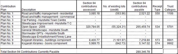
Figure
9: Calculation of Section 7.11
charges
IMPACTS
Natural
Environment
120. The
proposed development is unlikely to result in adverse impacts on the natural
environment.
Built
Environment
121. The
proposed development is unlikely to result in adverse impacts on the built
environment.
122. In
particular, the proposal is consistent with the bulk and scale of both existing
and emerging development in both the immediate and broader context.
Social
Impacts
123. The
development will provide additional housing stock, including five affordable
rental housing units, to the area and cater to the needs of families by
providing a range of dwelling sizes through a mix of one, two and three bedroom
units.
Economic
Impacts
124. The
development will have a positive short term economic benefit associated with
construction employment and minimal adverse economic impacts over the longer
term.
Suitability
of the site
125. The
subject site is inherently suitable for the proposed development having regard
to the emerging character of the surrounding locality which features
multi-level residential flat buildings and its location in close proximity to
public transport options and a wide range of services and facilities.
SUBMISSIONS
126. The
application was publicly exhibited in accordance with the public notification
provisions in Part A of the Kogarah Development Control Plan 2013. No
submissions objecting to the proposal were received.
REFERRALS
Council Referrals
Landscaping
127. No
objections were raised to the proposed landscape plan subject to conditions.
Those conditions have been incorporated into the recommended conditions.
Stormwater
128. The
proposed development drains to Cole Lane and incorporates an on-site detention
system located under the paved area of the COS. No objections were raised to
the drainage design and stormwater discharge subject to conditions. Those
conditions have been incorporated into the recommended conditions.
Health
129. No
objections were raised to the acoustic assessment subject to conditions. Those
conditions have been incorporated into the recommended conditions.
Waste
130. No
objections were raised to the proposal, subject to conditions. Those conditions
have been incorporated into the recommended conditions.
Building
131. No
objections were raised to the proposal, subject to conditions. Those conditions
have been incorporated into the recommended conditions.
Traffic
132. No
objections were raised to the proposal, subject to conditions. Those conditions
have been incorporated into the recommended conditions.
External
Referrals
Department of
Infrastructure, Regional Development and Cities
133. The
proposed development will penetrate prescribed airspace for Sydney Airport and
constitutes the need for a ‘controlled activity’ within the meaning
of Division 4 of Part 12 of the Airports Act 1996. The applicant has obtained
the necessary approval for the controlled activity.
Ausgrid
134. The
DA was referred to Ausgrid on 8 August 2019 in accordance with Clause 45 of
State Environmental Planning Policy (Infrastructure) 2007. At the time of
writing this report, no response had been received. The DA may be determined in
the event that no response has been received from Ausgrid within twenty one
(21) days, ie 29 August 2019.
CONCLUSION
135. The
proposal has been assessed using the matters for consideration listed in
Section 4.15 and 4.16(1) (a) of the Environmental Planning and Assessment Act
1979. Based on this assessment, the proposal is generally considered to be a
satisfactory outcome for subject site subject to appropriate conditions.
DETERMINATION
AND STATEMENT OF REASONS
Statement of
Reasons
· The
proposal is an appropriate response to the “up-zoning” of the site
(including increased FSR and height limits) afforded by the Kogarah “New
City Plan”. The building is consistent with the desired future character
of the R3 Medium Density Residential zone and is commensurate with nearby
recent Residential Flat Building development.
· The
proposed variation to the 15m building height limit will allow for the
provision of a high quality area of communal open space on the rooftop and is
supported pursuant to Clause 4.6 of KLEP 2012.
· The
proposal’s bulk and scale is appropriately contained within a generally
compliant building envelope that is respectful of the established character of
the area in relation to height, street setback and boundary setbacks.
· The
proposal has sufficient façade modulation and wall articulation that
will serve to provide visual interest and reduce the bulk of the building.
· The
proposal achieves full compliance with the Apartment Design Guide.
Determination
136. THAT Georges River
Local Planning Panel support the request for variation under Clause 4.6 of the
Kogarah LEP 2012, in relation to the building height control (Clause 4.3).
137. THAT pursuant to Section 4.16(1)(a) of the
Environmental Planning and Assessment Act 1979, the Georges River Local
Planning Panel grant development consent to Development Application DA2019/0329
for lot consolidation and construction of a four storey residential flat
building over basement parking at Lots 36, 37 and 38 in DP 1808 and known as
19-23 Empress Street, Hurstville, subject to the following conditions of consent:
Development
Details
1. Approved
Plans - The development must be implemented in accordance with the approved
plans and supporting documentation listed below which have been endorsed by
Council’s approved stamp, except where marked up on the plans and/or
amended by conditions of this consent:
|
Description
|
Reference No.
|
Date
|
Revision
|
Prepared by
|
|
Site Plan
|
DA-1000
|
6-5-19
|
C
|
Architecture and Building Works
|
|
Basement 2 Plan
|
DA-1010
|
6-5-19
|
C
|
Architecture and Building Works
|
|
Basement 1 Plan
|
DA-1020
|
6-5-19
|
C
|
Architecture and Building Works
|
|
Ground Floor Plan
|
DA-1030
|
31-7-19
|
C
|
Architecture and
Building Works
|
|
First Floor Plan
|
DA-1040
|
31-7-19
|
C
|
Architecture and
Building Works
|
|
Second Floor Plan
|
DA-1050
|
31-7-19
|
C
|
Architecture and
Building Works
|
|
Third Floor Plan
|
DA-1060
|
31-7-19
|
C
|
Architecture and Building
Works
|
|
Roof Plan
|
DA-1070
|
31-7-19
|
C
|
Architecture and
Building Works
|
|
North East Elevation
|
DA-1110
|
31-7-19
|
C
|
Architecture and
Building Works
|
|
North West Elevation
|
DA-1120
|
31-7-19
|
C
|
Architecture and
Building Works
|
|
South West Elevation
|
DA-1130
|
31-7-19
|
C
|
Architecture and
Building Works
|
|
South East Elevation
|
DA-1140
|
31-7-19
|
C
|
Architecture and
Building Works
|
|
Section A
|
DA-1150
|
31-7-19
|
C
|
Architecture and
Building Works
|
|
Section B
|
DA-1160
|
6-5-19
|
B
|
Architecture and
Building Works
|
|
Driveway Section
|
DA-1170
|
24-7-19
|
A
|
Architecture and
Building Works
|
|
Adaptability Details
|
DA-1500
|
6-5-19
|
B
|
Architecture and
Building Works
|
|
Construction Management Plan
|
DA-1900
|
24-7-19
|
B
|
Architecture and Building Works
|
|
Excavation Area
|
DA-2000
|
23-7-19
|
A
|
Architecture and Building Works
|
|
Landscape Plan
|
ISO237DA1
|
2-5-19
|
C
|
Ithsmus Landscape Design
|
|
Landscape Plan
|
ISO237DA2
|
2-5-19
|
C
|
Ithsmus Landscape Design
|
2. Surrender
of development consent - In accordance with the provisions of the Environmental
Planning and Assessment Act, 1979 and the Environmental Planning and
Assessment Regulation, 2000 (Clause 97), development consent DA2017/0465
must be surrendered.
Separate Approvals Required Under Other Legislation
3. Vehicular Crossing - Major Development - The
following vehicular crossing and road frontage works will be required to
facilitate access to and from the proposed development site:
(a) Construct a 1.5m wide footpath for the full
length of the frontage of the site in Finney Street in accordance with
Council’s Specifications applying at the time construction approval is
sought.
(b) The thickness and design of the driveway shall
be in accordance with Council’s Specifications applying at the time
construction approval is sought.
(c) Any existing vehicular crossing and/or
laybacks which are redundant must be removed. The kerb and gutter, any other
footpath and turf areas shall be restored at the expense of the
applicant. The work shall be carried out in accordance with
Council’s specification, applying at the time construction approval is
sought.
Constructing a vehicular crossing and/or
footpath requires separate approval under Section 138 of the Roads Act 1993,
prior to the commencement of those works.
4. Building - Hoarding Application Prior to demolition of the buildings on the site, or the commencement of work above ground level, a separate application for the
erection of an ‘A class’ (fence type) or a ‘B class’
(overhead type) hoarding or ‘C type’ scaffold, in accordance with
the requirements of SafeWork NSW, must be erected along that portion of
the footways/roadway where the building is within 3 metres of the street
boundary.
An application for this work under Section 68 of the Local Government Act 1993
and the Roads Act 1993 must be submitted for approval to Council.
The following
information is to be submitted with a Hoarding Application under Section 68 of
the Local Government Act 1993 and
Section 138 of the Roads Act 1993:
(a) A site and location plan of the hoarding
with detailed elevation, dimensions, setbacks, heights, entry and exit points
to/from the site, vehicle access points, location of public utilities,
electrical overhead wire protection, site management plan and builders sheds
location; and
(b) Hoarding plan and details that are
certified by an appropriately qualified engineer; and
(c) The payment to Council of a footpath
occupancy fee based on the area of footpath to be occupied and Council's
Schedule of Fees and Charges (available on our website) before the commencement
of work; and
(d) A Public Risk Insurance Policy with a
minimum cover of $10 million in relation to the occupation of and works within
Council's road reserve, for the full duration of the proposed works, must be
obtained a copy provided to Council. The Policy is to note Council as an
interested party; and
(e) The application must be endorsement by the
Roads & Maritime Services (RMS) as the hoarding is located within 100m of
an intersection with traffic lights. For assistance you should contact the DA
unit at RMS and speak to Hans on 88492076. Or email
hans.pilly.mootanah@rms.nsw.gov.au to obtain concurrence for the hoarding
structure.
5. Below
ground anchors - Information to be submitted with S68 Application under LGA
1993 and S138 Application under Roads Act 1993 - In the event that the
excavation associated with the basement carpark is to be supported by the use
of below ground (cable) anchors that are constructed under Council’s
roadways/footways, an application must be lodged with Council under Section 68
of the Local Government Act 1993 and the
Roads Act 1993 for approval, prior to
commencement of those works. The following details must be submitted.
a) That
cable anchors will be stressed released when the building extends above ground
level to the satisfaction of Council.
b) The
applicant has indemnified Council from all public liability claims arising from
the proposed works, and provide adequate insurance cover to the satisfaction of
council.
c) Documentary
evidence of such insurance cover to the value of $20 million.
d) The
applicant must register a non-terminating bank guarantee in favour of Council
for the amount of $50,000.
The guarantee will be released when the cables are stress
released. In this regard it will be necessary for a certificate to be submitted
to Council from a structural engineer at that time verifying that the cables
have been stress released.
e) That
in the event of any works taking place on Council’s roadways/footways
adjoining the property while the anchors are still stressed, all costs
associated with overcoming the difficulties caused by the presence of the
‘live’ anchors will be borne by the applicant.
6. Section
138 Roads Act 1993 and Section 68 Local Government Act 1993 - Unless
otherwise specified by a condition of this consent, this Development Consent
does not give any approval to undertake works on public infrastructure.
Separate approval is required under Section 138 of the Roads Act 1993 and/or Section 68 of the Local Government Act 1993 for any of the
following activities carried out in, on or over a public road (including the
footpath) listed below.
An application is required to be lodged and approved prior to the
commencement of any of the following works or activities;
(a) Placing or storing materials
or equipment;
(b) Placing or storing waste
containers or skip bins;
(c) Erecting a structure or
carrying out work
(d) Swinging or hoisting goods
over any part of a public road by means of a lift, crane or the like;
(e) Pumping concrete from a public
road;
(f) Pumping water from the
site into the public road;
(g) Constructing a vehicular
crossing or footpath;
(h) Establishing a “works
zone”;
(i) Digging up or disturbing
the surface of a public road (eg Opening the road for the purpose of connections
to utility providers);
(j) Stormwater and ancillary
works in the road reserve;
(k) Stormwater and ancillary to
public infrastructure on private land; and
(l) If any excavation is to
be supported by the use of below ground (cable) anchors that are constructed
under Council’s roadways/footways.
These separate activity approvals must be obtained and evidence of the
approval provided to the Certifying Authority prior to the issue of the
Construction Certificate.
The relevant Application Forms for these activities can be downloaded
from Council’s website www.georgesriver.nsw.gov.au.
For further information, please contact Council’s Customer Service Centre
on (02) 9330 6400.
7. Road
Opening Permit - A Road Opening Permit must be obtained from Council, in
the case of local or regional roads, or from the RMS, in the case of State
roads, for every opening of a public road reserve to access services including
sewer, stormwater drains, water mains, gas mains, and telecommunications before
the commencement of work in the road.
Requirements of Concurrence, Integrated & Other Government
Authorities
8. General
Terms of Approval - The development shall be carried out in accordance with
the requirements of the General Terms of Approval (GTA) outlined below.
|
Approval
Body
|
Date of GTA
|
|
Airspace
Protection
|
17 October 2019
|
A copy of the requirements of the approval Authority is
attached to this consent.
9. Electricity
Supply - An application is required to be made to Ausgrid for a network
connection. This may require the network to be extended or its capacity
augmented. Evidence of this application being lodged with Ausgrid is required
to be provided to the Certifying Authority prior to the issue of a Construction
Certificate. For further details, you are advised to contact Ausgrid on 13 13
65 or www.ausgrid.com.au (Business
and Commercial Services).
10. Connection to
the network will be required prior to the release of any Occupation Certificate
- Where works within the road reserve are to be carried out by the
developer, a Road Opening Permit must be obtained from Council's Customer
Service Centre before commencement of work.
11. Sydney Water -
Tap in TM - The approved plans must be submitted to a Sydney
Water Tap inTM to determine whether the development application will
affect Sydney Water’s sewer and water mains, stormwater drains and/or
easements, and if further requirements need to be met. The approved plans
will be appropriately endorsed. For details please refer to
‘Plumbing, building and developing’ section of Sydney Water’s
web site at www.sydneywater.com.au then
see ‘Building’, or telephone 13000 TAP IN (1300 082 746). The
Certifying Authority must ensure that a Tap inTM agent has
appropriately stamped the plans prior to the issue of the Construction
Certificate.
12. Notice of
Requirements for a Section 73 Certificate - A Notice of Requirements of
what will eventually be required when issuing a Section 73 Compliance
Certificate under the Sydney Water Act 1994
must be obtained from Sydney Water Corporation. Application must be made
through an authorised Water Servicing Co-ordinator. Please refer to the
‘Plumbing, building and developing’ section of the web site www.sydneywater.com.au then refer to
‘Providers’ under ‘Developing’ or telephone 13 20 92
for assistance.
Following application, a ‘Notice of Requirements’ will advise
of water and sewer infrastructure to be built and charges to be paid.
Please make early contact with the Co-ordinator, as it can take some time to
build water/sewer pipes and this may impact on other services and building,
driveway or landscape design.
The Notice of requirements must be submitted prior to the commencement of
work. A Section 73 Compliance Certificate will be required at the completion of
development in accordance with further conditions.
Prior to the Issue of a Construction Certificate
13. Low
reflectivity roof - Roofing materials must be low glare and reflectivity.
Details of finished external materials including colours and texture must be
provided to the Certifying Authority.
·
14. Pre-Construction
Dilapidation Report - Private Land - A professional engineer specialising
in structural or geotechnical engineering shall prepare a Pre-Construction
Dilapidation Report detailing the current structural condition of all adjoining
structures
a) All
neighbouring structures by the excavation as determined by the consulting
engineer.
The report shall be prepared at the expense of the applicant and
submitted to the satisfaction of the Certifying Authority prior to the issue of
the Construction Certificate.
A copy of the pre-construction dilapidation report is to be provided to
the adjoining properties (subject of the dilapidation report), a minimum of 5
working days prior to the commencement of work. Evidence confirming that a copy
of the pre-construction dilapidation report was delivered to the adjoining
properties must be provided to the PCA.
Should the owners of properties (or their agents) refuse access to carry
out inspections, after being given reasonable written notice, this shall be
reported to Council to obtain Council’s agreement to complete the report
without access. Reasonable notice is a request for access in no sooner than 14
days between 8.00am-6.00pm.
15. On Site
Detention - The submitted stormwater plan prepared by R Squire Pty Ltd
dated 6/11/2018 has been assessed as a concept plan only. Final detailed plans
of the drainage system shall be prepared by a professional engineer
specialising in hydraulic engineering and submitted for approval with the
Construction Certificate.
The design must include the computations of the inlet and outlet
hydrographs and stage/storage relationships of the proposed OSD using the
following design parameters:
(a) peak flow rates from the site are to be
restricted to a permissible site discharge (PSD) equivalent to the discharge
when assuming the site contained a single dwelling, garage, lawn and garden,
(b) at Annual Recurrence Intervals of 2 years and
100 years.
Refer to Flow Controls in Council's Draft/Adopted Stormwater Drainage
Policy. The OSD facility shall be designed to meet all legislated safety
requirements and childproof safety fencing around the facility must be provided
where the OSD facility is open or above ground when the design peak storage
depth is greater than 300mm. A durable metal plate or similar sign is to be
placed at the OSD facility and must bear the words:
"BEWARE: This is an on-site detention basin/tank for rainwater which
could overflow during heavy storms."
Full details shall accompany the application for the Construction
Certificate.
16. Compliance with
Flood Study - The development shall be designed to conform to the
recommendations and conclusions of the submitted flood study report
‘“Re: Flood Impact Assessment for the development site -19-23
Empress Street, Hurstville” by WMA Water dated 14 September 2017.
This
shall include, but not be limited to, any recommendations for the following:
(a) All possible ingress points such as
vehicle entrances and exits, ventilation ducts, windows, light wells, lift
shaft openings, risers and stairwells to the basement car parking levels are
built at or protected up to the 1 in 100 year flood levels as defined in in the
report
(b) Recommended flood planning level
(c) Protection of the basement from
inundation of surface waters
Evidence from professional engineer that specialises in hydraulic
engineering that all design requirements have been adhered to shall be
submitted with the Construction Certificate application.
17. Pump-Out System
Design for Stormwater Disposal - The design of the pump-out system for
stormwater disposal will be permitted for drainage of basement areas only, and
must be designed in accordance with the following criteria:
a) The pump system shall consist of two
pumps, connected in parallel, with each pump being capable of emptying the
holding tank at the rate equal to the rate of inflow for the one-hour duration
storm. The holding tank shall be capable of holding one hour’s runoff
from a one-hour duration storm of the 1 in 20 year storm;
b) The pump system shall be regularly
maintained and serviced, every six (6) months; and
c) Any drainage disposal to the street
gutter from a pump system must have a stilling sump provided at the property
line, connected to the street gutter by a suitable gravity line.
Details and certification of compliance from a professional engineer
specialising in civil engineering shall be provided for approval with the
Construction Certificate application.
18. Driveway
Construction Plan Details - Detailed engineering plans for the driveway
shall be submitted with the Construction Certificate application for approval
that show:
a) Longitudinal and cross sections,
gradients, access onto the proposed lots, type of construction materials
designed in accordance with Council's Subdivision standards and
AS/NZS2890.1-2004.
b) Suitable underground provision for
the supply of all relevant services to the proposed lots (proposed position of
pipes and conduits).
c) The full length of the driveway
designed with a minimum 150mm thick reinforced concrete and minimum of 5m wide
pavement/kerb face to kerb face width, and a non-slip surface.
19. Council
Property Shoring - Prior to the issue of the Construction Certificate,
plans and specifications prepared by a professional engineer specialising in
practising structural engineering must detail how Council’s property
shall be supported at all times.
Where any shoring is to be supporting, or located on Council’s
property, certified structural engineering drawings detailing; the extent of the
encroachment, the type of shoring and the method of removal, shall be included
on the plans. Where the shoring cannot be removed, the plans must detail
that the shoring will be cut to 150mm below footpath level and the gap between
the shoring and any building shall be filled with a 5MPa lean concrete mix.
20. Fire Safety
Measures - Prior to the issue of a construction certificate a list of the
essential fire safety measures that are to be provided in relation to the land
and any building on the land as a consequence of the building work must
accompany an application for a construction certificate, which is required to
be submitted to either Council or a PCA. Such list must also specify the
minimum standard of performance for each essential fire safety measure included
in the list. The Council or PCA will then issue a Fire Safety Schedule for the
building.
21. Damage Deposit
- Major Works - In order to insure against damage to Council property the
following is required:
a) Pay Council, before the issue of the
Construction Certificate, a damage deposit for the cost of making good any
damage caused to any Council property as a result of the development: $132,944.16
b) Pay Council, before the issue of the
Construction Certificate, a non-refundable inspection fee to enable assessment
of any damage and repairs where required: $300.00.
c) Submit to Council, before the
commencement of work, a dilapidation report of the condition of the Council
nature strip, footpath and driveway crossing, or any area likely to be affected
by the proposal.
At the completion of work Council will review the dilapidation report and
the Works-As-Executed Drawings (if applicable) and inspect the public works.
The damage deposit will be refunded in full upon completion of work where
no damage occurs and where Council is satisfied with the completion of works.
Alternatively, the damage deposit will be forfeited or partly refunded based on
the damage incurred.
22. Access for
Persons with a Disability - Access for persons with disabilities must be
provided direct to the site, including to the foyer, carpark and to sanitary
facilities in accordance with the requirements of the Premises Standards, the
Building Code of Australia and AS 1428.1. Details must be submitted with the
Construction Certificate Application.
In regards to the above, pedestrian access throughout basement levels
shall be highlighted/line marked and sign posted to safeguard egress.
In the event that full compliance cannot be achieved the services of an
accredited access consultant is to be obtained to determine alternative methods
of compliance, such a report must be submitted to and endorsed by the
Certifying Authority prior to issue of the Construction Certificate.
23. Slip Resistance
- All pedestrian surfaces in areas such as foyers, public corridors, common
areas and stairs as well as floor surfaces in the wet rooms in any residential
units must have slip resistance classifications, as determined using test
methods in either wet or dry conditions, appropriate to their gradient and
exposure to wetting. The classifications of the new pedestrian surface
materials, in wet or dry conditions, must comply with AS/NZS4586:2004 - Slip
Resistance Classifications of New Pedestrian Materials and must be detailed on
the plans lodged with the application for the Construction Certificate.
24. Geotechnical
report - The applicant must submit a Geotechnical Report, prepared by a
suitably qualified Geotechnical Engineer who holds the relevant Certificate of
accreditation as required under the Building Professionals Act 2005 in relation
to dilapidation reports, all site works and construction. This is to be
submitted before the issue of the Construction Certificate and is to
include:
(a) Investigations
certifying the stability of the site and specifying the design constraints to
be placed on the foundation, any earthworks/stabilization works and any
excavations.
(b) Dilapidation
Reports on the adjoining properties prior to any excavation of site works.
The Dilapidation Report is to include assessments on, but not limited to, the
dwellings at those addresses and any external paths, grounds etc. This
must be submitted to the Certifying Authority and the adjoining residents as
part of the application for the Construction Certificate. Adjoining
residents are to be provided with the report five (5) working days prior to any
works on the site.
(c) On-site
guidance by a vibration specialist during the early part of excavation.
(d) Rock
breaking techniques. Rock excavation is to be carried out with tools such
as rock saws which reduce vibration to adjoining buildings and associated
structures.
(e) Sides of the excavation are to be piered prior
to any excavation occurring to reinforce the walls of the excavation to prevent
any subsidence to the required setbacks and neighbouring sites.
25. Vibration
Damage - To minimise vibration damage and loss of support to the buildings
in close proximity to the development, any excavation is to be carried out by means
of a rock saw and if available, in accordance with the guidelines of the
Geotechnical Engineer’s report.
Alternatively where a hydraulic hammer is to be used within 30 metres of
any building (other than a path or a fence) a report from a qualified
geotechnical engineer detailing the maximum size of hammer to be used is to be
obtained and the recommendations in that report implemented during work on the
site. The report shall be submitted with the Construction Certificate
application.
26. Contamination of Land -
Reference is made to the Preliminary Site Investigation report issued by
STS Geo Environmental Pty Ltd on July 2019, Report No:19/1661 - Project No:
22543/2173D-E - as per Section 22. Conclusions and recommendations - Unexpected
Finds Protocol (UFP) report to be submitted to Council Prior to the issue of
the construction certificate.
27. Construction
Traffic Management Plan - A Construction Traffic Management Plan detailing:
(a) construction vehicle routes;
(b) anticipated number of trucks per day;
(c) hours of construction;
(d) Access arrangements; and
(e) Proposed traffic measures to minimise
impacts of construction vehicles
must be submitted for the approval of Council’s
Engineers. Council’s Engineers must specify in writing that they are
satisfied with the Traffic Management Plan prior to the issue of the
Construction Certificate.
28. An updated
Flood Impact Assessment is to be prepared - The assessment is to include:
a) the required distance between the
wall adjacent to the eastern most corner of the building and the south east
boundary of the site to allow for the modelled flow conveyance along the south
east boundary of the site.
b) the extent and design details along
all property boundaries of the site to allow for the design overland flow paths
entering and exiting the site, including locations where impermeable walls or
fencing are not to be installed.
c) the assessment is to be amended as
necessary for the approved proposal
d) detail of any design measures the
flood consultant determines necessary to prevent floodwater entering the
building including at the main entry to the ground floor of the building from
Empress Street, and at the stairwell entry to the basement at the eastern
corner of the building.
e) Detail that all openings including
ventilation ducts windows, light wells, lift shaft openings, risers and
stairwells to the basement car parking levels are built at or protected up to
the 1 in 100 year flood level.
The architectural plans are to be revised to include all design
requirements stated in the updated Flood Impact Assessment.
29. Acoustic
Requirements - An Acoustic Report prepared by a suitably qualified acoustic
consultant is required to be lodged to council prior to the issue of the
construction certificate.
The
report to demonstrate that, the proposed use of the premises and the operation
of all plant and equipment shall not give rise to an ‘offensive
noise’ as defined in the Protection of the
Environment Operations Act 1997 (as amended) and Regulations.
An
Acoustic Report shall be prepared by a suitably qualified acoustic consultant
demonstrating that the operation of the premises and plant equipment shall not
give rise to a sound pressure level at any affected premises that exceeds the
background LA90, 15 min noise level, measured in the absence of the noise
sources under consideration by more than 5dB. The source noise level shall be
assessed as an LAeq, 15 min in accordance with the NSW Environment Protection
Authority’s Noise Policy for Industry.
30. SEPP 65 Design
Verification Statement - A design verification statement, prepared by a
qualified designer, shall be submitted to the Certifying Authority verifying
that the plans and specifications achieve or improve the design quality of the
development for which development consent was granted, having regard to the design
quality principles set out under Schedule 1 of State
Environmental Planning Policy No 65 -Design Quality of Residential Flat
Development.
31. Waste Storage -
Residential and Mixed Use Developments - The plans shall include details of
the waste storage area. The waste storage area shall not be visible from the
street. The waste storage area shall be located within the lot/building in
accordance with the approved plans.
The waste storage area shall be large enough to accommodate the required
number of bins for the development and located in an area to suitably
facilitate servicing on waste collection day.
The path to the bin room is to be at least 1.0 metres wide and kept clear
and unobstructed at all times.
Residential Waste
The development will require the provision of the following waste and
recycling facilities:
The development will require thirteen (13) garbage bins and thirteen (13)
recycling bins collected once a week.
The bins must be taken to Empress Street for collection.
The waste room will contain the following to minimise odours, deter
vermin, protect surrounding areas, and make it a user-friendly and safe area:
· waste
room floor to be sealed;
· waste
room walls and floor surface is flat and even;
· all
walls painted with light colour and washable paint;
· equipment
electric outlets to be installed 1700mm above floor levels;
· The
bin storage rooms will be mechanically exhausted as required by AS 1668.2;
· light
switch installed at height of 1.6m;
· waste
rooms must be well lit (sensor lighting recommended);
· optional
automatic odour and pest control system installed to eliminate all pest
· types
and assist with odour reduction - this process generally takes place at
· building
handover - building management make the decision to install;
· all
personnel doors are hinged and self-closing;
· waste
collection area must hold all bins - bin movements should be with ease of
access;
· conform
to the Building Code of Australia, Australian Standards and local laws; and
childproofing and public/operator safety shall be assessed and ensured.
· Occupational
Health and Safety issues such as slippery floors in waste rooms and the weight
of the waste and recycling receptacles will need to be monitored.
· Cleaners
will monitor the bin storage area and all spills will be attended to
immediately by cleaners.
32. Design Quality
Excellence (Major Development) -
(a) In order to ensure the design quality
excellence of the development is retained:
i. The design architect is to have
direct involvement in the design documentation, contract documentation and
construct stages of the project;
ii. The design architect is to have full
access to the site and is to be authorised by the applicant to respond directly
to the consent authority where information or clarification is required in the
resolution of the design issues throughout the life of the project;
iii. Evidence of the design architect’s
commission is to be provided to the Council prior to release of the
Construction Certificate.
(b) The design architect of the project is not
to be changed without prior notice and approval of the Council.
33. Use of rooftop open space - A Plan of Management (POM) for use of rooftop open space
must be submitted for approval of Council. The POM must outline the:
· hours of use of the rooftop deck which shall be restricted
from 8am until 10pm;
· maximum number of users at any one time shall be specified
(for this development a maximum of 30 is recommended);
· Outline provisions to maximise the safety (fire safety and
general safety) for users of this area.
· No amplified music to be played;
· Identify other measures to ensure that the amenity and
safety of persons within the development and in nearby existing and future
development is maintained.
· Location and type of signage to be installed in the
building to notify residents and visitors in respect to the use of this space.
· The approved POM shall be incorporated into the Owners
Corporation by-laws in any future Strata subdivision and a sign in the front
entry of the building shall be included to ensure the use of this space is
monitored and understood by all occupants.
The
POM shall be prepared and shall be to the satisfaction of Council’s
Manager of Building and Development.
34. Fees to be paid
- The fees listed in the table below must be paid in
accordance with the conditions of this consent and Council’s adopted Fees
and Charges applicable at the time of payment (available at www.georgesriver.nsw.gov.au).
Payments must be made prior to the issue of the
Construction Certificate or prior to the commencement of work (if there is no
associated Construction Certificate).
Please contact Council prior to the payment of
Section 7.11 Contributions to determine whether the amounts have been indexed
from that indicated below in this consent and the form of payment that will be
accepted by Council.
Council will only accept Bank Cheque or
Electronic Funds Transfer (EFT) for transaction values of $500,000 or over.
Council must be contacted prior to payment to determine correct total amount to
be paid and bank account details (if applicable).
A summary of the fees to be paid are listed
below:
|
Fee Type
|
Fee
|
|
GENERAL FEES
|
|
Long Service Levy (to Long Service Corporation) Or,
provide evidence of Payment direct to the Long Service Corporation. See
https://portal.longservice.nsw.gov.au/bci/levy/
|
|
Builders Damage Deposit
|
$132,944.16
|
|
Inspection Fee for Refund of Damage Deposit
|
$300.00
|
|
Driveway and Restoration Works Design Inspection
Fee (Multi-unit Development)
|
$360.00
|
|
DEVELOPMENT
CONTRIBUTIONS
|
|
Kogarah Section 94 Development Contributions Plan No.1 -
Roads and Traffic Management - Residential
|
$2,521.22
|
|
Kogarah Section 94 Development Contributions Plan No.5 -
Open Space 2007
|
$265,459.74
|
|
Kogarah Section 94 Development Contributions Plan No.9 -
Kogarah Libraries - Buildings
|
$7,218.80
|
|
Kogarah Section 94 Development Contributions Plan No.9 -
Kogarah Libraries - Books
|
$5,147.02
|
|
Total Contributions
|
$280,346.78
|
General Fees
The fees and charges above are subject to
change and are as set out in the version of Council's Schedule of Fees and Charges
or as required by other Government Authorities, applicable at the time of
payment.
Development Contributions
The Section 7.11 contribution is imposed to
ensure that the development makes adequate provision for the demand it
generates for public amenities and public services within the area.
Indexation
The above contributions will be adjusted at the
time of payment to reflect changes in the cost of delivering public amenities
and public services, in accordance with the indices provided by the relevant
Section 94 Development Contributions Plan.
Timing of Payment
The contribution must be paid and receipted by
Council prior to the release of the Construction Certificate.
Further Information
A copy of the all current Development
Contributions Plans may be inspected or a copy purchased at Council’s
offices (Georges River Civic Centre, MacMahon Street, Hurstville and Kogarah
Library and Service Centre, Kogarah Town Square, Belgrave Street, Kogarah) or
viewed on Council’s website www.georgesriver.nsw.gov.au.
35. Site Management
Plan - Major Development - A Site Management Plan must be submitted
with the application for a Construction Certificate, and include the following:
a) location of protective
site fencing;
b) location of site storage areas/sheds/equipment;
c) location of building
materials for construction, e.g. stockpiles
d) provisions for public
safety;
e) dust control measures;
f) method used to
provide site access location and materials used;
g) details of methods of
disposal of demolition materials;
h) method used to provide
protective measures for tree preservation;
i) provisions for
temporary sanitary facilities;
j) location and
size of waste containers/skip bins;
k) details of proposed
sediment and erosion control measures;
l) method used to
provide construction noise and vibration management;
m) construction and demolition
traffic management details.
The site management measures are to be implemented prior to the
commencement of any works including demolition and excavation. The site
management measures are to be maintained throughout the works, to maintain
reasonable levels of public health, safety and amenity. A copy of the Site
Management Plan must be kept on site and is to be made available upon request.
36. BASIX Commitments
- All energy efficiency measures as detailed in the BASIX Certificate No. 857762M_02 must be implemented on
the plans lodged with the application for the Construction Certificate.
37. Required design
changes - The following changes are required to
be made and shown on the Construction Certificate plans:
|
Amendments to architectural plans
|
The architectural plans are to clearly detail that the
full width of the driveway entrance is to reach a minimum level of RL 49.4m
AHD as per the requirements of the Flood Impact Assessment to prevent flood
water to enter the basement levels.
|
|
Rooftop Communal Open Space
|
BBQ facilities are to be provided in the rooftop communal
open space kitchen area.
|
|
Hydrant Booster
|
The hydrant booster is to be relocated to the Finney
Street frontage.
|
|
Allocation of car parking spaces
|
Parking spaces are to be allocated and sign posted as
follows:
28 x resident spaces
6 x visitor spaces
|
38. Erosion and
Sedimentation Control - Erosion and sediment controls must be provided to
ensure:
(a) Compliance with the approved
Erosion and Sediment Control Plan
(b) Removal or disturbance of
vegetation and top soil is confined to within 3m of the approved building area
(no trees to be removed without approval)
(c) All clean water runoff is
diverted around cleared or exposed areas
(d) Silt fences, stabilised
entry/exit points or other devices are installed to prevent sediment from
entering drainage systems or waterways
(e) All erosion and sediment
controls are fully maintained for the duration of demolition, excavation and/or
development works
(f) Controls are put into
place to prevent tracking of sediment by vehicles onto adjoining roadway
(g) All disturbed areas are
rendered erosion-resistant by turfing, mulching, paving or similar
(h) Compliance with Managing Urban Stormwater - Soils and Construction (Blue
Book) produced by Landcom 2004.
These measures are to be implemented prior to the commencement of work
(including demolition and excavation) and must remain until works are completed
and all exposed surfaces are landscaped/sealed.
39. Stormwater
System - The submitted stormwater plan has been assessed as a concept plan
only. Final detailed plans of the drainage system, prepared by a professional
engineer specialising in hydraulic engineering, shall be submitted for approval
with the Construction Certificate.
All stormwater shall drain by gravity to Council's kerb and gutter
directly into Cole Lane in accordance with the Australian/New Zealand Standard
AS/NZS 3500.3: 2015 (as amended).
40. Stormwater
Drainage Plan Details - Stormwater drainage plans including pipe sizes,
type, grade, length, invert levels, dimensions and types of drainage pits
prepared by a professional engineering specialising in hydraulic engineering
shall be submitted with the Construction Certificate application.
These plans shall be prepared in accordance
with the Australian Institute of Engineers Australian Rainfall and Runoff
(1987) and Council's Hurstville Development Control Plan 1 which includes
Appendix 2.
41. Stormwater Systems with Basement - The
underground basement car park must pump to and all other stormwater must drain
by gravity to the street gutter.
The design of the proposed drainage system must be prepared by a
professional engineer who specialises in hydraulic engineering and be submitted
for approval with the Construction Certificate application.
42. Structural
details - Engineer's details prepared by a practising Structural Engineer
being used to construct all reinforced concrete work, structural beams, columns
and other structural members. The details are to be submitted to the Principal
Certifying Authority for approval prior to construction of the specified works.
A copy shall be forwarded to Council where Council is not
the PCA.
43. Traffic
Management - Compliance with AS2890 - All driveways, access ramps,
vehicular crossings and car parking spaces shall be designed and constructed in
accordance with the current version of Australian Standards, AS 2890.1 (for car
parking facilities) and AS 2890.2 (for commercial vehicle facilities).
44. Waste
Management Plan - A Waste Management Plan incorporating all requirements in
respect of the provision of waste storage facilities, removal of all materials
from the site that are the result of site clearing, extraction, and, or
demolition works and the designated Waste Management Facility shall be
submitted to the Certifying Authority prior to the issue of any Construction
Certificate.
45. Landscape Plans
- All landscape works shall be carried out in accordance with the approved
landscape plans and specifications, drawn by Isthmus Landscape Design, Ref No
IS0237DAI, Issue C, sheet 1 /2 and Deep Soil Planting Calculations, DA-1800 and
dated 2/5/19. The landscaping shall be maintained in accordance with the
approved plans in perpetuity, subject to the following -
a) The
proposed thirty (30) trees at 45 litre and all plant species, pot/ bag size and
quantities of plants shall be in accordance with the proposed plant schedule
upon the landscape plan. If plant species, pot/ bag size and quantities cannot
be sourced, Council shall be contacted for alternatives.
b) All trees
proposed upon the approved landscape plan shall comply with AS 2303 - 2018, Tree
Stock for Landscape use and NATSPEC Specifying Trees: a guide to
assessment of tree quality (2003), and be planted and maintained in
accordance with Councils standard specification.
c) If
the planted thirty (30) trees and plants are found to be faulty, damaged, dying
or dead within twelve (12) months of planting then they must be replaced with
the same species. If the trees are found dead before they reach a height where
they are protected by Councils Tree Management Controls, they must be replaced
with the same species and pot/bag size.
d) A
certificate of compliance for the planting of all thirty (30) trees and all
shrubs proposed for the site. An AQF 5 Horticulturist shall be engaged and in
writing certify that all trees have been planted as per landscape plan and
specifications and forwarded to the PCA - Principal Certifying Authority.
46. Tree Protection
and Retention - The following trees shall be retained and protected:
|
Tree Species
|
Location of Tree / Tree No.
|
Tree Protection Zone (metres) Fencing distance from trunk
|
|
Cupressus Spp
|
Within front corner of 25 Empress St
|
6.0 metres radially out from its trunk
|
|
Tristaniopsis laurina x 2
|
Councils street tree within Finney St
|
3.0 metres radially out from its trunk
|
Details of the
trees to be retained must be included on the Construction Certificate plans.
- The
client shall engage a qualified Arborist who holds an AQF Level 5 or above in
Arboriculture and who is a current practicing and financial member of an Arboricultural
Association or Affiliation.
- A
certificate of compliance letter for tree protection measures shall be
completed and forwarded to the PCA - Principal Certifying Authority, before
works, during works and once all building works have been completed, that tree
protection measures have been installed and maintained during the building
process.
General Tree
Protection Measures
(a) All
trees on Council property, subject site and adjacent sites, to be retained
shall be protected before and maintained during demolition, excavation and
construction of the site.
(b) The
tree protection measures must be in undertaken in accordance AS4970 -2009 Protection
of trees on development sites.
(c) Details
of the tree protection measures to be implemented must be provided with the
application for a Construction Certificate by a qualified Arborist who holds an
AQF Level 5 or above in Arboriculture and who is a current practicing and
financial member of an Arboricultural Association or Affiliation.
(d) The
Project Arborist must be present on-site during the stages of excavation,
demolition and construction when works are being undertaken that could impact
on the tree canopy or root zone within the tree protection zone of each tree.
(e) Unless
otherwise specified in AS 4970-2009 Protection of trees on development sites, a
protective fence consisting of 2.4 x 1.8 metres high, fully supported chainmesh
fence shall be used. The distance of the fence from the base of each tree is to
be in accordance with the TPZ listed in the table above. A layer of organic
mulch 100 millimetres thick shall be placed over the protected area and no soil
or fill should be placed within the protection area.
(f) The
Tree Protection Zone of each tree, to be protected, shall be watered thoroughly
and regularly to minimise the effects of construction works.
(g) No
building products/ materials or services shall be installed within the TPZ of
the tree/s unless approved by Council. This fence shall be kept in place during
demolition, construction and also have a sign displaying ‘Tree Protection
Zone - DO NOT ENTER’ attached to the fence and must also include the name
and contact details of the Project Arborist.
Excavation
works near tree to be retained
(h) Excavations
around the trees to be retained on site or the adjoining properties shall be
supervised by the Project Arborist to ensure that the root system will not
adversely be affected.
(i) Where
the Tree Protection Zone (TPZ) of trees on site or adjoining sites become
compromised by any excavation works, the Project arborist shall be consulted to
establish the position of any major roots and determine the necessary measures
to protect these roots. The recommendations of the Arborist shall be submitted
to Council prior to any further demolition or construction works taking place.
(j) Tree
Protection Zone around the trees to be retained are not to have soil level
changes, building product / materials stored or services installed in this
area. Any structures proposed to be built in this area of the trees are to
utilise pier and beam or cantilevered slab construction.
Details satisfying this
condition shall be shown on the Construction Certificate plans.
Street Tree
planting by Council
(k) Six (6)
street trees of species to be determined must be provided in the road reserve
fronting the site of Finney Street and Empress Street.
(l) Council
shall be appointed to plant all trees on public land. All costs associated with
the planting of trees shall be met by the applicant.
(m) The fee
payable is to ensure that the development makes adequate provision for the
demand it generates for public amenities and public services within the area.
(n) The fees
payable will be adjusted at the time of payment to reflect changes in the cost
of delivering public amenities and public services, in accordance with the
indices provided by the relevant conditions set out in this consent.
A copy of the Hurstville City Council’s Tree Removal and Pruning
Guidelines and Kogarah City Council, Street Tree Management Strategy,
Masterplan, and Tree Management Policy 2019, can be downloaded from
Council’s website www.georgesriver.nsw.gov.au.
Prior to the Commencement of Work (Including Demolition &
Excavation)
47. Dilapidation
Report on Public Land - Prior to the commencement of works (including
demolition and excavation), a dilapidation report must be prepared for the
Council infrastructure adjoining the development site. The report must include
the following:
a) Photographs showing the existing
condition of the road pavement fronting the site,
b) Photographs showing the existing
condition of the kerb and gutter fronting the site,
c) Photographs showing the existing
condition of the footpath pavement fronting the site,
d) Photographs showing the existing
condition of any retaining walls within the footway or road, and
e) Closed circuit television/video
inspection (in DVD format) of public stormwater drainage systems fronting,
adjoining or within the site, and
f) The full name and signature of
the structural engineer.
g) The Dilapidation Report must be
prepared by a qualified structural engineer. The report must be provided
to the PCA and a copy provided to the Council.
The Dilapidation Report must be prepared by a professional engineer. The
report must be provided to the PCA and a copy provided to the Council.
The report is to be supplied in electronic format in Word or PDF.
Photographs are to be in colour, digital and date stamped.
Note: Council will use this report to determine whether to refund the
damage deposit after the completion of works.
48. Structural
Engineers Details - Supporting Council road/footway - Prior to the
commencement of work in connection with the excavation of the site associated
with the basement carpark, structural engineer’s details relating to the
method of supporting Council’s roadways/footways must be submitted to the
satisfaction of Council.
49. Contamination
of land - Any new information that comes to light during demolition or
construction which has the potential to alter previous conclusions about site
contamination and remediation must be notified to Council and the accredited
certifier and all works on site must cease immediately.
A
detailed site contamination investigation shall be carried out by a certified
contaminated land consultant in accordance with the requirements of the
relevant NSW EPA Guidelines approved under the Contaminated Land Management Act
1997 including the EPA Guidelines for Consultants Reporting on contaminated
sites and shall certify the suitability of the site for the proposed
development. A copy of the detailed site contamination report must be
submitted to Council for review.
Should
the detailed site contamination report find that contamination makes the land
unsuitable for the proposed development and remediation is required, a Remedial
Action Plan must be submitted to Council as per required under State
Environmental Planning Policy No 55 - Remediation of Land.
Works
associated with the development must not commence until such time a validation
report prepared by the certified contaminated land consultant verifying that
the land is suitable to be used for this development consent is submitted to Council.
Should
the recommendation in the detailed site contamination report recommend
monitoring of the site, then a monitoring program is to be submitted to Council
for assessment and approval prior to any recommencement of works.
50. Dial before your
dig - The applicant shall contact “Dial Before You Dig on 1100”
to obtain a Service Diagram prior to the issuing of the Construction
Certificate. The sequence number obtained from “Dial Before You
Dig” shall be forwarded to the Principal Certifying Authority (PCA) and
Council for their records.
51. Registered
Surveyors Report - During Development Work - A report must be submitted to
the PCA at each of the following applicable stages of construction:
a) Set out before commencing excavation.
b) Floor slabs or foundation wall,
before formwork or commencing brickwork.
c) Completion of Foundation Walls -
Before any construction of flooring, detailing the location of the structure
relative to adjacent boundaries and floor levels relative to the datum shown on
the approved plans.
d) Completion of Floor Slab Formwork -
Before pouring of concrete/walls construction, detailing the location of the
structure relative to adjacent boundaries and floor levels relative to the
datum shown on the approved plans. In multi-storey buildings a further
survey must be provided at each subsequent storey.
e) Completion of any Pool Formwork -
Before concreting of pool shell, detailing the location of the pool relative to
the adjacent boundaries and its height relative to the datum shown on the
approved plans.
f) Completion of any Roof Framing
- Before roof covered detailing eaves/gutter setback from boundaries.
g) Completion of all Work - Detailing
the location of the structure (including eaves/gutters) relative to adjacent boundaries
and its height relative to the datum shown on the approved plans. A final
Check Survey must indicate the reduced level of the main ridge.
Work must not proceed beyond each stage until the PCA is satisfied that
the height and location of the building is proceeding in accordance with the
approved plans.
52. Utility
Arrangements - Arrangements are to be made with utility authorities in
respect to the services supplied by those authorities to the development. The
cost associated with the provision or adjustment of services within the road
and footway areas is to be at the applicant’s expense.
During Construction
53. Building
Materials - Flood Prone Land - All building materials used to construct the
proposed building must be constructed using flood proof materials up to the
Flood Plan Level and this must be specified by the manufacturer. All electrical
services must also be located above this level. The applicant should refer to
the NSW Government Public -Reducing
Vulnerability of Buildings to Flood Damage Guidance on Building in Flood Prone
Areas
<http://www.ses.nsw.gov.au/content/documents/pdf/resources/Building_Guidelines.pdf>,
Chapter 4.3’.
54. Structural
Certificate during Construction - The proposed building must be constructed
in accordance with details designed and certified by the practising qualified
structural engineer. All structural works associated with the foundations,
piers, footings and slabs for the proposed building must be inspected and
structurally certified for compliance by an independent practising geotechnical
and structural engineer. In addition a Compliance or Structural
Certificate, to the effect that the building works have been carried out in
accordance with the structural design, must be submitted to the Certifying
Authority at each stage of Construction or prior to the issue of the Occupation
Certificate.
55. Site sign -
Soil & Erosion Control Measures - Prior to the commencement of works
(including demolition and excavation), a durable site sign, issued by Council
in conjunction with this consent, must be erected in a prominent location on
site. The site sign warns of the penalties which apply to pollution, storing
materials on road or footpath and breaches of the conditions relating to
erosion and sediment controls. The sign must remain in a prominent location on
site up until the completion of all site and building works.
56. Hours of
construction for demolition and building work - Any work activity or
activity associated with the development consent that requires the use of any
tools (including hand tools) or any power operated plant and machinery that
creates noise on or adjacent to the site shall not be performed, or permitted
to be performed, except between the hours of 7.00 am to 5.00 pm, Monday to
Saturday inclusive. No work or ancillary activity is permitted on Sundays, or
Public Holidays.
Note: A penalty infringement notice may be issued for any offence.
57. Ground levels
and retaining walls - The ground levels of the site shall not be excavated,
raised or filled, or retaining walls constructed on the allotment boundary,
except where indicated on approved plans or approved by Council.
58. Cost of work to
be borne by the applicant - The applicant shall bear the cost of all works
associated with the construction of the development that occurs on Council
property. Care must be taken to protect Council's roads, including the
made footway, kerbs, etc., and, where plant and vehicles enter the site, the
footway shall be protected against damage by deep-sectioned timber members laid
crosswise, held together by hoop iron straps and chamfered at their ends.
This construction shall be maintained in a state of good repair and condition
throughout the course of construction.
59. Obstruction of
Road or Footpath - The use of the road or footpath for the storage of any
building materials, waste materials, temporary toilets, waste or skip bins, or
any other matter is not permitted unless separately approved by Council under
Section 138 of the Roads Act 1993
and/or under Section 68 of the Local Government
Act 1993. Penalty infringement Notices may be issued for any
offences and severe penalties apply.
60. Waste
Management Facility - All materials removed from the site as a result of
demolition, site clearing, site preparation and, or excavation shall be
disposed of at a suitable Waste Management Facility. No vegetation, article,
building material, waste or the like shall be ignited or burnt.
Copies of all receipts for the disposal, or processing of all such
materials shall be submitted to the PCA and Council, where Council is not the
Principal Certifying Authority.
Prior to the issue of the Occupation Certificate
61. Section 73
Compliance Certificate - A Section 73 Compliance Certificate under the Sydney Water Act 1994 must be submitted to the
PCA prior to the issue of the Occupation Certificate.
62. Major
Development - Internal driveways and parking
spaces are to be adequately paved with concrete or bitumen, or interlocking
pavers to provide a dust-free surface. All car parking spaces are to be
line marked in accordance with AS1742, ‘Australian Standard Manual of Uniform
Traffic Control Devices’ and the relevant guidelines published by the RMS.
63. SEPP 65 Design
Verification Statement - The PCA must not issue
an Occupation Certificate to authorise a person to commence occupation of the
residential flat development unless the PCA has received a design verification
from a qualified designer, being a statement in which the qualified designer
verifies that the residential flat development achieves the design quality of
the development as shown in the plans and specifications in respect of which
the construction certificate was issued, having regard to the design quality
principles set out in Part 2 of State
Environmental Planning Policy No 65Design Quality of Residential Flat
Development.
64. Flood Impact
Assessment - Prior to the issue of the Occupation Certificate the flood
consultant is to provide certification that the building and the design
overland flow paths through the site have been
provided in accordance with the requirements of the Flood Impact
Assessment.
65. Restriction to
User and Positive Covenant for On-Site Detention Facility - A Restriction on Use of the Land and Positive Covenant
shall be created and registered on the title of the property, which places the
responsibility for the maintenance of the on-site stormwater management system
on the owners of the land. The terms of the instrument are to be in
accordance with Council’s standard terms and restrictions which are as
follows;
Restrictions on Use of Land
The registered proprietor shall not make or permit or suffer the
making of any alterations to any on-site stormwater management system which is,
or shall be, constructed on the lot(s) burdened without the prior consent in
writing of Georges River Council. The expression “on-site stormwater
management system” shall include all ancillary gutters, pipes, drains,
walls, kerbs, pits, grates, tanks, chambers, basins and surfaces designed to
manage stormwater quantity or quality including the temporary detention or
permanent retention of stormwater storages. Any on-site stormwater management
system constructed on the lot(s) burdened is hereafter referred to as
“the system.
Name of Authority having the power to release, vary or modify the
Restriction referred to is Georges River Council.”
Positive Covenants
1. The registered proprietor of the lot(s) hereby burdened will in
respect of the system:
a) keep the system clean and free from silt, rubbish
and debris
b) maintain and repair at the sole expense of the
registered proprietors the whole of the system so that if functions in a safe
and efficient manner
c) permit the Council or its authorised agents from
time to time and upon giving reasonable notice (but at any time and without
notice in the case of an emergency) to enter and inspect the land for the compliance
with the requirements of this covenant
d) comply with the terms of any written notice issued
by the Council in respect of the requirements of this covenant within the time
stated in the notice.
2. Pursuant to Section 88F(3) of the Conveyancing Act
1919 the Council shall have the following additional powers:
a) in the event that the registered proprietor fails to
comply with the terms of any written notice issued by the Council as set out
above the Council or its authorised agents may enter the land with all
necessary materials and equipment and carry out any work which the Council in
its discretion considers reasonable to comply with the said notice referred to
in part 1(d) above
b) the Council may recover from the registered
proprietor in a Court of competent jurisdiction:
i. any expense reasonably incurred by it in exercising its powers
under subparagraph (i) hereof. Such expense shall include reasonable wages for
the Council’s employees engaged in effecting the work referred to in (i)
above, supervising and administering the said work together with costs,
reasonably estimated by the Council, for the use of materials, machinery, tools
and equipment in conjunction with the said work.
ii. legal costs on an indemnity basis for issue of the said notices
and recovery of the said costs and expenses together with the costs and
expenses of registration of a covenant charge pursuant to section 88F of the
Act or providing any certificate required pursuant to section 88G of the Act or
obtaining any injunction pursuant to section 88H of the Act. Name of Authority
having the power to release vary or modify the Positive Covenant referred to is
Georges River Council.
66. Maintenance
Schedule - On-site Stormwater Management - A Maintenance Schedule for the
proposed on-site stormwater management measures is to be prepared and submitted to Council. The Maintenance Schedule shall
outline the required maintenance works, how and when these will be done and who
will be carrying out these maintenance works.
67. Works as
Executed and Certification of Stormwater works - Prior to the issue of an
Occupation Certificate, the PCA must ensure that the stormwater drainage system
has been constructed in accordance with the approved design and relevant
Australian Standards. A works-as-executed
drainage plan and certification must be forwarded to the PCA and Council, from
a professional engineer specialising in hydraulic engineering.
This Plan and Certification shall confirm that the design and
construction of the stormwater drainage system satisfies the conditions of
development consent and the Construction Certificate stormwater design details
approved by the PCA.
The works-as-executed drainage plan must be prepared by a professional
engineer specialising in hydraulic engineering in conjunction with a Registered
Surveyor and must include the following details (as applicable):
(a) The location of any detention
basin/s with finished surface levels;
(b) Finished site contours at 0.2
metre intervals (if applicable)
(c) Volume of storage available in
any detention areas;
(d) The location, diameter,
gradient and material (i.e. PVC, RC etc.) of all stormwater pipes;
(e) The orifice size/s (if
applicable);
(f) Details of any
infiltration/absorption systems; and (if applicable);
(g) Details of any pumping systems
installed (including wet well volumes) (if applicable).
68. Consolidation
of Site - The site shall be consolidated into one allotment and by a Plan
of Consolidation being prepared by a Registered Surveyor. This Plan shall be
registered at the NSW Land and Property Information prior to the issue of a
final occupation certificate.
69. Requirements
prior to the issue of the Occupation Certificate - The following shall be
completed and or submitted to the PCA prior to the issue of the Occupation
Certificate:
(a) All the stormwater/drainage works shall be completed in accordance
with the approved Construction Certificate plans prior to the issue of the
Occupation Certificate.
(b) The internal driveway construction works, together with the
provision for all services (conduits and pipes laid) shall be completed in
accordance with the approved Construction Certificate plans prior to the issue
of the Occupation Certificate.
(c) Construct new vehicle crossing.
(d) Replace all redundant vehicle crossing laybacks with kerb and
guttering, and replace redundant concrete with turf.
(e) A Section 73 (Sydney Water) Compliance Certificate for the
Subdivision shall be issued and submitted to the PCA prior to the issue of the
Occupation Certificate.
(f) Work as Executed Plans prepared by a Chartered Professional Engineer
or a Registered Surveyor when all the site engineering works are complete shall
be submitted to the PCA prior to the issue of the Occupation Certificate.
(g) Council must
advise in writing that they are satisfied with the Works-As-Executed prior to
the issue of an Occupation Certificate.
70. Vehicular
crossing & Frontage work - Major development - The following road
frontage works shall be constructed in accordance with specifications issued
under the ‘Application for Driveway Crossing and Associated Works on
Council Road Reserve’ approval issued by Council’s Assets and
Infrastructure Division:
(a) Construct a
1.5m wide footpath for the full length of the frontage of the site in Finney
Street in accordance with Council’s Specifications for footpaths.
(b) Construct the
driveway crossing in accordance with Council’s specifications for
vehicular crossings.
(c) Any
existing vehicular crossing and/or laybacks which are redundant must be
removed. The kerb and gutter, any other footpath and turf areas shall be
restored at the expense of the applicant and in accordance with Council’s
Specification for Driveway Crossings and Associated Works.
A private contractor shall carry out the above work, at the expense of
the applicant and in accordance with Council’s Specification for Driveway
Crossings and Associated Works.
The driveway and road frontage works are to be completed before the issue
of the Occupation Certificate.
71. Completion of
Major Works - Prior to the issue of a Final Occupation Certificate, the
following works must be completed at the applicant’s expense to the
satisfaction of Council’s Engineering Services section:
(a) Stormwater pipes, pits and
connections to public stormwater systems within the road related area;
(b) Driveways and vehicular
crossings within the road related area;
(c) Removal of redundant driveways
and vehicular crossings;
(d) New footpaths within the road
related area;
(e) Relocation of existing
power/light pole
(f) Relocation/provision of
street signs
(g) New or replacement street
trees;
(h) New footway verges, where a
grass verge exists, the balance of the area between the footpath and the kerb
or site boundary over the full frontage of the proposed development must be
turfed. The grass verge must be constructed to contain a uniform minimum
75mm of friable growing medium and have a total cover of turf predominant
within the street.
(i) New or reinstated kerb
and guttering within the road related area; and
(j) New or reinstated road
surface pavement within the road.
Council’s Assets and Infrastructure Section must advise in writing
that the works have been completed to their satisfaction prior to the issue of
the Occupation Certificate. Note: The damage deposit paid to Council will not
be released until the works have been completed to Council’s satisfaction.
72. Fire Safety
Certificate before Occupation or Use - In accordance with Clause 153 of the
Environmental Planning and Assessment Regulation
2000, on completion of building works and prior to the issue of an
Occupation Certificate, the owner must cause the issue of a Final Fire Safety
Certificate in accordance with Clause 170 of the aforesaid Regulation. The Fire
Safety Certificate must be in the form or to the effect of Clause 174 of the
Environmental Planning and Assessment Regulation, 2000. In addition, in
relation to each essential fire or other safety measure implemented in the
building or on the land on which the building is situated, such a Certificate
is to state:
(a) That the measure has been
assessed by a person (chosen by the owner of the building) who is properly
qualified to do so.
(b) That as at the date of the
assessment the measure was found to be capable of functioning at a standard not
less than that required by the attached Schedule. [NOTE: ATTACH SCHEDULE]
A copy of the certificate is to be given by the applicant to the
Commissioner of Fire & Rescue NSW and a further copy is to be displayed in
a frame and fixed to a wall inside the building's main entrance.
73. BASIX
Certificate - All energy efficiency measures as detailed in the approved
BASIX Certificate in the plans approved with the Development Consent, must be
implemented before issue of any Occupation Certificate.
74. Acoustic
Compliance - Prior to the issue of any Occupation
Certificate, a report prepared by a suitably qualified acoustic consultant must
be submitted to the PCA certifying that the
construction has incorporated the recommendations in the DA Acoustic submitted
with the construction certificate.
75. Acoustic
Compliance - General Operation of Premises - The proposed use of the premises and the operation of all plant and equipment shall
not give rise to an ‘offensive noise’ as defined in the Protection of the Environment Operations Act 1997
(as amended) and Regulations.
A suitably qualified person shall certify that the
operation of the plant equipment shall not give rise to sound pressure level at
any affected premises that exceeds the background LA90, 15 min noise level,
measured in the absence of the noise sources under consideration by more than
5dB. The source noise level shall be assessed as an LAeq, 15 min in
accordance with the NSW Environment Protection
Authority’s “NSW industrial Noise Policy.
Certification must be submitted to the PCA prior to the
issue of any Occupation Certificate.
76. Allocation of
car parking spaces - Car parking associated with the development is to be
allocated as follows:
(a) Residential dwellings: 28
(b) Residential visitors: 6
77. BASIX
Compliance Certificate - A Compliance Certificate must be provided to the
PCA regarding the implementation of all energy efficiency measures as detailed
in the approved BASIX Certificate before any Occupation Certificate is issued.
78. Completion of
Landscape Works - All landscape works must be completed before the
issue of the Final Occupation Certificate. In accordance with approved
landscape plans and specifications, drawn by Isthmus Landscape Design, Ref No
IS0237DAI, Issue C, sheet 1/2 and Deep Soil Planting Calculations, DA-1800 and
dated 2/5/19. The landscaping shall be maintained in accordance with the
approved plans in perpetuity, subject to the following -
a) The
proposed thirty (30) trees and all plant species, pot/ bag size and quantities
of plants shall be in accordance with the proposed plant schedule upon the
landscape plan. If plant species, pot/ bag size and quantities cannot be
sourced, Council shall be contacted for alternatives.
b) All trees
proposed upon the approved landscape plan shall comply with AS 2303 - 2018, Tree
Stock for Landscape use and NATSPEC Specifying Trees: a guide to
assessment of tree quality (2003), and be planted and maintained in
accordance with Councils standard specification.
c) If
the planted thirty (30) trees and plants are found to be faulty, damaged, dying
or dead within twelve (12) months of planting then they must be replaced with
the same species. If the trees are found dead before they reach a height where
they are protected by Councils Tree Management Controls, they must be replaced
with the same species and pot/bag size.
d) A
certificate of compliance for the planting of all thirty (30) trees and all
shrubs proposed for the site. An AQF 5 Horticulturist shall be engaged and in
writing certify that all trees have been planted as per landscape plan and
specifications and forwarded to the PCA - Principal Certifying Authority.
79. Restriction on
use of land - Clause 38(1) SEPP (Affordable Rental Housing) - Residential Flat
Buildings - Social Housing Providers - For 10 years from the date of the
issue of the Occupation Certificate:
(a) Five (5) units within the
development as referenced on the approved Development Application Plans to
which the Development Application relates will be used for the purpose of
affordable rental housing, and
(b) All accommodation that is used
for affordable housing will be managed by a registered community housing
provider.
A Restriction of Use of the Land is to be created using Section 88E of
the Conveyancing Act 1919 over the
subject property on which this development is to be carried out. This
Restriction shall ensure that the requirements of Clause 38(1) of State Environmental Planning Policy (Affordable Rental
Housing) 2009 are met and shall be worded as follows:
For a continuous period of 10 years from the date of issue of any
occupation certificate (being an Interim or Final Occupation Certificate) the
following Restrictions on the Use of the Land will apply:
i. Five (5)
units within the development as referenced on the approved Development
Application Plans to which the development application relates will be used
for the purpose of affordable rental housing, and
ii. All
accommodation that is used for affordable housing will be managed by a
registered community housing provider.
This Restriction shall benefit Council and Council is to be nominated
as the Authority to release, vary or modify this Restriction.
This Restriction on Use of Land shall be registered on the title of
the land, prior to of the issue of any Occupation Certificate for the
development (Interim or Final Occupation Certificate).
Documentary evidence of the registration of this Restriction on title is
to be supplied to the PCA prior to the issue of any Occupation Certificate.
Operational Conditions (Ongoing)
80. Noise Control
- The use of the premises must not give rise to the transmission of offensive
noise to any place of different occupancy. Offensive noise is defined in the Protection of the Environment Operations Act 1997
(as amended).
81. Lighting -
General Nuisance - Any lighting on the site shall be designed so as not to
cause a nuisance to other residences in the area or to motorists on nearby
roads and to ensure no adverse impact on the amenity of the surrounding area by
light overspill or glare.
Flashing, moving or intermittent lights or signs are prohibited.
82. Entering &
Exiting of vehicles - All vehicles shall enter and exit the premises in a
forward direction.
83. Annual Fire
Safety Statement - The owner of the building premises must ensure the Council
is given an annual fire safety statement in relation to each essential fire
safety measure implemented in the building. The annual fire safety statement
must be given:
(a) Within 12 months after the
date on which the fire safety certificate was received.
(b) Subsequent annual fire safety
statements are to be given within 12 months after the last such statement was
given.
(c) An annual fire safety
statement is to be given in or to the effect of Clause 181 of the Environmental Planning and Assessment Regulation 2000.
(d) A copy of the statement is to
be given to the Commissioner of Fire & Rescue NSW, and a further copy is to
be prominently displayed in the building.
84. Responsibility
of Owners Corporation - The Owners Corporation shall be responsible for
presenting all approved waste and recycling receptacles for collection, and
returning all receptacles to the Main Waste Collection Room, as soon as
practicable after they have been serviced.
The Owners Corporation shall also be responsible for maintaining all
equipment, systems, facilities and storage areas used in conjunction with the
provision of waste management services in accordance with all applicable
regulatory requirements, relevant health and environmental standards, and to
the satisfaction of Council.
85. Maintenance of
Landscaping - All trees and plants forming part of the landscaping must be
maintained. Maintenance includes watering, weeding, removal of rubbish
from tree bases, fertilizing, pest and disease control, replacement of dead or
dying plants and any other operations required to maintain healthy trees,
plants and turfed areas.
86. Outdoor
Lighting - To avoid annoyance to the occupants of adjoining premises or
glare to motorist on nearby roads, outdoor lighting must comply with AS
4282-1997: Control of the obtrusive effects of outdoor lighting.
87. Amenity of the
neighbourhood - The implementation of this development shall not adversely
affect the amenity of the neighbourhood or interfere unreasonably with the
comfort or repose of a person who is outside the premises by reason of the
emission or discharge of noise, fumes, vapour, odour, steam, soot, dust, waste
water, waste products, grit, oil or other harmful products.
Operational
Requirements Under the Environmental Planning & Assessment Act 1979
88. Requirement for
a Construction Certificate - The erection of a building must not commence
until a Construction Certificate has been issued.
89. Appointment of
a PCA - The erection of a building must not commence until the applicant
has:
(a) appointed a PCA for the
building work; and
(b) if relevant, advised the PCA
that the work will be undertaken as an Owner -Builder.
If the work is not going to be undertaken by an Owner - Builder, the
applicant must:
(a) appoint a Principal Contractor
to undertake the building work. If residential building work (within the
meaning of the Home Building Act 1989)
is to be undertaken, the Principal Contractor must be a holder of a contractor
licence; and
(b) notify the PCA of the details
of any such appointment; and
(c) notify the Principal
Contractor of any critical stage inspections or other inspections that are
required to be carried out in respect of the building work.
An Information Pack is attached for your convenience should you wish to
appoint Georges River Council as the PCA for your development.
90. Notification
Requirements of PCA - No later than two days before the building work
commences, the PCA must notify:
(a) the consent authority and the
Council (if not the consent authority) of his or her appointment; and
(b) the applicant of the critical
stage inspections and other inspections that are to be carried out with respect
to the building work.
91. Notice of Commencement
- The applicant must give at least two days notice to the Council and the PCA
of their intention to commence the erection of a building.
A Notice of Commencement Form is attached for your convenience.
92. Critical Stage
Inspections - The last critical stage inspection must be undertaken by the
PCA. The critical stage inspections required to be carried out vary
according to Building Class under the Building Code of Australia and are listed
in Clause 162A of the Environmental Planning and
Assessment Regulation 2000.
93. Notice to be
given prior to critical stage inspections - The principal contractor for a
building site, or the owner-builder, must notify the PCA at least 48 hours
before each required inspection needs to be carried out.
Where Georges River Council has been appointed as the PCA, 48 hours
notice in writing, or alternatively 24 hours notice by facsimile or telephone,
must be given when specified work requiring inspection has been completed.
94. Occupation
Certificate - A person must not commence occupation or use of the whole or
any part of a new building unless an Occupation Certificate has been issued in
relation to the building or part.
Only the PCA appointed for the building work can issue the Occupation
Certificate.
An Occupation Certificate Application Form is attached for your
convenience.
Prescribed
Conditions
95. Clause 97A -
BASIX Commitments - This Clause requires the fulfilment of all BASIX
Commitments as detailed in the BASIX Certificate to which the development relates.
96. Clause 98 -
Building Code of Australia & Home Building Act 1989 - Requires all
building work to be carried out in accordance with the Building Code of
Australia. In the case of residential building work to which the Home
Building Act 1989 relates, there is a requirement for a contract of insurance
to be in force before any work commences.
97. Clause 98A -
Erection of Signs - Requires the erection of signs on site and outlines the
details which are to be included on the sign. The sign must be displayed
in a prominent position on site and include the name and contact details of the
PCA and the Principal Contractor.
98. Clause 98B -
Home Building Act 1989 - If the development involves residential building
work under the Home Building Act 1989,
no work is permitted to commence unless certain details are provided in writing
to Council. The name and licence/permit number of the Principal
Contractor or Owner Builder and the name of the Insurer by which work is
insured under Part 6 of the Home Building Act
1989.
99. Clause 98E -
Protection & support of adjoining premises - If the development
involves excavation that extends below the level of the base of the footings of
a building on adjoining land, this prescribed condition requires the person who
benefits from the development consent to protect and support the adjoining
premises and where necessary underpin the adjoining premises to prevent any
damage.
100. Clause 98E - Site Excavation
- Excavation of the site is to extend only to that area required for building
works depicted upon the approved plans. All excess excavated material
shall be removed from the site.
All excavations and backfilling associated with the erection or
demolition of a building must be executed safely and in accordance with
appropriate professional standards.
All excavations associated with the erection or demolition of a building
must be properly guarded and protected to prevent them from being dangerous to
life or property.
If the soil conditions require it, retaining walls associated with the
erection or demolition of a building or other approved methods of preventing
movement of the soil shall be provided and adequate provision shall be made for
drainage.
Notes/Advice
101. Review
of Determination - Section 8.2 of the Environmental Planning and Assessment
Act confers on an applicant who is dissatisfied with the determination of the
application the right to lodge an application with Council for a review of such
determination. Any such review must however be completed within 6 months
from its determination. Should a review be contemplated sufficient time
should be allowed for Council to undertake public notification and other
processes involved in the review of the determination.
Note: Review
provisions do not apply to Complying Development, Designated Development, State
Significant Development, Integrated Development or any application determined
by the Sydney South Planning Panel or the Land & Environment Court.
102. Appeal Rights - Part 8
(Reviews and appeals) of the Environmental Planning and Assessment Act 1979
confers on an applicant who is dissatisfied with the determination of the
application a right of appeal to the Land and Environment Court of New South
Wales.
103. Lapsing of Consent - This
consent will lapse unless the development is physically commenced within 5
years from the Date of Operation of this consent, in accordance with Section
4.53 of the Environmental Planning and Assessment Act 1979 as amended.
104. Access to NSW Legislations
(Acts, Regulations and Planning Instruments) - NSW legislation can be
accessed free of charge at www.legislation.nsw.gov.au
105. Energy Efficiency Provisions
- Should Council be appointed as the Principal Certifying Authority, a report
prepared and endorsed by an Energy Efficiency Engineer or other suitably
qualified person must be submitted, detailing the measures that must be
implemented in the building to comply with Section J of the BCA. The proposed
measures and feature of the building that facilitate the efficient use of
energy must be identified and detailed on the architectural plans. At
completion of the building and before the issue of an Occupation Certificate, a
certificate certifying that the building has been erected to comply with the
energy efficiency provisions must be submitted to the Principal Certifying
Authority.
106. Compliance with Access, Mobility
and AS4299 - Adaptable Housing - Should the Council be appointment as the
PCA, the Construction Certificate Application must be accompanied by detailed
working plans and a report or a Certificate of Compliance from an Accredited
Access Consultant certifying that the building design and access to the
adaptable units complies with Council’s DCP and AS 4299 Adaptable
Housing.
107. Sydney Water Section 73
Certificates - The Section 73 Certificate must be a separate certificate
that relates specifically to this development consent. For example, if the
development consent relates to the subdivision of the land, a Section 73
Certificate for the construction of the building that is subject to a different
development consent will not suffice.
108. Disability Discrimination Act
- This application has been assessed in accordance with the Environmental Planning and Assessment Act 1979.
No guarantee is given that the proposal complies with the Disability Discrimination Act 1992. The
applicant is responsible to ensure compliance with this and other
anti-discrimination legislation. The Disability
Discrimination Act 1992 covers disabilities not catered for in the
minimum standards called up in the Building Code of Australia which refers to
AS1428.1-Design for Access and Mobility.
109. Long Service Levy - The Long
Service Corporation administers a scheme which provides a portable long service
benefit for eligible workers in the building and construction industry in NSW.
All benefits and requirements are determined by the Building and Construction
Industry Long Service Payments Act 1986. More information about the scheme and
the levy amount you are required to pay to satisfy a condition of your consent
can be found at http://www.longservice.nsw.gov.au.
The required Long Service Levy payment can be direct to the Long Service
Corporation via their web site https://online.longservice.nsw.gov.au/bci/levy.
Payments can only be processed on-line for the full levy owing and where the
value of work is between $25,000 and $6,000,000. Payments will be accepted for
amounts up to $21,000, using either MasterCard or Visa.
110. Security deposit administration
& compliance fee - Under Section 97 (5) of the Local Government Act 1993, a security deposit
(or part) if repaid to the person who provided it is to be repaid with any
interest accrued on the deposit (or part) as a consequence of its investment.
Council must cover administration and other costs incurred in the
investment of these monies. The current charge is $50.00 plus 2% of the bond
amount per annum.
The interest rate applied to bonds is set at Council's business banking
facility rate as at 1 July each year. Council will accept a bank
guarantee in lieu of a deposit.
All interest earned on security deposits will be used to offset the
Security Deposit Administration and Compliance fee. Where interest earned on a
deposit is not sufficient to meet the fee, it will be accepted in full
satisfaction of the fee.
111. Site Safety Fencing - Site
fencing must be erected in accordance with SafeWork Guidelines, to exclude
public access to the site throughout the demolition and/or construction work,
except in the case of alterations to an occupied dwelling. The fencing must be
erected before the commencement of any work and maintained throughout any
demolition and construction work.
A demolition licence and/or a high risk work license may be required from
SafeWork NSW (see www.SafeWork.nsw.gov.au).
112. Stormwater & Ancillary Works
- Applications under Section 138 Roads Act and/or Section 68 Local Government
Act 1993 - To apply for approval under Section 138 of the Roads Act 1993
and/or Section 68 Local Government Act 1993:
(a) Complete the Stormwater
Drainage Application Form which can be downloaded from Georges River
Council’s website at www.georgesriver.nsw.gov.au.
(b) In the Application Form, quote
the Development Consent No. (eg. DA2018/0***) and reference this condition
number (e.g. Condition 23)
(c) Lodge the application form,
together with the associated fees at Council’s Customer Service Centre,
during business hours. Refer to Council’s adopted Fees and Charges
for the administrative and inspection charges associated with stormwater
applications.
The developer must meet all costs of the extension, relocation or
reconstruction of any part of Council’s drainage system (including design
drawings and easements) required to carry out the approved development.
The preparation of all engineering drawings (site layout plans, cross
sections, longitudinal sections, elevation views together with a hydraulic
grade analysis) and specifications for the new stormwater drainage system to be
arranged by the applicant. The design plans must be lodged and approved
by Council prior to the issue of a Construction Certificate.
NOTE: A minimum of four weeks should be allowed for assessment.
ATTACHMENTS
|
Attachment ⇩1
|
Site Plan - 19-23 Empress St Hurstville
|
|
Attachment ⇩2
|
Elevations - 19-23 Empress St Hurstville
|
|
Georges
River Council - Georges River Local Planning Panel (LPP) - Thursday, 5 March
2020
LPP011-20 19-23 Empress Street Hurstville
[Appendix
1] Site Plan - 19-23
Empress St Hurstville
|
Page 376
|
|
Georges
River Council - Georges River Local Planning Panel (LPP) - Thursday, 5 March
2020
LPP011-20 19-23 Empress Street Hurstville
[Appendix
2] Elevations - 19-23
Empress St Hurstville
|
Page 380
|