AGENDA - LPP
|
Meeting:
|
Georges River Local Planning
Panel (LPP)
|
|
Date:
|
Thursday, 20 August 2020
|
|
Time:
|
4.00pm
|
|
Venue:
|
Council Chambers, Civic
Centre, Hurstville
|
|
Panel Members:
|
Paul Vergotis (Chairperson)
Helen Deegan (Expert Panel
Member)
John Brockhoff (Expert Panel
Member)
Erin Sellers (Community
Representative)
|
|
1. On Site Inspections - 1.00pm – 3.30pm
a) 608 Forest
Road Penshurst
b) 35 River Road Oatley
c) 4 Wadsley
Crescent Connells Point
d) 591-611
Princes Highway Blakehurst
e) 506-508
Railway Parade Allawah
f) 33-35
Treacy Street Hurstville
|
|
Break - 3.30pm
|
|
2. Public Meeting
– Consideration of Items 4.00pm – 6.00pm
|
|
Public Meeting Session Closed - 6.00pm
(Break – Light Supper served to Panel
Members)
|
|
Georges
River Council – Local Planning Panel Thursday, 20 August
2020
|
Page 2
|
|
3. Reports and
LPP Deliberations in Closed Session - 6.30pm
|
LPP035-20 33-35
Treacy Street Hurstville – DA2018/0366
(Report by
Senior Development Assessment Planner)
LPP036-20 608
Forest Road Penshurst – DA2019/0135
(Report by
Senior Development Assessment Planner)
LPP037-20 506-508
Railway Parade Allawah – MOD2020/0076
(Report by
Senior Development Assessment Planner)
LPP038-20 591-611
Princes Highway Blakehurst – DA2020/0065
(Report by
Senior Development Assessment Planner)
LPP039-20 4
Wadsley Crescent Connells Point – DA2019/0638
(Report by
Development Assessment Planner)
LPP040-20 35
River Road Oatley – DA2020/0152
(Report by
Independent Assessment)
|
4. Confirmation of Minutes
|
REPORT TO
GEORGES RIVER COUNCIL
LPP MEETING OF Thursday, 20 August 2020
|
LPP Report No
|
LPP035-20
|
Development Application No
|
DA2018/0366
|
|
Site Address & Ward Locality
|
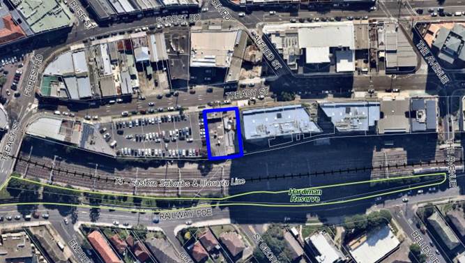
33-35 Treacy Street Hurstville
Hurstville Ward
|
|
Proposed Development
|
Construction of thirteen (13)
storey mixed use development comprising two (2) commercial/retail on ground
floor and a total of 41 residential apartments above, communal open space and
five (5) levels of basement car parking and associated site works
|
|
Owners
|
Wolf Construction Group Pty Ltd and
Prospa Developments Pty Ltd
|
|
Applicant
|
Danny Daher
|
|
Planner/Architect
|
Brett Daintry - Planner, Stanisic
Architects
|
|
Date Of Lodgement
|
5/09/2018
|
|
Submissions
|
Three (3) notification periods
which has generated a total of some 219 submissions (139 pro-forma letters
and 80 individual submissions).
|
|
Cost of Works
|
$23,650,000.00
|
|
Local Planning Panel Criteria
|
The application is subject to SEPP
65 (Design Quality of Residential Apartment Development) and more than 10
unique objections were received.
|
|
List of all relevant s.4.15
matters (formerly s79C(1)(a))
|
Environmental Planning and
Assessment Act 1979, Environmental Planning and Assessment Regulation
2000, Greater Metropolitan Regional Environmental Plan No 2 –
Georges River Catchment, State Environmental Planning Policy BASIX:
2004, State Environmental Planning Policy No. 55,
State Environmental Planning Policy
(Vegetation in Non-rural Areas) 2007, State Environmental Planning Policy
(Infrastructure) 2007, State Environmental Planning Policy No 55 –
Remediation of Land, State Environmental Planning Policy No.65 – Design
Quality of Residential Apartment Development, Draft Environment SEPP, Draft
Remediation of Land SEPP, Draft Georges River Local Environmental Plan 2020,
Hurstville Local Environmental Plan
2012, Hurstville Development Control Plan No 2, Draft Georges River Local
Environmental Plan 2020, Georges River Interim Policy 2019
|
|
List all documents submitted
with this report for the Panel’s consideration
|
Architectural Plans prepared by
Stanisic Architects, Statement of Environmental Effects prepared by Brett
Daintry,
Statement of Heritage Impact
prepared by Cracknell and Lonergan, Pedestrian Wind Environment Statement
prepared by Windtech,
Structural Report prepared by
Australian Consulting Engineers and Geotechnical Report prepared by Assetgeo,
Traffic and Parking Assessment
prepared by The Transport Planning Partnership, Waste Management Plan
prepared by Dickens Solutions
|
|
Report prepared by
|
Senior Development Assessment
Planner
|
|
Recommendation
|
That the application be granted an “In
Principle” Approval subject to the current Modification Application
to the Concept Approval (MP_10 0101 Mod 3) being determined by the
Department of Planning and Environment and concurrences from State Rail and
Water NSW being issued.
|
|
|
Summary of matters for
consideration under Section 4.15
Have all recommendations in relation
to relevant s4.15 matters been summarised in the Executive Summary of the
assessment report?
|
Yes
|
|
Legislative clauses requiring
consent authority satisfaction
Have relevant clauses in all
applicable environmental planning instruments where the consent authority
must be satisfied about a particular matter been listed and relevant recommendations
summarised, in the Executive Summary of the assessment report?
|
Yes
|
|
Clause 4.6 Exceptions to
development standards
If a written request for a
contravention to a development standard (clause 4.6 of the LEP) has been
received, has it been attached to the assessment report?
|
Not
Applicable
|
|
Special Infrastructure
Contributions
Does the DA require Special
Infrastructure Contributions conditions (under s7.24)?
|
Not
Applicable
|
|
Conditions
Have draft conditions been provided
to the applicant for comment?
|
No,
standard conditions have been attached with some design changes which will
need to be amended when the approval of the “Concept Approval” is
granted. The conditions can be reviewed once the report is published.
|
|
Site Plan
The subject site is
outlined in blue above
|
Executive Summary
Proposal
1. The development
application (DA2018/0366) seeks consent for the demolition of existing
structures on site, lot consolidation and the construction of a thirteen (13)
storey mixed use (shop top housing) development which provides for two (2)
ground floor retail/commercial tenancies, forty one (41) new upper level
apartments and basement car parking for a total of seventy four (74) vehicles
including landscaping in the form of ground and roof top areas of communal open
space and associated site works. The proposed front façade of the
building is shown in Figure 1 below known as the West Stage.
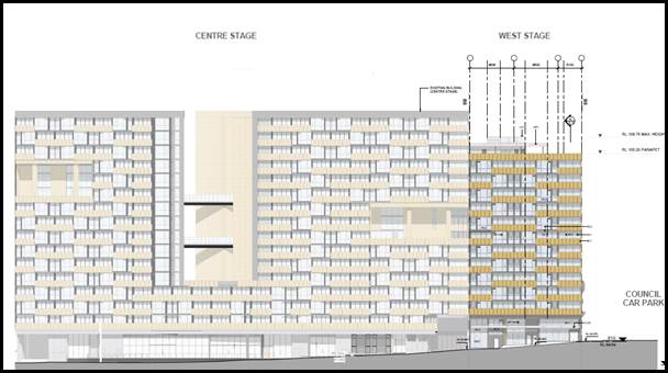
Figure 1 – Front elevation of the proposed building and its
relationship to the completed (Central Stage) (courtesy: Stanisic Architects)
2. The proposed
development forms the final stage (West Stage) of a large, integrated mixed use
development comprising of three (3) separate built forms across the site known
as 21-35 Treacy Street, Hurstville. The whole development is divided into three
(3) stages (East, Central and West). Refer to Figure 2 below which shows the
approved staging of the development. The buildings referenced as the East and
Central stage have been constructed and completed.
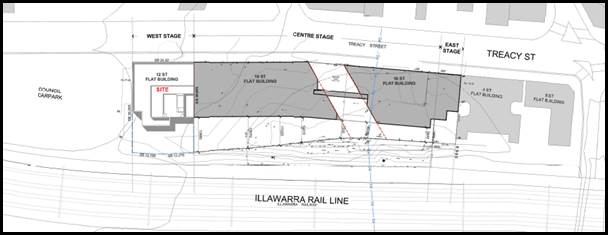
Figure 2 – Site plan showing the staging and siting of the
existing and proposed development (courtesy: Stanisic Architects)
Background
3. On 1 July 2011 the
Planning and Assessment Commission (PAC) granted approval for the Concept Plan
application No.MP_0101 which proposed a large scale, mixed use development
across 21-35 Treacy Street, Hurstville (refer to Figure 2 above and 3
below).
4. The approved
development scheme included the following features:
(a) Use of the sites for retail and residential purposes
and associated car parking;
(b) Indicative building envelope to a maximum height of
55 metres (being a maximum 114.6 metres AHD);
(c) Maximum number of 257 dwellings;
(d) Public domain improvements to Treacy Street; and
(e) Landscaping areas throughout.
5. The concept
approval included a series of conditions to ensure that the scale and bulk of
future development and the built form across the site is consistent with the
Concept plans. The approval also included conditions relating to the design to
ensure the external appearance of the development is integrated, balanced and
coherent. The same architect is to be engaged for all stages of the development
and a statement of commitments was also part of the approval which ensured
issues such as wind, acoustic, traffic and parking together with other environmental
considerations are detailed and adequately addressed at the DA stage/s.
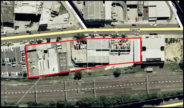
Figure 3 – Aerial photo
of the development site covered by the Concept Plan
6. On 4 September
2012 a Section 75W application to modify the Concept Plan (MP 10_0101 MOD 1)
was approved which amended the originally proposed development in the following
manner:
· An increase
in the residential floor area to 26,775sqm;
· A decrease
in retail floor area to 1,499sqm;
· Provision of
200sqm of community floor area;
· Staging of
the development;
· Modification
to floor layouts;
· Removal of
the requirement to have a maximum total number of 257 dwellings and
· A minimum
number of 30 parking spaces (as opposed to the original requirement for 79)
were to be provided for the retail uses and 5 spaces for the community uses.
7. This modification
also included the construction of the approved Concept Plan in three (3) stages
being:-
· Stage 1
– Centre Stage (23-31 Treacy Street)
· Stage 2
– West Stage (33-35 Treacy Street); and
· Stage 3
– East Stage (21-23 Treacy Street)
8. To date buildings
in relation to Stage 1 and Stage 3 have been constructed and completed.
9. The Concept Plan
approval provides that pursuant to Section 75P(1)(b) of the Environmental
Planning and Assessment Act 1979 (EP&A Act) (noting this section has been
repealed, but transitional provisions apply) that all future stages of the
Concept Plan are to be the subject of Part 4 of the EP&A Act, hence the
lodgement of Development Applications for each stage.
10. On 10 December 2012 Council granted
consent for the demolition of the existing structures on the site, removal of
underground storage tanks, remediation of the site which was validated after
completion.
11. On 30 May 2014 the Planning and
Assessment Commission (PAC) refused the Section 75W Modification No.2 which
sought to increase the height of the Central Stage building from 16 to 19
storeys, increase the residential floor area by an additional 3,684sqm, reduce
the retail floor space, amend the car parking layout and proposed a Draft
Voluntary Planning Agreement with a monetary contribution of $540,000 to
Council. The application was refused for the following reasons:
· The
current capacity of Hurstville City Centre has recently been reviewed resulting
in the adoption of a TMAP, and a revised planning framework to guide
development in the centre. The application is contrary to current evidence and
planning context.
· The
proposed increase in the height and mass of the approved building lacks merit
in the immediate context of Treacy Street and the wider context of the
Hurstville City Centre.
· The
integrity of the original architectural design as approved would be
compromised.
· Additional
overshadowing of properties to the south of the railway line is unwarranted in
the circumstances.
12. On 20 May 2015 the Joint Regional
Planning Panel, Sydney Region East granted a Deferred Commencement approval to
Development Application DA2014/1066 for the construction of a sixteen (16)
storey mixed use development with basement car parking on lots 1-4 DP2752, 1-2
DP2256951 and A DP 398056 known as 23-31 Treacy Street Hurstville. The deferred
commencement conditions required more detailed information and documentation to
be submitted to satisfy Sydney Rail requirements. This building relates to the
Central Stage (Stage 1) in the construction phase for this development and was
the first building to be constructed. The main features of this development
are:
· Two hundred
and twenty seven (227) residential apartments in a mix for 1, 2 and 3 bedrooms
(36 x studios/1 bedroom, 184 x 2 bed, 7 x 3 bed) with a combined floor area of
21,197sqm.
· Retail and
community space on the ground floor of the development with a gross floor area
of 1,012sqm. This includes a community space of 200sqm plus five car parking
spaces to be dedicated to Council as required by the Concept approval.
· Two hundred
and seventy three (273) car parking spaces and a car wash bay over four (4)
levels of basement and
· Landscaped
public domain and common areas.
13. A Construction Certificate has been
issued for this development and the building has been constructed and
completed. It is now known as “Imperial Hurstville”.
14. On 21 December 2016 Hurstville
Council approved DA2016/0073 for the construction of a sixteen (16) storey
building containing one (1) x retail tenancy on the ground floor and twelve
(12) x three (3) bedroom residential units at Lot 6 Section A DP 2752 and known
as 21 Treacy Street (East Stage). A Construction Certificate has been issued
for this development and the building has been constructed and completed. This
building relies on parking which is located below the Central Stage development
(as per MOD2016/0016).
15. A series of Modification
applications have also been submitted to date varying the development including
the following;
· MOD2015/0105
– Approved on 11 December 2015 which amended Condition 80 to increase the
number of parking spaces for the residential dwellings in the Central Stage
from one hundred and seventy five (175) to two hundred and thirty four (234)
and relocated the substation from the basement to the ground floor.
· MOD2016/0024
– Approved on 30 June 2016 to allow for the fifth basement level in the
Central Stage that will provides additional parking to cater for the East Stage.
· MOD2018/0006
– Approved on 15 February 2018 to add a mezzanine level to the ground
floor retail area as part of the East Stage development.
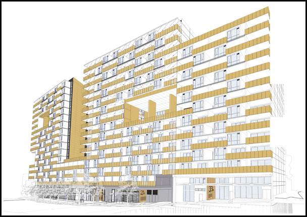
Figure 4 – 3D Montage
showing all stages of the development as visualised when completed (Concept Approval).
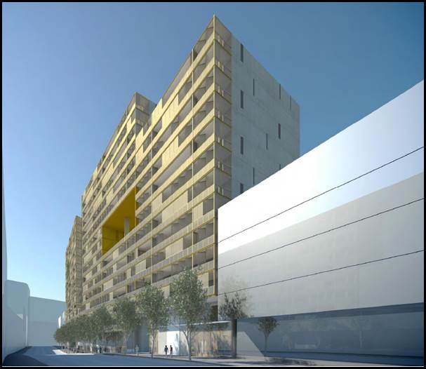
Figure 5 – 3D view of
the proposed building and development looking east along Treacy Street
16. The subject DA No DA2018/0366 was
lodged on 6 September 2018 and proposes a thirteen (13) storey mixed use, shop
top housing development that has been designed to comply with the approved
concept plan in terms of the proposed architectural design, building footprint
and building envelope. There are some minor variations to the internal design
of units and the amount and distribution of retail space, however these changes
were considered to be minor and within the general terms of the concept
approval and scope of works.
17. The application was referred to
several external agencies including State Rail given the site adjoins the
railway corridor, Water NSW, Ausgrid and Sydney Airports and other general
internal referrals occurred in respect to parking and access, stormwater and
drainage and given that the property is across the road from a designated
Heritage Item the application was referred to Council’s Heritage Officer
for comment. Also the proposal was referred to the Design Review Panel for
comment.
18. Since the lodgement of the
application the Site was subsequently sold and bought by Wolf Construction
Group and Prospa Developments who are now the new owners of the property.
Council prepared a letter to the new owners outlining all the outstanding
planning issues which they began working through. At the time of purchasing the
property the outstanding issues related to the need to provide:
· An updated
Detailed Site Investigation as contamination had not been accurately assessed
across the Site;
· Additional
details and documentation required by State Rail; and
· The GFA
calculations exceeded the maximum permitted by the Concept Approval and the
Applicant was requested to address this variation and area of non-compliance.
19. The new Applicant worked to address
these issues in detail.
Site and Locality
20. The subject site is known as 33-35
Treacy Street with a legal description of Lots 5 and Lot 6 in DP11931 (refer to
Figure 6 below which is an aerial view of the property). 33 Treacy Street
includes a single storey commercial building that extends the whole length of
the site. 35 Treacy Street contains a two storey commercial building that
extends across the whole of the Site.
21. The site has a combined frontage
width of 24.42m to Treacy Street, irregular rear boundary length of 24.47 and
depth of 36m with a total site area of 879sqm. The site area of the whole
development known as 21-35 Treacy Street Hurstville has a site area of
4,199sqm.
22. To the north of the site
are a series of mixed uses of varying forms and scales adjoining the Hurstville
Commercial Centre. 18 Treacy Street opposite is known as “Fretus
House” which is a local Heritage Item being a two (2) storey commercial
building. To the south of the Railway Line are low to medium scale residential
properties. Immediately to the west is a large scale on-grade Council car park.
23. To the east is the
Central Stage development which comprises of an extensive sixteen (16) storey
mixed use (shop top housing) development known as the “Imperial
Hurstville” building. The development is visually distinctive in the area
given its unique building finishes and materials.
24. The subject site is accessible
given it is located within 400m of Hurstville Railway Station and within the
Hurstville Commercial Centre. The site is also well serviced by public buses with
the Hurstville bus exchange located approximately 450m west of the site.
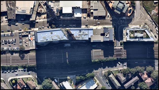
Figure 6 – 3D Aerial view of the subject site (courtesy Nearmaps 1 June
2020)
Zoning and Permissibility
25. The site is zoned
‘B4 – Mixed Use’ under the Hurstville Local Environmental
Plan 2012 (HLEP). The development is defined as ‘shop top housing’
under HLEP, which is a permissible land use with consent in this zone, subject
to compliance with Clause 6.6 to ensure that the proposal satisfies the Active
street frontage provision.
Submissions
26. The development application was
publicly exhibited on three (3) occasions in accordance with the provisions of
the Hurstville Development Control Plan (HDCP) 2013. A total of two hundred and
nineteen (219) submissions were received in response to all three (3)
notification periods.
27. The initial notification stage
which occurred between 26 September 2018 to 11 October 2018 included a sign on
site which generated three (3) submissions. It was realised after this process
that the owners of the adjoining development 23-31 Treacy Street (known as
“Imperial Hurstville” the Central Stage of the development site)
were not formally notified of the application.
28. A subsequent notification letter
was sent to all the owners at the adjoining property with the notification
period commencing on 18 September 2019 and finishing on 9 October 2019. A large
amount of owners residing at 23-31 Treacy Street (“Imperial
Hurstville”) were concerned about the proposed development, in particular
the proposed access arrangements that rely on utilising the existing driveway
from the Central Stage (along the eastern side of this site) of the development
through to the new basement levels at 33-35 Treacy Street. This arrangement is
consistent with the concept approval and always relied on this design given the
narrowness of the subject site. Council formally met with some owners and
representatives of Imperial Hurstville on 6 September 2019 to discuss these and
other issues and assured the residents they will be given a formal opportunity
to comment on the DA proposal.
29. All the submissions and the issues
raised in letters to Council’s are addressed in detail later in this
report.
Reason for referral to the Local
Planning Panel
30. This development application is
referred to the Local Planning Panel for consideration and determination as it
comprises development to which State Environmental Planning Policy No. 65
– Design Quality of Residential Apartment Development applies as required
by the Ministerial Direction of 23 February 2018 and that more than ten (10)
unique submissions objecting to the proposal have been
received.
Planning and
Design Issues
31. The proposal’s bulk, scale
and proposed building envelope is generally consistent with the approved Concept
Plan however since this is the final stage of the integrated development the
gross floor area proposed exceeds the gross floor area approved as part of the
Concept Plan. Given that the visual bulk and scale of the building is
consistent with the approved Building Envelope the additional GFA is a result
of the Concept Plan not realising the full extent and potential of the Site as
proposed by the indicative envelopes at all stages.
32. The Georges River Design Review
Panel (DRP) assessed the proposal and raised no objection to the proposed
design resolution of the building subject to some minor design changes being
implemented.
33. One (1) controversial element of
this proposal is that access to the basement levels of the proposed development
is through the existing driveway access from the Central building (also known
as Imperial Hurstville) by creating two (2) openings at each basement level to
provide this access/connection. Independent access to this building is
restricted due to the narrowness of the Site. The Concept approval anticipated
and expected that access will be derived in this manner. There are easements
for access dedicated as part of the Strata Plan for the Central Stage. The
following conditions were included as part of the concept approval consent;
“21. Building – Access to future stages - The
construction certificate plans must be accompanied by a certification from a
qualified structural engineer that the structural design of the basement walls
and ground floor walls will allow physical access required to the west stage
(No.33-35) and the east stage (No.21) whilst maintaining support to the
building as constructed.
67. Building - Structural Engineers Details – Supporting
excavations and adjoining land - Prior to the commencement of work in
connection with the excavation of the site associated with the basement car
park, structural engineer’s details relating to the method of supporting
the excavation must be submitted.
85. Access for Future Stages - Prior to the issue of a strata
certificate or occupation certificate over the subject site, (Stage 1)
easements relating to access, fire egress, support, wall openings,
construction, common space and garbage shall be registered on the title of the
subject land in favour of the adjoining stages 1 & 2 and consistent with
the plans approved under MPl0-0101 granted by the Planning Assessment
Commission, dated 1 July 2011 as modified on 4 Sept 2012 and this development
consent.”
34. Condition 23 on DA consent
DA2016/0073 in relation to the construction of the Central Stage (23-33 Treacy
Street) stated that “Building – Access
between stages - The
construction certificate plans must be accompanied by a certification from a
qualified structural engineer that the structural design of the walls will
allow physical access required between the west stage (No.33-35) and the east
stage (No.21) whilst maintaining support to the building as constructed.”
35. This
condition envisaged that access arrangements between all three (3) stages was
not only anticipated but expected. Similar conditions will be imposed if
consent is issued to ensure the structural stability of the existing building
walls and associated structures to the adjoining building are maintained during
excavation and construction.
36. The proposed development exceeds
the maximum Gross Floor Area (GFA) as stipulated in the Concept Approval. The
applicant was requested to justify the variation to the conditions in the
Concept Approval. Additional information was provided which included legal
advice confirming that the proposal (in its amended form) satisfied Schedule 3B
(2) (d) of the Savings and Transitional and other Provisions) Regulations 2017
(STOP) as the proposal was “consistent” with the Concept Approval.
Council’s independent legal advice did not support the Applicant’s
legal advice and stated that the Concept Approval conditions are prescriptive
controls that cannot be varied unless the Concept Approval is modified. The
proposed built form outcome with respect to height and scale for the site is
consistent with the Concept Approval and the excess GFA has come about due to
the following:
· The previous
stages of the redevelopment - Stage 1 (Central) and Stage 2 (East) have taken
up more floor space than originally anticipated through DA’s and
modification applications.
· The proposed
Winter Gardens were not considered GFA as part of the Concept Approval but they
are now elements that contribute to GFA.
· The building
is proposed to be constructed to the western boundary however the Concept
Approval had anticipated a 1m side setback, this side setback is not consistent
with the development and building outcome for development in commercial/mixed
use zones.
37. This issue is discussed in greater
detail later in this report.
38. The Applicant has submitted a
Modification to the Concept Plan (MP10_0101 Mod 3) varying the Concept Approval
to be aligned with the proposal currently before the Panel. The recommendation
before the Panel is to issue an “in principle” approval of the application
subject to the approval of the Modification application and concurrence from
State Rail (which is forthcoming) and Water NSW. Draft conditions are attached
to this report referencing the conditions to be imposed when the application is
determined.
39. If the State Government refuses the
Modification application this application should be refused or the applicant
provided the opportunity to amend the design to comply with the Concept
Approval (resulting in a reduction in GFA and an amended built form outcome)
with a report be prepared and provided back to the Panel for determination.
Conclusion
40. The application has been assessed having regard to the
Matters for Consideration under Section 4.15 of the Environmental Planning
and Assessment Act 1979, the provisions of the relevant State Environmental
Planning Policies, the concept plan approved for the precinct known as 21-35
Treacy Street Hurstville, Local Environmental Plan and Development Control
Plans with the Panel granting an “in principle” approval subject to
the following
information being provided:
· The Modification
Application (No.MP10_0101 Mod 3) lodged with the Department of Environment and
Planning on 22 July 2020 is approved and plans and documents being consistent
with this approval.
· Formal concurrence
received from State Rail.
· Formal concurrence
received from Water NSW.
· The draft
conditions attached to this report are to be updated to reflect any changes and
additional conditions and requirements stipulated by Government Agencies.
41. Once
the above information is provided and satisfied the Panel delegates
responsibility to the Manager Development and Building to issue the formal
development consent.
42. If
the modification application (Mod 3) before the State Government is refused or
approved in a modified form, the Applicant will be provided with the
opportunity (21 day period) in which to amend the Development Application and
an updated electronic report provided to the Panel within thirty (30) days of
receipt of the revised plans.
43. If
the Applicant decides not to amend the application and Council decides to
refuse the application the Panel delegates this decision to the Manager
Development and Building.
Report in Full
DESCRIPTION OF THE PROPOSAL
44. The development proposed is for the
demolition of existing structures, lot consolidation, and the construction of a
thirteen (13) storey shop top housing development containing, two (2) ground
floor retail tenancies and a total of forty one (41) apartments with five (5)
levels of basement car parking for seventy four (74) vehicles including ground
floor and rooftop areas of communal open space.
45. Concept Approval (MP_0101) was
granted on 1 July 2011 for a three staged development at No.21-35 Treacy Street,
Hurstville. East stage comprises of a 16 storey shop top housing development at
21-23 Treacy Street and the Central stage comprises of a 16 storey building
which is located at 23-31 Treacy Street and the west stage comprises of a 13
storey building at 33-35 Treacy Street. Five (5) levels of basement car parking
are catered for below the Central Stage (Imperial Hurstville building) and
fulfil the off-street car parking requirements for the East and Central stage
uses.
46. The proposed development is known
as the “West Stage” of this large mixed use development located at
21-35 Treacy Street, Hurstville. This is the final stage of this integrated
development as the East and Central stages have been completed and buildings
already constructed across the whole development site.
47. Details of the proposed design and
layout of the development are as follows:
The basement
parking is designed in a split-level configuration.
Basement
3B Plan
- Eleven
(11) Residential car parking spaces.
- Lift
lobby area and fire egress stairs.
Basement
3A Plan
- Six
(6) residential car parking spaces.
- Access
to the lift lobby and egress stairs.
Basement
2B Plan
- Eleven
(11) resident car parking spaces.
- Seven
(7) designated bicycle parking spaces.
- Lift
lobby area and fire egress stairs.
Basement
2A Plan
- Fourteen
(14) residential car parking spaces.
- One
(1) bicycle parking space.
Basement
1B Plan
- Nine
(9) visitor spaces (including one accessible space).
- Seven
(7) bicycle spaces.
- Lift
lobby area and fire egress stairs.
- One
(1) accessible retail space
Basement
1A Plan
- Six
(6) retail car parking spaces.
- Two
(2) visitor car parking spaces.
- Six
(6) residential spaces.
- One
(1) bicycle space.
Basement
1C Plan
- Eight
(8) residential car parking spaces (6 spaces are accessible).
- Lift
lobby area and fire egress stairs.
Basement
1D Plan
- Forty
(40) individual storage spaces (cages).
- Plant
and equipment and space for a hoist.
- Exhaust
fan room.
Basement
1E Plan
- This
level is located above 1D.
- Includes
plant and services including OSD, switch room, fire hydrant and sprinkler and
pump room.
- Main
lift lobby and fire egress stairs.
Ground Floor
Plan
- Two
(2) retail tenancies with total GFA of 210sqm.
- Residential
lobby area.
- Fire
egress.
- Waste
room with a separate hoist.
- Rear
area of deep soil comprising of 240sqm in area.
Level 1
Floor Plan
- Void
space above the residential lobby and retail area.
- 1
x 2 bedroom apartment.
- Main
Lift lobby.
- WC
and Pedestrian access to the communal area of open space.
- Communal
area of open space at the rear with an area of 240sqm.
Typical Level
2-8 Floor Plan
- 1
x 1 bedroom apartment.
- 2
x 2 bedroom apartments. One (1) being nominated as adaptable on each level.
- 1
x 3 bedroom apartment.
- Main
Lift lobby areas and fire egress stairs.
- Storage
areas and rises to support services.
Typical Level
9, 10, 11 and 12 Floor Plan
- 1
x 2 bedroom apartment.
- 1
x 3 bedroom apartment.
- 1
x 4 bedroom apartment.
- Main
lift lobby and fire stair egress.
- Storage
areas and rises to support services.
Level
13
- Roof
top communal terrace area with an area of 485sqm.
- Main
lift lobby area.
- Services
– hot water plant.
- Storage
areas and rises to support services.
DESCRIPTION OF THE SITE AND
LOCALITY
48. The subject site is known as 33-35
Treacy Street with a legal description of Lots 5 and Lot 6 in DP11931 (refer to
Figure 7 below which shows the combined site characteristics). 33 Treacy Street
includes a single storey commercial building that extends the whole length of
the site. 35 Treacy Street contains a two storey commercial building that also
extends across the whole of the Site.
49. The site has a combined frontage
width of 24.42m to Treacy Street, irregular rear boundary length of 24.47 and
depth of 36m with a total combined site area of 879sqm. The site area of the
whole redevelopment site is 4,199sqm.
50. To the north of the site
are a series of mixed uses of varying forms and scales adjoining the Hurstville
Commercial Centre. 18 Treacy Street across the road is known as “Fretus
House” which is a designated local Heritage Item and is a two storey
commercial building. To the south of the Railway Line are low to medium scale
residential properties.
51. Immediately to the west
is a large scale at grade Council car park which was the subject of a Planning
Proposal (PP2015/0006) to increase the height and floor space across the
site. On the 16 May 2018 Council decided not to proceed with the proposal
until a more holistic strategic assessment has been conducted for the
Hurstville CBD. This involves completing a series of studies and strategies
relating to car parking, affordable housing and urban design within the Centre
and which will better inform the future direction and approach for the site and
immediate locality.
52. To the east is the
Central Stage development which comprises of an extensive 16 storey mixed use
(shop top housing) development known as the “Imperial Hurstville”
building. The development is visually distinctive in the area given its unique
building finishes and materials.
53. The subject site is very accessible
located within 400m of Hurstville Railway Station and within the Hurstville
Commercial Centre. The site is also well serviced by public buses with the
Hurstville bus exchange located approximately 450m west of the Site.
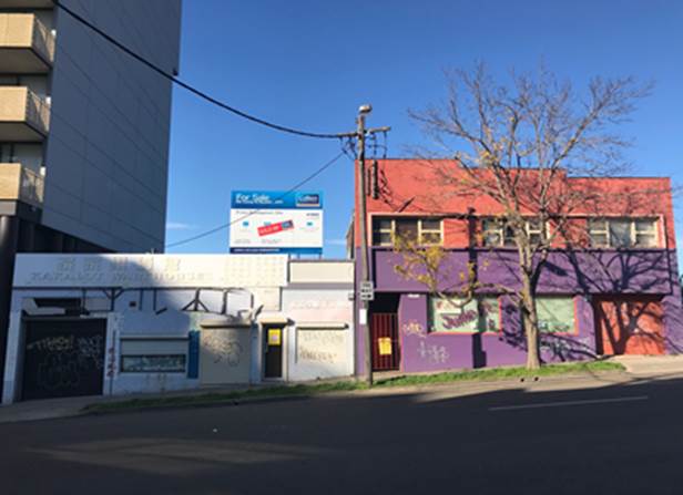
Photo 1: The
subject site – 33 and 35 Treacy Street, Hurstville
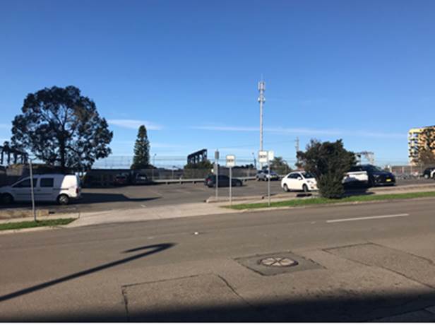
Photo 2: Council
public car park adjoining the site to the west
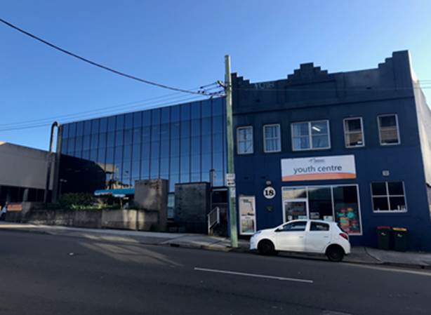
Photo 3: Commercial
and retail uses across the street to the north including 145 Forest Road (glass
commercial building to the left of the photo) and 18 Treacy Street (blue building
on the right which is a designated heritage item (I163 in HLEP2012)
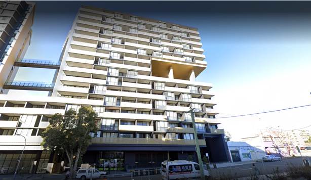
Photo 4: The
eastern section of the Imperial Hurstville building to the east of the subject
site
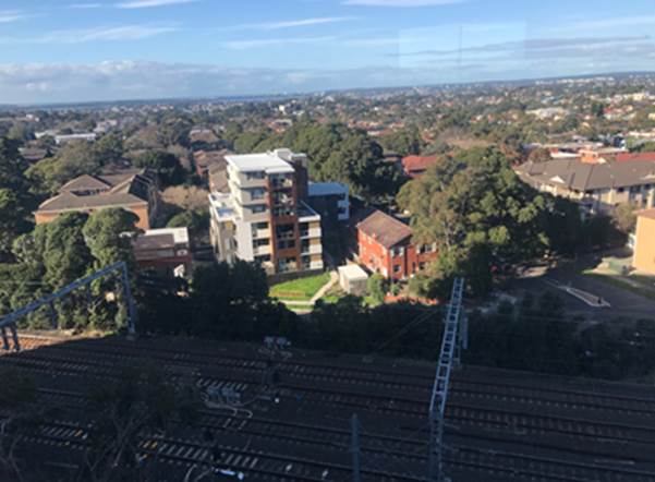
Photo 5: The
railway line and medium density development immediately to the rear (south)
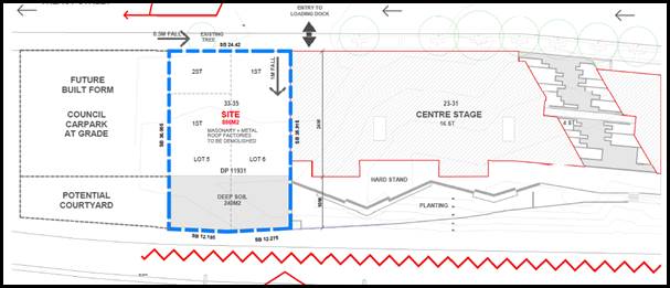
Figure 7 – The sites
area and main characteristics (courtesy: Stanisic Architects, 2018)
Planning Assessment
54. The
subject site has been inspected and the development has been assessed under the
relevant Section 4.15, Matters for Consideration of the Environmental Planning
and Assessment Act 1979.
Environmental
Planning Instruments
State Environmental Planning Policies
55. Compliance with relevant State
Environmental Planning Policies is summarised in the table as follows and discussed
in more detail thereafter.
|
State
Environmental Planning Policy
|
Complies
|
|
State
Environmental Planning Policy No 55 - Remediation of Land
|
Yes
|
|
State
Environmental Planning Policy (Building Sustainability Index: BASIX) 2004
|
Yes
|
|
State
Environmental Planning Policy – Infrastructure
|
Yes
|
|
State
Environmental Planning Policy (Vegetation in Non-Rural Areas) 2017
|
Yes
|
|
State
Environmental Planning Policy No. 65 - Design Quality of Residential
Apartment Development
|
Yes
|
State
Environmental Planning Policy No 55 - Remediation of Land
56. SEPP 55 aims to promote the
remediation of contaminated land in order to reduce the risk of harm to human
health or any other aspect of the environment.
57. Clause 7 of the Policy requires
contamination and remediation to be considered in the determination of a
development application. The consent authority must not approve of the carrying
out of development on land unless it has considered whether or not the land is
contaminated. If there is any trace of contamination, the determining
authority needs to be satisfied that the site can be appropriately remediated
and will be suitable for the proposed land use. This needs to occur prior to
the determination being made.
58. The Concept Plan application was
accompanied by a Stage 1 Environmental Site Assessment report prepared by
Environmental Investigations and dated 22 November 2010. Historically the sites
were occupied by a variety of commercial/industrial activities.
59. Stage 1 contamination assessment
recommended that:
“In
view of the historic activities, on-site areas of environmental concern were
subject to soil and/or groundwater contamination. These areas comprised of an
underground storage tank (UST) bowser and refuelling area, mechanical workshop
areas, panel repairs and spray painting areas and imported fill materials used
for site levelling….in view of the findings of Stage 1 ESA a field based
investigation comprising of a Stage 2 Environmental Site Assessment is
recommended focussing on soil sampling from the identified AECs with strategic
groundwater sampling up-gradient and down-gradient of the UST and the rear
workshop area to assess potential impacts to groundwater.”
60. A Phase 2 Detailed Environmental
Site Assessment was prepared by DLA Environmental and is dated March 2012.
Whilst this study considered the whole site comprising 21-35 Treacy Street and
includes the legal description of the two subject sites (33 and 35 Treacy
Street) no modelling, sampling or bore holes were included across these Sites
as can be seen in Figure 8 below. As such the detailed assessment should be
expended to conduct some sampling across the subject site. The Applicant was
requested to provide additional details and information in relation to this
issue. Despite this, the Phase 2 assessment prepared by DLA Environmental
concluded that parts of the site are contaminated and recommended that a
Remediation Action Plan (RAP) be prepared and implemented for the Site and
following the remedial works being conducted a Validation report prepared.
Figure 8:
Study area and bore hole and sampling locations as noted in the Phase 2
Detailed Environmental Site Assessment (courtesy: DLA Environmental, 2012)
61. A Remediation Action Plan (RAP) was
prepared by DLA Environmental dated May 2012. The remediation of the Central
and East Stages of the development and subsequent validation was conducted in
accordance with the recommendations of this report. Given that the RAP did not
clearly define the subject sites this process will need to be expanded and
detailed to include 33 and 35 Treacy Street to ensure that the site can be
appropriately analysed and ensure the land will be suitable for the proposed
mixed use development.
62. To provide some
further historical context to this issue, Council granted consent to
Development Application No 12/DA-193 on 10 December 2012 for the demolition
of existing structures, removal of an underground storage tank and associated
remediation works to 23-31 Treacy Street Hurstville (Central
Stage). This consent did not include 21, 33 and 35 Treacy Street Hurstville. In
the case of the East Stage development (21-23 Treacy Street) approval,
contamination remained an outstanding issue and was resolved by the
implementation of conditions where the issue of contamination was to be
resolved prior to the Construction Certificate. Although this is a standard
practice by some Council’s, SEPP 55 requires certainty prior to the
determining of the application that the site (if contaminated) can be made
“good” and suitable for the intended land use. In this case the
site has been found to be contaminated and it is important to ensure it can be
suitably remediated to facilitate the proposed development. The Applicant was
requested to prepare a Detailed Site Investigation and if remediation is
required a Remediation Action Plan (RAP) developed.
63. The Applicant engaged EI Australia
to prepare a Detailed Site Investigation (DSI), dated 1 April 2020. The
investigations across the site included two (2) specific testing areas and
boreholes and identified areas of fill material which reported elevated lead
and asbestos contaminant concentrations within shallow fill that exceeded human
health criteria and require remediation. The key findings of the DSI are as
follows:
· The site
was used for commercial businesses since the 1950’s including automotive
repair-related activities including panel beating, spray painting and glass
replacement.
· No
underground storage tanks (UST’s) were expected to be present.
· The
Environmental Protection Authority (EPA) had no outstanding notices or
regulatory involvement in relation to the site in accordance with the
Contaminated Land Management Act 1997 and the Protection of the Environment
Operations Act 1997.
· The site
nor its immediate surrounds were included on the List of NSW Contaminated Sites
Notified to the EPA.
· Subsurface
conditions were generalised as a layer of anthropogenic filling (up to a depth
of 1.8m below ground level (BGL), overlying natural, residual, silty clays and
shale bedrock.
· With the
exception of lead evident in the fill sample as well as some asbestos the
concentrations of contaminants of potential concern were found to comply with
the adopted soil investigation levels applicable for residential sites with
minimal access to soils.
· Ground
water sampling could not be conducted, as the monitoring well was dry at the
time of the monitoring event conducted on 25 March 2020. However local ground
water contamination was unlikely given the DLA (2012) results and substantial
depth to the water table. (Refer to the Integrated Development section of
this report which discusses the impact of the development on ground water and
the potential for dewatering).
64. Although the DSI found that site
contamination was at low levels there are certain limitations in the testing
and it recommended that the following procedures occur:
· Conduct a
Hazardous Materials Survey (HMS) of current site structures (prior to site
demolition)
· Prepare
and implement a Remediation Action Plan (RAP) for the site, which provides the
details of;
§ Procedures required for
the effective management of impacted (fill) soils;
§ A SAQP for the validation
of all remediation activities;
§ A waste management plan,
ensuring all soil materials removed from the site (including virgin excavated
natural material (VENM) are classified in accordance with EPA (2014) Waste
Classification Guidelines;
§ Validation of any material
to be imported to the site in accordance with EPA guidelines (confirming
suitability for the intended use or be classified as VENM); and
§ A contingency plan to
address unexpected finds, should they be encountered during any stage of the
remediation and construction phases of the proposed development.
· Prepare a
site validation report, certifying the land is suitable for the proposed use.
65. A Remediation Action Plan (RAP) was
prepared by EI Australia, dated 23 April 2020 and outlines the methods and
procedures that will be utilised to remediate the site to a condition suitable
for the proposed mixed use development without the need for any ongoing
environmental monitoring. This document was publicly advertised and notified
for a period of 30 days in line with the provisions for Advertised Development
pursuant to the Environmental Planning and Assessment Act 1979 provisions and
legislation. The remediation works are classified as Category 2 works and
technically do not require consent in accordance with the provisions of Clause
14 of SEPP 55.
66. The notification of the RAP
generated a large amount of submissions which did not object or make any
specific comment in relation to the RAP but rather objected to the development
as a whole (refer to submissions section in this report for further comments on
the process of advertising/notification).
67. The RAP outlines the preferred
approach for remediation which involves excavation and off-site disposal of
impacted fill materials which will occur in a staged manner (from site
preliminaries through to validation and reporting). This process is detailed
throughout the plan which also caters for the management of any unexpected
finds. The RAP was referred to Council’s Environmental Health Unit for
comment. No objection was raised subject to the imposition of conditions, if
consent was to be issued. A condition will also be included that ensures the
recommendations and procedures outlined in the RAP are implemented during the
construction process.
State
Environmental Planning Policy (Building Sustainability Index: BASIX) 2004
68. The State Environmental Planning
Policy (Building Sustainability Index: BASIX) 2004 aims to ensure consistency in the implementation of a scheme
to encourage sustainable residential development throughout New South Wales
(also referred to as the ‘BASIX scheme’).
69. A BASIX certificate accompanies the
DA (BASIX Certificate No.945605M) verifying that the relevant water, energy and
thermal comfort targets have been met by the proposal. Conditions of consent
have been included in the recommendation to ensure the commitments required
under the BASIX certificate will be satisfied by the proposed development.
Integrated
Development
70. In accordance with
Section 4.46 of the Environmental Planning and Assessment Act, 1979 (as
amended) the proposal could be classified as “Integrated Development”
as a water use approval, water management work approval or activity approval
may be required pursuant to Part 3 Chapter 3 of the Water Management Act ,
2000. The proposed works potentially fall within the requirements of Clauses 89
(water use approvals) and 91 (activity approvals) of the Water Management Act,
2000.
71. The Geotechnical
report prepared by Asset Geotechnical which accompanies the application found
that:
“groundwater is anticipated to be present within fractures
in the bedrock, at deeper than about 6m to 10m” and in respect to
dewatering the report stated that “some ground water seepage is
anticipated through the bedrock. It is expected that this could be controlled
by sump-and-pump techniques, and should not adversely affect adjoining
developments”.
72. Given that the
proposal includes five (5) levels of basement car parking it is likely that
dewatering may be required and an activity approval needs to be granted. In
this case the application was referred to Water NSW for their formal
concurrence on 10 July 2020. To date no response has been received from this
agency and concurrence could technically be assumed if there is no response
provided within 21 days from the date of the referral in accordance with the EP
and A Regulations. The issue of dewatering is technical and quite specific and
if an activity application is required then the requirements are detailed
through the referral process. Therefore, concurrence in this instance should
not be assumed and it is recommended that the application not be approved until
such time as Water NSW provides a formal response.
State Environmental Planning Policy (Infrastructure) 2007
73. The aim of the Infrastructure SEPP
is to facilitate the effective delivery of infrastructure across the State. The
Policy also examines and ensures that the acoustic performance of buildings
adjoining a rail corridor or busy arterial road are acceptable and internal
amenity within the apartments is reasonable given the impacts of adjoining
infrastructure development.
74. The DA was referred to Ausgrid on
17 September 2019 in accordance with Clause 45 of State Environmental Planning
Policy (Infrastructure) 2007. At the time of writing this report, no response
had been received. The DA may be determined in the event that no response has
been received from Ausgrid within twenty one (21) days of notifying this
agency. Draft standard conditions relating to Ausgrid requirements have been
included.
75. Clause 85
(Development adjacent to rail corridors) and Clause 86 (Excavation in, above,
below or adjacent to rail corridors) of the SEPP, are relevant to this DA on
the basis that the proposal involves the construction of residential
accommodation on land adjacent to the Illawarra Rail corridor which is
immediately to the rear and the development located within 25m of the rail
corridor.
76. The
application was referred to Sydney Trains for comment and concurrence. On 16
April 2019 Sydney Trains requested further information to assist with
the Engineering process and the cross-sectional drawings from the Structural
Report provided will require additional information including:
· Basement
structural support to rail boundary at the closest point;
· Rail
boundary to the overhead catenary structure at the closest point; and
· Rail
boundary to the nearest track centre at the closest point.
77. Updated horizontal distances and
cross-sectional drawings were provided to Sydney Trains and as at 22 July 2020
State Rail informed Council that internal engineering reviews with the
Applicant had recently been completed and conditions were being prepared.
Therefore concurrence is considered to be imminent.
78. A Noise
and Vibration Intrusion Assessment was prepared by Day Design and dated 21
August 2018. This report assessed the road traffic and rail noise and vibration
intrusion and its impact on the proposed mixed use development. Long term
traffic and rail noise levels were measured at two (2) locations (refer to
Figure 9 below for logger locations).
79. The
NSW Department of Planning published the “Development Near Rail Corridors
and Busy Roads – Interim Guidelines” in 2008. The guidelines refer
to clauses 87 (rail) and 102 (road) of the State Environmental Planning Policy
(Infrastructure) 2007 for the noise criteria for developments affected by
railway noise or traffic noise, which states the following:
“If
the development is for the purposes of a building for residential use, the
consent authority must not grant consent to the development unless it is
satisfied that appropriate measures will be taken to ensure that the following
LAeq levels are not
exceeded:
(a) in
any bedroom in the building – 35dB(A) at any time between 10.00pm and
7.00am
(b) anywhere
else in the building (other than a garage, kitchen, bathroom or hallway) 40dB
(A) at any time.”
In
addition, it also states that:
“if
internal noise levels with windows or doors open exceed the criteria by more
than 10 dB, the design of the ventilation for these rooms should be such that
occupants can leave windows closed, if they so desire, and also to meet the
ventilation requirements of the Building Code of Australia”
Figure
9: Locations of the noise logger (courtesy:
Noise and Vibration Intrusion Assessment, Day Design, 2018)
80. Section
3.6.3 of the “Development Near Rail Corridor and Busy Roads –
Interim Guidelines” requires vibration levels such as the intermittent
vibration emitted by trains to comply with the criteria in the NSW EPA’s
“Assessing Vibration: a technical guideline”. These guidelines
establish acceptable levels of vibration which are referred to as
“vibration dose levels”.
81. The
report assumes that all bedrooms and lounge rooms will be carpeted and with
kitchens and wet areas being the only spaces to have hard flooring. A condition
will ensure this is integrated into the design. Based on the technical findings
a series of recommendations have been proposed relating to specific acoustic
treatment to facades, masonry treatment to external walls integrating a
specific ceiling and roofing system, double glazing to windows and openings
which also specifies the type of windows and doors to be utilised (sliding or
casement window design preferred with interlocking stiles and Schlegel seals).
82. The
application was also accompanied by an Environmental Noise Impact Assessment
also prepared by Day Design and dated 21 August 2018. Unlike the Noise and
Vibration Intrusion Assessment, this acoustic report aims to ensure that the
noise impact from the development will not adversely impact nearby residences.
To assess the impacts, it is necessary to measure the ambient background noise
level. Figure 10 shows the location of noise loggers when conducting this assessment.
The report considers the controls outlined in the Hurstville Development
Control Plan No.2 (Amendment No.9) and also in relation to the controls
stipulated in the NSW EPA Noise Policy for Industry and the Protection of the
Environment Operations Act, 1997. The report concluded that the main noise
sources from the proposed development will be from the mechanical ventilation
and associated exhaust fans and condensers and also the impact of cars and
vehicles entering and exiting the car park.
Figure
10: Locations of the noise logger (courtesy:
Environmental Noise Impact, Day Design, 2018)
83. The
recommendations of the report are broken up into several components relating to
the following;
· Mechanical
Plant – mechanical plant and equipment will need to be appropriately
treated and sound proofed. It is recommended that prior to the Construction
Certificate (CC) stage a detailed acoustic assessment be conducted once the
exact location of the equipment is confirmed.
The report
suggests a number of design criteria to be implemented to assist with reducing
noise from mechanical plant and air conditioning systems including carbon
monoxide monitoring system (this will activate the exhaust fans when required),
lining ductwork, silencers could be implemented and vibration isolators should
achieve minimum static deflection measures and it is recommended that fans be
mounted on the roof are not located directly above living areas or bedrooms.
84. If
the development approval is to be granted a condition of consent would be
necessary to ensure the recommendations of the acoustic report are implemented
during the construction of the building and appropriately certified to be
consistent with the recommendations of the acoustic report after installation
and prior to occupation.
85. The
provisions and requirements of the Infrastructure SEPP have been addressed and
satisfied by the proposal subject to the imposition of appropriate conditions.
State Environmental Planning Policy (Vegetation in Non-Rural Areas)
2017
86. The State Environmental Planning
Policy (Vegetation in Non-Rural Areas) 2017 (‘Vegetation SEPP’)
regulates clearing of native vegetation on urban land and land zoned for
environmental conservation/management that does not require development
consent.
87. The Vegetation SEPP applies to
clearing of:
a. Native vegetation above the Biodiversity Offset
Scheme (BOS) threshold where a proponent will require an approval from the
Native Vegetation Panel established under the Local Land Services Amendment
Act 2016; and
b. Vegetation below the BOS threshold where a
proponent will require a permit from Council if that vegetation is identified
in the Council’s Development Control Plan (DCP).
88. The Vegetation SEPP repeals Clauses
5.9 and 5.9AA of the Standard Instrument - Principal Local Environmental Plan,
with the regulation of the clearing of vegetation (including native vegetation)
below the BOS threshold being through any applicable DCP.
89. No issues arise in terms of
satisfying the provisions of the Vegetation SEPP, as there is no vegetation on
the site considering existing structures cover the full extent of the Site.
There is an existing street tree at the front of 35 Treacy Street. This tree
will be retained and one (1) additional street tree to the east of this tree in
line with the street planting for this development will be required. A
consistent pattern of public domain works will also be required i.e. footpath
paving and detailing, species of trees etc. This will be appropriately
addressed through conditions.
State
Environmental Planning Policy No 65 – Design Quality of Residential
Apartment Development
90. The State Environmental Planning
Policy No 65 – Design Quality of Residential Apartment Development (SEPP
65) aims to improve the design quality of residential apartment development in
New South Wales.
91. The proposed development meets the
pre-requisites for the application of the SEPP 65 in that it constitutes
development for the purpose of ‘shop top housing’ in a proposed
building of more than three (3) storeys and having more than four (4)
dwellings. Therefore, it must be considered against the provisions of SEPP 65
and the Apartment Design Guide (ADG).
92. This development is unique in that
the Concept Plan approval acknowledged the “excellence in the
design” originally proposed and very specific urban design conditions
were attached to the approval. The original Concept Approval requested that the
original design architect, Frank Stanisic be involved in all stages of the
development and to ensure there is consistency in the design in terms of
façade treatment and articulation. A design verification statement dated
1 August 2018 has been provided by Frank Stanisic Registered Architect (Registration
No. 4480) in accordance with Clause 50(1A) of the Environmental Planning and
Assessment Regulation 2000.The proposed building is consistent in design with
the Concept Approval and subsequent S75W Modification approval. Modification
No.3 has been submitted to the Department of Environment and Planning to
slightly modify the building in the following ways;
· Extend the
currently recessed snorkel windows by approximately 1m to improve solar access
and amenity to the bedrooms. This is in line with the DRP’s
recommendation.
· Locate the
building directly on the western boundary (the concept approval included a 1m
side setback). This is consistent with the intended design approach for mixed
use developments in commercial centres.
· Reduce the number
of retail spaces across the whole development as stipulated by a condition of
the Modification No.1 approval.
· Remove the first
floor retail floor space and replace with a residential dwelling.
· The overall bulk,
scale and built form design remains as approved by the Concept Approval.
93. The DA has been reviewed by the
Design Review Panel (DRP) and their comments are further detailed in the DRP
discussions below.
Design
Review Panel
94. The initial plans that accompanied
the application were referred to the Design Review Panel (DRP) on 4 October
2018. In general, the Panel raised no objection to the proposal and their
comments are summarised in Table 1 below in respect to the Nine (9) Design
Quality Principles of SEPP 65.
Table 1:
Assessment against the Design Quality Principles of SEPP 65
|
SEPP 65
– Design Quality of Residential Flat Buildings
|
DRP
Comment
|
General
comment
|
|
Context and Neighbouring
Character
Good design
responds and contributes to its context. Context is the key natural and
built features of an area, their relationship and the character they
create when combined. It also includes social, economic, health and
environmental conditions.
Responding
to context involves identifying the desirable elements of an area’s
existing or future character. Well-designed buildings respond to
and enhance the qualities and identity of the area including the adjacent
sites, streetscape and neighbourhood.
Consideration
of local context is important for all sites, including sites in established
areas, those undergoing change or identified for change.
|
This is the second
stage of a major residential development located between Treacy Street and
the railway line at Hurstville. The first stage comprising two (2) x sixteen
(16) storey towers has been completed and is understood to be partly
occupied. The current application immediately adjoins the completed
development separated by a party wall and sharing access to the basement
parking already provided in that development.
The Council site to
the west which is currently an open car park is understood to be proposed for
development of a similar height and density.
|
This final
stage of the larger integrated development across 21-35 Treacy Street which
is consistent with the character and design of the larger development and in
keeping with the concept approval.
|
|
Built
Form and Scale
Good design
achieves a scale, bulk and height appropriate to the existing or desired
future character of the street and surrounding buildings.
Good
design also achieves an appropriate built form for a site and the
building’s purpose in terms of building alignments, proportions,
building type, articulation and the manipulation of building elements.
Appropriate
built form defines the public domain, contributes to the character
of streetscapes and parks, including their views and vistas, and
provides internal amenity and outlook.
|
The proposal is for
a thirteen (13) storey tower built boundary to boundary. The height was
determined, the Panel understands, by an overall site masterplan which
regulates height and density.
The form and scale
of the application appears satisfactory within the evolving context.
|
The height
of the building is below the concept plan approved “maximum
height” of 55m or 16 storeys. The adjoining buildings (Stage 1 and 2)
are 16 storeys in scale whilst the proposed final stage building steps down
and is proposed at 13 storeys which translates to an overall maximum height
of approximately 45m.
The built
form, scale and building envelope is consistent with the Concept approval.
|
|
Density
Good design
achieves a high level of amenity for residents and each apartment, resulting
in a density appropriate to the site and its context.
Appropriate
densities are consistent with the area’s existing or projected
population. Appropriate densities can be sustained by existing or proposed
infrastructure, public transport, access to jobs, community facilities and
the environment.
|
The current
proposal was advised by the applicant to have a FSR of 5.6:1 for this site.
The proponent advised that this complies with the overall masterplan for the
full site FSR recommended at 5:1. It is noted that the LEP provides FSR of
only 3:1 which is now to a large extent irrelevant.
|
The concept
approval permitted a maximum GFA across the whole site of 28, 474sqm which
translates to an FSR of 6.68:1 across the whole site (21-35 Treacy Street).
Although the building footprint and building envelope and form is consistent
with the Concept approval, the previous two (2) stages of development
have ‘eaten into’ the total GFA more than originally anticipated
and with the inclusion of winter gardens in GFA the proposed development
exceeds the GFA by 800sqm
(equating to a 2.6% variation across the entire development site). Although
there is an exceedance in the GFA this is a numerical technicality as there
is no alteration to the bulk, scale, form and density of the proposal as
envisaged and approved by the Concept Plan. The issue of floor space is
discussed in more detail later in this report.
The density
comprises of a mix of forty one (41) apartments which is consistent with the
original approval.
|
|
Sustainability
Good design
combines positive environmental, social and economic outcomes.
Good
sustainable design includes use of natural cross ventilation and sunlight for
the amenity and liveability of residents and passive thermal design
for ventilation, heating and cooling reducing reliance on technology and
operation costs. Other elements include recycling and reuse of materials and
waste, use of sustainable materials and deep soil zones for groundwater
recharge and vegetation.
|
Subject to BASIX
|
BASIX compliant
|
|
Landscape
Good
design recognises that together landscape and buildings operate as
an integrated and sustainable system, resulting in attractive developments
with good amenity. A positive image and contextual fit of well
designed developments is achieved by contributing to the landscape
character of the streetscape and neighbourhood.
Good
landscape design enhances the development’s environmental performance
by retaining positive natural features which contribute to the local context, co-ordinating water
and soil management, solar access, micro-climate, tree canopy, habitat values
and preserving green networks.
Good
landscape design optimises useability, privacy and opportunities
for social interaction, equitable access, respect for neighbours’ amenity
and provides for practical establishment and long term management.
|
The landscape
drawings did not provide adequate detail or content to draw satisfactory
conclusions on landscape proposals.
The proposal has a
very high site cover with very little deep soil opportunity. It is suggested
that the proponent investigate capacity for improving deep soil conditions on
the southern side of the site adjacent to the railway line where and if
possible by way of re-configuring part of the Level 1 Basement to Level 4
Basement and thus providing an extra level of deep soil.
The street front
landscaping on Treacy Street should complement the existing new planting on
the completed part of the development site to the east. This may require the
removal of the existing Paperbark tree in the footpath.
|
This is the
final stage of the development. It is a small site with a narrow frontage of
only 24.42m with a depth of some 36m.
Although
the Panel state that the building has “very high site coverage”.
The site coverage and building alignment in terms of the front and rear
setbacks is consistent with the adjoining buildings (Stage 1 and 3) of the
development and creates a rear courtyard area to be used as common open
space. The Applicant states that this courtyard will comprise of 240sqm of
“deep soil” which has been created by “filling in” a
section of the ground floor area and raising this area by some 3m. This will
allow for nearly all of the rear courtyard to be well landscaped and
vegetated. The proposal seeks to have some of this area paved however a
condition will require the whole space be softly landscaped with lawn,
planter boxes, trees and vegetation. The rear boundary will include larger,
mature tree species to create a green buffer and transition to the railway
line.
|
|
Amenity
Good design
positively influences internal and external amenity for residents
and neighbours. Achieving good amenity contributes to positive living
environments and resident wellbeing.
Good
amenity combines appropriate room dimensions and shapes, access to sunlight,
natural ventilation, outlook, visual and acoustic privacy, storage, indoor
and outdoor space, efficient layouts and service areas and ease of access for
all age groups and degrees of mobility.
|
The amenity of the
units would be of good standard and compliant with ADG recommendations.
The following
detailed issues should be addressed:
· Ensure continuity of covered footpath area to give access to
future development on Council’s site to the west
· The snorkel in the second bedroom units is rather deep and could
be improved by moving the window a metre or so forward to provide a small
desk space or similar. Since this is to improve amenity it would be
acceptable as small addition to the FSR
· Balconies on the north western corner for the full height of the
building should be screened to ensure adequate protection from the winds
· Provide small enclosed common space and amenities on the roof
adjacent to the roof garden. This also would enhance amenity and the very
small additional amount of FSR is acceptable.
· The roof garden should be screened to ensure adequate protection
against strong winds
|
The proposed
development includes an awning over the ground floor retail tenancies and
entry to the building which will be integrated with the existing awning to
the other buildings to the west.
A condition
will be imposed to move the snorkel window for the second bedrooms out a
further 1m so there is a small amount of additional floor space which could
allow for a small desk to be placed in this space as per the Panel’s
recommendation.
A condition
will require full height privacy screens to the balconies along the north
western sides of the building.
The Panel
request that an enclosed common space with amenities be included within the
roof top common open space because this space adjoins the community room that
is adjacent to the roof top area and will satisfy the intention of providing
a publicly accessible but enclosed space.
The rooftop
area of open space has access to a WC located within the lobby at L13.
|
|
Safety
Good design
optimises safety and security within the development and the public domain.
It provides for quality public and private spaces that are clearly defined
and fit for the intended purpose.
Opportunities
to maximise passive surveillance of public and communal areas
promote safety.
A positive
relationship between public and private spaces is achieved through clearly
defined secure access points and well-lit and visible areas that are easily
maintained and appropriate to the location and purpose.
|
Satisfactory
|
Satisfactory.
The building is built boundary to boundary with a high fence to the rear and
western boundary providing added security and protection. The building will
have standard security measures.
|
|
Housing
Diversity and Social Interaction
Good design
achieves a mix of apartment sizes, providing housing choice for different
demographics, living needs and household budgets.
Well-designed apartment
developments respond to social context by providing housing and facilities to
suit the existing and future social mix.
Good design
involves practical and flexible features, including different types of
communal spaces for a broad range of people and providing opportunities for
social interaction among residents.
|
Housing diversity
is satisfactory with a mixed range of units.
See comments above
under ‘Amenity’ and ‘Landscape’.
It is important
that a clear statement of intent and function is provided for the roof garden
area.
|
Mix and
diversity of apartments provided which satisfies this design quality
objective.
The roof
top area of open space has been designed so that it is flexible and will be
able to be used by the units within the Central stage (adjoining building
23-33 Treacy Street).
A condition
will be imposed to ensure an easement for access is created so that the
rooftop area of communal open space (like the community room) can be accessed
via the community room and used by all occupants of the development as
intended by the Concept Approval.
|
|
Aesthetics
Good design
achieves a built form that has good proportions and a balanced composition of
elements, reflecting the internal layout and structure.
Good design
uses a variety of materials, colours and textures.
The visual
appearance of a well designed apartment development responds to the
existing or future local context, particularly desirable elements and
repetitions of the streetscape.
|
The aesthetics are
generally considered acceptable however the following possibilities should be
explored:
· Provide greater articulation between the existing building and the
subject proposal by way of recessed areas, architectural detail, etc.
· Investigate the possibility of colour/shading variations to the
balustrading and/or the wall surfaces in this new extension, in order to
enhance the overall character of the north and south facades of this very
large development
Provide some
articulation and detailed refinement to the large blank wall to the west,
which could well be exposed for many years pending resolution of the future
of the Council’s car park site
|
The Panel
has suggested that the Designer/Applicant reconsider some of the design and
aesthetic qualities expressed in the building.
The design
of the building is consistent with the Concept Approval and will sit
comfortably in the context of the larger Site and will be well connected to
the adjoining building.
In respect
to the proposed blank wall along the western side it is agreed that this will
be a very tall, visually dominating wall and needs to be treated well to
reduce its visual bulk. It is recommended that part of the first two (2)
– three (3) levels are treated differently and maybe include a mural or
some street art as this is an exposed wall and will give it some expression
and creativity. Given it faces a public car park it will be highly visible. A
condition will be imposed to look at options in treating this element.
|
95. In
conclusion the Panel “supports” the application subject to
resolving some of the issues highlighted above.
Apartment Design
Guide
96. Clause
28 of SEPP 65 requires the consent authority to take into consideration the
provisions of the Apartment Design Guide. An assessment of the proposed
development against the relevant design criteria of the Apartment Design Guide
(ADG) is detailed in the compliance table below.
Table 2: Compliance with Parts 3 and 4 of the Apartment Design
Guide
|
Part 3 - Siting of the
development
|
|
Section
|
Design Criteria
|
Proposed
|
Comply
|
|
3D -
Communal and public open space
|
Communal
open space has a minimum area equal to 25% of the site.
Where it cannot be provided on
ground level it should be provided on a podium or roof
Developments
achieve a minimum of 50% direct sunlight to the principal usable part of the
communal open space for a minimum of 2 hours between 9 am and 3 pm on 21 June
(mid-winter)
|
The roof
top communal open space has an area of 485sqm whilst the rear ground floor
communal courtyard has a total area of 240sqm.
This
amounts to a total area of communal open space of 725sqm which amounts to 82%
of the site area which is well over the minimum required.
|
Yes
|
|
3E – Deep soil zones
|
Deep soil zones
are required at a sliding scale in this clause.
For a site area of
650sqm – 1500sqm, the deep soil zone requirement is 7% with minimum 3m dimensions.
|
The rear courtyard
area is designated as deep soil as it will comprise of 3m of soil depth. This
is considered to be enough to provide for larger trees and soft landscaping
within this space.
The courtyard has
a total area of 240sqm which amounts to 27% of the site which satisfies the
minimum numeric requirement. The minimum dimensions of this space are 3m.
There is currently
no existing trees on the site and the development will improve the existing
situation whereby the site is fully covered by buildings and there is no
landscaped area or deep soil area provided.
|
Yes
|
|
3F
– Visual privacy
|
Separation between windows and
balconies is provided to ensure visual privacy is achieved.
Minimum required separation
distances from buildings to the side and rear boundaries are as follows:
Up to 12m (4 storeys)
Habitable - 6m
Non-habitable – 3m
Up to 25m (5-8 storeys)
Habitable – 9m
Non-habitable – 4.5m
Over 25m (9 storeys and over)
Habitable – 12m
Non-habitable – 6m
|
Part 3F
relates to “visual privacy” and aims to establish minimum or
reasonable side setbacks for developments which allow for adequate separation
between buildings and therefore maintain privacy between properties.
The provisions in relation to
visual privacy are primarily focused around residential flat buildings and
their relationship to one another in residential zones. Given this is a
mixed-use development within a commercial zone the intention is for new
developments to be built to side boundaries with a nil side boundary setback.
The pattern of development, built form and design intent for this area has
been established by the existing buildings at 21-33 Treacy Street. The ADG
states that “no separation is required between blank walls”
which is adopted in this case.
The rear setback of the building
from the railway line varies from 10-15m. The separation along this side to
the closest residential properties which are located along Railway Parade
(540-550 Railway Parade) over 30m away so the physical separation along this
side is considered substantial.
|
Yes acceptable
given the site is located within a commercial zone
|
|
3G
– Pedestrian Access and Entries
|
Building entries and pedestrian
access connects to and addresses the public domain
Multiple entries (including
communal building entries and individual ground floor entries) should be
provided to activate the street edge
|
The
design creates two separate entries to each retail tenancy on the ground
floor with a recessed, spacious central residential entry lobby area which
has a regular shape and area of 49sqm. This is a well located and designed
space that will be functional and easily identifiable.
|
Yes
|
|
3H
– Vehicle Access
|
Vehicle access points are designed
and located to achieve safety, minimise conflicts between pedestrians and vehicles
and create high quality streetscapes
|
Given the narrowness of the site,
parking and access arrangements could not be catered for within the site. The
Concept Approval for the development as a whole designed access to both the
east and west stage buildings through the central stage building which was
the largest and longest building. This design approach minimises driveway
access points and crossovers which is a benefit to the streetscape.
The proposed design complies with
the Concept approval. The Central Stage building (23-33 Treacy Street) known
also as Imperial Hurstville was built with a series of easements “for
access” on the title to allow for future openings for vehicles
associated with this building and with the building at 21-23 Treacy Street.
The proposed vehicular entry is from the eastern side of the building
(adjoining the east stage) and utilises the existing ramps within the central
building to access two openings in Basement Levels B3A, B3B, B2A and B2B, B1A
and B1B and one opening in B1C. These openings align with the easements
within the subdivision plan for the Central stage. This issue is discussed in
greater detail later in this report.
|
Yes
|
|
3J – Bicycle and car
parking
|
For development in the following
locations:
• on sites that are within
800 metres of a railway station or light rail stop in the Sydney Metropolitan
Area; or
• on land zoned, and sites
within 400 metres of land zoned, B3 Commercial Core, B4 Mixed Use or
equivalent in a nominated regional centre,
the minimum car parking requirement
for residents and visitors is set out in the Guide to Traffic Generating
Developments, or the car parking requirement prescribed by the relevant
council, whichever is less.
The car parking needs for a
development must be provided off street
|
The
site is within 800m of the Hurstville Railway Station and located within the
B4 Mixed Use (commercial) zone. The parking provisions within the ADG are
applicable to this development.
This
development falls in the high density RFB category as the building contains
more than 20 dwellings. The site is classified as a “Metropolitan
Sub-Regional Centre” and the following parking rates apply;
Residential standards
0.4
spaces per 1 bedroom unit
0.7
spaces per 2 bedroom unit
1.2
spaces per 3 bedroom unit
1
space per 7 units (visitor parking)
Residential (required)
0.4
x 7 = 3 spaces
0.7
x 19 = 14 spaces
1.2
x 15 = 18 spaces
41/7
= 6 visitor spaces
Total = 41 spaces required for the residential component
Residential (Provided)
Total of 74 spaces broken down into the following;
11
x visitor spaces
7
x retail spaces
56
x resident parking spaces
A
total of 16 bicycle spaces are provided
The
development satisfies the ADG parking provisions however Condition No. A8 of
the Concept Approval (as Modified by Mod 1) required that residential parking
provision shall comply with the Hurstville City Council Development Control
Plan No.2. This is addressed in detail later in this report.
|
Yes however condition on the
Concept Plan (as amended by Mod 1) regulates the calculation of retail
parking across this Site and requires parking rates to be calculated in
accordance with the Hurstville DCP No.2 parking rates.
|
|
Part 4 – Designing the
Building
|
|
4A – Solar and daylight
access
|
Living rooms
and private open spaces of at least 70% of apartments in a building receive a
minimum of 2 hours direct sunlight between 9am and 3pm at mid-winter in the
Sydney Metropolitan Area and in the Newcastle and Wollongong local government
areas
A maximum of
15% of apartments in a building receive no direct sunlight between 9am and
3pm at mid-winter
|
The building is north-south facing
and this orientation is ideal for north facing apartments. The development
has minimised apartments facing south, at least by way of having bedrooms
facing this side where possible.
In this case the submitted solar
diagrams which have been assessed to be generally accurate indicate that
there are a total of seven (7) apartments which will not achieve a minimum of
2 hours of solar access into their living spaces. This amounts to 17% which
exceeds the maximum of 15%. This is considered to be a minor non-compliance
and is supported.
Most apartments have been
orientated to have living spaces and balconies facing north west, north or
north east. A total of thirty four (34) apartments satisfy the solar access
provisions which amounts to 83% of the development. Many of these apartments
particularly on the upper levels exceed this requirement and receive more
than two (2) hours of sunlight throughout the day.
|
Yes
|
|
4B – Natural ventilation
|
At least 60% of
apartments are naturally cross ventilated in the first nine storeys of the
building. Apartments at ten storeys or greater are deemed to be cross
ventilated only if any enclosure of the balconies at these levels allows
adequate natural ventilation and cannot be fully enclosed.
Overall depth
of a cross-over or cross-through apartment does not exceed 18m, measured
glass line to glass line.
|
A minimum of 25 apartments need to
be cross-ventilated to achieve the 60% minimum requirement.
Natural cross ventilation is
achieved by apartments having more than one aspect with direct exposure to
the prevailing winds.
Most apartments have been designed
to be dual aspect and the depth of the apartments (about 17m on average) will
improve air flow and circulation within the dual aspect apartments.
A total of 29 apartments are
designed to allow for cross ventilation which amounts to 70% of the
development which is compliant.
|
Yes
|
|
4C – Ceiling heights
|
Measured from
finished floor level to finished ceiling level, minimum ceiling heights are:
· Habitable
rooms 2.7m
· Non-habitable
rooms 2.4m
· For
2 storey apartments: 2.7m for main living area floor
2.4m for second
floor, where its area does not exceed 50% of the apartment area
· Attic
spaces: 1.8m at edge of room with a 30 degree minimum ceiling slope
· If
located in mixed use areas - 3.3m for ground and first floor to promote
future flexibility of use
These minimums
do not preclude higher ceilings if desired.
|
The floor to floor heights for the
apartment levels are 3.05m which will allow for the finished floor to ceiling
heights to achieve 2.7m.
The ground floor retail level has a
floor to ceiling height exceeding 5m for Retail No.1 tenancy which includes a
void area whilst Retail No.2 has a split level design so its floor to floor
height is lower and 3.73m and if the slab is taken out it will achieve the
3.3m minimum.
The heights at all levels have been
designed to be consistent with the heights of the adjoining building as
it needs to connect and achieve the same heights at each level so that
it appears to be integrated in appearance.
|
Yes
|
|
4D – Apartment size and
layout
|
Apartments are
required to have the following minimum internal areas:
Studio –
35sqm
1 bedroom
– 50sqm
2 bedroom
– 70sqm
3 bedroom
– 90sqm
4 bedroom
– 102sqm
The minimum
internal areas include only one bathroom. Additional bathrooms increase the
minimum internal area by 5sqm each
A fourth
bedroom and further additional bedrooms increase the minimum internal area by
12sqm each.
|
The internal apartment sizes comply
with the minimum requirements of the ADG apart from the 4 bedroom apartments
which have an area of 100sqm. This non-compliance is considered minor and the
internal amenity of the apartment is satisfactory.
The unit layouts and sizes comply
with the minimum requirements.
All apartments include a minimum of
one (1) bathroom most include ensuites for the master bedrooms.
|
Yes
|
|
Every habitable
room must have a window in an external wall with a total minimum glass area
of not less than 10% of the floor area of the room. Daylight and air may not
be borrowed from other rooms.
|
Every room has a window however the
Panel criticised the design of the snorkel windows in the second bedrooms and
requested that these be extended out a metre or so to improve the amenity
within these spaces. A condition is imposed to address this issue. These
windows shall also be full height which will allow more light to penetrate into
the spaces. This is consistent with the Modification application currently
under consideration by the Department of Planning, Industry and Environment.
|
Yes
|
|
Habitable room depths are limited
to a maximum of 2.5m x the ceiling height.
|
Room depths for bedrooms are within
the 6.75m requirement however where there is an open plan kitchen the room
depth is approximately 8m which is acceptable given that some apartments only
have a width of 4.855m and 5.1m for the narrower units.
|
Generally compliant
|
|
In open plan
layouts (where the living, dining and kitchen are combined) the maximum
habitable room depth is 8m from a window
|
Within prescribed standards with
the open plan layouts having maximum living/dining room depth of 8m.
|
Yes
|
|
Master bedrooms
have a minimum area of 10sqm and other bedrooms 9sqm (excluding wardrobe
space)
|
All master bedrooms comply.
|
Yes
|
|
Bedrooms have a
minimum dimension of 3m (excluding wardrobe space)
|
All bedrooms comply.
|
Yes
|
|
Living rooms or
combined living/dining rooms have a minimum width of:
· 3.6m for studio and 1 bedroom apartments
· 4m for 2 and 3 bedroom apartments
|
All living rooms comply with
minimum widths of 4.855m
|
Yes
|
|
The width of
cross-over or cross-through apartments are at least 4m internally to avoid
deep narrow apartment layouts.
|
All of the proposed units are in
excess of 4m in width internally with the minimum width of 4.85m and 5.1m.
|
Yes
|
|
4E – Private open space
and balconies
|
All apartments are
required to have primary balconies as follows:
· Studio apartments require 4sqm with no min depth
· 1 bedroom apartments require 8sqm with min depth 2m
· 2 bedroom apartments require 10sqm with min depth 2m
· 3+ bedroom apartments require 12sqm with minimum 2.4m depth
The minimum
balcony depth to be counted as contributing to the balcony area is 1m.
For apartments at ground level or
on a podium or similar structure, a private open space is provided instead of
a balcony. It must have a minimum area of 15sqm and a minimum depth of 3m.
|
All balconies achieve the minimum
area and depth requirements associated with the unit type.
Balconies for one (1) bedroom
apartments have a minimum area of 10.5sqm.
Two (2) bedroom units have
balconies with minimum area of 10sqm with most balconies having an area of
12.5sqm. The three and four bedroom apartments have balconies with minimum
areas of 12.5sqm. The eastern and western most 3 and 4 bedroom apartments
have two (2) balconies a larger north facing balcony with an area of 12.5sqm
and a secondary southern facing balcony with an area of 10sqm, 10.5sqm and
7sqm areas.
The south facing balconies have
been designed as “wintergardens” which is a requirement of State
Rail Authority as balconies along the rail corridor need to be largely
enclosed to reduce the impact of noise and potential for throwing objects
onto the railways tracks. The adjoining buildings have had their south facing
balconies treated in the same manner so this design is consistent.
The Applicant has amended the treatment
of these semi-enclosed spaces to create light translucent glazed features and
louvres. Figure 11 below shows the design treatment for these elements which
is considered to be satisfactory. A condition will require the bottom fixed
glass element to be constructed of obscure glass so you minimise the
potential of seeing through to this space which can be cluttered and messy
when viewed from the railway line.
There is only one apartment (1001)
that has ground floor access. It is a one (1) bedroom apartment with a small
recessed balcony along the northern side and with access to the rear communal
courtyard.
|
Yes
Yes
|
|
Figure
11: Proposed visual treatment and
design of the south facing winter gardens.
|
|
4F – Common circulation
and spaces
|
The maximum number
of apartments off a circulation core on a single level is eight.
|
A maximum of four
(4) apartments access the main lift core.
|
Yes
|
|
For buildings of
10 storeys and over, the maximum number of apartments sharing a single lift
is 40.
|
For levels 9, 10,
11 and 12 there are only three (3) apartments per floor as the larger units
are located on these upper levels.
|
Yes
|
|
4G - Storage
|
In addition to
storage in kitchens, bathrooms and bedrooms, the following storage is
provided:
· Studio apartments 4m3
· 1 bed apartments 6m3
· 2 bed apartments 8m3
· 3+ bed apartments 10m3
At least 50% of
the required storage is to be located within the apartment.
|
There are forty (40) individually
designated storage cages located within Basement B1C. This is deficient by
one (1) storage space for a unit as there are forty one (41) units in total.
A condition will require one (1) additional cage to be included in the
basement. There is ample space near the hoist to cater for this.
|
Yes – subject to a condition
requiring the inclusion of an additional storage cage in the basement.
|
|
4H – Acoustic Privacy
|
Adequate building separation is
provided within the development and from neighbouring buildings/adjacent
uses.
Window and door openings are
generally orientated away from noise sources
Noisy areas within buildings
including building entries and corridors should be located next to or above
each other and quieter areas next to or above quieter areas
Storage, circulation areas and
non-habitable rooms should be located to buffer noise from external sources
|
An assessment in respect to the
acoustic compliance of the scheme has been discussed in detail above.
Conditions have been imposed to
ensure that all the findings and recommendations of the acoustic assessment
will be implemented during construction and that validation be provided post
construction.
|
Yes
|
|
4J – Noise and Pollution
|
To minimise impacts the following
design solutions may be used:
• physical separation
between buildings and the noise or pollution source
• residential uses are
located perpendicular to the noise source and where possible buffered by
other uses
• buildings should respond to
both solar access and noise. Where solar access is away from the noise
source, non-habitable rooms can provide a buffer
• landscape design reduces
the perception of noise and acts as a filter for air pollution generated by
traffic and industry
|
The design solution within the ADG
which seeks to minimise noise and acoustic impacts have been considered
through the design and layout of apartments.
If the application was to be
supported a condition for compliance with the acoustic criterion would be
imposed.
The site is located within the
Hurstville Commercial Town Centre and adjacent to the railway line and as
such it is expected that there are several existing noise sources that will
provide some environmental impact but the design seeks to manage and minimise
these impacts in the best possible manner.
|
Yes
|
|
4K- Apartment Mix
|
A range of unit types and sizes is
provided to cater for different household types now and into the future
The unit mix is distributed to
suitable locations within the building
|
The development offers a mix of 1,
2, 3 and 4 bedroom units and these are distributed in the following manner;
7 x 1 bedroom units = 17%
19 x 2 bedroom units = 46 %
11 x 3 bedroom = 27%
4 x 4bedroom = 10%
Total = 41 units (100%)
|
Yes
|
|
4L – Ground floor
apartments
|
Street frontage activity is
maximised where ground floor units are located.
Design of ground floor units
delivers amenity and safety for residents
|
No ground floor units propose
access Treacy Street.
The ground floor is taken up by two
(2) retail tenancies which is more appropriate given the site is located
within a mixed use zone and setting and is defined as shop top housing.
|
N/A
|
|
4M- Facades
|
Facades should be well resolved
with an appropriate scale and proportion to the streetscape and human scale.
|
The building façade provides
articulation along the street frontages at an appropriate scale. The
design is consistent with the Concept Approval and aligned with the design
and visual appearance of the other two (2) stages of the development which
have been completed and it is a requirement of the concept approval that the
development as a whole be consistent in design and composition.
The existing buildings include
aluminium composite cladding in a gold colour. This is a predominant feature
of the development, however Council has requested on several occasions to
justify that this cladding is not combustible. The Applicant has provided
Council with evidence that any newly proposed cladding will comply with the
new National Standards for combustible building materials. A condition will
ensure this is satisfied.
|
Yes
|
|
4N- Roof Design
|
Roof treatments are integrated into
the building design and positively respond to the street. Opportunities to
use roof space for residential accommodation and open space are maximised.
Incorporates sustainability features.
|
The roof design is a standard flat
roof form with an area of communal open space that will be accessible for the
occupants of the adjoining development “The Imperial”. Level
access from the thirteenth (13) level through to the roof top area of open
space is a requirement and design feature of the original approval. New
occupants of this development will in turn be able to access and utilise the
community room located on the thirteenth floor in the Imperial development.
|
Yes
|
|
4O – Landscape Design
|
Landscape design is viable and
sustainable, contributes to the streetscape and amenity
|
Suitable landscaping has been
proposed which complies with minimum requirements.
Additional conditions will be
imposed to improve the landscaping across the site and provide the following
features;
- The
rear ground floor courtyard to be softly landscaped with lawn and the
provision of more seating and furniture.
- The
rear of the ground floor courtyard shall include a row of larger, established
trees to provide a dense green buffer and transition to the railway line.
- Some
additional planter boxes are to be introduced along the periphery of the roof
top terrace area.
|
Yes
|
|
4P – Planting on
structures
|
Planting on structures –
appropriate soil profiles are provided, plant growth is optimised with
appropriate selection and maintenance, contributes to the quality and amenity
of communal and public open spaces
|
Suitable landscaping is proposed as
part of formal Landscape Plan.
|
Yes
|
|
4Q – Universal Design
|
Universal design – design of
units allow for flexible housing, adaptable designs, accommodate a range of
lifestyle needs
|
Satisfactory, six (6) adaptable
units are proposed for Apartments 201, 301, 401, 501, 601 and 701.
|
Yes
|
|
4R – Adaptive reuse
|
Adaptive reuse as unit of existing
buildings- new additions are contemporary and complementary, provide
residential amenity while not precluding future adaptive reuse.
|
N/A as the development is new.
|
N/A
|
|
4S Mixed Use
|
Mixed use developments are provided
in appropriate locations and provide active street frontages that encourage
pedestrian movement
Residential levels of the building
are integrated within the development, and safety and amenity is maximised
for residents.
|
The proposal provides an active
street frontage and a practical connection between the development and the
public domain. The ground floor retail components are consistent with the
retail areas within the adjoining buildings as part of the Central and East
Stages.
The residential component is
separated from the retail component to a large degree with a main formal
entry to the residential levels above maximising safety for occupants and
visitors.
|
Yes
|
|
4U – Energy Efficiency.
|
Development incorporates passive
environmental design, passive solar design to optimise heat storage in winter
and reduce heat transfer in summer, natural ventilation minimises need for
mechanical ventilation
|
The proposal is BASIX compliant
|
Yes
|
|
4V – Water management and
conservation
|
Water management and conservation
– potable water use is minimised, stormwater is treated on site before
being discharged, flood management systems are integrated into the site
design
|
Satisfactory
Council’s Engineers have
reviewed the stormwater and drainage design and these are considered acceptable
subject to the imposition of conditions.
|
Yes
|
|
4W – Waste Management
|
Waste management – storage
facilities are appropriately designed, domestic waste is minimised by
convenient source separation and recycling
|
The proposal has been designed to
include a hoist that services the waste room (located on the ground floor
level) via the hoist to the Basement (B1E) where the bins are released out to
the loading bay within the Imperial Building for collection.
The strata plan for the adjoining
Imperial development SP90749 includes a series of easements (a total of six)
for access for the future development of this west stage connecting through
to the central stage. The Loading Dock is to be shared as the easements allow
for “access” (vehicular), “waste collection” and
“pedestrian access”. The width of the points of access are 1m, 3m
and some are “variable” meaning it is unclear how wide some of
the points of access are required.
Although the hoist is to be
predominantly used for waste disposal, it can also be used to assist with
furniture delivery or removal etc.
|
Yes – Further comments
are provided later in this report in relation to the number of waste bins,
their location and compliance with Council’s Waste Management Policy.
|
|
4X – Building Maintenance
|
Building design provides protection
form weathering
Enables ease of maintenance,
material selection reduces ongoing maintenance cost
|
Satisfactory. It is in line with
the materials, colour palette and finishes that are consistent with the
adjoining buildings.
|
Yes
|
97. The proposed development has been
designed to comply with the design principles and design standards of the
Apartment Design Guide. Where compliance has not been fully achieved the
variation is considered to be minor and the design response is considered to be
satisfactory and consistent with the intent of the criterion and not compromise
the internal amenity of the apartments or impact the adjoining development r
public domain.
Draft
Environmental Planning Instruments
Draft
Environment SEPP
98. The Draft Environment SEPP was
exhibited from 31 October 2017 to 31 January 2018.
99. This
consolidated SEPP proposes to simplify the planning rules for a number of water
catchments, waterways, urban bushland,
and Willandra Lakes World Heritage Property.
· Changes
proposed include consolidating the following seven existing SEPPs:
· State
Environmental Planning Policy No. 19 – Bushland in Urban Areas
· State
Environmental Planning Policy (Sydney Drinking Water Catchment) 2011
· State
Environmental Planning Policy No. 50 – Canal Estate Development
· Greater
Metropolitan Regional Environmental Plan No. 2 – Georges River Catchment
· Sydney
Regional Environmental Plan No. 20 – Hawkesbury-Nepean River (No.2-1997)
· Sydney
Regional Environmental Plan (Sydney Harbour Catchment) 2005
· Willandra
Lakes Regional Environmental Plan No. 1 – World Heritage Property.
100. The proposal is generally consistent with the provisions of this
Draft Instrument as it is not removing any established vegetation and there
will be no tree loss. In fact, the proposal will improve the landscaping
outcome. It aims to provide some mature and established trees, plants and
vegetation at the rear of the site and within the roof top. This will improve
the relationship of the site to its immediate neighbouring property to the
south. The new area of green, open space and larger setback and separation is a
better outcome than the current situation where the totality of the site is
built up.
Draft
Remediation of Land SEPP
101. The Department of Planning and Environment has
announced a Draft Remediation of Land SEPP, which will repeal and replace the
current State
Environmental Planning Policy No 55—Remediation of Land.
102. The main changes proposed include the
expansion of categories of remediation work which requires development consent,
a greater involvement of principal certifying authorities particularly in
relation to remediation works that can be carried out without development
consent, more comprehensive guidelines for Councils and certifiers and the
clarification of the contamination information to be included on Section 10.7
Planning Certificates.
103. Whilst the proposed SEPP will retain the key
operational framework of SEPP 55, it will adopt a
more modern approach to the management of contaminated land.
104. With additional
information being provided in relation to contamination and the Detailed Environmental
Assessment and RAP being extended to include the subject sites it is considered
that the information provided in respect to contamination is acceptable and
complies with the Draft SEPP provisions.
Concept Plan Approval Commitments and Conditions
105. It is important to
ensure the development proposal satisfies the conditions of the Concept Plan
Approval and the S75 Modification Application (MP_0101 MOD 1) as the conditions
pertain to future developments across the Site. Table 4 below considers the
compliance of the proposal against the terms of both approvals (the strike
through sections are the changes that remove parts and the bold sections are
additions to the conditions approved pursuant to the Section 75W Modification
(Mod 1) approved on 4 September 2012).
106. The Concept Approval
conditions were broken up into four (4) parts;
· Part A
Terms of Approval – these are the key planning conditions that need
to be adhered to.
· Part B
Modifications – these are conditions that require changes to the
design and built form.
· Schedule
3 Future Environmental Assessment Requirements – these are design and
amenity provisions that are generic and will need to be satisfied by the future
development applications for all stages of the redevelopment.
· Schedule
4 Statement of Commitments – these are future design commitments that
need to be met by the future DA’s.
107. Table 4 below considers
the design and layout of the proposal against all the conditions of the Concept
Approval and Mod 1.
Non-compliances with the Concept
Approval
108. When assessing the
proposal against the Concept Approval there are a few numerical non-compliances
and anomalies predominantly in respect to Gross Floor Area (GFA). Council sought
Legal advice which confirms that technical non-compliances with the Concept
Approval can only be addressed by modifying the conditions of the approval via
a Section 75W Modification. The non-compliances are discussed in more detail
below.
Gross Floor Area
109. After conducting a
detailed assessment of the proposal it was found that the development exceeded
the maximum gross floor area (GFA) as stipulated by the Concept Approval as
this stage of the development is the final stage. Condition 1A(c) established
the maximum GFA across the whole redevelopment site and stated that:
A “Maximum GFA of 28,474m2
(26,775m2 residential, 1,499m2 retail & 200m2
community space) and Maximum number of 257 dwellings”.
110. Mod 1 removed the total number of dwellings required as part of the
development. It was found that the total GFA across the whole site had a total
GFA of 29,274sqm which exceeds the maximum amount by approximately 800sqm of
floor space. The proposed built form arrangement of the development is consistent
with the approved Concept Plan for this final stage and the actual floor space
for the building “as proposed” is relatively the same as was
envisaged by the Concept Approval. The excess in the floor space is largely a
result of the previous stages (Central and East) taking up more floor space
than was originally envisaged. Again, the built forms of the Central and East
stage buildings are consistent with the Concept Approval however the concept
approval wasn’t as detailed as the future project applications and
therefore some additional floor space has been included that was not captured
at the Concept stage i.e. the winter gardens which technically contribute to
GFA but at the time were not considered to be floor space. The increase in the
floor space across the whole development site amounts to some 3% which is
considered to be a minor variation and will not be readily discernible given
the height and scale of the development is consistent with the concept
approval.
111. Table 3 below shows the detailed breakdown of GFA across the site
since the Concept Approval was issued. The
Applicant was requested to formally address the issue of non-compliance with
the GFA.
Table 3: Calculation of GFA across the Site since the
Concept Approval
|
GFA Compliance 21-35
Treacy Street, Hurstville (Stages 1, 2 and 3)
|
|
Development
Approval
(Stage)
|
GFA
Proposed/Approved
|
Subtotal
(remaining GFA) at each stage
|
|
Concept
Approval
21-35 Treacy
Street
MP_0101
PAC Approval, July
2011
|
Max total GFA =
28,474sqm
|
28,474sqm
|
|
S75W Modification
21-35 Treacy
Street
MP_0101 Mod 1
PAC
Approval, 4 September 2012
|
Mod changed
distribution of floor space between retail and residential
Max total
28,474sqm
Residential
– 26,775sqm
Retail –
1,499sqm
Community –
200sqm
|
28,474sqm
|
|
Stage 1
Central Stage
23-33 Treacy
Street
DA2014/1066
JRPP approved
“Deferred Commencement” on 20 May 2015, consent activated 1 June
2015
|
Approved
– 22,209sqm
Residential
– 21,197sqm
Retail –
1,012sqm
(community
200sqm included within retail component)
|
6,265sqm
|
|
Stage 2
East Stage
21-23 Treacy
Street
DA2016/0073
Delegated
authority 21 December 2016
|
Approved
– 1,669sqm
Residential
– 1,452sqm
Retail
– 217sqm
|
4,596sqm
|
|
Modification
Stage 2
East Stage
21-23 Treacy
Street
S96(1A)
DA2018/0006
Delegated
Authority 15 February 2018
|
Amendment
to DA2016/0073 to create a mezzanine level to the retail area (additional
149qsm)
|
4,447sqm
|
|
Stage 3
West Stage
33-35 Treacy
Street
DA2018/0366
Under Assessment
– Georges River LPP
|
Proposed
– 4,986sqm (without winter gardens original
calculation)
Actual –
5,247sqm
(including
220sqm for winter gardens and approximately 41sqm contributing to the extension to the bedrooms by increasing the length of the
snorkel window)
|
4,447sqm
(additional
800sqm of GFA proposed)
|
112. The Concept Approval
was determined in accordance with the provisions of Part 3A of the
Environmental Planning and Assessment Act (EP&A). In 2011 the NSW
Government repealed Part 3A of the EP&A Act, which has been replaced with
State Significant Development (SSD) and State Significant Infrastructure (SSI)
provisions. Schedule 2 of the Environmental Planning and Assessment (Savings,
Transitional and Other Provisions) Regulation 2017 (STOP) includes the
transferred transitional arrangements on repeal of Part 3A which was the former
Schedule 7 of the Act. Schedule 2, 3B outlines a series of provisions that need
to be considered when assessing development for which a concept plan has been
approved under the former Part 3A.
113. The
Applicant’s Town Planner and Legal representative provided Council with
formal written advice dated 19 March 2020 and 25 March 2020 respectively to
justify that the exceedance in the GFA which concluded that the proposal
satisfies clause 3B (2)(d) which states that:
“a consent authority must not grant consent under
Part 4 for the development unless it is satisfied that the development is
generally consistent with the terms of the approval of the concept plan”.
114. The
Applicant’s advice relied on the development being
“consistent” with the concept approval and argued this consistency
since the built form, architectural integrity and building envelope as proposed
is the same as the Concept Approval. It is acknowledged that the scale, height,
layout and general visual appearance of the building is consistent and the same
as the approved form. Furthermore, the Applicant’s consultant and legal
representative referred to clause 3B (2) (f) of the STOP provisions which
states that:
“the provisions of any environmental planning
instrument or any development control plan do not have effect to the extent to
which they are inconsistent with the terms of the approval of the concept
plan” and signifies that a Clause 4.6 Statement is not required as
the concept approval overrides the environmental planning instrument, in this
case the provisions within the Hurstville Local Environmental Plan (HLEP).
115. Council sought
independent legal advice to review and confirm the advice provided by the
Applicant. Council’s legal advice did not concur with the Applicants
interpretation of the STOP provisions. Council’s legal advice does not
believe the issue of consistency is relevant or able to be considered in this
instance and the proposal must comply with the conditions of the Concept
Approval which have become the new planning controls and provisions in
accordance with Clause 3B(f) of the STOP regulations. So in this case where
there are strict prescriptive conditions restricting floor space or height to a
maximum numerical control these must be adhered to and any variations can only
be approved by modifying the Concept Approval. The opinion states that
“Clause 3B(2)(d) is in the form of a prohibition,
in that the consent authority ‘must not’ grant consent under Part 4
for the development, unless it is satisfied that the development is
“generally consistent” with the terms of the approval of the
concept plan…..That is cl.3B(2)(d) is a gateway through which a
development application must pass in order for a consent authority to have
power to grant consent to the DA”.
116. Council’s
legal advice goes further to state:
“that it is not sufficient to reach the conclusion
that the DA and the Concept Plan are “generally consistent” and on
that basis grant consent to the DA”
and believes the Applicants legal advice ignores the “development
standards in the Concept Approval, which include condition A5, have effect”.
117. In summary, the
Concept Approval conditions override the existing planning controls and
establish the new statutory provisions that need to be satisfied and adhered to
when assessing any future development applications. In the case of the previous
DA’s for the Central and East stage the floor space was well within the
maximum permitted and these developments generally complied with all the conditions
of the Concept Approval. Given this application is the final stage in the
redevelopment of the site there are a number of conditions that now cannot be
met or satisfied due to the impact of the previous stages taking up more floor
space than was conceptually realised.
118. In response to
Council’s legal advice and interpretation of the proposal against the
STOP provisions the Applicant has submitted a modification application to the
Concept Plan with the Department of Planning, Industry and Environment (MP10_0101
Mod 3) which seeks modification to the following conditions:
· Condition A5 – Gross Floor Area
119. The proposed
development has been designed largely to be consistent with the built form,
architectural appearance, bulk, height and scale of this stage as represented
in the Concept Plan; however the maximum gross floor area has exceeded the
maximum 28,747sqm required as per Condition A5. The exceedance of approximately
800sqm is contributed by the following;
- The development has been designed to have a nil side
setback along the western side. The Concept Approval relied on a 1m setback
along the western side. The expectation of any building within a mixed use zone
is to have a nil side setback so this design feature is considered to be an
improvement in the built form.
- The proposed winter gardens which are consistent with the
Concept Approval plans were at the time not calculated as GFA across the whole
development site. Since that time these elements are considered to be floor
space in accordance with the GFA definition.
- The snorkel windows to some bedrooms have been extended by
1m in length which is additional floor space within the bedroom by extending
it. This was requested by the Design Review Panel and improves the internal
amenity of the spaces without increasing visual bulk as the spaces are still
recessed behind the front façade.
- The take up of additional floor space by previous
development stages for Central and East (1 and 3) buildings as the concept
stage plans were largely generic and the development applications are more
detailed and prescriptive.
120. As a result of these
changes it is requested that Condition A5 be modified to accommodate the
increased floor space. From a planning perspective the proposed changes are
considered minor, beneficial and the additional floor space will not adversely
affect the bulk and scale of the building.
· Condition A1(c) – Breakdown of floor space
121. As a result of the additional
GFA, this alters the distribution of floor space between uses. Condition A1 (c)
limits the amount of floor space for residential purposes to ensure there is a
sufficient mix of uses and there is a minimum amount of retail floor space
provided. The intent of the condition is to ensure retail uses and their floor
space is not diluted and reduced. The condition requires the following
breakdown:
“Maximum GFA of 28,474sqm (26,775sqm residential, 1,499sqm
retail & 200sqm community space)”.
122. The 200sqm of community space
has been captured within the Central stage and a large communal room has been
dedicated for this purpose. In respect to the breakdown of retail to
residential floor space this has been altered by all the previous development
approvals and modifications across the site.
123. Originally the Concept Plan
for this stage included two (2) ground floor retail tenancies and a first floor
retail/commercial tenancy. The proposed first floor retail tenancy has been
deleted and replaced with a residential unit. This development is located on
the edge of the Hurstville Town Centre and is by no means envisaged to be an
“attractor” for retail or commercial uses. The retail activities at
this site will be secondary, small scale and seen as complimentary uses. The
Applicant seeks to remove the first floor commercial/retail component and
replace it with a residential apartment however retain the two (2) ground floor
retail tenancies which is considered satisfactory and consistent with the
adjoining buildings. This will alter the distribution of floor space across the
two (2) dominant land uses (retail and residential) across the site.
· Condition A8 – Parking numbers and distribution
124. Condition A8 states that “Residential Parking provision shall comply with Hurstville City
Council Development Control Plan No 2 requirements and a minimum of 79 30
parking spaces for retail uses and 5 spaces for community uses.”
This condition was modified by Mod 1 and the total
number of retail spaces were reduced and a minimum of 5 spaces designated for
the community use. The 5 community car parking spaces have been catered for in
the Central Stage and this has been confirmed by reviewing the Strata Plan. The
number of retail spaces catered for by East Stage is five (5) and a minimum of
seventeen (17) spaces are provided for the Central Stage. A total of 22 spaces
have been catered for across the previous two (2) stages. The final stage
provides for seven (7) retail spaces which will create a deficiency of one (1)
car space. The deficiency of one retail car space across the whole site is
considered a minor non-compliance given that the site is highly accessible and
adjoins a large public car park.
125. This is not considered to be
a reasonable response simply to achieve compliance. It is unlikely that the
additional retail spaces will be utilised by the other stages as they will be
physically removed from the retail shops and access from the parking to the
retail tenancies is inefficient. Also the additional spaces should be dedicated
to the residential component as they are more likely to utilise these spaces.
Again in this case, the fact that the development reduces the amount of retail
floor space is also partially a result of the lack of retail spaces and due to
the numerical compliance with this condition not being achieved in the
development’s totality the condition will need to be amended to cater for
a maximum of twenty seven (27) retail spaces rather than thirty (30) spaces.
This achieves compliance across the site.
126. The Applicant has
submitted a formal modification to the Concept Approval and if this
modification will be approved then this application will be fully compliant
with the Concept Plan as amended. The recommendation of this report is to
provide an “in principle” approval subject to the determination of
the modification. If the modification is approved then the Council should be
provided delegation by the Panel to “electronically determine” the
DA subject to the draft conditions included in this report.
127. If the modification
is refused by the Department the Applicant has two (2) options, for the
application to be determined as it stands (non-compliant with the Concept
Approval) or for the building to be amended to achieve full compliance with the
Concept Plan approval. Amending the proposal to comply with the Concept Plan
approval has been explored and it will have serious visual, functional and
amenity impacts on the built form. It would require the loss of levels and
removal of the existing communal area of open space on L13 which is to be
utilised by the whole of the development (not just the subject occupants of
this building). The scale, form and overall design of the building will be
severely compromised by achieving compliance; this was never the intent or
purpose of the Concept Approval.
Table 4: Assessment of the proposal against the
Conditions of the Concept Approval
|
PART A – TERMS OF APPROVAL
|
|
Conditions
|
Complies
|
|
A1. Development Description
|
|
Concept approval is granted to the development as described below:
(a) Use of the site for retail and residential purposes and
associated car parking;
(b) Indicative building envelope to a maximum of 55 metres (to a
maximum of 114.6 metres AHD);
(c) Maximum GFA of 28,474sqm (26,775sqm residential, 1,499sqm
retail and 200sqm community space) Maximum number of 257 dwellings
(d) Public domain improvements to Treacy Street; and
(e) Landscaping areas throughout the site; and
(f) Staging of the development
|
Yes - The proposal is for a mixed use
retail and residential building (shop top housing development) with
associated basement car parking.
Yes - The proposal has a maximum height
of 45.5m (at its highest point) which translates to RL108.75. The building is
thirteen (13) storeys which is lower than the Central and East stage
buildings which are completed and reach sixteen (16) storeys.
No – this issue is discussed in
greater detail above. Concurrently, the Applicant has lodged a Modification
Application with Department of Planning Industry and Environment (DPIE) to
amend the GFA to now be in line with the development as proposed which is
generally consistent with the building footprint and built form as approved
by the Concept Approval. It is recommended that the proposal be approved
subject to the approval of this modification. If the modification is not
approved then this application would require changes to satisfy the condition
and comply with the maximum GFA.
Yes – One (1) new street tree is
proposed to be installed and the existing street tree to be retained.
Standard conditions are imposed to ensure that all public domain works (new
paving and landscaping) are consistent with the Central and East stages and
comply with Council’s requirements.
Yes – The development includes
two (2) areas of communal open space with the ground floor rear courtyard
area being appropriately softly landscaped.
Yes - The development proposal
constitutes Stage 2 (West Stage) of the Approved Concept Plan. Stages 1
(Central Stage) and Stage 3 (East Stage) have been completed.
|
|
A2. Development in Accordance with Plans and Documentation.
|
|
The approval shall be generally in accordance with MP 10_0101 and
with the EA, except where amended by the Preferred Project Report and
additional information to the Preferred Project Report, and the drawings
prepared by Stanisic Associates Architects and Habitation except where
amended by Section 75W Modification, prepared by Crosby Texter Pty Ltd, dated
April 2012 and the following drawings prepared by Stanisic Associates
Architects.
|
The plans submitted for this application are generally in
accordance with MP 10_0101 and Modified in MP 10_0101 MOD1.
Frank Stanisic Architects have designed the building to complement
its setting and to be consistent with the colours, materials, finishes and
design intent of the completed buildings to the east of the site. The
proposed internal layout at all levels is aligned with the Concept Approval
and modified plans.
|
|
A3. Inconsistencies between Documentation
|
|
In the event of any inconsistency between modifications of the
Concept Plan approval identified in this approval and the drawings/documents
including Statement of Commitments referred to above, the modifications of
the Concept Plan shall prevail.
|
Noted.
The Modification of the Concept Approval currently under
assessment (MP10_0101 Mod 3) at the Department of Planning Industry and
Environment (DPIE) will rectify any minor inconsistencies with the approved
modification application and the current plans.
|
|
A4. Building Envelopes
|
|
Building footprints and setbacks are to be generally consistent
with the Concept Plan building envelope parameter diagrams for each site, except
where amended by the Department of Planning's Modifications in Part B.
|
The building footprint and setbacks are generally consistent with
the concept plan envelope.
The proposed footprint of the building is consistent with the
approved plans however the one (1) difference in the DA is that the building
was approved with a 1m side setback from the western side (adjoining the
Council car park at 37-45 Treacy Street). The purpose of this setback is
unclear and is considered to be a poor design and planning outcome as any
future building at 37-45 Treacy Street will likely have a nil side setback as
this site is within a commercial zone where nil setbacks are encouraged.
This is a
pointless setback as it should be Nil to this boundary in accordance with the
ADG and as a “rule of thumb” for all mixed use developments in
commercial areas/zones. Both completed buildings to the east are built
boundary to boundary. This building has been designed to be sited on both
side boundaries to be consistent with the general planning and design
approach and to be compatible with development in the streetscape and
locality. This change to the building footprint is highlighted in the
Modification that is currently under assessment by Department
of Planning Industry and Environment (DPIE).
|
|
A5. Maximum Gross Floor Area (GFA)
|
|
The maximum GFA for the development shall not exceed 28,474m²
|
No – This issue has been
discussed in detail earlier.
|
|
A6. Maximum Height
|
|
The maximum height for the development shall not exceed 16 storeys
and shall not exceed a maximum RL of 114.6 metres AHD
|
Yes – Compliance has been
discussed and outlined above. The building’s height is well below the
maximum height permitted across the site.
|
|
A7. The maximum number of residential dwellings shall not exceed
257 units
|
|
Condition deleted via Mod 1
|
N/A
|
|
A8. Parking Provision
|
|
Residential Parking provision shall comply with Hurstville City
Council Development Control Plan No 2 requirements and a minimum of 79 30
parking spaces for retail uses and 5 spaces for community uses.
|
Yes – the following provides a
breakdown of the parking provisions and compliance against the HDCP No.2 car
parking provisions.
Hurstville DCP No.2 (Amendment No.9) has been effective since 28
February 2019.
Residential parking requirements
(HDCP)
Dwelling (1-2 bedrooms) – 1 space per dwelling
Dwelling (3 bedrooms) – 2 spaces per dwelling
The DCP doesn’t cater for 4 bedroom apartments and therefore
3 bedroom unit generation is used in this case.
Visitor – 1 space per 4 dwellings
Calculations:
26 (1bed/2bed) x 1 space = 26 car parking spaces
15 x 2 spaces (3bed/4bed) = 30 car parking spaces
Visitor parking = 11 visitor spaces are required.
Total required = 67 residential car parking spaces
Proposed = 67 spaces provided (11 visitor spaces and 56
residential spaces)
The proposed development complies with the requirements.
Retail parking (HDCP)
HDCP No.2 requires 1 space per 200sqm of retail area.
The two (2) tenancies proposed on the ground floor are
designated as “retail” uses and their combined floor space is
210sqm. They generate the need for 4.2 spaces rounded up to five (5)
spaces. The development provides seven (7) spaces and is therefore compliant.
A condition will ensure that Retail Tenancy No.1 will have a
minimum of three (3) car parking spaces allocated to this space and that
Retail Tenancy No.2 will have a minimum of two (2) car parking spaces
allocated to this space. The surplus 2 retail spaces should be dedicated to
the residential component as they are in excess to the commercial
requirements and would be better utilised by the residential component.
Whole of development compliance with parking and Condition A8.
The Central Stage development via a
modification application (Mod2015/0105) altered the parking distribution and
increased the amount of residential parking as Amendment 6 to the Hurstville
Development Control Plan (HDCP) modified the parking generation rates. This
in turn altered Condition 80 which required a minimum of 22 retail spaces (17
spaces for the Central Stage and 5 for the East Stage) and the 5 community
spaces to be accommodated within the Central Stage of the development via the
condition.
In order to cater for the
additional car parking spaces generated by the East Stage building and to
avoid excavation of this site, a further modification application was
approved to create a new fifth basement level to the Central Stage to cater
for this additional parking.
The East Stage development included
all its parking within the Central Stage. The East Stage generated a total of
32 car parking spaces (5 retail spaces and 24 residential spaces). The
approved strata plan SP90749 for the Central Stage shows Basement 5 and the
layout of the parking.
So when considering compliance with
this conditions across the whole development, the Central and East Stage
provide for a total of 22 retail car parking spaces and this development will
provide for a further 7 spaces bringing the total of the retail spaces to 29.
This is a shortfall of 1 space. The issue of the retail car parking
deficiency is being addressed by the Modification application (Mod 3) to the
Concept Approval which is seeking to rectify this anomaly. The Concept
Approval will need to be amended to allow for a total of 27 retail/commercial
spaces across the site.
|
|
A9. Lapsing of Approval
|
|
Approval of the Concept Plan at 21 - 35 Treacy Street Hurstville
shall lapse 5 years after the determination date in Part A of Schedule 1,
unless an application is submitted to carry out a project or development which
concept approval has been given.
|
The Concept Approval remains active given that Stage 1 (Central)
and 3 (East Stage) of the development have been completed.
|
|
PART B - MODIFICATIONS
|
B1. Building Separation
|
|
The building separation between the two tower elements shall be
increased to a minimum of 12m.
|
Not relevant to this application.
|
|
B2. Basement Parking
|
|
An additional level of basement parking may be required to
accommodate the number of parking spaces that are required under this
approval.
|
The Concept approval was based on four (4) levels of basement car
parking. The determination acknowledged that the Central Stage has the
capacity of integrating an additional (fifth) level of basement car parking
to accommodate all the parking requirements generated by the East Stage. The
development approvals for the Central and East Stage were approved on the
premise that a fifth level was created to cater for the combined parking
requirements.
|
|
B3. Building Setbacks
|
|
The zero lot line southern building setback at all basement and
ground floor levels may be required to be increased by a distance of up to 1
metre from the southern site boundary. The final rear setback of the basement
and ground floor levels shall be subject to written concurrence by RailCorp
and may be subject to conditions of consent. If Railcorp concurrence is not
granted, then the setback shall be 1 metre from the adjoining rail corridor
boundary.
|
This development application proposes a zero setback for the
ground level subject to RailCorp (Sydney Trains) concurrence.
Sydney Trains has not objected to this element and provided its
concurrence subject to the implementation of a series of conditions of
approval is to be granted.
|
|
SCHEDULE 3 – FUTURE ENVIRONMENTAL ASSESSMENT REQUIREMENTS
|
|
1. Residential Amenity
|
|
Future applications shall demonstrate compliance with the
provisions of the State Environmental Planning Policy 65 - Design Quality of
Residential Flat Development (SEPP 65) and the accompanying Residential Flat
Design Code 2002, except where modified by this Concept Plan approval.
|
The proposal is consistent with the provisions of SEPP 65 and the
Apartment Design Code (ADG) as discussed and outlined in detail earlier in
this report (refer to Table 1 and 2).
|
|
2. Built Form
|
|
Future applications shall demonstrate that the development:
-is consistent with the design integrity of the approved Concept
Plan;
-creates a very high quality, five star green star building of
distinguished architecture, with an interconnected spatial network of
landscaped communal open spaces and public domain; and
-achieves a high level of modulation/articulation consisting of a
range of high quality materials and finishes.
|
On 28/03/2012 the Planning Assessment Commission (PAC)
advised, that the appointment of Frank Stanisic of Stanisic Associates as the
design architect for future development applications relating to the approved
Concept Plan, would provide confidence that the high design quality
illustrated in The Concept Plan would not be diminished or compromised.
The PAC also
advised that a design integrity panel would not be required subject to the
provision of certification from Mr Stanisic that the design of future
applications is substantially the same as the approved Concept Plan and
retains the design excellence.
This
application is accompanied by such certification.
|
|
3. Design Excellence
|
|
Future applications for development on the site shall achieve
design excellence in accordance with the requirements of the Director
Generals' Design Excellence Guidelines.
|
See comment above.
|
|
4. Privacy
|
|
Future applications shall demonstrate an adequate level of privacy
screening and treatment is provided for apartments located adjoining areas of
communal open space.
|
The communal
area on the roof top level (L13) does not adjoin any residential apartments
but rather services and the community room.
The communal
area of open space on Level 1 adjoins the bedroom of apartment 1001. There is
a privacy screen and planter box included which adjoins the bedroom and reduces
the potential for any overlooking from the area of open space into this
apartment.
|
|
5. Landscaping
|
|
Future applications shall include detailed landscape plans
demonstrating consistency with the landscape concept plans prepared by
Habitation, including that a sufficient soil depth is provided within the
deep soil zone at the south-western corner of the site.
|
The landscape plans provided for this stage are generally
consistent with the concept plans.
The deep soil zone along the rear of Level 1 is considered to be
ample as it will have a depth of 3m.
|
|
6. Environmentally Sustainable Development
|
|
Future applications shall demonstrate that any future development
will incorporate ESD principles in the design, construction and ongoing
operation phases of the development, including water sensitive urban design
measures, energy efficiency, and recycling and water disposal.
|
This Development Application has been designed to incorporate ESD
principles and is accompanied by reports demonstrating this.
|
|
7. Noise and Vibration
|
|
Future applications shall ensure that the internal residential
amenity of the proposed units is not unduly affected by the noise and
vibration impacts from the Eastern Suburbs and Illawarra Railway Line to
comply with the requirements of the Department of Planning's 'Development
Near Rail Corridors and Busy Roads –Interim Guidelines'.
|
The application is accompanied by two (2) detailed acoustic
reports (Environmental Noise Impact Assessment and Noise and Vibration
Intrusion Assessment) prepared by Day Design which considers the noise
implication of the development on adjoining properties and the impact of the
surrounding environment (traffic and rail noise) on the proposed development.
|
|
8. Sydney Water
|
|
Extension to the existing wastewater system will need to be
designed and constructed to the available 225mm wastewater main that
transverse the site. The extension will need to be sized and configured
according to the Sewerage Code of Australia (Sydney Water Edition WSA
02-2002) and to the Guidelines for Building Over of Adjacent to Sydney
Water's wastewater mains. Details shall be submitted with future applications
in accordance with Sydney Water and Council requirements.
|
The application was referred to Water NSW (former Sydney Water) as
the development may require a dewatering licence/activity approval.
Sydney Water approval was gained as part of the Centre Stage
approval and similar appropriate conditions of consent will be attached to
any consent granted.
|
|
9. Section 94 Contributions
|
|
Future applications shall be required to pay developer
contributions to the Council towards the provision or improvement of public
amenities and services. The amount of the contribution shall be determined in
accordance with the requirements of the Contributions Plan current at the
time of approval.
|
Section 7.11 contributions (former Section 94 contributions) have
been calculated in accordance with Council's adopted plans.
|
|
10. RTA (now known as RMS)
|
|
a) The layout of the proposed car parking areas associated with
the proposed development (including driveway, ramp grades, aisle widths,
aisle lengths, parking bay dimensions, sight distances and loading bays)
should be designed in accordance with AS2890.1 - 2004 and AS2890.2 –
2002.
|
All car parking for the development was approved as part of the
other stages of the development.
The basement car parking spaces and associated areas are compliant
with Australian Standards. No referral to RMS was required as the site is not
located on or adjacent to an arterial road in accordance with the provisions
of the Infrastructure SEPP.
|
|
b) A Construction Traffic Management Plan detailing construction
vehicle routes, number of trucks, hours of operation, access arrangements and
traffic control should be submitted to Council, for approval.
|
A condition is included for the provision of a Construction
Management Plan to be prepared prior to the issuing of the Construction
Certificate.
|
|
c) An independent roads safety audit shall be prepared in
accordance with RTA requirements. Should any amendments to the development
proposal or findings of the independent roads safety audit impact on the
operation of nearby traffic signals, the Proponent shall submit this
information to the RTA for review. The Audit report shall be submitted to
Council as part of any future applications.
|
A detailed Independent Road Safety Audit was prepared as part of
the Central Stage development and recommendations of this report were
implemented as part of this approval.
|
|
d) The intersections at Forest Road and The Avenue, Railway Parade
and The Avenue and Forest Road, Park Road and Alfred Street require further
assessment on their performances and measures to be recommended to improve
their performances. The assessment report shall be reviewed by the RTA and
submitted to Council as part of any future applications.
|
The Independent Road Safety Audit was prepared in May 2012 by
McLaren Traffic Engineering and covers 21-35 Treacy Street being the whole
redevelopment site.
This is a comprehensive study and assessment of the existing
traffic environment adjacent to the site. The report considered a series of
issues such as queuing, lane widths, street furniture location, key
intersections (Forest Road and PJ Road, Treacy Street and The Avenue and
Forest Road, Park Road and Alfred Street). The audit made a series of
recommendations but mainly in relation to improved and additional signage and
improvements to the pedestrian environment ie pram ramp to be installed along
the western side of Treacy Street with the junction with Alfred Street.
The audit found that the levels of service of key intersections at
the time of assessment were satisfactory and operating at levels of Service A
or B which are very good. The report concluded that:
“Whilst there are a number of existing
deficiencies in terms of traffic management and pedestrian safety those
deficiencies can be readily corrected and are NOT considered to be the
responsibility of the proponent. Some of these deficiencies have in fact
resulted from poor installation of electrical cabling in terms of improper
surface treatment of filled trenches.
Speed limits
in the core area of Hurstville extending to the subject site should be
reviewed by Council’s local traffic committee with 40km/hr posted speed
limits desirable in town centres where high pedestrian activity exists.”
|
|
11. RailCorp (now known as Sydney Trains)
|
|
Future applications shall demonstrate consistency with the
following:
|
|
Property & Title Search Survey
a) The Applicant shall provide an accurate survey
locating the development with respect to the rail boundary and rail
infrastructure.
This work is to be undertaken by a registered surveyor, to the
satisfaction of RailCorp's representative. A copy of the plan shall be
submitted to Council for record purposes.
|
Sydney Trains has reviewed the application and formal concurrence
subject to the implementation of conditions is imminent.
Conditions will be included as soon as concurrence is received and
issued.
|
|
Dilapidation Surveys
b) A joint inspection of the rail infrastructure and
property in the vicinity of the project is to be carried out by
representatives from RailCorp and the Applicant. These dilapidation surveys
will establish the extent of any existing damage and enable any deterioration
during construction to be observed. The submission of a detailed dilapidation
report will be required unless otherwise notified by RailCorp.
|
A condition will require a dilapidation report to be prepared in
respect to all immediately adjoining development.
|
|
Noise and Vibration
c) Future applications shall include an acoustic
assessment that demonstrates how the proposed development will comply with
the Department of Planning's document titled "Development Near Rail Corridors
and Busy Roads -Interim Guidelines"
|
The application is accompanied by a
Noise and Vibration Intrusion Assessment prepared by Day Design and dated
August 2018.
This report assessed the
development against the Department’s “Development Near Rail Corridors
and Busy Roads Interim Guidelines”. The recommendations of the report
are included as conditions of consent if the application was approved.
|
|
Stray Currents and Electrolysis from Rail Operations
d) The Proponent is to engage an Electrolysis Expert to
prepare a report on the Electrolysis Risk to the development from stray
currents. All measures recommended in the report to control Electrolysis Risk
shall be incorporated into future applications.
|
Satisfactory – considered by
Sydney Trains when assessing the proposal.
|
|
Geotechnical and Structural Stability and Integrity
e) The Proponent shall provide a Geotechnical
Engineering report to RailCorp for review by RailCorp's Geotechnical section.
The report shall demonstrate that the development has no negative impact on
the rail corridor or the integrity of the infrastructure through its loading
and ground deformation and shall contain structural design details/analysis
for review by RailCorp. The report shall include the potential impact of
demolition and excavation, and demolition- and excavation- induced vibration
in rail facilities, and loadings imposed on RailCorp Facilities by the
development.
|
This report was prepared and has
been assessed and considered by Sydney Trains in providing concurrence.
|
|
Building, Balconies and Window Design
f) Given the possible likelihood of
objects being dropped or thrown onto the rail corridor from balconies,
windows and other external features (eg roof terraces and external fire
escapes) that face the rail corridor, measures (eg awning windows, louvers,
etc) shall be installed which prevent the throwing of objects onto the rail
corridor.
|
Wintergardens have been designed in
accordance with State Rail requirements. These elements are located at the
rear of the building adjacent to the railway line and have been designed so
as to avoid the potential for anything being able to be thrown onto the
railway line.
|
|
Derailment Protection of Structures
g) The development must be designed
and constructed so that supporting elements comply with the redundancy
requirements or the minimum collision loads specified in Australian Standard
AS5100.
|
Sydney
Trains’ considered this issue in the assessment of the application.
|
|
h) The Proponent is to provide the Rail
Authority with a report from a qualified structural engineer demonstrating
that the structural design of the development satisfies the requirements of
AS5100.
|
Report prepared
and provided to Sydney Trains’ and considered as part of their
assessment.
|
|
Use of Lights and Reflective Materials
i) The design, installation and use
of lights, sings and reflective materials, whether permanent or temporary,
which are (or from which reflected light might be) visible from the rail
corridor must limit glare and reflectivity to the satisfaction of Rail
Authority.
|
The design is considered to be
satisfactory and will be conditioned accordingly to ensure reflectivity from
lighting is minimised.
|
|
Demolition, Excavation and Construction Impacts
j) A Risk Assessment/Management Plan and
detailed Safe Work Method Statements (SWMS) for the proposed works are to be
submitted to the Rail Authority for review and comment on the impacts on rail
corridor.
|
A Risk Management
Plan was prepared and considered by State Rail to be satisfactory.
|
|
Environmental Conditions
k) During all stages of the
development, environmental legislation and regulations shall be
complied with.
I) During all stages of the development extreme
care shall be taken to prevent environmental harm within railway corridor.
Any form of environmental harm to areas within the railway corridor or
legislative non-compliance that arises as a consequence of the development
activities shall remain the full responsibility of the Proponent.
m) During all stages of the development extreme care shall
be taken to prevent any form of pollution entering the railway corridor. Any
form of pollution that arises as a consequence of the development activities
shall remain the full responsibility of the Proponent.
|
These issues can be covered by
standard conditions.
|
|
Drainage
n) Given the development site's location next to
the rail corridor, drainage from the development must be adequately disposed
of/managed and not allowed to be discharged into the corridor unless prior
approval has been obtained from Rail Authority.
|
State Rail concurrence is likely to be issued and at this stage
the stormwater and drainage arrangement is considered satisfactory.
|
|
12. Flooding
|
|
Future applications shall comply with Council's flooding
requirements
|
The allotment is not considered to be flood affected.
|
|
13. Sydney Airports
|
|
Future applications shall demonstrate all necessary approvals have
been obtained from SACL and Air Services Australia.
|
SACL has been formally notified of the proposal and has raised no
objections to the proposed height and scale of the development. A standard
condition is imposed as a separate approval for a crane application will have
to be submitted to this authority.
|
|
14. Parking Management Plan
|
|
Future applications shall include a parking management plan
detailing the allocation and management approaches to residential, visitor
and retail parking.
|
Car parking for this development has been clearly defined and
designated and conditions will be imposed to ensure this designation is
maintained and that occupants do not park in the Central and East parking
areas.
A condition will require a detailed plan regarding managing
parking, loading facilities and the removal of waste etc be prepared.
|
|
15. Community Space
|
|
Future applications shall include, at no cost to Council, an
appropriate community space within the development, of at least 200m² on
the ground floor level with street frontage, which can be used by Council for
community purposes. Note: The provision of the community space is in addition
to Council's Section 94 Contributions for future development.
|
Not relevant to this application. The community space and
associated car parking has been included in the Central Stage of the
development which has been completed.
|
|
SCHEDULE 4 – STATEMENT OF COMMITMENTS
|
|
8.1 Environmental and Residential Amenity
|
|
8.1.1 Acoustic Privacy
The details of the mechanical plant for the Concept Plan will be
finalised at the Project Application stage. Therefore the Proponent will
commit to prepare an Acoustic Report to assess the impact and make necessary
recommendation to manage these potential impacts as part of the Project
Application stage.
|
A Noise Impact Assessment has been prepared and submitted with the
application which addresses the impact of Mechanical ventilation systems.
Although the exact mechanical system has not been developed.
|
|
8.1.2 Wind Impact
The Proponent will undertake a detailed and accurate analysis of
the effects of wind on the proposed building and the environment as part of
the Project Application.
|
A Pedestrian Wind Environment Statement has been prepared by
WindTech and dated 11 May 2012. This detailed report considered the likely
impact of the proposed design on the local wind environment to the critical
outdoor areas within and around the development site. The effect of wind
activity within and around the proposed development is examined for the three
(3) prevailing winds for the Sydney Region (north-easterly, southerly and
westerly winds). This report was prepared for the redevelopment of 21-31 Treacy
Street (excluding the subject site). The report recommended measures such as
providing dense planting in the Garden Terrace area on Level 7 of the
Imperial Hurstville Building and the inclusion of a full height wall/screen
along the western edge. If balconies will include perforations they must be
no greater than 20% porous and have holes that are evenly distributed.
Given that this report did not cover the subject site Windtech
were engage to provide an addendum report focusing on the development at 33-35
Treacy Street. This additional report is dated 30 August 2018 and relates to
this West Stage.
The assessment concludes that this building will largely be
shielded by neighbouring buildings and the design of the recessed balconies
are effective in mitigating wind impacts. The report focused on the outdoor
trafficable areas which are more exposed. The report recommends a series of
measures that will reduce wind effects. Including densely foliating
vegetation and trees and shrubs/hedge to the communal area along the southern
boundary.
The inclusion of a pergola, baffle screening, dense foliage and
hedge plants along the boundary to a height of 1.5m or a raised balustrade
along the edge of the rooftop communal area of open space will mitigate and
reduce wind impacts. These recommendations are included as a condition if
consent is to be issued.
|
|
8.2 Traffic and Parking
|
|
All access, servicing and internal layout will be provided in
accordance with AS 2890.1:2004 and AS 2890.2 - 2002.
|
All access, servicing and internal layout has been assessed as
part of this application and Council’s Traffic Engineer is satisfied
with the layout and design of the basement areas and associated driveways and
points of access.
The basement areas have been designed to be split level and to
connect directly to the existing basement levels within the Central stage
(Imperial Hurstville). There is one inconsistency with the levels which is
the lift lobby within all basement levels being shown as RL55.00 and this
seems to be a simple drafting error. A condition will ensure that the
RL’s within all basement levels match up with the existing RL’s
within the Imperial Hurstville development (Central Stage).
|
|
An assessment of the construction traffic generated by the
development will be undertaken at the Project Application stage. The traffic
impacts during construction will be assessed in more detail for the Project
Application when the construction staging, construction period, truck
movements and truck sizes are considered. A construction traffic management
plan will be undertaken at the Project Application stage.
|
The traffic report submitted with the application satisfactorily
addresses this issue.
A condition will require a more detailed construction management
plan to be prepared prior to the issuing of the Construction Certificate to
ensure construction vehicles and movements are appropriately managed and
coordinated.
|
|
A "Green Travel Plan" will be developed for the Project
Application stage and will include initiatives such as:
-Bicycle storage, showers and changing facilities for employees
and bicycle storage for residents. Visitor bicycle parking facilities will be
provided at ground level close to entrances, in a visible and weather
protected location subject to casual surveillance.
-Provide train and bus timetables to staff and residents.
-Provision of a small commuter vehicle to transport elderly and
infirm residents to Hurstville railway station and for local shopping trips
etc. to the CBD.
-Co-ordinated car share scheme.
|
A Green Travel Plan has been prepared with other Central stage of
the development. The Plan was prepared by Stanisic Associates and included
basic strategies to encourage walking, cycling and alternate modes of
transport. A car share scheme has also been integrated into this stage by
designating 14 spaces located on Basement 1 in the Imperial Hurstville
development designated as part of a coordinated car share scheme i.e. Go Get
or the like.
A condition is included to ensure the recommendations of this plan
are maintained and adhered to as part of this final stage of the site’s
redevelopment as this stage is also able to encourage the use of alternative
modes of transport.
|
|
8.3 Obstacle Limitation Height
|
|
Prior to lodging a Project Application, a request will be made to
Sydney Airports Corporation regarding any further assessments of the
proposal.
|
SACL has provided its formal approval of the development.
|
|
8.4 Geotechnical and Ground Water
|
|
The building will be designed and constructed in accordance with
the recommendations prepared by Asset Geotechnical and summarised in Table 5
of the Environmental Assessment. In relation to temporary and permanent
shoring, Assett Geotechnical has confirmed that either “top-down
construction” or “bottom up construction” could be adopted
for the proposed development. This will be further confirmed at the Project
Application stage.
The Concept Plan will be assessed for derailment protection
requirements as per Rail Infrastructure Corporation (RIC) Standard C4004
Design Requirements for Pier or Column Protection and then designed to the
standard as appropriate. An engineering report will be provided at the
Project Application stage for review by the RIC.
|
The basement excavation may capture some ground water and as a
result a dewatering licence (activity approval) may be required. The
application has been formally referred to WaterNSW for their comments.
Approval of the application is subject to Water NSW concurrence.
State Rail have reviewed the design requirements of the building
and their siting adjoining the railway line. The technical requirements
stipulated by State Rail have been generally met and conditions are included
if consent is to be issued once concurrence is issued.
|
|
8.5 Public Domain
|
|
The footpath adjacent to the building will be treated with
bluestone banding with asphalt infill.
Street trees will be planted on the footpath at 8 metre centres.
|
A condition is recommended for a public domain plan including
planting to be approved by Council prior to the issue of a Construction
Certificate.
The existing street tree is to be retained and all other works
i.e. footpath improvements are to be consistent with the adjoining
development and its completed treatment and in line with Council’s
requirements and specifications.
|
|
8.6 Safety
|
|
A detailed Crime Prevention through Environmental Design
assessment will be undertaken at the Project Application stage. The
assessment will address the commitments expressed in the EA under the four
key principles of surveillance, access control, territorial reinforcement and
space management.
|
A Crime Prevention Assessment was prepared in relation to other
stages which is also relevant to the subject site. The development includes a
lighting plan and the fact there is only one point of secure formal access to
the site reduces the potential for criminal and unsafe behaviour. All areas
around and within the development will be monitored and include CCTV cameras
and footage.
|
|
8.7 Ecologically Sustainable Development
|
|
The Proponent is committed to achieving a 5·Star rating
(min. 4·Star rating) as detailed in the Architectural Design Report
subject to confirmation from the design and development team at the project
application stage.
|
Satisfactory and compliant.
A Sustainability and Building Consultants Report prepared by Floth
concludes that the building will be able to achieve a 4 star green star
rating subject to the implementation of a series of measures ie lighting
design, location and type, use of recycled timber and specific types of
joinery, appliances to be installed with a minimum 3 star rating, implement a
rainwater harvesting system etc.
A condition will require the implementation of the recommendations
of this report to be included during the construction of the building.
|
|
8.8 Drainage
|
|
The Proponent is committed to incorporating Water Sensitive Urban
Design features such as rainwater harvesting and rain gardens that will be
further detailed in the project application.
|
WSUD measures have been incorporated into the proposed design as
reflected in the Landscape Plans.
|
|
8.9 Contamination
|
|
A field based investigation comprising of a Stage 2 Environmental
Site Assessment will be conducted prior to the commencement of any future
site redevelopment and will form part of any Project Application.
A Hazardous Materials Assessment will be carried out prior to any
site demolition.
Remediation Action Plans will be prepared where required.
|
A Detailed Site Investigation report has been prepared which
suggests parts of the site are contaminated and a Remediation Action Plan
(RAP) has been prepared to address this issue.
A Hazardous Materials Assessment will be carried out prior to any
site demolition.
The process of remediation that is proposed is satisfactory and
Council’s Environmental Health Section have consented to the process
subject to the implementation of conditions.
|
|
8.10 Noise and Vibration
|
|
The Proponent will incorporate the recommendations of the Acoustic
Assessment prepared by Koikas Acoustics Pty Ltd and which relate to:
-Selection of building materials in relation to external walls and
windows/sliding doors;
-Mechanical ventilation in nominated spaces; and
-Building Code of Australia requirements in relation to walls,
entry doors, soil and waste pipes and concrete subfloor systems.
It is noted that an Acoustic Report is to be prepared in relation
to acoustic privacy as detailed in Section 8.1.1 of the revised Statement of
Commitments subject to the finalisation of the mechanical plant equipment.
There may be additional/alternative recommendations in relation to noise and
vibration that will be implemented as part of this report.
|
The Applicant has prepared updated acoustic reports that consider
and address the original recommendations of the Koikas Acoustic assessment.
The issue of noise and vibration has been addressed in detail
through out this report and the recommendations of the acoustic reports
prepared by Day Design have been included as conditions to ensure
recommendations are adopted and implemented through the construction process.
|
|
8.11 Utilities
|
|
The Proponents commit to up-sizing the existing 150mm water main
fronting the site in Treacy Street to a 200mm main that will be laid from the
existing main at the comer of Treacy Street and Forrest Road to the building
connection point. The extension will be sized and configured according to the
Water Supply Code of Australia (Sydney Water Edition WSA 03-2002) and
evidence of Code compliance will be attached with the extension design.
|
Sydney Water has commented on the proposal as part of other stages
and conditions of consent are recommended to meet their requirements.
A Section 73 Certificate will be required via a condition of
consent.
|
|
8.12 Provision of Community Space
|
|
The Concept Plan includes an appropriate community space of 200sm
on the ground floor level with street frontage. This space will be dedicated
to Council at no cost for community purposes.
|
Not relevant to this application as this area has been included as
part of the Central Stage. The roof top terrace area abuts the designated
“community room” which will be easily accessed and utilised by
all occupants of the building.
|
|
8.13 Construction
|
|
Construction of the proposed building should be undertaken without
requiring access to the RailCorp owned rail corridor to the southern boundary
of the site. If access is required to RailCorp land for any reason then the
prior written approval of RailCorp will be required.
|
RailCorp (Sydney Trains) has provided its conditions relating to
access to the rail corridor for construction as part of its concurrence.
|
|
8.14 Building Maintenance
|
|
The southern boundary wall will be sealed and coated in
anti-graffiti product that provides for long-term permanent protection. Any
access requirements for future maintenance of the boundary wall will be
infrequent and negotiated with RailCorp on an ‘as needs’ basis.
|
This is included as a condition of approval if consent is granted.
|
STATUTORY
COMPLIANCE AND ASSESSMENT
128. The development has been inspected and
assessed under the relevant Section 79C(1) "Matters for
Consideration" of the Environmental Planning and Assessment Act
1979.
Hurstville
Local Environmental Plan 2012
129. The extent to which the proposed development
complies with the Hurstville Local Environmental Plan 2012 (LEP 2012) is
detailed and discussed in the B below.
Table 5: Compliance with the
provisions of HLEP 2012
|
Clause
|
Standard
|
Proposed
|
Complies
|
|
1.2
Aims of the Plan
|
In accordance with Clause 1.2 (2)
|
The development is consistent with
the aims of the plan.
|
Yes
|
|
1.4
Definitions
|
Mixed use development defined as
“Shop top housing” which “means one or more
dwellings located above ground floor retail premises or business premises”.
|
The proposed development meets
these definitions.
|
Yes
|
|
2.3
Zone objectives and Land Use
Table
|
Zoned B4 Mixed Use
The objectives of the zone are;
To provide a mixture of compatible land uses.
To integrate suitable business, office, residential,
retail and other development in accessible locations so as to maximise public
transport patronage and encourage walking and cycling.
To allow for residential development in the Hurstville
City Centre while maintaining active retail, business or other non-residential
uses at street level.
Development must be permissible
with consent
|
The development satisfies the zone
objectives and is permissible with development consent. Location of the
property within the zone is shown in Figure 12 below.
|
Yes
|
|
2.7
Demolition
|
Demolition is permissible with
consent
|
Demolition is proposed with this
application
|
Yes
|
|
4.3
Height of Buildings
|
15m as identified on Height of
Buildings Map
|
55m maximum as per Concept Plan
Approval.
The Concept Approval establishes
new environmental planning controls across this site which supersedes the
local planning controls. This is in accordance with Schedule 3B (2) (f) of
the STOP provisions where the concept plan is inconsistent with local
provisions it overrides these. Proposed height is below the maximum
stipulated by the Concept Approval.
|
N/A
|
|
4.4
Floor Space Ratio
|
3:1 as identified on Floor Space
Ratio Map
|
The Stage 3 FSR is 4.42:1 based on
a total GFA of 5,247sqm for the building.
This control is overridden by the
Concept Approval which establishes a maximum GFA across the whole site.
The proposal exceeds the maximum
GFA as stipulated by the Concept Approval by some 800sqm. The Applicant has
submitted a formal Modification with the Department of Planning Industry and
Environment to modify the maximum GFA referenced.
|
N/A
|
|
5.10 (5) Heritage
Conservation
|
The consent authority
may, before granting consent to any development:
(a) on land on which
a heritage item is located, or
(b) on land that is
within a heritage conservation area, or
(c) on land that is
within the vicinity of land referred to in paragraph (a) or (b), require a
heritage management document to be prepared that assesses the extent to which
the carrying out of the proposed development would affect the heritage
significance of the heritage item or heritage conservation area concerned.
|
The subject site is within the
vicinity of a series of local heritage items including 18 Treacy Street (item
I163). This two (2) storey building is remnant of the Inter-War development
boom, complete with art deco façade in fair condition. Also 127-137
Forest Road (Item I120) the façade being the main historic feature of
this property and 167-169 Forest Road (Item I125).
The subject site is not within a
heritage conservation area (refer to the extract from the heritage mapping
shown as Figure 13 below).
The application was accompanied by
a Heritage Statement prepared by Cracknell and Lonergan and dated 13 June
2018. This report assesses the impact of the proposed development on the
heritage significance of this item. The report concludes that:
“the proposed works do not
have an adverse impact on the significance of the heritage items, and the
development should not be restricted on the grounds of heritage”.
The report and proposal was
referred to Council’s Heritage Officer for comment. On 28 January 2020
Council’s Heritage Advisor raised no objection to the proposed
development on heritage grounds and the proposal is supported subject to the
implementation of standard conditions.
|
Yes
|
|
6.6
Active Street Frontage
|
The objective of this
provision is “to promote uses that attract pedestrian traffic along
certain ground floor street frontages in zone B2, B3 and B4”.
The consent authority
must be satisfied that the proposed development will have an active frontage.
|
The subject site is identified on
the Active Frontages Map.
The proposed development includes
two (2) ground floor retail tenancies which satisfy the LEP provision which
intend on activating the street frontage after construction.
|
Yes
|
|
6.7
Essential Services
|
The following services that are
essential for the development shall be available or that adequate
arrangements must be made available when required:
-Supply of water,
electricity and disposal and management of sewerage
-Stormwater drainage or
on-site conservation
-Suitable vehicular
access
|
Council’s Engineers have
requested some changes to the stormwater drainage arrangement however
compliance can be achieved through conditions.
|
Yes subject to conditions
|
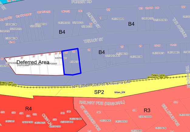
Figure
12: Zoning with the site outlined in
blue
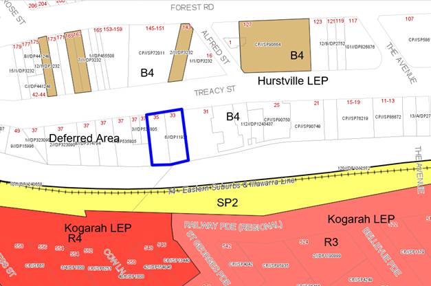
Figure
13: Heritage Items within the
vicinity of the subject site, the site is outlined in blue
Draft Georges
River Local Environmental Plan 2020
130. Consideration
is given to the provisions of Draft Georges River Local Environmental Plan 2020
in the assessment this application.
131. In this regard, the provisions have no
determining weight as a result of proposed operation of Clause “1.8A
Savings provisions relating to development applications” of the Draft
Plan which provides “If a development application has been made before
the commencement of this Plan in relation to land to which this Plan applies
and the application has not been finally determined before that commencement,
the application must be determined as if this Plan had not commenced.”
132. There are no changes proposed to the zoning
and main planning controls relating to the subject site. The only immediate
change is that the adjoining Council owned site to the west (35-49 Treacy
Street) has been rezoned from a “Deferred matter” on the zoning
plan to reflect a B4 zone as per the adjoining sites.
Development
Control Plans
133. Hurstville Development
Control Plan No 2 (DCP 2) applies to the proposed development. The site is
located within the City Centre East Precinct. The proposed development forms
Stage 3 (West Stage) of the Concept Plan Approval granted by the IPC (former
PAC) which has determined the building envelope and configuration of the
development. This consent was granted prior to DCP 2 (Amendment 9) coming into
effect. As such many of the provisions of DCP 2 are not particularly relevant
to the application. An assessment however has been undertaken against the main
provisions which are of relevance to the application and provided in Table 5
below.
Table 6: Compliance against the provisions of HDCP No.2 (Amendment
9)
|
DCP
Standard
|
Control/Proposed
|
Complies
|
|
Section
4.6
City
Centre East
|
This precinct is
characterised by “the extension of the retail strip along Forest
Road and under-utilised development along the railway line in Treacy Street”.
The key land use principles for this area are to promote a mix of land uses,
activation of the streetscapes and the exclusion of residential uses in the
B3 commercial core area to only retail/commercial uses.
|
Yes
|
|
Section
5.2
Building
Form Character Principles
|
A series
of principles that encourage and establish good architectural design and
development that promotes a high urban form outcome and encourages pedestrian
comfort, safety and sustainability.
|
Yes
|
|
Section
5.3
Built
form Controls
|
Site
Amalgamation
General
building floor plate of 900m - 1,000sqm
Proposed
floor plate of 630sqm Although not compliant, Stage 2 and 3 of the
development have smaller floor plates whilst Stage 2 has over 1,00sqm floor
plate. Considering the development will read as part of a much larger
integrated development site the provision is satisfied by meeting the intent
of the criterion.
Min 30m
street frontage – frontage of 24.2m. Although short of the minimum this
is part of a larger consolidated site and this frontage width in this
instance is satisfactory as it will not be read as a separate/independent
building.
The
redevelopment of this site will remove the “fine grain” character
of this street and create a larger consolidated development which is in line
with the objectives of the DCP for redevelopment in the commercial centre.
Housing
mix
Bed-sitters
and one bedroom apartments shall not exceed 25% and not less than 10% of the
development – one bedroom comprise of 17%
Two
bedroom apartments shall not exceed 75% of the development – two
bedrooms comprise of 46%
Three
bedroom apartments shall not exceed 10% of the development – Three
bedrooms comprise of 27%. This exceeds the 10% requirement but is considered
satisfactory given that there is a need for some larger apartments in the
area and the development still allows for an appropriate mix of apartments.
There are no provisions for 4 bedroom apartments and so these are included in
the 3 bedroom count.
Adaptable
dwellings 1 per 10 or there part of.
Total of
41 dwellings so a minimum of 5 dwellings are to be adaptable. – six (6)
dwellings are designated as adaptable (Apartments 201, 301, 401, 501, 601 and
701)
Unit
sizes in accordance with the NSW Residential Flat Design Code (2002) (RFDC)
– the proposal has been designed to generally comply with the ADG which
supersedes the RFDC.
Floor
to ceiling heights
Non-residential
– min 3.6m – Minimum 3.7m
Residential
– 2.7m (3m floor to floor) – minimum 2.7 with floor to floor
heights of 3.05m
Setbacks
Development
within 25m of rail corridors;
Min 1.5m
from rail corridor – setback of the building between 10.6m-13.9m
Basements
may adjoin subject to geotechnical reports and State Rail concurrence –
State Rail has accepted location of the basement.
Balconies
within 20m of the rail corridor need to be enclosed – all rear
balconies have been designed as winter gardens and are enclosed with
associated glazing and louvered features to the satisfaction of State Rail
requirements.
Building
separation is consistent with SEPP 65 requirements for mixed use
developments.
Solar
Access
Demonstrate access to
sunlight is to be substantially maintained so that existing private and
public open spaces, first and second order street footpaths and the existing
windows of all habitable rooms in adjoining buildings receive at least 3
hours of sunlight between 9am and 3pm on 21 June (winter solstice) –
Shadow diagrams show compliance with Council’s provisions. Properties
to the south along Railway Parade are affected by the development during the
winter solstice. There is no affectation to properties to the north along
Treacy Street or to the apartments in the Central Stage (Imperial
Hurstville). The area of communal open space (sky terrace) within the
Imperial Hurstville development is located on Level 8 and Level 9 will be
unaffected by any overshadowing until 3pm in midwinter. From about 11am to
1pm in the afternoon the shadow cast will not directly impact on any property
and affect the street and rail corridor.
Visual amenity
Privacy and overlooking
is minimised by offsetting windows and including privacy screens – the
building has been designed so that there are no adverse overlooking created
by the apartment location, design and orientation. Also the sides have blank
walls.
Acoustic and vibration
amenity
Layout of apartments
needs to consider noise transmission and a Noise and Vibration Assessment may
be required. – An assessment report has been prepared and suggests ways
to reduce noise transmission (discussed earlier in this report)
Entrances and lobbies
Need to be clearly
visible, identifiable – the entry lobby is centrally located and is
highly visible and easy to identify and large and formal.
Balconies
Each dwelling have a
minimum of one balcony with a depth of 2.5m – every unit includes a
balcony with minimum width of 2m and the larger apartments have the primary
balcony width of 2.5m in accordance with the ADG requirements which override
these controls.
Awnings
Awnings must be
cantilevered and have a minimum height of 3.2m – this can be satisfied
however the awning needs to be consistent with the awnings included along the
Central and East Stage buildings. A condition will ensure compliance with
Council’s specifications and consistency with the awning to the
adjoining developments.
Active street
frontages
Active
land uses included at the ground floor level – two retail tenancies are
proposed at the ground floor which is compliant.
Crime
Prevention through Environmental Design (CPTED)
The
proposal is designed to minimise any potential for criminal behaviour.
Natural and causal surveillance is encouraged through the design and camera
surveillance and security measures will be implemented including sensitive
lighting to ensure safety and security is maintained.
Landscaping
Prepare
a detailed Landscape Plan and utilise species which are hardy and indigenous
to the area. – Landscape plan provides suitable planting and vegetation
across the site.
Planting
on structures
Minimum
1000mm depth for tree planting and 500mm depth for shrub planting – The
deep soil area at the rear includes over 2m of soil so it can cater for the
planting of larger trees and shrubs particularly along the boundary to create
screening.
Site
Servicing
Ensure
all key services (air conditioning units, drying areas, storage areas are all
appropriately screened). – most services have been sensitively designed
and well located. Conditions will ensure these services are appropriately
screened.
Every apartment
should have individual or communal drying areas – every apartment has a
separate laundry
Provide
minimum of 10sqm per dwelling for storage – this is quite a large room
and is not feasible in most contemporary developments. The development provides
for dedicated internal storage spaces within the apartments which are
compliant with SEPP 65 provisions as individual storage cages are also
provided in the basement.
Electrical
substation
Cater
for the requirements of these services – the proposal relies on the
existing substation which services the larger development and located as part
of the central site.
|
No but
acceptable
No but
acceptable as an infill development and the final stage of an integrated 3
stage redevelopment
Partial
non-compliance but acceptable.
Yes
Yes
Comply
with ADG
Yes
Yes
Yes
Yes
Satisfactory
Satisfactory
Yes
Yes
– subject conditions
Yes
No but
compliant with ADG
Yes
Yes
Yes
Yes
subject to conditions
Yes
Yes
Yes
Yes
|
|
5.4
Transport,
Traffic, Parking and Access
|
The “Hurstville
City Centre Transport Management and Accessibility Plan (TMAP),13 June 2013
”, has been used to inform the planning controls for the City Centre
and has ensured a co-ordinated and efficient approach to planning of land use
and transport infrastructure in the centre. The TMAP was endorsed by Council
on 13 June 2013.
Developments need to
provide the following documents to support their proposal;
Transport and Parking
Assessment – this has been prepared by The Transport Planning
Partnership and dated 23 August 2018. In terms of parking provisions and
compliance with Australian Standards the proposed car parking arrangement is
satisfactory. In terms of traffic generation the development generates a
total of 11 trips per am peak and 10 trips per pm. The report concluded that
“the estimated traffic of 11vph (which translates to 1 additional
vehicle movement every 5min) creates an additional 3% to the traffic volumes
passing through the site (this is based on the traffic counts conducted by
Lyle Marchall and Associates in 2010 accompanying the Concept Approval).”
It is recognised that since that time traffic volumes have increased in the
vicinity of the site due to new larger scale developments being constructed.
However the density of this redevelopment was envisaged and anticipated when
the Concept Approval was determined. The total traffic generation is not
considered to be significant from this development and although there may be
some added pressure on key intersections it is unlikely it will significantly
affect their overall performance. The performance of most adjoining intersections
at the time of the concept approval was an A to C level of service. Although
they may have been impacted by developments in the centre it is unlikely they
are operating at F levels of service nor is it anticipated that the traffic
generated by this development will have a critical impact to these.
Council’s Traffic
Engineer reviewed the reports and raised no objection to the proposed design,
layout and conclusions of the report and plans submitted with the
application. A condition has been imposed to ensure that mirrors are
constructed at every opening within the basement to assist with visibility to
and from the driveways.
Construction
Management Plan – A condition will require the preparation of this
document prior to issuing the Construction Certificate.
A Travel Plan is
required if the development exceeds 50 dwellings – N/A for the density
proposed.
Bicycle storage
– 1 space per 300sqm of retail space and 1 space for every 3 units. A
total of 15 bicycle spaces are required. 16 spaces are catered for within the
basement levels.
Car parking rates
Retail – 1 space
per 50sqm
Residential - 1
space per 1 or 2 bedroom dwelling
2 spaces per 3 bedroom
dwelling
1 space per 4 dwellings
(or part thereof) for visitors
Development generates the
need for 5 retail spaces and 67 residential spaces – Development
provides 7 retail spaces and 67 residential spaces. (refer to Table 4 for
full calculation).
Minimum of 1 accessible
space per adaptable dwelling. Six (6) adaptable dwellings are proposed. Six
(6) for the residential, one (1) for visitors and one (1) for the retail.
Car wash bay – One
(1) car wash bay is required and can be doubled up as a visitor space. A
condition will ensure a space is designated for this purpose and
appropriately sign posted.
Vehicular Access
This is proposed through
the Central stage (Imperial Hurstville building) eastern side of the site and
this has always been the intention and purpose of access through to this site
as envisaged by the Concept Approval. A detailed discussion on this issue is
addressed in the Submissions section of this report.
The registered strata
plan for the Central stage includes several easements which allow for future
access to be created through to the western side (subject site). The
development plan aligns with the approved strata plan and the concept
approval plan. Driveway widths, gradients and points of access are consistent
and compliant with Australian Standards. The site is too narrow to permit
entry within the site boundaries. A new vehicular access point off Treacy
Street would compromise the density permitted on the site and would create
conflicts and remove some critical retail area on the ground floor. In
addition turning circles within the basements would not be able to be
achieved.
Loading/Unloading
New
developments must cater for and design an area for loading and unloading. The
proposal will share the existing loading bay within the Central Stage which
provides easy and convenient access to the building. Easements already exist
in this regard.
|
Yes
– satisfactory
Yes
subject to conditions
N/A
Yes,
however they have not been allocated to a use.
Yes
Yes
Yes
subject to conditions
Yes
satisfactory
Yes
satisfactory
|
|
6.1
Public
Domain
|
Street
trees
Select
trees with a mature height and spread which is appropriate to the scale of
the street. – A condition will require the retention and protection of
the existing street tree and the provision of a new tree adjoining it and
planting shall be in keeping with the Hurstville City Centre Public Domain
Plan 2007.
Street
furniture
A
condition will require the Applicant to prepare a detailed Public Domain Plan
which looks at paving, planting and street furniture treatment that is
consistent with the adjoining integrated development.
Paving,
Culture and Public Art
The design of public art
to be in accordance with the Hurstville City Centre Public Domain Plan
– A condition will require the provision of public art across the
western elevation of the building adjoining the public car park for the
ground and first floor level. The Applicant shall liaise with Council as to
the type of street art to be adopted and implemented and shall borne the cost
of this works. This will break up the bulk and scale of the wall and will
improve the visual appearance of this element when viewed from the street and
key public spaces.
Signage
No advertising signage is
proposed just a standard identification signage at the front that will denote
the name and number of the building assisting visitors.
Waste Management
The proposal provides a
dedicated residential and retail waste room along the ground floor behind the
retail areas. A Hoist has been included which allows for bins to be moved
down the Basement 1E where they can be collected from the garbage collection
area in the Central Stage (easements for this already exist). The calculation
of the amount of bins that is required is discussed later in the report and
is supported by a condition if consent is issued.
Wind
Mitigation
A wind
effects report is required. This report has been submitted and assessed
earlier in this report to be acceptable.
|
Yes
subject to conditions
Yes
Yes
subject to a condition
N/A
Yes
Satisfactory
|
|
6.3
Development
of a Heritage Item or in the vicinity of a Heritage Item
|
The
proposal needs to satisfy Clause 5.10 of the HLEP. This issue has been
addressed earlier in more detail and the impact of the proposal is considered
satisfactory and reasonable from a planning and heritage perspective.
|
Yes
|
Interim Policy – Georges River Development Control Plan 2020
134. Council
at its Environment and Planning Committee Meeting dated 24 June 2019 resolved to adopt
the Georges River Interim Policy DCP.
135. The Interim Policy is a
public policy that is to be used as a guide to set a consistent approach for
the assessment of residential development within the LGA. It is a supplementary
document, meaning that current DCP controls
will prevail if they are considered best practice. The Interim Policy has no
statutory recognition in the assessment of DAs pursuant to the Environmental
Planning and Assessment Act, 1979 (EP&A Act).
136. The Policy refers to
controls relating to dwelling houses, dual occupancy and residential flat
building developments. It does not alter or change the provisions for mixed use
developments or “shop top” housing developments; therefore the
Policy in this case is not applicable.
Developer Contributions
137. The
proposed development, if approved, would require the payment of developer contributions under Section 7.11 of the Environmental Planning and Assessment Act
1979 as the proposal is increasing the density of the locality by the
construction of 41 new apartments with a credit for two (2) existing lots. If
the development was to be approved a condition outlining the required
contributions would be imposed. The monetary contributions are as follows;
138. Contribution
for Open Space of $547,309.29
Contribution
for City Centre Improvements of $34,342.38
Contribution
for Community Facilities of $77,404.97
139. Total
contribution of $659,056.64 is applicable. A condition is imposed to
ensure this monetary contribution is paid prior to the issuing of the
Occupation Certificate.
140. A
Ministerial direction has been issued and changes made to the Environmental
Planning and Assessment Regulation 2000 that will allow developers to pay
all contributions prior to an occupation certificate being issued, instead of
up-front before construction commences. The directions have been
made following changes to the Environmental Planning and Assessment Act 1979 (EP&A Act) in response to the COVID-19 pandemic.
141. The Department has also prepared a
planning circular on a new requirement under the Environmental Planning
and Assessment Regulation 2000 (the EP&A Regulation). Certifiers are
now required to obtain a document from the local council or the Department of
Planning, Industry and Environment (for special infrastructure contributions)
confirming the payment of infrastructure contributions prior to the issuing of
Occupation Certificates.
142. This change is only temporary to help kick-start
the NSW economy, is applicable for projects with a construction cost of
$10 million or more, and existing development consents where infrastructure
contributions have not yet been paid, and proponents will have until September
2022 to make use of deferred payment provisions.
IMPACTS
Natural
Environment
143. The
proposed development does not involve excavation other than what will be
required for piers/footings/pads for the development. The proposal is unlikely
to adversely impact on existing drainage patterns and soil stability in the
locality. The site currently has no vegetation, but the proposed development
will include a communal open space area and a tree to the street frontage which
will improve the current site conditions. It is therefore considered unlikely
that the proposal will have adverse impacts on the natural environment.
Built
Environment
144. The
proposed development is unlikely to have an adverse impact on the built
environment. The proposed development is consistent with the Concept Plan
Approval granted for the site which has determined the building envelope and
configuration of the development. The proposed development complies or exceeds
the requirements of the Apartment Design Guide and results in high amenity for
the dwellings.
Social
Impacts
145. The
proposed development has no perceived adverse social impacts.
Economic
Impacts
146. The
proposed development will provide positive economic impacts in the short term
through the investment and injection to the construction industry. Through the
estimated 15 month construction period a total of approximately 350 people will
be employed in respect to this project.
Suitability
of the Site
147. The
subject site has no major impediments that preclude it from being developed for
the proposed development. Subject to the remediation of the site it is considered
it is suitable for its intended use.
Referrals
Council
Referrals
Traffic
Engineer
148. The
proposal was referred to Council’s Traffic Engineer. Council’s
Engineers reviewed the Traffic and Parking Assessment that was submitted with
the application, prepared by The Transport Planning Partnership and dated 23
August 2018.
149. No
objection was raised to the proposed parking and access arrangements. The
parking and assessment report that was prepared with the Concept Approval and
with the Central Stage development application acknowledged the impact of the
expected increase in density across the development site and anticipated there
will be some impacts and increases in traffic in the immediate area.
150. The
Safety Audit that was prepared and accompanied the Central Stage development
considered the general impact on immediate intersections and crossings and
found that at the time they were operating at a Level of Service (LOS) of A or
B which is very good. There is no doubt that at peak times the LOS of the
intersections will be reduced due to the additional traffic but it is not
considered that the will fail due to the density proposed (41 additional
dwellings). The traffic issues in the locality can only be addressed in a
holistic, strategic and integrated manner by the preparation of a
Transportation Management Plan which considers the strategic development of an
area as a whole and suggests infrastructure and public works that assist in
reducing queuing around intersections, traffic calming and other mechanisms to
improve traffic flows around the area.
151. The
fact that the development adjoins a public car park is beneficial and this
alleviates a large degree of on street parking pressures and conflicts as it
caters for a large amount of vehicles to be able to park and utilise this area.
Environmental
Health
152. The
application was referred to Council’s Environmental Health section for
comment including a review of the Remediation Action Plan. No objection was
raised subject to the imposition of a series of standard conditions if consent
is to be issued.
Landscape
Officer
153. The
application was referred to Council’s Consultant Arborist for comment. No
objection was raised in respect to the proposed design of the proposal.
Standard conditions are to be implemented if consent is to be granted. Specific
conditions are imposed to ensure the street tree will be retained and
maintained and protected during construction work.
Building
Services
154. The
application was referred to Council’s Building Services section for
comment. No objection was raised subject to the implementation of a series of
standard conditions.
Waste
155. The
disposal of waste within the development relies on a garbage chute system which
feeds down into two (2) x 240L mobile bins located on the ground floor in the
designated waste storage area. The chute system will be mechanically operated
by a diverter (splitter) system which will require inspection once a day to
ensure the bins do not overflow. The Waste Management Plan (WMP) that
accompanied the application prepared by Dickens Solutions and dated August
2018, stipulates the process of waste removal during demolition, construction
and the ongoing waste removal when the building is completed and occupied.
156. A
Bulky Goods Waste Storage room has also been designed and measures 2.5m x 2.5m,
fully enclosed and adjoins the waste room.
157. The
waste arrangement relies on the implementation of a hoist system that will send
bins from the ground floor level one level below to B1E where they will enter
the Loading Dock (located within the Central Stage, as part of the Imperial
Hurstville) development and a Private Contractor will then dispose of the waste
and the bins taken back up to the waste room via the hoist. There is no other
way to take bins out other than through the residential lobby which is a highly
undesirable and would be difficult given the large bin size. The strata plan
for the adjoining development (Imperial Hurstville) envisaged a series of
shared access provisions when the concept approval was issued and has been
catered for as “easements” in the Strata Plan.
158. At
the time of preparing the Waste Management Plan it wasn’t anticipated
that the site required remediation, the waste management plan will require
updating in relation to demolition and excavation phase to be consistent and in
line with the Remediation Action Plan. A condition will require for this to
occur prior to the issuing of the Construction Certificate.
159. In
respect to the ongoing waste management of the building it is intended to
provide the following to facilitate the intended uses;
- Retail
Waste - 2 x 240L bins which relies on 3 services per week.
- Retail
Recycling – 2 x 240L bins which relies on 2 services per week.
- Residential
Waste – 8 x 240L bins which relies on 3 services per week
- Residential
Recycling – 8 x 240L bins and relies on 2 services per week.
160. The
retail and residential waste arrangement requires 3 services per week and this
is not considered to be suitable solution as both waste and recycling should be
removed twice a week as a maximum. The overall bin capacity is also
insufficient. To accommodate this reduction in servicing the number of bins
will need to be increased. The waste management plan has relied on a larger
capacity as it calculates waste for 44 apartments (whilst there are only 41)
and 3 retail tenancies (whilst there are only 2 proposed). In accordance with
the provisions for waste in the HDCP the following minimum requirements are to
be provided;
- Retail
Waste – 4 x 240L bins
- Retail
Recycling – 2 x 240L bins
- Residential
waste – 13 x 240L bins
- Residential
recycling – 8 x 240L bins
- Green
waste – 1 x 240L bin
161. A
condition will require that the Waste Management Plan will be upgraded to
provide a system of removing waste that is ongoing and relies on a maximum the
2 services per week.
162. No
green waste bin is proposed as the WMP suggests that the Body Corporate will
need to ensure any contractors that will be managing and maintaining areas of
open space will have to remove this waste as part of their contract. It is
considered that a green waste bin should be accommodated which can be filled by
occupants or contractors servicing the building and can easily be taken out to
the street for collection by Council on designated days.
163. The
issues highlighted with waste management are considered to be relatively
straightforward and can be addressed via appropriate conditions as the waste
room and space has the capacity to be enlarged if it needs to.
Stormwater/Drainage
Engineer
164. The
application was referred to Council’s Engineers who raised some issues
with the connection of the proposed stormwater system through to
Council’s kerb and gutter. The design as proposed is not acceptable
however this issue can be addressed via a condition which has been imposed and
reads as follows:
“Referring
to Hurstville DCP 1, Section 3.7.3, Part A for Development Requirements,
development sites greater that 700sqm in area must discharge stormwater into
Council’s stormwater system. A gully pit with 2400mm lintel is to be
constructed at this location. If no pipe line exists, a new pipe line must be
constructed to discharge stormwater. Please note that a drainage application
under Section 68 of the Local Government Act 1993 and Section 138 of the Roads
Act 1993 is required to get approval to connect to Council’s drainage
system.
The stormwater
plans shall be revised and submitted to Council’s Asset Engineer
satisfying the following.
· A new
375mm diameter RCP drainage line shall be designed and constructed along Tracey
Street from the site to the nearest kerb inlet pit. This is to ensure
Council’s requirements are met.
· The
proposed drainage along Treacy Street shall be documented on a detailed
features survey plan that describes all existing structures, utility services,
vegetation and other relevant information.
· The inlet
pits shall be cast-in-situ and conforming to Council's standard drainage pit
details.
· The
minimum distance from the lintel to the near end of the splay of the driveway
at kerb line shall be at least 500mm.
· A
drainage system longitudinal section drawn at a scale of 1:100 or 1:200
horizontally and 1:10 or 1:20 vertically and showing crossing utility services,
pipe size, class and type (minimum class 2), pipe support type in accordance
with AS 3725 or AS 2032 as appropriate, pipeline chainages, pipeline grade,
hydraulic grade line and any other information necessary for the design and
construction of the drainage system.”
165. Other
standard engineering conditions are to be imposed if consent is to be granted.
Heritage
Officer
166. The
site is located within the vicinity of a few local designated heritage items.
In accordance with Clause 5.10 of the HLEP, an assessment of the proposed
development and its impact on the items is required. This issue was considered
in detail earlier in this report. Council’s Heritage Officer has reviewed
the Applicant’s Heritage Assessment and concurs with the report in that
there is no adverse impact generated to the items.
External
referrals
Sydney Trains
(RailCorp)
167. The
application was referred to Sydney Trains (RailCorp) for concurrence. Formal
concurrence has been issued subject to conditions if consent is to be granted.
Similar conditions were imposed on the consents issued for Stage 1 (Central)
and Stage 3 (East) buildings.
Sydney Airports
168. This application was referred to Sydney Airport for
comment. Although the proposal will not penetrate the prescribed airspace for
Sydney Airport it does not constitute the need for a ‘controlled
activity’ within the meaning of Division 4 of Part 12 of the Airports Act
1996. However, the development exceeds the 15.24m existing ground height
(AEGH) and comment is required from this Authority.
169. No objection is raised in respect to the proposed
development subject to the Applicant obtaining approval for a crane which is
included as a condition if approval is granted. Any increases to the
overall height of the building will require referral to this Authority.
Ausgrid
170. The application was referred to Ausgrid for comment on 17
September 2018 in accordance with Clause 45 of the Infrastructure SEPP. To date
no response has been provided and given the timeframe concurrence can be
assumed.
Water NSW
171. The
application was referred to Water NSW for comment as the development may fall
within the “Integrated” development provisions in accordance with
Sections 89 and 91 of the Water Management Act, 2000. The proposal relies on
excavation to accommodate five (5) basement levels and the Geotechnical
assessment states that ground water may be found 12-16m below ground level.
Given this situation a dewatering licence may be required and the proposal may
require an activity licence.
172. Water
NSW concurrence is forthcoming and it is recommended that the application be
deferred subject to concurrence being issued from Water NSW.
SUBMISSIONS AND THE PUBLIC
INTEREST
173. The
application was neighbour notified on three occasions in accordance with the
provisions of the Hurstville DCP 2013 for a period of 14 days on three (3)
occasions.
174. The
original notification period occurred between 26 September 2018 until 11
October 2018. A total of three (3) submissions were originally received. A
second round of notification occurred as the occupants of 21-33 Treacy Street
(known also as Imperial Hurstville) were not originally notified. The second
notification period was from 18 September 2019 to 9 October 2019.
175. The third and
final notification period occurred as a result of receiving the Remediation
Action Plan (RAP) which required formal notification and advertising between 6
May 2020 until 5 June 2020. This generated a significant amount of submissions
with no objections being raised in respect to the RAP itself but rather to the
development and its direct impact on the adjoining development to the east The
Imperial Hurstville building (21-33 Treacy Street).
176. Combined, one
hundred and thirty nine (139) pro-forma letters were received with 80
individual submissions so in total two hundred and nineteen (219) submissions
have been received.
177. A
summary of the issues raised by all the submissions received by Council are
provided below.
· Inadequate eastern side setback from
the Imperial Hurstville building.
178. Comment:
The proposed building is to be built to the eastern boundary to 23-31 Treacy
Street. This is consistent with the built form outcome envisaged by the Concept
Approval. A Nil side setback between all three (3) buildings reflects the
approved design outcome for this site.
· Lack of open space and green
landscaped area
179. Comment:
The amount of deep soil area and the total area of open space (on the ground
floor at the rear and roof top) satisfies the provisions and minimum numerical
requirements stipulated within the Apartment Design Guide (SEPP 65). The area
has been well designed, is functional and contributes to the overall amenity of
the development. Again the areas of open space are reflective of the approved
Concept Plan. Additional conditions are imposed to improve the visual
appearance and functionality of these spaces to enhance their appeal as
“green spaces” however the changes are considered minor.
· Loss of sunlight to apartments in
Imperial Hurstville (in particular Unit 731)
180. Comment:
Apartment 713 is located adjacent to the large communal area of open space
(refer to Photo 5 below). The apartment is recessed but its main orientation is
to the north and as such receives good solar access. The construction of the
building will reduce the amount of light entering the apartment in the
afternoon, however, a minimum of 3 hours of solar access will be received
during the day which satisfies the assessment criterion for Residential Flat
Buildings.
Photo 5: Units on Level 7 and
8 in the Imperial Hurstville building which adjoin the garden terrace level,
proposed development will include a wall along the western side.
· Adverse impact creating an unsafe
environment and relationship at Level 7 to the adjoining building.
181. Comment:
The building has been designed to comply with the built form outcome
anticipated by the Concept Approval. The west stage building will be similar to
the east stage building that has been completed and this outcome is consistent
with the approval. There are no openings located along the eastern side on
Level 7 and 8 that adjoin the sky terrace of the Imperial Hurstville building.
The relationship between the new building and the existing building and rooftop
area of open space is considered to be satisfactory. Granted there will be some
view loss to the west, the northern views will be retained which are important
and more iconic and the apartments along this level are largely focused and
orientated towards the north.
· Structural Integrity of the building wall
to Imperial Hurstville will be compromised by the proposed access arrangements
and new openings.
182. Comment:
A large proportion of occupants within the adjoining building (Imperial
Hurstville) are concerned about the impacts of the development on the
structural stability and integrity of the existing building given that new
openings are to be created within the existing structural wall and given a new
five level basement is to be constructed which will create more instability
onto the existing building structure.
183. The original
concept approval anticipated that there will be new openings within the Central
stage building along the eastern and western side of the building. The Central
Stage approved (DA2014/1066) plans indicated potential future openings within
the wall to cater for vehicular and/or pedestrian access through the central
stage development (refer to the approved Basement 1A/1B plan below in Figure
12). The approved strata plan for the Central Stage includes easements for the
driveway access through the development and caters for openings within the wall
for vehicles to access the basement levels at 33-35 Treacy Street.
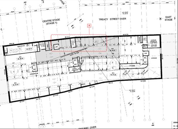
Figure 12: Approved basement
1A/1B plan for Central Stage building showing future cut outs on the western
and eastern boundaries to accommodate future access for the East and West
Stages (courtesy: Frank Stanisic, 2015)
· Increased parking and traffic
congestion
184. Comment:
The proposed increase in density will generate more traffic movements and
activity in the streetscape and in the immediate area than what was envisaged
at the time the concept approval was assessed and consented to. Given that
Treacy Street is located on the periphery of the Hurstville Town Centre, the
impacts are not direct but rather secondary. The traffic report submitted with
the application calculated that traffic generated by the development is some 11
additional vehicle movements in the am peak and 10 in the pm peak. This
isn’t considered to be significant or create adverse delays or conflicts
at key intersections.
185. The Concept
Approval in 2012 always envisaged this higher density in this area and the
subsequent approvals of other larger scaled mixed uses in the commercial area
have increased traffic and congestion in the area. The cumulative impact of
parking and traffic impacts should be considered in a more holistic way and
every individual development will find it difficult to correct impacts
generated by a series of developments. Town Centres are constantly faced with
the challenge of accommodating larger scaled developments and managing the
longer term impacts. By in large Council’s policies around parking
numbers and generation should assist in providing a longer term targeted
program to ease congestion and manage traffic impacts during certain times.
186. The development
comprises of 41 apartments and the traffic generated by this number of
dwellings is not considered to be significant. It will no doubt create some
added pressure on key intersections but this is not considered to be at a level
that is unmanageable.
· Existing leaks in the car park of
No.21-33 Treacy Street and the impact of this development may worsen this
situation
187. Comment:
If there are current building construction issues and deficiencies these are
issues that need to be rectified with the Builder under their insurance policy.
The proposed development includes a Geotechnical report which outlines the
method of excavation and piering/piling that will need to occur to create a
structurally secure building. Appropriate conditions will be included to ensure
the excavation and construction is safe and structurally viable.
188. The proposed
development does not rely on the adjoining building wall for structural
stability. It will have its own wall along the common boundary and will require
separate piling within the boundary of the subject site. Conditions will
require a detailed assessment by a qualified Structural Engineer prior to
construction and during construction. Conditions are imposed to ensure
structural stability of the existing building and the new works occurs as
Council does appreciate the sensitivity around building and construction
matters in the current environment. The East stage development successfully
achieved this through a number of openings within the Central Stage similar to
what is proposed.
· Increased safety concerns as more
people will be accessing the basement areas (new boomgates, cameras etc)
189. Comment:
Although there will be some more people accessing the basement of the Imperial
Hurstville, they are only using the driveway to access the subject site, they
will not be parking in this development. The only other shared use is the
loading bay which will allow for waste removal and assist with any deliveries
to the premises. A condition will require the creation of easements in relation
to the use of the driveway and loading bay and a Plan of management will need
to be prepared prior to the Construction Certificate being issued to resolve
these issues and the management of them moving forward.
190. The L13 rooftop
area of open space is also communal for the whole development so the strata
plan needs to acknowledge this element as well.
· Increased traffic congestion at the
intersections with The Avenue, Forest Road and Jack Brabham Drive.
191. Comment:
The main intersections that will be used by the occupants and visitors are
Treacy Street and The Avenue and Treacy Street, The Avenue and Forest Road or
Treacy Street and Forest. Traffic will not be able to access Brabham Drive
unless coming from the south as part of this road is one way onto Treacy Street
so it is unlikely many vehicles will use this as it will only capture cars
returning from the south. There are several options for vehicles to use to
leave Treacy Street and enter the town centre or travel north. Given the
options this will disperse traffic flows rather than have all cars utilise one
intersection.
· Increased maintenance costs for the
occupants of Imperial Hurstville as the new development will be utilising some
of their resources ie additional electricity, lighting etc.
192. Comments:
As mentioned above, the proposal requires access through the Imperial
Hurstville building and the Strata Plan for this development SP90749 includes
easements for access utilising the existing driveway, loading bay and allows
for openings within the wall to facilitate this access. It is not envisaged
that there will be any significant additional pressure on utilities such as
lighting and electricity as the vehicles are only using the existing driveway
and established resources. There should not be any additional electricity or
lighting requirements.
· Loss of views and outlook to Units 801
and 813 in the adjoining development.
193. Comment:
Units 801 and 813 located within Imperial Hurstville may lose some western view
but this is not considered to be an iconic or key view/outlook. The outlook
from these units was taken into consideration when the built form of this stage
was assessed as part of the concept approval.
· 23-33 Treacy Street was not notified
of the proposal
194. Comment:
Originally 21-33 Treacy Street were not notified of the proposal. This was
rectified and the adjoining property owners were formally notified and given an
opportunity to comment on two (2) separate occassions. Notification was
conducted in accordance with the provisions of the Hurstville DCP.
· Loss of views and outlook from a
commercial property across the road on Treacy Street
195. Comment:
The properties on the northern side of the street face south and the views and
outlook are limited to the railway line and some medium density residential
developments beyond (located along Railway Parade) and the distant skyline. The
loss of this outlook is not considered unreasonable given these are not iconic
or important views and the development scale, form and height was determined
during the assessment and determination of the concept approval. The outlook
will be replaced with larger scaled mixed use developments which are more
appropriate development in this zone; The existing buildings on the site are in
poor condition and reflect small scale almost industrial like buildings which
are uncharacteristic of commercial development in Town Centres.
· Increase in crime and anti-social
behaviour i.e. more abandoned trolleys
196. Comment:
The development is not encouraging more anti-social behaviour. It is a
well-designed and high quality development which should present well and has
been designed to ensure a safe and crime free environment.
· Retention of the existing street tree
on Treacy Street important.
197. Comment:
A condition is included that maintains the existence of the street tree and
ensures its protection during construction and seeks to ensure its longer term
viability.
· Pavement along 145-147 Forest Street
needs urgent repair
198. Comment:
This issue is not considered to be relevant to this application. The proposal
seeks to improve the pedestrian environment by providing a new pavement that is
consistent with the public domain along this side of Treacy Street. The quality
and amenity of the streetscape will be improved for pedestrians and locals.
· Proposal exceeds the maximum 15m
height limit and the 3:1 FSR.
199. Comment:
The Local Environmental Plan height and Floor Space Ratio controls have been
superseded by the Concept Approval conditions which establish new controls
across the site.
· Access arrangement unsatisfactory from
Central Stage development
200. Comment: As much as the existing
residents are not satisfied with additional vehicles utilising the existing
services and driveway, this was always anticipated as part of the Concept
Approval.
CONCLUSION
201. The
application seeks permission for the demolition of existing structures and
construction of a 13 storey mixed use development (West Stage of approved
Concept Plan). The proposed development has been assessed against the Concept
Plan Approval and relevant environmental planning instruments and development
control plan and is consistent with these requirements. Accordingly, the
application is recommended for an “in-principle” approval subject
to the determination of Modification No.3 application and concurrence of State
Rail and Water NSW. If these issues are satisfactorily addressed the
application should be approved subject to the “draft” conditions of
consent attached to this report.
DETERMINATION
AND STATEMENT OF REASONS
Statement of
Reasons
202. The
reasons for this recommendation are:
· The proposal
generally satisfies the conditions, requirements and commitments of the Concept
Plan Approval and subsequent Modification application subject to the approval
of the current Modification application which is with the State Government and
is currently “under assessment”
· If this
Modification application is approved the amended design will be in keeping with
the proposed development scheme for this Site. It will also ensure consistency
with the Concept Approval (as modified) and the proposed development.
· Subject to formal
concurrence being obtained from State Rail and Water NSW the development
satisfies the Integrated Development requirements pursuant to the
Infrastructure SEPP and Environmental Planning and Assessment regulation.
· The proposed built
form, scale and density of the development is consistent with the Concept
Approval and approval of this development will finalise the delivery of the
redevelopment of the
· The proposal will
provide additional housing in the Georges River Local Government Area and
provide a mix and diversity of apartment designs and options within a highly
accessible location.
· The proposal is
not considered to create any adverse amenity impacts and when completed and
should improve the visual appearance of the site and have a positive visual
impact to the street and immediate surrounds.
· The proposal
intends to provide a high quality mixed use development within the Hurstville
Commercial Centre.
RECOMMENDATION
203. THAT
pursuant to Section 4.16(1) of the Environmental Planning and Assessment
Act, 1979, as amended, the Georges River Local Planning Panel grants an
“in principle” approval to Development Application No DA2018/0366
for the demolition of existing structures, lot consolidation,
site remediation and construction of a thirteen (13) storey mixed use
development containing two (2) ground floor retail tenancies and forty
one (41) residential apartments above five (5) levels of basement car parking
for a total of seventy four (74) car parking spaces, communal landscaping on
the ground level and at the roof level including associated site works on
Lots 5 and 6 DP1193, known as 33-35 Treacy Street, Hurstville subject to
the following information being provided:
· The Modification
Application (No.MP10_0101 Mod 3) lodged with the Department of Environment and
Planning on 22 July 2020 is approved and plans and documents being consistent
with this approval.
· Formal concurrence
received from State Rail.
· Formal concurrence
received from Water NSW.
· The draft conditions
attached to this report are to be updated to reflect any changes and additional
conditions and requirements stipulated by Government Agencies.
Once the
above information is provided and satisfied the Panel delegates responsibility
to the Manager Development and Building to issue the formal development
consent.
204. If
the modification application (Mod 3) before the State Government is refused or
approved in a modified form, the Applicant will be provided with the
opportunity (21 day period) in which to amend the Development Application and
an updated electronic report provided to the Panel within thirty (30) days of
receipt of the revised plans.
205. If
the Applicant decides not to amend the application and Council decides to
refuse the application the Panel delegates this decision to the Manager
Development and Building.
DRAFT
DEVELOPMENT CONDITIONS
DEVELOPMENT
DETAILS
1. Approved
Plans - The development must be implemented in accordance with the approved
plans and supporting documentation listed below which have been endorsed by
Council’s approved stamp, except where marked up on the plans and/or
amended by conditions of this consent:
(note: plan numbers may need to be altered to reflect the Mod 3 plans
if approved)
|
The following
architectural plans prepared by Stanisic Architects
|
|
Description
|
Reference No.
|
Date
|
Revision
|
|
Cover Sheet
|
DA 00
|
16/07/2018
|
Issue 9
|
|
Location Plan
|
DA 01
|
15/06/2018
|
Issue 7
|
|
Context Analysis
Plan
|
DA 02
|
15/06/2018
|
Issue 8
|
|
Site Analysis
Plan
|
DA 03
|
15/06/2018
|
Issue 7
|
|
Site Plan
|
DA 04
|
15/06/2018
|
Issue 8
|
|
B3, B2 Plans
|
DA 05
|
30/07/2018
|
Issue 9
|
|
B1, B1C Plans
|
DA 06
|
30/07/2018
|
Issue 10
|
|
Level 1 (Ground)
Plan
|
DA 07
|
30/07/2018
|
Issue 9
|
|
B1E, B1D, L1, L2
Plans
|
DA 08
|
1/08/2018
|
Issue 12
|
|
L3, L4, L5, L6
|
DA 09
|
13/07/2018
|
Issue 9
|
|
L7, L8, L9, L10
|
DA 10
|
15/06/2018
|
Issue 8
|
|
L11, L12, L13,
Roof
|
DA 11
|
13/07/2018
|
Issue 10
|
|
North Elevation
|
DA 12
|
1/08/2018
|
Issue 10
|
|
South Elevation
|
DA 13
|
1/08/2018
|
Issue 11
|
|
West Elevation,
Section A-A
|
DA 14
|
1/08/2018
|
Issue 10
|
|
Section B-B
|
DA 15
|
13/07/2018
|
Issue 10
|
|
Cross
ventilation Diagrams
|
DA 19
|
16/07/2018
|
Issue 10
|
|
Common open space Diagram
|
DA 20
|
1/08/2018
|
Issue 7
|
|
Adaptable Unit – Pre and Post
Adaptable
|
DA 23
|
16/07/2018
|
Issue 9
|
|
The following
structural plans prepared by Australian Consulting Engineers
|
|
Description
|
Reference No.
|
Date
|
Revision
|
|
General notes sheet 1 of 3
|
S0000
|
24/05/2018
|
B
|
|
General notes sheet 2 of 3
|
S0001
|
24/05/2018
|
A
|
|
General notes sheet 3 of 3
|
S0002
|
24/05/2018
|
A
|
|
Shoring Plan
|
S0100
|
28/05/2018
|
C
|
|
Shoring Elevations
|
S0101
|
28/05/2018
|
C
|
|
Shoring Details 1 of 2
|
S0102
|
28/05/2018
|
B
|
|
Shoring Details 2 of 2
|
S0103
|
28/05/2018
|
A
|
|
Railway Profile Sections
|
S0104
|
24/05/2018
|
A
|
|
Monitoring Plan
|
S0105
|
28/05/2018
|
A
|
|
Basement B3A and B3B Slab on Ground
|
S0300
|
24/05/2018
|
A
|
|
Basement B2A and B2B
|
S0400
|
24/05/2018
|
A
|
|
Basement B1A and B1B
|
S0500
|
24/05/2018
|
A
|
|
Basement B1C and B1D
|
S0600
|
24/05/2018
|
A
|
|
Basement B1E
|
S0700
|
24/05/2018
|
A
|
|
Ground Floor Slab Plan
|
S0800
|
24/05/2018
|
A
|
Also the following plans and documentation:
|
Landscape Plans Drawing No.s 1-6 Rev E prepared by
Distinctive Living Design, Drawing No.s 23-18.00- 23-18.05 and dated 3 August
2018
|
|
Statement of Heritage Impact prepared by Cracknell and
Lonergan, dated 13 June 2018
|
|
Stormwater Drawings dated 23 September 2018 prepared by
Australian Consulting Engineers
|
|
Survey Plan dated 22 November 2010 and prepared by Danny
Linker and Co and Survey Plan prepared by Lockley Land Titles Solutions,
reference 34357DT and dated 28 August 2011
|
SEPARATE APPROVALS REQUIRED BY
OTHER LEGISLATION
2. Section
138 Roads Act 1993 and Section 68 Local Government Act 1993 – Unless
otherwise specified by a condition of this consent, this Development Consent
does not give any approval to undertake works on public infrastructure.
Separate approval is required under Section 138 of the Roads Act 1993
and/or Section 68 of the Local Government
Act 1993 for any of the following activities carried out in,
on or over a public road (including the footpath) listed below. This approval
is to be obtained from RMS.
An application is required to be lodged and approved prior to the
commencement of any of the following works or activities;
(a) Placing or
storing materials or equipment;
(b) Placing or
storing waste containers or skip bins;
(c) Erecting
a structure or carrying out work
(d) Swinging or
hoisting goods over any part of a public road by means of a lift, crane or the
like;
(e) Pumping
concrete from a public road;
(f) Pumping
water from the site into the public road;
(g) Constructing a
vehicular crossing or footpath;
(h) Establishing
a “works zone”;
(i) Digging
up or disturbing the surface of a public road (e.g. Opening the road for the
purpose of connections to utility providers);
(j) Stormwater
& ancillary works in the road reserve; and
(k) Stormwater
& ancillary to public infrastructure on private land
(l) If
any excavation is to be supported by the use of below ground (cable) anchors
that are constructed under Council’s roadways/footways.
These separate activity approvals must be obtained and evidence of the
approval provided to the Certifying Authority prior to the issue of the Construction
Certificate.
The relevant Application Forms for these activities can be downloaded
from Council’s website www.georgesriver.nsw.gov.au.
For further information, please contact Council’s Customer Service Centre
on (02) 9330 6400.
3. Below
ground anchors - Information to be submitted with S68 Application under LGA
1993 and S138 Application under Roads Act 1993 - In the event that the
excavation associated with the basement carpark is to be supported by the use
of below ground (cable) anchors that are constructed under Council or RMS
roadways/footways, an application must be lodged with Council or RMS under
Section 68 of the Local Government Act 1993 and the Roads Act 1993 for
approval, prior to commencement of those works.
The following details must be submitted:
a) That cable anchors will be
stressed released when the building extends above ground level to the
satisfaction of Council;
b) The applicant has indemnified
council from all public liability claims arising from the proposed works, and
provide adequate insurance cover to the satisfaction of Council.
c) Documentary evidence of such
insurance cover to the value of $20 million;
d) The applicant must register a
non-terminating bank guarantee in favour of Council. An amount will be
determined when the application is lodged;
e) The guarantee will be
released when the cables are stress released. In this regard it will be
necessary for a certificate to be submitted to Council from a structural
engineer at that time verifying that the cables have been stress released.
f) In the
event of any works taking place on Council’s roadways/footways adjoining
the property while the anchors are still stressed, all costs associated with
overcoming the difficulties caused by the presence of the ‘live’
anchors will be borne by the applicant.
4. Vehicular
Crossing – Major Development - The following road frontage works
shall be constructed in accordance with the specifications issued under the
“Application for Driveway Crossing and Associated Works on Council Road
Reserve” Approval issued by Council’s Assets and Infrastructure
Division.
(a) Construct a new footpath for the full length of the frontage
of the site on Treacy Street in accordance with Council’s Specifications
applying at the time construction approval is sought.
(b) The thickness and design of the driveway shall be in
accordance with Council’s Specifications applying at the time
construction approval is sought.
(c) Any existing vehicular crossing and/or laybacks which
are redundant must be removed. The kerb and gutter, any other footpath and turf
areas shall be restored at the expense of the applicant. The work shall
be carried out in accordance with Council’s specification, applying at
the time construction approval is sought.
A private contractor shall carry out the above work, at the expense of
the applicant and in accordance with Council’s Specification for Driveway
Crossings and Associated Works.
The driveway and road frontage works are to be completed before the issue
of the Occupation Certificate.
5. Road
Opening Permit - A Road Opening Permit must be obtained from Council and/or
RMS for every opening of a public road reserve to access services including
sewer, stormwater drains, water mains, gas mains, and telecommunications before
the commencement of work in the road.
REQUIREMENTS OF CONCURRENCE, INTEGRATED AND OTHER GOVERNMENT
AUTHORITIES
6. Sydney
Water – Tap in TM - The approved plans must be submitted to a Sydney
Water Tap inTM to determine whether the development application will affect Sydney
Water’s sewer and water mains, stormwater drains and/or easements, and if
further requirements need to be met. The approved plans will be
appropriately endorsed. For details please refer to ‘Plumbing,
building and developing’ section of Sydney Water’s web site at www.sydneywater.com.au then see
‘Building’, or telephone 13000 TAP IN (1300 082 746). The
Certifying Authority must ensure that a Tap inTM agent has appropriately
stamped the plans prior to the issue of the Construction Certificate.
7. Notice
of Requirements for a Section 73 Certificate - A Notice of Requirements of
what will eventually be required when issuing a Section 73 Compliance
Certificate under the Sydney Water Act 1994 must be obtained from Sydney Water
Corporation.
Application must be made through an authorised Water Servicing
Co-ordinator. Please refer to the ‘Plumbing, building and
developing’ section of the web site www.sydneywater.com.au then refer to
‘Providers’ under ‘Developing’ or telephone 13 20 92
for assistance.
Following application, a ‘Notice of Requirements’ will
advise of water and sewer infrastructure to be built and charges to be
paid. Please make early contact with the Co-ordinator, as it can take
some time to build water/sewer pipes and this may impact on other services and
building, driveway or landscape design.
The Notice of requirements must be submitted prior to the commencement
of work. A Section 73 Compliance Certificate will be required at the completion
of development in accordance with further conditions.
8. Electricity
Supply - An application is required to be made to Ausgrid for a network
connection. This may require the network to be extended or its capacity augmented.
Evidence of this application being lodged with Ausgrid is required to be
provided to the Certifying Authority prior to the issue of a Construction
Certificate. For further details, you are advised to contact Ausgrid on 13 13
65 or www.ausgrid.com.au (Business and Commercial Services).
9. Electricity
Supply to Development – The electricity supply to the development
must be underground.
10. Sydney
Trains – The following requirements need to be satisfied;
(i) Insert conditions when concurrence issued.
11. Sydney
Water – The following General Terms of Approval (GTA’s) for
dewatering shall be satisfied;
(i) Groundwater
shall not be pumped or extracted for any purpose other than temporary
construction dewatering at the site identified in the development application.
(ii) An
authorisation under the relevant water legislation, such as a Water Access
Licence (WAL) shall be obtained for the take of groundwater as part of the
activity. For avoidance of doubt, these terms do not represent any
authorisation for the take of groundwater, nor do they constitute the grant, or
the indication of an intention to grant, any WAL.
(iii) An
authorisation under the relevant water legislation, such as an Approval, is
also required for the works involved in extracting the groundwater. For
avoidance of doubt, these terms do not represent any authorisation for the
construction or installation of such works.
(iv) The
relevant works must not be carried out. Installed or operated until a
specialist hydrogeological assessment has been completed by the Department of
Planning Industry and Environment which concludes that adequate arrangements
are in force to ensure that no more than minimal harm will be done to any water
source, or its dependent ecosystems as a consequence of the construction or use
of the proposed water management work.
(v) The
design and construction of the building must prevent any take of groundwater
after the authorisation has lapsed by making any below-ground levels that may
be impacted by any water table fully watertight for the anticipated life of the
building. Waterproofing of below-ground levels must be sufficiently extensive
to incorporate adequate provision for unforeseen high water table elevations to
prevent potential future inundation.
(vi) Sufficient
permanent drainage shall be provided beneath and around the outside of the
watertight structure to ensure that natural groundwater flow is not impeded
and: a. groundwater mounding at the edge of the structure shall be at a level
not greater than 10% above the level to which the water table might naturally
rise in the location immediately prior to the construction of the structure;
and b. any elevated water table is more than 1.0m below the natural ground
surface existent at the location immediately prior to the construction of the
structure; and c. where the habitable part of the structure (not being the
footings or foundations) is founded in bedrock or impermeable natural soil then
the requirement to maintain ground water flows beneath the structure is not
applicable.
(vii) Construction
methods and material used in and for construction shall be designed to account
for the likely range of salinity and pollutants which may be dissolved in
groundwater, and shall not themselves cause pollution of the groundwater.
(viii) The
Applicant is bound by the above terms and any other terms and conditions of the
subsequent authorisations required for the extraction of groundwater and the
associated works under the relevant water legislation.
(ix) Measurement
and monitoring arrangements to the satisfaction of WaterNSW are to be
implemented. Weekly records of the volumes of all groundwater pumped and the
quality of any water discharged are to be kept and a completion report provided
after dewatering has ceased. Records of groundwater levels are to be kept and a
summary showing daily or weekly levels in all monitoring bores provided in the
completion report.
(x) Following
cessation of the dewatering operations and prior to the surrender of any
associated authorisation, the applicant shall submit to WaterNSW the completion
report which shall include: a. detail of the volume of water taken, the precise
periods and location of water taken, the details of water level monitoring in
all of the relevant bores; and b. The location and construction of groundwater
extraction works that are decommissioned c. a water table map depicting the
aquifer’s settled groundwater condition and a comparison to the baseline
conditions and d. a detailed interpreted hydrogeological report identifying all
actual resource and third party impacts, including an assessment of altered
groundwater flows and an assessment of any subsidence or excessive settlement
induced in nearby buildings and property and infrastructure.
(note: these are standard Water NSW
conditions which may need to be amended after concurrence is issued).
12. Trade Waste Agreements -
A Trade Waste Agreement with Sydney Water may be required. Details of any work
required to comply with the agreement must be detailed on the plans lodged with
the Construction Certificate. If no trade waste agreement or grease trap is
required, a letter from Sydney Water to this effect must be submitted with the
application for the Construction Certificate.
13. Ausgrid
– The following Ausgrid requirements are to be satisfied;
a) Prior to any development being carried out, the approved
plans must be submitted to Ausgrid’s local customer service office for
approval to determine whether the development will affect Ausgrid’s
network easements.
b) Should the existing overheard mains require relocating due
to the minimum safety clearances being compromised in either the above
scenarios, this relocation work is generally at the developer’s expense.
It is also the responsibility of the Developer to ensure that the existing
overhead mains have sufficient clearance from all types of vehicles that are expected
to be entering and leaving the site.
c) Ausgrid is to be consulted to determine if underground
electricity conduits are to be installed in the footway. If so, the developer
is to install the conduits within the footway across the frontage/s of the
development site, to Ausgrid's specifications. Ausgrid will supply the conduits
at no charge. The developer is responsible for compaction of the trench and
restoration of the footway in accordance with Council direction. For details
visit www.ausgrid.com.au or call 131365
14. Ausgrid - Clearances to electricity mains - If any part of the proposed structure, within 5m of a
street frontage, is higher than 3m above footway level, Ausgrid is to be
consulted to determine if satisfactory clearances to any existing overhead High
Voltage mains will be affected. If so, arrangements are to be made, at your
cost, with Ausgrid for any necessary modification to the electrical network in
question. For details visit www.ausgrid.com.auor call 131365.
15. Ausgrid - Undergrounding electricity mains (Hurstville CBD
area) - Arrangements are to be made with
Ausgrid to install underground all low voltage street mains in that section of
the street/s adjacent to the development and to provide conduits for the future
under grounding of high voltage mains. This shall include any associated
services and the installation of underground supplied street lighting columns
where necessary. These works to be carried out at the expense of the
beneficiary of the consent. For details visit www.ausgrid.com.au or call
131365.
16. Sydney
Airport – The following requirement/s from Sydney Airport shall be
satisfied;
(i) Approval to operate construction equipment
including cranes (Application for Approval of Crane Operation) should be
obtained prior to commencing any construction work.
PRIOR TO THE ISSUE OF A CONSTRUCTION CERTIFICATE
17. Required
Design Changes – The following amendments are to be made to the plans
and details provided with the Construction Certificate to the satisfaction of
the Principal Certifying Authority;
(a) The winter gardens
shall have the lower pane of glass from the finished floor level constructed of
obscure glazing.
(b) An entry door shall
be included to Unit 603 on Level 6 in the Construction Certificate Plans.
(c) The basement
finished floor levels shall be consistent with the finished floor levels within
the Central Stage (Imperial Hurstville) building. The lobby area in the
basement/s shall also be designed to reflect these levels.
(d) The rooms with a
snorkel window shall have this window relocated and extended 1m to the north
and the windows to this elevation shall be full height operable windows to
increase the amount of light and ventilation into these spaces.
(e) Full height,
louvred privacy screens shall be implemented along the western sides of
balconies to Units 1201, 1101, 1001, 901, 801, 701, 601, 501, 401, 301 and 201.
(f) One
additional storage space/cage shall be created in the basement to ensure every
apartment has access to an individual storage area/cage. The space shall
satisfy the minimum storage requirements as stipulated in the Apartment Design
Guide.
(g) The Landscape Plan
shall be updated to cater for the following details;
- Planter
boxes shall be included around the periphery of the roof terrace especially
along the western side and shall be designed to include a self irrigation
system and include a minimum of 5 medium sized trees/shrubs.
- The
roof top terrace area shall include some benches and seating that can be built
into the planter boxes.
- The
roof top landscaped area shall be redesigned to be similar and consistent with
the original landscape plans that were lodged with the Concept Approval
prepared by Habitation, plan No.s 10_081 L02 dated 26 November 2010 (Rev A).
- The
rear ground floor communal area shall be softly landscaped and shall be
consistent with the original landscape plans that were lodged with the Concept
Approval prepared by Habitation, plan No.s 10_081 L06 dated 26 November 2010
(Rev A). The water feature may not be necessary and could be replaced with
planting.
- A
minimum of four (4) new trees with heights of 8m at maturity to be planted
along the rear boundary to provide additional screening shall be included.
- A
WC is to be included adjoining the Lobby on L13.
(h) Details of the
proposed treatment of the western elevation wall (when completed) shall be
designed by Stanisic architects.
(i) An area with
minimum dimensions of 9m wide (equivalent to two panels CN1 wide as shown on
the western elevation plan DA 14) and up to the finished floor level of Level 2
shall be dedicated as a public art space.
(j) The awning
design shall be consistent with the existing awning adjoining the site along
the front of 21-33 Treacy Street and shall comply with Council’s
specifications and requirements in respect to awnings. Cut outs may be required
to accommodate street trees.
(k) The floor to
ceiling height of the retail tenancy No.1 shall be a minimum of 3.3m.
18. Stormwater
drainage design changes – The stormwater plans shall be
revised and submitted to Council’s Asset Engineer satisfying the
following.
· A new 375 mm
diameter RCP drainage line shall be designed and constructed along Tracey
Street from the site to the nearest kerb inlet pit. This is to ensure
Council’s requirements are met.
· The proposed
drainage along Treacy Street shall be documented on a detailed features survey
plan that describes all existing structures, utility services, vegetation and
other relevant information.
· The inlet pits
shall be cast-in-situ and conforming to Council's standard drainage pit
details.
· The minimum
distance from the lintel to the near end of the splay of the driveway at kerb
line shall be at least 500mm.
· A drainage system
longitudinal section drawn at a scale of 1:100 or 1:200 horizontally and 1:10
or 1:20 vertically and showing crossing utility services, pipe size, class and
type (minimum class 2), pipe support type in accordance with AS 3725 or AS 2032
as appropriate, pipeline chainages, pipeline grade, hydraulic grade line and
any other information necessary for the design and construction of the drainage
system.
· OSD Volume and
orifice size calculations shall be revised up to100 year ARI flood event and
shown on the Stormwater Plan. Please note that DRAINS model results table in
drawing D14, Rev B shows up to the 20 year ARI event which is not acceptable.
It is noted Lane Cove Council On-Site Stormwater Detention System label is used
on the drawing.
19. Stormwater
System - The submitted stormwater plan has been assessed as a concept plan
only. Final detailed plans of the drainage system, prepared by a professional
engineer specialising in hydraulic engineering, shall be submitted for approval
with the Construction Certificate.
(a) All stormwater shall drain by gravity to
Council's drainage line in accordance with the Australian/New Zealand Standard
AS/NZS 3500.3: 2015 (as amended).
(b) Stormwater drainage plans including pipe
sizes, type, grade, length, invert levels, dimensions and types of drainage
pits prepared by a professional engineer who specialises in Hydraulic
Engineering in accordance with the Australian Institute of Engineers Australian
Rainfall and Runoff (1987) and Council's Stormwater Drainage Guidelines, shall
accompany the application for the Construction Certificate.
20. Stormwater
Drainage Plan Details - Stormwater drainage plans including pipe
sizes, type, grade, length, invert levels, dimensions and types of drainage
pits prepared by a professional engineering specialising in hydraulic
engineering shall be submitted with the Construction Certificate application.
These plans shall
be prepared in accordance with the Australian Institute of Engineers Australian
Rainfall and Runoff (2005 or 2016) and Council's drainage guidelines within the
Georges River Stormwater Management Policy.
21. Structural
stability - The construction certificate plans must be accompanied
by a certification from a qualified structural engineer that the structural
design of the basement walls and upper level walls will be structurally sound
and stable to support the building as well as considering the siting and
maintaining support to the adjoining building (21-33 Treacy Street).
22. Access
through to adjoining building - The construction certificate plans must be
accompanied by a certification from a qualified structural engineer that the
structural design and construction method proposed to create the new openings
for access through to No.21-33 Treacy Street (Imperial Hurstville building)
will be structurally stable and will be able to support the new and existing
building.
23. Building
- Structural Engineers Details – Supporting excavations and adjoining
land - Prior to the commencement of work in connection with the excavation
of the site associated with the basement car park, structural engineer’s
details relating to the method of supporting the excavation must be submitted.
24. Mechanical
Plant – the proposed design and location of the mechanical ventilation
system, plant and equipment will need to be provided to the Certifier. All
plant and equipment shall be appropriately treated and sound proofed. It is
recommended that prior to the Construction Certificate (CC) being issued a
detailed acoustic assessment be conducted once the exact location of the
equipment is confirmed.
25. Development Assessment - Design Quality Excellence - In order to ensure the design quality excellence of the
development is retained:
(i) The design architect – Frank Stanisic
is to have direct involvement in the design documentation, contract
documentation and construct stages of the project;
(ii) The design architect is to have full
access to the site and is to be authorised by the applicant to respond directly
to the consent authority where information or clarification is required in the
resolution of the design issues throughout the life of the project;
(iii) Evidence of the design architect’s
commission is to be provided to the Council prior to release of the
Construction Certificate.
(iv) The design architect of the project is not
to be changed without prior notice and approval of the Council.
26. External
Finishes (Colours and Textures) – The development shall be
constructed in accordance with the schedule of finishes, colours and materials
as stipulated in the plan submitted with the application and prepared by
Stanisic Architects.
27. BCA
Compliance – The recommendations in the BCA Compliance Assessment
Report prepared by BCA Consulting and dated 4 July 2018 shall be implemented as
part of the Construction Certificate and the Certifier shall ensure compliance
is achieved.
28. Remediation
– The recommendations of the Remediation Action Plan prepared by EI
Australia and dated 19 May 2020 Remediation Works shall be implemented prior to
any form of demolition and excavation occurring.
All remediation
work must be carried out in accordance with: -
· The State
Environmental Planning Policy No 55--Remediation of Land (SEPP 55); and
· Guidelines made or
approved by the EPA include the National Environment Protection (Assessment of
Site Contamination) Measure 1999 (April 2013) (ASC NEPM), Guidelines for consultants
reporting on Contaminated Sites and Guidelines for the NSW Site Auditor; and in
accordance with the Remediation Action Plan, 33-35 Treacy St Hurstville.
Version E24585.E06_Rev1” by Eiaustralia dated 19 May 2020.
29. BASIX
Commitments - All energy efficiency measures as detailed in the BASIX
Certificate No. 945605M and dated 28 August 2018 must be implemented on the
plans lodged with the application for the Construction Certificate.
30. Acoustic
requirements for timber flooring - If timber flooring is installed within
the development, then appropriate insulation between floors shall be
implemented to exceed the minimum sound attenuation.
31. Acoustic
attenuation for apartments adjoining lift core – Where bedrooms
within apartments that adjoin the internal lift core; appropriate noise
attenuation measures are to be applied to prevent transmission of noise in
accordance with the Building Code of Australia (BCA)
32. Wind
mitigation – The recommendations in the Addendum Report
prepared by Wind Tech and dated 30 August 2018 shall be included as part of the
Construction Certificate Plans. Updated Landscape Plans shall include the
recommendations included as part of this report.
33. Building
Sustainability – The recommendations of the Building Sustainability
report prepared by Floth Consultants and dated 20 April 2012 shall be
incorporated into the development and compliance shown at the Construction
Certificate stage to ensure a minimum 4 Star Rating against the Green Star
Scheme can be achieved.
34. Geotechnical
– The recommendations of the Geotechnical report prepared by Assetgeo and
dated 25 May 2018 shall be implemented as part of the Construction Certificate
details and plans.
35. Street trees –
The existing street tree at the front of the site along Treacy Street shall be
retained and an additional street tree installed to the east of the existing
tree. The new tree shall be to Council’s specifications having a min 100L
pot size and will be consistent with the planting of street trees along the
front of 21-31 Treacy Street.
36. Dial before your dig
- The applicant shall contact “Dial Before You Dig on 1100”
to obtain a Service Diagram prior to the issuing of the Construction
Certificate. The sequence number obtained from “Dial Before You
Dig” shall be forwarded to the Principal Certifying Authority (PCA) and
provided to Council with the construction certificate plans and documents.
37. Site
Management Plan (Major Development) - Site Management Plan must be
submitted with the application for a Construction Certificate, and include the
following:
(a) location
of protective site fencing;
(b) location
of site storage areas/sheds/equipment;
(c) location
of building materials for construction, e.g. stockpiles
(d) provisions
for public safety;
(e) dust
control measures;
(f) method
used to provide site access location and materials used;
(g) details
of methods of disposal of demolition materials;
(h) method
used to provide protective measures for tree preservation;
(i) provisions
for temporary sanitary facilities;
(j) location
and size of waste containers/skip bins;
(k) details
of proposed sediment and erosion control measures;
(l) method
used to provide construction noise and vibration management;
(m) construction
and demolition traffic management details.
The site management measures are to be implemented prior to the
commencement of any works including demolition and excavation. The site
management measures are to be maintained throughout the works, to maintain
reasonable levels of public health, safety and amenity. A copy of the
Site Management Plan must be kept on site and is to be made available upon
request.
38. Crime Prevention/Maintenance Conditions - The construction certificate plans shall show the following
details:
- External boundary walls to be sealed and
coated in anti-graffiti product that provides for long-term permanent
protection.
- Lighting to the Treacy Street frontage and in
the residential and commercial foyers
39. Development Engineering – Alignment Levels - An Application under Section 138 of the Roads Act 1993
shall be submitted to Council’s Engineer for the issue of levels for the
new kerb and gutter, footpath design and alignment levels for the full frontage
of the site in Treacy Street. These kerb and alignment levels shall be issued prior
to the issue of the Construction Certificate.
Constructing a vehicular crossing, kerb, gutter
and/or footpath requires separate approval under Section 138 of the Roads Act
1993, prior to the issue of the Construction Certificate.
40. Health - Acoustic Certification - Rooftop Mechanical
Equipment (CBD only) - The Construction
Certificate plans must be accompanied by a certificate from a professional
acoustic engineer certifying that noise from the operation of any roof top
mechanical plant and equipment will not exceed the background noise level when
measured at any boundary of the site. If sound attenuation is required, this
must be detailed on the plans lodged with the Construction Certificate.
41. Public
Domain works plan - Prior to issuing the Construction Certificate, a Public
Domain Works Plan is to be prepared which shall provide details on how the
public domain will be treated and landscaped. The following features are to be
shown on the plan (but not limited to these);
· Footpath
design and layout including materials and finishes (to be consistent with the
adjoining footpath detailing and treatment at the front of 21-31 Treacy Street;
· Design
and treatment of Council’s front verge. This shall include the planting
of mature trees in accordance with the Landscape conditions as part of this
consent.
· Location
of any infrastructure services although electricity lines are recommended to be
relocated below ground where possible.
· Type
and area of any grass to be replaced.
· New
driveway cross-overs
A detailed plan shall be provided and approved by Council’s
Delegate prior to the issuing of the Construction Certificate.
42. Fire
Safety Measures - Prior to the issue of a Construction Certificate a list
of the essential fire safety measures that are to be provided in relation to
the land and any building on the land as a consequence of the building work
must accompany an application for a construction certificate, which is required
to be submitted to either Council or a PCA. Such list must also specify the
minimum standard of performance for each essential fire safety measure included
in the list. The Council or PCA will then issue a Fire Safety Schedule for the
building.
43. NBN
Connection - Prior to
the issue of the Subdivision or Construction Certificate in connection with a
development, the developer (whether or not a constitutional corporation) is to provide evidence satisfactory to the
Certifying Authority that arrangements have been made for:
(i) the
installation of fibre-ready facilities to all individual lots and/or premises
in a real estate development project so as to enable fibre to be readily
connected to any premises that is being or may be constructed on those lots.
Demonstrate that the carrier has confirmed in writing that they are satisfied
that the fibre ready facilities are fit for purpose; and
(ii) the
provision of fixed-line telecommunications infrastructure in the fibre-ready
facilities to all individual lots and/or premises in a real estate development
project demonstrated through an agreement with a carrier.
(Note real estate development
project has the meanings given in section 372Q of the Telecommunications
Act).
44. Acoustic
Requirements - Compliance with submitted Acoustic Report - The
Construction Certificate plans shall demonstrate compliance with the
recommendations in the Acoustic Report, titled “Environmental Noise
Impact” prepared by Day Design and dated 21 August 2018.
Written
verification from a suitably qualified acoustic consultant must be submitted to
Council validating that the acoustic objectives and recommendations contained
within the aforementioned report will be met, must be submitted to Council
prior to the issuing of the Construction Certificate.
45. Noise
and vibration - The Construction Certificate plans shall demonstrate
compliance with the recommendations in the “Noise and Vibration
Intrusion Assessment” report prepared by Day Design and dated 21
August 2018.
Written
verification from a suitably qualified acoustic consultant must be submitted to
Council validating that the acoustic objectives and recommendations contained
within the aforementioned report will be met, must be submitted to Council
prior to the issuing of the Construction Certificate.
46. Traffic
management – Mirrors are to be installed at each breakaway connection
between the basement levels to ensure that vehicles moving between the two
developments are visible to each other at all times.
47. Car
Wash Bays - Plans and specifications of the car
washing system which has been approved by Sydney Water must be submitted with
the application for the Construction Certificate.
All car washing bays shall be contained within
a roofed and bunded car wash bay with pre-treatment approved by Sydney
Water. The water from the car wash bay must be graded to a drainage point
and connected to sewer.
If alternative
water management and disposal options are proposed (i.e. where water is
recycled, minimised or reused on the site), detailed plans and specifications
of the water recycling system must be submitted with the application for the
Construction Certificate for approval.
48. Fire
requirements - Prior to the issue of a Construction Certificate the
applicant may be required, under Clause 144 of the Environmental Planning &
Assessment Regulation, 2000 to seek written
comment from FR NSW about the location of water storage tanks, construction of
hydrant/booster pump and valve rooms, and any Fire Engineered Solution
developed to meet the performance requirements under the Category 2 Fire Safety
Provisions.
The applicant is also advised to seek written advice from FR NSW on the
location and construction of the proposed Fire Control Centre Facility and
location and installation of the sites Fire Indicator / mimic Panels.
49. Fees to
be paid - The fees listed in the table
below must be paid in accordance with the conditions of this consent and Council’s adopted Fees and
Charges applicable at the time of payment (available at www.georgesriver.nsw.gov.au).
Payments for General Fees must be made prior to
the issue of the Construction Certificate or prior to the commencement of work
(if there is no associated Construction Certificate).
Please contact Council prior to the payment of
Section 7.11 Contributions to determine whether the amounts have been indexed
from that indicated below in this consent and the form of payment that will be
accepted by Council.
Council will only accept Bank Cheque or
Electronic Funds Transfer (EFT) for transaction values of $500,000 or over.
Council must be contacted prior to payment to determine correct total amount to
be paid and bank account details (if applicable).
A summary of the fees to be paid are listed
below:
|
Fee Type
|
Fee
|
|
GENERAL FEES
|
|
Long Service Levy (to Long Service Corporation) Or,
provide evidence of Payment direct to the Long Service Corporation. See
https://portal.longservice.nsw.gov.au/bci/levy/
|
|
Builders Damage Deposit
24.42m frontage x $1236.00 Treacy Street frontage
|
$30,183.12
|
|
Inspection Fee for refund of Damage Deposit (x2)
|
$742.00
|
|
DEVELOPMENT
CONTRIBUTIONS
|
|
Hurstville
Section 94 Development Contributions Plan 2012 (Amendment No.2)
City Centre
Contributions
|
$34,342.38
|
|
Hurstville
Section 94 Development Contributions Plan 2012 (Amendment No.2)
Community
Facilities
|
$77,404.97
|
|
Hurstville
Section 94 Development Contributions Plan 2012 (Amendment No.2)
Open Space
|
$547,309.29
|
|
Total Development
Contributions
(this excludes
General Fees – damage deposit and inspections)
|
$659,056.64
|
General Fees
The fees and charges above are subject to
change and are as set out in the version of Council's Schedule of Fees and
Charges or as required by other Government Authorities, applicable at the time
of payment.
Development Contributions
The Section 7.11 contribution is imposed to
ensure that the development makes adequate provision for the demand it
generates for public amenities and public services within the area.
A Section 7.12 contribution has been levied on
the subject development pursuant to the Georges River Council Section 94A
Contributions Plan.
Indexation
The above contributions will be adjusted after
1May 2020, at the time of payment to reflect changes in the cost of delivering
public amenities and public services, in accordance with the indices provided
by the relevant Section 94 Development Contributions Plan.
Timing of Payment
The development contribution that is
required to be paid in accordance with this condition of this consent must be
paid before the issue of the first Occupation Certificate in respect of any
building to which this consent relates, except as noted below in accordance
with the Ministerial Direction issued 25 June 2020.
If no Construction Certificate in
respect of the erection of any building to which the consent relates has been
issued before or on 25 September 2022, the monetary contribution must be paid
before the issue of the [first] Construction Certificate after that date for
any such building.
Further Information
A copy of the all current Development
Contributions Plans may be inspected or a copy purchased at Council’s
offices (Georges River Civic Centre, MacMahon Street, Hurstville and Kogarah
Library and Service Centre, Kogarah Town Square, Belgrave Street, Kogarah) or
viewed on Council’s website www.georgesriver.nsw.gov.au.
50. Damage
Deposit - Major Works In order to insure against damage to Council property the following is required:
i. Pay Council, before the issue of
the Construction Certificate, a damage deposit for the cost of making good any
damage caused to any Council property as a result of the development: $30,183.12
ii. Pay Council, before the issue of the
Construction Certificate, a non-refundable inspection fee (for two inspections)
to enable assessment of any damage and repairs where required: $742.00.
51. Landscape
Plans - All landscape works shall be carried out in accordance with the
approved landscape plans and specifications, drawn by Distinctive Living
Design, drawing numbers – 23 – 18.01 - 05 .
The landscaping shall be maintained in accordance with the approved plans
(apart from any landscape design changes specified in other conditions
specified as part of this consent) in perpetuity, subject to the following:
· All proposed
trees shall be minimum 75 litre trees.
52. General
Landscape Requirements - The proposed plant species, pot/ bag size and
quantities of plants shall be in accordance with the proposed plant schedule
upon the landscape plan. If plant species, pot/ bag size and quantities cannot
be sourced, Council shall be contacted for alternatives.
All trees proposed upon the approved landscape plan shall comply with
NATSPEC Specifying Trees: a guide to assessment of tree quality (2003), and be
planted and maintained in accordance with Councils standard specification.
53. Tree
Removal & Retention - The following trees shall be
retained and protected:
|
Tree Species
|
Location of Tree / Tree No.
|
Tree Protection Zone (metres)
Fencing distance from trunk
|
|
Robinia psuedoacacia
|
Council’s street tree
|
4.2 metres radially around tree
|
Details of the trees to be retained
must be included on the Construction Certificate plans.
General Tree
Protection Measures
(a) All trees to be retained shall be protected
before and maintained during demolition, excavation and construction of the
site.
(b) The tree protection measures must be in
undertaken in accordance AS4970 -2009 Protection of trees on development
sites.
(c) Details of the tree protection measures
to be implemented must be provided with the application for a Construction
Certificate by a suitably qualified Arborist (AQF Level 5 or above in
Arboriculture).
(d) The Project Arborist must be present on-site
during the stages of excavation, demolition and construction when works are
being undertaken that could impact on the tree canopy or root zone within the
tree protection zone of each tree.
(e) Unless otherwise specified in AS 4970-2009 Protection
of trees on development sites, a protective fence consisting of 1.8 metres
high, fully supported chainmesh fence shall be erected around the base of the
tree. The distance of the fence from the base of each tree is to be in
accordance with the TPZ listed in the table above. A layer of organic mulch 100
millimetres thick shall be placed over the protected area and no soil or fill
should be placed within the protection area.
(f) The Tree Protection Zone of each
tree, to be protected, shall be watered thoroughly and regularly to minimise
the effects of construction works.
(g) No building products/ materials or services
shall be installed within the TPZ of the tree/s unless approved by Council.
This fence shall be kept in place during demolition, construction and also have
a sign displaying ‘Tree Protection Zone – DO NOT ENTER’
attached to the fence and must also include the name and contact details of the
Project Arborist.
Excavation
works near tree to be retained
(h) Excavations around the trees to be
retained on site or the adjoining properties shall be supervised by the Project
Arborist to ensure that the root system will not adversely be affected.
(i) Where the Tree Protection Zone
(TPZ) of trees on site or adjoining sites become compromised by any excavation
works, the Project arborist shall be consulted to establish the position of any
major roots and determine the necessary measures to protect these roots. The recommendations
of the Arborist shall be submitted to Council prior to any further demolition
or construction works taking place.
(j) Tree Protection Zone around the
trees to be retained are not to have soil level changes, building product /
materials stored or services installed in this area. Any structures proposed to
be built in this area of the trees are to utilise pier and beam or cantilevered
slab construction.
Details satisfying this condition shall be shown on the Construction
Certificate plans.
Street Tree Removal / Replacement by Council –
a) One street tree of species to be
determined and to Council’s satisfaction must be provided in the road
reserve fronting the site.
b) Council shall be appointed to
remove and plant all tree/s on public land. All costs associated with the
removal of the tree/s and the planting of replacement trees shall be met by the
applicant. Fees and charges outlined in the table below are subject to change
and are set out in the current version of Council's ‘Schedule of Fees and
Charges’, applicable at the time of payment.
c) The fees must be paid in accordance
with the conditions of this consent. The fee payable is to ensure that the
development makes adequate provision for the demand it generates for public
amenities and public services within the area.
d) The fees payable will be adjusted
at the time of payment to reflect changes in the cost of delivering public
amenities and public services, in accordance with the indices provided by the
relevant conditions set out in this consent.
|
Fee Type
– Tree planting on public land
|
Number of
trees
|
Amount per
tree
|
|
Administration
Fee, tree planting and maintenance
|
X1
|
$452.00
|
|
Cost of tree
removal
|
-
|
N/A
|
|
Cost of Stump
Grinding
|
-
|
N/A
|
54. Use of
Rooftop open space - A Plan of Management (POM) for use of rooftop open
space must be submitted to the satisfaction of the Principal Certifying
Authority with a copy provided to Council
prior to the issuing of the Construction Certificate. The POM must outline the
following:
(i) The hours of use of the
rooftop deck which shall be restricted from 8am until 10pm;
(ii) The maximum number of users
at any one time shall be specified (for this development a maximum of 20 at any
one time is recommended) given the size of the space;
(iii) Include provisions to maximise the
safety (fire safety and general safety) for users of this area.
(iv) no amplified music is permitted;
(v) identify other measures to ensure
that the amenity and safety of persons within the development and in nearby
existing and future development is maintained.
(vi) Location and type of signage to be
installed in the building to notify residents and visitors in respect to the
use of this space.
(vii) The approved POM shall be incorporated into
the Owners Corporation by-laws in any future Strata subdivision and a sign in
the front entry of the building shall be included to ensure the use of this
space is monitored and understood by all occupants.
55. Parking and Layout - The
design of the development shall comply with the following requirements with
details demonstrating this submitted to the satisfaction of the Principal
Certifying Authority prior to the release of a Construction Certificate;
· The layout of the proposed car parking and loading areas
associated with the subject development (including, driveways, grades, turn
paths, sight distance requirements in relation to landscaping and/or fencing,
aisle widths, aisle lengths, and parking bay dimensions) shall be in accordance
with AS 2890.1-2004, AS2890.6-2009 and AS 2890.2-2002 for heavy vehicle usage.
· Bicycle parking associated with the subject development
shall be in accordance with AS 2890.3 (Bicycle Parking Facilities).
· Driveway
access is to comply with figure 3.3-Minimum Sight Lines for Pedestrian Safety
as per AS 2890.1:2004 of the Australian Standard for off-street car parking.
Figure 3.3 specifies the minimum sight lines for pedestrian safety along a
circulation driveway or domestic driveway.
· Any
wall or fence or solid object on either side of the driveway/vehicular crossing
where it meets the Council’s road reserve at the boundary must comply
with sight distance requirements stipulated in the Australian Standards
AS2890.1.
· All
vehicles shall enter and exit the premises in a forward direction.
56. Construction
materials - Any proposed new cladding shall be constructed of fire
resistant materials which comply with the requirements of the National Construction Code (NCC) 2019 Volume (1) One Building
Code of Australia (BCA). Details of the proposed materials and finishes shall
be to the satisfaction of the Principal Certifier.
57. Railway corridor – The wall to the railway corridor shall be finished or painted with
anti-graffiti paint or similar materials.
58. Mechanical ventilation – Any proposed
mechanical ventilation system will need to satisfy Council’s requirements
and those stipulated by the National Construction Code and AS1668.2-2002.
Details of the proposed Mechanical Ventilation system shall be provided to the
Certifier and shall be sensitively located to minimise visual appearance of
these ancillary structures and in a way to minimise any noise or visual impacts
from adjoining properties.
59. Geotechnical
Reports - The applicant must submit a Geotechnical Report, prepared by a
suitably qualified Geotechnical Engineer who holds the relevant Certificate of
accreditation as required under the Building Professionals Act 2005 in relation
to dilapidation reports, all site works and construction. This is to be
submitted to the satisfaction of the Principal Certifying Authority before
the issue of the Construction Certificate and is to include:
(a) Investigations
certifying the stability of the site and specifying the design constraints to
be placed on the foundation, any earthworks/stabilization works and any
excavations.
(b) Dilapidation
Reports on the adjoining properties prior to any excavation of site
works. The Dilapidation Report is to include assessments on, but not
limited to, the dwellings at those addresses and any external paths, grounds
etc. This must be submitted to the Certifying Authority and the adjoining
residents as part of the application for the Construction Certificate.
Adjoining residents are to be provided with the report five (5) working days
prior to any works on the site.
(c) On-site
guidance by a vibration specialist during the early part of excavation.
(d) Rock
breaking techniques. Rock excavation is to be carried out with tools such
as rock saws which reduce vibration to adjoining buildings and associated
structures.
(e) Sides
of the excavation are to be piered prior to any excavation occurring to
reinforce the walls of the excavation to prevent any subsidence to the required
setbacks and neighbouring sites.
60. Vibration
Damage - To minimise vibration damage and loss of support to the buildings
in close proximity to the development, any excavation is to be carried out by
means of a rock saw and if available, in accordance with the guidelines of the
Geotechnical Engineer’s report.
Alternatively
where a hydraulic hammer is to be used within 30 metres of any building (other
than a path or a fence) a report from a qualified geotechnical engineer
detailing the maximum size of hammer to be used is to be obtained and the
recommendations in that report implemented during work on the site. The
report shall be submitted with the Construction Certificate application.
61. Slip
Resistance - All pedestrian surfaces in areas such as foyers, public corridors/hallways,
stairs and ramps as well as floor surfaces in the wet rooms in any residential
unit must have slip resistance classifications, as determined using test
methods in either wet or dry conditions, appropriate to their gradient and
exposure to wetting. The classifications of the new pedestrian surface
materials, in wet or dry conditions, must comply with AS/NZS4586:2004 - Slip
Resistance Classifications of New Pedestrian Materials and must be detailed on
the plans lodged with the application for the Construction Certificate.
62. Traffic
Management - Compliance with AS2890 - All driveways, access ramps,
vehicular crossings and car parking spaces shall be designed and constructed in
accordance with the current version of Australian Standards, AS 2890.1 (for car
parking facilities) and AS 2890.2 (for commercial vehicle facilities).
63. Development Engineering - Driveway Construction Plan
Details - Engineer's details shall
be submitted with the Construction Certificate application regarding the proposed
construction of the driveway.
These details shall show longitudinal and cross sections, gradients,
swept paths, type of construction materials and shall be designed in accordance
with AS/NZS2890.1-2004.
The driveway shall be designed with a surface that shall be non-slip.
64. Construction
Traffic Management Plan (CTMP) - A Construction Traffic Management Plan is
to be prepared detailing:
(a) construction vehicle routes;
(b) anticipated number of trucks per day;
(c) hours of construction activity;
(d) how construction works will be coordinated with
the use of No.21-33 Treacy Street
(e) Access arrangements; and
(f) Proposed traffic measures to
minimise impacts of construction vehicles
must be submitted for the approval of Council’s
Engineers. Council’s Engineers must specify in writing that they are
satisfied with the Traffic Management Plan prior to the issue of the
Construction Certificate.
The CTMP shall be sent to Georges River Council email to mail@georgesriver.nsw.gov.au
Attention: Traffic Section - Construction Traffic Management Plan for
DA2018/0366.
65. Community
room – The builder shall communicate and coordinate with the Strata
Manager of the adjoining development (21-31 Treacy Street) the construction
process which will provide a physical opening within this room through to the
roof terrace on Level 13 for access for occupants within the Imperial
Hurstville building.
66. Easements
– An easement for access may need to be created prior to the issuing
of the Occupation Certificate that entitles the owners and occupants of
No.21-31 Treacy Street to be able to use the roof top garden and the Plan of
Management is provided to the Body Corporate of the neighbouring building for
their information.
67. Waste
Management Plan – an updated/revised Waste Management Plan shall be
prepared and lodged to the satisfaction of the Certifier prior to the issuing
of the Construction Certificate and shall outlined waste management and removal
during construction and ongoing occupation of the building. It shall also
outline how waste removal will be coordinated with the existing waste removal
arrangements at 21-31 Treacy Street. Measures shall be adopted to minimise any
conflicts and the proposed arrangements shall comply with Council’s
requirements for waste disposal.
68. Waste
Storage (Residential and Mixed Use Developments) - The plans shall
include details of the waste storage area as below to the satisfaction of the
Principal Certifying Authority prior to the release of a Construction
Certificate. The waste storage area shall not be visible from the street. The
waste storage area shall be located within the lot/building in accordance with
the approved plans.
The waste storage
area shall be large enough to accommodate the required number of bins for the
development and located in an area to suitably facilitate servicing on waste
collection day. The path to the bin room is to be at least 1.0metre wide and
kept clear and unobstructed at all times. All garbage rooms must have double
doors to allow the access of bins from the basement to kerbside.
Residential Waste
The development
will require the provision of the following waste and recycling facilities:
Putrescible Waste
(a) A minimum of 13 x 240L garbage bins.
Recycling Waste
(b) A minimum of 8 x 240L recycling bins.
Green Waste
(c) A minimum of 1 x 240 litre mobile bins.
Retail Waste
The development
will require the provision of the following waste and recycling facilities:
Retail Putrescible Waste
(a) A minimum of 4 x 240L or 1 x 1100L
mobile bins for commercial waste, and
Retail Recycling
(b) A minimum of 4 x 240L or 2 x
1100L mobile bins for commercial recycling
The number of bins and the removal of waste shall be once
to a maximum of twice a week.
69. Garbage
rooms – The residential garbage/recycling rooms shall be separate to
the commercial garbage/recycling areas. These rooms shall be clearly designated
on the construction certificate plans and will need to accommodate the minimum
number of bins as specified in Condition 49 to the satisfaction of the
Principal Certifying Authority prior to the release of the Construction Certificate.
70. Removal
of waste – Garbage and recyclable waste shall be removed from the
street or loading bay located at 21-31 Treacy Street. An arrangement for either
a Private Contractor or Council to remove waste shall be organised and either
arrangement shall ensure that waste removal will minimise noise and impact on
the streetscape.
71. Bulky
Goods Waste Room – An area shall be enclosed and designated as a
Bulky Goods Waste/Storage space. This room is to cater for larger goods such as
furniture that is to be disposed of and can be stored in this space until
collection occurs and is to be shown within the approved building envelope on
the Construction Certificate Plans to the satisfaction of the principal
certifying authority prior to the release of a Construction Certificate.
72. Waste
room design - The waste room will contain the following to minimise odours,
deter vermin, protect surrounding areas, and make it a user friendly and safe
area:
· waste
room floor to be sealed;
· waste
room walls and floor surface is flat and even;
· all
walls painted with light colour and washable paint;
· equipment
electric outlets to be installed 1700mm above floor levels;
· The
bin storage rooms will be mechanically exhausted as required by AS 1668.2;
· light
switch installed at height of 1.6m;
· waste
rooms must be well lit (sensor lighting recommended);
· optional
automatic odour and pest control system installed to eliminate all pest types
and assist with odour reduction - this process generally takes place at
building handover - building management make the decision to install;
· all
personnel doors are hinged and self-closing;
· waste
collection area must hold all bins - bin movements should be with ease of
access;
· Conform
to the Building Code of Australia, Australian Standards and local laws; and
childproofing and public/operator safety shall be assessed and ensured.
· Occupational
Health and Safety issues such as slippery floors in waste rooms and the weight
of the waste and recycling receptacles will need to be monitored.
· Cleaners
will monitor the bin storage area and all spills will be attended to
immediately by cleaners.
This
information shall be reflected on construction drawings submitted to the
certifying authority to the satisfaction of the Principal Certifying Authority.
73. Commonwealth
Disability (Access to Premises) Standard - The Commonwealth Disability (Access
to Premises - Buildings) Standards 2010 (the Premises Standards) applies to all
applications (including a Construction Certificate). This requires any new
building, part of a building and the affected part of the existing building to
comply with the Premises Standards, the Building Code of Australia and AS 1428.
74. Access
for Persons with a Disability and Adaptable Housing -
Access for persons with disabilities must be provided throughout the site,
including to all communal spaces, lobby/entry areas and
sanitary facilities in accordance with the requirements of the Premises
Standards, the Building Code of Australia and AS 1428.1. Details of which must
be submitted with the Construction Certificate Application.
In regards to the above, pedestrian access throughout basement levels
shall be highlighted/line marked and sign posted to safeguard egress.
In the event that
full compliance cannot be achieved the services of an accredited access
consultant is to be obtained to determine alternative methods of compliance,
such a report must be submitted to and endorsed by the Certifying Authority
prior to issue of the Construction Certificate.
75. Stormwater
Systems with Basement - The underground basement car park must pump to and all other stormwater must drain by gravity to the
drainage system within the site via a silt trap pit.
The design of
the proposed drainage system must be prepared by a professional engineer who
specialises in hydraulic engineering and be submitted for approval with the
Construction Certificate application.
76. Protection
of basement from inundation of stormwater waters - The underground basement
shall be protected from possible inundation by surface waters from
the street.
Evidence from
a professional engineer who specialises in hydraulic engineering that this
design requirement has been adhered to shall be submitted with the Construction
Certificate application demonstrating compliance with this requirement to the
satisfaction of the Principal Certifying Authority.
77. On Site
Detention - The submitted stormwater plan has been assessed as a concept
plan only. Final detailed plans of the drainage system, prepared by a
professional engineer specialising in hydraulic engineering, shall be submitted
for approval with the Construction Certificate.
An on-site
detention (OSD) facility designed by a professional engineer who specialises in
Hydraulic Engineering must be designed, approved and installed. The
design must include the computations of the inlet and outlet hydrographs and
stage/storage relationships of the proposed OSD using the following design
parameters:
(a) peak flow rates from the site are
to be restricted to a permissible site discharge (PSD) equivalent to the
discharge when assuming the site contained a single dwelling, garage, lawn and
garden.
(b) at Annual Recurrence Intervals of
2 years and 100 years.
Full
details shall accompany the application for the Construction Certificate.
78. Pump-Out
System Design for Stormwater Disposal - The design of the pump-out system
for storm water disposal will be permitted for drainage of basement areas and
the section of driveway that cannot drain from the site by gravity only, and
must be designed in accordance with the following criteria:
a) The pump system shall consist of two
pumps, connected in parallel, with each pump being capable of emptying the
holding tank at the rate equal to the rate of inflow for the one-hour duration
storm. The holding tank shall be capable of holding one hour’s runoff
from a one-hour duration storm of the 1 in 20 year storm;
b) The pump system shall be regularly
maintained and serviced, every six (6) months; and
c) Any drainage disposal to the street
gutter from a pump system must have a stilling sump provided at the property
line, connected to the street gutter by a suitable gravity line.
Details and certification of compliance from a professional engineer
specialising in civil engineering shall be provided for approval with the
Construction Certificate application to the satisfaction of the Principal
Certifying Authority.
79. Council
Property Shoring - Prior to the issue of the Construction Certificate,
plans and specifications prepared by a professional engineer specialising in
practising structural engineering must detail how Council’s property
shall be supported at all times to the satisfaction of the Principal Certifying
Authority.
Where any shoring is to be supporting, or located on Council’s
property, certified structural engineering drawings detailing; the extent of
the encroachment, the type of shoring and the method of removal, shall be
included on the plans. Where the shoring cannot be removed, the plans
must detail that the shoring will be cut to 150mm below footpath level and the
gap between the shoring and any building shall be filled with a 5MPa lean
concrete mix.
80. Allocation
of street addresses - In order to comply with AS/NZS 4819:2011 Rural and
Urban Addressing, the NSW Addressing User Manual (Geographical Names Board of
NSW) and Georges River Council’s requirements, the Applicant shall liaise
with Council’s Geographical Information System to confirm the primary
street address.
Unit
Addresses
· Please
contact Council’s GIS section in respect to the allocated units numbers
for this development
Details indicating
compliance with this condition must be shown on the plans lodged with any
Construction Certificate for approval.
81. Written
comments from Fire and Rescue NSW - Prior to the issue of a Construction
Certificate the applicant may be required, under Clause 144 of the Environmental
Planning & Assessment Regulation, 2000 to seek written comment from FR NSW
about the location of water storage tanks, construction of booster pump and
valve rooms and any Fire Engineered Solution developed to meet the performance
requirements under the Category 2 Fire Safety Provisions.
PRIOR TO THE COMMENCEMENT OF WORK (INCLUDING DEMOLITION AND
EXCAVATION)
82. Site
Safety Fencing - Site fencing must be erected in accordance with SafeWork
Guidelines, to exclude public access to the site throughout the demolition
and/or construction work, except in the case of alterations to an occupied
dwelling. The fencing must be erected before the commencement of any work and
maintained throughout any demolition and construction work.
A demolition licence and/or a high risk work license may be required from
SafeWork NSW (see www.SafeWork.nsw.gov.au).
83. Building
– Hoarding Application - Prior to demolition of the buildings on the
site or the commencement of work above ground level a separate application for
the erection of an A class (fence type) or a B
class hoarding or C type scaffold, in accordance with the requirements of Work
Cover Authority of NSW, must be erected along that portion of the
footway/roadway where the building is within 3.0 metres of the street boundary.
An application for this work under Section 68 of the Local Government Act 1993
and the Roads Act 1993 must be submitted for approval to Council.
The following
information is to be submitted with a Hoarding Application under s68 of the
Local Government Act and s138 of the Roads Act 1993:
(a) A
site and location plan of the hoarding with detailed elevation, dimensions,
setbacks, heights, entry and exit points to/from the site, vehicle access
points, location of public utilities, electrical overhead wire protection, site
management plan and builders sheds location; and
(b) Hoarding
plan and details that are certified by an appropriately qualified engineer; and
(c) The
payment to Council of a footpath occupancy fee based on the area of footpath to
be occupied and Council's Schedule of Fees and Charges (available on our
website) before the commencement of work; and
(d) A
Public Risk Insurance Policy with a minimum cover of $10 million in relation to
the occupation of and works within Council's road reserve, for the full
duration of the proposed works, must be obtained a copy provided to Council.
The Policy is to note Council as an interested party; and
(e) The
application must be endorsement by the Roads & Maritime Services (RMS) as
the hoarding is located within 100m of an intersection with traffic lights. For
assistance you should contact the DA unit at RMS and speak to Hans on 88492076.
Or email hans.pilly.mootanah@rms.nsw.gov.au to obtain concurrence for the
hoarding structure.
84. Building
- Structural Engineers Details - Supporting excavations and adjoining land
- Prior to the commencement of work in connection with the excavation of the
site associated with the basement car park, structural engineer’s details
relating to the method of supporting the excavation must be submitted.
85. Structural
details - Engineer's details prepared by a practising Structural Engineer
being used to construct all reinforced concrete work, structural beams, columns
and other structural members. The details are to be submitted to the
Certifier for approval prior to construction of the specified works. A
copy shall be forwarded to Council where Council is not the Certifier.
86. Registered Surveyor's Report - During Development Work - A report will be submitted to the Certifier at each
of the following applicable stages of construction:
(a) Set out before commencing
excavation.
(b) Floor slabs or foundation
wall, before formwork or commencing brickwork.
(c) Completion of
Foundation Walls - Before any construction of flooring, detailing the location
of the structure relative to adjacent boundaries and floor levels relative to
the datum shown on the approved plans.
(d) Completion of Floor Slab
Formwork - Before pouring of concrete/walls construction, detailing the
location of the structure relative to adjacent boundaries and floor levels
relative to the datum shown on the approved plans. In multi-storey buildings a
further survey will be provided at each subsequent storey.
(e) Completion of any Roof
Framing - Before roof covered detailing eaves/gutter setback from boundaries.
(f) Completion of
all Work - Detailing the location of the structure (including eaves/gutters)
relative to adjacent boundaries and its height relative to the datum shown on
the approved plans. A final Check Survey will indicate the reduced level
of the main ridge.
Work will not proceed beyond each stage until the
Principal Certifier is satisfied that the height and location of the building
is proceeding in accordance with the approved plans.
87. Dilapidation
Report on Public Land - Prior to the commencement of works (including
demolition and excavation), a dilapidation report must be prepared for the
Council infrastructure adjoining the development site. The report must
include the following:
(i) Photographs
showing the existing condition of the road pavement fronting the site
(ii) Photographs showing
the existing condition of the kerb and gutter fronting the site
(iii) Photographs showing the
existing condition of the footpath pavement fronting the site
(iv) Photographs showing the
existing condition of any retaining walls within the footway or road,
(v) Closed circuit
television/video inspection (in DVD format) of public stormwater drainage
systems fronting, adjoining or within the site, and
(vi) The full name and signature
of the structural engineer.
The Dilapidation Report must be prepared by a qualified structural
engineer. The report must be provided to the Certifier and a copy
provided to the Council.
The report is to be supplied in electronic format in Word or PDF.
Photographs are to be in colour, digital and date stamped.
Note: Council will use this report to determine whether to refund
the damage deposit after the completion of works.
88. Hazardous
materials survey – A hazardous materials survey shall be prepared
prior to the commencement of works on site.
89. Site Stormwater
Discharge Pipe across the Footpath - The stormwater connections to the
street gutter are to discharge via a silt arrestor pit within the site and are
to have a minimum 1% fall to the street gutter. The connections are to be
made to Council’s requirements and are to be spaced a minimum 100mm at
the street gutter and shall not connect against the flow in the
street.
90. Pre-Construction
Dilapidation Report (Private Land) - A
professional engineer specialising in structural or geotechnical engineering
shall prepare a Pre-Construction Dilapidation
Report detailing the current structural condition of adjoining premises
including but not limited to:
(a) All
neighbouring buildings likely to be affected by the excavation as determined by
the consulting engineer.
The report shall be prepared at the expense of
the applicant and submitted to the satisfaction of the Certifying Authority
prior to the issue of the Construction Certificate.
A copy of the pre-construction dilapidation
report is to be provided to the adjoining properties (subject of the
dilapidation report), a minimum of 5 working days prior to the commencement of
work. Evidence confirming that a copy of the pre-construction dilapidation
report was delivered to the adjoining properties must be provided to the PCA.
Should the owners of properties (or their
agents) refuse access to carry out inspections, after being given reasonable
written notice, this shall be reported to Council to obtain Council’s agreement
to complete the report without access. Reasonable notice is a request for
access in no sooner than 14 days between 8.00am-6.00pm.
91. Demolition
and Asbestos - The demolition work shall comply with the provisions of
Australian Standard AS2601:2001 - Demolition of Structures, NSW Work Health
& Safety Act 2011 and the NSW Work Health & Safety Regulation 2011. The work plans required by
AS2601:2001 shall be accompanied by a written statement by a suitably qualified
person that the proposals contained in the work plan comply with the safety
requirements of the Standard. The work plans and the safety statement
shall be submitted to the Principal Certifier prior to the commencement of
works.
For demolition work which involves the removal of asbestos, the asbestos
removal work must be carried out by a licensed asbestos removalist who is
licensed to carry out the work in accordance with the NSW Work Health &
Safety Act 2011 and the NSW Work Health & Safety Regulation 2011 unless
specified in the Act and/or Regulation that a license is not required.
All demolition work including the removal of asbestos, shall be
undertaken in accordance with the Demolition Code of Practice (NSW Work Cover
July 2015).
Note: Copies of the Act, Regulation and Code of Practice can be
downloaded free of charge from the SafeWork NSW website: www.SafeWork.nsw.gov.au.
92. Demolition
work involving asbestos removal - Work involving bonded asbestos removal
work (of an area of more than 10 square metres) or friable asbestos removal
work must be undertaken by a person who carries on a business of such removal
work in accordance with a licence under clause 458 of the Work Health and
Safety Regulation 2011.
93. Demolition
Notification Requirements - The developer/builder must notify adjoining
residents five (5) working days prior to demolition. Such notification is
to be a clearly written note giving the date demolition will commence, contact
details of the developer/builder, licensed asbestos
demolisher and the appropriate regulatory authority. Notification is to be
placed in the letterbox of every premises (including every residential flat or
unit, if any) either side and immediately at the rear of the demolition site.
Five (5) working days prior to demolition, the developer/builder is to
provide written notification to Council advising of the demolition date,
details of the SafeWork licensed asbestos demolisher and the list of residents
advised of the demolition.
On demolition sites where buildings to be demolished contain asbestos, a
standard commercially manufactured sign containing the words “DANGER
ASBESTOS REMOVAL IN PROGRESS” measuring not less than 400mm x 300mm is to
be erected in a prominent visible position (from street frontage) on the site.
The sign is to be erected prior to demolition work commencing and is to remain
in place until such time as all asbestos material has been removed from the
site to an approved waste facility.
94. Utility
Arrangements - Arrangements are to be made with utility authorities in
respect to the services supplied by those authorities to the development. The
cost associated with the provision or adjustment of services within the road
and footway areas is to be at the applicant’s expense.
95. Erosion
and Sedimentation Control - Erosion and sediment controls must be provided
to in accordance with the approved Site Management Plan.
Removal or disturbance of vegetation and top soil is confined to within 3
m of the approved building area (no trees to be removed without
approval). All disturbed areas are rendered erosion-resistant by turfing,
mulching, paving or similar.
All clean water run-off is diverted around cleared or exposed areas.
Silt fences, stabilised entry/exit points or other devices are installed
to prevent sediment from entering drainage systems or waterways.
Controls are put into place to prevent tracking of sediment by vehicles
onto adjoining roadway. Compliance with Managing
Urban Stormwater – Soils and Construction (Blue Book) produced by Landcom
2004 is to be met.
These measures are to be implemented prior to the commencement of work
(including demolition and excavation) and must remain until works are completed
and all exposed surfaces are landscaped/sealed.
96. Site
sign – Soil and Erosion Control Measures - Prior to the commencement
of works (including demolition and excavation), a durable site sign, issued by
Council in conjunction with this consent, must be erected in a prominent
location on site. The site sign warns of the penalties which apply to
pollution, storing materials on road or footpath and breaches of the conditions
relating to erosion and sediment controls. The sign must remain in a
prominent location on site up until the completion of all site and building
works.
97. Physical
connection of stormwater to site - No work is permitted to proceed above
the ground floor slab level of the building until there is physical connection
of the approved stormwater drainage system from the land the subject of this
consent to Council's drainage system.
98. Utility
Services - The applicant shall undertake and bear all costs associated with
the liaison, approval and relocation of any utility services. All
correspondence and approvals between the Applicant and utility authorities
shall be provided to the Council in conjunction with engineering documentation
for the stormwater drainage works.
99. Drainage
Works - Construction inspections shall be required by Council’s Asset
Engineer for the Council stormwater drainage works on public roads at the
following hold points: -
· Upon excavation
of trenches shown on the approved drainage drawings.
· Upon
installation of pipes and other drainage structures.
· Upon
backfilling of excavated areas and prior to the construction of the final
pavement surface.
An inspection fee is applicable for
each visit, and at least 24 hours’ notice will be required for the
inspections.
During
Construction
100. Site Validation report
– A Validation report shall be prepared in accordance with the
requirements of the EPA (2020) Guidelines for Consultants Reporting on
Contaminated Sites and the EPA (2017) Guidelines for the NSW Site Auditor
Scheme and will confirm that the site has been remediated to a suitable
standard and in accordance with the process stipulated in the Remediation
Action Plan prepared by EI Australia and dated 19 May 2020.
A fully qualified Auditor will be required to sign off on the remediation
works and a copy of the Validation report shall be provided to Council at the
completion of the remediation works program.
101. Site Validation and
monitoring Report - After completion of all Remediation works, a Notice of
completion of remediation work must be submitted to Council in accordance with
clause 17(2) of the SEPP 55 and the Notice must address all requirements listed
in Clause 18 of SEPP 55.
Where a full clean-up is not feasible, or on-site containment of
contamination is proposed, the need for an ongoing monitoring program should be
assessed. If a monitoring program is needed, it should detail the proposed
monitoring strategy, parameters to be monitored, monitoring locations,
frequency of monitoring, and reporting requirements.
This Report must be completed and submitted for approval by an EHO prior
to the site being granted an OC.
102. Site contamination
(Additional information) - Any new information that comes to light during
demolition or construction which has the potential to alter previous
conclusions about site contamination and remediation must be notified to
Council and the accredited certifier immediately.
103. Public Street Art
– The developer shall liaise with Council’s Coordinator of Cultural
Services and scope the works for a local artist/s to prepare an artwork along
the designated section of the western elevation of the building. The artwork
will be at the Applicants expense and the final artwork selected shall be to
the satisfaction of Council’s Coordinator of Cultural Services.
104. Bollards to spaces
associated with Community Room – The Applicant shall liaise with the
Body Corporate of 21-31 Treacy Street and Council to install bollards to the 5
designated car parking spaces related to the community room subject to the
agreement of the Body Corporate and Council.
105. Archaeology - As
required by the National Parks and Wildlife Service Act 1974 and the Heritage
Act 1977, in the event that Aboriginal cultural heritage or historical
cultural fabric or deposits are encountered/discovered where they are not
expected, works must cease immediately and Council and Heritage NSW must be
notified of the discovery.
In the event that
archaeological resources are encountered, further archaeological work may be
required before workscan re-commence, including the statutory requirement under
the Heritage Act 1977 to obtain the necessary approvals/permits from Heritage
NSW.
Note: The National
Parks and Wildlife Service Act 1974 and the Heritage Act 1977 impose
substantial penalty infringements and / or imprisonment for the unauthorised
destruction of archaeological resources, regardless of whether or not such
archaeological resources are known to exist on the site.
106. Hazardous or Intractable
Waste – Removal and Disposal - Hazardous or intractable waste arising
from the demolition or construction process shall be removed and disposed of in
accordance with the requirements of SafeWork NSW and the NSW Environment
Protection Authority and with the provision of:
a) Work Health and Safety Act 2011 (NSW)
(as amended);
b) Work Health and Safety Regulation 2011
(as amended);
c) Protection Of the Environment
Operations Act 1997 (NSW) (as amended); and
d) Protection of the Environment
Operations (Waste) Regulation 2014 (as amended)
107. Cost of work to be borne
by the applicant - The applicant shall bear the cost of all works
associated with the construction of the development that occurs on Council
property. Care must be taken to protect Council's roads, including the
made footway, kerbs, etc., and, where plant and vehicles enter the site, the
footway shall be protected against damage by deep-sectioned timber members laid
crosswise, held together by hoop iron straps and chamfered at their ends.
This construction shall be maintained in a state of good repair and condition
throughout the course of construction.
108. Obstruction of Road or
Footpath - The use of the road or footpath for the storage of any building
materials, waste materials, temporary toilets, waste or skip bins, or any other
matter is not permitted unless separately approved by Council under Section 138
of the Roads Act 1993 and/or under Section 68 of the Local Government Act 1993.
Penalty infringement Notices may be issued for any offences and severe
penalties apply.
109. Hours of construction
for demolition and building work - Any work activity or activity associated
with the development consent that requires the use of any tools (including hand
tools) or any power operated plant and machinery that creates noise on or
adjacent to the site shall not be performed, or permitted to be performed,
except between the hours of 7.00 am to 5.00 pm, Monday to Saturday
inclusive. No work or ancillary activity is permitted on Sundays, or
Public Holidays.
Note: A penalty infringement notice may be issued for any offence.
110. Waste Management
Facility - All materials removed from the site as a result of demolition,
site clearing, site preparation and, or excavation shall be disposed of at a
suitable Waste Management Facility. No vegetation, article, building
material, waste or the like shall be ignited or burnt. Copies of all
receipts for the disposal, or processing of all such materials shall be
submitted to the Principal Certifier, and Council, where Council is not the
Principal Certifier.
111. Site
contamination – Discovery of Additional information –
If any new information
is discovered during
demolition or construction (unexpected finds) that has the potential
to alter previous conclusions about site contamination,
all works must cease the site made secure and the Council and the Principal
Certifying Authority (if Council is not the PCA) must be notified as soon as
practicable and appropriate action taken, reporting and approvals obtained.
112. Ground
levels and retaining walls - The ground
levels of the site shall not be excavated, raised or
filled, or retaining walls constructed on the allotment boundary, except where
indicated on approved plans or approved by Council.
113. Registered Surveyors
Report - During Development Work - A report must be submitted to the
Principal Certifier at each of the following applicable stages of construction:
(i) Set out before
commencing excavation;
(ii) Floor slabs or
foundation wall, before formwork or commencing brickwork;
(iii) Completion of Foundation
Walls - Before any construction of flooring, detailing the location of the
structure relative to adjacent boundaries and floor levels relative to the
datum shown on the approved plans;
(iv) Completion of Floor Slab
Formwork - Before pouring of concrete/walls construction, detailing the
location of the structure relative to adjacent boundaries and floor levels
relative to the datum shown on the approved plans. In multi-storey
buildings a further survey must be provided at each subsequent storey;
(v) Completion of any Roof
Framing - Before roof covered detailing eaves/gutter setback from boundaries;
(vi) Completion of all Work -
Detailing the location of the structure (including eaves/gutters) relative to
adjacent boundaries and its height relative to the datum shown on the approved
plans. A final Check Survey must indicate the reduced level of the main
ridge of all structures.
Work must not proceed beyond each stage until the Principal Certifier is
satisfied that the height and location of the building is proceeding in
accordance with the approved plans.
Prior to the issue of the
Occupation Certificate
114. Art work – The
public artwork to be located along the western elevation of the building
(across the ground and first floor levels) shall be completed to the
satisfaction of Council’s delegate.
115. Section 73 Compliance
Certificate - A Section 73 Compliance Certificate under the Sydney Water
Act 1994 must be submitted to the Principal Certifier prior to the issue of the
Occupation Certificate.
116. Completion of Landscape
Work- All landscape works must be completed before the issue of the Final
Occupation Certificate in accordance with approved landscape plans and
specifications, drawn by Distinctive Living Design, reference numbers –
23 – 18.01 - 05. The landscaping shall be maintained in accordance with
the approved plans in perpetuity, subject to the following –
All
proposed trees shall be minimum 75 litre trees.
A copy of the Hurstville City Council’s Tree Removal and Pruning
Guidelines and Kogarah City Council, Street Tree Management Strategy,
Masterplan, and Tree Management Policy 2019, can be downloaded from
Council’s website www.georgesriver.nsw.gov.au
.
117. Major Development - Internal
driveways and parking spaces are to be adequately paved with concrete or
bitumen, or interlocking pavers to provide a dust-free surface. All car
parking spaces are to be line marked in accordance with AS1742,
‘Australian Standard Manual of Uniform Traffic Control Devices’ and
the relevant guidelines published by the RMS.
118. Post Construction
Dilapidation report – Private Land - At the
completion of the construction works, a suitably qualified person is to be
engaged to prepare a post-construction dilapidation report. This report
is to ascertain whether the construction works associated with the subject
development created any structural damage to the five adjoining premises.
The report is to be prepared at the expense of the
applicant and submitted to the Principal Certifier prior to the issue of the
Occupation Certificate. In ascertaining whether adverse structural
damaged has occurred to the adjoining premises, the Principal Certifier, must
compare the post-construction dilapidation report with the pre-construction
dilapidation report required by conditions in this consent.
Evidence confirming that a copy of the post-construction
dilapidation report was delivered to the adjoining properties subject of the
dilapidation report must be provided to the Principal Certifier prior to the
issue of any Occupation Certificate.
119. Design
Excellence Verification Statement - A
certifying authority must not issue an Occupation Certificate for development
unless the certifying authority has received a design verification from Frank
Stanisic being a statement in which it is verified that the building as
constructed meets the design excellence requirements of the PAC approval
MP10_0101 in terms of design, materials and finishes.
120. Green
Travel Plan – The Green Travel Plan
approved as part of the Centre Stage shall be implemented and communicated to
residents and employees of the development. The car share scheme shall be
operated by a registered car share company.
121. Traffic Control Devices
- The internal road network, pedestrian facilities and parking facilities
(including visitor parking and employee
parking) shall be designated and line marked
in accordance with Australian Standard - AS1742, Manual of Uniform Traffic
Control Devices.
If an exit
from car park utilises a pedestrian footpath, then a warning system such as
flashing light and/or ‘alarm sound’ must be installed on the
subject property to alert pedestrians of vehicles exiting the car park.
The Alarm System must be designed and installed in accordance with AS2890.1
-2004.
122. Consolidation of Sites -
The site shall be consolidated into one allotment and by a Plan of
Consolidation being prepared by a Registered Surveyor. This Plan shall be
registered at the NSW Land and Property
Information prior to the issue of an occupation certificate.
123. Access for facilities -
Prior to the issue of a strata certificate or occupation certificate over the
subject site, (West Stage) easements relating to access, fire egress, support,
common space and garbage shall be registered on the title of the subject land
in favour of the adjoining stages 1 & 3 and consistent with the plans
approved under MPl0-0101 granted by the Planning Assessment Commission, dated 1
July 2011 as modified on 4 Sept 2012 and this development consent.
124. Restriction to User and
Positive Covenant for On-Site Detention Facility - A Restriction on Use of
the Land and Positive Covenant shall be created an registered on the title of
the property, which places the responsibility
for the maintenance of the on-site stormwater management system on the owners
of the land. The terms of the instrument are to be in accordance with
Council’s standard terms and restrictions which are as follows:
Restrictions
on Use of Land
The registered
proprietor shall not make or permit or suffer the making of any alterations to
any on-site stormwater management system which is, or shall be, constructed on
the lot(s) burdened without the prior consent in writing of Georges River
Council. The expression “on-site stormwater management system”
shall include all ancillary gutters, pipes, drains, walls, kerbs, pits, grates,
tanks, chambers, basins and surfaces designed to manage stormwater quantity or
quality including the temporary detention or permanent retention of stormwater
storages. Any on-site stormwater management system constructed on the lot(s)
burdened is hereafter referred to as “the system.
Name of
Authority having the power to release, vary or modify the Restriction referred
to is Georges River Council.
Positive
Covenants
The registered
proprietor of the lot(s) hereby burdened will in respect of the system:
i) keep
the system clean and free from silt, rubbish and debris
ii) maintain and repair at the sole expense of the
registered proprietors the whole of the system so that if functions in a safe
and efficient manner
iii) permit the Council or its authorised agents from
time to time and upon giving reasonable notice (but at any time and without
notice in the case of an emergency) to enter and inspect the land for the
compliance with the requirements of this covenant
iv) comply with the terms of any written notice issued by the
Council in respect of the requirements of this covenant within the time stated
in the notice.
Pursuant to
Section 88F(3) of the Conveyancing Act 1919 the Council shall have the
following additional powers:
In the event
that the registered proprietor fails to comply with the terms of any written
notice issued by the Council as set out above the Council or its authorised
agents may enter the land with all necessary materials and equipment and carry
out any work which the Council in its discretion considers reasonable to comply
with the said notice referred to in part b) (iii) above.
The Council may
recover from the registered proprietor in a Court of competent jurisdiction:
i) any expense reasonably
incurred by it in exercising its powers under subparagraph (c) hereof. Such
expense shall include reasonable wages for the Council’s employees
engaged in effecting the work referred to in (c) above, supervising and
administering the said work together with costs, reasonably estimated by the Council,
for the use of materials, machinery, tools and equipment in conjunction with
the said work.
ii) Legal costs on an indemnity basis
for issue of the said notices and recovery of the said costs and expenses
together with the costs and expenses of registration of a covenant charge
pursuant to section 88F of the Act or providing any certificate required
pursuant to section 88G of the Act or obtaining any injunction pursuant to
section 88H of the Act.
Name of
Authority having the power to release vary or modify the Positive Covenant
referred to is Georges River Council.
125. Maintenance Schedule for
On-site Stormwater Management - A Maintenance Schedule for the proposed
on-site stormwater management measures is to be prepared and submitted to Council. The Maintenance Schedule shall
outline the required maintenance works, how and when these will be done and who
will be carrying out these maintenance works.
126. Requirements prior to
the issue of the Occupation Certificate - The following shall be completed
and or submitted to the Principal Certifier prior to the issue of the
Occupation Certificate:
a) The internal driveway construction
works, together with the provision for all services (conduits and pipes laid)
shall be completed in accordance with the approved Construction Certificate
plans prior to the issue of the Occupation Certificate.
b) A
Section 73 (Sydney Water) Compliance Certificate for the Subdivision shall be
issued and submitted to the PCA prior to the issue of the Occupation
Certificate.
c) Work as All the stormwater/drainage
works shall be completed in accordance with the approved Construction
Certificate plans prior to the issue of the Occupation Certificate.
d) Work as Executed Plans prepared by a
Chartered Professional Engineer or a Registered Surveyor when all the site
engineering works are complete shall be submitted to the PCA prior to the issue
of the Occupation Certificate.
127. Vehicular crossing &
Frontage work – Major development - The following road frontage works
shall be constructed in accordance with Council's Specification for Vehicular
Crossings and Associated Works together with the Vehicular Crossing Approval
issued by Council’s Engineering Services Division:
(a) Any
existing vehicular crossing and/or laybacks which are redundant must be
removed. The kerb and gutter, any other footpath and turf areas shall be
restored at the expense of the applicant. The work shall be carried out
in accordance with Council’s specification, applying at the time
construction approval is sought.
(b) Construct
footpath for the full length of the frontage of the site in accordance with
Council’s Specifications for footpaths.
(c) Construct
a new 150mm high concrete kerb with 450mm wide gutter for the full frontage(s)
of the site in accordance with Council’s Specifications for kerb and
guttering.
(d) The
materials and finishes shall be consistent with the eastern section of the
roadway and shall be in accordance with Council’s specifications.
A private
contractor shall carry out the above work, at the expense of the applicant and
in accordance with Council’s Specification for Vehicular Crossings and
Associated Works.
The driveway and road frontage works are to be completed before the issue
of the Occupation Certificate.
128. Completion of major road
related works - Prior to the issue of a Final Occupation Certificate, the
following works must be completed at the applicant’s expense to the satisfaction
of Council’s Engineering Services section:
(a) Driveways
and vehicular crossings within the road related area;
(b) Removal of
redundant driveways and vehicular crossings;
(c) New
footpaths within the road related area and all associated paving;
(d) Relocation
of any existing above ground utility services
(e) Relocation/provision
of street signs
(f) New
or replacement street trees;
(g) New footway
verges, if a grass verge exists, the balance of the area between the footpath
and the kerb or site boundary over the full frontage of the proposed development
must be turfed. The grass verge must be constructed to contain a uniform
minimum 75mm of friable growing medium and have a total cover of turf
predominant within the street.
(h) New or
reinstated kerb and guttering within the road related area; and
(i) New
or reinstated road surface pavement within the road.
(j) New
or replaced street trees
(k) The
proposed artwork located along the western elevation of the building.
Council’s
Engineering Services Section must advise in writing that the works have been
completed to their satisfaction prior to the issue of the Occupation
Certificate. Note: The damage deposit paid to Council will not be released
until the works have been completed to Council’s satisfaction.
129. Dilapidation Report on
Public Land - Upon completion of works, a follow up dilapidation report
must be prepared or the items of Council infrastructure adjoining the
development site. The dilapidation report must be prepared by a
professional engineer specialising in structural engineering, and include:
(i) Photographs
showing the condition of the road pavement fronting the site;
(ii) Photographs
showing the condition of the kerb and gutter fronting the site;
(iii) Photographs showing the condition of the
footway including footpath pavement fronting the site;
(iv) Photographs showing the condition of retaining
walls within the footway or road;
(v) Closed circuit television/video inspection
(in DVD format) of public stormwater drainage systems fronting, adjoining or
within the site, and
(vi) The full name and
signature of the professional engineer.
The report
must be provided to the Principal Certifier and a copy provided to the Council.
The reports are to be supplied in electronic format in Word or PDF. Photographs
are to be in colour, digital and date stamped.
Note: Council will
use this report to determine whether or not to refund the damage deposit.
130. Stormwater drainage
works – Works As Executed - Prior to
the issue of the Occupation Certificate, storm water drainage works are to be
certified by a professional engineer specialising in hydraulic engineering,
with Works-As-Executed drawings supplied to Council detailing:
(a) Compliance with conditions of development
consent relating to stormwater;
(b) The structural adequacy of the On-Site
Detention system (OSD);
(c) That the works have been constructed in
accordance with the approved design and will provide the detention storage
volume and attenuation in accordance with the submitted calculations; and
(d) Pipe inverts levels and surface levels to
Australian Height Datum.
131. Fire Safety Certificate
before Occupation or Use - In accordance with Clause 153 of the Environmental
Planning and Assessment Regulation 2000, on completion
of building works and prior to the issue of an Occupation Certificate, the
owner must cause the issue of a Final Fire Safety Certificate in accordance
with Clause 170 of the aforesaid Regulation. The Fire Safety Certificate
must be in the form or to the effect of Clause 174 of the Environmental
Planning and Assessment Regulation, 2000. In addition, in relation to each
essential fire or other safety measure implemented in the building or on the
land on which the building is situated, such a Certificate is to state that:
(i) the measure
has been assessed by a person (chosen by the owner of the building) who is
properly qualified to do so;
(ii) as at the date of the assessment the
measure was found to be capable of functioning at a standard not less than that
required by the Schedule.
A copy of the
certificate is to be given by the applicant to the Commissioner of Fire &
Rescue NSW and a further copy is to be displayed in a frame and fixed to a wall
inside the building's main entrance.
132. Structural Certificate
During Construction - The proposed building must be constructed in
accordance with details designed and certified by the practising qualified
structural engineer. All structural works associated with the foundations,
piers, footings and slabs for the proposed building must be inspected and
structurally certified for compliance by an independent practising geotechnical
and structural engineer. In addition a Compliance or Structural
Certificate, to the effect that the building works have been carried in
accordance with the structural design, must be submitted to the Principal
Certifying Authority at each stage of Construction or prior issue of the
Occupation Certificate.
133. Structural Certificates
- The proposed structure must be constructed in accordance with details
designed and certified by the practising qualified structural engineer. In
addition, Compliance or Structural Certificates, to the effect that the
building works have been carried in accordance with the structural design, must
be submitted to the Principal Certifier prior issue of the Occupation
Certificate.
134. Acoustic Compliance - Prior
to the issue of any Occupation Certificate, a report prepared by a suitably
qualified acoustic consultant must be submitted to the PCA certifying that the
construction has incorporated the recommendations in the Acoustic Report,
titled “Environmental Noise Impact” prepared by Day Design
and dated 21 August 2018 and the operation of the
premises and plant equipment will not give
rise to a sound pressure level at any affected premises that exceeds the
relevant acoustic criteria. The development will at all times comply with these
noise levels post occupation.
135. BASIX Certificate -
All energy efficiency measures as detailed in the approved BASIX and in the
plans approved with the Development Consent, must be implemented before issue
of any Occupation Certificate.
136. Certification - Air
handling systems (including water cooling system, hot water systems and warm water
systems) - Certification by a suitably qualified person engineer
‘2012 must be submitted to the PCA prior to the issue of any occupation certificate verifying that the air handling system
has been installed in accordance with:
(a) Public Health Act 2010 (as amended)
(b) Public Health Regulation 2012 (as amended)
(c) AS/NZS 3666.1:2011 Air-handling and water
systems of buildings -Microbial control -Design, installation and commissioning
Operational Conditions (Ongoing)
137. Noise Control - The
use of the premises must not give rise to the transmission of offensive noise
to any place of different occupancy. Offensive noise is defined in the
Protection of the Environment Operations Act 1997 (as amended).
138. Maintenance of Sound
Attenuation - Sound attenuation must be maintained in accordance with the
Acoustic Report Acoustic Report, titled “Environmental Noise
Impact” prepared by Day Design and dated 21 August 2018.
139. Communal
Open Space - A Plan of Management for the use of this space shall be adhered to for the perpetuity of the development. The Strata Manager shall ensure that the
plan is provided to all residents and occupants of the development and a sign
shall be installed communal open space areas to highlight the hours of use of
the area and any other operational restrictions i.e keeping the space clean,
rules around using the BBQ’s.
140. Final
Acoustic Report – Verification of Noise report - Within three months from the issue of an Occupation
Certificate, an acoustic assessment is to be carried out by an appropriately
qualified acoustic consultant, in accordance with the EPA's Industrial Noise
Policy and submitted to Council for consideration. This report should
include but not be limited to, details verifying that the noise control
measures as recommended in the acoustic report.
141. Lighting
– General Nuisance - Any lighting on the site shall be
designed so as not to cause a nuisance to other residences
in the area or to motorists on nearby roads and to ensure no adverse impact on
the amenity of the surrounding area by light overspill or glare. Flashing,
moving or intermittent lights or signs are prohibited.
142. Safety
- All communal entrances for the building will be capable of being
secured. Entry doors are to be self-closing and signs are to be displayed
requesting that building occupants not wedge doors open.
143. Security
- If any security screens/grilles are installed, they are to
be openable from within the building.
144. Building
identification - The numbering
is to be constructed from durable materials and shall not be obscured by
vegetation and consistent with the signage of the adjoining building.
145. Entering & Exiting
of vehicles - All vehicles shall enter and exit the basement in a forward
direction.
146. Loading Bay operations
– The Loading bay shall be utilised for the following way;
· The
Loading Bay shall be utilised for deliveries to the site and for waste removal.
· Appropriate
access arrangements will need to be made with 21-31 Treacy Street as the
Loading bay is a shared facility.
147. Annual Fire Safety
Statement - The owner of the building premises must ensure the Council is
given an annual fire safety statement in relation to each essential fire safety
measure implemented in the building. The annual fire safety statement
must be given:
a) Within 12 months after the date on
which the fire safety certificate was received.
b) Subsequent annual fire safety
statements are to be given within 12 months after the last such statement was
given.
c) An annual fire safety statement is to
be given in or to the effect of Clause 181 of the Environmental Planning and
Assessment Regulation 2000.
d) A copy of the statement is to be given
to the Commissioner of Fire & Rescue NSW, and a further copy is to be
prominently displayed in the building.
148. Responsibility of Owners
Corporation - The Owners Corporation shall be responsible for presenting
all approved waste and recycling receptacles for collection, and returning all
receptacles to the Main Waste Collection Room, as soon as practicable after
they have been serviced.
The Owners
Corporation shall also be responsible for maintaining all equipment, systems,
facilities and storage areas used in conjunction with the provision of waste
management services in accordance with all applicable regulatory requirements,
relevant health and environmental standards, and to the satisfaction of
Council.
149. Maintenance of Landscaping
- All trees and plants forming part of the approved landscaping in must be
maintained in perpetuity. Maintenance includes watering, weeding, removal
of rubbish from tree bases, fertilizing, pest and disease control, replacement
of dead or dying plants and any other operations required to maintain healthy
trees, plants and turfed areas.
150. Amenity of the
neighbourhood - The implementation of this development shall not adversely
affect the amenity of the neighbourhood or interfere unreasonably with the
comfort or repose of a person who is outside the premises by reason of the
emission or discharge of noise, fumes, vapour, odour, steam, soot, dust, waste
water, waste products, grit, oil or other harmful products.
151. Waste
facilities - Occupational Health and Safety issues such as slippery floors
in waste rooms and the weight of the waste and
recycling receptacles will need to be monitored. Cleaners must monitor
the bin storage area and all spills need to be attended to immediately by
cleaners.
152. Activities and Storage of Goods Outside Buildings - There will be no activities
including storing or depositing of any goods
or maintenance to any machinery external to the building with the exception of waste receptacles.
153. Disability
Discrimination Act - The applicant is responsible to ensure compliance with this and other
anti-discrimination
legislation.
154. Intensity of car park
lighting - Prior to occupation, the intensity of
lighting at the entrance to the basement car park is to be designed to allow
for progressive adjustment of light.
155. Removal and collection -
Bins are to be collected from the loading bay area or taken to the kerbside for
collection and garbage bins and recycling bins are to be collected on a twice a
week basis. They are to be removed from the kerbside as soon as possible after
collection.
156. Allocation of Car
Parking Spaces - A total of seventy-four (74) car parking spaces, and a minimum
of fifteen (15) bicycle parking spaces associated with the development is to be
allocated as follows, sign posted and/or line marked accordingly:
· Fifty
eight (58) residential spaces, including designated accessible spaces. Every
unit shall have a minimum of one (1) space
· Minimum
of five (5) spaces for the retail component dedicated in the following manner;
Retail 1 tenancy – 2 car parking spaces
Retail 2 tenancy – 3 car parking spaces
· Eleven
(11) dedicated visitor spaces (with a minimum of one (1) accessible space)
· Fifty
eight (58) resident car parking spaces with each residential apartment being
allocated a minimum of one (1) car parking space.
· One
(1) of the visitor spaces will double up as a shared as a car wash bay.
· Twenty
two (22) bicycle spaces.
· Two
(2) dedicated motor bike parking spaces
All
car parking spaces will be numbered and marked accordingly and all other spaces
shall be marked and signposted accordingly.
157. Development Engineering
- Conditions relating to future Strata Subdivision of Buildings
No approval is expressed or implied for the subdivision of the subject
building(s). For any future Strata subdivision, a separate Complying
Development Certificate shall be approved by Council or an Accredited
Certifier.
Prior to the issue of any Strata Certificate of the subject building(s)
the following conditions shall be satisfied:
(a) Unit Numbering - Apartment
type numbers shall be installed adjacent or to the front door of each
unit. The unit number shall coincide with the strata plan lot numbering.
(b) Car Parking Space Marking
and Numbering - Each car space shall be line marked with paint and numbered
in accordance with the strata plan lot numbering.
“Visitor Parking" signs shall be installed adjacent to any and
all visitor car spaces prior to the issue of any Strata Certificate.
(c) Designation of
Visitor Car Spaces on any Strata Plan - Any Visitor car spaces shall be
designated on the final strata plan as "Visitor Parking - Common
Property".
(d) Allocation of Car
Parking Spaces, Storage Areas and Common Property on any Strata Plan
i. All
car parking spaces shall be created as a part lot of the individual
strata’s unit lot in any Strata Plan of the subject building.
ii. All
storage areas shall be created as a part lot of the individual strata’s
unit lot or a separate Utility Lot (if practical) in any Strata Plan of the
subject building.
iii. The
minimum number of parking spaces required to be allocated as a part lot to each
individual strata’s unit lot shall be in accordance with the car parking
requirements of Council's Development Control Plan and as required by the
relative development consent for the building construction.
iv. No
parking spaces shall be created as an individual strata allotment on any Strata
Plan of the subject building unless these spaces are surplus to the minimum
number of parking spaces required.
If preferred the surplus car spaces shall be permitted to be created as
separate Utility Lots, (instead as a part lot of the individual strata’s
unit lot), in accordance with Section 39 of the Strata schemes (freehold
development Act 1973.
The above requirements regarding car parking spaces and storage areas may
only be varied with the conditions of a separate Development Application
Approval for Strata Subdivision of the Building(s).
(e) On Site Detention
Requirements - The location any on-site detention facility shall be shown
on the strata plan and suitably denoted.
(f) Creation of
Positive Covenant - A Positive Covenant shall be created over any on-site
detention facility by an Instrument pursuant to Section 88B of the Conveyancing
Act 1919, with the covenant including the following wording:
"It is the responsibility of the Owner's Corporation to keep the
on-site detention facilities, together with any ancillary pumps, pipes, pits
etc, clean at all times and maintained in an efficient working condition. The
on-site detention facilities shall not be modified in any way without the prior
approval of Georges River Council."
Georges River Council is to be nominated as the Authority to release, vary
or modify this Covenant.
(g) Creation of Positive
Covenant for the accessway – A positive covenant shall be created
over the rear driveway access by an Instrument pursuant to Section 88B of the
Conveyancing Act 1919, with the covenant including the following wording:
"It is the responsibility of the Owner's Corporation to keep the
rear accessway clean at all times and maintained in an efficient working
condition. The accessway shall not be modified in any way without the prior
approval of Georges River Council."
Georges River Council is to be nominated as the Authority to release,
vary or modify this Covenant.
158. Strata Subdivision -
Council will check the consent conditions on the relevant Strata Subdivision
consent. Failure to submit the required information will delay endorsement of
the plan of subdivision.
Council
will undertake the required inspections to satisfy the requirements of the Strata
Schemes Development Regulation 2016 to determine the Strata Certificate.
Strata Plans, Administration Sheets, 88B Instruments and
copies must not be folded. All Strata Plans, Strata Plan Administration Sheets
and 88B Instruments shall be submitted to Council enclosed in a protective
cardboard tube (to prevent damage during transfer).
Operational Requirements Under the
Environmental Planning & Assessment Act 1979
159. Requirement for a
Construction Certificate - The erection of a building must not commence
until a Construction Certificate has been issued.
160. Appointment of a
Principal Certifier - The erection of a building must not commence until
the applicant has:
i) appointed a
Principal Certifier for the building work; and
ii) if relevant,
advised the Principal Certifier that the work will be undertaken as an Owner
-Builder.
If the work is not going to be undertaken by an Owner - Builder, the applicant
must:
i) appoint a
Principal Contractor to undertake the building work. If residential building
work (within the meaning of the Home Building Act 1989) is to be undertaken,
the Principal Contractor must be a holder of a contractor licence; and
ii) notify the
Principal Certifier of the details of any such appointment; and
iii) notify the Principal
Contractor of any critical stage inspections or other inspections that are
required to be carried out in respect of the building work.
161. Notification of critical
Stage Inspections - No later than two days before the building work
commences, the Principal Certifier must notify:
a) the consent authority and the Council
(if not the consent authority) of his or her appointment; and
b) the applicant of the critical stage
inspections and other inspections that are to be carried out with respect to
the building work.
162. Notice of Commencement -
The applicant must give at least two days notice to the Council and the
Principal Certifier of their intention to commence the erection of a building.
163. Critical Stage
Inspections - The last critical stage inspection must be undertaken by the
Principal Certifier. The critical stage inspections required to be
carried out vary according to Building Class under the Building Code of
Australia and are listed in Clause 162A of the Environmental Planning and
Assessment Regulation 2000.
164. Notice to be given prior
to critical stage inspections - The principal contractor for a building
site, or the owner-builder, must notify the Principal Certifier at least 48
hours before each required inspection needs to be carried out. Where Georges
River Council has been appointed as the Principal Certifier, 48 hours notice in
writing, or alternatively 24 hours notice by facsimile or telephone, must be
given when specified work requiring inspection has been completed.
165. Occupation Certificate
- A person must not commence occupation or use of the whole or any part of a
new building unless an Occupation Certificate has been issued in relation to
the building or part. Only the Principal Certifier appointed for the
building work can issue the Occupation Certificate.
Prescribed Conditions
166. Clause 97A - BASIX
Commitments - This Clause requires the fulfilment of all BASIX Commitments
as detailed in the BASIX Certificate to which the development relates.
167. Clause 98 –
Building Code of Australia & Home Building Act 1989 Requires all
building work to be carried out in accordance with the Building Code of
Australia. In the case of residential building work to which the Home
Building Act 1989 relates, there is a requirement for a contract of insurance
to be in force before any work commences.
168. Clause 98A –
Erection of Signs - Requires the erection of signs on site and outlines the
details which are to be included on the sign. The sign must be displayed
in a prominent position on site and include the name and contact details of the
Principal Certifier and the Principal Contractor.
169. Clause 98B – Home
Building Act 1989 - If the development involves residential building work
under the Home Building Act 1989, no work is permitted to commence unless
certain details are provided in writing to Council. The name and
licence/permit number of the Principal Contractor or Owner Builder and the name
of the Insurer by which work is insured under Part 6 of the Home Building Act
1989.
170. Clause 98E - Protection
& support of adjoining premises - If the development involves
excavation that extends below the level of the base of the footings of a
building on adjoining land, this prescribed condition requires the person who
benefits from the development consent to protect and support the adjoining
premises and where necessary underpin the adjoining premises to prevent any
damage.
171. Clause 98E - Site
Excavation - Excavation of the site is to extend only to that area required
for building works depicted upon the approved plans. All excess excavated
material shall be removed from the site.
All excavations
and backfilling associated with the erection or demolition of a building must
be executed safely and in accordance with appropriate professional standards.
All excavations
associated with the erection or demolition of a building must be properly
guarded and protected to prevent them from being dangerous to life or property.
If the soil
conditions require it, retaining walls associated with the erection or
demolition of a building or other approved methods of preventing movement of
the soil shall be provided and adequate provision shall be made for drainage.
END CONDITIONS
172. Review
of Determination - Section 8.2 of the Environmental Planning and Assessment
Act confers on an applicant who is dissatisfied with
the determination of the application the right to lodge an application with Council for a review of such determination. Any such review must however be completed
within 6 months from its determination. Should a review be contemplated
sufficient time should be allowed for Council to undertake public notification
and other processes involved in the review of the determination.
Note: Review provisions
do not apply to Complying Development, Designated Development, State Significant Development, Integrated Development or any application determined
by the Sydney South Planning Panel or the Land & Environment Court.
173. Appeal
Rights - Part 8 (Reviews and appeals) of the Environmental Planning and Assessment Act 1979 confers on an applicant who is
dissatisfied with the determination of the application a right of appeal to the
Land and Environment Court of New South Wales.
174. Lapsing
of Consent - This consent will lapse unless the
development is physically commenced within 7 years from the Date of Operation of this consent, in accordance with
Section 4.53 of the Environmental Planning and Assessment Act 1979 as amended.
175. Access to NSW
Legislations (Acts, Regulations and Planning Instruments) - NSW legislation can be accessed free of charge at www.legislation.nsw.gov.au
176. Principal Certifier - Should
the Council be appointed as the Principal Certifier in determining the
Construction Certificate, the building must comply with all the applicable
deemed to satisfy provision of the BCA. However, if an alternative
solution is proposed it must comply with the performance requirements of the
BCA, in which case, the alternative solution, prepared by an appropriately
qualified fire consultant, accredited and having specialist qualifications in
fire engineering, must justifying the non-compliances
with a detailed report, suitable evidence and expert judgement. Council will
also require if deemed necessary, for the alternative solution to undergo an
independent peer review by either the CSIRO or other accredited
organisation. In these circumstances, the applicant must pay all costs
for the independent review.
177. Accompanying Information
- Should the Council be appointed as the Principal Certifier, the
Construction Certificate Application must be accompanied by the following
details, with plans prepared and certified by an appropriately qualified person
demonstrating compliance with the BCA:
· Mechanical ventilation
to bathroom, laundry and basement areas not afforded natural ventilation.
· Fire-fighting services
and equipment including hydrant systems and booster assembly location,
sprinkler and valve room systems, hose reels, portable fire extinguishers,
smoke hazard management systems, sound & warning systems and the location
of the fire control centre.
· Emergency lighting and
exit signs throughout, including communal open space areas, lobby/foyer and
basement areas.
· Construction of all fire
(smoke) doors including warning and operational signage to required exit and
exit door areas.
· Egress grades, provision
of handrails, travel distance and the discharge from fire isolated exits.
· The protection of
openings, entry to basement areas.
· Fire compartmentation
and fire wall separation details including all stairway, lift and service shaft
areas.
· The location and
construction of an electricity substation, including the location and smoke
separation of electrical distribution boards.
· Re-entry facilities from
fire isolated exit stairways.
· Sound transmission and
insulation details.
· Window schedule is to
include the protection of openable windows.
· Stretcher facility and
emergency lift installation.
In this regard,
detailed construction plans and specifications that demonstrate compliance with
the above requirements of the BCA must be submitted to the Principal Certifier
with the Construction Certificate Application. Should there be any
non-compliance, an alternative method of fire protection and structural
capacity must be submitted, with all supporting documents prepared by a
suitably qualified person.
In the event that
full compliance with the BCA cannot be achieved and the services of a fire
engineer are obtained to determine an alternative method of compliance with the
BCA, such report must be submitted to and endorsed by the Principal Certifier
prior to issue of the Construction Certificate.
178. Energy Efficiency
Provisions - Should Council be appointed as the Principal Certifier, a
report prepared and endorsed by an Energy Efficiency Engineer or other suitably
qualified person must be submitted, detailing the measures
that must be implemented in the building to comply with Section J of the BCA.
The proposed measures and feature of the building that facilitate the efficient
use of energy must be identified and detailed on the architectural plans. At
completion of the building and before the issue of an Occupation Certificate, a
certificate certifying that the building has been erected to comply with the
energy efficiency provisions must be submitted to the Principal Certifier.
179. Compliance with Access,
Mobility and AS4299 - Adaptable Housing - Should the Council be appointment
as the PCA, the Construction Certificate Application must be accompanied by
detailed working plans and a report or a Certificate of Compliance
from an Accredited Access Consultant certifying that the building design and
access to the adaptable units complies with Council’s DCP and AS 4299
Adaptable Housing.
180. Noise - Noise related conditions - Council will generally enforce
noise related conditions in accordance with the Noise Guide for Local
Government (http://www.environment.nsw.gov.au/noise/nglg.htm) and the
Industrial Noise Guidelines (http://www.environment.nsw.gov.au/noise/industrial.htm)
publish by the Department of Environment and Conservation. Other state
government authorities also regulate the Protection of the Environment
Operations Act 1997.
Useful links relating to Noise:
(a) Community Justice Centres -
free mediation service provided by the NSW Government (www.cjc.nsw.gov.au).
(b) Department of Environment and
Conservation NSW, Noise Policy Section web page (www.environment.nsw.gov.au/noise).
(c) New South Wales Government
Legislation home page for access to all NSW legislation, including the
Protection of the Environment Operations Act 1997 and the Protection of the
Environment Noise Control Regulation 2000 (www.legislation.nsw.gov.au).
(d) Australian Acoustical Society
- professional society of noise-related professionals (www.acoustics.asn.au/index.php).
(e) Association of Australian
Acoustical Consultants - professional society of noise related professionals (www.aaac.org.au).
(f) Department of Gaming and Racing - (www.dgr.nsw.gov.au).
181. Acoustical Engineer Contacts
& Reference Material - Further information including lists
of Acoustic Engineers can be obtained from:
(a) Australian Acoustical Society
- professional society of noise-related professionals (www.acoustics.asn.au)
(b) Association of Australian Acoustical
Consultants - professional society of noise related professionals (www.aaac.org.au)
(c) NSW Industrial Noise Policy -
Office of Environment & Heritage (www.environment.nsw.gov.au)
182. Strata Subdivisions
(a) Council will check the consent
conditions on the relevant Strata Subdivision consent. Failure to submit the
required information will delay endorsement of the plan of subdivision.
(b) Council will undertake the
required inspections to satisfy the requirements of the Strata Schemes
Development Regulation 2016 to determine the Strata Certificate.
(c) Strata Plans, Administration
Sheets, 88B Instruments and copies must not be folded.
(d) All Strata Plans, Strata Plan
Administration Sheets and 88B Instruments shall be submitted to Council
enclosed in a protective cardboard tube (to prevent damage during transfer).
183. Sydney Water Section 73
Certificates - The Section 73 Certificate must be a separate certificate
that relates specifically to this development consent. For example, if the
development consent relates to the subdivision of the land, a Section 73
Certificate for the construction of the building that is subject to a different
development consent will not suffice.
184. Electricity Supply -
This development may need a connection to the Ausgrid network which may require
the network to be extended or its capacity augmented. You are advised to
contact Ausgrid on 13 13 65 or www.ausgrid.com.au (Business and Commercial
Services) for further details and information on lodging your application to
connect to the network.
185. Disability
Discrimination Act - This application has been assessed in accordance with
the Environmental Planning and Assessment Act 1979. No guarantee
is given that the proposal complies with the Disability Discrimination Act
1992. The applicant is responsible to ensure compliance with this and other
anti-discrimination legislation. The Disability Discrimination Act
1992 covers disabilities not catered for in the minimum standards called up
in the Building Code of Australia which refers to AS1428.1-Design for Access
and Mobility.
186. Council as PCA - Total
Conformity with BCA - Accompanying Information - Should the Council
be appointed as the Principal Certifier, the Construction Certificate
Application must be accompanied by the following details, with plans prepared
and certified by an appropriately qualified person demonstrating compliance
with the BCA:
a) Mechanical ventilation to
bathroom, laundry and basement areas not afforded natural ventilation.
b) Fire-fighting services and
equipment including hydrant systems and booster assembly location, sprinkler
and valve room systems, hose reels, portable fire extinguishers, smoke hazard
management systems, sound and warning systems.
c) Emergency lighting and exit
signs throughout, including communal open space areas, lobby/foyer and basement
areas.
d) Construction of all fire
doors including warning and operational signage to required exit and exit door
areas.
e) Egress travel distances to
exits and the discharge from fire isolated exits including the swing of exit
doors.
f) The spandrel protection
of openings in external walls
g) The protection of paths of
travel from a fire isolated exit when passing within 6m of an opening within
the external wall of the building.
h) Fire compartmentation and
fire wall separation details including all stairway, lift and service shaft
areas.
i) The location and
construction of an electricity substation, including the location and smoke
separation of electrical distribution boards.
j) Sound transmission and
insulation details.
k) Window schedule is to include
the protection of openable windows.
In this regard, detailed construction plans and specifications that
demonstrate compliance with the above requirements of the BCA must be submitted
to the Principal Certifier with the Construction Certificate Application.
Should there be any non-compliance, an alternative method of fire protection
and structural capacity must be submitted, with all supporting documents
prepared by a suitably qualified person.
In the event that full compliance with the BCA cannot be achieved and the
services of a fire engineer are obtained to determine an alternative method of
compliance with the BCA, such report must be submitted to and endorsed by the
Principal Certifier prior to issue of the Construction Certificate.
187. Long Service Levy -
The Long Service Corporation administers a scheme which provides a portable
long service benefit for eligible workers in the building and construction
industry in NSW. All benefits and requirements are determined by the Building
and Construction Industry Long Service Payments Act 1986. More information
about the scheme and the levy amount you are required to pay to satisfy a
condition of your consent can be found at http://www.longservice.nsw.gov.au.
The required Long Service Levy payment can be direct to the Long Service
Corporation via their web site https://online.longservice.nsw.gov.au/bci/levy.
Payments can only be processed on-line for the full levy owing and where the
value of work is between $25,000 and $6,000,000. Payments will be accepted for
amounts up to $21,000, using either MasterCard or Visa.
188. Security deposit
administration & compliance fee - Under Section 97 (5) of the Local
Government Act 1993, a security deposit (or part) if repaid to the person
who provided it is to be repaid with any interest accrued on the deposit (or
part) as a consequence of its investment.
Council must cover administration and other costs incurred in the
investment of these monies. The current charge is $50.00 plus 2% of the bond
amount per annum.
The interest rate applied to bonds is set at Council's business banking
facility rate as at 1 July each year. Council will accept a bank
guarantee in lieu of a deposit.
All interest earned on security deposits will be used to offset the
Security Deposit Administration and Compliance fee. Where interest earned on a
deposit is not sufficient to meet the fee, it will be accepted in full
satisfaction of the fee.
189. Site Safety Fencing
- Site fencing must be erected in accordance with SafeWork Guidelines, to
exclude public access to the site throughout the demolition and/or construction
work, except in the case of alterations to an occupied dwelling. The fencing
must be erected before the commencement of any work and maintained throughout
any demolition and construction work.
A demolition licence and/or a high risk work license may be required from
SafeWork NSW (see www.SafeWork.nsw.gov.au).
190. Stormwater &
Ancillary Works - Applications under Section 138 Roads Act and/or Section 68
Local Government Act 1993 - To apply for approval under Section 138 of the
Roads Act 1993:
(i) Complete the “Stormwater Drainage
Application Form” which can be downloaded from Georges River
Council’s Website at www.georgesriver.nsw.gov.au
(ii) In the Application Form, quote the Development
Consent number and reference this condition number (e.g. Condition 10)
(iii) Lodge the application form, together with the associated
fees at Council’s Customer Service Centre, during business hours.
Refer to Council’s adopted Fees and Charges for the administrative and
inspection charges associated with Stormwater applications.
The developer must
meet all costs of the extension, relocation or reconstruction of any part of
Council’s drainage system (including design drawings and easements)
required to carry out the approved development.
The preparation of
all engineering drawings (site layout plans, cross sections, longitudinal
sections, elevation views together with a hydraulic grade analysis) and
specifications for the new storm water drainage system to be arranged by the
applicant. The design plans must be lodged and approved by Council prior
to the issue of a Construction Certificate.
Note: A minimum of four weeks should
be allowed for assessment.
191. Council as PCA -
Compliance with the BCA - Should the Council be appointed as the Principal
Certifying Authority in determining the Construction Certificate, the building
must comply with all the applicable deemed to satisfy provision of the
BCA. However, if an alternative solution is proposed it must comply with
the performance requirements of the BCA, in which case, the alternative
solution, prepared by an appropriately qualified fire consultant, accredited
and having specialist qualifications in fire engineering, must justifying the
non-compliances with a detailed report, suitable evidence and expert judgement.
Council will also require if deemed necessary, for the alternative solution to
undergo an independent peer review by either the CSIRO or other accredited
organisation. In these circumstances, the applicant must pay all costs
for the independent review.
192. Energy Efficiency
Provisions - Should Council be appointed as the Principal Certifying
Authority, a report prepared and endorsed by an Energy Efficiency Engineer or
other suitably qualified person must be submitted, detailing the measures that
must be implemented in the building to comply with Section J of the BCA. The
proposed measures and feature of the building that facilitate the efficient use
of energy must be identified and detailed on the architectural plans. At
completion of the building and before the issue of an Occupation Certificate, a
certificate certifying that the building has been erected to comply with the
energy efficiency provisions must be submitted to the Principal Certifying
Authority.
193. Compliance with Access,
Mobility and AS4299 - Adaptable Housing - Should the Council be
appointment as the PCA, the Construction Certificate Application must be
accompanied by detailed working plans and a report or a Certificate of
Compliance from an Accredited Access Consultant certifying that the building
design and access to the adaptable units complies with Council’s DCP and
AS 4299 Adaptable Housing.
ATTACHMENTS
|
Attachment ⇩1
|
Site Plan - 33-35 Treacy St Hurstville
|
|
Attachment ⇩2
|
North Elevation - 33-35 Treacy St Hurstville
|
|
Attachment ⇩3
|
South Elevation - 33-35 Treacy St Hurstville
|
|
Attachment ⇩4
|
West Elevation Section A-A - 33-35 Treacy St
Hurstville
|
|
Georges
River Council - Georges River Local Planning Panel (LPP) - Thursday, 20
August 2020
LPP035-20 33-35 Treacy Street Hurstville
[Appendix
1] Site Plan -
33-35 Treacy St Hurstville
|
Page 145
|
|
Georges
River Council - Georges River Local Planning Panel (LPP) - Thursday, 20
August 2020
LPP035-20 33-35 Treacy Street Hurstville
[Appendix
2] North
Elevation - 33-35 Treacy St Hurstville
|
Page 146
|
|
Georges
River Council - Georges River Local Planning Panel (LPP) - Thursday, 20
August 2020
LPP035-20 33-35 Treacy Street Hurstville
[Appendix
3] South
Elevation - 33-35 Treacy St Hurstville
|
Page 147
|
|
Georges
River Council - Georges River Local Planning Panel (LPP) - Thursday, 20
August 2020
LPP035-20 33-35 Treacy Street Hurstville
[Appendix
4] West Elevation
Section A-A - 33-35 Treacy St Hurstville
|
Page 148
|
|
Georges
River Council – Local Planning Panel Thursday, 20 August
2020
|
Page 221
|
REPORT TO GEORGES RIVER COUNCIL
LPP MEETING OF Thursday, 20 August 2020
|
LPP Report No
|
LPP036-20
|
Development Application No
|
DA2019/0135
|
|
Site Address & Ward Locality
|
608 Forest Road Penshurst
Mortdale Ward
|
|
Proposed Development
|
Demolition works and construction
of a three (3) storey mixed use development over two (2) levels of basement
parking
|
|
Owners
|
Three Olives Pty Ltd
|
|
Applicant
|
D Tsagaris
|
|
Planner/Architect
|
Architect: Lyle Marshall and
Partners Pty Ltd
|
|
Date Of Lodgement
|
12/04/2019
|
|
Submissions
|
First Notification – 13 and
Second Notification - 14
|
|
Cost of Works
|
$3,170,000.00
|
|
Local Planning Panel Criteria
|
The application is subject to SEPP
65 (Design Quality of Residential Apartment Development), more than 10 unique
objections were received and a variation to the height of buildings standard
of greater than 10%.
|
|
List of all relevant s.4.15 matters
(formerly s79C(1)(a))
|
State Environmental Planning Policy
No 55 - Remediation of Land, State Environmental Planning Policy BASIX 2004,
State Environmental Planning Policy No 65 - Design Quality of Residential
Apartment Development, State Environmental Planning Policy (Infrastructure)
2007,
State Environmental Planning Policy
(Vegetation in Non-Rural Areas) 2017, Draft SEPP (Environment) 2017), Draft
Remediation SEPP, Greater Metropolitan Regional Environmental Plan No 2 -
Georges River Catchment,
Draft Georges River Local
Environmental Plan 2020, Hurstville Local Environmental Plan 2012, Hurstville
Development Control Plan No 1 - LGA Wide
|
|
List all documents submitted
with this report for the Panel’s consideration
|
Architectural Plans, Landscape Plans,
Stormwater Plans
Statement of Environmental Effects,
Traffic Report, Acoustic Report
|
|
Report prepared by
|
Senior Development Assessment
Planner
|
|
Recommendation
|
That the application be approved in accordance with the
conditions included in the report..
|
|
|
Summary of matters for
consideration under Section 4.15
Have all recommendations in relation
to relevant s4.15 matters been summarised in the Executive Summary of the
assessment report?
|
Yes
|
|
Legislative clauses requiring
consent authority satisfaction
Have relevant clauses in all
applicable environmental planning instruments where the consent authority
must be satisfied about a particular matter been listed and relevant
recommendations summarised, in the Executive Summary of the assessment report?
|
Yes
|
|
Clause 4.6 Exceptions to
development standards
If a written request for a
contravention to a development standard (clause 4.6 of the LEP) has been
received, has it been attached to the assessment report?
|
Yes
- Clause 4.3 - Height of buildings
|
|
Special Infrastructure
Contributions
Does the DA require Special
Infrastructure Contributions conditions (under s7.24)?
|
Not
Applicable
|
|
Conditions
Have draft conditions been provided
to the applicant for comment?
|
No,
standard conditions have been attached with minor design changes. The
condition can be reviewed when the report is published.
|
|
Site Plan
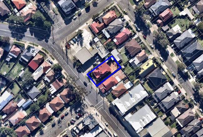
The site is outlined in
blue
|
Executive Summary
Proposal
1. The
development application proposes demolition works and construction of a three
(3) storey shop top housing development comprising two (2) levels of basement
parking. The development consists of one (1) retail tenancy fronting Forest
Road on the ground floor, three (3) commercial offices at the rear of the
ground floor and vehicular access from Forest Road on the north western side of
the site. The total number of units proposed is eight (8) residential units (5
x 1 bedroom units with one being nominated as accessible and 3 x 2 bedroom
units). Communal open space is provided on the rooftop.
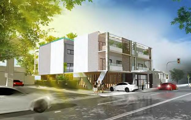
Figure
1: Photomontage of the proposal
Site and Locality
2. The
subject site is legally identified as Lot B in DP 404106, and has a street
address of 608 Forest Road, Penshurst.
3. The
site is located on the north eastern side of Forest Road, adjacent to the
petrol station and is 40m from the intersection with George Street with a
signalised intersection commencing within the frontage of the site, being the
Forest Road and Junction Street intersection. The site currently contains a
single storey weatherboard building with vehicle access along the south eastern
boundary.
4. The
wider locality features a mix of land uses including shop top housing,
commercial, food and drink premise, residential and a service station
immediately north west of the site.
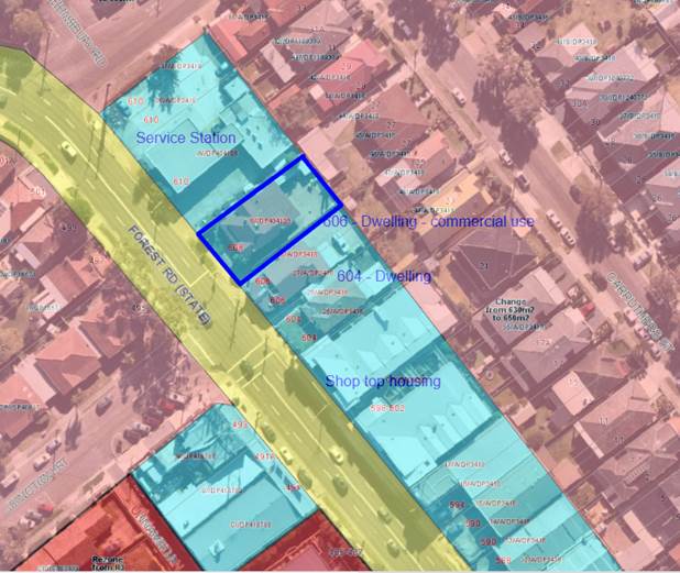
Figure 2:
Uses of allotment in the immediate vicinity of the site.
Zoning and Permissibility
5. The
site is zoned ‘B2 Local Centre’ under the Hurstville Local
Environmental Plan 2012 (HLEP). The development is defined as shop top housing
under HLEP which is permissible with consent in the zone.
Submissions
6. The
development application was publicly exhibited in accordance with the
provisions of the Hurstville Development Control Plan No.1.The initial
notification was between 24 April 2019 to 17 May 2019 and fourteen (14)
submissions were received in response.
7. The
amended plans were renotified between 20 November 2019 and 4 December 2019 and
one (1) submission containing thirteen (13) signatures was received.
8. The
final set of plans dated May 2020, which form the basis of this report were no
required to be re-notified under the provisions of the HDCP as they did not
result in additional environmental impacts and were an improvement in relation
to privacy for neighbouring properties.
Level of Determination
9. This
development application is referred to the Local Planning Panel for
consideration and determination as it comprises development to which State
Environmental Planning Policy No 65 – Design Quality of Residential
Apartment Development applies, there are more than ten (10) unique submissions
and there is a Clause 4.6 variation to the height control as required by the
Ministerial Direction of 23 February 2018.
Conclusion
10. The
proposed development has been assessed having regard to the matters for
consideration under Section 4.15(1) of the Environmental Planning and
Assessment Act 1979. The proposal is acceptable and it is recommended for
approval subject to conditions.
Report in Full
Description of Proposal
11. The
development application proposes demolition works and construction of a three
(3) storey shop top housing development comprising two (2) levels of basement
parking. The development consists of one (1) retail tenancy fronting Forest
Road on the ground floor, three (3) commercial offices at the rear of the
ground floor and vehicular access from Forest Road on the north western side of
the site. The total number of units proposed is eight (8) residential units (5
x 1 bedroom units with one being nominated as accessible and 3 x 2 bedroom
units). Communal open space is provided on the rooftop.
12. Specifically,
the proposal includes the following:
- Basement Level 2 - contains seven
(7) residential parking spaces, three (3) bicycle spaces, storages cages for
each unit, lift and stair access to the levels above. A waiting bay and
signalized system is proposed to manage vehicle movements.
- Basement Level 1 – contains
one (1) x residential parking space being the accessible space, one (1) x
retail parking space, two (2) commercial parking spaces and three (3) visitor
parking spaces (one doubling as a car wash bay), 3 x bicycle spaces, plant
room, lift and stair access to the levels above. A waiting bay and signalized
system is proposed to manage vehicle movements.
- Ground floor - contains a retail
tenancy at the front of the building fronting Forest Road, an access corridor
providing pedestrian movement to the residential lobby, bin store and the three
(3) commercial tenancies and open space at the rear of the site, letterboxes,
booster assembly, driveway to the basement parking levels including a passing
bay at the top of the ramp.
- First floor - contains four (4)
residential apartments (2 x 1B units and 2 x 2B units). Balconies are located
to the front and rear of the site, with courtyard style open spaces also
provided to the side elevations servicing the front-facing units.
- Second floor - contains four (4)
residential units (3 x 1B unit with 1 nominated as assessable and 1 x 2B unit).
Balconies are located to the front and rear of the site, with courtyard style
open spaces also provided to the side elevations servicing the front-facing
units.
- Rooftop - contains communal open
space and rooftop gardens. The communal area includes a kitchenette and a WC.
Description of
the Site and Locality
13. The
subject site is legally identified as Lot B in DP 404106, and has a street
address of 608 Forest Road, Penshurst.
14. The
site is located on the north-eastern side of Forest Road, adjacent to the
petro; station and is 40m from the intersection with George Street with a
signalised intersection commencing within the frontage of the site, being the
Forest Road and Junction Street intersection. The site currently contains a
single storey weatherboard building with vehicle access along the south eastern
boundary.
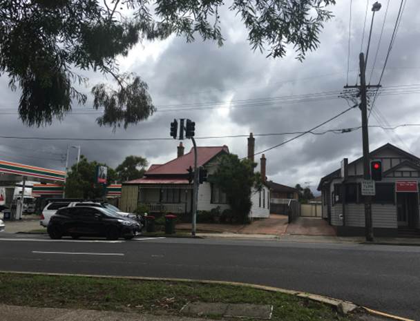
Figure 3: The
subject site
15. The
wider locality features a mix of land uses including shop top housing, commercial,
food and drink premise, residential and a service station immediately north
west of the site.
16. Land
to the north of the site is residential land characterised by one (1) and two
(2) storey dwelling houses. Figure 4 is the dwelling located directly behind
the subject site on Carruthers Street.
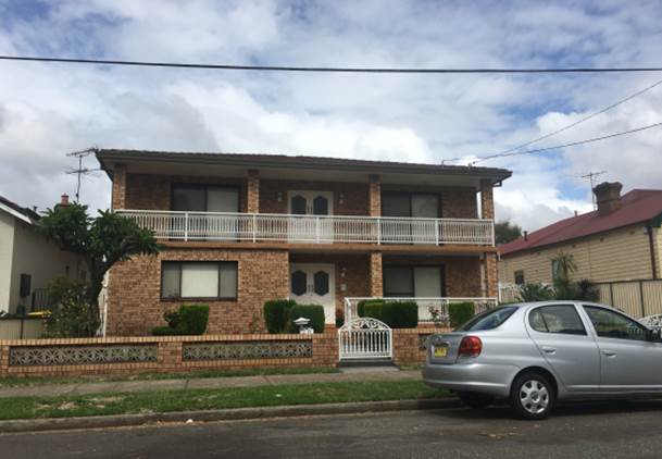
Figure 4: 27
Carruthers Street (directly behind the site)
17. The
site to the south east is occupied by a single storey building most recently
operating as a food and drink premise. Further south east is another single
storey dwelling and a recent two (2) storey shop top housing development with
basement car parking.
Figure 5: 606
Forest Road (adjacent to the site)
Figure 6: Development
further south of Forest Road
18. The
land to the north west is a service station and land on the opposite side of
the intersection of Forest Road and Junction Street contains two (2) storey
older style shop top housing and commercial development.
Figure 7: Service
Station on the corner of Forest Road and George Street
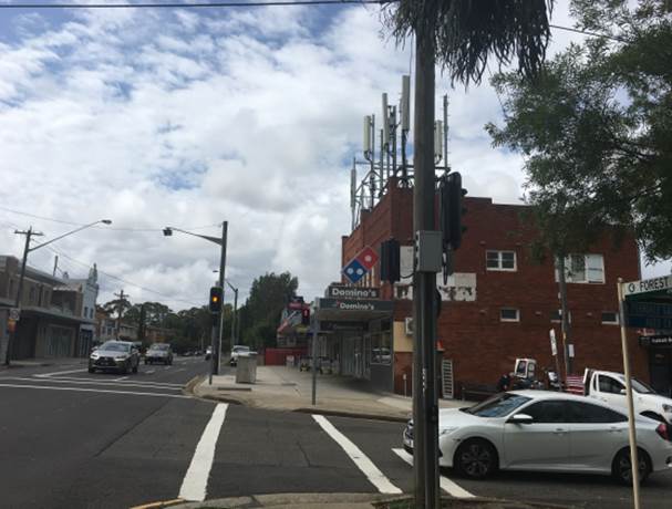
Figure
8: Commercial development on southern
side of Forest Road
PLANNING
ASSESSMENT
19. The
subject site has been inspected and the development has been assessed under the
relevant Section 4.15, Matters for Consideration of the Environmental Planning
& Assessment Act 1979.
Environmental
Planning Instruments
State Environmental Planning Policies
20. Compliance
with relevant State Environmental Planning Policies is summarised in the table
as follows and discussed in more detail thereafter.
|
State
Environmental Planning Policy
|
Complies
|
|
State
Environmental Planning Policy No 55 - Remediation of Land
|
Yes
|
|
State
Environmental Planning Policy (Building Sustainability Index: BASIX) 2004
|
Yes
|
|
State
Environmental Planning Policy (Vegetation in Non-Rural Areas) 2017
|
N/A
|
|
State
Environmental Planning Policy No. 65 - Design Quality of Residential
Apartment Development
|
Yes
|
|
State
Environmental Planning Policy – Infrastructure
|
Yes
|
State
Environmental Planning Policy No 55 - Remediation of Land
21. SEPP
55 aims to promote the remediation of contaminated land in order to reduce the
risk of harm to human health or any other aspect of the environment.
22. Clause
7 requires contamination and remediation to be considered in determining a
development application. The consent authority must not consent to the carrying
out of development on land unless it has considered whether or not the land is
contaminated.
23. A Preliminary
Investigation Report was submitted with the application, which concludes:
“The data quality objectives of the report have been fulfilled.
Therefore, the findings of this report, and the results of the chemical
analyses indicate the site is suitable for the proposed development in a
‘standard residential with garden/accessible soil’
(‘A’) setting, which is considered suitable for Residential
properties with garden/accessible soil (home grown produce <10% fruit and
vegetable intake (no poultry), also includes childcare centres, preschools and
primary schools, and does not require any remediation works.”
24. The
findings of the assessment determined the site is suitable for its intended use
and therefore satisfies the requirements of SEPP 55.
State
Environmental Planning Policy (Building Sustainability Index: BASIX) 2004
25. The
State Environmental Planning Policy (Building Sustainability Index: BASIX) 2004
aims to ensure consistency in the implementation
of a scheme to encourage sustainable residential development throughout New
South Wales (also referred to as the ‘BASIX scheme’).
26. A
BASIX certificate accompanies the DA verifying that the relevant water, energy
and thermal comfort targets have been met by the proposal. Conditions of
consent have been included in the recommendation to ensure the commitments
required under the BASIX certificate will be satisfied by the proposed
development.
State Environmental
Planning Policy (Infrastructure) 2007
27. The
aim of the Infrastructure SEPP is to facilitate the effective delivery of
infrastructure across the State.
28. The
DA was referred to Ausgrid on 16 April 2019 in accordance with Clause 45 of
State Environmental Planning Policy (Infrastructure) 2007. Ausgrid had not
provided comment at the time of writing this report.
29. The
DA was referred to Transport for NSW (RMS) on 16 April 2019 in accordance with
Clause 101 of State Environmental Planning Policy (Infrastructure) 2007.
Comments on the original plans were provided on 15 May 2019 advising:
1. In
accordance with Australian Standards 2890.1- 2004 (Parking Facilities, Part 1:
Off-street car parking), the driveway should be a minimum of 5.5 metres in
width for a minimum distance of 6 metres from the property boundary. Roads and
Maritime notes that the proposed development is not compliant in this regard,
in conjunction with the proposed development’s increased vehicle
movements near the Forest Road/Junction Street intersection, which could be
dangerous to existing road users and future occupiers of the site.
Roads and
Maritime acknowledges that there is an existing traffic signal lantern near the
existing access point of the subject site, which limits potential widening. As
such, Roads and Maritime recommends that the existing driveway is removed and
replaced with kerb and guttering to match existing with a new access point, in
accordance with Australian Standards, to be established at the most north
western extent of the property.
30. Amended
plans were referred back to the RMS, and concurrence was granted on 3 December
2019, subject to conditions of consent.
State Environmental Planning Policy (Vegetation in Non-Rural Areas)
2017
31. The
State Environmental Planning Policy (Vegetation in Non-Rural Areas) 2017
(‘Vegetation SEPP’) regulates clearing of native vegetation on
urban land and land zoned for environmental conservation/management that does
not require development consent.
32. The
Vegetation SEPP applies to clearing of:
a) Native
vegetation above the Biodiversity Offset Scheme (BOS) threshold where a
proponent will require an approval from the Native Vegetation Panel established
under the Local Land Services Amendment Act 2016; and
b) Vegetation
below the BOS threshold where a proponent will require a permit from Council if
that vegetation is identified in the council’s development control plan
(DCP).
33. The
Vegetation SEPP repeals clauses 5.9 and 5.9AA of the Standard Instrument -
Principal Local Environmental Plan, with the regulation of the clearing of
vegetation (including native vegetation) below the BOS threshold being through
any applicable DCP.
34. No
issues arise in terms of the provisions of the Vegetation SEPP, as there is no
significant vegetation on the site or within the footpath area or immediately
fronting the site. Further, there is no significant vegetation on immediately
adjoining properties in close proximity to the site.
State
Environmental Planning Policy No 65 – Design Quality of Residential
Apartment Development
35. The
State Environmental Planning Policy No 65 – Design Quality of Residential
Apartment Development (‘SEPP 65’) aims to improve the design
quality of residential apartment development in New South Wales.
36. The
proposed development meets the pre-requisites for the application of the SEPP
65 in that it constitutes development for the purpose of ‘shop top
housing’ in a proposed building of more than three (3) storeys and having
more than four (4) dwellings. Therefore, it must be assessed against the
provisions of SEPP 65 and the Apartment Design Guide (ADG).
37. A
design verification statement dated May 2020 has been provided by Erica
Marshall-McClelland Registered Architect (Registration No. 6513) in accordance
with Clause 50 of the Environmental Planning and Assessment Regulation 2000.
Was there a new one following the design changes?
38. The
DA has been reviewed by the Design Review Panel (DRP) and their comments are
further detailed in the DRP discussions below.
Design
Review Panel
39. The
initial plans that accompanied the application were referred to the Design
Review Panel (DRP) on 11 July 2019. The amended plans were referred back to the
Panel on 12 March 2020.
40. The
design quality principles of SEPP 65 are addressed as follows, in the context
of the DRP comments. Commentary in response has been provided by the Assessment
Officer where necessary. The comments in italics relate to the original plans
submitted with the DA and the comments below the italicised text relate to the
amended plans submitted in response to those comments.
|
SEPP
65 – Design Quality of Residential Flat Buildings
|
DRP
Comment
|
General
comment
|
|
Context and Neighbouring
Character
Good design
responds and contributes to its context. Context is the key natural and
built features of an area, their relationship and the character they
create when combined. It also includes social, economic, health and
environmental conditions.
Responding
to context involves identifying the desirable elements of an area’s
existing or future character. Well-designed buildings respond to
and enhance the qualities and identity of the area including the adjacent
sites, streetscape and neighbourhood.
Consideration
of local context is important for all sites, including sites in established
areas, those undergoing change or identified for change.
|
The site is located on the north western extremity of a small
local centre. It sits between a service station, a couple of remnant
cottages used for business purposes and some church buildings and
facilities. On the other side of Forest Road are a number of commercial
premises including a bottle shop and a large computer games establishment.
Low density residential development surrounds this small local centre.
It is very likely that in the medium to long term the adjoining
sites on both sides are very likely to be re-developed, and the design must
take this into consideration, assuming that it is not unlikely that
continuous solid walls could be constructed along both common boundaries.
|
The proposed
design considers possible future development by providing solid walls and
voids to the side boundaries. Future development can be accommodated on the
adjacent site with a similar footprint. This development is not indifferent
to the development constructed at 598-602 Forest Road.
|
|
Built
Form and Scale
Good design
achieves a scale, bulk and height appropriate to the existing or desired
future character of the street and surrounding buildings.
Good
design also achieves an appropriate built form for a site and the
building’s purpose in terms of building alignments, proportions,
building type, articulation and the manipulation of building elements.
Appropriate
built form defines the public domain, contributes to the character
of streetscapes and parks, including their views and vistas, and
provides internal amenity and outlook.
|
The proposal comprises a small commercial retail space at street
level with two storeys of residential apartments above and four (4) boarding
house rooms at the rear with two levels of residential apartments
above. These components are linked in the centre of the site by a lift
and the fire stairs. There are 2 spaces either side of the central core
landscaped at ground floor level. The driveway enters the site at the
north west corner occupying a significant portion of the frontage, leaving a
narrow pedestrian entry to the residential accommodation. This results
in a constricted point of pedestrian access to the development overlooking
the ramp to the parking areas.
The
driveway is now on the south west corner of the site; however the access to
development is still constrained.
The development is set into the site at the rear and the roof
level steps at the front to fit underneath the 9m height standard. It
should be noted that the floor to floor heights for the apartments are 2.9m
and the commercial retail has a 3.4m ceiling height. The applicant will
have to demonstrate that the ADG ceiling height of 2.7m can be achieved given
that the guideline is 3.1m floor to floor.
The
floor heights have been amended and now appear to be acceptable.
The rear setback is non-compliant at 4m. The building is
built to the side boundaries.
The
setback is now 6m to the main building line, although the balconies to the
upper levels project 1m further towards the boundary. These should be
redesigned to comply with the 6m setback.
The drawings show two (2) basement levels with retaining walls of
approximately 200mm thick to the boundaries. It is questionable whether
this is achievable noting the geotechnical information is not available to
the Panel.
The
thickness has been increased to 450mm which should be satisfactory. See
further comments below in relation to setback of the basement level B2.
Close examination of the ramp configurations in the basement
indicates that they cannot achieve a rise of 2.7m between the basement
floors. This has been determined by calculating ramp gradings and distances
and also by calculating using the RL’s provided.
This
appears to be resolved.
There is insufficient separation between habitable rooms of 8.5m
instead of the required 12m.
With
the revised plan the main concern is now the extremely small midblock
courtyard spaces which are overlooked by bedrooms and balconies. The Panel
believes these spaces should be increased, eg by deleting the second bedrooms
in the south facing units, which would then achieve courtyards of acceptable
size and amenity. These courtyards should be further enhanced by floor slabs
covering the ground floor level so that the courtyards are accessible to
level 1 and will act as a lightwell to level 2. There should be more solid
boundary walls/screens to both boundaries to deal with overlooking, light
intrusion from car headlight etc and noise from the service station on the
north west side, and potential future development on the south east side.
These should be designed to maximise light to the courtyards.
The lift overrun should be clarified, although the Panel has no
objection to it penetrating the height plane.
As
above. See further comments below under ‘Landscape’.
The Panel is not concerned about the definitional aspects of shop
top housing with regards to this application.
No
further comment, however the following initiatives should be explored:-
· With the covering of the all the ground floor spaces the open
space adjacent to the retail could be converted to an extension of the retail
area.
· The space above the driveway entrance could be fully enclosed and
converted for use as storage for garbage bins or additional storage for
units.
The applicant will need to provide evidence that the fire egress
from the central fire stairs complies with the National Construction
Code. It is also noted that blade walls to balconies on the boundaries
are not in fire rated material.
To
be confirmed.
The basement level 2 should be re-planned to provide consolidated
deep soil in the northern corner adjacent to Unit 7 and Unit 3. This should
be an unimpeded area, free from all structure and of minimum of 5m in any
dimension. A medium sized tree should be included in this corner. This may
require re-configuration of the car park levels, review of storage layout and
removal of one car parking space at a minimum.
|
The
pedestrian lobby widens closer to the lift entry to improve and open up the
common area and also provide a transition to the commercial spaces at the
rear of the development.
RMS has
granted concurrence to the proposal and Council’s Traffic Engineer
supports the proposal.
Floor
heights are compliant.
A compliant
6m setback is now proposed.
Noted.
Council’s
Engineer supports the revised design.
The first
floor voids are now courtyards accessed from the living room and bedrooms of
the unit. The balconies off the units above have been deleted and glass block
walls proposed along the corridor on the units above for privacy.
Location
clarified.
The open
space has been amended to a bin store room and the floor over the ramp has
been widened to provide a planter at the entrance to the commercial
tenancies.
A Fire
Safety Report has been submitted that confirms the non-compliances with egress,
fire separation and services and equipment will be the subject of a fire
engineered design.
The deep
soil area has been increased and now extends across the width of the site at
the rear measuring between 1.7m and 6m in depth.
|
|
Density
Good design achieves
a high level of amenity for residents and each apartment, resulting in a
density appropriate to the site and its context.
Appropriate
densities are consistent with the area’s existing or projected
population. Appropriate densities can be sustained by existing or proposed
infrastructure, public transport, access to jobs, community facilities and
the environment.
|
It is understood
that the proposal complies with the LEP being equal to or less than 1.5 to 1
FSR. However Clause 4.4A1 requires commercial/retail space to be a
minimum of 0.3 to 1. Considerably less than this amount is provided and
the question arises as to whether the application should have the benefit of
the shortfall to be re-assigned to residential GFA.
The commercial area
would be increased by the extension over the area presently proposed as a
courtyard/lightwell and floor space would be further expanded with
recommended changes (covering driveway access and courtyards space at level
1). The recommended deletion of the four second bedrooms would reduce total
floor area, so that overall the FSR would approximate that permissible.
Subject to compliance with FSR control, these changes are recommended.
The Panel has
identified several deficiencies throughout the application documents that
arise from the intention to put so much accommodation on this small
constrained site. In these circumstances it is not appropriate to
maximize available floor space.
This will be largely resolved by reduction in unit sizes and
increases in courtyard/lightwell areas.
|
The proposal
complies with the maximum FSR standard for the site.
|
|
Sustainability
Good design
combines positive environmental, social and economic outcomes.
Good
sustainable design includes use of natural cross ventilation and sunlight for
the amenity and liveability of residents and passive thermal design
for ventilation, heating and cooling reducing reliance on technology and
operation costs. Other elements include recycling and reuse of materials and
waste, use of sustainable materials and deep soil zones for groundwater
recharge and vegetation.
|
The apartments achieve 75% of direct solar access but 25% receive
no solar access which is non-compliant. All apartments are cross
ventilated. Otherwise subject to BASIX.
As
presented the units would not achieve ADG recommended 70% solar access.
Contrary to the statement in the applicant’s submission which claims
compliance, however if the south facing units on the second floor were to be
provided with rooftop lights/vents to provide good winter sunlight compliance
could be achieved. All units would continue to achieve good cross
ventilation.
Sustainability
issues should be addressed by inclusion of adequate deep soil, rainwater
collection and recycling, tree planting, and very desirably solar energy
collection and improved solar access to the units.
|
The
proposal is BASIX compliant and meets ADG controls for solar access and
ventilation as roof lights have been included in the latest plans.
|
|
Landscape
Good
design recognises that together landscape and buildings operate as
an integrated and sustainable system, resulting in attractive developments
with good amenity. A positive image and contextual fit of well
designed developments is achieved by contributing to the landscape
character of the streetscape and neighbourhood.
Good
landscape design enhances the development’s environmental performance
by retaining positive natural features which contribute to the local
context, co-ordinating water and soil management, solar access,
micro-climate, tree canopy, habitat values and preserving green
networks.
Good
landscape design optimises useability, privacy and opportunities
for social interaction, equitable
access, respect for neighbours’ amenity and
provides for practical establishment and long term management.
|
Deep soil
provision is inadequate. The only proposed deep soil is a narrow 2m side
strip located on the rear of the development. This width also does not comply
with ADG min 3m width requirements. Furthermore the design drawings include
reference to “deep soil planters” – soil in planters over
basement car park is not deep soil.
Refer to comments
above under ‘Built Form’ regarding deep soil provision.
The development
provides no communal open space for residents. Communal open
space is a required, to provide opportunities for group and individual
recreation and activities, social interaction
The proposal now provides communal
open space on the roof top which is a positive outcome. It is recommended
that the roof top space be replanned to provide a planted buffer to both side
boundaries. A small enclosed communal space with kitchen/toilet should also
be provided.
The internal ground level
landscape spaces would be deeply shadowed, and these raised planters offer
limited amenity The typical details provided do not illustrate actual
conditions and nominated plant species may not be suitable for this context.
The configuration and design provide inadequate capacity to achieve optimum
plant growth/ health.
The revised application does not
provide revised landscape plans therefore we cannot comment on items raised
above. It is recommended that the rear space be redesigned to maximise soil
areas and space for tree canopy and root ball growth. This condition should
be documented clearly in plan and section in the revised landscape
submission. This ground level space should be designed as garden outlook for
commercial units at ground floor and with trees to provide screening and
visual amenity for units above.
There is also
poor access to nominated communal space for boarders at the rear of the lot,
and the space configuration would create privacy/ overlooking issues for
tenants.
Refer comments
above. The communal residential space has now been moved to the roof top. It
is recommended that the ground level space will be accessed by the commercial
tenants only.
The built form
and landscape strategy requires substantial review to provide adequate and
amenable communal open space for residents.
Provide adequate
deep soil provision and minimum dimension across the site.
Refer comments above.
|
A
consolidated area of deep soil is provided at the rear of the site which
equates to 7% of the site area.
Landscaped
planters are proposed on the rooftop and a communal kitchen and bathroom
facilities are provided.
Amended
Landscape Plans have been submitted and supported by Council’s
Consulting Arborist subject to conditions.
The ground
level landscaped area is now nominated for the use of the commercial tenants
and the rooftop communal open space is provided for the residents.
|
|
Amenity
Good design
positively influences internal and external amenity for residents and neighbours.
Achieving good amenity contributes to positive living environments and
resident wellbeing.
Good amenity
combines appropriate room dimensions and shapes, access to sunlight, natural
ventilation, outlook, visual and acoustic privacy, storage, indoor and
outdoor space, efficient layouts and service areas and ease of access for all
age groups and degrees of mobility.
|
Several aspects of the application arising from the quantum of
accommodation sought on this constrained site result in poor amenity as
follows:-
- Basement car spaces are with
insufficient clearance to side walls. Not complying with AS2980.1 Part
2.4.2(d).
- Constricted cave like character of
the lift lobbies in the basement.
- Insufficient storage in the basement.
- Poor residential access.
- Under sized boarding house rooms.
- Garbage storage beside front entrance
and lift lobby.
- Bathrooms that are too small.
- Lack of bench space in the kitchens.
- Apartments 5 & 6 do not have
sufficient shelter over balconies.
- Maintenance access to landscaped
light wells is difficult or non existent.
With
the re-planning as recommended above and the amended function of the ground
floor north facing spaces these issues should be able to be addressed.
An
additional issue is to ensure that the constant noise from the arterial road
is considered in the design of the south facing units. For example the
soffits of the balcony should be acoustically treated and the screen walls at
the end of balconies should similarly deal with the noise.
In relation to the covering of the south facing second floor
balconies the drawings are ambiguous in relation to the documents provided
(see Sections AA and BB as well as the Massing Model Image). These balconies
should be fully covered to ensure protection from weather.
|
A condition
of consent has been included requiring compliance with the recommendations of
the Acoustic report.
The second
floor balconies are roofed.
|
|
Safety
Good design
optimises safety and security within the development and the public domain.
It provides for quality public and private spaces that are clearly defined
and fit for the intended purpose.
Opportunities
to maximise passive surveillance of public and communal areas
promote safety.
A positive
relationship between public and private spaces is achieved through clearly
defined secure access points and well lit and visible areas that are easily
maintained and appropriate to the location and purpose.
|
Main residential
entry doors intended to serve as fire egress need to be recessed opening
outwards if compliance can otherwise be demonstrated.
The car park
ramp is not at a gradient of 1:20 for the first 6m.
Acceptable
|
Safety
and security have been adequately addressed in the design and public and
private areas are defined acceptably.
Surveillance
of public and communal areas is achieved.
The
separation of the retail entry and the pedestrian entry to the commercial
tenancies and residential lobby defines the different uses.
|
|
Housing
Diversity and Social Interaction
Good design
achieves a mix of apartment sizes, providing housing choice for different
demographics, living needs and household budgets.
Well-designed apartment
developments respond to social context by providing housing and facilities to
suit the existing and future social mix.
Good design
involves practical and flexible features, including different types of
communal spaces for a broad range of people and providing opportunities for
social interaction among residents.
|
Mix of
apartments and boarding house accommodation is satisfactory.
Acceptable
There is nowhere
on site for residents to mix and have social interaction.
Now provided on the roof level, and to be enhanced as recommended
above by provision of enclosed communal space and attractive landscaping.
|
A mix of 5 x
1B units and 3 x 2B units are proposed.
The rooftop
communal open space now provides a kitchen and bathroom facilities and
covered areas with landscaped planters to the roof edge.
|
|
Aesthetics
Good design
achieves a built form that has good proportions and a balanced composition of
elements, reflecting the internal layout and structure.
Good design
uses a variety of materials, colours and textures.
The visual
appearance of a well designed apartment development responds to the
existing or future local context, particularly desirable elements and
repetitions of the streetscape.
|
The splayed
columns at the south east corner are completely at odds with the modest scale
of this building and also out of character in the urban context. A more
straight forward and simple structure is warranted.
The ground level
boundary to the service station requires some screening treatment to separate
the subject building entry from activities in the service station.
As recommended
above the ends of balconies facing the service station and the
courtyard/lightwell space in the centre all need to be adequately screened to
deal with light and noise. Those on the other side adjacent to the existing
and future potential residential developments also need consideration in
relation to privacy and overlooking. These issues will require revision of
the design and appearance of the side walls.
Planters shown on balconies need to be fully documented in the
landscape package.
|
Timber
battens provide screening to the lobby area.
A condition
of consent has been recommended to screen the courtyard and balcony side
edges of the units at the rear with fixed louvre screens for privacy which
will maintain solar access. The street facing units have screens shown on the
plans.
An amended
Landscape Plan has been submitted with the amended architectural plans.
|
41. The
amended plans dated 20 May 2020, which form the basis of this assessment
report, are considered to respond positively to the Design Review Panel’s
comments and approval of the proposal is recommended.
Apartment
Design Guide
42. An
assessment of the proposed development against the relevant design criteria of
the Apartment Design Guide (ADG) is detailed in the compliance table as
follows.
Note:
where relevant, the figures/percentages in the ADG compliance table have been
rounded up/down to the nearest whole number.
|
Section
|
Design Criteria
|
Proposed
|
Comply
|
|
3D - Communal and public open space
|
Communal open
space has a minimum area equal to 25% of the site (495 x 0.25 = 123.75sqm)
|
Communal open space is located on
the rooftop: 26% (128.7sqm)
|
Yes
|
|
Developments
achieve a minimum of 50% direct sunlight to the principal usable part of the
communal open space for a minimum of 2 hours between 9 am and 3 pm on 21 June
(mid-winter)
|
2 hours of
sunlight is achieved to all of the communal
open space areas, with the roof top area receiving direct sunlight.
|
Yes
|
|
3E – Deep soil zones
|
Deep soil zones
are required at a sliding scale in this clause.
For a site area of
495sqm, the deep soil zone requirement is 7% with no minimum dimensions.
|
39.71sqm (8%) of
deep soil is provided on the site.
|
Yes
|
|
3F – Visual privacy
|
Minimum required separation
distances from buildings to the side and rear boundaries are as follows:
Up to 12m (4 storeys)
Habitable - 6m
Non-habitable – 3m
|
Sides:
Nil setback with solid wall; and
3m with frosted glass block
windows; and
Privacy screens to balcony edges
(front units only).
Rear: 6m
|
Sides: Refer to
comments below
Yes
|
|
Comments on
visual privacy:
The proposal
requires setbacks of between 3m (non-habitable rooms) and 6m (habitable rooms
and balconies) to the side setbacks. The development proposed nil setbacks
for a majority of the building and setbacks of 3m to provide the internal
courtyards and light wells for the residential units.
Despite the
numerical non-compliance, the proposed setbacks are acceptable on merit as
the design of the building meets the objectives for the visual privacy
control, in that future development to the east is not compromised as the two
(2) allotments at Nos. 604 and 606 are in the same family ownership,
therefore the two (2) allotments could be redeveloped as an amalgamated site
and able to adopt a similar ‘boundary to boundary’ built form
without compromising development potential.
Possible future
redevelopment of the petrol station site to the west is not compromised as it
has the benefit of a substantially larger site area and dual frontage
enabling building separation to the subject site to be more easily achieved.
|
|
3J – Bicycle and car parking
|
For development in
the following locations:
· on sites that are within 800m of a railway station or light rail
stop in the Sydney Metropolitan Area; or
· on land zoned, and sites within 400 metres of land zoned, B3
Commercial Core, B4 Mixed Use or equivalent in a nominated regional centre
the minimum car
parking requirement for residents and visitors is set out in the Guide to
Traffic Generating Developments, or the car parking requirement prescribed by
the relevant council, whichever is less
The car parking
needs for a development must be provided off street
|
NA – DCP parking rates apply.
The following are the DCP controls
for car parking:
1 space per 1B or 2B unit:
1B x 5 units = 5
2B x 3 units = 3
8 spaces required
8 proposed
|
NA
|
|
4A – Solar and daylight
access
|
Living rooms
and private open spaces of at least 70% of apartments in a building receive a
minimum of 2 hours direct sunlight between 9am and 3pm at mid-winter in the
Sydney Metropolitan Area and in the Newcastle and Wollongong local government
areas
|
87.5% of units (7 of 8) achieve
minimum 2 hours sunlight in mid-winter.
|
Yes
|
|
A maximum of
15% of apartments in a building receive no direct sunlight between 9am and
3pm at mid-winter
|
One unit (12.5%) (Unit 1) receives
no direct sunlight)
|
Yes
|
|
4B – Natural ventilation
|
At least 60% of
apartments are naturally cross ventilated in the first nine storeys of the
building. Apartments at ten storeys or greater are deemed to be cross
ventilated only if any enclosure of the balconies at these levels allows
adequate natural ventilation and cannot be fully enclosed.
|
100% of units are cross ventilated.
|
Yes
|
|
Overall depth
of a cross-over or cross-through apartment does not exceed 18m, measured
glass line to glass line.
|
All of the proposed units are less
than 18m in depth.
|
Yes
|
|
4C – Ceiling heights
|
Measured from
finished floor level to finished ceiling level, minimum ceiling heights are:
· Habitable
rooms 2.7m
· Non-habitable
rooms 2.4m
· For
2 storey apartments: 2.7m for main living area floor
- 2.4m
for second floor, where its area does not exceed 50% of the apartment area
· Attic
spaces: 1.8m at edge of room with a 30 degree minimum ceiling slope
· If
located in mixed use areas - 3.3m for ground and first floor to promote
future flexibility of use
-
These minimums
do not preclude higher ceilings if desired.
|
All of the proposed units have
ceiling heights of minimum 2.8m.
The commercial and retail tenancies
have 2.8m and 3.4m floor to ceiling heights respectively.
|
Yes
|
|
4D – Apartment size and
layout
|
Apartments are
required to have the following minimum internal areas:
-
Studio – 35sqm
-
1 bedroom – 50sqm
-
2 bedroom – 70sqm
-
3 bedroom – 90sqm
-
The minimum
internal areas include only one bathroom. Additional bathrooms increase the
minimum internal area by 5sqm each
A fourth
bedroom and further additional bedrooms increase the minimum internal area by
12sqm each.
|
All apartments meet the minimum
internal size requirements.
Minimum 50sqm for 1 bedroom units
and
Minimum 75.3sqm for 2 bedrooms
units.
Calculated accordingly.
N/A
|
Yes
Yes
N/A
|
|
Every habitable
room must have a window in an external wall with a total minimum glass area
of not less than 10% of the floor area of the room. Daylight and air may not
be borrowed from other rooms.
|
All within the prescribed range.
It is noted that all bathrooms are
internal.
|
Yes
|
|
Habitable room depths are limited
to a maximum of 2.5m x the ceiling height.
|
All within the prescribed range.
|
Yes
|
|
In open plan
layouts (where the living, dining and kitchen are combined) the maximum
habitable room depth is 8m from a window
|
All within the prescribed range.
|
Yes
|
|
Master bedrooms
have a minimum area of 10sqm and other bedrooms 9sqm (excluding wardrobe
space)
|
All bedrooms comply.
|
Yes
|
|
Bedrooms have a minimum
dimension of 3m (excluding wardrobe space)
|
All bedrooms comply.
|
Yes
|
|
Living rooms or
combined living/dining rooms have a minimum width of:
· 3.6m for studio and 1 bedroom apartments
· 4m for 2 and 3 bedroom apartments
|
All living rooms comply.
|
Yes
|
|
The width of
cross-over or cross-through apartments are at least 4m internally to avoid
deep narrow apartment layouts.
|
All of the proposed units are in
excess of 4m in width internally.
|
Yes
|
|
4E – Private open space and
balconies
|
All apartments are
required to have primary balconies as follows:
· Studio apartments require 4sqm with no min depth
· 1 bedroom apartments require 8sqm with min depth 2m
· 2 bedroom apartments require 10sqm with min depth 2m
· 3+ bedroom apartments require 12sqm with minimum 2.4m depth
The minimum
balcony depth to be counted as contributing to the balcony area is 1m.
|
All primary balconies achieve the
minimum area and depth requirements.
Calculated accordingly.
|
Yes
Yes
|
|
For apartments at ground level or
on a podium or similar structure, a private open space is provided instead of
a balcony. It must have a minimum area of 15sqm and a minimum depth of 3m.
|
There are no ground floor units
proposed.
|
N/A
|
|
4F – Common circulation and
spaces
|
The maximum number
of apartments off a circulation core on a single level is eight.
|
A maximum of 4
units at each level.
|
Yes
|
|
For buildings of
10 storeys and over, the maximum number of apartments sharing a single lift
is 40.
|
NA
|
NA
|
|
4G - Storage
|
In addition to
storage in kitchens, bathrooms and bedrooms, the following storage is
provided:
· Studio apartments require 4m3
· 1 bedroom apartments require 6m3
· 2 bedroom apartments require 8m3
· 3+ bedroom apartments require 10m3
At least 50% of
the required storage is to be located within the apartment.
|
All units have compliant total
storage volumes as per the Apartment Design Guide (ADG) volumes.
At least 50% of storage is located
within the apartments.
|
Yes
Yes
|
Draft
Environmental Planning Instruments
Draft
Environment SEPP
43. The
Draft Environment SEPP was exhibited from 31 October 2017 to 31 January 2018.
44. This consolidated SEPP proposes to simplify the planning
rules for a number of water catchments, waterways, urban bushland, and Willandra
Lakes World Heritage Property.
· Changes
proposed include consolidating the following seven existing SEPPs:
· State
Environmental Planning Policy No. 19 – Bushland in Urban Areas
· State
Environmental Planning Policy (Sydney Drinking Water Catchment) 2011
· State
Environmental Planning Policy No. 50 – Canal Estate Development
· Greater
Metropolitan Regional Environmental Plan No. 2 – Georges River Catchment
· Sydney
Regional Environmental Plan No. 20 – Hawkesbury-Nepean River (No.2-1997)
· Sydney Regional
Environmental Plan (Sydney Harbour Catchment) 2005
· Willandra
Lakes Regional Environmental Plan No. 1 – World Heritage Property.
45. The proposal is consistent
with the provisions of this Draft Instrument given there is no vegetation
impacted by the proposed development.
Draft
Remediation of Land SEPP
46. The
Department of Planning and Environment has announced a Draft Remediation of Land
SEPP, which will repeal and replace the current State Environmental Planning Policy No 55—Remediation of Land.
47. The
main changes proposed include the expansion of categories of remediation work
which requires development consent, a greater involvement of principal
certifying authorities particularly in relation to remediation works that can
be carried out without development consent, more comprehensive guidelines for
Councils and certifiers and the clarification of the contamination information
to be included on Section 149 Planning Certificates.
48. Whilst the proposed SEPP will retain the key
operational framework of SEPP 55, it will adopt a more modern approach to the
management of contaminated land.
49. A Preliminary Site Investigation Report has been
submitted with the DA which concludes:
“The data quality objectives of the report have been fulfilled.
Therefore, the findings of this report, and the results of the chemical
analyses indicate the site is suitable for the proposed development in a
‘standard residential with garden/accessible soil’
(‘A’) setting, which is considered suitable for Residential
properties with garden/accessible soil (home grown produce <10% fruit and
vegetable intake (no poultry), also includes childcare centres, preschools and
primary schools, and does not require any remediation works.”
50. The
proposed development has been assessed as being suitable for its intended use
and therefore satisfies the requirements of the Draft SEPP.
Hurstville
Local Environmental Plan 2012
Zoning and
Permissibility
51. The
site is located within the ‘B2 Local Centre’ zone under the
Hurstville Local Environmental Plan 2012.
Figure 9: Zoning
map with the site outlined in blue
52. The
proposed development is defined as shop top housing, which is permissible in
the zone. Namely a ground floor retail space fronting Forest Road and three (3)
commercial tenancies at the rear of the development with two (2) levels of
residential units above all over 2 levels of basement carpark.
53. The
objectives for development in the B2 Local Centre zone are as follows:
• To provide a range of
retail, business, entertainment and community uses that serve the needs of
people who live in, work in and visit the local area.
• To encourage employment
opportunities in accessible locations.
• To maximise public
transport patronage and encourage walking and cycling.
• To maintain a commercial
and retail focus for larger scale commercial precincts.
54. The
proposed development is consistent with the above objectives in that it
provides for additional residential accommodation and compatible commercial
tenancies at the ground floor level within close proximity to a range of
services and facilities including public transport options.
55. An
assessment of the proposed development against the relevant provisions of
Hurstville LEP 2012 is detailed in the compliance table below.
|
Clause
|
Objectives/Provisions
|
Comment
|
Complies
|
|
4.3 - Height of buildings
|
The height of a
building on any land is not to exceed the maximum height shown for the land
on the Height of Buildings Map: 9m
|
The proposal has a
building height of up to 11.4m.
|
No – refer to Clause 4.6
variation assessment following this table.
|
|
4.4 - Floor space ratio
|
The maximum
floor space ratio for a building on any land is not to exceed the floor space
ratio shown for the land on the Floor Space Ratio Map: 1.5:1.
|
The proposal has a
floor space ratio of 1.5:1.
|
Yes
|
|
6.1 - Acid sulfate soils
|
The objective
of this clause is to ensure that development does not disturb, expose or
drain acid sulfate soils and cause environmental damage.
|
The subject site
is not identified on the Acid Sulfate Soils Map as being affected by any
particular class of acid sulfate soils.
|
N/A
|
|
6.2 - Earthworks
|
The objective
of this clause is to ensure that earthworks for which development consent is
required will not have a detrimental impact on environmental functions and
processes, neighbouring uses, cultural or heritage items or features of the
surrounding land.
|
Excavation is limited to the extent
required for the basement parking levels. Suitable conditions of consent have
been recommended to protect neighbouring properties and the public domain
during demolition and construction.
|
Yes
|
Detailed assessment of variation to Clause 4.3 Height of
Buildings
56. The proposed development seeks a
variation to the development standard relating to height (Clause 4.3 of the
Hurstville Local Environmental Plan 2012) (LEP). The LEP permits a maximum
height of 9m for the site. Building height is calculated in accordance with
the definition in the HLEP which states:
building height (or height of building) means:
(a) in relation the height of a building in
metres – the vertical distance from ground level (existing) to the
highest point of the building, or
(b) in relation to the RL of a building –
the vertical distance from the Australian Height Datum to the highest point of
the building, including plant and lift overruns, but excluding communication
devices, antennae, satellite dishes, masts, flagpoles, chimneys, flues and the
like.
57. Having regard to the above
definition, the non-compliance with the height of buildings development
standard relates to the lift overrun, fire stairs and rooftop communal open
space and supporting structures, shown on the architectural drawings to have a
max RL of 65.78m AHD (11.4m).
58. On
this basis, the proposed development will exceed the height up to 2.4m which
comprises of the lift overrun, fire stairs and rooftop communal open
space. This is a 26.7% variation
to the control. Any variation to the height can only be considered under Clause
4.6 – Exceptions to Development Standards of the HLEP. The area
and degree of non-compliance with the height is shown in Figure 10.
Figure 10: Extent
of height non-compliance
59. Clause 4.6(1) outlines the objectives of the standard
which are to “provide an appropriate degree of flexibility in applying
certain development standards to particular development” and
“to achieve better outcomes for and from development by allowing
flexibility in particular circumstances”.
60. Clause 4.6(3) states that:
“Development consent must not be granted for development that
contravenes a development standard unless the consent authority has considered
a written request from the applicant that seeks to justify the contravention of
the development standard by demonstrating:
- that compliance with
the development standard is unreasonable or unnecessary in the circumstances of
the case, and
- that
there are sufficient environmental planning grounds to justify contravening the
development standard”
61. To support the non-compliance, the
applicant has provided a request for a variation to Clause 4.3 prepared by
Ludvik & Associates Pty Ltd and dated May 2020 in accordance with Clause
4.6 of HLEP 2012. The Clause 4.6 request for a variation is assessed in detail
below.
Is the
planning control in question a development standard?
62. Height of Buildings limitation
under Clause 4.3 of the HLEP 2012 is a development standard.
What are the
underlying objectives of the development standard?
63. The objectives of Height of
Buildings standard under Clause 4.3 of HLEP 2012 are:
(a) to ensure that
buildings are compatible with the height, bulk and scale of the existing and
desired future character of the locality,
(b) to minimise
visual impact, disruption of views, loss of privacy and loss of solar access to
existing development and to public areas and public domain, including parks,
streets and lanes,
(c) to minimise the
adverse impact of development on heritage items,
(d) to nominate
heights that will provide a transition in built form and land use intensity,
(e) to establish
maximum building heights that achieve appropriate urban form consistent with
the major centre status of the Hurstville City Centre,
(f) to facilitate an
appropriate transition between the existing character of areas or localities
that are not undergoing, and are not likely to undergo, a substantial
transformation,
(g) to minimise
adverse environmental effects on the use or enjoyment of adjoining properties
and the public domain.
Compliance is unreasonable or unnecessary in the
circumstances of the case (clause 4.6(3)(a))
64. Applicant’s comments: “The rooftop communal open space was
included in the amended plans as a result of Council’s Design Review
Panel having raised the issue that the development had not provided communal
open space when it originally reviewed the proposal on 11 July 2019.
When the Panel reviewed the current plans on 12 March 2020 with the
rooftop communal open space, it indicated that the proposal had resulted in a
positive outcome. The sections of the building that exceeds the height standard
are largely restricted to the central part of the building that accommodates
the facilities associated with the communal open space to be used by residents
of the shop top housing, such as:
• landscape planters and a glass
balustrade defining the area; and
• a core area which contains the lift
and stairway accessing it, a toilet and an
outdoor
kitchenette.
These
facilities are setback from the principal elevations of the building as
follows:
The sections of the building that exceed the height standard represent
a minor proportion of the overall building form. The sections of the building
which exceed the standard do not result in any adverse effects on the amenity
enjoyed by occupiers or residents of surrounding properties in terms of:
• privacy;
• overshadowing;
• view loss; or
• visual impact, but
will, in fact, have a positive outcome for the prospective residents of the
shop top housing to be established. In these circumstances, the standard is
both unreasonable and unnecessary in terms of the proposed development.
A summary assessment of the proposal in terms of the objectives of the
height standard
contained in Clause
4.3(2) of HLEP 2012 is as follows.
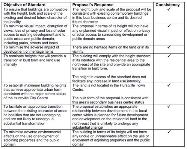
The proposal is consistent with the objectives of the standard.
A summary assessment of the proposal in terms of the objectives for
development in the B2 Local Centre zone is as follows.
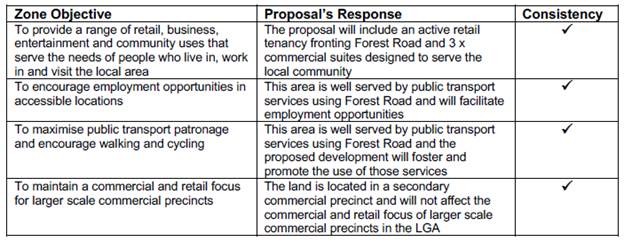
The proposal is consistent with the objectives for development in the
B2 Local Centre zone.”
65. Council’s
comments: In respect to Prestons CJ judgement the NSW Land and Environment
Court and in accordance with a recent decision (Initial Action Pty Ltd v
Woollahra Council [2018] NSWLEC 118), the NSW Land and Environment Court has
established a “five part test” for consent authorities to consider
when assessing a DA proposing a Clause 4.6 request for variation. The Applicant
has justified above that the development satisfies the purpose and intention of
the five part test. It is considered that the proposal satisfies the five part
test for the following reasons:
· The
accessible area of the communal open space is setback over 9m from the rear
boundary in accordance with the ADG separation control which will minimise
privacy impacts to adjoining residential properties.
· The visual
impact of the structure has been minimised as it is an ancillary structure that
is centrally located and treated with dark recessive colours and finishes. The
scale and intensity of development, as proposed is consistent with the desired
future character for new development in this precinct.
· The
objectives of the height standard are considered to be satisfied despite the
non-compliance as there is no overshadowing created by the rooftop structures
affecting the public domain or adjoining properties due to the central location
of the structures on the building and their setback from the street wall.
· The
underlying objective of the height standard remains relevant and therefore
compliance is necessary and warranted. The majority of the building sits within
the height limit with the lift overrun and access to the rooftop communal open
space area are the only structures encroaching the height limit. No habitable
area extends above the 9m height limit.
· In this case
the underlying objective will not be defeated or thwarted by the approval of
the building. As the building has been designed to generally comply with the
height standard. The height control will not be abandoned or destroyed through
this or any recent approvals for similar mixed use developments.
Clause
4.6(3)(b) are there sufficient environmental planning grounds to justify
contravening the standard
66. Applicant’s
comments: “The underlying purpose of contemporary town
planning practice to encourage shop top housing in business centres is to
achieve highly desirable urban design outcomes given:
• it
creates an increased level of vitality and activity in centres;
• it reinforces demand
and viability of shops and commercial services and facilities in centres; and
• it fosters and
promotes the use of public transport, walking and cycling as the principal
modes of private transport.
However, such mixed-use development presents challenges in providing
appropriately designed communal open space for the residents of shop top
housing because of the extent of the site required to be given over to parking
and vehicular access and the needs and impacts of the retail/commercial uses at
the ground floor level.
These competing demands for the use of areas at the ground floor level
result in communal open space associated with shop top housing being more
appropriately located on building rooftops.
The provision of the proposed rooftop communal open space is designed
to achieve a positive environmental planning outcome, resolving the competing
demands of the uses to be established on the site.
In terms of the building’s design, the proposed rooftop communal
open space:
• has resulted in a positive
outcome for the development according to Council’s Design Review Panel;
and
• is consistent with the
design guidance in the ADG which indicates that, where communal open space
cannot be provided at ground level, it should be provided on a podium or roof.
In this context, the nature, extent and location of the parts of the building
that exceed the height standard:
• will not have any
adverse effect on the amenity enjoyed by occupiers or residents of surrounding
properties in terms of privacy, overshadowing, view loss or visual impact;
• will not have any
adverse effects on the Forest Road streetscape when viewed from the public
domain;
• will not be
inconsistent with the existing or desired future character of development in
this business centre; and
•
are satisfactory and suitable for approval.
The proposed building:
• is consistent with the
existing and desired future character of development in this locality;
• represents an
appropriate and satisfactory design response to the opportunities and
constraints offered by the site and its setting; and
• will result in the
orderly and economic use and development of the land in accordance with Section
1.3(c) of the EP&A Act.
Consequently, there are sufficient environmental planning grounds to
justify the variation from the standard as proposed.”
67. Council’s
comments: Based on the discussion above, it is considered that there are
sufficient environmental planning grounds to justify contravening the
development standard. Key environmental planning grounds to support the
variation include:
· Despite the rooftop structures and lift overrun exceeding
the height of buildings development standard, the remainder of the building is
below the 9m height limit. As such, the overall bulk and scale of the building
is considered to be acceptable in terms of its scale and built form and the
relationship of the building to the street and adjoining development;
· The lift overrun and rooftop structures maintain a building
of a scale and form that is appropriate for the location will not be readily
visible from street level as it is setback from the street frontage and located
centrally within the roof, 7.2m from the north western edge of the roof,
providing visual interest and a varied building profile.
· When travelling east on Forest Road, the rooftop structures
and lift overrun will be screened by the rooftop landscaping around the
communal open space area, with the dark colours chosen for the finish of these
rooftop elements further assisting in them being viewed as recessive elements.
· Despite the increased height of the lift overrun and
rooftop structures above the statutory height limit, the proposed development
will not have an unreasonable impact on adjoining residential properties in
terms of loss of privacy or views or overshadowing (606 Forest Road is a
restaurant and 604 Forest Road is a dwelling house: the dwelling on 604 Forest
Road will retain sunlight between 9am and 1pm during midwinter, satisfying the
DCP controls of solar access);
· Despite the breach to the building height standard, the
lift overrun and rooftop structures are located so that it will not be easily
seen from the street frontage or from Forest Road when travelling east due to
the recessive colour palette and setback from the roof edge of these elements
and the landscaping surrounding the communal open space on the north western
edge of the rooftop, and the building will make a positive contribution to the
streetscape character and visual amenity of the area.
Will the
development be in the public interest despite the non-compliance?
68. Applicant’s comments: The building height standard is both
unreasonable and unnecessary in the circumstances of this case and there are
sufficient environmental planning grounds to justify variations from it.
The proposal is in the public interest because it is consistent with:
• the objectives of the standard; and
• the objectives for development in the
B2 Local Centre zone.
The development, with the variation from the standard as proposed:
• will not result in any adverse
environmental impacts;
• will not have any
undue or unreasonable effect on the amenity enjoyed by occupiers or residents
of surrounding properties in terms of privacy, solar access, visual impact or
view loss; and
• will promote the
orderly and economic use and development of the land in accordance with Section
1.3(c) of the EP&A Act.
The proposal is, therefore, suitable for approval under the terms of
Clause 4.6(2) of HLEP2012, despite its variation from the numerical value of
the building height standard contained in Clause 4.3(2) of the Plan.”
69. Council’s
comment: The proposed built form is acceptable given the context of the
site, the planning controls applicable to the site and its local centre zoning,
existing patterns of subdivision, site orientation, area and dimension. The development
makes sufficient accommodation for the required building services and
infrastructure.
70. The
proposed development will be in the public interest because it is consistent
with the objectives of the height standard and the objectives for development
within the zone. The development will provide additional commercial/retail
floor space for the neighbourhood and will provide a variety of new housing
stock in the form of 1 and 2 bedroom apartments.
Concurrence of
the Director-General has been obtained
71. In accordance with clause 64 of the
Environmental Planning and Assessment Regulation 2000, Council may assume the
Secretary’s concurrence for exceptions to development standards for
applications made under clause 4.6 of the LEP. This was further confirmed by
directions provided within Planning Circular PS 18-003 issued on 21 February
2018.
Non-compliance
does not hinder the attainment of the Objects of the Environmental Planning and
Assessment Act 1979
72. The Wehbe decision identifies that
in assessing a variation to a development standard, consideration must be given
to Objects (a)(i) and (a)(ii) in Section 5 of the Environmental Planning and
Assessment Act 1979. These are:
(i) the proper management, development and
conservation of natural and artificial resources, including agricultural land,
natural areas, forests, minerals, water, cities, towns and villages for the
purpose of promoting the social and economic welfare of the community and a
better environment,
(ii) the promotion and co-ordination of the orderly and
economic use and development of land.
73. It is not considered that the
proposed variation to the building height standard will contravene either of
these Objects. The proper management of the existing urban environment in order
to achieve better social and community outcomes, as well as the orderly and
economic use and development of land, will be realised through the provision of
a high quality mixed use development in a location with good access to public
transport options and in proximity to shops, services and recreational
facilities and educational establishments.
Whether
contravention of the development standard raises any matter of significance for
State or regional environmental planning (Clause 4.6(5)(a))
74. Contravention of the maximum height
development standard proposed by this application does not raise any matter of
significance for State or regional environmental planning.
Any other
matters required to be taken into consideration by the Director-General before
granting concurrence
75. Despite exceeding the statutory
maximum building height, the proposed redevelopment of the site will facilitate
the orderly and economic redevelopment of the site for the purposes of a mixed
use development that will positively contribute to the achievement of the
objectives of Hurstville Local Environmental Plan 2012.
Conclusion
– Assessment of Clause 4.6 Request for Variation
76. Despite the non-compliance in terms
of the height, the proposal is considered to be acceptable and satisfies the provisions
of Clause 4.6. The encroachment of the lift overrun and rooftop structures
associated with the communal open space will not create any unreasonable
environmental or amenity impacts. The proposed development satisfies the
objectives of the height control and the zone objectives and is therefore
considered to be in the public interest.
77. It is considered that the Clause
4.6 Statement lodged with the application addresses all the information
required pursuant to Clause 4.6 and the statement is considered to be well
founded as there are sufficient environmental planning grounds to justify
contravening the standard in this particular case.
Draft Georges River Local
Environmental Plan 2020
78. Consideration
is given to the provisions of Draft Georges River Local Environmental Plan 2020
in the assessment this application.
79. In
this regard, the provisions have no determining weight as a result of proposed
operation of Clause “1.8A Savings provisions relating to development
applications” of the Draft Plan which provides “If a
development application has been made before the commencement of this Plan in
relation to land to which this Plan applies and the application has not been
finally determined before that commencement, the application must be determined
as if this Plan had not commenced.”
Development
Control Plan
Hurstville
Development Control Plan No. 1
80. An
assessment of the proposed development against the relevant controls in the
HDCP No. 1 is detailed in the compliance table below.
|
Development
|
Requirements
|
Proposed
|
Complies
|
|
3.0 General Planning
Considerations
|
|
3.1 Vehicle access and car parking
rates
|
Underground parking areas are to be
concentrated under building footprints so as to maximise deep soil
landscaping.
Driveways to underground car parks
are to be designed so as to minimise the visual impact on the street, and to
maximise pedestrian safety.
Pedestrian access to the
development should be separate and clearly defined.
Access ways to underground car parking
areas is to be located away from doors and windows to habitable rooms
wherever possible.
Basement car parking is preferable
in commercial and residential flat buildings.
|
The basement design allows for a
deep soil area along the rear boundary and northern rear corner of the site.
The driveway is suitably located in
accordance with the requirements of the RMS.
Pedestrian and vehicular access is
separate.
Access to the basement parking area
is via the central lift and stair core.
Basement parking is proposed.
|
Yes
Yes
Yes
Yes
Yes
|
|
Car Parking Rates
(Table 1 – business zones)
|
Residential:
a. 1 resident space for every
studio, 1 or 2 bedroom dwelling
8 spaces required
b. 2 resident spaces for every 3 or
more bedroom dwelling
c. for developments of 4 dwellings
or more, one visitor space per 4 dwellings or part thereof
2 visitor spaces required
Business/Office: 1/60sqm
72.39sqm requires 3 spaces
Retail: 1/50sqm
75.6sqm requires 2 spaces
|
1B x 5 units
2B x 3 units
8 spaces proposed
N/A
N/A
3 visitor spaces proposed
2 spaces proposed
1 space proposed
|
Yes
N/A
N/A
Yes
No – refer to comments below.
No – refer to comments below.
|
|
Comment on parking:
Parking spaces have been noted on
the plans as follows:
Residential x 7 plus one (1)
accessible space (8 total)
3 x visitor (including one (1)
shared as a car wash bay)
2 x commercial (shortfall of one
(1) space)
1 x retail (shortfall of one (1)
space)
There is a numerical shortfall of
one (1) space for commercial and one (1) space for retail.
Given there are three (3)
commercial tenancies and there is an excess of one (1) visitor space, one (1)
of the visitor spaces is required to be nominated as a commercial space. A
condition of consent has been recommended for this to be included in the
plans accompanying the Construction Certificate.
The shortfall of one (1) retail
space is not considered of concern with respect to the developments
functionality given the small size of the tenancy (75.6sqm) and the
likelihood that visitors to the shop would be passing by on foot or park in
the local streets.
|
|
3.3 Access and Mobility
|
In developments containing five or
more dwellings, a minimum of one adaptable dwelling, designed in accordance
with relevant Australian Standards must be provided for every ten dwellings
or part thereof.
Access to required adaptable
dwellings and relevant parking spaces Appropriate access for all persons through
the principal entrance of the building and access to any common facilities
shall be provided.
One accessible space is dedicated
to each adaptable apartment
|
Unit 6 is accessible.
All parts of the building are
accessible.
One (1) accessible space is
provided.
|
Yes
Yes
Yes
|
|
3.4 Crime Prevention through Design
|
Ensure that the way in which the
site, and the buildings within the site, are laid out enhance security and
feelings of safety
|
The development has been well considered
to cater for CPTD principles in terms of lighting the location, accessibility
and legibility of services and uses. The corridor accessing the commercial
tenancies at the rear of the building has an open form vertical timber screen
element along the western side to allow for light and casual surveillance.
|
Yes
|
|
3.5 Landscaping
|
Development contributes to the
creation of a distinct, attractive landscape character for streets and
neighbourhoods
|
The development proposes rooftop
planters and planters on the uppermost street facing balconies, together with
green walls which will be seen from the street at certain angles.
|
Yes
|
|
3.6 Public Domain
|
Development contributes to the
creation of attractive, comfortable and safe streets that comprise consistent
and high quality paving, street furniture and street tree plantings.
|
The proposal presents well to
Forest Road and will activate the streetscape in this location.
|
Yes
|
|
3.7 Stormwater
|
Stormwater discharge for
development sites is not to exceed the 5 year ARI storm event.
An on-site stormwater detention
system is provided that reduces the flow rate of stormwater discharge.
Stormwater quality
The quality of stormwater leaving
development sites is consistent with water quality standards set by the
Environment Protection Authority and ANZECC.
|
Council’s Development
Engineer supports the proposed stormwater management system and conditions
have been recommended accordingly.
|
Yes
|
|
Chapter 4.1 Residential Flat
Buildings
|
The DCP does not contain controls
for shop-top housing. The controls below relate to Residential Flat Buildings
and have been included as they are relevant to the proposed development.
|
|
Solar Access
|
Development allows for at least 3
hours of sunlight on the windows of main living areas and adjoining principal
private open space of adjacent dwellings between 9.00 am and 3.00 pm on 22
June.
|
All adjoining residential
development to the east will continue to receive at least 3 hours to living
areas and private open space during midwinter.
The adjoining southern allotment
known as 606 Forest Road is a commercial tenancy with a dwelling located at
604 Forest Road.
|
Yes
|
Section 7.11
Contributions
81. Monetary
contributions are required under Section 7.11 of the Environmental Planning and
Assessment Act 1979, with respect to the proposed development. These
contributions have been calculated appropriately and a suitable condition of
consent has been included in the recommendation in this respect:
|
DEVELOPMENT
CONTRIBUTIONS
|
|
Hurstville
Section 94 Development Contributions Plan 2012 - Residential (Community
Facilities)
|
$9,399.85.00
|
|
Hurstville
Section 94 Development Contributions Plan 2012 - Residential (Open Space,
Recreation, Public Domain)
|
$66,466.11
|
IMPACTS
Natural
Environment
82. The
proposed development is unlikely to result in adverse impacts on the natural
environment.
Built
Environment
83. The
proposed development is unlikely to result in adverse impacts on the built
environment.
84. In
particular, the proposal complies with the FSR standard contained in Hurstville
LEP 2012, and proposes an acceptable bulk and scale in the context of the site.
85. The
proposed built form is acceptable given the context of the site, the planning
controls applicable to the site and its local centre zoning, existing patterns
of subdivision, site orientation, area and dimension. The development makes
sufficient accommodation for the required building services and infrastructure.
Social
Impacts
86. The
development will provide additional housing stock to the area and cater to the
needs of families by providing a range of dwelling sizes through a mix of one
(1) and two (2) bedroom units.
Economic
Impacts
87. The
development will have a positive short term economic benefit associated with
construction employment and minimal adverse economic impacts over the longer
term.
Suitability
of the site
88. The
subject site is suitable for the proposed development having regard to the
existing and desired future character of the surrounding locality which
features multi-level mixed use buildings and residential accommodation in a
location in close proximity to public transport options and a wide range of
services and facilities. Further, there are no natural or man-made
environmental constraints (e.g. flooding/bushfire risks) that would render the
site unsuitable for the proposed development.
SUBMISSIONS
89. The
application was publicly exhibited on two (2) occasions in accordance with the
public notification provisions in Hurstville Development Control Plan No. 1. A
total of twenty seven (27) submissions objecting to the proposal were received.
90. The
issues raised in the submissions received following the second exhibition were
the same as the issues raised in the submissions received when initially
exhibited. The submissions continued to reference the boarding rooms which were
deleted from the proposal and replaced with commercial suites.
91. The
issues raised in the submission are addressed below.
Privacy
from rear facing balconies
92. Officer
Comment: The balconies are setback a compliant 6m from the rear boundary in
accordance with the visual privacy controls of the Apartment Design Guide.
Overshadowing
of neighbours
93. Officer
Comment: The shadow will be cast south, south-west and south-east, and not
over properties in Carruthers Street as they are located to the north and
north-east of the subject site.
Decrease
in property values
94. Officer
Comment: Property values are not a matter for consideration in the
Environmental Planning and Assessment Act 1979 in the assessment of development
applications.
Parking
overflow on to Carruthers Street
95. Officer
Comment: The proposal provides a satisfactory number of parking spaces for
the residential and commercial uses in accordance with the Hurstville DCP No.
1. The shortfall of one (1) retail space is considered acceptable due to the
small size of the tenancy and the availability of on street parking nearby in
Junction Street, west of the site as potentially within Caruthers Street. These
are public roads and vehicles are able to parking in these locations. In
addition this area is serviced by public transport in the form of buses along
the frontage of the site and also along George Street.
No visitor
parking provided
96. Officer
Comment: The proposal provides visitor parking that complies with the
provisions of the Hurstville Development Control Plan No. 1.
Noise from
the units and boarding house
97. Officer
Comment: The boarding rooms no longer form part of the proposal and have
been replaced with commercial suites. It is considered that the small number of
residential units will not result in unreasonable acoustic impacts on
neighbouring properties given the context of the site. A condition has been
recommended for a Plan of Management to be submitted to the satisfaction for
Council limiting the use of the rooftop communal open space area with respect
to times and occupant numbers. The communal area at ground level is nominated
for the use of the commercial tenants and use of that area at night is unlikely
given the expected hours of use of these commercial suites.
Safety
concerns from residents of the boarding house
98. Officer
Comment: The boarding rooms no longer form part of the proposal and have
been replaced with commercial suites with the revised plans. These revised
plans were re-notified.
99. The
submissions received following the second notification period did not raise
additional issues to those raised in the initial notification, despite the
changes to the proposal including the replacement of the boarding rooms with
commercial tenancies and relocation of the communal open space to the rooftop.
100. The
number of units, commercial tenancies and rooftop communal open space area
formed part of the plans forming part of the second notification period. The
latest set of plans, the basis of this assessment, were not required to be
publicly notified in accordance with the Hurstville Development Control Plan No.
1 as they were considered not to result in additional environmental impacts,
and involved amendments made in response to design issues raised by Council
Officers and the Design Review Panel.
REFERRALS
Council
Referrals
Landscaping
101. No
objections were raised to the proposed landscape plan subject to conditions.
These conditions have been incorporated into the recommended conditions at the
end of this report.
Stormwater
102. No
objections were raised to the drainage design and stormwater discharge subject
to conditions. The conditions have been incorporated into the recommended
conditions at the end of this report.
Health
103. No
objections were raised to the proposal subject to conditions. These conditions
have been incorporated into the recommended conditions at the end of this
report.
Waste
104. No
objections were raised to the proposal, subject to conditions. These conditions
have been incorporated into the recommended conditions at the end of this
report.
Building
105. No
objections were raised to the proposal, subject to conditions. These conditions
have been incorporated into the recommended conditions at the end of this
report.
Traffic
106. No
objections were raised to the proposal, subject to conditions. These conditions
have been incorporated into the recommended conditions at the end of this
report.
External
Referrals
Roads and
Maritime (RMS)
107. In
accordance with Clause 101 of the SEPP (Infrastructure) 2007, the application
was referred to RMS for comment. No objection has been raised subject to
conditions of consent.
Ausgrid
108. The
DA was referred to Ausgrid in accordance with Clause 45 of SEPP
(Infrastructure) 2007. No comments had been received at the time of writing
this report (3 August 2020).
CONCLUSION
109. The
proposal has been assessed using the matters for consideration listed in
Section 4.15 and 4.16(1) (a) of the Environmental Planning and Assessment Act
1979. Based on this assessment, the proposal is considered generally to be a
satisfactory outcome for the site subject to appropriate conditions.
DETERMINATION
AND STATEMENT OF REASONS
Statement
of Reasons
110. The reasons for this
recommendation are:
· The proposed development generally complies with the
requirements of the relevant environmental planning instruments and development
control plan.
· The proposal is an acceptable response to the zoning,
context, site area, dimension and orientation of the allotment.
· The proposed development is well considered and sensitively
designed so that it will not result in any unreasonable impact on the natural
and built environment.
· The building will not adversely affect the amenity of any
immediately adjoining properties in terms of unreasonable overlooking,
overshadowing or view loss.
· The proposal aims to provide a high-quality, contemporary
mixed use development in an accessible location in accordance with the planning
and design requirements for development of this nature in this precinct.
Determination
A. THAT the Georges River Local Planning Panel, as the consent
authority, support the request for variation pursuant to Clause 4.6 of
Hurstville Local Environmental Plan 2012, in relation to the Height of
Buildings (Clause 4.3) control as the variation is considered to be well
founded and in the public interest.
B. THAT the Georges River Council Local
Planning Panel, as the consent authority, pursuant to
Section 4.15 and 4.16(1)(b) of the Environmental Planning and Assessment
Act 1979 (as amended) grant development consent to Development
Application DA2019/0135 for demolition works and construction of a
three (3) storey shop top housing development over two (2) levels of basement
parking, site works and landscaping at the property known as Lot B in
DP 404106, being 608 Forest Road, Penshurst, subject
to the following conditions:
Development
Details
1. Approved
Plans - The development must be implemented in accordance with the approved
plans and supporting documentation listed below which have been endorsed by
Council’s approved stamp, except where marked up on the plans and/or
amended by conditions of this consent:
|
Description
|
Reference No.
|
Date
|
Revision
|
Prepared by
|
|
BASIX Commitments
|
01
|
18.06.19
|
B
|
Lyle Marshall & Partners Pty Ltd
|
|
Site Control Plan
|
04
|
09.04.19
|
A
|
Lyle Marshall & Partners Pty Ltd
|
|
Lower Basement Floor Plan B2
|
07
|
20.05.20
|
D
|
Lyle Marshall & Partners Pty Ltd
|
|
Basement Floor Plan B1
|
08
|
20.05.20
|
D
|
Lyle Marshall & Partners Pty Ltd
|
|
Ground Floor Plan
|
09
|
20.05.20
|
D
|
Lyle Marshall & Partners Pty Ltd
|
|
First Floor Plan
|
10
|
20.05.20
|
D
|
Lyle Marshall & Partners Pty Ltd
|
|
Second Floor Plan
|
11
|
20.05.20
|
D
|
Lyle Marshall & Partners Pty Ltd
|
|
Proposed Roof Plan
|
13
|
20.05.20
|
D
|
Lyle Marshall & Partners Pty Ltd
|
|
Proposed Sections Sheet 1
|
14
|
20.05.20
|
D
|
Lyle Marshall & Partners Pty Ltd
|
|
Proposed Sections Sheet 2
|
14A
|
20.05.20
|
D
|
Lyle Marshall & Partners Pty Ltd
|
|
Proposed Elevations
|
15
|
20.05.20
|
D
|
Lyle Marshall & Partners Pty Ltd
|
|
Typical Unit Layouts Sheet 1
|
29
|
20.05.20
|
D
|
Lyle Marshall & Partners Pty Ltd
|
|
Typical Unit Layouts Sheet 2
|
30
|
20.05.20
|
D
|
Lyle Marshall & Partners Pty Ltd
|
|
Typical Unit Layouts Sheet 3
|
31
|
20.05.20
|
D
|
Lyle Marshall & Partners Pty Ltd
|
|
Proposed Materials and Finishes
|
32
|
20.05.20
|
D
|
Lyle Marshall & Partners Pty Ltd
|
|
Proposed Excavation Plan
|
34
|
20.05.20
|
D
|
Lyle Marshall & Partners Pty Ltd
|
|
Proposed Demolition & Sediment Control Plan
|
35
|
20.05.20
|
D
|
Lyle Marshall & Partners Pty Ltd
|
|
Acoustic Report
|
2019-080
|
03.04.19
|
|
Acoustic, Vibration and Noise Pty Ltd
|
|
Geotechnical Investigation Report
|
DD-822
|
28.02.19
|
|
Dirt Doctors Pty Ltd
|
2. Fit-out
of retail premises - No approval is granted for the use or fit-out of the
retail premises. Separate Development Consent for the use and fit-out is
required prior to the occupation of the retail component of the development.
Separate Approvals Required Under Other Legislation
3. Vehicular
Crossing - Major Development - The following vehicular crossing and road
frontage works will be required to facilitate access to and from the proposed
development site:
(a) Construct a full width - boundary to kerb -
footpath for the full length of the frontage of the site in Forest Road in
accordance with Council’s Specifications applying at the time
construction approval is sought.
(b) The thickness and design of the driveway shall
be in accordance with Council’s Specifications applying at the time
construction approval is sought.
(c) Construct a new 150mm high concrete kerb
with 450mm wide gutter for the full frontage(s) of the site in Forest Road in
accordance with Council’s Specifications for kerb and guttering, applying
at the time construction approval is sought.
(d) Any existing vehicular crossing and/or
laybacks which are redundant must be removed. The kerb and gutter, any other
footpath areas shall be restored at the expense of the applicant. The
work shall be carried out in accordance with Council’s specification,
applying at the time construction approval is sought.
Constructing a vehicular crossing and/or footpath requires separate
approval under Section 138 of the Roads Act 1993
<http://legislation.nsw.gov.au/>, prior to the commencement of
those works.
4. Building
- Hoarding Application Prior to demolition of the buildings on the site, or
the commencement of work above ground level, a separate application for the
erection of an ‘A class’ (fence type) or a ‘B class’
(overhead type) hoarding or ‘C type’ scaffold, in accordance with
the requirements of SafeWork NSW, must be erected along that portion of
the footways/roadway where the building is within 3 metres of the street
boundary.
An application for this work under Section 68 of the Local Government
Act 1993 <http://www.legislation.nsw.gov.au/> and the Roads Act 1993
must be submitted for approval to Council.
The following information is to be submitted with a Hoarding Application
under Section 68 of the Local Government Act 1993
<http://www.legislation.nsw.gov.au/> and Section 138 of the Roads
Act 1993 <http://legislation.nsw.gov.au/>:
a) A site and
location plan of the hoarding with detailed elevation, dimensions, setbacks,
heights, entry and exit points to/from the site, vehicle access points,
location of public utilities, electrical overhead wire protection, site
management plan and builders sheds location; and
b) Hoarding plan and
details that are certified by an appropriately qualified engineer; and
c) The payment to
Council of a footpath occupancy fee based on the area of footpath to be
occupied and Council's Schedule of Fees and Charges (available at www.georgesriver.nsw.gov.au
<http://www.georgesriver.nsw.gov.au>) before the commencement of
work; and
d) Public Risk
Insurance Policy with a minimum cover of $20 million in relation to the
occupation of and works within Council's road reserve, for the full duration of
the proposed works, must be obtained a copy provided to Council. The Policy is
to note Council as an interested party.
5. Below
ground anchors - Information to be submitted with S68 Application under LGA
1993 and S138 Application under Roads Act 1993 - In the event that the
excavation associated with the basement carpark is to be supported by the use
of below ground (cable) anchors that are constructed under Council’s
roadways/footways, an application must be lodged with Council under Section 68
of the Local Government Act 1993 <http://www.legislation.nsw.gov.au/>
and the Roads Act 1993 <http://legislation.nsw.gov.au/> for
approval, prior to commencement of those works. The following details must be
submitted.
a) That cable anchors
will be stressed released when the building extends above ground level to the
satisfaction of Council.
b) The applicant has
indemnified Council from all public liability claims arising from the proposed
works, and provide adequate insurance cover to the satisfaction of council.
c) Documentary
evidence of such insurance cover to the value of $20 million.
d) The applicant must
register a non-terminating bank guarantee in favour of Council for the amount
of [$50,000].
The guarantee will be released when the cables are stress released. In
this regard it will be necessary for a certificate to be submitted to Council
from a structural engineer at that time verifying that the cables have been
stress released.
e) That in the event
of any works taking place on Council’s roadways/footways adjoining the
property while the anchors are still stressed, all costs associated with overcoming
the difficulties caused by the presence of the ‘live’ anchors will
be borne by the applicant.
6. Section
138 Roads Act 1993 and Section 68 Local Government Act 1993 - Unless
otherwise specified by a condition of this consent, this Development Consent
does not give any approval to undertake works on public infrastructure.
Separate approval is required under Section 138 of the Roads Act 1993
and/or Section 68 of the Local Government Act 1993 for any of the
following activities carried out in, on or over a public road (including the
footpath) listed below.
An application is required to be lodged and approved prior to the
commencement of any of the following works or activities;
(a) Placing or storing materials
or equipment;
(b) Placing or storing waste
containers or skip bins;
(c) Erecting a structure or
carrying out work
(d) Swinging or hoisting goods
over any part of a public road by means of a lift, crane or the like;
(e) Pumping concrete from a public
road;
(f) Pumping water from the
site into the public road;
(g) Constructing a vehicular
crossing or footpath;
(h) Establishing a “works
zone”;
(i) Digging up or disturbing
the surface of a public road (eg Opening the road for the purpose of
connections to utility providers);
(j) Stormwater and ancillary
works in the road reserve;
(k) Stormwater and ancillary to
public infrastructure on private land; and
(l) If any excavation is to
be supported by the use of below ground (cable) anchors that are constructed
under Council’s roadways/footways.
These separate activity approvals must be obtained and evidence of the
approval provided to the Certifying Authority prior to the issue of the
Construction Certificate.
The relevant Application Forms for these activities can be downloaded
from Council’s website www.georgesriver.nsw.gov.au. For further
information, please contact Council’s Customer Service Centre on (02)
9330 6400.
7. Driveway
Crossing - Minor Development - Constructing a driveway crossing and/or
footpath requires a separate approval under Section 138 of the Roads Act
1993 prior to the commencement of those works.
To apply for approval, complete the “Application for Driveway
Crossing and Associated Works on Council Road Reserve” issued under
Section 138 Roads Act.” which can be downloaded from Georges River
Council’s Website at www.georgesriver.nsw.gov.au. Lodge the application
form, together with the associated fees at Council’s Customer Service Centre,
during business hours. Refer to Section P1 and P2, in Council’s
adopted Fees and Charges for the administrative and inspection charges
associated with Driveway Crossing applications.
An approval for a new or modified driveway crossing will contain the
approved access and/or alignment levels which will be required to construct the
crossing and/or footpath. Once approved, all work shall be carried
out in accordance with Council’s specifications applicable at the time,
prior to the issue of an Occupation Certificate.
The design boundary level is to be received from Council prior to
construction of the internal driveway.
8. Road
Opening Permit - A Road Opening Permit must be obtained from Council, in
the case of local or regional roads, or from the RMS, in the case of State
roads, for every opening of a public road reserve to access services including
sewer, stormwater drains, water mains, gas mains, and telecommunications before
the commencement of work in the road.
Requirements of Concurrence, Integrated & Other Government
Authorities
9. Electricity
Supply - An application is required to be made to Ausgrid for a network
connection. This may require the network to be extended or its capacity
augmented. Evidence of this application being lodged with Ausgrid is required
to be provided to the Certifying Authority prior to the issue of a Construction
Certificate. For further details, you are advised to contact Ausgrid on 13 13
65 or www.ausgrid.com.au (Business and Commercial Services).
10. NSW Roads and
Maritime Services
(a) All buildings and structures other than pedestrian
footpath awnings, together with any improvements integral to the future use of
the site are wholly within the freehold property unlimited in height or depth
along the Forest Road boundary.
(b) The proponent will be required to provide an updated
traffic control signal (TCS) plan to demonstrate the removal of the current
driveway (replaced with kerb and gutter to match existing) and reflect the
newly proposed driveway. The updated TCS plans shall be drawn by a suitably
qualified person and endorsed by a suitably qualified practitioner.
The submitted design shall be in accordance with Austroads
Guide to Road Design in association with relevant TfNSW supplements (available
on www.rms.nsw.gov.au). The certified copies of the TCS design and civil design
plans shall be submitted to TfNSW for consideration and approval prior to the
release of a Construction Certificate and commencement of the works. Please
send all documentation to development.sydney@rms.nsw.gov.au.
(c) The design and construction of the gutter
crossing on Forest Road shall be in accordance with TfNSW requirements. Details
of these requirements should be obtained by email to
DeveloperWorks.Sydney@rms.nsw.gov.au.
Detailed design plans of the proposed gutter crossing are
to be submitted to TfNSW for approval prior to the issue of a Construction
Certificate and commencement of any road works. Please send all documentation
to development.sydney@rms.nsw.gov.au.
A plan checking fee and lodgement of a performance bond is
required from the applicant prior to the release of the approved road design
plans by Roads and Maritime.
(d) All vehicles are to enter and exit the site in a
forward direction.
(e) All vehicles are to be wholly contained on site before
being required to stop.
(f) Detailed design plans and hydraulic
calculations of any changes to the stormwater drainage system are to be
submitted to TfNSW for approval, prior to the commencement of any works. Please
send all documentation to development.sydney@rms.nsw.gov.au.
A plan checking fee will be payable and a performance bond
may be required before Roads and Maritime approval is issued.
(g) The developer is to submit design drawings and
documents relating to the excavation of the site and support structures to
TfNSW for assessment, in accordance with Technical Direction GTD2012/001.
The developer is to submit all documentation at least six
(6) weeks prior to commencement of construction and is to meet the full cost of
the assessment by TfNSW. Please send all documentation to
development.sydney@rms.nsw.gov.au
If it is necessary to excavate below the level of the base
of the footings of the adjoining roadways, the person acting on the consent
shall ensure that the owner/s of the roadway is/are given at least seven (7)
day notice of the intention to excavate below the base of the footings. The
notice is to include complete details of the work.
(h) “No Stopping” restrictions shall be
implemented along the full Forest Road frontage of the development site at no
cost to TfNSW.
(i) All demolition and construction vehicles
are to be contained wholly within the site and vehicles must enter the site
before stopping. A construction zone will not be permitted on Forest Road.
(j) A Road Occupancy Licence (ROL) should be
obtained from Transport Management Centre for any works that may impact on
traffic flows on Forest Road during construction activities. A ROL can be
obtained through https://myrta.com/oplinc2/pages/security/oplincLogin.jsf
11. Sydney Water -
Tap in TM - The approved plans must be submitted to a Sydney
Water Tap inTM to determine whether the development application will
affect Sydney Water’s sewer and water mains, stormwater drains and/or
easements, and if further requirements need to be met. The approved plans
will be appropriately endorsed. For details please refer to
‘Plumbing, building and developing’ section of Sydney Water’s
web site at www.sydneywater.com.au then see ‘Building’, or
telephone 13000 TAP IN (1300 082 746). The Certifying Authority must
ensure that a Tap inTM agent has appropriately stamped the plans
prior to the issue of the Construction Certificate.
12. Notice of
Requirements for a Section 73 Certificate - A Notice of Requirements of
what will eventually be required when issuing a Section 73 Compliance
Certificate under the Sydney Water Act 1994
<http://legislation.nsw.gov.au/> must be obtained from Sydney Water
Corporation. Application must be made through an authorised Water
Servicing Co-ordinator. Please refer to the ‘Plumbing, building and
developing’ section of the web site www.sydneywater.com.au
<http://www.sydneywater.com.au> then refer to ‘Providers’
under ‘Developing’ or telephone 13 20 92 for assistance.
Following application, a ‘Notice of Requirements’ will advise
of water and sewer infrastructure to be built and charges to be paid.
Please make early contact with the Co-ordinator, as it can take some time to
build water/sewer pipes and this may impact on other services and building,
driveway or landscape design.
The Notice of requirements must be submitted prior to the commencement of
work. A Section 73 Compliance Certificate will be required at the completion of
development in accordance with further conditions.
13. Section 73
Compliance Certificate - A Section 73 Compliance Certificate under the Sydney
Water Act 1994 <http://legislation.nsw.gov.au/> must be submitted to
the PCA prior to the issue of the Occupation/Subdivision Certificate.
Prior to the Issue of a Construction Certificate
14. Low
reflectivity roof - Roofing materials must be low glare and reflectivity.
Details of finished external materials including colours and texture must be
provided to the Certifying Authority.
15. Engineering -
Required design changes
|
Drawing Reference
|
Drawing Date
|
Revision
|
Description
|
Author
|
|
Job No.2019080 Drawing 2019080 HO1
|
16/5/2020
|
1
|
Roof Plan and Ground Floor Plan Hydraulic Details
|
ANA Civil Pty Ltd
|
|
Job No.2019080 Drawing 2019080 HO2
|
16/5/2020
|
1
|
Basement 1 & 2 Hydraulic Details
|
ANA Civil Pty Ltd
|
The following changes are required to be made to the Detailed Hydraulic Plans
included with the Construction Certificate application:
i. The existing kerb inlet pit
in the Forest Road kerb and gutter is to be supplemented by an additional kerb
inlet pit, contained to the frontage of the subject development site, with
stormwater inlet capture to be no less than the existing structure;
ii. Outlet pipes from external grated
inlet pits and grated trench drains are to be 150mm (min.).
16. Stormwater
Drainage Application - This Development Consent does not give approval to
undertake works on public infrastructure. A separate approval of a
Stormwater Drainage Application is required under Section 138 of the Roads Act
1993 and/or Section 68 of the Local Government Act 1993 to undertake:
(a) Stormwater & ancillary works in the road reserve.
This includes connections to council's drainage system.
(b) Stormwater & ancillary to public
infrastructure on private land
The Stormwater Drainage Application approval must be obtained and
evidence of the approval provided to the Certifying Authority prior to the
issue of the Construction Certificate.
The Application Form for this activity can be downloaded from
Council’s website www.georgesriver.nsw.gov.au . For further
information, please contact Council’s Customer Service Centre on (02)
9330 6400.
17. On Site
Detention - The submitted stormwater plan has been assessed as a concept
plan only. Final detailed plans of the drainage system, prepared by a
professional engineer specialising in hydraulic engineering, shall be submitted
for approval with the Construction Certificate.
An on-site detention (OSD) facility designed by a professional engineer
who specialises in Hydraulic Engineering must be designed, approved and
installed. The design must include the computations of the inlet and
outlet hydrographs and stage/storage relationships of the proposed OSD using
the following design parameters:
a) peak flow rates from the
site are to be restricted to a permissible site discharge (PSD) equivalent to
the discharge when assuming the site contained a single dwelling, garage, lawn
and garden,
b) at Annual Recurrence
Intervals of 2 years and 100 years.
Refer to Flow Controls in Council's Draft/Adopted Stormwater Drainage
Policy.
The OSD facility shall be designed to meet all legislated safety requirements
and childproof safety fencing around the facility must be provided where the
OSD facility is open or above ground when the design peak storage depth is
greater than 300mm. A durable metal plate or similar sign is to be placed at
the OSD facility and must bear the words:
"BEWARE: This is an on-site detention basin/tank for rainwater which
could overflow during heavy storms."
Full details shall accompany the application for the
Construction Certificate.
18. Detailed
Stormwater Drainage Design - The submitted stormwater plan has been
assessed as a concept plan only. A detailed drainage design supported by a
catchment area plan and drainage calculations (including a Hydraulic Grade Line
Analysis) must be submitted with the Construction Certificate application.
19. Pump-Out System
Design for Stormwater Disposal - The design of the pump-out system for
stormwater disposal will be permitted for drainage of basement areas only, and
must be designed in accordance with the following criteria:
a) The pump system shall
consist of two pumps, connected in parallel, with each pump being capable of
emptying the holding tank at the rate equal to the rate of inflow for the
one-hour duration storm. The holding tank shall be capable of holding one
hour’s runoff from a one-hour duration storm of the 1 in 20 year storm;
b) The pump system shall be
regularly maintained and serviced, every six (6) months; and
c) Any drainage disposal to
the street gutter from a pump system must have a stilling sump provided at the
property line, connected to the street gutter by a suitable gravity line.
Details and certification of compliance from a professional engineer
specialising in civil engineering shall be provided for approval with the
Construction Certificate application.
20. Driveway
Construction Plan Details - Detailed engineering plans for the driveway
shall be submitted with the Construction Certificate application for approval
that show:
(a) A Longitudinal section, with gradients, prepared in
accordance with AS/NZS2890.1-2004
21. Council
Property Shoring - Prior to the issue of the Construction Certificate,
plans and specifications prepared by a professional engineer specialising in
practising structural engineering must detail how Council’s property
shall be supported at all times.
Where any shoring is to be supporting, or located on Council’s
property, certified structural engineering drawings detailing; the extent of
the encroachment, the type of shoring and the method of removal, shall be
included on the plans. Where the shoring cannot be removed, the plans
must detail that the shoring will be cut to 150mm below footpath level and the
gap between the shoring and any building shall be filled with a 5MPa lean
concrete mix.
22. Access for
Persons with a Disability - Access and/or sanitary facilities for persons
with disabilities must be provided to the premises/building in accordance with
the requirements of the Premises Standards, the Building Code of Australia, and
AS 1428.1. Details must be submitted with the Construction Certificate
Application for approval.
23. Acoustic
Requirements - Acoustic Report - General Operation of Premises - The
proposed use of the premises and the operation of all plant and equipment shall
not give rise to an ‘offensive noise’ as defined in the Protection
of the Environment Operations Act 1997 (as amended) and Regulations.
An Acoustic Report shall be prepared by a suitably qualified acoustic
consultant demonstrating that the operation of the premises and plant equipment
shall not give rise to a sound pressure level at any affected premises that
exceeds the background LA90, 15 min noise level, measured in the absence of the
noise sources under consideration by more than 5dB. The source noise level
shall be assessed as an LAeq, 15 min in accordance with the NSW Environment Protection
Authority’s NSW Industrial Noise Policy.
24. Irrigation of
rooftop planter boxes – Details must be provided on an amended
Landscape Plan showing the provision of irrigation within the rooftop planter
boxes.
25. Use of Rooftop open space - A Plan of Management (POM) for use of rooftop open space
must be submitted for approval of Council. The
POM must outline the:
(i) hours of use of the rooftop terrace which
shall be restricted from 8am until 10pm;
(ii) maximum number of users at any one time;
(iii) provisions for no amplified music to be
played;
(iv) and identify other measures to ensure that
the amenity of persons within the development and in nearby existing and future
development is maintained.
The approved POM shall be incorporated into the
Owners Corporation by-laws in any future Strata subdivision and a sign in the
front entry of the building shall be included to ensure the use of this space
is monitored and understood by all occupants.
26. SEPP 65 Design
Verification Statement - A design verification statement, prepared by a
qualified designer, shall be submitted to the Certifying Authority verifying
that the plans and specifications achieve or
improve the design quality of the development for which development consent was
granted, having regard to the design quality principles set out under Schedule
1 of State Environmental Planning Policy No 65 -Design Quality of
Residential Flat Development.
27. Waste Storage -
Residential and Mixed Use Developments - The plans shall include details of
the waste storage area. The waste storage area shall not be visible from the
street. The waste storage area shall be located within the lot/building in
accordance with the approved plans.
The waste storage area shall be large enough to accommodate the required
number of bins for the development and located in an area to suitably
facilitate servicing on waste collection day.
The path to the bin room is to be at least 1.0 metres wide and kept clear
and unobstructed at all times.
Residential Waste
The development will require the provision of the following waste and
recycling facilities:
(a) Domestic Waste - 2 x 240 litre
mobile bins.
(b) Domestic Recycling - 3 x 240
litre mobile bins.
(c) Green Waste - 1 x 240 litre
mobile bin.
Commercial Waste
The development will require the provision of the following waste and
recycling facilities:
(a) General Waste - 2 x 240 litre
mobile bins.
(b) General Recycling - 1 x 240
litre mobile bins.
28. Public Domain
Plan - A public domain plan prepared by a Qualified Landscape Architect in
conjunction with a Civil Engineering Designer is to be submitted and approved
by Council. The plan is to address the following design criteria, including but
not limited to:
· Street
trees to be retained and new trees to be planted in accordance with the
relevant Council’s street tree planting Policy;
· Reconfiguration
and treatment of the public domain in addition to the design of new
landscaping;
· Expanded
soil volumes within the public domain to provide for maximum space to enable
root spread;
· Planting
of additional street trees, including the proposed species and their location
(new trees shall be established and have a minimum pot size of 100L);
· The
removal and reinstatement of redundant driveway crossings;
· Details
of the public footpath, crossings and pram ramp locations to and around the
proposed development;
· Materials
and finishes, colours, furniture, and vegetation type proposed within the
Public Domain are to be consistent with the design principles specified in
Council’s Public Domain plans.
The public domain plan shall be prepared in accordance with
Council’s Urban Design and Public Domain plans. A copy of the Hurstville
City Centre Urban Design Strategy, Hurstville City Centre Public Domain Plan,
Kogarah North Urban Design Strategy, and the Kogarah North Precinct Public
Domain Plan can be downloaded from Council’s website <www.georgesriver.nsw.gov.au>
The installation of hostile architectural features in communal open space
areas accessible to the public is not permitted; Hostile architecture includes
a restriction on the design and installation of Items such as: slanted or
curved benches, rocky pavements, spiked windowsills, segmented benches, street
spikes, awning gaps, barred corners, street dividers, raised grate covers,
tiered seating, fence grates, retractable spikes and the like.
The cost of the Public Domain works is to be borne by the Applicant.
The Public Domain Plan is to be completed to the satisfaction of the
Council’s Assets & Infrastructure Division delegate prior to the
issuing of the Construction Certificate.
29. Hostile
Architecture within Public Domain - As part of the public
domain works proposed under this consent, the Construction Design Details are
not to include the installation of hostile
architectural features in communal open space areas accessible to the public.
(Hostile architecture includes a restriction on the design and installation of
Items such as: slanted or curved benches, rocky pavements, spiked windowsills,
segmented benches, street spikes, awning gaps, barred corners, street dividers,
raised grate covers, tiered seating, fence grates, retractable spikes and the
like.) The cost of the Public Domain works is to be borne by the Applicant.
The construction detailed Public Domain
Plan is to be to the satisfaction of the Council’s Assets &
Infrastructure Division delegate prior to the issuing of the Construction
Certificate.
30. Hostile
Architecture within the Development Site - As part of the development works
proposed under this consent, the Construction Design Details are not to include
the installation of hostile architectural features in communal open space areas
accessible to the public; Hostile architecture includes a restriction on the
design and installation of Items such as: slanted or curved benches, rocky
pavements, spiked windowsills, segmented benches, street spikes, awning gaps,
barred corners, street dividers, raised grate covers, tiered seating, fence
grates, retractable spikes and the like.
The construction detailed Public Domain Plan is to be to
the satisfaction of the Certifying Authority prior to the issuing of the
Construction Certificate.
31. NBN Connection
- Prior to the issue of the Subdivision or Construction Certificate in
connection with a development, the developer (whether or not a constitutional
corporation) is to provide evidence satisfactory to the Certifying Authority
that arrangements have been made for:
(i) the installation of fibre-ready facilities to all
individual lots and/or premises in a real estate development project so as to
enable fibre to be readily connected to any premises that is being or may be
constructed on those lots. Demonstrate that the carrier has confirmed in
writing that they are satisfied that the fibre ready facilities are fit for
purpose; and
(ii) the provision of fixed-line telecommunications
infrastructure in the fibre-ready facilities to all individual lots and/or
premises in a real estate development project demonstrated through an agreement
with a carrier.
(Note real estate development project has the meanings
given in section 372Q of the Telecommunications Act).
32. Fees to be paid
- The fees listed in the table below must be paid in accordance with the conditions
of this consent and Council’s adopted Fees and Charges applicable at the
time of payment (available at www.georgesriver.nsw.gov.au).
Payments must be made prior to the issue of the Construction Certificate
or prior to the commencement of work (if there is no associated Construction
Certificate).
Please contact Council prior to the payment of Section 7.11 Contributions
to determine whether the amounts have been indexed from that indicated below in
this consent and the form of payment that will be accepted by Council.
Council will only accept Bank Cheque or Electronic Funds Transfer (EFT)
for transaction values of $500,000 or over. Council must be contacted prior to
payment to determine correct total amount to be paid and bank account details
(if applicable).
A summary of the fees to be paid are listed below:
|
Fee Type
|
Fee
|
|
GENERAL FEES
|
|
Long Service
Levy (to Long Service Corporation) Or, provide evidence of Payment direct to
the Long Service Corporation. See https://portal.longservice.nsw.gov.au/bci/levy/
|
|
Builders Damage
Deposit
|
$1,900.00
|
|
Inspection Fee
for Refund of Damage Deposit
|
$155.00
|
|
Driveway and
Restoration Works Design Inspection Fee (Multi-unit Development)
|
$820.00
|
|
DEVELOPMENT
CONTRIBUTIONS
|
|
Hurstville
Section 94 Development Contributions Plan 2012 - Residential (Community
Facilities)
|
$9,399.85.00
|
|
Hurstville
Section 94 Development Contributions Plan 2012 - Residential (Open Space,
Recreation, Public Domain)
|
$66,466.11
|
General Fees
The fees and charges above are subject to change and are as set out in
the version of Council's Schedule of Fees and Charges or as required by other
Government Authorities, applicable at the time of payment.
Development Contributions
The Section 7.11 contribution is imposed to ensure that the development
makes adequate provision for the demand it generates for public amenities and
public services within the area.
Indexation
The above contributions will be adjusted at the time of payment to
reflect changes in the cost of delivering public amenities and public services,
in accordance with the indices provided by the relevant Section 94 Development
Contributions Plan.
Timing of Payment
The contribution must be paid and receipted by Council prior to the
release of the Construction Certificate.
Further Information
A copy of the all current Development Contributions Plans may be
inspected or a copy purchased at Council’s offices (Georges River Civic
Centre, MacMahon Street, Hurstville and Kogarah Library and Service Centre,
Kogarah Town Square, Belgrave Street, Kogarah) or viewed on Council’s
website www.georgesriver.nsw.gov.au.
33. Site Management Plan
- Major Development - A Site Management Plan must be submitted with the
application for a Construction Certificate, and include the following:
a) location of protective
site fencing;
b) location of site storage
areas/sheds/equipment;
c) location of building
materials for construction, e.g. stockpiles
d) provisions for public
safety;
e) dust control measures;
f) method used to
provide site access location and materials used;
g) details of methods of
disposal of demolition materials;
h) method used to provide
protective measures for tree preservation;
i) provisions for
temporary sanitary facilities;
j) location and
size of waste containers/skip bins;
k) details of proposed
sediment and erosion control measures;
l) method used
to provide construction noise and vibration management;
m) construction and demolition
traffic management details.
The site management measures are to be implemented prior to the
commencement of any works including demolition and excavation. The site management
measures are to be maintained throughout the works, to maintain reasonable
levels of public health, safety and amenity. A copy of the Site Management Plan
must be kept on site and is to be made available upon request.
34. BASIX Commitments
- All energy efficiency measures as detailed in the BASIX Certificate No.
1003366M must be implemented on the plans lodged with the application for the
Construction Certificate.
35. Required design
changes - The following changes are required to be made and shown on the
Construction Certificate plans:
|
Privacy Screen
|
A privacy
screen shall be provided to the side of:
- the first
floor courtyard (Unit 1 and Unit 2) and
- the
balconies of Units 3, 4 , 7 and 8.
The privacy
screen is to be a minimum of 1.8m high from the finished floor level of the
balcony and comprise of fixed louvres in a position that does not allow
downward viewing of the adjoining properties but allows for solar access to
the balcony.
|
|
Works wholly
within the site
|
All works
proposed are to be located wholly within the site.
|
36. Erosion &
Sedimentation Control - Erosion and sediment controls must be provided to
ensure:
(a) Compliance with the approved
Erosion & Sediment Control Plan
(b) Removal or disturbance of
vegetation and top soil is confined to within 3m of the approved building area
(no trees to be removed without approval)
(c) All clean water runoff is
diverted around cleared or exposed areas
(d) Silt fences, stabilised
entry/exit points or other devices are installed to prevent sediment from
entering drainage systems or waterways
(e) All erosion and sediment
controls are fully maintained for the duration of demolition, excavation and/or
development works
(f) Controls are put into
place to prevent tracking of sediment by vehicles onto adjoining roadway
(g) All disturbed areas are
rendered erosion-resistant by turfing, mulching, paving or similar
(h) Compliance with Managing
Urban Stormwater - Soils and Construction (Blue Book) produced by Landcom 2004.
These measures are to be implemented prior to the commencement of work
(including demolition and excavation) and must remain until works are completed
and all exposed surfaces are landscaped/sealed.
37. Stormwater System - The
submitted stormwater plan has been assessed as a concept plan only. Final
detailed plans of the drainage system, prepared by a professional engineer
specialising in hydraulic engineering, shall be submitted for approval with the
Construction Certificate.
(a) All stormwater shall drain underground by
gravity to the upper level of Council’s kerb inlet /gully pit located in
Forest Road directly in front of the subject development in accordance with the
Australian/New Zealand Standard AS/NZS 3500.3: 2015 (as amended).
(b) Stormwater drainage plans including pipe
sizes, type, grade, length, invert levels, dimensions and types of drainage
pits prepared by a professional engineer who specialises in Hydraulic
Engineering in accordance with the Australian Institute of Engineers Australian
Rainfall and Runoff (1987) and Council's Stormwater Drainage Guidelines, shall
accompany the application for the Construction Certificate.
Stormwater Systems with Basement
(c) The underground basement car park must
pump to and all other stormwater must drain by gravity to:
i. the upper level of the existing, or new kerb
inlet pit required to be constructed directly in front of the development
site.
The design of the proposed drainage system must be prepared by a
professional engineer who specialises in hydraulic engineering and be submitted
for approval with the Construction Certificate application.
Protection of basement from inundation of stormwater waters
(d) A crest is to be provided in the driveway ramp
that provides protection for the underground basement from gutter flow and
wave-motion created from passing traffic during a 1:100yr ARI storm event.
Evidence from a professional engineer who specialises in hydraulic
engineering that this design requirement has been adhered to shall be submitted
with the Construction Certificate application.
38. Stormwater Drainage
Plan Details - Stormwater drainage plans including pipe sizes, type, grade,
length, invert levels, dimensions and types of drainage pits prepared by a
professional engineering specialising in hydraulic engineering shall be
submitted with the Construction Certificate application.
These plans shall be prepared in accordance with the Australian Institute
of Engineers Australian Rainfall and Runoff (1987) and Council's Hurstville
Development Control Plan 1 which includes Appendix 2.
39. Traffic Management -
Compliance with AS2890 - All driveways, access ramps, vehicular crossings
and car parking spaces shall be designed and constructed in accordance with the
current version of Australian Standards, AS 2890.1 (for car parking facilities)
and AS 2890.2 (for commercial vehicle facilities).
40. Waste Management Plan
- A Waste Management Plan incorporating all requirements in respect of the
provision of waste storage facilities, removal of all materials from the site
that are the result of site clearing, extraction, and, or demolition works and
the designated Waste Management Facility shall be submitted to the Certifying
Authority prior to the issue of any Construction Certificate.
41. Allocation of street
addresses - In order to comply with AS/NZS 4819:2011 Rural and Urban
Addressing & the NSW Addressing User Manual (Geographical Names Board of
NSW) and Georges River Council’s requirements, the street addresses for
the subject development must be allocated as follows:
|
Unit No. on
plan
|
Proposed
street address to comply with AS/NZS 4819:2011 and NSW Addressing
Manual
|
|
Retail
|
Shop 1/608
Forest Road, Penshurst NSW 2222
|
|
CS1
|
Suite G01/608
Forest Road, Penshurst NSW 2222
|
|
CS2
|
Suite G02/608
Forest Road, Penshurst NSW 2222
|
|
CS3
|
Suite G03/608
Forest Road, Penshurst NSW 2222
|
|
Unit 1
|
Unit 101/608
Forest Road, Penshurst NSW 2222
|
|
Unit 2
|
Unit 102/608
Forest Road, Penshurst NSW 2222
|
|
Unit 3
|
Unit 103/608
Forest Road, Penshurst NSW 2222
|
|
Unit 4
|
Unit 104/608
Forest Road, Penshurst NSW 2222
|
|
Unit 5
|
Unit 201/608
Forest Road, Penshurst NSW 2222
|
|
Unit 6
|
Unit 202/608
Forest Road, Penshurst NSW 2222
|
|
Unit 7
|
Unit 203/608
Forest Road, Penshurst NSW 2222
|
|
Unit 8
|
Unit 204/608
Forest Road, Penshurst NSW 2222
|
Details indicating compliance with this condition must be shown on the
plans lodged with any Construction Certificate for approval.
Prior to the Commencement of Work (Including Demolition &
Excavation)
42. Contamination of land
- Any new information that comes to light during demolition or construction
which has the potential to alter previous conclusions about site contamination
and remediation must be notified to Council and the accredited certifier and
all works on site must cease immediately.
A detailed site contamination investigation shall be carried out by a certified contaminated land consultant in accordance
with the requirements of the relevant NSW EPA Guidelines approved under the Contaminated
Land Management Act 1997 including the EPA Guidelines for Consultants
Reporting on contaminated sites and shall certify the suitability of the site
for the proposed development. A copy of the detailed site contamination
report must be submitted to Council for review.
Should the detailed site contamination report find that contamination
makes the land unsuitable for the proposed development and remediation is
required, a Remedial Action Plan must be submitted to Council as per required
under State Environmental Planning Policy No 55 - Remediation of Land.
Works associated with the development must not commence until such time a
validation report prepared by the certified contaminated land consultant
verifying that the land is suitable to be used for this development consent is
submitted to Council.
Should the recommendation in the detailed site contamination report
recommend monitoring of the site, then a monitoring program is to be submitted
to Council for assessment and approval prior to any recommencement of
works.
43. Hazardous or
Intractable Waste - Removal and Disposal - Hazardous or intractable waste
arising from the demolition or construction process shall be removed and
disposed of in accordance with the requirements of SafeWork NSW and the NSW
Environment Protection Authority and with the provision of:
· Work Health and Safety Act 2011 (NSW)
(as amended);
· Work Health and Safety Regulation 2011
(as amended);
· Protection Of the Environment Operations
Act 1997 (NSW) (as amended); and
· Protection of the Environment Operations
(Waste) Regulation 2014 (as amended)
44. Demolition &
Asbestos - The demolition work shall comply with the provisions of
Australian Standard AS2601:2001 - Demolition of Structures, NSW Work Health
& Safety Act 2011 and the NSW Work Health & Safety Regulation
2011. The work plans required by AS2601:2001 shall be accompanied by
a written statement by a suitably qualified person that the proposals contained
in the work plan comply with the safety requirements of the Standard. The work
plans and the safety statement shall be submitted to the PCA prior to the
commencement of works.
For demolition work which involves the removal of asbestos, the asbestos
removal work must be carried out by a licensed asbestos removalist who is
licensed to carry out the work in accordance with the NSW Work Health &
Safety Act 2011 and the NSW Work Health & Safety Regulation 2011
unless specified in the Act and/or Regulation that a license is not required.
All demolition work including the removal of asbestos, shall be
undertaken in accordance with the Demolition Code of Practice (NSW Work
Cover July 2015).
Note: Copies of the Act, Regulation and Code of Practice can be
downloaded free of charge from the SafeWork NSW website: www.SafeWork.nsw.gov.au.
45. Demolition
Notification Requirements - The following notification requirements apply
to this consent:
(a) The developer /builder must
notify adjoining residents five (5) working days prior to demolition.
Such notification is to be a clearly written note giving the date demolition
will commence, contact details of the developer/builder, licensed asbestos
demolisher and the appropriate regulatory authority. Notification is to be
placed in the letterbox of every premises (including every residential flat or
unit, if any) either side and immediately at the rear of the demolition site.
(b) Five (5) working days prior to
demolition, the developer/builder is to provide written notification to Council
advising of the demolition date, details of the SafeWork licensed asbestos
demolisher and the list of residents advised of the demolition.
(c) On demolition sites where
buildings to be demolished contain asbestos, a standard commercially
manufactured sign containing the words “DANGER ASBESTOS REMOVAL IN
PROGRESS” measuring not less than 400mm x 300mm is to be erected in a
prominent visible position (from street frontage) on the site. The sign is to
be erected prior to demolition work commencing and is to remain in place until
such time as all asbestos material has been removed from the site to an approved
waste facility.
46. Demolition work
involving asbestos removal - Work involving bonded asbestos removal work
(of an area of more than 10 square metres) or friable asbestos removal work
must be undertaken by a person who carries on a business of such removal work
in accordance with a licence under clause 458 of the Work Health and Safety
Regulation 2011.
47. Dial before your dig
- The applicant shall contact “Dial Before You Dig on 1100” to
obtain a Service Diagram prior to the issuing of the Construction
Certificate. The sequence number obtained from “Dial Before You
Dig” shall be forwarded to the Principal Certifying Authority (PCA) and
Council for their records.
48. Registered Surveyors
Report - During Development Work - A report must be submitted to the PCA at
each of the following applicable stages of construction:
a) Set out before commencing
excavation.
b) Floor slabs or foundation
wall, before formwork or commencing brickwork.
c) Completion of Foundation
Walls - Before any construction of flooring, detailing the location of the
structure relative to adjacent boundaries and floor levels relative to the
datum shown on the approved plans.
d) Completion of Floor Slab
Formwork - Before pouring of concrete/walls construction, detailing the location
of the structure relative to adjacent boundaries and floor levels relative to
the datum shown on the approved plans. In multi-storey buildings a
further survey must be provided at each subsequent storey.
e) Completion of any Pool
Formwork - Before concreting of pool shell, detailing the location of the pool
relative to the adjacent boundaries and its height relative to the datum shown
on the approved plans.
f) Completion of any
Roof Framing - Before roof covered detailing eaves/gutter setback from boundaries.
g) Completion of all Work -
Detailing the location of the structure (including eaves/gutters) relative to
adjacent boundaries and its height relative to the datum shown on the approved
plans. A final Check Survey must indicate the reduced level of the main
ridge.
Work must not proceed beyond each stage until the PCA is satisfied that
the height and location of the building is proceeding in accordance with the
approved plans.
49. Utility Arrangements
- Arrangements are to be made with utility authorities in respect to the
services supplied by those authorities to the development. The cost associated
with the provision or adjustment of services within the road and footway areas
is to be at the applicant’s expense.
During Construction
50. Physical connection
of Stormwater to site - No work is permitted to proceed above the ground
floor slab level of the building until there is physical connection of the
approved stormwater drainage system from the land the subject of this consent
to Council's kerb inlet/gully pit in Forest Road.
51. Site sign - Soil
& Erosion Control Measures - Prior to the commencement of works
(including demolition and excavation), a durable site sign, issued by Council
in conjunction with this consent, must be erected in a prominent location on
site. The site sign warns of the penalties which apply to pollution, storing
materials on road or footpath and breaches of the conditions relating to
erosion and sediment controls. The sign must remain in a prominent location on site
up until the completion of all site and building works.
52. Hours of construction
for demolition and building work - Any work activity or activity associated
with the development consent that requires the use of any tools (including hand
tools) or any power operated plant and machinery that creates noise on or
adjacent to the site shall not be performed, or permitted to be performed,
except between the hours of 7.00 am to 5.00 pm, Monday to Saturday inclusive.
No work or ancillary activity is permitted on Sundays, or Public Holidays.
Note: A penalty infringement notice may be issued for any offence.
53. Ground levels and
retaining walls - The ground levels of the site shall not be excavated,
raised or filled, or retaining walls constructed on the allotment boundary,
except where indicated on approved plans or approved by Council.
54. Cost of work to be
borne by the applicant - The applicant shall bear the cost of all works
associated with the construction of the development that occurs on Council property.
Care must be taken to protect Council's roads, including the made footway,
kerbs, etc., and, where plant and vehicles enter the site, the footway shall be
protected against damage by deep-sectioned timber members laid crosswise, held
together by hoop iron straps and chamfered at their ends. This
construction shall be maintained in a state of good repair and condition
throughout the course of construction.
55. Obstruction of Road
or Footpath - The use of the road or footpath for the storage of any building
materials, waste materials, temporary toilets, waste or skip bins, or any other
matter is not permitted unless separately approved by Council under Section 138
of the Roads Act 1993 and/or under Section 68 of the Local Government
Act 1993. Penalty infringement Notices may be issued for any offences
and severe penalties apply.
56. Waste Management
Facility - All materials removed from the site as a result of demolition,
site clearing, site preparation and, or excavation shall be disposed of at a suitable
Waste Management Facility. No vegetation, article, building material, waste or
the like shall be ignited or burnt.
Copies of all receipts for the disposal, or processing of all such
materials shall be submitted to the PCA and Council, where Council is not the
Principal Certifying Authority.
Prior to the issue of the Occupation Certificate
57. Major Development
- Internal driveways and parking spaces are to be adequately paved with
concrete or bitumen, or interlocking pavers to provide a dust-free
surface. All car parking spaces are to be line marked in accordance with
AS1742, ‘Australian Standard Manual of Uniform Traffic Control
Devices’ and the relevant guidelines published by the RMS.
58. SEPP 65 Design
Verification Statement - The PCA must not issue an Occupation Certificate
to authorise a person to commence occupation of the residential flat
development unless the PCA has received a design verification from a qualified
designer, being a statement in which the qualified designer verifies that the
residential flat development achieves the design quality of the development as
shown in the plans and specifications in respect of which the construction
certificate was issued, having regard to the design quality principles set out
in Part 2 of State Environmental Planning Policy No 65Design Quality of
Residential Flat Development.
59. Restriction to User
and Positive Covenant for On-Site Detention Facility - A Restriction on Use
of the Land and Positive Covenant shall be created and registered on the title
of the property, which places the responsibility for the maintenance of the
on-site stormwater management system on the owners of the land. The terms
of the instrument are to be in accordance with Council’s standard terms
and restrictions which are as follows;
Restrictions on Use of Land
The registered proprietor shall not make or permit or suffer the
making of any alterations to any on-site stormwater management system which is,
or shall be, constructed on the lot(s) burdened without the prior consent in
writing of Georges River Council. The expression “on-site stormwater
management system” shall include all ancillary gutters, pipes, drains,
walls, kerbs, pits, grates, tanks, chambers, basins and surfaces designed to
manage stormwater quantity or quality including the temporary detention or
permanent retention of stormwater storages. Any on-site stormwater management
system constructed on the lot(s) burdened is hereafter referred to as
“the system”.
Name of Authority having the power to release, vary or modify the
Restriction referred to is Georges River Council.
Positive Covenants
1. The registered
proprietor of the lot(s) hereby burdened will in respect of the system:
a) keep the system clean
and free from silt, rubbish and debris
b) maintain and repair at
the sole expense of the registered proprietors the whole of the system so that
if functions in a safe and efficient manner
c) permit the Council or
its authorised agents from time to time and upon giving reasonable notice (but
at any time and without notice in the case of an emergency) to enter and
inspect the land for the compliance with the requirements of this covenant
d) comply with the terms
of any written notice issued by the Council in respect of the requirements of
this covenant within the time stated in the notice.
2. Pursuant to Section 88F(3) of the
Conveyancing Act 1919 the Council shall have the following additional powers:
a) in the event that the
registered proprietor fails to comply with the terms of any written notice
issued by the Council as set out above the Council or its authorised agents may
enter the land with all necessary materials and equipment and carry out any
work which the Council in its discretion considers reasonable to comply with
the said notice referred to in part 1(d) above
b) the Council may
recover from the registered proprietor in a Court of competent jurisdiction:
i. any
expense reasonably incurred by it in exercising its powers under subparagraph
(i) hereof. Such expense shall include reasonable wages for the Council’s
employees engaged in effecting the work referred to in (i) above, supervising
and administering the said work together with costs, reasonably estimated by
the Council, for the use of materials, machinery, tools and equipment in
conjunction with the said work.
ii. legal costs on
an indemnity basis for issue of the said notices and recovery of the said costs
and expenses together with the costs and expenses of registration of a covenant
charge pursuant to section 88F of the Act or providing any certificate required
pursuant to section 88G of the Act or obtaining any injunction pursuant to
section 88H of the Act. Name of Authority having the power to release vary or
modify the Positive Covenant referred to is Georges River Council.
60. Maintenance Schedule
- On-site Stormwater Management - A Maintenance Schedule for the proposed
on-site stormwater management measures is to be prepared and submitted to
Council. The Maintenance Schedule shall outline the required maintenance works,
how and when these will be done and who will be carrying out these maintenance
works.
61. Works as Executed and
Certification of Stormwater works - Prior to the issue of an Occupation
Certificate, the PCA must ensure that the stormwater drainage system has been
constructed in accordance with the approved design and relevant Australian
Standards. A works-as-executed drainage plan and certification must be
forwarded to the PCA and Council, from a professional engineer specialising in
hydraulic engineering.
This Plan and Certification shall confirm that the design and
construction of the stormwater drainage system satisfies the conditions of
development consent and the Construction Certificate stormwater design details
approved by the PCA.
The works-as-executed drainage plan must be prepared by a professional
engineer specialising in hydraulic engineering in conjunction with a Registered
Surveyor and must include the following details (as applicable):
(a) The location of any detention tank/facility
with finished surface levels;
(b) Volume of storage available in any detention
system;
(c) The location, diameter, gradient and
material (i.e. PVC, RC etc.) of all stormwater pipes;
(d) The orifice size/s;
(e) Details of any pumping systems installed
(including wet well volumes).
.
62. Requirements prior to
the issue of the Occupation Certificate - The following shall be completed
and or submitted to the PCA prior to the issue of the Occupation Certificate:
(a) All the stormwater/drainage works shall be
completed in accordance with the approved Construction Certificate plans prior
to the issue of the Occupation Certificate.
(b) The internal driveway construction works,
together with the provision for all services (conduits and pipes laid) shall be
completed in accordance with the approved Construction Certificate plans prior
to the issue of the Occupation Certificate.
(c) Construct any new vehicle crossings
required.
(d) Replace all redundant vehicle crossing
laybacks with kerb and guttering.
(e) A Section 73 (Sydney Water) Compliance
Certificate for the Subdivision shall be issued and submitted to the PCA prior
to the issue of the Occupation Certificate.
(f) Work as Executed Plans prepared by
a Chartered Professional Engineer or a Registered Surveyor when all the site
engineering works are complete shall be submitted to the PCA prior to the issue
of the Occupation Certificate.
(g) The construction of the kerb inlet pit in
Forest Road shall be completed in accordance with the conditions and
specifications of the Section 138 Activity Approval.
63. Vehicular crossing
& Frontage work - Major development - The following road frontage works
shall be constructed in accordance with specifications issued under the
‘Application for Driveway Crossing and Associated Works on Council Road
Reserve’ approval issued by Council’s Assets and Infrastructure Division:
(a) Construct a width or full width - boundary to
kerb - footpath for the full length of the frontage of the site in Forest Road
in accordance with Council’s Specifications for footpaths.
(b) Construct the driveway crossing in accordance
with Council’s specifications for vehicular crossings.
(c) Construct a new 150mm high concrete kerb
with 450mm wide gutter for the full frontage(s) of the site in Forest Road in
accordance with Council’s specifications for kerb and guttering.
(d) Any existing vehicular crossing and/or
laybacks which are redundant must be removed. The kerb and gutter, any other
footpath areas shall be restored at the expense of the applicant and in
accordance with Council’s Specification for Driveway Crossings and
Associated Works.
(e) Construct a kerb inlet pit in Forest Road to
supplement the diminished inlet capacity of the modified gully pit coinciding
with the proposed vehicular crossing.t works]
A private contractor shall carry out the above work, at the expense of
the applicant and in accordance with Council’s Specification for Driveway
Crossings and Associated Works.
The driveway and road frontage works are to be completed before the issue
of the Occupation Certificate.
64. Completion of Major
Works - Prior to the issue of a Final Occupation Certificate, the following
works must be completed at the applicant’s expense to the satisfaction of
Council’s Engineering Services section:
(a) Stormwater pipes, pits and connections to
public stormwater systems within the road related area;
(b) Driveways and vehicular crossings within the
road related area;
(c) Removal of redundant driveways and
vehicular crossings;
(d) New footpaths within the road related area;
(e) New or reinstated kerb and guttering within
the road related area; and
(f) New or reinstated road surface
pavement within the road.
Council’s Assets and Infrastructure Section must advise in writing
that the works have been completed to their satisfaction prior to the issue of
the Occupation Certificate. [Note: The damage deposit paid to Council will not
be released until the works have been completed to Council’s
satisfaction.
65. Stormwater drainage
works - Works As Executed - Prior to the issue of the Occupation
Certificate, stormwater drainage works are to be certified by a professional
engineer specialising in hydraulic engineering, with Works-As-Executed drawings
supplied to Council detailing:
(a) Compliance with conditions of development
consent relating to stormwater;
(b) The structural adequacy of the On-Site
Detention system (OSD);
(c) That the works have been constructed in
accordance with the approved design and will provide the detention storage
volume and attenuation in accordance with the submitted calculations;
(d) Pipe invert levels and surface levels to
Australian Height Datum;
(e) Contours indicating the direction in which
water will flow over land should the capacity of the pit be exceeded in a storm
event exceeding design limits.
66. BASIX Certificate
- All energy efficiency measures as detailed in the approved BASIX Certificate
in the plans approved with the Development Consent, must be implemented before
issue of any Occupation Certificate.
67. Electricity Supply
- Evidence shall be provided demonstrating that the development has been
connected to the Ausgrid, if required.
68. Allocation of car
parking spaces - Car parking associated with the development is to be
allocated as follows:
(a) Residential dwellings: 8
(including the accessible space on B1)
(b) Residential visitors: 3
(including car wash bay)
(c) Retail: 1
(d) Commercial: 2
69. Driveways and parking
spaces - Minor Development - Internal driveways and parking spaces are to
be adequately paved with concrete or bitumen, or interlocking pavers to provide
a dust-free surface.
70. BASIX Compliance
Certificate - A Compliance Certificate must be provided to the PCA
regarding the implementation of all energy efficiency measures as detailed in
the approved BASIX Certificate before any Occupation Certificate is issued.
71. Vehicular crossing -
Minor development - The vehicular crossing and/or footpath works shall be
constructed by a private contractor at the expense of the applicant, in
accordance with the ‘Application for Driveway Crossing and Associated
Works on Council Road Reserve’ approval issued by Council’s Assets
and Infrastructure Division.
Any existing vehicular crossing and/or laybacks which are redundant must
be removed. The kerb and gutter, any other footpath and turf areas shall be
restored at the expense of the applicant and in accordance with Council’s
Specification for Vehicular Crossings and Associated Works.
NOTE: No stencilled or coloured concrete may be used outside
the boundary of the property.
The work must be completed before the issue of an Occupation Certificate.
72. Notice to Council -
Allocation of street addresses - Prior to the issue of any Occupation
Certificate, ‘as-built’ drawings detailing the installed and
allocated street/unit address and numbering must be submitted to the
satisfaction of Council.
Operational Conditions (Ongoing)
73. No Structures on
Street Facing Roof Plane or Awning - No solar hot water heater storage
tanks, collar panels, ventilators, air conditioning units, satellite dishes and
antennae or the like are to be placed on roof planes, parapets or street
awnings of the building which are visible from a public street (other than rear
laneways).
74. Noise Control -
The use of the premises must not give rise to the transmission of offensive
noise to any place of different occupancy. Offensive noise is defined in the Protection
of the Environment Operations Act 1997 (as amended).
75. Activities and
storage of goods outside buildings - There shall be no activities including
storing or depositing of any goods or maintenance to any machinery external to
the building with the exception of waste receptacles.
76. Entering &
Exiting of vehicles - All vehicles shall enter and exit the premises in a
forward direction.
77. Outdoor Lighting
- To avoid annoyance to the occupants of adjoining premises or glare to
motorist on nearby roads, outdoor lighting must comply with AS 4282-1997:
Control of the obtrusive effects of outdoor lighting.
78. Amenity of the
neighbourhood - The implementation of this development shall not adversely
affect the amenity of the neighbourhood or interfere unreasonably with the
comfort or repose of a person who is outside the premises by reason of the
emission or discharge of noise, fumes, vapour, odour, steam, soot, dust, waste
water, waste products, grit, oil or other harmful products.
Operational
Requirements Under the Environmental Planning & Assessment Act 1979
79. Requirement for a
Construction Certificate - The erection of a building must not commence
until a Construction Certificate has been issued.
80. Appointment of a PCA
- The erection of a building must not commence until the applicant has:
(a) appointed a PCA for the
building work; and
(b) if relevant, advised the PCA
that the work will be undertaken as an Owner -Builder.
If the work is not going to be undertaken by an Owner - Builder, the
applicant must:
(a) appoint a Principal Contractor
to undertake the building work. If residential building work (within the
meaning of the Home Building Act 1989) is to be undertaken, the
Principal Contractor must be a holder of a contractor licence; and
(b) notify the PCA of the details
of any such appointment; and
(c) notify the Principal
Contractor of any critical stage inspections or other inspections that are
required to be carried out in respect of the building work.
An Information Pack is attached for your convenience should you wish to
appoint Georges River Council as the PCA for your development.
81. Notification
Requirements of PCA - No later than two days before the building work
commences, the PCA must notify:
(a) the consent authority and the
Council (if not the consent authority) of his or her appointment; and
(b) the applicant of the critical
stage inspections and other inspections that are to be carried out with respect
to the building work.
82. Notice of
Commencement - The applicant must give at least two days notice to the
Council and the PCA of their intention to commence the erection of a building.
A Notice of Commencement Form is attached for your convenience.
83. Critical Stage
Inspections - The last critical stage inspection must be undertaken by the
PCA. The critical stage inspections required to be carried out vary
according to Building Class under the Building Code of Australia and are listed
in Clause 162A of the Environmental Planning and Assessment Regulation 2000.
84. Notice to be given
prior to critical stage inspections - The principal contractor for a
building site, or the owner-builder, must notify the PCA at least 48 hours
before each required inspection needs to be carried out.
Where Georges River Council has been appointed as the PCA, 48 hours
notice in writing, or alternatively 24 hours notice by facsimile or telephone,
must be given when specified work requiring inspection has been completed.
85. Occupation
Certificate - A person must not commence occupation or use of the whole or
any part of a new building unless an Occupation Certificate has been issued in
relation to the building or part.
Only the PCA appointed for the building work can issue the Occupation
Certificate.
An Occupation Certificate Application Form is attached for your
convenience.
Prescribed
Conditions
86. Clause 97A - BASIX
Commitments - This Clause requires the fulfilment of all BASIX Commitments
as detailed in the BASIX Certificate to which the development relates.
87. Clause 98 - Building
Code of Australia & Home Building Act 1989 - Requires all building work
to be carried out in accordance with the Building Code of Australia. In
the case of residential building work to which the Home Building Act 1989
relates, there is a requirement for a contract of insurance to be in force before
any work commences.
88. Clause 98A - Erection
of Signs - Requires the erection of signs on site and outlines the details
which are to be included on the sign. The sign must be displayed in a
prominent position on site and include the name and contact details of the PCA
and the Principal Contractor.
89. Clause 98B - Home
Building Act 1989 - If the development involves residential building work
under the Home Building Act 1989, no work is permitted to commence
unless certain details are provided in writing to Council. The name and
licence/permit number of the Principal Contractor or Owner Builder and the name
of the Insurer by which work is insured under Part 6 of the Home Building
Act 1989.
90. Clause 98E -
Protection & support of adjoining premises - If the development
involves excavation that extends below the level of the base of the footings of
a building on adjoining land, this prescribed condition requires the person who
benefits from the development consent to protect and support the adjoining premises
and where necessary underpin the adjoining premises to prevent any damage.
91. Clause 98E - Site
Excavation - Excavation of the site is to extend only to that area required
for building works depicted upon the approved plans. All excess excavated
material shall be removed from the site.
All excavations and backfilling associated with the erection or
demolition of a building must be executed safely and in accordance with
appropriate professional standards.
All excavations associated with the erection or demolition of a building
must be properly guarded and protected to prevent them from being dangerous to
life or property.
If the soil conditions require it, retaining walls associated with the
erection or demolition of a building or other approved methods of preventing
movement of the soil shall be provided and adequate provision shall be made for
drainage.
Advice
92. Review
of Determination - Section 8.2 of the Environmental Planning and Assessment
Act confers on an applicant who is dissatisfied with the determination of the
application the right to lodge an application with Council for a review of such
determination. Any such review must however be completed within 6 months
from its determination. Should a review be contemplated sufficient time
should be allowed for Council to undertake public notification and other
processes involved in the review of the determination.
Note:
Review provisions do not apply to Complying Development, Designated
Development, State Significant Development, Integrated Development or any
application determined by the Sydney South Planning Panel or the Land &
Environment Court.
93. Appeal Rights - Part
8 (Reviews and appeals) of the Environmental Planning and Assessment Act 1979
confers on an applicant who is dissatisfied with the determination of the
application a right of appeal to the Land and Environment Court of New South
Wales.
94. Lapsing of Consent - This
consent will lapse unless the development is physically commenced within 5
years from the Date of Operation of this consent, in accordance with Section
4.53 of the Environmental Planning and Assessment Act 1979 as amended.
95. Access to NSW
Legislations (Acts, Regulations and Planning Instruments) - NSW legislation
can be accessed free of charge at www.legislation.nsw.gov.au
96. Council as PCA -
Compliance with the BCA - Should the Council be appointed as the PCA, the
Construction Certificate Application must be accompanied by the following
details, with plans prepared and certified by an appropriately qualified person
demonstrating compliance with the BCA:
a) Mechanical air handling,
ventilation and car park exhaust system.
b) Essential fire services
and equipment including hydrant systems, hose reels, sprinklers, mechanical air
handling system, portable fire extinguishers, emergency lights, exit signs,
smoke hazard management and warning systems, etc.
c) Smoke hazard management
system and associated alarm system, stair pressurisation and fire modelling
etc.
d) Emergency lights, exit
signs and warning systems.
e) Energy efficiency report
demonstrating compliance with the BCA.
f) Protection of wall
openings that stand less than 3 metres from the boundary or fire source
feature.
g) Fire Separation and
Construction between Occupancies
h) Sound Transmission &
Insulation between Occupancies
i) A new Fire
Engineered Building Report prepared by an accredited fire engineer, confirming
that the existing alternative solution implemented in the building will not be
rendered ineffective by the proposed building alterations and fit-out works.
j) Floor plan of
the whole of the existing building with sufficient details to enable assessment
for compliance with the BCA.
97. Energy Efficiency
Provisions - Should Council be appointed as the PCA, a report prepared and
endorsed by an Energy Efficiency Engineer or other suitably qualified person
must be submitted, detailing the measures that must be implemented in the
building to comply with Section J of the BCA. The proposed measures and feature
of the building that facilitate the efficient use of energy must be identified
and detailed on the architectural plans. At completion of the building and
before the issue of an Occupation Certificate, a certificate certifying that
the building has been erected to comply with the energy efficiency provisions
must be submitted to the PCA.
Energy efficiency provisions relate only to new building work or the
installation of new measure. Existing building fabric and measures may not be
upgraded.
98. Compliance with
Access, Mobility and AS4299 - Adaptable Housing - Should the Council be
appointment as the PCA, the Construction Certificate Application must be
accompanied by detailed working plans and a report or a Certificate of
Compliance from an Accredited Access Consultant certifying that the building
design and access to the adaptable units complies with Council’s DCP and
AS 4299 Adaptable Housing.
99. Acoustical Engineer
Contacts & Reference Material - Further information including lists of
Acoustic Engineers can be obtained from:
(a) Australian Acoustical Society
- professional society of noise-related professionals (www.acoustics.asn.au)
(b) Association of Australian
Acoustical Consultants - professional society of noise related professionals (www.aaac.org.au)
(c) NSW Industrial Noise Policy -
Office of Environment & Heritage (www.environment.nsw.gov.au)
100. Access for persons with
disabilities - Should the Council be appointed as the PCA, an Access report
prepared by an Accredited Access Consultant may be required to be submitted
with the Construction Certificate Application, detailing the existing level of
compliance in the building with the above requirements, and to provide details
of proposed upgrading work necessary to bring the building into conformity with
the Premises Standards and the BCA. All recommendations of the accredited
access consultant must be incorporated in the plans to be submitted with the
Construction Certificate application.
101. Long Service Levy - The Long
Service Corporation administers a scheme which provides a portable long service
benefit for eligible workers in the building and construction industry in NSW.
All benefits and requirements are determined by the Building and Construction
Industry Long Service Payments Act 1986. More information about the scheme and
the levy amount you are required to pay to satisfy a condition of your consent
can be found at http://www.longservice.nsw.gov.au.
The required Long Service Levy payment can be direct to the Long Service
Corporation via their web site https://online.longservice.nsw.gov.au/bci/levy.
Payments can only be processed on-line for the full levy owing and where the
value of work is between $25,000 and $6,000,000. Payments will be accepted for
amounts up to $21,000, using either MasterCard or Visa.
102. Security deposit administration
& compliance fee - Under Section 97 (5) of the Local Government Act
1993, a security deposit (or part) if repaid to the person who provided it
is to be repaid with any interest accrued on the deposit (or part) as a
consequence of its investment.
Council must cover administration and other costs incurred in the
investment of these monies. The current charge is $50.00 plus 2% of the bond
amount per annum.
The interest rate applied to bonds is set at Council's business banking
facility rate as at 1 July each year. Council will accept a bank
guarantee in lieu of a deposit.
All interest earned on security deposits will be used to offset the
Security Deposit Administration and Compliance fee. Where interest earned on a
deposit is not sufficient to meet the fee, it will be accepted in full
satisfaction of the fee.
103. Council as PCA - Deemed to
Satisfy Provisions of BCA - Should the Council be appointed as the PCA in
determining the Construction Certificate, the building must comply with all the
applicable deemed to satisfy provision of the BCA. However, if an
alternative fire solution is proposed it must comply with the performance
requirements of the BCA, in which case, the alternative solution, prepared by
an appropriately qualified fire consultant, accredited and having specialist
qualifications in fire engineering, must justifying the non-compliances with a
detailed report, suitable evidence and expert judgement. Council will also
require if deemed necessary, for the alternative solution to undergo an
independent peer review by either the CSIRO or other accredited
organisation. In these circumstances, the applicant must pay all costs
for the independent review.
104. Site Safety Fencing - Site
fencing must be erected in accordance with SafeWork Guidelines, to exclude
public access to the site throughout the demolition and/or construction work,
except in the case of alterations to an occupied dwelling. The fencing must be
erected before the commencement of any work and maintained throughout any
demolition and construction work.
A demolition licence and/or a high risk work license may be required from
SafeWork NSW (see www.SafeWork.nsw.gov.au).
105. Stormwater & Ancillary Works
- Applications under Section 138 Roads Act and/or Section 68 Local Government
Act 1993 - To apply for approval under Section 138 of the Roads Act 1993
and/or Section 68 Local Government Act 1993:
(a) Complete the Stormwater
Drainage Application Form which can be downloaded from Georges River
Council’s website at www.georgesriver.nsw.gov.au.
(b) In the Application Form, quote
the Development Consent No. (eg. DA2019/0135) and reference this condition
number (e.g. Condition 23)
(c) Lodge the application form,
together with the associated fees at Council’s Customer Service Centre,
during business hours. Refer to Council’s adopted Fees and Charges
for the administrative and inspection charges associated with stormwater
applications.
The developer must meet all costs of the extension, relocation or
reconstruction of any part of Council’s drainage system (including design
drawings and easements) required to carry out the approved development.
The preparation of all engineering drawings (site layout plans, cross
sections, longitudinal sections, elevation views together with a hydraulic
grade analysis) and specifications for the new stormwater drainage system to be
arranged by the applicant. The design plans must be lodged and approved
by Council prior to the issue of a Construction Certificate.
NOTE: A minimum of four weeks should be allowed for assessment.
ATTACHMENTS
|
Attachment ⇩1
|
Site Plan - 608 Forest Rd Penshurst
|
|
Attachment ⇩2
|
Elevations - 608 Forest Rd Penshurst
|
|
Georges
River Council - Georges River Local Planning Panel (LPP) - Thursday, 20
August 2020
LPP036-20 608 Forest Road Penshurst
[Appendix
1] Site Plan
- 608 Forest Rd Penshurst
|
Page 222
|
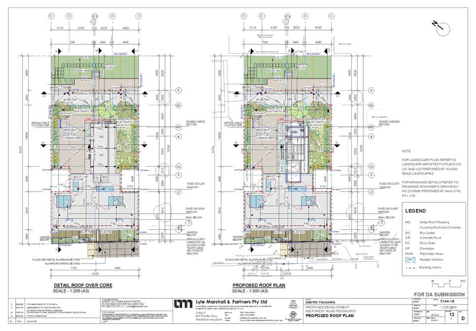
|
Georges
River Council - Georges River Local Planning Panel (LPP) - Thursday, 20
August 2020
LPP036-20 608 Forest Road Penshurst
[Appendix
2] Elevations -
608 Forest Rd Penshurst
|
Page 223
|
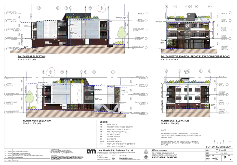
|
Georges
River Council – Local Planning Panel Thursday, 20 August
2020
|
Page 302
|
REPORT TO GEORGES RIVER COUNCIL
LPP MEETING OF Thursday, 20 August 2020
|
LPP Report No
|
LPP037-20
|
Development Application No
|
MOD2020/0076
|
|
Site Address & Ward Locality
|
506-508 Railway Parade Allawah
Kogarah Bay Ward
|
|
Proposed Development
|
Section 4.55(2) Modification of
Consent No: DA2017/0394 for demolition works and construction a residential
flat building to relocate the rooftop communal open space to ground level and
provide 3 additional residential units at level 5, and other design
rearrangements
|
|
Owners
|
Jomand Group Pty Ltd
|
|
Applicant
|
Jim Apostolou
|
|
Planner/Architect
|
Architect: Jim Apostolou; Planner:
ARPS
|
|
Date Of Lodgement
|
7/05/2020
|
|
Submissions
|
Two (2)
|
|
Cost of Works
|
$5,464,272.00
|
|
Local Planning Panel Criteria
|
The application proposes a
modification to development approved by the Local Planning Panel
|
|
List of all relevant s.4.15
matters (formerly s79C(1)(a))
|
State Environmental Planning Policy
No 65 – Design Quality of Residential Apartment Development, State
Environmental Planning Policy (Vegetation in Non-Rural Areas) 2017, State
Environmental Planning Policy (Building Sustainability Index: BASIX) 2004,
Greater Metropolitan Regional
Environmental Plan No 2 – Georges River Catchment, State Environmental
Planning Policy No 55 - Remediation of Land, State Environmental Planning
Policy (Infrastructure) 2007, Greater Metropolitan Regional Environmental Plan
No 2 – Georges River Catchment, State Environmental Planning Policy No
55 - Remediation of Land
Kogarah Local Environmental Plan
2012, Draft Georges River Local Environmental Plan 2020, Kogarah DCP 2013
|
|
List all documents submitted
with this report for the Panel’s consideration
|
Architectural Plans, Landscape
Plan, Stormwater Plan, Statement of Environmental Effects
|
|
Report prepared by
|
Senior Development Assessment
Planner
|
|
Recommendation
|
That the application be approved in accordance with the conditions
included in the report.
|
|
|
Summary of matters for
consideration under Section 4.15
Have all recommendations in relation
to relevant s4.15 matters been summarised in the Executive Summary of the
assessment report?
|
Yes
|
|
Legislative clauses requiring
consent authority satisfaction
Have relevant clauses in all
applicable environmental planning instruments where the consent authority
must be satisfied about a particular matter been listed and relevant
recommendations summarised, in the Executive Summary of the assessment
report?
|
Yes
|
|
Clause 4.6 Exceptions to
development standards
If a written request for a
contravention to a development standard (clause 4.6 of the LEP) has been
received, has it been attached to the assessment report?
|
Not
Applicable
|
|
Special Infrastructure
Contributions
Does the DA require Special
Infrastructure Contributions conditions (under s7.24)?
|
Not
Applicable
|
|
Conditions
Have draft conditions been provided
to the applicant for comment?
|
No,
standard conditions have been attached with no design changes. The conditions
can be viewed when the report is published.
|
|
Site Plan
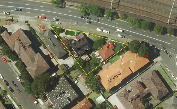
Site outlined in yellow
|
Executive Summary
Proposal
1. Council
is in receipt of a Section 4.55 (2) modification application for alterations
and additions to Development Approval No. DA2017/0394 to relocate the communal
open space and the addition of three (3) additional units and design changes to
enable these works.
2. Georges
River Local Planning Panel granted deferred commencement consent to Development
Application No. DA2017/0394 for demolition of existing dwellings and
construction of 6 storey residential flat building containing of 19 units and
basement parking. It is noted that the approved plans were for a five (5)
storey building containing 15 units.
3. The
application seeks to modify the approved residential flat building by deleting
one (1) unit from the ground floor, relocating the communal open space from the
rooftop to the ground floor and replacing the approved rooftop communal open
space with three (3) residential units. Details on the background associated
with the approval is provided at paragraphs five (5) to eight (8) of this
report.
4. The
proposal remains compliant with the maximum 21m height limit and floor space
ratio applicable to the site. The approved and proposed Railway Parade
elevations are provided below.
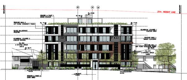
Figure 1: Approved
Railway Parade elevation
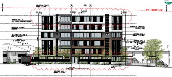
Figure 2: Proposed
Railway Parade elevation
Background
5. At its
meeting on 3 October 2019, the Local Planning Panel considered DA2017/0394,
which proposed a six (6) storey building containing eighteen (18) apartments.
Council staff recommended approval of the proposal, however the Panel resolved
to defer the determination as follows:
Deferral
Development Application No DA2017/0394 for the demolition, lot
consolidation, tree removal and construction of a 6 storey residential flat
building containing 19 units over 2 levels of basement parking at 506-508
Railway Parade, Allawah is deferred and the Panel invites the applicant to
submit the following:
1. Revised plans which remove
the rooftop communal open space and lift overrun from Level 6 and relocate the
communal open space to all or part of Level 5. Alternatively the
applicant could demonstrate that reasonable communal open space can be provided
at the ground level.
Amended plans addressing the Panel’s concerns above must be
submitted to the Council within 60 days, otherwise the application will be
determined on the information currently provided. Following receipt of
this information, the Panel (as constituted on 3 October 2019) will determine
the application electronically, unless the Chair determines that a further public
meeting is required.
6. In
response, the applicant submitted amended plans which proposed a five
(5) storey building containing fifteen (15) apartments, over basement parking
for twenty two (22) vehicles. The amended plans provided in response to the
reason for deferral included the following changes:
· Deletion
of the fifth floor (reduction of 3 apartments);
· Reduction
in height from 22.84m to 21m (compliant with the 21m height limit);
· Basement
2: deletion of the mechanical stacker parking spaces and provision of 12
resident parking spaces, resident storage cages and bicycle spaces;
· Basement
1: no change (6 resident spaces and 4 visitor spaces, motorbike and bicycle
parking plus resident storage).
7. The
amended plans were considered by the Georges River Local Planning Panel and
deferred commencement approval on the basis of the amended plans was granted on
12 December 2019.
8. The
applicant’s Statement of Environmental Effects submitted with this
modification application states:
“…since consent was granted, the applicant has
reconsidered the economic viability of the project and arising from further
design development during the Construction Certificate documentation phase, a
number of design changes are now proposed. In particular, the modifications
seek to relocate the communal open space from the rooftop to the Ground Floor
Level and to provide three (3) residential apartments at the upper level. The
communal open space replaces one of the ground floor apartments, so that the overall
increase in residential yield is two (2) apartments. Basement parking has also
been adjusted to cater for the two (2) additional apartments. It is considered
that the proposed design modifications are not contrary to the concerns raised
by the Local Planning Panel on the basis that although the approved development
moved the communal open space to Level 5, the Panel also offered the applicant
the opportunity to demonstrate that reasonable communal open space could be
provided at ground level.
Accordingly, this application seeks to modify the existing
development consent granted by the Georges River Local Planning Panel.”
Site and Locality
9. The
development site is located on the southern side of Railway Parade,
approximately 18m west of its intersection with Noble Street and 53m east of
its intersection with Woids Avenue. It consists of two (2) existing allotments
known as 506 and 508 Railway Parade, Allawah. These sites are legally
identified as Lots B and C in DP323018.
10. The
site is generally triangular in shape, though its front boundary along Railway
Parade is slightly curved. It has a total frontage to Railway Parade of 61.67m.
The south western boundary length is 46.47m and the south-eastern corner is
39.63m. The total site area is 963.7sqm.
11. The
land falls from Railway Parade to its rear (southern) corner by approximately
3m. There is a level difference of approximately 1.4m along the street
frontage, with the eastern corner sitting higher than the western corner.
12. Presently
situated on the site are two (2) dwelling houses, a detached garage, a detached
shed and an in-ground swimming pool.
13. The
site is situated amongst residential flat buildings (RFBs) of various scale,
heights and ages. Immediately to the west is a 2 storey RFB built prior to
1961. Immediately to the south east is a 2-3 storey RFB constructed in the late
1990s. Beyond, to the south and south west, are 4 storey RFBs that were
constructed in the late 1960s to 1970s.
14. The
site is located within an area that has been up-zoned under the Kogarah
“New City Plan”. The area is presently characterised by 2–4
storey RFBs of varying ages, the desired future character of the locality
resulting from the up-zoning is 6–7 storey RFBs.
15. To
the north on the opposite side of the railway corridor is B4 Mixed Use land
known as “East Quarter” with buildings ranging in height from 13 to
20 storeys
Zoning and Permissibility
16. The
subject site is zoned R3 Medium Density
Residential under the provisions of Kogarah Local Environmental
Plan 2012 (KLEP 2012). The proposal involves the modification of an
approved residential flat building which is a permissible use in the
zone with development consent.
Submissions
17. The
application was publicly notified to neighbours for a period of fourteen (14)
days in accordance with the Kogarah Development Control Plan 2013 (KDCP 2013).
Two (2) submissions were received during the notification period. The
submissions raised concern in relation to height, overshadowing, privacy, traffic
and parking.
Reason for Referral to the Local Planning Panel
18. This
application is referred to the Georges River Local Planning Panel for
determination on the basis that the residential flat building to which State
Environmental Planning Policy No 65 – Design Quality of Residential
Apartment Development was approved by the Panel.
Planning and Design Issues
19. The
proposal is generally an appropriate response to the site when considered against
the Design Quality Principles of State Environmental Planning Policy No 65
– Design Quality of Residential Apartment Development. Its bulk and scale
is consistent with the desired future character of the area.
20. The
modified proposal involves some minor Apartment Design Guide (ADG) building
separation “design criteria” non-compliances at the uppermost
level. These are detailed within the ADG Compliance Table within this report.
The variations are acceptable on merit on the basis that privacy impacts have
been mitigated to an appropriate degree and therefore the proposal meets the
objectives of the design criteria.
21. The
proposal complies with the maximum 21m building height and maximum 2:1 floor
space ratio development standards that apply to the site under Kogarah Local
Environmental Plan 2012.
Conclusion
22. The
application has been assessed having regard to S4.55(2) of the Environmental
Planning and Assessment Act 1979 (EP&A Act) and the Matters for
Consideration under Section 4.15(1) of the EP&A Act 1979. Following the
assessment of the proposal, it is considered that Modification No. MOD2020/0076
is worthy of support and is recommended for approval subject to amended
conditions of consent.
Report in
Full
PROPOSAL
23. The
application seeks to modify the approved residential flat building by
relocating the communal open space from the rooftop to the ground floor and
proposing three (3) units on the rooftop level. The proposal remains compliant
with the maximum 21m height limit and floor space ratio applicable to the site.
24. The
unit mix is proposed to be modified from the approved 5 x 1B, 6 x 2B and 4 x 3B
units to 1 x studio, 5 x 1B and 11 x 2B units.
25. Specifically,
the proposal seeks approval for the following modifications:
Basement
Level 2:
- Redesign of
parking spaces and storage spaces;
- Redesign of
service/storage area and relocation of fire stairs; and
- Redesigned
parking spaces to provide seven (7) standards spaces and four car stackers
(eight (8) spaces) to total 15 parking spaces.
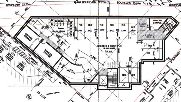
Figure 3: Approved
Basement Level 2
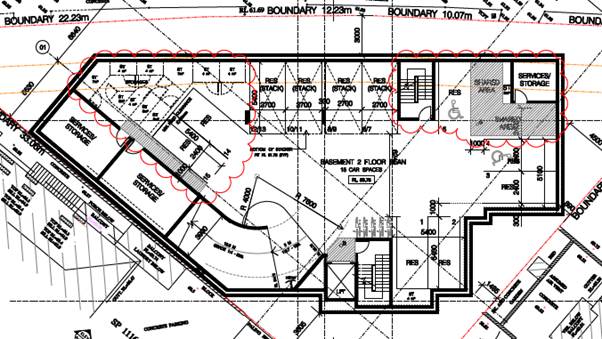
Figure 4: Proposed
Basement Level 2
Basement Level 1:
- Pump
room relocated;
- New
and relocated fire stairs;
- Relocated
storage cages;
- Redesigned
parking spaces to provide nine (9) standard parking spaces, comprising three
(3) visitor spaces and one (1) visitor/car wash bay, and five (5) residential
spaces.
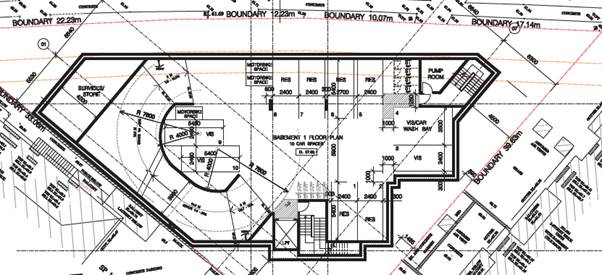
Figure 5: Approved
Basement Level 1
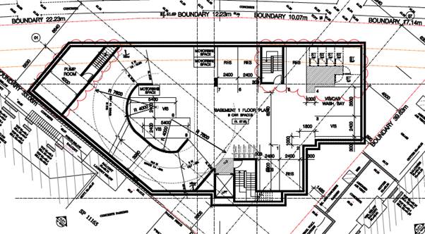
Figure 6:
Proposed Basement Level 1
Ground Floor:
- New
fire stairs from Basement Level 1;
- Relocated
fire stair from the eastern side to the centre of the ground floor;
- Relocation
of the building entry and lobby to between Unit G.02 and the communal open
space;
- Relocated
ramp along the eastern site boundary; and
- Deletion
of Unit G.03 and replacement with communal space. The communal space includes
indoor and outdoor facilities, covered terraces and north-facing landscaped
gardens to Railway Parade.
Rooftop Communal Open Space/Fifth
Floor:
- The
relocation of the rooftop communal open space to the ground floor results in
the fifth floor now containing three (3) units, being one (1) x one (1) bedroom
unit and two (2) x two (2) bedroom units.
THE SITE AND LOCALITY
26. The
subject site consists of two (2) lots with the following legal descriptions;
· Lot B
DP323018 (506 Railway Parade)
· Lot C
DP323018 (508 Railway Parade)
27. The
subject site is located on the southern side of Railway Parade and is
relatively close to the half-way point between Allawah and Hurstville railway
stations.
28. The
site is approximately 18m west of its intersection with Noble Street and 53m
east of its intersection with Woids Avenue.
29. The
site is generally triangular in shape, though its front boundary along Railway
Parade is slightly curved. It has a total frontage width to Railway Parade of
61.67m. The south-western boundary length is 46.47m and the south-eastern
corner is 39.63m. The total site area is 963.7sqm.
30. The
land falls from Railway Parade to its rear (southern) corner by about 3m. There
is a level difference of about 1.4m along the street frontage, with the eastern
corner sitting higher than the western corner.
31. 506
Railway Parade is currently occupied by a single storey brick and tile dwelling
house constructed prior to 1961. There is a detached garage in the backyard of
the property.
32. 508
Railway Parade is currently occupied by a two (2) storey brick and tile
dwelling house, also constructed prior to 1961 but renovated to include a
second storey addition and the installation of an in-ground swimming pool.
Refer to Figure 7 below.
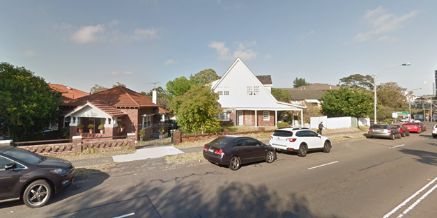
Figure 7: The
subject site with existing dwelling houses
33. Immediately
adjoining the site to the south east is a 2–3 storey Residential Flat
Building (RFB) (ie 2 storeys at street level and 3 storeys at its rear) known
as 504 Railway Parade. The top two (2) storeys contain ten (10) apartments
(five (5) per level, of which three (3) face the subject site. The lowest
storey contains car parking. The building has courtyards on its northern side
adjacent to the subject site, elevated above natural ground level by up to 1.7m
at its highest point towards the rear of the site due to the car parking level
protruding above ground.
34. Immediately
adjoining the site to the south-west are two (2) properties known as 510
Railway Parade and 6-8 Woids Avenue. The former is occupied by a 2 storey RFB
that was constructed prior to 1961, whilst the latter is occupied by a 3
– 4 storey RFB (ie four (4) storeys at street level and three (3) storeys
at its rear) constructed in the 1960s – 1970s.
35. The
site is situated at the northern edge of an extensive corridor of R3 Medium
Density Residential zoned land that extending from Hurstville station in the
west to St George Hospital in Kogarah to the east. This area has been up-zoned
under the Kogarah “New City Plan”. It is presently characterised by
two (2) – four (4) storey RFBs of varying ages, however the up-zoning has
a desired future character of six (6) – seven (7) storey RFBs. The
majority of this R3 zone has height and FSR limits of 15m (4-5 storeys) and
1.5:1, except along the railway corridor where the height and FSR limits
increase to 21m (6-7 storeys) and 2:1. The subject site is subject to the
latter.
36. To
the north on the opposite side of the railway corridor is B4 Mixed Use land
known as “East Quarter” with buildings ranging in height from 13 to
20 storeys.
ASSESSMENT
Section 4.55
Considerations
37. The application has been
made pursuant to Section 4.55(2) of the Environmental Planning and Assessment
Act 1979 to modify Development Consent No. DA2017/0394, dated 12
December 2019.
38. Section 4.55(2) of the
Environmental Planning and Assessment Act 1979 enables the consent authority to
modify a development consent upon application by the applicant or any person
entitled to act on the consent, provided that the consent authority:
Is satisfied the proposed development as modified is substantially
the same development for which consent was originally granted?
39. Comment: The proposed development and use of the site is the same as the original
approval.
Has consulted with the relevant Minister, public authority or
approval body with respect to a condition imposed on the consent or general
terms of approval.
40. Comment: Not
Applicable
Has advertised and or notified the application in accordance with
the regulations or a development control plan?
41. Comment: Yes neighbour notification for this application occurred under the provisions of KDCP 2013.
Has considered any submissions made concerning the proposed
modification.
42. Comment: Two submissions were received during the notification period.
Section 4.15 Evaluation
43. In
determining a section 4.55 modifications the provisions of Section 4.15 of the
EP&A Act 1979 (where relevant) need to be considered as part of the
assessment. The following considers the proposal in respect to these
requirements.
State Environmental Planning
Policies
44. Compliance
with the relevant state environmental planning policies is summarised in the
table, and discussed in more detail below.
|
State Environmental Planning
Policy
|
Complies
|
|
Greater Metropolitan Regional
Environmental Plan No 2 – Georges River Catchment
|
Yes
|
|
State Environmental Planning Policy
(Building Sustainability Index: BASIX) 2004
|
Yes
|
|
State Environmental Planning Policy
No 55 - Remediation of Land
|
Yes
|
|
State
Environmental Planning Policy (Vegetation in Non-Rural Areas) 2017
|
Yes
|
|
State Environmental Planning Policy
(Infrastructure) 2007
|
Yes
|
|
State Environmental Planning Policy No 65—Design Quality of
Residential Apartment Development
|
Yes
|
45. The
modified proposal does not alter the level of compliance with any SEPPs in
comparison to the approved development, with the exception of SEPP 65. An
assessment of the modification is provided below.
State
Environmental Planning Policy No 65 – Design Quality of Residential
Apartment Development
46. The
proposed modification does not affect the overall design quality of the
development which was also taken into consideration under Clause 29 of the SEPP
in the assessment of the original DA with regards to the cl 29(b) the design
quality principles, and cl 29(c) the Apartment Design Guide (ADG).
47. An
assessment of the application against the relevant Design Principles of SEPP 65
and the Objectives in the ADG is provided below.
Part 4 Application of Design Principles under the SEPP
Principle 1:
Context and neighbourhood character
48. The
additional level of units, which complies with the maximum height permitted for
the site, is not considered to be inconsistent with regard to its context and
how the modified built form will be reflected within the character of this
locality.
Principle 2:
Built form and scale
49. The
built form of the building, including the additional level of units, complies
with the height and FSR standards for the site, and its relationship to other
built form in the locality remains acceptable. The additional height is
acceptable and will not have a significant visual or amenity impact on the
adjoining allotments or the public domain. The solar access impact of the
proposal is not unreasonable given the context of the site and is discussed in
further detail in this report.
Principle 4:
Sustainability
50. An
updated BASIX certificate supporting the changed built form has been issued and
indicates compliance with the BASIX SEPP.
Principle 5:
Landscape
51. The
landscape principles for the proposal as amended will be met given the numeric
and functional criteria have been achieved.
Principle 6:
Amenity
52. The
modified development provides reasonable amenity for residents, neighbours and
visitors to the site which is consistent with Principle 6. The additional level
of units is supported as outlined in the ADG table below.
Principle
7: Safety
53. The
amended design does not affect the safety and security of the development.
Principle
8: Housing diversity and social
interaction
54. A
mix of studio, one (1) and two (2) bedroom apartments are proposed. The
modified proposal will provide 1 x studio, 5 x 1B and 11 x 2B units.
Principle
9: Aesthetics
55. The
additional level is in keeping with the design of the approved building,
maintains finishes and materials and is a suitable response to the existing and
desired local character of the area.
56. In
summary, the proposal is considered to be consistent with the principles of the
ADG and Design Principles of SEPP 65 – Design Quality of Residential
Apartment Development.
Clause
28 – Consideration of Apartment Design Guide
57. The
following table is an assessment against the Objectives of the ADG relevant to
the modification application.
|
ADG Compliance Table
|
|
|
|
Standard
|
Proposal
|
Complies
|
|
3D – Communal Open Space (COS)
|
|
Communal open space has a minimum
area equal to 25% of the site (241sqm).
At least 50% direct sunlight to the
principal usable part of the COS for at least 2 hours between 9 am and 3 pm
on 21 June (mid-winter)
|
Communal space is provided on the
ground floor in a combination of a communal room and an adjacent terrace,
with and area totalling 108sqm. It is noted the plan says 276sqm; however
some of this is within the front setback which cannot be include in this
calculation.
At least 50% of the communal open
space will receive direct sunlight during midwinter from 12pm onwards.
|
No – refer to comments below
Yes
|
|
Comments on communal open space:
The communal open space has been
designed as a combination of indoor and outdoor space on the ground floor.
Whilst not a typical location for communal open space in residential flat buildings,
the amended location can be supported on merit for the following reasons:
· It meets
Objective 3D-1 of the ADG for adequate space to be provided to enhance
residential amenity and to provide opportunities for landscaping;
· Increased
landscaped area is provided in the front setback when compared to the
approved development through the relocation of the fire stairs to the eastern
side of the pedestrian pathway leading to the building entry;
· the ADG
encourages communal rooms as common space on small lots;
· the communal
room offers an alternative indoor recreation space for residents to entertain
guests with kitchen facilities, tables and seating provided, which was not
available on the rooftop communal open space as approved.
There is a condition in the consent
requiring a Plan of Management to be submitted to Council, and approved by
the Manager of Building and Development, for the use of the communal area.
Despite the numerical
non-compliance with the control, the amended location of the communal area,
and the proposed combination of indoor and outdoor areas, is supported.
|
|
3E – Deep Soil Zones
|
|
Site area is 650sqm - 1,500sqm
= 3m minimum dimension
Min deep soil area of 7% (67.5sqm)
|
The majority of the deep soil areas
have minimum 3m x 3m dimensions and will allow for tree planting. Acceptable
deep soil is provided.
34% (335sqm)
|
Yes
Yes
|
|
3F – Visual Privacy
|
|
Minimum separation to side and rear
boundaries:
Up to 12m (4 storeys):
3m non-habitable rooms
6m habitable rooms & balconies
|
Ground to Level 4 - No change to
approved building.
Proposed Level 5:
Between 5.5m and 6.1m (same
setbacks as the approved levels below).
|
Yes
No – see comments below
|
|
Minimum separation to side and rear
boundaries:
12m to 25m (5-8 storeys):
4.5m non-habitable rooms
9m habitable rooms and balconies
|
|
Comments on visual privacy:
The proposed units on Level 5
maintain the setbacks of the approved levels below. Despite the numerical
non-compliance, the setbacks are supported as the elevations that face
adjoining residential neighbours contain frosted windows and privacy screens
to low activity rooms and the living areas and balconies are oriented to the
street to ensure the visual privacy of neighbours is not unreasonably
impacted. The design meets the objectives of the control.
Substantial landscaping is proposed
along the north eastern site boundary between the boundary and the communal
open space area to provide additional visual an acoustic privacy at the
ground level.
|
|
3G – Pedestrian Access and Entries
|
|
Building entries and pedestrian
access connects to and addresses the public domain
Multiple entries (including
communal building entries and individual ground floor entries) should be
provided to activate the street edge
|
The building entry has been
relocated to the eastern side of the ground floor unit (Unit G02) and the
western side of the communal open space room. Each of the ground floor units
has direct access to Railway Parade.
|
Yes
|
|
3H – Vehicle Access
|
|
Vehicle access points are designed and
located to achieve safety, minimise conflicts between pedestrians and
vehicles and create high quality streetscapes
|
No change to approved building.
|
|
3J – Bicycle and Car Parking
|
|
Car parking provided in accordance
with RMS GTTGD (Sub-Regional Centres) for sites located within
800m of a railway station or light rail stop in the Sydney Metropolitan Area:
Residential spaces:
0.6 spaces per 1br units (6)
= 3.6 spaces
0.9 spaces per 2br units (11)
= 9.9 spaces
14 residential spaces total minimum
Visitor spaces:
1 space per 5 units = 4 spaces
Total spaces: 18 minimum
|
20 residential spaces provided
within the basement levels.
4 visitor spaces provided within
the basement levels.
24 spaces total.
|
Yes
Yes
Yes
|
|
4A – Solar and Daylight Access
|
|
Living rooms and private open space
receive 2 hours direct sunlight between 9am and 3pm in midwinter for 70% of
apartments (i.e. 13 apartments)
Max. 15% of apartments receive no
direct sunlight between 9am and 3pm in midwinter
|
Two (2) hours sunlight achieved to
all 17 (i.e. 100%) apartments.
No (zero) apartments receive no
direct sunlight.
|
Yes
Yes
|
|
4B – Natural Ventilation
|
|
At least 60% of apartments are
naturally cross ventilated in the first nine storeys of the building (i.e. 11
apartments)
Overall depth of a cross-over or
cross-through apartment does not exceed 18m, measured glass line to glass
line.
|
65% (11 apartments)
No cross-over apartments exceed 16m
in depth.
|
Yes
Yes
|
|
4C – Ceiling Heights
|
|
Minimum ceiling heights measured
from FFL to finished ceiling level:
Habitable rooms = 2.7m
Non-habitable rooms = 2.4m
|
All habitable and non-habitable
rooms 2.7m min.
|
Yes
|
|
4D – Apartment Size and Layout
|
|
Minimum internal areas:
Studio: 35sqm
1br: 50sqm
2br: 70sqm
(Add 5sqm if second bathroom
proposed)
Each habitable room must have a
window in an external wall with a total minimum glass area of at least 10% of
the floor area of the room.
|
All apartments meet minimum
internal size requirements.
Calculated accordingly.
All apartments achieve compliance.
|
Yes
Yes
Yes
|
|
Habitable room depths are limited
to a maximum of 2.5 x the ceiling height
In open plan layouts (where the
living, dining and kitchen are combined) the maximum habitable room depth is
8m from a window
|
All rooms (excluding open plan
layouts) are compliant.
All apartments with open plan
layouts have a depth no greater than 8m.
|
Yes
Yes
|
|
Master bedrooms have a minimum area
of 10sqm and other bedrooms 9sqm (excluding wardrobe space)
Bedrooms have a minimum dimension
of 3m (excluding wardrobe space)
Living rooms or combined
living/dining rooms have a minimum width of:
- 3.6m for studio and 1 bedroom
- 4m for 2 and 3 bedroom apartments
Internal width of cross-over or
cross-through apartments are at least 4m
|
All bedrooms are compliant.
All bedrooms are compliant.
All living and living/dining rooms
achieve the minimum required widths.
N/A – none proposed.
|
Yes
Yes
Yes
N/A
|
|
4E – Private Open Space and Balconies
|
|
Minimum primary balcony sizes:
Studio: 4sqm area
1br: 8sqm area, 2m depth
2br: 10sqm area, 2m depth
3+br: 12sqm area, 2.4m depth
The minimum balcony depth to be
counted as contributing to the balcony area is 1m
For apartments at ground level or
on a podium or similar structure, a private open space is provided instead of
a balcony. It must have a minimum area of 15sqm and a minimum depth of 3m
|
All balconies achieve the minimum
area and depth requirements.
Calculated accordingly.
There is no change to the approved
studio (G02) terrace size (10sqm).
The 2b ground floor unit has a
terrace of 13sqm.
The 10sqm studio terrace and 13sqm
2B terrace are 150% and 130%, respectively, larger than the minimum balcony
size that would be required if the units were situated on any of the levels
above ground. They will therefore offer a high level of amenity for their
future occupants relative to an upper level studio apartment.
|
Yes
Yes
Yes – acceptable on merit
|
|
4F – Common Circulation Areas
|
|
Maximum 12 apartments off a
circulation core on a single level
|
No change to the approved building.
Three (3) units off each level.
|
|
4G – Storage
|
|
In addition to storage in kitchens,
bathrooms and bedrooms, the following storage is provided:
Studio: 4m3
1br: 6m³
2br: 8m³
At least 50% of storage is located
within the apartment
|
All units have compliant total storage
volumes as per the ADG volumes.
At least 50% of storage is located
within the apartment.
|
Yes
Yes
|
|
4H – Acoustic Privacy
|
|
Adequate building separation is
provided within the development and from neighbouring buildings/adjacent
uses.
Window and door openings are
generally orientated away from noise sources
Noisy areas within buildings
including building entries and corridors should be located next to or above
each other and quieter areas next to or above quieter areas
Storage, circulation areas and
non-habitable rooms should be located to buffer noise from external sources
|
The proposed additional level
maintains the approved setbacks of the lower levels.
Complies.
The building entry has been
relocated to be adjacent to the communal area on the ground floor.
No change to the approved layout.
|
Yes
Yes
Yes
Yes
|
|
4J – Noise and Pollution
|
|
To minimise impacts the following
design solutions may be used:
• Physical
separation between buildings and the noise or pollution source
• Residential
uses are located perpendicular to the noise source and where possible
buffered by other uses
• Buildings
should respond to both solar access and noise. Where solar access is away
from the noise source, non-habitable rooms can provide a buffer
• Landscape
design reduces the perception of noise and acts as a filter for air pollution
generated by traffic and industry
|
Physical separation of the approved
building and site boundaries remains the same; the communal area is relocated
from the roof to the ground floor which will reduce noise impacts to
neighbouring properties.
The introduction of the three (3)
units to the upper level has been assessed and is not considered to result in
unreasonable acoustic amenity impacts and the shadow cast by the proposed
amended design will have no greater impact than the approved building.
|
|
4K – Apartment Mix
|
|
A range of apartment types and
sizes is provided to cater for different household types now and into the
future.
The apartment mix is distributed to
suitable locations within the building.
|
1 x studio
5 x 1B
11 x 2B
Achieved.
|
Yes
Yes
|
|
4L – Ground Floor Apartments
|
|
Street frontage activity is
maximised where ground floor apartments are located
Design of ground floor apartments delivers
amenity and safety for residents
|
A reasonable degree of street
activation has been achieved.
Ground floor apartment amenity and
safety is satisfactory.
|
Yes
Yes
|
|
4M – Facades
|
|
Facades should be well resolved
with an appropriate scale and proportion to the streetscape and human scale
|
No change to approved building.
|
|
4N – Roof Design
|
|
Roof treatments are integrated into
the building design and positively respond to the street. Opportunities to
use roof space for residential accommodation and open space are maximised.
|
Clean, simple roof form with a lift
overrun that is located at the rear to minimise its visual impact to Railway
Parade, which is compliant with the 21m height limit for the site.
|
Yes
|
|
4O – Landscape Design
|
|
Landscape design is viable and
sustainable, contributes to the streetscape and amenity
|
A good range of plants within the
street setback are proposed to enhance the public domain. Deep soil zones
that exceed the minimum required by the ADG will provide a landscaped setting
with the compliant building setbacks enabling the planting of canopy trees to
soften the built form and provide a landscaped setting to the building,
thereby improving both the internal and external amenity.
|
Yes
|
|
4P – Planting on Structures
|
|
Planting on structures –
appropriate soil profiles are provided, plant growth is optimised with
appropriate selection and maintenance, contributes to the quality and amenity
of communal and public open spaces
|
No change to approved building.
|
|
4Q – Universal Design
|
|
Universal design – design of
apartments allow for flexible housing, adaptable designs, accommodate a range
of lifestyle needs
|
Two adaptable units are proposed.
|
|
4R – Adaptive Reuse
|
|
Adaptive reuse as apartment of
existing buildings- new additions are contemporary and complementary, provide
residential amenity while not precluding future adaptive reuse.
|
Not applicable – the
application relates to a new building.
|
|
4U – Energy Efficiency
|
|
Development incorporates passive
environmental design, passive solar design to optimise heat storage in winter
and reduce heat transfer in summer, natural ventilation minimises need for
mechanical ventilation
|
The proposal is BASIX compliant.
|
|
4V – Water Management and Conservation
|
|
Water management and conservation
– potable water use is minimised, stormwater is treated on site before
being discharged, flood management systems are integrated into the site
design
|
The services provided to the site
can be extended to service the proposed development.
|
|
4W – Waste Management
|
|
Waste management – storage
facilities are appropriately designed, domestic waste is minimised by
convenient source separation and recycling
|
A bulky waste storage room is
provided within the waste room on the Ground Level.
|
Yes
|
|
4X – Building Maintenance
|
|
Building design provides protection
from weathering
Enables ease of maintenance,
material selection reduces ongoing maintenance cost
|
The addition will be finished in
the same materials and finishes as those approved in the DA.
|
Draft Environmental
Planning Instruments
58. The Draft
Environment SEPP was exhibited from 31 October 2017 to 31 January 2018. This
consolidated SEPP proposes to simplify the planning rules for a number of water
catchments, waterways, urban bushland and Willandra Lakes World Heritage
Property. Changes proposed include consolidating the following seven existing
SEPPs:
· State Environmental Planning Policy No. 19 – Bushland in Urban
Areas;
· State Environmental Planning Policy (Sydney Drinking Water Catchment)
2011;
· State Environmental Planning Policy No. 50 – Canal Estate
Development;
· Greater Metropolitan Regional Environmental Plan No. 2 –
Georges River Catchment;
· Sydney Regional Environmental Plan No. 20 – Hawkesbury-Nepean
River (No.2-1997);
· Sydney Regional Environmental Plan (Sydney Harbour Catchment) 2005;
· Willandra Lakes Regional Environmental Plan No. 1 – World
Heritage Property.
59. The
proposal is not inconsistent with the provisions of this Draft Instrument.
60. The
Draft Remediation of Land SEPP was exhibited from 31 January
2018 to 13 April 2018. The proposed remediation of land SEPP will:
· Provide a state-wide planning framework for the remediation of land;
· Maintain the objectives and reinforce those aspects of the existing
framework that have worked well;
· Require planning authorities to consider the potential for land to
be contaminated when determining development applications and rezoning land;
· Clearly list the remediation works that require development consent;
· Introduce certification and operational requirements for remediation
works that can be undertaken without development consent.
61. The
proposal is not inconsistent with the provisions of this Draft Instrument.
Kogarah Local Environmental Plan
2012 (KLEP)
62. The subject site is zoned Zone R3 Medium Density Residential under the
provisions of Kogarah Local Environmental Plan 2012 (KLEP), see Figure 8
below. The proposal is defined as a residential flat building which is
permitted in the R3 zone with consent.
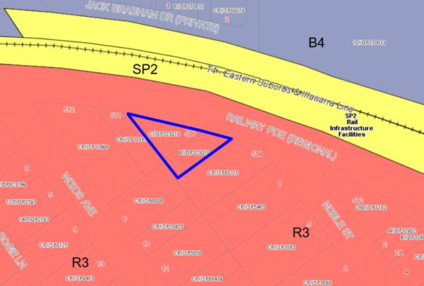
Figure 8: Zoning
map – the site outlined in blue
· To
provide for the housing needs of the community within a medium density
residential environment.
· To
provide a variety of housing types within a medium density residential
environment.
· To enable
other land uses that provide facilities or services to meet the day to day
needs of residents.
63. The
proposal satisfies the objectives of the R3 zone as it will provide for a
variety of residential apartments in a medium density residential environment.
64. The
proposal is fully compliant with the relevant provisions of KLEP 2012 as
detailed within the following table.
|
Kogarah Local Environmental Plan (KLEP) 2012 Compliance Table
|
|
Standard
|
Proposed
|
Complies
|
|
Clause
4.1A – Minimum subdivision lot size
|
|
Minimum
1,000sqm for RFBs in the R3 Medium Density Residential zone
|
963.7sqm
(ie 36.3sqm below the minimum lot
size).
|
No change from the approved
development (approved by the LPP 12 December 2019).
|
|
Clause
4.3 – Height of buildings
|
|
Maximum 21m
|
21m
|
Yes
|
|
Clause
4.4 – Floor space ratio (FSR)
|
|
Maximum 2:1
(1,927.4sqm)
|
1.46:1
|
Yes
|
|
Clause
4.5 – Calculation of floor space ratio and site area
|
|
FSR and site area calculated in
accordance with Cl.4.5
|
Calculated accordingly.
|
Yes
|
|
Clause
5.10 – Heritage Conservation
|
|
The objectives
of this clause are;
(a) to conserve the environmental heritage of Kogarah,
(ii) to
conserve the heritage significance of heritage items and heritage
conservation areas, including associated fabric, settings and views.
|
Proposal is not within the vicinity
of any environmental heritage nominated under KLEP 2012.
|
Yes
|
|
Clause
6.1 – Acid Sulphate Soils (ASS)
|
|
The objective of this clause is to ensure that
development does not disturb, expose or
drain ASS and cause environmental damage
|
The site is not affected by Acid
Sulfate Soils under KLEP 2012.
|
N/A
|
|
Clause
6.2 – Earthworks
|
|
To ensure that
earthworks do not have a detrimental impact on environmental functions and
processes, neighbouring uses, cultural or heritage items or features of the surrounding
land
|
Earthworks necessary to enable
construction of the proposal will be acceptable subject to conditions of
consent.
|
Yes
|
|
Clause
6.5 – Airspace Operations
|
|
The consent authority must not grant development
consent to development that is a controlled activity within the
meaning of Division 4 of Part 12 of the Airports Act 1996 of the
Commonwealth unless the applicant has obtained
approval for the controlled activity under regulations made for the purposes
of that Division
|
The proposal is not a controlled
activity under the relevant Division 4. The proposal has a maximum height of
RL 81 AHD which does not penetrate the Obstacle Limitation Surface (OLS).
|
N/A
|
Draft Georges River Local Environmental
Plan 2020
65. Consideration
is given to the provisions of Draft Georges River Local Environmental Plan 2020
in the assessment this application.
66. In
this regard, the provisions have no determining weight as a result of proposed
operation of Clause “1.8A Savings provisions relating to development
applications” of the Draft Plan which provides “If a
development application has been made before the commencement of this Plan in
relation to land to which this Plan applies and the application has not been
finally determined before that commencement, the application must be determined
as if this Plan had not commenced.”
67. In
relation to this development site the zoning is proposed to change for R3
Medium Density Residential to R4 High Density Residential, however the height
and floor space ratio are unchanged.
Kogarah Development Control Plan
2013 (KDCP)
68. The
proposed development is subject to the provisions of the Kogarah Development
Control Plan 2013 (KDCP2013).
Recent
Amendment to Part C2 – Medium Density Development of Kogarah DCP 2013
69. Arising
from the significant increase in development activity as a result of the New
City Plan (Amendment No 2) to the Kogarah Local Environmental Plan gazetted in
May 2017 which permitted greater density (2:1) and height (21m), Council
immediately proceeded to prepare an amendment to Part C of the Kogarah
Development Control Plan.
70. Council
has engaged Consultants to prepare a new Development Control Plan 2020 which
will consolidate and harmonise existing controls (Hurstville and Kogarah) to
establish appropriate new Georges River Council controls to assist with
redevelopment for up zoned sites.
In summary the development of the
DCP will involve five (5) stages;
· Stage 1 Community
Participation Plan
· Stage 2 General
and Industrial
· Stage 3
Residential Precincts
· Stage 4 Business
Precincts
· Stage 5 Specific
Sites and Localities
71. Stage
3 aims to review and establish controls across different precincts and
categories of residential developments (residential flat building’s,
multi-dwelling housing, dwelling houses, dual occupancy’s etc.). The
first task within this stage was to look at medium density development within
R3 zoned areas.
72. This Modification
Application was lodged on 7 May 2020 before the introduction of the latest
controls in Chapter C2 of the KDCP, however at Council’s meeting of 25
May 2020, Council adopted Part C2 - Medium Density Housing; with amendments as
a result of submissions received; and review by the Design Review Panel and
Council officers. The adopted Part C2 DCP has replaced the current Part C2 -
Medium Density Housing and repealed Appendices 2, 3 and 4 of the Kogarah DCP
2013.
73. The following compliance
table is an assessment of the proposal against the current C2 controls that
came into effect in June 2020. Where a
non-compliance has been identified in the table, the proposal is considered
acceptable on merit as the original development application was lodged and
approved well before the exhibition and adoption of the latest DCP controls for
this type of development.
|
Part C2- Medium Density Housing
– Kogarah DCP 2013
|
|
Part 1
Residential Flat Buildings
|
|
Required
|
Proposed
|
Complies
|
|
1.
Minimum site requirements
|
|
1000sqm minimum
lot size
24m minimum
frontage
|
The lot size
non-compliance 963.7sqm was assessed as part of the original DA.
|
|
2. Site
isolation and amalgamation
|
|
Adjoining sites
not to be left isolated.
Site
amalgamation requirements apply for specific sites.
|
This
development does not present amalgamation opportunities of adjoining
allotments.
|
|
3.
Building Setbacks
|
|
Front
setbacks
Up to four (4) storeys – 5m
Above four (4)
storeys – 8m (increased setback may be required if street is <20m
wide)
|
· Proposed
front setback to Railway Parade range from 3m to 8m.
· The
front boundary is slightly curved, and the outer “wings” on each
side of the building do not sit square to the boundary.
· The
wings come within 3m of the front boundary.
· The
central portion of the building between the wings sits at 5m from the front
boundary.
The outer walls
of the wings taper away from the front boundary and in doing so have a setback
of up to 8m.
|
The setbacks
were assessed as part of the original DA and are not altered by this
modification.
|
|
Side
boundary setbacks
Up to four (4) storeys – 6m
Above four (4) storeys – 9m
|
Min. 5m
Min. 5.5m
|
The setbacks
were assessed as part of the original DA and the proposed modification is
does not result in changes to the assessment in this regard.
|
|
Rear
boundary setbacks
Up to four (4) storeys – 6m
Above four (4) storeys – 12m
|
Triangular
shaped lot – two side boundaries and a front boundary.
|
The setbacks
were assessed as part of the original DA and the proposed modification is
does not result in changes to the assessment in this regard.
|
|
Encroachments
into boundary setbacks:
Ground floor
private open space may encroach up to 2m into the 5m front setback leaving a
min 3m of landscaped area to the street.
Ground floor
private open space may encroach up to 3m into the side setback leaving a min
3m of landscaped area to the street.
|
A 3m landscaped
setbacks is proposed to the street.
Private open
space does not encroach the side setback.
|
Yes
N/A
|
|
Setbacks are to
be landscaped
|
All site
boundaries will be landscaped with a range of trees, shrubs and groundcovers.
|
Yes
|
|
Powerlines to
be underground
|
Conditioned
|
Yes
|
|
Sub-stations,
fire booster valves and waste bin storage structures need to be integrated
into the development and identified at the DA stage.
|
Indicated on
the plans in a suitable location.
|
Yes
|
|
4.
Basement Setbacks
|
|
3m from site
boundaries
South
West
North
East
|
Variable due to
triangular shape of the site.
|
The setbacks
were assessed as part of the original DA.
|
|
Basement
setback areas are to be deep soil areas as defined in the ADG
|
Setbacks, where
provided, are deep soil areas.
|
Yes
|
|
Driveways and crossings
are to be located a minimum of 1.5m from a side boundary
|
Access to the
basement remains the same as the location approved on the DA plans being the
western front corner of the site on Railway Parade.
|
Yes
|
|
5.
Façade Treatment and Street Corners
|
|
Building
facades to be clearly articulated with high quality materials and finishes.
Modulation and
articulation in the building form to be explored.
Large areas of
blank, minimally or poorly articulated walls are not acceptable.
Façade treatments such as wall cladding and green walls should be
considered as alternatives.
Clear glazing
balustrades to be avoided where they are visible from the public
domain.
|
Level 5
proposes the same materials and finishes as the approved development.
Level 5 adopts
a similar modulation and articulation as the approved levels below.
Level 5 does
not introduce any blank facades or unarticulated walls.
The Level 5
balcony balustrades are predominantly solid construction.
|
Yes
Yes
Yes
Yes
|
|
6. Landscaped
area and Private Open Space
|
|
A minimum 10%
of the site is to be landscaped area that is not impeded by buildings or
structures above or below ground level with a minimum dimension of 2m on two
axes.
|
34%
|
Yes
|
|
Private open
space to be adjacent to and visible from the main living area/dining rooms
and be accessible
|
Provided
|
Yes
|
|
Private open
space and balconies must comply with Part 4E of the ADG
|
Complies
|
Yes
|
|
7.
Common Open space
|
|
Common Open
Space to be a minimum of 25% of the site area with a minimum dimension of 5m.
|
Communal open space provided is
278sqm (28%) with a minimum 5m dimension.
|
Yes
|
|
A maximum of
50% of common open space may be provided above ground level.
|
All common open space is provided
at ground level.
|
Yes
|
|
At least 50% of
the required common open space area is to receive 2 hours of direct sunlight
between 9am and 3pm on 21 June.
|
The communal open space faces north
and will receive at least 2 hours of sunlight to at least 50% of the area.
|
Yes
|
|
A minimum of
50% of the total area of common open space provided at ground level is to
comprise unpaved landscape area.
|
More than 50% of the communal open
space is landscaped area.
|
Yes
|
|
The useable and
trafficable area of any rooftop common open space is to be setback a minimum
of 2.5m from the edge of the roof of the floor below with landscape planters
to prevent overlooking.
|
Rooftop COS not proposed.
|
N/A
|
|
Roof top open
space areas should include equitable access.
|
Rooftop COS not proposed.
|
N/A
|
|
Ancillary
structures such as lift overruns and staircases should be centralised to
reduce their visual dominance.
|
Fire stairs and lift over runs are
centrally located.
|
Yes
|
|
8.
Solar Access
|
|
Where the
neighbouring properties are affected by overshadowing, at least 50% of the
neighbouring existing primary private open space or windows to main living
areas must receive a minimum of 3 hours sunlight between 9am–3pm on the
winter solstice (21 June)
|
The approved development does not
meet this control - refer to discussion following this table.
|
|
9.
Vehicular access, parking and circulation
|
|
Car parking to
be provided in accordance with Part B4 unless objective 3J-1 of the ADG
applies.
|
Development
complies with the ADG numerical parking requirements which is the applicable
assessment criterion for this application:
20 residential spaces provided
within the basement levels.
4 visitor spaces provided within
the basement levels.
24 spaces
total.
|
Yes
|
|
Car parking
layout and vehicular access complies with AS2890.1-2004
|
Complies,
reinforced by conditions of consent.
|
Yes
|
|
All residential
flat buildings to provide car wash bay
|
A visitor car
wash bay (space 4) has been provided. The KDCP allows for a visitor space to
double as a car wash bay.
|
Yes
|
|
10.
Views and view sharing
|
|
Provide for
reasonable sharing of views
|
The location
does not have significant views. The development generally complies with
height requirements and is reasonable in terms of view sharing.
|
Yes
|
|
11.
Dwelling Mix
|
|
Dwellings that
propose more than 10 dwellings are to provide a mix of dwellings as
follows:
Studio
apartments and 1 bed apartments - 20% min
2 bed
apartments – 30% max
3 bed
apartments – 15% min
|
The proposal
includes the following unit mix:
1 x studio = 6%
5 x 1 bedroom apartments = 29%
11 x 2 bedroom apartments = 65%
|
No however the
proposal provides a suitable mix of apartments.
|
|
12.
Adaptable and accessible housing
|
|
(i) 5-10 units
– 1 adaptable unit
(ii) 11-20
units – 2 adaptable units
(iii) 21-30
units – 3 adaptable units
(iv) 31-40
units – 4 adaptable units
(v) 41-50 units
– 5 adaptable units
(vi) 51+ units
- 6 adaptable units + 10% of additional dwellings beyond 60 (rounded up to
the nearest whole number).
Every adaptable
unit needs to have an accessible car space.
|
17 units
proposed – 2 adaptable units required
2 adaptable
units are proposed A1.02 and A2.02 with provision for accessible parking.
|
Yes
Yes
|
74. Where
non-compliance has been identified in the table above, the proposal is
considered acceptable on merit as the original Development Application was
approved prior to the introduction of the new controls and this modification
application was lodged prior to the adoption of the latest DCP controls for
this type of development.
Solar Access
Analysis
75. With
respect to the proposal satisfying the objectives and controls contained within
the DCP, the modified proposal does not alter the level of compliance with the
relevant (previous) DCP controls in comparison to the approved development,
with the exception of solar access to neighbouring properties.
76. At
its meeting on 3 October 2019, the Local Planning Panel raised concern in
relation to whether the height exceedance of the building could be supported
given the shadow impacts of the proposal. The DCP requires the
neighbours’ private open space and living areas to maintain 3 hours of
direct sunlight between 9am and 3pm at mid-winter.
77. The
applicant submitted amended shadow diagrams reflecting the reduced height of
the building (compliant at 21m). The electronic LPP report prepared following
the deferral of the application at the meeting of 3 October 2019 included a
solar analysis that concluded:
The proposal will result in non-compliant solar access to the two (2)
rearmost North West facing apartments at 504 Railway Parade. These apartments
each have two (2) windows and one (1) balcony facing the subject site. The
windows will receive approximately 1.5 – 1.75 hours of direct sunlight
mid-winter and the balcony will receive approximately 2 hours. The four (4)
apartments (ie 2 per level) closer to the street will each receive at least 3
hours of direct sunlight between 10am and 1pm mid-winter.
The extent of non-compliance with this requirement results from the
north west to south east alignment of Noble Street which has resulted in
allotments having a north east to south west orientation. In addition, the
topography of the locality is such that the land slopes down from Railway
Parade to the south, with a change in levels between the subject site and the
adjacent property to the south of up to 4m.
Redevelopment of any property on the western side of Noble Street
would result in a fairly high degree of overshadowing to the adjacent property
to the south east. Primarily this affects any north west facing windows on the
impacted properties for the most part to the apartments located towards the
rear of the building.
Land in Noble Street between Railway Parade and First Avenue has seen
uplift in maximum building height to 21m (ie 7 storeys) under the “New
City Plan” with a corresponding increase in maximum FSR to 2:1. As a
result, whilst the area is in transition the existing two (2) storey RFBs will
be prone to overshadowing by new 6-7 storey buildings, and particularly the
apartments at the rear of each building, as outlined previously, this is
exacerbated by the topographic and geographic relationship between the sites.
The proposal provides a reasonable envelope and complies with the
maximum height control, and accordingly is supported notwithstanding the
overshadowing non-compliance.
78. The
modified proposal includes shadow diagrams to demonstrate the shadow cast by
the proposed building (pink shading), and provides a comparison with the
approved building (dashed blue line) in Figures 9 to 11.
79. The
figures indicate the extent of shadow cast by the additional level is not
unreasonable compared to the approved building and will not impact other
properties on Woids Avenue or Noble Street that are not already impacted by the
approved building.
80. During
consideration of the DA by the LPP in October 2019, the Panel raised concerns
with providing support for the proposed height non-compliance of the lift
overrun that was servicing the rooftop communal open space given the impact
onto the residential allotments to the rear. Ultimately, the Panel deferred
determination of the application in order to allow the applicant the
opportunity to reduce the height to comply with the 21m height limit, by
removing the communal open space from Level 6 and relocating it to Level 5 or
relocating the communal open space to the ground floor, thus reducing the
number of units and ensuring compliance with the height control. The applicant
amended the plans by deleting Level 6 and relocating the communal open space to
Level 5 in lieu of the units originally proposed at that level.
81. This
modification seeks consent to relocate the communal open space to ground floor
and reintroduce three (3) units to Level 6, while complying with the height
control. As demonstrated in the shadow plans below, the additional shadow cast
is minimal and does not result in any additional properties being affected over
and above those already impacted by the approved development.
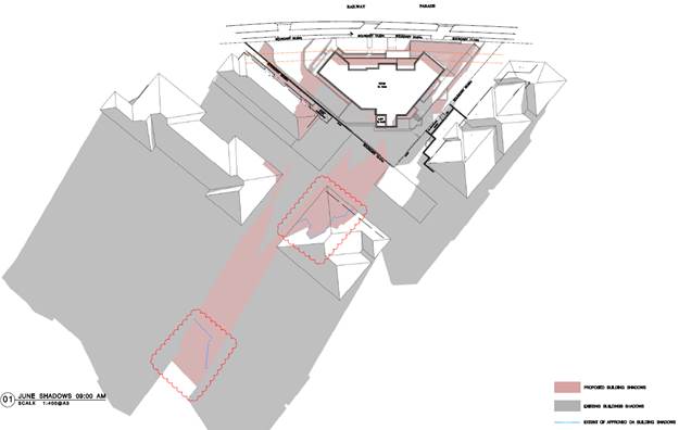
Figure 9: June
shadow at 9am
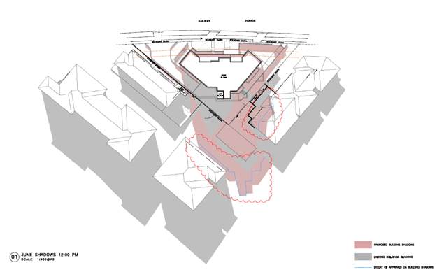
Figure 10: June
shadow at 12pm
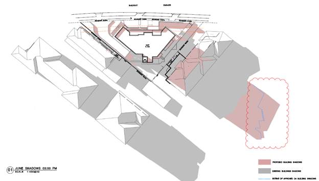
Figure 11: June
shadow at 3pm
|
11.
Solar access
|
|
Neighbours’
private open space and living areas to maintain 3 hours of direct sunlight
between 9am and 3pm at mid-winter.
|
· The
north west facing apartments at the rear of 504 Railway Parade will receive approximately
1.5 – 1.75 hours of direct sunlight between 9.30am and 11.15am
mid-winter.
· The
north east facing apartments at the rear of 510 Railway Parade will receive 3
hours of direct sunlight between 11am and 2pm at mid-winter.
· The
proposal will have negligible impact on 512 Railway Parade.
|
No, in relation
to 504 Railway Parade – see comment below
|
|
Comment on Solar Access
The proposal
will result in non-compliant solar access to the two (2) rearmost north-west
facing apartments at 504 Railway Parade. These apartments each have two (2)
windows and one (1) balcony facing the subject site. The windows will receive
approximately 1.5 – 1.75 hours of direct sunlight mid-winter and the
balcony will receive approximately 2 hours. The four (4) apartments (ie 2 per
level) closer to the street will each receive at least 3 hours of direct
sunlight between 10am and 1pm mid-winter.
The extent of
non-compliance with this requirement results from the north west to south
east alignment of Noble Street which has resulted in allotments having a
north east to south west orientation, noting the topography of the
locality.
Redevelopment
of any property on the western side of Noble Street (plus the subject site)
would result in a fairly high degree of overshadowing to the adjacent
property to the south east, primarily to any north west facing windows on
those properties and mostly to the apartments located towards the rear of the
building. Land in Noble Street between Railway Parade and First Avenue has
seen uplift in maximum building height to 21m (ie 7 storeys) under the
“New City Plan” with a corresponding increase in maximum FSR to
2:1. As a result, whilst the area is in transition the existing two (2)
storey RFBs will be prone to overshadowing by new 6–7 storey buildings,
and particularly the apartments at the rear of each building.
The future
desired character of Noble Street, between Railway Parade and First Avenue,
as defined in the planning controls will consist of 6–7 storey RFBs
which should individually seek to achieve a high level of compliance with the
solar access provisions of the ADG.
As the precinct
remains in transition, and given the local topography, the level of
overshadowing to existing developments, and the lower levels of potential
future development, will not comply with this control. However, when the
allotments to the south are redeveloped the upper levels will achieve
complaint solar access.
|
Interim Policy – Georges River Development Control Plan 2020
82. Council at its Environment and Planning Committee Meeting
dated 11 June 2019 resolved to adopt the Georges River Interim Policy DCP.
83. The
Interim Policy is a public policy that is to be used as a guide to set a
consistent approach for the assessment of residential development within the
LGA. It is a supplementary document,
meaning that current DCP controls will prevail if they are considered best
practice. The Interim Policy has no statutory recognition in the assessment of
DAs pursuant to the Environmental Planning and Assessment Act, 1979 (EP&A
Act).
84. The
modified proposal does not alter the level of compliance with the Interim
Policy controls in comparison to the approved development.
Developer Contributions
85. The
proposed development requires payment of developer contributions under Section
7.11 of the Environmental Planning and Assessment Act 1979. The modified
proposal is affected by the following adopted Development
Contribution Plans and the corresponding contributions are payable as shown,
calculated on the basis of 17 new residential apartments with a concession of
two existing dwelling houses. The condition of consent will be updated to
reflect the new units and the change in unit mix as follows:
|
Kogarah Section
94 Contribution Plan No.1 – Road and Traffic Management –
Residential
|
$1,308.07
|
|
Kogarah Section
94 Contribution Plan No.5 – Open Space 2007
|
$135,134.68
|
|
Kogarah Section
94 Contribution Plan No.9 – Kogarah Libraries – Buildings
|
$3,055.33
|
|
Kogarah Section
94 Contribution Plan No.9 – Kogarah Libraries – Books
|
$2,178.33
|
|
Total
Development Contributions payable
|
$141,676.41
|
Planning Agreements
86. There
is no planning agreement applicable to the development.
EP&A Regulation 2000
87. No
matters within the Regulation are affected by the modification. An
updated BASIX certificate has been lodged. The BASIX certificate reference in
the conditions of consent has been updated.
IMPACTS
Likely impacts of that development,
including environmental impacts
on both the natural and built environments,
and social and economic impacts in the locality
88. The
proposed changes result in minimal environmental impacts when compared to the development
previously approved, as discussed above.
Suitability of the site for the development
89. The
site is zoned R3 – Medium Density Residential. The proposal is a
permissible form of development in this zone. The proposed changes do not
affect the suitability of the site for the development, not impact the
development potential of the adjoining allotments.
SUBMISSIONS AND THE PUBLIC
INTEREST
90. The application was notified in accordance with the
provisions of KDCP 2013.Two (2) submissions were received. The issues
raised in the submissions are summarised and addressed below.
Overshadowing
91. Comments: The proposed
building will overshadow adjoining properties however the assessment of the
application concludes that the extent of overshadowing is not unreasonable in
this circumstance given the up-zoning of this area which is in transition in
combination with the topography of the locality. See detailed assessment above.
Height is greater than other buildings
92. Comments: The subject
sites, and properties on the eastern side of Noble Street and the Western side
of Woids Avenue, have a 21m height limit that was introduced through an
amendment to the Kogarah LEP 2012 in 2017. As a result of this uplift the
locality is in transition to higher densities. The proposal complies with the
maximum 21m height limit for the site.
Increased noise and traffic
93. Comments: The proposal
will result in increased traffic as a result of the additional number of people
residing on the site however the proposal provides the required number of
parking spaces within the basement parking levels. A Plan of Management for use
of the communal area will be a condition of consent to limit the number of
people using the communal area at any time, and to also limit the times within
which the communal area can be occupied. The residents who will occupy the
three (3) additional units proposed on Level 6 will not have an unreasonable
acoustic impact on the neighbouring properties.
The Public Interest
94. The proposal is considered to be in the public interest.
REFERRALS
Council
Referrals
95. The application was referred to other Council departments
for comment:
Traffic Engineer
– no objection to the proposed modification; no changes to conditions of
consent required.
Consultant Arborist
– no objection to the proposed modification; updated conditions of
consent have been provided.
Development Engineer
– no objection raised to the proposed modification.
External Referrals
Ausgrid
96. The application was referred to Ausgrid in accordance with
Clause 45 of State Environmental Planning Policy (Infrastructure) 2007. No
objection was raised by Ausgrid and no conditions recommended.
CONCLUSION
97. The application has been assessed having regard to the
Section 4.55(2) and the Matters for Consideration under Section 4.15(1) of the
EP&A Act 1979. Following assessment, it is considered that
Modification No. MOD2020/0076 is considered worthy of support.
98. The modifications to the approved development will not have
any unreasonable impacts on the natural or built environment beyond the
approved development and approval of the modification is recommended.
DETERMINATION AND STATEMENT OF REASONS
Statement of Reasons
99. The reasons for this recommendation are:
· The
proposal remains consistent with the original reasons for approval; and
· The
proposed modifications to the approved plans do not result in any adverse
impact on the natural and built environment.
Determination
100. THAT pursuant
to Section 4.55(2) of the Environmental Planning and Assessment Act 1979 that
the Georges River Local Planning Panel grant consent to Modification
Application MOD2020/0076 for modifications to DA2017/0394 which approved
demolition works and construction of a five (5) storey residential flat
building containing fourteen (14) units, the modification proposes an
additional level to accommodate three (3) additional units, resulting in the
development being a six (6) storey residential flat building containing
seventeen (17) units and twenty four (24) car parking spaces in accordance with
the conditions of consent originally imposed and modified as referenced below
at Lots B and C in DP323018 known as 506-508 Railway Parade, Allawah,
subject to the following amendments to the conditions of consent:
- Condition 3:
Approved
Plans – The development must be implemented in accordance with the
approved plans and supporting documentation listed below which have been
endorsed by Council’s approved stamp, except where marked up on the plans
and/or amended by conditions of this consent:
|
Description
|
Reference No.
|
Date
|
Revision
|
Prepared by
|
|
Stormwater Plans as per Section A – Deferred Commencement
Conditions
|
|
Site Plan
|
A-0600
|
20/04/2018
|
D
|
Architecture & Building Works
|
|
Basement 2 Plan
|
A-0800
|
28/10/2019
19/02/2020
|
F
G
|
Loucas Architects
|
|
Basement 1 Plan
|
A-0900
|
28/10/2019
19/02/2020
|
F
G
|
Loucas Architects
|
|
Ground Floor Plan
|
A-1000
|
28/10/2019
19/02/2020
|
F
G
|
Loucas Architects
|
|
First Floor Plan
|
A-1100
|
28/10/2019
19/02/2020
|
F
G
|
Loucas Architects
|
|
Second Floor Plan
|
A-1200
|
28/10/2019
19/02/2020
|
F
G
|
Loucas Architects
|
|
Third Floor Plan
|
A-1300
|
28/10/2019
19/02/2020
|
F
G
|
Loucas Architects
|
|
Fourth Floor Plan
|
A-1400
|
28/10/2019
19/02/2020
|
F
G
|
Loucas Architects
|
|
Fifth Floor Plan
|
A-1500
|
28/10/2019
19/02/2020
|
F
G
|
Loucas Architects
|
|
Roof Plan
|
A-1650
|
28/10/2019
19/02/2020
|
F
G
|
Loucas Architects
|
|
Elevation
|
A-1700
|
28/10/2019
19/02/2020
|
F
G
|
Loucas Architects
|
|
Elevation
|
A-1800
|
28/10/2019
19/02/2020
|
F
G
|
Loucas Architects
|
|
Elevation
|
A-1900
|
28/10/2019
19/02/2020
|
F
G
|
Loucas Architects
|
|
Section
|
A-2000
|
28/10/2019
19/02/2020
|
F
G
|
Loucas Architects
|
|
Ramp/Direction
|
A-2060
|
23/04/2018
|
D
|
Architecture &
Building Works
|
|
Adaptability Details
|
A-3000
|
23/04/2018
|
D
|
Architecture &
Building Works
|
|
Soil and Waste Management Plan
|
A-5000
|
23/04/2018
|
D
|
Architecture &
Building Works
|
|
Demolition Plan
|
A-6000
|
23/04/2018
|
D
|
Architecture &
Building Works
|
|
Landscape Plan – Cover Sheet
|
000
|
09/09/2019
17/04/2020
|
C
E
|
Site Image
|
|
Landscape Plan – Ground
|
101
|
09/09/2019
17/04/2020
|
C
E
|
Site Image
|
|
Landscape Plan – Level 6
|
102
|
09/09/2019
17/04/2020
|
C
E
|
Site Image
|
|
Landscape Plan – Landscape Details
|
501
|
10/05/2017
17/04/2020
|
B
E
|
Site Image
|
|
Acoustic Report
|
|
28/05/2018
|
-
|
Acoustic,
Vibration & Noise Pty Ltd
|
- Condition 50 – updated bin
numbers to be provided:
Waste
Storage – Residential and Mixed Use Developments – The
development must comply with all requirements of the Waste Management Plan
Issue A prepared by Mackenzie Architects International and dated 5 June 2018,
except where amended by the following:
Residential Waste
The development will require the provision of the following waste and
recycling facilities:
(a) Domestic Waste – Eight
(8) Nine (9) x 240L, collected once a week.
(b) Domestic Recycling – Six
(6) Nine (9) x 240L recycling bins collected once a week.
The waste and recycling bins must be presented weekly for kerbside
collections. All bins may only be taken to the kerb on the day immediately
preceding Council collection and returned to the basement waste storage room
within 24 hours following collection.
The waste room must contain the following to the satisfaction of the PCA,
in order to minimise odours, deter vermin, protect surrounding areas, and make
it a user-friendly and safe area:
· waste
room floor to be sealed;
· waste
room walls and floor surface is flat and even;
· all
walls painted with light colour and washable paint;
· equipment
electric outlets to be installed 1700mm above floor levels;
· The
bin storage rooms will be mechanically exhausted as required by AS 1668.2;
· light
switch installed at height of 1.6m;
· waste
rooms must be well lit (sensor lighting recommended);
· optional
automatic odour and pest control system installed to eliminate all pest
· types
and assist with odour reduction – this process generally takes place at
· building
handover – building management make the decision to install;
· all
personnel doors are hinged and self-closing;
· waste
collection area must hold all bins – bin movements should be with ease of
access;
· conform
to the Building Code of Australia, Australian Standards and local laws; and
childproofing and public/operator safety shall be assessed and ensured.
· Occupational
Health and Safety issues such as slippery floors in waste rooms and the weight
of the waste and recycling receptacles will need to be monitored.
· Cleaners
will monitor the bin storage area and all spills will be attended to
immediately by cleaners.
The path to the basement waste storage rooms must be at least 1.0 metres
wide and kept clear and unobstructed at all times.
- Condition 52 – updated S7.11
contributions:
Fees to be
paid – The fees listed in the table below must be paid in accordance
with the conditions of this consent and Council’s adopted Fees and
Charges applicable at the time of payment (available at www.georgesriver.nsw.gov.au).
Payments must be made prior to the issue of the Construction Certificate.
Please contact Council prior to the payment of Section 7.11 (Section 94)
Contributions to determine whether the amounts have been indexed from that
indicated below in this consent and the form of payment that will be accepted
by Council.
Council will only accept Bank Cheque or Electronic Funds Transfer (EFT)
for transaction values of $500,000 or over. Council must be contacted prior to
payment to determine correct total amount to be paid and bank account details
(if applicable).
A summary of the fees to be paid are listed below:
|
Fee Type
|
Fee
|
|
GENERAL FEES
|
|
Long Service
Levy (to Long Service Corporation) Or, provide evidence of Payment direct to
the Long Service Corporation. See https://portal.longservice.nsw.gov.au/bci/levy/
|
|
Damage Deposit
|
$76,224.12
|
|
Inspection Fee
of Major developments (min 2 inspections) – Non refundable
|
$371.00
|
|
Ground Anchor
Deposit (where excavation is to be supported by the use of below ground cable
anchors that are constructed under Council’s roadways / footpaths)
|
$61,670.00
|
|
Driveway Design
and Inspection Fee (Medium Density)
|
$745.45 (excl. GST)
|
|
DEVELOPMENT
CONTRIBUTIONS
|
|
|
Kogarah
Section 94 Contribution Plan No.1 – Road and Traffic Management –
Residential
|
$1,100.00
|
|
Kogarah
Section 94 Contribution Plan No.5 – Open Space 2007
|
$115,321.33
|
|
Kogarah Section
94 Contribution Plan No.9 – Kogarah Libraries – Buildings
|
$2,615.75
|
|
Kogarah
Section 94 Contribution Plan No.9 – Kogarah Libraries – Books
|
$1,864.94
|
|
Total
Development Contributions payable:
|
$120,913.03
|
|
Kogarah Section
94 Contribution Plan No.1 – Road and Traffic Management –
Residential
|
$1,308.07
|
|
Kogarah Section
94 Contribution Plan No.5 – Open Space 2007
|
$135,134.68
|
|
Kogarah Section
94 Contribution Plan No.9 – Kogarah Libraries – Buildings
|
$3,055.33
|
|
Kogarah Section
94 Contribution Plan No.9 – Kogarah Libraries – Books
|
$2,178.33
|
|
Total
Development Contributions payable:
|
$141,676.41
|
General Fees
The fees and charges above are subject to change and are as set out in
the version of Council’s Schedule of Fees and Charges or as required by
other Government Authorities, applicable at the time of payment.
Development Contributions
The Section 7.11 (Section 94) contribution is imposed to ensure that the
development makes adequate provision for the demand it generates for public
amenities and public services within the area.
Indexation
The above contributions will be adjusted at the time of payment to
reflect changes in the cost of delivering public amenities and public services,
in accordance with the indices provided by the relevant Section 7.11 (Section
94) Development Contributions Plan.
Timing of Payment
The contribution must be paid and receipted by Council prior to the
release of the Construction Certificate.
Further Information
A copy of the all current Development Contributions Plans may be
inspected or a copy purchased at Council’s offices (Georges River Civic
Centre, MacMahon Street, Hurstville and Kogarah Library and Service Centre,
Kogarah Town Square, Belgrave Street, Kogarah) or viewed on Council’s
website www.georgesriver.nsw.gov.au.
- Condition 56 – BASIX certificate
details updated:
BASIX
Commitments - All energy efficiency measures as detailed in the BASIX
Certificate No. 822722M_03 05 dated 8 November 2019 12
May 2020 must be implemented on the plans lodged with the application for
the Construction Certificate.
- Condition 59 – updated Landscape
Plans:
Landscape
Plans – All landscape works shall be carried out in accordance with
the approved landscape plans and specifications, drawn by Site Image Landscape
Architects, Ref No SS17 – 3520, 000B - 102B and dated 26/7/17 Ref
No SS17 – 3520, 101 Rev E - and dated 17/4/20. The landscaping shall
be maintained in accordance with the approved plans in perpetuity, subject to
the following -
a) The
proposed nineteen (19) twenty one (21) trees and plant species,
pot/ bag size and quantities of plants shall be in accordance with the proposed
plant schedule upon the landscape plan. If plant species, pot/ bag size and
quantities cannot be sourced, Council shall be contacted for alternatives.
b) Three
(3) street trees fronting Railway Parade shall form part of the landscape works
and paid for by the applicant.
c) All nineteen
(19) twenty one (21) trees proposed upon the approved landscape plan
shall comply with AS 2303 – 2018, Tree Stock for Landscape use and
NATSPEC Specifying Trees: a guide to assessment of tree quality (2003), and be
planted and maintained in accordance with Councils standard specification.
d) If
the planted trees and plants are found to be faulty, damaged, dying or dead within
twelve (12) months of planting then they must be replaced with the same
species. If the trees are found dead before they reach a height where they are
protected by Councils Tree Management Controls, they must be replaced with the
same species and pot/bag size.
e) A
certificate of compliance for the planting of all nineteen (19) trees and
shrubs proposed for the site. An AQF 5 Horticulturist shall be engaged and in
writing certify that all trees have been planted as per landscape plan and
specifications and forwarded to the PCA – Principal Certifying Authority.
- Condition 62 – updated
addressing detail:
Allocation
of street addresses - In order to comply with AS/NZS 4819:2011 Rural and
Urban Addressing & the NSW Addressing User Manual (Geographical Names Board
of NSW) and Georges River Council’s requirements, the street address for
the subject development is allocated as follows:
Primary
Street Address
· 506
Railway Parade ALLAWAH NSW 2218
Apartment
Addresses
· To
be obtained from Council’s GIS Unit
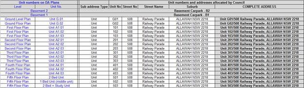
Details indicating compliance with this condition must be shown on the
plans lodged with any Construction Certificate for approval.
- Condition 84 – updated condition
for Plan of Management for communal area:
Use Of
Communal Rooftop Terrace Area – A Plan of Management (POM) for
use of the communal rooftop terrace on Level 3 area must be
submitted for approval of Council. The POM must include the following:
(a) The hours of use
of the rooftop terrace communal area must be restricted from 8am
until 10pm, 7 days a week.
(b) The maximum number
of users at any one time shall be specified (for this development a maximum of
20 is recommended).
(c) Outline
provisions to maximise the safety (fire safety and general safety) for users of
this area.
(d) Stipulate that no
amplified music is to be played on the terrace in the communal area.
(e) Identify other
measures to ensure that the amenity and safety of persons within the
development and in nearby existing and future development is maintained.
(f) Detail the location and type of signage to be
installed in the building to notify residents and visitors in respect to the
use of this space.
The POM shall be
submitted and approved in writing by Council’s Manager of Building and
Development.
The approved POM
shall be incorporated into the Owners Corporation by-laws in any future Strata
subdivision and a sign in the front entry of the building shall be included to
ensure the use of this space is monitored and understood by all occupants.
- Condition 108 –
updated Landscape Plans:
Completion
of Landscape Works - All landscape works must be completed before the
issue of the Final Occupation Certificate in accordance with approved landscape
plans and specifications, drawn by Conzept Landscape Architects, reference
numbers LPDA 20-007, Page Nos. 1 - 4, Rev. A, dated 09/07/2019.
All landscape
works, the planting of all twenty one (21) trees and the fees paid for three
(3) street trees must be completed before the issue of the Final
Occupation Certificate. In accordance with approved landscape plans and
specifications, drawn by Site Image Landscape Architects, Ref No SS17 –
3520, 101 Rev E - and dated 17/4/20. The landscaping shall be maintained in
accordance with the approved plans in perpetuity, subject to the following -
a) The proposed twenty one (21)
trees and plant species, pot/ bag size and quantities of plants shall be in
accordance with the proposed plant schedule upon the landscape plan. If plant species,
pot/ bag size and quantities cannot be sourced, Council shall be contacted for
alternatives.
b) Three (3) street trees fronting
Railway Parade Shall form part of the landscape works and paid for by the
applicant.
c) All twenty one (21) trees proposed
upon the approved landscape plan shall comply with AS 2303 – 2018, Tree
Stock for Landscape use and NATSPEC Specifying Trees: a guide to
assessment of tree quality (2003), and be planted and maintained in
accordance with Councils standard specification.
d) If the planted trees and plants are
found to be faulty, damaged, dying or dead within twelve (12) months of
planting then they must be replaced with the same species. If the trees are
found dead before they reach a height where they are protected by Councils Tree
Management Controls, they must be replaced with the same species and pot/bag
size.
e) A certificate of compliance for the
planting of all twenty one (21) trees and shrubs proposed for the site. An AQF
5 Horticulturist shall be engaged and in writing certify that all trees have
been planted as per landscape plan and specifications and forwarded to the PCA
– Principal Certifying Authority.
Tree
Protection Measures
(a) A
final certificate of compliance letter, once all building and landscape works
have been completed, from the engaged AQF 5 Consulting Arborist, that tree
protection measures have been installed and maintained for the entirety of the
project and report on the condition of the trees that as part of this Consent,
were to be protected and retained.
Tree Replacement within subject site
a) A minimum of 21 x
trees, which will attain a minimum mature height of nine (9) metres, shall be
planted within the property. The trees are to conform to AS2303 – 2018, Tree
stock for landscape use.
b) Tree species selected
shall be from Georges River Councils Tree Management Policy, April 2019.
Appendix 1 – Tree Planting.
c) If the replacement
trees are found to be faulty, damaged, dying or dead within twelve (12) months
of planting then they must be replaced with the same species. If the trees are
found dead before they reach a height where they are protected by Councils Tree
Management Controls, they must be replaced with the same species and pot/bag
size.
A copy of the
Hurstville City Council’s Tree Removal and Pruning Guidelines and Kogarah
City Council, Street Tree Management Strategy, Masterplan, and Tree Management
Policy 2019, can be downloaded from Council’s website www.georgesriver.nsw.gov.au.
CONDITIONS
The Development Application described above has
been determined by the granting of a Deferred Commencement Consent subject to
the conditions specified in this notice.
This is a
“Deferred Commencement” consent that is granted subject to
conditions under Section 4.16(3) of the Environmental Planning and Assessment
Act 1979 that the consent is not to operate until the person with the benefit
of this consent satisfies Georges River Council (“Council”) as to
the matters set out in SECTION A below. The period within which the applicant
must produce evidence to the Council sufficient enough to enable it to be
satisfied as to the matters in SECTION A is thirty six (36) months
from the date this deferred consent is granted.
If the person with
the benefit of this consent produces evidence to the Council within the period
specified sufficient to enable the Council to be satisfied as to the matters
set out in SECTION A and the Council notifies the person in writing that
it is satisfied as to the relevant matters, the development consent shall
become operative subject to compliance with conditions outlined in SECTION B.
SECTION A
1. (a) The Applicant
must acquire an Easement to Drain Water of 1 metre (minimum) width. The
easement must allow for a piped, gravity fed system of drainage of stormwater
from the subject site with direct, underground connection to Council's kerb and
gutter in Woids Avenue. Evidence of registration of the easement to drain water
benefitting the subject site and burdening the title of the properties listed
below is to be provided to Council:
i. 6 Woids Avenue,
Allawah
(b)
The applicant must obtain separate Development Consent for all drainage works
to be carried out within the Easement to Drain Water. The written consent of
each of the owners of the property/ies burdened by the Easement will be
required for each development application to carry out the drainage works on
the burdened lot/s.
(c)
The applicant must submit to Council a long section through the
stormwater drainage pipe to be located in the aforementioned easement, with
adequate surveyed spot levels along the full length of the pipe in the easement
and to the kerb.
(d)
A detailed design including a long section of the proposed pipe line within
the easement shall be provided up to 6 Woids Avenue and to the street gutter.
Surveyed detail of all existing features within the affected properties in the
vicinity of the proposed easement are to be accurately detailed on the design
including but not limited to structures, walls, retaining walls, pathways,
stairs and finished ground surface types. It will be required to be proven that
it is feasible to both construct and maintain a drainage line as is proposed.
2. The Applicant must
submit to and obtain approval/certification from Sydney Trains, the following
final version items in compliance with relevant ASA Standards https://www.transport.nsw.gov.au/industry/asset-standards-authority):
a) Geotechnical
and Structural report/drawings that meet Sydney Trains requirements. The
Geotechnical Report must be based on actual borehole testing conducted on the site
closest to the rail corridor.
b) Construction
methodology with construction details pertaining to structural support during
excavation. The Applicant is to be aware that Sydney Trains will not permit any
rock anchors/bolts (whether temporary or permanent) within its land or
easements.
c) Cross sectional
drawings showing the rail corridor, sub soil profile, proposed basement
excavation and structural design of sub ground support adjacent to the rail
corridor. All measurements are to be verified by a Registered Surveyor.
d) Detailed Survey
Plan showing the relationship of the proposed developed with respect to Sydney
Trains easement and rail corridor land.
e) If required by
Sydney Trains, an FE analysis which assesses the different stages of loading-unloading
of the site and its effect on the rock mass surrounding the rail corridor.
f) If required by
Sydney Trains, a Monitoring Plan.
Documentary evidence as requested or the above
information must be submitted within thirty six (36) months of the granting of
this deferred commencement consent. Commencement of the Consent cannot
commence until written approval of the submitted information has been given by
Council.
Subject to 1 and 2 above being satisfied a
development consent be issued, subject to the following conditions:
SECTION B
DEVELOPMENT DETAILS
3. Approved Plans –
The development must be implemented in accordance with the approved plans and
supporting documentation listed below which have been endorsed by
Council’s approved stamp, except where marked up on the plans and/or
amended by conditions of this consent:
|
Description
|
Reference No.
|
Date
|
Revision
|
Prepared by
|
|
Stormwater Plans as per Section A – Deferred Commencement
Conditions
|
|
Site Plan
|
A-0600
|
20/04/2018
|
D
|
Architecture & Building Works
|
|
Basement 2 Plan
|
A-0800
|
28/10/2019
19/02/2020
|
F
G
|
Loucas Architects
|
|
Basement 1 Plan
|
A-0900
|
28/10/2019
19/02/2020
|
F
G
|
Loucas Architects
|
|
Ground Floor Plan
|
A-1000
|
28/10/2019
19/02/2020
|
F
G
|
Loucas Architects
|
|
First Floor Plan
|
A-1100
|
28/10/2019
19/02/2020
|
F
G
|
Loucas Architects
|
|
Second Floor Plan
|
A-1200
|
28/10/2019
19/02/2020
|
F
G
|
Loucas Architects
|
|
Third Floor Plan
|
A-1300
|
28/10/2019
19/02/2020
|
F
G
|
Loucas Architects
|
|
Fourth Floor Plan
|
A-1400
|
28/10/2019
19/02/2020
|
F
G
|
Loucas Architects
|
|
Fifth Floor Plan
|
A-1500
|
28/10/2019
19/02/2020
|
F
G
|
Loucas Architects
|
|
Roof Plan
|
A-1650
|
28/10/2019
19/02/2020
|
F
G
|
Loucas Architects
|
|
Elevation
|
A-1700
|
28/10/2019
19/02/2020
|
F
G
|
Loucas Architects
|
|
Elevation
|
A-1800
|
28/10/2019
19/02/2020
|
F
G
|
Loucas Architects
|
|
Elevation
|
A-1900
|
28/10/2019
19/02/2020
|
F
G
|
Loucas Architects
|
|
Section
|
A-2000
|
28/10/2019
19/02/2020
|
F
G
|
Loucas Architects
|
|
Ramp/Direction
|
A-2060
|
23/04/2018
|
D
|
Architecture &
Building Works
|
|
Adaptability Details
|
A-3000
|
23/04/2018
|
D
|
Architecture &
Building Works
|
|
Soil and Waste Management Plan
|
A-5000
|
23/04/2018
|
D
|
Architecture &
Building Works
|
|
Demolition Plan
|
A-6000
|
23/04/2018
|
D
|
Architecture &
Building Works
|
|
Landscape Plan – Cover Sheet
|
000
|
09/09/2019
17/04/2020
|
C
E
|
Site Image
|
|
Landscape Plan – Ground
|
101
|
09/09/2019
17/04/2020
|
C
E
|
Site Image
|
|
Landscape Plan – Level 6
|
102
|
09/09/2019
17/04/2020
|
C
E
|
Site Image
|
|
Landscape Plan – Landscape Details
|
501
|
10/05/2017
17/04/2020
|
B
E
|
Site Image
|
|
Acoustic Report
|
|
28/05/2018
|
-
|
Acoustic,
Vibration & Noise Pty Ltd
|
(This condition is amended as part of MOD2020/0076 (DA2017/0394))
SEPARATE APPROVALS REQUIRED UNDER OTHER LEGISLATION
4. Vehicular
Crossing – Major Development – The following vehicular crossing
and road frontage works will be required to facilitate access to and from the
proposed development site:
(a) Construct a
1.2m wide footpath for the full length of the frontage of the site in
accordance with Council’s Specifications applying at the time
construction approval is sought.
(b) The
thickness and design of the driveway shall be in accordance with
Council’s Specifications applying at the time construction approval is
sought.
(c) Any existing
vehicular crossing and/or laybacks which are redundant must be removed. The
kerb and gutter, any other footpath and turf areas shall be restored at the
expense of the applicant. The work shall be carried out in accordance
with Council’s specification, applying at the time construction approval
is sought.
Constructing a vehicular crossing and/or footpath requires separate
approval under Section 138 of the Roads Act 1993, prior to the
commencement of those works.
5. Below ground
anchors – Information to be submitted with S68 Application under LGA 1993
and S138 Application under Roads Act 1993 – In the event that the
excavation associated with the basement carpark is to be supported by the use
of below ground (cable) anchors that are constructed under Council’s
roadways/footways, an application must be lodged with Council under Section 68
of the Local Government Act 1993 and the Roads Act 1993 for
approval, prior to commencement of those works.
The following details must be submitted.
a) That cable anchors
will be stressed released when the building extends above ground level to the satisfaction
of Council.
b) The applicant has
indemnified Council from all public liability claims arising from the proposed
works, and provide adequate insurance cover to the satisfaction of council.
c) Documentary
evidence of such insurance cover to the value of $20 million.
d) The applicant must
register a non-terminating bank guarantee in favour of Council for the amount
of $35,050.00. The guarantee will be released when the cables are stress
released. In this regard it will be necessary for a certificate to be submitted
to Council from a structural engineer at that time verifying that the cables
have been stress released.
e) That in the event
of any works taking place on Council’s roadways/footways adjoining the
property while the anchors are still stressed, all costs associated with
overcoming the difficulties caused by the presence of the ‘live’
anchors will be borne by the applicant.
6. Section 138
Roads Act 1993 and Section 68 Local Government Act 1993 – Unless
otherwise specified by a condition of this consent, this Development Consent
does not give any approval to undertake works on public infrastructure.
Separate approval is required under Section 138 of the Roads Act 1993
and/or Section 68 of the Local Government Act 1993 for any of the
following activities carried out in, on or over a public road (including the
footpath) listed below.
An application is required to be lodged and approved prior to the
commencement of any of the following works or activities;
(a) Placing or storing materials
or equipment;
(b) Placing or storing waste
containers or skip bins;
(c) Erecting a structure or
carrying out work
(d) Swinging or hoisting goods
over any part of a public road by means of a lift, crane or the like;
(e) Pumping concrete from a public
road;
(f) Pumping water from the
site into the public road;
(g) Constructing a vehicular
crossing or footpath;
(h) Establishing a “works
zone”;
(i) Digging up or disturbing
the surface of a public road (eg Opening the road for the purpose of
connections to utility providers);
(j) Stormwater and ancillary
works in the road reserve;
(k) Stormwater and ancillary to
public infrastructure on private land; and
(l) If any excavation is to
be supported by the use of below ground (cable) anchors that are constructed
under Council’s roadways/footways.
These separate activity approvals must be obtained and evidence of the
approval provided to the Certifying Authority prior to the issue of the
Construction Certificate.
The relevant Application Forms for these activities can be downloaded
from Council’s website www.georgesriver.nsw.gov.au.
For further information, please contact Council’s Customer Service Centre
on (02) 9330 6400.
7. Road Opening
Permit – A Road Opening Permit must be obtained from Council, in the
case of local or regional roads, or from the RMS, in the case of State roads,
for every opening of a public road reserve to access services including sewer,
stormwater drains, water mains, gas mains, and telecommunications before the
commencement of work in the road.
REQUIREMENTS OF CONCURRENCE, INTEGRATED & OTHER GOVERNMENT
AUTHORITIES
Sydney Trains
8. The Applicant shall
prepare an acoustic assessment demonstrating how the proposed development will
comply with the Department of Planning's document titled "Development Near
Rail Corridors and Busy Roads- Interim Guidelines". The Applicant must
incorporate in the development all the measures recommended in the report. A
copy of the report is to be provided to the Principal Certifying Authority and
Council prior to the issuing of a Construction Certificate. The Principal
Certifying Authority must ensure that the recommendations of the acoustic
assessment are incorporated in the construction drawings and documentation prior
to the issuing of the relevant Construction Certificate.
9. Prior to the issue
of a Construction Certificate the Applicant is to engage an Electrolysis Expert
to prepare a report on the Electrolysis Risk to the development from stray
currents. The Applicant must incorporate in the development all the measures
recommended in the report to control that risk. A copy of the report is to be
provided to the Principal Certifying Authority with the application for a
Construction Certificate. The Principal Certifying Authority must ensure that
the recommendations of the electrolysis report are incorporated in the
construction drawings and documentation prior to the issuing of the relevant
Construction Certificate.
10. If required by Sydney Trains,
prior to the issue of a Construction Certificate a Risk Assessment/Management
Plan and detailed Safe Work Method Statements (SWMS) for the proposed works are
to be submitted to Sydney Trains for review and comment on the impacts on rail
corridor. The Principal Certifying Authority is not to issue the Construction
Certificate until written confirmation has been received from Sydney Trains
confirming that this condition has been satisfied.
11. Prior to the issuing of a
Construction Certificate the Applicant must submit to Sydney Trains a plan
showing all craneage and other aerial operations for the development and must
comply with all Sydney Trains requirements. If required by Sydney Trains, the
Applicant must amend the plan showing all craneage and other aerial operations
to comply with all Sydney Trains requirements. The Principal Certifying
Authority is not to issue the Construction Certificate until written
confirmation has been received from the Sydney Trains confirming that this
condition has been satisfied.
12. Unless advised by Sydney
Trains in writing, all excavation, shoring and piling works within 25m of the
rail corridor are to be supervised by a geotechnical engineer experienced with
such excavation projects and who holds current professional indemnity insurance.
13. The design, installation and
use of lights, signs and reflective materials, whether permanent or temporary,
which are (or from which reflected light might be) visible from the rail
corridor must limit glare and reflectivity to the satisfaction of the light
rail operator. The Principal Certifying Authority is not to issue the
Construction Certificate until written confirmation has been received from
Sydney Trains confirming that this condition has been satisfied.
14. No scaffolding is to be used
facing the rail corridor unless prior written approval has been obtained from
Sydney Trains. To obtain approval the Applicant will be required to submit
details of the scaffolding, the means of erecting and securing this
scaffolding, the material to be used, and the type of screening to be installed
to prevent objects falling onto the rail corridor. Unless agreed to by Sydney
Trains in writing, scaffolding shall not be erected without isolation and
protection panels.
15. If required, prior to the
issue of a Construction Certificate the Applicant is to contact Sydney Trains
Engineering & Maintenance Interface to determine the need for public
liability insurance cover. If insurance cover is deemed necessary this
insurance be for sum as determined by Sydney Trains and shall not contain any
exclusion in relation to works on or near the rail corridor, rail
infrastructure and must be maintained for the duration specified by Sydney
Trains. The Applicant is to contact Sydney Trains Engineering & Maintenance
Interface to obtain the level of insurance required for this particular
proposal. Prior to issuing the Construction Certificate the Principal
Certifying Authority must witness written proof of this insurance in
conjunction with Sydney Trains written advice to the Applicant on the level of
insurance required.
16. If required, prior to the
issue of a Construction Certificate the Applicant is to contact Sydney Trains
Engineering & Maintenance Interface to determine the need for the lodgement
of a Bond or Bank Guarantee for the duration of the works. The Bond/Bank
Guarantee shall be for the sum determined by Sydney Trains. Prior to issuing
the Construction Certificate the Principal Certifying Authority must witness
written advice from Sydney Trains confirming the lodgement of this Bond/Bank
Guarantee.
17. If required by Sydney Trains,
prior to the commencement of works or at any time during the excavation and
construction period deemed necessary by Sydney Trains, a joint inspection of
the rail infrastructure and property in the vicinity of the project is to be
carried out by representatives from Sydney Trains and the Applicant. These
dilapidation surveys will establish the extent of any existing damage and
enable any deterioration during construction to be observed. The submission of
a detailed dilapidation report will be required within 10 days following the
undertaking of the inspection, unless otherwise notified by Sydney Trains.
18. The Applicant must ensure that
at all times they have a representative (which has been notified to Sydney
Trains in writing), who:
• oversees the carrying out of the Applicant's obligations under
the conditions of this consent and in accordance with correspondence issued by
Sydney Trains;
• acts as the authorised representative of the Applicant; and
• is available (or has a delegate notified in writing to Sydney
Trains that is available) on a 7 day a week basis to liaise with the
representative of Sydney Trains, as notified to the Applicant.
19. Without in any way limiting
the operation of any other condition of this consent, the Applicant must,
during demolition, excavation and construction works, consult in good faith
with Sydney Trains in relation to the carrying out of the development works and
must respond or provide documentation as soon as practicable to any queries
raised by Sydney Trains in relation to the works.
20. Where a condition of consent
requires consultation with Sydney Trains, the Applicant shall forward all
requests and/or documentation to the relevant Sydney Trains external party
interface team. In this instance the relevant interface team is Illawarra
Interface and they can be contacted via email on Illawarra
Interfacetransport.nsw.qov.au.
21. Copies of any certificates,
drawings, approvals/certification or documents endorsed by, given to or issued
by Sydney Trains or RailCorp must be submitted to Council for its records prior
to the issuing of the applicable Construction Certificate or Occupation
Certificate.
22. Sydney Trains or Transport for
NSW, and persons authorised by those entities for the purpose of this
condition, must be permitted to inspect the site of the development and all
structures to enable it to consider whether those structures have been or are
being constructed and maintained in accordance with the approved plans and the
requirements of this consent, on giving reasonable notice to the principal
contractor for the development or the owner or occupier of the part of the site
to which access is sought.
23. Any conditions issued as part
of Sydney Trains approval/certification of any documentation for compliance
with the Sydney Trains conditions of consent, those approval/certification
conditions will also form part of the consent conditions that the Applicant is
required to comply with.
24. Where a condition of consent
requires Sydney Trains or Transport for NSW endorsement the Principal
Certifying Authority is not to issue a Construction Certificate or Occupancy
Certificate, as the case may be, until written confirmation has been received
from those entities that the particular condition has been complied with. The
issuing of staged Construction Certificates dealing with specific works and
compliance conditions can be issued subject to written agreement from those
entities to which the relevant conditions applies.
25. Electricity Supply
– An application is required to be made to Ausgrid for a network
connection. This may require the network to be extended or its capacity
augmented. Evidence of this application being lodged with Ausgrid is required
to be provided to the Certifying Authority prior to the issue of a Construction
Certificate. For further details, you are advised to contact Ausgrid on 13 13
65 or www.ausgrid.com.au
(Business and Commercial Services).
26. Electricity Supply to
Development – The electricity supply to the development must be
underground.
27. Sydney
Water – Tap in TM – The approved plans must be submitted to
a Sydney Water Tap inTM to determine whether the development application will
affect Sydney Water’s sewer and water mains, stormwater drains and/or
easements, and if further requirements need to be met. The approved plans
will be appropriately endorsed. For details please refer to
‘Plumbing, building and developing’ section of Sydney Water’s
web site at www.sydneywater.com.au then see ‘Building’, or
telephone 13000 TAP IN (1300 082 746). The Certifying Authority must
ensure that a Tap inTM agent has appropriately stamped the plans prior to the
issue of the Construction Certificate.
28. Notice of Requirements for
a Section 73 Certificate – A Notice of Requirements of what will
eventually be required when issuing a Section 73 Compliance Certificate under
the Sydney Water Act 1994 must be obtained from Sydney Water Corporation.
Application must be made through an authorised Water Servicing Co-ordinator.
Please refer to the ‘Plumbing, building and developing’ section of
the web site www.sydneywater.com.au
then refer to ‘Providers’ under ‘Developing’ or
telephone 13 20 92 for assistance.
Following application, a ‘Notice of Requirements’ will advise
of water and sewer infrastructure to be built and charges to be paid.
Please make early contact with the Co-ordinator, as it can take some time to
build water/sewer pipes and this may impact on other services and building,
driveway or landscape design.
The Notice of requirements must be submitted prior to the commencement of
work. A Section 73 Compliance Certificate will be required at the completion of
development in accordance with further conditions.
PRIOR TO THE
ISSUE OF A CONSTRUCTION CERTIFICATE
29. Pre-Construction
Dilapidation Report – Private Land – A professional engineer
specialising in structural or geotechnical engineering shall prepare a
Pre-Construction Dilapidation Report detailing the current structural condition
of adjoining premises.
The report shall be prepared at the expense of the applicant and
submitted to the satisfaction of the Certifying Authority prior to the issue of
the Construction Certificate.
A copy of the pre-construction dilapidation report is to be provided to
the adjoining properties (subject of the dilapidation report), a minimum of 5
working days prior to the commencement of work. Evidence confirming that a copy
of the pre-construction dilapidation report was delivered to the adjoining
properties must be provided to the PCA.
Should the owners of properties (or their agents) refuse access to carry
out inspections, after being given reasonable written notice, this shall be
reported to Council to obtain Council’s agreement to complete the report
without access. Reasonable notice is a request for access in no sooner than 14
days between 8.00am-6.00pm.
30. Stormwater System
– The submitted stormwater plan has been assessed as a concept plan only.
Final detailed plans of the drainage system, prepared by a professional
engineer specialising in hydraulic engineering, shall be submitted for approval
with the Construction Certificate to the satisfaction of the PCA.
(a) All stormwater shall drain by gravity to
the easement to drain water in accordance with the Australian/New Zealand
Standard AS/NZS 3500.3: 2015 (as amended).
31. Stormwater Systems with
Basement - The underground basement car park must pump to and all other
stormwater must drain by gravity to the proposed OSD system.
The design of the
proposed drainage system must be prepared by a professional engineer who
specialises in hydraulic engineering and be submitted for approval with the
Construction Certificate application.
Protection of
basement from inundation of stormwater waters
The construction
of the building shall be designed to conform to the recommendations and
conclusions of [Insert author and date] in regards to the protection of the
underground basement from possible inundation by surface waters.
Evidence from a
professional engineer who specialises in hydraulic engineering that this design
requirement has been adhered to shall be submitted with the Construction
Certificate application to the satisfaction of the PCA.
32. Detailed Stormwater
Drainage Design – The submitted stormwater plan has been assessed as
a concept plan only. A detailed drainage design supported by a catchment area
plan and drainage calculations (including a Hydraulic Grade Line Analysis) must
be submitted with the Construction Certificate application.
33. On Site Detention –
The submitted stormwater plan has been assessed as a concept plan only. Final
detailed plans of the drainage system, prepared by a professional engineer
specialising in hydraulic engineering, shall be submitted for approval with the
Construction Certificate.
The submitted stormwater plan has been assessed as a concept plan only.
Final detailed plans of the drainage system, prepared by a professional
engineer specialising in hydraulic engineering, shall be submitted for approval
with the Construction Certificate.
An on-site detention (OSD) facility designed by a professional engineer
who specialises in Hydraulic Engineering must be designed, approved and
installed. The design must include the computations of the inlet and
outlet hydrographs and stage/storage relationships of the proposed OSD using
the following design parameters:
(a) peak
flow rates from the site are to be restricted to a permissible site discharge
(PSD) equivalent to the discharge when assuming the site contained a single
dwelling, garage, lawn and garden,
(b) At
Annual Recurrence Intervals of 2 years and 100 years.
Refer to Flow Controls in Council's
Draft/Adopted Stormwater Drainage Policy.
The OSD facility shall be designed to meet all
legislated safety requirements and childproof safety fencing around the
facility must be provided where the OSD facility is open or above ground when
the design peak storage depth is greater than 300mm. A durable metal plate or
similar sign is to be placed at the OSD facility and must bear the words:
"BEWARE: This is an on-site detention
basin/tank for rainwater which could overflow during heavy storms."
Full details shall accompany the application
for the Construction Certificate to the satisfaction of the PCA.
34. Pump-Out System Design for
Stormwater Disposal – The design of the pump-out system for
stormwater disposal will be permitted for drainage of basement areas only, and
must be designed in accordance with the following criteria:
a) The pump system shall
consist of two pumps, connected in parallel, with each pump being capable of
emptying the holding tank at the rate equal to the rate of inflow for the one
hour duration storm. The holding tank shall be capable of holding one
hour’s runoff from a one hour duration storm of the 1 in 20 year storm;
b) The pump system shall be
regularly maintained and serviced, every six (6) months; and
c) Any drainage disposal to
the street gutter from a pump system must have a stilling sump provided at the
property line, connected to the street gutter by a suitable gravity line.
Details and certification of compliance from a professional engineer
specialising in civil engineering shall be provided for approval with the
Construction Certificate application to the satisfaction of the PCA.
35. Driveway Construction Plan
Details – Detailed engineering plans for the driveway shall be
submitted with the Construction Certificate application for approval that show
the following to the satisfaction of the PCA:
a) Longitudinal and cross
sections, gradients, access onto the proposed lots, type of construction
materials designed in accordance with Council’s Subdivision standards and
AS/NZS2890.1-2004.
b) Suitable underground
provision for the supply of all relevant services to the proposed lots
(proposed position of pipes and conduits).
c) The full length of the
driveway designed with a minimum 150mm thick reinforced concrete and minimum of
2.7m wide pavement/kerb face to kerb face width, and a non-slip surface.
36. Stormwater Drainage Plan
Details – Stormwater drainage plans including pipe sizes, type,
grade, length, invert levels, dimensions and types of drainage pits prepared by
a professional engineering specialising in hydraulic engineering shall be
submitted with the Construction Certificate application to the satisfaction of
the PCA.
These plans shall be prepared in accordance with the Australian Institute
of Engineers Australian Rainfall and Runoff (1987) and Council's stormwater
drainage guide lines.
37. Council Property Shoring
– Prior to the issue of the Construction Certificate, plans and
specifications prepared by a professional engineer specialising in practising
structural engineering must detail how Council’s property shall be
supported at all times.
Where any shoring is to be supporting, or located on Council’s
property, certified structural engineering drawings detailing; the extent of
the encroachment, the type of shoring and the method of removal, shall be
included on the plans. Where the shoring cannot be removed, the plans
must detail that the shoring will be cut to 150mm below footpath level and the
gap between the shoring and any building shall be filled with a 5Mpa lean
concrete mix.
Documentation in this regard must be submitted to the satisfaction of the
PCA prior to the release of the Construction Certificate.
38. Damage Deposit –
Major Works – In order to insure against damage to Council property
the following is required:
a) Pay Council, before the
issue of the Construction Certificate, a damage deposit for the cost of making
good any damage caused to any Council property as a result of the development:
$76,224.12
b) Pay Council, before the
issue of the Construction Certificate, a non-refundable inspection fee to
enable assessment of any damage and repairs where required: $371.00
c) Submit to Council, before
the commencement of work, a dilapidation report of the condition of the Council
nature strip, footpath and driveway crossing, or any area likely to be affected
by the proposal.
At the completion of work Council will review the dilapidation report and
the Works-As-Executed Drawings (if applicable) and inspect the public works.
The damage deposit will be refunded in full upon completion of work where
no damage occurs and where Council is satisfied with the completion of works.
Alternatively, the damage deposit will be forfeited or partly refunded based on
the damage incurred.
Evidence of the payment of the above fees must be provided to the
satisfaction of the PCA prior to the release of a Construction Certificate.
39. Access for Persons with a
Disability – Access for persons with disabilities must be provided
throughout the site, including to all common rooms, lobby areas and sanitary
facilities in accordance with the requirements of the Premises Standards, the
Building Code of Australia and AS 1428.1. Details must be submitted with the
Construction Certificate Application to the satisfaction of the PCA.
In regards to the above, pedestrian access throughout basement levels
shall be highlighted/line marked and sign posted to safeguard egress.
40. Vibration Damage –
To minimise vibration damage and loss of support to the buildings in close
proximity to the development, any excavation is to be carried out by means of a
rock saw and if available, in accordance with the guidelines of the Geotechnical
Engineer’s report.
Alternatively where a hydraulic hammer is to be used within 30 metres of
any building (other than a path or a fence) a report from a qualified
geotechnical engineer detailing the maximum size of hammer to be used is to be
obtained and the recommendations in that report implemented during work on the
site. The report shall be submitted with the Construction Certificate
application to the satisfaction of the PCA.
41. Slip Resistance –
All pedestrian surfaces in areas such as foyers, public corridors/hallways,
stairs and ramps as well as floor surfaces in the wet rooms in any
commercial/retail/residential units must have slip resistance classifications,
as determined using test methods in either wet or dry conditions, appropriate
to their gradient and exposure to wetting. The classifications of the new
pedestrian surface materials, in wet or dry conditions, must comply with
AS/NZS4586:2004 – Slip Resistance Classifications of New Pedestrian
Materials and must be detailed on the plans lodged with the application for the
Construction Certificate to the satisfaction of the PCA.
42. Geotechnical Reports -
The applicant must submit a Geotechnical Report, prepared by a professional
engineer specialising in geotechnical engineering who holds the relevant
Certificate of accreditation as required under the Building Professionals Act
2005 in relation to dilapidation reports, all site works and
construction. This is to be submitted before the issue of the
Construction Certificate to the satisfaction of the PCA and is to include:
(a) Investigations certifying the
stability of the site and specifying the design constraints to be placed on the
foundation, any earthworks/stabilization works and any excavations.
(b) Dilapidation Reports on the
adjoining properties including, but not limited to adjoining properties prior
to any excavation of site works. The Dilapidation Report is to include
assessments on, but not limited to, the dwellings at those addresses and any
external paths, grounds etc. This must be submitted to the PCA and the
adjoining residents as part of the application for the Construction
Certificate. Adjoining residents are to be provided with the report five
(5) working days prior to any works on the site.
(c) On-site guidance by a
vibration specialist during the early part of excavation.
(d) Measures to minimise vibration
damage and loss of support to other buildings. Where possible any excavation
into rock is to be carried out with tools such as rock saws which reduce
vibration to adjoining buildings and associated structures. Where a hydraulic
hammer is to be used within 30 metres of any building (other than a path or a
fence) the report shall detail the maximum size of hammer to be used and
provide all reasonable recommendations to manage impacts.
(e) Sides of the excavation are to
be piered prior to any excavation occurring to reinforce the walls of the
excavation to prevent any subsidence to the required setbacks and neighbouring
sites.
43. Fire and Rescue NSW -
Prior to the issue of a Construction Certificate the applicant may be required,
under Clause 144 of the Environmental Planning & Assessment Regulation,
2000 to seek written comment from Fire and Rescue NSW about the construction of
hydrant/booster pump and valve rooms, and any Fire Engineered Solution
developed to meet the performance requirements under the Category 2 Fire Safety
Provisions.
44. Fire Safety Measures
– Prior to the issue of a construction certificate a list of the
essential fire safety measures that are to be provided in relation to the land
and any building on the land as a consequence of the building work must
accompany an application for a construction certificate, which is required to
be submitted to either Council or a PCA. Such list must also specify the
minimum standard of performance for each essential fire safety measure included
in the list. The Council or PCA will then issue a Fire Safety Schedule for the
building.
45. Structural details
– Engineer's details prepared by a practising Structural Engineer being
used to construct all reinforced concrete work, structural beams, columns &
other structural members. The details are to be submitted to the
Principal Certifying Authority for approval prior to construction of the
specified works. A copy shall be forwarded to Council where Council is not the
PCA.
46. Construction Traffic
Management Plan – A Construction Traffic Management Plan detailing:
(a) construction vehicle routes;
(b) anticipated number of trucks
per day;
(c) hours of construction;
(d) Access arrangements; and
(e) Proposed traffic measures to
minimise impacts of construction vehicles
must be submitted for the approval of Council’s
Engineers. Council’s Engineers must specify in writing that they are
satisfied with the Traffic Management Plan prior to the issue of the
Construction Certificate.
47. Acoustic Requirements
– Compliance with submitted Acoustic Report - Road traffic noise criteria
for sensitive developments – The building must be designed and
constructed so that the road traffic noise levels inside the building comply
with the noise criteria specified in Development Near Rail Corridors and Busy
Roads – Interim Guideline (Department of Planning, 2008). This may
require the installation of mechanically ducted air-conditioning / ventilation
to each apartment to be determined and designed by the project acoustic
consultant so as not to adversely impact the amenity of adjacent or nearby
properties.
The project
Acoustic Consultant must provide certification in writing to the satisfaction
of the PCA that the Construction Certificate plans are compliant with the
recommendations of the Acoustic Report, titled Acoustic Report prepared by
Acoustic, Vibration & Noise Pty Ltd and dated 28 May 2018.
48. Car Wash Bays –
The visitor space/car wash bay (Space #4 in Basement 1) shall consist of a
bunded bay with pre-treatment approved by Sydney Water. The water from the car
wash bay must be graded to a drainage point and connected to sewer.
If alternative water management and disposal options are proposed (i.e.
where water is recycled, minimised or reused on the site), detailed plans and
specifications of the water recycling system must be submitted with the
application for the Construction Certificate for approval.
49. SEPP 65 Design Verification
Statement – A design verification statement, prepared by a qualified
designer, shall be submitted to the satisfaction of the Certifying Authority
verifying that the plans and specifications achieve or improve the design
quality of the development for which development consent was granted, having
regard to the design quality principles set out under Schedule 1 of State
Environmental Planning Policy No 65 –Design Quality of Residential Flat
Development.
50. Waste Storage –
Residential and Mixed Use Developments – The development must comply
with all requirements of the Waste Management Plan Issue A prepared by
Mackenzie Architects International and dated 5 June 2018, except where amended
by the following:
Residential Waste
The development will require the provision of the following waste and
recycling facilities:
(a) Domestic Waste – Eight
(8) Nine (9) x 240L, collected once a week.
(b) Domestic Recycling – Six
(6) Nine (9) x 240L recycling bins collected once a week.
The waste and recycling bins must be presented weekly for kerbside
collections. All bins may only be taken to the kerb on the day immediately
preceding Council collection and returned to the basement waste storage room
within 24 hours following collection.
The waste room must contain the following to the satisfaction of the PCA,
in order to minimise odours, deter vermin, protect surrounding areas, and make
it a user-friendly and safe area:
· waste
room floor to be sealed;
· waste
room walls and floor surface is flat and even;
· all
walls painted with light colour and washable paint;
· equipment
electric outlets to be installed 1700mm above floor levels;
· The
bin storage rooms will be mechanically exhausted as required by AS 1668.2;
· light
switch installed at height of 1.6m;
· waste
rooms must be well lit (sensor lighting recommended);
· optional
automatic odour and pest control system installed to eliminate all pest
· types
and assist with odour reduction – this process generally takes place at
· building
handover – building management make the decision to install;
· all
personnel doors are hinged and self-closing;
· waste
collection area must hold all bins – bin movements should be with ease of
access;
· conform
to the Building Code of Australia, Australian Standards and local laws; and
childproofing and public/operator safety shall be assessed and ensured.
· Occupational
Health and Safety issues such as slippery floors in waste rooms and the weight
of the waste and recycling receptacles will need to be monitored.
· Cleaners
will monitor the bin storage area and all spills will be attended to
immediately by cleaners.
The path to the basement waste storage rooms must be at least 1.0 metres
wide and kept clear and unobstructed at all times.
(This condition is amended as part of MOD2020/0076 (DA2017/0394))
51. Waste Handling Systems
– All waste handling equipment and systems used in conjunction with the
provision of waste and recycling services shall be manufactured, installed and
maintained in accordance with any applicable regulatory requirements, relevant
Australian Standards, and relevant manufacturer’s specifications.
52. Fees to be paid –
The fees listed in the table below must be paid in accordance with the
conditions of this consent and Council’s adopted Fees and Charges
applicable at the time of payment (available at www.georgesriver.nsw.gov.au).
Payments must be made prior to the issue of the Construction Certificate.
Please contact Council prior to the payment of Section 7.11 (Section 94)
Contributions to determine whether the amounts have been indexed from that
indicated below in this consent and the form of payment that will be accepted
by Council.
Council will only accept Bank Cheque or Electronic Funds Transfer (EFT)
for transaction values of $500,000 or over. Council must be contacted prior to
payment to determine correct total amount to be paid and bank account details
(if applicable).
A summary of the fees to be paid are listed below:
|
Fee Type
|
Fee
|
|
GENERAL FEES
|
|
Long Service
Levy (to Long Service Corporation) Or, provide evidence of Payment direct to
the Long Service Corporation. See https://portal.longservice.nsw.gov.au/bci/levy/
|
|
Damage Deposit
|
$76,224.12
|
|
Inspection Fee
of Major developments (min 2 inspections) – Non refundable
|
$371.00
|
|
Ground Anchor
Deposit (where excavation is to be supported by the use of below ground cable
anchors that are constructed under Council’s roadways / footpaths)
|
$61,670.00
|
|
Driveway Design
and Inspection Fee (Medium Density)
|
$745.45 (excl. GST)
|
|
DEVELOPMENT
CONTRIBUTIONS
|
|
|
Kogarah
Section 94 Contribution Plan No.1 – Road and Traffic Management –
Residential
|
$1,100.00
|
|
Kogarah
Section 94 Contribution Plan No.5 – Open Space 2007
|
$115,321.33
|
|
Kogarah Section
94 Contribution Plan No.9 – Kogarah Libraries – Buildings
|
$2,615.75
|
|
Kogarah
Section 94 Contribution Plan No.9 – Kogarah Libraries – Books
|
$1,864.94
|
|
Total
Development Contributions payable:
|
$120,913.03
|
|
Kogarah Section
94 Contribution Plan No.1 – Road and Traffic Management –
Residential
|
$1,308.07
|
|
Kogarah Section
94 Contribution Plan No.5 – Open Space 2007
|
$135,134.68
|
|
Kogarah Section
94 Contribution Plan No.9 – Kogarah Libraries – Buildings
|
$3,055.33
|
|
Kogarah Section
94 Contribution Plan No.9 – Kogarah Libraries – Books
|
$2,178.33
|
|
Total
Development Contributions payable:
|
$141,676.41
|
General Fees
The fees and charges above are subject to change and are as set out in
the version of Council’s Schedule of Fees and Charges or as required by
other Government Authorities, applicable at the time of payment.
Development Contributions
The Section 7.11 (Section 94) contribution is imposed to ensure that the
development makes adequate provision for the demand it generates for public
amenities and public services within the area.
Indexation
The above contributions will be adjusted at the time of payment to
reflect changes in the cost of delivering public amenities and public services,
in accordance with the indices provided by the relevant Section 7.11 (Section
94) Development Contributions Plan.
Timing of Payment
The contribution must be paid and receipted by Council prior to the
release of the Construction Certificate.
Further Information
A copy of the all current Development Contributions Plans may be
inspected or a copy purchased at Council’s offices (Georges River Civic
Centre, MacMahon Street, Hurstville and Kogarah Library and Service Centre,
Kogarah Town Square, Belgrave Street, Kogarah) or viewed on Council’s
website www.georgesriver.nsw.gov.au.
(This condition is amended as part of MOD2020/0076 (DA2017/0394))
53. Required design changes
– The following changes are required to be made and shown on the
Construction Certificate plans to the satisfaction of the Principal Certifying
Authority:
|
Allocation of
car parking and storage spaces
|
A plan showing
the allocation of each car space and storage area to each individual
apartment shall be prepared.
|
|
Landscaping
– Maintenance Access
|
A door shall be
provided within the exterior wall along the south eastern side of the egress
pathway located adjacent to the waste room on the Ground Floor. The door
shall be located generally nearby the fire egress stairs and shall provide
access to the rear OSD basin and south-eastern and south-western setback
areas for the purposes of landscape maintenance.
|
|
Drainage pipes
in The OSD basin
|
All new
stormwater pipes located within the OSD basin in the rear (southern) corner
of the site must be situated as close as practicable to the south-western and
south-eastern boundaries in order to maximise deep soil available for the
aforementioned 2 new trees in this location.
|
|
Retaining wall
height
|
Any retaining
wall located along or adjacent to any boundary (excluding the OSD basin in
the southern corner) must not exceed 500mm in height and must be designed to
allow for natural stormwater overland flow. Any filling of land associated
with the retaining wall must not be used for any purpose other than
landscaping.
|
|
Driveway design
|
Driveway access
must comply with figure 3.3-Minimum Sight Lines for Pedestrian Safety as per
AS 2890.1:2004 of the Australian Standard for off-street car parking. Figure
3.3 specifies the minimum sight lines for pedestrian safety along a
circulation driveway or domestic driveway.
Any wall or
fence or solid object on either side of the driveway/vehicular crossing where
it meets the Council’s road reserve at the boundary must comply with
sight distance requirements stipulated in the Australian Standards AS2890.1.
|
|
Traffic Light
System on Driveway and Basement Ramps
|
The
Construction Certificate plans must detail a traffic light system to be
installed on the single lane driveway AND the ramp between Basement 1 and
Basement 2 so that any motorist either entering or exiting the basement or
moving from one basement level to another is warned of any other vehicle
already using the single lane driveway. This will require at a minimum
warning lights at the top and bottom of the driveway and basement ramps with
appropriate sensors as recommended by a Traffic Engineer.
|
|
External
Lighting
|
The
Construction Certificate plans must detail the external lighting that will be
provided at the central entry point of the building. The lighting should be
sensor activated for the residents’ security.
|
|
Podium Planting
|
All podium
planter boxes must achieve the minimum soil depths specified in Table 5 in
Part 4P of the Apartment Design Guide.
|
54. Site Management Plan -
A Site Management Plan must be submitted with the application for a
Construction Certificate, and include the following:
a) location of protective
site fencing;
b) location of site storage areas/sheds/equipment;
c) location of building
materials for construction, e.g. stockpiles
d) provisions for public
safety;
e) dust control measures;
f) method used to
provide site access location and materials used;
g) details of methods of
disposal of demolition materials;
h) method used to provide
protective measures for tree preservation;
i) provisions for
temporary sanitary facilities;
j) location and
size of waste containers/skip bins;
k) details of proposed
sediment and erosion control measures;
l) method used
to provide construction noise and vibration management;
m) construction and demolition
traffic management details.
The site management measures are to be implemented prior to the
commencement of any works including demolition and excavation. The site
management measures are to be maintained throughout the works, to maintain
reasonable levels of public health, safety and amenity. A copy of the Site
Management Plan must be kept on site and is to be made available upon request.
55. Erosion & Sedimentation
Control - Erosion and sediment controls must be provided to ensure:
(a) Compliance with the approved
Erosion & Sediment Control Plan
(b) Removal or disturbance of
vegetation and top soil is confined to within 3m of the approved building area
(no trees to be removed without approval)
(c) All clean water runoff is
diverted around cleared or exposed areas
(d) Silt fences, stabilised
entry/exit points or other devices are installed to prevent sediment from
entering drainage systems or waterways
(e) All erosion and sediment
controls are fully maintained for the duration of demolition, excavation and/or
development works
(f) Controls are put into
place to prevent tracking of sediment by vehicles onto adjoining roadway
(g) All disturbed areas are rendered
erosion-resistant by turfing, mulching, paving or similar
(h) Compliance with Managing
Urban Stormwater - Soils and Construction (Blue Book) produced by Landcom 2004.
These measures are to be implemented prior to the commencement of work
(including demolition and excavation) and must remain until works are completed
and all exposed surfaces are landscaped/sealed.
56. BASIX Commitments - All
energy efficiency measures as detailed in the BASIX Certificate No. 822722M_03
05 dated 8 November 2019 12 May 2020 must be implemented
on the plans lodged with the application for the Construction Certificate.
(This condition is amended as part of MOD2020/0076 (DA2017/0394))
57. Traffic Management -
Compliance with AS2890 - All driveways, access ramps, vehicular crossings
and car parking spaces shall be designed and constructed in accordance with the
current version of Australian Standard AS2890.1.
58. Traffic Management Plan
– A suitably qualified Traffic Engineer must prepare a Traffic Management
Plan and provide a copy to the Principal Certifying Authority prior to the
issue of a Construction Certificate. The Traffic Management Plan must fully
detail the operation of the traffic light system on both the driveway ramp and
internal basement ramp to the extent that the Engineer is satisfied that it
will permit satisfactory ingress and egress to the site and circulation within
the basement levels.
59. Landscape Plans –
All landscape works shall be carried out in accordance with the approved
landscape plans and specifications, drawn by Site Image Landscape Architects, Ref
No SS17 – 3520, 000B - 102B and dated 26/7/17 Ref No SS17 –
3520, 101 Rev E - and dated 17/4/20. The landscaping shall be maintained in
accordance with the approved plans in perpetuity, subject to the following -
f) The
proposed nineteen (19) twenty one (21) trees and plant species,
pot/ bag size and quantities of plants shall be in accordance with the proposed
plant schedule upon the landscape plan. If plant species, pot/ bag size and
quantities cannot be sourced, Council shall be contacted for alternatives.
g) Three
(3) street trees fronting Railway Parade shall form part of the landscape works
and paid for by the applicant.
h) All nineteen
(19) twenty one (21) trees proposed upon the approved landscape plan
shall comply with AS 2303 – 2018, Tree Stock for Landscape use and
NATSPEC Specifying Trees: a guide to assessment of tree quality (2003), and be
planted and maintained in accordance with Councils standard specification.
i) If
the planted trees and plants are found to be faulty, damaged, dying or dead within
twelve (12) months of planting then they must be replaced with the same
species. If the trees are found dead before they reach a height where they are
protected by Councils Tree Management Controls, they must be replaced with the
same species and pot/bag size.
j) A
certificate of compliance for the planting of all nineteen (19) trees and
shrubs proposed for the site. An AQF 5 Horticulturist shall be engaged and in
writing certify that all trees have been planted as per landscape plan and
specifications and forwarded to the PCA – Principal Certifying Authority.
(This condition is amended as part of MOD2020/0076 (DA2017/0394))
60. Tree Protection and
Retention - The following trees shall be retained and protected:
|
Tree Species
|
Location of Tree / Tree No.
|
Tree Protection Zone (metres)
Fencing distance from trunk
|
|
Elaeocarpus
reticulatus x 2
|
504 Railway
Parade, north corner fronting road
|
3.5 metres
radially
|
|
Elaeocarpus
reticulatus x 1
|
504 Railway
Parade, back south west corner
|
2.0 metres
radially
|
|
Eucalyptus
microcorys
|
Within back fence
of 512 Railway Parade
|
12.0 metres
radially
|
|
All excavations
within the easement, within the Tree Protection Zone of the Eucalyptus
microcorys shall be completed by hand only, under the guidance of an AQF
5 Arborist and a letter of compliance forwarded to the PCA
|
Details of the
trees to be retained must be included on the Construction Certificate plans.
- The
client shall engage a qualified Arborist who holds an AQF Level 5 or above in
Arboriculture and who is a current practicing and financial member of an
Arboricultural Association or Affiliation.
- A
certificate of compliance letter for tree protection measures shall be
completed and forwarded to the PCA – Principal Certifying Authority,
before works, during works and once all building works have been completed,
that tree protection measures have been installed and maintained during the
building process.
General Tree Protection Measures
(a) All trees
on Council property, subject site and adjacent sites, to be retained shall be
protected before and maintained during demolition, excavation and construction
of the site.
(b) The tree
protection measures must be in undertaken in accordance AS4970 -2009 Protection
of trees on development sites.
(c) Details of
the tree protection measures to be implemented must be provided with the
application for a Construction Certificate by a qualified Arborist who holds an
AQF Level 5 or above in Arboriculture and who is a current practicing and
financial member of an Arboricultural Association or Affiliation.
(d) The
Project Arborist must be present on-site during the stages of excavation,
demolition and construction when works are being undertaken that could impact
on the tree canopy or root zone within the tree protection zone of each tree.
(e) Unless
otherwise specified in AS 4970-2009 Protection of trees on development sites, a
protective fence consisting of 2.4 x 1.8 metres high, fully supported chainmesh
fence shall be used. The distance of the fence from the base of each tree is to
be in accordance with the TPZ listed in the table above. A layer of organic
mulch 100 millimetres thick shall be placed over the protected area and no soil
or fill should be placed within the protection area.
(f) The
Tree Protection Zone of each tree, to be protected, shall be watered thoroughly
and regularly to minimise the effects of construction works.
(g) No
building products/ materials or services shall be installed within the TPZ of
the tree/s unless approved by Council. This fence shall be kept in place during
demolition, construction and also have a sign displaying ‘Tree Protection
Zone – DO NOT ENTER’ attached to the fence and must also include
the name and contact details of the Project Arborist.
Excavation works near tree to be
retained
(h) Excavations
around the trees to be retained on site or the adjoining properties shall be
supervised by the Project Arborist to ensure that the root system will not
adversely be affected.
(i) Where
the Tree Protection Zone (TPZ) of trees on site or adjoining sites become
compromised by any excavation works, the Project arborist shall be consulted to
establish the position of any major roots and determine the necessary measures
to protect these roots. The recommendations of the Arborist shall be submitted
to Council prior to any further demolition or construction works taking place.
(j) Tree
Protection Zone around the trees to be retained are not to have soil level
changes or services installed in this area. Any structures proposed to be built
in this area of the trees are to utilise pier and beam or cantilevered slab
construction.
Details satisfying this condition shall be shown on the Construction
Certificate plans.
Removal or
pruning of any other tree (that would require consent of Council) on the site
is not approved. All pruning must be undertaken by a qualified Arborist in
accordance with AS4373 -2007 Pruning of Amenity Trees and Amenity Tree
Industry, Code of Practice (SafeWork NSW August 1998).
61. Tree Removal &
Replacement - Tree removal - Permission is granted for the removal of the
following trees:
|
Tree Species
|
Number of trees
|
Location
|
|
Ligustrum
lucidum
|
X1
|
Within site, north
eastern fence line
|
|
Ligustrum lucidum
|
X2
|
Within site, south
east fence corner
|
|
Hibiscus
sinensis
|
X1
|
North east fence
line
|
|
Lagerstroemia
indica
|
X1
|
Middle of site
|
|
Tibouchina Spp
|
X2
|
Middle of site
|
|
Plumeria rubra
|
X1
|
South fence line
|
|
Lagerstroemia
indica
|
X1
|
South fence line
|
|
Cinnamomum camphora
|
X1
|
South east fence
line
|
|
Ficus benjamina
|
X1
|
Within front
corner of site north west
|
|
Ficus benjamina
|
X1
|
Within easement
|
|
Viburnum tinus
|
X1
|
Within easement
|
General Tree Removal Requirements
(a) All tree
removal shall be carried out by a minimum certificate Level 3, Licenced and
insured Tree Surgeon/Arborist to ensure that removal is undertaken in a safe
manner and complies with the AS 4373-2007 - Pruning of Amenity Trees and
Tree Works Industry Code of Practice (Work Cover NSW 1.8.98).
(b) No trees
are to be removed on the site or neighbouring properties without the prior
written approval of Council.
Street Tree Replacement by
Council
(a) Three (3)
street trees of species to be determined must be provided in the road reserve
fronting the site.
(b) Council
shall be appointed to plant all trees on public land. All costs associated with
the planting of trees shall be met by the applicant.
(c) The fee
payable is to ensure that the development makes adequate provision for the
demand it generates for public amenities and public services within the area.
(d) The fees
payable will be adjusted at the time of payment to reflect changes in the cost
of delivering public amenities and public services, in accordance with the
indices provided by the relevant conditions set out in this consent.
A copy of the
Hurstville City Council’s Tree Removal and Pruning Guidelines and Kogarah
City Council, Street Tree Management Strategy and Masterplan, can be downloaded
from Council’s website www.georgesriver.nsw.gov.au.
62. Allocation of street
addresses - In order to comply with AS/NZS 4819:2011 Rural and Urban
Addressing & the NSW Addressing User Manual (Geographical Names Board of
NSW) and Georges River Council’s requirements, the street address for the
subject development is allocated as follows:
Primary
Street Address
· 506
Railway Parade ALLAWAH NSW 2218
Apartment
Addresses
· To
be obtained from Council’s GIS Unit
Details indicating compliance with this condition must be shown on the
plans lodged with any Construction Certificate for approval.
(This condition is amended as part of MOD2020/0076 (DA2017/0394))
PRIOR TO THE COMMENCEMENT OF WORK (INCLUDING DEMOLITION &
EXCAVATION)
63. Dilapidation Report on
Public Land - Major Development Only - Prior to the commencement of works
(including demolition and excavation), a dilapidation report must be prepared
for the Council infrastructure adjoining the development site, including:
The report must
include the following:
(a) Photographs showing the existing condition
of the road pavement fronting the site,
(b) Photographs showing the existing condition
of the kerb and gutter fronting the site,
(c) Photographs showing the existing condition
of the footpath pavement fronting the site,
(d) Photographs showing the existing condition
of any retaining walls within the footway or road, and
(e) The full name and signature of the
structural engineer.
(f) The Dilapidation Report must be
prepared by a qualified structural engineer. The report must be provided
to the PCA and a copy provided to the Council.
The Dilapidation
Report must be prepared by a professional engineer. The report must be provided
to the PCA and a copy provided to the Council.
The report is to
be supplied in electronic format in Word or PDF. Photographs are to be in
colour, digital and date stamped.
Note: Council
will use this report to determine whether to refund the damage deposit after
the completion of works.
64. Building – Hoarding
Application - Prior to demolition of the buildings on the site or the
commencement of work above ground level a separate application for the erection
of an A class (fence type) or a B class hoarding or C type scaffold, in
accordance with the requirements of Work Cover Authority of NSW, must be erected
along that portion of the footway/road reserve, where the building is within
3.0 metres of the street boundary. An application for this work under Section
68 of the Local Government Act 1993 and the Roads Act 1993 must be submitted
for approval to Council.
The following
information is to be submitted with a Hoarding Application under s68 of the
Local Government Act and s138 of the Roads Act 1993:
A site and
location plan of the hoarding with detailed elevation, dimensions, setbacks,
heights, entry and exit points to/from the site, vehicle access points,
location of public utilities, electrical overhead wire protection, site
management plan and builders sheds location; and
Hoarding plan and
details that are certified by an appropriately qualified engineer; and
The payment to
Council of a footpath occupancy fee based on the area of footpath to be
occupied and Council's Schedule of Fees and Charges (available on our website)
before the commencement of work; and
A Public Risk
Insurance Policy with a minimum cover of $10 million in relation to the
occupation of and works within Council's road reserve, for the full duration of
the proposed works, must be obtained a copy provided to Council. The Policy is
to note Council as an interested party; and
The application
must be endorsement by the Roads & Maritime Services (RMS) as the hoarding
is located within 100m of an intersection with traffic lights. For assistance
you should contact the DA unit at RMS and speak to Hans on 88492076. Or email
hans.pilly.mootanah@rms.nsw.gov.au to obtain concurrence for the hoarding
structure.
65. Structural Engineers
Details - Supporting excavations and adjoining land - Prior to the
commencement of work in connection with the excavation of the site associated
with the basement car park, structural engineer’s details relating to the
method of supporting the excavation must be submitted.
66. Demolition & Asbestos
- The demolition work shall comply with the provisions of Australian Standard
AS2601:2001 - Demolition of Structures, NSW Work Health & Safety Act
2011 and the NSW Work Health & Safety Regulation 2011. The
work plans required by AS2601:2001 shall be accompanied by a written statement
by a suitably qualified person that the proposals contained in the work plan
comply with the safety requirements of the Standard. The work plans and the
safety statement shall be submitted to the PCA prior to the commencement of
works.
For demolition work which involves the removal of asbestos, the asbestos
removal work must be carried out by a licensed asbestos removalist who is
licensed to carry out the work in accordance with the NSW Work Health &
Safety Act 2011 and the NSW Work Health & Safety Regulation 2011
unless specified in the Act and/or Regulation that a license is not required.
All demolition work including the removal of asbestos, shall be
undertaken in accordance with the Demolition Code of Practice (NSW Work
Cover July 2015).
Note: Copies of the Act, Regulation and Code of Practice can be
downloaded free of charge from the SafeWork NSW website: www.SafeWork.nsw.gov.au.
67. Demolition Notification
Requirements - The following notification requirements apply to this
consent:
(a) The developer /builder must
notify adjoining residents five (5) working days prior to demolition.
Such notification is to be a clearly written note giving the date demolition
will commence, contact details of the developer/builder, licensed asbestos
demolisher and the appropriate regulatory authority. Notification is to be
placed in the letterbox of every premises (including every residential flat or
unit, if any) either side and immediately at the rear of the demolition site.
(b) Five (5) working days prior to
demolition, the developer/builder is to provide written notification to Council
advising of the demolition date, details of the SafeWork licensed asbestos
demolisher and the list of residents advised of the demolition.
(c) On demolition sites where
buildings to be demolished contain asbestos, a standard commercially
manufactured sign containing the words “DANGER ASBESTOS REMOVAL IN
PROGRESS” measuring not less than 400mm x 300mm is to be erected in a
prominent visible position (from street frontage) on the site. The sign is to
be erected prior to demolition work commencing and is to remain in place until
such time as all asbestos material has been removed from the site to an
approved waste facility.
68. Dial before you dig -
The applicant shall contact “Dial Before You Dig on 1100” to obtain
a Service Diagram prior to the issuing of the Construction Certificate.
The sequence number obtained from “Dial Before You Dig” shall be
forwarded to the Principal Certifying Authority (PCA) and Council for their
records.
69. Registered Surveyors Report
- During Development Work - A report must be submitted to the PCA at each
of the following applicable stages of construction:
a) Set out before commencing
excavation.
b) Floor slabs or foundation
wall, before formwork or commencing brickwork.
c) Completion of Foundation
Walls - Before any construction of flooring, detailing the location of the
structure relative to adjacent boundaries and floor levels relative to the
datum shown on the approved plans.
d) Completion of Floor Slab
Formwork - Before pouring of concrete/walls construction, detailing the
location of the structure relative to adjacent boundaries and floor levels
relative to the datum shown on the approved plans. In multi-storey
buildings a further survey must be provided at each subsequent storey.
e) Completion of any Pool
Formwork - Before concreting of pool shell, detailing the location of the pool
relative to the adjacent boundaries and its height relative to the datum shown
on the approved plans.
f) Completion of any
Roof Framing - Before roof covered detailing eaves/gutter setback from
boundaries.
g) Completion of all Work -
Detailing the location of the structure (including eaves/gutters) relative to
adjacent boundaries and its height relative to the datum shown on the approved
plans. A final Check Survey must indicate the reduced level of the main
ridge.
Work must not proceed beyond each stage until the PCA is satisfied that
the height and location of the building is proceeding in accordance with the
approved plans.
70. Utility Arrangements -
Arrangements are to be made with utility authorities in respect to the services
supplied by those authorities to the development. The cost associated with the
provision or adjustment of services within the road and footway areas is to be
at the applicant’s expense.
71. NBN Connection - Prior
to the issue of the Subdivision or Construction Certificate in connection with
a development, the developer (whether or not a constitutional corporation) is
to provide evidence satisfactory to the Certifying Authority that arrangements
have been made for:
a) the
installation of fibre-ready facilities to all individual lots and/or premises
in a real estate development project so as to enable fibre to be readily
connected to any premises that is being or may be constructed on those lots.
Demonstrate that the carrier has confirmed in writing that they are satisfied
that the fibre ready facilities are fit for purpose; and
b) the
provision of fixed-line telecommunications infrastructure in the fibre-ready
facilities to all individual lots and/or premises in a real estate development
project demonstrated through an agreement with a carrier.
c) (Note real
estate development project has the meanings given in section 372Q of the
Telecommunications Act).
DURING CONSTRUCTION
72. Structural Certificate
during Construction - The proposed building must be constructed in
accordance with details designed and certified by the practising qualified
structural engineer. All structural works associated with the foundations,
piers, footings and slabs for the proposed building must be inspected and
structurally certified for compliance by an independent practising geotechnical
and structural engineer. In addition a Compliance or Structural
Certificate, to the effect that the building works have been carried in
accordance with the structural design, must be submitted to the Principal
Certifier at each stage of Construction or prior issue of the Occupation
Certificate.
73. Development Engineering -
Damage within Road Reserve and Council Assets - The owner shall bear the
cost of restoring any footpath, roadway and any other Council assets damaged
due to works at, near or associated with the site. This may include works
by Public Utility Authorities in the course of providing services to the site.
74. Development Engineering -
Public Utility and Telecommunication Assets - The owner shall bear the cost
of any relocation or modification required to any Public Utility Authority
assets including telecommunication lines and cables and restoring any footpath,
roadway and any other Council assets damaged due to works at, near or
associated with the site.
75. Site sign - Soil &
Erosion Control Measures - Prior to the commencement of works (including
demolition and excavation), a durable site sign, issued by Council in
conjunction with this consent, must be erected in a prominent location on site.
The site sign warns of the penalties which apply to pollution, storing
materials on road or footpath and breaches of the conditions relating to
erosion and sediment controls. The sign must remain in a prominent location on
site up until the completion of all site and building works.
76. Hours of construction for
demolition and building work - Any work activity or activity associated
with the development consent that requires the use of any tools (including hand
tools) or any power operated plant and machinery that creates noise on or
adjacent to the site shall not be performed, or permitted to be performed,
except between the hours of 7.00 am to 5.00 pm, Monday to Saturday inclusive.
No work or ancillary activity is permitted on Sundays, or Public Holidays.
Note: A penalty infringement notice may be issued for any offence.
77. Ground levels and retaining
walls - The ground levels of the site shall not be excavated, raised or
filled, or retaining walls constructed on the allotment boundary, except where
indicated on approved plans or approved by Council.
78. Cost of work to be borne by
the applicant - The applicant shall bear the cost of all works associated
with the construction of the development that occurs on Council property.
Care must be taken to protect Council's roads, including the made footway,
kerbs, etc., and, where plant and vehicles enter the site, the footway shall be
protected against damage by deep-sectioned timber members laid crosswise, held
together by hoop iron straps and chamfered at their ends. This
construction shall be maintained in a state of good repair and condition
throughout the course of construction.
79. Obstruction of Road or
Footpath - The use of the road or footpath for the storage of any building
materials, waste materials, temporary toilets, waste or skip bins, or any other
matter is not permitted unless separately approved by Council under Section 138
of the Roads Act 1993 and/or under Section 68 of the Local Government Act
1993. Penalty infringement Notices may be issued for any offences and
severe penalties apply.
80. Site contamination –
Additional information – Any new information that comes to light
during demolition or construction which has the potential to alter previous
conclusions about site contamination and remediation must be notified to
Council and the accredited certifier immediately.
81. Waste Management Facility
- All materials removed from the site as a result of demolition, site clearing,
site preparation and, or excavation shall be disposed of at a suitable Waste
Management Facility. No vegetation, article, building material, waste or the
like shall be ignited or burnt.
Copies of all
receipts for the disposal, or processing of all such materials shall be
submitted to the PCA and Council, where Council is not the Principal Certifying
Authority.
82. Excavation works near tree
to be retained - Excavation around the tree/s to be retained on site or on
the adjoining properties shall be supervised by the Project Arborist to ensure
that the root system will not be adversely affected.
Where the Tree
Protection Zone of trees on site or adjoining sites become compromised by any
excavation works, the Project Arborist shall be consulted to establish the
position of any major roots and determine the necessary measures to protect
these roots. The recommendations of the Arborist shall be submitted to Council
prior to any further demolition or construction works taking place.
PRIOR TO THE ISSUE OF THE OCCUPATION CERTIFICATE
83. If required by Sydney Trains,
prior to the issue of the Occupation Certificate, or at any time during the
excavation and construction period deemed necessary by Sydney Trains, a joint
inspection of the rail infrastructure and property in the vicinity of the
project is to be carried out by representatives from Sydney Trains and the
Applicant. These dilapidation surveys will establish the extent of any existing
damage and enable any deterioration during construction to be observed. The
Principal Certifying Authority is not to issue the final Occupation Certificate
until written confirmation has been received from Sydney Trains confirming that
this condition has been satisfied.
84. Use Of Communal Rooftop
Terrace Area – A Plan of Management (POM) for use of the communal
rooftop terrace on Level 3 area must be submitted for approval of
Council. The POM must include the following:
(g) The hours of use
of the rooftop terrace communal area must be restricted from 8am
until 10pm, 7 days a week.
(h) The maximum
number of users at any one time shall be specified (for this development a
maximum of 20 is recommended).
(i) Outline provisions to maximise the safety (fire safety
and general safety) for users of this area.
(j) Stipulate that no amplified music is to be played on
the terrace in the communal area.
(k) Identify
other measures to ensure that the amenity and safety of persons within the
development and in nearby existing and future development is maintained.
(l) Detail the location and type of signage to be
installed in the building to notify residents and visitors in respect to the
use of this space.
The POM shall be
submitted and approved in writing by Council’s Manager of Building and
Development.
The approved POM
shall be incorporated into the Owners Corporation by-laws in any future Strata
subdivision and a sign in the front entry of the building shall be included to
ensure the use of this space is monitored and understood by all occupants.
(This condition is amended as part of MOD2020/0076 (DA2017/0394))
85. SEPP 65 Design Verification
Statement - The PCA must not issue an Occupation Certificate to authorise a
person to commence occupation of the residential flat development unless the
PCA has received a design verification from a qualified designer, being a
statement in which the qualified designer verifies that the residential flat
development achieves the design quality of the development as shown in the
plans and specifications in respect of which the construction certificate was
issued, having regard to the design quality principles set out in Part 2 of State
Environmental Planning Policy No 65Design Quality of Residential Flat
Development.
86. Connection to the network
will be required prior to the release of any Occupation Certificate –
Where works within the road reserve are to be carried out by the developer, a
Road Opening Permit must be obtained from Council’s Customer Service
Centre before commencement of work.
87. Section 73 Compliance
Certificate – A Section 73 Compliance Certificate under the Sydney
Water Act 1994 must be submitted to the PCA prior to the issue of the
Occupation/Subdivision Certificate.
88. Restriction to User and
Positive Covenant for On-Site Detention Facility - A Restriction on Use of
the Land and Positive Covenant shall be created and registered on the title of
the property, which places the responsibility for the maintenance of the on-site
stormwater management system on the owners of the land. The terms of the
instrument are to be in accordance with Council’s standard terms and
restrictions which are as follows;
Restrictions
on Use of Land
The registered
proprietor shall not make or permit or suffer the making of any alterations to
any on-site stormwater management system which is, or shall be, constructed on
the lot(s) burdened without the prior consent in writing of Georges River
Council. The expression “on-site stormwater management system”
shall include all ancillary gutters, pipes, drains, walls, kerbs, pits, grates,
tanks, chambers, basins and surfaces designed to manage stormwater quantity or
quality including the temporary detention or permanent retention of stormwater
storages. Any on-site stormwater management system constructed on the lot(s)
burdened is hereafter referred to as “the system”.
Name of Authority having the power to release, vary or modify the
Restriction referred to is Georges River Council.
Positive Covenants
1. The registered
proprietor of the lot(s) hereby burdened will in respect of the system:
a) keep the system clean
and free from silt, rubbish and debris
b) maintain and repair at
the sole expense of the registered proprietors the whole of the system so that
if functions in a safe and efficient manner
c) permit the Council or
its authorised agents from time to time and upon giving reasonable notice (but
at any time and without notice in the case of an emergency) to enter and
inspect the land for the compliance with the requirements of this covenant
d) comply with the terms
of any written notice issued by the Council in respect of the requirements of
this covenant within the time stated in the notice.
2. Pursuant to Section
88F(3) of the Conveyancing Act 1919 the Council shall have the following
additional powers:
a) in the event that the
registered proprietor fails to comply with the terms of any written notice
issued by the Council as set out above the Council or its authorised agents may
enter the land with all necessary materials and equipment and carry out any
work which the Council in its discretion considers reasonable to comply with
the said notice referred to in part 1(d) above
b) the Council may
recover from the registered proprietor in a Court of competent jurisdiction:
i. any
expense reasonably incurred by it in exercising its powers under subparagraph
(i) hereof. Such expense shall include reasonable wages for the Council’s
employees engaged in effecting the work referred to in (i) above, supervising
and administering the said work together with costs, reasonably estimated by
the Council, for the use of materials, machinery, tools and equipment in
conjunction with the said work.
ii. legal costs on
an indemnity basis for issue of the said notices and recovery of the said costs
and expenses together with the costs and expenses of registration of a covenant
charge pursuant to section 88F of the Act or providing any certificate required
pursuant to section 88G of the Act or obtaining any injunction pursuant to
section 88H of the Act. Name of Authority having the power to release vary or
modify the Positive Covenant referred to is Georges River Council.
89. Maintenance Schedule -
On-site Stormwater Management - A Maintenance Schedule for the proposed
on-site stormwater management measures is to be prepared and submitted to
Council. The Maintenance Schedule shall outline the required maintenance works,
how and when these will be done and who will be carrying out these maintenance
works.
90. Works as Executed and
Certification of Stormwater works - Prior to the issue of an Occupation
Certificate, the PCA must ensure that the stormwater drainage system has been
constructed in accordance with the approved design and relevant Australian
Standards. A works-as-executed drainage plan and certification must be
forwarded to the PCA and Council, from a professional engineer specialising in
hydraulic engineering.
This Plan and Certification shall confirm that the design and
construction of the stormwater drainage system satisfies the conditions of
development consent and the Construction Certificate stormwater design details
approved by the PCA.
The works-as-executed drainage plan must be prepared by a professional
engineer specialising in hydraulic engineering in conjunction with a Registered
Surveyor and must include the following details (as applicable):
(a) The location of any detention
basin/s with finished surface levels;
(b) Finished site contours at 0.2
metre intervals (if applicable)
(c) Volume of storage available in
any detention areas;
(d) The location, diameter,
gradient and material (i.e. PVC, RC etc.) of all stormwater pipes;
(e) The orifice size/s (if
applicable);
(f) Details of any
infiltration/absorption systems; and (if applicable);
(g) Details of any pumping systems
installed (including wet well volumes) (if applicable).
91. Consolidation of Site -
The site shall be consolidated into one (1) allotment and by a Plan of
Consolidation being prepared by a Registered Surveyor. This Plan shall be
registered at the NSW Land and Property Information prior to the issue of a
Final Occupation Certificate.
92. Requirements prior to the
issue of the Occupation Certificate – The following shall be
completed and or submitted to the PCA prior to the issue of the Occupation
Certificate:
(a) All the stormwater/drainage works shall be
completed in accordance with the approved Construction Certificate plans prior
to the issue of the Occupation Certificate.
(b) The internal driveway construction works,
together with the provision for all services (conduits and pipes laid) shall be
completed in accordance with the approved Construction Certificate plans prior
to the issue of the Occupation Certificate.
(c) Construct any new vehicle crossings
required.
(d) Replace all redundant vehicle crossing
laybacks with kerb and guttering, and replace redundant concrete with turf.
(e) A Section 73 (Sydney Water) Compliance
Certificate for the Subdivision shall be issued and submitted to the PCA prior
to the issue of the Occupation Certificate.
(f) Work as Executed Plans prepared by a
Chartered Professional Engineer or a Registered Surveyor when all the site
engineering works are complete shall be submitted to the PCA prior to the issue
of the Occupation Certificate.
93. Vehicular crossing &
Frontage work - Major development – The following vehicular crossing
and road frontage works will be required to facilitate access to and from the
proposed development site:
(a) Construct a 1.2m wide footpath for the full
length of the frontage of the site in Railway Parade in accordance with
Council’s Specifications applying at the time construction approval is
sought.
(b) The thickness and design of the driveway
shall be in accordance with Council’s Specifications applying at the time
construction approval is sought.
(c) Construct a new 150mm high concrete kerb
with 450mm wide gutter for the full frontage(s) of the site in Railway Parade,
in accordance with Council’s Specifications for kerb and guttering,
applying at the time construction approval is sought.
(d) Any existing vehicular crossing and/or
laybacks which are redundant must be removed. The kerb and gutter, any other
footpath and turf areas shall be restored at the expense of the
applicant. The work shall be carried out in accordance with Council’s
specification, applying at the time construction approval is sought.
Constructing a vehicular crossing and/or footpath requires separate
approval under Section 138 of the Roads Act 1993, prior to the commencement of
those works.
94. Completion of Major Works
– Prior to the issue of a Final Occupation Certificate, the following
works must be completed at the applicant’s expense to the satisfaction of
Council’s Engineering Services section:
· If
applicable stormwater pipes, pits and connections to public stormwater systems
within the road related area;
· Driveways
and vehicular crossings within the road related area;
· Removal
of redundant driveways and vehicular crossings;
· New
footpaths within the road related area;
· Relocation
of existing power/light pole if applicable
· Relocation/provision
of street signs
· New
footway verges, where a grass verge exists, the balance of the area between the
footpath and the kerb or site boundary over the full frontage of the proposed
development must be turfed. The grass verge must be constructed to
contain a uniform minimum 75mm of friable growing medium and have a total cover
of turf predominant within the street.
· New
or reinstated kerb and guttering within the road related area and new or
reinstated road surface pavement within the road where it is applicable.
Council’s
Engineering Services Section must advise in writing that the works have been
completed to their satisfaction prior to the issue of the Occupation
Certificate. Note: The damage deposit paid to Council will not be released
until the works have been completed to Council’s satisfaction.
95. Traffic Control Devices
- The internal road network, pedestrian facilities and parking facilities
(including visitor parking and employee parking) shall be designated and line
marked in accordance with Australian Standard - AS1742, Manual of Uniform
Traffic Control Devices.
A traffic light control system must be installed on the single lane
driveway leading from Railway Parade into Basement 1 and on the internal ramp
between Basement 1 and Basement 2, so that any motorist either entering or
exiting the basement or travelling between basement levels is appropriately
warned of any other vehicle already using the driveway or ramp. This will
require at a minimum warning lights at the top and bottom of the driveway and
basement ramp with appropriate sensors as recommended in writing by a suitably
qualified Traffic Engineer and to the satisfaction of the Principal Certifying
Authority.
If an exit from car park utilises a pedestrian footpath, then a warning
system such as flashing light and/or ‘alarm sound’ must be
installed on the subject property to alert pedestrians of vehicles exiting the
car park. The Alarm System must be designed and installed in accordance with AS2890.1
-2004.
96. Dilapidation Report on
Public Land for Major Development Only – Upon completion of works, a
follow up dilapidation report must be prepared for the items of Council
infrastructure adjoining the development site:
The dilapidation
report must be prepared by a professional engineer specialising in structural
engineering, and include:
(a) Photographs showing the condition of the
road pavement fronting the site
(b) Photographs showing the condition of the
kerb and gutter fronting the site
(c) Photographs showing the condition of the
footway including footpath pavement fronting the site
(d) Photographs showing the condition of
retaining walls within the footway or road
(e) Closed circuit television/video inspection
(in DVD format) of public stormwater drainage systems fronting, adjoining or
within the site, and
(f) The full name and signature of the
professional engineer.
The report must
be provided to the PCA and a copy provided to the Council. The reports are to
be supplied in electronic format in Word or PDF. Photographs are to be in
colour, digital and date stamped.
NOTE: Council
will use this report to determine whether or not to refund the damage deposit.
Council’s
Engineering Services Division must advise in writing that the works have been
completed to their satisfaction prior to the issue of an Occupation
Certificate.
97. Stormwater drainage works -
Works As Executed – Prior to the issue of the Occupation Certificate,
storm water drainage works are to be certified by a professional engineer
specialising in hydraulic engineering, with Works-As-Executed drawings supplied
to Council detailing:
(a) Compliance
with conditions of development consent relating to stormwater;
(b) The
structural adequacy of the On-Site Detention system (OSD);
(c) That
the works have been constructed in accordance with the approved design and will
provide the detention storage volume and attenuation in accordance with the
submitted calculations;
(d) Pipe
invert levels and surface levels to Australian Height Datum;
(e) Contours
indicating the direction in which water will flow over land should the capacity
of the pit be exceeded in a storm event exceeding design limits.
Council’s
Engineering Services section must advise in writing that they are satisfied
with the Works-As-Executed prior to the issue of an Occupation Certificate.
98. Fire
Safety Certificate before Occupation or Use - In accordance with Clause 153
of the Environmental
Planning and Assessment Regulation 2000, on completion of building works
and prior to the issue of an Occupation
Certificate, the owner must cause the issue of a Final Fire Safety
Certificate in accordance with Clause 170 of the aforesaid Regulation. The Fire Safety Certificate must be in
the form or to the effect of Clause 174 of the Environmental
Planning and Assessment Regulation, 2000. In addition, in relation to each essential fire or other
safety measure implemented in the building or on the land on which the building
is situated, such a Certificate is to
state:
(a) That the
measure has been assessed by a person (chosen by the owner of the building) who
is properly qualified to do so.
(b) That as at
the date of the assessment the measure was found to be capable of functioning
at a standard not less than that required by the attached Schedule.
A
copy of the certificate is to be given by the applicant to the Commissioner of
Fire & Rescue NSW and a further copy is to be displayed in a frame and
fixed to a wall inside the building's main entrance.
99. Slip Resistance - At
completion of work an in-situ (on-site) test, in wet and dry conditions, must
be carried out on the pedestrian floor surfaces used in the foyers, public
corridors/hallways, stairs and ramps as well as the floor surfaces in wet rooms
in any commercial/retail/residential units to ascertain the actual slip
resistance of such surfaces taking into consideration the effects of grout, the
gradients of the surface and changes from one material to another. The
in-situ test must be carried out in accordance with AS/NZS 4663:2002. Proof of
compliance must be submitted with the application for the Occupation Certificate
for approval.
100. Structural Certificates - The proposed
structure must be constructed in accordance with details designed and certified
by the practising qualified structural engineer. In addition, Compliance or
Structural Certificates, to the effect that the building works have been
carried in accordance with the structural design, must be submitted to the
Principal Certifier prior issue of the Occupation Certificate.
101. BASIX Certificate - All energy
efficiency measures as detailed in the approved BASIX Certificate in the plans
approved with the Development Consent, must be implemented before issue of any
Occupation Certificate.
102. Acoustic Compliance - Prior to the issue
of any Occupation Certificate, a report prepared by a suitably qualified
acoustic consultant must be submitted to the satisfaction of the PCA certifying
that the construction has incorporated the recommendations in the DA Acoustic Report
Acoustic, Vibration & Noise Pty Ltd and dated 28 May 2018.
103. Electricity Supply - Evidence shall be
provided demonstrating that the development has been connected to the Ausgrid,
if required.
104. Car Parking Signage and Line Marking
– All car parking spaces shall be clearly designated (sign posted and
marked on ground) and line marked prior to the issuing of an Occupation
Certificate. Signage, pavement symbols and line marking shall comply with
Australian Standards, AS1742, Manual of Uniform Traffic Control Devices and NSW
Road Transport (Safety and Traffic Management) Regulations 1999.
105. Post Construction Dilapidation report -
Private Land – At the completion of the construction works, a
suitably qualified person is to be engaged to prepare a post-construction
dilapidation report. This report is to ascertain whether the construction
works associated with the subject development created any structural damage to
the adjoining premises.
The report is to be prepared at the expense of the applicant and
submitted to the PCA prior to the issue of the Occupation Certificate. In
ascertaining whether adverse structural damaged has occurred to the adjoining
premises, the PCA, must compare the post-construction dilapidation report with
the pre-construction dilapidation report required by conditions in this
consent.
Evidence confirming that a copy of the post-construction dilapidation
report was delivered to the adjoining properties subject of the dilapidation
report must be provided to the PCA prior to the issue of any Occupation
Certificate.
106. Allocation of car parking spaces - Car
parking associated with the development is to be allocated as follows:
(a) Residents’ parking: 18
car spaces allocated to individual apartments
(b) Residential visitor parking: 4
car spaces for visitors
(c) Car wash bay: 1 bay, shared
with a visitor space
107. BASIX
Compliance Certificate - A Compliance
Certificate must be provided to the PCA regarding the implementation of all
energy efficiency measures as detailed in the approved BASIX Certificate
before any Occupation Certificate is issued.
108. Completion of Landscape Works - All
landscape works must be completed before the issue of the Final Occupation
Certificate in accordance with approved landscape plans and specifications,
drawn by Conzept Landscape Architects, reference numbers LPDA 20-007, Page Nos.
1 - 4, Rev. A, dated 09/07/2019.
All landscape
works, the planting of all twenty one (21) trees and the fees paid for three
(3) street trees must be completed before the issue of the Final
Occupation Certificate. In accordance with approved landscape plans and
specifications, drawn by Site Image Landscape Architects, Ref No SS17 –
3520, 101 Rev E - and dated 17/4/20. The landscaping shall be maintained in accordance
with the approved plans in perpetuity, subject to the following -
a) The proposed twenty one
(21) trees and plant species, pot/ bag size and quantities of plants shall be
in accordance with the proposed plant schedule upon the landscape plan. If plant
species, pot/ bag size and quantities cannot be sourced, Council shall be
contacted for alternatives.
b) Three (3) street trees
fronting Railway Parade Shall form part of the landscape works and paid for by
the applicant.
c) All twenty one (21)
trees proposed upon the approved landscape plan shall comply with AS 2303
– 2018, Tree Stock for Landscape use and NATSPEC Specifying Trees: a
guide to assessment of tree quality (2003), and be planted and maintained in
accordance with Councils standard specification.
d) If the planted trees and
plants are found to be faulty, damaged, dying or dead within twelve (12) months
of planting then they must be replaced with the same species. If the trees are
found dead before they reach a height where they are protected by Councils Tree
Management Controls, they must be replaced with the same species and pot/bag
size.
e) A certificate of
compliance for the planting of all twenty one (21) trees and shrubs proposed
for the site. An AQF 5 Horticulturist shall be engaged and in writing certify
that all trees have been planted as per landscape plan and specifications and
forwarded to the PCA – Principal Certifying Authority.
Tree
Protection Measures
(a) A final certificate of compliance
letter, once all building and landscape works have been completed, from the
engaged AQF 5 Consulting Arborist, that tree protection measures have been
installed and maintained for the entirety of the project and report on the
condition of the trees that as part of this Consent, were to be protected and
retained.
Tree Replacement within subject site
a) A minimum of 21 x trees,
which will attain a minimum mature height of nine (9) metres, shall be planted
within the property. The trees are to conform to AS2303 – 2018, Tree
stock for landscape use.
b) Tree species selected
shall be from Georges River Councils Tree Management Policy, April 2019.
Appendix 1 – Tree Planting.
c) If the replacement trees
are found to be faulty, damaged, dying or dead within twelve (12) months of
planting then they must be replaced with the same species. If the trees are
found dead before they reach a height where they are protected by Councils Tree
Management Controls, they must be replaced with the same species and pot/bag
size.
A copy of the
Hurstville City Council’s Tree Removal and Pruning Guidelines and Kogarah
City Council, Street Tree Management Strategy, Masterplan, and Tree Management
Policy 2019, can be downloaded from Council’s website www.georgesriver.nsw.gov.au.
(This condition is amended as part of MOD2020/0076 (DA2017/0394))
109. Completion of Landscape Works –
All landscape works must be completed before the issue of the Final Occupation
Certificate. In accordance with approved landscape plans and specifications,
drawn by Site Image Landscape Architects, Ref No SS17 – 3520, 000B - 102B
and dated 26/7/17. The landscaping shall be maintained in accordance with the
approved plans in perpetuity, subject to the following:
a) The
proposed nineteen (19) trees and plant species, pot/ bag size and quantities of
plants shall be in accordance with the proposed plant schedule upon the
landscape plan. If plant species, pot/ bag size and quantities cannot be
sourced, Council shall be contacted for alternatives.
b) Three
(3) street trees fronting Railway Parade Shall form part of the landscape works
and paid for by the applicant.
c) All
nineteen (19) trees proposed upon the approved landscape plan shall comply with
AS 2303 – 2018, Tree Stock for Landscape use and NATSPEC Specifying
Trees: a guide to assessment of tree quality (2003), and be planted and
maintained in accordance with Councils standard specification.
d) If the
planted trees and plants are found to be faulty, damaged, dying or dead within
twelve (12) months of planting then they must be replaced with the same
species. If the trees are found dead before they reach a height where they are
protected by Councils Tree Management Controls, they must be replaced with the
same species and pot/bag size.
e) A
certificate of compliance for the planting of all nineteen (19) trees and
shrubs proposed for the site. An AQF 5 Horticulturist shall be engaged and in
writing certify that all trees have been planted as per landscape plan and
specifications and forwarded to the PCA – Principal Certifying
Authority.
110. Notice to Council - Allocation of street
addresses - Prior to the issue of any Occupation Certificate,
‘as-built’ drawings detailing the installed and allocated
street/unit address and numbering must be submitted to the satisfaction of
Council.
111. Clearance Certificate - Prior to the
issue of any Occupation Certificate, a clearance certificate prepared by an
appropriately qualified environmental consultant or similarly qualified and
experienced practitioner must be submitted to Council.
OPERATIONAL CONDITIONS (ONGOING)
112. Loading & Unloading of vehicles -
All loading and unloading of vehicles in relation to the use of the premises
shall take place wholly within the site.
113. Entering & Exiting of vehicles - All
vehicles shall enter and exit the premises in a forward direction.
114. Annual
Fire Safety Statement – The owner of the building premises must
ensure the Council is given an annual fire safety statement in relation to each
essential fire safety measure implemented in the building. The annual fire
safety statement must be given
(a) Within 12
months after the date on which the fire safety certificate was received.
(b) Subsequent
annual fire safety statements are to be given within 12 months after the last
such statement was given.
(c) An annual
fire safety statement is to be given in or to the effect of Clause 181 of the Environmental
Planning and Assessment Regulation 2000.
(d) A copy of
the statement is to be given to the Commissioner of Fire & Rescue NSW, and
a further copy is to be prominently displayed in the building.
OPERATIONAL REQUIREMENTS UNDER THE ENVIRONMENTAL
PLANNING & ASSESSMENT ACT 1979
115. Requirement for a Construction Certificate -
The erection of a building must not commence until a Construction Certificate
has been issued.
116. Appointment of a PCA - The erection of a
building must not commence until the applicant has:
(a) appointed a PCA for the
building work; and
(b) if relevant, advised the PCA
that the work will be undertaken as an Owner -Builder.
If the work is not going to be undertaken by an Owner - Builder, the
applicant must:
(a) appoint a Principal Contractor
to undertake the building work. If residential building work (within the
meaning of the Home Building Act 1989) is to be undertaken, the
Principal Contractor must be a holder of a contractor licence; and
(b) notify the PCA of the details
of any such appointment; and
(c) notify the Principal
Contractor of any critical stage inspections or other inspections that are
required to be carried out in respect of the building work.
An Information Pack is attached for your convenience should you wish to
appoint Georges River Council as the PCA for your development.
117. Notification Requirements of PCA - No
later than two days before the building work commences, the PCA must notify:
(a) the consent authority and the
Council (if not the consent authority) of his or her appointment; and
(b) the applicant of the critical
stage inspections and other inspections that are to be carried out with respect
to the building work.
118. Notice of Commencement - The applicant
must give at least two days notice to the Council and the PCA of their
intention to commence the erection of a building. A Notice of Commencement Form
is attached for your convenience.
119. Critical Stage Inspections - The last
critical stage inspection must be undertaken by the PCA. The critical
stage inspections required to be carried out vary according to Building Class
under the Building Code of Australia and are listed in Clause 162A of the Environmental
Planning and Assessment Regulation 2000.
120. Notice to be given prior to critical stage
inspections - The principal contractor for a building site, or the
owner-builder, must notify the PCA at least 48 hours before each required
inspection needs to be carried out.
Where Georges River Council has been appointed as the PCA, 48 hours
notice in writing, or alternatively 24 hours notice by facsimile or telephone,
must be given when specified work requiring inspection has been completed.
121. Occupation Certificate - A person must
not commence occupation or use of the whole or any part of a new building
unless an Occupation Certificate has been issued in relation to the building or
part.
Only the PCA appointed for the building work can issue the Occupation
Certificate.
An Occupation Certificate Application Form is attached for your
convenience.
PRESCRIBED
CONDITIONS
122. Clause 97A - BASIX Commitments - This
Clause requires the fulfilment of all BASIX Commitments as detailed in the
BASIX Certificate to which the development relates.
123. Clause 98 - Building Code of Australia &
Home Building Act 1989 - Requires all building work to be carried out in
accordance with the Building Code of Australia. In the case of
residential building work to which the Home Building Act 1989 relates, there is
a requirement for a contract of insurance to be in force before any work
commences.
124. Clause 98A - Erection of Signs -
Requires the erection of signs on site and outlines the details which are to be
included on the sign. The sign must be displayed in a prominent position
on site and include the name and contact details of the PCA and the Principal
Contractor.
125. Clause 98B - Home Building Act 1989 - If
the development involves residential building work under the Home Building
Act 1989, no work is permitted to commence unless certain details are
provided in writing to Council. The name and licence/permit number of the
Principal Contractor or Owner Builder and the name of the Insurer by which work
is insured under Part 6 of the Home Building Act 1989.
126. Clause 98E - Protection & support of
adjoining premises - If the development involves excavation that extends
below the level of the base of the footings of a building on adjoining land,
this prescribed condition requires the person who benefits from the development
consent to protect and support the adjoining premises and where necessary
underpin the adjoining premises to prevent any damage.
127. Clause 98E - Site Excavation -
Excavation of the site is to extend only to that area required for building
works depicted upon the approved plans. All excess excavated material
shall be removed from the site.
All excavations and backfilling associated with the erection or
demolition of a building must be executed safely and in accordance with
appropriate professional standards.
All excavations associated with the erection or demolition of a building
must be properly guarded and protected to prevent them from being dangerous to
life or property.
If the soil conditions require it, retaining walls associated with the
erection or demolition of a building or other approved methods of preventing
movement of the soil shall be provided and adequate provision shall be made for
drainage.
END OF CONDITIONS
128. Review of
Determination - Section 8.2 of the Environmental Planning and Assessment
Act confers on an applicant who is dissatisfied with the determination of the
application the right to lodge an application with Council for a review of such
determination. Any such review must however be completed within 6 months
from its determination. Should a review be contemplated sufficient time
should be allowed for Council to undertake public notification and other
processes involved in the review of the determination.
Note:
Review provisions do not apply to Complying Development, Designated
Development, State Significant Development, Integrated Development or any
application determined by the Sydney South Planning Panel or the Land &
Environment Court.
129. Appeal Rights - Part 8 (Reviews and
appeals) of the Environmental Planning and Assessment Act 1979 confers on an
applicant who is dissatisfied with the determination of the application a right
of appeal to the Land and Environment Court of New South Wales.
130. Lapsing of Consent - This consent will
lapse unless the development is physically commenced within 5 years from the
Date of Operation of this consent, in accordance with Section 4.53 of the
Environmental Planning and Assessment Act 1979 as amended.
131. Access to NSW Legislations (Acts,
Regulations and Planning Instruments) - NSW legislation can be accessed
free of charge at www.legislation.nsw.gov.au
132. Principal Certifier - Should the Council
be appointed as the Principal Certifier in determining the Construction
Certificate, the building must comply with all the applicable deemed to satisfy
provision of the BCA. However, if an alternative solution is proposed it
must comply with the performance requirements of the BCA, in which case, the
alternative solution, prepared by an appropriately qualified fire consultant,
accredited and having specialist qualifications in fire engineering, must
justifying the non-compliances with a detailed report, suitable evidence and
expert judgement. Council will also require if deemed necessary, for the
alternative solution to undergo an independent peer review by either the CSIRO
or other accredited organisation. In these circumstances, the applicant
must pay all costs for the independent review.
133. Energy Efficiency Provisions - Energy
Efficiency Provisions - Should Council be appointed as the Principal
Certifier, a report prepared and endorsed by an Energy Efficiency Engineer or
other suitably qualified person must be submitted, detailing the measures that
must be implemented in the building to comply with Section J of the BCA. The
proposed measures and feature of the building that facilitate the efficient use
of energy must be identified and detailed on the architectural plans. At
completion of the building and before the issue of an Occupation Certificate, a
certificate certifying that the building has been erected to comply with the
energy efficiency provisions must be submitted to the Principal Certifier.
134. Compliance with Access, Mobility and AS4299
- Adaptable Housing - Should the Council be appointment as the PCA, the
Construction Certificate Application must be accompanied by detailed working
plans and a report or a Certificate of Compliance from an Accredited Access
Consultant certifying that the building design and access to the adaptable
units complies with Council’s DCP and AS 4299 Adaptable Housing.
135. Noise - Noise related conditions -
Council will generally enforce noise related conditions in accordance with the
Noise Guide for Local Government (http://www.environment.nsw.gov.au/noise/nglg.htm)
and the Industrial Noise Guidelines (http://www.environment.nsw.gov.au/noise/industrial.htm)
publish by the Department of Environment and Conservation. Other state
government authorities also regulate the Protection of the Environment
Operations Act 1997.
Useful links relating to Noise:
(a) Community Justice Centres -
free mediation service provided by the NSW Government (www.cjc.nsw.gov.au).
(b) Department of Environment and
Conservation NSW, Noise Policy Section web page (www.environment.nsw.gov.au/noise).
(c) New South Wales Government
Legislation home page for access to all NSW legislation, including the
Protection of the Environment Operations Act 1997 and the Protection of the
Environment Noise Control Regulation 2000 (www.legislation.nsw.gov.au).
(d) Australian Acoustical Society
- professional society of noise-related professionals (www.acoustics.asn.au/index.php).
(e) Association of Australian
Acoustical Consultants - professional society of noise related professionals (www.aaac.org.au).
(f) Department of Gaming and Racing - (www.dgr.nsw.gov.au).
136. Acoustical Engineer Contacts & Reference
Material - Further information including lists of Acoustic Engineers can be
obtained from:
(a) Australian Acoustical Society
- professional society of noise-related professionals (www.acoustics.asn.au)
(b) Association of Australian
Acoustical Consultants - professional society of noise related professionals (www.aaac.org.au)
(c) NSW Industrial Noise Policy -
Office of Environment & Heritage (www.environment.nsw.gov.au)
137. Strata Subdivisions
(a) Council will check the consent
conditions on the relevant Strata Subdivision consent. Failure to submit the
required information will delay endorsement of the plan of subdivision.
(b) Council will undertake the
required inspections to satisfy the requirements of the Strata Schemes
Development Regulation 2016 to determine the Strata Certificate.
(c) Strata Plans, Administration
Sheets, 88B Instruments and copies must not be folded.
(d) All Strata Plans, Strata Plan
Administration Sheets and 88B Instruments shall be submitted to Council
enclosed in a protective cardboard tube (to prevent damage during transfer).
138. Sydney Water Section 73 Certificates -
The Section 73 Certificate must be a separate certificate that relates
specifically to this development consent. For example, if the development
consent relates to the subdivision of the land, a Section 73 Certificate for
the construction of the building that is subject to a different development
consent will not suffice.
139. Electricity Supply - This development
may need a connection to the Ausgrid network which may require the network to
be extended or its capacity augmented. You are advised to contact Ausgrid on 13
13 65 or www.ausgrid.com.au (Business and Commercial Services) for further details
and information on lodging your application to connect to the network.
140. Disability Discrimination Act - This
application has been assessed in accordance with the Environmental Planning
and Assessment Act 1979. No guarantee is given that the proposal
complies with the Disability Discrimination Act 1992. The applicant is
responsible to ensure compliance with this and other anti-discrimination
legislation. The Disability Discrimination Act 1992 covers
disabilities not catered for in the minimum standards called up in the Building
Code of Australia which refers to AS1428.1-Design for Access and
Mobility.
141. Council as PCA - Total Conformity with BCA
- Accompanying Information - Should the Council be appointed as the
Principal Certifier, the Construction Certificate Application must be
accompanied by the following details, with plans prepared and certified by an
appropriately qualified person demonstrating compliance with the BCA:
a) Mechanical
ventilation to bathroom, laundry and basement areas not afforded natural
ventilation.
b) Fire-fighting
services and equipment including hydrant systems and booster assembly location,
sprinkler and valve room systems, hose reels, portable fire extinguishers,
smoke hazard management systems, sound and warning systems.
c) Emergency lighting
and exit signs throughout, including communal open space areas, lobby/foyer and
basement areas.
d) Construction of
all fire doors including warning and operational signage to required exit and
exit door areas.
e) Egress travel
distances to exits and the discharge from fire isolated exits including the
swing of exit doors.
f) The spandrel
protection of openings in external walls
g) The protection of
paths of travel from a fire isolated exit when passing within 6m of an opening
within the external wall of the building.
h) Fire
compartmentation and fire wall separation details including all stairway, lift
and service shaft areas.
i) The location
and construction of an electricity substation, including the location and smoke
separation of electrical distribution boards.
j) Sound
transmission and insulation details.
k) Window schedule is
to include the protection of openable windows.
In this regard, detailed construction plans and specifications that
demonstrate compliance with the above requirements of the BCA must be submitted
to the Principal Certifier with the Construction Certificate Application.
Should there be any non-compliance, an alternative method of fire protection
and structural capacity must be submitted, with all supporting documents
prepared by a suitably qualified person.
In the event that full compliance with the BCA cannot be achieved and the
services of a fire engineer are obtained to determine an alternative method of
compliance with the BCA, such report must be submitted to and endorsed by the
Principal Certifier prior to issue of the Construction Certificate.
142. Long Service Levy - The Long Service
Corporation administers a scheme which provides a portable long service benefit
for eligible workers in the building and construction industry in NSW. All
benefits and requirements are determined by the Building and Construction
Industry Long Service Payments Act 1986. More information about the scheme and
the levy amount you are required to pay to satisfy a condition of your consent
can be found at http://www.longservice.nsw.gov.au.
The required Long Service Levy payment can be direct to the Long Service
Corporation via their web site https://online.longservice.nsw.gov.au/bci/levy.
Payments can only be processed on-line for the full levy owing and where the
value of work is between $25,000 and $6,000,000. Payments will be accepted for
amounts up to $21,000, using either MasterCard or Visa.
143. Security deposit administration &
compliance fee - Under Section 97 (5) of the Local Government Act 1993,
a security deposit (or part) if repaid to the person who provided it is to be
repaid with any interest accrued on the deposit (or part) as a consequence of
its investment.
Council must cover administration and other costs incurred in the
investment of these monies. The current charge is $50.00 plus 2% of the bond
amount per annum.
The interest rate applied to bonds is set at Council's business banking
facility rate as at 1 July each year. Council will accept a bank
guarantee in lieu of a deposit.
All interest earned on security deposits will be used to offset the
Security Deposit Administration and Compliance fee. Where interest earned on a
deposit is not sufficient to meet the fee, it will be accepted in full
satisfaction of the fee.
144. Site Safety Fencing - Site fencing must
be erected in accordance with SafeWork Guidelines, to exclude public access to
the site throughout the demolition and/or construction work, except in the case
of alterations to an occupied dwelling. The fencing must be erected before the
commencement of any work and maintained throughout any demolition and
construction work.
A demolition licence and/or a high risk work license may be required from
SafeWork NSW (see www.SafeWork.nsw.gov.au).
145. Stormwater & Ancillary Works -
Applications under Section 138 Roads Act and/or Section 68 Local Government Act
1993 - To apply for approval under Section 138 of the Roads Act 1993 and/or
Section 68 Local Government Act 1993:
(a) Complete the Stormwater
Drainage Application Form which can be downloaded from Georges River
Council’s website at www.georgesriver.nsw.gov.au.
(b) In the Application Form, quote
the Development Consent No. (eg DA2018/0***) and reference this condition
number (eg Condition 23)
(c) Lodge the application form,
together with the associated fees at Council’s Customer Service Centre,
during business hours. Refer to Council’s adopted Fees and Charges
for the administrative and inspection charges associated with stormwater applications.
The developer must meet all costs of the extension, relocation or
reconstruction of any part of Council’s drainage system (including design
drawings and easements) required to carry out the approved development.
The preparation of all engineering drawings (site layout plans, cross
sections, longitudinal sections, elevation views together with a hydraulic
grade analysis) and specifications for the new stormwater drainage system to be
arranged by the applicant. The design plans must be lodged and approved
by Council prior to the issue of a Construction Certificate.
NOTE: A minimum of four weeks should be allowed for assessment.
ATTACHMENTS
|
Attachment ⇩1
|
Elevations and Montage - 506-508 Railway Pde Kogarah
|
|
Georges
River Council - Georges River Local Planning Panel (LPP) - Thursday, 20
August 2020
LPP037-20 506-508 Railway Parade Allawah
[Appendix
1] Elevations and
Montage - 506-508 Railway Pde Kogarah
|
Page 306
|
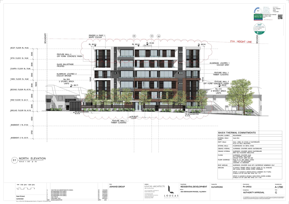
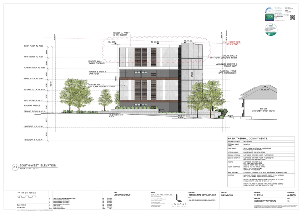
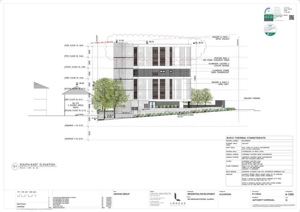
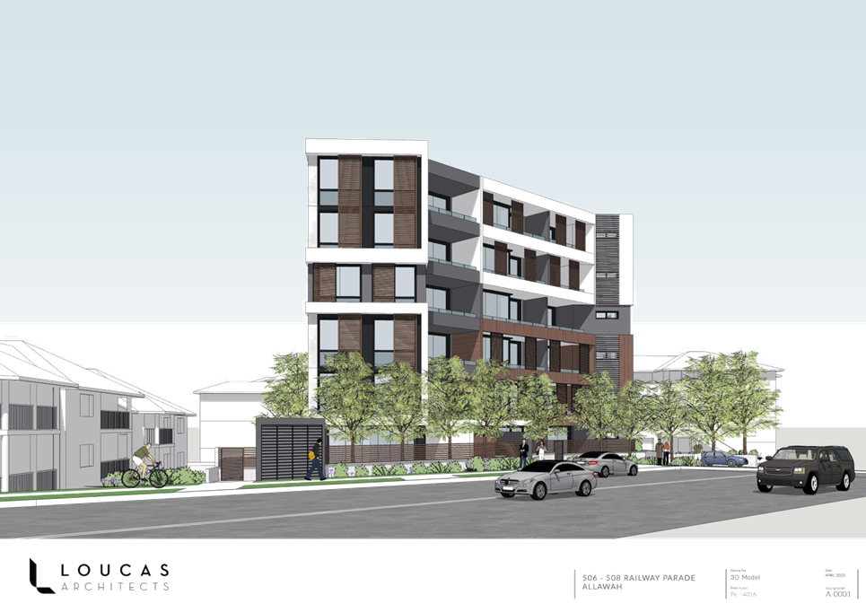
|
Georges River Council – Local Planning
Panel Thursday, 20 August 2020
|
Page 337
|
REPORT TO GEORGES RIVER COUNCIL
LPP MEETING OF Thursday, 20 August 2020
|
LPP Report No
|
LPP038-20
|
Development Application No
|
DA2020/0065
|
|
Site Address & Ward Locality
|
591-611 Princes Highway Blakehurst
Blakehurst Ward
|
|
Proposed Development
|
Installation of a digital
advertising sign
|
|
Owners
|
Georges River Council
|
|
Applicant
|
QMS Media
|
|
Planner/Architect
|
Planner: Mecone, Drawings: Outdoor
Elements Pty Ltd
|
|
Date Of Lodgement
|
19/02/2020
|
|
Submissions
|
No submissions
|
|
Cost of Works
|
$295,863.00
|
|
Local Planning Panel Criteria
|
The subject site is Council owned
land.
|
|
List of all relevant s.4.15
matters (formerly s79C(1)(a))
|
State Environmental Planning Policy
(Vegetation in Non-Rural Areas) 2017,
Greater Metropolitan Regional
Environmental Plan No 2 – Georges River Catchment, State Environmental
Planning Policy No 55 - Remediation of Land, State Environmental Planning
Policy (Infrastructure) 2007, Greater Metropolitan Regional Environmental
Plan No 2 – Georges River Catchment, State Environmental Planning
Policy No 64 – Advertising and Signage
Kogarah Local Environmental Plan
2012, Draft Georges River Local Environmental Plan 2020, Kogarah DCP 2013
|
|
List all documents submitted
with this report for the Panel’s consideration
|
Statement of Environmental Effects,
Signage Plans, Lighting Impact Assessment, Traffic and Road Safety Assessment
Report
|
|
Report prepared by
|
Senior Development Assessment
Planner
|
|
Recommendation
|
That the application be refused in accordance with the
reasons included in this report.
|
|
|
Summary of matters for
consideration under Section 4.15
Have all recommendations in relation
to relevant s4.15 matters been summarised in the Executive Summary of the
assessment report?
|
Yes
|
|
Legislative clauses requiring
consent authority satisfaction
Have relevant clauses in all
applicable environmental planning instruments where the consent authority
must be satisfied about a particular matter been listed and relevant recommendations
summarised, in the Executive Summary of the assessment report?
|
Yes
|
|
Clause 4.6 Exceptions to
development standards
If a written request for a
contravention to a development standard (clause 4.6 of the LEP) has been
received, has it been attached to the assessment report?
|
Not
Applicable
|
|
Special Infrastructure
Contributions
Does the DA require Special
Infrastructure Contributions conditions (under s7.24)?
|
Not
Applicable
|
|
Conditions
Have draft conditions been provided
to the applicant for comment?
|
No
– the application is recommended for refusal. The refusal reasons can
be viewed when the report is published.
|
|
Site Plan
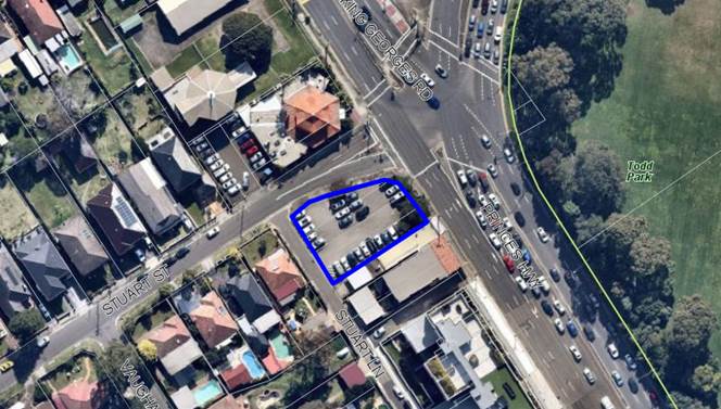
Subject site outlined in
blue
|
Executive Summary
Proposal
1. This
development application (DA) seeks consent for the installation of a digital
advertising sign within a car park that is owned by Georges River Council.
2. The
signs structural support is located centrally along the northern boundary of
the site. The sign is splayed to take visual advantage of the intersection of
King Georges Road and Princes Highway. See Figure 1 below.
3. The
sign is supported by a single monopole with an overall height of 8.45m. The LED
advertising display board has dimensions of 12.44m x 3.29m (40.93sqm). The sign
consists of a digital (LED) screen which will display a series of static images
on the screen for no less than 10 seconds being the dwell time before changing
to a new static image.
4. The
site and elevation plan are shown in Figure 1 below.
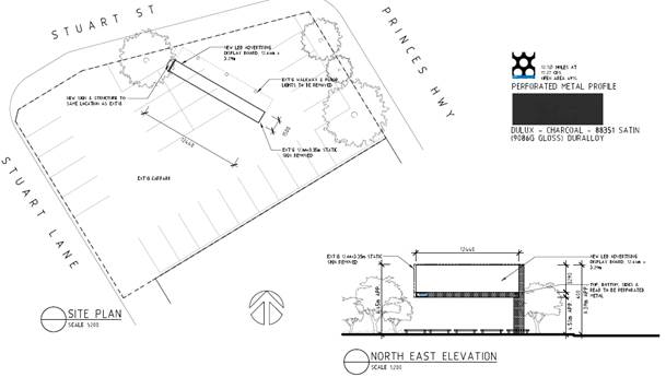
Figure 1: Site
and elevation plans
Site and Locality
5. The
site consists of Lot 1 and 2 in DP 1108360 and Lot 3 and 4 in DP15830 and is
otherwise known as 591-611 Princes Highway, Blakehurst. The site is located on
the south western side of the Princes Highway at the intersection of King
Georges Road and has three (3) frontages being Princes Highway, Stuart Street
and Stuart Lane. The lot is irregular in shape having dimensions of 15.15m to
the Princes Highway with 3.905m splay on the corner of Princes Highway and
Stuart Street, a depth of 33.785m (north combined), 36.575m (south), splay
corner of 2.16m on Stuart Street and Stuart Lane, and boundary of 24.38m to
Stuart Lane and a site of 824sqm.
6. The
corner is subject to road widening; however this affectation does not impact
this allotment.
7. The
site is owned by Georges River Council and utilised as a carpark, providing at
grade parking accessed from Stuart Lane. No built form is present on site with
limited vegetation concentrated to the Princes Highway frontage.
8. Surrounding
development consists of a restaurant to the north on the opposite side of
Stuart Street. Crystal Car Wash (including a digital sign) exists diagonally
opposite the site on the corner of Princes Highway and King Georges Road. Todd
Park is located on the opposing side of the Princes Highway to the north and
east. Commercial development adjoins the southern boundary with detached
dwelling houses to the west fronting Stuart Street.
Zoning and Permissibility
9. The
subject site is zoned B2 Local Centre under the provisions of Kogarah Local
Environmental Plan 2012 (KLEP 2012). The proposal involves the installation of
a digital advertising sign which is not listed as a prohibited use in the zone.
As a result the development is permissible with consent.
Submissions
10. The DA was
publicly notified to neighbours between 16 March and 30 March 2020 in
accordance with the Kogarah DCP 2013. No submissions were received.
Reason for Referral to the Local Planning Panel
11. This application
is referred to the Georges River Local Planning Panel for determination as the
subject site is owned by Georges River Council.
Conclusion
12. The application
has been assessed having regard to the Matters for Consideration under Section
4.15 of the Environmental Planning and Assessment Act 1979, the provisions
of the relevant State Environmental Planning Policies, Local Environmental
Plans and Development Control Plans.
13. The proposal fails
to meet the requirements of the State Environmental Planning Policy No. 64
– Advertising and Signage in relation to the objectives of the policy and
the impacts on the visual catchment of the locality.
14. The proposal also
fails to meet the controls in the Kogarah Development Control Plan 2013 in
relation to size, height and location of the sign, the impacts on the visual
catchment and dominance of the sign within the skyline having regard to the
residential development to the south-west of the site.
15. The application is
recommended for refusal subject to the reasons referenced at the end of this
report.
Report in Full
Description of the Proposal
16. This development
application (DA) seeks consent for the installation of a digital advertising
sign within a carpark that is owned by Georges River Council.
17. The signs structural
support is located centrally along the northern boundary of the site. The sign
is splayed to take visual advantage of the intersection of King Georges Road
and Princes Highway. See figure 1 below.
18. The sign is
supported by a single monopole with an overall height of 8.45m. The LED
advertising display board has dimensions of 12.44m x 3.29m (40.93sqm). The sign
consists of a digital (LED) screen which will display a series of static images
on the screen for no less than 10 seconds being the dwell time before changing
to a new static image.
19. The site and
elevation plan are shown in Figure 1 above.
Description of the Site and
Locality
20. The site consists
of Lot 1 and 2 in DP 1108360 and Lot 3 and 4 in DP15830 and is otherwise known
as 591-611 Princes Highway, Blakehurst. The site is located on the south
western side of the Princes Highway at the intersection of King Georges Road
and has three (3) frontages being Princes Highway, Stuart Street and Stuart
Lane. The lot is irregular in shape having dimensions of 15.15m to the Princes
Highway with 3.905m splay on the corner of Princes Highway and Stuart Street, a
depth of 33.785m (north combined), 36.575m (south), splay corner of 2.16m on
Stuart Street and Stuart Lane, and boundary of 24.38m to Stuart Lane and a site
of 824sqm.
21. The site is owned
by Georges River Council and utilised as a carpark, providing at grade parking
accessed from Stuart Lane. No built form is present on site with limited
vegetation concentrated to the Princes Highway frontage.
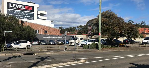
Figure 2: Subject
site as viewed from Stuart Street
22. Surrounding
development consists of a restaurant to the north on the opposite side of
Stuart Street. Crystal Car Wash (including a digital sign) exists diagonally
opposite the site on the corner of Princes Highway and King Georges Road (see
Figure 3). Todd Park is located on the opposing side of the Princes Highway to
the north and east (see Figure 4). Commercial development adjoins the southern
boundary with detached dwelling houses to the west fronting Stuart Street (see
Figure 5).
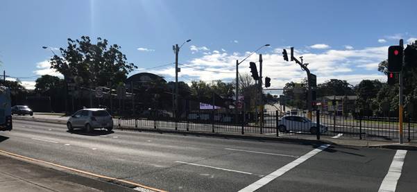
Figure 3: Development
to the north east of the site
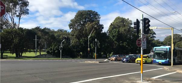
Figure 4: Todd
Park to the east of the site
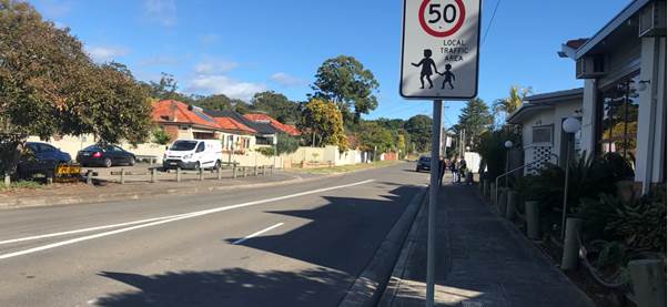
Figure 5: Stuart
Street as viewed to the west
Background
23. On 10 December
2001 the former Kogarah Council approved Development Application 466/01 for the
construction of a free-standing advertising sign on the site.
24. The sign was subsequently
constructed and operated for several years providing a static display. It is
noted that the consent was time limited in accordance with SEPP 64 with the
sign removed from the site at the end of 2019. Figure 6 shows a photo of the
previous sign.
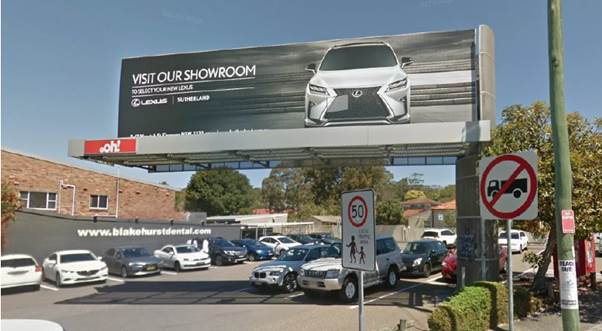
Figure 6: The
previous sign on the site (now removed) (Source: GoogleMaps)
State Environmental Planning
Policies (SEPPs)
25. Compliance with
the relevant SEPPs is summarised in the following table and discussed in
further detail below it.
|
SEPP Title
|
Complies
|
|
State Environmental Planning Policy
(Infrastructure) 2007
|
Yes
|
|
State Environmental Planning Policy
No. 64 Advertising and Signage
|
No
|
|
State
Environmental Planning Policy No 55 - Remediation of Land
|
Yes
|
|
State Environmental Planning Policy (Vegetation in Non-Rural
Areas) 2017
|
Yes
|
|
Greater
Metropolitan Regional Environmental Plan No 2 – Georges River Catchment
|
Yes
|
State
Environmental Planning Policy (Infrastructure) 2007
26. The objectives of
this clause are:
(a) to
ensure that new development does not compromise the effective and ongoing
operation and function of classified roads, and
(b) to
prevent or reduce the potential impact of traffic noise and vehicle emission on
development adjacent to classified roads.
(1) The
consent authority must not grant consent to development on land that has a
frontage to a classified road unless it is satisfied that:
(a) where
practicable and safe, vehicular access to the land is provided by a road other
than the classified road, and
(b) the
safety, efficiency and ongoing operation of the classified road will not be
adversely affected by the development as a result of:
(i) the
design of the vehicular access to the land, or
(ii) the
emission of smoke or dust from the development, or
(iii) the
nature, volume or frequency of vehicles using the classified road to gain
access to the land, and
(c) the
development is of a type that is not sensitive to traffic noise or vehicle
emissions, or is appropriately located and designed, or includes measures, to
ameliorate potential traffic noise or vehicle emissions within the site of the
development arising from the adjacent classified road.
27. The subject site
is located on Princes Highway, which is a classified road (State Road).
28. The installation
of the proposed sign is considered to satisfy the objectives as it does not
compromise the effective and ongoing operation and function of the road which
is a classified road or contribute to traffic noise and vehicle emissions.
29. Vehicular access
to the site is not altered and remains via Stuart Lane to the rear. The safety,
efficiency and ongoing operation will not be impacted. The development is of a
type that is not disruptive to traffic noise or vehicle emissions given its
location.
30. Transport for NSW
has raised no objections subject to specific conditions being imposed should
the application be supported.
State Environmental Planning Policy No. 64 - Advertising
and Signage (SEPP 64)
31. SEPP 64 applies to
the state and commenced on 16 March 2001. The policy aims to ensure that
signage is compatible with the desired amenity and visual character of an area.
The SEPP applies to the whole State and particularly as per clause 6, to all
signage that:
(a) can
be displayed with or without development consent under another environmental
planning instrument that applies to the signage, and
(b) is
visible from any public place or public reserve.
32. Clause 3 - Aims,
objectives etc of SEPP 64 are as follows:
(a) to
ensure that signage (including advertising):
(i)
is compatible with desired amenity and visual
character of an area, and
(ii)
provides effective communication in suitable locations, and
(iii)
is of high-quality design and finish, and
(b) to
regulate signage (but not content) under Part 4 of the Act, and
(c) to
provide time-limited consents for the display of certain advertisements, and
(d) to
regulate the display of advertisements in transport corridors, and
(e)
to ensure that public benefits may be derived
from advertising in and adjacent to transport corridors.
33. The proposed
digital sign is considered incompatible with the desired amenity and visual
character of the immediate locality, particularly the residential development
to the south west. The site is located on a prominent intersection and directly
adjoins low density residential development to the south west characterised by
single storey dwellings on the southern side of Stuart Street. The proposed
sign will visually dominate the landscape and visual catchment on the south
western side of the Princes Highway in this location given it is to be
installed in an open air at grade car park that has no impediments in the
airspace, therefore promoting its dominance.
34. The proposal is
not considered to meet objective (a)(i) of the SEPP64.
35. Part 3 of the
SEPP64 applies to Advertisements. Subclause 13 outlines the Matters for
consideration, which states:
(1)
A consent authority (other than in a case to which subclause (2) applies) must
not grant consent to an application to display an advertisement to which this
Policy applies unless the advertisement or the advertising structure, as the
case requires:
(a) is
consistent with objectives of this Policy as set out in clause 3(1)(a), and
(b) has
been assessed by the consent authority in accordance with the assessment
criteria in Schedule 1 and the consent authority is satisfied that the proposal
is acceptable in terms of its impacts, and
(c) satisfies
any other relevant requirements of this Policy.
(2) If
the Minister for Planning is the consent authority or clause 18 or 24 applies
to the case, the consent authority must not grant consent to an application to
display an advertisement to which this Policy applies unless the advertisement
or the advertising structure, as the case requires:
(a) is
consistent with objectives of this Policy as set out in clause 3(1)(a), and
(b) has
been assessed by the consent authority in accordance with the assessment
criteria in Schedule 1 and in the Guidelines and the consent authority is
satisfied that the proposal is acceptable in terms of:
(i) design,
and
(ii) road
safety, and
(iii) the
public benefits to be provided in connection with the display of the
advertisement, and
(c) satisfies
any other relevant requirements of this Policy.
(3)
In addition, if clause 18 or 24 applies to the case, the consent authority must
not grant consent unless arrangements that are consistent with the Guidelines
have been entered into for the provision of the public benefits to be provided
in connection with the display of the advertisement.
Schedule 1
Assessment Criteria
36. An assessment of
the proposal against Schedule 1 of the SEPP64 is provided in Table 1.
|
Criteria
|
Proposed
|
Complies
|
|
Table 1: Schedule 1 of SEPP 64
1 Character of the area
• Is the proposal compatible with the existing or desired
future character of the area or locality in which it is proposed to be
located?
• Is the proposal consistent with a particular theme
for outdoor advertising in the area or locality?
|
No. The desired
future character of the area is not characterised by large digital signage
which will dominate the landscape in what is an up-zoned area to shop top
housing and residential flat buildings.
No. There is no
theme for outdoor advertising in the locality, Chapter F1 – Advertising
and Signage of the Kogarah DCP 2013 states signs of this size, height,
location and nature are not considered appropriate.
The digital sign
is considered out of character in the locality and will have an adverse
impact on the amenity of the locality in terms of its domination of the
visual character which will dominate the landscape in what is an up-zoned
area to shop top housing and residential flat buildings.
|
No
No
|
|
2 Special
areas
• Does the proposal detract from the amenity or
visual quality of any environmentally sensitive areas, heritage areas,
natural or other conservation areas, open space areas, waterways, rural
landscapes or residential areas?
|
The site is not
located in a special area.
However it is
diagonally opposite Carrs Bush Park which is a listed Heritage Item.
The sign will not
impact this item
|
Yes
|
|
3 Views
and vistas
• Does the proposal obscure or compromise
important views?
• Does the proposal dominate the skyline and
reduce the quality of vistas?
• Does the proposal respect the viewing rights of
other advertisers?
|
No.
Yes. The digital
sign will dominate the skyline. The quality of the visual catchment will be
degraded by the digital sign and set an undesirable precedent in the
locality. The existing vistas from the surrounding residential developments
will be adversely impacted with the installation of a sign that will take up
the air space within an open form at grade carpark with no airspace
impediments.
No.
|
N/A
No
N/A
|
|
4 Streetscape,
setting or landscape
• Is the scale, proportion and form of the
proposal appropriate for the streetscape, setting or landscape?
• Does the proposal contribute to the visual
interest of the streetscape, setting or landscape?
• Does the proposal reduce clutter by
rationalising and simplifying existing advertising?
• Does the proposal screen unsightliness?
• Does the proposal protrude above buildings, structures
or tree canopies in the area or locality?
• Does the proposal require ongoing vegetation
management?
|
No. When viewed from the Princes Highway approaching the intersection
with King Georges Road (looking south), the sign will protrude above the
single storey dwellings to the south west of the site on Stuart Street and
the tree line of the vegetation on the sites fronting Princes Highway.
No. The proposal
will adversely impact the visual character of the locality. The digital sign
is visually intrusive, unsightly and will dominate the visual catchment in
this location.
There is currently
no signage on the site.
The proposal is
unsightly, dominates the skyline of the location and is visually intrusive.
Yes. The sign
protrudes above the treeline of the vegetation on the site on the Princes
Highway and above the single storey dwellings south east of the site on
Stuart Street.
No.
|
No
No
N/A
No
No
Yes
|
|
5 Site
and building
• Is the proposal compatible with the scale,
proportion and other characteristics of the site or building, or both, on
which the proposed signage is to be located?
• Does the proposal respect important features of
the site or building, or both?
• Does the proposal show innovation and
imagination in its relationship to the site or building, or both?
|
No. When viewed from the Princes Highway approaching the intersection
with King Georges Road (looking south), the sign will protrude above the
single storey dwellings to the south west of the site on Stuart Street and
the tree line of the vegetation on the site fronting Princes Highway. The
site is an open form carpark and will dominate the locality as it will be
seen from multiple directions on Princes Highway and King Georges Road and
from within Stuart Street.
There are no
important features of the site or building.
No the proposed
sign does not relate to the site or the locality.
|
No
N/A
No
|
|
6 Associated
devices and logos with advertisements and advertising structures
• Have any safety devices, platforms, lighting
devices or logos been designed as an integral part of the signage or
structure on which it is to be displayed?
|
No the digital
sign is supported by a monopole and does not require external lighting or
platforms to change signage.
|
No
|
|
7 Illumination
• Would illumination result in unacceptable
glare?
• Would illumination affect safety for
pedestrians, vehicles or aircraft?
• Would illumination detract from the amenity of
any residence or other form of accommodation?
• Can the intensity of the illumination be
adjusted, if necessary?
• Is the illumination subject to a curfew?
|
If the application
were to be approved, conditions of consent could be imposed to control illumination
levels and curfews for operation of the sign.
|
By condition
|
|
8 Safety
• Would the proposal reduce the safety for any
public road?
• Would the proposal reduce the safety for
pedestrians or bicyclists?
• Would the proposal reduce the safety for
pedestrians, particularly children, by obscuring sightlines from public
areas?
|
The RMS has
reviewed the Traffic and Road Safety Assessment Report submitted with the
application and did not raise any concern with the proposal, subject to
conditions of consent should the application be approved.
However Council
considers the sign will be visually intrusive, attention-grabbing and the
changing nature of the content of the sign will distract drivers.
Insufficient information has been provided with the application, such as
crash data from other locations that contain digital signage of the same
size, to confirm the sign would not reduce the safety of the road or
intersection.
|
No
|
37. As discussed above
and further in this report, the proposed digital sign is not supported as the
sign is a dynamic and changeable digital sign which is inconsistent with the
aims and objectives and the Schedule 1 Assessment Criteria of SEPP 64. It will
dominate the visual character and quality of the catchment, is of a nature and
scale that is out of context for the locality, is not compatible with the
desired amenity and visual character of the area.
38. The proposed sign
is eye catching and insufficient information has been provided
with the application, such as the impacts of this form of signage with respect
to crash data from other locations that contain digital signage of the same
size, to confirm the sign would not reduce the safety of the road or
intersection.
Clause
14 - Duration of consents
39. Clause 14 states:
(1)
A consent granted under this Part ceases to be in force:
(a) on
the expiration of 15 years after the date on which the consent becomes
effective and operates in accordance with section 83 of the Act, or
(b) if
a lesser period is specified by the consent authority, on the expiration of the
lesser period.
40. Any consent
granted would be limited to a maximum period of 15 years if consent was to be
granted.
Clause 17 -
Advertisements with display area greater than 20 square metres or higher than 8
metres above ground
41. Clause 17 states:
(1) This clause applies to
an advertisement:
(a) that has a display area greater than 20
square metres, or
(b) that is higher than 8 metres above the
ground.
(2) The display of an
advertisement to which this clause applies is advertised development for the
purposes of the Act.
(3) The consent authority
must not grant consent to an application to display an advertisement to which
this clause applies unless:
(a) the applicant has
provided the consent authority with an impact statement that addresses the
assessment criteria in Schedule 1 and the consent authority is satisfied that
the proposal is acceptable in terms of its impacts, and
(b) the application has been advertised in
accordance with section 79A taken from SEPP so old reference to the Act
of the Act, and
(c) the consent
authority gave a copy of the application to RMS at the same time as the
application was advertised in accordance with section 79A of the Act if the
application is an application for the display of an advertisement to which
clause 18 applies.
42. The display area
of the sign is 40sqm and reaches a height of 8.45m.
43. The application
was advertised from 16 March 2020 and 30 March 2020 and referred to RMS (now
Transport for NSW), with no objections raised subject to conditions being
imposed on any consent issued.
Clause
18 - Advertisements greater than 20 square metres and within 250 metres
of, and visible from, a classified road
44. Clause 18 states:
(1)
This clause applies to the display of an advertisement to which clause 17
applies, that is within 250 metres of a classified road any part of which is
visible from the classified road.
(2)
The consent authority must not grant development consent to the display of an
advertisement to which this clause applies without the concurrence of RMS.
(3)
In deciding whether or not concurrence should be granted, RMS must take into
consideration:
(a) the
impact of the display of the advertisement on traffic safety, and
(b) the Guidelines.
(4)
If RMS has not informed the consent authority within 21 days after the copy of
the application is given to it under clause 17 (3) (c) (ii) that it has
granted, or has declined to grant, its concurrence, RMS is taken to have
granted its concurrence.
(5)
Nothing in this clause affects clause 16.
(6)
This clause does not apply when the Minister for Planning is the consent
authority.
45. This clause
applies as the sign is located within 250m of the Princes Highway which is a
classified road. The application was referred to RMS (now Transport for NSW)
for concurrence. No objections were raised subject to relevant requirements
being imposed via a condition on any consent issued.
Clause
20 - Location of certain names and logos
46. Clause 18 states:
(1) The
name or logo of the person who owns or leases an advertisement or advertising
structure may appear only within the advertising display area.
(2) If
the advertising display area has no border or surrounds, any such name or logo
is to be located:
(a) within
the advertisement, or
(b) within
a strip below the advertisement that extends for the full width of the
advertisement.
(3) The
area of any such name or logo must not be greater than 0.25 square metres.
(4) The
area of any such strip is to be included in calculating the size of the
advertising display area.
47. The logo
‘QMS’ is proposed in the lower left corner of the structure, beneath
the LED panel and equates to 0.746sqm. Should the application be approved a
condition of consent would be included requiring the logo to be reduced in size
to a maximum 0.25sqm.
Clause 23
– Freestanding advertisements
48. Clause 23 states:
(1) The consent authority
may grant consent to the display of a freestanding advertisement only if the
advertising structure on which the advertisement is displayed does not protrude
above the dominant skyline, including any buildings, structures or tree canopies,
when viewed from ground level within a visual catchment of 1 kilometre.
49. Development within
the visual catchment is comprised of Todd Park to the east and generally of
single and two storey built form with a recently constructed six (6) storey
shop top housing development to the south.
50. When viewed from
the Princes Highway approaching the intersection with King Georges Road
(looking south), the sign will protrude above the single storey dwellings to
the south west of the site on Stuart Street and the tree line of the vegetation
on the site fronting Princes Highway.
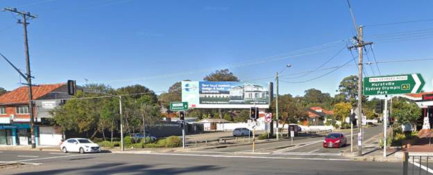
Figure 7: The
proposed sign is located in the same position as the previous sign, and is
440mm higher than the previous sign (now removed).
51. An assessment of
the proposal in relation to Clauses 17, 18 and 23 of SEPP is provided in the
following table.
|
Criteria
|
Proposed
|
Complies
|
|
17 Advertisements
with display area greater than 20 square metres or higher than 8 metres above
ground
(1) This clause applies to an advertisement:
(a) that has a display area greater than 20 square metres, or
(b) that is higher than 8 metres above the ground.
(2) The display of an advertisement
to which this clause applies is advertised development for the purposes of
the Act.
(3) The consent authority must not grant consent
to an application to display an advertisement to which this clause applies
unless:
(a) the applicant has provided the consent authority
with an impact statement that addresses the assessment criteria in Schedule 1
and the consent authority is satisfied that the proposal is acceptable in
terms of its impacts, and
(b) the application has been advertised in accordance
with section 79A of the Act, and
(c) the consent authority gave a copy of the
application to RMS at the same time as the application was advertised in
accordance with section 79A of the Act if the application is an application
for the display of an advertisement to which clause 18 applies.
|
The sign has an
area of 40sqm.
8.45m
Noted. Was the
notification undertaken in accordance with the Advertised development
criterion of the Act
Refer to Table 1
(above) in this report.
The application
has been notified.
The RMS was
notified of the proposal and provided conditions of consent if the
application is to be favourably determined.
|
Clause applies
Clause applies
-
-
Yes
Yes
|
|
18 Advertisements
greater than 20 square metres and within 250 metres of, and visible from, a classified
road
(1) This clause applies to the display of
an advertisement to which clause 17 applies that is within 250 metres of a
classified road any part of which is visible from the classified road.
(2) The consent authority must not grant development
consent to the display of an advertisement to which this clause applies
without the concurrence of RMS.
|
The site is
located on Princes Highway which is a classified road.
The RMS has
provided concurrence in the form of conditions.
|
Yes
Yes
|
|
23 Freestanding advertisements
(1) The consent authority may grant consent to
the display of a freestanding advertisement only if the advertising structure
on which the advertisement is displayed does not protrude above the dominant skyline,
including any buildings, structures or tree canopies, when viewed from ground
level within a visual catchment of 1 kilometre.
|
When viewed from the Princes
Highway approaching the intersection with King Georges Road (looking south),
the sign will protrude above the single storey dwellings to the southwest of
the site on Stuart Street and the tree line of the vegetation on the site
fronting Princes Highway.
|
No
|
Transport
Corridor Outdoor Advertising and Signage Guidelines 2017
52. The Transport
Corridor Outdoor Advertising and Signage Guidelines 2017 apply to the proposed
digital signage. An assessment against the digital sign criteria of the
Guidelines is provided in the following table.
|
Transport
Corridor Outdoor Advertising and Signage Guidelines 2017
|
|
Criteria
(applies to signs greater than or equal to 20sqm)
|
Proposal
|
Complies
|
|
a. Each advertisement must be displayed in a completely static
manner, without any motion, for the approved dwell time as per criterion (d)
below.
|
If the application
were to be approved, conditions of consent could be imposed.
|
Yes
|
|
b. Message sequencing designed to make a driver anticipate the
next message is prohibited across images presented on a single sign and
across a series of signs.
|
If the application
were to be approved, conditions of consent could be imposed.
|
Yes
|
|
c. The image must not be capable of being mistaken:
i. for a prescribed traffic control device
because it has, for example, red, amber or green circles, octagons, crosses
or triangles or shapes or patterns that may result in the advertisement being
mistaken for a prescribed traffic control device
ii. as text providing driving instructions to drivers.
|
If the application
were to be approved, conditions of consent could be imposed.
|
Yes
|
|
d. Dwell times for image display must not be less than:
i. 10 seconds for areas where the speed limit is below 80 km/h
ii. 25 seconds for areas where the speed limit is 80km/h and over.
|
If the application
were to be approved, conditions of consent could be imposed as the speed
limit is below 80kms per hour.
|
Yes
|
|
e. The transition time between messages must be no longer than 0.1
seconds, and in the event of image failure, the default image must be a black
screen.
|
If the application
were to be approved, conditions of consent could be imposed.
|
Yes
|
|
f. Luminance levels must comply with the requirements
in Section 3 below.
|
If the application
were to be approved, conditions of consent could be imposed.
|
Yes
|
|
g. The images displayed on the sign must not otherwise
unreasonably dazzle or distract drivers without limitation to their colouring
or contain flickering or flashing content.
|
If the application
were to be approved, conditions of consent could be imposed.
|
Yes
|
|
h. The amount of text and information supplied on a sign should be
kept to a minimum (e.g. no more than a driver can read at a short glance).
Any sign that is
within 250m of a classified road and is visible from a school zone must be
switched to a fixed display during school zone hours.
|
If the application
were to be approved, conditions of consent could be imposed.
The sign is
located on a State Road and visible from the school zone on Princes Highway
when travelling towards the intersection with King Georges Road.
|
Yes
Could be conditioned
if the application was to be supported.
|
|
j. Each sign proposal must be assessed on a case-by-case
basis including replacement of an existing fixed, scrolling or tri-vision
sign with a digital sign, and in the instance of a sign being visible from
each direction; both directions for each location must be assessed on their
own merits.
|
Noted.
|
Yes
|
|
k. At any time, including where the speed limit in the
area of the sign is changed, if detrimental effect is identified on road
safety post installation of a digital sign, RMS reserves the right to
re-assess the site using an independent RMS-accredited road safety auditor.
Any safety issues identified by the auditor and options for rectifying the
issues are to be discussed between RMS and the sign owner and operator.
|
If the application
were to be approved, conditions of consent could be imposed.
|
Yes
|
|
l. Sign spacing should limit drivers’ view to a
single sign at any given time with a distance of no less than 150m between
signs in any one corridor. Exemptions for low speed, high pedestrian zones or
CBD zones will be assessed by RMS as part of their concurrence role.
|
If the application
were to be approved, conditions of consent could be imposed.
|
Yes
|
|
m. Signs greater than or equal to 20sqm must obtain RMS
concurrence and must ensure the following minimum vertical clearances;
i. 2.5m from lowest point of the sign above the road surface if
located outside the clear zone
ii. 5.5m from lowest point of the sign above the road surface if
located within the clear zone (including shoulders and traffic lanes) or the
deflection zone of a safety barrier if a safety barrier is installed.
If attached to road
infrastructure (such as an overpass), the sign must be located so that no
portion of the advertising sign is lower than the minimum vertical clearance
under the overpass or supporting structure at the corresponding location.
|
The RMS has
provided concurrence.
|
Yes
|
|
n. An electronic log of a sign’s operational activity must
be maintained by the operator for the duration of the development consent and
be available to the consent authority and/or RMS to allow a review of the
sign’s activity in case of a complaint.
|
If the application
were to be approved, conditions of consent could be imposed.
|
Yes
|
|
o. A road safety check which focuses on the effects of the
placement and operation of all signs over 20sqm must be carried out in
accordance with Part 3 of the RMS Guidelines for Road Safety Audit Practices
after a 12 month period of operation but within 18 months of the signs
installation. The road safety check must be carried out by an independent
RMS-accredited road safety auditor who did not contribute to the original
application documentation. A copy of the report is to be provided to RMS and
any safety concerns identified by the auditor relating to the operation or
installation of the sign must be rectified by the applicant. In cases where
the applicant is the RMS, the report is to be provided to the Department of
Planning and Environment as well.
|
If the application
were to be approved, conditions of consent could be imposed.
|
Yes
|
53. Section 4 outlines
how proposals for certain outdoor advertisements along railway corridors,
classified roads and on bridges must meet a public benefit test to ensure that
the advertising will result in a positive gain or benefit for the community
54. The level of
public benefit for a given SEPP 64 advertisement is to be negotiated and agreed
upon between the consent authority and the applicant.
55. The public benefit
can be provided as a monetary contribution or as an ‘in-kind’
contribution. Both monetary and in-kind contributions must be linked to
improvements in local community services and facilities including benefits such
as:
· improved traffic safety (road, rail, bicycle and pedestrian)
· improved public transport services
· improved public amenity within, or adjacent to, the
transport corridor
· support school safety infrastructure and programs
· other appropriate community benefits such as free
advertising time to promote a service, tourism in the locality, community
information, or emergency messages
56. The Applicant has
not provided any information with the Development Application to detail that
they have approached Council to discuss arrangements that the sign could be used
for the purposes of promoting community programs, public safety announcements
and other public purposes including use by Georges River Council.
State Environmental Planning
Policy (Vegetation in Non-Rural Areas) 2017
57. The Vegetation
SEPP regulates clearing of native vegetation on urban land and land zoned for
environmental conservation/management that does not require development
consent.
58. The Vegetation
SEPP applies to clearing of:
a) Native vegetation above the Biodiversity Offset
Scheme (BOS) threshold where a proponent will require an approval from the
Native Vegetation Panel established under the Local Land Services Amendment Act
2016; and
b) Vegetation below the BOS threshold where a
proponent will require a permit from Council if that vegetation is identified
in the council’s development control plan (DCP).
59. The objectives of
the SEPP are to protect the biodiversity values of trees and other vegetation
in non-rural areas and preserve the amenity of non-rural areas through the
preservation of trees and other vegetation. This policy is applicable pursuant
to Clause 5(1) of the SEPP as the site is within the Georges River Council.
60. Pursuant to Clause
8(1) of the SEPP, clearing does not require authority under the policy as it is
a type of clearing that is authorised under Section 60O of the Local Land
Services Act 2013 (specifically, that associated with a development
consent issued under Part 4 of the Environmental Planning and Assessment
Act 1979).
61. No vegetation or
trees will require removal as part of this proposal. With respect to existing
vegetation Council’s Tree Officer has provided conditions to ensure
retention and protection during construction activities on site should the
application be approved.
Deemed State Environmental
Planning Policy – Georges River Catchment
62. Due to the nature
of the proposal, stormwater management does not form part of the proposed
development as a monopole supports the advertising structure.
State
Environmental Planning Policy No 55 - Remediation of Land
63. SEPP 55 aims to
promote the remediation of contaminated land in order to reduce the risk of
harm to human health or any other aspect of the environment.
64. Clause 7 requires
contamination and remediation to be considered in determining a development
application. The consent authority must not consent to the carrying out of
development on land unless it has considered whether or not the land is
contaminated.
65. The proposal is
for the installation of a digital sign supported by a monopole, where
foundation works are only to facilitate the footings of the pole. In this
regard, no further assessment is warranted with regard to site contamination.
Draft State Environmental Planning Policies (SEPPs)
Draft Environment SEPP
66. The Draft Environment SEPP was exhibited from 31 October 2017 to 31
January 2018. This consolidated SEPP proposes to simplify the planning rules
for a number of water catchments, waterways, urban bushland, and Willandra
Lakes World Heritage Property.
67. Changes proposed include consolidating the following seven
existing SEPPs:
· State Environmental Planning Policy No. 19 – Bushland
in Urban Areas
· State Environmental Planning Policy (Sydney Drinking Water
Catchment) 2011
· State Environmental Planning Policy No. 50 – Canal
Estate Development
· Greater Metropolitan Regional Environmental Plan No. 2
– Georges River Catchment
· Sydney Regional Environmental Plan No. 20 –
Hawkesbury-Nepean River (No.2-1997)
· Sydney Regional Environmental Plan (Sydney Harbour
Catchment) 2005
· Willandra Lakes Regional Environmental Plan No. 1 –
World Heritage Property
68. The proposal is not inconsistent with the provisions of this
Draft Instrument.
Draft Remediation of Land SEPP
69. The Department of
Planning and Environment has announced a Draft Remediation of Land SEPP, which
will repeal and replace the current State Environmental Planning Policy No 55
— Remediation of Land.
70. The main changes
proposed include the expansion of categories of remediation work which requires
development consent, a greater involvement of principal certifying authorities
particularly in relation to remediation works that can be carried out without
development consent, more comprehensive guidelines for Councils and certifiers
and the clarification of the contamination information to be included on
Section 149 Planning Certificates.
71. Whilst the proposed
SEPP will retain the key operational framework of SEPP 55, it will adopt a more
modern approach to the management of contaminated land. The Draft SEPP will not
alter or affect the findings in relation to contamination at the site.
72. The proposal is
for the installation of a digital sign supported by a monopole, where
foundation works are only to facilitate the footings of the pole. In this
regard, no further assessment is warranted with regard to site contamination.
Local Environmental Plan
73. The site is
subject to the Kogarah Local Environmental Plan 2012 (KLEP 2012).
Figure 8: Zoning map with the site outlined in blue
74. The site is zoned
B2 ‘Local Centre’ under the KLEP 2012. The development is defined
as an ‘advertising structure’ is permissible with consent.
75. The objectives of
the B2 Local Centre zone are as follows:
• To provide a range of
retail, business, entertainment and community uses that serve the needs of
people who live in, work in and visit the local area.
• To encourage
employment opportunities in accessible locations.
• To maximise public
transport patronage and encourage walking and cycling.
76. The extent to which the proposal
complies with the relevant standards of Kogarah Local Environmental Plan
2012 (KLEP2012) is outlined in the table below.
|
Clause
|
Requirement
|
Proposed
|
Complies
|
|
4.3
Height of Buildings
|
21m
|
Maximum
8.45m
|
Yes
|
|
4.4
Floor Space Ratio
|
2.5:1
|
No
additional FSR
|
Yes
|
|
6.1
Acid Sulfate Soils
|
The
site is mapped as Class 5 Acid Sulfate Soil
|
Noting
levels of the site and limited excavation for the footings supporting the
monopole, the proposed development is considered acceptable testing is not
warranted.
|
Yes
|
|
6.2
Earthworks
|
Objective
of this clause is to ensure that earthworks for which development consent is
required will not have a detrimental impact on environmental functions and
processes, neighbouring uses, cultural or heritage items or features of the
surrounding land.
|
Associated
earthworks are deemed to be minor in nature and limited to the structural
foundation of the signs monopole and is therefore considered acceptable.
|
Yes
|
Draft Georges River Local Environmental Plan 2020
77. In this regard,
the provisions have no determining weight as a result of proposed operation of
Clause “1.8A Savings provisions relating to development
applications” of the Draft Plan which provides “If a
development application has been made before the commencement of this Plan in
relation to land to which this Plan applies and the application has not been
finally determined before that commencement, the application must be determined
as if this Plan had not commenced.”
Development
Control Plan
Kogarah
Development Control Plan 2013
78. The proposed
development is subject to provisions of the Kogarah Development Control Plan
2013 (KDCP 2013). The following comments are made with respect to the proposal
satisfying the objectives and controls contained within the DCP.
|
Control
|
Complies
|
|
Part F1 Advertising and Signage
|
|
1.4 Advertising signs that are
prohibited.
|
|
(1)
The following types of advertising signs are prohibited in Kogarah local
government area:
(i)
Advertising signs over 45sqm
(ii)
Advertising signs within navigable waters (except a sign on a vessel that is
ancillary to the dominant purpose of the vessel).
(iii)
Advertising signs on land zoned Residential (but not including a mixed use
zone or similar zone), Open Space or Waterways, or in a heritage area,
natural or other conservation area or scenic protection area are prohibited,
except for advertising signs identified as ‘Exempt Development’
by the Kogarah Local Environmental Plan 2012.
(2)
The following forms of advertising are not considered appropriate in Kogarah
City:
(i)
Signs with an area greater than 20sqm or higher than 8m above the ground,
including billboards;
(ii)
Signs higher than 8m above the ground; or with a display area greater than
20sqm; and the advertising sign is within 250m of, and any part of the sign
is visible from, a classified road;
(3)
Corporate colours, logos and other graphics are acceptable elements of signs
only where they achieve a very high degree of compatibility with the
architecture, materials, finishes and colours of the building and the
streetscape. In many cases, the corporate colours, logo and other graphics
will need to be modified to achieve this compatibility
|
Proposed area is 40.93sqm
N/A
Site is zoned B2
Local Centre.
No - Sign has an area of 40.93sqm and height
of 8.39m - 8.45m.
No - Maximum height is 8.45m, 40.93sqm in area and located adjacent
to a classified road.
No - A small associated corporate logo is proposed below the sign
however it exceeds the size permitted under SEPP64.
|
|
2.2 General Requirements
|
|
Billboard sign
Only permissible in Business and
Industrial Zones. Note: SEPP 64 should be consulted for additional
requirements for the following types of advertising:
•
Sign extends higher than 8m above the ground;
•
The display area of the sign is greater than 20sqm;
•
The sign is within 250m of, and any part of the sign is visible from, a
classified road, and either of the above applies.
Illuminated
sign
Must include suitable screening to
avoid nuisance and light spillage to adjoining properties and potential
danger to drivers or pedestrians.
|
Yes - Site located in a B2 Local Centre zone with provisions of SEPP
64 considered.
If the application
were to be approved the sign would be condition to meet this criterion.
|
|
3.1 All
Advertising Signs
|
|
(1)
Advertising must relate to the use of the premises and products sold on the
premises.
(2)
Signage must be sympathetic to, and integrated with, the architecture and
structure of supporting building and not be the dominant visual element on a
building.
(3)
Proposed advertising sign must be compatible with the streetscape, setting or
landscape, and not dominating in terms of scale, proportion and form.
(4)
Lettering, materials and colours must complement the existing building or
place.
(5)
Signage must not project above any parapet or eave.
(6)
Signage must not be located where it will adversely impact views or vistas or
cause significant overshadowing.
(7)
The main facades of buildings between the first floor and parapet must be
uncluttered and generally free of signage.
(10)
All advertising and signage must be displayed in English but may also include
a translation in another language. Any translated message must be accurate
and complete, and using wording and/or numbering that is not larger than
English message.
(11) Signs
must be attractive and professionally sign written.
(12)
Changes in content or message of advertising sign are allowed without the
approval of Council provided that:
(i)
the structure to which the advertising sign is attached has been approved by
Council;
(ii)
the size and dimensions of the sign remain as approved, or are reduced;
(iii)
there is no change to the intensity of, or hours of illumination;
(iv)
moving or flashing messages or symbols are not proposed; and
(v)
the message is not likely to cause distraction to motorists; or
(vi)
the proposed sign meets exempt development requirements.
(vii) The
name or logo of the person who owns or leases an advertisement or advertising
structure must not be greater than 0.25sqm and may appear only within the
advertising display area.
(13)
Where a business or organisation offers a product or service, the name of the
business or organisation should have greater dominance over the product or
service advertisement.
(14) The
wording and content of the advertising sign must not:
(i)
offend nearby sensitive land uses (e.g. places of worship, schools, child
care centres);
(ii)
contain undesirable discriminatory advertising messages as specified in the
Anti-Discrimination Act 1977;
(iii)
encourage unlawful purchase or excessive consumption of alcohol; or promote
anti-social behaviour.
(15)
Council discourages signs that are prone to deterioration and may request
removal of redundant, unsafe, unsightly or objectionable signage.
(16)
Council discourages signage on common boundaries where maintenance
difficulties could occur and may require provision for maintenance of
signage.
|
N/A - The proposed development is defined as a billboard sign as per
the DCP definition which permits general advertising not necessarily related
to the place or premises on which it is located. This sign is proposed in an
on grade carpark where there is no use.
N/A - Sign is freestanding, supported by a monopole.
N/A - Sign is freestanding, supported by a monopole.
No – the proposed digital sign will be visually intrusive and
dominate the setting and is a scale that is not acceptable in this location.
N/A - Sign is freestanding, supported by a monopole.
N/A - Digital LED screen proposed and not content has been disclosed
at this time.
N/A – The sign is freestanding supported by a
monopole.
If the application
was to be supported conditions in this regard would be imposed.
No - The logo ‘QMS’ is proposed in the lower left corner of
the structure, beneath the LED panel and equates to 0.746sqm. Should the
application be approved a condition of consent
This would be
included as a condition of consent requiring the logo to be reduced in size
to a maximum 0.25sqm.
Yes – condition would be imposed on any consent.
Yes – condition would be imposed on any consent.
Yes – condition would be imposed on any consent.
Yes – condition would be imposed on any consent.
Yes - Sign is considered of robust materiality.
N/A - Sign contained within the site and readily accessible for
maintenance purposes.
|
|
3.2 General
Commercial Advertising
|
|
The exceptional circumstances where
such signs are permissible shall be assessed against the following criteria:
(1)
Whether the sign directly supports the commercial viability of a significant
building tenant or use in or near the building supporting the sign.
(2)
Whether the sign is advertising a civic / community event involving the
Kogarah area.
(3)
The number of existing signs on the site and in its vicinity, the consistency
of those signs with the provisions of this section and whether the cumulative
impact contributes to visual clutter.
(4)
Development consent is required for any colour scheme, lighting scheme or
external change to the appearance of a building that constitutes advertising
(such as painting of a building to the corporate
|
N/A – The proposed development relates to construction of an
advertising structure and not an existing commercial use of the site. The
content of the sign is unknown at this time.
No – unknown at this time.
There are
currently no signs on the site.
N/A – The sign is freestanding supported by a
monopole.
|
|
3.4 Traffic and
Pedestrian Safety
|
|
(1)
Proposed advertising, whether illuminated or not, must not adversely impact
safety of pedestrians, cyclists or motorists on any public road
(2)
Advertising signs must be securely fastened to the structure or building to
which they are attached, and must comply with all relevant Australian
Standards and Building Code of Australia requirements.
(3)
Freestanding signboards must be located and designed so that they do not pose
any safety risk to pedestrians or motorists.
(4)
Advertising signs must not be liable to interpretation as an official traffic
sign, be confused with instructions given by traffic signals or other
devices, or obscure the view of traffic signals, signs or road hazards.
(5)
Signs facing roads with high traffic volumes, traffic lights or major
intersections may be referred to Roads and Maritime Services (RMS) for
comment.
|
No –Insufficient information has been provided
with the application to demonstrate the crash data of incidents within
location where signage such as this exists.
N/A – The signage is freestanding and supported by a monopole.
Yes - The sign is contained wholly within the site and not foreseen
to result in a safety risk as it is a sign erected on
a monopole.
Yes – condition would be imposed on any consent.
Yes - Application was referred to TfNSW with concurrence and conditions
provided.
|
|
3.5 Illumination and Electrical
Wiring
|
|
(1)
Excessive or special illumination schemes expressly designed for the purpose
of promoting the business, activity or produce, both on and within sites and
buildings, including windows and doorways, are prohibited.
(2)
Illuminated signs are not to detract from the architecture of supporting
building during daylight.
(3)
Electrical wiring to illuminated signs or spotlights is to be concealed.
(4)
The ability to adjust the light intensity of illuminated signs is to be
installed where Council considers necessary.
(5)
Council may impose a curfew on sign illumination, or restrict illumination to
hours of operation for late night trading premises, to preserve local amenity
and ensure that the illuminated sign will not unreasonably impact adjoining
residential areas.
(6)
Up lighting of signs is prohibited. Any external lighting of signs is to be
downward pointing, focused directly on the sign and is to prevent or minimise
the escape of light beyond the sign.
|
N/A - Proposed development relates to an advertising structure with
general content and not an associated business or activity.
Yes - Sign is freestanding with no existing built form present on
site.
Yes - All wiring concealed within the proposed structure.
Yes – condition would be imposed on any consent.
Noted - condition would be imposed on any consent to address these
matters if the application as to be supported.
Yes – The proposed sign is an LED sign with no up lighting
required or proposed.
|
DEVELOPER CONTRIBUTIONS
79. If
approved, the proposed development requires payment of developer contributions
under Section 7.12 of the Environmental Planning and Assessment Act 1979.
IMPACTS
80. The proposal does
not respond to the context of the site or the character of the locality, and
will therefore have adverse impacts on the built environment. It will visually
dominate the intersection and skyline, is of a nature and scale that is out of
context with the locality. In addition to not complying with the relevant
planning controls, the size and scale of the proposed digital sign is
unacceptable on its merits.
Suitability of the site
81. It is considered
that the proposed development is unsuitable for the site as it is not
compatible with the scale, character and amenity of the surrounding development
and the locality, and the proposed signage will be visually intrusive and
dominate the skyline of the locality.
SUBMISSIONS AND THE
PUBLIC INTEREST
82. The application
was neighbour notified in accordance with Kogarah DCP 2013. No submissions were
received.
83. The proposed development
is of a scale and nature that is considered unacceptable on its merits and not
in the public interest for the reasons discussed in this report. The digital
sign will have an adverse impact on the character of the area, the visual
amenity of the locality, potentially the safety of motorists, cyclists and
pedestrians using the intersection, and will be a dominating and visually
intrusive element on the skyline and intersection.
REFERRALS
Internal Referrals
Environmental
Health
84. The application
was referred to Council’s Environmental Health Officer. No objection was
raised subject to the provision of conditions if consent is granted which
related primarily to lighting compliance and amenity.
Traffic
Engineer
85. The application
was referred to Council’s Traffic Engineer. No objections were raised
noting that the sign is to be installed in the same location as the previous
which has been removed and ensures that there is no loss of parking
spaces.
Tree Management
Officer
86. The application
was referred to Council’s Tree Management Officer for review. No
objection was raised, conditions were recommended if consent is granted to
ensure retention and protection of existing trees on site during construction
activities.
External Referrals
Transport for
NSW (TfNSW)
87. The subject site
is located adjacent to the Princes Highway, which is a classified road, and
pursuant to Clause 18 of SEPP No. 64 - Advertising and Signage, the application
was referred to TfNSW.
88. Concurrence was
subsequently provided by TfNSW as well as conditions of consent in a letter
dated 2 April 2020.
Ausgrid
89. Ausgrid reviewed
the application and raised no objections and no conditions were recommended.
CONCLUSION
90. The proposal has been assessed in accordance with Section
4.15(1) of the Environmental Planning and Assessment Act, 1979. As discussed
throughout this report the proposal fails to meet a number of standards in
State Environmental Planning Policy No. 64 – Advertising and Signage and
controls for signage in Kogarah Development Control Plan 2013.
91. The proposed development is not considered to be suitable
for the site or its locality and is likely to set an undesirable precedent.
92. The application is recommended for refusal for the reasons
outlined below.
DETERMINATION
AND STATEMENT OF REASONS
Statement
of Reasons
93. The reasons for
this recommendation are:
· The proposal fails to demonstrate compliance with a number
of State Environmental Planning Policy No. 64 – Advertising and Signage standards.
· The proposal fails to demonstrate compliance with a number
of advertising and signage controls of the Kogarah Development Control Plan
2013.
· The proposed development will have unacceptable adverse
impacts on the built environment.
· The proposed sign will visually dominate the intersection
and skyline, is of a nature and scale that is out of context for the locality.
· The size and scale of the proposed digital sign is unacceptable
on its merits.
· In consideration of the aforementioned reasons, the
proposed development is not a suitable use of the site and its approval is not
in the public interest.
Determination
94. THAT pursuant to
Section 4.16(1) of the Environmental Planning and Assessment Act, 1979, the
Georges River Local Planning Panel refuse Development Application DA2020/0065
for the installation of a digital advertising sign on Lot 1
and 2 in DP 1108360 and Lot 3 and 4 in DP15830 and known as 591-611
Princes Highway, Blakehurst, for the following reasons:
1. Environmental
Planning Instrument - State Environmental Planning Policy - Pursuant
to Section 4.15(1)(a)(i) of the Environmental Planning and Assessment Act 1979,
the proposed development does not comply with objectives (a)(i) of State
Environmental Planning Policy No. 64 – Advertising and Signage as the
proposed digital sign is not compatible with desired amenity and visual
character of the area.
2. Environmental
Planning Instrument - State Environmental Planning Policy - Pursuant
to Section 4.15(1)(a)(i) of the Environmental Planning and Assessment Act 1979,
the proposed development does not comply with Schedule 1 of State Environmental
Planning Policy No. 64 – Advertising and Signage as the digital
sign will dominate the skyline and other forms of signage in the locality. The
quality of the visual catchment will be degraded by the digital sign and set an
undesirable precedent in the locality.
3. Development
Control Plan - Pursuant to Section 4.15(1)(a)(iii) of the Environmental
Planning and Assessment Act 1979, the proposed development does not comply with
the objectives of Chapter F1 – Advertising and Signage in Kogarah
Development Control Plan 2013, specifically:
(a) The proposal is not compatible with the
scale, character and amenity of the subject site or the surrounding development
and the locality.
(b) The proposed signage will dominate the
visual character of its location.
(c) The proposed signage is not
appropriate for the streetscape or setting of the location and will dominate
the locality in terms of scale and proportion.
(d) The proposed signage will be a dominant
visual element in the locality.
4. Impacts
on the Environment - Pursuant to Section 4.15(1)(b) of the Environmental
Planning and Assessment Act 1979, the proposed development is likely to have an
adverse impact on the built environment as the
proposal does not respond to the context of the site or the character of the
locality, and will therefore have adverse impacts on the built environment. It
will visually dominate the intersection and skyline, is of a nature and scale
that is out of context for the locality. In addition to not complying with the
relevant planning controls, the size and scale of the proposed digital sign is
unacceptable on its merits.
5. Suitability
of Site - Pursuant to Section 4.15(1)(c) of the Environmental Planning and
Assessment Act 1979, the site is not considered suitable for the proposed
development as the proposal is not compatible with the scale, character and
amenity of the subject site or the surrounding development and the locality,
and the proposed signage will dominate the visual character of its location.
6. Public
interest - Pursuant to Section 4.15(1)(e) of the Environmental Planning and
Assessment Act 1979, the proposed development is not considered to be in the
public interest and is likely to set an undesirable precedent within the
locality.
Appeal Rights - Part 8 (Reviews and appeals) of the Environmental Planning and Assessment Act 1979 confers on an applicant who is
dissatisfied with the determination of the application a right of appeal to the
Land and Environment Court of New South Wales.
Review of
Determination - Division 8.2 of the Environmental Planning and Assessment
Act confers on an applicant who is dissatisfied with the determination of the
application the right to lodge an application with Council for a review of such
determination. Any such review must however be submitted, reviewed and
completed within 6 months from its determination. Should a review be
contemplated sufficient time should be allowed for Council to undertake public
notification and other processes involved in the review of the determination.
Note: Review provisions do not apply to Complying Development, Designated
Development, Crown Development or the Land and Environment Court.
ATTACHMENTS
|
Attachment ⇩1
|
Site and Signage Plan - 591-611 Princes Hwy Blakehurst
|
|
Georges
River Council - Georges River Local Planning Panel (LPP) - Thursday, 20
August 2020
LPP038-20 591-611 Princes Highway Blakehurst
[Appendix
1] Site and
Signage Plan - 591-611 Princes Hwy Blakehurst
|
Page 339
|

|
Georges River Council – Local Planning
Panel Thursday, 20 August 2020
|
Page 407
|
REPORT TO GEORGES RIVER COUNCIL
LPP MEETING OF Thursday, 20 August 2020
|
LPP Report No
|
LPP039-20
|
Development Application No
|
DA2019/0638
|
|
Site Address & Ward Locality
|
4 Wadsley Crescent Connells Point
Blakehurst Ward
|
|
Proposed Development
|
Demolition works, alterations and
additions to the existing garage and boatshed and construction of a 2-3
storey dwelling with a front fence and in-ground swimming pool
|
|
Owners
|
Dr Peter William Edward Child
|
|
Applicant
|
Dr Peter William Edward Child
|
|
Planner/Architect
|
Planner: Planning Ingenuity Pty
Ltd
Architect: Innovate Architects Pty Ltd
|
|
Date Of Lodgement
|
20/12/2019
|
|
Submissions
|
No submissions
|
|
Cost of Works
|
$2,104,011.00
|
|
Local Planning Panel Criteria
|
Development exceeds the Height of
Building Development Standard by more than 10%
|
|
List of all relevant s.4.15
matters (formerly s79C(1)(a))
|
State Environmental Planning Policy
(Infrastructure) 2007; State Environmental Planning Policy No 55 -
Remediation Of Land; State Environmental Planning Policy (Building
Sustainability Index: BASIX) 2004; State Environmental Planning Policy
(Vegetation in Non-Rural Areas) 2017;
Greater Metropolitan Regional
Environmental Plan No 2 – Georges River Catchment; Draft Environment
State Environmental Planning Policy; Draft Remediation of Land SEPP; Draft
Georges River Local Environmental Plan 2020;
Kogarah Local Environmental Plan
2012; Kogarah Development Control Plan 2013.
|
|
List all documents submitted
with this report for the Panel’s consideration
|
Architectural Plans; Statement of
Environmental Effects, Survey Plan, Geotechnical Investigation Report,
Acid Sulfate Report, Arborist
Report,
Cost Summary Report, Clause 4.6
– Height of Building,
Clause 4.6 – Limited
Development in Foreshore Area; BASIX Certificate.
|
|
Report prepared by
|
Development Assessment Planner
|
|
Recommendation
|
THAT the application be approved in accordance with the
conditions included in this report.
|
|
|
Summary of matters for
consideration under Section 4.15
Have all recommendations in relation
to relevant s4.15 matters been summarised in the Executive Summary of the
assessment report?
|
Yes
|
|
Legislative clauses requiring
consent authority satisfaction
Have relevant clauses in all
applicable environmental planning instruments where the consent authority
must be satisfied about a particular matter been listed and relevant recommendations
summarised, in the Executive Summary of the assessment report?
|
Yes
|
|
Clause 4.6 Exceptions to
development standards
If a written request for a
contravention to a development standard (clause 4.6 of the LEP) has been
received, has it been attached to the assessment report?
|
Yes
- Two (2) Clause 4.6 requests received proposing variation to Clause 4.3
‘Height of Building’ and Clause 6.4 ‘Limited Development in
Foreshore Area’
|
|
Special Infrastructure
Contributions
Does the DA require Special Infrastructure
Contributions conditions (under s7.24)?
|
Not
Applicable
|
|
Conditions
Have draft conditions been provided
to the applicant for comment?
|
No,
standard conditions have been attached with no design changes. The conditions
can be reviewed when the report is published.
|
|
Site Plan
Figure 1: Aerial view of subject site outlined in blue
|
Executive Summary
Proposal
1. Development consent is sought for demolition works,
alterations and additions to the existing garage and boatshed and construction
of a 2-3 storey dwelling house with front fence and swimming pool.
Site and Locality
2. The subject site is an irregularly shaped allotment along
the foreshore located on the eastern side of Wadsley Crescent Connells Point.
The site has a frontage of 9.1m and a site area of 1,057sqm. The local
area is characterised by two (2) and three (3) storey dwelling houses with
detached boatsheds and jetty’s along the waterway.
Zoning and Permissibility
3. The site is zoned R2 –
Low Density Residential under the provisions of Kogarah Local Environmental
Plan 2012 (KLEP 2012). Dwelling houses are permitted with consent.
Submissions
4. The application was
notified for a period of fourteen (14) days in accordance with the Kogarah
Development Control Plan 2013. No submissions objecting to the development were
received.
Conclusion
5. Having regard to
the matters for consideration under section 4.15(1) of the Environmental
Planning and Assessment Act 1979 and following a detailed assessment, the
proposed Development Application (DA2019/0638) is recommended for approval
subject to the conditions referenced at the end of this report.
Report in Full
Proposal
6. Development
consent is sought for demolition works, alterations
and additions to the existing garage and boatshed and construction of a 2-3
storey dwelling house with a front fence and swimming pool.
7. Further details of
the proposed development are as follows:
Demolition
· Demolition of
majority of existing multi-storey dwelling house, swimming pool, and ancillary
structures (two storey detached garage and rear boatshed to remain);
· Removal of twelve
(12) on-site trees;
Construction -
Principle Dwelling
· Lower Ground
Floor:
o Excavation works extending the
existing lower ground floor area approximately 11.5m north;
o The lower ground floor will consist
of a storage and plant room, rumpus room, cinema room, powder room, terrace
along southern façade, and lift connecting to upper levels.
· Ground Floor:
o The ground level will consist of an entry
foyer, study room, family room with terrace along northern facade, laundry
room, powder room, pantry, kitchen, living/dining area and balcony along
southern façade which contains a BBQ area.
· First Floor:
o The first floor will consist of four
(4) bedrooms (three (3) of which include an ensuite and two (2) of which
include a walk-in-robe), bathroom and a balcony along the southern
façade.
Alteration and
Addition - Detached Garage
· Ground Floor:
o The garage ground level will consist
of a double garage, storage space and a pool plant room including a stair to
the first floor;
o A covered entry feature will extend
along the southern façade of the garage providing weather protection
when accessing the entry of the dwelling;
· First Floor:
o The garage first floor will consist
of a family room with a balcony along the street façade and the fifth
(5) bedroom.
Note: The
roof of the garage will be replaced with a new roof matching that of the
primary dwelling with regards to colour and finishes.
Alteration
and Addition - Boatshed
· Remove existing
door and replace with a garage door;
· Stone cladding
works to the external façade of the boatshed;
· Landscape works to
the roof of the boatshed roof;
· Maintenance works
to the existing metal sliprails.
Note:
The internal floor layout of the boatshed remains as existing.
Construction
- Swimming Pool
· Construction of a swimming
pool with dimensions (8.7m x 3.3m x 1.5m average depth) between the northern
façade of the dwelling and the garage adjacent to the eastern boundary;
· Ancillary decking
and pool fencing; and
· Landscaping works.
Ancillary works
· Retaining wall along
the western boundary extending from the lower ground level to the ground level;
· Retaining wall
adjacent to the eastern boundary extending from the lower ground level to the
ground level;
· Minor front
fence/letterbox feature along the front boundary (condition imposed for the
height not to exceed 1.4m);
· Ancillary
landscape works to the site;
· New internal
driveway;
· Cladding and
external colours and finishes works;
Note:
The vehicular crossing will remain as existing.
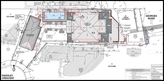
Figure
2: Proposed site plan- 4 Wadsley
Crescent Connells Point (Source: Innovate Architects 2020).
The Site and Locality
8. The subject site is
formally identified as Lot 51 in DP 805073 and known as 4 Wadsley Crescent
Connells Point. The subject site is an ‘L’ shaped allotment with a
site area of 1,057sqm, having a radial frontage of 9.1m to Wadsley Crescent and
an average depth of approximately 53.5m. The site has a western frontage to
Wadsley Crescent and a southern frontage to the waterway (Connells Bay). The
site slopes to the rear with a change in levels of around 8m based on the RLs,
and a gradient of 23%.
9. The site currently
accommodates a stepped three storey rendered residential dwelling house with a
tiled roof, a rendered detached two storey double garage, and a swimming pool
between the garage building and the principal dwelling. The site also includes
a rear boatshed with a timber jetty, pontoon, and metal sliprails extending
southwards into the waterway. A number of scattered trees are located within
the site.
10. Part of the existing dwelling
is located below the foreshore building line. In addition it is noted that the
dwelling is located within a habitat reinforcement corridor based on the
Kogarah Greenweb. The site is serviced by a sewer line located along the foreshore.
11. Adjoining the site to the
north, east, and west are two (2) – three (3) storey single dwellings.
The locality is generally residential in character with the predominant land
use being single dwelling houses either contemporary or traditional in design.
12. In the wider context, the
subject site is located approximately 100m west of Donnelly Park and
approximately 250m east of Connells Point Reserve.
Background
13. Development application
‘477/100’ was approved on 1 December 2000 for a first floor
addition to the existing garage.
14. The proposal as originally
lodged has been amended through Council’s assessment of the application.
The application previously proposed a larger building footprint with an
accompanied Clause 4.6 request to vary the permitted floor space criterion. The
proposal was not supported and amended plans were submitted reducing the size
of the built form.
15. The original proposal
incorporated larger balconies along the rear southern façade. The
proposal was not supported and amended plans were submitted reducing the size
of the balconies.
Compliance and
Assessment
16. The development site has been
inspected and assessed having regarding to the Matters for Consideration under
Section 4.15(1) of the Environmental Planning and Assessment Act 1979.
STATE
ENVIRONMENTAL PLANNING INSTRUMENTS
17. Compliance with the relevant
State Environmental Planning Policies (SEPP) is detailed below.
|
State
Environmental Planning Policy
|
Complies
|
|
State
Environmental Planning Policy No 55 - Remediation of Land
|
Yes
|
|
State
Environmental Planning Policy (Building Sustainability Index: BASIX) 2004
|
Yes
|
|
State Environmental Planning Policy (Coastal Management) 2018
|
Yes
|
|
State Environmental Planning Policy (Vegetation in Non-Rural
Areas) 2017
|
Yes
|
|
Greater
Metropolitan Regional Environmental Plan No 2 – Georges River Catchment
|
Yes
|
|
State
Environmental Planning Policy (Infrastructure) 2007
|
Yes
|
STATE
ENVIRONMENTAL PLANNING POLICY NO 55 – REMEDIATION OF LAND
18. SEPP 55 aims to promote the
remediation of contaminated land in order to reduce the risk of harm to human
health or any other aspect of the environment. Clause 7 requires contamination
and remediation to be considered in determining a development application. The
consent authority must not consent to the carrying out of development on land
unless it has considered whether or not the land is contaminated.
19. A review of the site history
indicates that the site has been used for residential purposes for extended
periods of time, and such uses and/or development are not typically associated
with activities that would result in the contamination of the site. The
proposed works do not include any change to the use of the land that would
result in any concerns with respect to contamination. There is no indication of
previous uses that would cause contamination. In this regard there is no
indication that the land is contaminated. The criterion of SEPP 55 have been
satisfied.
STATE ENVIRONMENTAL PLANNING POLICY (BUILDING
SUSTAINABILITY INDEX: BASIX) 2004
20. The trigger for BASIX
Certification is when the estimated cost of works for residential development
(new dwelling(s)/alterations and additions) is equal to or above $50,000. BASIX
Certification is also triggered when proposing a swimming pool with a volume of
40,000 litres or more.
21. A BASIX Certificate prepared
by Efficient Living Pty Ltd, dated 18 December 2019, certificate number
1066924S, has been submitted with the Development Application satisfying the
minimum requirements of SEPP (Building Sustainability Index: BASIX) 2004.
22. The amended plans did not
require for an amended BASIX Certificate to be issued.
STATE ENVIRONMENTAL PLANNING POLICY (COASTAL MANAGEMENT) 2018
23. SEPP (Coastal Management) 2018
updates and consolidates three previous SEPPs (SEPP 14 Coastal Wetlands, SEPP
26 Littoral Rainforests, SEPP 71 Coastal Protection) into one integrated Policy
and is a matter for consideration for the current DA.
24. The Coastal Management SEPP
2018 aims to: “Promote an integrated and co-ordinated approach to land
use planning in the coastal zone in a manner consistent with the objects of the
Coastal Management Act 2016 including the management objectives for each
coastal management area”.
25. Under SEPP (Coastal
Management) 2018, the subject site is mapped as a Coastal Environment area and
a Coastal Use area. These have the following management objectives under the
SEPP:
(a) to
protect and enhance the coastal environmental values and natural processes of
coastal waters, estuaries, coastal lakes and coastal lagoons, and enhance
natural character, scenic value, biological diversity and ecosystem integrity,
(b) to
reduce threats to and improve the resilience of coastal waters, estuaries,
coastal lakes and coastal lagoons, including in response to climate change,
(c) to
maintain and improve water quality and estuary health,
(d) to
support the social and cultural values of coastal waters, estuaries, coastal
lakes and coastal lagoons,
(e) to
maintain the presence of beaches, dunes and the natural features of foreshores,
taking into account the beach system operating at the relevant place,
(f) to
maintain and, where practicable, improve public access, amenity and use of
beaches, foreshores, headlands and rock platforms.
26. The following is an assessment
of the matters for consideration listed under the SEPP as applicable to the
Coastal Environment Area and Coastal Use Area.
|
Division 3 Costal Environmental Area
13 Development
on land within the coastal environment area
|
|
Control
|
Comment and compliance
|
|
(1) Development consent
must not be granted to development on land that is within the coastal
environment area unless the consent authority has considered whether the
proposed development is likely to cause an adverse impact on the following:
(a) the integrity and resilience of the biophysical,
hydrological (surface and groundwater) and ecological environment,
(b) coastal environmental values and natural coastal
processes,
(c) the water quality of the marine estate (within the
meaning of the Marine Estate Management Act 2014), in particular, the
cumulative impacts of the proposed development on any of the sensitive
coastal lakes identified in Schedule 1,
(d) marine vegetation, native vegetation and fauna and
their habitats, undeveloped headlands and rock platforms,
(e) existing public open space and safe access to and
along the foreshore, beach, headland or rock platform for members of the
public, including persons with a disability,
(f) Aboriginal cultural heritage, practices and places,
(g) the use of the
surf zone.
|
Satisfied - The proposed dwelling will not have
unreasonable impacts on the integrity and resilience of the biophysical,
hydrological (surface and groundwater) and ecological environment. Surface
water runoff is to be managed in accordance with the approved stormwater
management plan and relevant conditions imposed. The proposal is generally
satisfactory subject to conditions.
Satisfies - Although the site adjoins the waterway the
proposed dwelling is setback and does not physically adjoin the waterway. The
existing boatshed is being altered changing the façade there will be
no changes to the footprint. It is considered that the works will not have
unreasonable impacts on the coastal environmental values and natural coastal
processes. It is noted that a condition of consent has been imposed requiring
sediment control fencing around the perimeter of the site (including the
boundary with the water way) during construction.
Appropriate standard conditions to be imposed to ensure
water quality is maintained. The site is not located on any of the sensitive
coastal lakes identified in Schedule 1.
Satisfied - The development will not have unreasonable
impacts on marine and native vegetation.
There is no public access across the foreshore within the
vicinity of this site.
The works are respectful of the cultural heritage,
practices and places. The site is not a known as a European or Aboriginal
place of significance.
The site is not
located within the surf zone.
|
|
(2) Development consent must not be granted to
development on land to which this clause applies unless the consent authority
is satisfied that:
(a) the development is designed, sited and will be
managed to avoid an adverse impact referred to in subclause (1), or
(b) if that impact cannot be reasonably avoided - the
development is designed, sited and will be managed to minimise that impact,
or
(c) if that impact cannot be minimised - the development
will be managed to mitigate that impact.
|
The development will not result in an unreasonable impact
on the waterway. The development is setback and terraces down the site. The
stormwater from the development will be controlled prior to it discharging to
the waterway.
The works proposed to the existing boatshed and sliprails
are acceptable subject to adequate erosion and sediment control fencing.
|
|
Division 4 Coastal use area
14 Development on land within
the coastal use area
|
|
Control
|
Comment and compliance
|
|
(1) Development consent must not be granted to
development on land that is within the coastal use area unless the consent
authority:
(a) has considered whether the proposed development is
likely to cause an adverse impact on the following:
(i) existing, safe access to and along the foreshore,
beach, headland or rock platform for members of the public, including persons
with a disability,
(ii) overshadowing, wind funnelling and the loss of views
from public places to foreshores,
(iii) the visual amenity and scenic qualities of the
coast, including coastal headlands,
(iv) Aboriginal cultural heritage, practices and places,
(v) cultural and built environment heritage, and
(b) is satisfied that:
(i) the development is designed, sited and will be
managed to avoid an adverse impact referred to in paragraph (a), or
(ii) if that impact cannot be reasonably
avoided—the development is designed, sited and will be managed to
minimise that impact, or
(iii) if that impact cannot be minimised -the development
will be managed to mitigate that impact, and
(c) has taken into
account the surrounding coastal and built environment, and the bulk, scale
and size of the proposed development.
|
The development does not impact any of these waterway
features.
There is no public access to the waterway within the
vicinity of this site.
Satisfied - There are no unreasonable overshadowing
impacts generated by the proposal to the public domain. The submitted shadow
diagrams demonstrate compliance with the relevant shadow controls albeit the
height exceedance of the building. The height exceedance has been accompanied
by a Clause 4.6 variation which is assessed later in the report. There is
currently no visual line of site through this site from the public domain to
the waterway.
Satisfied - The development does not have unreasonable
impact on the visual amenity and scenic qualities of the coast, including
coastal headlands,
Satisfied - The works are respectful to the cultural
heritage, practices and places. The site is not identified as a place of
European or Aboriginal significance.
Satisfied - The works retain the historical connection
between the domestic use of the Georges River and connection of people and
property to the Georges River.
Satisfied - The development will not have unreasonable
impacts on the coastal zone and its processes. It is considered that the
proposed development has been designed in a way to avoid unreasonable adverse
impacts as stipulate in clause 14 (1) (a).
Satisfied - The
application has considered the surrounding costal area. The development form
and scale is not inconsistent with the built form immediately adjoining and
that of the visual catchment.
|
|
Division 4 Coastal use area
15 Development
in coastal zone generally - development not to increase risk of coastal
hazards
|
|
Control
|
Comment and compliance
|
|
Development
consent must not be granted to development on land within the coastal zone
unless the consent authority is satisfied that the proposed development is
not likely to cause increased risk of coastal hazards on that land or other
land.
|
Satisfied - The
proposed development is unlikely to increase the risk of coastal
hazards.
|
|
16 Development
in coastal zone generally - coastal management programs to be considered
|
|
Control
|
Comment and compliance
|
|
Development
consent must not be granted to development on land within the coastal zone
unless the consent authority has taken into consideration the relevant
provisions of any certified coastal management program that applies to the
land
|
Satisfied - The
proposed works are in keeping with the provisions of the Georges River
Coastal Zone Management Plan.
|
STATE ENVIRONMENTAL PLANNING POLICY (VEGETATION IN NON-RURAL AREAS)
2017
27. The Vegetation
SEPP regulates clearing of native vegetation on urban land and land zoned for
environmental conservation/management that does not require development
consent.
28. The Vegetation
SEPP applies to clearing of:
(a) Native vegetation above the Biodiversity Offset Scheme
(BOS) threshold where a proponent will require an approval from the Native
Vegetation Panel established under the Local Land Services Amendment Act 2016;
and
(b) Vegetation below the BOS threshold where a proponent will
require a permit from Council if that vegetation is identified in the
council’s development control plan (DCP).
29. The objectives
of the SEPP are to protect the biodiversity values of trees and other
vegetation in non-rural areas and preserve the amenity of non-rural areas
through the preservation of trees and other vegetation. This policy is
applicable pursuant to Clause 5(1) of the SEPP as the site is within both
Georges River Council and the R2 Low Density Residential zone.
30. Pursuant to
Clause 8(1) of the SEPP, clearing does not require authority under the policy
as it is a type of clearing that is authorised under Section 60O of
the Local Land Services Act 2013 (specifically, that associated with
a development consent issued under Part 4 of the Environmental Planning
and Assessment Act 1979).
31. Twelve (12)
trees are nominated to be removed as part of the works. The application was
referred to Council’s Consultant Arborist who did not object to the
removal of these trees subject to replacing and replanting new trees at a 2:1
ratio. Specific landscape conditions have been imposed in that regard.
GREATER
METROPOLITAN REGIONAL ENVIRONMENTAL PLAN NO 2 - GEORGES RIVER CATCHMENT
32. The main aims
and objectives of this plan include but are not limited to the following:
· To maintain
and improve the water quality and river flows of the Georges River and its
tributaries and ensure that development is managed in a manner that is in
keeping with the national, State, regional and local significance of the Catchment,
· To protect
and enhance the environmental quality of the Catchment for the benefit of all
users through the management and use of the resources in the Catchment in an
ecologically sustainable manner,
· To ensure
consistency with local environmental plans and also in the delivery of the
principles of ecologically sustainable development in the assessment of
development within the Catchment where there is potential to impact adversely
on groundwater and on the water quality and river flows within the Georges
River or its tributaries,
· To
establish a consistent and coordinated approach to environmental planning and
assessment for land along the Georges River and its tributaries and to promote
integrated catchment management policies and programs in the planning and
management of the Catchment,
33. The proposed
stormwater drainage system has been assessed by Council’s Development
Engineer and has been found to be satisfactory. Specific stormwater conditions
have been imposed in that regard.
Draft
Environmental Planning Instruments
DRAFT
ENVIRONMENTAL STATE ENVIRONMENTAL PLANNING POLICY
34. The Draft Environment SEPP was exhibited from 31 October 2017 to 31
January 2018. This consolidated SEPP proposes to simplify the planning rules
for a number of water catchments, waterways, urban bushland and Willandra Lakes
World Heritage Property. Changes proposed include consolidating the following
seven existing SEPPs:
· State Environmental Planning Policy No. 19 – Bushland in Urban
Areas;
· State Environmental Planning Policy (Sydney Drinking Water
Catchment) 2011;
· State Environmental Planning Policy No. 50 – Canal Estate
Development;
· Greater Metropolitan Regional Environmental Plan No. 2 –
Georges River Catchment;.
· Sydney Regional Environmental Plan No. 20 – Hawkesbury-Nepean
River (No.2-1997);
· Sydney Regional Environmental Plan (Sydney Harbour Catchment) 2005;
· Willandra Lakes Regional Environmental Plan No. 1 – World
Heritage Property.
35. The proposal is not inconsistent with the provisions of this Draft
Instrument.
DRAFT
REMEDIATION OF LAND STATE ENVIRONMENTAL PLANNING POLICY
36. The Draft Remediation of
Land SEPP was exhibited from 31 January 2018 to 13 April 2018.
The proposed remediation of land SEPP will:
· Provide a state-wide planning framework for the remediation of land;
· Maintain the objectives and reinforce those aspects of the existing
framework that have worked well;
· Require planning authorities to consider the potential for land to
be contaminated when determining development applications and rezoning land;
· Clearly list the remediation works that require development consent;
· Introduce certification and operational requirements for remediation
works that can be undertaken without development consent.
37. The proposal is not inconsistent with the
provisions of this Draft Instrument as there is no evidence this site is
contaminated based on previous uses.
KOGARAH LOCAL
ENVIRONMENTAL PLAN 2012
38. The extent to which the
proposed development complies with the Kogarah Local Environmental Plan 2012
(KLEP 2012) is detailed and discussed in the table below.
39. The allotment is zoned R2
– Low Density Residential Zone, a ‘dwelling house’ is
permitted with consent. It is noted that swimming pools and retaining walls are
considered ancillary to the dwelling house use and are also a permitted form of
development.
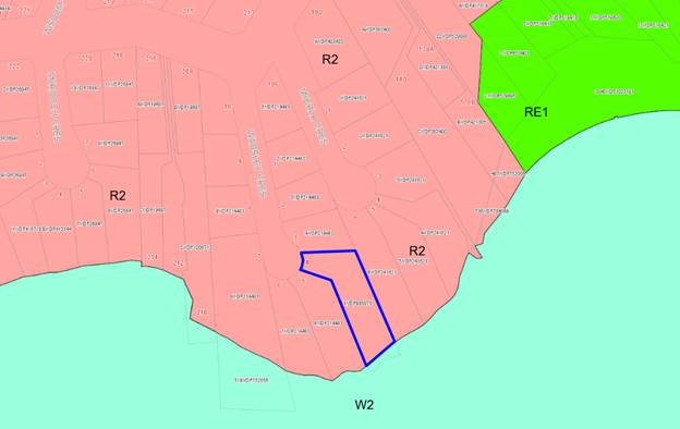
Figure 3:
Zoning Map – site outlined in blue
|
Clause
|
Standard
|
Proposed
|
Complies
|
|
Part 1 Preliminary
|
|
1.2 – Aims of the Plan
|
In accordance with Clause 1.2 (2)
|
The development is consistent with
the aims of the plan.
|
Yes
|
|
1.4 – Definitions
|
Dwelling house means a building
containing only one dwelling.
|
The proposed development is
consistent with the definition.
|
Yes
|
|
Part 2 Permitted or prohibited
development
|
|
2.3 - Zone objectives and Land Use
Table
|
Meets objectives of R2- Low Density
Residential Zone:
· To
provide for the housing needs of the community within a low density
residential environment.
· To enable
other land uses that provide facilities or services to meet the day to day
needs of residents.
|
The proposal satisfies the
objectives of the R2 zone and is permissible with development consent.
|
Yes
|
|
Part 4 Principal development
standards
|
|
4.3 – Height of Buildings
|
9m as identified on Height of Buildings
Map
|
The building is generally within
the height limit however the rear top floor balcony roof form and part of the
rear roof of the dwelling exceed the height control by up to 1.7m (18.8%
variation). At its maximum the roof structures reach a height of 10.7m.
|
Please
refer to clause 4.6 below (paragraph 40)
|
|
4.4A – Exceptions to floor
space ratio for residential accommodation in Zone R2
|
(2)
Despite clause 4.4 (2), the floor space ratio for residential accommodation
on land in Zone R2 Low Density Residential is not to exceed the maximum floor
space ratio specified in the table to this subclause.
For
a site area less than 1,500 square metres but not less than 1,000 square
metres, floor space is not to exceed: [(lot area − 1,000) ×
0.15 + 442.5] ÷ lot area:1
Site
area: 1,057sqm
0.42:1
or 451.05sqm
|
The proposed development has a
total FSR of 450.93sqm
(Including garage habitable areas,
dwelling, boatshed, and excluding pool pump room, storage room and plant room
within basement/lower ground level).
|
Yes
|
|
4.6 – Exceptions to
development standards
|
(1)
The objectives of this clause are as follows—
(a)
to provide an appropriate degree of flexibility in applying certain
development standards to particular development,
(b)
to achieve better outcomes for and from development by allowing flexibility
in particular circumstances.
|
Two
(2) Clause 4.6 requests accompany this application proposing variation to
Clause 4.3 ‘Height of Building’ and Clause 6.4 ‘Limited
Development in Foreshore Area’.
The
requests have been assessed in detail below.
|
Please
refer to clause 4.6 below
|
|
Part 5 Miscellaneous provisions
|
|
5.7 – Development below mean
high water mark
|
(2) Development consent is
required to carry out development on any land below the mean high water mark
of any body of water subject to tidal influence (including the bed of any
such water).
|
The proposed development will not
be located below the mean high water mark and will therefore satisfy the
objectives of this control.
The maintenance works to the
existing metal sliprails along the waterway is considered acceptable as the
metal sliprails are existing.
|
Yes
|
|
5.10 – Heritage conservation
|
In accordance with Clause 5.10 (1)
|
The site is not a heritage item and
not located within the vicinity of any heritage items.
The site is not in a heritage
conservation area.
|
Yes
|
|
Part 6 Additional local
provisions
|
|
6.1 – Acid sulfate soils
|
(2) Development consent is required for the carrying
out of works described in the Table to this subclause on land shown on the Acid Sulfate
Soils Map as being of the
class specified for those works:
Class 5: Works within 100 metres of adjacent Class 2, 3 or 4 land that is
below 5 metres Australian Height Datum and by which the watertable is likely
to be lowered below 1 metre Australian Height Datum on adjacent Class 2, 3 or
4 land.
(4) Despite subclause (2), development consent is not
required under this clause for the carrying out of works if—
(a) a preliminary assessment of the proposed works
prepared in accordance with the Acid Sulfate Soils Manual indicates that an
acid sulfate soils management plan is not required for the works, and
(b) the preliminary assessment has been provided to the
consent authority and the consent authority has confirmed the assessment by
notice in writing to the person proposing to carry out the works.
|
Site is located in a class 5 acid sulfate soils area, and
is within 100m of adjacent class 2 area which is below 5 AHD. It is
considered that the works are not likely to lower the watertable below 1
meter on the adjacent class 2 area.
A preliminary Acid Sulfate Soils
Assessment prepared by Australia Geotechnical Pty Ltd (reference AG-478_2
dated 26/05/2020) concluded:
“that potential or actual
Acid Sulfate Soil is not present below surface level at the proposed
excavation depth (approximate reduced level 8.27m) for the proposed
development, therefore an Acid Sulfate Management Plan is not required for
the site based on the current scope of work/depth of excavation.”
|
Yes
Yes
|
|
6.2
– Earthworks
|
(2) Development consent is
required for earthworks unless—
(a) the earthworks are exempt
development under this Plan or another applicable environmental planning
instrument, or (b) the earthworks are ancillary to development that is
permitted without consent under this Plan or to development for which
development consent has been given.
|
The proposed earthworks are
considered acceptable having regard to the provisions of this clause as the
works are not likely to have a detrimental impact on environmental functions
and processes, neighbouring properties.
A geotechnical report and
pre-construction dilapidation report will be required to be undertaken prior
to the release of the construction certificate. A condition has been imposed
in this regard.
|
Yes
|
|
6.3
– Flood planning
|
(2) This clause applies to
—
(a) land identified as
“Flood planning area” on the Flood Planning Map, and
(b) other land at or below
the flood planning level.
|
The proposed development is not
located in a mapped flood prone area.
|
Yes
|
|
6.4
– Limited development on
foreshore area
|
(1) The
objective of this clause is to ensure that development in the foreshore area will
not impact on natural foreshore processes or affect the significance and
amenity of the area.
|
The subject site is located within
a designated Foreshore Area and the siting of the building is dictated by the
established Foreshore Building Line (FBL) which is approximately 15.0m in the
site.
The development has been designed
to respect the character and nature of the foreshore and has been designed to
satisfy the FBL however the rear southern portion of the building encroaches
beyond the FBL. This is considered acceptable given the siting of the
existing building and structures on site. This issue has been discussed in
more detail through a clause 4.6 assessment below.
The proposal will improve the
character and nature of the development on the foreshore.
|
Please
refer to clause 4.6 below (paragraph 87)
|
Clause 4.6
Exceptions to Development Standards
Request for
Variation under Clause 4.6 KLEP 2012 (LEP) - Clause 4.3 Height of Buildings
40. The relevant
development standard to be varied is clause 4.3 height of buildings more
specifically subclause (2) of this standard. Clause 4.3 (2) specifies that the
maximum permitted building height applicable to the site is 9.0m above existing
ground level.
41. The building is
generally within the height limit however the rear top floor balcony roof form,
and part of the rear roof of the dwelling exceed the height control by up to
1.7m equating to a 18.8% variation. At its maximum the roof structures reach a
height of 10.7m. A variation to the height
can only be considered under Clause 4.6 – Exceptions to Development
Standards of the LEP.
42. Clause 4.6(1) outlines the objectives of the
standard which are to “provide an appropriate degree of flexibility in
applying certain development standards to particular development”
and “to achieve better outcomes for and from development by allowing
flexibility in particular circumstances”.
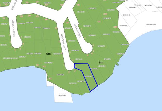
The original
plans as lodged measured the building height against the predicted ground level
prior to the construction of the currently existing house, which is not in
accordance with the definition of height under the KLEP 2012. This planning
instrument defines Height a:“the vertical distance from ground level
(existing) to the highest point of the building, or in relation to the RL of a
building – the vertical distance from the Australian Height Datum to the
highest point of the building”
The plans were amended to show the relative heights of the building
against the current existing ground levels resulting in a Clause 4.6 request
submitted to support the proposed height breach. The non-compliance being 1.7m
and 18.8% of the permitted control, is considered to be acceptable in this case
as the area where the variation is located will not be visible from the public
domain and will not cause unreasonable adverse amenity impacts to adjoining
properties or as presented to the waterway. In addition, the area of
non-compliance is limited to the roof element predominately over the rear top
floor balcony. The site is unique and quite constrained due to the topography
and the shape of the allotment being an ‘L’ shape due to the
frontage of the allotment being off the head of a cul-de-sac.The land has
previously been cut to accommodate the existing development on the site due to
the sloping nature of the allotment where there is a change in level of RL10.16
adjacent to the front boundary of the site down to RL3.47 adjacent to the
boatshed being a change in level of 6.6m.The design of the development is to
take advantage of the interface with the waterway whereby the entertaining and
living areas and private open space faces the water. The areas of
non-compliance relate to roofs over a balcony for weather protection and the
roof over the window seat within a bedroom.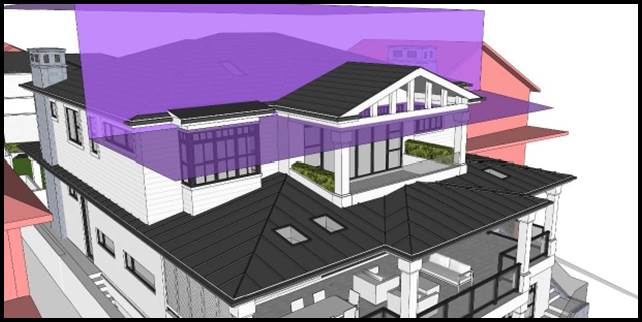 Clause 4.6(3)(a)
states that: “Development consent must not be granted for development
that contravenes a development standard unless the consent authority has
considered a written request from the applicant that seeks to justify the
contravention of the development standard by demonstrating:
Clause 4.6(3)(a)
states that: “Development consent must not be granted for development
that contravenes a development standard unless the consent authority has
considered a written request from the applicant that seeks to justify the
contravention of the development standard by demonstrating:
(a) that compliance with the development standard is
unreasonable or unnecessary in the circumstances of the case, and
49. Applicant’s
Comment: The applicant has considered that strict compliance is both
unreasonable and unnecessary in this case and has provided environmental
planning grounds to justify the contravening of the standard for the following
reasons:
· The
development is consistent with the standard and zone objectives, even with the
proposed variation;
· The
objectives of the standard are achieved notwithstanding non-compliance with the
standard.
50. The applicant
adopted the judgment of Initial Action Pty Ltd v Woollahra Municipal Council
[2018] NSWLEC 118 (‘Initial Action’), in which Preston CJ
indicated that a Clause 4.6 does not directly or indirectly establish a test
that a non-compliant development should have a neutral or beneficial effect
relative to a compliant development. Rather, the non-compliance should be
assessed with regard to whether the impacts are reasonable in the context of
achieving consistency with the objectives of the zone and the objectives of the
development standard.
51. The applicant
has adopted the 5 point test set out by the Land and Environment Court in Wehbe
v Pittwater Council (2007) NSW LEC 827, specifically that there are five
different ways in which compliance with a development standard can be
considered unreasonable or unnecessary, namely:
1. The objectives of the standard
are achieved notwithstanding non-compliance with the standard;
Comment:
The proposal is considered to be consistent with the objectives of Clause 4.3
Height of Buildings, notwithstanding the numerical variation. The applicant has
outlined that the proposal complies with all the DCP controls regarding
setbacks, landscaping, car parking spaces and the site is able to provide high
quality amenity to the residents and neighbours notwithstanding the height
non-compliance.
2. The underlying
objective or purpose of the standard is not relevant to the development and
therefore compliance is unnecessary;
Comment:
The objectives of standard remain relevant and the proposal is consistent with,
or at least is not antipathetic to the objectives of this standard,
notwithstanding the numerical variation.
3. The underlying object
of purpose would be defeated or thwarted if compliance was required and
therefore compliance is unreasonable;
Comment:
The proposal is consistent with the objectives of standard, notwithstanding the
numerical variation, and it would not defeat or thwart the purpose of the
standard.
4. The development
standard has been virtually abandoned or destroyed by the Council's own actions
in granting consents departing from the standard and hence compliance with the
standard is unnecessary and unreasonable;
Comment:
The standard has not been abandoned by Council in its assessments of
applications seeking variations. The standard has been consistently applied.
5. The zoning of the
particular land is unreasonable or inappropriate so that a development standard
appropriate for that zoning is also unreasonable and unnecessary as it applies
to the land and compliance with the standard would be unreasonable or
unnecessary. That is, the particular parcel of land should not have been
included in the particular zone.
Comment:
The proposed single dwelling development is a permissible land use and the
zoning of the site is considered to be appropriate in this location and in the
context of the surrounding land uses and built form.
52. Officer
Comment: The applicant’s written request to vary the
development standard has been considered and it is concluded that the applicant
has justified that compliance with the development standard is unreasonable or unnecessary
in the circumstances of the case, and that there are sufficient environmental
planning grounds (as detailed below) to justify contravening the development
standard. This conclusion has been reached for the following reasons:
· The site is unique
and quite constrained due to the topography of the land sloping towards the
waterway and due to location of the main private open space area of the
dwelling being forward of the main building face resulting in the
building’s recessed location within the site.
· The majority of
the dwelling is located below the 9.0m height limit, with the elements above
the limit not unreasonably impacting the solar amenity of the adjoining
premises. This is discussed in further detail below.
· The floor space
ratio of the development complies with the relevant development standard which
demonstrates that the height of the development is not as a result of
additional floor area being provided to the development. As a result the bulk
and form of the development is consistent with what is anticipated for the
locality.
· The development
observes a built form consistent with that established within the locality. The
setbacks proposed are both consistent with the objectives of the DCP, and are
similar to other dwelling houses along Wadsley Crescent and in the locality.
Clause 4.6(3)(b) states that: (b) that
there are sufficient environmental planning grounds to justify contravening the
development standard.
54. The applicant
has demonstrated that although the height of building exceeds the permitted
9.0m limit, the proposed development is of a form and scale that is
proportionate with that envisaged by the planning controls applicable to the
land. The applicant relied on the proceedings of Four2Five Pty Ltd v Ashfield
Council [2015] NSWLEC 90.
55. The applicant
demonstrated that there are sufficient environmental planning grounds as
detailed below:
56. “The
point of the maximum breach is limited to a minor area located at the rear
(centrally) along the north- south axis and is limited to a small portion of
the open gable end roof which provides cover to the balcony below. The
non-compliance also pertains to a small portion of the roof above bedroom 1 and
eaves to the east and west of the open end gable roof.
57. The height breach
is a result of the site topography and floor levels of the existing dwelling,
which has a fall of approximately 11m from the northern boundary to the
southern boundary. This is a specific condition that the LEP height limit does
not specifically contemplate, in that the height limit applies equally to a
vast area of the LGA with distinctly different topography
58. The height
non-compliance is measured from the lowest level of the existing dwelling. When
considering the topography around the periphery of the site in accordance with
the NSW LEC Case Bettar Vs Council of the City of Sydney (2014) NSWLEC 1070,
the extent of non-compliance when measured from the natural ground line is
9.775m. The non-compliance will not be visually obtrusive from the foreshore
area, will not result in any adverse impact to the amenity of neighbours and
will be compatible with residential dwellings throughout the locality.
59. The height
exceedance will only be visible from the public domain (being Georges River) and
to the casual observer; the proposal would appear compliant with the intended
height and form of development on the site. The proposed works are not visible
from Wadsley Crescent and will sit well below the permitted height standard for
the majority of the proposal. The proposed non-compliance will not impose an
unreasonable bulk or scale when viewed from adjoining properties, No. 6 Myerla
Crescent and No. 5 Wadsley Crescent. Furthermore, when viewed from the Georges
River the height variation will not be readily apparent due to its minor size,
open construction and staggered design approach. This element will improve the
articulation of the façade and will provide cover to the proposed
balcony on Level 1, a non-habitable open space. The proposed design and overall
height is also considered to be entirely compatible with the built form and
character of the locality.
60. The social
benefits of providing improved dwelling stock within a highly sought after
location should be given weight in the consideration of the variation request.
The rebuilding works will significantly improve the visual qualities of the
proposed dwelling over the existing dwelling and it would be a loss to the
future occupants (and contrary to the public interest) to deny the variation and
require alterations to the design which will ultimately impact residential
amenity and building aesthetics.
(a) The extent of the non-compliance creates
no additional overshadowing. Shadow diagrams (reproduced below) indicate that
the extent of overshadowing created by the non-compliant elements are entirely
cast onto the subject site and will not adversely impact the solar gain of
neighbouring properties or future occupants of the proposed dwelling;
(b) The height breach does not result in any
significant additional privacy impacts, as it does not provide any openings
which will create overlooking. This also applies to the height non-compliance
created by the roof element above bedroom 1. The height variation will have no
greater impact on the privacy of adjoining properties when compared to the
complying elements of the building; and
(c) The proposed
development will not result in any material loss of views or outlook when
compared to a building with a compliant height. When considering the extent of
view sharing against the backdrop of the applicable planning controls, the
extent of view loss caused by the non-compliant element would be insignificant
or nil.
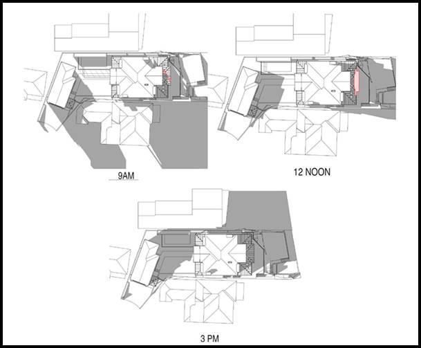 Source:
Innovate Architects 2020).61. The
height breach allows for a roof form which will provide a higher level of
amenity to occupants of the development. The additional height enables the
provision of an open end gable roof which will provide weather protection to
the balcony which is accessed from Bedroom 1 on the first floor. The additional
height also provides a façade feature which will improve the overall
articulation of the building when viewed form the waterway.
Source:
Innovate Architects 2020).61. The
height breach allows for a roof form which will provide a higher level of
amenity to occupants of the development. The additional height enables the
provision of an open end gable roof which will provide weather protection to
the balcony which is accessed from Bedroom 1 on the first floor. The additional
height also provides a façade feature which will improve the overall
articulation of the building when viewed form the waterway.
62. The proposed
development meets the objectives of the development standard and meets the
objectives of the R2 Low Density Residential zone.
63. The proposed
building envelope has been carefully considered and is reflective of the
topographical features of the site and compatible with the neighbouring
dwellings and views afforded by Georges River. The proposed works have been designed
with a compliant floor space ratio, landscaped area and setbacks to mitigate
any concerns regarding bulk and scale.
64. The proposal
provides for an appropriate scale and form that reflects the desired future
character for development in the area. The proposed replacement dwelling will
be hidden from Wadsley Crescent, however will be perceived from the waterway as
a staggered three storey residential dwelling which has incorporated high
quality architectural elements and represents a significant improvement over
the existing dwelling.
65. The proposed
development achieves the objects in Section 1.3 of the EPA Act, specifically
(a) The proposal promotes the orderly and
economic use and development of land through the redevelopment of an underutilised
site for residential uses (1.3(c));
(b) The proposed developed promotes good
design and amenity of the built environment through a well- considered design
which is responsive to its setting and context (1.3(g)).”
66. Officer
comment: The written request adequately addresses the matters in subclause
(3). Sufficient environmental planning grounds have been articulated
demonstrating that the height exceedance will not unreasonably impact upon the
amenity of adjoining residents and the locality and will not result in an
undesirable precedent. It is noted that prior to resolving if compliance with
the height is unreasonable and unnecessary in this case, the consent authority
must be satisfied that the matters under clause 4.6 (4)(a) have been satisfied
being:
(i) the
applicant’s written request has adequately addressed the matters required
to be demonstrated by subclause (3), and
(ii) the
proposed development will be in the public interest because it is consistent
with the objectives of the particular standard and the objectives for
development within the zone in which the development is proposed to be carried
out, and
67. In accordance
with subclause 4.6(4), the proposal needs to satisfy both the development
standard and zone objectives in order to determine whether the development is
in the public interest. Assessment of the non-compliance with the height
control objectives is provided below.
68. The objectives
of the R2– Low Density Residential are considered to be achieved as detailed
below albeit non-compliance with the height control.
|
Zone R2
– Low Density Residential Objectives
|
Response
|
|
To provide for the housing needs of the
community within a low density residential environment.
|
The siting
arrangement, built form and architectural language of the development is
consistent with that likely to be encountered in a low density residential
setting on an allotment of land where there is a considerable change in level
and the development is working with the topography of the site.
|
|
To enable other land uses that provide
facilities or services to meet the day to day needs of residents.
|
The proposal does
not offer the provision of other land uses on the land apart from a new
dwelling. Notwithstanding, access to numerous services are located within the
locality.
|
69. It is also
considered that the objectives of Clause 4.3 - Height of Buildings are achieved
notwithstanding the breach of the numerical control. The objectives of this
clause are as follows:
(a) to establish the maximum height for buildings,
(b) to minimise the impact of overshadowing, visual impact
and loss of privacy on adjoining properties and open space areas,
(c) to provide appropriate scale and intensity of
development through height controls.
Objective (a) To
establish the maximum height for buildings;
70. Applicant
comment: This objective articulates the ultimate function of the height
of buildings development standard. The maximum height for buildings on land
within the former Kogarah Local Government Area is identified in the Height of
Buildings Map. As previously described, the maximum building height permitted
on the subject site is 9m and the maximum height of the proposal is 10.7m. The
development standard provides for a 3 storey development across the site given
the nature of the topography in which the majority of the development complies
with the control. A minor non-compliance is created by physical attributes of
the site, specifically the steeply sloping topography of the land and floor
levels of the existing dwelling. The proposed variation is limited an open roof
structure at the point in which the portion of the land is steeply sloping and
the existing floor level is lowest.
71. Officer
comment: The Clause 4.6 Statement has been updated in July 2020 and now is
representative of the final set of drawings.
72. The height
objective “to establish a maximum height for buildings” aims
to limit the height of buildings and establishes a “maximum” height
limit. Ordinarily, Council has permitted slight exceedances to the height
control if they involve ancillary roof structures and areas of open space where
no habitable spaces encroach on the height limit and amenity and visual impacts
are minimised.
73. The exceedance
does not involve any habitable area. The rear roof form could easily be removed
from the plans however this will adversely affect the amenity and functionality
of the space it services, namely the rear top floor balcony and the roof form over
the window seat within a bedroom. Given that these structures are largely
recessed from the site elevations of the building they will not be visible from
the street or perceived as bulky or excessive elements when viewed from the
waterway and immediate surrounds, it is considered that objective 4.6 (4)(a) is
still achieved.
Objective (b)
to minimise the impact of overshadowing, visual impact and loss
of privacy on adjoining properties and open space areas;
Applicant comment: The non-compliant has been located
and designed in order to minimise any potential impact
to overshadowing, disruption
to views and loss of privacy to surrounding developments. The maximum height
will be limited to 10.7m above ground level (existing), and is limited to the
open gable end roof, which occupies a minor portion of the overall site with
the remaining built form below the 9m height maximum. The non-compliant height
is not considered unreasonable in the surrounding locality.75. Officer
comment: In order to undertake a full and proper assessment of the breach
the applicant was requested to provide shadow diagrams to demonstrate the
impact of the non-compliance. In relation to solar
access, the proposed roof elements above the 9m height limit create no
significant additional overshadowing when compared to a compliant roof height.
Given the location of the non-compliant elements being centrally within the
dwelling and at the rear, together with the lot orientation, the shadows cast
by the non-compliant roof height will be contained within the shadow cast by
the compliant elements of the dwelling. As a result there is no additional
impact on the adjoining allotment resulting from the numeric non-compliance.
The neighbouring properties will receive the required 3 hours of solar access
between 9am and 3pm in midwinter as referenced in KDCP 2013.
76. In terms of
visual impact the floor plans highlight the location of the structures which
are more centrally located and recessed from all sides of the building.
Although they will be partially visible from adjoining allotments and the
waterway, the visual impact is not considered to be unreasonable as it is not a
dominating element.
77. The design,
location and siting of the top floor rear balcony has considered potential
amenity impacts including overlooking, as a result planter boxes have been
introduced to the side façade of the top floor rear balcony to restrict
the area where overlooking can occur.
Objective (c) to provide appropriate
scale and intensity of development through height controls.Applicant
comment: The variations to the height of buildings development standards
are limited to a maximum 1.7m variation to the open gable end roof to the rear
upper most level. This variation is considered to be minor and would not be
alarming to the visual aesthetic when viewed from the waterway. The proposed
non-compliance is setback considerably from each side boundary, and has been
articulated into the southern (rear) elevation. Only where the site slopes at
the central portion of the proposed development and at the lowest point of the
floor level of the existing dwelling will the height breach be present. The
architectural design of the development presents as a three storey dwelling
which is stepped according to the topography as is common in the locality.Officer
comment: The proposed scale of the building is considered generally
satisfactory and consistent with similar contemporary dwelling houses in the
immediate locality.80. The
architectural language and rear façade articulation successfully masks
the height breach and presents as a compliant built form which will not be
visible to the casual observer. It is considered that the minor variation to
the roof over a balcony will not result in a scale of development that is
noticeably different from the remaining compliant built form. The design of the
proposal ensures that the development will nestle comfortably between the
neighbouring dwellings and is compatible with the existing character of the
locality.
81. The proposed
bulk and scale is generally considered acceptable. The density and scale is
considered to be in line with the expected and anticipated form of development
within this zone. The proposal satisfies the objectives of the height
control.
82. Clause 4.6(4)(b)
consent must not be granted for development that contravenes a development
standard unless concurrence of the Director-General must be obtained.
83. In accordance
with clause 64 of the Environmental Planning and Assessment Regulation 2000,
Council may assume the Secretary’s concurrence for exceptions to
development standards for applications made under clause 4.6 of the LEP. This
was further confirmed by directions provided within Planning Circular PS 18-003
issued on 21 February 2018, with the consent authority in this instance be the
Georges River Local Planning Panel.
84. Clause 4.6 (5)
states that: “Whether contravention of the development standard raises
any matter of significance for State or regional environmental planning (Clause
4.6(5)(a))”
85. Contravention of
the maximum height development standard proposed by this application does not
raise any matter of significance for State or regional environmental planning.
86. Despite the
non-compliance in terms of the height, the proposed variation is considered to
be a reasonable planning and urban design outcome given that the variation
satisfies the provisions of clause 4.3, the zone objectives, and the
non-compliance does not conflict with the public interest. It is considered that
the Clause 4.6 Statement dated July 2020 is well founded.
Request for
Variation under Clause 4.6 KLEP 2012 - Clause 6.4 Limited development on
foreshore area
87. The proposed development seeks a
variation to the development standard relating to Foreshore Development
pursuant to Clause 6.4 of the KLEP. The LEP identifies a Foreshore Building
Line (FBL) of 15m for the Site (refer to Figure 12 below). Parts of the
proposed building encroach the 15m FBL. A variation to the FBL (Clause 6.4) can
only be considered under Clause 4.6 – Exceptions to Development Standards
of the LEP. The Applicant has submitted a Clause 4.6 Statement to support the
non-compliance. An assessment of the statement and reasoning for the variation
is discussed below.
88. Clause 4.6(1) outlines the objectives
of the standard which are to “provide an appropriate degree of
flexibility in applying certain development standards to particular development”
and “to achieve better outcomes for and from development by allowing
flexibility in particular circumstances”.
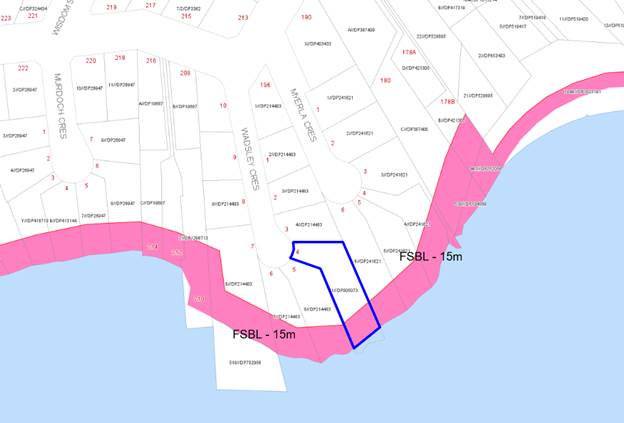
89. The site has a Foreshore Building Line
(FBL) of 15m as per KLEP 2012. The proposed development is for the rebuilding
of an existing dwelling, which is located partially within the foreshore area.
It is noted that the proposal will not result in any further encroachment in a
southerly direction beyond the established rear building line. The proposal
will in fact reduce the portion of encroachment by a reduction of the lower
ground floor plate. Numerically, if encroachment is measured as a ratio between
the established foreshore building line (15m) and the mean high water mark, the
building at its most southern portion (11.4m setback between building and mean
high water mark), the building encroaches approximately 24% past the 15m
foreshore building line.
90. The existing building at its most
southern portion (9.92m setback between building and mean high water mark), the
existing building encroaches 33.8% past the 15m foreshore building line. This
is only on a numerical basis and does consider the volume of built form
encroaching past the 15m foreshore building line.
91. It is acknowledged that calculating
encroachment as a ratio between the established foreshore building line (15m)
and the mean high water mark is purely to yield a numerical value and does not
consider the volume of built form encroaching past the 15m foreshore building
line. An assessment against clause 4.6 and clause 6.4 has been undertaken to
establish whether the encroachment in this case has sufficient
environmental planning grounds to justify contravening the development standard
and to establish if compliance
with the development standard is unreasonable or unnecessary in the
circumstances of this case.
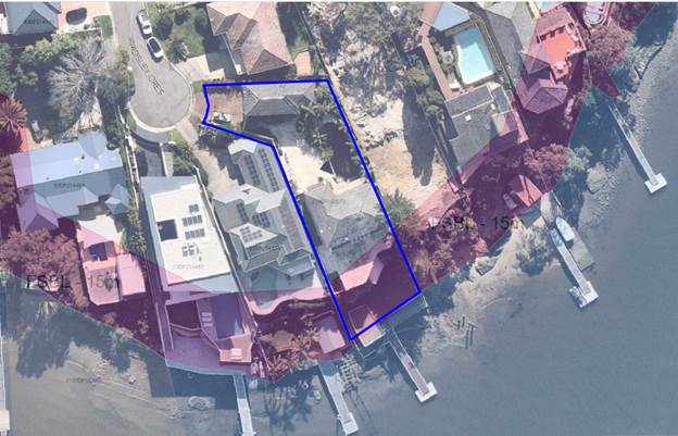
Figure 8:
Foreshore building line with respect to the existing dwelling - 4 Wadsley
Crescent Connells Point
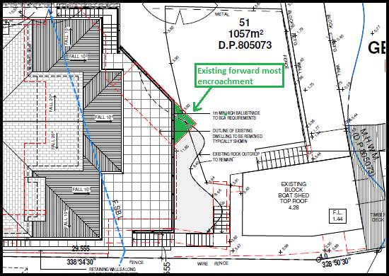
Figure 9:
Existing forward most part of the dwelling shown in green, with the forward
most part of the proposed dwelling behind.
Clause 4.6(3)(a) states that: “Development consent must not be
granted for development that contravenes a development standard unless the
consent authority has considered a written request from the applicant that
seeks to justify the contravention of the development standard by
demonstrating:
(a) that compliance with the development standard is
unreasonable or unnecessary in the circumstances of the case, and
93. Applicant’s
comment: The applicant has considered that strict compliance is both
unreasonable and unnecessary in this case and has provided environmental
planning grounds to justify the contravening of the standard for the following
reasons:
· The
development is consistent with the standard and zone objectives, even with the
proposed variation;
· The
objectives of the standard are achieved notwithstanding non-compliance with the
standard.
94. The applicant
adopted the judgment of Initial Action Pty Ltd v Woollahra Municipal Council
[2018] NSWLEC 118 (‘Initial Action’), in which Preston CJ
indicated that a Clause 4.6 does not directly or indirectly establish a test
that a non-compliant development should have a neutral or beneficial effect
relative to a compliant development. Rather, the non-compliance should be
assessed with regard to whether the impacts are reasonable in the context of
achieving consistency with the objectives of the zone and the objectives of the
development standard.
95. The applicant
has adopted the 5 point test set out by the Land and Environment Court in Wehbe
v Pittwater Council (2007) NSW LEC 827, specifically that there are five
different ways in which compliance with a development standard can be
considered unreasonable or unnecessary, namely:
1. The objectives of the standard are
achieved notwithstanding non-compliance with the standard;
Comment: The proposal is considered to be consistent with the
objectives of Clause 6.4 Limited Development in Foreshore area, notwithstanding
the variation. The applicant has outlined that the development is for the
rebuilding of an existing building partly in the foreshore area as per Clause
6.4(2)(a), and has satisfactorily demonstrated that the proposal is capable of
achieving the criteria as set by Clause 6.4(3).
2. The underlying objective or
purpose of the standard is not relevant to the development and therefore
compliance is unnecessary;
Comment: The objectives of standard remain relevant and the
proposal is consistent with, or at least is not antipathetic to the objectives
of this standard, notwithstanding the numerical variation.
3. The underlying object of purpose
would be defeated or thwarted if compliance was required and therefore
compliance is unreasonable;
Comment: The proposal is consistent with the objectives of
standard, notwithstanding the numerical variation, and it would not defeat or
thwart the purpose of the standard
4. The development standard has been
virtually abandoned or destroyed by the Council's own actions in granting
consents departing from the standard and hence compliance with the standard is
unnecessary and unreasonable;
Comment: The standard has not been abandoned by Council through
its actions in granting consent for other developments within the Georges River
Council LGA that depart from the standard. The control continues to be applied
in the assessment of applications.
5. The zoning of the particular land
is unreasonable or inappropriate so that a development standard appropriate for
that zoning is also unreasonable and unnecessary as it applies to the land and
compliance with the standard would be unreasonable or unnecessary. That is, the
particular parcel of land should not have been included in the particular zone.
Comment: The proposed single dwelling development is a permissible
land use and the zoning of the site is considered to be appropriate in this
location and in the context of the surrounding land uses and built form.
96. Officer
comment: The applicant’s written request to vary the
development standard has been considered and it is concluded that the applicant
has justified that compliance with the development standard is unreasonable or
unnecessary in the circumstances of the case, and that there are sufficient
environmental planning grounds to justify contravening the development standard.
This conclusion has been reached for the following reasons:
· The existing
building is located partly in the foreshore area and clause 6.4 (2)(a) permits
the rebuilding of a dwelling which is wholly or partially located in the
foreshore area.
· The proposal will not result in any
further encroachment in a southerly direction beyond the established rear
building line.
· The proposal will
be not be inconsistent with the established rear building line as observed
along foreshore allotments in the locality.
· The proposal has
been designed to ensure compatibility with the character of the foreshore area
and enhance the visual quality of the existing dwelling
Clause 4.6(3)(b) states that: (b) that
there are sufficient environmental planning grounds to justify contravening the
development standard.
98. The applicant
demonstrated that there are sufficient environmental planning grounds as
summarised below:
99. The proposed
development has been designed to ensure compatibility with the character of the
foreshore area and enhance the visual quality of the existing dwelling.
100. The proposed development
replaces the existing external walls on the lower ground floor with an open
terrace space which has been designed with a considerably increased rear
setback to the proposed external wall. Although the proposal continues to
provide portions of the internal area at the lower ground floor within the
foreshore area (as is existing), it is considered to be a significant
improvement with regards to build form and articulation.
101. The proposed ground
floor rear balcony has been setback further from the existing rear boundary and
rationalised with regards to its footprint. The first floor proposes a minor
increase (reduced rear setback) to the external wall of Bed 1, however does not
extend into the foreshore area.
102. The social benefits of
providing improved dwelling stock within a highly sought after location should
be given weight in the consideration of the variation request
103. It is considered that
there is an absence of any significant material impacts of the proposed non-
compliance on the amenity of the environmental values of the locality, the
amenity of future building occupants and on area character. Specifically:
(a) The
non-compliance already exists and the extent of additional encroachment behind
the existing alignment creates no additional adverse overshadowing to adjoining
properties;
(b) The proposed
development does not result in any significant additional privacy impacts, as
it does not provide any large openings which will create overlooking to
neighbouring properties. The proposed variation will have no greater impact on
the privacy of adjoining properties when compared to the complying and existing
elements of the building; and
(c) The proposed
development will not result in any material loss of views or outlook when
compared to the existing dwelling. When considering the extent of view sharing
against the backdrop of the applicable planning controls, the extent of view
loss caused by the non-compliant element would be insignificant or nil.
104. The proposed development
allows for a building design which will provide a high levels of amenity to
occupants of the development.
105. The proposed development
achieves the objects in Section 1.3 of the EPA Act, specifically
(a) The proposal promotes the orderly and
economic use and development of land through the redevelopment of an
underutilised site for residential uses (1.3(c));
(b) The proposed developed promotes good
design and amenity of the built environment through a well- considered design
which is responsive to its setting and context (1.3(g)).”
106. Officer comment: The
written request adequately addresses the matters in subclause (3). Sufficient
environmental planning grounds have been demonstrated that the building
encroachment past the foreshore building line will not unreasonably impact upon
the amenity of adjoining residents and the locality and will not result in an
undesirable precedent. It is noted prior to resolving if compliance with the
limited development in foreshore area development standard is unreasonable and
unnecessary in this case, the consent authority must be satisfied that the
matters under Clause 4.6(4)(a) have been satisfied specifically –
(i) the
applicant’s written request has adequately addressed the matters required
to be demonstrated by subclause (3), and
(ii) the
proposed development will be in the public interest because it is consistent
with the objectives of the particular standard and the objectives for
development within the zone in which the development is proposed to be carried
out, and
107. In accordance with subclause
4.6(4), the proposal needs to satisfy both the development standard and zone
objectives in order to determine whether the development is in the public
interest. Assessment of the non-compliance with the limited development in
foreshore area development standard is provided below.
108. The objectives of the R2–
Low Density Residential are considered to be achieved as detailed below albeit
non-compliance with limited development in foreshore area development standard.
|
Zone R2
– Low Density Residential Objectives
|
Response
|
|
To provide for the housing needs of the
community within a low density residential environment.
|
The proposed development will
continue to provide low density residential housing within the locality and
will improve the quality of the neighbourhood by improving the appearance and
amenity of the existing dwelling. The development forward of the foreshore
building line is a single dwelling and therefore consistent with the R2 zone
objective.
|
|
To enable other land uses that provide
facilities or services to meet the day to day needs of residents.
|
The proposal will not have
unreasonable impacts on the ability of other land uses to provide facilities
and services within the locality given all surrounding properties within the
immediate vicinity are primarily residential.
|
109. When considering the
objective of Clause 6.4, subclauses Clause 6.4(2) and 6.3(3) need to be taken
into account as they have been constructed to assist in the interpretation of
the Clause and aim to provide an indication of development that is considered
to be acceptable along the foreshore. Clause 4.6(2) states that development
consent must not be granted to development on land in the foreshore area except
for the following purposes:
(a) the
extension, alteration or rebuilding of an existing building wholly or partly in
the foreshore area,
(b) the
erection of a building in the foreshore area, if the levels, depth or other
exceptional features of the site make it appropriate to do so,
(c) boat
sheds, sea retaining walls, wharves, slipways, jetties, works to enable
pedestrian access to the waterway, swimming pools, fences, cycleways or walking
trails.
110. In terms of compliance with
Clause 6.4(2) the proposal complies as the proposal fits within the category of
Clause 6.4(2)(a) as it is development that it involves “the extension,
alteration or rebuilding of an existing building wholly or partly in the
foreshore area”. It is noted that proposal does not extend further
beyond the FBL than the development that presently exists on site. This
dwelling will improve the breach by 1.0m.
111. Clause 6.4(3) requires a
detailed assessment of the proposal against a series of provisions to ensure
there are no detrimental impacts on the foreshore in terms of environmental, cultural,
social and visual impacts:
|
Clause 6.4 (3)
Provisions
|
Response
|
|
(3)
Development consent must not be granted under this clause unless the consent
authority is satisfied that—
(a) the
development will contribute to achieving the objectives for the zone in which
the land is located, and
(b) the
appearance of any proposed structure, from both the waterway and adjacent
foreshore areas, will be compatible with the surrounding area, and
(c) the
development will not cause environmental harm such as—
(i) pollution
or siltation of the waterway, or
(ii) an
adverse effect on surrounding uses, marine habitat, wetland areas, fauna and
flora habitats, or
(iii) an
adverse effect on drainage patterns, and
(d) the
development will not cause congestion or generate conflict between people
using open space areas or the waterway, and
(e) opportunities
to provide continuous public access along the foreshore and to the waterway
will not be compromised, and
(f) any
historic, scientific, cultural, social, archaeological, architectural,
natural or aesthetic significance of the land on which the development is to
be carried out and of surrounding land will be maintained, and
(g) in
the case of development for the alteration or rebuilding of an existing
building wholly or partly in the foreshore area, the alteration or rebuilding
will not have an adverse impact on the amenity or aesthetic appearance of the
foreshore, and
(h) sea
level rise or change of flooding patterns as a result of climate change has
been considered.
|
The dwelling will continue to achieve the objectives if the R2 zone.
The three (3) storey dwelling as
viewed from the waterway will be compatible with the surrounding areas.
The proposed dwelling will be
largely located within the existing footprint of the dwelling and does not
propose to intensify the use. The application has been assessed with regards
to stormwater and the proposed method of drainage has been supported by
Council’s engineers.
The development will not result in
a change in circumstances of the use of the waterway or public open space.
The proposed development will not
alter any existing access arrangement.
The proposed dwelling will largely
be located within the footprint of the existing dwelling. The main rock
formations along the waterway will remain as existing and will not be altered
or removed.
Although the existing dwelling is
located forward of the FBL, the dwelling will be located behind the forward
most part of the existing dwelling not impacting the amenity or aesthetic of
the foreshore.
The dwelling has been appropriately
located to protect against rise in sea levels due to climatic changes.
|
112. Clause 4.6(4)(b) consent
must not be granted for development that contravenes a development standard
unless concurrence of the Director-General must be obtained.
113. In accordance with clause
64 of the Environmental Planning and Assessment Regulation 2000, Council may assume
the Secretary’s concurrence for exceptions to development standards for
applications made under clause 4.6 of the LEP. This was further confirmed by
directions provided within Planning Circular PS 18-003 issued on 21 February
2018.
114. Clause 4.6 (5) states that:
“Whether contravention of the development standard raises any matter
of significance for State or regional environmental planning (Clause
4.6(5)(a))”
115. Contravention of the
limited development in foreshore area development standard proposed by this
application does not raise any matter of significance for State or regional
environmental planning.
116. Despite the non-compliance
in terms of the foreshore building line, the proposed variation is considered
to be a reasonable planning and urban design outcome given that the variation
satisfies the provisions as set by clause 6.4, the zone objectives, and the
non-compliance does not conflict with the public interest. It is considered
that the Clause 4.6 Statement dated July 2020 is well founded.
DRAFT GEORGES
RIVER LOCAL ENVIRONMENTAL PLAN 2020
117. Consideration is given to the provisions of Draft Georges River
Local Environmental Plan 2020 in the assessment this application.
118. In this
regard, the provisions have no determining weight as a result of proposed
operation of Clause “1.8A Savings provisions relating to development
applications” of the Draft Plan which provides “If a
development application has been made before the commencement of this Plan in
relation to land to which this Plan applies and the application has not been
finally determined before that commencement, the application must be determined
as if this Plan had not commenced.”
DEVELOPMENT
CONTROL PLANS
119. The proposal has
been assessed under the relevant sections of the Kogarah Development Control
Plan 2013 as follows.
|
Kogarah DCP 2013 Part C1- Low
Density Housing
|
|
Clause
|
Standard
|
Proposed
|
Complies
|
|
1.2 Building Scale and Height
|
|
1.2.1 Floor space
Requirements
|
(5) Blank walls and flat facades
should be avoided. Walls longer than 10m should be articulated by a minimum
300mm projection or indentation in the façade.
(6) The overall building should
present a building mass that is in proportion with the allotment size,
provides opportunities for modulation and articulation of the building and
does not detract from the satisfaction of any other applicable design
principle.
(7) Where proposed development
includes a two (2) residential level element, then the second level should
not extend beyond 60% of the depth of the allotment measured from the street
boundary. Where side boundaries are of varying length, the second level is
limited to a line across the block between the points on both boundaries.
|
The proposed development is
sufficiently articulated.
The proposed development is
considered to be appropriate given the streetscape, locality and subject
site.
Due to the irregular shape of the
site and the position of the existing house, part of the dwelling will extend
beyond the 60% line.
|
Yes
Yes
Refer to comment (1)
|
|
Comment (1)
The site is an irregularly
‘L’ shaped allotment with the dwelling located a considerable
distance from the front boundary. In addition, the existing primary private
open space of the dwelling is located between the front boundary and the
front building line of the dwelling. These factors result in a building
sitting towards the middle of the site.
The building is currently located
approximately 5.0m past the 60% line, which represents a variation of
approximately 10.5%. This has been calculated by utilizing the side
boundaries adjacent to the dwelling only (excluding side boundaries adjacent
to garage).
The proposal has generally been
designed to maintain the footprint of the existing building. Albeit a
southerly extension to the ground and first floor, the areas past the 60%
line are primarily balconies which benefit from views of Connells Point. Due
to the recessed front building line, the rear extension is considered to be
sufficiently articulated and designed to limit privacy impacts and excessive
overshadowing. The objectives of the control are: to be in scale with the
allotment size; to provide opportunities for modulation and articulation of
the building form; and not detract from the satisfaction of any other
requirement.
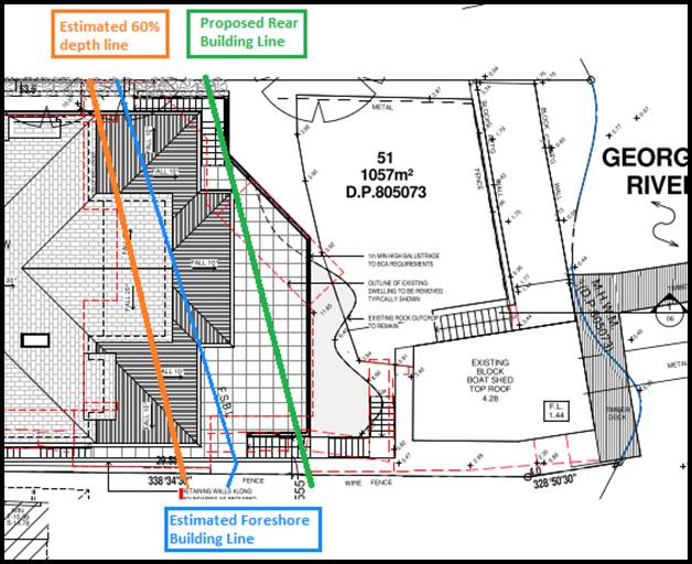
It is considered that the building
responds well to the objectives of the control, however numerically the 60%
depth line would be difficult to comply with due to the existing sitting of
the building and the irregular shape of the site.
The numeric non-compliance is
considered to be acceptable in this individual instance.
|
|
1.2.2 Building Heights
|
(1) The maximum building height must
comply with the requirements specified in table below:
Dwelling Type
Single dwelling;
Maximum Height
7.2m to the underside of the upper
ceiling;
9.0 to the top of the ridge;
(2) The maximum number of
residential levels is two (2), except where the site has a slope exceeding
1:8 (12.5%), where the maximum number of residential levels is three (3).
|
9.23m
10.7m
23%.
Three (3) residential levels are proposed
|
Refer to comment (2)
Yes
|
|
Comment (2)
As per the lodged 4.6 request, the
application is seeking a variation to the height of building sought
particularly to the rear roof elements. This has been assessed in paragraph
39. The variation to the DCP in this case is 28.19% to the upper ceiling
height and 18.8% to the ridge. It is important to note that the variation is
only for the rear roof form. The main roof ridge in the middle of the
building is 8.32m to the ridge and 5.9m to the upper ceiling.
The variation to the height in this
case is considered to be satisfactory as the variation does not prohibit the
proposal from achieving the R2 zone objectives, the objectives of clause 4.3
- Height of Building as per the LEP, and the objectives of the building
height controls as per 1.2.2 of KDCP 2013 being: “Ensure that the
height of development is not excessive and relates well to the local
context.”
The development has been designed
to be harmonious and sympathetic to the developments that exist within the
foreshore locality. The height of building albeit exceeding the DCP limit does
not contribute to unreasonable impacts to adjoining allotments.
The development is located in a
position that is not indifferent to the dwellings in the immediate vicinity
of the site.
|
|
1.2.3 Rhythm of the Built
Elements in the Streetscape
|
(1) The primary building
façade should not exceed 40% of the overall width of the total
frontage.
(2) The secondary building
façade should be set back a minimum of 1.5 metres from the primary
building façade.
(3) Where the dominant built form
in the streetscape provides for a pitched hip or gable ended presentation to
the street, the new buildings and/or additions should reflect that roof form.
|
Garage façade and size will
remain as existing. The garage roof will be refurbished and a new balcony
will be added along the street façade.
The secondary building
façade of the garage is setback 1.0m
The streetscape is characterised by
a mix of pitched and parapet roofs. The proposed development incorporates a
pitched roof design which is acceptable.
|
Yes
Refer to comment (3)
Yes
|
|
Comment (3)
The DCP requires that a secondary
building façade be setback at least 1.5m from the primary
façade. The proposal includes the provision of a balcony along the
street elevation of the existing two (2) storey garage building. The
variation in this case is 33.33%.
The incorporation of a balcony
along the street elevation of the garage is an acceptable design solution as
the current building is unarticulated and does not includes any architectural
features that aid in breaking up the garage’s western wall. The balcony
will serve to add interest to the street façade which is a good
outcome in this case, especially because the main dwelling is detached form
the garage and is significantly setback from the street.
Although the balcony as per the DCP
is to be setback a further 0.5m, the 1.0m setback is considered sufficient
and will still achieve the control’s objectives by reducing the
dominance of the main facade, and by providing an articulated front
façade.
|
|
1.2.4 Building Setbacks
|
1.2.4.2 Front Setbacks
(1) Where the setback of an
adjacent building is greater than 5m, an appropriate setback may be achieved
by ensuring development is set back:
(i) the same distance as one or the
other of the adjoining buildings, provided the difference between the
setbacks of the two adjoining buildings is less than or equal to 2.0m
1.2.4.3 Side & Rear
Setbacks
(1) The side and rear boundary
setbacks should comply with the table below.
Rear Setback
Buildings are to have a minimum
rear setback of 15% of the average site length, or 6m, whichever is greater.
Side Setbacks
For buildings having a wall height
of 3.5m or less, the minimum side boundary setback is 900mm.
For buildings having a wall height
of greater than 3.5m, the minimum side boundary setback is 1200mm.
|
The garage observes a setback of
6.9m which is consistent with that of the adjoining sites (6.9m for 3 Wadsley
Crescent, 6.9m for 5 Wadsley Crescent)
Dwelling:
Rear setback exceeds 15% the
average site length. Approximately 12m.
Garage:
As existing
Western side setback
Lower Ground: 1.6m
First storey: 1.2m
Second storey: 1.2m
Eastern side setback
Lower Ground: 1.8m
First storey: 1.595m
Second storey: 1.595m
Detached two storey garage:
The detached garage setbacks will remain as existing
Boatshed:
The boatshed setbacks will remain
as existing even though the external face is being reskinned.
|
Yes
Yes
Yes
Yes
Yes
Yes
Yes
|
|
1.2.5 Fenestration and
External Materials
|
(1) New buildings and alterations
and additions should present a primary building façade and roofing
that is constructed of materials, and within a colour range, that is
complementary to the dominant character of buildings in the streetscape.
(2) Garage doors should not
dominate the street front elevation (Figure 16).
(3) The roof should be similar to
the angle of pitch, materials and colour of roofs in the streetscape (Figure
14).
(4) The colours of garages, window
frames, and balustrading on main facades and elevations are to be integrated
with the external design of the building.
(5) Glazing shall be limited to a
maximum 35% of the total area of the overall street front façade. This
includes both primary and secondary façade bays (Figure 15).
|
The proposed development is
considered to be consistent with the modern design demonstrated throughout
the immediate vicinity.
Garage location is existing. It is
noted that with the addition of a balcony on the first floor of the garage
building, the façade will be broken up and will read as a narrow house
when viewed from the street. This cannot be avoided given the narrow frontage
having a radius of 9.6m as it is within the head of a cul-de-sac.
The immediate vicinity demonstrates
both pitched and parapet roofs, the proposal is consistent with the
streetscape given the pitched roof design.
The external facades of the
proposed development are considered appropriate for the locality.
The proposed front façade
does not exceed the maximum.
Glazing at the street façade
does not exceed 35%.
|
Yes
Yes
Yes
Yes
Yes
|
|
1.2.6 Street Edge
|
(1) New developments should provide
front fencing that complements fencing within the streetscape.
(3) Existing vegetation in the
front building line setback or on the street verge that contributes to the
character of the streetscape should be preserved.
(4) The driveway location should
not result in the removal of any street trees or removal of substantial trees
on the site.
|
Minor front fence/letterbox feature
along front boundary, being reskinned with stone to reflect the new dwelling.
A number of trees (12) will be
removed. The proposal has been referred to Council’s Consultant
Arborist who did not object to the proposal and provided specific conditions
which include replacement planting.
No new driveways are proposed. The
internal driveway will be resurfaced.
|
Yes, condition imposed for height
not to exceed 1.4m
Yes
Yes
|
|
1.3 Open Space
|
|
|
(1) 15% of the site area must be
deep soil landscaped area.
(2) Private open space should be
adjacent to and visible from the main living and/or dining rooms and be
accessible from those areas.
(3) Development should take
advantage of opportunities to provide north facing private open space to
achieve comfortable year round use.
(4) Where soil and drainage
conditions are suitable, unpaved or unsealed landscaped areas should be
maximised and designed to facilitate on site infiltration of stormwater.
(5) Existing significant trees and vegetation
must be incorporated into proposed landscape treatment.
|
25% or 280sqm
The proposed development includes a
satisfactory area for private open space.
The proposed private open space is
appropriately located. It is noted that the dwelling observes two (2) private
open space areas. The primary private open space area is located
between the garage and the main dwelling, which is directly accessed from the
living area along the northern side of the dwelling. It is noted that the
pool will be located in the primary open space area. The secondary private
open space area is located at the rear of the dwelling along the foreshore.
The area is accessible via the staircase along the western boundary.
The proposed development provides
satisfactory and appropriate amounts of landscaped area.
All removed trees will require to
be replaced at a 2:1 ratio. The landscape plans illustrates the location of
the new trees and vegetation.
|
Yes
Yes
Yes
Yes
Yes
|
|
1.4 Vehicular access, parking
and circulation
|
|
|
(1) Car parking is to be provided
in accordance with the requirements in Section B4.
(4) Crossings are to be positioned
so that on-street parking and landscaping on the site are maximised, and
removal or damage to existing street trees is avoided.
(5) Garaging should be setback
behind the primary façade.
|
The proposed development is
satisfactory having regard to Section B4 of the KDCP 2013.
No new driveway crossing is
proposed.
Garage is existing forward of the
proposed dwelling given the allotment shape and width, and given it is
accessed via a cul-de-sac head.
|
Yes
Yes
Yes
|
|
1.5 Privacy
|
|
1.5.1 Visual Privacy
|
(1) Windows from active rooms are
to be offset between adjacent dwellings so as to avoid direct overlooking
onto neighbouring windows.
(2) Where terraces and balconies
are proposed and are elevated more than 1.5m above ground level (finished)
and are located behind the street front façade, they are restricted to
a maximum width of 2.5m and must be setback a minimum 3m from any adjoining
property boundary.
(3) The area of balconies or
terraces greater than 1.5m above ground level is limited to a cumulative
total of 40sqm per dwelling.
(4) Council may consider a
variation to the above requirements where it is considered that the terrace
or balcony will not result in a loss of privacy to neighbouring properties.
(5) For active rooms or balconies
on an upper level, the design should incorporate placement of room windows or
screening devices to only allow oblique views to adjoining properties
(Figures 18 and 19).
|
The proposed development is
satisfactory with respect to this control.
Lower ground floor
Western setback: 1.6m
Eastern setback: 3.4m
Depth: 4.7m
Ground floor
Western setback: 1.56m
Eastern setback: 1.8m
Depth: 5.0m
First floor
Western setback: 5.9m
Eastern setback: 5.2m
Depth:2.5m
113.9sqm
Although the rear balconies
overlooking the waterway exceed the criterion of the KDCP 1.5.1 (4) permits
variation to the controls if the balconies will not result in privacy
concerns. It is considered that all balconies have been sufficiently treated
by way of privacy screening or planter boxes and will not result in adverse
privacy or overlooking impacts. The balconies are located along the rear
façade primarily to maximise views of Connells Bay.
The proposed development is
considered to appropriately treated to prevent any privacy concerns.
|
Yes
Refer to 1.5.1Visual Privacy (4)
Refer to 1.5.11Visual Privacy (4)
Yes
Yes
|
|
1.6 Solar Access
|
|
|
(1) At least 50% of the primary
private open space of the proposed development should have access to a
minimum of four hours of sunlight between 9am–3pm on 21 June.
(3) Where the neighbouring
properties are affected by overshadowing, at least 50% of the neighbouring
existing primary private open space or windows to main living areas must
receive a minimum of 3 hours sunlight between 9am–3pm on 21 June
(Figure 21).
|
The proposed private open space
will receive minimum 4 hours sunlight between 9am–3pm on 21 June.
The site being located along a
north-south orientation will naturally overshadow adjoining properties at
certain times, however adjoining properties will receive the minimum of 3
hours sunlight between 9am–3pm to at least 50% of the existing primary
private open space on 21 June.
It is noted that as demonstrated by
the submitted shadow diagrams, the shadow cast by the roof elements in excess
of 9.0m overshadows part of the subject site and does not result in
additional shadowing to adjoining allotments.
|
Yes
Yes
|
|
1.7 Views
and view sharing
|
|
|
(1) Development shall provide for
the reasonable sharing of views. Note: Assessment of applications will refer
to the Planning Principle established by the Land and Environment Court in
Tenacity Consulting vs Warringah Council (2004) NSWLEC140
|
The proposed development is not
expected to impact any adjoining properties or public space access to view
corridors.
|
Yes
|
|
4.4 Outbuildings
|
|
|
(1) Outbuildings are not to be
located within the front building line and must be set back 900mm from the
site boundaries. Windows and glass doors must face into the yard, or be
frosted if facing a neighbour’s property.
(2) Outbuildings must not be used
as a secondary dwelling or dual occupancy.
(4) The sum of the floor space of
all outbuildings on a site (excluding carports and open structures such as
pergolas, awnings and the like) must not exceed 70sqm.
(5) Maximum height of outbuildings
is 3.5m to the ridge and 2.5m to the underside of the eaves above natural ground
level.
|
The setbacks of the boatshed and
the two (2) storey garage will remain as existing.
A condition of consent will be
imposed restricting the use of the boatshed and garage habitable areas.
The floor area of the existing
boatshed and (2) two storey garage will not be changed and will remain as
existing.
The height of the existing boatshed
and (2) two storey garage will not be changed and will remain as existing.
|
Yes
Yes, by condition
Yes
Yes
|
|
4.6 Swimming pools, spas and
enclosures
|
|
|
(1) Swimming pools/ spas should be
located at the rear of properties.
(3) Swimming pools/spas must be
positioned a minimum of 900mm from the property boundary with the water line
being a minimum of 1500mm from the property boundary.
(4) In-ground swimming pools shall
be built so that the top of the swimming pool is as close to the existing
ground level as possible. On sloping sites this will often require excavation
of the site on the high side to obtain the minimum out of ground exposure of
the swimming pool at the low side.
(7) On steeply sloping sites,
Council may consider allowing the top of the swimming pool at one point or
along one side to extend up to 1m above natural ground level, provided that
the exposed face of the swimming pool wall is treated to minimise impact. The
materials and design of the retaining wall should be integrated with, and
complement the style of the swimming pool.
(8) Filling is not permitted
between the swimming pool and the property boundary. The position of the
swimming pool, in relation to neighbours and other residents, must be
considered to minimise noise associated with activities carried out in the
swimming pool or from the swimming pool equipment, such as cleaning
equipment.
(10) A pool fence complying with
the legislation should separate access from the residential dwelling on the
site to the pool.
(11) Safety and security measures
for swimming pools must comply with the relevant requirements of the Swimming
Pools Act and any relevant Australian Standards.
|
The pool will replace that existing
and will be located in the yard between the garage building and the dwelling.
1.595m from all adjoining
boundaries
The location of the pool is
appropriate and is supported.
The location of the pool is
appropriate and is supported.
Condition of consent will be
imposed
Condition of consent will be
imposed
Condition of consent will be
imposed
|
Yes, a condition has been imposed
with regards to the fill material used to backfill areas of the existing pool
Yes
Yes
Yes
Yes, by condition
Yes, by condition
Yes, by condition
|
|
C3 - Foreshore & Waterfront
Controls
|
|
6.4 Sliprails
|
(1) Sliprails are to be in the form
of two parallel rails located as close as practical to the seabed and must be
recessed into any seawall or reclamation to minimise the height of the
sliprails.
|
The maintenance works to the
existing metal sliprails along the waterway is considered acceptable as it is
considered maintenance of work that presently exists.
|
Yes
|
|
6.5 Boatsheds
|
(1) Boatsheds are to be single
storey and will generally only be permitted at or above MHWM.
(2) Boatsheds can have a maximum
length of 7m, a maximum width of 4m and a maximum height of 3m to the eaves
or ceiling of the elevation/s facing the water and a maximum of 5m to the
highest part of the roof (Figure 3).
(3) The maximum floor level of the
boatshed shall be 900mm above MHWM (1.44 AHD).
(4) Boatsheds are to have a direct
relationship with the water, with openings and main boat access facing the
water.
(5) Boatsheds should incorporate a
gable pitched roof with a minimum pitch of 30 degrees. The use of roofs as
sundecks, patios or the like is not permitted.
(8) Boatsheds shall be setback a
minimum 1.5m from side boundaries.
|
The boatshed is existing and the
works are limited to reskinning the outside of the boatshed with a stonework
finish.
The dimensions of the boatshed will
remain as existing.
The floor level of the boatshed
will remain as existing.
The boatshed includes a garage door
onto the sliprails which lead directly to the waterway.
The flat roof of the boatshed will
remain as existing. The proposal includes landscape works to the roof of the
existing boatshed which is considered acceptable.
The siting of the boatshed will
remain as existing.
|
Yes
Yes
Yes
Yes
Yes
Yes
|
|
|
|
|
|
|
View Sharing
120. The subject site and surrounding lands
benefit from views to the south, south-east and southwest across Georges River.
Clause 1.7 (Part C1) of Kogarah DCP seeks to ensure
the location and design of dwellings must reasonably maintain
existing view corridors or vistas from the neighbouring dwellings,
streets and public open space areas.
121. The proposed works will not significantly extend
beyond the existing
building footprint with the rear extent being reduced (or setback increased) from
the MHWM. Whilst an additional balcony extent is proposed at first floor, it is
well setback from the side boundaries. The proposed roof over the ground floor
level may introduce some reduction in views across the site currently available
to 5 Wadsley Crescent (due to the absence of any roofing currently to this space). However,
it is important to note that this balcony space is being reduced in size
(providing potential view gains at the lower level), it is a reasonable
expectation to include weather protection over an outdoor recreation space, and
5 Wadsley Crescent enjoys uninterrupted views in a south/south east to south
west orientation.
122. 6 Myerla Crescent
to the east is setback
behind the existing
and proposed alignment of the subject
dwelling. There may be some view gain at lower levels due to pulling
back the lower and ground level alignments. Any views across the site would be
limited due to the viewing angle and current siting of the subject dwelling,
such that the introduced ground floor roof structure and first floor balcony
would not further impact significantly on this limited cross view. This
property also enjoys uninterrupted views south and south east.
123. The proposed outcome
on view sharing is considered a reasonable one in consideration of site context,
building location, FBL encroachment reduction and orientation.
124. As such it is considered that the
surrounding development will maintain views of the Georges River.
GEORGES RIVER DEVELOPMENT CONTROL PLAN
2020 (INTERIM POLICY)
125. The Interim Policy is a supplementary
document, meaning that the current Development Control Plan controls continue
to apply if a particular control is not specified in the Interim Policy, or if
it is still considered best practice. All operative Development Control Plans
still legally apply. Whilst the Interim Policy has no statutory recognition in
the assessment of a Development Applications pursuant to the Environmental
Planning and Assessment Act 1979, the policy was used as a guide as it is an
endorsed position of the Council.
126. In relation to
the proposed dwelling house, the proposal does not conflict with the controls
of the Interim Policy Development Control Plan.
IMPACTS
Natural
Environment
127. The proposal
seeks for the removal of twelve (12) trees which will be replaced at a 2:1
ratio within the site. Specific conditions have been imposed in that regard by
Council’s Tree Consultant.
128. The proposed method of drainage to the
waterway has been assessed by Council’s Development Engineer has
condition of consent have been imposed in that regard.
129. The development
will not result in any significant adverse impacts on the natural environment.
As a portion of the area of the existing pool will be required to be filled, a
condition has been imposed requiring certified clean
imported soil or virgin excavated material (VENM) to be used.
Built Environment
130. The built form of
the proposed development is of a bulk and scale that is consistent with
contemporary dwelling houses in the locality. The dwelling proposes a pitched
roof which is consistent with the existing housing stock in the locality.
131. The proposed
works will result in an architectural style that is compatible with the
character of the area and consistent in scale with the surrounding development.
The materials propose includes painted render, cladding, stone elements and
glazed openings. The design incorporates both attractive and functional
architectural details which maintain outlook to living spaces whilst
maintaining privacy to neighbouring properties.
132. Shadow diagrams
for the proposed development indicate shadow cast at 9am, 12 noon and 3pm on
the winter solstice (21 June) demonstrate the shadow will largely fall toward
the rear waterway. The shadows are considered
not to be unreasonable in light of the topography and height non-compliance.
133. Given the site
orientation, the proposed development will result in some overshadowing to the
neighbouring properties during the winter solstice. However, to the west, 5
Wadsley Crescent will retain three (3) hours of solar access to its private
open space from 12pm to 3pm. It is noted that the primary living areas of this
neighbouring property will similarly maintain solar access from approximately
11am onwards.
134. With regards
to the neighbouring property to the east, 6 Myerla
Crescent will also retain three (3) hours of solar access to its private open space at 9am
to 12pm, and solar access to its living areas from approximately 9am to 1pm.
135. It is noted that
the proposed development will not unreasonably increase overshadowing to the neighbouring
properties and is therefore considered acceptable.
136. This shadow cast by the elements above the height limit
will only cast a shadow on the subject site and will not have unreasonable
adverse impacts on the neighbouring allotments.
Social Impact
137. The proposed development is of a scale and form that is
consistent with modern development which does not result in a negative social
impact.
Economic Impact
138. The proposal will result
in a short term positive economic stimulus due to the employment opportunities
created by the demolition and construction works.
Suitability of the Site
139. The site is zoned R2 – Low Density Residential, and
dwelling houses are a permissible form of development. The proposal is
considered to be a suitable form of development in the subject R2 zone.
SUBMISSIONS, REFERRALS AND THE PUBLIC INTEREST
140. The application
was notified to adjoining residents between 14 January 2020 and 4 February 2020
in which notified residents were invited to view the plans and submit any
comments on the proposal. No submissions were received in response to
this notification.
Council
Referrals
Team Leader -
Subdivision and Development (Stormwater and Subdivision)
141. No objections were raised, and specific
conditions of consent have been recommended and included in the conditions
referenced at the end of this report.
Consultant Arborist
142. No objections
were raised, and specific conditions of consent have been recommended and
included in the conditions referenced at the end of this report including
replacement planting.
External Referrals
Ausgrid
143. The application
was referred to Ausgrid as per Clause 45(2) of the State Environmental Planning
Policy (Infrastructure) 2007 on 9 January
2020. No response was received
at the time of preparation of this report.
Local Infrastructure Contributions
144. The development
is subject to Section 7.12 (former Section 94A Contribution) contribution as
the proposed cost of works, registered with Council exceeds $100,000.00. In
accordance with Council’s Section 94A Plan, Section 7.12 – Fixed
Development Consent Levies are applicable to residential developments.
145. In this case
the levied charge is $21,040.11, which is required to be paid in full prior to
the release of any Construction Certificate.
CONCLUSION
146. Development consent is sought for demolition works, alteration and addition to the existing
garage and boatshed, and construction of a 2-3 storey dwelling house with a
front fence and swimming pool.
147. The proposal has
been assessed in accordance with Section 4.15 (1) of the Environmental Planning
and Assessment Act, 1979. As discussed throughout this report, the proposal
satisfies the R2 Low Density zone objectives, in addition to complying with the
relevant State Environmental Planning Policies, Local Environmental Plan and
Development Control Plan. The application has been accompanied by two Clause
4.6 variations for the height of building and development in the foreshore
area.
148. The Clause 4.6
requests have been assessed and found to be well founded and present sufficient
environmental planning grounds to justify that compliance in this individual
case is unreasonable and unnecessary.
149. The proposal will
not result in any unreasonable impacts to the amenity of adjoining properties subject to the conditions of consent recommended
below.
150. The application is recommended for approval subject to
conditions.
DETERMINATION AND STATEMENT OF REASONS
151. Statement of Reasons
· The proposal is an appropriate response to the site and is
consistent with the objectives of the R2 zone and existing developments in the
locality.
· The clause 4.6 requests to vary the height of building
development standard, and the limited development in foreshore area development
standard are well founded and are acceptable in the circumstances of this
proposal.
· The proposed development generally complies with the
requirements of the relevant environmental planning instruments and development
control plan.
· The proposed development is well considered and sensitively
designed so that it will not result in any unreasonable impact on the natural
and built environment.
· The building will not unreasonably affect the amenity of
any immediately adjoining properties in terms of unreasonable overlooking,
overshadowing or view loss.
· The proposal aims to replace the existing dwelling located
partially within the foreshore area with a high-quality dwelling house that
largely maintains the same footprint.
· The proposal is not inconsistent with the provisions of
Draft Georges River Local Environmental Plan 2020.
Determination
152. THAT the
Georges River Local Planning Panel, as the consent authority, support the
request for variation pursuant to Clause 4.6 of Hurstville Local Environmental
Plan 2012, in relation to the Height of Buildings (Clause 4.3) control and
Limited Development on Foreshore Area (Clause 6.4) as the variations are considered
to be well founded and in the public interest.
153. THAT pursuant
to Section 4.16(1)(a) of the Environmental Planning and Assessment Act 1979
(as amended) Georges River Local Planning Panel grants consent to DA2019/0638
for demolition works, alterations and additions to
the existing garage and boatshed and construction of a 2-3 storey dwelling
house with a front fence and new swimming pool at Lot 51, DP805073 and
known as 4 Wadsley Crescent, Connells Point, subject to the following
conditions:
Development Details
1. Approved Plans -
The development must be implemented in accordance with the approved plans and
supporting documentation listed below which have been endorsed by
Council’s approved stamp, except where marked up on the plans and/or amended
by conditions of this consent:
|
Description
|
Reference No.
|
Date
|
Revision
|
Prepared by
|
|
Site Plan
|
Job 2614 sheet 01
|
July 2020
|
E
|
Innovate Architects
|
|
Lower Ground and Ground Floor Plan
|
Job 2614 sheet 02
|
July 2020
|
E
|
Innovate Architects
|
|
First Floor Plan
|
Job 2614 sheet 03
|
July 2020
|
E
|
Innovate Architects
|
|
Elevations Plan
|
Job 2614 sheet 04
|
July 2020
|
E
|
Innovate Architects
|
|
Garage and Boatshed Elevations Plan
|
Job 2614 sheet 05
|
July 2020
|
E
|
Innovate Architects
|
|
Sections Plan
|
Job 2614 sheet 06
|
July 2020
|
E
|
Innovate Architects
|
|
Excavations Plan
|
Job 2614 sheet 10
|
July 2020
|
E
|
Innovate Architects
|
|
Landscape Plan
|
L-01 E, L-02 E, L-03 E, L-04 E,
|
03/07/2020
|
E
|
Site Design+ Studios
|
|
Schedule of Colours and Finishes (on plan references)
|
Job 2614 sheet 04 and sheet 05
|
July 2020
|
E
|
Innovate Architects
|
|
Finishes and General Detail Schedule
|
4 Wadsley Crescent Connells Point
|
16/12/19
|
-
|
Eb Interiors
|
|
Acid Sulfate Soil Assessment
|
AG-478_2
|
26/05/2020
|
-
|
Australian Geotechnical Pty Ltd
|
|
Arboricultural Impact Assessment
|
AIA-20-455
|
28/05/2020
|
-
|
Matthew Reed
|
Separate Approvals Required Under Other Legislation
2. Section 138 Roads Act
1993 and Section 68 Local Government Act 1993 - Unless otherwise specified
by a condition of this consent, this Development Consent does not give any
approval to undertake works on public infrastructure.
Separate
approval is required under Section 138 of the Roads
Act 1993 and/or Section 68 of the Local
Government Act 1993 for any of the following activities carried out
in, on or over a public road (including the footpath) listed below.
An
application is required to be lodged and approved prior to the commencement of
any of the following works or activities;
(a) Placing or storing materials
or equipment;
(b) Placing or storing waste
containers or skip bins;
(c) Erecting a structure or
carrying out work
(d) Swinging or hoisting goods
over any part of a public road by means of a lift, crane or the like;
(e) Pumping concrete from a public
road;
(f) Pumping water from the
site into the public road;
(g) Constructing a vehicular
crossing or footpath;
(h) Establishing a “works
zone”;
(i) Digging up or disturbing
the surface of a public road (eg Opening the road for the purpose of
connections to utility providers);
(j) Stormwater and ancillary
works in the road reserve;
(k) Stormwater and ancillary to
public infrastructure on private land; and
(l) If any excavation is to
be supported by the use of below ground (cable) anchors that are constructed
under Council’s roadways/footways.
These
separate activity approvals must be obtained and evidence of the approval
provided to the Certifying Authority prior to the issue of the Construction
Certificate.
The
relevant Application Forms for these activities can be downloaded from
Council’s website www.georgesriver.nsw.gov.au.
For further information, please contact Council’s Customer Service Centre
on (02) 9330 6400.
3. Driveway Crossing -
Minor Development - Constructing a driveway crossing and/or footpath
requires a separate approval under Section 138 of the Roads Act 1993
prior to the commencement of those works.
To apply for approval, complete the “Application for Driveway
Crossing and Associated Works on Council Road Reserve” issued under
Section 138 Roads Act.” which can be downloaded from Georges River
Council’s Website at www.georgesriver.nsw.gov.au.
Lodge the application form, together with the associated fees at
Council’s Customer Service Centre, during business hours. Refer to
Section P1 and P2, in Council’s adopted Fees and Charges for the
administrative and inspection charges associated with Driveway Crossing
applications.
An approval for a new or modified driveway crossing will contain the
approved access and/or alignment levels which will be required to construct the
crossing and/or footpath. Once approved, all work shall be carried
out in accordance with Council’s specifications applicable at the time,
prior to the issue of an Occupation Certificate.
The design boundary level is to be received from Council prior to construction
of the internal driveway
4. Road Opening Permit
- A Road Opening Permit must be obtained from Council, in the case of local or
regional roads, or from the RMS, in the case of State roads, for every opening
of a public road reserve to access services including sewer, stormwater drains,
water mains, gas mains, and telecommunications before the commencement of work
in the road.
Requirements of Concurrence, Integrated & Other Government
Authorities
5. Sydney Water - Tap in TM
- The approved plans must be submitted to a Sydney Water Tap inTM
to determine whether the development application will affect Sydney
Water’s sewer and water mains, stormwater drains and/or easements, and if
further requirements need to be met. The approved plans will be appropriately
endorsed. For details please refer to ‘Plumbing, building and
developing’ section of Sydney Water’s web site at www.sydneywater.com.au then see
‘Building’, or telephone 13000 TAP IN (1300 082 746). The
Certifying Authority must ensure that a Tap inTM agent has
appropriately stamped the plans prior to the issue of the Construction
Certificate.
Prior to the Issue of a Construction Certificate
6. Low reflectivity roof
- Roofing materials must be low glare and reflectivity. Details of finished
external materials including colours and texture must be provided to the
Certifying Authority.
7. Pre-Construction
Dilapidation Report - Private Land - A professional engineer specialising
in structural or geotechnical engineering shall prepare a Pre-Construction
Dilapidation Report detailing the current structural condition of adjoining
premises including but not limited to:
(a)
(b)
a) All
neighbouring buildings likely to be affected by the excavation as determined by
the consulting engineer.
(c)
(d)
The report shall be prepared at the expense of the applicant and
submitted to the satisfaction of the Certifying Authority prior to the issue of
the Construction Certificate.
(e)
(f)
A copy of the pre-construction dilapidation report is to be provided to
the adjoining properties (subject of the dilapidation report), a minimum of 5
working days prior to the commencement of work. Evidence confirming that a copy
of the pre-construction dilapidation report was delivered to the adjoining
properties must be provided to the PCA.
(g)
(h)
Should the owners of properties (or their agents) refuse access to carry
out inspections, after being given reasonable written notice, this shall be
reported to Council to obtain Council’s agreement to complete the report
without access. Reasonable notice is a request for access in no sooner than 14
days between 8.00am-6.00pm.
(i)
8. Driveway Construction
Plan Details - Detailed engineering plans for the driveway shall be
submitted with the Construction Certificate application for approval that show:
(a) Longitudinal and cross
sections, gradients, access onto the proposed lots, type of construction
materials designed in accordance with Council's Subdivision standards and
AS/NZS2890.1-2004.
(b) The full length of the
driveway designed with a minimum 150mm thick reinforced concrete and minimum of
2.7m wide pavement/kerb face to kerb face width, and a non-slip surface.
9. Geotechnical report
- The applicant must submit a Geotechnical Report, prepared by a professional
engineer specialising in geotechnical engineering who holds the relevant
Certificate of accreditation as required under the Building Professionals Act
2005 in relation to dilapidation reports, all site works and construction.
This is to be submitted before the issue of the Construction Certificate and is
to include:
(a) Investigations certifying the
stability of the site and specifying the design constraints to be placed on the
foundation, any earthworks/stabilization works and any excavations.
(b) Dilapidation Reports on the
adjoining properties including, but not limited to (address) and (address)
prior to any excavation of site works. The Dilapidation Report is to
include assessments on, but not limited to, the dwellings at those addresses
and any external paths, grounds etc. This must be submitted to the PCA
and the adjoining residents as part of the application for the Construction
Certificate. Adjoining residents are to be provided with the report five
(5) working days prior to any works on the site.
(c) On-site guidance by a
vibration specialist during the early part of excavation.
(d) Measures to minimise vibration
damage and loss of support to other buildings. Where possible any excavation
into rock is to be carried out with tools such as rock saws which reduce
vibration to adjoining buildings and associated structures. Where a hydraulic
hammer is to be used within 30 metres of any building (other than a path or a
fence) the report shall detail the maximum size of hammer to be used and
provide all reasonable recommendations to manage impacts.
(e) Sides of the excavation are to
be piered prior to any excavation occurring to reinforce the walls of the
excavation to prevent any subsidence to the required setbacks and neighbouring
sites.
10. Environmental
Matters - Prior to the issue of a Construction Certificate, the PCA should
ensure that the following design
requirements are met:
(a) No
fill, building materials, rubbish or any other deleterious matter shall be
allowed to enter the waterway as a result of the development. In the event that
any such material enters insert water locality name it shall be removed
immediately.
(b) Prior
to the commencement of any demolition, dredging or construction works on site
the consent holder shall ensure that silt curtains are in place to prevent the
migration of sediment plumes and/or debris.
(c) Construction
vessels (including barges) are only to be used at suitable tides when not less
than 600mm clearance is available between the underside of the vessel and the
bed of name of water locality,
(d) Anchoring
and/or use of construction vessels (including barges) is not permitted over
marine vegetation or rocky reef habitat as shown on insert plan detail.
11. Fees
to be paid - The fees listed in the table below
must be paid in accordance with the conditions of this consent and
Council’s adopted Fees and Charges applicable at the time of payment
(available at www.georgesriver.nsw.gov.au).
1
2
Payments must be made prior to the
issue of the Construction Certificate or prior to the commencement of work (if
there is no associated Construction Certificate).
3
4
Council will only accept Bank Cheque or
Electronic Funds Transfer (EFT) for transaction values of $500,000 or over.
Council must be contacted prior to payment to determine correct total amount to
be paid and bank account details (if applicable).
5
6
A summary of the fees to be paid are
listed below:
7
|
8
Fee Type
|
9
Fee
|
|
10
GENERAL FEES
|
|
11
Long Service Levy (to Long Service
Corporation) Or, provide evidence of Payment direct to the Long Service
Corporation. See https://portal.longservice.nsw.gov.au/bci/levy/
|
|
12
Builders Damage Deposit
|
13 $1,900.00
|
|
14
Inspection Fee for Refund of Damage
Deposit
|
15 $155.00
|
|
16
Georges River Council Section 94A
Development Contributions Plan 2017
|
17
$21,040.11
|
|
18
Tree Valuation Fee (as per
Arboriculture Impact Assessment Report prepared by Matthew Reed dated 28 May
2020)
|
19
$1,084.00
|
20
21
General Fees
22
23
The fees and charges above are subject
to change and are as set out in the version of Council's Schedule of Fees and
Charges or as required by other Government Authorities, applicable at the time
of payment.
24
25
Development Contributions
26
27
A Section 7.12 contribution has been
levied on the subject development pursuant to the Georges River Council Section
94A Contributions Plan 2017.
28
29
Timing of Payment
30
The contribution must be paid and receipted by
Council prior to the release of the Construction Certificate.
31
32
Further Information
33
A copy of the all current
Development Contributions Plans may be inspected or a copy purchased at
Council’s offices (Georges River Civic Centre, MacMahon Street,
Hurstville and Kogarah Library and Service Centre, Kogarah Town Square,
Belgrave Street, Kogarah) or viewed on Council’s website www.georgesriver.nsw.gov.au.
34
12. Damage Deposit - Minor Works
- In order to insure against damage to Council property the following is required:
(a) Pay Council, before the issue
of the Construction Certificate, a damage deposit for the cost of making good
any damage caused to any Council property as a result of the development: $1,900.00
(b) Pay Council, before the issue
of the Construction Certificate, a non-refundable inspection fee to enable
assessment of any damage and repairs where required: $155.00
(c) Submit to Council, before the
commencement of work, a photographic record of the condition of the Council
nature strip, footpath and driveway crossing, or any area likely to be affected
by the proposal.
At
the completion of work Council will inspect the public works, and the damage
deposit will be refunded in full upon completion of work where no damage
occurs. Otherwise the amount will be either forfeited or partly refunded
according to the amount of damage.
13. Site Management Plan - A Site
Management Plan detailing all weather access control points, sedimentation
controls, fencing, builder’s site sheds office, amenities, materials
storage and unloading arrangements must be submitted with the application for
the Construction Certificate.
14. Front Fence Height –
The front fence/letterbox feature along the front boundary adjoining Wadsley
Crescent is not to exceed 1.4m above the existing ground level.
15. BASIX Commitments - All
energy efficiency measures as detailed in the BASIX Certificate No. 1066924S
prepared by Efficient Living Pty Ltd, dated 18 December 2019 must be
implemented on the plans lodged with the application for the Construction
Certificate.
16. Erosion & Sedimentation
Control - Erosion and sediment controls must be provided to ensure:
(a) Compliance with the approved
Erosion & Sediment Control Plan
(b) Removal or disturbance of
vegetation and top soil is confined to within 3m of the approved building area
(no trees to be removed without approval)
(c) All clean water runoff is
diverted around cleared or exposed areas
(d) Silt fences, stabilised
entry/exit points or other devices are installed to prevent sediment from
entering drainage systems or waterways
(e) All erosion and sediment
controls are fully maintained for the duration of demolition, excavation and/or
development works
(f) Controls are put into
place to prevent tracking of sediment by vehicles onto adjoining roadway
(g) All disturbed areas are
rendered erosion-resistant by turfing, mulching, paving or similar
(h) Compliance with Managing Urban Stormwater - Soils and Construction (Blue
Book) produced by Landcom 2004.
These
measures are to be implemented prior to the commencement of work (including
demolition and excavation) and must remain until works are completed and all
exposed surfaces are landscaped/sealed.
17. Stormwater
System - The submitted stormwater plan has been
assessed as a concept plan only. Final detailed plans of the drainage system,
prepared by a professional engineer specialising
in hydraulic engineering, shall be submitted for approval with the Construction
Certificate.
· An
energy dissipating structure is to be provided at the point of stormwater
discharge to the bay. For more information refer to the
document ‘Water Management Policy. Kogarah Council. August 2006’ -
Practice Note 1 "Site Drainage and Flood Management" particularly
section 6.2 "Discharge to Natural Areas" for discharging stormwater
directly into bays and reserves. The energy dissipating structure is to be
completely within the property. The energy dissipator will not be
required if the stormwater discharges directly onto bed rock.
· All roof water and surface water from paved or concreted
areas are to be disposed of in accordance with the Stormwater Plan by means of
a sealed pipeline constructed in accordance with AS/NZS 3500.3:2015. The line
must pass through a silt arrestor pit.
18. Stormwater Drainage Plan Details
- Stormwater drainage plans including pipe sizes, type, grade, length, invert
levels, dimensions and types of drainage pits prepared by a professional
engineering specialising in hydraulic engineering shall be submitted with the
Construction Certificate application.
These
plans shall be prepared in accordance with the Australian Institute of Engineers
Australian Rainfall and Runoff (2016) and stormwater drainage guide lines.
19. Compliance
with Swimming Pool Act 1992 - The alterations and
additions to the dwelling house and/or the construction of the new dwelling
house subject of this consent must not generate any non-compliances with the
Swimming Pools Act 1992, Swimming Pool Regulation 2008, Building Code of Australia and/or AS 1926.1-2007 - Swimming Pool
Safety. Details of compliance to be illustrated on the plans lodged with
the application for the Construction Certificate.
20. Structural details -
Engineer's details prepared by a practising Structural Engineer being used to
construct all reinforced concrete work, structural beams, columns and other
structural members. The details are to be submitted to the Principal Certifying
Authority for approval prior to construction of the specified works.
A copy shall be forwarded to Council where Council is not
the PCA.
21. Swimming Pools - Use and
Maintenance - The following apply to the construction, use and maintenance
of swimming pools and spas:
(a) no ground level may be raised
or filled except where shown specifically on the approved plans;
(b) all pool/spa waste water is to
be discharged to the sewer according to the requirements of Sydney Water;
(c) the swimming pool must not be
used for commercial or professional purposes;
(d) drain paved areas to the
landscaped areas or a suitable lawful drainage system; and
(e) arrange any external pool/spa
lighting to minimise glare nuisance to adjoining owners.
22. Traffic Management - Compliance
with AS2890 - All driveways, access ramps, vehicular crossings and car
parking spaces shall be designed and constructed in accordance with the current
version of Australian Standards, AS 2890.1 (for car parking facilities) and AS
2890.2 (for commercial vehicle facilities).
23. Waste Management Plan - A
Waste Management Plan incorporating all requirements in respect of the
provision of waste storage facilities, removal of all materials from the site
that are the result of site clearing, extraction, and, or demolition works and
the designated Waste Management Facility shall be submitted to the Certifying
Authority prior to the issue of any Construction Certificate.
24. Landscape Plans - All
landscape works shall be carried out in accordance with the approved landscape
plans and specifications, drawn by Site Design and Studios, Ref Issue E, Sheets
1 - 4 and dated 3/7/20. The landscaping shall be maintained in accordance with
the approved plans in perpetuity, subject to the following -
(a) The proposed tree and plant
species, pot/ bag size and quantities of plants as depicted upon the proposed
plant schedule upon the landscape plan L -02E, must be planted. If plant
species, pot/ bag size and quantities cannot be sourced, Council shall be
contacted for alternatives;
(b) All trees proposed and
quantities shown upon the approved landscape plan L - 02E shall comply with AS
2303 - 2018, Tree Stock for Landscape use and NATSPEC Specifying Trees:
a guide to assessment of tree quality (2003), and be planted and maintained
in accordance with Councils standard specification;
(c) If the planted
trees and plants are found to be faulty, damaged, dying or dead within twelve
(12) months of planting then they must be replaced with the same species. If
the trees are found dead before they reach a height where they are protected by
Councils Tree Management Controls, they must be replaced with the same species
and pot/bag size;
(d) A certificate of compliance
for the planting of all trees and shrubs proposed for the site. An AQF 5
Horticulturist shall be engaged and in writing certify that all trees have been
planted as per landscape plan and specifications and forwarded to the PCA -
Principal Certifying Authority.
25. Compliance with submitted
Arborist Report - The recommendations outlined in the Arborist’s
Report titled Arboricultural Impact Assessment prepared by Mathew Reed
Consulting Arborist dated 28 May, 2020 must be implemented throughout the
relevant stages of construction. Details of tree protection measures to
be implemented must be detailed and lodged with the Construction Certificate
application for approval and shall be in accordance with Section 4 - Australian
Standard AS 4970-2009: Protection of trees on development sites and in
accordance with the following -
Monitoring, Certification and Hold Points - The
tree/s to be retained and protected are listed in the table below.
|
Tree Species
|
Location of Tree / Tree No.
|
Tree Protection Zone (metres) TPZ as per AS4970 - 2009
Fencing distance from trunk
|
|
Tree 6 - Araucaria heterophylla
|
Within 6 Mylera Cres, adjacent site
|
3.6 metres
|
|
Tree 7 - Araucaria heterophylla
|
Within 6 Mylera Cres, adjacent site
|
3.6 metres
|
|
Tree 8 - Araucaria heterophylla
|
Within 6 Mylera Cres, adjacent site
|
3.4 metres
|
|
Tree 9 - Syzygium Spp
|
Within 5 Wadsley Cres, Adjacent site
|
2.0 metres
|
|
Tree 10 - Magnolia grandiflora
|
Within 3 Wadsley Cres, adjacent site
|
2.4 metres
|
26. Tree
Protection and Retention - The following trees shall be retained and protected:
|
Tree Species
|
Location of Tree / Tree No.
|
Tree Protection Zone (metres) TPZ as per AS4970 - 2009
Fencing distance from trunk
|
|
Tree 6 - Araucaria heterophylla
|
Within 6 Mylera Cres, adjacent site
|
3.6 metres
|
|
Tree 7 - Araucaria heterophylla
|
Within 6 Mylera Cres, adjacent site
|
3.6 metres
|
|
Tree 8 - Araucaria heterophylla
|
Within 6 Mylera Cres, adjacent site
|
3.4 metres
|
|
Tree 9 - Syzygium Spp
|
Within 5 Wadsley Cres, Adjacent site
|
2.0 metres
|
|
Tree 10 - Magnolia grandiflora
|
Within 3 Wadsley Cres, adjacent site
|
2.4 metres
|
(a) The client shall
engage a qualified Arborist who holds an AQF Level 5 or above in Arboriculture
and who is a current practicing and financial member of an Arboricultural
Association or Affiliation.
(b) A certificate of
compliance letter for tree protection measures shall be completed and forwarded
to the PCA - Principal Certifying Authority, at three (3) stages being before
works, during works and once all building works have been completed, that tree
protection measures have been installed and maintained during the building
process.
Tree Protection Measures
(a) All trees on Council
property, subject site and adjacent sites, to be retained shall be protected
before site set up and maintained during demolition, excavation and
construction of the site.
(b) Although trees may
be on adjacent sites, the tree protection fencing must be placed on the
nominated distances as per table above, out from the trees trunk, within the
subject site to minimise impacts to neighbours trees and kept for the
entirety of the project.
(c) The tree
protection measures must be in undertaken in accordance AS4970 -2009 Protection
of trees on development sites.
(d) Details of the tree
protection measures to be implemented must be provided with the application for
a Construction Certificate by a qualified Arborist who holds an AQF Level 5 or
above in Arboriculture and who is a current practicing and financial member of
an Arboricultural Association or Affiliation.
(e) The engaged AQF 5
Consulting Project Arborist must be present on-site during the stages of site
set up, excavation, demolition and construction when works are being undertaken
that could impact on the tree canopy or root zone within the tree protection
zone of each tree.
(f) In
accordance with AS 4970-2009 Protection of trees on development sites, a
protective fence consisting of 2.4 x 1.8 metres high, fully supported chainmesh
fence shall be used. The distance of the fence out from the base of each tree
is to be in accordance with the TPZ listed in the table above. A layer of
organic mulch 100 millimetres thick shall be placed over the protected area and
no soil or fill should be placed within the protection area.
(g) The Tree Protection
Zone of each tree, to be protected, shall be watered thoroughly and regularly
to minimise the effects of construction works.
(h) No building
products/ materials or services shall be installed within the TPZ of the tree/s
unless approved by Council. This fence shall be kept in place during
demolition, construction and also have a sign displaying ‘Tree Protection
Zone - DO NOT ENTER’ attached to the fence and must also include the name
and contact details of the Project Arborist.
Excavation works near tree to be retained -
Araucaria heterophylla - Trees 6 and 7
(i) Excavations
around the trees to be retained on site or the adjoining properties shall be
supervised by the AQF 5 Project Arborist to ensure that the root system will
not adversely be affected.
(j) Where
the Tree Protection Zone (TPZ) of trees on site or adjoining sites become
compromised by any excavation works, the AQF 5 Project arborist shall be
consulted to establish the position of any major roots and determine the
necessary measures to protect these roots. The recommendations of the Arborist
shall be submitted to Council prior to any further demolition or
construction works taking place.
(k) Tree
Protection Zones around the trees to be retained are not to have soil level
changes, building product / materials stored or services installed in this
area. Any structures proposed to be built in this area of the trees are to
utilise pier and beam or cantilevered slab construction.
Removal or pruning of any other tree (that
would require consent of Council) on the site is not approved. All pruning must
be undertaken by a qualified Arborist in accordance with AS4373 -2007 Pruning
of Amenity Trees and Amenity Tree Industry, Code of Practice (SafeWork NSW
August 1998).
27. Tree Removal & Replacement
- Tree removal
a) Tree
removal
In accordance with Georges River Tree
Management Policy 2019, The Thyer method of tree valuation has been completed
by the AQF Consulting Arborist. Trees 1 through to 5 have been valued as per
Arborist report, 1. Summary.
A value has been placed on trees 1 through to 5
and this fee must be paid to council prior to removal and prior to the issue of
a Construction Certificate. This fee is to offset removal and for Council to
facilitate planting of trees elsewhere within the municipality. Please contact
Council.
Permission is granted for the removal of the
following trees:
|
Tree Species
|
Number of trees
|
Location
|
|
T1 - Archontophoenix alexandrae
|
X1
|
Within site, courtyard
|
|
T2 - Platycladus orientalis
|
X1
|
Within site, courtyard
|
|
T3, 4 and 5 - Archontophoenix alexandrae
|
X3
|
Within site, courtyard
|
|
The monetary value for these five (5) trees need to be
paid for before removing
|
General Tree Removal Requirements
(a) All tree removal
shall be carried out by a minimum certificate Level 3, Licenced and insured
Tree Surgeon/Arborist to ensure that removal is undertaken in a safe manner and
complies with the AS 4373-2007 - Pruning of Amenity Trees and Tree Works
Industry Code of Practice (Work Cover NSW 1.8.98).
(b) No trees are to be
removed on the site or neighbouring properties without the prior written
approval of Council.
Prior to the Commencement of Work (Including Demolition &
Excavation)
28. Demolition & Asbestos -
The demolition work shall comply with the provisions of Australian Standard AS2601:2001
- Demolition of Structures, NSW Work Health
& Safety Act 2011 and the NSW Work
Health & Safety Regulation 2011. The work plans required
by AS2601:2001 shall be accompanied by a written statement by a suitably
qualified person that the proposals contained in the work plan comply with the
safety requirements of the Standard. The work plans and the safety statement
shall be submitted to the PCA prior to the commencement of works.
For
demolition work which involves the removal of asbestos, the asbestos removal
work must be carried out by a licensed asbestos removalist who is licensed to
carry out the work in accordance with the NSW
Work Health & Safety Act 2011 and the NSW Work Health & Safety Regulation 2011
unless specified in the Act and/or Regulation that a license is not required.
All
demolition work including the removal of asbestos, shall be undertaken in
accordance with the Demolition Code of Practice
(NSW Work Cover July 2015).
Note:
Copies of the Act, Regulation and Code of Practice can be downloaded free of
charge from the SafeWork NSW website: www.SafeWork.nsw.gov.au.
29. Demolition work involving
asbestos removal - Work involving bonded asbestos removal work (of an area
of more than 10 square metres) or friable asbestos removal work must be
undertaken by a person who carries on a business of such removal work in
accordance with a licence under clause 458 of the Work
Health and Safety Regulation 2011.
30. Dial before your dig - The
applicant shall contact “Dial Before You Dig on 1100” to obtain a
Service Diagram prior to the issuing of the Construction Certificate. The
sequence number obtained from “Dial Before You Dig” shall be
forwarded to the Principal Certifying Authority (PCA) and Council for their
records.
31. Registered Surveyors Report -
During Development Work - A report must be submitted to the PCA at each of
the following applicable stages of construction:
(a) Set out before commencing
excavation.
(b) Floor slabs or foundation
wall, before formwork or commencing brickwork.
(c) Completion of Foundation Walls
- Before any construction of flooring, detailing the location of the structure
relative to adjacent boundaries and floor levels relative to the datum shown on
the approved plans.
(d) Completion of Floor Slab
Formwork - Before pouring of concrete/walls construction, detailing the
location of the structure relative to adjacent boundaries and floor levels relative
to the datum shown on the approved plans. In multi-storey buildings a
further survey must be provided at each subsequent storey.
(e) Completion of any Pool
Formwork - Before concreting of pool shell, detailing the location of the pool
relative to the adjacent boundaries and its height relative to the datum shown
on the approved plans.
(f) Completion of any Roof
Framing - Before roof covered detailing eaves/gutter setback from boundaries.
(g) Completion of all Work -
Detailing the location of the structure (including eaves/gutters) relative to
adjacent boundaries and its height relative to the datum shown on the approved
plans. A final Check Survey must indicate the reduced level of the main
ridge.
Work must not proceed beyond each stage until the PCA is satisfied that
the height and location of the building is proceeding in accordance with the
approved plans.
During Construction
32. Site sign - Soil & Erosion
Control Measures - Prior to the commencement of works (including demolition
and excavation), a durable site sign, issued by Council in conjunction with
this consent, must be erected in a prominent location on site. The site sign
warns of the penalties which apply to pollution, storing materials on road or
footpath and breaches of the conditions relating to erosion and sediment
controls. The sign must remain in a prominent location on site up until the
completion of all site and building works.
33. Hours of construction for
demolition and building work - Any work activity or activity associated
with the development consent that requires the use of any tools (including hand
tools) or any power operated plant and machinery that creates noise on or
adjacent to the site shall not be performed, or permitted to be performed,
except between the hours of 7.00 am to 5.00 pm, Monday to Saturday inclusive.
No work or ancillary activity is permitted on Sundays, or Public Holidays.
Note:
A penalty infringement notice may be issued for any offence.
34. Ground levels and retaining walls
- The ground levels of the site shall not be excavated, raised or filled, or
retaining walls constructed on the allotment boundary, except where indicated
on approved plans or approved by Council.
35. Cost of work to be borne by the
applicant - The applicant shall bear the cost of all works associated with
the construction of the development that occurs on Council property. Care
must be taken to protect Council's roads, including the made footway, kerbs,
etc., and, where plant and vehicles enter the site, the footway shall be
protected against damage by deep-sectioned timber members laid crosswise, held
together by hoop iron straps and chamfered at their ends. This
construction shall be maintained in a state of good repair and condition
throughout the course of construction.
36. Obstruction of Road or Footpath
- The use of the road or footpath for the storage of any building materials,
waste materials, temporary toilets, waste or skip bins, or any other matter is
not permitted unless separately approved by Council under Section 138 of the Roads Act 1993 and/or under Section 68 of the Local Government Act 1993. Penalty
infringement Notices may be issued for any offences and severe penalties apply.
37. Removal & Filling of Swimming
Pools
(a) The site of the swimming pool must be
filled (if necessary) so as to restore the site to the ground levels (existing)
adjacent to the pool, and
(b) The swimming pool must not be filled with
building demolition waste of any kind and if constructed as a concrete shell
must be demolished so as to allow ground water to escape or drain to
groundwater and
(c) The fill must be certified clean
imported soil or virgin excavated material (VENM) and compacted, and
(d) Any piping or similar material must be
removed from the site before the site is filled.
38. Swimming Pools - Filling with
water - The pool/spa shall not filled until the safety fences have been completed
in accordance with the approved plans and specifications and inspected by the
PCA.
39. Waste Management Facility -
All materials removed from the site as a result of demolition, site clearing,
site preparation and, or excavation shall be disposed of at a suitable Waste
Management Facility. No vegetation, article, building material, waste or the
like shall be ignited or burnt.
Copies
of all receipts for the disposal, or processing of all such materials shall be
submitted to the PCA and Council, where Council is not the Principal Certifying
Authority.
40. Tree Removal on Private Land
- The trees identified as ‘to be removed/pruned’ on the approved
plans or by conditions of this consent shall be removed in accordance with AS4373
-2007 and the Amenity Tree Industry Code of Practice (SafeWork NSW,
August 1998).
41. Excavation works near tree to be
retained - Excavation around the tree/s to be retained on site or
the adjoining properties shall be supervised by the Project Arborist to ensure
that the root system will not be adversely affected.
Where
the Tree Protection Zone of trees on site or adjoining sites become compromised
by any excavation works, the Project Arborist shall be consulted to establish
the position of any major roots and determine the necessary measures to protect
these roots. The recommendations of the Arborist shall be submitted to Council
prior to any further demolition or construction works taking place.
Prior to the issue of the Occupation Certificate
42. Requirements prior to the issue
of the Occupation Certificate - The following shall be completed and or
submitted to the PCA prior to the issue of the Occupation Certificate:
(a) All the
stormwater/drainage works shall be completed in accordance with the approved
Construction Certificate plans prior to the issue of the Occupation
Certificate.
(b) The internal driveway
construction works, together with the provision for all services (conduits and
pipes laid) shall be completed in accordance with the approved Construction
Certificate plans prior to the issue of the Occupation Certificate.
(c) Construct any
new vehicle crossings required.
(d) Replace all redundant
vehicle crossing laybacks with kerb and guttering, and replace redundant
concrete with turf.
43. BASIX Compliance Certificate
- A Compliance Certificate must be provided to the PCA regarding the
implementation of all energy efficiency measures as detailed in the approved
BASIX Certificate before any Occupation Certificate is issued.
44. Completion of Landscape Works
- All landscape works must be completed before the issue of the Final
Occupation Certificate.
(a) All landscape works,
including all tree planting at 45 litre pot/ bag size, must be completed before
the issue of the Final Occupation Certificate and to the satisfaction of
Councils Tree Management Officers. In accordance with approved landscape plans
and specifications, drawn by Site Design and Studios, Ref Issue E, Sheets 1 - 4
and dated 3/7/20. The landscaping shall be maintained in accordance with the
approved plans in perpetuity, subject to the following -
(b) The proposed tree and plant
species, pot/ bag size and quantities of plants as depicted upon the proposed plant
schedule upon the landscape plan L -02E, must be planted. If plant species,
pot/ bag size and quantities cannot be sourced, Council shall be contacted for
alternatives;
(c) If the planted
trees and plants are found to be faulty, damaged, dying or dead within twelve
(12) months of planting then they must be replaced with the same species. If
the trees are found dead before they reach a height where they are protected by
Councils Tree Management Controls, they must be replaced with the same species
and pot/bag size;
(d) A certificate of
compliance for the planting of all trees and shrubs proposed for the site. An
AQF 5 Horticulturist shall be engaged and in writing certify that all trees
have been planted as per landscape plan and specifications and forwarded to the
PCA - Principal Certifying Authority for compliance.
(e) If the replacement
trees are found to be faulty, damaged, dying or dead within twelve (12) months
of planting then they must be replaced with the same species. If the trees are
found dead before they reach a height where they are protected by Councils Tree
Management Controls, they must be replaced with the same species and pot/bag
size.
Tree Protection Measures
A final certificate of compliance letter, once
all building and landscape works have been completed, from the engaged AQF 5
Consulting Arborist, that tree protection measures have been installed and
maintained for the entirety of the project and report on the condition of the
trees that as part of this Consent, were to be protected and retained and
forwarded this letter of compliance to the nominated PCA.
A copy of the Hurstville City Council’s
Tree Removal and Pruning Guidelines and Kogarah City Council, Street Tree
Management Strategy, Masterplan, and Tree Management Policy 2019, can be
downloaded from Council’s website www.georgesriver.nsw.gov.au.
45. Vehicular crossing - Minor
development - The vehicular crossing and/or footpath works shall be
constructed by a private contractor at the expense of the applicant, in
accordance with the ‘Application for Driveway Crossing and Associated
Works on Council Road Reserve’ approval issued by Council’s Assets
and Infrastructure Division.
Any
existing vehicular crossing and/or laybacks which are redundant must be
removed. The kerb and gutter, any other footpath and turf areas shall be
restored at the expense of the applicant and in accordance with Council’s
Specification for Vehicular Crossings and Associated Works.
NOTE:
No stencilled or coloured concrete may be used outside the boundary of the
property.
The
work must be completed before the issue of an Occupation Certificate.
Operational Conditions (Ongoing)
46. Noise Control - The use of
the premises must not give rise to the transmission of offensive noise to any
place of different occupancy. Offensive noise is defined in the Protection of the Environment Operations Act 1997
(as amended).
47. Maintenance
of Landscaping - All trees and plants forming
part of the landscaping must be maintained. Maintenance includes
watering, weeding, removal of rubbish from tree bases, fertilising, pest and
disease control, replacement of dead or dying plants and other
operations required to maintain healthy trees, plants and turfed areas.
48. Swimming Pools - Resuscitation
Notice - An expired air resuscitation warning notice complying with the Swimming
Pools Act 1992 must be affixed in a prominent position adjacent to
the pool.
49. Outdoor Lighting - To avoid
annoyance to the occupants of adjoining premises or glare to motorist on nearby
roads, outdoor lighting must comply with AS
4282-1997: Control of the obtrusive effects of outdoor lighting.
50. Amenity of the neighbourhood
- The implementation of this development shall
not adversely affect the amenity of the neighbourhood or interfere unreasonably
with the comfort or repose of a person who is outside the premises by reason of
the emission or discharge of noise, fumes, vapour, odour, steam, soot, dust,
waste water, waste products, grit, oil or other harmful products.
51. Use of garage building - No
part of the garage building is to be used as a separate domicile (such as
secondary dwelling, dual occupancy or similar).
52. Private Swimming Pools & Spas
- Pump Noise - The swimming pool/spa pump and associated equipment must be
located so that the noise emitted does not exceed 5dB(A) above the background
level. If this cannot be achieved, a ventilated and sound-proofed enclosure
must enclose the pump to achieve the required noise levels.
Swimming
pool is to be installed with a timer that limits the recirculation and
filtration systems operation such that it does not emit noise that can be heard
within a habitable room in any other residential premises (regardless of
whether any door or window to that room is open):
(a) before 8 am or after 8 pm on
any Sunday or public holiday, or
(b) before 7 am or after 8 pm on
any other day.
53. Maintenance of Landscaping -
All trees and plants forming part of the landscaping must be maintained.
Maintenance includes watering, weeding, removal of rubbish from tree bases,
fertilizing, pest and disease control, replacement of dead or dying plants and
any other operations required to maintain healthy trees, plants and turfed
areas.
Operational Requirements Under the Environmental Planning &
Assessment Act 1979
54. Requirement for a Construction
Certificate - The erection of a building must not commence until a Construction
Certificate has been issued.
55. Appointment of a PCA - The
erection of a building must not commence until the applicant has:
(a) appointed a PCA for the
building work; and
(b) if relevant, advised the PCA
that the work will be undertaken as an Owner -Builder.
If the work is not going to be undertaken by an Owner - Builder, the
applicant must:
(a) appoint a Principal Contractor
to undertake the building work. If residential building work (within the
meaning of the Home Building Act 1989)
is to be undertaken, the Principal Contractor must be a holder of a contractor
licence; and
(b) notify the PCA of the details
of any such appointment; and
(c) notify the Principal
Contractor of any critical stage inspections or other inspections that are required
to be carried out in respect of the building work.
An Information Pack is attached for your convenience should you wish to
appoint Georges River Council as the PCA for your development.
56. Notification Requirements of PCA
- No later than two days before the building work commences, the PCA must
notify:
(a) the consent authority and the
Council (if not the consent authority) of his or her appointment; and
(b) the applicant of the critical
stage inspections and other inspections that are to be carried out with respect
to the building work.
57. Notice of Commencement - The
applicant must give at least two days notice to the Council and the PCA of
their intention to commence the erection of a building.
A Notice of Commencement Form is attached for your convenience.
58. Critical Stage Inspections -
The last critical stage inspection must be undertaken by the PCA. The
critical stage inspections required to be carried out vary according to
Building Class under the Building Code of Australia and are listed in Clause
162A of the Environmental Planning and
Assessment Regulation 2000.
59. Notice to be given prior to
critical stage inspections - The principal contractor for a building site,
or the owner-builder, must notify the PCA at least 48 hours before each
required inspection needs to be carried out.
Where
Georges River Council has been appointed as the PCA, 48 hours notice in
writing, or alternatively 24 hours notice by facsimile or telephone, must be
given when specified work requiring inspection has been completed.
60. Occupation Certificate - A
person must not commence occupation or use of the whole or any part of a new
building unless an Occupation Certificate has been issued in relation to the
building or part.
Only
the PCA appointed for the building work can issue the Occupation Certificate.
An
Occupation Certificate Application Form is attached for your convenience.
Prescribed Conditions
61. Clause 97A - BASIX Commitments
- This Clause requires the fulfilment of all BASIX Commitments as detailed in
the BASIX Certificate to which the development relates.
62. Clause 98 - Building Code of
Australia & Home Building Act 1989 - Requires all building work to be
carried out in accordance with the Building Code of Australia. In the
case of residential building work to which the Home Building Act 1989 relates,
there is a requirement for a contract of insurance to be in force before any
work commences.
63. Clause 98A - Erection of Signs
- Requires the erection of signs on site and outlines the details which are to
be included on the sign. The sign must be displayed in a prominent
position on site and include the name and contact details of the PCA and the
Principal Contractor.
64. Clause 98B - Home Building Act
1989 - If the development involves residential building work under the Home Building Act 1989, no work is permitted
to commence unless certain details are provided in writing to Council.
The name and licence/permit number of the Principal Contractor or Owner Builder
and the name of the Insurer by which work is insured under Part 6 of the Home Building Act 1989.
65. Clause 98E - Protection &
support of adjoining premises - If the development involves excavation that
extends below the level of the base of the footings of a building on adjoining
land, this prescribed condition requires the person who benefits from the
development consent to protect and support the adjoining premises and where
necessary underpin the adjoining premises to prevent any damage.
66. Clause 98E - Site Excavation
- Excavation of the site is to extend only to that area required for building
works depicted upon the approved plans. All excess excavated material
shall be removed from the site.
All
excavations and backfilling associated with the erection or demolition of a
building must be executed safely and in accordance with appropriate
professional standards.
All
excavations associated with the erection or demolition of a building must be
properly guarded and protected to prevent them from being dangerous to life or
property.
If
the soil conditions require it, retaining walls associated with the erection or
demolition of a building or other approved methods of preventing movement of
the soil shall be provided and adequate provision shall be made for drainage.
67. Clause 98E - Protection &
support of adjoining premises - If the development involves excavation that
extends below the level of the base of the footings of a building on adjoining
land, this prescribed condition requires the person who benefits from the
development consent to protect and support the adjoining premises and where
necessary underpin the adjoining premises to prevent any damage.
Advice
68. Review of
Determination - Section 8.2 of the Environmental Planning and Assessment
Act confers on an applicant who is dissatisfied with the determination of the
application the right to lodge an application with Council for a review of such
determination. Any such review must however be completed within 6 months
from its determination. Should a review be contemplated sufficient time
should be allowed for Council to undertake public notification and other
processes involved in the review of the determination.
Note: Review
provisions do not apply to Complying Development, Designated Development, State
Significant Development, Integrated Development or any application determined
by the Sydney South Planning Panel or the Land & Environment Court.
69. Appeal Rights - Part 8
(Reviews and appeals) of the Environmental Planning and Assessment Act 1979
confers on an applicant who is dissatisfied with the determination of the
application a right of appeal to the Land and Environment Court of New South
Wales.
70. Lapsing of Consent - This
consent will lapse unless the development is physically commenced within 5
years from the Date of Operation of this consent, in accordance with Section
4.53 of the Environmental Planning and Assessment Act 1979 as amended.
71. Long Service Levy - The Long
Service Corporation administers a scheme which provides a portable long service
benefit for eligible workers in the building and construction industry in NSW.
All benefits and requirements are determined by the Building and Construction
Industry Long Service Payments Act 1986. More information about the scheme and
the levy amount you are required to pay to satisfy a condition of your consent
can be found at http://www.longservice.nsw.gov.au.
The
required Long Service Levy payment can be direct to the Long Service
Corporation via their web site https://online.longservice.nsw.gov.au/bci/levy.
Payments can only be processed on-line for the full levy owing and where the
value of work is between $25,000 and $6,000,000. Payments will be accepted for
amounts up to $21,000, using either MasterCard or Visa.
72. Security deposit administration
& compliance fee - Under Section 97 (5) of the Local Government Act 1993, a security deposit
(or part) if repaid to the person who provided it is to be repaid with any
interest accrued on the deposit (or part) as a consequence of its investment.
Council
must cover administration and other costs incurred in the investment of these
monies. The current charge is $50.00 plus 2% of the bond amount per annum.
The
interest rate applied to bonds is set at Council's business banking facility
rate as at 1 July each year. Council will accept a bank guarantee in lieu
of a deposit.
All
interest earned on security deposits will be used to offset the Security
Deposit Administration and Compliance fee. Where interest earned on a deposit
is not sufficient to meet the fee, it will be accepted in full satisfaction of
the fee.
73. Council as PCA - Deemed to
Satisfy Provisions of BCA - Should the Council be appointed as the PCA in
determining the Construction Certificate, the building must comply with all the
applicable deemed to satisfy provision of the BCA. However, if an
alternative fire solution is proposed it must comply with the performance
requirements of the BCA, in which case, the alternative solution, prepared by
an appropriately qualified fire consultant, accredited and having specialist
qualifications in fire engineering, must justifying the non-compliances with a
detailed report, suitable evidence and expert judgement. Council will also
require if deemed necessary, for the alternative solution to undergo an
independent peer review by either the CSIRO or other accredited
organisation. In these circumstances, the applicant must pay all costs
for the independent review.
74. Site Safety Fencing - Site
fencing must be erected in accordance with SafeWork Guidelines, to exclude
public access to the site throughout the demolition and/or construction work,
except in the case of alterations to an occupied dwelling. The fencing must be
erected before the commencement of any work and maintained throughout any
demolition and construction work.
A demolition licence and/or a high risk work license may be required from
SafeWork NSW (see www.SafeWork.nsw.gov.au).
75. Register your Swimming Pool -
All swimming pools in NSW are required to be registered. Fines apply for pools
that are not registered. To register please visit:
swimmingpoolregister.nsw.gov.au.
76. Stormwater & Ancillary Works
- Applications under Section 138 Roads Act and/or Section 68 Local Government
Act 1993 - To apply for approval under Section 138 of the Roads Act 1993
and/or Section 68 Local Government Act 1993:
(a) Complete the Stormwater
Drainage Application Form which can be downloaded from Georges River
Council’s website at www.georgesriver.nsw.gov.au.
(b) In the Application Form, quote
the Development Consent No. and reference this condition number.
(c) Lodge the application form,
together with the associated fees at Council’s Customer Service Centre,
during business hours. Refer to Council’s adopted Fees and Charges
for the administrative and inspection charges associated with stormwater
applications.
The developer must meet all costs of the extension, relocation or
reconstruction of any part of Council’s drainage system (including design
drawings and easements) required to carry out the approved development.
The preparation of all engineering drawings (site layout plans, cross
sections, longitudinal sections, elevation views together with a hydraulic
grade analysis) and specifications for the new stormwater drainage system to be
arranged by the applicant. The design plans must be lodged and approved
by Council prior to the issue of a Construction Certificate.
NOTE: A minimum of four weeks should be allowed for assessment.
ATTACHMENTS
|
Attachment ⇩1
|
Site plan - 4 Wadsley Crescent Connells Point
|
|
Attachment ⇩2
|
Elevation plans - 4 Wadsley Crescent Connells Point
|
|
Georges
River Council - Georges River Local Planning Panel (LPP) - Thursday, 20 August
2020
LPP039-20 4 Wadsley Crescent Connells Point
[Appendix
1] Site plan - 4
Wadsley Crescent Connells Point
|
Page 408
|
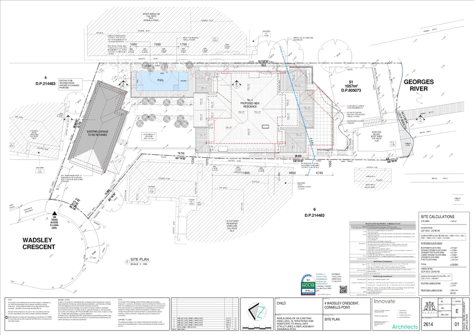
|
Georges
River Council - Georges River Local Planning Panel (LPP) - Thursday, 20
August 2020
LPP039-20 4 Wadsley Crescent Connells Point
[Appendix
2] Elevation
plans - 4 Wadsley Crescent Connells Point
|
Page 410
|
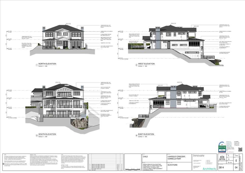
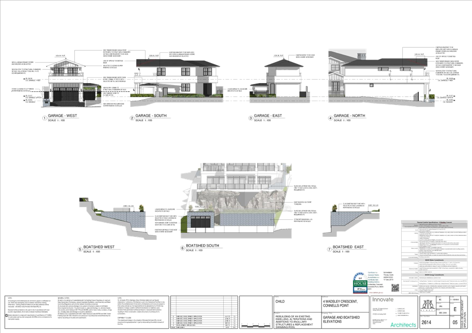
|
Georges River Council – Local Planning
Panel Thursday, 20 August 2020
|
Page 437
|
REPORT TO GEORGES RIVER COUNCIL
LPP MEETING OF Thursday, 20 August 2020
|
LPP Report No
|
LPP040-20
|
Development Application No
|
DA2020/0152
|
|
Site Address & Ward Locality
|
35 River Road Oatley
Peakhurst Ward
|
|
Proposed Development
|
Remediation works of the former
Oatley Bowling Club site in accordance with the remedial action plan prepared
for the site including associated retaining walls and land grading
|
|
Owners
|
Georges River Council
|
|
Applicant
|
El Australia
|
|
Planner/Architect
|
Contaimination Assessment –
EI
Australia;
Review of Environmental Factors Morasey Environment Pty Ltd
|
|
Date Of Lodgement
|
20/04/2020
|
|
Submissions
|
Nil
|
|
Cost of Works
|
$1,347,100.00
|
|
Local Planning Panel Criteria
|
Development for which the Land
Owner is the Council
|
|
List of all relevant s.4.15
matters (formerly s79C(1)(a))
|
State Environmental Planning Policy
No.55 – Remediation of Land; State Environmental Planning Policy
(Vegetation in Non-Rural Areas) 2017; Deemed State Environmental Planning
Policy – Georges River Catchment;
Draft Environment State
Environmental Planning Policy 2017; Draft Remediation State Environmental
Planning Policy;
Hurstville Local Environmental Plan
2012; Hurstville Development Control Plan No.1 – LGA Wide and Draft
Georges River Local Environmental Plan 2020.
|
|
List all documents submitted
with this report for the Panel’s consideration
|
Excavation Drawings; Retaining Wall
Drawings
|
|
Report prepared by
|
Independent Assessment
|
|
Recommendation
|
That the application be approved in accordance with the
conditions included in the report.
|
|
|
Summary of matters for
consideration under Section 4.15
Have all recommendations in relation
to relevant s4.15 matters been summarised in the Executive Summary of the
assessment report?
|
Yes
|
|
Legislative clauses requiring
consent authority satisfaction
Have relevant clauses in all
applicable environmental planning instruments where the consent authority
must be satisfied about a particular matter been listed and relevant
recommendations summarised, in the Executive Summary of the assessment
report?
|
Yes
|
|
Clause 4.6 Exceptions to
development standards
If a written request for a
contravention to a development standard (clause 4.6 of the LEP) has been
received, has it been attached to the assessment report?
|
Not
Applicable
|
|
Special Infrastructure Contributions
Does the DA require Special
Infrastructure Contributions conditions (under s7.24)?
|
Not
Applicable
|
|
Conditions
Have draft conditions been provided
to the applicant for comment?
|
Yes
– the applicant has reviewed the conditions, they can also be reviewed
when the report is published.
|
|
Site Plan
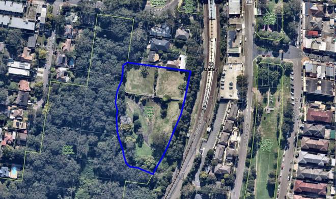
Site is outlined in blue
|
Executive Summary
Proposal
1. The
development application proposes remediation of the former Oatley Bowling Club
site which includes land regrading and retaining walls, to a level acceptable
for use as a public recreation area.
2. Extensive
testing has occurred across the site which has identified chemicals of concern
in the soil as being lead and fragments of fibrous cement sheeting containing
asbestos.
3. As
part of the works, a three (3) tiered retaining wall is proposed to be
constructed along the southern and western edge of the site to support the
existing site.
4. The
remediation works will consist of a combination of onsite management,
excavation, consolidation, capping and off-site disposal.
5. The
application also proposes the removal of twenty six (26) trees on the site in
order to facilitate the required remediation works.
Site and Locality
6. The
subject site is legally identified as Lot 100 in DP 1252069 and has a street
address of 35 River Road, Oatley.
7. The
site is located at the southern end being the terminus of River Road which is
accessed from Mulga Road. The site is irregular in shape with an area of
1.095ha. The site currently contains the terraced bowling greens of the former
Oatley Bowling Club, with the remainder of the site containing scattered
vegetation and open grass. Geo-textile fabric currently occupies the steep
slope to the western boundary with silt fencing at the base.
8. In
terms of surrounding development, residential dwelling houses are located to
the north, Oatley Railway Station is approximately 60m to the north east, with
the rail corridor adjoining the eastern boundary. The site is bound by Myles
Dunphy Reserve which provides bushland to the south and west, with an adjacent
pedestrian track.
Zoning and Permissibility
9. The
site is zoned RE1 ‘Public Recreation’ under the Hurstville Local
Environmental Plan 2012. The application seeks consent for ‘environmental
protection works’ which are permitted with consent in the zone.
Submissions
10. The
development application was publicly exhibited in accordance with the
provisions of the Hurstville Development Control Plan No.1.The notification was
between 13
May 2020 and 10 June 2020. No submissions were received in response.
Conclusion
11. The
proposed development has been assessed having regard to the matters for
consideration under Section 4.15(1) of the Environmental Planning and
Assessment Act 1979. The proposal is acceptable and the application is
recommended for approval subject to conditions.
Report in Full
DESCRIPTION OF
THE PROPOSAL
12. The proposed development seeks
consent for remediation of the former Oatley Bowling Club site (site) including
land regrading and retaining walls to a level that would be acceptable for use
as a public recreational area. Extensive testing has occurred across the site
which has identified chemicals of concern in soil as being lead and fragments
of fibrous cement sheeting containing asbestos. A Remediation Action Plan (RAP)
divides the site into four zones (A, B, C1 and C2) as follows.
Figure
1: Identification of zone and asbestos
(source: EI Australia)
13. A three-tiered retaining wall is
to be constructed in zone C2 with remediation and management of contaminated
areas using a combination of onsite management, excavation, consolidation,
capping and offsite disposal. Plans prepared by EI Australia provide an
indicative concept of required earthworks, though given the nature of works
finished levels have not been provided, however in this regard the levels are
not envisaged to vary significantly from the existing. It is also noted that
the proposed works entail the removal of a selection of existing vegetation
from the site.
Figure
2: Proposed Retaining Wall Plan
(source: EI Australia)
14. The RAP has
provided the following methodology with respect to remediation:
Stage 1
– Site Preparation & Community Engagement
Stage 2
– Remediation of Steep Slope (Zone C2)
Stage 3
– Remediation / Management of Remainder of Site (Zones A, B & C1)
Stage 4
– Waste Classification & Offsite Disposal
Stage 5
– Validation
Stage 6
– Validation Report Preparation
Stage 7
– Environmental Management Plan Preparation
DESCRIPTION OF
THE SITE AND LOCALITY
15. The site is legally identified as
Lot 100 in DP 1252069 and otherwise known as 35 River Road, Oatley. It
is located at the southern end being the terminus of River Road which is
accessed from Mulga Road. The site is irregular in shape with an area of
1.095ha.
16. The site is under the
ownership of Georges River Council and was previously utilised as a bowling
green ‘Oatley Bowling Club’, the existing built form has since been
demolished and the site has remained vacant for several years. The former
terraced bowling greens are located adjacent to the northern boundary with the
remaining component of the site comprising open grass with scattered vegetation
concentrated primarily to the south western part of the site. The site is
secured and in response to previous reporting geo-textile fabric has been
installed over the steep slope to the western boundary with silt fencing at the
base to contain silt and asbestos fragments.
17. Access to the site is from
a gated driveway on River Road located in the north western corner of the site
with a bitumen drive providing access to the central component of the site.
With respect to topography a cross fall of approximately 18m is noted from the
north eastern corner being 27.09AHD down towards the south western boundary
being 9AHD and adjacent bushland.
18. With respect to surrounding
development, residential dwelling houses are located to the north, Oatley
Railway Station is approximately 60m to the north east with the rail corridor
adjoining the eastern boundary. The site is bound by Myles Dunphy Reserve which
provides bushland to the south and west with an adjacent pedestrian track.
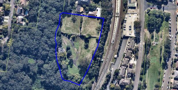
Figure
3: Aerial Site Image
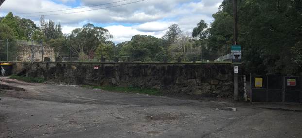
Figure
4: Site as viewed from the River Road
frontage
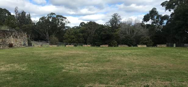
Figure
5: The site as viewed from the former
bowling green adjacent to River Road towards the south
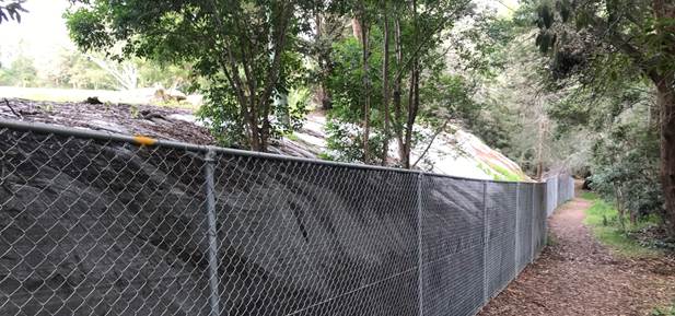
Figure
6: The site as viewed from the pedestrian
track adjacent to the western boundary
Section 4.15 Assessment
19. The following is an
assessment of the application with regard to Section 4.15 of the Environmental
Planning and Assessment Act 1979.
(1) Matters
for consideration - general
In
determining an application, a consent authority is to take into consideration
such of the following matters as are of relevance to the development the
subject of the development application:
(a) the
provision of:
(i) any
environmental planning instrument,
State Environmental Planning Policies
State Environmental Planning
Policy No. 55 - Remediation of Land
20. Clause
7 of SEPP No. 55 provides that Council must not consent to the carrying out of
any development on land unless it has considered whether the land is
contaminated, and if the land is contaminated it is satisfied that the land is
suitable in its contaminated state (or will be suitable after remediation) for
the purpose that development consent is sought.
21. Clause
17 requires that all remediation work must, in addition to complying with any
requirement under the Act or any other law, be carried out in accordance with
contaminated land planning guidelines.
22. Comment:
A Remediation Action Plan (RAP) prepared by EI Australia (E24352.E06 Rev2)
dated 20 March 2020 accompanies the application. It concludes as follows:
23. At
the time of drafting this RAP, the site comprised of vacant exposed soil. One
lead hotspot and fragments of asbestos cement sheeting were present in fill.
24. The
purpose of this document is to provide remediation / management options to
allow the site to be rendered suitable for future recreational use through
adherence to an environmental management plan (EMP). It is understood that
Council’s preference is for site remediation / management to occur prior
to future construction / development works which is yet to be confirmed.
25. The
preferred remedial approaches involve cap and containment of contaminated
material onsite. The main site remediation works will include, though not
necessarily be limited to:
· Stage 1
– Site Preparation
· Stage 2
– Remediation of Steep Slope (Zone C2)
· Stage
3 – Remediation / Management of Remainder of Site (Zones A, B & C1)
· Stage 4
– Waste Classification & Offsite Disposal
· Stage 5
– Validation
· Stage 6
– Validation Report Preparation
· Stage 7
– Environmental Management Plan Preparation
26. EI
considers that the site can be made suitable for recreational use subject to an
EMP, through the implementation of the works described in this RAP.
27. Council’s
Environmental Health Division reviewed the RAP and raised no objections subject
to the imposition of conditions relating to remediation works, requirement of a
Validation Report and Environmental Monitoring Plan (which are
incorporated).
State Environmental Planning
Policy (Vegetation in Non-Rural Areas) 2017
28. The
Vegetation SEPP aims to protect the biodiversity values of trees and other
vegetation in non-rural areas of the State and preserve the amenity of
non-rural areas through the preservation of trees and other vegetation. This is
applicable pursuant to Clause 5(1) of the SEPP as the site is both within
Georges River Local Government Area and land zoned RE1 Public
Recreation.
29. The
Vegetation SEPP applies to clearing of:
a) Native vegetation above the Biodiversity Offset
Scheme (BOS) threshold where a proponent will require an approval from the
Native Vegetation Panel established under the Local Land Services Amendment Act
2016; and
b) Vegetation below the BOS threshold where a
proponent will require a permit from Council if that vegetation is identified
in the council’s development control plan (DCP).
30. Pursuant
to Clause 8(1) of the SEPP, clearing does not require authority under the
policy as it is a type of clearing that is authorised under Section 60O of
the Local Land Services Act 2013 (specifically, that associated with
a development consent issued under Part 4 of the Environmental Planning
and Assessment Act 1979).
31. Comment:
The proposed development entails removal of existing vegetation from the
site which is concentrated primarily to the south western component and
impacted directly through construction of the retaining wall and earthworks.
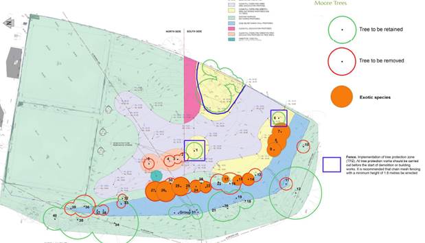
Figure 7: Site Layout Plan which notates existing trees (source:
P. Vezgoff)
32. An
Arboricultural Assessment Report prepared by Moore Trees dated 21 July 2020 was
submitted in support of the application. It provided a detailed plan and
subsequent assessment of trees to be removed, retained, and protected.
33. Council’s Tree
Management Officer reviewed the submitted Arborist Report and raised no
objections subject to imposition of conditions which have been endorsed. It is
noted that in accordance with Georges River Councils, Tree
Management Policy, 2019 a 2:1 replacement is to be implemented of which will
maintain and increase urban canopy. Replacement tree species must be as per
Appendix 1 of the Policy.
Deemed State
Environmental Planning Policy – Georges River Catchment
34. This
plan applies to all land within the Georges River Catchment. The Catchment
consists of parts of the Georges River local government area and includes the
subject site. The primary aims of the plan which is relevant to the application
at hand is …’to
maintain and improve the water quality and river flows of the Georges River and
its tributaries and ensure that development is managed in a manner that is in
keeping with the national, State, regional and local significance of the
Catchment’.
Comment:
The development relates to site remediation and associated earthworks which
will ultimately improve water quality
and river flows of the Georges River and its
tributaries. Noting environmental protection controls set out within the
provided RAP and recommended conditions of consent, no adverse impacts
are foreseen.
(ii) any
draft environmental planning instrument that is or has been placed on public
exhibition and details of which have been notified to the consent authority,
and
Draft
Environment SEPP
35. Draft Environment SEPP was
exhibited from 31 October 2017 to 31 January 2018. This consolidated SEPP
proposes to simplify the planning rules for several water catchments,
waterways, urban bushland, and Willandra Lakes World Heritage Property. Changes
include the consolidation of the following seven existing SEPPs:
· State Environmental Planning Policy No. 19 – Bushland in Urban
Areas
· State Environmental Planning Policy (Sydney Drinking Water
Catchment) 2011
· State Environmental Planning Policy No. 50 – Canal Estate
Development
· Greater Metropolitan Regional Environmental Plan No. 2 –
Georges River Catchment
· Sydney Regional Environmental Plan No. 20 – Hawkesbury-Nepean
River (No.2-1997)
· Sydney Regional Environmental Plan (Sydney Harbour Catchment) 2005
· Willandra Lakes Regional Environmental Plan No. 1 – World
Heritage Property.
36. Comment:
The proposal is not inconsistent with provisions of this Draft
Instrument.
Local Environmental Plan
Hurstville
Local Environmental Plan 2012
37. The
site is zoned RE1 ‘Public Recreation’ under the provisions of the
Hurstville Local Environmental Plan 2012 (HLEP 2012). The proposed development
being the remediation of the site is defined as ‘environmental protection
works’ which is permissible with consent and defined as follows:
environmental
protection works means works associated with the rehabilitation
of land towards its natural state or any work to protect land from
environmental degradation, and includes bush regeneration works, wetland
protection works, erosion protection works, dune restoration works and the
like, but does not include coastal protection works.
38. Objectives
of the RE1 Public Recreation zone are as follows:
• To enable land to be used
for public open space or recreational purposes.
• To provide
a range of recreational settings and activities and compatible land uses.
• To protect and enhance the
natural environment for recreational purposes.
The proposed development remains consistent with stated
objectives in that its purpose is to remediate the site to a level suitable for
use as public open space. Works necessitate removal of vegetation, replacement
planting is recommended and to enable the site to retain a landscaped setting.
39. Compliance
with applicable standards of the HLEP 2012 is outlined below.
|
Clause
|
Standard
|
Proposed
|
Complies
|
|
6.1 - Acid sulfate soils
|
Site is mapped as Class 5 Acid
Sulfate Soil.
|
Noting levels of the site and
extent of excavation the proposed development is considered acceptable and an
acid sulfate soils assessment is not required.
|
Yes
|
|
6.4 - Foreshore Scenic Protection
Area
|
Site is within a Foreshore Scenic
Protection Area.
Subclause (3) provides that
development consent must not be granted to development on land to which this
clause applies unless consent authority has considered how the development
would –
(a) affect
the natural environment, including topography, rock formations, canopy
vegetation or other significant vegetation, and
(b) affect
the visual environment, including the views to and from the Georges River,
foreshore reserves, residential areas and public places, and
(c) affect
the environmental heritage of Hurstville, and
(d) contribute
to the scenic qualities of the residential areas and the Georges River by
maintaining the dominance of landscape over built form.
|
With respect to natural environment
the proposed remediation is deemed beneficial. Existing vegetation is to be
removed due to the excavation required to facilitate the remediation of the
site. In this regard Council’s Tree Management Officer has recommended
a two (2) for one (1) replacement planting which will ultimately increase the
urban canopy.
Noting site context and nature of
proposed works which relate to earthworks and a retaining wall the visual
environment and existing view corridors will not be compromised.
Site is not listed as a heritage
item or located in a conservation area.
The site is zoned RE1 Public
Recreation with residential development abutting the northern boundary. The
proposed retaining wall will be largely concealed from view with remediation
works facilitating the future use of the site as public open space and
retaining the dominance of landscaping over built form.
|
Yes
Yes
Yes
Yes
|
Draft Georges River Local
Environmental Plan 2020
40. Consideration
is given to the provisions of Draft Georges River Local Environmental Plan 2020
in the assessment this application.
41. In
this regard, the provisions have no determining weight as a result of proposed
operation of Clause “1.8A Savings provisions relating to development
applications” of the Draft Plan which provides “If a
development application has been made before the commencement of this Plan in
relation to land to which this Plan applies and the application has not been
finally determined before that commencement, the application must be determined
as if this Plan had not commenced.”
(iii) any
development control plan,
Hurstville Development Control
Plan No. 1
42. The Hurstville Development Control
Plan No. 1 (HDCP) applies to all land to which the HLEP 2012 applies, excluding
land identified as the Hurstville City Centre.
The
proposed development being remediation of land and associated works within land
zoned RE1 Public Recreation, there are no provisions of relevance in the HDCP
and thus a merit assessment is provided within this report and below in
response to likely impacts considerations.
Georges River
Development Control Plan 2000 - Interim Policy
43. The Georges River Development
Control Plan 2020 - Interim Policy was introduced in response to a resolution
of Council which cited numerous development control plans that applied across
the Local Government Area and the need for consistency.
44. The Interim Policy is a
supplementary document, meaning that current DCP controls continue to apply if
a particular control is not specified, or if it is still considered best
practice. The Interim Policy has no statutory recognition in the assessment of
Development Applications, and it is solely used as a guide to achieve
consistency.
The Interim Policy
does not address this for of development, as a result this policy is not relevant
to this application.
Georges River Section 94A Contributions Plan
45. Clause 4.7.2 of the
Georges River Section 94A Contribution Plan identifies exemptions available to
the plan including under “(h)”:
h)
Development applications made for or on behalf of the Council for
community infrastructure, such as but not limited to libraries, community
facilities, child care facilities, recreational areas and facilities or car
parks.
46. As
the works are on behalf of Council, for a public purpose (remediating a portion
of public land) an exemption is available subject to the following requirements
being met:
Applicants
seeking exemption from a levy under this Plan must provide a comprehensive
submission to Council which clearly demonstrates how the proposed development
falls within the types of development listed in (d) to (h) above. Council will
consider the submission and determine whether an exemption applies. In
considering any application for an exemption the Council will take into
account:
(i) The
extent to which the proposed development comprises or includes the provision,
extension or augmentation of public facilities that provide a public benefit,
and/or
(ii) Whether
the applicant is affected by any adverse financial circumstances which will
impact on its ability to fund the payment of any levy which is imposed in
accordance with this Plan.
47. The applicant has
provided a written submission outlining that the works, in remediating a public
reserve, provide a public benefit.
48. In this regard, the
exemption request is acceptable and as such no contributions will be levied.
(iiia) any planning agreement that has been entered
into under section 7.4, or any draft planning agreement that a developer
has offered to enter into under section 7.4,
49. No planning agreements or
draft planning agreements have been offered or have been entered into.
(iv) Any
matters prescribed by the regulations, that apply to the land to which the
development application relates,
50. No additional regulations required for
the proposed development.
(b) the likely impacts of that
development, including environmental impacts on both the natural and built
environments, and social and economic impacts in the locality,
(i) Impact on the natural environment:
51. The proposed development
seeks to formally remediate a site that is contaminated which will have a
positive impact towards the long-term health of the natural environment, noting
interim measures currently in place to control silt and asbestos.
52. As previously outlined,
works necessitate removal of existing vegetation from the site. In this regard
it is noted that many of the trees to be removed are exotic species and of less
significance. Council’s Tree Management Officer raised no objections to
the submitted Arborist Report and has recommended conditions with respect to
retention and protection of other existing trees. A 2:1 replacement is
recommended for all trees removed and will result in an increase in the urban
canopy.
(ii) Impact on the built environment:
53. With
respect to the built environment a retaining wall is to be constructed adjacent
to the western boundary of the site to provide stability to the steep slope.
The slope measures up to 7.5m in height with the retaining wall construction
providing three (3) tiers that are appropriately spaced and respect existing
ground levels. The retaining wall will not be readily apparent from River Road
and will only be visible from the walking track that bypasses the site within Myles Dunphy Reserve. Construction comprises stones within wire
cages and remains consistent with a bushland setting.
54. With respect to remediation and
management the RAP has suggested a combination of onsite management,
excavation, consolidation, capping and offsite disposal. Mapping has identified
the location of contaminants on site with a conceptual earthworks plan provided
with no significant change in levels is anticipated. In this regard it is also
noted that limited if any earthworks will be undertaken in zone A which is the
former bowling greens adjacent to the northern boundary and residential
dwellings.
55. The
proposed development is not foreseen to result in any adverse or unreasonable
impact towards the amenity of adjoining residential properties. Suitable conditions
of consent are also recommended to mitigate any impact during remediation
works.
(iii) Social and Economic impacts in the locality:
56. The proposed development
is not foreseen to have any adverse social / economic impacts. Works will
likely result in a positive outcome noting the intent of the remediation to
facilitate the use of the site for recreation purpose, using a site which has
been vacant for many years as public open space.
(c) the suitability of the site for the
development,
57. It
is considered that the proposed development being the remediation of the land,
land regrading and retaining walls is suitable for the site as it resulting the
unused site being remediated to a level that enables the land to be used as
public open space.
(d) any submissions made in accordance with this Act
or the regulations,
58. In accordance with the
provisions of Councils Public Notification process, the application was placed
on neighbour notification for a period of twenty eight (28) days between 13 May
2020 and 10 June 2020. No submissions were received.
(e) the
public interest.
59. Noting
the nature of proposed development, it does not conflict with public interest.
Internal Referrals
Environmental
Health
60. Referral was
provided to Council’s Environmental Health Officer. No objection was raised subject to imposition of conditions
relating to remediation works, requirement of a Validation Report and
Environmental Monitoring Plan which have been included in the conditions
referenced at the end of this report.
Tree Management Officer
61. Referral
was provided to Council’s Tree Management Officer for review. No
objection was raised though conditions were provided clarifying trees to be
removed, retained, and protected during site works. In addition, and in accordance
with Georges River Councils, Tree Management Policy, 2019, a 2:1 replacement
was recommended which will reinstate and increase urban canopy. All replacement
tree species selection must be as per Appendix 1, Tree Planting of the Tree
Management Policy.
Engineering
62. Referral
was provided to Council’s Engineering Section. No objection was
raised.
External
Referrals
NSW Trains
63. Referral
was provided to NSW Trains. To date no response has been received.
AUSGRID
64. Referral
was provided to AUSGRID pursuant to clause 45(2) of SEPP (Infrastructure) 2007.
Correspondence was received raising no objections and not conditions requested.
Conclusion
65. The
application has been assessed having regard to Section 4.15(1) of the
Environmental Planning and Assessment Act 1979, and provisions of the relevant State
Environmental Planning Policy No. 55 – Remediation of Land, Hurstville
Local Environmental Plan 2012 and Hurstville Development Control Plan.
66. The
proposal has been considered on its merits and is considered to be acceptable
for the reasons outlined within this report. The proposal is reasonable given
that the objectives of the controls have been reasonably satisfied.
67. Following
detailed assessment contained within this report, it is considered that DA2020/0152
should be approved subject to conditions of consent.
DETERMINATION
AND STATEMENT OF REASONS
Statement
of Reasons
68. The reasons for this recommendation are:
· The proposed development generally complies with the
requirements of the relevant environmental planning instruments and development
control plan.
· The proposed development is well considered and sensitively
designed so that it will not result in any unreasonable impact on the natural
and built environment.
· The proposed development will reduce risk to the
environment from contamination and will facilitate the use of the land for its
zoned purpose as a public reserve and accordingly is in the public interest.
Determination
A. That the Georges River Council Local
Planning Panel as the Consent Authority pursuant to Section 4.16(1)(a) Environmental
Planning and Assessment Act 1979, grant consent to Development Application No
DA2020/0152 for remediation works to the former Oatley Bowling Club including
regrading and retaining walls at 35 River Road, Oatley, subject to the
following conditions of consent.
Development Details
1. Approved
Plans - The development must be implemented in accordance with the approved
plans and supporting documentation listed below which have been endorsed by
Council’s approved stamp, except where marked up on the plans and/or
amended by conditions of this consent:
|
Description
|
Reference No.
|
Date
|
Revision
|
Prepared by
|
|
Construction Sequence - Sheet 1
|
E24352 (S01.01)
|
17.12.19
|
A
|
EI Australia
|
|
Construction Sequence - Sheet 2
|
E24352 (S01.02)
|
-
|
-
|
EI Australia
|
|
Site Layout
|
E24352 (S01.03)
|
-
|
-
|
EI Australia
|
|
Site Layout - Landscaping Finishes
|
E24352 (S01.04)
|
-
|
-
|
EI Australia
|
|
Cross Sections - Sheet 1
|
E24352 (S01.05)
|
-
|
-
|
EI Australia
|
|
Cross Sections - Sheet 2
|
E24352 (S01.06)
|
-
|
-
|
EI Australia
|
|
Cross Sections - Sheet 3
|
E24352 (S01.07)
|
-
|
-
|
EI Australia
|
|
Retaining Wall - 3D View
|
E24352 (S05.00)
|
-
|
-
|
EI Australia
|
|
Civilworks - Retaining Wall Plan
|
E24352 (S05.01)
|
-
|
-
|
EI Australia
|
|
Civilworks - Typical Retaining Wall Section - 3D
|
E24352 (S05.02)
|
-
|
-
|
EI Australia
|
|
Civilworks - Typical Retaining Wall Details
|
E24352 (S05.03)
|
-
|
-
|
EI Australia
|
|
Civilworks - Cross Sections - Sheet 1
|
E24352 (S05.05)
|
-
|
-
|
EI Australia
|
|
Civilworks - Cross Sections - Sheet 2
|
E24352 (S05.06)
|
-
|
-
|
EI Australia
|
|
Civilworks - Cross Sections - Sheet 3
|
E24352 (S05.07)
|
-
|
-
|
EI Australia
|
|
Tree Protection Plan
|
-
|
16.07.20
|
-
|
P. Vezgoff
|
|
Remediation Action Plan
|
E24352.EO6
|
20.03.20
|
2
|
EI Australia
|
Separate Approvals Required Under Other Legislation
2. Section
138 Roads Act 1993 and Section 68 Local Government Act 1993 - Unless
otherwise specified by a condition of this consent, this Development Consent
does not give any approval to undertake works on public infrastructure.
Separate approval is required under Section 138 of the Roads Act 1993 and/or Section 68 of the Local Government Act 1993 for any of the
following activities carried out in, on or over a public road (including the
footpath) listed below.
An application is required to be lodged and approved prior to the
commencement of any of the following works or activities;
(a) Placing or storing materials
or equipment;
(b) Placing or storing waste
containers or skip bins;
(c) Erecting a structure or
carrying out work
(d) Swinging or hoisting goods
over any part of a public road by means of a lift, crane or the like;
(e) Pumping concrete from a public
road;
(f) Pumping water from the
site into the public road;
(g) Constructing a vehicular
crossing or footpath;
(h) Establishing a “works
zone”;
(i) Digging up or disturbing
the surface of a public road (eg Opening the road for the purpose of
connections to utility providers);
(j) Stormwater and ancillary
works in the road reserve;
(k) Stormwater and ancillary to
public infrastructure on private land; and
(l) If any excavation is to
be supported by the use of below ground (cable) anchors that are constructed
under Council’s roadways/footways.
These separate activity approvals must be obtained and evidence of the
approval provided to the Certifying Authority prior to the issue of the
commencement of works.
The relevant Application Forms for these activities can be downloaded
from Council’s website www.georgesriver.nsw.gov.au.
For further information, please contact Council’s Customer Service Centre
on (02) 9330 6400.
3. Road
Opening Permit - A Road Opening Permit must be obtained from Council, in
the case of local or regional roads, or from the RMS, in the case of State
roads, for every opening of a public road reserve to access services including
sewer, stormwater drains, water mains, gas mains, and telecommunications before
the commencement of work in the road.
4. Sydney
Water – Tap in TM - The approved plans must be submitted
to a Sydney Water Tap inTM to determine whether the development
application will affect Sydney Water’s sewer and water mains, stormwater
drains and/or easements, and if further requirements need to be met. The
approved plans will be appropriately endorsed. For details please refer
to ‘Plumbing, building and developing’ section of Sydney
Water’s web site at www.sydneywater.com.au
then see ‘Building’, or telephone 13000 TAP IN (1300 082
746). The Certifying Authority must ensure that a Tap inTM
agent has appropriately stamped the plans prior to the issue of the
Construction Certificate.
Prior to the issue of a Construction Certificate
5. Fees
to be paid - The fees listed in the table below must be paid in accordance
with the conditions of this consent and Council’s adopted Fees and
Charges applicable at the time of payment (available at www.georgesriver.nsw.gov.au).
Payments must be made prior to the issue of the
Construction Certificate or prior to the commencement of work (if there is no
associated Construction Certificate).
Council will only accept Bank Cheque or Electronic
Funds Transfer (EFT) for transaction values of $500,000 or over. Council must
be contacted prior to payment to determine correct total amount to be paid and
bank account details (if applicable).
A summary of the fees to be paid are listed below:
|
Fee Type
|
Fee
|
|
GENERAL FEES
|
|
Long Service
Levy (to Long Service Corporation) Or, provide evidence of Payment direct to
the Long Service Corporation. See https://portal.longservice.nsw.gov.au/bci/levy/
|
|
Builders Damage
Deposit
|
$3,750.00
|
|
Inspection Fee
for Refund of Damage Deposit
|
$371.00
|
General Fees
The fees and charges above are subject to change and are as set out in
the version of Council's Schedule of Fees and Charges or as required by other
Government Authorities, applicable at the time of payment.
6. Site
Management – Major Development - A Site Management Plan must be
submitted with the application for a Construction Certificate,
and include the following:
(a) location
of protective site fencing;
(b) location
of site storage areas/sheds/equipment;
(c) location
of building materials for construction, e.g. stockpiles
(d) provisions
for public safety;
(e) dust
control measures;
(f) method
used to provide site access location and materials used;
(g) details
of methods of disposal of demolition materials;
(h) method
used to provide protective measures for tree preservation;
(i) provisions
for temporary sanitary facilities;
(j) location
and size of waste containers/skip bins;
(k) details
of proposed sediment and erosion control measures;
(l) method
used to provide construction noise and vibration management;
(m) construction
and demolition traffic management details.
The site management measures are to be
implemented prior to the commencement of any works including demolition and
excavation. The site management measures are to be maintained throughout
the works, to maintain reasonable levels of public health, safety and
amenity. A copy of the Site Management Plan must be kept on site and is
to be made available upon request.
7. Erosion
& Sedimentation Control - Erosion and sediment controls must be
provided to ensure:
(a) Compliance with the approved
Erosion & Sediment Control Plan
(b) Removal or disturbance of
vegetation and top soil is confined to within 3m of the approved building area
(no trees to be removed without approval)
(c) All clean water runoff is
diverted around cleared or exposed areas
(d) Silt fences, stabilised
entry/exit points or other devices are installed to prevent sediment from
entering drainage systems or waterways
(e) All erosion and sediment
controls are fully maintained for the duration of demolition, excavation and/or
development works
(f) Controls are put into
place to prevent tracking of sediment by vehicles onto adjoining roadway
(g) All disturbed areas are rendered
erosion-resistant by turfing, mulching, paving or similar
(h) Compliance with Managing Urban Stormwater - Soils and Construction (Blue
Book) produced by Landcom 2004.
These measures are to be implemented prior to the commencement of work
(including demolition and excavation) and must remain until works are completed
and all exposed surfaces are landscaped/sealed.
8. Compliance
with submitted Arborist Report - The recommendations outlined in the
Arborist’s Report titled Arboricultural Development Assessment Report,
prepared by Moore Trees, dated July 2020 must be implemented throughout the
relevant stages of construction. Details of tree protection measures to be
implemented must be detailed and lodged with the Construction Certificate
application for approval and shall be in accordance with Section 4 - Australian
Standard AS 4970-2009: Protection of trees on development sites.
All remediation works must be carried out in accordance with the Tree
Protection Plan, provided by Moore Trees, with the use of the remediation plan
by EI Australia.
The trees to be retained and protected are listed in the
table below.
|
Tree
Species
|
Location of
Tree / Tree No.
|
Tree
Protection Zone (metres) TPZ as per AS4970-2009 Fencing distance from trunk
|
|
Tree 1 –
Eucalyptus haemastoma
|
Middle of
site. No works proposed due to trees
|
10.8 metres
radially out from its trunk
|
|
Tree 6 –
Brachychiton acerifolius
|
South eastern
fence line, No works proposed due to trees
|
4.2 metres
|
|
Tree 12
– Eucalyptus pilularis
|
Bottom of
embankment, No works proposed in this area
|
11.4 metres
|
|
Tree 19 – Pittosporum undulatum
|
Embankment
area, proposed retaining wall
|
2.0 metres
|
|
Tree 20
– Angophora costata
|
Embankment
area, proposed retaining wall
|
3.5 metres
radially
|
|
Tree 21
– Pittosporum undulatum
|
Embankment
area, proposed retaining wall
|
2.0 metres
|
|
Tree 31 (Group
x 6) Casuarina cunninghamiana
|
Embankment
area, proposed retaining wall
|
2.5m,
collectively one tree protection zone around all
|
|
Tree 34
– Eucalyptus pilularis
|
Bottom of
embankment west boundary
|
9.6 metres
radially out from its trunk
|
|
Tree 35 - Eucalyptus
pilularis
|
Bottom of
embankment west boundary
|
10.8 metres
radially out from its trunk
|
|
Tree 40
– Glochidion ferdinandi
|
Bottom of
embankment west boundary
|
3.5 metres
radially out from its trunk
|
|
Group of trees
not assessed close to eastern boundary fencing, middle, coloured in yellow
upon S01.03 (eiaustralia)
Yellow –
clean fill overlay Asbestos. No works proposed due to trees.
|
eastern
boundary fencing, middle, coloured in yellow upon S01.03 (eiaustralia)
Yellow –
clean fill overlay Asbestos. No works proposed due to trees.
|
5.0 metres radially
|
a) The client shall
engage a qualified Arborist who holds an AQF Level 5 or above in Arboriculture
and who is a current practicing and financial member of an Arboricultural
Association or Affiliation.
b) A certificate of
compliance letter for tree protection measures shall be completed and forwarded
to the PCA – Principal Certifying Authority, at three (3) stages being
before works, during works and once all building works have been completed,
that tree protection measures have been installed and maintained during the
building process and Tree
Protection Measures as per Arborist Report - 5. TREE PROTECTION, 5.1,
5.2, 5.3, 5.4, 5.5, 5.6 and 5.7
c) All trees on
Council property, subject site and adjacent sites, to be retained shall be
protected before site set up and maintained during demolition, excavation and
construction of the site.
d) The tree
protection measures must be in undertaken in accordance AS4970 -2009 Protection
of trees on development sites.
e) The engaged AQF
5 Consulting Project Arborist must be present on-site during the stages of site
set up, excavation, demolition and construction when works are being undertaken
that could impact on the tree canopy or root zone within the tree protection
zone of each tree, nominated for retention within this consent.
f) In
accordance with AS 4970-2009 Protection of trees on development sites, a
protective fence consisting of 2.4 x 1.8 metres high, fully supported chainmesh
fence shall be used. The distance of the fence out from the base of each tree
is to be in accordance with the TPZ listed in the table above. A layer of
organic mulch 100 millimetres thick shall be placed over the protected area and
no soil or fill should be placed within the protection area.
g) To preserve the
trees to be retained and protection from machinery, no work shall
commence until the Tree Protection Zone has been protected with 100mm of
organic mulch laid, timber sleepers at 200mm x 100mm laid over the top and
secured with metal framing bands as per AS4970 -2009, clause 4.5.3 Ground
protection.
h) The Tree
Protection Zone of each tree, to be protected, shall be watered thoroughly and
regularly to minimise the effects of construction works.
i) No
building products/ materials or services shall be installed within the TPZ of
the tree/s unless approved by Council. This fence shall be kept in place during
demolition, construction and also have a sign displaying ‘Tree Protection
Zone – DO NOT ENTER’ attached to the fence and must also include
the name and contact details of the Project Arborist.
Excavation works near tree to be retained -
j) Excavations
around the trees to be retained on site or the adjoining properties shall be
supervised by the AQF 5 Project Arborist to ensure that the root system and
canopy of each tree will not adversely be affected.
k) Where the Tree
Protection Zone (TPZ) of trees on site or adjoining sites become compromised by
any excavation works, the AQF 5 Project arborist shall be consulted to
establish the position of any major roots and determine the necessary measures
to protect these roots.
l) Tree
Protection Zones around the trees to be retained are not to have soil level
changes, building product / materials stored, services or site sheds installed
in this area.
9. Tree
Removal & Replacement - In accordance with Georges River Councils, Tree
Management Policy, 2019, a 2:1 replacement shall be implemented. For every one
(1) tree removed from the site, two (2) additional trees must be planted, to
maintain and increase urban canopy. Location of all planted trees must be in
accordance with Councils future landscape management of the subject site.
All replacement
tree species selection must be as per Appendix 1, Tree Planting, within Georges
River Tree Management Policy.
In accordance
with the Arborist’s Report titled Arboricultural Development Assessment
Report, prepared by Moore Trees, dated July 2020.
Permission is
granted for the removal of the following trees:
|
Tree Species
|
No. of
|
Location
|
|
Tree 2 & 3 – Backhousia
myrtifolia
|
X2
|
Middle of open site
|
|
Tree 4 & 5 – Syzygium australe
|
X2
|
Middle of open
site
|
|
Tree 7, 8 & 9 – Jacaranda
mimosifolia
|
X3
|
South west
corner of site
|
|
Tree 10 – Eucalyptus Spp
|
X1
|
South west
corner lower embankment
|
|
Tree 11 & 13 – Pittosporum
undulatum
|
X2
|
South end of
the site, embankment
|
|
Tree 14 – Jacaranda
mimosifolia
|
X1
|
Top of
embankment, south
|
|
Tree 15 – Nerium oleander
|
X1
|
Top of
embankment, south
|
|
Tree 16 – Grevillea robusta
|
X1
|
Top of
embankment, south west
|
|
Tree 17 – Nerium Oleander
|
X1
|
Top of
embankment, south west
|
|
Tree 18 – No description
|
X1
|
Embankment,
south west
|
|
Tree 22 – Grevillea robusta
|
X1
|
Top of
embankment, south west
|
|
Tree 23 – Jacaranda
mimosifolia
|
X1
|
Top of
embankment, west
|
|
Tree 24 – Nerium Oleander
|
X1
|
Top of
embankment, west
|
|
Tree 25 – Jacaranda
mimosifolia
|
X1
|
Top of embankment,
west
|
|
Tree 26 – Liquidamber
styraciflua
|
X1
|
Top of
embankment, west
|
|
Tree 27 – Nerium oleander
|
X1
|
Top of
embankment, west
|
|
Tree 28, 29 & 30 – Pittosporum
undulatum
|
X3
|
Top of
embankment, west
|
|
Tree 32 – Pittosporum
undulatum
|
X1
|
Top of embankment,
north west
|
|
Tree 33 – Eucalyptus
pilularis
|
X1
|
Top of
embankment, north west
|
General
Tree Removal Requirements
All
tree removal shall be carried out by a minimum certificate Level 3, Licenced
and insured Tree Surgeon/Arborist to ensure that removal is undertaken in a
safe manner and complies with the AS 4373-2007 - Pruning of Amenity Trees and
Tree Works Industry Code of Practice (Work Cover NSW 1.8.98).
During Construction
10. Hours
of construction for demolition and building work - Any work activity or
activity associated with the development consent that requires the use of any
tools (including hand tools) or any power operated plant and machinery that
creates noise on or adjacent to the site shall not be performed, or permitted
to be performed, except between the hours of 7.00 am to 5.00 pm, Monday to
Saturday inclusive. No work or ancillary activity is permitted on Sundays, or
Public Holidays.
Note: A penalty infringement notice may be issued for any offence.
11. Section
138 Roads Act 1993 and Section 68 Local Government Act 1993 - Unless
otherwise specified by a condition of this consent, this Development Consent
does not give any approval to undertake works on public infrastructure.
Separate approval is required under Section 138 of the Roads Act 1993
and/or Section 68 of the Local Government
Act 1993 for any of the following activities carried out in,
on or over a public road (including the footpath) listed below.
An application is required to be lodged and approved prior to the
commencement of any of the following works or activities;
(a) Placing or storing
materials or equipment or otherwise enclosing public road reserve; (refer: work
zone application);
(b) Placing or storing
waste containers or skip bins; (refer Application To Place Waste Skip Bin On
Roadway)
(c) Erecting a structure or
carrying out work (refer: Temporary Structures Application, Roads Act
Application)
(d) Swinging or hoisting
goods over any part of a public road by means of a lift, crane or the like;
(refer: Road Lane and Footpath Closure Application)
(e) Pumping concrete from a
public road; (refer Road Lane and Footpath Closure Application)
(f) Pumping water
from the site into the public road; (refer: Roads Act application)
(g) Constructing a
vehicular crossing or footpath; (refer: Application for Driveway Crossing &
Associated Works)
(h) Establishing a
“works zone”; (refer Works Zone Application)
(i) Digging up or
disturbing the surface of a public road (e.g. Opening the road for the purpose
of utility connections to stormwater kerb outlet connection); (refer: Road
Opening Permit Application)
(j) If any excavation
is to be supported by the use of below ground (cable) anchors that are
constructed under Council’s roadways/footways. (refer: Temporary
Structures Application)
The relevant
Application Forms for these activities can be downloaded from Council’s
website www.georgesriver.nsw.gov.au.
For further information, please contact Council’s Customer Service Centre
on (02) 9330 6400.
12. Obstruction
of Road or Footpath - The use of the road or footpath for the storage of
any building materials, waste materials, temporary toilets, waste or skip bins,
or any other matter is not permitted unless separately approved by Council
under Section 138 of the Roads Act 1993 and/or under Section 68 of the Local
Government Act 1993. Penalty infringement Notices may be issued for any
offences and severe penalties apply.
13. Road
Opening Permit - A Road Opening Permit must be obtained from Council for
every opening of a public road reserve to access services including sewer,
water mains, gas mains, connecting of stormwater to the kerb and
telecommunication. This is for any work that involves excavation through
or within a public road, kerb and gutter, and or the public footway between the
road and the property boundary. The permit is to be lodged prior to the
commencement of works. Additional approval is required from Roads and
Maritime Services for works on a State Road.
14. Remediation Works - All
remediation work must be carried out in
accordance with: -
· The Managing Land Contamination: Planning Guidelines SEPP
55 Remediation of Land; and
· the EPA Guidelines made under the Contaminated Land
Management Act 1997.
And in accordance with the subject Remedial Action Plan:
(a) The site is to be prepared in
accordance with the requirements of the remediation plan and all site
management measures to be in place to minimise dust and odour and stormwater
management and control.
(b) As-built survey plans of any
capped areas are to be prepared to document:
· The final excavation depth;
· The final contaminated fill level;
· The final surface capping level.
(c) Any excess soil designated for
offsite disposal is to be first classified in accordance with EPA (2014) Waste
Classification Guidelines and transported to a licensed facility.
(d) Should unexpected finds be
discovered during the course of the remediation program, or should any phase of
the validation identify residual, high level contamination requiring additional
remediation, then the procedures described under the Unexpected Finds Protocol
(Section 7.6) and/or the Validation Plan (Section 6.6) will be implemented,
until the remediation goals have been achieved and the site is deemed suitable
for the intended land use with an EMP.
15. Waste
Management Facility - All materials removed from the site as a result of
demolition, site clearing, site preparation and, or excavation shall be
disposed of at a suitable Waste Management Facility. No vegetation, article,
building material, waste or the like shall be ignited or burnt.
Copies of all receipts for the disposal, or processing of all such
materials shall be submitted to the PCA and Council, where Council is not the
Principal Certifying Authority.
Prior to the issue of the Occupation Certificate
16. Validation
Report - After completion of all remediation works, a copy of the
Validation and Monitoring Report prepared by suitably qualified contaminated
land consultant shall be submitted to Council.
The validation
report shall be prepared in accordance with the EPA Guidelines, Consultants
Reporting on Contaminated Sites, and shall certify the suitability of the
site for the proposed development.
· describe and
document all works performed;
· include
results of validation testing and monitoring;
· include
validation results of any fill imported on to the site; and
· show how the
objectives of the Remedial Action Plan have been met; and
· show how all
clean-up criteria & relevant regulations have been complied with; and
· include
clear justification as to the suitability of the site for the proposed
development; and
· the
potential for off-site migration of any residual contaminants.
In conclusion the
validation report is required to confirm:
· The absence
of asbestos and lead across the surface of the site;
· The
suitability of the installed physical barrier for any material encapsulated
beneath; and
· The
suitability of any material imported to site.
17. Tree
Protection Measures - A final certificate of compliance letter, once all
remediation works have been completed, from the engaged AQF 5 Consulting
Arborist, that tree protection measures have been installed and maintained for
the entirety of the project and report on the condition of the trees that as
part of this Consent, were to be protected and retained.
18. Replacement
Tree Planting - In accordance with Georges River Councils, Tree Management
Policy, 2019, a 2:1 replacement shall be implemented. For every one (1) tree
removed from the site, two (2) additional trees must be planted, to maintain
and increase urban canopy. All planted trees must be specified upon a landscape
plan drawn by a Landscape Architect, showing details and locations of all trees
and forwarded to the nominated PCA for compliance.
Operational Conditions (Ongoing)
19. Environmental
Monitoring Plan - At the completion of all site remediation and the
submission of the validation report, the Environmental Monitoring Plan (EMP)
shall be implemented to manage the contaminated materials capped on site. The
EMP is to include:
· Details,
location and nature of contaminated material.
· Guidance
against the exposure of underlying contaminated material.
· Management
measures for contaminated material if future access is required.
In addition
management measures will be detailed in the EMP and will mainly involve routine
site inspections and inspections of the site after heavy rain.
The EMP will be
registered on the certificate of title with NSW Land and Property Information.
Operational Requirements under the Environmental Planning and
Assessment Act 1979
20. Requirement
for a Construction Certificate - The erection of a building must not commence
until a Construction Certificate has been issued
21. Appointment
of a PCA - The erection of a building must not commence until the applicant
has:
(a) appointed a PCA for the
building work; and
(b) if
relevant, advised the PCA that the work will be undertaken as an Owner
-Builder.
If work is not going to be undertaken by an Owner - Builder, applicant
must:
(c) appoint a
Principal Contractor to undertake the building work. If residential building
work (within the meaning of the Home Building Act
1989) is to be undertaken, the Principal Contractor must be a holder of a
contractor licence; and
(d) notify the
PCA of the details of any such appointment; and
(e) notify the
Principal Contractor of any critical stage inspections or other inspections
that are required to be carried out in respect of the building work.
An Information Pack is attached for your convenience should you wish to
appoint Georges River Council as the PCA for your development.
22. Notification
of Critical Stage Inspections - No later than two days before the building
work commences, the PCA must notify:
(a) the consent
authority and the Council (if not the consent authority) of his or her
appointment; and
(b) the
applicant of the critical stage inspections and other inspections that are to
be carried out with respect to the building work.
23. Notice
of Commencement - The applicant must give at least two days notice to the
Council and the PCA of their intention to commence the erection of a building.
A Notice of Commencement Form is attached for your convenience.
24. Critical
Stage Inspections - The last critical stage inspection must be undertaken
by the PCA. The critical stage inspections required to be carried out
vary according to Building Class under the Building Code of Australia and are
listed in Clause 162A of the Environmental
Planning and Assessment Regulation 2000.
25. Notice
to be given prior to critical stage inspections - The principal contractor
for a building site, or the owner-builder, must notify the PCA at least 48
hours before each required inspection needs to be carried out.
Where Georges River Council has been appointed as the PCA, 48 hours
notice in writing, or alternatively 24 hours notice by facsimile or telephone, must
be given when specified work requiring inspection has been completed.
26. Occupation
Certificate - A person must not commence occupation or use of the whole or
any part of a new building unless an Occupation Certificate has been issued in
relation to the building or part.
Only the PCA appointed for the building work can issue the Occupation
Certificate.
An Occupation Certificate Application Form is attached for your
convenience.
Prescribed Conditions
27. Clause
98 - Building Code of Australia & Home Building Act 1989 - Requires all
building work to be carried out in accordance with the Building Code of
Australia. In the case of residential building work to which the Home
Building Act 1989 relates, there is a requirement for a contract of insurance
to be in force before any work commences.
28. Erection
of Signs - Requires the
erection of signs on site and outlines the details which are to be included on
the sign. The sign must be displayed in a prominent position on site and include
the name and contact details of the Principal Contractor and any Principal
Supervisor.
Advice
29. Review
of Determination - Section 8.2 of the Environmental Planning and Assessment
Act confers on an applicant who is dissatisfied with the determination of the application
the right to lodge an application with Council for a review of such
determination. Any such review must however be completed within 6 months
from its determination. Should a review be contemplated sufficient time
should be allowed for Council to undertake public notification and other
processes involved in the review of the determination.
Note:
Review provisions do not apply to Complying Development, Designated
Development, State Significant Development, Integrated Development or any
application determined by the Sydney South Planning Panel or the Land &
Environment Court.
30. Appeal
Rights - Part 8 (Reviews and appeals) of the Environmental Planning and
Assessment Act 1979 confers on an applicant who is dissatisfied with the
determination of the application a right of appeal to the Land and Environment
Court of New South Wales.
31. Lapsing
of Consent - This consent will lapse unless the development is physically
commenced within 5 years from the Date of Operation of this consent, in
accordance with Section 4.53 of the Environmental Planning and Assessment Act
1979 as amended.
32. Access
to NSW Legislations (Acts, Regulations and Planning Instruments) - NSW
legislation can be accessed free of charge at www.legislation.nsw.gov.au
33. Long
Service Levy - The Long Service Corporation administers a scheme which
provides a portable long service benefit for eligible workers in the building
and construction industry in NSW. All benefits and requirements are determined
by the Building and Construction Industry Long Service Payments Act 1986. More
information about the scheme and the levy amount you are required to pay to
satisfy a condition of your consent can be found at http://www.longservice.nsw.gov.au.
The required Long Service Levy payment can be direct to the Long Service
Corporation via their web site https://online.longservice.nsw.gov.au/bci/levy.
Payments can only be processed on-line for the full levy owing and where the
value of work is between $25,000 and $6,000,000. Payments will be accepted for
amounts up to $21,000, using either MasterCard or Visa.
34. Security
deposit administration & compliance fee - Under Section 97 (5) of the Local
Government Act 1993, a security deposit (or part) if repaid to the person
who provided it is to be repaid with any interest accrued on the deposit (or
part) as a consequence of its investment.
Council must cover administration and other costs incurred in the
investment of these monies. The current charge is $50.00 plus 2% of the bond
amount per annum.
The interest rate applied to bonds is set at Council's business banking
facility rate as at 1 July each year. Council will accept a bank
guarantee in lieu of a deposit.
All interest earned on security deposits will be used to offset the
Security Deposit Administration and Compliance fee. Where interest earned on a
deposit is not sufficient to meet the fee, it will be accepted in full
satisfaction of the fee.
35. Council
as PCA - Deemed to Satisfy Provisions of BCA - Should the Council be
appointed as the PCA in determining the Construction Certificate, the building
must comply with all the applicable deemed to satisfy provision of the
BCA. However, if an alternative fire solution is proposed it must comply with
the performance requirements of the BCA, in which case, the alternative
solution, prepared by an appropriately qualified fire consultant, accredited
and having specialist qualifications in fire engineering, must justifying the
non-compliances with a detailed report, suitable evidence and expert judgement.
Council will also require if deemed necessary, for the alternative solution to
undergo an independent peer review by either the CSIRO or other accredited
organisation. In these circumstances, the applicant must pay all costs
for the independent review.
36. Site
Safety Fencing - Site fencing must be erected in accordance with SafeWork
Guidelines, to exclude public access to the site throughout the demolition
and/or construction work, except in the case of alterations to an occupied
dwelling. The fencing must be erected before the commencement of any work and
maintained throughout any demolition and construction work.
A demolition licence and/or a high risk work license may be required from
SafeWork NSW (see www.SafeWork.nsw.gov.au).
37. Stormwater
& Ancillary Works - Applications under Section 138 Roads Act and/or Section
68 Local Government Act 1993 - To apply for approval under Section 138 of
the Roads Act 1993 and/or Section 68 Local Government Act 1993:
(a) Complete the Stormwater
Drainage Application Form which can be downloaded from Georges River
Council’s website at www.georgesriver.nsw.gov.au.
(b) In the Application Form, quote
the Development Consent No. (eg. DA2018/0***) and reference this condition
number (e.g. Condition 23)
(c) Lodge the application form,
together with the associated fees at Council’s Customer Service Centre,
during business hours. Refer to Council’s adopted Fees and Charges
for the administrative and inspection charges associated with stormwater
applications.
The developer must meet all costs of the extension, relocation or
reconstruction of any part of Council’s drainage system (including design
drawings and easements) required to carry out the approved development.
The preparation of all engineering drawings (site layout plans, cross
sections, longitudinal sections, elevation views together with a hydraulic
grade analysis) and specifications for the new stormwater drainage system to be
arranged by the applicant. The design plans must be lodged and approved
by Council prior to the issue of a Construction Certificate.
NOTE: A minimum of four weeks should be allowed for assessment.
ATTACHMENTS
|
Attachment ⇩1
|
Excavation Drawings - 35 River Rd Oatley
|
|
Attachment ⇩2
|
Retaining Wall Drawings - 35 Rvier Rd Oatley
|
|
Georges
River Council - Georges River Local Planning Panel (LPP) - Thursday, 20
August 2020
LPP040-20 35 River Road Oatley
[Appendix
1] Excavation
Drawings - 35 River Rd Oatley
|
Page 444
|
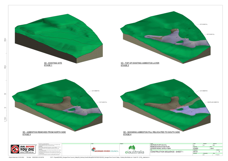
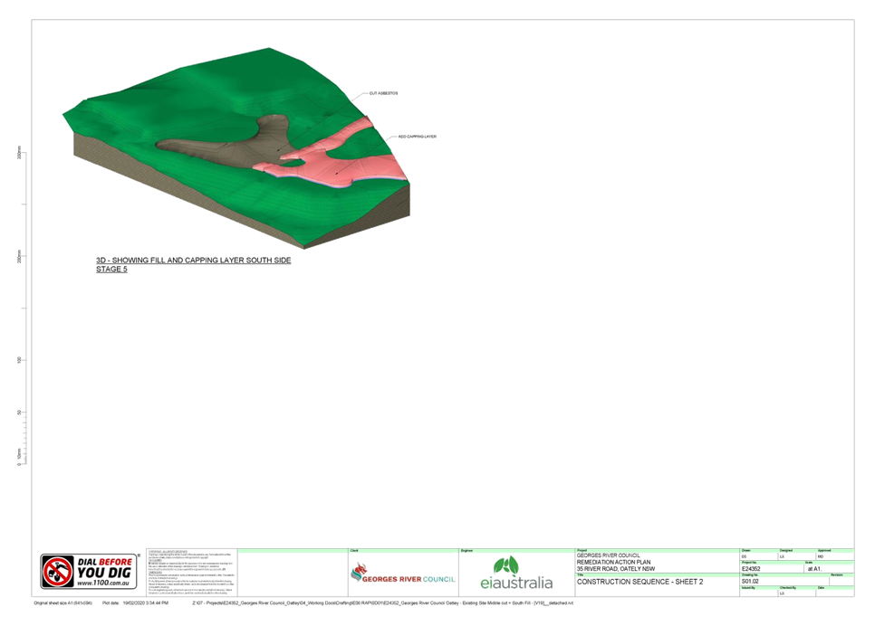
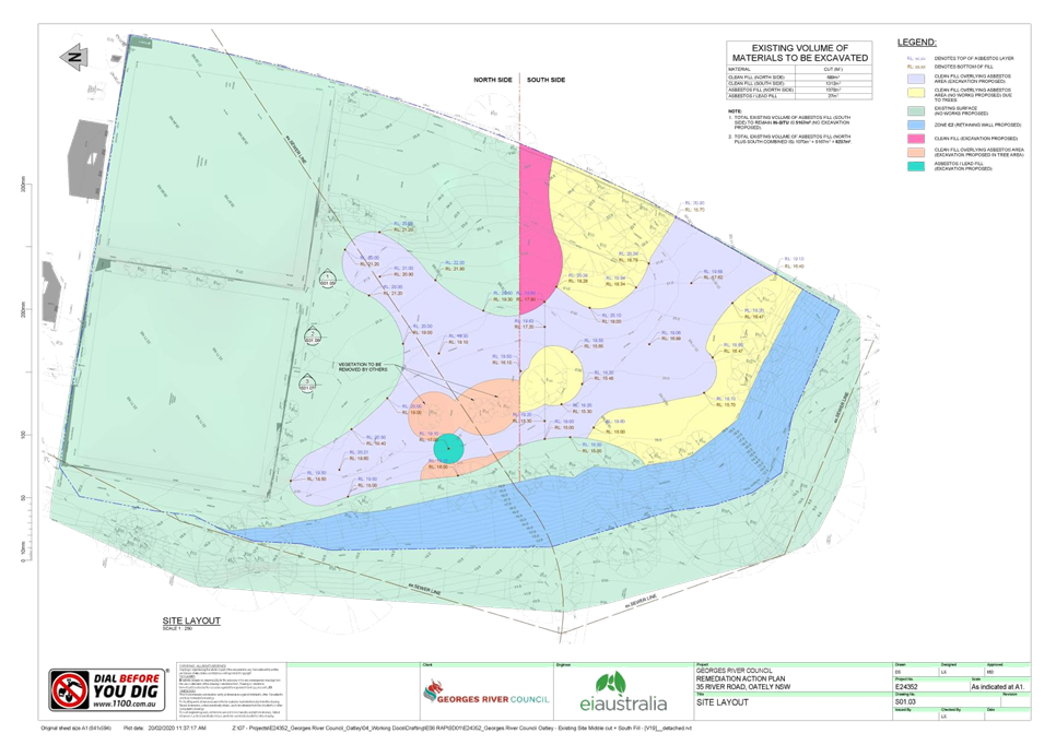
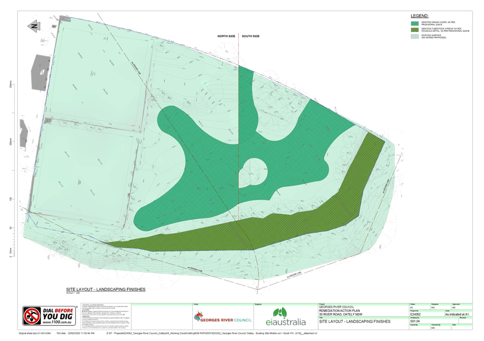
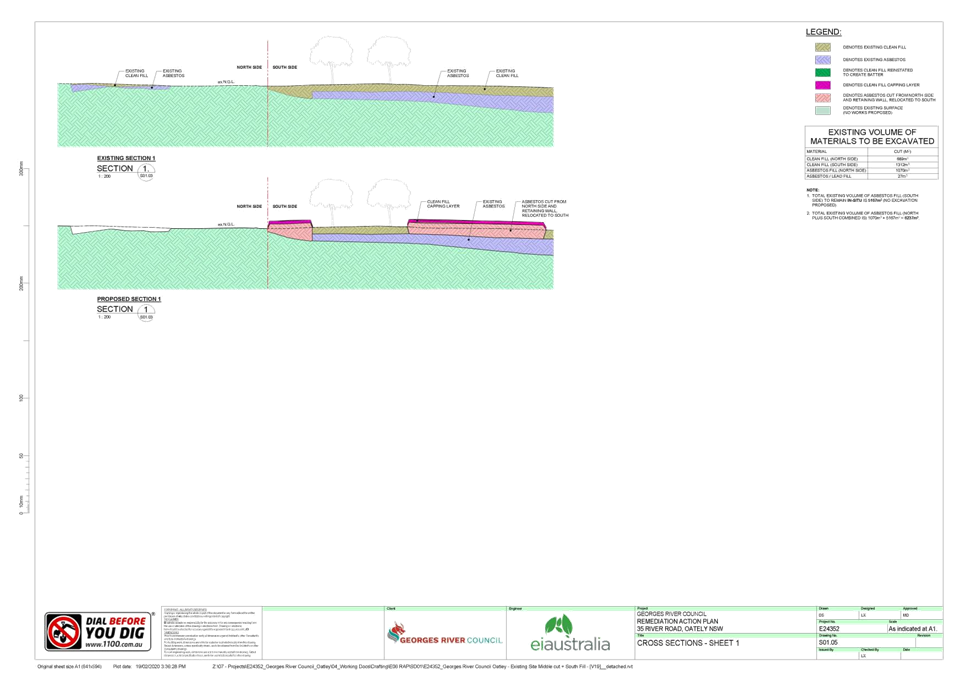
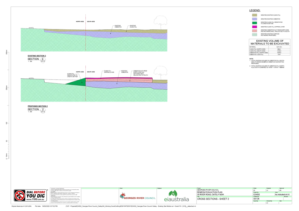
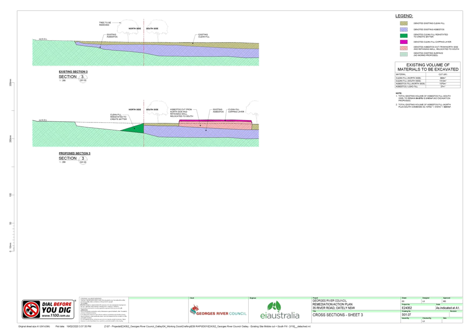
|
Georges River Council - Georges River Local Planning
Panel (LPP) - Thursday, 20 August 2020
LPP040-20 35 River Road Oatley
[Appendix
2] Retaining Wall
Drawings - 35 Rvier Rd Oatley
|
Page 451
|